June 13-July 8, Astoria-Astoria
|
|
|
- Stewart Powers
- 6 years ago
- Views:
Transcription

1 MGL1211: Cascadia Basin Ridge to Trench June 13-July 8, Astoria-Astoria
, faulting in plate interior (Nedimovic et al (2009).")
2 Motivation 1. How does the JdF plate evolve from ridge to trench and is there significant hydration of the crust and upper mantle prior to subduction at this warm young plate? Chile SubductionZone Contreras-Reyes et al 2008 Juan De Fuca Plate: Documented progressive alteration of L2A (Nedimovic et al., 2008), faulting in plate interior (Nedimovic et al (2009). Alteration deeper in crust/upper mantle? Is plate interior faulting pervasive to trench? Bending related faulting at trench?


3 Motivation 2. How does the structure of the downgoing plate vary along the trench across distinct structural regimes of the Cascadia subduction zone? Plate Isochrons: Wilson, 1993; 2002 Plate Isodepth: McCrory et al., 2004 Brudzinski et al GLG 2007

4 The Experiment Coincident long streamer MCS (8 km) and wide-angle OBS (85 ST) Complete plate transects from JdF Ridge to the trench. ~ 400 km long transect parallel to deformation front. Fan shoots for study of mantle anisotropy, 2 MCS lines at Axial Crustal structure, crustal and shallow mantle seismic velocities, fault distribution across plate and at deformation front R/V Langseth MGL1211 June 13-July 8 R/V Oceanus OC1206A June 7-July 13

5 Add-on Program - Imaging the Cascadia Subduction Zone: A Ship-to-shore Opportunity Trehu/Abers/Carton co-pis Goals: Image Subduction zone structure 6 OBS, 2 deployments Land stations: 3D array in Oregon 2D array in Washington along CAFÉ transect 2 days Langseth acquisition


6 MCS Survey 6600 cu in array 9 m source depth 7950 m streamer 636 channels 37.5 m shot interval 2 ms sample interval s record length Eastern 50 km of line 2 acquired on Holbrook MGL1212

7 OBS Survey 47 OBSs: Short-period XYZ geophone Hydrophone 200 samples per second 85 Deployments 6600 cu in array 12 m source 500 m/150/170 m
8 Summary of Acquisition Gun/Strea mer Maintena nce & Deploy/R ecover 0.4 days & 1 day Marine mammal mitigation (days) Number PD/SD* OBS km acquired OBS days acquired MCS km acquired MCS days acquired 3 days days days *PD/SD Power Down/Shut Down Lost ~ 220 line km of planned acquisition, ~200 km impacted by PD/SD
9 Budgeted -3 days Contingency No time lost to weather delays, minimal to equipment Needed: Delayed departure for IHA 2 days Mammal Mitigation 3 days + Gun/streamer maintenance -.5 days


10 Mammals encountered primarily near deformation front, along Washington Line, Oregon shelf Northern Fur Seal Dolphins off Oregon coast

11 9 m source depth Total shots fired ~45,000
12 Streamer Deployment: 2 km from streamer 1 added to #3 Took 14 hrs


")
13 Onboard Multibeam Processing Oregon Usable swath ~ 10 km (deep water) Gridded to 50 m (25 m)

14 Differencing of coincident 180 tracks revealed small roll bias.


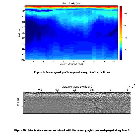
15 Seismic Oceanography Program Led by Berta Biescas and Guillermo Bornstein, Dalhousie University North Pacific Current System splits into Alaska and California Currents 3 different water masses in Cascadia Basin reflectivity expected


16 Seismic Oceanography Program 378 Probes deployed: 237 XBT-T5, 120 XSV-02, 21 XBT-T7 Deployed at 1-3 km spacing Sound speed profile acquired along Oregon Line with XSVs

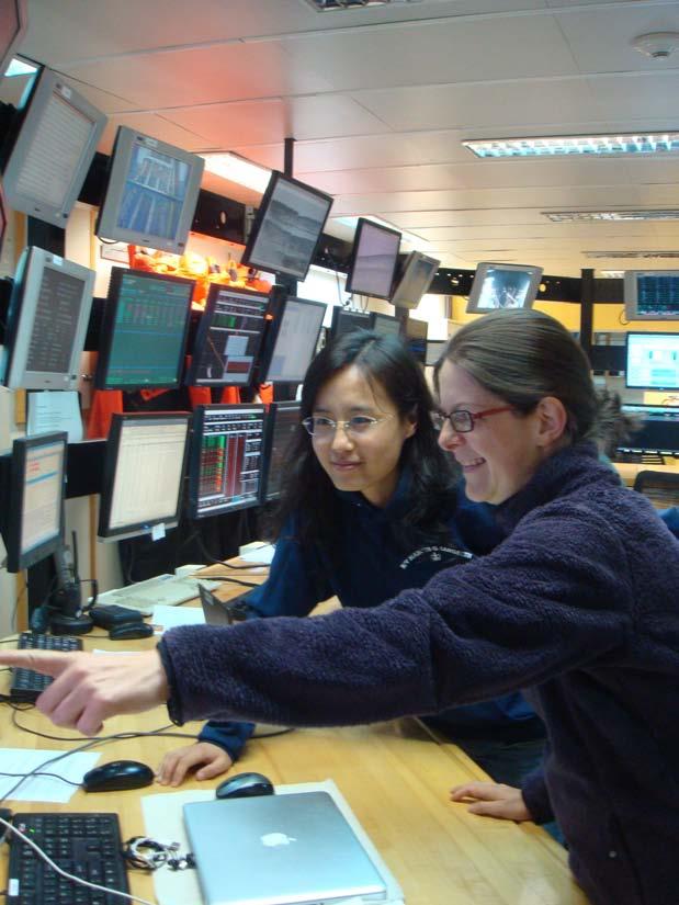
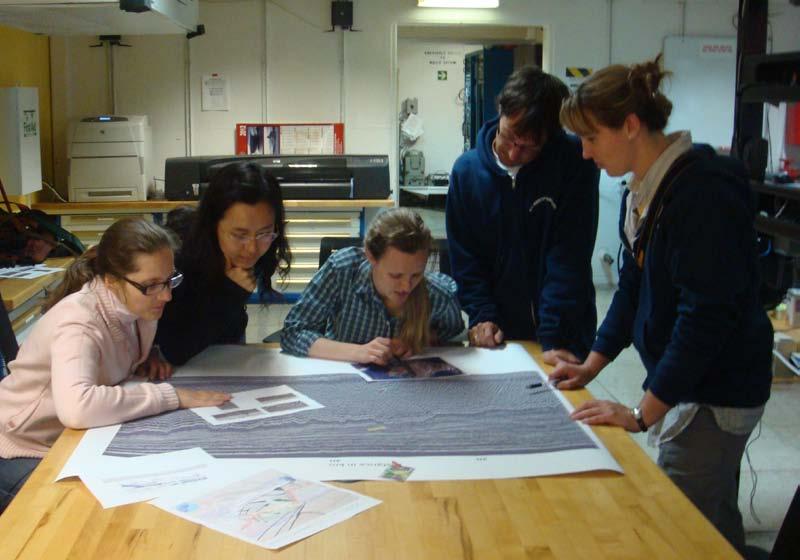
17 Science Party: 9 grad/undergrad 2 post-docs 1 junior faculty


18 Oregon Line Faulted sediments Antithetic through-crust reflectors Moho relief-possible fault offsets Bend-related faulting 4s Faults 5 km 5s Crustal faults? 6s Moho 7s W E


19 Oregon Line Faulted sediments - reactivated abyssal hill faults Lower Crustal Dipping Reflections, ridgeward facing, 30-35, 2-10 km spacing 4s Faulted Sediments 5 km 5s LCR Moho 6s W E

20 OBS Data: Long-offset Pn recordings
21 Equipment Problems Starboard Compressor failed 2 days from end- only 10 shots lost with switch to port Knudsen deck unit failed (2 days from end) Primary Challenges (OMO) ITAR restrictions for gravimeter (precruise) Oceanus Canadian Clearance (precruise) IHA/Marine Mammal Mitigation
22 Recommendations More contingency time needs to be budgeted for near coast studies IHA process procedural changes to allow time for survey modifications? More licenses for Echo/Landmark Multibeam roll bias patch test at least once/yr HighSeasNet inadequate New capability- short streamer high res
23 AGU presentations T11 Before and after Subduction Monday 8 am: T11A-2523 Han et al, Moscone South Monday 1:40pm: T13H-01 Carbotte et al, 308 Moscone South OS51 Ocean Exploration Posters Friday 8 am: OS51D Biescas et al, Moscone South


24 Thanks to Technical Staff, Officers, & Crew Sponsored by
25

26 Motivation U Washington - CEV How does the JdF plate evolve from ridge to trench and is there significant hydration of the crust and upper mantle prior to subduction at this warm young plate? How does the structure of the downgoing plate vary along the trench across distinct structural regimes of the Cascadia subduction zone?
27


28 Raw shot gather noise bursts Streamer Deployment: 2 km from streamer 1 added to #3 Took 14 hrs

29 OBS recording of MCS shots
Along-Trench Structural Variations of Downgoing Juan de Fuca Plate: Insights from Multichannel Seismic Imaging
 Along-Trench Structural Variations of Downgoing Juan de Fuca Plate: Insights from Multichannel Seismic Imaging S. Han¹; S. M. Carbotte¹; H. D. Carton¹; J. Canales²; M. R. Nedimovic³ 1. Lamont-Doherty Earth
Geophysical Constraints on Incoming Plate Hydration
 Geophysical Constraints on Incoming Plate Hydration Douglas A. Wiens Dept. of Earth and Planetary Sciences Washington University, St. Louis, MO, USA Subduction Cycles the Incoming Plate Subduction Input
R/V Kairei Cruise Report KR Seismic study in the northwestern Pacific region. Jan. 4, 2011 Jan. 20, 2011
 R/V Kairei Cruise Report KR11-01 Seismic study in the northwestern Pacific region Jan. 4, 2011 Jan. 20, 2011 Japan Agency for Marine-Earth Science and Technology (JAMSTEC) Contents: 1.Cruise Information:
R/V Marcus G. Langseth. Office of Marine Operations Lamont-Doherty Earth Observatory. MGL0902 Data Report PRELIMINARY
 R/V Marcus G. Langseth Office of Marine Operations Lamont-Doherty Earth Observatory MGL0902 Data Report PRELIMINARY 2009-01-13-2009-01-20 Nuku alofa, Tonga - Nuku alofa, Tonga PI: Del Bohnensteihl Prepared
Activity Pacific Northwest Tectonic Block Model
 Activity Pacific Northwest Tectonic Block Model The Cascadia tectonic margin is caught between several tectonic forces, during the relentless motions of the giant Pacific Plate, the smaller subducting
Lecture Marine Provinces
 Lecture Marine Provinces Measuring bathymetry Ocean depths and topography of ocean floor Sounding Rope/wire with heavy weight Known as lead lining Echo sounding Reflection of sound signals 1925 German
A 3D seismic survey for mapping shallow targets
 A 3D seismic survey for mapping shallow targets Don C. Lawton, Robert R. Stewart, and Malcolm B. Bertram Department of Geoscience University of Calgary 2500 University Drive N.W. Calgary, Alberta T2N 1N4
Continental Margin Geology of Korea : Review and constraints on the opening of the East Sea (Japan Sea)
") Continental Margin Geology of Korea : Review and constraints on the opening of the East Sea (Japan Sea) Han-Joon Kim Marine Satellite & Observation Tech. Korea Ocean Research and Development Institute
Continental Margin Geology of Korea : Review and constraints on the opening of the East Sea (Japan Sea) Han-Joon Kim Marine Satellite & Observation Tech. Korea Ocean Research and Development Institute
Final Report for DOEI Project: Bottom Interaction in Long Range Acoustic Propagation
 Final Report for DOEI Project: Bottom Interaction in Long Range Acoustic Propagation Ralph A. Stephen Woods Hole Oceanographic Institution 360 Woods Hole Road (MS#24) Woods Hole, MA 02543 phone: (508)
OCN 201: Seafloor Spreading and Plate Tectonics I
 OCN 201: Seafloor Spreading and Plate Tectonics I Revival of Continental Drift Theory Kiyoo Wadati (1935) speculated that earthquakes and volcanoes may be associated with continental drift. Hugo Benioff
Bathymetry Measures the vertical distance from the ocean surface to mountains, valleys, plains, and other sea floor features
 1 2 3 4 5 6 7 8 9 10 11 CHAPTER 3 Marine Provinces Chapter Overview The study of bathymetry determines ocean depths and ocean floor topography. Echo sounding and satellites are efficient bathymetric tools.
Dynamic Crust Practice
 1. Base your answer to the following question on the cross section below and on your knowledge of Earth science. The cross section represents the distance and age of ocean-floor bedrock found on both sides
Chapter Overview. Bathymetry. Measuring Bathymetry. Measuring Bathymetry
 CHAPTER 3 Marine Provinces Chapter Overview The study of bathymetry determines ocean depths and ocean floor topography. Echo sounding and satellites are efficient bathymetric tools. Most ocean floor features
Velocity-Interface Structure of the Southwestern Ryukyu Subduction Zone from EW OBS/MCS Data
 Marine Geophysical Researches 22: 265-287, 2001. 2002 Kluwer Academic Publishers. Printed in the Netherlands. Velocity-Interface Structure of the Southwestern Ryukyu Subduction Zone from EW9509-1 OBS/MCS
Originally published as:
 Originally published as: Henstock, T., McNeill, L., Dean, S., Barton, P., Tilmann, F., Rietbrock, A., Robinson, D., Gulick, S., Austin, J., Djajadihardja, Y., Natawidjaja, D., Permana, H., Bonneville,
2012 COAST survey MGL1212 Cascadia Open-Access Seismic Transect off Grays Harbor Washington
 2012 COAST survey MGL1212 Cascadia Open-Access Seismic Transect off Grays Harbor Washington Ten (ish...) lines collected over 12 days Single 8 km streamer for MCS Multibeam bathymetry & backscatter, gravity
6. In the diagram below, letters A and B represent locations near the edge of a continent.
 1. Base your answer to the following question on the cross section below and on your knowledge of Earth science. The cross section represents the distance and age of ocean-floor bedrock found on both sides
Shape of the seafloor. Shape of the seafloor. Shape of the seafloor. Shape of the seafloor. Shape of the seafloor. Shape of the seafloor
 Multibeam echo sounders - Research vessel Scripps Institution of Oceanography R/V Roger Revelle depth Source: Scripps Institution of Oceanography http://woodshole.er.usgs.gov/project-pages/caribbean/movie1.html
R/V Kairei Cruise Report KR Seismic study in Nansei-Shoto Region. November 17, 2013 December 14, 2013
 R/V Kairei Cruise Report KR13-18 Seismic study in Nansei-Shoto Region November 17, 2013 December 14, 2013 Japan Agency for Marine-Earth Science and Technology (JAMSTEC) Contents: 1.Cruise Information:
A seismic refraction study of the Cocos plate offshore Nicaragua and Costa Rica Harm Van Avendonk (UTIG, UT Austin)
") A seismic refraction study of the Cocos plate offshore Nicaragua and Costa Rica Harm Van Avendonk (UTIG, UT Austin)! October 18, 2012 "#$%&'($)*!+,!-&./(!01!2/(+! Plate tectonics:!!large fluxes of solids
A seismic refraction study of the Cocos plate offshore Nicaragua and Costa Rica Harm Van Avendonk (UTIG, UT Austin)! October 18, 2012 "#$%&'($)*!+,!-&./(!01!2/(+! Plate tectonics:!!large fluxes of solids
A Preliminary Full Wave Ambient Noise Tomography Model Spanning from the Juan de Fuca and Gorda Spreading Centers to the Cascadia Volcanic Arc
 University of Rhode Island DigitalCommons@URI Graduate School of Oceanography Faculty Publications Graduate School of Oceanography 2015 A Preliminary Full Wave Ambient Noise Tomography Model Spanning from
The Ocean Floor Earth Science, 13e Chapter 13
 The Ocean Floor Earth Science, 13e Chapter 13 Stanley C. Hatfield Southwestern Illinois College The vast world ocean Earth is often referred to as the blue planet Seventy-one percent of Earth s surface
Shear wave statics in 3D-3C : An alternate approach
 P-157 C. B. Yadava*, M Singh, Kuldeep Prakash, Kunal Niyogi GEOPIC, Oil & Natural Gas Corporation Ltd, Dehradun Summary 3D-3C data was acquired in Sayan-Tadkeshwar area of Cambay basin to bring out sand
Late 20 th Century Tests of the Continental Drift Hypothesis
 Late 20 th Century Tests of the Continental Drift Hypothesis 5 Characteristics of the Ocean Trenches Unless otherwise noted the artwork and photographs in this slide show are original and by Burt Carter.
Map shows 3 main features of ocean floor
 Map shows 3 main features of ocean floor 2017 Pearson Education, Inc. Chapter 3 Marine Provinces 2017 Pearson Education, Inc. 1 Chapter 3 Overview The study of bathymetry determines ocean depths and ocean
PG&E OFFSHORE CENTRAL COASTAL CALIFORNIA SEISMIC IMAGING PROJECT
 PG&E OFFSHORE CENTRAL COASTAL CALIFORNIA SEISMIC IMAGING PROJECT Public Scoping Meeting California State Lands Commission July 21, 2011 Project Area Project Commitments Assessment of the Hosgri, Shoreline,
crustal structure experiment beneath Wairarapa - Wellington area: results from SAHKE
 crustal structure experiment beneath Wairarapa - Wellington area: results from SAHKE Tim Stern and SAHKE team* * VUW, GNS, University of Southern California, University of Tokyo(Japan) SAHKE = Seismic
We A10 12 Common Reflection Angle Migration Revealing the Complex Deformation Structure beneath Forearc Basin in the Nankai Trough
 We A10 12 Common Reflection Angle Migration Revealing the Complex Deformation Structure beneath Forearc Basin in the Nankai Trough K. Shiraishi* (JAMSTEC), M. Robb (Emerson Paradigm), K. Hosgood (Emerson
is a unifying theme in modern geology that integrates the earlier ideas of
 The concept of Global Plate Tectonics is a unifying theme in modern geology that integrates the earlier ideas of continental drift, sea-floor spread, and mountain building To explain why the present ocean
SONGS Seismic Research Projects
 SONGS Seismic Research Projects Energy Division Independent Peer Review Group September 21, 2012 Agenda Background Overview Project Support Permits, Approvals, and Reviews Schedule Use of Advanced Technologies
11. THE OBLIQUE SEISMIC EXPERIMENT ON DEEP SEA DRILLING PROJECT LEG 70 1
 11. THE OBLIQUE SEISMIC EXPERIMENT ON DEEP SEA DRILLING PROJECT LEG 0 1 R. A. Stephen, Woods Hole Oceanographic Institution, Woods Hole, Massachusetts ABSTRACT A bore-hole seismic experiment was carried
Multicomponent seismic surveys at Sibbald Flats, Alberta
 Multicomponent seismic surveys at Sibbald Flats, Alberta Robert R. Stewart and Don C. Lawton ABSTRACT We conducted a 3C seismic survey, using vibrators, over a 5 km line in the Sibbald Flats area some
Improving Marine Mammal Monitoring Survey on Langseth using Streamer Data
 Improving Marine Mammal Monitoring Survey on Langseth using Streamer Data Marcus Langseth Science Oversight Commi5ee, December 2014 ALEUT: Alaska Langseth Experiment to Understand the megathrust, July
Foundations of Earth Science, 6e Lutgens, Tarbuck, & Tasa
 Foundations of Earth Science, 6e Lutgens, Tarbuck, & Tasa Oceans: The Last Frontier Foundations, 6e - Chapter 9 Stan Hatfield Southwestern Illinois College The vast world ocean Earth is often referred
Ocean Basins, Bathymetry and Sea Levels
 Ocean Basins, Bathymetry and Sea Levels Chapter 4 Please read chapter 5: sediments for next class and start chapter 6 on seawater for Thursday Basic concepts in Chapter 4 Bathymetry the measurement of
Earth s Continents and Seafloors. GEOL100 Physical Geology Ray Rector - Instructor
 Earth s Continents and Seafloors GEOL100 Physical Geology Ray Rector - Instructor OCEAN BASINS and CONTINENTAL PLATFORMS Key Concepts I. Earth s rocky surface covered by of two types of crust Dense, thin,
General Oceanography Geology 105 Expedition 10 - Whole Lotta Shakin' Goin' On
 General Oceanography Geology 105 Expedition 10 - Whole Lotta Shakin' Goin' On Name Not attempting to answer questions on expeditions will result in point deductions on course workbook (two or more blank
Plate boundary at the Alaska- Aleutian subduction zone!
 Plate boundary at the Alaska- Aleutian subduction zone! Anne Bécel 1! Donna J. Shillington 1, Jiyao Li 1, Mladen R. Nedimovi" 2,#Geoffrey Abers 3, Kathleen Keranen 3,#Matthias Delescluse 4,#Demian Saffer
Marine Science and Oceanography
 Marine Science and Oceanography Marine geology- study of the ocean floor Physical oceanography- study of waves, currents, and tides Marine biology study of nature and distribution of marine organisms Chemical
Seafloor Evidence of Remotely Triggered Slope Failures & Turbidity Currents. Paul Johnson, Joan Gomberg, Susan Hautala, and Marie Salmi
 Seafloor Evidence of Remotely Triggered Slope Failures & Turbidity Currents Paul Johnson, Joan Gomberg, Susan Hautala, and Marie Salmi Why Do We Care? The turbidite record is a key constraint on recurrence
The 1700/01/26 Cascadia subduction zone Earthquake and Tsunami
 Jason R. Patton GEO 142 1/13/15 Abstract: Cascadia subduction zone earthquakes (CSZ) can generate strong ground shaking and deadly tsunamis. Geologists used sediment cores and stream bank exposures to
The influence of short wavelength variations in viscosity on subduction dynamics
 1 Introduction Deformation within the earth, driven by mantle convection due primarily to cooling and subduction of oceanic lithosphere, is expressed at every length scale in various geophysical observations.
SIO 226: Introduction to Marine Geophysics
 SIO 226: Introduction to Marine Geophysics Plate Tectonics Dave Chadwell Plate Tectonics, Sea-Floor Spreading and Continental Drift Main Parody Plate Geography Lineated Magnetic Anomalies in the Oceanic
General Oceanography Geology 105 Expedition 8 Plate Boundaries Beneath the Sea
 General Oceanography Geology 105 Expedition 8 Plate Boundaries Beneath the Sea Name Not attempting to answer questions on expeditions will result in point deductions on course workbook (two or more blank
Oceanography, An Invitation to Marine Science 9e Tom Garrison. Ocean Basins Cengage Learning. All Rights Reserved.
 Oceanography, An Invitation to Marine Science 9e Tom Garrison 4 Ocean Basins Key Concepts Tectonic forces shape the seabed The ocean floor is divided into continental margins and deep ocean basins The
Lecture Outlines PowerPoint. Chapter 13 Earth Science 11e Tarbuck/Lutgens
 Lecture Outlines PowerPoint Chapter 13 Earth Science 11e Tarbuck/Lutgens 2006 Pearson Prentice Hall This work is protected by United States copyright laws and is provided solely for the use of instructors
General Oceanography Geology 105 Expedition 8 Plate Boundaries Beneath the Sea Complete by Thursday at 11:00 PM
 General Oceanography Geology 105 Expedition 8 Plate Boundaries Beneath the Sea Complete by Thursday at 11:00 PM Name Expedition Objectives Learn about the types of plate boundaries and their key characteristics
ANOTHER MEXICAN EARTHQUAKE! Magnitude 7.1, Tuesday Sept. 19, 2017
 ANOTHER MEXICAN EARTHQUAKE! Magnitude 7.1, Tuesday Sept. 19, 2017 Why is there no oceanic crust older than 200 million years? SUBDUCTION If new oceanic crust is being continuously created along the earth
Seismic Imaging in Three Dimensions on the East Pacific Rise
 Eos, Vol. 90, No. 42, 20 October 2009 here would represent dramatic improvements over the do nothing situation in which nearly all of the delta will be lost. Acknowledgments This paper is a contribution
12. The diagram below shows the collision of an oceanic plate and a continental plate.
 Review 1. Base your answer to the following question on the cross section below, which shows the boundary between two lithospheric plates. Point X is a location in the continental lithosphere. The depth
FloatSeis Technologies for Ultra-Deep Imaging Seismic Surveys
 FloatSeis Technologies for Ultra-Deep Imaging Seismic Surveys 25 th January, 2018 Aleksandr Nikitin a.nikitin@gwl-geo.com Geology Without Limits Overview 2011-2016 GWL Acquired over 43000 km 2D seismic
MARINE GEOLOGY & GEOGRAPHY
 MARINE GEOLOGY & GEOGRAPHY Bathymetry BATHYMETRY BATHYMETRY THE UNDERWATER EQUIVALENT TO TOPOGRAPHY THE STUDY OF WATER DEPTH A BATHYMETRIC MAP SHOWS FLOOR RELIEF OR TERRAIN AS CONTOUR LINES Bathymetry
EXCITATION AND PROPAGATION OF SHORT-PERIOD SURFACE WAVES IN YOUNG SEAFLOOR. Donald W. Forsyth. Department of Geological Sciences, Brown University
 EXCITATION AND PROPAGATION OF SHORT-PERIOD SURFACE WAVES IN YOUNG SEAFLOOR ABSTRACT Donald W. Forsyth Department of Geological Sciences, Brown University Sponsored by The Defense Threat Reduction Agency
Chapter 2. The Planet Oceanus
 Chapter 2 The Planet Oceanus Composition of the Earth The Earth consists of a series of concentric layers or spheres which differ in chemistry and physical properties. There are two different ways to describe
Numerical modelling: The governing equation used in this study is: (K T ) c T H 0,
 c T H 0,") GSA DATA REPOSITORY 2012254 Cozzens and Spinelli Numerical modelling: The governing equation used in this study is: (K T ) c T H 0, where K is thermal conductivity, T is temperature, ρ is density, c is
GSA DATA REPOSITORY 2012254 Cozzens and Spinelli Numerical modelling: The governing equation used in this study is: (K T ) c T H 0, where K is thermal conductivity, T is temperature, ρ is density, c is
OCN 201 Physiography of the Seafloor
 OCN 201 Physiography of the Seafloor 1 Ocean Depth versus Continental Height Why do we have dry land? Solid surface of Earth is dominated by two levels: Land with a mean elevation of +840 m (29% of Earth
S/V Yokosuka Cruise Report YK14-E02
 S/V Yokosuka Cruise Report YK14-E02 2014FY Marine geological and geophysical surveys to unravel the subduction zone great earthquakes and tsunamis : Seismic refraction and reflection survey in the outer
Data archiving and dissemination, sample information, scientists ashore, and multibeam bathymetric collection and data processing (Raineault) 10
 10") Cover: Seafloor image (~0.5 m across) of a methane hydrate shelf above bubble streams discovered on dive H1517 at Astoria Canyon on the southern canyon floor, 850 m depth. 3d background image of Astoria
Cover: Seafloor image (~0.5 m across) of a methane hydrate shelf above bubble streams discovered on dive H1517 at Astoria Canyon on the southern canyon floor, 850 m depth. 3d background image of Astoria
OCN 201 Physiography of the Seafloor
 OCN 201 Physiography of the Seafloor Hypsometric Curve for Earth s solid surface Note histogram Hypsometric curve of Earth shows two modes. Hypsometric curve of Venus shows only one! Why? Ocean Depth vs.
Our Dynamic Earth Unit Unit 5
 EARTH SCIENCE REGENTS - SOTO Our Dynamic Earth Unit Unit 5 Mr. Soto - Key 1/1/2013 Our Dynamic Earth Vocabulary List 1 Directions: Define each vocabulary word provided below. You may have to use your Earth
Plate Tectonics on a Plane. Observations related to plate tectonics " " Plate tectonic theory types of plate boundaries!
 Plate Tectonics on a Plane Scripps Inst. Of Oceanography" Observations related to plate tectonics " Ocean and continent topography, hypsometry, and crustal thickness. Global seismicity, Benioff zones,
3-D seismic data acquisition, with special reference to recovery programme, in Contai area, Bengal Basin, India
 P - 352 3-D seismic data acquisition, with special reference to recovery programme, in Contai area, Bengal Basin, India *A. K. Roy, S. Shanmugaswamy, T. R. Verma,Y.P. Babu, & B. K. Sharma, ONGC, akroy_ongc@yahoo.co.in
The Lithosphere and the Tectonic System. The Structure of the Earth. Temperature 3000º ºC. Mantle
 The Lithosphere and the Tectonic System Objectives: Understand the structure of the planet Earth Review the geologic timescale as a point of reference for the history of the Earth Examine the major relief
Origin and Evolution of the Ocean Floor
 Origin and Evolution of the Ocean Floor Outline Mapping the Ocean Floor Continental Margins Origin of Oceanic Lithosphere Structure of Ocean Crust Mapping the ocean floor Depth originally measured by lowering
Full file at
 Essentials of Oceanography, 10e (Trujillo/Keller) Chapter 2 Plate Tectonics and the Ocean Floor Match the term with the appropriate phrase. You may use each answer once, more than once or not at all. A)
The Ocean Floor Chapter 14. Essentials of Geology, 8e. Stan Hatfield and Ken Pinzke Southwestern Illinois College
 The Ocean Floor Chapter 14 Essentials of Geology, 8e Stan Hatfield and Ken Pinzke Southwestern Illinois College The vast world ocean Earth is often referred to as the water planet 71% of Earth s surface
Topic 5: The Dynamic Crust (workbook p ) Evidence that Earth s crust has shifted and changed in both the past and the present is shown by:
 Evidence that Earth s crust has shifted and changed in both the past and the present is shown by:") Topic 5: The Dynamic Crust (workbook p. 65-85) Evidence that Earth s crust has shifted and changed in both the past and the present is shown by: --sedimentary horizontal rock layers (strata) are found
Topic 5: The Dynamic Crust (workbook p. 65-85) Evidence that Earth s crust has shifted and changed in both the past and the present is shown by: --sedimentary horizontal rock layers (strata) are found
Geophysical constraints on geodynamic processes at convergent margins: A global perspective
 Geophysical constraints on geodynamic processes at convergent margins: A global perspective Gondwana Research, 2015 Irina Artemieva Hans Thybo Alexey Shulgin Univ. Copenhagen, Denmark Univ. Copenhagen,
Plate Tectonics. entirely rock both and rock
 Plate Tectonics I. Tectonics A. Tectonic Forces are forces generated from within Earth causing rock to become. B. 1. The study of the origin and arrangement of Earth surface including mountain belts, continents,
Plate Tectonics Tutoiral. Questions. Teacher: Mrs. Zimmerman. Plate Tectonics and Mountains Practice Test
 Teacher: Mrs. Zimmerman Print Close Plate Tectonics and Mountains Practice Test Plate Tectonics Tutoiral URL: http://www.hartrao.ac.za/geodesy/tectonics.html Questions 1. Fossils of organisms that lived
Geology 101 Study Guide #4
 Geology 101 Study Guide #4 Our last unit is the study of the earthquakes, the Earth s interior and plate tectonics. We live in a region which has been added on to North America through plate tectonics.
Geophysics the use of geology, laboratory & field experiments, mathematics, and instruments to study: Earthquakes and Volcanoes seismometers,
 Geophysics the use of geology, laboratory & field experiments, mathematics, and instruments to study: Earthquakes and Volcanoes seismometers, tiltmeters, EDM, remote sensing, Energy: oil, gas, hydrothermal
Sendai Earthquake NE Japan March 11, Some explanatory slides Bob Stern, Dave Scholl, others updated March
 Sendai Earthquake NE Japan March 11, 2011 Some explanatory slides Bob Stern, Dave Scholl, others updated March 14 2011 Earth has 11 large plates and many more smaller ones. Plates are 100-200 km thick
3. UNDERWAY GEOPHYSICS 1
 Sawyer, D.S., Whitmarsh, R.B., Klaus, A., et al., 1994 Proceedings of the Ocean Drilling Program, Initial Reports, Vol. 149 3. UNDERWAY GEOPHYSICS 1 Shipboard Scientific Party 2 EQUIPMENT AND METHODS Navigation
discussion of North America s physical features, including its landforms and bodies of
 Chapter 7 Natural Environments of North America Chapter 7 focuses on the natural environments of North America. The chapter opens with a discussion of North America s physical features, including its landforms
Announcements. Manganese nodule distribution
 Announcements Lithospheric plates not as brittle as previously thought ESCI 322 Meet in Env. Studies Bldg Rm 60 at 1 PM on Tuesday One week (Thursday): Quiz on Booth 1994 and discussion. (Lots of odd terms
A) B) C) D) 4. Which diagram below best represents the pattern of magnetic orientation in the seafloor on the west (left) side of the ocean ridge?
 B) C) D) 4. Which diagram below best represents the pattern of magnetic orientation in the seafloor on the west (left) side of the ocean ridge?") 1. Crustal formation, which may cause the widening of an ocean, is most likely occurring at the boundary between the A) African Plate and the Eurasian Plate B) Pacific Plate and the Philippine Plate C)
1. Crustal formation, which may cause the widening of an ocean, is most likely occurring at the boundary between the A) African Plate and the Eurasian Plate B) Pacific Plate and the Philippine Plate C)
DESIGN & IMPLEMENATION WORKSHOP. Conceptual Network Design For The Regional Cabled Observatory
 DESIGN & IMPLEMENATION WORKSHOP Conceptual Network Design For The Regional Cabled Observatory 50 N N4 N10 N11 N7 N8 N5 N9 N6 AN INTEGRATED RCO Maintain Integrity of a Plate-Scale Experiment & Future Expandability
What scientists know and do not know about the big one at Cascadia
 What scientists know and do not know about the big one at Cascadia Kelin Wang Pacific Geoscience Centre, Geological Survey of Canada Natural Resources Canada The Cascadia Subduction Zone M 7.3, 1946 Rupture
Crustal structure beneath the Strait of Juan de Fuca and southern Vancouver Island from seismic and gravity analyses
 JOURNAL OF GEOPHYSICAL RESEARCH, VOL. 108, NO. B10, 2484, doi:10.1029/2002jb001823, 2003 Crustal structure beneath the Strait of Juan de Fuca and southern Vancouver Island from seismic and gravity analyses
SEISMIC STRUCTURE, GAS-HYDRATE CONCENTRATIONS, AND SLUMPING ALONG THE IODP X311 TRANSECT ON THE N. CASCADIA MARGIN
 Proceedings of the 6th International Conference on Gas Hydrates (ICGH 2008), Vancouver, British Columbia, CANADA, July 6-10, 2008. SEISMIC STRUCTURE, GAS-HYDRATE CONCENTRATIONS, AND SLUMPING ALONG THE
Meteor-Cruise M 75 / 2 Short Cruise Report Chief scientist: Dr. Jürgen Pätzold Universität Bremen Bremen / Germany
 Meteor-Cruise M 75 / 2 Short Cruise Report Chief scientist: Dr. Jürgen Pätzold Universität Bremen Bremen / Germany Dar es Salaam Dar es Salaam Febr. 06 th Febr. 24 th, 2008 1 SHORT CRUISE REPORT RV METEOR
Plate Tectonics 3. Where Does All the Extra Crust Go?
 Plate Tectonics 3 Where Does All the Extra Crust Go? Unless otherwise noted the artwork and photographs in this slide show are original and by Burt Carter. Permission is granted to use them for non-commercial,
Seismic Oceanography and the R/V Langseth
 Seismic Oceanography and the R/V Langseth W. Steven Holbrook University of Wyoming cknowledgments: Ray Schmitt, WHOI Ilker Fer, Bjerknes Center, Bergen Pedro Páramo Papia Nandi Joel Seymour Andrew Bullock
APPLICATION OF A PASSIVE TOMOGRAPHY METHOD AND CORRELATION WITH ACTIVE SEISMIC OBSERVATIONS IN THE KYPARISSIAKOS GULF, SOUTHWESTERN HELLENIC ARC
 APPLICATION OF A PASSIVE TOMOGRAPHY METHOD AND CORRELATION WITH ACTIVE SEISMIC OBSERVATIONS IN THE KYPARISSIAKOS GULF, SOUTHWESTERN HELLENIC ARC Tsambas A. 1, Fasoulaka Ch. 2, Papoulia J. 1, Makris J.
High Resolution Geophysics: A Better View of the Subsurface. By John Jansen, P.G., Ph.D., Aquifer Science and Technology
 High Resolution Geophysics: A Better View of the Subsurface By John Jansen, P.G., Ph.D., Aquifer Science and Technology Geologist Use Only Part of the Information Available To Them Most Geologist rely
Short Cruise Report Maria S. Merian; Cruise No. MSM 17/2
 Dr. Wilfried Jokat Alfred Wegener Institute for Polar and Marine Research Columbusstrasse 27568 Bremerhaven Germany Tel.: +49-471-4831-1211 email: Wilfried.Jokat@awi.de Short Cruise Report Maria S. Merian;
Lab 1: Plate Tectonics April 2, 2009
 Name: Lab 1: Plate Tectonics April 2, 2009 Objective: Students will be introduced to the theory of plate tectonics and different styles of plate margins and interactions. Introduction The planet can be
Controlled-source electromagnetic imaging of the Middle America Trench o"shore Nicaragua
 Controlled-source electromagnetic imaging of the Middle America Trench o"shore Nicaragua Kerry Key Scripps Institution of Oceanography Collaborators: Samer Naif (SIO, now LDEO), Steven Constable (SIO),
Magnitude 6.5 OFFSHORE NORTHERN CALIFORNIA
 A powerful offshore earthquake that struck near the Northern California coast left a hodgepodge of debris for communities to sort through Sunday but spared residents any serious injury. After 25,000 people
Chapter 02 The Sea Floor
 Chapter 02 The Sea Floor Multiple Choice Questions 1. One of the following is not one of the world's major ocean basins: A. Atlantic Ocean B. Arctic Ocean C. Indian Ocean D. Antarctic Ocean E. Pacific
Objectives: Describe the structure of the ocean floor. Describe light intensity and temperature characteristics at different ocean depths.
 Ocean Structure Virtual Lab What are some characteristics of the ocean and the ocean floor? Earths highest mountains, deepest valleys, and flattest plains are found not on land but under the ocean. Beyond
IODP Science Evaluation Panel: Guidelines and Rationale for Site Characterization Data (Revised: August 2013)
") Site Characterization Data Guidelines IODP Science Evaluation Panel: Guidelines and Rationale for Site Characterization Data (Revised: August 2013) This document outlines the method and rationale for data
Site Characterization Data Guidelines IODP Science Evaluation Panel: Guidelines and Rationale for Site Characterization Data (Revised: August 2013) This document outlines the method and rationale for data
Evidence of an axial magma chamber beneath the ultraslow spreading Southwest Indian Ridge
 GSA Data Repository 176 1 5 6 7 9 1 11 1 SUPPLEMENTARY MATERIAL FOR: Evidence of an axial magma chamber beneath the ultraslow spreading Southwest Indian Ridge Hanchao Jian 1,, Satish C. Singh *, Yongshun
NAME Lab TA. Introduction to Oceanography, EPSS15 Practice Lecture Exam #1, Fall 2017 Exam#
 NAME Lab TA Introduction to Oceanography, EPSS15 Practice Lecture Eam #1, Fall 2017 Eam# 654321 Instructions 1. PRINT your name and lab TA s name on BOTH the cover sheet of this eam and on the SCANTRON
Plate Tectonics. 1)The plate tectonic system 2)A theory is born 3) Early evidence for continental drift 4) Continental drift and paleomagnetism
The plate tectonic system 2)A theory is born 3) Early evidence for continental drift 4) Continental drift and paleomagnetism") Plate Tectonics Plate boundaries 1)The plate tectonic system 2)A theory is born 3) Early evidence for continental drift 4) Continental drift and paleomagnetism 6)History and future of plate motions system
Plate Tectonics Plate boundaries 1)The plate tectonic system 2)A theory is born 3) Early evidence for continental drift 4) Continental drift and paleomagnetism 6)History and future of plate motions system
overlie the seismogenic zone offshore Costa Rica, making the margin particularly well suited for combined land and ocean geophysical studies (Figure
 Chapter 1 Introduction Historically, highly destructive large magnitude (M w >7.0) underthrusting earthquakes nucleate along the shallow segment of subduction zone megathrust fault, and this region of
1.4 Notes: Plates Converge or Scrape Past Each Other Think About Tectonic Plates Push Together at Convergent Boundaries
 1.4 Notes: Plates Converge or Scrape Past Each Other Think About If new crust is created at divergent boundaries, why does the total amount of crust on Earth stay the same? Tectonic Plates Push Together
Short Cruise Report RV METEOR Cruise M111. Catania Catania 10. October 01. November 2014 Chief Scientist: Heidrun Kopp Captain: Rainer Hammacher
 Heidrun Kopp Helmholtz-Zentrum für Ozeanforschung Kiel Wischhofstr. 1-3 24148 Kiel Tel: +49-431-600-2334 Fax: +49-431-600-2922 hkopp@geomar.de Short Cruise Report RV METEOR Cruise M111 Catania Catania
DEEP SAN ANDREAS FAULT BOUNDARY STRUCTURE FROM MARINE MAGNETOTELLURICS A
 DEEP SAN ANDREAS FAULT BOUNDARY STRUCTURE FROM MARINE MAGNETOTELLURICS A proposal submitted to UC Shipfunds for New Horizon and Sproul shiptime Brent Wheelock Kerry Key and Steven Constable SUMMARY Knowledge