GNH7/GG09/GEOL4002 EARTHQUAKE SEISMOLOGY AND EARTHQUAKE HAZARD
|
|
|
- Gloria Shelton
- 6 years ago
- Views:
Transcription
1 Tectonics Lecture 10 Global Seismotectonics

2 Rigid plate translation A Map of the World s Fracture Zones Magnetic anomalies and fracture zones form the basic building blocks for the construction of isochron charts.

3 Rigid plate translation Isochrons - used to calculate the relative positions of North America with respect to Northwest Africa
4 Plate translation on a sphere The relative position of a plate i with respect to a reference plate j at time t can be mathematically described in terms of finite rotation of i about an axis a by an angle ω: longitude shift, rotation about equatorial axis, rotation about vertical axis. A 3x3 matrix describes this rotation. Definition: Euler's fixed point theorem states that any motion of a rigid body on the surface of a sphere may be represented as a rotation about an appropriately chosen rotation pole, called an Euler pole. The axis about which two plates, i and j, rotate with respect to each other is called the rotation axis. Since vectors in general are additive, the (unknown) rotation vector for any plate may be found by combining the (known) rotation vectors from two other plates: ω = ω + ω jk ji ik
5 Plate translation on a sphere Transcurrent and transform tectonic boundaries allow direct calculation of finite rotations by a combination of geologic data and kinematic methods The strike-slip fault is modelled as a small circle arc about axis α The corresponding Euler pole e is calculated by fitting the modelled arc to plate boundary data The rotation angle Ω, it must be determined geologically The timing of displacement is estimated stratigraphically or other indirect methods Sketch map illustrating the method of computation of finite rotations associated to strike-slip boundaries
6 Plate translation on a sphere Euler's fixed point theorem: Any motion of a rigid body on the surface of a sphere may be represented as a rotation about an Euler pole. The rotation axis passes through the centre of the Earth, and pierces the surface of the Earth at the two Euler poles; equivalently, the Euler poles are the sites on the Earth's surface where the angular velocity vector is located. The linear velocity vector for any point may be found from: v ji = ω r sinθ ji Its magnitude v is equal to ω a sin θ where θ is the angle between the rotation pole and a is the radius of the Earth. Further reading: Fowler
 FROM AROUND THE WORLD (mm/yr) further reading: Vita-Finzi, Monitoring the")
7 NUVEL-1 GLOBAL RELATIVE PLATE MOTION MODEL COMBINES DATA (277 SPREADING RATES, 121 TRANSFORM DIRECTIONS, 724 EARTHQUAKE SLIP VECTORS) FROM AROUND THE WORLD (mm/yr) further reading: Vita-Finzi, Monitoring the Earth
8 Back arc Volcano Continent x x x x or Accretionary wedge Compression or tension Intermediate earthquakes km Deep focus earthquakes x x km x Lower mantle km Subduction x x x P Fore arc Trench x x x x x x P x T Highly schematic subduction zone Outer rise x x x T x x x T P T P Down dip tension Down dip compression T P Shallow thrusting Shallow normal faults Compression Focal mechanisms in section
9 Subduction Back arc Trench Fore arc Shallow normal faults Deep Intermediate Shallow thrusting Compression at greater depth Going down Benioff zone Fore arc compression or tension parallel to plate motion Focal mechanisms in plan
10 Intermediate & deep focus events Phase transitions Olivine spinel at 400km exothermic: heat source for back arc, accounts for high heat flow Olivine spinel increases density increase in down dip tension and affects intermediate depth earthquakes Spinel perovskite at 670km endothermic: absorbs heat (as removing energy) and leads to down dip compression. No earthquakes below ~700km Kirby (1987) proposed that the solid-solid phase transition occurs preferentially in a deviatoric stress field, so accounting for double-couple mechanism Seismic tomography and attenutation

11 North American seismotectonics Dot-dash lines shows small circle, and thus direction of plate motion, about the Pacific- North American Euler pole. The variation in the boundary type along its length from extension, to transform, to convergence, is shown by the focal mechanisms. The diffuse nature of the boundary zone is shown by the seismicity, focal mechanisms, topography and vectors showing the motion of GPS n VLBI sites with respect to the stable North America
12 Seismotectonics: oceanic spreading centre
13 Seismotectonics of transform faults Spreading ridge Transform fault Earthquake foci on transform faults < 30km depth Ridge offsets are sinistral Earthquake focal mechanisms show dextral displacement Focal mechanism suggests displacement on planes approximately parallel or perpendicular to trace of seismic zone. Parallel planes from geometry seem more likely to be real fault planes
14 Compare with normal transcurrent fault Transform fault Earthquake focal mechanisms show sinistral displacement

15 Slow and fast spreading centres The slow Mid-Atlantic ridge has earthquake both on the active transform and ridge segment. Strike-slip faulting on a plane parallel to the transform azimuth is characteristic. On the ridge segments, normal faulting with nodal planes parallel to the ridge are seen. The fast East Pacific Rise has only strike-slip earthquakes on the transform segments.


16 2003 Bam earthquake, Iran Magnitude SE IRAN 2003 December 26 01:56:52 UTC Government officials in Iran warned yesterday that the number of people who perished in Bam could reach 50,000, the highest toll from any earthquake for more than 25 years.

17 2003 Bam earthquake: seismotectonic history The Arabian plate is pushing northeastwards against the Asian plate in the Zagros region, producing earthquakes along the northern side of the Gulf. The Asian plate, in turn, is pushing the central Iranian block, moving north-east, deforming slowly along its north and eastern flanks.
18 2003 Bam earthquake, Iran The earthquake was caused by right-lateral strike-slip motion on a north-south oriented fault The earthquake occurred in a region within which major north-south, right-lateral, strike-slip faults had been previously mapped, and the epicentre lies near the previously mapped, north-south oriented, Bam fault. The December 26 earthquake is 100 km south of the destructive earthquakes of June 11, 1981 (magnitude 6.6, approximately 3,000 deaths) and July 28, 1981 (magnitude 7.3, approximately 1,500 deaths). These earthquakes were caused by a combination of reverse-motion and strike-slip motion on the north-south oriented Gowk fault.

19 Iran: peak ground acceleration and seismicity

20 2003 Central California earthquake Hearst Castle Magnitude CENTRAL CALIFORNIA 2003 December 22 19:15:56 UTC Paso Robles, San Luis Obispo County -- When the earth heaved and the 111- year-old building began to wobble, life or death came down to which door you picked to run through. The door onto 12th Street led to safety. The door onto Park Street did not.

21 2003 Central California earthquake
22 2003 Central California earthquake The earthquake occurred on the Oceanic fault zone in the Santa Lucia mountains of coastal Central California The earthquake was caused by reverse faulting. Rupture propagated to the southeast from the hypocenter over approximately 20 km. Previous shocks from the region have also been caused by reverse faulting or by oblique-reverse faulting. The broad-scale tectonics of coastal Central California are dominated by the northwestward motion of the Pacific plate with respect to the North American plate. Most of the relative plate motion is accommodated by slip on major strike-slip faults, the San Andreas fault. The reverse faulting that generated the recent earthquake was caused by the release of compressive stress that was generated by the motion of crustal blocks within the overall strike-slip plate-boundary zone.

23 Central California: peak accelerations and seismicity

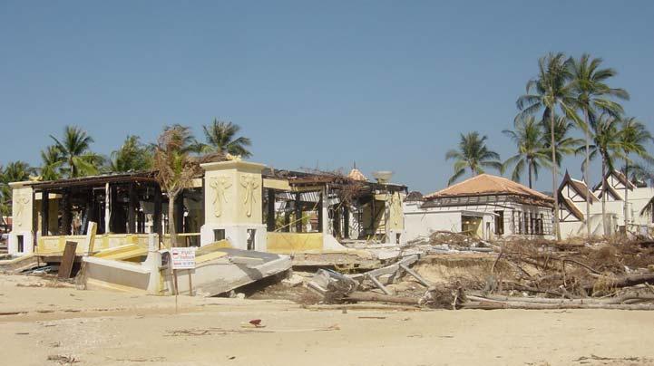
24 The Sumatra earthquake and tsunami Worst tsunami disaster in history Casualties from tsunami Somalia 300 India 16,000 Thailand 8,300 Sri Lanka 35,000 Indonesia 160,000

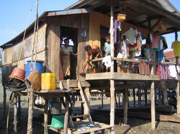
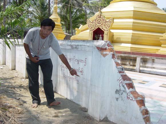
25 Thailand Myanmar

26 Tsunami heights along Andaman Sea Japanese survey teams
 Digital Globe s QuickBird satellite http://www.digitalglobe.")
 ENVISAT-ASAR http://gmoss.jrc.cec.eu.")
27 Satellite Images April 12, 2004 January 2, 2005 submerged Gleebruk Village (South of Banda Aceh) Digital Globe s QuickBird satellite /images/tsunami June 3, 2004 December 30, 2004 emerged Sentinel Island (Andaman Is.) ENVISAT-ASAR /workpackages/20300/sentinel /new/images.html


28 Tsunami surveys around Bengal Bay Andaman Is. < 5m Tsunami height, m Myanmar < 3 m Inferred tsunami source Thailand 5-15m Sri Lanka 5-15m Measured height (m) Indonesia Band Aceh, max 30 m Measured height (m)


29 Northern Andaman 1 m uplift Southeast Andaman 1m subsidence Crustal deformation near the source Coastal surveys and GPS observation detected meter-scale deformation along Sumatra to Andaman Is (~1,000 km) Source for crustal deformation AIST, Univ. Tokyo Sumatra Is. 1m shift to SW Uplift of Sentinel Island ENVISAT-ASAR June 3, 2004 December 30, 2004 Nagoya Univ.


30 Only four M9 events in 20 th century Cumulative seismic moment Harvard CMT


31 M=9.0 Sumatra Earthquake The interface between the subducting plate and overriding plate is a large thrust fault, often termed an interplate thrust or megathrust.

32 M=9.0 Sumatra Earthquake

33 Tsunami size: earthquake mechanism Epicenters of the December 26, 2004, northern Sumatra earthquake and its large aftershocks. The Harvard CMT (Centroid Moment Tensor) solutions are plotted as beach-balls.

34 Tectonic situation
35 Tectonic situation Dec.26 March 28


36 A Flying Start, Then a Slow Slip Slow slip only Fast and slow slips Tsunami source Fast slip only May 20 issue of Science

37 M=9.0 Sumatra Earthquake

38 Source Time Functions from Body Waves 1 st stage ~ 400 km rupture 2 nd stage slower rupture Mw 8.4 Y. Yagi BRI


39 Source Time Functions from Body Waves P wave time window: ~ 200 sec < 90 deg ~ 280 sec > 90 deg Source process time may be longer than the time window Larry Ruff U. Michigan


40 Three slip distribution models ~3 x Nm 6.5 x Nm 6.5 x Nm surface waves SH waves regional +surface waves telseismic body + regional +surface waves SH waves regional +surface waves telseismic body +regional +surface waves Ammon et al. (2005, Science)


41 Northward rupture propagation 1,300 km 2.8 km/s 8 minutes Ishii et al., 2005

42 Surface waves travel around the Earth
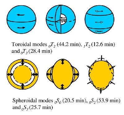
43 Sumatra Earthquake: Earth oscillations
44 Earth s free oscillation Football mode 53.7 min n (radial order) = 0 l (angular order) = 2 m (azimuthal) =±2, ±1, 0 Spectral amp: CMT x 2.6 (Mo = 10x Nm; Mw 9.3) m=1, -1 (zero at equator) too small Better fit for a source at 7.5ºN For T > 1000 s Amplitudes = x CMT Mw= (if dip = 8º) does not fit a simple sinc function Park et al. (2005, Science)

45 Tsunami Generation from the 2004 M=9.0 Sumatra Earthquake Tsunami wave field in the Bay of Bengal. View to the north west, focused near the earthquake epicenter (northern Sumatra)
46 Deep and shallow water waves
47 2004 Off-Sumatra Earthquake
48 Tsunami size: breaking surface

49 Forward and inverse problems


50 Tsunami source estimated from arrival times


51 JASON-1 altimeter on NASA s satellite Observed Sea Surface Heights (SSH) 120 min Estimated tsunami source
52 Tsunami size: earthquake magnitude The magnitude of the earthquake is, in most cases, the most important factor that determines the size of a tsunami.

53 Next earthquake? McCloskey et al., 2005 Nalbant et al., 2005
54 Past earthquakes along Sumatran trench
55 Past earthquakes along Sumatran trench Seih et al. (2004, AGU fall meeting) No giant earthquakes have struck the outer-arc islands of western Sumatra since the sequence of 1797, 1833 and Mw 9.0 slip 10 m uplift 2m Paleoseismic studies of coral microatolls reveal that failure of the subduction interface occurs in clusters of such earthquakes about every 230 years. Thus, the next such sequence may well be no more than a few decades away.
Lessons from the 2004 Sumatra earthquake and the Asian tsunami
 Lessons from the 2004 Sumatra earthquake and the Asian tsunami Kenji Satake National Institute of Advanced Industrial Science and Technology Outline 1. The largest earthquake in the last 40 years 2. Tsunami
News Release December 30, 2004 The Science behind the Aceh Earthquake
 News Release December 30, 2004 The Science behind the Aceh Earthquake PASADENA, Calif. - Kerry Sieh, the Robert P. Sharp Professor of Geology at the California Institute of Technology and a member of Caltech's
1.3 Short Review: Preliminary results and observations of the December 2004 Great Sumatra Earthquake Kenji Hirata
 1.3 Short Review: Preliminary results and observations of the December 2004 Great Sumatra Earthquake Kenji Hirata We give a brief review about observations and preliminary results regarding the 2004 great
Seismic Activity near the Sunda and Andaman Trenches in the Sumatra Subduction Zone
 IJMS 2017 vol. 4 (2): 49-54 International Journal of Multidisciplinary Studies (IJMS) Volume 4, Issue 2, 2017 DOI: http://doi.org/10.4038/ijms.v4i2.22 Seismic Activity near the Sunda and Andaman Trenches
Sendai Earthquake NE Japan March 11, Some explanatory slides Bob Stern, Dave Scholl, others updated March
 Sendai Earthquake NE Japan March 11, 2011 Some explanatory slides Bob Stern, Dave Scholl, others updated March 14 2011 Earth has 11 large plates and many more smaller ones. Plates are 100-200 km thick
Earthquakes Physical Geology 2017 Part 1: Exploring Earthquake distributions. Home butto California Earthquakes: 1) 2) 3) above
 2) 3) above") Earthquakes Physical Geology 2017 Adapted from a lab by Jennifer Wenner This lab is designed to give you experience exploring seismicity associated with different plate boundaries. You will examine seismograms
Earthquakes Physical Geology 2017 Adapted from a lab by Jennifer Wenner This lab is designed to give you experience exploring seismicity associated with different plate boundaries. You will examine seismograms
Earth Science, (Tarbuck/Lutgens) Chapter 10: Mountain Building
 Chapter 10: Mountain Building") Earth Science, (Tarbuck/Lutgens) Chapter 10: Mountain Building 1) A(n) fault has little or no vertical movements of the two blocks. A) stick slip B) oblique slip C) strike slip D) dip slip 2) In a(n) fault,
Earth Science, (Tarbuck/Lutgens) Chapter 10: Mountain Building 1) A(n) fault has little or no vertical movements of the two blocks. A) stick slip B) oblique slip C) strike slip D) dip slip 2) In a(n) fault,
The Earthquake of Padang, Sumatra of 30 September 2009 scientific information and update
 The Earthquake of Padang, Sumatra of 30 September 2009 scientific information and update 01-October-2009 Christophe Vigny Directeur de recherches at CNRS Laboratoire de Géologie Geoscience Dept. Of ENS,
MAR110 Lecture #5 Plate Tectonics-Earthquakes
 1 MAR110 Lecture #5 Plate Tectonics-Earthquakes Figure 5.0 Plate Formation & Subduction Destruction The formation of the ocean crust from magma that is upwelled into a pair of spreading centers. Pairs
EARTHQUAKE LOCATIONS INDICATE PLATE BOUNDARIES EARTHQUAKE MECHANISMS SHOW MOTION
 6-1 6: EARTHQUAKE FOCAL MECHANISMS AND PLATE MOTIONS Hebgen Lake, Montana 1959 Ms 7.5 1 Stein & Wysession, 2003 Owens Valley, California 1872 Mw ~7.5 EARTHQUAKE LOCATIONS INDICATE PLATE BOUNDARIES EARTHQUAKE
Earthquakes and Earthquake Hazards Earth - Chapter 11 Stan Hatfield Southwestern Illinois College
 Earthquakes and Earthquake Hazards Earth - Chapter 11 Stan Hatfield Southwestern Illinois College What Is an Earthquake? An earthquake is the vibration of Earth, produced by the rapid release of energy.
Magnitude 7.7 QUEEN CHARLOTTE ISLANDS REGION
 A major 7.7 magnitude earthquake struck at 8:04 PM local time in western British Columbia, Canada. The epicenter is located on Moresby Island, the southern large island in the Queen Charlotte Islands region.
Chapter 2. Earthquake and Damage
 EDM Report on the Chi-Chi, Taiwan Earthquake of September 21, 1999 2.1 Earthquake Fault 2.1.1 Tectonic Background The island of Taiwan is located in the complex junction where the Eurasian and Philippine
Topic 5: The Dynamic Crust (workbook p ) Evidence that Earth s crust has shifted and changed in both the past and the present is shown by:
 Evidence that Earth s crust has shifted and changed in both the past and the present is shown by:") Topic 5: The Dynamic Crust (workbook p. 65-85) Evidence that Earth s crust has shifted and changed in both the past and the present is shown by: --sedimentary horizontal rock layers (strata) are found
Topic 5: The Dynamic Crust (workbook p. 65-85) Evidence that Earth s crust has shifted and changed in both the past and the present is shown by: --sedimentary horizontal rock layers (strata) are found
Earthquakes and Seismotectonics Chapter 5
 Earthquakes and Seismotectonics Chapter 5 What Creates Earthquakes? The term Earthquake is ambiguous: Applies to general shaking of the ground and to the source of the shaking We will talk about both,
Lab 1: Plate Tectonics April 2, 2009
 Name: Lab 1: Plate Tectonics April 2, 2009 Objective: Students will be introduced to the theory of plate tectonics and different styles of plate margins and interactions. Introduction The planet can be
Earthquakes Chapter 19
 Earthquakes Chapter 19 Does not contain complete lecture notes. What is an earthquake An earthquake is the vibration of Earth produced by the rapid release of energy Energy released radiates in all directions
FOCAL MECHANISMS OF SUBDUCTION ZONE EARTHQUAKES ALONG THE JAVA TRENCH: PRELIMINARY STUDY FOR THE PSHA FOR YOGYAKARTA REGION, INDONESIA
 FOCAL MECHANISMS OF SUBDUCTION ZONE EARTHQUAKES ALONG THE JAVA TRENCH: PRELIMINARY STUDY FOR THE PSHA FOR YOGYAKARTA REGION, INDONESIA Myo Thant 1, Hiroshi Kawase 2, Subagyo Pramumijoyo 3, Heru Hendrayana
Geology Topics. Unit 6 Notes
 Geology Topics Unit 6 Notes Composition of the Earth Earth is layered due to density differences. Crust thin outer layer, solid, made up of continental and oceanic crust Mantle rocky layer below the crust
RELOCATION OF THE MACHAZE AND LACERDA EARTHQUAKES IN MOZAMBIQUE AND THE RUPTURE PROCESS OF THE 2006 Mw7.0 MACHAZE EARTHQUAKE
 RELOCATION OF THE MACHAZE AND LACERDA EARTHQUAKES IN MOZAMBIQUE AND THE RUPTURE PROCESS OF THE 2006 Mw7.0 MACHAZE EARTHQUAKE Paulino C. FEITIO* Supervisors: Nobuo HURUKAWA** MEE07165 Toshiaki YOKOI** ABSTRACT
Chapter 15. Earthquakes and Plate Tectonics. what s the connection? At the boundaries friction causes plates to stick together.
 Chapter 15 Earthquakes and Plate Tectonics what s the connection? As with volcanoes, earthquakes are not randomly distributed over the globe At the boundaries friction causes plates to stick together.
Plate Tectonics. entirely rock both and rock
 Plate Tectonics I. Tectonics A. Tectonic Forces are forces generated from within Earth causing rock to become. B. 1. The study of the origin and arrangement of Earth surface including mountain belts, continents,
What is an Earthquake?
 Earthquakes What is an Earthquake? Earthquake - sometimes violent shaking of ground caused by movement of Earth s tectonic plates; creates seismic waves Often followed by smaller earthquakes (aftershocks);
DETERMINATION OF SLIP DISTRIBUTION OF THE 28 MARCH 2005 NIAS EARTHQUAKE USING JOINT INVERSION OF TSUNAMI WAVEFORM AND GPS DATA
 Synopses of Master Papers Bulletin of IISEE, 47, 115-10, 013 DETERMINATION OF SLIP DISTRIBUTION OF THE 8 MARCH 005 NIAS EARTHQUAKE USING JOINT INVERSION OF TSUNAMI WAVEFORM AND GPS DATA Tatok Yatimantoro
Earthquakes = shaking of Earth because of a rapid release of energy
 There are more than 30,000 earthquakes worldwide each year! Earthquakes = shaking of Earth because of a rapid release of energy usually because of movement of tectonic plates Most earthquakes last for
Magnitude 7.0 PAPUA, INDONESIA
 A 7.0 magnitude earthquake struck eastern Indonesia's mountainous West Papua province on Saturday but there were no immediate reports of casualties or damage. The region is sparsely populated. According
Plate tectonics - 3. Homework 1: Due Monday. Hot Spots Magnetic Reversals Isostasy Continental Tectonics. EESC 2200 The Solid Earth System.
 2500 EESC 2200 The Solid Earth System Plate tectonics - 3 17 Sep 08 Hot Spots Magnetic Reversals Isostasy Continental Tectonics Depth (m) 6000 0 9 36 100 155 Homework 1: Due Monday Review: Fracture zone
3. PLATE TECTONICS LAST NAME (ALL IN CAPS): FIRST NAME: PLATES
: FIRST NAME: PLATES") LAST NAME (ALL IN CAPS): FIRST NAME: PLATES 3. PLATE TECTONICS The outer layers of the Earth are divided into the lithosphere and asthenosphere. The division is based on differences in mechanical properties
LAST NAME (ALL IN CAPS): FIRST NAME: PLATES 3. PLATE TECTONICS The outer layers of the Earth are divided into the lithosphere and asthenosphere. The division is based on differences in mechanical properties
GEOLOGY MEDIA SUITE Chapter 13
 UNDERSTANDING EARTH, SIXTH EDITION GROTZINGER JORDAN GEOLOGY MEDIA SUITE Chapter 13 Earthquakes 2010 W.H. Freeman and Company Three different types of seismic waves are recorded by seismographs Key Figure
Plate Tectonics. Structure of the Earth
 Plate Tectonics Structure of the Earth The Earth can be considered as being made up of a series of concentric spheres, each made up of materials that differ in terms of composition and mechanical properties.
Magnitude 6.5 OFFSHORE NORTHERN CALIFORNIA
 A powerful offshore earthquake that struck near the Northern California coast left a hodgepodge of debris for communities to sort through Sunday but spared residents any serious injury. After 25,000 people
Seth Stein and Emile Okal, Department of Geological Sciences, Northwestern University, Evanston IL USA. Revised 2/5/05
 Sumatra earthquake moment from normal modes 2/6/05 1 Ultra-long period seismic moment of the great December 26, 2004 Sumatra earthquake and implications for the slip process Seth Stein and Emile Okal,
The Indian Ocean. Copyright 2010 LessonSnips
 The Indian Ocean One of the five major geographic divisions of the world s ocean, the Indian Ocean is located in the Eastern Hemisphere. The Indian Ocean is bounded by three continents: Africa to the west,
Earthquakes Earth, 9th edition, Chapter 11 Key Concepts What is an earthquake? Earthquake focus and epicenter What is an earthquake?
 1 2 3 4 5 6 7 8 9 10 Earthquakes Earth, 9 th edition, Chapter 11 Key Concepts Earthquake basics. "" and locating earthquakes.. Destruction resulting from earthquakes. Predicting earthquakes. Earthquakes
Dynamic Crust Practice
 1. Base your answer to the following question on the cross section below and on your knowledge of Earth science. The cross section represents the distance and age of ocean-floor bedrock found on both sides
Magnitude 7.1 NEAR THE EAST COAST OF HONSHU, JAPAN
 Japan was rattled by a strong aftershock and tsunami warning Thursday night nearly a month after a devastating earthquake and tsunami flattened the northeastern coast. This earthquake can be considered
OCN 201: Seafloor Spreading and Plate Tectonics I
 OCN 201: Seafloor Spreading and Plate Tectonics I Revival of Continental Drift Theory Kiyoo Wadati (1935) speculated that earthquakes and volcanoes may be associated with continental drift. Hugo Benioff
Earthquakes. Building Earth s Surface, Part 2. Science 330 Summer What is an earthquake?
 Earthquakes Building Earth s Surface, Part 2 Science 330 Summer 2005 What is an earthquake? An earthquake is the vibration of Earth produced by the rapid release of energy Energy released radiates in all
General Oceanography Geology 105 Expedition 10 - Whole Lotta Shakin' Goin' On
 General Oceanography Geology 105 Expedition 10 - Whole Lotta Shakin' Goin' On Name Not attempting to answer questions on expeditions will result in point deductions on course workbook (two or more blank
OCN 201 Seafloor Spreading and Plate Tectonics. Question
 OCN 201 Seafloor Spreading and Plate Tectonics Question What was wrong from Wegener s theory of continental drift? A. The continents were once all connected in a single supercontinent B. The continents
Magnitude 7.2 OAXACA, MEXICO
 A magnitude 7.2 earthquake has occurred in Oaxaca, Mexico at a depth of 24.6 km (15 miles). It was felt as far away as Guatemala. There have been no reported deaths directly linked to the earthquake. Emergency
5-31. Cambodia. Vietnam. South China S ea. Malaysia. Kuala L umpur. Singapore. Kalimantan. Sunda S trait. Jakarta. Java 98E. Sumatra. Pini.
 5-31 Ridge Ninetyeast 52mm/yr Wharton For e S umatran Ridge Indian Andaman Sea arc 1861 Burma Ridge 1833 Thailand Sumatran Sliver Subduction Southeast Asian P late Malaysia Fault P Cambodia Kuala L umpur
This document is downloaded from DR-NTU, Nanyang Technological University Library, Singapore.
 This document is downloaded from DR-NTU, Nanyang Technological University Library, Singapore. Title Aceh Andaman earthquake : what happened and what's next? Author(s) Sieh, Kerry Citation Sieh, K. (2005).
Preparation for Future Earthquake and Tsunami Hazards: Lessons Learned from the 2004 Sumatra-Andaman Earthquake and the Asian Tsunami
 First International Conference of Aceh and Indian Ocean Studies Organized by Asia Research Institute, National University of Singapore & Rehabilitation and Construction Executing Agency for Aceh and Nias
PLATE MOTIONS: BASIC CONCEPTS
 PLATE MOTIONS: BASIC CONCEPTS North American plate 20 mm/yr Eurasian plate Pacific plate 35 mm/yr North American plate Iceland Spreading Center, Thingvellir San Andreas Transform Fault Carrizo Plain BASIC
Plate Tectonics on a Plane. Observations related to plate tectonics " " Plate tectonic theory types of plate boundaries!
 Plate Tectonics on a Plane Scripps Inst. Of Oceanography" Observations related to plate tectonics " Ocean and continent topography, hypsometry, and crustal thickness. Global seismicity, Benioff zones,
Magnitude 7.9 SE of KODIAK, ALASKA
 A magnitude 7.9 earthquake occurred at 12:31 am local time 181 miles southeast of Kodiak at a depth of 25 km (15.5 miles). There are no immediate reports of damage or fatalities. Light shaking from this
CHAPTER 1 BASIC SEISMOLOGY AND EARTHQUAKE TERMINOLGY. Earth Formation Plate Tectonics Sources of Earthquakes...
 CHAPTER 1 BASIC SEISMOLOGY AND EARTHQUAKE TERMINOLGY Earth Formation... 1-2 Plate Tectonics... 1-2 Sources of Earthquakes... 1-3 Earth Faults... 1-4 Fault Creep... 1-5 California Faults... 1-6 Earthquake
Magnitude 7.6 & 7.4 SOLOMON ISLANDS
 A magnitude 7.6 earthquake struck near the Solomon Islands on Sunday morning local time; there were no immediate reports of damage. The earthquake was centered 100 km (60 miles) south of Kira Kira, a town
Dynamic Earth A B1. Which type of plate boundary is located at the Jordan Fault? (1) divergent (3) convergent (2) subduction (4) transform
 divergent (3) convergent (2) subduction (4) transform") Dynamic Earth A B1 1. The edges of most lithospheric plates are characterized by (1) reversed magnetic orientation (2) unusually rapid radioactive decay (3) frequent volcanic activity (4) low P-wave and
Dynamic Earth A B1 1. The edges of most lithospheric plates are characterized by (1) reversed magnetic orientation (2) unusually rapid radioactive decay (3) frequent volcanic activity (4) low P-wave and
5. What is an earthquake 6. Indicate the approximate radius of the earth, inner core, and outer core.
 Tutorial Problems 1. Where Do Earthquakes Happen? 2. Where do over 90% of earthquakes occur? 3. Why Do Earthquakes Happen? 4. What are the formulae for P and S velocity 5. What is an earthquake 6. Indicate
Evidence for a slab fragment wedged under Tokyo and its tectonic and seismic implications
 Supplementary Information to accompany Evidence for a slab fragment wedged under Tokyo and its tectonic and seismic implications Shinji Toda, Ross S. Stein, Stephen H. Kirby, and Serkan B. Bozkurt This
A) B) C) D) 4. Which diagram below best represents the pattern of magnetic orientation in the seafloor on the west (left) side of the ocean ridge?
 B) C) D) 4. Which diagram below best represents the pattern of magnetic orientation in the seafloor on the west (left) side of the ocean ridge?") 1. Crustal formation, which may cause the widening of an ocean, is most likely occurring at the boundary between the A) African Plate and the Eurasian Plate B) Pacific Plate and the Philippine Plate C)
1. Crustal formation, which may cause the widening of an ocean, is most likely occurring at the boundary between the A) African Plate and the Eurasian Plate B) Pacific Plate and the Philippine Plate C)
Plates & Boundaries The earth's continents are constantly moving due to the motions of the tectonic plates.
 Plates & Boundaries The earth's continents are constantly moving due to the motions of the tectonic plates. As you can see, some of the plates contain continents and others are mostly under the ocean.
SUPPLEMENTARY INFORMATION
 doi:10.1038/nature11492 Figure S1 Short-period Seismic Energy Release Pattern Imaged by F-net. (a) Locations of broadband seismograph stations in Japanese F-net used for the 0.5-2.0 Hz P wave back-projection
Earthquakes 11/14/2014. Earthquakes Occur at All Boundaries. Earthquakes. Key Aspects of an Earthquake. Epicenter. Focus
 Earthquakes Earthquakes Caused by friction and movement between Earth s tectonic plates A release of force Often caused by a catch between two plates As plates slide by, they stick to each other When the
Geology 300, Physical Geology Spring 2019 Quiz Ch 19, Plate Tectonics Name
 Geology 300, Physical Geology Spring 2019 Quiz Ch 19, Plate Tectonics Name MULTIPLE CHOICE. Choose the one alternative that best completes the statement or answers the question. 1) The portion of a fracture
ANOTHER MEXICAN EARTHQUAKE! Magnitude 7.1, Tuesday Sept. 19, 2017
 ANOTHER MEXICAN EARTHQUAKE! Magnitude 7.1, Tuesday Sept. 19, 2017 Why is there no oceanic crust older than 200 million years? SUBDUCTION If new oceanic crust is being continuously created along the earth
Essentials of Oceanography Eleventh Edition
 Chapter Chapter 1 2 Clickers Lecture Essentials of Oceanography Eleventh Edition Plate Tectonics and the Ocean Floor Alan P. Trujillo Harold V. Thurman Chapter Overview Much evidence supports plate tectonics
USU 1360 TECTONICS / PROCESSES
 USU 1360 TECTONICS / PROCESSES Observe the world map and each enlargement Pacific Northwest Tibet South America Japan 03.00.a1 South Atlantic Arabian Peninsula Observe features near the Pacific Northwest
TAKE HOME EXAM 8R - Geology
 Name Period Date TAKE HOME EXAM 8R - Geology PART 1 - Multiple Choice 1. A volcanic cone made up of alternating layers of lava and rock particles is a cone. a. cinder b. lava c. shield d. composite 2.
Magnitude 7.5 NEW BRITAIN REGION, PAPUA NEW GUINEA
 A magnitude 7.5 earthquake struck off the eastern coast of Papua New Guinea on Sunday, approximately 54 km (33 miles) southeast of Kokopo. Residents reported strong ground shaking for about five minutes.
Plate Tectonics IDEA THAT EARTH S SURFACE IS BROKEN INTO PLATES THAT MOVE AROUND. Fault = fracture in the crust where the movement has occurred
 Warm-up #14 A mountain range found 100 meters above sea level is measured to be 1,000 meters high from its tallest peak. From the top, the first 500 meters are incredibly steep. After this point, the mountain
Crustal Boundaries. As they move across the asthenosphere and form plate boundaries they interact in various ways. Convergent Transform Divergent
 Name: Date: Period: Plate Tectonics The Physical Setting: Earth Science CLASS NOTES Tectonic plates are constantly moving and interacting As they move across the asthenosphere and form plate boundaries
Beneath our Feet: The 4 Layers of the Earty by Kelly Hashway
 Beneath our Feet: The 4 Layers of the Earty by Kelly Hashway The Earth is more than a giant ball made up of dirt, rocks, and minerals. The Earth may look like a giant ball from when looking at it from
Earth Dynamics. Landforms at Plate Boundaries
 Earth Dynamics CHAPTER 8 LESSON 2 Landforms at Boundaries What do you think? Read the two statements below and decide whether you agree or disagree with them. Place an A in the Before column if you agree
Alfred Wegener gave us Continental Drift. Fifty years later...
 CHAPTER 2 Plate Tectonics and the Ocean Floor Plate Tectonics: summary in haiku form Alfred Wegener gave us Continental Drift. Fifty years later... Words Chapter Overview Much evidence supports plate tectonics
Magnitude 7.4 SOUTH GEORGIA ISLAND REGION
 A magnitude 7.4 earthquake occurred in the South Georgia Island Region. South Georgia Island is a British territory in the South Atlantic Ocean that lies about 800 miles east of the Falkland Islands. It
Earthquake Hazards. Tsunami
 Earthquake Hazards Tsunami Review: What is an earthquake? Earthquake is the vibration (shaking) and/or displacement of the ground produced by the sudden release of energy. The point inside the Earth where
Learning Objectives (LO)! Lecture 11: Plate Tectonics II! No Homework!! ** Chapter 3 **! What we ll learn today:!
! Lecture 11: Plate Tectonics II! No Homework!! ** Chapter 3 **! What we ll learn today:!") Learning Objectives (LO)! Lecture 11: Plate Tectonics II! No Homework!! ** Chapter 3 **! What we ll learn today:! 1. List the three types of tectonic plate boundaries! 2. Describe the processes occurring
Learning Objectives (LO)! Lecture 11: Plate Tectonics II! No Homework!! ** Chapter 3 **! What we ll learn today:! 1. List the three types of tectonic plate boundaries! 2. Describe the processes occurring
Introduction to Oceanography. Chapter 2: Plate Tectonics Overview
 Introduction to Oceanography Chapter 2: Plate Tectonics Overview Much evidence supports plate tectonics theory. The plate tectonics model describes features and processes on Earth. Plate tectonic science
Magnitude 7.5 NEW BRITAIN REGION, PAPUA NEW GUINEA
 A magnitude 7.5 earthquake struck off the eastern coast of Papua New Guinea on Tuesday, approximately 130 km (81 mi) southsouthwest of Kokopo at a depth of 42 km (26.1 mi). There are reports of some structural
Magnitude 8.2 NORTHWEST OF IQUIQUE, CHILE
 An 8.2-magnitude earthquake struck off the coast of northern Chile, generating a local tsunami. The USGS reported the earthquake was centered 95 km (59 miles) northwest of Iquique at a depth of 20.1km
Tsunami waves swept away houses and cars in northern Japan and pushed ships aground.
 Japan was struck by a magnitude 8.9 earthquake off its northeastern coast Friday. This is one of the largest earthquakes that Japan has ever experienced. In downtown Tokyo, large buildings shook violently
FORCES ON EARTH. An investigation into how Newton s Laws of Motion are applied to the tectonic activity on Earth.
 FORCES ON EARTH An investigation into how Newton s Laws of Motion are applied to the tectonic activity on Earth. GEOLOGY Geologists scientists who study the forces that make and shape the Earth Geologists
Plate Tectonics - Demonstration
 Name: Reference: Prof. Larry Braile - Educational Resources Copyright 2000. L. Braile. Permission granted for reproduction for non-commercial uses. http://web.ics.purdue.edu/~braile/indexlinks/educ.htm
Earth Movement and Resultant Landforms
 Earth Movement and Resultant Landforms Structure of the Earth Lithosphere : earth s crust Asthenosphere : upper mantle zone where material is near its melting point & acts almost like liquid (appprox.
General-Circulation- Model System for Global Tsunami Warning
 A Coupled Teleseismic Ocean-General General-Circulation- Model System for Global Tsunami Warning Y. Tony Song Jet Propulsion Laboratory, California Institute of Technology Contents:. Tsunami formation
Earthquake Hazards. Tsunami
 Earthquake Hazards Tsunami Review: What is an earthquake? Earthquake is the vibration (shaking) and/or displacement of the ground produced by the sudden release of energy. The point inside the Earth where
LECTURE #5: Plate Tectonics: Boundaries & Earthquake Science
 GEOL 0820 Ramsey Natural Disasters Spring, 2018 LECTURE #5: Plate Tectonics: Boundaries & Earthquake Science Date: 23 January 2018 I. Reminder: Exam #1 is scheduled for Feb 1st one week from Thursday o
Tectonic Forces Simulation: Earthquakes Activity One
 Tectonic Forces Simulation: Earthquakes Activity One Introduction If you marked all the earthquakes from the past century on a world map, you'd notice that most tend to occur along certain lines around
Earthquakes and Tsunamis
 Earthquakes and Tsunamis Kenji Satake Earthquake Research Institute University of Tokyo 1 Part I 2011 Tohoku earthquake and tsunami 2 Fukushima Dai ichi NPP accident Earthquake ground motion Reactors automatically
We have previously looked at artificial seismograms such as this one here.
 We have previously looked at artificial seismograms such as this one here. S P A realistic Seismic Record Each vertical line = 1 minute Each horizontal line = 15 minutes Seismic station PMM is in Parkfield,
Establishment and Operation of a Regional Tsunami Warning Centre
 Establishment and Operation of a Regional Tsunami Warning Centre Dr. Charles McCreery, Director NOAA Richard H. Hagemeyer Pacific Tsunami Warning Center Ewa Beach, Hawaii USA Why A Regional Tsunami Warning
4 Deforming the Earth s Crust
 CHAPTER 7 4 Deforming the Earth s Crust SECTION Plate Tectonics BEFORE YOU READ After you read this section, you should be able to answer these questions: What happens when rock is placed under stress?
CONTENT. A. Changes in the Crust Facts Changes Construction and Destruction. B. Continental Drift What is it? Evidence
 Name Earth Science Date Period TOPIC THE DYNAMIC EARTH CONTENT A. Changes in the Crust Facts Changes Construction and Destruction B. Continental Drift What is it? Evidence C. Theory of Plate Tectonics
An Earthquake is a rapid vibration or shaking of the Earth s crust created by a release in energy from sudden movement of a part of a plate along a
 An Earthquake is a rapid vibration or shaking of the Earth s crust created by a release in energy from sudden movement of a part of a plate along a fault. Energy released radiates in all directions from
Topic 12 Review Book Earth s Dynamic Crust and Interior
 Topic 12 Review Book Earth s Dynamic Crust and Interior Define the Vocabulary 1. asthenosphere 2. continental crust 3. Convection current 4. Convergent plate boundary 5. Divergent plate boundary 6. earthquake
Chapter 2 Plate Tectonics and the Ocean Floor
 Chapter 2 Plate Tectonics and the Ocean Floor Chapter Overview Much evidence supports plate tectonics theory. The plate tectonics model describes features and processes on Earth. Plate tectonic science
12. The diagram below shows the collision of an oceanic plate and a continental plate.
 Review 1. Base your answer to the following question on the cross section below, which shows the boundary between two lithospheric plates. Point X is a location in the continental lithosphere. The depth
of other regional earthquakes (e.g. Zoback and Zoback, 1980). I also want to find out
. I also want to find out") 4. Focal Mechanism Solutions A way to investigate source properties of the 2001 sequence is to attempt finding well-constrained focal mechanism solutions to determine if they are consistent with those
4. Focal Mechanism Solutions A way to investigate source properties of the 2001 sequence is to attempt finding well-constrained focal mechanism solutions to determine if they are consistent with those
Name: Date: Bell: The Sumatra Earthquake and Tsunami December 26, 2004
 Name: Date: Bell: The Sumatra Earthquake and Tsunami December 26, 2004 Introduction: The incredible damage and tragic loss of life resulting from the 9.0 magnitude earthquake and ensuing tsunami was shocking
FORCES ON EARTH UNIT 3.2. An investigation into how Newton s Laws of Motion are applied to the tectonic activity on Earth.
 FORCES ON EARTH UNIT 3.2 An investigation into how Newton s Laws of Motion are applied to the tectonic activity on Earth. USE THESE NOTES: OUR HOME PLANET EARTH: What do you know about our planet? SO.HOW
(First Edition: prepared on 29/12/2003)
") (First Edition: prepared on 29/12/2003) Dr Sassan Eshghi 1 and Dr Mehdi Zaré 2 International Institute of Earthquake Engineering and Seismology, Tehran, P.O.Box: 19395/3913, IRAN e-mails: 1)s.eshghi@iiees.ac.ir,
(First Edition: prepared on 29/12/2003) Dr Sassan Eshghi 1 and Dr Mehdi Zaré 2 International Institute of Earthquake Engineering and Seismology, Tehran, P.O.Box: 19395/3913, IRAN e-mails: 1)s.eshghi@iiees.ac.ir,
Plate Tectonics GEOL 101 Lecture 22 How Are Mountains Built?
 Plate Tectonics GEOL 101 Lecture 22 How Are Mountains Built? The Grand Tetons, Wyoming First a Brief Review of Sea Floor Spreading Prop: Test 3 Invitations Break-Up of a Continent and Origin of an Ocean
AVERAGE AND VARIATION OF FOCAL MECHANISM AROUND TOHOKU SUBDUCTION ZONE
 13 th World Conference on Earthquake Engineering Vancouver, B.C., Canada August 1-6, 24 Paper No. 414 AVERAGE AND VARIATION OF FOCAL MECHANISM AROUND TOHOKU SUBDUCTION ZONE Shunroku YAMAMOTO 1 Naohito
MAR110 LECTURE #6 West Coast Earthquakes & Hot Spots
 17 September 2007 Lecture 6 West Coast Earthquakes & Hot Spots 1 MAR110 LECTURE #6 West Coast Earthquakes & Hot Spots Figure 6.1 Plate Formation & Subduction Destruction The formation of the ocean crust
Earthquake Hazards. Tsunami
 Earthquake Hazards Tsunami Measuring Earthquakes Two measurements that describe the power or strength of an earthquake are: Intensity a measure of the degree of earthquake shaking at a given locale based
SCIENCE IN THE NEWS Plate Tectonics
 SCIENCE IN THE NEWS Plate Tectonics From VOA Learning English, this is Science in the News. I m Anna Matteo. And I m Christopher Cruise. Scientists who study the Earth tell us the continents and ocean
Earthquakes. Earthquakes are caused by a sudden release of energy
 Earthquakes Earthquakes are caused by a sudden release of energy The amount of energy released determines the magnitude of the earthquake Seismic waves carry the energy away from its origin Fig. 18.1 Origin