SENSITIVITY ANALYSIS IN SHALE GOUGE RATIO AND FAULT PERMEABILITY MODEL FOR POST MORTEM RE-EVALUATION OF M CLOSURE, OFFSHORE TIMOR SEA, INDONESIA
|
|
|
- Joan Robertson
- 6 years ago
- Views:
Transcription
1 P2O-01 SENSITIVITY ANALYSIS IN SHALE GOUGE RATIO AND FAULT PERMEABILITY MODEL FOR POST MORTEM RE-EVALUATION OF M CLOSURE, OFFSHORE TIMOR SEA, INDONESIA Rahmadi Hidayat 1*, Sugeng Sapto Surjono 1 1 Jurusan Teknik Geologi, Fakultas Teknik, Universitas Gadjah Mada Jl.Grafika No.2 Bulaksumur, Yogyakarta, Indonesia, Tel , * rahmadihidayat@ugm.ac.id Abstract Accepted 9 September 2014 Since gas discovery in Abadi Gas Field, Offshore Timor Sea, many exploration works have been conducted in adjacent area, including M closure. However, no gas findings were reported in M closure. In order to determine post mortem evaluation of M closure, evaluating fault seal is critical to understand trapping mechanism uncertainty in M closure. This evaluation is carried out at Triassic Challis sandstone reservoir, utilizing well data to obtain volume shale properties as well as 2D seismic data to map fault throw, orientation and juxtaposition. Shale Gouge Ratio (SGR) and Fault Permeability (Kf) model will be calculated using Yielding and Manzocchi algorithm. M closure is a horst structure, bounded by two NNE-SSW trending vertical faults as part of extensional event in Mesozoic. Based on three sensitivity analysis conducted in this study, SGR model revealed that bounding faults in M closure mostly have more than 0.2 while Kf model have 0.1 md. Utilizing reference from earlier studies, it indicates that those bounding faults are categorized as likely sealed faults. Post mortem re-evaluation suggests that fault breaching is not the main geological risk issue in M closure. Furthermore, opportunities for discovery in Offshore Timor Sea are still wide open. There are many undrilled tilt-block closures similar to M Closure which can be potential for further development by determining its position relative to hydrocarbon charge and migration pathway. Keyword: Shale Gouge Ratio, Fault permeability, Challis reservoir Introduction M closure is situated in Offshore Timor Sea, Eastern of Indonesia which has water-depth meters. Geologically, it is included in Ashmore Platform, Northwest of Bonaparte Basin. Bonaparte Basin, especially in northwestern area, is well-known as main hydrocarbon producer (Figure 1). Many hydrocarbon discoveries have been found in this region, mostly in Australian territory, starting from Sunrise-Troubadour gas field in , Evan Shoals gas field in 1988 and Bayu-Undan gas field in 1995 (Nagura et al., 2003). In Indonesian territory, Abadi gas field is the only successful exploration within Northwestern Bonaparte Basin. It was discovered in 2000 with Abadi-1 exploration well drilled by INPEX Masela, Ltd. (Zushi et al., 2009). In contrary to Australia, some exploration studies in Indonesia were failed to discover other fields similar to Abadi. M closure, drilled in 1999 with M-1 exploration well, is one example of unsuccessful exploration within this region. M-1 well status is plugged and abandoned with no report of hydrocarbon show. The main reason of this unsuccessful drilling is still ambiguous whether hydrocarbon charges migration pathway failure or fault-seal failure. In order to understand the main failure, post mortem re-evaluation is necessary to give clearer exploration opportunities within area with new concept of petroleum play. 265
2 Main objective of this study is a sensitivity analysis for fault-seal potential within M closure to evaluate geological risk of trapping mechanism point of view. Geological Settings Eastern Indonesia lies within a complex tectonic zone formed as a result of Neogene collision and interaction of the Australian and Eurasian continental plates and the Caroline and Philippine Sea oceanic micro-plates (Barber et al. 2003). Tectonic history of this area is affected by multi-phase extensional and compressional episodes during Late Paleozoic to Neogene. Orthogonal and curvilinear geometry of basin morphologies in the study area are implied to these tectonic episodes. Mesozoic Extensional Event as representation of Vulcan, Malita and Calder Graben, formed during Triassic through Jurassic to Early Cretaceous rifting and continental breakup of the NW Shelf Australia (Barber et al. 2003). Based on seismic interpretation, this event has massive impact to the study area, characterized by multiple series of NNE- SSW horst-graben structures (Figure 2). Geometry of these horst-graben systems are typically vertical and have major fault throw. The regional Valanginian Event, happened in the post-breakup sequence, created massive erosion in surrounding study area, such as Londonderry High and Ashmore Platform. This break was probably due to a relative fall in sea level (MacDaniel, 1988). In Vulcan sub-basin, non-depositional hiatus was expressed while in study area, massive erosion was commenced and entirely eroded Jurassic sequence, such as well-known Plover Formation as major gas reservoir in most of NW Australian Shelf. In the Miocene to Pliocene, the Australian Plate collided with the Banda volcanic arc which caused down-warping of the Australian continental margin and led to flexure of the Australian Plate (Cadman and Temple, 2003; Amir et al., 2010). This event created major thrust-belt system in north of Timor Trough. Regional stratigraphy of M closure can be referred from Vulcan Sub-basin. Oldest sequence is Late Permian Cape Hay Sequence, mostly consists of shale. Typically deltaic system in the Bonaparte Basin but may change into pro-delta to marine environment further NW (Mory, 1991). Overlying Cape Hay, development of a broad carbonate platform along the northern margin Bonaparte Basin was established (MacDaniel, 1988), forming Dombey Limestone member. In Middle Triassic event, mixed clastic - carbonate sequence was deposited in shallow-marine environments. This event created two conformable sequences, which are Mt. Goodwin and Challis-Pollard. Mt. Goodwin expected as potential marine source, even though unproven (Kennard et al., 2003). Second sequence consists of silisiclastic reservoirs with interbedded shale, carbonates (Challis, as primary reservoir target in this study), and mixed carbonate silisiclastic reservoir in lower part, known as Pollard member. Challis reservoir in some oil fields was reported that it was deposited on the margin of a protected macrotidal estuary or bay with marine conditions to the south and a major fluvial system to the northeast. This Triassic petroleum bearing units of the Challis field comprises migratory channel sequences within a broad estuary or bay. Intercalated with the channels are tidal shoals and shoreline-oriented barrier island sands (Cadman and Temple, 2003). Valanginian event then massively eroded almost entirely Jurassic sequence. Starting from Cretaceous to Early Tertiary, outer shelf carbonates developed widespread in north westernmost of Bonaparte Basin (Mory, 1991). This event created thick marl-shale sequences as regional seal, starting from of Echuca Shoal, Wangarlu and Johnson. 266
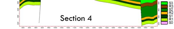
3 Method PROSIDING SEMINAR NASIONAL KEBUMIAN KE-7 Triassic Challis sandstone is the target for this research as the primary reservoir in this area. In M-1 well, Challis is divided into three zones, such as R1, R2 and R3. All zones has typical blocky GR log characteristic. The method of this research can be divided into two major groups. Seismic analysis, first group, was conducted to reveal subsurface maps and fault identification. In subsurface analysis, seismic interpretation of several key horizons was observed to build depth structure map. Ladinian event was picked as the lowermost of Challis interest zone. R2 and R3 zone markers were picked as well as the interest zone while Valanginian unconformity was included as the uppermost part of Challis. Two bounding faults of M Closure would be modeled in this research, Northwest Fault (NWF) and Southeast Fault (SEF). Both are extensional faults as product of Mesozoic Extensional Event. Fault attributes, such as horizontal-vertical throw as well as dip-azimuth fault. Petrophysical analysis, second group, was also utilized to reveal reservoir and seal zone identification within Challis interval. Volume shale (VSH) analysis was also conducted for Shale Gouge Ratio (SGR) calculation in next stage. Both groups then combined to gain geobody modeling for further fault modeling. For calculating SGR, Yielding algorithm was applied as follows: (ݖΔ ݔ hݏ ) Σ = ܩ ݓݎhݐ SGR = Shale Gouge Ratio (fraction) Vsh = shale volume fraction Δz = thickness of each layer throw = fault throw For fault permeability calculation (Kf), Manzocchi algorithm (1999) was utilized as follows: Log Kf = -4xSGR 0.25xlog(D)x(1-SGR) 5 Kf = fault zone permeability (md) SGR = Shale Gouge Ratio (fraction) D = fault displacement (m) Data Analyses R1 zone is the deepest reservoir with 18.8 meter thick. VSH calculation in R1 revealed VSH in range of 0.1 to 0.4 with an average of R2 zone appeared as thinnest zone with only meter. VSH range is slightly higher than R1, 0.12 to 0.43, and average value is R3 is the shallowest zone and thickest as well, meter. VSH calculation showed range of 0.11 to 0.79 and average High value of VSH indicates that some thin shale layers occurred in between R3 zone. M closure is bounded by NWF in southern part and interpreted as a product of Mesozoic Extensional Event. NWF is categorized as NNE SSW trending vertical fault with dip angle 54.5 deg in average. The average dip azimuth is N W and it is categorized as NW facing fault. Vertical throw of NWF is quite high, m in average (Figure 3). In section 1, southwest part of area, NWF has major throw (83.51 m) and quite vertical dip angle (52.36 deg). Further east, dip angle of NWF is remain parallel (
4 deg); however fault throw is changed to m. In northeastern section, fault throw is slightly higher (46.3 m) with dip angle around deg. SEF is the southern bound fault of M closure. Similar to NWF, this fault also has NNE-SSW trend and occurred during Mesozoic Extension Event. Vertical angle of this fault is slightly higher than NWF, 56.2 deg in average. This fault is SE facing fault with mean dip azimuth is N E. Mean vertical throw is slightly lower than NWF, m in average (Figure 4). Section 1 suggests that fault throw and dip angle of SEF is low (40.99 m and deg) and getting lower further section 2 (15.6 m and deg). However, fault throw in northeastern section depicts high value (93.56 m) as well as dip angle (61.67 deg). Fault Modeling SGR model of NWF as well as SEF can be described in Figure 6. SGR of NWF in R1 zone has in range of 0.32 to In R2 zone, SGR value is slightly increasing 0.42 to R3 zone has SGR in range of In SEF, SGR value on R1 zone is while R2 zone has in range of and R3 has Based on SGR modeling, all reservoir zones have SGR more than 0.2. In fault permeability derived from Manzocchi algorithm, all reservoir zones in both fault, SEF and NWF, have lower than 0.1 md. Generalized classification of faults is made by Yielding based on SGR value. He suggested that SGR 0.2 or lesser are typically with cataclastic fault gouge and it is unlikely for sealing. However, if the value is greater than 0.2, the faults will tend to be more potential for sealing as the occurrence of some clay smears (Sahoo et al., 2010). Sensitivity Analysis Fault modeling conducted in this study was controlled only by M-1 exploratory well. In modeling, lateral distribution of VSH property in all reservoirs was assumed to have similar value. This is unlikely for geological understanding, especially in case of depositional environment. The difficulty to understand the exact condition of fault-seal modeling is also occurred when data are limited. In this research, sensitivity analysis was proposed to acknowledge possibility of variation in lateral distribution using regional paleogeography during Triassic as timing of Challis reservoir adopted from Mory (1991). Mory stated that further NW, deposition of Triassic sequence was more distal to marine condition. It can be assumed that in such condition, VSH of reservoir zone will be higher (Figure 7). On the other hand, VSH will drop further SE as the environment is changing into more proximal (deltaic area). Three scenarios (12.5%, 25% and 50%) have been applied and developed to accommodate the rise or drop of VSH. These scenarios, as the sensitivity point of view, will be able to see the pessimistic and optimistic case of faultsealing in M closure. SEF is located in SE of the study area with more proximal and has sandier tendency. The value of SGR as well as fault permeability of all reservoir zones will be pessimistic for sealing due to its condition. In 12.5% scenario, the decreasing of SGR potency is slightly lower, with minimum SGR is around In more pessimistic scenario, 25% scenario, SGR potency is down into In extremely pessimistic scenario which has 50% difference, minimum SGR potency is dropped into 0.23 (Figure 8). In term of sealing potency, those numbers can be included as sealing fault. However, if the value near to 0.2, as limit of sealing fault proposed by Yielding et al. (2010), some of cataclastic fault gouge may reduce the capability and act as poor sealing. Maximum fault permeability in extreme pessimistic 50% scenario still suggests low number, 0.26 md. In other scenarios, the fault permeability value will be lesser than 50% scenario. 268
5 NWF is assumed to have shalier tendency because its position relative to M closure tends to be more distal. Both SGR and fault permeability are assumed to be optimistic for sealing capacity. SGR potency in NWF for zone R1 to R3 is slightly higher in 12.5% scenario, with minimum SGR is around In 25% scenario, SGR potency is going up into 0.44 and further optimistic scenario (50%), minimum SGR potency reached until 0.51 (Figure 9). Based on these multiple scenario observations, NWF is interpreted to have more clay smears and will act as moderate sealing fault. Conclusions This evaluation suggests that most of sensitivity scenarios have SGR more than 0.2 in all reservoir zones (R1, R2 and R3). It can be concluded that those bounding faults are above threshold for faults sealing hydrocarbon and potentially hold sufficient amount of hydrocarbon column. No hydrocarbon indication or show in M closure is likely due to failure in migration pathway or hydrocarbon charge rather than fault-breach. As result, exploration opportunities for hydrocarbon discovery in Offshore Timor Sea are still widely open. There are many undrilled tilt-block closures similar to M Closure which could be potential if geochemical or source rock study can determine its position relative to kitchen area, hydrocarbon charge and migration pathway. However, advanced geochemical and migration pathway analysis are critical because fault-seal also gives major impact to the direction of migration pathway. Migration of hydrocarbon, if any, will be strictly limited and localized the interest area by the occurrence of these sealing faults. References Amir, V., Hall, R., and Elders, C. F., 2010, Structural Evolution of The Northern Bonaparte Basin, Northwest Shelf Australia, Proceedings 34th Annual Convention of the Indonesian Petroleum Association. Barber, P., Carter, P., Fraser, T., Baillie, P., and Myers, K., 2003, Paleozoic and Mesozoic Petroleum Systems in the Timor and Arafura Seas, Eastern Indonesia, Proceedings 29th Annual Convention of the Indonesian Petroleum Association. Cadman, S.J. and Temple, P.R., 2003, Bonaparte Basin, NT, WA, AC & JPDA, Australian Petroleum Accumulations Report 5, 2nd Edition. Geoscience Australia. Canberra. Kennard, J.M., Deighton, I., Ryan, D., Edwards, D.S. and Boreham, C.J., Subsidence and thermal history modeling: New insights into hydrocarbon expulsion from multiple petroleum systems in the Browse Basin. Timor Sea Petroleum Geoscience, Bonaparte Basin and Surrounds, Darwin, Northern Territory. MacDaniel, R. P., 1988, The geological evolution and hydrocarbon potential of the western Timor Sea region, in Petroleum in Australia: The First Century: APEA/ Macarthur Press, Parramatta, p Manzocchi, T., Walsh, J. J., Nell, P., and Yielding, G., 1999, Fault Transmissibility Multipliers for Flow Simulation Models. Petroleum Geoscience, Vol. 5, p Mory, A. J., 1991, Geology of the Offshore Bonaparte Basin Northwestern Australia, Department of Mines Western Australia. Nagura, H., Suzuki, I., Teramoto, T., Hayashi, Y., Yoshida, T., Bandjarnahor, H. M. P., Kihara, K., Swiecicki, T., and Bird, R., 2003, The Abadi Gas Field, Proceedings 29th Annual Convention of the Indonesian Petroleum Association. 269
6 Sahoo, T. R., Nayak, S., Senapati, S., and Singh, Y.N., 2010, Fault Seal Analysis: A method to reduce uncertainty in Hydrocarbon Exploration. Case study: Northern part of Cambay basin. Proceeding of 8 th Biennial International Conference & Exposition on Petroleum Geophysics. Wormald, G. B., 1988, The geology of the Challis Oilfield - Timor Sea, Australia, in the North West Shelf, Australia. Petroleum Exploration Society of Australia, Symposium, Perth, 1988, p Yielding, G., Freeman, B., Needham, and D. T., 1997, Quantitative fault seal prediction: AAPG Bulletin, Vol. 81, p Yielding, G., Bretan, P., and Freeman, B., 2010, Fault seal calibration: a brief review. Geological Society, London, Special Publications, Vol. 347, pp Zushi, T., Takano, S., and Suzuki, I., 2009, Reservoir Architecture of The Abadi Gas Field, Proceedings 33th Annual Convention of the Indonesian Petroleum Association. 270
7 A B Figure 1. Location of M Closure, relative to (A) Timor Sea water-depth map and (B) NW shelf of Australia (modified from Amir et al., 2010). Figure 2. NW-SE seismic line shows multiple series of NNE-SSW horst-graben structures in M closure. 271
8 Figure 3. Northwest Fault (NWF) attributes histograms. Figure 4. Southeast Fault (SEF) attributes histograms. 272


9 PROSIDING SEMINAR NASIONAL KEBUMIAN KE-7 Figure 5. NW-SE cross-sections of fault juxtaposition. Figure 6. NWF and SEF fault modeling. 273


. Figure 8.")
10 PROSIDING SEMINAR NASIONAL KEBUMIAN KE-7 Figure 7. Multiple scenarios of VSH property distribution adopted from Triassic paleogeography map from Mory (1991). Figure 8. SEF sensitivity in Shale Gouge Ratio model. 274
11 PROSIDING SEMINAR NASIONAL KEBUMIAN KE-7 Figure 9. NWF sensitivity in Shale Gouge Ratio model. 275
Triassic petroleum system as an alternative exploration concept in offshore western Timor Indonesia
 https://doi.org/10.1007/s13202-017-0421-4 ORIGINAL PAPER - EXPLORATION GEOLOGY Triassic petroleum system as an alternative exploration concept in offshore western Timor Indonesia Sugeng S. Surjono 1 Rahmadi
Bulletin of Earth Sciences of Thailand. Evaluation of the Petroleum Systems in the Lanta-Similan Area, Northern Pattani Basin, Gulf of Thailand
 Evaluation of the Petroleum Systems in the Lanta-Similan Area, Northern Pattani Basin, Gulf of Thailand Sirajum Munira Petroleum Geoscience Program, Department of Geology, Faculty of Science, Chulalongkorn
MUHAMMAD S TAMANNAI, DOUGLAS WINSTONE, IAN DEIGHTON & PETER CONN, TGS Nopec Geological Products and Services, London, United Kingdom
 Geological and Geophysical Evaluation of Offshore Morondava Frontier Basin based on Satellite Gravity, Well and regional 2D Seismic Data Interpretation MUHAMMAD S TAMANNAI, DOUGLAS WINSTONE, IAN DEIGHTON
Petroleum geology framework, West Coast offshore region
 Petroleum geology framework, West Coast offshore region James W. Haggart* Geological Survey of Canada, Vancouver, BC jhaggart@nrcan.gc.ca James R. Dietrich Geological Survey of Canada, Calgary, AB and
Bulletin of Earth Sciences of Thailand
 Quantitative Seismic Geomorphology of Early Miocene to Pleistocene Fluvial System of Northern Songkhla Basin, Gulf of Thailand Oanh Thi Tran Petroleum Geoscience Program, Department of Geology, Faculty
PROCEEDINGS, INDONESIAN PETROLEUM ASSOCIATION Fortieth Annual Convention & Exhibition, May 2016
 IPA16-546-G PROCEEDINGS, INDONESIAN PETROLEUM ASSOCIATION Fortieth Annual Convention & Exhibition, May 2016 BASIN AND PETROLEUM SYSTEM MODELING OF OFFSHORE TANIMBAR REGION: IMPLICATIONS OF STRUCTURAL DEVELOPMENT
Surface multiple attenuation in shallow water, case study on data from the Bonaparte Basin, Australia
 10 th Biennial International Conference & Exposition P 437 Summary Surface multiple attenuation in shallow water, case study on data from the Bonaparte Basin, Australia Sonika Chauhan 1, Irwan Djamaludin
Fault seal analysis: a regional calibration Nile delta, Egypt
 International Research Journal of Geology and Mining (IRJGM) (2276-6618) Vol. 3(5) pp. 190-194, June, 2013 Available online http://www.interesjournals.org/irjgm Copyright 2013 International Research Journals
Blocks 31, 32, 33, 34, 35 & 36/03 Southeast Offshore Vietnam
 Blocks 31, 32, 33, 34, 35 & 36/03 Southeast Offshore Vietnam Block 31 32 33 34 35 36/03 Area (km 2) 5,036 4,440 4,630 4,700 4,630 2,950 Sea level (m) 20 20-30 30-40 50 50 50 Seismic 2D (km) 1,294 685 431
Trapping Mechanisms along North Similan and Lanta Trends, Pattani Basin, Gulf of Thailand
 Trapping Mechanisms along North Similan and Lanta Trends, Pattani Basin, Gulf of Thailand Piyaporn Aukkanit Petroleum Geoscience Program, Department of Geology, Faculty of Science, Chulalongkorn University,
Structural Evolution of Banda Arc, Eastern Indonesia: As a Future Indonesian Main Oil and Gas Development*
 Structural Evolution of Banda Arc, Eastern Indonesia: As a Future Indonesian Main Oil and Gas Development* Zaenal Holis 1, Agung Shirly Ponkarn 2, Agung Gunawan 2, Shinta Damayanti 2, and Brahmantyo K.
RELINQUISHMENT REPORT. License P1546 Block April 2009
 RELINQUISHMENT REPORT License P1546 Block 110-01 14 April 2009 Sherritt International Oil and Gas Limited 2000, 425-1 st street S.W., Calgary, Alberta Canada T2P 3L8 Telephone (403) 260-2900 Fax (403)
SAND DISTRIBUTION AND RESERVOIR CHARACTERISTICS NORTH JAMJUREE FIELD, PATTANI BASIN, GULF OF THAILAND
 SAND DISTRIBUTION AND RESERVOIR CHARACTERISTICS NORTH JAMJUREE FIELD, PATTANI BASIN, GULF OF THAILAND Benjawan KIinkaew Petroleum Geoscience Program, Department of Geology, Faculty of Science, Chulalongkorn
Bulletin of Earth Sciences of Thailand. A study of Reservoir Connectivity in the Platong Field, Pattani Basin, Gulf of Thailand. Hathairat Roenthon
 A study of Reservoir Connectivity in the Platong Field, Pattani Basin, Gulf of Thailand Hathairat Roenthon Petroleum Geoscience Program, Department of Geology, Faculty of Science, Chulalongkorn University,
APPENDIX C GEOLOGICAL CHANCE OF SUCCESS RYDER SCOTT COMPANY PETROLEUM CONSULTANTS
 APPENDIX C GEOLOGICAL CHANCE OF SUCCESS Page 2 The Geological Chance of Success is intended to evaluate the probability that a functioning petroleum system is in place for each prospective reservoir. The
PROCEEDINGS, INDONESIAN PETROLEUM ASSOCIATION Thirty-Fourth Annual Convention & Exhibition, May 2010
 IPA10-G-210 PROCEEDINGS, INDONESIAN PETROLEUM ASSOCIATION Thirty-Fourth Annual Convention & Exhibition, May 2010 STRUCTURAL EVOLUTION OF THE NORTHERN BONAPARTE BASIN, NORTHWEST SHELF AUSTRALIA Vicki Amir
Controls on clastic systems in the Angoche basin, Mozambique: tectonics, contourites and petroleum systems
 P2-2-13 Controls on clastic systems in the Angoche basin, Mozambique: tectonics, contourites and petroleum systems Eva Hollebeek, Olivia Osicki, Duplo Kornpihl Schlumberger, London, UK Introduction Offshore
Application of fault seal Analysis, Buselli field, Onshore Nile Delta, Egypt
 P Application of fault seal Analysis, Buselli field, Onshore Nile Delta, Egypt 1 M. Y. Zein El-Din P P, Nabil Abdel Hafez P and Osama Mahrous P 2 3 Professor of petroleum exploration, Geology department,
BALOCHISTAN FOLDBELT BASIN
 INTRODUCTION BALOCHISTAN FOLDBELT BASIN The Kharan-3 block is located in the Kharan Trough of Balochistan Basin. GEOLOGICAL SETTING The Balochistan Province is an Upper Cretaceous to Recent structurally
Bureau of Mineral Resources, Geology & Geophysics
 BMR PUBLICATIONS COMPACTUS (LENDlJ."IG SECTION) Bureau of Mineral Resources, Geology & Geophysics,. BMR RECORD 1990/55.. ~,- ~;),'>-, BMR RECORD 1990/55 VULCAN GRABEN, TIMOR SEA: REGIONAL STRUCTURE FROM
Serica Energy (UK) Limited. P.1840 Relinquishment Report. Blocks 210/19a & 210/20a. UK Northern North Sea
 Limited. P.1840 Relinquishment Report. Blocks 210/19a & 210/20a. UK Northern North Sea") Serica Energy (UK) Limited P.1840 Relinquishment Report Blocks 210/19a & 210/20a UK Northern North Sea January 2013 1 Header Licence: P.1840 Round: Licence Type: 26th Round Traditional "Drill-or-Drop"
Serica Energy (UK) Limited P.1840 Relinquishment Report Blocks 210/19a & 210/20a UK Northern North Sea January 2013 1 Header Licence: P.1840 Round: Licence Type: 26th Round Traditional "Drill-or-Drop"
Integrated well log and 3-D seismic data interpretation for the Kakinada area of KG PG offshore basin
 IOSR Journal of Applied Geology and Geophysics (IOSR-JAGG) e-issn: 2321 0990, p-issn: 2321 0982.Volume 5, Issue 4 Ver. II (Jul. Aug. 2017), PP 01-05 www.iosrjournals.org Integrated well log and 3-D seismic
Maturity Modeling of Gomin and South Gomin fields Southern Pattani Basin, Gulf of Thailand
 Maturity Modeling of Gomin and South Gomin fields Southern Pattani Basin, Gulf of Thailand Patinya Jaithan Petroleum Geoscience Program, Department of Geology, Faculty of Science, Chulalongkorn University,
Tetsuya Fujii. Bachelor of Geology, Shinshu University, Japan Master of Geophysics, the University of Tokyo, Japan
 USING 2D AND 3D BASIN MODELLING AND SEISMIC SEEPAGE INDICATORS TO INVESTIGATE CONTROLS ON HYDROCARBON MIGRATION AND ACCUMULATION IN THE VULCAN SUB-BASIN, TIMOR SEA, NORTH-WESTERN AUSTRALIA By Tetsuya Fujii
Stratigraphic Plays in Active Margin Basin: Fluvio-Deltaic Reservoir Distribution in Ciputat Half Graben, Northwest Java Basin*
 Stratigraphic Plays in Active Margin Basin: Fluvio-Deltaic Reservoir Distribution in Ciputat Half Graben, Northwest Java Basin* Ary Wahyu Wibowo 1, Astri Pujianto 1, Wisnu Hindadari 1, Arief Wahidin Soedjono
Geomechanics for reservoir and beyond Examples of faults impact on fluid migration. Laurent Langhi Team Leader August 2014
 Geomechanics for reservoir and beyond Examples of faults impact on fluid migration Laurent Langhi Team Leader August 2014 Reservoir Geomechanics It is critical to understand the mechanical behaviour of
EGAS. Ministry of Petroleum
 EGAS Ministry of Petroleum EGAS Ministry of Petroleum About The Block Location: N. El Arish offshore block is located in the extreme eastern part of the Egypt s economic water border and bounded from the
Ministry of Oil and Minerals Petroleum Exploration & Production Authority BLOCK 6 (Iryam)
") Ministry of Oil and Minerals Petroleum Exploration & Production Authority BLOCK 6 (Iryam) The Iryam Block (6) occupies an area of 3,911 km 2 in the Sabatayn Basin in the province of Shabwah in central
Ministry of Oil and Minerals Petroleum Exploration & Production Authority BLOCK 6 (Iryam) The Iryam Block (6) occupies an area of 3,911 km 2 in the Sabatayn Basin in the province of Shabwah in central
Ministry of Oil and Minerals Petroleum Exploration & Production Authority BLOCK 85 (Al Uqlah North)
") Ministry of Oil and Minerals Petroleum Exploration & Production Authority BLOCK 85 (Al Uqlah North) The Al Uqlah North Block (85) occupies an area of 597 km 2 in the Sabatayn Basin in the province of Shabwah
Ministry of Oil and Minerals Petroleum Exploration & Production Authority BLOCK 85 (Al Uqlah North) The Al Uqlah North Block (85) occupies an area of 597 km 2 in the Sabatayn Basin in the province of Shabwah
Estimating Fault Seal and Capillary Sealing Properties in the Visund Field, North Sea A study carried out for Norsk Hydro
 Estimating Fault Seal and Capillary Sealing Properties in the Visund Field, North Sea A study carried out for Norsk Hydro Abstract This study investigates the difference in seal/leakage mechanisms across
Southern Songkhla Basin, Gulf of Thailand
 Architecture and Depositional Environment of Fluvial Systems of Southern Songkhla Basin, Gulf of Thailand Toan Manh Do Petroleum Geoscience Program, Department of Geology, Faculty of Science, Chulalongkorn
Blocks: 53/15b, 53/19, 53/20, 54/11 & 54/16. Promote Licence P1252 Two Year Report
 Blocks: 53/15b, 53/19, 53/20, 54/11 & 54/16 Promote Licence P1252 Two Year Report Wintershall Noordzee BV October 2006 Contents Contents 1 List of Figures and Tables...2 1. Licence details and work commitments...3
EGAS. Ministry of Petroleum
 EGAS Ministry of Petroleum EGAS Ministry of Petroleum About The Block Location: N. Thekah offshore block is located at about 56 km to the north of the Mediterranean shore line, 85 km to the north west
Meandering Miocene Deep Sea Channel Systems Offshore Congo, West Africa
 Meandering Miocene Deep Sea Channel Systems Offshore Congo, West Africa S. Baer* (PGS), J. E. Comstock (PGS), K. Vrålstad (PGS), R. Borsato (PGS), M. Martin (PGS), J.P. Saba (SNPC), B. Débi-Obambé (SNPC)
Structural Styles and Geotectonic Elements in Northwestern Mississippi: Interpreted from Gravity, Magnetic, and Proprietary 2D Seismic Data
 Structural Styles and Geotectonic Elements in Northwestern Mississippi: Interpreted from Gravity, Magnetic, and Proprietary 2D Seismic Data Nick Loundagin 1 and Gary L. Kinsland 2 1 6573 W. Euclid Pl.,
Relinquishment Report
 Relinquishment Report Licence P1403 Block 13/22d Chevron North Sea Limited Korean National Oil Company Chevron North Sea Limited December 2009 1 SYNOPSIS... 3 2 INTRODUCTION. 3 2.1 Licence Terms.. 3 2.2
Kilometre-Scale Uplift of the Early Cretaceous Rift Section, Camamu Basin, Offshore North-East Brazil*
 Kilometre-Scale Uplift of the Early Cretaceous Rift Section, Camamu Basin, Offshore North-East Brazil* Iain Scotchman 1 and Dario Chiossi 2 Search and Discovery Article #50183 (2009) Posted May 20, 2009
EGAS. Ministry of Petroleum and Mineral Resources EGAS
 EGAS 5 8 7 6 2 1 3 Block Summary Location: North Ras El Esh Offshore Block is located in the shallow waters of the Mediterranean Sea, at the outlet of Damietta Branch of the River Nile. The southern boundary
Sedimentary Cycle Best Practice: Potential Eo-Oligocene Sediments in Western Indonesia*
 Sedimentary Cycle Best Practice: Potential Eo-Oligocene Sediments in Western Indonesia* Mellinda Arisandy 1 and I Wayan Darma 1 Search and Discovery Article #11008 (2017)** Posted November 6, 2017 *Adapted
A comparison of structural styles and prospectivity along the Atlantic margin from Senegal to Benin. Peter Conn*, Ian Deighton* & Dario Chisari*
 A comparison of structural styles and prospectivity along the Atlantic margin from Senegal to Benin Overview Peter Conn*, Ian Deighton* & Dario Chisari* * TGS, Millbank House, Surbiton, UK, KT6 6AP The
Chapter 3. Geology & Tectonics
 Chapter 3 Geology & Tectonics 3.1 Geology The general geological features of Indonesia are shown in Figure 3.1. The basement formation is metamorphic and it is intruded with plutonic formations. They are
Case Study of the Structural and Depositional-Evolution Interpretation from Seismic Data*
 Case Study of the Structural and Depositional-Evolution Interpretation from Seismic Data* Yun Ling 1, Xiangyu Guo 1, Jixiang Lin 1, and Desheng Sun 1 Search and Discovery Article #20143 (2012) Posted April
BACK TO BASICS WHY THE TORRES BASIN COULD BE A COMPANY MAKER Papua New Guinea :PPL326 A Frontier Basin
 BACK TO BASICS WHY THE TORRES BASIN COULD BE A COMPANY MAKER Papua New Guinea :PPL326 A Frontier Basin 1 Tertiary Carbonate/Clastic Prospects and Leads PNG_LNG Facility PPL326 has a large number of over
Aptian/Albian Reservoir Development in the Jeanne d Arc Basin, Offshore Eastern Canada
 Aptian/Albian Reservoir Development in the Jeanne d Arc Basin, Offshore Eastern Canada Jonathan Marshall, Statoil Canada Ltd. Calgary, Alberta, Canada. jomars@statoil.com Introduction: The Jeanne d Arc
Bulletin of Earth Sciences of Thailand. Controls on Reservoir Geometry and Distribution, Tantawan Field, Gulf of Thailand.
 Controls on Reservoir Geometry and Distribution, Tantawan Field, Gulf of Thailand Atchara Praidee Petroleum Geoscience Program, Department of Geology, Faculty of Science, Chulalongkorn University, Bangkok
REGIONAL GEOLOGY IN KHMER BASIN
 CONTENTS 1-Khmere Basin 2-Regional Geology Khmer Basin 3-Regime Tectonic 4-Seismic Database -a/ Acquisition Data -b/ Prospect Angkor -C/ Cross Section Seismic 5-Play Type -a/ Play Schematic -b/ Structure
Overview of Selected Shale Plays in New Mexico*
 Overview of Selected Shale Plays in New Mexico* Ron Broadhead 1 Search and Discovery Article #10627 (2014)** Posted August 18, 2014 *Adapted from presentation at RMAG luncheon meeting, Denver, Colorado,
The Late Tertiary Deep-Water Siliciclastic System of the Levant Margin - An Emerging Play Offshore Israel*
 The Late Tertiary Deep-Water Siliciclastic System of the Levant Margin - An Emerging Play Offshore Israel* Michael A. Gardosh 1, Yehezkel Druckman 2 and Binyamin Buchbinder 2 Search and Discovery Article
Geologic influence on variations in oil and gas production from the Cardium Formation, Ferrier Oilfield, west-central Alberta, Canada
 Geologic influence on variations in oil and gas production from the Cardium Formation, Ferrier Oilfield, west-central Alberta, Canada Marco Venieri and Per Kent Pedersen Department of Geoscience, University
Perspectives from Offshore Argentina & Uruguay
 Perspectives from Offshore Argentina & Uruguay A Prospectivity Overview Hannah Kearns October 2018 Introduction Argentina Offshore License Round 1 14 blocks Argentina North, 24 Austral-Malvinas Offshore
Pre-Feasibility Report
 Pre-Feasibility Report Project Details: The Block MB-OSN-2005/1 is a Saurashtra shallow water block situated between GS-OSN- 2003/1(NELP-V) in the west, C-37/C-43 PEL in the east and Saurashtra - Dahanu
Vail et al., 1977b. AAPG 1977 reprinted with permission of the AAPG whose permission is required for further use.
 Well 5 Well 4 Well 3 Well 2 Well 1 Vail et al., 1977b AAPG 1977 reprinted with permission of the AAPG whose permission is required for further use. Well 5 Well 4 Well 3 Well 2 Well 1 Vail et al., 1977b
UK Onshore Licence PEDL 153 Relinquishment Report September 2010
 UK Onshore Licence PEDL 153 September 2010 Licence Details Licence Number : PEDL 153 Licence Round : UK 12 th Onshore Licensing Round Effective Date: 1 October 2004 Licence Type : Petroleum Exploration
THE NORTH SUMATERA BASIN : GEOLOGICAL FRAMEWORK & PETROLEUM SYSTEM REVIEW
 THE NORTH SUMATERA BASIN : GEOLOGICAL FRAMEWORK & PETROLEUM SYSTEM REVIEW By the Delegation of Indonesia : Bambang Wicaksono TM* Jonathan Setyoko H* Hermes Panggabean** * Lemigas ** PSG Krabi, 12-15 May
L.K. Carr 1, R.J. Korsch 1, A.J. Mory 2, R.M. Hocking 2, S.K. Marshall 1, R.D. Costelloe 1, J. Holzschuh 1, J.L. Maher 1. Australia.
 STRUCTURAL AND STRATIGRAPHIC ARCHITECTURE OF WESTERN AUSTRALIA S FRONTIER ONSHORE SEDIMENTARY BASINS: THE WESTERN OFFICER AND SOUTHERN CARNARVON BASINS L.K. Carr 1, R.J. Korsch 1, A.J. Mory 2, R.M. Hocking
RELINQUISHMENT REPORT FOR LICENCE P.1663, BLOCK 29/4b and 29/5e
 RELINQUISHMENT REPORT FOR LICENCE P.1663, BLOCK 29/4b and 29/5e Licence: P.1663 Blocks: 29/4b & 29/5e 25th Round Traditional Licence Operator: Ithaca Energy UK(Ltd) 100% Work Programme Summary The agreed
30th IAS MANCHESTER. 2nd - 5th September 2013
 30th IAS MANCHESTER International Association of Sedimentologists The University of Manchester and The City of Manchester are pleased to welcome you to: 30th IAS MEETING OF SEDIMENTOLOGY 2nd - 5th September
The Mesozoic. Wednesday, November 30, 11
 The Mesozoic Periods of the Mesozoic Triassic- First period of the Mesozoic era Jurassic Cretaceous- Last period of the Mesozoic era Breakup of Pangaea Stage one (Triassic) Rifting and volcanism, normal
entered a rapid development phase. Annual increased proven reserves are above 500 billion cubic meters (bcm) from 2003, and annual natural gas product
 from 2003, and annual natural gas product") (), entered a rapid development phase. Annual increased proven reserves are above 500 billion cubic meters (bcm) from 2003, and annual natural gas production has increased from 50bcm in 2000 to nearly
(), entered a rapid development phase. Annual increased proven reserves are above 500 billion cubic meters (bcm) from 2003, and annual natural gas production has increased from 50bcm in 2000 to nearly
Licence P.185, Blocks 30/11b and 30/12b Relinquishment Report February 2015
 1. General Licence: P.185 Round: 4 th (1972) Licence Type: Traditional Blocks: 30/11b (part) and 30/12b (part) Equity: Talisman Sinopec Energy UK Limited 60%, Centrica North Sea Oil Limited 40% Work Programme:
Fault History analysis in Move
 Fault History analysis in Move The new Fault History plot in Move provides a method to conduct a quick-look analysis of the evolution of faults through time. By restoring the vertical displacement of a
Structural Geology of the Mountains
 Structural Geology of the Mountains Clinton R. Tippett Shell Canada Limited, Calgary, Alberta clinton.tippett@shell.ca INTRODUCTION The Southern Rocky Mountains of Canada (Figure 1) are made up of several
Fluvial-Estuarine and Deltaic Reservoirs, Shelf Margin Delta and Slope Reservoir Characteristics Philip Sedore 2015
 Fluvial-Estuarine and Deltaic Reservoirs, Shelf Margin Delta and Slope Reservoir Characteristics Philip Sedore 2015 Introduction The offshore Columbus Basin and the onshore Southern Basin of Trinidad are
Structural characteristics of northern Houtman sub-basin, Perth Basin
 Structural characteristics of northern Houtman sub-basin, Perth Basin Chris Southby* 1 Irina Borissova 1 Lisa Hall 1 Ryan Owens 1 George Bernardel 1 Emmanuelle Grosjean 1 Cameron Mitchell 1 Guillaume Sanchez
Abstract. Introduction. Regional Setting. GCSSEPM to be published December 2003
 Shelf Margin Deltas and Associated Deepwater Deposits: Implications on Reservoir Distribution and Hydrocarbon Entrapment, Block VI-1, Ulleung Basin, East Sea, South Korea Sneider, John S. Sneider Exploration,
Block 43B - Onshore Oman
 Block 43B - Onshore Oman SUMMARY Block 43B is an 11,967 km 2 area located along the coastal area of Oman north of the Hajar Mountains. This is an unexplored region, both geographically and stratigraphically.
Petroleum Potential of the Application Area L12-4
 Petroleum Potential of the Application Area L12-4 The Application Area (L12-4) is underlain by the western Officer Basin, beneath the Gunbarrel Basin. The general basin architecture is outlined in Figure
The characteristics of fracture dense belt and its effect on hydrocarbon. accumulation in the Putaohua reservoir, Xingnan oilfield, Daqing
 The characteristics of fracture dense belt and its effect on hydrocarbon accumulation in the Putaohua reservoir, Xingnan oilfield, Daqing 1 Y.Y. YIN,2 Zh. Luo, 3Q. Li, 4X.R. Wang 1 School of Energy Resources,
INPEX IN THE BANDA ARC EXPLORATION HISTORY
 SEMINAR ADAN GEOLOGI PENGUATAN PERAN GEOSAINS UNTUK MENENTUKAN POTENSI HIDROKARON DI KAWASAN PERATASAN RI INPEX IN THE ANDA ARC EXPLORATION HISTORY 26 October 2017 AGENDA THE ANDA ARC INPEX ACTIVITY IN
Figure 1: Mode Shale Gouge Ratio results for a normal fault interpreted offshore Nova Scotia, Canada.
 Uncertainty Modelling in Fault Analysis The sealing capacity of a fault can be estimated by constraining the interaction between fault throw and the surrounding stratigraphy. Throw is calculated as the
Orphan Basin, Offshore Newfoundland: New seismic data and hydrocarbon plays for a dormant Frontier Basin
 Orphan Basin, Offshore Newfoundland: New seismic data and hydrocarbon plays for a dormant Frontier Basin Jerry Smee* G&G Exploration Consulting, 301 400-3rd Avenue SW, Calgary, AB, T2P 4H2 Sam Nader, Paul
Implications of the Rabat Deep 1 exploration well on the prospectivity of the surrounding area
 Transformational Growth Through Exploration Implications of the exploration well on the prospectivity of the surrounding area Morocco Brazil Namibia South Atlantic 100 Ma Reconstruction Growth through
Migration Lag - What is it and how it affects Charge Risk and Fluid Properties*
 Migration Lag - What is it and how it affects Charge Risk and Fluid Properties* Zhiyong He 1 Search and Discovery Article #42014 (2017)** Posted February 20, 2017 *Adapted from oral presentation given
Exploration, Drilling & Production
 Nontechnical Guide to PETMOLEUM Geology, Exploration, Drilling & Production Third Edition Norman J. Hyne, Ph.D. Contents Preface *i Introduction 1 The Nature of Gas and Oil 1 Petroleum 1 The Chemistry
Dalhousie University- Petroleum Geoscience Field Methods- Trinidad Summary Report
 Dalhousie University- Petroleum Geoscience Field Methods- Trinidad Summary Report Submitted to: Offshore Energy Research Association of Nova Scotia (OERA) To fulfill requirements of the Undergraduate Student
Seismic Stratigraphy of the Fang Basin, Chiang Mai, Thailand Rungsun Nuntajun
 Chiang Mai J. Sci. 2009; 36(1) 77 Chiang Mai J. Sci. 2009; 36(1) : 77-82 www.science.cmu.ac.th/journal-science/josci.html Contributed Paper Seismic Stratigraphy of the Fang Basin, Chiang Mai, Thailand
The Kingfisher Field, Uganda - A Bird in the Hand! S R Curd, R Downie, P C Logan, P Holley Heritage Oil plc *
 A Bird in the Hand! EXTENDED ABSTRACT The Kingfisher Field, Uganda - A Bird in the Hand! Heritage Oil plc * The Kingfisher Field lies on Uganda s western border beneath Lake Albert, situated in the western
Distribution of Overpressure and its Prediction in Saurashtra Dahanu Block, Western Offshore Basin, India*
 Distribution of Overpressure and its Prediction in Saurashtra Dahanu Block, Western Offshore Basin, India* Kanak R. Nambiar 1, B.K. Singh 2, R.N. Goswami 2, and K.R.K. Singh 2 Search and Discovery Article
Northern Houtman Sub-basin prospectivity preliminary results
 Northern Houtman Sub-basin prospectivity preliminary results Irina Borissova, Chris Southby, George Bernardel, Jennifer Totterdell, Robbie Morris & Ryan Owens Geoscience Australia, GPO Box 378, Canberra
Development of Petroleum Systems in Northern Alaska Timing of Petroleum System Events Controls Presence of Accumulations*
 Development of Petroleum Systems in Northern Alaska Timing of Petroleum System Events Controls Presence of Accumulations* Oliver Schenk 1, Kenneth J. Bird 2, Kenneth E. Peters 3, and Leslie B. Magoon 2
Hydrocarbon Potential of the Marginal Fields in Niger Delta Oza Field, a case study*
 Hydrocarbon Potential of the Marginal Fields in Niger Delta Oza Field, a case study* J.N. Sahu 1, C.H.V. Satya Sai 1, V. Chintamani 1 and C. Vishnu Vardhan 1 Search and Discovery Article #20182 (2012)*
Depositional History and Petroleum Potential of Ombilin Basin, West Sumatra - Indonesia, Based on Surface Geological Data*
 Depositional History and Petroleum Potential of Ombilin Basin, West Sumatra - Indonesia, Based on Surface Geological Data* Yahdi Zaim 1, Litto Habrianta 2, Chalid I. Abdullah 1, Aswan 1, Yan Rizal 1, Nurcahyo
Figure 1: Location and bathymetry of the study area. Gulf of Guinea. Cameroon. Congo. Gabon. PGS/DGH Gabon MegaSurvey Coverage (35000Km 2 ) Eq.
 Eq.") Deepwater hydrocarbon prospectivity analysis of offshore North and South Gabon Muhammad S Tamannai (*), Thomas Hansen (1), Ron Borsato (1), Jennifer Greenhalgh (1) Martial-Rufin Moussavou (2) & Landry
Deepwater hydrocarbon prospectivity analysis of offshore North and South Gabon Muhammad S Tamannai (*), Thomas Hansen (1), Ron Borsato (1), Jennifer Greenhalgh (1) Martial-Rufin Moussavou (2) & Landry
OIL INDIA LIMITED, GEOPHYSICS DEPARTMENT, DULIAJAN, ASSAM.
 J. P. Singh, M. K. Gupta & Akshaya Kumar, Oil India Limited, Duliajan. jpsingh@oilindia.in Summary Oil exploration in Upper Assam commenced with the discovery of the Digboi oilfield more than 100 years
Petroleum Systems (Part One) Source, Generation, and Migration
 Source, Generation, and Migration") Petroleum Systems (Part One) Source, Generation, and Migration GEOL 4233 Class January 2008 Petroleum Systems Elements Source Rock Migration Route Reservoir Rock Seal Rock Trap Processes Generation Migration
Petroleum Systems (Part One) Source, Generation, and Migration GEOL 4233 Class January 2008 Petroleum Systems Elements Source Rock Migration Route Reservoir Rock Seal Rock Trap Processes Generation Migration
Reservoir Geomechanics and Faults
 Reservoir Geomechanics and Faults Dr David McNamara National University of Ireland, Galway david.d.mcnamara@nuigalway.ie @mcnamadd What is a Geological Structure? Geological structures include fractures
RWE Dea UK SNS Limited (50%), Faroe Petroleum (UK) Limited
, Faroe Petroleum (UK) Limited") 1. Licence information Licence Number P1975 Licence Round 27 th (2012) Licence Type Traditional Blocks 3/28c & 9/3e Licensees Work Programme 2. Synopsis RWE Dea UK SNS Limited (50%), Faroe Petroleum (UK)
1. Licence information Licence Number P1975 Licence Round 27 th (2012) Licence Type Traditional Blocks 3/28c & 9/3e Licensees Work Programme 2. Synopsis RWE Dea UK SNS Limited (50%), Faroe Petroleum (UK)
Fault seal analysis in Move
 Fault seal analysis in Move Faults play a critical role in the distribution and accumulation of fluids in sedimentary basins. On the one hand, a fault or fault zone may provide a conduit for fluid migration,
RESERVOIR COMPARTMENT ASSESSMENT: A CASE STUDY OF BANGKO AND BEKASAP FORMATION, CENTRAL SUMATRA BASIN INDONESIA
 Geotec., Const. Mat. & Env., DOI: https://doi.org/10.21660/2018.51.23451 ISSN: 2186-2982 (Print), 2186-2990 (Online), Japan RESERVOIR COMPARTMENT ASSESSMENT: A CASE STUDY OF BANGKO AND BEKASAP FORMATION,
Triassic of the Barents Sea shelf: depositional environments and hydrocarbon potential. Daria A. Norina 1,2
 Triassic of the Barents Sea shelf: depositional environments and hydrocarbon potential Daria A. Norina 1,2 1 TOTAL (Paris, France) 2 The work is a part of PhD thesis conducted in Petroleum Department,
S. Mangal, G.L. Hansa, S. R. Savanur, P.H. Rao and S.P. Painuly Western Onshore Basin, ONGC, Baroda. INTRODUCTION
 5th Conference & Exposition on Petroleum Geophysics, Hyderabad-2004, India PP 782-787 Identification of Shallow Gas Prospects from DHI and Inversion Studies of 2D Seismic Data, Kosamba Oil field, South
Evaluation of Neocomian Shale source rock In Komombo Basin, Upper Egypt
 Evaluation of Neocomian Shale source rock In Komombo Basin, Upper Egypt Abdelhady, A. 1, Darwish, M. 2, El Araby, A. 3 and Hassouba, A. 4 1 DEA Egypt, Cairo, Egypt 2 Geology Department, Faculty of Science,
The Stratigraphic Trap in the Benchamas Field Pattani Basin, Gulf of Thailand
 The Stratigraphic Trap in the Benchamas Field Pattani Basin, Gulf of Thailand Jurairat Buangam Petroleum Geoscience Program, Department of Geology, Faculty of Science, Chulalongkorn University, Bangkok
Horizontal Well Injector/Producer Pair Platong Field, Pattani Basin, Thailand*
 Horizontal Well Injector/Producer Pair Platong Field, Pattani Basin, Thailand* Abhiphat Pakdeesirote 1, Sonchawan Ackagosol 3, Sarayoot Geena 3, Nualjun Kitvarayut 3, Kenneth Lewis 2, Tom Tran 3, Nancy
Figure 1: PEDL 155 Location Map
 Licence Details UK Onshore Licence PEDL 155 October 2014 Licence Number: PEDL 155 Licence Round: UK 12 th Onshore Licensing Round Effective Date: 1 October 2004 Licence Type: Petroleum Exploration and
RELINQUISHMENT REPORT. UK Traditional Licence P Blocks 12/16b & 12/17b. First Oil Expro Limited (Operator, 46.67%)
") RELINQUISHMENT REPORT UK Traditional Licence P.1887 Blocks 12/16b & 12/17b First Oil Expro Limited (Operator, 46.67%) Nautical Petroleum Limited (26.67%) North Sea Energy (UK NO2) Limited (26.67%) February
RELINQUISHMENT REPORT UK Traditional Licence P.1887 Blocks 12/16b & 12/17b First Oil Expro Limited (Operator, 46.67%) Nautical Petroleum Limited (26.67%) North Sea Energy (UK NO2) Limited (26.67%) February
Hydrocarbon Exploration of Mesozoic in Kutch Offshore Area
 6 th International Conference & Exposition on Petroleum Geophysics Kolkata 2006 Hydrocarbon Exploration of Mesozoic in Kutch Offshore Area Ram Krishna Singh 1, R.C. Agrawalla 2, D. P. Verma 3, A. K. Goel
PETROLEUM GEOLOGY AND GEOPHYSICS OF THE MOZAMBIQUE CHANNEL ANNOUNCEMENT
 PETROLEUM GEOLOGY AND GEOPHYSICS OF THE MOZAMBIQUE CHANNEL ANNOUNCEMENT Rusk, Bertagne & Associates are pleased to announce the completion of a three year study and the publication of a report entitled
A.K. Khanna*, A.K. Verma, R.Dasgupta, & B.R.Bharali, Oil India Limited, Duliajan.
 P-92 Application of Spectral Decomposition for identification of Channel Sand Body in OIL s operational area in Upper Assam Shelf Basin, India - A Case study A.K. Khanna*, A.K. Verma, R.Dasgupta, & B.R.Bharali,
Fractured Basement in Mature Basin Exploration: New Play Analog in Central Sumatra Basin*
 Fractured Basement in Mature Basin Exploration: New Play Analog in Central Sumatra Basin* Damian Pascal 1 and Sheila Ayu Pricilla 2 Search and Discovery Article #11014 (2017)** Posted November 20, 2017