GPS study of N-S trending Karaburun Belt (Turkey) and its E-W trending eastern part
|
|
|
- Jodie Lambert
- 6 years ago
- Views:
Transcription
1 Presented at the FIG Working Week 2017, GPS study of N-S trending Karaburun Belt (Turkey) and its E-W trending eastern part May 29 - June 2, 2017 in Helsinki, Finland Muzaffer KAHVECİ Selcuk University, Faculty of Engineering, Geomatics Engineering, Konya, TURKEY Oya PAMUKÇU, Ayça ÇIRMIK and Tolga GÖNENÇ Dokuz Eylul University, Engineering Faculty, Geophysical Engineering, İzmir, TURKEY
2 OVERVIEW 1. Seismicity in Turkey 2. Study Area 3. Performing&Processing GPS Obs. 4. Discussion 5. Conclusions

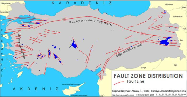
3 Figure 1. The map of Earthquake regions in Turkey about 92% of Turkey is situated in earthquake regions
4
5 STUDY AREA: The study area which includes Karaburun (Belt) Peninsula and its surrounding locates in İzmir city and Western Anatolia. The Western Anatolia is one of the most active extensional regions in the world.
6 Figure 2. Simplified tectonic map of Turkey showing major neotectonic structures and neotectonic provinces (Bozkurt, 2001) The red rectangle represents the study area.
7 Figure 3. Main geological structure of Western Anatolia

8 Figure 4. Main geological structure of İzmir and its surroundings In İzmir and its surrounding, the NE-SW directional dextral strike-slip faults are dominant and the most important faults are Seferihisar, Orhanlı and Gülbahçe fault zones.
9 The E-W trending graben system is the main tectonic structure of Western Anatolia. Additionally; NE-SW trending basins which are located at NE side of E-W trending graben system are also effective at the complex tectonism of Western Anatolia.
10 Gülbahçe fault zone is the east border of the N-S trending of Karaburun Peninsula. Karaburun fault zone dominates the southwestern of İzmir Bay.
 in the GPS velocity vectors was found out between Western Anatolia and İzmir city. Figure 5.")
11 PERFORMING AND PROCESSING GPS OBSERVATIONS In the study of Nyst and Thatcher (2004) (Fig. 5), based on the GPS observations, some dissimilarity (red circle in Fig. 5) in the GPS velocity vectors was found out between Western Anatolia and İzmir city. Figure 5. The study of Nyst and Thatcher (2004) shows that GPS velocity vector directions have some differences surrounding Izmir.
 (Figure 6) mentioned the existence of a N-S directional transfer zone, namely; Western Anatolia Transfer Zone")
12 Additionally, Gessner et al. (2013) (Figure 6) mentioned the existence of a N-S directional transfer zone, namely; Western Anatolia Transfer Zone (approximately at º longitude) by using the earthquake focal depths. Figure 6. Gessner et al., 2013.
.")
13 For analyzing the difference between the kinematic motions of İzmir and Western Anatolia, GPS observations performed in İzmir and Western Anatolia were processed together. Three GPS campaigns were conducted in 2009, 2010 and 2011 at 21 stations in the south of İzmir (Figure 7). Figure 7.
14 In 2009: GPS observations were performed for 3 days in two groups (DoY: and ). In each group, 10 stations were observed per session for 10 hours. The station UZUN was observed for 4 days.
15 In 2010: Observations were performed in three groups (DoY: , and ) with 3 sessions for 10 hours. Besides, UZUN and DU12 stations were observed for nine days.
16 In 2011: 21 stations were observed for 10 hours for 3 sessions in 3 groups (DOY: , and ). During this campaign DU05, DU12 and UZUN stations were observed continuously.
17 In addition to the 3 GPS campaigns; GPS observations of two national GPS projects namely; a. CORS-TR b. TURDEP (Multi-Disciplinary Earthquake Researches in High Risk Regions of Turkey Representing Different Tectonic Regimes) were processed using GAMIT/GLOBK.
18 For connecting the local network with the ITRF network IGS stations were also included to the processings. 12 IGS stations; ISTA, TUBI, ANKR, ZECK, NSSP, NICO, MIKL, GLSV, BUCU, PENC, WTZR and MATE were used to define the Eurasia-fixed reference frame.
19 GPS processing strategy Data Interval Cut Off Elevation 30 sec. 10 degree Day Of Year Orbit Antenna Phase Center Variation Troposphere Parameters Correlation Final Coordinate Estimation IGS final orbit and ERP Elevation dependent weighting model (PCVantmod.dat) VMF (Vienna Mapping Function) model. Zenith parameters were estimated for every 2 hours. Full correlation between observations and unknowns. Daily solutions were combined using GLOBK
 component and under 10 mm on the vertical component (Figure 8).")
20 ITRF2008 coordinates of these IGS stations were used as reference in the computations. The repeatabilities are under 5 mm on horizontal (north and east) component and under 10 mm on the vertical component (Figure 8). Figure 8. WRMS (mm): combination of 2009, 2010 and 2011
21 In this study for investigating the interplate motions of the region, the Anatolian block fixed frame solutions (realized by using the Euler vectors relative to Eurasia for Anatolian block) were computed.
22 In (Reilinger et al., 2006), the Euler vectors were given as 30.8ºN, 32.1ºE and 1.231º/Myr for Anatolian block fixed solutions.

23 Figure 9. The velocity field with 95% confidence ellipses of the stations computed in Anatolian block fixed frame from 3- years (2009, 2010 and 2011) GPS observations by using Euler vectors obtained relative to Eurasia.
24 Additionally, for interpreting the dissimilarities on the GPS velocities of the micro-plates, the earthquakes occurred between the years 1973 and 2016, with an amplitude range between 2.5 and 9.0 were taken from United States Geological Service (USGS) and the focal depth distribution map was obtained. (Figure 10)

25 Figure 10. Topographic map of study area and the earthquake focal depth distributions between the years (from USGS). (The topographic data was obtained from TOPEX; Smith and Sandwell, 1997.)
26 Due to the dissimilarities on the GPS velocity directions we found in the Anatolian block fixed frame solution, the study area was divided into 3 zones (as zones A, B and C) by taking into account these directional dissimilarities (Figure 11) ZONE A: Anatolian block ZONE B: Aegean block ZONE C:Southwest Anatolian block DISCUSSION Figure 11. Directional dissimilarities of GPS velocities
. Figure 3.")
27 In zone A the directions of GPS velocities are approximately towards W and the velocity amplitudes are lower than the other GPS velocities at Zones B and C (Figure 11). Figure 11 It is thought that these GPS stations located at zone A are under the effect of NE- SW trending basins (which is shown with red square in Figure 3). Figure 3.
28 In Figure 11, it is seen that the directions of GPS velocities at zone B are generally towards S. On the other hand, the directions of GPS velocities at zone C are generally towards SW (Figure 11). Figure 11
29 It is thought that the orientations for the GPS velocities at zone B (Karaburun and its surroundings) occur with the effect of the roll-back process at Eastern Mediterranean Sea through Hellenic Subduction zone (Aegean Arc)(Figure 2). Figure 2
30 Additionally, a stable block at western of Karaburun Peninsula stops these movements and change the directions of the GPS velocities.
31 It was also found that the GPS velocities at zone C are bigger than the GPS velocities at zone B.
32 The reason of the differences on the velocity magnitudes for these zones may be the effect of existence of greater dipping angle at eastern wing of Hellenic Subduction zone relative to western wing (Papazachos et al., 1995).
33 Consequently, if these results are compared with the earthquakes occurred at the study area between the years (Figure 10), it is noticed that the distributions of earthquakes represent coherency with the groups at Figure 11 created by directional dissimilarities of GPS velocities (Figure 12). Figure 12. Distributions of earthquakes and the zones occurred with the differences on GPS velocities
34 CONCLUSIONS Our findings were evaluated with the earthquakes occurred in the study area since It was found that the seismicity was higher on the Karaburun belt and its surrounding relative to the eastern side where the E-W trending tectonic elements located.
35 The border which separates the seismicity differences is coherent with the velocity direction changing border of GPS vectors. Additionally, the orientation of the seismic activity and the trending of the tectonic structures at eastern part of Karaburun are figured out to be coherent with the GPS velocity directions.

36 THANK YOU FOR YOUR ATTENTION! DR. MUZAFFER KAHVECİ 6-11 May 2018, İstanbul
Determination of Current Velocity Field (Rate) of North Anatolian Fault in Izmit-Sapanca Segment
 of North Anatolian Fault in Izmit-Sapanca Segment") Determination of Current Velocity Field (Rate) of North Anatolian Fault in Izmit-Sapanca Segment Cetin MEKIK, Bulent TURGUT, Haluk OZENER, Turkish Republic INTRODUCTION Turkey is geologically the part
Determination of Current Velocity Field (Rate) of North Anatolian Fault in Izmit-Sapanca Segment Cetin MEKIK, Bulent TURGUT, Haluk OZENER, Turkish Republic INTRODUCTION Turkey is geologically the part
Recent GNSS Developments and Reference Frame Issues in Turkey. Onur LENK and Bahadir AKTUĞ
 Recent GNSS Developments and Reference Frame Issues in Turkey Onur LENK and Bahadir AKTUĞ General Command of Mapping onur.lenk lenk@hgk.mil.tr 1/31 GPS STUDIES İN TURKEY date back to early 1990s geodynamics-oriented
Tectonic deformations in Greece and the operation of HEPOS network
 Tectonic deformations in Greece and the operation of HEPOS network M. Gianniou KTIMATOLOGIO S.A. (Hellenic Cadastre) Abstract Today, networks of permanent reference stations are broadly used for the realization
A Multi-Purpose Continuous GPS Network within the boundary zones of the Eurasian, African, and Arabian plates
 A Multi-Purpose Continuous GPS Network within the boundary zones of the Eurasian, African, and Arabian plates Bahadır AKTUĞ General Command of Mapping TR06100 Ankara/Turkey http://www.hgk.mil.tr Anatolia,
Investigation of vertical mass changes in the south of Izmir (Turkey) by monitoring microgravity and GPS/GNSS methods
 by monitoring microgravity and GPS/GNSS methods") Investigation of vertical mass changes in the south of Izmir (Turkey) by monitoring microgravity and GPS/GNSS methods Oya Pamukçu, Tolga Gönenç, Ayça Çırmık, Petek Sındırgı, İlknur Kaftan and Özer Akdemir
Investigation of vertical mass changes in the south of Izmir (Turkey) by monitoring microgravity and GPS/GNSS methods Oya Pamukçu, Tolga Gönenç, Ayça Çırmık, Petek Sındırgı, İlknur Kaftan and Özer Akdemir
Slip Rates Estimate of Western North Anatolian Fault System in Turkey
 Slip Rates Estimate of Western North Anatolian Fault System in Turkey Haluk OZENER, Asli DOGRU, Bahadir AKTUG, Semih ERGINTAV, Bulent TURGUT, Onur YILMAZ, Kerem HALICIOGLU, Onur GURKAN, Turkey Keywords:
INSAR ATMOSPHERIC DELAY MIGITIGATION BY GPS; CASE STUDY IZMIT EARTQUAKE INTERFEROGRAMS
 INSAR ATMOSPHERIC DELAY MIGITIGATION BY GPS; CASE STUDY IZMIT EARTQUAKE INTERFEROGRAMS M.U. Altın a, *, E. Tari a, L. Ge b a ITU, Civil Engineering Faculty, 80626 Maslak Istanbul, Turkey (altinm, tari)@itu.edu.tr
5. INTEGRATED EXAMPLES FROM REAL EQs.
 5. INTEGRATED EXAMPLES FROM REAL EQs. Some strong seismic events occurred in the Greek territory, during the period 2003-2007 of the operation of the installed, monitoring network, for the registration
GEODETIC NETWORK OF SAUDI ARABIA AND FIDUCIAL STATIONS. GFN OF Saudi Arabia in Based on ITRF2000 Datum
 STUDIES OF TECTONIC MOVEMENTS IN SAUDI ARABIA USING CORS M. Al Rajhi, Ali Al Omar, R. Yanar, F. Kartal, K. Eren, SUBJECT TO TALKS BACKGROUND GEODETIC NETWORK OF SAUDI ARABIA AND FIDUCIAL STATIONS GFN OF
ON THE RELATION BETWEEN GPS STRAIN FIELD AND ACTIVE FAULTS IN THE EASTERN BALTIC REGION
 ON THE RELATION BETWEEN GPS STRAIN FIELD AND ACTIVE FAULTS IN THE EASTERN BALTIC REGION B.A. Assinovskaya 1, V.L. Gorshkov 2, N.V. Shcherbakova 2, N.M. Panas 1 1 Geophysical Service RAS, seismic station
ESTIMATES OF HORIZONTAL DISPLACEMENTS ASSOCIATED WITH THE 1999 TAIWAN EARTHQUAKE
 ESTIMATES OF HORIZONTAL DISPLACEMENTS ASSOCIATED WITH THE 1999 TAIWAN EARTHQUAKE C. C. Chang Department of Surveying and Mapping Engineering Chung Cheng Institute of Technology, Taiwan, ROC ABSTRACT A
CONTINENTAL PLATE BOUNDARY ZONES
 CONTINENTAL PLATE BOUNDARY ZONES Plate boundaries initially viewed as narrow Now recognize that many plate boundaries - especially continental - are deformation zones up to 1000 km wide, with motion spread
Dealing with significant differential tectonic plate velocities within an RTK-network: The case of HEPOS
 Dealing with significant differential tectonic plate velocities within an RTK-network: The case of HEPOS M. Gianniou, E. Mitropoulou, I. Stavropoulou National Cadastre and Mapping Agency S.A. Mesogion
Case Study 2: 2014 Iquique Sequence
 Case Study 2: 2014 Iquique Sequence Overview Mw 8.2 earthquake on 1 April 2014 at 11:08:43 UTC Pictures of damage Seismicity maps Foreshock seismicity -> Main shock -> Aftershock 1 April 2014 11:08:43
The problem (1/2) GPS velocity fields in plate boundary zones are very smooth. What does this smoothness hide?
 GPS velocity fields in plate boundary zones are very smooth. What does this smoothness hide?") Block models The problem (1/2) GPS velocity fields in plate boundary zones are very smooth Figure from Tom Herring, MIT What does this smoothness hide? Continuous deformation? Rigid block motions, with
Block models The problem (1/2) GPS velocity fields in plate boundary zones are very smooth Figure from Tom Herring, MIT What does this smoothness hide? Continuous deformation? Rigid block motions, with
THREE SEASONAL BEHAVIOUR OF THE BALKAN PENINSULA GNSS PERMANENT STATIONS FROM GPS SOLUTIONS
 Доклади на Българската академия на науките Comptes rendus de l Académie bulgare des Sciences Tome 66, No 1, 2013 GEOPHYSIQUE Sismologie THREE SEASONAL BEHAVIOUR OF THE BALKAN PENINSULA GNSS PERMANENT STATIONS
Realizing a geodetic reference frame using GNSS in the presence of crustal deformations: The case of Greece
 Realizing a geodetic reference frame using GNSS in the presence of crustal deformations: The case of Greece M. Gianniou National Cadastre and Mapping Agency S.A. Outline 1. Introduction 2. Deformation
C05 Evaluation of Earthquake Hazard Parameters for the Different Regions in the Western Anatolia for Whole Time Periods
 C05 Evaluation of Earthquake Hazard Parameters for the Different Regions in the Western Anatolia for Whole Time Periods Y. Bayrak* (Karadeniz Technical University) & E. Bayrak (Karadeniz Technical University)
Teleseismic waveform modelling of the 2008 Leonidio event
 The 6 January 2008 (Mw6.2) Leonidio (southern Greece) intermediate depth earthquake: teleseismic body wave modelling Anastasia Kiratzi and Christoforos Benetatos Department of Geophysics, Aristotle University
SUPPLEMENTARY INFORMATION
 SUPPLEMENTARY INFORMATION doi: 10.1038/ngeo739 Supplementary Information to variability and distributed deformation in the Marmara Sea fault system Tobias Hergert 1 and Oliver Heidbach 1,* 1 Geophysical
Principles of the Global Positioning System Lecture 23
 12.540 Principles of the Global Positioning System Lecture 23 Prof. Thomas Herring 05/12/03 12.540 Lec 23 1 OVERVIEW Run through HW 03. Final lecture: Application area and GPS results Analysis of contemporary
Earthquakes in Barcelonnette!
 Barcelonnette in the Ubaye valley : the landscape results of large deformations during the alpine orogene (40 5 Myr in this area) and the succession of Quaternary glaciations. The sedimentary rocks are
Bonn, Germany MOUTAZ DALATI. General Organization for Remote Sensing ( GORS ), Syria Advisor to the General Director of GORS,
, Syria Advisor to the General Director of GORS,") Bonn, Germany Early Warning System is needed for Earthquakes disaster mitigation in Syria Case Study: Detecting and Monitoring the Active faulting zones along the Afro-Arabian-Syrian Rift System MOUTAZ
Bonn, Germany Early Warning System is needed for Earthquakes disaster mitigation in Syria Case Study: Detecting and Monitoring the Active faulting zones along the Afro-Arabian-Syrian Rift System MOUTAZ
NTUA, Faculty of Rural and Surveying Engineering, Dionysos Satellite Observatory, Higher Geodesy Laboratory NOA, Institute of Geodynamics 1
 NOA, Institute of Geodynamics 1 Crustal Deformation from GPS measurements at the Ionian Sea : Preliminary Results Anastasiou 1 D., Paradissis 1 D., Ganas 2 A., Marinou 1 A., Papazissi 1 K., Drakatos 2
Estimation of tectonic velocities using GPS Precise Point Positioning: The case of Hellenic RTK network HEPOS
 Estimation of tectonic velocities using GPS Precise Point Positioning: The case of Hellenic RTK network HEPOS M. Gianniou, I. Stavropoulou National Cadastre and Mapping Agency S.A. Mesogion Ave. 288, 15562
Lab 9: Satellite Geodesy (35 points)
") Lab 9: Satellite Geodesy (35 points) Here you will work with GPS Time Series data to explore plate motion and deformation in California. This lab modifies an exercise found here: http://www.unavco.org:8080/cws/pbonucleus/draftresources/sanandreas/
Lab 9: Satellite Geodesy (35 points) Here you will work with GPS Time Series data to explore plate motion and deformation in California. This lab modifies an exercise found here: http://www.unavco.org:8080/cws/pbonucleus/draftresources/sanandreas/
Africa-Arabia-Eurasia plate interactions and implications for the dynamics of Mediterranean subduction and Red Sea rifting
 This page added by the GeoPRISMS office. Africa-Arabia-Eurasia plate interactions and implications for the dynamics of Mediterranean subduction and Red Sea rifting Authors: R. Reilinger, B. Hager, L. Royden,
Lateral extrusion and tectonic escape in Ilan Plain of northeastern Taiwan
 Lateral extrusion and tectonic escape in Ilan Plain of northeastern Taiwan Angelier, J., Chang, T.Y., Hu, J.C., Chang, C.P., Siame, L., Lee, J.C., Deffontaines, B., Chu, H.T, Lu, C.Y., Does extrusion occur
Magnitude 6.9 GULF OF CALIFORNIA
 A pair of strong earthquakes struck off the coast of Mexico early Thursday only minutes apart. The magnitude 6.9 and 6.2 were centered about 85 miles northeast of Guerrero Negro in the Mexican state of
CONTENTS 1. INTRODUCTION (STUDY AREA) 3. PROCESSING (CONVENTIAL& GPS) 4. ANALYSIS OF OUTCOMES 5. CONCLUSIONS 2. THE GCM-ITU NETWORK SURVEYING
 3. PROCESSING (CONVENTIAL& GPS) 4. ANALYSIS OF OUTCOMES 5. CONCLUSIONS 2. THE GCM-ITU NETWORK SURVEYING") INVESTIGATION OF THE DISPLACEMENTS FROM 1941 TO 2007 USING TERRESTRIAL AND GPS MEASUREMENTS ALONG THE WESTERN PART OF NORTH ANATOLIAN FAULT IN MARMARA REGION G. Akay 1 and H. Ozener 2,1 [1]{Bogazici University,
INVESTIGATION OF THE DISPLACEMENTS FROM 1941 TO 2007 USING TERRESTRIAL AND GPS MEASUREMENTS ALONG THE WESTERN PART OF NORTH ANATOLIAN FAULT IN MARMARA REGION G. Akay 1 and H. Ozener 2,1 [1]{Bogazici University,
Empirical Green s Function Analysis of the Wells, Nevada, Earthquake Source
 Nevada Bureau of Mines and Geology Special Publication 36 Empirical Green s Function Analysis of the Wells, Nevada, Earthquake Source by Mendoza, C. 1 and Hartzell S. 2 1 Centro de Geociencias, Universidad
Geodetic applications of GNSS in the Black Sea region
 BALGEOS II - Balkan countries integration into GGOS Second workshop, 27-29 January, 2010 Vienna - AUSTRIA Geodetic applications of GNSS in the Black Sea region Lyubka Pashova CENTRAL LABORATORY OF GEODESY
Principles of the Global Positioning System Lecture 24
 12.540 Principles of the Global Positioning System Lecture 24 Prof. Thomas Herring http://geoweb.mit.edu/~tah/12.540 OVERVIEW Examination of results from Earthscope Reference frame definition: SNARF High-rate
Preliminary Observations of the January 8, 2006 Kythira Island (South Western Greece) Earthquake (Mw 6.9).
 Earthquake (Mw 6.9).") Preliminary Observations of the January 8, 2006 Kythira Island (South Western Greece) Earthquake (Mw 6.9). Following the earthquake of January 8 2006, EERI members Dr. E. Lekkas, Professor of Dynamic Tectonics
Preliminary Observations of the January 8, 2006 Kythira Island (South Western Greece) Earthquake (Mw 6.9). Following the earthquake of January 8 2006, EERI members Dr. E. Lekkas, Professor of Dynamic Tectonics
IS THE SUDETIC MARGINAL FAULT STILL ACTIVE? RESULTS OF THE GPS MONITORING
 Acta Geodyn. Geomater.Vol.1, No.3 (135), 35-39, 2004 IS THE SUDETIC MARGINAL FAULT STILL ACTIVE? RESULTS OF THE GPS MONITORING 1996-2002 Bernard KONTNY Department of Geodesy and Photogrammetry, Agricultural
The Hellenic Seismological Network of Crete (HSNC): Monitoring results and the new strong motion network
: Monitoring results and the new strong motion network") The Hellenic Seismological Network of Crete (HSNC): Monitoring results and the new strong motion network Georgios Chatzopoulos 1, Ilias Papadopoulos 1 and Filippos Vallianatos 1 1 Technological Educational
The Hellenic Seismological Network of Crete (HSNC): Monitoring results and the new strong motion network Georgios Chatzopoulos 1, Ilias Papadopoulos 1 and Filippos Vallianatos 1 1 Technological Educational
Crustal deformation by the Southeast-off Kii Peninsula Earthquake
 Crustal deformation by the Southeast-off Kii Peninsula Earthquake 51 Crustal deformation by the Southeast-off Kii Peninsula Earthquake Tetsuro IMAKIIRE, Shinzaburo OZAWA, Hiroshi YARAI, Takuya NISHIMURA
REGIONAL CHARACTERISTICS OF STRESS FIELD AND ITS DYNAMICS IN AND AROUND THE NANKAI TROUGH, JAPAN
 46 4 2003 7 CHINESE JOURNAL OF GEOPHYSICS Vol. 46, No. 4 July, 2003 1 1 2 3 1, 100037 2, 920-1192 3, 237-0061,,, : -. (10 22 ), (60 85km) ; (40 ), (160km)..,. GPS,, -,,.,,,.. 0001-5733(2003) 04-0488 -
Introduction to Displacement Modeling
 Introduction to Displacement Modeling Introduction Deformation on the Earth surface informs us about processes and material properties below surface Observation tools: GPS (static-dynamic) InSAR (static)
Tectonic position of the sandstone Cenozoic Uranium Deposit of Bulgaria
 Tectonic position of the sandstone Cenozoic Uranium Deposit of Bulgaria Radoslav Nakov Geological Institute, Bulgarian Academy of Sciences Pirin Mountain view from Eleshnitsa Mine 2915 m Technical meeting
Seismotectonics of the Cyprian Arc
 Geophys. J. Int. (2006) 164, 176 181 doi: 10.1111/j.1365-246X.2005.02737.x Seismotectonics of the Cyprian Arc Shimon Wdowinski, 1,2 Zvi Ben-Avraham, 1 Ronald Arvidsson 3 and Goran Ekström 4 1 Department
Inversion of travel times to estimate Moho depth in Shillong Plateau and Kinematic implications through stress analysis of Northeastern India
 Inversion of travel times to estimate Moho depth in Shillong Plateau and Kinematic implications through stress analysis of Northeastern India by Saurabh Baruah Geoscience Division North-East Institute
P33 Correlation between the Values of b and DC for the Different Regions in the Western Anatolia
 P33 Correlation between the Values of b and DC for the Different Regions in the Western Anatolia E. Bayrak* (Karadeniz Technical University) & Y. Bayrak (Karadeniz Technical University) SUMMARY The b-value
Perspectives for earthquake prediction in the Mediterranean and contribution of geological observations
 Perspectives for earthquake prediction in the Mediterranean and contribution of geological observations B. C. PAPAZACHOS, G. F. KARAKAISIS, C. B. PAPAZACHOS & E. M. SCORDILIS Geophysical Laboratory, Aristotle
P32 Temporal and Spatial Variations of b-value in the Western Anatolia
 P32 Temporal and Spatial Variations of b-value in the Western Anatolia E. Bayrak* (Karadeniz Technical University) & Y. Bayrak (Karadeniz Technical University) SUMMARY The b-value calculated in time and
Sendai Earthquake NE Japan March 11, Some explanatory slides Bob Stern, Dave Scholl, others updated March
 Sendai Earthquake NE Japan March 11, 2011 Some explanatory slides Bob Stern, Dave Scholl, others updated March 14 2011 Earth has 11 large plates and many more smaller ones. Plates are 100-200 km thick
Magnitude 7.3 IRAQ. Early reports indicate that 140 have been killed with over 800 injuries reported. Sunday, November 12, 2017 at 18:18:17 UTC
 A magnitude 7.3 earthquake has occurred in the northern border region of Iran and Iraq centered about 350 kilometers (217 miles) north of Baghdad at a depth of 33.9 km (21 miles). The earthquake was felt
Palaeozoic oceanic crust preserved beneath the eastern Mediterranean
 Palaeozoic oceanic crust preserved beneath the eastern Mediterranean Roi Granot Magnetic Anomaly Data Total field Three components 75 m 75 m Total field 250 m Overhauser Three-axial fluxgate Overhauser
A STUDY OF CRUSTAL DEFORMATION ALONG THE RED SEA REGION USING GEODETIC AND SEISMIC DATA FROM EGYPT AND YEMEN
 A C T A G E O P H Y S I C A P O L O N I C A Vol. 53, No. 1 2005 A STUDY OF CRUSTAL DEFORMATION ALONG THE RED SEA REGION USING GEODETIC AND SEISMIC DATA FROM EGYPT AND YEMEN K. SAKR 1, S.M. ABDEL-MONEM
Magnitude 7.0 PAPUA, INDONESIA
 A 7.0 magnitude earthquake struck eastern Indonesia's mountainous West Papua province on Saturday but there were no immediate reports of casualties or damage. The region is sparsely populated. According
Northern Tanzanian Earthquakes: Fault orientations, and depth distribution
 Northern Tanzanian Earthquakes: Fault orientations, and depth distribution Stewart Rouse (NC A&T Physics) Penn State University SROP Mentors: Dr. Andy Nyblade & Dr. Rick Brazier July 27, 2005 1.0 Introduction
Seismic Source Mechanism
 Seismic Source Mechanism Yuji Yagi (University of Tsukuba) Earthquake Earthquake is a term used to describe both failure process along a fault zone, and the resulting ground shaking and radiated seismic
SENS'2006 Second Scientific Conference with International Participation SPACE, ECOLOGY, NANOTECHNOLOGY, SAFETY June 2006, Varna, Bulgaria
 SENS'2006 Second Scientific Conference with International Participation SPACE, ECOLOGY, NANOTECHNOLOGY, SAFETY 14 16 June 2006, Varna, Bulgaria SURFACE SEISMIC DEFORMATIONS IN THE PLOVDIV REGION (BULGARIA)
Contemporary strain rates in the northern Basin and Range province from GPS data
 TECTONICS, VOL. 22, NO. 2, 1008, doi:10.1029/2001tc001355, 2003 Contemporary strain rates in the northern Basin and Range province from GPS data R. A. Bennett Harvard-Smithsonian Center for Astrophysics,
Magnitude 7.9 SE of KODIAK, ALASKA
 A magnitude 7.9 earthquake occurred at 12:31 am local time 181 miles southeast of Kodiak at a depth of 25 km (15.5 miles). There are no immediate reports of damage or fatalities. Light shaking from this
GEORED Project: GNSS Geodesy Network for Geodynamics Research in Colombia, South America. Héctor Mora-Páez
 GEORED Project: GNSS Geodesy Network for Geodynamics Research in Colombia, South America. Héctor Mora-Páez Colombian Geological Survey UNAVCO SCIENCE MEETING Feb 27 March 1, 2012 Boulder, CO, TECTONIC
CORS Network and Datum Harmonisation in the Asia-Pacific Region. Richard Stanaway and Craig Roberts
 CORS Network and Datum Harmonisation in the Asia-Pacific Region Richard Stanaway and Craig Roberts School of Surveying and Spatial Information Systems University of New South Wales CORS Networks in the
How GNSS CORS in Japan works for geodetic control and disaster mitigations
 ICG Working Group D Reference Frames, Timing and Applications How GNSS CORS in Japan works for geodetic control and disaster mitigations ICG11, Nov. 7-11, 2016, Sochi, Russia Hiromichi TSUJI Geodetic Observation
Once you have opened the website with the link provided choose a force: Earthquakes
 Name: Once you have opened the website with the link provided choose a force: Earthquakes When do earthquakes happen? On the upper left menu, choose number 1. Read What is an Earthquake? Earthquakes happen
An Analysis of Strain Accumulation in the Western Part of Black Sea Region in Turkey
 An Analysis of Strain Accumulation in the Western Part of Black Sea Region in Turkey Ilke DENIZ, Nevin Betul AVSAR, Rasim DENIZ, Cetin MEKIK, Senol Hakan KUTOGLU, Turkey Key words: Deformation measurement,
Slip distributions of the 1944 Tonankai and 1946 Nankai earthquakes including the horizontal movement effect on tsunami generation
 Slip distributions of the 1944 Tonankai and 1946 Nankai earthquakes including the horizontal movement effect on tsunami generation Toshitaka Baba Research Program for Plate Dynamics, Institute for Frontier
Continental Margin Geology of Korea : Review and constraints on the opening of the East Sea (Japan Sea)
") Continental Margin Geology of Korea : Review and constraints on the opening of the East Sea (Japan Sea) Han-Joon Kim Marine Satellite & Observation Tech. Korea Ocean Research and Development Institute
Continental Margin Geology of Korea : Review and constraints on the opening of the East Sea (Japan Sea) Han-Joon Kim Marine Satellite & Observation Tech. Korea Ocean Research and Development Institute
United States NSRS 2022: Terrestrial Reference Frames
 United States NSRS 2022: Terrestrial Reference Frames Daniel ROMAN, U.S.A. Key words: Capacity building; Positioning; Reference frames; Reference systems, Cadastre SUMMARY In 2022, the United States will
The Mw 6.2 Leonidio, southern Greece earthquake of January 6, 2008: Preliminary identification of the fault plane.
 The Mw 6.2 Leonidio, southern Greece earthquake of January 6, 28: Preliminary identification of the fault plane. J. Zahradnik 1, E. Sokos 2, A.Serpetsidaki 2, and G A.Tselentis 2 1 Charles University in
IOP Conference Series: Earth and Environmental Science PAPER OPEN ACCESS
 IOP Conference Series: Earth and Environmental Science PAPER OPEN ACCESS Evaluation of Seismicity Using Density Analysis of 2000-2015 Earthquakes in The West Coastal Zone of Anatolia (Turkey) And Its Correlation
EARTHQUAKE LOCATIONS INDICATE PLATE BOUNDARIES EARTHQUAKE MECHANISMS SHOW MOTION
 6-1 6: EARTHQUAKE FOCAL MECHANISMS AND PLATE MOTIONS Hebgen Lake, Montana 1959 Ms 7.5 1 Stein & Wysession, 2003 Owens Valley, California 1872 Mw ~7.5 EARTHQUAKE LOCATIONS INDICATE PLATE BOUNDARIES EARTHQUAKE
Seven years of postseismic deformation following the 1999, M = 7.4 and M = 7.2, Izmit-Düzce, Turkey earthquake sequence
 JOURNAL OF GEOPHYSICAL RESEARCH, VOL. 114,, doi:10.1029/2008jb006021, 2009 Seven years of postseismic deformation following the 1999, M = 7.4 and M = 7.2, Izmit-Düzce, Turkey earthquake sequence S. Ergintav,
FOCAL MECHANISMS OF SUBDUCTION ZONE EARTHQUAKES ALONG THE JAVA TRENCH: PRELIMINARY STUDY FOR THE PSHA FOR YOGYAKARTA REGION, INDONESIA
 FOCAL MECHANISMS OF SUBDUCTION ZONE EARTHQUAKES ALONG THE JAVA TRENCH: PRELIMINARY STUDY FOR THE PSHA FOR YOGYAKARTA REGION, INDONESIA Myo Thant 1, Hiroshi Kawase 2, Subagyo Pramumijoyo 3, Heru Hendrayana
Case Study 1: 2014 Chiang Rai Sequence
 Case Study 1: 2014 Chiang Rai Sequence Overview Mw 6.1 earthquake on 5 May 2014 at 11:08:43 UTC Largest recorded earthquake in Thailand Fault Orientation How does the orientation of the fault affect the
National Report of Greece to EUREF 2016
 National Report of Greece to EUREF 2016 M.Gianniou, E. Mitropoulou, D. Mastoris National Cadastre and Mapping Agency S.A. Mesogion Ave. 288, 15562 Athens, Greece 1. Introduction During the last months
Measurements in the Creeping Section of the Central San Andreas Fault
 Measurements in the Creeping Section of the Central San Andreas Fault Introduction Duncan Agnew, Andy Michael We propose the PBO instrument, with GPS and borehole strainmeters, the creeping section of
Your Advisor Said, Get the GPS Data and Plot it. Jeff Freymueller Geophysical University of Alaska Fairbanks
 Your Advisor Said, Get the GPS Data and Plot it Jeff Freymueller Geophysical Ins@tute University of Alaska Fairbanks Actual GPS Data GPS Data are phase and pseudorange data that measure distances to satellites.
Summary so far. Geological structures Earthquakes and their mechanisms Continuous versus block-like behavior Link with dynamics?
 Summary so far Geodetic measurements velocities velocity gradient tensor (spatial derivatives of velocity) Velocity gradient tensor = strain rate (sym.) + rotation rate (antisym.) Strain rate tensor can
Magnitude 7.1 NEAR THE EAST COAST OF HONSHU, JAPAN
 Japan was rattled by a strong aftershock and tsunami warning Thursday night nearly a month after a devastating earthquake and tsunami flattened the northeastern coast. This earthquake can be considered
Paleo and New Earthquakes and Evaluation of North Tabriz Fault Displacement in Relation to Recurrence Interval of Destructive Earthquakes
 Journal of Civil Engineering and Architecture 9 (2015) 1012-1016 doi: 10.17265/1934-7359/2015.08.013 D DAVID PUBLISHING Paleo and New Earthquakes and Evaluation of North Tabriz Fault Displacement in Relation
Chapter 2. Earthquake and Damage
 EDM Report on the Chi-Chi, Taiwan Earthquake of September 21, 1999 2.1 Earthquake Fault 2.1.1 Tectonic Background The island of Taiwan is located in the complex junction where the Eurasian and Philippine
Blind fault Configuration in Osaka, Japan based on 2D gravity inversion
 Blind fault Configuration in Osaka, Japan based on 2D gravity inversion N. Inoue & N. Kitada Geo-research Institute, Osaka, Japan K. Takemura Institute for Geothermal Sciences, Kyoto University, Beppu,
44031 Crustal Compensation Rate In Central Anatolian Region And Comparison Of Seismic Activity
 44031 Crustal Compensation Rate In Central Anatolian Region And Comparison Of Seismic Activity B. Oruç* (Kocaeli University), T. Sönmez (Kocaeli University), E. Ulutaş (Kocaeli University), H.H. Selim
TOWARD A JOINT CATALOGUE OF RECENT SEISMICITY IN WESTERN GREECE: PRELIMINARY RESULTS
 Δελτίο της Ελληνικής Γεωλογικής Εταιρίας τομ. XXXVII, 2007 Πρακτικά 11 ου Διεθνούς Συνεδρίου, Αθήνα, Μάιος 2007 Bulletin of the Geological Society of Greece vol. XXXVII, 2007 Proceedings of the 11 th International
NATIONAL SEISMIC NETWORKS OF TURKEY
 Ministry of Public Works and Settlement General Directorate of Disaster Affairs EARTHQUAKE RESEARCH DEPARMENT (GDDA- ERD) NATIONAL SEISMIC NETWORKS OF TURKEY RELEMR WORKSHOP İSTANBUL - 2008 Sami ZÜNBÜL
The Size and Duration of the Sumatra-Andaman Earthquake from Far-Field Static Offsets
 The Size and Duration of the Sumatra-Andaman Earthquake from Far-Field Static Offsets P. Banerjee, 1 F. F. Pollitz, 2 R. Bürgmann 3 * 1 Wadia Institute of Himalayan Geology, Dehra Dun, 248001, India. 2
Seismic Hazard Evaluation in Western Turkey as Revealed by Stress Transfer and Time-dependent Probability Calculations
 Pure Appl. Geophys. 167 (2010), 1013 1048 Ó 2010 Birkhäuser / Springer Basel AG DOI 10.1007/s00024-010-0085-1 Pure and Applied Geophysics Seismic Hazard Evaluation in Western Turkey as Revealed by Stress
A ten years analysis of deformation in the Corinthian Gulf via GPS and SAR Interferometry
 A ten years analysis of deformation in the Corinthian Gulf via GPS and SAR Interferometry Briole P. (1), A. Avallone (1), E. Agatza-Balodimiou (2), H. Billiris (2), O. Charade (1), H. Lyon- Caen (1), Ch.
Seismological Study of Earthquake Swarms in South-Eastern Puerto Rico
 Seismological Study of Earthquake Swarms in South-Eastern Puerto Rico Principal Investigator: Lillian Soto-Cordero [1] Co-Investigators: Victor Huérfano 1, Leonardo Cano [2], Robert Watts [3], and Christa
Integration of Seismic and Seismological Data Interpretation for Subsurface Structure Identification
 Integration of Seismic and Seismological Data Interpretation for Subsurface Structure Identification Iftikhar Ahmed Satti, and Wan Ismail Wan Yusoff Abstract The structural interpretation of a part of
Analysis of Vertical Velocities from BARGEN Continuous GPS Data at Yucca Mountain, Southern Nevada
 Analysis of Vertical Velocities from BARGEN Continuous GPS Data at Yucca Mountain, Southern Nevada Emma Hill and Geoffrey Blewitt Nevada Bureau of Mines and Geology/178 University of Nevada, Reno Reno,
Practical considerations for determining Euler Pole Parameters for the terrestrial reference frames in the United States
 Practical considerations for determining Euler Pole Parameters for the terrestrial reference frames in the United States Jacob M. HECK and Dru A. SMITH, United States Key words: GNSS/GPS, Positioning,
Case study of Japan: Reference Frames in Practice
 Case study of Japan: Reference Frames in Practice Basara Miyahara and Koji Matsuo Sponsors: 1 Outline Introduction - Geodetic reference frame of Japan - GEONET : continuous GNSS observation system Geometric
PROJECT FOR THE PRODUCTION OF 1/1000 SCALE BASE MAPS FROM COLOUR IMAGES USING DIGITAL CAMERAS IN BURSA METROPOLITAN AREA (BMA) IN TURKEY
 IN TURKEY") PROJECT FOR THE PRODUCTION OF 1/1000 SCALE BASE MAPS FROM COLOUR IMAGES USING DIGITAL CAMERAS IN BURSA METROPOLITAN AREA (BMA) IN TURKEY Şenol KUŞCU, M.Sait AYIK, Eray CAN, Hasan Yasar ARKAYIN, Turkey
PROJECT FOR THE PRODUCTION OF 1/1000 SCALE BASE MAPS FROM COLOUR IMAGES USING DIGITAL CAMERAS IN BURSA METROPOLITAN AREA (BMA) IN TURKEY Şenol KUŞCU, M.Sait AYIK, Eray CAN, Hasan Yasar ARKAYIN, Turkey
Earthquakes and Faulting
 Earthquakes and Faulting Crustal Strength Profile Quakes happen in the strong, brittle layers Great San Francisco Earthquake April 18, 1906, 5:12 AM Quake lasted about 60 seconds San Francisco was devastated
GPS strain analysis examples Instructor notes
 GPS strain analysis examples Instructor notes Compiled by Phil Resor (Wesleyan University) This document presents several examples of GPS station triplets for different tectonic environments. These examples
Case Study of Japan: Crustal deformation monitoring with GNSS and InSAR
 Technical Seminar Reference Frame in Practice, Case Study of Japan: Crustal deformation monitoring with GNSS and InSAR Basara Miyahara miyahara-b96ip@milt.go.jp Geospatial Information Authority of Japan
DEFORMATION KINEMATICS OF TIBETAN PLATEAU DETERMINED FROM GPS OBSERVATIONS
 DEFORMATION KINEMATICS OF TIBETAN PLATEAU DETERMINED FROM GPS OBSERVATIONS Jinwei Ren Institute of Geology, China Seismological Bureau, Beijing 100029 China Tel: (10)62009095; Fax: (10)62009003; email:
Coseismic slip distribution of the 1946 Nankai earthquake and aseismic slips caused by the earthquake
 Earth Planets Space, 53, 235 241, 2001 Coseismic slip distribution of the 1946 Nankai earthquake and aseismic slips caused by the earthquake Yuichiro Tanioka 1 and Kenji Satake 2 1 Meteorological Research
Earth Science, (Tarbuck/Lutgens) Chapter 10: Mountain Building
 Chapter 10: Mountain Building") Earth Science, (Tarbuck/Lutgens) Chapter 10: Mountain Building 1) A(n) fault has little or no vertical movements of the two blocks. A) stick slip B) oblique slip C) strike slip D) dip slip 2) In a(n) fault,
Earth Science, (Tarbuck/Lutgens) Chapter 10: Mountain Building 1) A(n) fault has little or no vertical movements of the two blocks. A) stick slip B) oblique slip C) strike slip D) dip slip 2) In a(n) fault,
Magnitude 7.6 & 7.6 PERU
 Two deep 7.6 magnitude earthquakes have shaken a sparsely populated jungle region near the Peru-Brazil border in southeast Peru. There were no immediate reports of injuries or damage. The second M 7.6
Geometry of co-seismic surface ruptures and tectonic meaning of the 23 October 2011 Mw 7.1 Van earthquake (East Anatolian Region, Turkey)
") Geometry of co-seismic surface ruptures and tectonic meaning of the 23 October 2011 Mw 7.1 Van earthquake (East Anatolian Region, Turkey) Bülent Dogan & Ahmet Karakaș. Journal of Structural Geology, 46(2013),
Geometry of co-seismic surface ruptures and tectonic meaning of the 23 October 2011 Mw 7.1 Van earthquake (East Anatolian Region, Turkey) Bülent Dogan & Ahmet Karakaș. Journal of Structural Geology, 46(2013),
Comparison of the ITRF2000 and ITRF96 Space Displacements of the Stations for Europe
 Abstract: Comparison of the ITRF2000 and ITRF96 Space Displacements of the Stations for Europe J. KOSTELECKÝ 12, A.ZEMAN 1 Residual horizontal and vertical movements were computed for individual tectonic
Electronic supplement for Forearc motion and deformation between El Salvador and Nicaragua: GPS, seismic, structural, and paleomagnetic observations
 DR2011053 Electronic supplement for Forearc motion and deformation between El Salvador and Nicaragua: GPS, seismic, structural, and paleomagnetic observations by D. Alvarado et al., Lithosphere, April,
The BIFROST Project: 21 years of search for the true crustal deformation in Fennoscandia
 The BIFROST Project: 21 years of search for the true crustal deformation in Fennoscandia Martin Lidberg and Holger Steffen Lantmäteriet, Sweden Jan Johansson Chalmers University of Technology Halfdan Kierulf