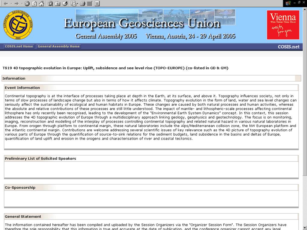
TOPO-EUROPE: 4D Topography Evolution in Europe: Uplift, Subsidence and Sea Level Rise
|
|
|
- Warren Collins
- 5 years ago
- Views:
Transcription


1 Exploratory workshop Budapest, Hungary March 2005 ESF ILP Academia Europaea ELTE ISES GFZ

2 TOPO-EUROPE Geoscience of coupled lithosphere/mantle and surface processes of continental Europe and its margins
3 Rationale for TOPO-EUROPE Continental topography is a product of the interaction between processes taking place deep in the Earth, on its surface and in the atmosphere Topography influences society, not only in terms of slow processes of landscape change but also in terms of how it affects climate The present state and behaviour of the Shallow Earth System is a consequence of processes on a wide range of time scales, including: - tectonic long term effects on uplift, subsidence - river systems - residual effects of the ice ages on crustal movement - natural climate and environmental changes - powerful anthropogenic impacts of the last century The impact of mantle- and lithospheric-scale processes affecting intraplate areas has only recently been recognised
4 General objectives of TOPO-EUROPE To integrate national research programmes in a common European framework To promote Europe as the international scientific leader in the field of continental topography research To provide interdisciplinary forum to share knowledge and information in the field of the topography evolution of Europe
5 Specific objectives of TOPO-EUROPE 4D picture of topography evolution of Europe Quantification of source-to-sink relations to quantify sediment budgets Quantification of land subsidence in the basins and deltas of Europe Quantification of land uplift in orogens Quantification of river tectonics
6 TOPO-EUROPE aims to integrate distributed facilities and know-how Comprehensive monitoring programs including satellite, surface and borehole monitoring instruments Large-scale geomechanical, geochemical and geobiological laboratory facilities Top quality geoinformation databases containing historical data on global and regional changes in combination with the vulnerability of natural and human habitats Know-how base on geo-motion modelling and simulation, as well as on risk and impact assessment
7 TOPO-EUROPE promotes the natural laboratory concept from orogen through platform to continental margin EXAMPLES Within the orogen: In front of the orogen: Far-field studies: Alps/Carpathians Pannonian basin system North European platform, Iberia Atlantic continental margin

8 Examples for the natural laboratory concept of TOPO-EUROPE

9 Scientific concept of TOPO-EUROPE

10 Methodology of TOPO-EUROPE

11 4D 4D Topography Topography Evolution Evolution in in Europe: Europe: Uplift, Uplift, Subsidence Subsidence and and Sea Sea Level Level Rise Rise Societal relevance of Land, water and sea level changes and the European habitat
12 Prelimiary programme of workshop Location Eötvös L. University, Budapest, Hungary Dates March, 2005 Organisation European Science Foundation (ESF) Academia Europaea Eötvös L. University, Budapest, Hungary (ELTE) Netherlands Research Centre for Integrated Solid Earth Science (ISES) Hungarian Academy of Sciences International Lithosphere Program (ILP) GeoForschungsZentrum Potsdam (GFZ)
13 Preliminary programme of workshop Scientific Committee: Prof. Sierd CLOETINGH (Amsterdam, Netherlands) Prof. Frank HORVÁTH (Budapest, Hungary) Dr. Gábor BADA (Amsterdam, Netherlands) Prof. Jean-Pierre BRUN (Rennes, France) Prof. Domenico GIARDINI (Zürich, Switzerland) Prof. Jörg NEGENDANK (Potsdam, Germany) Prof. Hans THYBO (Copenhagen, Denmark Prof. Peter ZIEGLER (Basel, Switzerland)
14 Preliminary programme of workshop 16 March, 2005: Arrival 17 March, 2005: Day 1 MORNING SESSION Key note TOPO-EUROPE objectives Key notes, theme 1 Coupled Lithosphere/mantle and surface processes LUNCH AFTERNOON SESSION Working group meetings (themes 1, 2, 3) Plenary session - reports on working group meetings DINNER 18 March, 2005: Day 2 MORNING SESSION Key notes, theme 2 Hazards Key notes, theme 3 Coupled climate and surface processes Working group meetings (themes 1, 2, 3) LUNCH AFTERNOON SESSION Plenary session - reports on working group meetings Plenary session - summary, conclusions, next steps DINNER
 Easier access to ESF")

15 What s in it for us? European network (competence and infrastructure) Easier access to ESF and EU funding of programs Topo-Europe as an entrance to national research programs Increased focus on processes-oriented research at NGU Increased cooperation between the different NGU teams
16

17 A 4D view of the Norwegian margin: From glaciated mountains to the deep sea floor Mesozoic and Cenozoic tectonostratigraphic framework Post mid-jurassic depositional megacycles Neogene uplift and erosion Recent processes and geohazards
TOPO-EUROPE an integrated solid earth approach to Continental Topography and Deep Earth Surface Processes in 4D
 roadmap Earth Science Europe Paris, 17-18 October 2012 TOPO-EUROPE an integrated solid earth approach to Continental Topography and Deep Earth Surface Processes in 4D Sierd Cloetingh, Sean Willett & TOPO-EUROPE
GEOCHEMISTRY RESEARCH GROUP projects & research
 PATHWAY GEOCHEMISTRY RESEARCH GROUP projects & research MOROCCO-HUNGARY Bilateral Project Meknes 2012 GYOZO JORDAN Geochemistry Department, Hungarian Geological and Geophysical Institute RECEPTOR SOURCE
B13 SSS2.5/GM6.10/HS8.3.7/SSP3.1.20
 SSP Stratigraphy, Sedimentology & Palaeontology Orals Monday, 28 April MO1, 08:30 10:00 MO2, 10:30 12:00 MO3, 13:30 15:00 MO4, 15:30 17:00 TU1, 08:30 10:00 TU2, 10:30 12:00 GM1.7, Non-continuous palaeoenvironmental
International Workshop on the Northern Eurasia High Mountain Ecosystems.
 International Workshop on the Northern Eurasia High Mountain Ecosystems B.Moldobekov, H.Echtler HEchtler http://www.caiag.kg Bishkek, Kyrgyzstan September 8-15, 2009 GFZ: Focus on Central Asia 1992 Space
Neogene Uplift of The Barents Sea
 Neogene Uplift of The Barents Sea W. Fjeldskaar A. Amantov Tectonor/UiS, Stavanger, Norway FORCE seminar April 4, 2013 The project (2010-2012) Funding companies Flat Objective The objective of the work
Sedimentary Basins. Gerhard Einsele. Springer-Verlag Berlin Heidelberg New York London Paris Tokyo Hong Kong Barcelona Budapest
 Gerhard Einsele Sedimentary Basins Evolution, Facies, and Sediment Budget With 269 Figures Springer-Verlag Berlin Heidelberg New York London Paris Tokyo Hong Kong Barcelona Budapest Contents Part I Types
University of Leeds 3GP Geophysics Field Trip Lake Balaton, Hungary
 University of Leeds 3GP Geophysics Field Trip Lake Balaton, Hungary September 1-15, 2007 geological background and logistics Staff: Greg Houseman, Graham Stuart The Alpine-Carpathian-Pannonian System Elevation
Earth Systems Science Chapter 7. Earth Systems Science Chapter 7 11/11/2010. Seismology: study of earthquakes and related phenomena
 Earth Systems Science Chapter 7 I. Structure of the Earth II. Plate Tectonics The solid part of the earth system includes processes, just like the atmosphere and oceans. However, the time scales for processes
Play fairway mapping in the Northeast Atlantic Margin Comparison between mature and immature basins. David Mudge, Joanne Cranswick
 Play fairway mapping in the Northeast Atlantic Margin Comparison between mature and immature basins David Mudge, Joanne Cranswick Contents Ternan North Sea Play fairway mapping Tertiary case study Northeast
TEACHER CERTIFICATION STUDY GUIDE KNOWLEDGE OF THE NATURE OF SCIENCE...1. Skill 1.1 Identify the components of scientific inquiry...
 Table of Contents COMPETENCY 1.0 KNOWLEDGE OF THE NATURE OF SCIENCE...1 Skill 1.1 Identify the components of scientific inquiry...1 Skill 1.2 Skill 1.3 Skill 1.4 Skill 1.5 Identify the consistent patterns
MARINE GEOLOGY & GEOGRAPHY
 MARINE GEOLOGY & GEOGRAPHY Bathymetry BATHYMETRY BATHYMETRY THE UNDERWATER EQUIVALENT TO TOPOGRAPHY THE STUDY OF WATER DEPTH A BATHYMETRIC MAP SHOWS FLOOR RELIEF OR TERRAIN AS CONTOUR LINES Bathymetry
Research Programme Polar, Marine and Coastal Systems. Current and future Arctic research priorities of Germany Nicole Biebow, AWI
 Research Programme Polar, Marine and Coastal Systems Current and future Arctic research priorities of Germany Nicole Biebow, AWI Arctic Science and Technology (S&T) Collaboration and Engagement Workshop,
Alfred Wegener gave us Continental Drift. Fifty years later...
 CHAPTER 2 Plate Tectonics and the Ocean Floor Plate Tectonics: summary in haiku form Alfred Wegener gave us Continental Drift. Fifty years later... Words Chapter Overview Much evidence supports plate tectonics
DEEP SEISMIC SOUNDING ACROSS THE VRANCEA REGION
 International Symposium on Strong Vrancea Earthquakes and Risk Mitigation Oct. 4-6, 2007, Bucharest, Romania DEEP SEISMIC SOUNDING ACROSS THE VRANCEA REGION V. Raileanu 1, F. Hauser 2, 4, A. Bala 1, W.
Dr. Yildirim Dilek Department of Earth Sciences Miami University, USA
 Dr. Yildirim Dilek Department of Earth Sciences Miami University, USA 40 years of successful, field-based, inter-disciplinary exploration of the Earth processes and training of the future generations of
Working group on Gas Hydrates and Natural Seeps in the Nordic Sea region (GANS)
") Working group on Gas Hydrates and Natural Seeps in the Nordic Sea region (GANS) Hans Petter Sejrup (UoB) Gas Hydrates and Natural Seeps in the Nordic Sea region Where Where? Who Who? Objectives Objectives?
Working group on Gas Hydrates and Natural Seeps in the Nordic Sea region (GANS) Hans Petter Sejrup (UoB) Gas Hydrates and Natural Seeps in the Nordic Sea region Where Where? Who Who? Objectives Objectives?
34 th IGC, AUSTRALIA 2012 Brisbane Convention and Exhibition Centre (BCEC) Opening 5 August 2012 Closing 10 August 2012 Pre-congress training workshop
 Opening 5 August 2012 Closing 10 August 2012 Pre-congress training workshop") 34th International Geological Congress Brisbane, Australia: 5-10 August, 2012 www.34igc.org 03/153-22 34 th IGC, AUSTRALIA 2012 Brisbane Convention and Exhibition Centre (BCEC) Opening 5 August 2012 Closing
34th International Geological Congress Brisbane, Australia: 5-10 August, 2012 www.34igc.org 03/153-22 34 th IGC, AUSTRALIA 2012 Brisbane Convention and Exhibition Centre (BCEC) Opening 5 August 2012 Closing
Advancing Geoscientific Capability. Geological Survey of Finland
 Advancing Geoscientific Capability Geological Survey of Finland GTK in brief The Geological Survey of Finland (GTK) is one of the largest European centres of excellence in assessment, research and the
COST-716, EUMETNET and possible role of EUREF
 EUREF TWG Meeting, Budapest, Hungary, March 22-23, 2004 COST-716, EUMETNET and possible role of EUREF Hans VAN DER MAREL, Elmar BROCKMANN Delft University of Technology, Aerospace Engineering (DEOS/MGP)
Chapter 2. The Planet Oceanus
 Chapter 2 The Planet Oceanus Composition of the Earth The Earth consists of a series of concentric layers or spheres which differ in chemistry and physical properties. There are two different ways to describe
DRAFT. In preparing this WCRP Workshop program some key questions identified were:
 1 DRAFT What have we learnt from the Paleo/Historical records. Kurt Lambeck Background One of the aims of workshop is to identify and quantify the causes contributing to the present observed sea-level
Sea Level Rise and Coastal Inundation Thursday 11 th October, 2012, 1.00pm, With lunch in the Legislative Council Committee Room
 The Presiding Officers invite Parliamentarians and Staff to a Science Briefing on Sea Level Rise and Coastal Inundation Thursday 11 th October, 2012, 1.00pm, With lunch in the Legislative Council Committee
GD3.3/GM3.3/GMPV16/TS4.7
 GM Geomorphology Orals and PICOs MO1, 08:30 10:00 MO2, 10:30 12:00 MO3, 13:30 15:00 MO4, 15:30 17:00 MO5, 17:30 19:00 TU1, 08:30 10:00 TU2, 10:30 12:00 TUL, 12:15 13:15 TU3, 13:30 15:00 Monday, 08 April
UNIT 3 GEOLOGY VOCABULARY FLASHCARDS THESE KEY VOCABULARY WORDS AND PHRASES APPEAR ON THE UNIT 3 CBA
 UNIT 3 GEOLOGY VOCABULARY FLASHCARDS THESE KEY VOCABULARY WORDS AND PHRASES APPEAR ON THE UNIT 3 CBA A map that shows Earth s Topographic Map surface topography, which is Earth s shape and features Contour
NATURAL ENVIRONMENT. Geophysics
 NATURAL ENVIRONMENT Geophysics Geodynamics Alpine, Carpathian and Dinaric mountain belts surround the Pannonian (Carpathian) Basin, of Neogene through Quaternary in age. The Cenozoic evolution of the Alpine-Pannonian
Essentials of Oceanography Eleventh Edition
 Chapter Chapter 1 2 Clickers Lecture Essentials of Oceanography Eleventh Edition Plate Tectonics and the Ocean Floor Alan P. Trujillo Harold V. Thurman Chapter Overview Much evidence supports plate tectonics
Plate Tectonics. Why Continents and Ocean Basins Exist
 Plate Tectonics Plate Tectonics Why Continents and Ocean Basins Exist Topics Density Structure of Earth Isostasy Sea-Floor Spreading Mechanical Structure of Earth Driving Mechanism of Plate Tectonics Lithospheric
GO ON. Directions: Use the diagram below to answer question 1.
 d i a g n o s t i c t e s t : e a r t h a n d s p a c e s c i e n c e question 1. 1. What is the correct order (starting from the surface) of Earth s layers? A crust, outer core, inner core, mantle B mantle,
Marine Science and Oceanography
 Marine Science and Oceanography Marine geology- study of the ocean floor Physical oceanography- study of waves, currents, and tides Marine biology study of nature and distribution of marine organisms Chemical
Theory of Continental Drift
 Plate Tectonics Theory of Continental Drift Alfred Wegener suggested that continents had once been part of a supercontinent named Pangaea, that later broke up. The pieces moved apart over millions of years
Chapter 2 Plate Tectonics and the Ocean Floor
 Chapter 2 Plate Tectonics and the Ocean Floor Chapter Overview Much evidence supports plate tectonics theory. The plate tectonics model describes features and processes on Earth. Plate tectonic science
TEACHER CERTIFICATION STUDY GUIDE FOUNDATIONS OF SCIENTIFIC INQUIRY
 Table of Contents SUBAREA I. COMPETENCY 1.0 FOUNDATIONS OF SCIENTIFIC INQUIRY UNDERSTAND THE GENERAL RELATIONSHIPS AND COMMON THEMES THAT CONNECT MATHEMATICS, SCIENCE, AND TECHNOLOGY...1 SKILL 1.1 SKILL
PLATE TECTONICS REVIEW GAME!!!!
 PLATE TECTONICS REVIEW GAME!!!! Name the four layers of the earth - crust - mantle - outer core - inner core Which part of Earth s structure contains tectonic plates? LITHOSPHERE Name one reason why the
Geological information for Europe : Towards a pan-european Geological Data Infrastructure
 Geological information for Europe : Towards a pan-european Geological Data Infrastructure Integrating geoscientific information for EU competitiveness Co-funded by the European Union European societal
1. Introduction 2. Organization of the meeting 3. Project aims, hypothesis and structure 4. AWAKE phases 5. Project prolongation? 6.
 Second meeting 1. Introduction 2. Organization of the meeting 3. Project aims, hypothesis and structure 4. AWAKE phases 5. Project prolongation? 6. Additional measurements? 7. Papers!!!!! 8. EGU 2015 9.
CHAPTER 2 Plate Tectonics and the Ocean Floor Pearson Education, Inc.
 CHAPTER 2 Plate Tectonics and the Ocean Floor Plate Tectonics Alfred Wegener first proposed in 1912 Called it Continental Drift Evidence for Continental Drift 1. Noted puzzle-like fit of modern continents
DANUBIUS. Advanced Studies. The Danube International Centre for. in the River Delta Sea systems: a Pan-European Research Infrastructure
 DANUBIUS The Danube International Centre for Advanced Studies in the River Delta Sea systems: a Pan-European Research Infrastructure Case study: Danube River Danube Delta Black Sea System In June 2011
MARINE GEOLOGY & GEOGRAPHY
 MARINE GEOLOGY MARINE GEOLOGY & GEOGRAPHY Marine Geology 4 LAYERS OF THE EARTH CRUST THICKNESS: VARIES BETWEEN OCEAN & CONTINENTS 5-40 KM STATE: SOLID ELEMENTS: SILICON, ALUMINUM, CALCIUM, SODIUM, POTASSIUM
Gravimetry as a tool for hydrologic research at the Sutherland Observatory
 Gravimetry as a tool for hydrologic research at the Sutherland Observatory Andreas Güntner, Christoph Förste, Theresa Blume GFZ German Research Centre for Geosciences Gaathier Mahed, Maarten De Wit, Moctour
EuroGeoSurveys An Introduction
 EGS -ASGMI Workshop, Madrid, 2015 EuroGeoSurveys An Introduction 40 Years Listening to the Beat of the Earth Click to edit Master title Albania style EuroGeoSurveys Austria Lithuania Luxembourg Belgium
Unit 1: Water Systems on Earth Chapter 2
 Unit 1: Water Systems on Earth Chapter 2 Create a mind map with the driving question, Why are Oceans Important? Remember: Why are oceans so important? Why are oceans so important? Primary water source
The Safeland Project General Overview and Monitoring Technology Development
 Ber. Geol. B. A., 82, ISSN 1017 8880 Landslide Monitoring Technologies & Early Warning Systems The Safeland Project General Overview and Monitoring Technology Development The SafeLand Consortium a), N.
Geodetic Observing Systems: tools in observing the Glacial Isostatic Adjustment. Markku Poutanen Finnish Geodetic Institute
 Geodetic Observing Systems: tools in observing the Glacial Isostatic Adjustment Markku Poutanen Finnish Geodetic Institute Glacial Isostatic Adjustment Land uplift is just one consequence of the physical
Earth Science, (Tarbuck/Lutgens) Chapter 10: Mountain Building
 Chapter 10: Mountain Building") Earth Science, (Tarbuck/Lutgens) Chapter 10: Mountain Building 1) A(n) fault has little or no vertical movements of the two blocks. A) stick slip B) oblique slip C) strike slip D) dip slip 2) In a(n) fault,
Earth Science, (Tarbuck/Lutgens) Chapter 10: Mountain Building 1) A(n) fault has little or no vertical movements of the two blocks. A) stick slip B) oblique slip C) strike slip D) dip slip 2) In a(n) fault,
OS Ocean Sciences (#EGU17OS) Orals Monday, 24 April. Tuesday, 25 April
 Orals Monday, 24 April. Tuesday, 25 April") OS Ocean Sciences (#EGU17OS) Orals MO1, 08:30 10:00 MO2, 10:30 12:00 MOL, 12:15 13:15 MO3, 13:30 15:00 MO4, 15:30 17:00 TU1, 08:30 10:00 TU2, 10:30 12:00 Monday, 24 April OS1.2/AS1.20/CL1.29, The North
OS Ocean Sciences (#EGU17OS) Orals MO1, 08:30 10:00 MO2, 10:30 12:00 MOL, 12:15 13:15 MO3, 13:30 15:00 MO4, 15:30 17:00 TU1, 08:30 10:00 TU2, 10:30 12:00 Monday, 24 April OS1.2/AS1.20/CL1.29, The North
Bathymetry. EMODnet Stakeholder Conference & Sea-basin Workshops February Bathymetry
 EMODnet Stakeholder Conference & Sea-basin Workshops 14-15 February 2017 Arctic checkpoint Belinda Kater On behalf of all Checkpoints http://www.emodnet.eu 1 ? is the study of the "beds" or "floors" of
SOCIAL STUDIES GENERAL
 GEOGRAPHY, MILITARY Maps War - Greece and Turkey War - Greece and Turkey 1920-1922 (p1) 1920-1922 (p2) Dieppe (p1) Dieppe (p2) Dieppe (p3) Dieppe (p4) Dieppe (p5) 120 GEOGRAPHY, MILITARY Maps Allied advances
TS Tectonics & Structural Geology Orals and PICOs Monday, 08 April
 TS Tectonics & Structural Geology Orals and PICOs Monday, 08 April MO1, 08:30 10:00 MO2, 10:30 12:00 MOL, 12:15 13:15 MO3, 13:30 15:00 MO4, 15:30 17:00 GD3.3/GM3.3/GMPV16/TS4.7, The evolution of plate
International Conference on Silk-roads Disaster Risk Reduction and Sustainable Development
 International Conference on Silk-roads Disaster Risk Reduction and Sustainable Development May 11-12, 2019 Beijing International Convention Center, CHINA SiDRR Conference Conference Website: http://www.sidrr.com/
EDIMENTARY BASINS. What is a Sedimentary Basin? by Prof. Dr. Abbas Mansour
 EDIMENTARY BASINS What is a Sedimentary Basin? by Prof. Dr. Abbas Mansour WHAT IS A SEDIMENTARY BASIN? A low area on the Earth s surface relative to surroundings e.g. deep ocean basin (5-10 km deep) e.g.
PALEOGEOGRAPHY of NYS. Definitions GEOLOGIC PROCESSES. Faulting. Folding 9/6/2012. TOPOGRAPHIC RELIEF MAP of NYS GRADATIONAL TECTONIC
 TOPOGRAPHIC RELIEF MAP of NYS PALEOGEOGRAPHY of NYS Prof. Anthony Grande AFG 2012 Definitions GEOLOGIC PROCESSES Geography: study of people living on the surface of the earth. Geology: the scientific study
Cycles, Systems and Changing Places 5 days
 AS Level Geography AQA Cycles, Systems and Changing Places 5 days Complete the fieldwork requirements for AS level students within physical and human environments. Fieldwork in these locations provides
Changing the World of Geosciences
 Changing the World of Geosciences This is a great time to pursue graduate studies at the Jackson School of Geosciences. Since receiving one of the largest bequests in the history of higher education, we
GLG101: What-To-Know List
 Exam 3, Page 1 GLG101: What-To-Know List (Derived from Before You Leave This Page Lists) This list is intended to guide your reading and to help you prepare for the online multiple-choice quizzes. Each
The Structure of the Earth and Plate Tectonics
 The Structure of the Earth and Plate Tectonics Agree or Disagree? 1. The Earth if made up of 4 different layers. 2. The crust (where we live) can be made of either less dense continental crust or the more
Question #1: What are some ways that you think the climate may have changed in the area where you live over the past million years?
 Reading 5.2 Environmental Change Think about the area where you live. You may see changes in the landscape in that area over a year. Some of those changes are weather related. Others are due to how the
Building a Virtual Geological Observatory
 DERCAP Workshop 2009 Building a Virtual Geological Observatory Dietmar Müller School of Geosciences, University of Sydney Virtual Observatories... have revolutionized astronomy by giving people anywhere
The Ocean Floor Earth Science, 13e Chapter 13
 The Ocean Floor Earth Science, 13e Chapter 13 Stanley C. Hatfield Southwestern Illinois College The vast world ocean Earth is often referred to as the blue planet Seventy-one percent of Earth s surface
Introduction To Plate Tectonics Evolution. (Continents, Ocean Basins, Mountains and Continental Margins)
") Introduction To Plate Tectonics Evolution (Continents, Ocean Basins, Mountains and Continental Margins) Geo 386 (Arabian Shield Course) Dr. Bassam A. A. Abuamarah Mohanna G E O 3 8 6 A R A B I A N G E
Introduction To Plate Tectonics Evolution (Continents, Ocean Basins, Mountains and Continental Margins) Geo 386 (Arabian Shield Course) Dr. Bassam A. A. Abuamarah Mohanna G E O 3 8 6 A R A B I A N G E
8 th Grade Science Plate Tectonics and Topography Review
 8 th Grade Science Plate Tectonics and Topography Review #1 Scientists believe that the land masses of Earth were once joined together as one supercontinent called. A: Australia B: Wegner C: Pangaea D:
Terrain Units PALEOGEOGRAPHY: LANDFORM CREATION. Present Geology of NYS. Detailed Geologic Map of NYS
 NYS TOPOGRAPHY Why so? PALEOGEOGRAPHY: LANDFORM CREATION Prof. Anthony Grande AFG 014 Present Geology of NYS Detailed Geologic Map of NYS Generalized Geology Detailed Geology Hot links to the fold out
Geology: Earth and Space Science
 Geology: Earth and Space Science Essential Questions: 1. How is science different from other disciplines in the way it approaches questions? 2. How do rocks and minerals cycle through our environment and
Arc-Continent Collision
 Frontiers in Earth Sciences Arc-Continent Collision Bearbeitet von Dennis Brown, Paul D Ryan 1. Auflage 2011. Buch. xiii, 495 S. Hardcover ISBN 978 3 540 88557 3 Format (B x L): 19,3 x 26 cm Weitere Fachgebiete
Crustal Activity. Plate Tectonics - Plates - Lithosphere - Asthenosphere - Earth s surface consists of a major plates and some minor ones
 Name: Date: Period: Tectonics The Physical Setting: Earth Science CLASS NOTES Tectonics - s - Lithosphere - Asthenosphere - Earth s surface consists of a major plates and some minor ones The plates are
Introduction to Oceanography. Chapter 2: Plate Tectonics Overview
 Introduction to Oceanography Chapter 2: Plate Tectonics Overview Much evidence supports plate tectonics theory. The plate tectonics model describes features and processes on Earth. Plate tectonic science
Plenary Session 2, part 2 A European shared information system
 3 rd GMES Forum 5 6 June 2003 Athens Plenary Session 2, part 2 A European shared information system Gordon McInnes Deputy Director European Environment Agency 1 I keep six honest serving men. They taught
THE EARTH S RELIEF SOCIAL SCIENCES 1º ESO
 THE EARTH S RELIEF SOCIAL SCIENCES 1º ESO 1. THE STRUCTURE OF THE EARTH The Earth is divided into layers: The crust is the surface layer. It is a thin, solid layer made of rock. The Earth s crust has a
Coimisiún na Scrúduithe Stáit State Examinations Commission
 2009. M24 Coimisiún na Scrúduithe Stáit State Examinations Commission LEAVING CERTIFICATE EXAMINATION, 2009 GEOGRAPHY HIGHER LEVEL FRIDAY 5 JUNE AFTERNOON 2.00 to 4.50 Examination Number For the Examiner
PHYSICAL FEATURES OF EUROPE. Europe Unit
 PHYSICAL FEATURES OF EUROPE Europe Unit PENINSULA OF PENINSULAS Europe is a large peninsula that consists of many smaller peninsulas Most places in Europe are no more than 300 miles from an ocean or sea
WHAT IS THE EARTH MADE OF? LITHOSPHERE AND HYDROSPHERE
 UNIT 8 WHAT IS THE EARTH MADE OF? LITHOSPHERE AND HYDROSPHERE TABLE OF CONTENTS 1 THE STRUCTURE OF THE EARTH... 2 2 THE FORMATION OF THE RELIEF: INTERNAL AND EXTERNAL FORCES.... 2 2.1 Internal forces:
Report on the establishment of UN GGIM: Europe Item 14. 4th session of the Committee of Experts on UN-GGIM
 Report on the establishment of UN GGIM: Europe Item 14 1 Why regional European committees of UN GGIM? In the ECOSOC resolution 2011/24 on the UN GGIM: Emphasizes the importance of promoting national, regional
InnovaRig - an Instrument for a European Geothermal Drilling Program
 InnovaRig - an Instrument for a European Geothermal Drilling Program Lothar Wohlgemuth, Bernhard Prevedel, and Ernst Huenges GeoForschungsZentrum Potsdam GeoForschungsZentrum Potsdam Member of the Helmholtz
Towards more integrated research and observation in the Alps. The Bavarian Academy of Sciences and Humanities and its
 Towards more integrated research and observation in the Alps The Bavarian Academy of Sciences and Humanities and its Commission i for Glaciology l Our activities in Alpine Research Towards more integrated
Copyright McGraw-Hill Education. All rights reserved. No reproduction or distribution without the prior written consent of McGraw-Hill Education
 Copyright McGraw-Hill Education. All rights reserved. No reproduction or distribution without the prior written consent of McGraw-Hill Education Tibetan Plateau and Himalaya -southern Asia 11.00.a VE 10X
The Global Geodetic Observing System (GGOS) of the International Association of Geodesy (IAG)
 of the International Association of Geodesy (IAG)") The Global Geodetic Observing System (GGOS) of the International Association of Geodesy (IAG) Hermann Drewes Representative of the International Union of Geodesy and Geophysics (IUGG) to the Cartographic
The Global Geodetic Observing System (GGOS) of the International Association of Geodesy (IAG) Hermann Drewes Representative of the International Union of Geodesy and Geophysics (IUGG) to the Cartographic
CONTENT. A. Changes in the Crust Facts Changes Construction and Destruction. B. Continental Drift What is it? Evidence
 Name Earth Science Date Period TOPIC THE DYNAMIC EARTH CONTENT A. Changes in the Crust Facts Changes Construction and Destruction B. Continental Drift What is it? Evidence C. Theory of Plate Tectonics
Earth Science Flight Mission Overview
 Earth Science Flight Mission Overview Nand Topiwala Science Mission Directorate NASA Headquarters April 25, 2007 Earth Science Missions Afternoon Constellation, or A-Train, Multi-Satellite Observatory
DEPARTMENT OF GEOGRAPHY B.A. PROGRAMME COURSE DESCRIPTION
 DEPARTMENT OF GEOGRAPHY B.A. PROGRAMME COURSE DESCRIPTION (3 Cr. Hrs) (2340100) Geography of Jordan (University Requirement) This Course pursues the following objectives: - The study the physical geographical
Lecture 05: Ocean Basins. Hypsometric Curve. Consider Ocean Basins: What is the elevation of Chambana?
 Lecture 05: Ocean Basins 1 Hypsometric Curve What is the elevation of Chambana? Shows distribution of surface relative to sea level ~67% below sea level Mean ocean depth ~ -3.7 km (well below sea level)
Landscape Development
 CHAPTER 22 Landscape Development Chapter Summary Landscapes are described in terms of their topography: elevation, the altitude of the surface of the Earth above sea level; relief, the difference between
a national geological survey perspective François ROBIDA BRGM (French Geological Survey)
") a national geological survey perspective François ROBIDA BRGM (French Geological Survey) Pre-Conference Seminar on Socio-Economic Value of Geospatial for National and Regional Development 21 August 2017,
a national geological survey perspective François ROBIDA BRGM (French Geological Survey) Pre-Conference Seminar on Socio-Economic Value of Geospatial for National and Regional Development 21 August 2017,
Regional-scale understanding of the geologic character and sand resources of the Atlantic inner continental shelf, Maine to Virginia
 Regional-scale understanding of the geologic character and sand resources of the Atlantic inner continental shelf, Maine to Virginia Workshop on Dredging, Beach Nourishment and Bird Conservation Atlantic
OKLAHOMA SUBJECT AREA TESTS (OSAT )
") CERTIFICATION EXAMINATIONS FOR OKLAHOMA EDUCATORS (CEOE ) OKLAHOMA SUBJECT AREA TESTS (OSAT ) June 1998 Subarea Range of Competencies I. Foundations of Scientific Inquiry 01 07 II. Space Systems 08 12
CERTIFICATION EXAMINATIONS FOR OKLAHOMA EDUCATORS (CEOE ) OKLAHOMA SUBJECT AREA TESTS (OSAT ) June 1998 Subarea Range of Competencies I. Foundations of Scientific Inquiry 01 07 II. Space Systems 08 12
Geosphere Final Exam Study Guide
 Geosphere Final Exam Study Guide Chapter 1 Intro to Earth Systems 1. Name and describe Earth s 4 major spheres Geosphere-- nonliving, mostly solid rock divided into crust, mantle, and core Atmosphere a
The Geology of Stratigraphic Sequences
 The Geology of Stratigraphic Sequences Bearbeitet von Andrew Miall 2nd ed. 2010. Buch. xvii, 522 S. Hardcover ISBN 978 3 642 05026 8 Format (B x L): 19,5 x 26 cm Gewicht: 1337 g Weitere Fachgebiete > Geologie,
Chapter Overview. Evidence for Continental Drift. Plate Tectonics. Evidence for Continental Drift. Evidence for Continental Drift 9/28/2010
 Chapter Overview CHAPTER 2 Plate Tectonics and the Ocean Floor Much evidence supports plate tectonics theory. Different plate boundaries have different features. Tectonic plates continue to move today.
EUMETSAT. A global operational satellite agency at the heart of Europe. Presentation for the Spanish Industry Day Madrid, 15 March 2012
 EUMETSAT A global operational satellite agency at the heart of Europe Presentation for the Spanish Industry Day Madrid, Angiolo Rolli EUMETSAT Director of Administration EUMETSAT objectives The primary
September 14, SWBAT explain how divergent boundaries shape Earth s surface.
 September 14, 2016 Aims: SWBAT explain how divergent boundaries shape Earth s surface. Agenda 1. Do Now 2. Class Notes 3. Guided Practice 4. Independent Practice 5. Practicing our AIMS: Homework: EI.11
ECRA General Assembly 2019
 ECRA General Assembly 2019 Collaborative Programme on High Impact Events and Climate Change (CP-HIE) Martin Drews and Hilppa Gregow Technical University of Denmark & Finnish Meteorological Institute Understanding
Section 11.1 pp Where Mountains Form
 Section 11.1 pp. 236 237 Where Mountains Form Chapter 11 Set a Purpose: TE, p. 236 Reading Study Guide, p. 36 Discussion: TE, p. 236 Differentiating ion Reading Support: TE, p. 236 Visual Teaching Interpret
GEOG 1010A. Come to the PASS workshop with your mock exam complete. During the workshop you can work with other students to review your work.
 It is most beneficial to you to write this mock midterm UNDER EXAM CONDITIONS. This means: Complete the midterm in 1.5 hours. Work on your own. Keep your notes and textbook closed. Attempt every question.
The Dynamic Crust 2) 4) Which diagram represents the most probable result of these forces? 1)
 4) Which diagram represents the most probable result of these forces? 1)") 1. The diagrams below show cross sections of exposed bedrock. Which cross section shows the least evidence of crustal movement? 1) 3) 4. The diagram below represents a section of the Earth's bedrock. The
1. The diagrams below show cross sections of exposed bedrock. Which cross section shows the least evidence of crustal movement? 1) 3) 4. The diagram below represents a section of the Earth's bedrock. The
Actual bathymetry (with vertical exaggeration) Geometry of the ocean 1/17/2018. Patterns and observations? Patterns and observations?
 Geometry of the ocean 1/17/2018. Patterns and observations? Patterns and observations?") Patterns and observations? Patterns and observations? Observations? Patterns? Observations? Patterns? Geometry of the ocean Actual bathymetry (with vertical exaggeration) Continental Continental Basin
Patterns and observations? Patterns and observations? Observations? Patterns? Observations? Patterns? Geometry of the ocean Actual bathymetry (with vertical exaggeration) Continental Continental Basin
Plaattektoniek en Mickey Mouse: de bewegingen van de Aarde en de geologie van Marokko. G. Bertotti - TUDelft
 Plaattektoniek en Mickey Mouse: de bewegingen van de Aarde en de geologie van Marokko G. Bertotti - TUDelft Moving continents Continent with matching boundaries Same fauna in different continents Similar
From SARA (Germany)*) (= Satellitengestütztes Raummonitoring) to SASMO**) (=Satellite based spatial monitoring for Europe)
*) (= Satellitengestütztes Raummonitoring) to SASMO**) (=Satellite based spatial monitoring for Europe)") From SARA (Germany)*) (= Satellitengestütztes Raummonitoring) to SASMO**) (=Satellite based spatial monitoring for Europe) *) This cooperative project, funded by the Brandenburg Ministry for Economic Affairswas
From SARA (Germany)*) (= Satellitengestütztes Raummonitoring) to SASMO**) (=Satellite based spatial monitoring for Europe) *) This cooperative project, funded by the Brandenburg Ministry for Economic Affairswas
Evolution of Continents Chapter 20
 Evolution of Continents Chapter 20 Does not contain complete lecture notes. Mountain belts Orogenesis the processes that collectively produce a mountain belt Includes folding, thrust faulting, metamorphism,
The HYDRATE network of hydrometeorological observatories:
 The HYDRATE network of hydrometeorological observatories:. taking stock, looking ahead Marco Borga University of Padova Department of Land and Agroforest Environments marco.borga@unipd.it Outline HYDRATE-NHO:
Standards. Lesson Plan: Glaciers. Earth Science Grade 3. Grade 4. Grade 7. Grade 8
 Lesson Plan: Glaciers Grade 3 Standards 3-5 Benchmark C. Describe Earth s resources including rocks, soil, water, air, animals and plants and the ways in which they can be conserved. Earth Systems / Y2003.CSC.S01.G03-05.BC.L03.I03
3. The diagram below shows how scientists think some of Earth's continents were joined together in the geologic past.
 1. The map below shows the present-day locations of South America and Africa. Remains of Mesosaurus, an extinct freshwater reptile, have been found in similarly aged bedrock formed from lake sediments
THE FEASIBILITY AND APPLICATION OF PSI TO DETECT A RANGE OF GROUND AND STRUCTURE MOTION PHENOMENA.
 THE FEASIBILITY AND APPLICATION OF PSI TO DETECT A RANGE OF GROUND AND STRUCTURE MOTION PHENOMENA. Rachel Holley, InSAR Surveying Consultant InSAR Surveying Team Fugro NPA Satellite Mapping Introduction