Robotic Systems and Technologies: New tools for ocean exploration
|
|
|
- Shavonne Rose
- 5 years ago
- Views:
Transcription

1
2 Robotic Systems and Technologies: New tools for ocean exploration Elgar Desa National Institute of Oceanography, Goa, India Antonio Pascoal Institute for Systems and Robotics / IST, Lisbon, Portugal Ricardo Santos Dept. Oceanography and Fisheries, Univ. Azores, Portugal


3 Key Objectives: To better know planet Earth To promote the rational Ocean Exploration exploitation of marine resources To ensure sustainable development

4 Scientific Challenges To study the physical, chemical, biological and geological phenomena that occur in the ocean and its frontiers (atmosphere and Earth s interior).


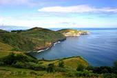
5 The Azores Triple Junction The region harbours a large variety of vents and seamounts, active underwater volcanoes, chemosynthetic ecosystems, and extreme life forms (extremophyles)
 Submersibles: place human lifes at")
6 Scientific Challenges Vents are very hard to study: Large depth (pressure is high) Highly corrosive environment Lack of optical visibility Navigation is a formidable challenge (lack of a GPS-like system) Submersibles: place human lifes at risk


7 Technical Challenges: Deep Sea Habitat Mapping near hydrothermal vents and in complex 3D environments Underwater cliffs, canyon walls, mass wasting walls, mid-ocean ridges, fracture zones, seamount flanks, continental margins, hydrothermal vent offices.


8 End products: Habitat maps (acoustics and vision)


9 Sea: the Ultimate Frontier Explore the Ocean Advanced technology is mandatory Future: Mobile Networked Sensor Systems (moored systems, robotic surface and underwater vehicles, gliders, submersibles, vessels, etc.)


10 Meeting IN-PT (1999)


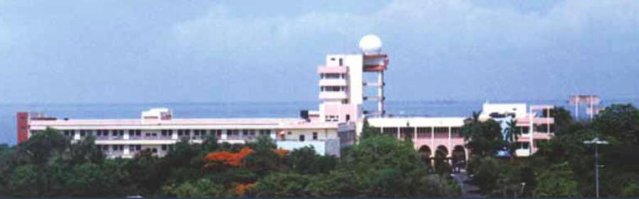
11 Dona Paula, Goa MAYA-Sub work and tests in India Interchange of Researchers PT-INDIA; co-project via Web


12 MAYA-Sub Work and tests in India Amthnem, Goa


13 Joint Operations Goa, India
14 OXYGEN 4D plots in Idukki Reservoir Intense Hypoxia was detected for the first time by Maya AUV below 15 m on 12 th May, 2006


15 Joint operations in the Azores, PT
16 Financing IN NIO, Dona Paula, Goa Ministry of Communications and Information Technology (MIT) New Delhi Department of Science New Delhi Environmental Monitoring Oceanography an extension of a surface vessel. Financing PT AdI (Agency for Development and Innovation) GRICES (Indo-Portuguese Cooperation Agreement) Internal (IST/ISR, IMAR) Marine Habitat Mapping Oceanography Environmental studies


 Intensive cooperative work (extended visits; exchange of MSc")
17 WHY did it work out? Technology transfer : 1- VEA Automation and Robotics Pvt Ltd, Coimbatore, Tamil Nadu, IN 2. Larsen and Toubro Limited, Mumbai., IN 3. BLUEdge: spin-off, PT Complementary expertise fully exploited (marine S&T, mechanics, electronics, computer networks, communications, hydrodynamics, energy systems, navigation and control) Intensive cooperative work (extended visits; exchange of MSc and PhDS students and senior researchers; joint integration and field testing all leading to TRUST) Passion for the field
18 Monitoring the Oceanic Environment using Advanced Systems and Robots Ocean Exploration Monitor/observe the environment using technology Predict System behavior with models Understand Ecosystems World wide strategy on sustainability of ecosystems under human stresses

19 Autonomous Vertical Profiler (AVP) Performing a mission 1. AVP gets a GPS lock 2. Controlled thruster powered descent 3. Hovers if programmed 4. Ascends with buoyancy 5. Gets sat-lock & transmits data


20 Autonomous Vertical Profiler (AVP)


21 AVP discovers a close coupling between biological and physical processes NRDC Meritorious Innovation Award for the year 2010, IN National Research Development Corporation (NRDC)

")
 j0 p")
22 p ( 1 t ) j 4 p ( 2 t ) j 4 Robot-Assisted operations p 1 t j 0 ( ) d 1 r r2 1 r 3 p 3 t j 4 ( ) Tracking based on GPS and range data p d ( t ) j0 p d ( t ) j4

23 Key components: the MEDUSA ASVs Intensive joint work on Advanced Motion Control and Geophysical Navigation of Multiple Cooperative Vehicles
 Fernando L.")

24 Elgar Desa (NIO, IN) Tata Sudhakar (NIOT, IN) Antonio Pascoal (IST, PT) Joao Tasso (FEUP, PT) Fernando L. Pereira (FEUP, PT) Kanna Raja (MBARI, USA) Exploiting links with NSTL - a Navy lab CMERI - a CSIR lab Partners of EU-India in EUCLID The future: distributed sensing and mapping capabilities (joint projects, workshops, students exchange, commercial exploitation)

25 Robotic Systems and Technologies: New tools for ocean exploration Elgar Desa National Institute of Oceanography, Goa, India Antonio Pascoal Institute for Systems and Robotics / IST, Lisbon, Portugal Ricardo Santos Dept. Oceanography and Fisheries, Univ. Azores, Portugal
Monitoring the coastal ocean: from local to regional
 Monitoring the coastal ocean: from local to regional Luísa Bastos University of Porto / CIIMAR RAIA partners Ocean monitoring To answer key societal and scientific challenges navigation safety, fisheries,
NOAA/University of New Hampshire Joint Hydrographic Center & Center for Coastal and Ocean Mapping. MAPPS Summer Conference July 23, 2013
 NOAA/University of New Hampshire Joint Hydrographic Center & Center for Coastal and Ocean Mapping MAPPS Summer Conference July 23, 2013 07/23/2013 2 07/23/2013 3 Center Goals To be a world leader in the
Vision: The National Oceanography Centre will, by 2015, be recognised as the world-leading Centre for integrated ocean sciences and technology".
 National Oceanography Centre from coast to deep ocean Waterfront Campus, Southampton Vision: Joseph Proudman Building, Liverpool The National Oceanography Centre will, by 2015, be recognised as the world-leading
Shape of the seafloor. Shape of the seafloor. Shape of the seafloor. Shape of the seafloor. Shape of the seafloor. Shape of the seafloor
 Multibeam echo sounders - Research vessel Scripps Institution of Oceanography R/V Roger Revelle depth Source: Scripps Institution of Oceanography http://woodshole.er.usgs.gov/project-pages/caribbean/movie1.html
Earth / Environmental Science. Ch. 14 THE OCEAN FLOOR
 Earth / Environmental Science Ch. 14 THE OCEAN FLOOR The Blue Planet Nearly 70% of the Earth s surface is covered by the global ocean It was not until the 1800s that the ocean became an important focus
Fluid-Rock Interactions and the Sub-Seafloor Biosphere
 Fluid-Rock Interactions and the Sub-Seafloor Biosphere BACKGROUND DATA Examples of Key Scientific Questions (OOI Science Plan) Scientific Priorities (San Juan Meeting) Example ORION Experiments (San Juan
Geography IIN. Exploration of Polymetallic Nodules
 Geography IIN Exploration of Polymetallic Nodules Cabinet approves extension of contract between India and The International Seabed Authority for the exploration of Polymetallic Nodules Background The
General Oceanography Geology 105 Expedition 14 Dive & Discover Explorations of the Seafloor See Due Date in Greensheet or in Module Area of Canvas
 General Oceanography Name Geology 105 Expedition 14 Dive & Discover Explorations of the Seafloor See Due Date in Greensheet or in Module Area of Canvas Expedition Objective: In this expedition, we will
MARITIME PLANNING IN PORTUGAL
 MARITIME PLANNING IN PORTUGAL Marta Chantal Ribeiro 2 May 2007 In Portugal there is currently no strategic planning system in force for the maritime area as a whole The maritime area under Portuguese jurisdiction
Missions from MARS: Marine Autonomous and Robotic Systems - current and future science applications
 Missions from MARS: Marine Autonomous and Robotic Systems - current and future science applications Dr Russell B Wynn (MARS Chief Scientist, Head of NOC Marine Geoscience) Marine Autonomous and Robotic
Advances in Synoptic Observations with Robotic Vehicles
 Advances in Synoptic Observations with Robotic Vehicles Kanna Rajan (NTNU & UPorto, Norway) Tor Arne Johansen (NTNU, Norway) Joao Sousa (UPorto, Portugal) Javier Gilabert (UPCT, Spain) Air surface space
The use of CARAVELA 2000 vehicles in operational oceanography
 The use of CARAVELA 2000 vehicles in operational oceanography M. Alves a, A. Pascoal b, A.M. Pereira c, J. Rodeia a, A. Simões a, M. Juliano a, R. Duarte a, C. Silvestre b, P. Oliveira b, L. Sebastião
Earth Systems Curriculum
 Earth Systems Curriculum Course Description This course provides the opportunity to develop knowledge and understanding about the relationships between the structure, processes, and resources on Earth
PORTUGAL NATIONAL REPORT
 PORTUGAL NATIONAL REPORT 14 TH MEETING OF THE EASTERN ATLANTIC HYDROGRAPHIC COMMISSION Cadiz, Spain 18 th 20 th October 2016 INSTITUTO HIDROGRÁFICO Miguel Arenga IHPT Head of the Hydrography Division 2016-10-18
The MARS Deep-Sea Observatory in Monterey Bay
 The MARS Deep-Sea Observatory in Monterey Bay Yanwu Zhang, James Bellingham, Gene Massion, Craig Dawe, Steve Etchemendy, and Christopher Scholin Monterey Bay Aquarium Research Institute Monterey Bay Aquarium
Kyle Griebel NRS 509 Dr. August & Dr. Wang GIS and remote sensing in Seafloor mapping
 GIS and remote sensing in Seafloor mapping Introduction to seafloor mapping Seafloor maps have a wide variety of uses for scientists and coastal planning needs. Some of these uses include biological assessment
Adaptive Leader-Follower Formation Control of Autonomous Marine Vehicles
 Adaptive Leader-Follower Formation Control of Autonomous Marine Vehicles Lara Briñón-Arranz, António Pascoal, and A. Pedro Aguiar Abstract This paper addresses the problem of adaptive leader-follower formation
A trans-atlantic assessment and deep-water ecosystem-based spatial management plan for Europe
 A trans-atlantic assessment and deep-water ecosystem-based spatial management plan for Europe This project has received funding from the European Union s Horizon 2020 research and innovation programme
Tutorial on Methane Hydrate. Presented by Ad Hoc Group on Methane Hydrate Research March 24, 2004
 Tutorial on Methane Hydrate Presented by Ad Hoc Group on Methane Hydrate Research March 24, 2004 Tutorial on Methane Hydrate What is it and how is it formed? Where is it found? How much may exist? Multi-National
PORTUGAL NATIONAL REPORT
 PORTUGAL NATIONAL REPORT 13 TH SOUTHERN AFRICA AND ISLANDS HYDROGRAPHIC COMMISSION MEETING Cape Town, South Africa 29 th 31 st August 2016 INSTITUTO HIDROGRÁFICO Miguel Arenga IHPT Head of the Hydrography
Protecting the ocean s final frontiers the high seas and deep ocean. Callum Roberts University of York
 Protecting the ocean s final frontiers the high seas and deep ocean Callum Roberts University of York The high seas = 61% of the oceans and 43% of the surface of the Earth Courtesy of NASA Goddard Space
Adaptive Path Planning for Tracking Ocean Fronts with an Autonomous Underwater Vehicle
 Adaptive Path Planning for Tracking Ocean Fronts with an Autonomous Underwater Vehicle Ryan N. Smith, Frederic Py, Kanna Rajan, and Gaurav Sukhatme 1 Motivation, Problem Statement, Related Work An oceanic
2012 FORUM OF MARINE PROTECTED AREAS IN THE MEDITERRANEAN ANTALYA, TURKEY
 2012 FORUM OF MARINE PROTECTED AREAS IN THE MEDITERRANEAN ANTALYA, TURKEY SPECIAL EVENT Challenges for Open Seas MPAs in the Mediterranean region November 27, 2012. 15h00-16H00 Slide # 1 2012 FORUM OF
Managing Impacts of Deep-seA resource exploitation - the MIDAS project. Phil Weaver Seascape Consultants Romsey, UK
 Managing Impacts of Deep-seA resource exploitation - the MIDAS project Phil Weaver Seascape Consultants Romsey, UK Seas at Risk workshop, Brussels 5 th November 2014 Total number of ISA Contractors Number
Ocean Observatories Initiative. Oscar Schofield Rutgers University. Ocean Leadership October 2010
 Ocean Observatories Initiative Oscar Schofield Rutgers University Ocean Leadership October 2010 What is OOI? THE VISION To launch an era of scientific discovery across and within the ocean basins, utilizing
The IHPT Marine Spatial Data infrastructure and its contribution to the INSPIRE Directive
 The IHPT Marine Spatial Data infrastructure and its contribution to the INSPIRE Directive INSPIRE - GWF 2015 - Coastal & Marine session Lisbon Congress Center, Portugal - Thursday, 28 May 2015 Summary
Is sustainable Blue Growth possible? Prof. Alan Deidun FRSB Department of Geosciences, University of Malta Director, IOI Malta Training Centre
 Is sustainable Blue Growth possible? Prof. Alan Deidun FRSB Department of Geosciences, University of Malta Director, IOI Malta Training Centre Alan.de The Blue Growth context Potential of blue
Earth Science Lesson Plan Quarter 2, Week 10, Day 1
 Earth Science Lesson Plan Quarter 2, Week 10, Day 1 Outcomes for Today Standard Focus: PREPARE 1. Background knowledge necessary for today s reading. Beaches are created by the actions of waves, tides,
Deep sea floor By. The structures and features of ocean basin are summarized in Fig. 1. Ocean basin
 Deep sea floor By Sufia Zaman 1, Tanmay Ray Chaudhuri 2, Prosenjit Pramanick 2 and Abhijit Mitra 1 1 Department of Marine Science, University of Calcutta, 35, B. C. Road, Kolkata-700 019, India. 2 Department
National Marine Sanctuary Program
 National Marine Sanctuary Program NMSP/USGS Joint Seabed Mapping Initiative: September 2004 AA National Ocean Service National Marine Sanctuaries Interim Report September 2004 Background: Since 2002,
The Physical Context for Thin Layers in the Coastal Ocean
 The Physical Context for Thin Layers in the Coastal Ocean David M. Fratantoni Physical Oceanography Department Woods Hole Oceanographic Institution Woods Hole, MA 02543 phone: (508) 289-2908 fax: (508)
Advancing Geoscientific Capability. Geological Survey of Finland
 Advancing Geoscientific Capability Geological Survey of Finland GTK in brief The Geological Survey of Finland (GTK) is one of the largest European centres of excellence in assessment, research and the
NOAA and the National Deep Submergence Facility DEep Submergence Science Committee Meeting NOAA 2006 Report
 NOAA and the National Deep Submergence Facility DEep Submergence Science Committee Meeting NOAA 2006 Report November 9, 2006 Seattle, WA Image courtesy of the MTS 04 science team, IFE, URI/IAO NOAA and
International Union of Geodesy and Geophysics. Resolutions
 International Union of Geodesy and Geophysics Resolutions ADOPTED BY THE COUNCIL AT THE XXVI GENERAL ASSEMBLY PRAGUE, CZECH REPUBLIC (22 JUNE 2 JULY 2015) 0 Page Resolution 1: Role of Ocean in Climate
Marine Science and Oceanography
 Marine Science and Oceanography Marine geology- study of the ocean floor Physical oceanography- study of waves, currents, and tides Marine biology study of nature and distribution of marine organisms Chemical
UNOLS DeSSC Meeting December 14, 2014 DeSSC New-Users Program Introductions Part 2
 University-National Oceanographic Laboratory System ~UNOLS ~ Deep Submergence Science Committee Meeting UNOLS DeSSC Meeting December 14, 2014 DeSSC New-Users Program Introductions Part 2 AIDA FAROUGH Looking
The Sea Floor. Chapter 2
 The Sea Floor Chapter 2 Geography of the Ocean Basins World ocean is the predominant feature on the Earth in total area Northern Hemisphere = 61% of the total area is ocean. Southern Hemisphere = about
Chapter Overview. Bathymetry. Measuring Bathymetry. Measuring Bathymetry
 CHAPTER 3 Marine Provinces Chapter Overview The study of bathymetry determines ocean depths and ocean floor topography. Echo sounding and satellites are efficient bathymetric tools. Most ocean floor features
U.S. Arctic Campaign Scenario
 Prepared by the NOAA Office of Ocean Exploration and Research for Nation Ocean Exploration Forum 2016: Beyond the Ships. Sea ice extent from National Snow Service Layer Credits: NOAA National Centers for
Mapping of marine habitats in shallow coastal areas in Denmark
 6 th Workshop Seabed Acoustics, Rostock, November 14/15, 2013 P11-1 Mapping of marine habitats in shallow coastal areas in Denmark Dr. Zyad Al-Hamdani Geological Survey of Denmark and Greenland - GEUS
OSU Ocean Observing Center
 OSU Ocean Observing Center and The Ocean Observatories Initiative OSU Retirement Association March 10,19 2016 2 Early Ocean Observations OSU Retirement Association March 10,19 2016 3 No information off
Integration of a strapdown gravimeter system in an Autonomous Underwater Vehicle
 Integration of a strapdown gravimeter system in an Autonomous Underwater Vehicle Clément ROUSSEL PhD - Student (L2G - Le Mans - FRANCE) April 17, 2015 Clément ROUSSEL ISPRS / CIPA Workshop April 17, 2015
Observability Analysis of 3D AUV Trimming Trajectories in the Presence of Ocean Currents using Single Beacon Navigation
 Observability Analysis of 3D AUV Trimming Trajectories in the Presence of Ocean Currents using Single Beacon Navigation N. Crasta M. Bayat A. Pedro Aguiar, António M. Pascoal, Institute for Automation
Small area of the ocean that is partially surrounded by land. The Ocean Basins. Three Major Oceans. Three Major Oceans. What is a SEA?
 The Ocean Basins How Deep is the Ocean? 1 2 Three Major Oceans Three Major Oceans Pacific Atlantic the shallowest ocean (3.3km average depth) Indian second shallowest ocean (3.8km average depth) Pacific
Marine Vehicle Path Following Using Inner-Outer Loop Control
 Marine Vehicle Path Following sing Inner-Outer Loop Control P. Maurya,, A. Pedro Aguiar, A. Pascoal National Institute of Oceanography, Marine Instrumentation Division Dona Paula Goa-434, India E-mail:
Table of Contents. Introduction 4. Chapter 1 Research and the Deep Oceans 6. Chapter 2 Physical Characteristics of the Ocean 10
 Table of Contents Introduction 4 Chapter 1 Research and the Deep Oceans 6 Chapter 2 Physical Characteristics of the Ocean 10 Chapter 3 Composition of the Oceans Waters 16 Chapter 4 Tides, Waves, and Currents
Research Programme Polar, Marine and Coastal Systems. Current and future Arctic research priorities of Germany Nicole Biebow, AWI
 Research Programme Polar, Marine and Coastal Systems Current and future Arctic research priorities of Germany Nicole Biebow, AWI Arctic Science and Technology (S&T) Collaboration and Engagement Workshop,
Map shows 3 main features of ocean floor
 Map shows 3 main features of ocean floor 2017 Pearson Education, Inc. Chapter 3 Marine Provinces 2017 Pearson Education, Inc. 1 Chapter 3 Overview The study of bathymetry determines ocean depths and ocean
SUSTAINABLE OCEANS GOVERNANCE:: NEW APPROACHES. Oceans Governance: Shaping our Future Workshop USP, 1-2 December 2016
 SUSTAINABLE OCEANS GOVERNANCE:: NEW APPROACHES Oceans Governance: Shaping our Future Workshop USP, 1-2 December 2016 WHAT IS SUSTAINABLE OCEAN GOVERNANCE? O C E A N G O V E R N A N C E I S T H E C O N
Control of Autonomous Underwater Vehicles
 Control of Autonomous Underwater Vehicles Raja Rout Department of Electrical Engineering National Institute of Technology,Rourkela Rourkela-769008, Odisha, India Jan 2013 Control of Autonomous Underwater
Underwater platforms and photographic techniques
 Underwater platforms and photographic techniques Underwater platforms Robotic vehicles are in use for seafloor surveys aleady since the late 1960's s in deep water archaeology. Submersible technology (human
Yev Kontar. Illinois State Geological Survey, University of Illinois at Urbana-Champaign
 Addressing Caribbean Geophysical Hazards through the Continuously Operating Caribbean GPS Observational Network (COCONet) and International Ocean Drilling Program (IODP) Yev Kontar Illinois State Geological
Floats in the Seasonal ice zone
 Floats in the Seasonal ice zone Co-ordinator: Institut Français de Recherche pour l'exploitation de la Mer - France Potential for a task team has discussed at AST-15 Colleagues have been approached and
Roger Revelle Memorial lectures, 2008
 INTERGOVERNMENTAL OCEANOGRAPHIC COMMISSION (of UNESCO) Forty-first Session of the Executive Council UNESCO, Paris, 24 June 1 st July 2008 Roger Revelle Memorial lectures, 2008 Thursday 26 June 2008, UNESCO
NEW SEAFLOOR INSTALLATIONS REQUIRE ULTRA-HIGH RESOLUTION SURVEYS
 NEW SEAFLOOR INSTALLATIONS REQUIRE ULTRA-HIGH RESOLUTION SURVEYS Donald Hussong (Fugro Seafloor Surveys, Inc.) dhussong@fugro.com Fugro Seafloor Surveys, Inc., 1100 Dexter Avenue North (Suite 100), Seattle,
Hydrothermal vents from the Azores
 Hydrothermal vents from the Azores Ana Colaço Center of IMAR from University of Azores Departement of Oceanography and Fisheries 1 Hydrothermal vents are zones of fluid expulsion from the sea floor, normally
Are seafloor hydrothermal sulphides deposits valuable mineral resources? Bramley J Murton
 Are seafloor hydrothermal sulphides deposits valuable mineral resources? Bramley J Murton Outline Why do we need new sources of metals? What are seafloor mineral deposits Where do they occur and why: Why
The giant Gas planets of the outer solar system. Rocky inner planets. Silicates with Iron/Nickel cores. Hydrogen, Helium, methane, water, ammonia
 SUN Hydrogen (74%), some helium (24%) Rocky inner planets Silicates with Iron/Nickel cores The giant Gas planets of the outer solar system Hydrogen, Helium, methane, water, ammonia Where did the water
Harmful Algal Bloom Detectives in the Gulf of Mexico Satellites, Gliders and Buoys, Oh My!
 Harmful Algal Bloom Detectives in the Gulf of Mexico Satellites, Gliders and Buoys, Oh My! By Chris Simoniello and Ruth Mullins* With information from: *The Gulf of Mexico Coastal Ocean Observing System
Digital Development of Territories. Pedro Leite Member of the Board of Directors
 Digital Development of Territories Pedro Leite Member of the Board of Directors Digital Development of Territories Pedro Leite Member of the Board of Directors Azores Archipelago 9 islands located in the
Contents. Preface. IC. Introductory Chapter. 1. The Ocean in the Earth System. Ocean Studies and Pedagogy Acknowledgments
 Contents Preface Ocean Studies and Pedagogy Acknowledgments IC. Introductory Chapter IC.1 Why the Ocean is Important to Us? IC.1.1 Biological Resources IC.1.1.1 Fisheries IC.1.1.2 Other Biological Resources
Applied Geoscience and Technology Division SOPAC. Joy Papao, Risk Information Systems Officer
 Joy Papao, Risk Information Systems Officer Secretariat of the Pacific Community SPC 22 Pacific Island States Head office in Noumea, New Caledonia 2 Regional offices (Pohnpei and Honiara) 600 staff 9 Technical
Your web browser (Safari 7) is out of date. For more security, comfort and the best experience on this site: Update your browser Ignore
 is out of date. For more security, comfort and the best experience on this site: Update your browser Ignore") Your web browser (Safari 7) is out of date. For more security, comfort and the best experience on this site: Update your browser Ignore Activitydevelop PRO TECTING THE MARIANA TRENCH Why is it important
Your web browser (Safari 7) is out of date. For more security, comfort and the best experience on this site: Update your browser Ignore Activitydevelop PRO TECTING THE MARIANA TRENCH Why is it important
Carbon pathways in the South Atlantic
 Carbon pathways in the South Atlantic Olga T. Sato, Ph.D. Paulo Polito, Ph.D. olga.sato@usp.br - polito@usp.br Oceanographic Institute University of São Paulo Olga Sato and Paulo Polito (IOUSP) Carbon
The Spatial Information Corridor Contributes to UNISPACE+50. JIANG HUI Director of Internation Cooperation Department
 The Spatial Information Corridor Contributes to UNISPACE+50 JIANG HUI Director of Internation Cooperation Department 01 02 03 What is Belt & Road Spatial Information Corridor? China put forward the "Belt
4. In areas where tectonic plates collide, the seafloor has deep. 5. In areas where tectonic plates separate, the seafloor has mid- ocean
 Name Date Hour Table Chapter 14 Lesson One- General Directions: Use the word bank below to complete each statement. NOT all terms are used. abyssal plains brackish water condensation energy freshwater
Earth Planet Water. Earth 71% Formation of Water on Planet. Nearly ¾ of Earth s surface is covered by liquid water More covered by solid water
 Earth Planet Water 71% Nearly ¾ of Earth s surface is covered by liquid water More covered by solid water Where is it from? Formation of Water on Planet Earth Combination of volcanic activity and strong
SIO 226: Introduction to Marine Geophysics
 SIO 226: Introduction to Marine Geophysics Plate Tectonics Dave Chadwell Plate Tectonics, Sea-Floor Spreading and Continental Drift Main Parody Plate Geography Lineated Magnetic Anomalies in the Oceanic
The Water Planet Ch. 22
 The Water Planet Ch. 22 What is Oceanography? the study of the Earth s oceans using chemistry, biology, geology, and physics. Oceans cover 70% of the Earth s surface Ocean Research 22.1 The use of submarines
Bathymetry Measures the vertical distance from the ocean surface to mountains, valleys, plains, and other sea floor features
 1 2 3 4 5 6 7 8 9 10 11 CHAPTER 3 Marine Provinces Chapter Overview The study of bathymetry determines ocean depths and ocean floor topography. Echo sounding and satellites are efficient bathymetric tools.
CGSN Overview. GSN Sites CSN Sites Shore Facilities
 GSN Sites CSN Sites Shore Facilities CGSN Overview Coastal Pioneer Array Endurance Array Global Irminger Sea Southern Ocean Station Papa Fixed assets Surface mooring Subsurface mooring Mobile assets Ocean
Understanding oceans in change: Engineering science and technological tools for distributed real-time sensing Kristin Guldbrandsen Frøysa, CMR and
 Understanding oceans in change: Engineering science and technological tools for distributed real-time sensing Kristin Guldbrandsen Frøysa, CMR and University of Bergen Anne A Hageberg, CMR Christian Michelsen
Toward Environmental Predictions MFSTEP. Executive summary
 Research Project co-funded by the European Commission Research Directorate-General 5 th Framework Programme Energy, Environment and Sustainable Development Contract No. EVK3-CT-2002-00075 Project home
Coastal Zones & Ocean Science
 4 th International Conference on Coastal Zones & Ocean Science Theme: Discovering the Innovative methods for the betterment of Coastal and Ocean science Dates: May 15-16, 2019 Venue: https://coastalzonemanagement.conferenceseries.com/
DURIP: Side Scan Sonar and Inertial Navigation System for AUV-Based Ocean Bottom/Sub-Bottom Mapping for Object Search/Identification
 DURIP: Side Scan Sonar and Inertial Navigation System for AUV-Based Ocean Bottom/Sub-Bottom Mapping for Object Search/Identification Gerald L. D Spain Marine Physical Laboratory Scripps Institution of
Opportunities for Geothermal Development Created by New Technologies S2-1-2
 Opportunities for Geothermal Development Created by New Technologies S2-1-2 Geothermal Academy Masami Nakagawa Director of Geothermal Academy Fulbright Energy Specialist CSM/NREL Joint Appointee Department
Using SBSE for the study of organic compounds in submarine hydrothermal vents: from the research vessel to the lab
 Using SBSE for the study of organic compounds in submarine hydrothermal vents: from the research vessel to the lab Cécile Konn, Sophie Chataing LGM, Ifremer, Brest 2 nd SBSE technical meeting, Paris, 11&12
Excel Geomatics: Offering Excellence with Unique Consultancy & Services
 Excel Geomatics: Offering Excellence with Unique Consultancy & Services Providing consultancy and value Added Services using Remote Sensing, Photogrammetry and LiDAR in areas such as Agriculture, Forestry,
Autonomous Platforms for Marine Mapping and Monitoring: A UK Perspective. Dr Russell B Wynn (Head of NOC Marine Geoscience, MARS Chief Scientist)
") Autonomous Platforms for Marine Mapping and Monitoring: A UK Perspective Dr Russell B Wynn (Head of NOC Marine Geoscience, MARS Chief Scientist) Marine mapping and monitoring: an escalating problem. Policy
Autonomous Platforms for Marine Mapping and Monitoring: A UK Perspective Dr Russell B Wynn (Head of NOC Marine Geoscience, MARS Chief Scientist) Marine mapping and monitoring: an escalating problem. Policy
Essential Question: How are the geological features that exist on land similar to the geological features on the ocean floor?
 Essential Question: How are the geological features that exist on land similar to the geological features on the ocean floor? Geography of the Oceans The world ocean can be divided into four main ocean
Physiography Ocean Provinces p. 1 Dimensions p. 1 Physiographic Provinces p. 2 Continental Margin Province p. 2 Deep-Ocean Basin Province p.
 Physiography Ocean Provinces p. 1 Dimensions p. 1 Physiographic Provinces p. 2 Continental Margin Province p. 2 Deep-Ocean Basin Province p. 2 Mid-Ocean Ridge Province p. 3 Benthic and Pelagic Provinces
Marine Biology, Oceanography and Underwater Robots Teleclass Webinar!
 Welcome to the Supercharged Science Marine Biology, Oceanography and Underwater Robots Teleclass Webinar! You can fill out this worksheet as we go along to get the most out of time together, or you can
OCEANOGRAPHY CURRICULUM. Unit 1: Introduction to Oceanography
 Chariho Regional School District - Science Curriculum September, 2016 OCEANOGRAPHY CURRICULUM Unit 1: Introduction to Oceanography OVERVIEW Summary In this unit students will be introduced to the field
Egypt-NOAA Cooperation: Advancing our Environmental Science, Technology, and Education
 Egypt-NOAA Cooperation: Advancing our Environmental Science, Technology, and Education T. G. Onsager NOAA Space Weather Prediction Center and NWS International Activities Office (one-year detail) Terry.Onsager@noaa.gov
Collaborative Systems for the Creation of Marine Services
 Collaborative Systems for the Creation of Marine Services INSPIRE 2016 Nuno Almeida Nuno Catarino Barcelona, 28 th September 2016 Elecnor Deimos is a trademark which encompasses Elecnor Group companies
Dr. K. Prabakaran Assistant Professor
 Dr. K. Prabakaran Assistant Professor Contact Address : Department of Geology Alagappa University Karaikudi 630 003 Tamil Nadu, INDIA Employee Number : 53408 Date of Birth : 10-05-1982 Contact Phone (Office)
Spatial Data Infrastructure for Marine Environnement Ifremer initiatives in France and in Europe
 E. Quimbert, M. Bellouis, F. Lecuy, M. Treguer Centre de Bretagne BP 70, Plouzané 29280 France E-mail: sextant@ifremer.fr Spatial Data Infrastructure for Marine Environnement Ifremer initiatives in France
Office of Naval Research Arctic Observing Activities
 Office of Naval Research Arctic Observing Activities Jim Thomson Applied Physics Laboratory, University of Washington jthomson@apl.washington.edu Scott L. Harper, Program Officer, Arctic and Global Prediction
It s true, these activities are all facets of marine science. But they represent a pretty small part of the picture.
 Welcome. Thanks for coming to CBNERR s Discovery Lab. I m Lisa Lawrence and I m a marine educator at VIMS. Tonight, I m going to give you just glimpse of what it s like to be a marine scientist and tell
Objectives: Describe the structure of the ocean floor. Describe light intensity and temperature characteristics at different ocean depths.
 Ocean Structure Virtual Lab What are some characteristics of the ocean and the ocean floor? Earths highest mountains, deepest valleys, and flattest plains are found not on land but under the ocean. Beyond
Section 21.1 pp What is Climate?
 Section 21.1 pp. 466 468 What is Climate? Set a Purpose: TE, p. 466 Reading Study Guide, p. 73 More about How Climate Controls Interact TE, p. 466 Differentiating ion Reading Support: TE, p. 466 Critical
The Future of Deep-Sea Mining
 Linking Global & Regional levels in the Management of Marine Areas Beyond National Jurisdiction FAO, Rome, 18-20 February 2015 The Future of Deep-Sea Mining David Johnson Seascape Consultants Ltd EU FP7
Organisms in the Ocean
 Oceans Objective 8.E.1.2 Summarize evidence that Earth's oceans are a reservoir of nutrients, minerals, dissolved gases, and life forms: estuaries, marine ecosystems, upwelling, and behavior of gases in
DOOS platform considerations
 DOOS platform considerations Focus on platforms that can be deployed below 1000m and in a globally distributed fashion (or at hotspots, choke points, places of societal interest) Uwe Send Scripps Institution
Ultrasonic Measuring System for Deposition of Sediments in Reservoirs
 MECAHITECH 11, vol. 3, year: 011 Ultrasonic Measuring System for Deposition of Sediments in Reservoirs M. Mărgăritescu* 1, A. Moldovanu * 1, P. Boeriu *, A.M.E. Rolea* 1 * 1 National Institute of Research
NOAA S Arctic Program in 2017
 NOAA S Arctic Program in 2017 NOAA s Arctic Mission To determine how the Arctic system is changing on time scales of weeks to decades, particularly with respect to the consequences that the loss of sea
METOC at Defence Center for Operational Oceanography (FCOO)
") METOC at Defence Center for Operational Oceanography (FCOO) Forsvarets Center for Operativ Oceanografi Dr. Johan Söderqvist Oceanographer jos@fcoo.dk FCOO Staff (13 pos.) Geophysical expertise: oceanography,
METOC at Defence Center for Operational Oceanography (FCOO) Forsvarets Center for Operativ Oceanografi Dr. Johan Söderqvist Oceanographer jos@fcoo.dk FCOO Staff (13 pos.) Geophysical expertise: oceanography,
Hydrography at MSc and Category A level: a European perspective. Victor Abbott & Nicolas Seube
 Hydrography at MSc and Category A level: a European perspective Victor Abbott & Nicolas Seube La Manche A map of our localities... Plymouth University of Plymouth RNHMS Training School Plymouth Martine
The Emerging SIBER Initiative of IMBER/IOGOOS: Biogeochemical Observing Programs and Modeling Needs in the Indian Ocean
 The Emerging SIBER Initiative of IMBER/IOGOOS: Biogeochemical Observing Programs and Modeling Needs in the Indian Ocean Raleigh R. Hood (chair), Lynnath E. Beckley and S. Wajih A. Naqvi GSSC-XII Workshop,