Focus questions pertaining to landscape conservation
|
|
|
- Michael Gordon
- 5 years ago
- Views:
Transcription


1 Photo: Rich Watson


2
3 Connectivity Group collaboration Focus areas of work Identifying linkages (scales, current and climate change) Developing GIS tools, and broadly sharing Supporting/including research to validate models Communications to build support for connectivity conservation Collaboration with Western Governors Association Columbia Plateau Pilot Project, and Arid Lands Initiative Focus questions pertaining to landscape conservation Collaboration/integration of new & ongoing efforts Strategic focus of resources towards landscape condition or priority How the GNLCC can/is supporting this effort, and the value towards achieving collective vision among diverse agencies and organizations

4 Promoting the long term viability of wildlife populations in Washington State through a science based, collaborative approach that identifies opportunities and priorities to conserve and restore habitat connectivity. Public private partnership Science based Participation from conservation organizations, state and federal agencies, universities, tribes, and others


5
 Scale of analysis WA statewide analysis WA Columbia Plateau analysis Climate")
6 Identifying habitat linkages at statewide and ecoregional scales (current conditions and climate change) Scale of analysis WA statewide analysis WA Columbia Plateau analysis Climate connectivity


7 Statewide and Surrounding Landscapes Ecoregion Local Creates statewide data layers Emphasizes wildlife Habitat Concentration and Core Areas Identifies areas important for statewide connectivity Establishes statewide context to inform finer-scale analyses Focuses on particular habitat types Includes wildlife species with smaller geographic ranges Increases resolution regarding wildlife Habitat Concentration and Core Areas and connection patterns Includes species with small ranges or local significance Can be accomplished by local organizations Provides sufficient detail for project-scale action


8 In addition: GIS linkage mapper and hca toolkits GIS files and metadata By fall: Searchable layers (Executive Summaries)
9 16 Focal Species + Landscape Integrity Focal Species Vancouverian Forests Rocky Mt. Forests Semi-desert Habitats Alpine Habitats Subalpine Forests Black Bear X X * * Elk X X * * * Northern Flying Squirrel X X Western Toad X X * X American Marten X * X Bighorn Sheep X * Western Gray Squirrel * X Mule Deer X X * * Sharp-tailed Grouse X Greater Sage-grouse X American Badger X Black-tailed Jackrabbit X White-tailed Jackrabbit X Mountain Goat * * X X Wolverine X X Lynx X Primary species for class X Species also occurs here *


10

.")

11 Areas of highest landscape integrity have the lowest human footprint (e.g., natural land-covers, low housing density, and minimum roads). Composite landscape integrity linkage map which combines four sensitivity models. Cost values indicate relative ease of movement within each linkage.
12 Cluster Dendrogram Shrub-Steppe Associates TYPH Sharp-tailed Grouse Height TYPH CEUR LECA LETO TATA LYCA GUGU ORAM URAM GLSA MAAM ANBO CEEL ODHE LI_LCC OVCA SCGR CEUR LECA LETO TATA Sage Grouse Black-tailed Jackrabbit White-tailed Jackrabbit Badger Montane Associates LYCA Lynx GUGU ORAM URAM GLSA MAAM Wolverine Mountain Goat Black Bear Flying Squirrel Marten Habitat Generalists & Edge Spp. ANBO Western Toad CEEL ODHE Elk Mule Deer Shrub-Steppe Montane Generalist/edge OVCA SCGR Bighorn Sheep Western Grey Squirrel

13 Figure 4.2. Cost-weighted distance map for elk. Even though box 1 spans a larger distance, the higher permeability of habitat means the length of this box is predicted to be easier and safer for elk to traverse than box 2, which spans a fracture zone.


14 Columbia Plateau Connectivity Analysis Higher resolution data Regional data, expertise, and communications Energy development Climate change


15 Columbia Plateau Focal Species Columbia Plateau connectivity analysis focal species. X = primary habitats species is chosen to represent; * = additional habitats where species occurs. Dunes connectivity will be modeled through a systems approach; no species were chosen specifically to represent this vegetation class. Taxon Common Name Scientific Name Shrubsteppe Grassland Cliff, Canyon, Talus Riparian Wetland Bird Sharp tailed Grouse Tympanuchus phasianellus X X * X * Bird Greater Sage grouse Centrocercus urophasianus X X * * * Mammal Black tailed Jackrabbit Lepus californicus X * * Mammal White tailed Jackrabbit Lepus townsendii X X * Mammal Townsend's Ground Squirrel Spermophilus townsendii X X * Mammal Washington Ground Squirrel Spermophilus washingtoni X X * Mammal Least Chipmunk Tamias minimus X * Mammal Mule Deer Odocoileus hemionus X X * * * * Reptile Western Rattlesnake Crotalus oreganus * * X * * * Mammal Beaver Castor canadensis X X Amphibian Tiger Salamander Ambystoma tigrinum * * * * X Dunes


16 Implementation Identify opportunities for conserving and restoring habitat connectivity Develop, coordinate and implement conservation strategies ARID LANDS INITIATIVE


17 Nunez et al. in prep

18 Developing needed GIS tools for our work, and broadly sharing these tools Habitat concentration and core areas Resistance surface Linkage mapper FUTURE: Climate mapper Bighorn sheep, photo by Mike Schroeder.


19 Spatial data 1. Core area mapping automated with the HCA TOOLKIT 2. Resistance layer mapping automated soon with new ArcGIS tools

20 Linkage Mapper The precedent: California had just finished their statewide analysis. It required painstaking ID of which core area pairs to connect. After that, corridor mapping took months and tens of thousands of dollars in analyst time.


21 Linkage Modeling: The Linkage Mapper toolkit


22 Sharp-tailed Grouse 9 Linkage Mapper automatically decides where to map linkages Landscape Resistance Low 3 High


23 Sharp-tailed Grouse It then creates corridor maps connecting networks of core areas Connectivity value Low High
 Shirk et. al.")
24 Supporting/including research to validate models and scientific assumptions (Sage Grouse, Cascades Carnivores) Shirk et. al


25 Cascades Carnivore Connectivity Project: Evaluating Habitat Connectivity for Carnivores in Washington's Cascade Mountains Update for WWHCWG February, 24, 2011 Robert Long, Paula MacKay, James Begley Western Transportation Institute, Montana State University William Gaines, Okanogan/Wenatchee National Forest Roger Christophersen, North Cascades National Park Service Complex
26 Validation Approaches Use WWHCWG linkage models as costsurface for testing; Compare degree of correspondence between WWHCWG models and genetically derived models; Evaluate how well occurrence data matches predicted HCA and linkage habitat from WWHCWG models.

27 Greater Sage-Grouse Model Validation Leslie Robb Mike Schroeder Andrew Shirk


28 Integration Movement pattern Genetic variation Lek persistence
29 Model Validation Approaches Patterns of movement relative to model assumptions and predictions Patterns of lek persistence relative to model predictions Genetic variation relative to movement, lek persistence, and model predictions
30 Communications to build support for connectivity conservation The goal of the communications and implementation subgroup: to provide complementary products to our scientific analysis that will inform and guide communications and implementation of our work, while facilitating effective internal and external communications.

31 3. How the GNLCC can/is supporting this effort, and the value towards achieving collective vision among diverse agencies and organizations Big picture needs: consistent data sets, collaboration sites such as data portel, GIS tools, communicating and sharing across state and national borders Connectivity group includes ambitious work plan, we seek to accomplish this work in ways that can be shared with and by the GNLCC. Capacity and funding for all aspects of work very challenging. GNLCC funding is hugely important for the group s work


32 Find information about the analyses, data availability, and GIS tools at: Contacts: WHCWG Co lead Joanne Schuett Hames Joanne.Schuett Lead GIS Analyst Brian Cosentino Communications Jen Watkins
GREAT NORTHERN LCC PROJECT PROPOSAL. February 22, 2013
 Project Title: Informing Connectivity Conservation Decisions in the British Columbia Washington Transboundary Region and the Columbia Plateau Ecoregion Project Coordinator: Joanne Schuett-Hames, Co-lead
WHCWG Connected Landscapes Project Page 1
 Project Title: The Washington Connected Landscapes Project: Analyzing Ecoregions, Incorporating Climate Change, Providing Analysis Tools, and Validating Models Project Coordinator: Joanne Schuett-Hames,
Focal species and landscape naturalness corridor models offer complementary approaches for connectivity conservation planning
 Landscape Ecol (2015) 30:2121 2132 DOI 10.1007/s10980-015-0235-z RESEARCH ARTICLE Focal species and landscape naturalness corridor models offer complementary approaches for connectivity conservation planning
Project Primary Contact: Gregg Servheen, Idaho Department of Fish and Game, PO Box 25 Boise, ID ,
 Project Title: Idaho Montana Divide Project Objective: Pilot the conceptualization and coordination of a transboundary Decision Support System(DSS) for fish, wildlife, and habitats along the Idaho Montana
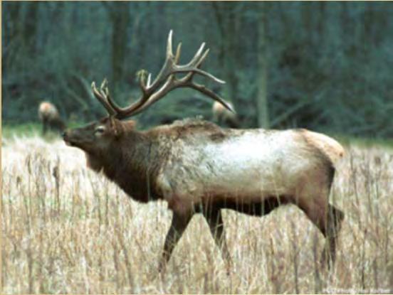
Cover photo, elk in meadow, Rich Watson
 Cover photo, elk in meadow, Rich Watson Washington Connected Landscapes Project: Statewide Analysis Washington Wildlife Habitat Connectivity Working Group December 2010 Mission Statement of the Washington
Describing Greater sage-grouse (Centrocercus urophasianus) Nesting Habitat at Multiple Spatial Scales in Southeastern Oregon
 Nesting Habitat at Multiple Spatial Scales in Southeastern Oregon") Describing Greater sage-grouse (Centrocercus urophasianus) Nesting Habitat at Multiple Spatial Scales in Southeastern Oregon Steven Petersen, Richard Miller, Andrew Yost, and Michael Gregg SUMMARY Plant
Describing Greater sage-grouse (Centrocercus urophasianus) Nesting Habitat at Multiple Spatial Scales in Southeastern Oregon Steven Petersen, Richard Miller, Andrew Yost, and Michael Gregg SUMMARY Plant
H IGHWAY 3 WILDLIFE MORTALITY
 Miistakis Institute for the Rockies H IGHWAY 3 WILDLIFE MORTALITY CONTENTS Introduction 1 Methods 2 Data Limitations 3 Results 3 Discussion 8 Special points of interest: The analysis includes mortality
Priority areas for grizzly bear conservation in western North America: an analysis of habitat and population viability INTRODUCTION METHODS
 Priority areas for grizzly bear conservation in western North America: an analysis of habitat and population viability. Carroll, C. 2005. Klamath Center for Conservation Research, Orleans, CA. Revised
EXECUTIVE SUMMARY (Continued)
") EXECUTIVE SUMMARY In 1980, Congress passed the Pacific Northwest Electric Power Planning and Conservation Act which authorized creation of the Northwest Power and Conservation Council by the states of
EXECUTIVE SUMMARY In 1980, Congress passed the Pacific Northwest Electric Power Planning and Conservation Act which authorized creation of the Northwest Power and Conservation Council by the states of
EcoServ-GIS. EcoServ GIS Stage I. Why EcoServ GIS? 17/12/2012
 EcoServ-GIS Ecosystem Services Mapping: A Wildlife Trust GIS Toolkit to map ecosystem services at a county scale Dr Jonathan Winn Living Landscape Coordinator Durham Wildlife Trust Dr Chloe Bellamy Ecosystem
Spatio-temporal Patterns of Wildlife Distribution and Movement in Canmore s Benchlands Corridor.
 Spatio-temporal Patterns of Wildlife Distribution and Movement in Canmore s Benchlands Corridor. March 2010 Prepared by Tracy Lee, Samantha Managh and Neil Darlow Prepared for: Alberta Tourism, Parks and
Vegetation and Wildlife Habitat Mapping Study in the Upper and Middle Susitna Basin Study Plan Section 11.5
 (FERC No. 14241) Vegetation and Wildlife Habitat Mapping Study in the Upper and Middle Susitna Basin Study Plan Section 11.5 Initial Study Report Part C: Executive Summary and Section 7 Prepared for Prepared
Natural Resource Management. Northern Tasmania. Strategy. Appendix 2
 Natural Resource Management Strategy Northern Tasmania 2015 2020 Appendix 2 Appendix 2 Appendix 2. Carbon Planting Spatial Prioritisation In support of this Strategy s development and implementation, work
Landform Regions of Canada
 Landform Regions of Canada The movement of the earth s plates, and the resulting folding, faulting, and volcanic activity, have combined with the forces of erosion and weathering to create a variety of
An Introduction to Day Two. Linking Conservation and Transportation Planning Lakewood, Colorado August 15-16, 16, 2006
 An Introduction to Day Two Linking Conservation and Transportation Planning Lakewood, Colorado August 15-16, 16, 2006 1 Agenda Day One Transportation Planning Heritage Program State Wildlife Action Plan
The Arctic Landscape Conservation Cooperative Conservation Goals
 The Arctic Landscape Conservation Cooperative Conservation Goals Adopted by the Arctic LCC Steering Committee, 24 August 2010 Background : Landscape Conservation Cooperatives and Climate Science Centers
Reminder that we update the website: with new information, project updates, etc.
 1 Reminder that we update the website: http://www.njfishandwildlife.com/ensp/connectivity_proj.htm with new information, project updates, etc. regularly. Any suggestions are welcome on how to make the
Through their research, geographers gather a great deal of data about Canada.
 Ecozones What is an Ecozone? Through their research, geographers gather a great deal of data about Canada. To make sense of this information, they often organize and group areas with similar features.
Using Landscape Analysis Metrics to Manage Aquatic Invasive Species and Targeted Transboundary Species in the Crown of the Continent Ecosystem
 Using Landscape Analysis Metrics to Manage Aquatic Invasive Species and Targeted Transboundary Species in the Crown of the Continent Ecosystem Project Coordinator: Erin Seton, Crown Managers Partnership
Upper Owyhee Watershed Assessment
 * Owyhee Watershed Council and Scientific Ecological Services The upper Owyhee subbasin is located in parts of three states: the southeastern corner of Oregon, the southwestern corner of Idaho, and north
WEBINAR AGENDA. Review of connectivity mapping progress to date. Describe draft methodology for delineating and validating core areas
 WEBINAR AGENDA Review of connectivity mapping progress to date Describe draft methodology for delineating and validating core areas Review examples of the methodology implemented in the Highlands Explain
Habitat Occupancy and Movements by Greater Sage-Grouse in Washington State
 WHCWG GNLCC Final Report December 2015 Habitat Occupancy and Movements by Greater Sage-Grouse in Washington State Michael A. Schroeder, Andrew J. Shirk, Adam Wells, and Leslie A. Robb Cover photo of male
United States Department of the Interior NATIONAL PARK SERVICE Northeast Region
 United States Department of the Interior NATIONAL PARK SERVICE Northeast Region June 17, 2017 REQUEST FOR STATEMENTS OF INTEREST and QUALIFICATIONS Project Title: ASSESSMENT OF NATURAL RESOURCE CONDITION
EcoServ-GIS. Ecosystem Services Mapping: A Wildlife Trust GIS Toolkit to map ecosystem services at a county scale
 EcoServ-GIS Ecosystem Services Mapping: A Wildlife Trust GIS Toolkit to map ecosystem services at a county scale Dr Jonathan Winn Living Landscape Coordinator Durham Wildlife Trust Dr Chloe Bellamy Ecosystem
Ecological Response Units Ecosystem Mapping System for the Southwest US
 Ecological Response Units Ecosystem Mapping System for the Southwest US J. C. Moreland, W. A. Robbie, F. J. Triepke, E. H. Muldavin, and J. R. Malusa Objectives What are Ecological Response Units? What
Development of statewide 30 meter winter sage grouse habitat models for Utah
 Development of statewide 30 meter winter sage grouse habitat models for Utah Ben Crabb, Remote Sensing and Geographic Information System Laboratory, Department of Wildland Resources, Utah State University
APPENDIX PHASE 1 GREEN INFRASTRUCTURE FRAMEWORK
 APPENDIX PHASE 1 GREEN INFRASTRUCTURE FRAMEWORK KANSAS MISSOURI CONTENTS A DATA WISHLIST 4 B PRECEDENTS 7 C WORKSHOP MATERIALS 13 D ANALYSIS PROCESS 124 E ATLAS & PLAYBOOK DETAILS 156 F POLICY ANALYSIS
Wildlife and Traffic in the Carpathians
 Wildlife and Traffic in the Carpathians How to solve the problem between green and gray infrastructure Václav Hlaváč TRANSGREEN Kick-off Meeting Vienna, 28 February 2 March 2017 Nature Conservation Agency
Looking at the big picture to plan land treatments
 Looking at the big picture to plan land treatments Eva Strand Department of Rangeland Ecology and Management University of Idaho evas@uidaho.edu, http://www.cnr.uidaho.edu/range Why land treatment planning?
The Vertebrates and Invertebrates of British Columbia: Scientific and English Names
 The Vertebrates and Invertebrates of British Columbia: Scientific and English Names Standards for Components of British Columbia's Biodiversity No. 2 Prepared by Ministry of Environment, Ecosystems Branch
Route 120 Build-out Analysis Using CommunityViz Scenario 360
 Route 120 Build-out Analysis Using CommunityViz Scenario 360 Jennifer Lingeman CommunityViz Technical Resource Center UNH Complex Systems Research Center jennifer.lingeman@unh.edu NH GRANIT o Central GIS
LANDSLIDE HAZARD ANALYSIS AND ITS EFFECT ON ENDANGERED SPECIES HABITATS, GRAND COUNTY, UTAH
 12/5/2016 LANDSLIDE HAZARD ANALYSIS AND ITS EFFECT ON ENDANGERED SPECIES HABITATS, GRAND COUNTY, UTAH GIS Final Project Ashlyn Murphy Fall 2016 1. Introduction and Problem A well-known geologic hazard
Background. North Cascades Ecosystem Grizzly Bear Restoration Plan/ Environmental Impact Statement. Steve Rochetta
 Grizzly Bear Restoration Plan/ Environmental Impact Statement Steve Rochetta Background Situated in the core of the North Cascades ecosystem (NCE), the North Cascades National Park Complex is surrounded
FWS PROJECT Year project
 FWS PROJECT 2014 3 Year project Project Title: Core Habitat Identification and Fine Scale Habitat Use of Grizzly Bears in the US Northern Rockies and southern Canada Project Coordinator (contact information):
The Use of GIS in Habitat Modeling
 Amy Gottfried NRS 509 The Use of GIS in Habitat Modeling In 1981, the U.S. Fish and Wildlife Service established a standard process for modeling wildlife habitats, the Habitat Suitability Index (HSI) and
Crown of the Continent Landscape Analysis/Ecological Indicators Project
 Crown of the Continent Landscape Analysis/Ecological Indicators Project Project Coordinator: Erin Sexton, Crown Managers Partnership (CMP), Flathead Lake Biological Station, University of Montana; (406)
Summary Description Municipality of Anchorage. Anchorage Coastal Resource Atlas Project
 Summary Description Municipality of Anchorage Anchorage Coastal Resource Atlas Project By: Thede Tobish, MOA Planner; and Charlie Barnwell, MOA GIS Manager Introduction Local governments often struggle
Section 2. Indiana Geographic Information Council: Strategic Plan
 Section 2. Indiana Geographic Information Council: Strategic Plan Introduction A geographic information system (GIS) is an automated tool that allows the collection, modification, storage, analysis, and
Improvement of the National Hydrography Dataset for Parts of the Lower Colorado Region and Additional Areas of Importance to the DLCC
 Improvement of the National Hydrography Dataset for Parts of the Lower Colorado Region and Additional Areas of Importance to the DLCC Carlos Reyes-Andrade California State University, Northridge September
Landscape Planning and Habitat Metrics
 Landscape Planning and Habitat Metrics Frank W. Davis National Center for Ecological Analysis and Synthesis UC Santa Barbara (Tools for Landscape Biodiversity Planning) Jimmy Kagan Institute for Natural
Changes in Texas Ecoregions
 Comment On Lesson Changes in Texas Ecoregions The state of Texas can be divided into 10 distinct areas based on unique combinations of vegetation, topography, landforms, wildlife, soil, rock, climate,
SELF-GUIDED LEARNING EXPEDITION LIFE SCIENCE. Name GRADE LEVEL: 4 5 STUDENT GUIDE
 SELF-GUIDED LEARNING EXPEDITION Name GRADE LEVEL: 4 5 STUDENT GUIDE LIFE SCIENCE On this expedition, you will visit the following areas in order to complete activities related to the theme Organisms and
Biome- complex of terrestrial communities that cover a large area; characterized by soil, climate, plants, and animals Plants and animals vary by
 Major Land Biomes Biome- complex of terrestrial communities that cover a large area; characterized by soil, climate, plants, and animals Plants and animals vary by tolerance to temperature and precipitation
Grant Opportunity Monitoring Bi-State Sage-grouse Populations in Nevada
 Grant Opportunity Monitoring Bi-State Sage-grouse Populations in Nevada Proposals are due no later than November 13, 2015. Grant proposal and any questions should be directed to: Shawn Espinosa @ sepsinosa@ndow.org.
Museum of Vertebrate Zoology, UC Berkeley
 Museum of Vertebrate Zoology, UC Berkeley Non-specimen archival record (fieldnotes and photographs)... our efforts are not... to accumulate as great a mass of animal remains as possible [rather]... our
Putative Canada Lynx (Lynx canadensis) Movements across I-70 in Colorado
 Movements across I-70 in Colorado") Putative Canada Lynx (Lynx canadensis) Movements across I-70 in Colorado INTRODUCTION March 8, 2012 Jake Ivan, Mammals Researcher Colorado Parks and Wildlife 317 W. Prospect Fort Collins, CO 80526 970-472-4310
Putative Canada Lynx (Lynx canadensis) Movements across I-70 in Colorado INTRODUCTION March 8, 2012 Jake Ivan, Mammals Researcher Colorado Parks and Wildlife 317 W. Prospect Fort Collins, CO 80526 970-472-4310
How does the physical environment influence communities and ecosystems? Hoodoos in Cappadocia, Turkey
 Biomes of the World How does the physical environment influence communities and ecosystems? Hoodoos in Cappadocia, Turkey ecosystems are shaped by: abiotic factors climate/weather space Rainfall Soil air
Project Leader: Project Partners:
 UTILIZING LIDAR TO MAP HIGH PRIORITY WOODLAND HABITAT IN ARKANSAS DEVELOPING METHODOLOGY AND CONDUCTING A PILOT PROJECT IN THE OZARK HIGHLANDS TO MAP CURRENT EXTENT, SIZE AND CONDITION Project Summary
Kootenai River Habitat Restoration Program Update
 Kootenai River Habitat Restoration Program Update Kootenai Tribe of Idaho Kootenai Valley Resource Initiative November 19, 2012 Bonners Ferry, Idaho Changes to Kootenai Basin Beaver trapping Floodplain
Unmanned Aircraft Systems (UAS) Activities in Earth Sciences
 Activities in Earth Sciences") Unmanned Aircraft Systems (UAS) Activities in Earth Sciences Bruce K. Quirk quirk@usgs.gov Department of the Interior U.S. Geological Survey June 22, 2015 Department of the Interior Bureau of Land Management
Unmanned Aircraft Systems (UAS) Activities in Earth Sciences Bruce K. Quirk quirk@usgs.gov Department of the Interior U.S. Geological Survey June 22, 2015 Department of the Interior Bureau of Land Management
Native species (Forbes and Graminoids) Less than 5% woody plant species. Inclusions of vernal pools. High plant diversity
 Less than 5% woody plant species. Inclusions of vernal pools. High plant diversity") WILLAMETTE VALLEY WET-PRAIRIE RESTORATION MODEL WHAT IS A WILLAMETTE VALLEY WET-PRAIRIE Hot Spot s Native species (Forbes and Graminoids) Rare plant species Less than 5% woody plant species Often dominated
WILLAMETTE VALLEY WET-PRAIRIE RESTORATION MODEL WHAT IS A WILLAMETTE VALLEY WET-PRAIRIE Hot Spot s Native species (Forbes and Graminoids) Rare plant species Less than 5% woody plant species Often dominated
GIS Data, Technology, and Models. to Integrate Information and Improve Transportation Decision-Making. within the Eco-Logical* Framework for Oregon
 GIS Data, Technology, and Models to Integrate Information and Improve Transportation Decision-Making within the Eco-Logical* Framework for Oregon GIS-T 2009, Oklahoma City, OK April 8, 2009, Session 5..2.2
EBIPM Curriculum. Unit Pre/Post test. Module 1 Test. Rangeland ecosystems
 Module 1 Test. Rangeland ecosystems EBIPM Curriculum Unit Pre/Post test Species Identification - Label the species pictured with the correct name. (2 points each) 1 2 1 Mark W. Skinner. USDA, NRCS. 2011.
Southwest LRT Habitat Analysis. May 2016 Southwest LRT Project Technical Report
 Southwest LRT Habitat Analysis Southwest LRT Project Technical Report This page intentionally blank. Executive Summary This technical report describes the habitat analysis that was performed to support
Analyzing Suitability of Land for Affordable Housing
 Analyzing Suitability of Land for Affordable Housing Vern C. Svatos Jarrod S. Doucette Abstract: This paper explains the use of a geographic information system (GIS) to distinguish areas that might have
Ecoregional Assessment of Biodiversity Conservation Executive Summary September 2006 Hawaiian High Islands
 Ecoregional Assessment of Biodiversity Conservation Executive Summary September 2006 Hawaiian High Islands This executive summary presents an 9-page overview of the Hawaiian High Islands Ecoregional Assessment
Introduction to Geographic Information Systems
 Introduction to Geographic Information Systems What is GIS? GIScience, Geography and Cartography GIS Maps Why is it important? What is Driving GIS? Applications of GIS Case Studies Components of a GIS
Assessing Michigan s Biological diversity. Michigan Natural Features Inventory MSU Extension
 Assessing Michigan s Biological diversity John Paskus,, Amy Derosier,, Edward Schools, and Helen Enander Michigan Natural Features Inventory MSU Extension Goal Provide scientifically based information
The Cassiar Mountains
 The Cassiar Mountains Introduction Topography Dease Plateau Dease Lake, BC Stikine Ranges Eve Cone Mount Edziza Provincial Park Mount Ash, BC 2 125m Ketchika Ranges Muskwa- Ketchika Management Area Sifton
V E R M E J O P A R K R A N C H
 V E R M E J O P A R K R A N C H ABOUT TED TURNER EXPEDITIONS Ted Turner Expeditions is rooted in two million acres of wild, private North American landscape acquired by Ted Turner as a pioneering investment
Resilient Landscapes Fund
 Resilient Landscapes Fund Definitions and Map Guide 2017 This document includes definitions of key terms and instructions for developing maps for application to OSI s Resilient Landscapes Fund. INTRODUCTION
Vancouver Island and Coast
 Places in B.C. This handout package provides students with a brief overview of one of seven regions in B.C. These descriptions will help students audit the different types of energy (see the Energy Primers)
BIOS 230 Landscape Ecology. Lecture #32
 BIOS 230 Landscape Ecology Lecture #32 What is a Landscape? One definition: A large area, based on intuitive human scales and traditional geographical studies 10s of hectares to 100s of kilometers 2 (1
Spatial Data Availability Energizes Florida s Citizens
 NASCIO 2016 Recognition Awards Nomination Spatial Data Availability Energizes Florida s Citizens State of Florida Agency for State Technology & Department of Environmental Protection Category: ICT Innovations
Using Big Interagency Databases to Identify Climate Refugia for Idaho s Species of Concern
 Using Big Interagency Databases to Identify Climate Refugia for Idaho s Species of Concern What is a Climate Refugia? habitat that supports a locally reproducing population [or key life history stage]
Five Themes of Geography Project Ms. Kiesel, Per 5. The United States of America
 Five Themes of Geography Project Ms. Kiesel, Per 5 The United States of America Location Absolute Location : The USA is located in the continent of North America in the northern and western hemispheres.
Define Ecology. study of the interactions that take place among organisms and their environment
 Ecology Define Ecology Define Ecology study of the interactions that take place among organisms and their environment Describe each of the following terms: Biosphere Biotic Abiotic Describe each of the
An Update on Land Use & Land Cover Mapping in Ireland
 An Update on Land Use & Land Cover Mapping in Ireland Progress Towards a National Programme Kevin Lydon k.lydon@epa.ie Office of Environmental Assessment, Environmental Protection Agency, Johnstown Castle,
Continental Divide National Scenic Trail GIS Program
 CDNST Vision Statement: Provide the most accurate geospatial locational information of the Continental Divide Trail and nearby resources to the public as well as help provide internal management information
HOUSEKEEPING. Notes. Upcoming meetings related to connectivity: FTP site? Zotero
 HOUSEKEEPING Notes Upcoming meetings related to connectivity: FTP site? Zotero NJ Land Conservation Rally March 9, 2013; NJIT in Newark, NJ One-day educational conference about preserving New Jersey s
Preparing GIS Data for NG9-1-1 in the Commonwealth of Virginia
 Preparing GIS Data for NG9-1-1 in the Commonwealth of Virginia Brian Crumpler Regional Coordinator Virginia Information Technologies Agency (VITA) February 28, 2017 1 1 Overview: Sharing ways Virginia
RANGE SUSTAINABILITY GIS APPLICATIONS AND ENTERPRISE IMPLEMENTATIONS
 RANGE SUSTAINABILITY GIS APPLICATIONS AND ENTERPRISE IMPLEMENTATIONS May 4, 2009 Gabe Lovasz, Geospatial Analyst, ManTech SRS Molly Rodriguez, Geospatial Analyst, ManTech SRS -In Support of- The Office
Creating A-16 Compliant National Data Theme for Cultural Resources
 Creating A-16 Compliant National Data Theme for Cultural Resources Cultural Resource GIS Facility National Park Service John J. Knoerl Deidre McCarthy Paper 169 Abstract OMB Circular A-16 defines a set
Note: This validation is designed to test the accuracy of the mapping process (i.e. the map models) not the accuracy of the map itself.
 not the accuracy of the map itself.") Ecological Classes and Criteria for Assigning Fuzzy Set Values Fuzzy set validation assessment is being used to evaluate land cover mapping by comparing the label of reference point to map. The validation
Ecological Classes and Criteria for Assigning Fuzzy Set Values Fuzzy set validation assessment is being used to evaluate land cover mapping by comparing the label of reference point to map. The validation
Nomination Form. Clearinghouse. New York State Office for Technology. Address: State Capitol-ESP, PO Box
 NASIRE 2001 RECOGNITION AWARDS Recognizing Outstanding Achievement in the Field of Innovative Use of Technology Nomination Form Title of Nomination: Manager/Job Title: Agency: NYS Geographic Information
Sandra Lee Pinel, PhD, AICP
 Sandra Lee Pinel, PhD, AICP Exper se: Community, indigenous, and regional planning, applied anthropology, comprehensive local and regional planning, conflict management, case studies, strategic and par"cipatory
Development of Riparian Maps for Sonoma County Long Term Riparian Corridor Conservation. Mark Tukman & Dylan Loudon Tukman Geospatial
 L A N D F O R Development of Riparian Maps for Sonoma County Long Term Riparian Corridor Conservation Mark Tukman & Dylan Loudon Tukman Geospatial L I F E Mark Background on functional riparian mapping
Features of the Arid and Semiarid Region
 Appendixes Appendix A Features of the Arid and Semiarid Region Note: The information in this appendix further elaborates on material presented in chapter II. Natural Features of the Arid and Semiarid Region
Biomes of the World What is a Biome?
 Biomes of the World What is a Biome? A large, relatively distinct terrestrial region with characteristic Climate Soil Plants Animals Interacting landscapes 1 Terrestrial Biomes Using Precipitation And
Saving the Leuser Ecosystem with Arc GIS
 Brian Mattern APEC 480 Saving the Leuser Ecosystem with Arc GIS Background: Right now, a significant and relatively unreported crisis is occurring on the island of Sumatra. The Leuser ecosystem is a topographically
NATIONAL HYDROGRAPHY DATASET (NHD) UPDATE PROJECT FOR US FOREST SERVICE REGION 3
 UPDATE PROJECT FOR US FOREST SERVICE REGION 3") NATIONAL HYDROGRAPHY DATASET (NHD) UPDATE PROJECT FOR US FOREST SERVICE REGION 3 Allison Moncada California State University, Northridge February 2018 July 2018 Advisor: Joel Osuna Center for Geospatial
NATIONAL HYDROGRAPHY DATASET (NHD) UPDATE PROJECT FOR US FOREST SERVICE REGION 3 Allison Moncada California State University, Northridge February 2018 July 2018 Advisor: Joel Osuna Center for Geospatial
A Regional Database Tracking Fire Footprint Each Year within the South Atlantic Region: Current Database Description and Future Directions
 A Regional Database Tracking Fire Footprint Each Year within the South Atlantic Region: Current Database Description and Future Directions Last Updated on September 30, 2018 Contributors: NatureServe,
Spatial Planning for Protected Areas in Response to Climate Change (SPARC)
") Spatial Planning for Protected Areas in Response to Climate Change (SPARC) CI-GEF and Conservation International PROJECT SUMMARY Protected areas are the centerpiece of place-based conservation. The Convention
Spatial Planning for Protected Areas in Response to Climate Change (SPARC) CI-GEF and Conservation International PROJECT SUMMARY Protected areas are the centerpiece of place-based conservation. The Convention
Zoogeographic Regions. Reflective of the general distribution of energy and richness of food chemistry
 Terrestrial Flora & Fauna Part II In short, the animal and vegetable lines, diverging widely above, join below in a loop. 1 Asa Gray Zoogeographic Regions Reflective of the general distribution of energy
Getting On the Same Page and Parcel
 Getting On the Same Page and Parcel Local flair is a valued and cherished quality of small Vermont towns and cities. The Agency of Natural Resources works daily with town officials and local committee
Case Study: Ecological Integrity of Grasslands in the Apache Highlands Ecoregion
 Standard 9: Screen all target/biodiversity element occurrences for viability or ecological integrity. Case Study: Ecological Integrity of Grasslands in the Apache Highlands Ecoregion Summarized from: Marshall,
ARCH PROJET Activity 1 -Synthesis-
 ARCH PROJET Activity 1 -Synthesis- CONTENT 1 ARCH project context... 3 1.1. General context... 3 1.2. The ARCH Project... 3 1.3. The Project ARCH partners... 3 1.4. The ARCH project content... 4 2 Activity
An Introduction to NatureServe Linking Conservation and Transportation Planning Phoenix, Arizona November 8 & 9, 2006
 An Introduction to NatureServe Linking Conservation and Transportation Planning Phoenix, Arizona November 8 & 9, 2006 1 NatureServe in Brief An independent, non-profit conservation organization Provides
Goals: Be able to. Basic conflict: Economic opportunity vs. Environmental quality. Human population is growing exponentially
 Goals: Be able to Describe the general history of biodiversity and extinctions on Earth. Discuss why species go extinct. Explain why predators generally need larger land area than herbivores. Describe
Lesson 9: California Ecosystem and Geography
 California Education Standards: Kindergarten, Earth Sciences 3. Earth is composed of land air, and water. As a basis for understanding this concept: b. Students know changes in weather occur from day to
Weather and Climate in Canada. October 2 nd, 2017
 Weather and Climate in Canada October 2 nd, 2017 Big Ideas How are climate and weather in Canada influenced by geography? How do weather and climate affect the lives of Canadians? Weather and Climate
INDONESIA S S UPDATE: GEOSPATIAL INFORMATION FOR SUSTAINABLE DEVELOPMENT RELATED TO INA SDI Dr. Asep Karsidi, M.Sc
 INDONESIA S S UPDATE: GEOSPATIAL INFORMATION FOR SUSTAINABLE DEVELOPMENT RELATED TO INA SDI Dr. Asep Karsidi, M.Sc GEOSPATIAL INFORMATION AGENCY 08 August, 2012 OUTLINE 1. Transformation Bakosurtanal into
Assessing state-wide biodiversity in the Florida Gap analysis project
 University of Nebraska - Lincoln DigitalCommons@University of Nebraska - Lincoln Nebraska Cooperative Fish & Wildlife Research Unit -- Staff Publications Nebraska Cooperative Fish & Wildlife Research Unit
cooperating sites as the three initial units of a new Southern Appalachian Biosphere Reserve, approved by UNESCO in 1988.
 -» TOWARD A U.S. MODALITY OF BIOSPHERE RESERVES: THE SOUTHERN APPALACHIAN BIOSPHERE RESERVE William s_ P. Gregg, Chief, International Affairs Office, National Biological Service, Washington, D.C. Hubert
why is a national or regional context important?
 The need Accessibility to opportunities, Efficient movement of people and goods, Environmental Health Strength and competitiveness of the economy, Availability and cost of energy, Safety and Security,
GIS Data and Technology to Support Transportation & MPO Decision-Making & Planning. using an Eco-Logical* Approach within the Kansas City Region
 GIS Data and Technology to Support Transportation & MPO Decision-Making & Planning using an Eco-Logical* Approach within the Kansas City Region Authors (in alphabetical order): Tom Gerend, Tom Jacobs,
KUNMING FORUM ON UNITED NATIONS GLOBAL GEOSPATIAL INFORMATION MANAGEMENT CITIES OF THE FUTURE: SMART, RESILIENT
 KUNMING FORUM ON UNITED NATIONS GLOBAL GEOSPATIAL INFORMATION MANAGEMENT CITIES OF THE FUTURE: SMART, RESILIENT and SUSTAINABLE Yunnan Zhenzhuang Guest House, Kunming, China 10 12 May 2017 BACKGROUND CONCEPT
Landscape Connectivity & Metapopulation Dynamics
 Shelby Southworth 509: Concepts in GIS & RS December 6 th, 2012 Landscape Connectivity & Metapopulation Dynamics The natural world is growing increasingly fragmented due to human activities, and once expansive
GREATER SAGE-GROUSE HABITAT SUITABILITY ANALYSIS IN GRAND TETON NATIONAL PARK, WYOMING, USA Jean Edwards
 GREATER SAGE-GROUSE HABITAT SUITABILITY ANALYSIS IN GRAND TETON NATIONAL PARK, WYOMING, USA Jean Edwards INTRODUCTION AND PURPOSE The greater sage-grouse (Centrocercus urophasianus) is a large game bird
Doug Kluck NOAA Kansas City, MO National Center for Environmental Information (NCEI) National Integrated Drought Information System (NIDIS)
 National Integrated Drought Information System (NIDIS)") National Integrated Drought Information System (NIDIS) for the Missouri River Basin Drought Early Warning Information System (DEWS) & Runoff Trends in the Missouri Basin & Latest Flood Outlook Doug Kluck
National Integrated Drought Information System (NIDIS) for the Missouri River Basin Drought Early Warning Information System (DEWS) & Runoff Trends in the Missouri Basin & Latest Flood Outlook Doug Kluck