1: Scale Colour Raster User guide
|
|
|
- Aubrie McDaniel
- 5 years ago
- Views:
Transcription

1
2 1: Scale Colour Raster User guide Contents Section Page no Preface...3 Contact details...3 Use of the product...3 Purpose and disclaimer...3 Copyright in this guide...4 Data copyright and other intellectual property rights...4 Trademarks...4 Back-up provision of the product...4 Using this guide...4 Chapter 1 Introduction...5 Chapter 2 Content...6 Settlements...6 Man-made structures...6 Transport...6 Water features...6 Natural landscape features...6 Rights of way and access land...6 Height...6 Administrative boundaries...7 Tourist information...7 Heritage and archaeological sites...7 Coastline and coastal features...7 National Grid lines...7 Annotation...7 Chapter 3 Scale...8 Coordinates...8 Coverage...8 Chapter 4 Formats...9 TIFF...9 Chapter 5 Data compression...10 Image compression...10 Lossless compression...10 Lossy compression...10 TIFF...10 Chapter 6 Georeferencing...11 Chapter 7 Revision...12 Chapter 8 Data measures...13 Annexe A Case study...14 Transport Direct...14 Underpinning multi-mode transport services...14 Annexe B Metadata...15 Annexe C Product and service performance report form...16 v2.4 11/2010 D05300_08 1: Scale Colour Raster user guide contents v2.4 11/2010 Crown copyright Page 2 of 33
3 Preface This user guide (hereafter referred to as the guide) is designed to provide an overview of 1: Scale Colour Raster (hereafter referred to as the product) and it gives guidelines and advice on how a customer might derive the maximum benefit from the product. It assumes a general knowledge of geographic information. If you find an error or omission in this guide, or otherwise wish to make a comment or suggestion as to how we can improve the guide, please contact us at the address shown below under contact details or complete the product and service performance report form at annexe C and return it to us. Contact details Our Customer Service Centre will be pleased to deal with your enquiries: Customer Service Centre Ordnance Survey Adanac Drive SOUTHAMPTON SO16 0AS General enquiries (calls charged at local rate): +44 (0) Dedicated Welsh Language HelpLine: Textphone (deaf and hard of hearing users only please): +44 (0) customerservices@ordnancesurvey.co.uk This document has been screened in accordance with the requirements set out in Ordnance Survey's Equality Scheme. If you have difficulty reading this information in its current format and would like to find out how to access it in a different format (Braille, large print, computer disk or in another language), please contact us on: +44 (0) Use of the product The terms and conditions upon which the product, including this guide, is made available to you and your organisation are contained in the customer contract made between you and Ordnance Survey. If there is an inconsistency between the terms of your customer contract and this guide, then the terms of your customer contract prevail. If you or your organisation has not signed a valid current customer contract then you are not entitled to use the product. Purpose and disclaimer This guide is provided for guidance only and does not constitute any warranty, representation, undertaking, commitment or obligation (express or implied) about the product or its suitability for any particular or intended purpose. Any warranties, representations, undertakings, commitments and obligations given by Ordnance Survey about the product and/or its suitability for any particular or intended purpose are set out in your customer contract. It is your responsibility to ensure that this product is suitable for your intended purpose. Ordnance Survey does not accept any liability (whether for breach of contract, negligence or otherwise) for any loss or liability you or any third party may suffer in relying on this guide and any guidance, suggestion, advice or explanation provided in it. Any liability that Ordnance Survey has to you in relation to the product, its supply, use, accuracy, data supplied, functionality or any other liability arising out of or in connection with the product is limited as set out in your customer contract. We may change the information in this guide at any time without notice. We do not accept responsibility for the content of any third party websites referenced or accessed in or through this guide, any contractual documentation, and/or the Ordnance Survey website. 1: Scale Colour Raster user guide preface v2.4 11/2010 Crown copyright Page 3 of 33
4 Copyright in this guide This guide (including for the avoidance of doubt any mapping images reproduced herein) is Crown copyright All rights reserved. Any part of this guide may be copied for use internally in your organisation or business so that you can use the product for the purpose for which it is licensed to your organisation or business (but not otherwise). No part of this guide may be reproduced or transmitted in any form or by any means (including electronically) for commercial exploitation without the prior written consent of Ordnance Survey. No part of this guide may be copied or incorporated in products, services or publications that you generate for onward sale, or as free promotional or support materials, without the prior written consent of Ordnance Survey. Data copyright and other intellectual property rights The Crown (or, where applicable, Ordnance Survey s suppliers) owns the intellectual property rights in Ordnance Survey digital map data. Full details of the terms and conditions under which Ordnance Survey digital map data may be processed and/or manipulated or copied by a customer whether or not for use on PCs or workstations or for making hard copies are available from the Customer Service Centre, please see contact details. You should check the terms and conditions with us before using the data. It is also the responsibility of the holder of the digital map data to ensure that any plotted or printed output contains the required copyright and database acknowledgements in a conspicuous position. Trademarks Ordnance Survey, the OS Symbol and OS are registered trademarks of Ordnance Survey, the national mapping agency of Great Britain. Acrobat Reader and Adobe are registered trademarks of Adobe Systems Incorporated. English Heritage is a registered trademark of Historic Buildings And Monuments Commission For England. Intel is a registered trademark of Intel Corporation. Motorola is a registered trademark of Motorola, Inc. The National Trust is a registered trademark of The National Trust For Places Of Historic Interest Or Natural Beauty. Unisys is a registered trademark of Unisys Corporation. Unix is a registered trademark of X/Open Company Ltd. Back-up provision of the product You are advised to copy the supplied data to a backup medium. Using this guide The documentation is supplied in portable document format (PDF) only. Free Adobe Reader software, which displays the guide, incorporates search and zoom facilities and allows you to navigate within. Hyperlinks are used to navigate between associated parts of the guide and to relevant Internet resources by clicking on the blue hyperlinks and the table of contents. If you are unfamiliar with any words or terms used and require clarification please refer to the glossary at the end of the document. 1: Scale Colour Raster user guide preface v2.4 11/2010 Crown copyright Page 4 of 33

5 Chapter 1 Introduction The 1: Scale Colour Raster data product mirrors the popular OS Explorer Map series, showing a detailed overview of environmental and leisure features. It can provide the ideal mapping backdrop upon which to overlay business information. 1: Scale Colour Raster s backdrop can then be overlaid with other Ordnance Survey vector products or a customer s own geographic/business data, besides being a useful background map in its own right. As 1: Scale Colour Raster is aimed at professional/business markets, its graphic specification can provide assistance with: Environme ntal applications Leisure applications C onstruction Enginee ring Planning and licence applications Farm/e state/property management Real estate Screen images can be plotted to produce a high-quality map. An example of the data is shown in figure 1 below. Figure 1: an extract of 1: Scale Colour Raster 1: Scale Colour Raster user guide chapter 1 v2.4 11/2010 Crown copyright Page 5 of 33
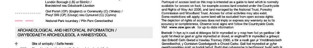
6 Chapter 2 Content 1: Scale Colour Raster includes the following features. Settlements Buildings are generalised and shown with stipple infill and cartographically-placed text to indicate settlement name and extent. Man-made structures Structures are indicated by line, building or symbol and supplemented with text description for all distinctive named features. Transport Transport features depicted include tracks, paths, roads, railway lines (single and multiple track), railway stations, airports and airstrips, cycle routes, ferries and ferry ports, coach and major bus stations. Water features Water features are shown in blue with associated descriptive text. A distinction is made between natural (cyan) and man-made (black) water features, with the exception of canals (cyan). Natural landscape features Different types of natural features and vegetation are shown by symbol or colour tint, including woods, rock, scree, boulders, sand, shingle, mud and slope. Rights of way and access land The following routes are depicted on this product: Rights of way Footpaths, including permissive Bridleways, including permissive Byways open to all traffic Re stricted byways Other routes with public access (ORPAs) National Trails and Long Distance Routes Re creational routes Rights of way are not shown in Scotland Acce ss land Portrayal of access land is intended as a guide to land that is normally available for access on foot, for example, access land created under the Countryside and Rights of Way Act 2000, and land managed by The National Trust, Forestry Commission, Woodland Trust, National Parks and local authorities. Height Ground survey heights and air survey heights are depicted. Surface heights are to the nearest metre above mean sea level. Heights shown close to a triangulation pillar refer to the ground level height at the pillar and not necessarily at the summit. 1: Scale Colour Raster user guide chapter 2 v2.4 11/2010 Crown copyright Page 6 of 33
7 Administrative boundaries National, county, district, unitary boundaries, civil parish and constituency boundaries are all depicted. Tourist information Selected tourist and leisure information is normally restricted to features providing public access or services. Tourist information is shown by a cyan symbol using, where possible, nationally-recognised symbols. Where appropriate, symbols also have black distinctive names, for example, all country parks, major gardens and so on. A full list of the tourist features in 1: Scale Colour Raster is at annexe B. Heritage and archaeological sites Depiction includes information supplied by English Heritage, the Royal Commission on the Ancient and Historical Monuments of Scotland, and the Royal Commission on the Ancient and Historical Monuments of Wales. Coastline and coastal features Low and high water, man-made and natural landscape features are all depicted. National Grid lines National Grid lines shown at 1-km intervals. Annotation Descriptive and distinctive names are depicted as text. 1: Scale Colour Raster user guide chapter 2 v2.4 11/2010 Crown copyright Page 7 of 33
8 Chapter 3 Scale 1: Scale Colour Raster is derived from the source data used to create its graphic counterpart, the OS Explorer Map series. Generalisation is used to emphasise, simplify, select and sometimes omit features to produce a cartographic representation of the landscape at a scale of 1: The nominal scale of the product is 1:25 000, but recommended minimum-to-maximum scale range is 1:8 000 to 1: scale. Coordinates 1: Scale Colour Raster is available in National Grid coordinates, which are expressed in metres relative to an origin set to a point west of the Isles of Scilly. These coordinates can easily be spatially related to other surveys, drawings, datasets or Ordnance Survey products. Customers can visit the British National Grid pages of Ordnance Survey s website for more information. Coverage 1: Scale Colour Raster is supplied in standard 10 km by 10 km tiles aligned to the National Grid. 1: Scale Colour Raster user guide chapter 3 v2.4 11/2010 Crown copyright Page 8 of 33
9 Chapter 4 Formats 1: Scale Colour Raster comes in Tagged Image File Format (TIFF uncompressed and compressed), LZW and packbit compressed formats. LZW (Lempel-Ziv-Welch) is a lossless compression (see chapter 5). TIFF PackBits is a lossless compression scheme that is supported by virtually all applications that can import TIFF graphics. TIFF TIFF is a file-based format for storing and interchanging raster images, with the most recent version 6.0 published in There are two types of architecture for a TIFF. Many mainframe computers use what is known as a big-endian (Motorola ) architecture. Most modern computers, including personal computers (PCs), use the little-endian (Intel ) system. 1: Scale Colour Raster TIFFs are supplied with Intel architecture. Converting between these two systems is possible but, as a general rule, modern software should be expected to handle both of these outputs without operator intervention. The 1: Scale Colour Raster conforms to the TIFF 6.0 standard. Customers are recommended to contact their system suppliers to ensure that it can read the Intel/little-endian TIFF architecture. 1: Scale Colour Raster user guide chapter 4 v2.4 11/2010 Crown copyright Page 9 of 33
10 Chapter 5 Data compression The data volumes for each file format are influenced by the level of data compression. Image compression When an image is compressed, duplicated data that has no value is removed or saved in a shorter form, reducing a file s size. For example, if large areas of water are the same tone, only the value for one pixel needs to be saved, together with the locations of the other pixels with the same colour. When the image is edited or displayed, the compression process is reversed. When raster data is compressed, not only are the data volumes reduced, but the user can download, display, edit and transfer images more quickly. There are two forms of compression: lossless and lossy. Lossless compression As its name suggests, lossless compression does not lose information within an image. Lossless compression retains the original quality of an image when it is uncompressed. This process does not provide much compression, so file sizes remain large. Lossless compression is used mainly where detail is important, such as when planning to make large prints. Lossy compression This process degrades images to some degree, meaning that the decompressed image is not quite the same as the original. The more an image is compressed, the more degraded it becomes. In many situations, such as posting images on the Internet or printing small- to medium-sized prints, the image degradation is not so obvious. If a lossy compressed image is over-enlarged, the degradation will become apparent, and therefore, 1: Scale Colour Raster is not supplied using this compression. TIFF TIFF is one of the most commonly used lossless image formats. TIFF is primarily designed for raster data interchange, and is supported by numerous image-processing applications. This permits much more efficient access to very large files that have been compressed. 1: Scale Colour Raster user guide chapter 5 v2.4 11/2010 Crown copyright Page 10 of 33
11 Chapter 6 Georeferencing To be able to view each tile in the correct geographic relation to the National Grid and to each other, the tiles must be georeferenced. Geographical information systems (GIS) typically provide georeferencing as part of their functionality, but for each set of tiles, it is necessary to provide the information on how the tiles should be ordered. Ordnance Survey provides this information in a set of georeferencing files, also known as world files. A complete set for 1: Scale Colour Raster is available to download free of charge from the 1: Scale Colour Raster product page on the Ordnance Survey website. There are several different types of world file. Prior to downloading one of the sets, customers are advised to check with their system suppliers to find out which type their system supports. The conventions behind the files creation can be found in chapter 4 of the technical specification. By using the conventions outlined there, this means that other datasets using the same conventions can be imported into the same GIS to add value to the raster map; for example, overlaying a routing or logistics network over the map or displaying a customer s demographic information. The georeferencing files should be saved in the same directory as the files of the map tiles themselves. 1: Scale Colour Raster user guide chapter 6 v2.4 11/2010 Crown copyright Page 11 of 33
12 Chapter 7 Revision 1: Scale Colour Raster is updated via a revision programme. The revision programme mirrors that of the OS Explorer Map series, and is determined by assessing the following factors: kno wn surveyed change; change intelligence gathered from a range of sources; and consideration is given to how long since an area was last revised. Priority is given to prestige sites categorised as significant items of change, such as major road construction projects. Significant items of survey change relevant to the scale are captured during the revision programme. Where a line feature ends by intersecting the tile edge, it is matched with its corresponding feature on the adjacent tile so that both features end on the same unique coordinate. The representation of detail across the tile edge will be of a cartographically-acceptable standard when plotted or displayed at scale. Changes are applied to the data and supplied to customers in May and November each year. For 1: Scale Colour Raster, only tiles that have changed since the previous supply are provided to help with customers data management. 1: Scale Colour Raster user guide chapter 7 v2.4 11/2010 Crown copyright Page 12 of 33
13 Chapter 8 Data measures Ordnance Survey measures the data in its products in one or more of the ways set out in table 1 below. Table 1 Definitions of data measures Data measure Definition Sub-measure Definition Completeness Logical consistency Positional accuracy Temporal accuracy Thematic accuracy (attribute accuracy) Presence and absence of features against the specified data content* Degree of adherence to logical rules of data structure, attribution and relationships Accuracy of the position of features Accuracy of temporal attributes and temporal relationships of features Classification of features and their attributes Omission Commission Conceptual consistency Domain consistency Format consistency Topological consistency Absolute accuracy Relative accuracy Geometric fidelity Temporal consistency Temporal validity (currency) Classification correctness Features representing objects that conform to the specified data content but are not present in the data Features representing objects that do not conform to the specified data content but are present in the data How closely the data follows the conceptual rules (or model) How closely the data values in the dataset match the range of values in the dataset specification The physical structure (syntax): how closely the data stored and delivered fits the database schema and agreed supply formats The explicit topological references between features (connectivity) according to specification How closely the coordinates of a point in the dataset agree with the coordinates of the same point on the ground (in the British National Grid reference system) Positional consistency of a data point or feature in relation to other local data points or features within the same or another reference dataset The trueness of features to the shapes and alignments of the objects they represent* How well ordered events are recorded in the dataset (life cycles) Validity of data with respect to time: the amount of real-world change that has been incorporated in the dataset that is scheduled for capture under current specifications How accurately the attributes within the dataset record the information about objects* *When testing the data according to the dataset specification against the real world or reference dataset. 1: Scale Colour Raster user guide chapter 8 v2.4 11/2010 Crown copyright Page 13 of 33
14 Annexe A Case study Transport Direct Underpinning multi-mode transport services Transport Direct is the first ever web portal giving instant access to comprehensive journey information by both public and private transport across Great Britain. It includes a journey planner, maps, live travel information and onward links to coach and rail fares and ticketing services from different travel retailers. As it develops, the portal will also incorporate services such as information on hotels, restaurants and other points of interest. Read more at: 1: Scale Colour Raster user guide annexe A v2.4 11/2010 Crown copyright Page 14 of 33
15 Annexe B Metadata ISO compliant UK GEMINI discovery level metadata is provided for the data and can be found on the GIgateway ( The following is a detailed description of the metadata elements that are provided on the GIgateway: Title: The title of the product. Abstract: The abstract gives a brief description of the product. Currency: The currency takes the form of date of last update for the feature. Lineage: The lineage metadata takes the form of product specification name and date of product specification. Spatial extent: The spatial extent is supplied in the form of geographic identifiers (for example, England, Scotland and Wales) and in the form of geographic coordinates. Spatial reference system: The spatial reference system for all products takes the form of a British National Grid system, namely OSGB36. Data format: Data format takes the form of the name of the format or formats the product is supplied in. Frequency of updates: Frequency of update takes the form of a stated period of time. Distributor contact details: Distributor contact details include with postal address, phone number, fax number, address and website. Data originator: Given as the company having primary responsibility for the intellectual content of the data source; in all cases this will be Ordnance Survey. Other metadata available includes keywords, start date of data capture, access constraints, use constraints, level of spatial data, supply media and presentation details. 1: Scale Colour Raster user guide annexe B v2.4 11/2010 Crown copyright Page 15 of 33
16 Annexe C Product and service performance report form Ordnance Survey welcomes feedback from its customers about 1: Scale Colour Raster. If you would like to share your thoughts with us, please print a copy of this form and when completed post or fax it to the address below. Your name:... Organisation: Address: Postcode:... Phone: Fax: Quotation or order reference:... Please record your comments or feedback in the space below. We will acknowledge receipt of your form within three (3) working days and provide you with a full reply or a status report within 21 working days. If you are posting this form, please send it to: 1: Scale Colour Raster Product Manager, Ordnance Survey, Adanac Drive, SOUTHAMPTON, SO16 0AS. If you wish to return it by fax, please dial +44 (0) Any personal information that you supply with this report form will be used by Ordnance Survey only in the improvement of its products and services. It will not be made available to third parties. 1: Scale Colour Raster user guide annexe C v2.4 11/2010 Crown copyright Page 16 of 33
17 1: Scale Colour Raster Technical specification Contents Section Page no Introduction...18 Purpose of this specification and disclaimer...18 Copyright in this specification...18 Chapter 1 Specification : Scale Colour Raster...19 Chapter 2 Legend...20 Welsh...22 Unique symbols used on 1: scale mapping...24 Common abbreviations...25 Chapter 3 Georeferencing...26 Chapter 4 Image file directory (TIFF)...27 TIFF...28 Colour image directory (TIFF)...28 Annexe A Glossary...29 v2.4 11/2010 1: Scale Colour Raster technical specification contents v2.4 11/2010 Crown copyright Page 17 of 33
18 Introduction Purpose of this specification and disclaimer This is the technical specification (hereafter referred to as the specification) applicable to the 1: Scale Colour Raster (hereafter referred to as the product) which is referred to in the Framework Direct Licence, Specific Use Framework Partner Licence or your other customer contract for the product. We may change the information in this specification at any time, giving you the notice period specified in the customer contract made between you and Ordnance Survey. We do not accept responsibility for the content of any third party websites referenced or accessed in or through this specification, any other contractual documentation, and/or the Ordnance Survey website. Copyright in this specification This specification, (including for the avoidance of doubt any mapping images reproduced herein) is Crown copyright All rights reserved. Any part of this specification may be copied for use internally in your organisation or business so that you can use 1: Scale Colour Raster for the purpose for which it is licensed to your organisation or business (but not otherwise). No part of this specification may be reproduced or transmitted in any form or by any means (including electronically) for commercial exploitation without the prior written consent of Ordnance Survey. No part of this specification may be copied or incorporated in products, services or publications that you generate for onward sale, or as free promotional or support materials, without the prior written consent of Ordnance Survey. 1: Scale Colour Raster technical specification introduction v2.4 11/2010 Crown copyright Page 18 of 33
19 Chapter 1 Specification The following chapters include information about 1: Scale Colour Raster, file compression, symbology, georeferencing and formats. 1: Scale Colour Raster Specification Number of tiles in Great Britain Tile size Availability Nation Resolution Data structure Transfer format Storage volumes per tile Update frequency 1: Scale Colour Raster (edgematched) England Scotland Wale s km by 10 km al coverage 254 dots per inch Raster TIFF PackBits compressed. TIFF palette 8-bit (256 colours) with LZW* compression Mb compressed Half-yearly update in May and November (see chapter 7 in the user guide) * If LZW compressed formats are used then registration may be required. Information is available on the Unisys website at unisys/lzw/. 1: Scale Colour Raster technical specification chapter 1 v2.4 11/2010 Crown copyright Page 19 of 33


20 Chapter 2 English Legend 1: Scale Colour Raster technical specification chapter 2 v2.4 11/2010 Crown copyright Page 20 of 33


21 1: Scale Colour Raster technical specification chapter 2 v2.4 11/2010 Crown copyright Page 21 of 33


22 Welsh 1: Scale Colour Raster technical specification chapter 2 v2.4 11/2010 Crown copyright Page 22 of 33


23 1: Scale Colour Raster technical specification chapter 2 v2.4 11/2010 Crown copyright Page 23 of 33
24 Unique symbols used on 1: scale mapping 1: Scale Colour Raster technical specification chapter 2 v2.4 11/2010 Crown copyright Page 24 of 33
25 Common abbreviations Term Description Term Description Allot Gdns Allotment gardens Met Sta Meteorological station Amb Sta Ambulance station MHW Mean high water B Rock Boundary rock MHWS Mean high water springs Bdy Boundary Mkt Market BP Boundary post or plate MLW Mean low water Br Bridge MLWS Mean low water springs BS Boundary stone Mon Monument Burial Gd Burial ground MP Milepost Car Pk Car park MS Milestone Cath Cathedral Multi Car Multi-storey car park Cemy Cemetery Munl Municipal CG Cattle grid Mus Museum CG Sta Coastguard station N North CH Clubhouse NTL Normal tidal limit Chy Chimney Obsy Observatory Coll College P Post (on 1:25 000) Comm Cen Community centre P Post Office (on 1:50 000) Conv Home Convalescent home PC Public convenience Cott Cottage PH Public house Crem Crematorium PL Pipeline Cvt Convent PO Post Office Dis Disused Pol Sta Police station Dismtd Rly Dismantled railway Pp Pump ELDR European Long Distance Route Pp Ho Pump house El Gen Sta Electricity generating station Ppg Sta Pumping station El Sub Sta Electricity substation Presby Presbytery Ex Exchange R River Fall Waterfall Rec Rectory FB Footbridge Recn Gd Recreation ground Ferry P Ferry, passenger Rems of Remains of Ferry V Ferry, vehicular Resr Reservoir Fm Farm Rly Railway F Sta Fire station S South Gdns Gardens S Stone Govt Government (offices) Sanatm Sanatorium Ho House Sch School Hospl Hospital Sl Sluice HPO Head Post Office Spr Spring HQ Headquarters Sprs Springs H Ram Hydraulic ram St Saint Ind Est Industrial estate Sta Station Infmy Infirmary TA Territorial Army IRB Sta Inshore rescue boat station Tech Coll Technical college Inst Institute Tel Ex Telephone exchange Instn Institution TH Town hall Isoln Hospl Isolation hospital Tk Track Km Kilometres Toll Toll bridge or gate L Loch TV Sta Television station L Twr Lighting tower Twr Tower LB London borough Univ University LB Ho Lifeboat house Vic Vicarage LB Sta Lifeboat station W Well LC Level crossing War Meml War memorial Liby Library Wks Works Look Sta Lookout station Wr Twr Water tower LRTS Light rapid transit system Wr Wks Water works M Metres WT Sta Wireless transmitting station Meml Memorial 1: Scale Colour Raster technical specification chapter 2 v2.4 11/2010 Crown copyright Page 25 of 33
26 Chapter 3 Georeferencing A definition for registering raster images within a geographic framework is the process of assigning map coordinates to the raster image data and resampling the pixels of the image to conform to the map projection grid. This allows tiles of map data to be located in their correct geographic position relative to the map projection and also to themselves. Great Britain is surveyed and mapped using the Transverse Mercator (or Gauss-Kruger) projection, so all raster tiles will be mapped to this projection as it applies to Ordnance Survey National Grid if using world or TAB files supplied by Ordnance Survey. Within the MIF record header, the following information will be found under COORDSYS: CoordSys Earth Projection 8, 79, "m", -2, 49, , , Bounds( e-011, e-011) (700000, ) This information relates to the Transverse Mercator projection, its position relative to the rest of the world and also an individual tile s position relative to the projection. The record header is constructed as (not all fields have to be used): CoordSys Earth Projection 8 The 8 relates to a MapInfo identifier, in this case the Transverse Mercator projection. 79 A MapInfo identifier, in this case, this relates to Ordnance Survey of Great Britain 1936, Airy ellipsoid. m Relates to the unit of measurement, in this case, metres. -2 This is the origin of the projection in respect of longitude. 49 This is the origin of the projection in respect of latitude Indicates the distortion of the tile at the central meridian. A value of 1.0 would indicate no distortion at all. However, distortion within this projection is minimal, even at the far western or eastern limits , These figures indicate the false origin of the British National Grid. They represent the south-west corner of the Transverse Mercator projection which overlays Great Britain, so all coordinates for any tile, no matter what scale, will always be positive. Bounds: ( e- 011, e-011) These values represent the minimum bounding X and Y coordinates for the tile. (700000, ) These values represent the maximum bounding X and Y coordinates for the tile. 1: Scale Colour Raster technical specification chapter 3 v2.4 11/2010 Crown copyright Page 26 of 33
27 Chapter 4 Image file directory (TIFF) The image file directory for TIFF will contain a selection of the following entries: Tag 254 (NewSubfileType) An indication of the kind of data contained in this sub-file, for example, value = 0 Tag 256 (ImageWidth) The number of columns in the image, the number of pixels per row, for example, value = 4000 Tag 257 (ImageLength) The number of rows of pixels in the image, for example, value = 4000 Tag 258 (BitsPerSample) Number of bits per component, for example, value = 8 Tag 259 (Compression) Compression scheme used on the image data, for example, value = 5 (LZW) Tag 262 (Photo.Interpretation) The colour space of the image data, for example, value = 3 (RGB Palette). Tag 270 (ImageDescription) A string that describes the subject of the image, for example, value = 1: SU41 Tag 273 (StripOffsets) For each strip, the byte offset of that strip, for example, 1st 4 values = Tag 278 (RowsPerStrip) The number of rows in each strip, for example, value = 8 Tag 279 (StripByteCounts) For each strip, the number of bytes in that strip after compression, for example, 1st 4 values = Tag 282 (XResolution) The number of pixels per Resolution Unit in the Image Width, for example, value = 100/1 Tag 283 (YResolution) The number of pixels per Resolution Unit in the Image Length, for example, value = 100/1 Tag 296 (ResolutionUnit) Units used for Resolution, for example, value = 3 (Centimetre) Tag 306 (DateTime) Date and time of image creation, for example, value = 2007:06:30 12:38:41 Tag 320 (ColourMap) Look-up table, for example, value = 1st 4 values = Tag (Copyright) Copyright notice, for example, value = ORDNANCE SURVEY CROWN COPYRIGHT 2007 NOTE: The values given above are relevant to 1: scale TIFF data with LZW compression. 1: Scale Colour Raster technical specification chapter 4 v2.4 11/2010 Crown copyright Page 27 of 33
28 TIFF Colour image directory (TIFF) Tag number TIFF 8-bit uncompressed TIFF 8-bit LZW compressed File Byte Order : MM (Little-endian) MM (Little-endian) Magic Number : Number of fields in IFD : NewSubfileType Image Width ImageLength BitsPerSample Compression (Uncompressed) 5 (LZW) Photo.Interpretation (RGB Palette) 3 (RGB Palette) ImageDescription 270 1: TILE SU41 1: TILE SU41 XResolution /1 100/1 YResolution /1 100/1 ResolutionUnit (Centimetre) 3 (Centimetre) DateTime :09:20 11:20: :09:20 11:20:04 ColorMap 320 1st 4 values = Copyright ORDNANCE SURVEY CROWN COPYRIGHT st 4 values = ORDNANCE SURVEY CROWN COPYRIGHT 2007 The tag values listed in the above table are relevant to 1: scale Intel TIFF raster data. It should be noted that customers can access tag information from a raster file image by right-clicking on a TIFF data image and looking at properties, and then left clicking on summary. 1: Scale Colour Raster technical specification chapter 4 v2.4 11/2010 Crown copyright Page 28 of 33
29 Annexe A Glossary The purpose of this chapter is to provide a glossary of terms used in the definition of products, services, licensing and other terms and conditions for 1: Scale Colour Raster. American Standard Code for Information Interchange (ASCII) A standard binary coding system used to represent characters within a computer. binary digit (bit) The smallest possible unit of data, resulting from a choice between 0 and 1. boundary A boundary forms the division between two similar real-world objects, for example, property boundary or administrative boundary, and is defined by one or more lines. byte A unit of computer storage of binary data, usually comprising 8 bits, equivalent to a character. character A distinctive mark; an inscribed letter; one of a set of writing symbols. character code The binary representation of a single element of a character set; for example, EBCDIC, ASCII. coordinate pair A coordinate pair is an easting and a northing. coordinate transformation A computational process of converting an image or map from one coordinate system to another. compact disc (CD) Read-only memory (CD-ROM). A data storage medium. A 12-cm disc similar to the audio CD. It is an alloy disc pitted with tiny holes and then coated in plastic. A laser head reads the pattern of the holes and translates them into binary data. copyright The sole legal right to print or publish a work. Crown Copyright subsists in all Ordnance Survey publications for a 50-year period, from the end of the year in which they were first published, by virtue of the Copyright Designs and Patents Act customer An organisation or individual that makes use of Ordnance Survey s data supply facilities. This includes both direct sales customers of Ordnance Survey as well as customers of Licensed Partners. It does not include anyone, or any organisation, that has access to Ordnance Survey material without charge. data A representation of facts, concepts or instructions in a formalised manner suitable for communication, interpretation or processing. database An organised, integrated collection of geographic data, which may or may not be spatial data. It is stored so that specific applications can access the data by different logical paths. A database is accessed and managed by a database management system (software for managing database information). data format A specification that defines the order in which data is stored or a description of the way data is held in a file or record. data quality Attributes of a dataset that define its suitability for a particular purpose, such as completeness, positional accuracy, currency and so on. 1: Scale Colour Raster technical specification annexe A v2.4 11/2010 Crown copyright Page 29 of 33
30 data structure The defined logical arrangement of data as used by a system for data management; a representation of a data model in computer form. data transfer medium This is the means by which computer files are transferred from one computer to another. Transfer media may be subdivided into communications media and physical media. dataset Data as supplied in a particular format to customers, whether internal or external to Ordnance Survey. density A measure of the number of units of data held on a stated length of storage surface. For example, some magnetic tapes may be recorded at a density of bits per inch (bpi). Often referred to as packing density. delivery mechanism The method of supply of data to a customer (such as offline and online). descriptive name A name describing a real-world object or feature (for example, School) as shown on the 1: Scale Colour Raster map. definitive name The name as shown on the 1: Scale Colour Raster map. digital Data that is expressed as numbers (digits) in computer-readable form. digital update The supply of revised digital data to a customer at a predetermined interval of time. direct sale A direct transaction between Ordnance Survey and a customer. distinctive name A text feature which forms a name that distinguishes it from other text features of the same type, for example, Millbrook School. dots per inch (dpi) The resolution, or fineness, of a raster image. Digital Versatile Disc (DVD) A data storage medium. eastings See rectangular coordinates. JPEG An image named after the Joint Photographic Experts Group, it uses a lossy compression format. It is designed for compressing full colour or greyscale images of natural, real-world scenes and works well on photographs. It is the de facto standard for photographs on the web. encoding The process of converting information to a computer-readable form, for example, digitising maps. feature A geographic entity such as a building or stream, either taken from a map or surveyed directly from the real world. Can be a point/symbol, text or line. 1: Scale Colour Raster technical specification annexe A v2.4 11/2010 Crown copyright Page 30 of 33
31 format The specified arrangement of data, for example, the layout of a printed document, the arrangement of the parts of a computer instruction, the arrangement of data in a record. generalisation The cartographic process of simplifying the depiction of features to fit the output scale. For example, road widening is necessary at smaller scales to enhance their visibility. geocode Assigning a geographic location to data, for example, adding coordinates to an address. geographic coordinates Coordinates, usually expressed as latitudes and longitudes, that define position on the Earth's surface. georef A definition for registering raster images within a geographic framework is the process of assigning map coordinates to the raster image data and resampling the pixels of the image to conform to the map projection grid. gigabyte (Gb) bytes, a measure of data storage capacity (see megabyte). kilobyte (Kb) bytes, a measure of data storage capacity. Licensed Partner Any organisation that has entered into a formal licence agreement with Ordnance Survey to market map information or to incorporate map data with their application or service. linear feature Map feature in the form of a line (for example, river, and boundary) that may or may not represent a real-world (existent) feature. local origin The local origin of rectangular coordinates is the south-west corner of the 1 km by 1 km National Grid square they identify. map scale The ratio between the extent of a feature on the map and its extent on the ground, normally expressed as a representative fraction, for example, 1:1250, 1: and so on. megabyte (Mb) bytes, a measure of data storage capacity (see gigabyte). MIF MapInfo format. National Grid The metric grid on the Transverse Mercator projection used by Ordnance Survey on all post-second World War mapping to provide an unambiguous spatial reference in Great Britain for any place or entity, whatever the map scale. northings See rectangular coordinates. origin The zero point in a system of rectangular coordinates. pixel In the 1: scale product a pixel is a single point represented by a square. 1: Scale Colour Raster technical specification annexe A v2.4 11/2010 Crown copyright Page 31 of 33
32 points A pair of coordinates. raster data Attribute data expressed as an array of pixels, with spatial position implicit in the ordering of the pixels. real-world object The real-world feature represented by a feature, for example, a building, a fence, a wood. rectangular coordinates Also known as x-y coordinates and as eastings and northings. These are two-dimensional coordinates that measure the position of any point relative to an arbitrary origin on a plane surface (for example, a map projection, a digitising table or a VDU screen). stipple Used to produce light or dark shading (for example, building/water fill); this is dependent on spacing of the dots the denser the dots, the darker the effect. string A set of items that can be arranged into a sequence according to a rule. supply format The file format in which the data is supplied to the customer. TAB MapInfo format. tag Tags are unique numbers that are used for identifying specific information in TIFF files, for example, image width, image length, bits per sample, photo interpretation and resolution. terminator Character, or character string, or field, or record used to signal the end of a record, or section, or volume or database. tile A unit of map used to divide large areas into regular and more manageable sizes. TIFF TIFF is a tagged image file format-based file format for storing and interchanging raster images with the most recent version 6.0 published in transfer format The format used to transfer data between computer systems. In general usage, this can refer not only to the organisation of data but also to the associated information, such as attribute codes, which are required in order to successfully complete the transfer. transfer medium The physical medium on which digital data is transferred from one computer system to another. For example, compact disc. UNIX An operating system that supports multitasking and is used by many workstations and minicomputers. update The process of adding to and revising existing digital map data to take account of change. volume A physical unit of the transfer medium that is a single disk, or a single DVD. 1: Scale Colour Raster technical specification annexe A v2.4 11/2010 Crown copyright Page 32 of 33
33 Annexe B Tourist features Abbey Adventure activity centre Amusement park Angling Aquarium Arboretum Art centre major centres only Art gallery major galleries only Artificial ski slope Bird garden Bird sanctuary not when in nature reserve Boat hire Boat trips Botanical gardens Brass-rubbing centre Butterfly farm Campsite Canal trips Canoeing centre including coastal features Caravan site Camp/Caravan site Castle Cathedral Cave, cavern Country park Craft centre Cycle hire Cycle trails Deer sanctuary Deer park Distillery Donkey sanctuary major sanctuaries only Dry ski slope Electric boat charging point shown on The Broads sheets only Emergency telephone Falconry centre Forestry Commission visitor centre Fort Garden Golf course/links Hawk conservancy centre Hawk reserve Hawk sanctuary Heritage centre Hill fort Hill figure shown if accessible to the public Historic house Horse riding Inn (rural only) Karting Leisure centre Leisure pool Model village 24-hour moorings shown on The Broads sheet only Motoring organisation telephone Museum national heritage National Park information centre National Trust property (England and Wales) Nature reserve Observatory Oceanarium Open farm Ornamental drive Owl sanctuary Park and ride all year/seasonal Parking (rural only) Picnic site Pinetum Pleasure flights Pleasure park Planetarium Pony trekking Pottery Preserved railway Public convenience (rural only) Public hard Public house Public slipway Public telephone Rare breeds centre Recreation centre Reindeer park Reptiliary River cruises Roman site shown on Hadrian s Wall sheets only Safari park Sailing centre Seal sanctuary Shire horse centre Skiing Ski centre Ski slope described only when artificial Sports centre Swannery Tennis centre Theme park Tide mill Tourist information centre all year/seasonal; includes tourist board, trail Viewpoint Vineyard Visitor centre Walks Waterfall Watermill Waterskiing centre including coastal features Water sports/activities inland water areas only Wildfowl centre Wildfowl reserve Wildlife centre Wildlife park Windmill Windsurfing centre including coastal features Working farm Zoo 1: Scale Colour Raster technical specification annexe B v2.4 11/2010 Crown copyright Page 33 of 33
1: Scale Colour Raster User guide
 1:250 000 Scale Colour Raster User guide Contents Section Page no Preface...3 Contact details...3 Use of the product...3 Purpose and disclaimer...3 Copyright in this guide...4 Data copyright and other
Land-Line Technical information leaflet
 Land-Line Technical information leaflet The product Land-Line is comprehensive and accurate large-scale digital mapping available for Great Britain. It comprises nearly 229 000 separate map tiles of data
1: Scale Colour Raster and 1: Scale Gazetteer User guide
 1:50 000 Scale Colour Raster and 1:50 000 Scale Gazetteer User guide Contents Section Page no Preface...3 Contact details...3 Use of the product...3 Purpose and disclaimer...3 Copyright in this guide...4
Product description: GSD-Property Map, layered raster List of contents
 L A N T M Ä T E R I E T 1 (9) D ate: D ocument version: 2011-04-08-1.4 Product description: GSD-Property Map, layered raster List of contents 1 General description... 3 1.1 Contents... 3 1.1.1 Administrative
Map reading made easy
 Map reading made easy 1. What is a map? A map is simply a drawing or picture (in 2-D) of a landscape or area of a country (in 3-D). It could be anything from a sketch map for a visitor to find your school
Map reading made easy
 Map reading made easy Maps can be great fun and they can lead you to all sorts of discoveries. They can help you get to know an area really well, because they pinpoint interesting places that are often
PostPoint Professional
 PostPoint Professional 2014.02 PRODUCT GUIDE Information in this document is subject to change without notice and does not represent a commitment on the part of the vendor or its representatives. part
UK Academic Geospatial Metadata Application Profile (Version 1.0)
") UK Academic Geospatial Metadata Application Profile (Version 1.0) The Go-Geo! UK Academic Geospatial Metadata Application Profile (UK AGMAP), (Appendix A) is a template designed to support the documentation
UK Academic Geospatial Metadata Application Profile (Version 1.0) The Go-Geo! UK Academic Geospatial Metadata Application Profile (UK AGMAP), (Appendix A) is a template designed to support the documentation
ISO INTERNATIONAL STANDARD. Geographic information Metadata Part 2: Extensions for imagery and gridded data
 INTERNATIONAL STANDARD ISO 19115-2 First edition 2009-02-15 Geographic information Metadata Part 2: Extensions for imagery and gridded data Information géographique Métadonnées Partie 2: Extensions pour
Flood Map. National Dataset User Guide
 Flood Map National Dataset User Guide Version 1.1.5 20 th April 2006 Copyright Environment Agency 1 Contents 1.0 Record of amendment... 3 2.0 Introduction... 4 2.1 Description of the Flood Map datasets...4
 Boone County GIS has the right to inquire about and investigate the use of any requested products and deny access to anyone based on concerns relating to privacy, security, public health, public safety,
Explore. history landscapes family.
 Explore history landscapes family www.explorethepast.co.uk Contents From the team Section 1 Researching Worcestershire Section 2 Local Studies & Archaeology Reference Library Section 3 Maps and plans Accessing
Map Name(s) and Date(s) Historical Map - Slice A
 and Date(s) Historical Map - Slice A") Ordnance Survey Plan Published 1975 The historical maps shown were reproduced from maps predominantly held at the scale adopted for England, Wales and Scotland in the 1840`s. In 1854 the 1:2,500 scale
Ordnance Survey Plan Published 1975 The historical maps shown were reproduced from maps predominantly held at the scale adopted for England, Wales and Scotland in the 1840`s. In 1854 the 1:2,500 scale
Russian Military Mapping Legends
 Russian Military Mapping Legends 1:5,000 and 1:10,000 mapping 1:25,000 mapping Key to Numbers on Mapping Historical Mapping & Photography included: NZ52_Middlesbrough No. Description 52 Factories (Chemicals)
Map Name(s) and Date(s) Russian Map - Slice A. Order Details. Site Details Wilton Site, Middlesbrough, Cleveland, TS8 9JA
 and Date(s) Russian Map - Slice A. Order Details. Site Details Wilton Site, Middlesbrough, Cleveland, TS8 9JA") Middlesbrough Published 1991 Source map scale - 1:25,000 These maps were produced by the Russian military during the Cold War between 1950 and 1997, and cover 103 towns and cities throughout the U.K. The
Middlesbrough Published 1991 Source map scale - 1:25,000 These maps were produced by the Russian military during the Cold War between 1950 and 1997, and cover 103 towns and cities throughout the U.K. The
Source Protection Zones. National Dataset User Guide
 Source Protection Zones National Dataset User Guide Version 1.1.4 20 th Jan 2006 1 Contents 1.0 Record of amendment...3 2.0 Introduction...4 2.1 Description of the SPZ dataset...4 2.1.1 Definition of the
OS MASTERMAP SITES LAYER. User Guide
 OS MASTERMAP SITES LAYER User Guide OS MasterMap Sites Layer User guide Contents Section Page no Preface.. 3 Contact details... 3 Use of the product... 3 Purpose and disclaimer... 3 Copyright in this guide...
This Unit is suitable for candidates with no previous archaeological experience but who have an interest in history and/or archaeology.
 National Unit specification: general information Unit code: H29B 12 Superclass: DC Publication date: August 2012 Source: Scottish Qualifications Authority Version: 01 Summary This Unit introduces candidates
Royal Mail Postcode Delivery Points With Postcode Sector Delivery Points Summary
 Royal Mail Postcode Delivery Points With Postcode Sector Delivery Points Summary 2014.08 PRODUCT GUIDE Information in this document is subject to change without notice and does not represent a commitment
Royal Mail Postcode Reference
 Royal Mail Postcode Reference With Postcode Sector Delivery Points Weighted Centroids 2014.01 PRODUCT GUIDE Information in this document is subject to change without notice and does not represent a commitment
Map reading made easy
 Map reading made easy 1. What is a map? A map is simply a drawing or picture (in 2-D) of a landscape or area of a country (in 3-D). It could be anything from a sketch map for a visitor to find your school
Digital Topographic Map 1 : DTK1000
 Digital Topographic Map 1 : 1 DTK Documentation as of: 14.8.217 Federal Agency for Cartography and Geodesy DTK page 1 Digital Topographic Map 1 : 1 DTK Contents DTK Page 1 Index of data sets 3 2 Description
METADATA. Publication Date: Fiscal Year Cooperative Purchase Program Geospatial Data Presentation Form: Map Publication Information:
 METADATA CONTOURS Digital Geospatial Metadata: North Central Texas Orthophotography Identification Information Citation Originator: Publication Date: Fiscal Year 2001-2002 Title: Cooperative Purchase Program
GEOPHYSICAL DATA SET (GDS) 1084B METADATA
 1084B METADATA") GEOPHYSICAL DATA SET (GDS) 1084B METADATA GENERAL INFORMATION Official Name of the Data Set or Information Holding: Ontario Airborne Geophysical Surveys, Magnetic Gradiometer and Gamma-Ray Spectrometric
GEOPHYSICAL DATA SET (GDS) 1084B METADATA GENERAL INFORMATION Official Name of the Data Set or Information Holding: Ontario Airborne Geophysical Surveys, Magnetic Gradiometer and Gamma-Ray Spectrometric
PostMap TM UK. Royal Mail Update 57 PRODUCT GUIDE
 PostMap TM UK Royal Mail Update 57 PRODUCT GUIDE Information in this document is subject to change without notice and does not represent a commitment on the part of the vendor or its representatives. No
Introduction to GIS. Dr. M.S. Ganesh Prasad
 Introduction to GIS Dr. M.S. Ganesh Prasad Department of Civil Engineering The National Institute of Engineering, MYSORE ganeshprasad.nie@gmail.com 9449153758 Geographic Information System (GIS) Information
Large-Scale National Grid Data. Source map scale - 1:1,250. Published Historical Map - Segment A13. Map Name(s) and Date(s)
 and Date(s)") Large-Scale National Grid Data Published 1993 Source map scale - 1:1,250 'Large Scale National Grid Data' superseded SIM cards (Ordnance Survey's 'Survey of Information on Microfilm') in 1992, and continued
Large-Scale National Grid Data Published 1993 Source map scale - 1:1,250 'Large Scale National Grid Data' superseded SIM cards (Ordnance Survey's 'Survey of Information on Microfilm') in 1992, and continued
AS/NZS ISO :2015
 Australian/New Zealand Standard Geographic information Reference model Part 1: Fundamentals Superseding AS/NZS ISO 19101:2003 AS/NZS ISO 19101.1:2015 (ISO 19101-1:2014, IDT) AS/NZS ISO 19101.1:2015 This
Version 1.1 GIS Syllabus
 GEOGRAPHIC INFORMATION SYSTEMS CERTIFICATION Version 1.1 GIS Syllabus Endorsed 1 Version 1 January 2007 GIS Certification Programme 1. Target The GIS certification is aimed at: Those who wish to demonstrate
NAME: DATE: Leaving Certificate GEOGRAPHY: Maps and aerial photographs. Maps and Aerial Photographs
 NAME: DATE: Leaving Certificate Geography Maps and Aerial Photographs Please see Teachers Notes for explanations, additional activities, and tips and suggestions. Learning Support Vocabulary, key terms
PC ARC/INFO and Data Automation Kit GIS Tools for Your PC
 ESRI PC ARC/INFO and Data Automation Kit GIS Tools for Your PC PC ARC/INFO High-quality digitizing and data entry Powerful topology building Cartographic design and query Spatial database query and analysis
2011 Built-up Areas - Methodology and Guidance
 2011 Built-up Areas - Methodology and Guidance June 2013 Version: 2013 v1 Office for National Statistics 2013 Contents 1. Introduction... 3 2. Methodology... 3 2.1 Identifying built-up areas for the 2011
User Guide: RADON POTENTIAL DATASET - England and Wales
 User Guide: RADON POTENTIAL DATASET - England and Wales This document provides information for users of the joint HPA-BGS RADON POTENTIAL DATASET for England and Wales. 1. Background to joint Health Protection
2015 Nigerian National Settlement Dataset (including Population Estimates)
") 2015 Nigerian National Settlement Dataset (including Population Estimates) Data Users Report and Meta Data (version 2.0) A Commercial Spatial Data Product Developed by GeoTerraImage (Pty) Ltd, South Africa
2015 Nigerian National Settlement Dataset (including Population Estimates) Data Users Report and Meta Data (version 2.0) A Commercial Spatial Data Product Developed by GeoTerraImage (Pty) Ltd, South Africa
INTRODUCTION TO GEOGRAPHIC INFORMATION SYSTEM By Reshma H. Patil
 INTRODUCTION TO GEOGRAPHIC INFORMATION SYSTEM By Reshma H. Patil ABSTRACT:- The geographical information system (GIS) is Computer system for capturing, storing, querying analyzing, and displaying geospatial
SPOT DEM Product Description
 SPOT DEM Product Description Version 1.1 - May 1 st, 2004 This edition supersedes previous versions Acronyms DIMAP DTED DXF HRS JPEG, JPG DEM SRTM SVG Tiff - GeoTiff XML Digital Image MAP encapsulation
UNCLASSIFIED. Risk of Flooding from Reservoirs - Western Wales River Basin District
 UNCLASSIFIED Flood Risk Maps Risk of Flooding from Reservoirs - Western Wales Why have we produced these maps what can they be used for? Under the Flood Risk Regulations Natural Resources Wales have worked
MAPWORK PRACTICE EXERCISES 13+ ABERDEEN
 Independent Schools Examinations Board MAPWORK PRACTICE EXERCISES 13+ ABERDEEN Belinda Froud-Yannic Independent Schools Examinations Board www.galorepark.co.uk Published by ISEB Publications, an imprint
CatchmentsUK. User Guide. Wallingford HydroSolutions Ltd. Defining catchments in the UK
 Defining catchments in the UK Wallingford HydroSolutions Ltd Cover photographs (clockwise from top left): istockphoto.com/hazel Proudlove istockphoto.com/antony Spencer istockphoto.com/ann Taylor-Hughes
CENSUS MAPPING WITH GIS IN NAMIBIA. BY Mrs. Ottilie Mwazi Central Bureau of Statistics Tel: October 2007
 CENSUS MAPPING WITH GIS IN NAMIBIA BY Mrs. Ottilie Mwazi Central Bureau of Statistics E-mail: omwazi@npc.gov.na Tel: + 264 61 283 4060 October 2007 Content of Presentation HISTORICAL BACKGROUND OF CENSUS
MRD283-REV METADATA. Acronyms are Used to Identify the Data Set or Information Holding: MRD283-REV
 MRD283-REV METADATA GENERAL INFORMATION Official Name of the Data Set or Information Holding: Ambient Groundwater Geochemistry Data for Southern Ontario, 2007 2014 Acronyms are Used to Identify the Data
presents challenges related to utility infrastructure planning. Many of these challenges
 1 Introduction: - a. Purpose According to U.S. Census Bureau the population of stark county was 367,585 in 1990, and in 2000 it was increase to 378,098. Thus County is experiencing a growth that presents
Map reading made easy
 Map reading made easy 1 1. What is a map? A map is simply a drawing or picture (in 2-D) of a landscape or area of a country (in 3-D). It could be anything from a sketch map for a visitor to find your school
Part 1: Fundamentals
 Provläsningsexemplar / Preview INTERNATIONAL STANDARD ISO 19101-1 First edition 2014-11-15 Geographic information Reference model Part 1: Fundamentals Information géographique Modèle de référence Partie
ISO INTERNATIONAL STANDARD. Geographic information Spatial referencing by coordinates
 INTERNATIONAL STANDARD ISO 19111 Second edition 2007-07-01 Geographic information Spatial referencing by coordinates Information géographique Système de références spatiales par coordonnées Reference number
UNCLASSIFIED. Risk of Flooding from Rivers and Sea - Western Wales River Basin District
 UNCLASSIFIED Flood Risk Maps Risk of Flooding from Rivers and Sea - Western Wales Why have we produced these maps what can they be used for? Under the Flood Risk Regulations Natural Resources Wales have
1/28/16. EGM101 Skills Toolbox. Map types. Political Physical Topographic Climate Resource Road. Thematic maps (use one of the above as backdrop)
") EGM101 Skills Toolbox Map types Political Physical Topographic Climate Resource Road Thematic maps (use one of the above as backdrop) Map Types Deriving information from maps Hydrographic Geological Soils
EGM101 Skills Toolbox Map types Political Physical Topographic Climate Resource Road Thematic maps (use one of the above as backdrop) Map Types Deriving information from maps Hydrographic Geological Soils
Large Scale Mapping Policy for the Province of Nova Scotia
 Large Scale Mapping Policy for the Province of Nova Scotia December, 2005 Version 1.0 TABLE OF CONTENTS PAGE BACKGROUND...3 POLICY...5 Policy 1.0 Large Scale Mapping Program...5 Policy 2.0 Service Offering...5
ISO INTERNATIONAL STANDARD. Geographic information Metadata Part 2: Extensions for imagery and gridded data
 INTERNATIONAL STANDARD ISO 19115-2 First edition 2009-02-15 Geographic information Metadata Part 2: Extensions for imagery and gridded data Information géographique Métadonnées Partie 2: Extensions pour
Parish Boundaries Project. East Midlands NOTES ON THE PARISH BOUNDARIES PROJECT
 Parish Boundaries Project East Midlands NOTES ON THE PARISH BOUNDARIES PROJECT GENERAL COMMENTS 1. Parishes first came into existence during Anglo-Saxon times and were variable in area depending on changes
Report of the United Kingdom Division
 UNITED NATIONS GROUP OF EXPERTS WORKING PAPER ON GEOGRAPHICAL NAMES NO. 41/4 Twenty-ninth session Bangkok, Thailand, 25 29 April 2016 Item 4 of the Provisional Agenda Report of the Divisions Report of
DATA SOURCES AND INPUT IN GIS. By Prof. A. Balasubramanian Centre for Advanced Studies in Earth Science, University of Mysore, Mysore
 DATA SOURCES AND INPUT IN GIS By Prof. A. Balasubramanian Centre for Advanced Studies in Earth Science, University of Mysore, Mysore 1 1. GIS stands for 'Geographic Information System'. It is a computer-based
MAP READING MADE EASY
 ORDNANCE SURVEY MAP READING MADE EASY 1 What is a map? A map is simply a drawing or picture (in 2D) of a landscape or area of a country (in 3D). It could be anything from a sketch map for a visitor to
Population 24/7 Download: User Guide. Purpose
 Population 24/7 Download: User Guide Purpose The Population 24/7 Download application is designed to enable a user to navigate around a map of England and Wales; select an area of interest represented
What is GIS? Introduction to data. Introduction to data modeling
 What is GIS? Introduction to data Introduction to data modeling 2 A GIS is similar, layering mapped information in a computer to help us view our world as a system A Geographic Information System is a
Topographic Strategy National Topographic Office March 2015
 www.linz.govt.nz Topographic Strategy National Topographic Office March 2015 >> Foreword Topographic information is vital to understanding our country and its assets, and for supporting economic development.
GIS = Geographic Information Systems;
 What is GIS GIS = Geographic Information Systems; What Information are we talking about? Information about anything that has a place (e.g. locations of features, address of people) on Earth s surface,
Utilization and Provision of Geographical Name Information on the Basic Map of Japan*
 UNITED NATIONS WORKING PAPER GROUP OF EXPERTS NO. 1/9 ON GEOGRAPHICAL NAMES Twenty-eight session 28 April 2 May 2014 Item 9 of the Provisional Agenda Activities relating to the Working Group on Toponymic
USAGE OF OLD MAPS AND THEIR DISTRIBUTION WITHIN THE FRAME OF WEB MAP SERVICES
 USAGE OF OLD MAPS AND THEIR DISTRIBUTION WITHIN THE FRAME OF WEB MAP SERVICES Jiri Cajthaml, Jiri Krejci Czech Technical University in Prague, Faculty of Civil Engineering, Department of Mapping and Cartography,
A new type of RICEPOTS
 A new type of RICEPOTS Alan Parkinson Geography teaching resource College Crown Copyright and Database Right 2014. Ordnance Survey (Digimap Licence) This is one of a series of teaching resources for use
British Standard 7666:2006 (parts 0, 1 and 2) its impact & use within local government
 its impact & use within local government") British Standard 7666:2006 (parts 0, 1 and 2) its impact & use within local government geoplace.co.uk Background to British Standard (BS) 7666 BS7666:2006 is one of around 27,000 British Standards. BS7666:2006
British Standard 7666:2006 (parts 0, 1 and 2) its impact & use within local government geoplace.co.uk Background to British Standard (BS) 7666 BS7666:2006 is one of around 27,000 British Standards. BS7666:2006
MRD 228 METADATA. Official Name of the Data Set or Information Holding: Physiography of Southern Ontario
 MRD 228 METADATA GENERAL INFORMATION Official Name of the Data Set or Information Holding: Physiography of Southern Ontario Acronyms are Used to Identify the Data Set or Information Holding: MRD228 Describe
Map reading made easy
 Map reading made easy Maps can be great fun and they can lead you to all sorts of discoveries. They can help you get to know an area really well, because they pinpoint interesting places that are often
AGGREGATE RESOURCES OF ONTARIO (ARO) METADATA
 METADATA") AGGREGATE RESOURCES OF ONTARIO (ARO) METADATA GENERAL INFORMATION Official Name of the Data Set or Information Holding: Aggregate Resources of Ontario Acronyms are Used to Identify the Data Set or Information
AGGREGATE RESOURCES OF ONTARIO (ARO) METADATA GENERAL INFORMATION Official Name of the Data Set or Information Holding: Aggregate Resources of Ontario Acronyms are Used to Identify the Data Set or Information
Lecture 9: Reference Maps & Aerial Photography
 Lecture 9: Reference Maps & Aerial Photography I. Overview of Reference and Topographic Maps There are two basic types of maps? Reference Maps - General purpose maps & Thematic Maps - maps made for a specific
GEOVEKST A Norwegian Program for Cost Sharing in Production, Updating and Administration of Geographic Data
 GEOVEKST A Norwegian Program for Cost Sharing in Production, Updating and Administration of Dr. Anne Kirsten S. HØSTMARK, Norway Key words: Mapping in large scale, formal co-operation, cost sharing, standarised
ArcGIS Data Models: Raster Data Models. Jason Willison, Simon Woo, Qian Liu (Team Raster, ESRI Software Products)
") ArcGIS Data Models: Raster Data Models Jason Willison, Simon Woo, Qian Liu (Team Raster, ESRI Software Products) Overview of Session Raster Data Model Context Example Raster Data Models Important Raster
ArcGIS Data Models: Raster Data Models Jason Willison, Simon Woo, Qian Liu (Team Raster, ESRI Software Products) Overview of Session Raster Data Model Context Example Raster Data Models Important Raster
Navigating to Success: Finding Your Way Through the Challenges of Map Digitization
 Library Faculty Presentations Library Faculty/Staff Scholarship & Research 10-15-2011 Navigating to Success: Finding Your Way Through the Challenges of Map Digitization Cory K. Lampert University of Nevada,
HertfordshireCC GIS Standards (draft) Contents
 Contents") Standards for Geographic Information Systems Contents Requirements for the procurement of systems with mapping/gis functionality...2 Background...2 System Requirements...2 HCC Corporate Standard for Spatial
Standards for Geographic Information Systems Contents Requirements for the procurement of systems with mapping/gis functionality...2 Background...2 System Requirements...2 HCC Corporate Standard for Spatial
Frequently Asked Questions about MnDOT s Railroad Map Conversion Project
 Frequently Asked Questions about MnDOT s Railroad Map Conversion Project What were the main objectives of the project? What are the results and end products? What can these railroad maps be used for? Who
56H. This system allows definition of points on the Earth s surface to within 100 meters. Page 20. Navigation Systems Basics of Maps
 Grid References Many maps are provided with the standard grid overlaying them. This provides a simple and accurate method for finding features on the map. It is a network of intersecting parallel lines
AS/NZS ISO :2015
 (ISO 19115-1:2014, IDT) Australian/New Zealand Standard Geographic information Metadata Part 1: Fundamentals Superseding AS/NZS ISO 19115:2005 AS/NZS ISO 19115.1:2015 This joint Australian/New Zealand
Land adjacent to 103 Pound Lane, Sonning, Berkshire
 Land adjacent to 103 Pound Lane, Sonning, Berkshire An Archaeological Evaluation for Hicks Development Ltd by James McNicoll-Norbury Thames Valley Archaeological Services Ltd Site Code PLS 09/50 June 2009
BOUNDARY MAP USER GUIDE
 BOUNDARY MAP USER GUIDE Get Exploring. Boundaries. The Northern Ontario Boundary Map provides users with the ability to explore the many community, administrative and service provider boundaries in the
SECTION 1: Identification Information
 Page 1 of 5 Home Data Catalog Download Data Data Status Web Services About FAQ Contact Us SECTION 1: Identification Information Originator: University of Minnesota-Duluth Geology Department; MN Geological
Quality and Coverage of Data Sources
 Quality and Coverage of Data Sources Objectives Selecting an appropriate source for each item of information to be stored in the GIS database is very important for GIS Data Capture. Selection of quality
ISO/TR TECHNICAL REPORT. Geographic information Imagery and gridded data. Information géographique Imagerie et données quadrillées
 TECHNICAL REPORT ISO/TR 19121 First edition 2000-10-15 Geographic information Imagery and gridded data Information géographique Imagerie et données quadrillées Reference number ISO/TR 19121:2000(E) ISO
Specification & Content of Marine Reference Information
 Specification & Content of Marine Reference Information By Mike Osborne and James Rapaport SeaZone Solutions Limited CONTENTS 1. History of Marine Data 2. User Requirements 3. Geographic Content 4. SeaZone
Performing Map Cartography. using Esri Production Mapping
 AGENDA Performing Map Cartography Presentation Title using Esri Production Mapping Name of Speaker Company Name Kannan Jayaraman Agenda Introduction What s New in ArcGIS 10.1 ESRI Production Mapping Mapping
MRD 281. Official Name of the Data Set or Information Holding: Northeastern Ontario Rhyolite Database
 MRD 281 GENERAL INFORMATION Official Name of the Data Set or Information Holding: Northeastern Ontario Rhyolite Database Acronyms are Used to Identify the Data Set or Information Holding: MRD281 Describe
of places Key stage 1 Key stage 2 describe places
 Unit 25 Geography and numbers ABOUT THE UNIT This continuous unit aims to show how geographical enquiry can provide a meaningful context for the teaching and reinforcement of many aspects of the framework
MRD273-REV METADATA. Acronyms are Used to Identify the Data Set or Information Holding: MRD273-REV
 MRD273-REV METADATA GENERAL INFORMATION Official Name of the Data Set or Information Holding: Ontario Precambrian Bedrock Magnetic Susceptibility Geodatabase for 2001 to 2012 Acronyms are Used to Identify
A Case Study for Semantic Translation of the Water Framework Directive and a Topographic Database
 A Case Study for Semantic Translation of the Water Framework Directive and a Topographic Database Angela Schwering * + Glen Hart + + Ordnance Survey of Great Britain Southampton, U.K. * Institute for Geoinformatics,
Map Name(s) and Date(s) Historical Map - Slice A
 and Date(s) Historical Map - Slice A") VectorMap Local Published 2016 Source map scale - 1:10,000 VectorMap Local (Raster) is Ordnance Survey's highest detailed 'backdrop' mapping product. These maps are produced from OS's VectorMap Local,
VectorMap Local Published 2016 Source map scale - 1:10,000 VectorMap Local (Raster) is Ordnance Survey's highest detailed 'backdrop' mapping product. These maps are produced from OS's VectorMap Local,
EEOS 381 -Spatial Databases and GIS Applications
 EEOS 381 -Spatial Databases and GIS Applications Lecture 5 Geodatabases What is a Geodatabase? Geographic Database ESRI-coined term A standard RDBMS that stores and manages geographic data A modern object-relational
Oakland County Parks and Recreation GIS Implementation Plan
 Oakland County Parks and Recreation GIS Implementation Plan TABLE OF CONTENTS 1.0 Introduction... 3 1.1 What is GIS? 1.2 Purpose 1.3 Background 2.0 Software... 4 2.1 ArcGIS Desktop 2.2 ArcGIS Explorer
New York City Public Use Microdata Areas (PUMAs) for 2010 Census
 for 2010 Census") New York City Public Use Microdata Areas (PUMAs) for 2010 Census ESRI Shapefile Tags PUMA, Public Use Microdata Area, Census, New York, Manhattan, Queens, Brooklyn, Richmond, Bronx, Kings, Staten Island,
New York City Public Use Microdata Areas (PUMAs) for 2010 Census ESRI Shapefile Tags PUMA, Public Use Microdata Area, Census, New York, Manhattan, Queens, Brooklyn, Richmond, Bronx, Kings, Staten Island,
Wednesday 8 June 2016 Afternoon
 Oxford Cambridge and RSA H Wednesday 8 June 2016 Afternoon GCSE GEOGRAPHY A A732/02 Geographical Skills (Higher Tier) *4410185572* Candidates answer on the Question Paper. OCR supplied materials: An Insert
GIS (GEOGRAPHIC INFORMATION SYSTEMS)
") GIS (GEOGRAPHIC INFORMATION SYSTEMS) 1 1. DEFINITION SYSTEM Any organised assembly of resources and procedures united and regulated by interaction or interdependence to complete a set of specific functions.
GIS (GEOGRAPHIC INFORMATION SYSTEMS) 1 1. DEFINITION SYSTEM Any organised assembly of resources and procedures united and regulated by interaction or interdependence to complete a set of specific functions.
Lecture 6 - Raster Data Model & GIS File Organization
 Lecture 6 - Raster Data Model & GIS File Organization I. Overview of Raster Data Model Raster data models define objects in a fixed manner see Figure 1. Each grid cell has fixed size (resolution). The
Landmarks Paula Owens 5 7 years
 Landmarks Paula Owens Geography teaching resource 5 7 years This is one of a series of teaching resources for use with Digimap for Schools. For more details about this service, visit http://digimapforschools.edina.ac.uk
Your web browser (Safari 7) is out of date. For more security, comfort and. the best experience on this site: Update your browser Ignore
 is out of date. For more security, comfort and. the best experience on this site: Update your browser Ignore") Your web browser (Safari 7) is out of date. For more security, comfort and Activityengage the best experience on this site: Update your browser Ignore Introduction to GIS What is a geographic information
Your web browser (Safari 7) is out of date. For more security, comfort and Activityengage the best experience on this site: Update your browser Ignore Introduction to GIS What is a geographic information
Write a report (6-7 pages, double space) on some examples of Internet Applications. You can choose only ONE of the following application areas:
 on some examples of Internet Applications. You can choose only ONE of the following application areas:") UPR 6905 Internet GIS Homework 1 Yong Hong Guo September 9, 2008 Write a report (6-7 pages, double space) on some examples of Internet Applications. You can choose only ONE of the following application
UPR 6905 Internet GIS Homework 1 Yong Hong Guo September 9, 2008 Write a report (6-7 pages, double space) on some examples of Internet Applications. You can choose only ONE of the following application
4. GIS Implementation of the TxDOT Hydrology Extensions
 4. GIS Implementation of the TxDOT Hydrology Extensions A Geographic Information System (GIS) is a computer-assisted system for the capture, storage, retrieval, analysis and display of spatial data. It
Reference: 4880(DOP.ADA)1136 Subject: Survey on the integration of geographic information systems into postal address development
1136 Subject: Survey on the integration of geographic information systems into postal address development") International Bureau Weltpoststrasse 4 P.O. Box 312 3000 BERNE 15 SWITZERLAND To: Union member countries Regulators Designated operators T +41 31 350 31 11 F +41 31 350 31 10 www.upu.int For information
International Bureau Weltpoststrasse 4 P.O. Box 312 3000 BERNE 15 SWITZERLAND To: Union member countries Regulators Designated operators T +41 31 350 31 11 F +41 31 350 31 10 www.upu.int For information
Brian D. George. GIMS Specialist Ohio Coastal Atlas Project Coordinator and Cartographer. Impacts and Outcomes of Mature Coastal Web Atlases
 Ohio Coastal Atlas Project Brian D. George GIMS Specialist Ohio Coastal Atlas Project Coordinator and Cartographer Ohio Department of Natural Resources Office of Coastal Management Sandusky, OH Impacts
Mapping UK. David Martin, University of Southampton. Open Data Workshop, Nottingham, 21 June 2011
 Mapping UK population over time David Martin, University of Southampton Open Data Workshop, Nottingham, 21 June 2011 Presentation overview Small area spatial population distributions The time dimension
Haslemere Design Statement
 For Beacon Hill, Critchmere, Grayswood, Haslemere, Hindhead and Shottermill Ensuring new development takes account of local character Contents Overview 3 1. Introduction 4 2. What makes Haslemere Special
Popular Mechanics, 1954
 Introduction to GIS Popular Mechanics, 1954 1986 $2,599 1 MB of RAM 2017, $750, 128 GB memory, 2 GB of RAM Computing power has increased exponentially over the past 30 years, Allowing the existence of
Using OS Resources - A fieldwork activity for Key Stage 2
 Using OS Resources - A fieldwork activity for Key Stage 2 Liz Spincer, Saltford CE Primary School Outline of the fieldwork project: This series of activities was designed to illustrate how Primary School