Topographic Strategy National Topographic Office March 2015
|
|
|
- Gillian West
- 6 years ago
- Views:
Transcription


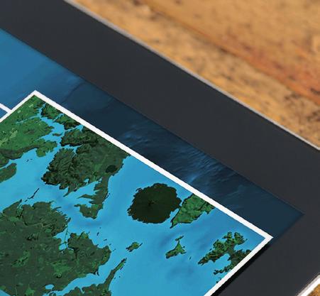


1 Topographic Strategy National Topographic Office March 2015
2 >> Foreword Topographic information is vital to understanding our country and its assets, and for supporting economic development. For over a century, LINZ and its predecessor organisations have been responsible for managing this information and making it available through topographic maps. These have been carried into the back country by generations of Kiwis, and have uses as diverse as defence, land management, and search and rescue. As LINZ looks forward, we are confident that topographic information will play an important part in our vision for growing the value generated by location information over the next decade. This vision recognises the way location information can help to unlock new patterns and knowledge, particularly when it is combined with other types of information. It has the power to drive better decision making, benefitting our economy, environment and communities. This strategy sets the direction the New Zealand Topographic Office will take to help make this possible. In developing it LINZ has consulted users and stakeholders. Through its goals we will continue to reflect the need for our maps, while ensuring that accurate data is at the core of our topographic products. We will work with our customers to ensure it meets their needs, and to gather data from a wider range of sources. We will also look at the potential for new digital products that mean this data can be adapted, enabling enterprise and innovation. Understanding our land and its features is essential to a range of industries and activities. These actions will increase New Zealanders access to LINZ s topographic information, making it more usable in ways that have even greater benefits for our customers unleashing the power of where to drive New Zealand s success. Jan Pierce Deputy Chief Executive Location Information Aaron Jordan Group Manager Topography and Addressing 2 Land Information New Zealand Topographic Strategy March 2015 National Topographic Office
3 >> Introduction This strategy sets the direction LINZ will take with its topographic information, as well as data such as elevation and imagery. It aims to increase the value this data has for New Zealanders, making it available in new forms and at standards that better meet the needs of users. In taking on this direction, LINZ has a strong base to build on. The Topo50 map series, launched in 2009, adopted the new national datum (New Zealand Geodetic Datum 2000), which had changed the way that coordinates (latitudes and longtitudes) of points in New Zealand were determined. The Topo50 maps were produced directly from digital data which provided the opportunity to supply them in a GeoTIFF format. In 2011 we launched the LINZ Data Service, which made topographic data available in a greater range of digital forms on the one website alongside other LINZ datasets. LINZ has also worked with local government and others to open up the availability of the aerial imagery captured by airborne cameras and sensors. As a result, New Zealand s most current publicly owned imagery, covering 95 percent of the country, is now freely available through the LINZ Data Service. Over the next five years we will build on these successes. We have reviewed our mapping programme and have talked to our customers and stakeholders. We have also consulted mapping agencies overseas. This review and consultation identified a number of areas where topographic information and its availability could be improved so that it can make an even greater contribution to our economy and way of life. Through the goals in this strategy we will continue to deliver topographic mapping for New Zealand with national coverage and consistent standards, supporting national security, emergency services responses, land management and planning, recreation and tourism. We will coordinate initiatives for imagery and elevation data acquisition and release. The strategy ensures topographic resources are spent in areas where they will provide the maximum value and benefit for New Zealand. It will also result in a more targeted approach to the maintenance of LINZ s topographic data and products that better meets the needs of both its enduring and emerging customers. In this way we will identify high priority topographic data and products that require maintenance more often than others, as well as topographic features that require a higher level of accuracy. Implementation of this strategy will also see a move to greater reuse of topographic data as we work with other organisations who produce or have uses for it. New topographic products and services specifically for digital use will be created. These goals ensure topographic information will not only continue to make an important contribution to New Zealand, but that this contribution will grow and play an important part in achieving the aims of LINZ s 10 Year Vision. >> Vision This strategy sets a vision of: Accurately mapping New Zealand for the future National Topographic Office Land Information New Zealand Topographic Strategy March
4 >> Five Year Goals This vision will be achieved through the following five-year goals: Actively engage with customers, stakeholders and the international topographic community. Ensure topographic data reflects real-world change at levels of spatial, temporal and attribution accuracy that maximise its value. Coordinate other sources of topographic data into open national datasets to maximise opportunities for its reuse. Coordinate the acquisition and release of imagery and elevation data into open national datasets to maximise opportunities for its reuse. Expand the production of topographic products and services to include those specifically for digital use. >> CLICK HERE TO SEE MORE P5 >> CLICK HERE TO SEE MORE P6 >> CLICK HERE TO SEE MORE P7 >> CLICK HERE TO SEE MORE P8 >> CLICK HERE TO SEE MORE P9 Land Information New Zealand Annual Report 2013> Land Information New Zealand Topographic Strategy March 2015 National Topographic Office
5 >> Goal 1 Actively engage with customers, stakeholders and the international topographic community. Technology is changing at ever increasing rates and so too are the expectations for location information. Mobile devices can already show location to within a few metres and, when combined with location information, they can help users make decisions such as where to go for dinner or which is the quickest route home. Topographic information is an important subset of location information and by showing the features of the land, it gives context to other information. As expectations for location information increase, so will the requirements for topographic data. LINZ will need to engage with customers and stakeholders to understand and respond to their changing requirements. Users provide valuable feedback on the currency and accuracy of topographic information. Engaging with those users will give LINZ a better understanding of the many uses of topographic information and help to improve its quality. There is also opportunity for LINZ to learn from other national mapping agencies that are facing (or have already faced) similar challenges and opportunities. These learnings can then be refined and shared with others who work with topographic information. The implementation of Strategic Goal 1 will ensure that evolving customer and stakeholder requirements and expectations are understood and that LINZ can meet them. >> CUSTOMERS AND STAKEHOLDERS a) Establish mechanisms for engaging with customers and stakeholders that: enable LINZ to understand and respond to customer and stakeholder requirements and expectations now and as they evolve encourage active participation and allow for two-way communication cater for a broadening range of customers and stakeholders >> INTERNATIONAL TOPOGRAPHIC COMMUNITY b) Engage with the international topographic community so that: LINZ can learn from the practices and processes used by other national mapping agencies LINZ remains informed on current and emerging technologies and techniques LINZ can pro-actively contribute to the international topographic community for the benefit of the community and New Zealand National Topographic Office Land Information New Zealand Topographic Strategy March

6 >> Goal 2 Ensure topographic data reflects real-world change at levels of spatial, temporal and attribution accuracy that maximise its value. The National Topographic Office s processes and techniques for data collection and maintenance have served the current products well. The Topo50 and Topo250 map series are still world class. Presently the data maintenance programme is driven by the Topo50 map series and, as a result, this is New Zealand s core topographic dataset. This dataset is a result of more than 40 years of map production, with the majority of the data having been digitised from an earlier map series. Features in this dataset were and are captured with a 1:50,000 publication scale as the goal. Demands for data and data reuse highlight the need for a new set of topographic data standards. It is expected that the data captured is fit for purpose at larger scales to maximise data reuse opportunities. In combination with Strategic Goals 1 and 3, Strategic Goal 2 aims to establish a new core topographic dataset for New Zealand. This will be used to produce multiple topographic datasets, products and services that meet the currency and accuracy requirements of both our enduring and emerging customers. >> CURRENCY & COMPLETENESS a) Develop and implement standards for keeping topographic data complete and up to date that: ensure real-world change is reflected in topographic data within defined timeframes reflect that some features will have a higher maintenance priority 1 than others preserve historic (updated or removed) features for the topographic record of New Zealand >> ACCURACY & CONSISTENCY b) Develop and implement standards for topographic data accuracy and consistency that: ensure the spatial, temporal and attribution accuracy of topographic data meets the needs of both enduring and emerging customers of topographic data, products and services reflect that some features have higher customer expectations than others (including three dimensional (3D) information) ensure metadata is available for all topographic features and datasets 1 While topographic information covers a wide range of features (rivers, roads, tracks, huts, fences, etc), not all features are equal. For example, features such as roads and tracks will have a higher priority for maintenance activities than fences. 6 Land Information New Zealand Topographic Strategy March 2015 National Topographic Office

, the Department of Conservation (track and hut data) and Transpower (transmission line data).")

.")

 inform LINZ topographic data collection activities (i.")
 to: include their datasets into the LINZ core topographic dataset ensure the supply")
 Produce, maintain and release national topographic datasets for: inclusion into official LINZ topographic")
7 >> Goal 3 Coordinate other sources of topographic data into open national datasets to maximise opportunities for its reuse. Many organisations collect and maintain topographic data that has the potential to be reused in LINZ s core topographic dataset. In addition to official names in the New Zealand Geographic Board s Gazetteer, data is currently being sourced from organisations such as Landcare Research (vegetation data), the Department of Conservation (track and hut data) and Transpower (transmission line data). However, there are other datasets (including privately maintained and crowd sourced datasets) that could be included in LINZ s core topographic dataset, such as datasets managed and maintained by territorial and local authorities. LINZ aims to aggregate these organisations topographic data into national datasets and make them available for reuse, as well as use them in our own topographic products and services (e.g. to assist in the maintenance of the Topo50 and Topo250 map series). Through Strategic Goal 3, LINZ will seek to establish positive and mutually beneficial agreements with all organisations that manage and maintain topographic datasets, ensuring that a capture once and use many times philosophy is applied to topographic data in New Zealand. >> IDENTIFY ORGANISATIONS AND DATASETS a) Identify and engage with organisations that manage and maintain topographic datasets of New Zealand that: are suitable for inclusion in LINZ official topographic data (i.e. make an improvement to the data) inform LINZ topographic data collection activities (i.e. a source of change information) b) Identify opportunities for the use of crowd sourced topographic data >> SECURE DATA SUPPLY c) Establish appropriate agreements with organisations identified in (a) to: include their datasets into the LINZ core topographic dataset ensure the supply of data is sustainable into the future ensure the data quality is maintained and/or improved to meet standards defined through Strategic Goal 2 >> PRODUCE NATIONAL DATASETS d) Produce, maintain and release national topographic datasets for: inclusion into official LINZ topographic products and services reuse by other people/organisations requiring topographic data National Topographic Office Land Information New Zealand Topographic Strategy March

8 >> Goal 4 Coordinate the acquisition and release of imagery and elevation data into open national datasets to maximise opportunities for reuse. As fundamental datasets, imagery and elevation are the sources from which nearly all topographic data is generated. They also provide the basis of many other location datasets, such as land use and land cover mapping, the management and monitoring of waterways, hazard risk assessments (e.g. flooding and tsunami inundation) and emissions trading. Such initiatives are typically undertaken at local or regional scales and are, more often than not, government funded. Historically, LINZ s predecessors were responsible for the acquisition and creation of national imagery and elevation data and products. More recently, this has been the domain of local government agencies, which have produced data and products at local and regional level, often under restricted licence. In early 2012, LINZ began an initiative to remove licensing restrictions on all current local and regional imagery datasets. In early 2013 it began coordinating the acquisition of aerial imagery to ensure it would be available under open licence and maximise efficiency across local and central government. Through Strategic Goal 4, LINZ will coordinate the acquisition and open release of both imagery and elevation data to ensure a capture once and use many times philosophy is applied to imagery and elevation data in New Zealand. >> IDENTIFY ORGANISATIONS AND DATASETS a) Identify and engage with all government organisations that procure imagery and elevation data and products, and ensure that: procurement is coordinated across both central and local government the data and products are released under open licences >> PRODUCE NATIONAL DATASETS b) Produce, maintain and release national imagery and elevation datasets for: inclusion into official LINZ topographic products and services reuse by other people/organisations requiring imagery and elevation data A capture once and use many times philosophy. 8 Land Information New Zealand Topographic Strategy March 2015 National Topographic Office

9 >> Goal 5 Expand the production of topographic products and services to include those specifically for digital use. There is demand 2 for digital topographic products and services from both our enduring and emerging customers. Under this goal, focus will be on expanding LINZ topographic products to include new products and services that can be easily used in geographic information systems, web and mobile applications. This is in addition to existing LINZ topographic products such as the Topo50 and Topo250 map series. The purpose of these is to provide a consistent spatial context on which to overlay spatial information. These base maps would be kept current with the latest topographic data and would be able to be used at varying scales unlike digital versions of fixed scale maps (e.g. Topo50 geo-tiffs or web map services (WMS)). In combination with Strategic Goal 1, the implementation of Strategic Goal 5 will ensure that appropriate topographic products and services meet customer content and delivery requirements. The first example of the expanded products will be a number of digital base maps 3 of New Zealand. >> PRODUCE OFFICIAL DIGITAL PRODUCTS AND SERVICES a) Produce and deliver official digital products and services that: can be easily used in GIS, web and mobile applications are updated automatically when official topographic datasets are maintained and released meet standards that comply with the requirements of customers and stakeholders 2. For example, use of topographic maps via web map services on LINZ Data Service has steadily increased since the services began in December The base maps will be multi-scale maps delivered, as a minimum, via Open Geospatial Consortium (OGC) web map tile service standard. National Topographic Office Land Information New Zealand Topographic Strategy March
10 >> Appendix >> CURRENT TOPOGRAPHIC PRODUCTS Topo50 Series 445 map sheets at 1:50,000 Topo250 Series 31 map sheets at 1:250,000 Offshore Islands 19 maps at 1:50,000/1:25,000 Antarctica Series 55 map sheets at 1:50,000 Pacific Islands 19 maps (Cook Island, Tokelau, Niue) Infomap 242 Series 4 map sheets at 1:500,000 Infomap 265 Series 2 map sheets at 1:1,000,000 Infomap map sheet at 1:2,000,000 Infomap map at 1:3,000,000 Infomap map at 1:4,000,000 >> CURRENT TOPOGRAPHIC DATA PRODUCTS 686 layers of topographic data on the LINZ Data Service layers of recent aerial imagery on the LINZ Data Service 10 Land Information New Zealand Topographic Strategy March 2015 National Topographic Office
11 This information can be found at: This work is licensed under the Creative Commons Attribution 3.0 New Zealand licence. In essence, you are free to copy, distribute, and adapt the work, as long as you attribute the work to the Crown and abide by the other licence terms. To view a copy of this licence, visit Please note that no departmental or governmental emblem, logo, or Coat of Arms may be used in any way that infringes any provision of the Flags, Emblems, and Names Protection Act Attribution to the Crown should be in written form and not by reproduction of any such emblem, logo, or Coat of Arms. Crown copyright National Topographic Office Land Information New Zealand Topographic Strategy March
12 WELLINGTON OFFICE Level 7, Radio New Zealand House 155 The Terrace PO Box 5501 Wellington 6145 Ph: or (New Zealand callfree only) Fax: E:mail: customersupport@linz.govt.nz
Large Scale Mapping Policy for the Province of Nova Scotia
 Large Scale Mapping Policy for the Province of Nova Scotia December, 2005 Version 1.0 TABLE OF CONTENTS PAGE BACKGROUND...3 POLICY...5 Policy 1.0 Large Scale Mapping Program...5 Policy 2.0 Service Offering...5
The future of SDIs. Ian Masser
 The future of SDIs Ian Masser Presentation Considers two questions relating to the future development of SDIs throughout the world Where have we got to now? Where should we go from here? Identifies four
REGIONAL SDI DEVELOPMENT
 REGIONAL SDI DEVELOPMENT Abbas Rajabifard 1 and Ian P. Williamson 2 1 Deputy Director and Senior Research Fellow Email: abbas.r@unimelb.edu.au 2 Director, Professor of Surveying and Land Information, Email:
Positioning the Pacific: NOAA s Geospatial Activities. Juliana Blackwell, Director NOAA s National Geodetic Survey March 6, 2012
 Positioning the Pacific: NOAA s Geospatial Activities Juliana Blackwell, Director NOAA s National Geodetic Survey March 6, 2012 A Common Problem of the Early 19 th Century 1807 President Thomas Jefferson
FIG Asia Pacific Capacity Development Network
 FIG Asia Pacific Capacity Development Network Report to the 41th General Assembly FIG Congress 2018, Istanbul - Turkey Rob Sarib Chair FIG Asia Pacific Capacity Development Network (AP CDN) Story of the
Country Report on SDI Activities in Singapore *
 UNITED NATIONS E/CONF.100/CRP.9 ECONOMIC AND SOCIAL COUNCIL Eighteenth United Nations Regional Cartographic Conference for Asia and the Pacific Bangkok, 26-29 October 2009 Item 7(a) of the provisional
QUESTIONNAIRE THE CURRENT STATUS OF MAPPING IN THE WORLD
 QUESTIONNAIRE ON THE CURRENT STATUS OF MAPPING IN THE WORLD The questionnaire is intended to take stock of the current status of mapping in the world. The information collected will eventually be used
US National Spatial Data Infrastructure A Spatial Framework for Governance and Policy Development to Enable a Location-Based Digital Ecosystem
 GeoPlatform Workshop 7 Dec 2016, Department of the Interior Washington, D.C. US National Spatial Infrastructure A Spatial Framework for Governance and Policy Development to Enable a Location-Based Digital
Country Report On Sdi Activities In Singapore ( )
") UNITED NATIONS E/CONF.102/IP.4 ECONOMIC AND SOCIAL COUNCIL Nineteenth United Nations Regional Cartographic Conference for Asia and the Pacific Bangkok, 29 October 1 November 2012 Item 6(b) of the provisional
UNITED NATIONS E/CONF.102/IP.4 ECONOMIC AND SOCIAL COUNCIL Nineteenth United Nations Regional Cartographic Conference for Asia and the Pacific Bangkok, 29 October 1 November 2012 Item 6(b) of the provisional
Spatial Data Availability Energizes Florida s Citizens
 NASCIO 2016 Recognition Awards Nomination Spatial Data Availability Energizes Florida s Citizens State of Florida Agency for State Technology & Department of Environmental Protection Category: ICT Innovations
The Swedish National Geodata Strategy and the Geodata Project
 The Swedish National Geodata Strategy and the Geodata Project Ewa Rannestig, Head of NSDI Co-ordination Unit, Lantmäteriet, ewa.rannstig@lm.se Ulf Sandgren, Project Manager Geodata Project, Lantmäteriet,
ICSM delivering benefits through collaboration
 ICSM delivering benefits through collaboration Russell Priebbenow Chair and Queensland Member Australia and New Zealand s Intergovernmental Committee on Surveying and Mapping Overview Who is ICSM & why
STEREO ANALYST FOR ERDAS IMAGINE Stereo Feature Collection for the GIS Professional
 STEREO ANALYST FOR ERDAS IMAGINE Stereo Feature Collection for the GIS Professional STEREO ANALYST FOR ERDAS IMAGINE Has Your GIS Gone Flat? Hexagon Geospatial takes three-dimensional geographic imaging
GEOGRAPHIC INFORMATION SYSTEMS Session 8
 GEOGRAPHIC INFORMATION SYSTEMS Session 8 Introduction Geography underpins all activities associated with a census Census geography is essential to plan and manage fieldwork as well as to report results
Tourism. April State Planning Policy state interest guideline. Department of Infrastructure, Local Government and Planning
 Department of Infrastructure, Local Government and Planning State Planning Policy state interest guideline Tourism April 2016 Great state. Great opportunity. Preface Using this state interest guideline
Better Topographic Map Production Using ArcGIS. A Comprehensive Solution for Mapping Organizations
 Better Topographic Map Production Using ArcGIS A Comprehensive Solution for Mapping Organizations The World Is Always Changing As a member of a national mapping organization, you know this is true. You
Adding value to Copernicus services with member states reference data
 www.eurogeographics.org Adding value to Copernicus services with member states reference data Neil Sutherland neil.sutherland@os.uk GIS in the EU 10 November 2016 Copyright 2016 EuroGeographics 61 member
Topographic Mapping in Australia: The Future State
 Topographic ping in Australia: The Future State Context Australia s geography and demography Greg Scott Group Leader National ping & Information Group Chair Permanent Committee for Topographic Information
2018/1 The integration of statistical and geospatial information. The Regional Committee of UN-GGIM: Americas:
 The following are the conclusions and recommendations of the Regional Committee of the United Nations on Global Geospatial Information Management for the Americas, during its Fifth Session, Thursday 8
Nomination Form. Clearinghouse. New York State Office for Technology. Address: State Capitol-ESP, PO Box
 NASIRE 2001 RECOGNITION AWARDS Recognizing Outstanding Achievement in the Field of Innovative Use of Technology Nomination Form Title of Nomination: Manager/Job Title: Agency: NYS Geographic Information
Working with ArcGIS Online
 Esri International User Conference San Diego, CA Technical Workshops July 12, 2011 Working with ArcGIS Online Bern Szukalski, Deane Kensok Topics for this Session ArcGIS Online Overview ArcGIS Online Content
Spanish national plan for land observation: new collaborative production system in Europe
 ADVANCE UNEDITED VERSION UNITED NATIONS E/CONF.103/5/Add.1 Economic and Social Affairs 9 July 2013 Tenth United Nations Regional Cartographic Conference for the Americas New York, 19-23, August 2013 Item
Flood Map. National Dataset User Guide
 Flood Map National Dataset User Guide Version 1.1.5 20 th April 2006 Copyright Environment Agency 1 Contents 1.0 Record of amendment... 3 2.0 Introduction... 4 2.1 Description of the Flood Map datasets...4
Colin Bray, OSi CEO. Collaboration to develop a data platform for geospatial and statistical information in Ireland
 Colin Bray, OSi CEO Collaboration to develop a data platform for geospatial and statistical information in Ireland Organisations Ireland s National Mapping Agency Established in 1824 Operates under the
A Broad View of Geospatial Technology & Systems
 A Broad View of Geospatial Technology & Systems Pete Large Vice President, Trimble On the shoulders of giants 1 Since their time, our ability to generate geospatial information has grown exponentially
Exploit your geodata to enable smart cities and countries
 Exploit your geodata to enable smart cities and countries Carsten Rönsdorf, Head of Advisory Services Middle East Practice Manager Future Cities, standards and 3D 24 November 2014 Importance of Standards
Mapping Maine s Working Waterfront: for Our Heritage and Economy
 Mapping Maine s Working Waterfront: for Our Heritage and Economy Abstract Mapping Maine s Working Waterfronts is a collaborative project led by the Island Institute that inventories the state s current
Introduction. Elevation Data Strategy. Status and Next Steps
 1 2 Introduction Elevation Data Strategy Status and Next Steps 3 Canada is the 2nd largest country in the world - 9.9 million sq km Surrounded by 3 oceans with 202 000 km of coastline Population over 35
8 th Arctic Regional Hydrographic Commission Meeting September 2018, Longyearbyen, Svalbard Norway
 8 th Arctic Regional Hydrographic Commission Meeting 11-13 September 2018, Longyearbyen, Svalbard Norway Status Report of the Arctic Regional Marine Spatial Data Infrastructures Working Group (ARMSDIWG)
GEOMATICS. Shaping our world. A company of
 GEOMATICS Shaping our world A company of OUR EXPERTISE Geomatics Geomatics plays a mayor role in hydropower, land and water resources, urban development, transport & mobility, renewable energy, and infrastructure
7 GEOMATICS BUSINESS SOLUTIONS - ANNUAL REPORT 2006
 7 GEOMATICS BUSINESS SOLUTIONS - ANNUAL REPORT 2006 The Planning and Economic Development Committee recommends the adoption of the recommendation contained in the following report November 30, 2006, from
New Zealand Country Report
 UNITED NATIONS E/CONF.102/IP.14 ECONOMIC AND SOCIAL COUNCIL Nineteenth United Nations Regional Cartographic Conference for Asia and the Pacific Bangkok, 29 October 1 November 2012 Item 6(b) of the provisional
Briefing. H.E. Mr. Gyan Chandra Acharya
 Briefing by H.E. Mr. Gyan Chandra Acharya Under-Secretary-General and High Representative for the Least Developed Countries, Landlocked Developing Countries and Small Island Developing States Briefing
Land Information New Zealand Topographic Strategy DRAFT (for discussion)
") Land Infrmatin New Zealand Tpgraphic Strategy DRAFT (fr discussin) Natinal Tpgraphic Office Intrductin The Land Infrmatin New Zealand Tpgraphic Strategy will prvide directin fr the cllectin and maintenance
Land Infrmatin New Zealand Tpgraphic Strategy DRAFT (fr discussin) Natinal Tpgraphic Office Intrductin The Land Infrmatin New Zealand Tpgraphic Strategy will prvide directin fr the cllectin and maintenance
THE CURRENT STATUS OF MAPPING IN THE WORLD - SPOTLIGHT ON PACIFIC ISLANDS
 THE CURRENT STATUS OF MAPPING IN THE WORLD - SPOTLIGHT ON PACIFIC ISLANDS John C. Trinder School of Civil and Environmental Engineering, UNSW SYDNEY NSW 2052, Australia (j.trinder@unsw.edu.au) Commission
SUPPORTS SUSTAINABLE GROWTH
 DDSS BBUUN NDDLLEE G E O S P AT I A L G O V E R N A N C E P A C K A G E SUPPORTS SUSTAINABLE GROWTH www.digitalglobe.com BRISBANE, AUSTRALIA WORLDVIEW-3 30 CM International Civil Government Programs US
THE SEVILLE STRATEGY ON BIOSPHERE RESERVES
 THE SEVILLE STRATEGY ON BIOSPHERE RESERVES 1 VISION FOR BIOSPHERE RESERVES IN THE 21 ST CENTURY The international Seville Conference on Biosphere Reserves, organised by UNESCO, adopted a two-pronged approach,
Ministry of ICT of I.R.IRAN
 The ECO 8/6 mill km 2 10 Slamic countries ~330 mill people Oil, Gas, Industries,Tourism 2 Issue transformation in last decade Problem solving needs more integrated approach More interaction &complexity
To: Ross Martin, Lisa Stapleton From: Brad Lind Subject: Joint Funding Agreement with USGS for 2012 Imagery Date: March 14, 2012.
 To: Ross Martin, Lisa Stapleton From: Brad Lind Subject: Joint Funding Agreement with USGS for 2012 Imagery Date: March 14, 2012 Attached are two copies of the Joint Funding Agreement (JFA) between SanGIS
Arctic Spatial Data Infrastructure Enabling Access to Arctic Location-Based Information
 Arctic Spatial Data Infrastructure Enabling Access to Arctic Location-Based Information Arctic SDI Side Event Co-Chairs: Arvo Kokkonen Arctic SDI Board Chair & Director General, National Land Survey of
What are the social, technical, environmental and economic benefits and opportunities of accessing and sharing geodetic data?
 What are the social, technical, environmental and economic benefits and opportunities of accessing and sharing geodetic data? Graeme Blick Group Manager Positioning and Resilience Land Information New
THE ROLE OF GEOSPATIAL AT THE WORLD BANK
 THE ROLE OF GEOSPATIAL AT THE WORLD BANK INSPIRE Conference Barcelona, Spain September 26, 2016 Kathrine Kelm Senior Land Administration Specialist Global Land and Geospatial Unit The World Bank Group
Collaboration, Automation & Foundation Data: three steps towards spatially enabled government **
 ADVANCE UNEDITED VERSION UNITED NATIONS E/CONF.103/25 ECONOMIC AND SOCIAL COUNCIL Tenth United Nations Regional Cartographic Conference for the Americas New York, 19-23, August 2013 Item 6 (a) of the provisional
CHAPTER 22 GEOGRAPHIC INFORMATION SYSTEMS
 CHAPTER 22 GEOGRAPHIC INFORMATION SYSTEMS PURPOSE: This chapter establishes the administration and use of to improve the quality and accessibility of Department s spatial information and support graphical
Weather Climate Science to Service Partnership South Africa
 PROJECTS UNDERWAY Title of the Weather Climate Science to Service Partnership South Africa Together, building on an existing strong partnership, South African Weather Service and the Met Office will build
Land Information New Zealand Earth Observation Research Strategy
 www.linz.govt.nz Land Information New Zealand Earth Observation Research Strategy Positioning and Innovation Group 2017/2020 >> Contents... >> Foreword 2 >> Introduction to Earth observation 3 >> Motivation
The impact of the open geographical data follow up study Agency for Data Supply and Efficiency
 www.pwc.dk The impact of the open geographical data follow up study Agency for Data Supply and Efficiency March 17th 2017 Management summary In recent years, interest in releasing public-sector data has
Factors that Shape Places Stage 3 Geography
 Factors that Shape Places Stage 3 Geography Summary This unit is written for Stage 3 "Factors that shape places". It is a Geographical Inquiry, enabling students to work through the 3 stages of inquiry;
Natura 2000 and spatial planning. Executive summary
 Natura 2000 and spatial planning Executive summary DISCLAIMER The information and views set out in this study are those of the author(s) and do not necessarily reflect the official opinion of the Commission.
Utilization and Provision of Geographical Name Information on the Basic Map of Japan*
 UNITED NATIONS WORKING PAPER GROUP OF EXPERTS NO. 1/9 ON GEOGRAPHICAL NAMES Twenty-eight session 28 April 2 May 2014 Item 9 of the Provisional Agenda Activities relating to the Working Group on Toponymic
2015 Copyright Board of Studies, Teaching and Educational Standards NSW for and on behalf of the Crown in right of the State of New South Wales.
 2015 Copyright Board of Studies, Teaching and Educational Standards NSW for and on behalf of the Crown in right of the State of New South Wales. This document contains Material prepared by the Board of
USGS National Geospatial Program Understanding User Needs. Dick Vraga National Map Liaison for Federal Agencies July 2015
 + USGS National Geospatial Program Understanding User Needs Dick Vraga National Map Liaison for Federal Agencies July 2015 + Topics 2 Background Communities of Use User Surveys National Map Liaisons Partnerships
GIS FOR MAZOWSZE REGION - GENERAL OUTLINE
 GIS FOR MAZOWSZE REGION - GENERAL OUTLINE S. Bialousz 1), K Mączewski 2), E. Janczar 2), K. Osinska-Skotak 1) 1) Warsaw University of Technology, Warsaw, Poland 2) Office of the Surveyor of the Mazowieckie
Geography. Programme of study for key stage 3 and attainment target (This is an extract from The National Curriculum 2007)
") Geography Programme of study for key stage 3 and attainment target (This is an extract from The National Curriculum 2007) Crown copyright 2007 Qualifications and Curriculum Authority 2007 Curriculum aims
Geography Programme of study for key stage 3 and attainment target (This is an extract from The National Curriculum 2007) Crown copyright 2007 Qualifications and Curriculum Authority 2007 Curriculum aims
The 3D Elevation Program: Overview. Jason Stoker USGS National Geospatial Program ESRI 2015 UC
 + The 3D Elevation Program: Overview Jason Stoker USGS National Geospatial Program ESRI 2015 UC + 2 A little history USGS has a long, proud tradition of mapmaking (2009) + 3 The changing times Mapping
Statewide Topographic Mapping Program
 Statewide Topographic Mapping Program February 28, 2018 www.dotd.la.gov Outline Purpose of the Statewide Topographic Mapping Program History Breakdown of R.S. 48:36 - Topographic Mapping Statewide Topographic
Geospatial natural disaster management
 Geospatial natural disaster management disasters happen. are you ready? Natural disasters can strike almost anywhere at any time, with no regard to a municipality s financial resources. These extraordinarily
The purpose of this report is to recommend a Geographic Information System (GIS) Strategy for the Town of Richmond Hill.
 Strategy for the Town of Richmond Hill.") Staff Report for Committee of the Whole Meeting Department: Division: Subject: Office of the Chief Administrative Officer Strategic Initiatives SRCAO.18.12 GIS Strategy Purpose: The purpose of this report
Staff Report for Committee of the Whole Meeting Department: Division: Subject: Office of the Chief Administrative Officer Strategic Initiatives SRCAO.18.12 GIS Strategy Purpose: The purpose of this report
SA/SNZ TS ISO :2015
 (ISO/TS 19130-2:2014, IDT) Australian/New Zealand Technical Specification Geographic information Imagery sensor models for geopositioning Part 2: SAR, InSAR, lidar and sonar SA/SNZ TS ISO 19130.2:2015
Applied Geoscience and Technology Division SOPAC. Joy Papao, Risk Information Systems Officer
 Joy Papao, Risk Information Systems Officer Secretariat of the Pacific Community SPC 22 Pacific Island States Head office in Noumea, New Caledonia 2 Regional offices (Pohnpei and Honiara) 600 staff 9 Technical
NGIAs' roles in successful disaster response
 The Second UN-GGIM-AP Plenary Meeting NGIAs' roles in successful disaster response Japan Teheran Iran 28 October 2013 Shin-ichi SAKABE, Director of International Affairs Division Geospatial Information
Economic and Social Council 2 July 2015
 ADVANCE UNEDITED VERSION UNITED NATIONS E/C.20/2015/11/Add.1 Economic and Social Council 2 July 2015 Committee of Experts on Global Geospatial Information Management Fifth session New York, 5-7 August
Data Aggregation with InfraWorks and ArcGIS for Visualization, Analysis, and Planning
 Data Aggregation with InfraWorks and ArcGIS for Visualization, Analysis, and Planning Stephen Brockwell President, Brockwell IT Consulting, Inc. Join the conversation #AU2017 KEYWORD Class Summary Silos
Catchment Guide Appendix 2: Case Studies
 Catchment Guide Appendix 2: Case Studies List of Case Studies 1. Ribble Catchment Online Information 2. Upper Thames Catchment Integrated Local Delivery The Ribble Catchment Question 8: What information
Exploring GIS Potential for Northwestern Ontario Land Information Ontario
 Exploring GIS Potential for Northwestern Ontario Land Information Ontario May 13, 2015 The LIO Vision LIO Vision: That all geographic information about Ontario is fully integrated and accessible LIO Goal:
Analysis of Regional Fundamental Datasets Questionnaire
 Permanent Committee on GIS Infrastructure for Asia and the Pacific Working Group 2 Regional Fundamental Data Summary Report on Analysis of Regional Fundamental Datasets Questionnaire ABBAS RAJABIFARD and
The Global Statistical Geospatial Framework and the Global Fundamental Geospatial Themes
 The Global Statistical Geospatial Framework and the Global Fundamental Geospatial Themes Sub-regional workshop on integration of administrative data, big data and geospatial information for the compilation
GIS-Based Sediment Quality Database for the St. Louis River Area of Concern (AOC): Overview Presentations and Demonstration
: Overview Presentations and Demonstration") GIS-Based Sediment Quality Database for the St. Louis River Area of Concern (AOC): Overview Presentations and Demonstration Judy L. Crane 1 and Dawn E. Smorong 2 1 Minnesota Pollution Control Agency, St.
GIS-Based Sediment Quality Database for the St. Louis River Area of Concern (AOC): Overview Presentations and Demonstration Judy L. Crane 1 and Dawn E. Smorong 2 1 Minnesota Pollution Control Agency, St.
Development of the Kingdom of Tonga Cyclone Emergency Recovery and Management System using Geospatial Tools
 Development of the Kingdom of Tonga Cyclone Emergency Recovery and Management System using Geospatial Tools Malcolm ARCHBOLD, New Zealand and Sione Nailasikau (Naila) HALATUITUIA, Tonga. Key words: Tonga,
Spatially Enabled Society
 International Seminar on Land Administration Trends and Issues in Asia and the Pacific Region Spatially Enabled Society Abbas Rajabifard Vice Chair PCGIAP-WG3 Vice-President (President Elect), GSDI Association
Key Indicators for Territorial Cohesion & Spatial Planning Stakeholder Workshop - Project Update. 13 th December 2012 San Sebastián, Basque Country
 Key Indicators for Territorial Cohesion & Spatial Planning Stakeholder Workshop - Project Update 13 th December 2012 San Sebastián, Basque Country Key Aims Explore the use of territorial data in developing
Disaster Management & Recovery Framework: The Surveyors Response
 Disaster Management & Recovery Framework: The Surveyors Response Greg Scott Inter-Regional Advisor Global Geospatial Information Management United Nations Statistics Division Department of Economic and
Statement of Mr. Sandagdorj Erdenebileg, Chief, Policy Development, Coordination, Monitoring and Reporting Service, UN-OHRLLS.
 Statement of Mr. Sandagdorj Erdenebileg, Chief, Policy Development, Coordination, Monitoring and Reporting Service, UN-OHRLLS at the Botswana National Workshop on the Vienna Programme of Action 27 th October
CARTOGRAPHIC INFORMATION MANAGEMENT IN COLOMBIA REACH A LEVEL OF PERFECTION
 CARTOGRAPHIC INFORMATION MANAGEMENT IN COLOMBIA REACH A LEVEL OF PERFECTION Jaime Alberto Duarte Castro 1 Carrera 30 No. 48 51 Bogotá - Colombia, jduarte@igac.gov.co Claudia Inés Sepúlveda Fajardo 2 Carrera
International Conference Analysis and Management of Changing Risks for Natural Hazards November 2014 l Padua, Italy
 Abstract Code: B01 Assets mapping products in support of preparedness and prevention measures (examples from Germany, Italy and France) Marc Mueller, Thierry Fourty, Mehdi Lefeuvre Airbus Defence and Space,
INTEGRATION OF BUILT AND NATURAL ENVIRONMENTAL DATASETS WITHIN NATIONAL SDI INITIATIVES
 UNITED NATIONS E/CONF.97/6/IP. 38 and IP. 39 ECONOMIC AND SOCIAL COUNCIL Seventeenth United Nations Regional Cartographic Conference for Asia and the Pacific Bangkok, 18-22 September 2006 Item 7 of the
Global Geospatial Information Management Country Report Finland. Submitted by Director General Jarmo Ratia, National Land Survey
 Global Geospatial Information Management Country Report Finland Submitted by Director General Jarmo Ratia, National Land Survey Global Geospatial Information Management Country Report Finland Background
From PCGIAP to UN GGIM AP: A Regional Perspective on GGIM
 Regional Committee of United Nations Global Geospatial Information Management for Asia and the Pacific (UN-GGIM-AP) Established by a United Nations Resolution From PCGIAP to UN GGIM AP: A Regional Perspective
EO Information Services. Assessing Vulnerability in the metropolitan area of Rio de Janeiro (Floods & Landslides) Project
 Project") EO Information Services in support of Assessing Vulnerability in the metropolitan area of Rio de Janeiro (Floods & Landslides) Project Ricardo Armas, Critical Software SA Haris Kontoes, ISARS NOA World
EO Information Services in support of Assessing Vulnerability in the metropolitan area of Rio de Janeiro (Floods & Landslides) Project Ricardo Armas, Critical Software SA Haris Kontoes, ISARS NOA World
NSDI as a tool for Secure land tenure
 NSDI as a tool for Secure land tenure General Overview To look at the progress in SDI development and its application in policy formulation and impact on land tenure. INTEGRATION OF INFORMATION POLICIES
Why You Should Invest in an Address Point Layer
 A GeoComm White Paper June 6, 2012 601 West Saint Germain St. St. Cloud, MN 56301 1.866.GEO.COMM Identifying 9-1-1 Caller Location By John Brosowsky, GeoComm Product Development Director Nathan Ekdahl,
Philippines NSDI Foundation Data Program. Andrew Bashfield
 Philippines NSDI Foundation Data Program Andrew Bashfield 1 Overview Part 1: Building the NSDI Framework Part 2: Collecting Foundation Datasets 2 Building the NSDI Framework Background & NDSI Overview
Framework on reducing diffuse pollution from agriculture perspectives from catchment managers
 Framework on reducing diffuse pollution from agriculture perspectives from catchment managers Photo: River Eden catchment, Sim Reaney, Durham University Introduction This framework has arisen from a series
Government launch call for evidence to be geospatial world leader: OSGeo:UK Response
 Government launch call for evidence to be geospatial world leader: OSGeo:UK Response Questions: Please select which of the following best describes you as a respondent: Respondent Please mark with a X
The GIS Path Forward Saskatchewan s Geomatics Strategic Plan
 The GIS Path Forward Saskatchewan s Geomatics Strategic Plan John Potter, SK Ministry of Central Services Office of Geomatics Coordination Sept.17/13 Table of Contents 1. 2011-2016, Geomatics Strategic
DEPARTMENT OF GEOLOGY AND MINERAL INDUSTRIES WAYS & MEANS SUBCOMMITTEE ON NATURAL RESOURCES MARCH 2, 2017
 DEPARTMENT OF GEOLOGY AND MINERAL INDUSTRIES WAYS & MEANS SUBCOMMITTEE ON NATURAL RESOURCES MARCH 2, 2017 1 ABOUT DOGAMI AGENCY MISSION, VISION & GOALS 2 Lidar image of a stream network along the Umpqua
Ordnance Survey Ireland. Research Policy Initiative
 Ordnance Survey Ireland Research Policy Initiative 1 Contents Preface... 3 Introduction... 4 What is Spatial Data?... 4 Who We Are... 5 OSi Mandate... 5 The Value of Spatial Information... 6 Annual Savings
To achieve these Global Sustainable Development Goals, geospatial data are crucial.
 To achieve these Global Sustainable Development Goals, geospatial data are crucial. 2 http://www.globalgoals.org/ HIGH INCOME NATION SUSTAINABLE GROWTH SOCIALLY INCLUSIVE 3 http://etp.pemandu.gov.my/ 12
EuroSDR (European Spatial Data Research)
") EuroSDR (European Spatial Data Research) ROLLING RESEARCH PLAN 2015-2018 EuroSDR Secretariat Public Governance Institute KU Leuven Parkstraat 45 bus 3609 3000 Leuven Belgium Tel.: +32 16 32 31 80 Fax:
EuroSDR (European Spatial Data Research) ROLLING RESEARCH PLAN 2015-2018 EuroSDR Secretariat Public Governance Institute KU Leuven Parkstraat 45 bus 3609 3000 Leuven Belgium Tel.: +32 16 32 31 80 Fax:
Roadmap to interoperability of geoinformation
 Roadmap to interoperability of geoinformation and services in Europe Paul Smits, Alessandro Annoni European Commission Joint Research Centre Institute for Environment and Sustainability paul.smits@jrc.it
Realizing benefits of Spatial Data Infrastructure A user s perspective from Environment Agency - Abu Dhabi
 Realizing benefits of Spatial Data Infrastructure A user s perspective from Environment Agency - Abu Dhabi Anil Kumar Director, Environment Information Management 26 April 2012 Geospatial World Forum,
2013 Cartographic Country Report Uruguay **
 ADVANCE UNEDITED VERSION UNITED NATIONS _ STATISTICS DIVISION E/CONF.103/IP.5 Tenth United Nations Regional Cartographic Conference for the Americas New York, 19-23, August 2013 Item 6(b) of the provisional
Jordan's Strategic Research Agenda in cultural heritage
 Jordan's Strategic Research Agenda in cultural heritage Analysis of main results Alessandra Gandini Amman, Jordan 3 rd November 2013 Main objectives The work performed had the main objective of giving
CHARTING SPATIAL BUSINESS TRANSFORMATION
 CHARTING SPATIAL BUSINESS TRANSFORMATION An in-depth look at the business patterns of GIS and location intelligence adoption in the private sector EXECUTIVE SUMMARY The global use of geographic information
Economic and Social Council
 United Nations Economic and Social Council Distr.: General 18 July 2016 Original: English Committee of Experts on Global Geospatial Information Management Sixth session New York, 3-5 August 2016 Item 2
E-Government and SDI in Bavaria, Germany
 135 E-Government and SDI in Bavaria, Germany Wolfgang STOESSEL, Germany Key words: GDI-BY, Bavaria, Spatial Data Infrastructure SUMMARY Spatial Data Infrastructure (SDI) is an important part of the e-government
National Planning Standards: Plan mapping standards. Discussion paper F
 National Planning Standards: Plan mapping standards Discussion paper F Disclaimer The opinions and options contained in this document are for consultation purposes only and do not reflect final Government
Study Visit University of Applied Sciences Utrecht Netherlands
 Study Visit University of Applied Sciences Utrecht Netherlands Directorate-General for Territorial Development Lisbon 1 April 2014 1 Agenda Presentation Cadastre Department Surveying / Geodesy Department
Norwegian spatial data infrastructure supporting disaster risk management Norwegian Mapping Authority
 Norwegian spatial data infrastructure supporting disaster risk management Norwegian Mapping Authority Arvid Lillethun, Norwegian Mapping Authority Land and Poverty 2018 Conference, World Bank 19.-23. March
UN GGIM and National SDI Strategy
 MSDI Open Forum on 26 th January 2016 Contributing to the successful delivery of MSDI UN GGIM and National SDI Strategy Hiroshi Murakami Deputy Administrator Geospatial Information Authority of Japan Geospatial