A preliminary global survey of high elevation mountain stations and remarks on recent climatic changes at high altitudes in Asia
|
|
|
- Rosamond Hunter
- 5 years ago
- Views:
Transcription


1 A preliminary global survey of high elevation mountain stations and remarks on recent climatic changes at high altitudes in Asia What is a mountain station? Global HE station distribution PET as an estimator of evaporative conditions remarks on HE climate change in Asia The climatlas Project
2 Global HE station distribution Introductory remarks + Climate data from mountain regions are required in all scientific areas + HE stations provide data from atmospheric regions otherwise only accessible by sounding balloons - Data are often not published or are not easily accessible - Basic climatic information is available for temperature and precipitation but is scant for evaporation or water balance - A large proportion of HE stations have been operated only for a short time - No consistent global data base available, particularly no data about long-term trends - International programs collecting HE climate data (e.g. GLORIA, SHARE) appear to be little coordinated Climate data are taken by very different institutions: meteorology / hydrology / botany / forest or agricultural services but also: astronomy / aeronomy

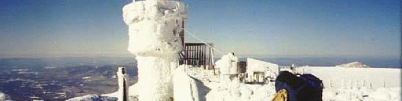


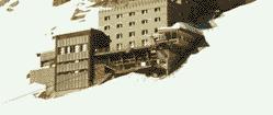
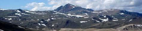
3 MOUNTAIN STATION CHARACTERISTICS Elevation alone is not a suitable criterion Mt. Washington 1941 m Brocken 1142 m


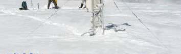
4 MOUNTAIN STATION CHARACTERISTICS exposure is as important as elevation Dörrbecker 2007 UfS 2007 UfS 2007
5 MOUNTAIN STATION CHARACTERISTICS Considerations for a global mountain station network elevation exposure integration in local / regional station networks equipment global distribution


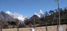
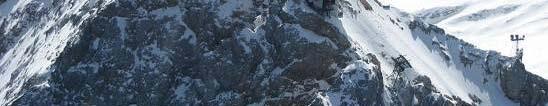
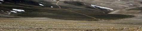
6 Integration in local / regional station networks Everest South Col 7990m Kalar Pattar 5545m P Pyramid id m Dughla 4600m Ph i h 4258m Pheriche 4258 Namche 3560m Lukla 2660m


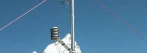


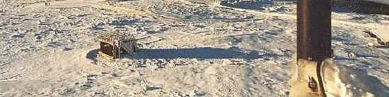
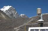
7 Equipment observatories HEO automatic weather stations AWS sensors S ZAMG 2003 Lazar 2005


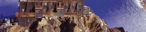
8 Astronomical observatories Mauna Kea 4205 m Pic du Midi 3845 m ZAMG 2003
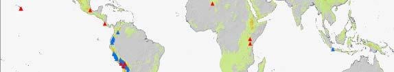
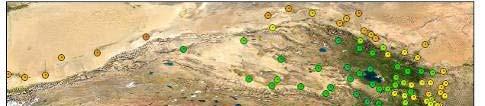
9 A PRELIMINARY GLOBAL MOUNTAIN STATION OVERVIEW

10
11

12
13


14 Burford et al. 1998
15 MOUNTAIN STATION CHARACTERISTICS HE stations elevation distribution 9000 m alt HEO AWS AO S number of stations
16 Climatic Change: ET and the water cycle in mountains Burford et al. 1998


17 Temperature based ET rates are unreliable! Grieser and Thomas, in prep.. Penman-Monteith PET is the only physically sound evapotranspiration estimator


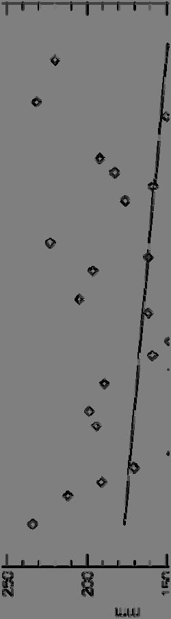

18 July climate trends at Tujuksu station
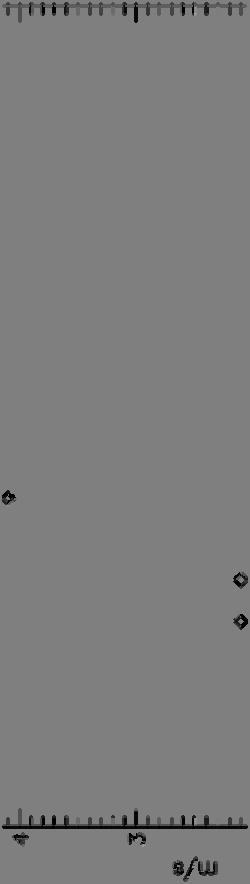
19 Wind radiation influence on ET Grieser and Thomas, in prep.


20 Climate trends in Eastern Tibet Chen et al. Clim. Change 2006


21 The climatlas project A tool for: data a exploration o data presentation communication education and ist is NOT another data base
22 The ideas behind climatlas unrestricted access over the Internet data sources: FAOCLIM2 publications data contributed by researchers and organisations Internet in principle all kind of climate data can be integrated (e.g. incomplete / short duration) incorporation of small scale stations networks of research programs presentation of data as graphs (climate diagrams, trends) integration of evapotranspiration/sublimation data link to contributing researcher / institute


23 climatlas
24 climatlas How can you contribute? provide information on HE stations (metadata) meteorological measurements (long-term means or time series) data to estimate evapotranspiration/sublimation (temperature, solar radiation, humidity and wind speed) give your ideas and criticism
25 Thank you for your attention! i Institute of Geography Johannes Gutenberg-University Mainz Germany
The TexasET Network and Website User s Manual
 The TexasET Network and Website http://texaset.tamu.edu User s Manual By Charles Swanson and Guy Fipps 1 September 2013 Texas AgriLIFE Extension Service Texas A&M System 1 Extension Program Specialist;
Snow Melt with the Land Climate Boundary Condition
 Snow Melt with the Land Climate Boundary Condition GEO-SLOPE International Ltd. www.geo-slope.com 1200, 700-6th Ave SW, Calgary, AB, Canada T2P 0T8 Main: +1 403 269 2002 Fax: +1 888 463 2239 Introduction
Zachary Holden - US Forest Service Region 1, Missoula MT Alan Swanson University of Montana Dept. of Geography David Affleck University of Montana
 Progress modeling topographic variation in temperature and moisture for inland Northwest forest management Zachary Holden - US Forest Service Region 1, Missoula MT Alan Swanson University of Montana Dept.
Be relevant and effective thinking beyond accuracy and timeliness
 The Fourth Technical Conference on the Management of Meteorological and Hydrological Services in WMO RA II (Asia) Be relevant and effective thinking beyond accuracy and timeliness C. Y. LAM Hong Kong Observatory
* * * Table (1) Table (2)
 Table (2)") A step Forward to Atomize the Sudan Meteorological Authority (SMA) Net work Y.S. Odan Surface Instruments Department Tel: 00249 912220246 E-mail yaseen@ersad.gov.sd Abstract AWS has been introduced to
A step Forward to Atomize the Sudan Meteorological Authority (SMA) Net work Y.S. Odan Surface Instruments Department Tel: 00249 912220246 E-mail yaseen@ersad.gov.sd Abstract AWS has been introduced to
Monitoring daily evapotranspiration in the Alps exploiting Sentinel-2 and meteorological data
 Monitoring daily evapotranspiration in the Alps exploiting Sentinel-2 and meteorological data M. Castelli, S. Asam, A. Jacob, M. Zebisch, and C. Notarnicola Institute for Earth Observation, Eurac Research,
Development of High Resolution Gridded Dew Point Data from Regional Networks
 Development of High Resolution Gridded Dew Point Data from Regional Networks North Central Climate Science Center Open Science Conference May 20, 2015 Ruben Behnke Numerical Terradynamic Simulation Group
and soils characterizing would be defined.
 Working out of the basic network for monitoring of natural and climatic processes in Siberia M.V. Kabanov, V.V. Zuev, V.А. Krutikov Institute of Monitoring of Climatic and Ecological Systems SB RAS, Tomsk,
Atmospheric Moisture, Precipitation, and Weather Systems
 Atmospheric Moisture, Precipitation, and Weather Systems 6 Chapter Overview The atmosphere is a complex system, sometimes described as chaotic in nature. In this chapter we examine one of the principal
The Colorado Climate Center at CSU. residents of the state through its threefold
 The CoAgMet Network: Overview History and How It Overview, Works N l Doesken Nolan D k and d Wendy W d Ryan R Colorado Climate Center Colorado State University First -- A short background In 1973 the federal
NATIONAL HYDROMETEOROLOGICAL SERVICE OF REPUBLIC KAZAKHSTAN
 KAZHYDROMET- NATIONAL HYDROMETEOROLOGICAL SERVICE OF REPUBLIC KAZAKHSTAN ASTANA, 2010 The ministry of preservation of the environment of Republic Kazakhstan The republican State Enterprise «Kazhydromet»
Introductions to RIC-Beijing. NAN Xuejing, CUI Xiai Meteorological Observation Center China Meteorological Administration March,2018
 Introductions to RIC-Beijing NAN Xuejing, CUI Xiai China Meteorological Administration March,2018 Contents 1. China Meteorological Administration (CMA) Organization 2. (MOC) Functional Structure Responsibilities
CHAPTER 13 WEATHER ANALYSIS AND FORECASTING MULTIPLE CHOICE QUESTIONS
 CHAPTER 13 WEATHER ANALYSIS AND FORECASTING MULTIPLE CHOICE QUESTIONS 1. The atmosphere is a continuous fluid that envelops the globe, so that weather observation, analysis, and forecasting require international
Wali Ullah Khan Pakistan Meteorological Department
 An overview of Weather Observation practices over Pakistan By Wali Ullah Khan Pakistan Meteorological Department JMA/WMO TRAINING WORKSHOP ON CALIBRATION AND MAINTENANCE OF METEOROLOGICAL INSTRUMENTS IN
5B.1 DEVELOPING A REFERENCE CROP EVAPOTRANSPIRATION CLIMATOLOGY FOR THE SOUTHEASTERN UNITED STATES USING THE FAO PENMAN-MONTEITH ESTIMATION TECHNIQUE
 DEVELOPING A REFERENCE CROP EVAPOTRANSPIRATION CLIMATOLOGY FOR THE SOUTHEASTERN UNITED STATES USING THE FAO PENMAN-MONTEITH ESTIMATION TECHNIQUE Heather A. Dinon*, Ryan P. Boyles, and Gail G. Wilkerson
Evapotranspiration and Irrigation Water Requirements for Washington State
 Evapotranspiration and Irrigation Water Requirements for Washington State R. Troy Peters, PE, PhD Extension Irrigation Specialist Washington State University Irrigated Ag. Research and Extension Cntr Prosser,
The Colorado Agricultural no Meteorological Network (CoAgMet) and Crop ET Reports
 and Crop ET Reports") C R O P S E R I E S Irrigation Quick Facts The Colorado Agricultural no. 4.723 Meteorological Network (CoAgMet) and Crop ET Reports A.A. Andales, T. A. Bauder and N. J. Doesken 1 (10/09) CoAgMet is a network
C R O P S E R I E S Irrigation Quick Facts The Colorado Agricultural no. 4.723 Meteorological Network (CoAgMet) and Crop ET Reports A.A. Andales, T. A. Bauder and N. J. Doesken 1 (10/09) CoAgMet is a network
KEY WORDS: Palmer Meteorological Drought Index, SWAP, Kriging spatial analysis and Digital Map.
 PALMER METEOROLOGICAL DROUGHT CLASSIFICATION USING TECHNIQUES OF GEOGRAPHIC INFORMATION SYSTEM IN THAILAND S. Baimoung, W. Waranuchit, S. Prakanrat, P. Amatayakul, N. Sukhanthamat, A. Yuthaphan, A. Pyomjamsri,
GEOG415 Mid-term Exam 110 minute February 27, 2003
 GEOG415 Mid-term Exam 110 minute February 27, 2003 1 Name: ID: 1. The graph shows the relationship between air temperature and saturation vapor pressure. (a) Estimate the relative humidity of an air parcel
Lecture 5: Precipitation
 Lecture 5: Precipitation Key Questions 1. What physical concepts control the formation of precipitation (air pressure, expanding gases and cooling, and vapor pressure)? 2. What are some air mass lifting
Climate Change and Biomes
 Climate Change and Biomes Key Concepts: Greenhouse Gas WHAT YOU WILL LEARN Biome Climate zone Greenhouse gases 1. You will learn the difference between weather and climate. 2. You will analyze how climate
1. Abstract. Estimation of potential evapotranspiration with minimal data dependence. A.Tegos, N. Mamassis, D. Koutsoyiannis
 European Geosciences Union General Assembly 29 Vienna, Austria, 19 24 April 29 Session HS5.3: Hydrological modelling. Adapting model complexity to the available data: Approaches to model parsimony Estimation
4 Forecasting Weather
 CHAPTER 16 4 Forecasting Weather SECTION Understanding Weather BEFORE YOU READ After you read this section, you should be able to answer these questions: What instruments are used to forecast weather?
London Heathrow Field Site Metadata
 London Heathrow Field Site Metadata Field Site Information Name: Heathrow src_id (Station ID number): 708 Geographic Area: Greater London Latitude (decimal ): 51.479 Longitude (decimal ): -0.449 OS Grid
Manoa Watershed Water Balance Study: Potential ET
 Manoa Watershed Water Balance Study: Potential ET Wyatt Blair, Josh Donovan, Max Irion, Jordan Muratsuchi, and David Heir Geography 405 Fall 2016 Overview Introduction Objectives Methodology Results Summary/Conclusion
CIMIS. California Irrigation Management Information System
 CIMIS California Irrigation Management Information System What is CIMIS? A network of over 130 fully automated weather stations that collect weather data throughout California and provide estimates of
Persistence of Soil Moisture in the Cariboo Mountains, BC
 Persistence of Soil Moisture in the Cariboo Mountains, BC Tullia Leona Upton University of Northern Brithish Columbia M.Sc. Candidate Natural Resources and Environmental Studies upton@unbc.ca Overview
Variability of Reference Evapotranspiration Across Nebraska
 Know how. Know now. EC733 Variability of Reference Evapotranspiration Across Nebraska Suat Irmak, Extension Soil and Water Resources and Irrigation Specialist Kari E. Skaggs, Research Associate, Biological
The Atmosphere. Importance of our. 4 Layers of the Atmosphere. Introduction to atmosphere, weather, and climate. What makes up the atmosphere?
 The Atmosphere Introduction to atmosphere, weather, and climate Where is the atmosphere? Everywhere! Completely surrounds Earth February 20, 2010 What makes up the atmosphere? Argon Inert gas 1% Variable
Lecture 6: Precipitation Averages and Interception
 Lecture 6: Precipitation Averages and Interception Key Questions 1. How much and when does Whatcom County receive rain? 2. Where online can you find rainfall data for the state? 3. How is rainfall averaged
Chapter 12: Meteorology
 Chapter 12: Meteorology Section 1: The Causes of Weather 1. Compare and contrast weather and climate. 2. Analyze how imbalances in the heating of Earth s surface create weather. 3. Describe how and where
Vermont Soil Climate Analysis Network (SCAN) sites at Lye Brook and Mount Mansfield
 sites at Lye Brook and Mount Mansfield") Vermont Soil Climate Analysis Network (SCAN) sites at Lye Brook and Mount Mansfield 13 Years of Soil Temperature and Soil Moisture Data Collection September 2000 September 2013 Soil Climate Analysis Network
Vermont Soil Climate Analysis Network (SCAN) sites at Lye Brook and Mount Mansfield 13 Years of Soil Temperature and Soil Moisture Data Collection September 2000 September 2013 Soil Climate Analysis Network
LE Accumulation, Net Radiation, and Drying with Tipped Sensors
 LE Accumulation, Net Radiation, and Drying with Tipped Sensors Three different situations were examined, where the influence that the deployment angle of the sensor has on the accumulation of latent heat
Accessing and Using National Long Term Ecological Research (LTER) Climate and Hydrology Data from ClimDB and HydroDB: A Tutorial
 Climate and Hydrology Data from ClimDB and HydroDB: A Tutorial") Accessing and Using National Long Term Ecological Research (LTER) Climate and Hydrology Data from ClimDB and HydroDB: A Tutorial Gordon M. Heisler USDA Forest Service, Syracuse, NY Gary Fisher U.S. Geological
Accessing and Using National Long Term Ecological Research (LTER) Climate and Hydrology Data from ClimDB and HydroDB: A Tutorial Gordon M. Heisler USDA Forest Service, Syracuse, NY Gary Fisher U.S. Geological
MT-CLIM for Excel. William M. Jolly Numerical Terradynamic Simulation Group College of Forestry and Conservation University of Montana c 2003
 MT-CLIM for Excel William M. Jolly Numerical Terradynamic Simulation Group College of Forestry and Conservation University of Montana c 2003 1 Contents 1 INTRODUCTION 3 2 MTCLIM for Excel (MTCLIM-XL) 3
Chapter 2 Agro-meteorological Observatory
 Chapter 2 Agro-meteorological Observatory Abstract A Meteorological observatory is an area where all the weather instruments and structures are installed. The chapter gives a description of a meteorological
4 Forecasting Weather
 CHAPTER 2 4 Forecasting Weather SECTION Understanding Weather BEFORE YOU READ After you read this section, you should be able to answer these questions: What instruments are used to forecast weather? How
Eric. W. Harmsen 1, John Mecikalski 2, Vanessa Acaron 3 and Jayson Maldonado 3
 Estimating Ground-Level Solar Radiation and Evapotranspiration In Puerto Rico Using Satellite Remote Sensing Eric. W. Harmsen 1, John Mecikalski 2, Vanessa Acaron 3 and Jayson Maldonado 3 1 Department
Study Guide. Earth Systems 1109 Weather Dynamics. Adult Basic Education Science. Prerequisites: Credit Value: 1
 Adult Basic Education Science Weather Dynamics Study Guide Prerequisites: None Credit Value: 1 Text: Science 10 ; Ritter, Plumb, et al; Nelson, 2001. Earth Systems Concentration Earth Systems 3109A Earth
Comparison of historical trends of pan evaporation and modeled lake evaporation in Lake Taihu catchment. Hu Cheng
 Comparison of historical trends of pan evaporation and modeled lake evaporation in Lake Taihu catchment Hu Cheng 2013-1-17 Outline Background Methods and Materials Results and Discussion Conclusion Background
Indices and Indicators for Drought Early Warning
 Indices and Indicators for Drought Early Warning ADRIAN TROTMAN CHIEF, APPLIED METEOROLOGY AND CLIMATOLOGY CARIBBEAN INSTITUTE FOR METEOROLOGY AND HYDROLOGY IN COLLABORATION WITH THE NATIONAL DROUGHT MITIGATION
Austria s Information Portal Climate Change Getting climate science across
 Zentralanstalt für Meteorologie und Geodynamik Johann Hiebl, Barbara Chimani, Klaus Haslinger, Daniel Binder, Harald Bamberger, Ingeborg Auer Getting climate science across Overview 1. Climate service
Deliverable 1.1 Historic Climate
 Deliverable 1.1 Historic Climate 16.04.2013 Christopher Thurnher ARANGE - Grant no. 289437- Advanced multifunctional forest management in European mountain ranges www.arange-project.eu Document Properties
QualiMET 2.0. The new Quality Control System of Deutscher Wetterdienst
 QualiMET 2.0 The new Quality Control System of Deutscher Wetterdienst Reinhard Spengler Deutscher Wetterdienst Department Observing Networks and Data Quality Assurance of Meteorological Data Michendorfer
Identifying Biomes from Climatograms
 Identifying Biomes from Welcome to your climatogram lab. In this lab you will investigate the between the amount of rainfall and the variance of temperature and the effect on the distribution of biomes
. Study locations and meteorological data Seven meteorological stations from southern to northern parts in Finland were selected for this study (Fig.
 Long-term trends of pan evaporation and an analysis of its causes in Finland Toshitsugu Moroizumi, Naoya Ito, Jari Koskiaho and Sirkka Tattari Graduate School of Environmental and Life Science, Okayama
ESTIMATION OF NEW SNOW DENSITY USING 42 SEASONS OF METEOROLOGICAL DATA FROM JACKSON HOLE MOUNTAIN RESORT, WYOMING. Inversion Labs, Wilson, WY, USA 2
 ESTIMATION OF NEW SNOW DENSITY USING 42 SEASONS OF METEOROLOGICAL DATA FROM JACKSON HOLE MOUNTAIN RESORT, WYOMING Patrick J. Wright 1 *, Bob Comey 2,3, Chris McCollister 2,3, and Mike Rheam 2,3 1 Inversion
A downscaling and adjustment method for climate projections in mountainous regions
 A downscaling and adjustment method for climate projections in mountainous regions applicable to energy balance land surface models D. Verfaillie, M. Déqué, S. Morin, M. Lafaysse Météo-France CNRS, CNRM
SOUTH MOUNTAIN WEATHER STATION: REPORT FOR QUARTER 2 (APRIL JUNE) 2011
 2011") SOUTH MOUNTAIN WEATHER STATION: REPORT FOR QUARTER 2 (APRIL JUNE) 2011 Prepared for ESTANCIA BASIN WATERSHED HEALTH, RESTORATION AND MONITORING STEERING COMMITTEE c/o CLAUNCH-PINTO SOIL AND WATER CONSERVATION
SOUTH MOUNTAIN WEATHER STATION: REPORT FOR QUARTER 2 (APRIL JUNE) 2011 Prepared for ESTANCIA BASIN WATERSHED HEALTH, RESTORATION AND MONITORING STEERING COMMITTEE c/o CLAUNCH-PINTO SOIL AND WATER CONSERVATION
Figure 1. Daily variation of air temperature
 Comparative analysis of the meteorological data acquired on standard equipment and by automatic weather station of CAMPBELL SCIENTIFIC, INC Company Kudekov T.K. Director-General of the KAZHYDROMET 050022
Flash Droughts: Their Characteristics and A Proposed Definition
 Flash Droughts: Their Characteristics and A Proposed Definition Jason Otkin University of Wisconsin-Madison, Cooperative Institute for Meteorological Satellite Studies Jeff Basara and Jordan Christian
Detecting Trends in Evapotranspiration in Colorado
 Detecting Trends in Evapotranspiration in Colorado W. Austin Clifford and Nolan J. Doesken Colorado Climate Center Department of Atmospheric Science Colorado State University Presented at Colorado Water
Spatial representation of evapotranspiration in the Mara basin: results derived from the SWAT model and remote sensing products
 Spatial representation of evapotranspiration in the Mara basin: results derived from the SWAT model and remote sensing products Alemayehu, T 1., van Griensven, A. 1,2, Kilonzo, F. 1,2, and Bauwens, W.
Research Note COMPUTER PROGRAM FOR ESTIMATING CROP EVAPOTRANSPIRATION IN PUERTO RICO 1,2. J. Agric. Univ. P.R. 89(1-2): (2005)
: (2005)") Research Note COMPUTER PROGRAM FOR ESTIMATING CROP EVAPOTRANSPIRATION IN PUERTO RICO 1,2 Eric W. Harmsen 3 and Antonio L. González-Pérez 4 J. Agric. Univ. P.R. 89(1-2):107-113 (2005) Estimates of crop
Research Note COMPUTER PROGRAM FOR ESTIMATING CROP EVAPOTRANSPIRATION IN PUERTO RICO 1,2 Eric W. Harmsen 3 and Antonio L. González-Pérez 4 J. Agric. Univ. P.R. 89(1-2):107-113 (2005) Estimates of crop
From MeteoMet to MeteoMet2. and more. Andrea Merlone
 From MeteoMet to MeteoMet2 and more Presented by Tom Gardiner WP1 WP2 Upper air measurements: sensors and techniques Novel methods, instruments and measurements WP3 Traceable measurement and protocols
Estimation of Wavelet Based Spatially Enhanced Evapotranspiration Using Energy Balance Approach
 Estimation of Wavelet Based Spatially Enhanced Evapotranspiration Using Energy Balance Approach Dr.Gowri 1 Dr.Thirumalaivasan 2 1 Associate Professor, Jerusalem College of Engineering, Department of Civil
Lake Tahoe Watershed Model. Lessons Learned through the Model Development Process
 Lake Tahoe Watershed Model Lessons Learned through the Model Development Process Presentation Outline Discussion of Project Objectives Model Configuration/Special Considerations Data and Research Integration
URBAS Prediction and management of flash floods in urban areas
 URBAS Prediction and management of flash floods in urban areas 1 Thomas Einfalt, Klaus Friedeheim, Andreas Wagner Project funded by the Federal Ministry of Education and Research BMBF (Germany) as a part
Complex Terrain (EDUCT) experiment, conducted by the National Center for Atmospheric
 experiment, conducted by the National Center for Atmospheric") Alex Ameen Shenandoah Trip Paper I visited Shenandoah National Park on April 11, 2009 to investigate the Education in Complex Terrain (EDUCT) experiment, conducted by the National Center for Atmospheric
Alex Ameen Shenandoah Trip Paper I visited Shenandoah National Park on April 11, 2009 to investigate the Education in Complex Terrain (EDUCT) experiment, conducted by the National Center for Atmospheric
Accuracy of Meteonorm ( )
") Accuracy of Meteonorm (7.1.6.14035) A detailed look at the model steps and uncertainties 22.10.2015 Jan Remund Contents The atmosphere is a choatic system, not as exactly describable as many technical
Accuracy of Meteonorm (7.1.6.14035) A detailed look at the model steps and uncertainties 22.10.2015 Jan Remund Contents The atmosphere is a choatic system, not as exactly describable as many technical
Meteorology. Chapter 15 Worksheet 1
 Chapter 15 Worksheet 1 Meteorology Name: Circle the letter that corresponds to the correct answer 1) The Tropic of Cancer and the Arctic Circle are examples of locations determined by: a) measuring systems.
WegenerNet: A new climate station network in Eastern Styria/Austria for monitoring weather and climate at 1 km-scale resolution
 Session GI 2 Atmosphere, Ocean, Meteorological Instruments and Ocean Observatory Instrumentation ; EGU General Assembly 2008; 13-18 Apr 2008, Vienna, Austria. WegenerNet: A new climate station network
2 nd Cryonet-Asia Worskshop Salekhard, Russian Federation (2-5 February 2016)
") WMO 2 nd Cryonet-Asia Worskshop Salekhard, Russian Federation (2-5 February 2016) WMO Rolling Review of Requirements (RRR) Etienne Charpentier Chief, WMO Observing Systems Division WMO; Name of Department
WMO 2 nd Cryonet-Asia Worskshop Salekhard, Russian Federation (2-5 February 2016) WMO Rolling Review of Requirements (RRR) Etienne Charpentier Chief, WMO Observing Systems Division WMO; Name of Department
Skeletal remains of what was a debris-covered glacier near Mt. Everest
 Annual satellite imaging of the world s glaciers Assessment of glacier extent and change GLIMS Development and population of a digital glacier data inventory HIGH ICE Skeletal remains of what was a debris-covered
Series tore word. Acknowledgements
 Series tore word p. xi Preface p. xiii Acknowledgements p. xv Disclaimer p. xvii Introduction p. 1 The instrumental age p. 2 Measurements and the climate record p. 2 Clouds and rainfall p. 3 Standardisation
Specifications for a Reference Radiosonde for the GCOS Reference. Upper-Air Network (GRUAN)
") Specifications for a Reference Radiosonde for the GCOS Reference Upper-Air Network (GRUAN) By the Working Group on Atmospheric Reference Observations (WG-ARO) Final Version, October 2008 1. Introduction
Specifications for a Reference Radiosonde for the GCOS Reference Upper-Air Network (GRUAN) By the Working Group on Atmospheric Reference Observations (WG-ARO) Final Version, October 2008 1. Introduction
POTENTIAL EVAPOTRANSPIRATION AND DRYNESS / DROUGHT PHENOMENA IN COVURLUI FIELD AND BRATEŞ FLOODPLAIN
 PRESENT ENVIRONMENT AND SUSTAINABLE DEVELOPMENT, VOL. 5, no.2, 2011 POTENTIAL EVAPOTRANSPIRATION AND DRYNESS / DROUGHT PHENOMENA IN COVURLUI FIELD AND BRATEŞ FLOODPLAIN Gigliola Elena Ureche (Dobrin) 1
GEOGRAPHY AND HISTORY
 GEOGRAPHY AND HISTORY YEAR 1, PART 1 www.vicensvives.es Contents 01 Our planet Earth 02 The representation of the Earth: maps 03 The Earth s relief 04 Rivers and seas 05 Weather and climate 06 Climates
Quality assurance for sensors at the Deutscher Wetterdienst (DWD)
") Quality assurance for sensors at the Deutscher Wetterdienst (DWD) Quality assurance / maintenance / calibration Holger Dörschel, Dr Tilman Holfelder WMO International Conference on Automatic Weather Stations
Quality assurance for sensors at the Deutscher Wetterdienst (DWD) Quality assurance / maintenance / calibration Holger Dörschel, Dr Tilman Holfelder WMO International Conference on Automatic Weather Stations
1 What Is Climate? TAKE A LOOK 2. Explain Why do areas near the equator tend to have high temperatures?
 CHAPTER 17 1 What Is Climate? SECTION Climate BEFORE YOU READ After you read this section, you should be able to answer these questions: What is climate? What factors affect climate? How do climates differ
China Physiographi hi i c v ew of N l epa India
 JMA/WMO Workshop on Quality Management in Surface, Climate and Upper-Air Observations in RA II (ASIA) Tokyo, Japan, 27-30 July 2010 Rajendra P. Shrestha Meteorological Forecasting Division Department of
Leveraging Existing and Future In-Situ Observational Networks
 Leveraging Existing and Future In-Situ Observational Networks John Horel* Department of Atmospheric Sciences University of Utah john.horel@utah.edu * COI Disclosure: equity stake in Synoptic Data Corp.
Comparative analysis of data collected by installed automated meteorological stations and manual data in Central Asia.
 Comparative analysis of data collected by installed automated meteorological stations and manual data in Central Asia. Merkushkin Aleksandr Uzhydromet 71 K. Makhsumov str., 100052 Tashkent, Uzbekistan
Recent Improvement of Integrated Observation Systems in JMA
 Recent Improvement of Integrated Observation Systems in JMA Mr Osamu Suzuki and Mr Yoshihiko Tahara Japan Meteorological Agency 1-3-4 Otemachi, Chiyoda-ku, Tokyo 100-8122, Japan Tel: +81-3-3212-8341, Fax:
Global Warming degrees over the last 50 years (e.g., IPCC)
") Global Warming 0.5 1.0 degrees over the last 50 years (e.g., IPCC) Global Dimming (?) 10 20% decrease in surface solar radiation over the period 1950 1990 Pan Evaporation Paradox If climate is warming,
Global Warming 0.5 1.0 degrees over the last 50 years (e.g., IPCC) Global Dimming (?) 10 20% decrease in surface solar radiation over the period 1950 1990 Pan Evaporation Paradox If climate is warming,
Comparing the Relationships Between Heat Stress Indices and Mortality in North Carolina
 Comparing the Relationships Between Heat Stress Indices and Mortality in North Carolina Jordan Clark PhD Student CISA Research Assistant Department of Geography UNC-Chapel Hill 10/30/2018 Overview Background
SWIM and Horizon 2020 Support Mechanism
 SWIM and Horizon 2020 Support Mechanism Working for a Sustainable Mediterranean, Caring for our Future REG-7: Training Session #1: Drought Hazard Monitoring Example from real data from the Republic of
Presented by Jerry A. Gomez, P.E. National Hydropower Association Northeast Regional Meeting - September 17, 2009
 Presented by Jerry A. Gomez, P.E. National Hydropower Association Northeast Regional Meeting - September 17, 2009 Defining Probable Maximum Precipitation (PMP) PMP is the theoretically greatest depth of
Report of the 2013 BE expedition to observe climate change in the Himalayas
 Report of the 2013 BE expedition to observe climate change in the Himalayas Introduction scientific leader, John Griffiths (Meteogroup) In the summer of 2013 British Exploring (BE) organised and ran a
AUTOMATION OF OBSERVING NETWORK IN BMKG
 Agency for Meteorology, Climatology, and Geophysics of the Republic of Indonesia AUTOMATION OF OBSERVING NETWORK IN BMKG Agung Saifulloh Majid, G.S. Budhi Dharmawan, Damianus Tri Heryanto, Untung Merdijanto
Lisa Hannak Karsten Friedrich, Florian Imbery, Frank Kaspar Deutscher Wetterdienst National climate monitoring
 Changes in the measurement systems and the impact on the homogeneity of long time series A study based on parallel measurements from German reference stations Lisa Hannak (Lisa.Hannak@dwd.de) Karsten Friedrich,
U s e r M a n u a l W e a t h e r s t a t i o n s
 U s e r M a n u a l W e a t h e r s t a t i o n s These user instructions were drawn up by the Tirol Avalanche Warning Service. Please send all enquiries and comments to: lawine@tirol.gv.at. Table of Content
Investigation of Monthly Pan Evaporation in Turkey with Geostatistical Technique
 Investigation of Monthly Pan Evaporation in Turkey with Geostatistical Technique Hatice Çitakoğlu 1, Murat Çobaner 1, Tefaruk Haktanir 1, 1 Department of Civil Engineering, Erciyes University, Kayseri,
Steve Colwell. British Antarctic Survey
 Global Climate Observing System (GCOS) Steve Colwell British Antarctic Survey Goal and Structure of GCOS The Goal of GCOS is to provide continuous, reliable, comprehensive data and information on the state
SENSITIVITY ANALYSIS OF PENMAN EVAPORATION METHOD
 Global NEST Journal, Vol 16, No X, pp XX-XX, 2014 Copyright 2014 Global NEST Printed in Greece. All rights reserved SENSITIVITY ANALYSIS OF PENMAN EVAPORATION METHOD MAMASSIS N.* PANAGOULIA D. NOVKOVIC
THE METEOROLOGICAL DATA QUALITY MANAGEMENT OF THE ROMANIAN NATIONAL SURFACE OBSERVATION NETWORK
 THE METEOROLOGICAL DATA QUALITY MANAGEMENT OF THE ROMANIAN NATIONAL SURFACE OBSERVATION NETWORK Ioan Ralita, Ancuta Manea, Doina Banciu National Meteorological Administration, Romania Ionel Dragomirescu
Level 3 Earth and Space Science, 2014
 91414 914140 3SUPERVISOR S Level 3 Earth and Space Science, 2014 91414 Demonstrate understanding of processes in the atmosphere system 2.00 pm Tuesday 2 December 2014 Credits: Four Achievement Achievement
BUFR Table D List of common sequences
 BUFR Table D List of common sequences F X Category of sequences Identifier NONE Category 01 Location and identification sequences (Temperature and humidity instrumentation) 3 01 130 0 03 002 Generic type
Regional climate change in Tibet: past and future
 Symposium on Advanced Assimilation and Uncertainty Quantification in Big Data Research for Weather, Climate and Earth System Monitoring and Prediction May 23-24, 2016, State College. photos: www.dawide.com
3. The map below shows an eastern portion of North America. Points A and B represent locations on the eastern shoreline.
 1. Most tornadoes in the Northern Hemisphere are best described as violently rotating columns of air surrounded by A) clockwise surface winds moving toward the columns B) clockwise surface winds moving
FORENSIC WEATHER CONSULTANTS, LLC
 MOST INFORMATION HAS BEEN CHANGED FOR THIS SAMPLE REPORT FORENSIC WEATHER CONSULTANTS, LLC Howard Altschule Certified Consulting Meteorologist 1971 Western Avenue, #200 Albany, New York 12203 518-862-1800
Moisture content in concrete
 Universal Moisture Transport Model in Concrete under Natural Environment Takumi Shimomura Nagaoka University of Technology Moisture content in concrete Shrinkage and creep of concrete Transport of aggressive
Technical Note: Hydrology of the Lukanga Swamp, Zambia
 Technical Note: Hydrology of the Lukanga Swamp, Zambia Matthew McCartney July 7 Description The Lukanga swamp is located approximately 5km west of the city of Kabwe, in the Central province of Zambia,
H2020-TWINN Guest lecture. 9May2018 Vienna, Austria
 H2020-TWINN-2015 Meteorological data: sources, representativeness & use + Brčko Ao. Prof. Branislava Lalic Guest lecture 9May2018 Vienna, Austria Institution: Faculty of Agriculture, University of Novi
Trevor Lee Director, Buildings. Grant Edwards PhD Department of Environment and Geography
 Weather Affects Building Performance Simulation v Monitoring real time solar and coincident weather data for building optimisation and energy management Trevor Lee Director, Buildings Grant Edwards PhD
Wednesday February 1 st, Daily Science: How are the upper and the lower part of the stratosphere different?
 Wednesday February 1 st, 2017 Daily Science: How are the upper and the lower part of the stratosphere different? Properties of Air Because air has mass, it also has other properties, including density
The Kentucky Mesonet: Entering a New Phase
 The Kentucky Mesonet: Entering a New Phase Stuart A. Foster State Climatologist Kentucky Climate Center Western Kentucky University KCJEA Winter Conference Lexington, Kentucky February 9, 2017 Kentucky
H13-81 DISPERSION MODELING OF ACCIDENTAL TOXIC GAS RELEASES SENSITIVITY STUDIES AND OPTIMIZATION OF THE METEOROLOGICAL INPUT
 H13-81 DIPRIO MODLIG OF ACCIDTAL TOXIC GA RLA ITIVITY TUDI AD OPTIMIZATIO OF TH MTOROLOGICAL IPUT Kathrin Baumann-tanzer 1, irma tenzel 1 1 Central Institute for Meteorology and Geodynamics (ZAMG), Vienna,
La circulation atmosphérique dans le sud du Portugal et l'effet du réservoir d'alqueva. Cas d étude ALEX 2014
 8th Meso-NH user's meeting La circulation atmosphérique dans le sud du Portugal et l'effet du réservoir d'alqueva. Cas d étude ALEX 2014, Carlos Policarpo et Miguel Potes Instituto de Ciências da Terra
Results from WMO High Quality Radiosonde Comparison, Mauritius As related to planning Reference Upper Air Observations for GCOS
 Results from WMO High Quality Radiosonde Comparison, Mauritius As related to planning Reference Upper Air Observations for GCOS John Nash, Met Office (UK), Workshop on Reference Upper Air Observations