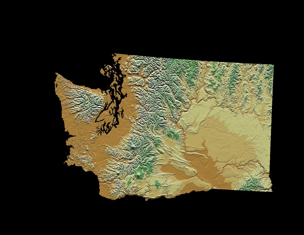
Evapotranspiration and Irrigation Water Requirements for Washington State
|
|
|
- Godwin Hampton
- 6 years ago
- Views:
Transcription

1 Evapotranspiration and Irrigation Water Requirements for Washington State R. Troy Peters, PE, PhD Extension Irrigation Specialist Washington State University Irrigated Ag. Research and Extension Cntr Prosser, WA Leigh Nelson, PE WA State Irrigation Engineer USDA NRCS Ephrata, WA
2 Definitions Consumptive Use Evapotranspiration (ETc) Effective Precipitation (Pe) Irrigation Water Requirements (IWR) IWR = ETc - Pe Historical Average ET
3 Estimating Crop Water Use (Evapotranspiration) Reference ET (Weather and climate) Water use of harvestable alfalfa Crop ET ET = K c c ET Crop Coefficient (Crop and growth stage) r
4 Uses for Avg. ET Estimates Irrigation system design Simple irrigation scheduling tools Evaporation pond/wetland design Water rights transfers Water rights adjudication / litigation Hydrologic modeling River basin planning and management.
5 Blaney-Criddle equation Published 1985 Last data 1982 Actual ET and crop coefficients hidden
6 New Revision More recent and complete historical weather data Latest ETr estimation techniques (ASCE standardized Penman-Monteith equations) Take into account humidity, wind, and solar radiation, elevation, latitude as well as temperature. Expanded station coverage Inclusion of actual ET separate from IWR Inclusion of information on the variability (probability) of estimation
7
8
9 Estimating Crop Water Use (Evapotranspiration) Reference ET (Weather and climate) Water use of harvestable alfalfa Crop ET ET = K c c ET Crop Coefficient (Crop and growth stage) r
10 Reference ET: From Weather Standardized ASCE Penman-Monteith ET ref Solar Radiation = ( R n Cn G) + γ T γ (1 + C u ) d 2 u 2 ( e Temperature Wind Speed s e a ) Humidity Credit: Richard Allen, University of Idaho

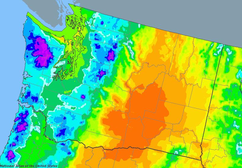
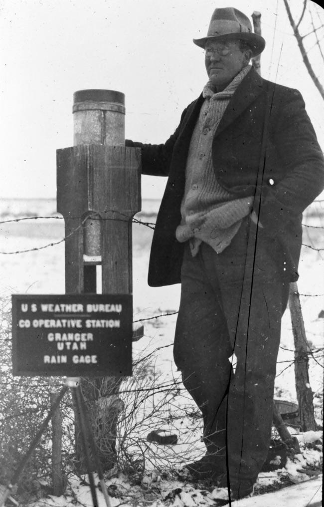
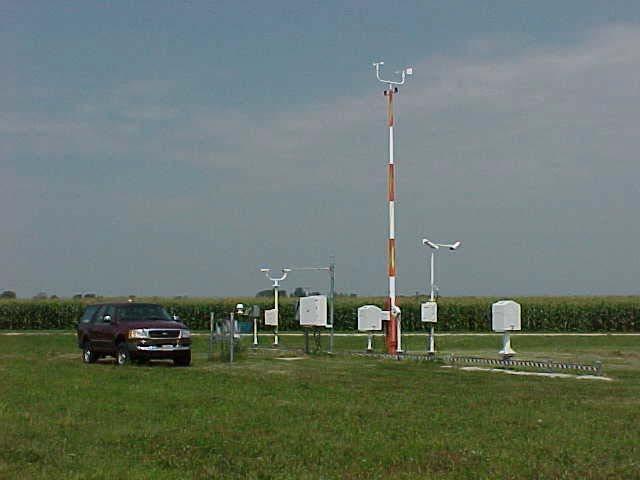
11 Historical Weather Data Sources 1. NCDC COOP Stations Best coverage/longest history (>100 yrs) Temperature and precipitation only 2. NCDC ASOS Full data set Airport Tarmacs RH data only 3. Agrimet Full data set and good locations Limited coverage 4. Washington AgWeatherNet (AWN) Full data set and good locations Growing coverage Limited data history (5-20 yrs)

12 White = COOP, Blue = AWN, Pink = AgriMet, Dot = In previous WIG
13 AWN Data Cleaning Plotted and looked at: Solar radiation plotted with calculated clear sky radiation Wind speed was plotted look for anomalies T dew plotted and compared with T min T max and T min plotted look for anomalies Seasonal total rainfalls compared year to year.
14 Strategy Applied the ASCE Penman Monteith for COOP (temp and precip only) Stations. Estimate missing Solar Radiation, using the Thornton-Running (1999) Wind is from nearby station using long-term historical monthly averages Dew Point Estimated from T min with offsets as needed. Calculate for full year not just growing season.
15 Data Corrections Manipulations Missing values in NCDC (COOP or MMTS) were treated as missing instead of 0. Out of bounds data was set to missing Solar radiation visually compared to theoretical clear sky radiation RH over 100% or less than 0% Temperatures greater than 160 deg F or less than - 60 deg F
16 Data Corrections Manipulations Missing data was interpolated from stations within a 50 km radius. Weighted average based on distance. Everything except precip. Missing set to 0. Still missing values were generated by ClimGen. ASOS stations used only for avg dewpoint interpolations in stations that didn t have RH data.
17 Way Out There Stations Many COOP (MMTS) stations weren t close enough (50 km; 30 miles) to be comfortable with interpolating data from full data stations. Hargreaves equation (temp only) was calibrated using nearest full data stations. This calibrated Hargreaves equation used to make estimates for these stations.
18 Data Corrections Manipulations Over 20 different full iterations using various methods/assumptions etc. to troubleshoot (each takes 3-6hrs computation time). Final results plotted and reviewed with Leigh Nelson Specific stations were excluded. No tweaking just removal. Removed stations are listed along with the reasons that they were excluded. Best station of a close group was retained. (Eliminate redundancy) Best = best data source, location, history, results or believability.
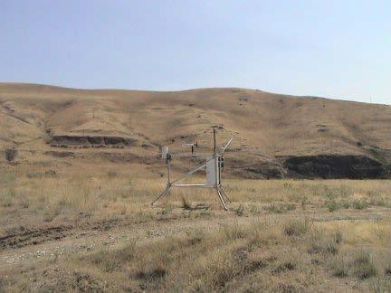
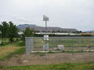
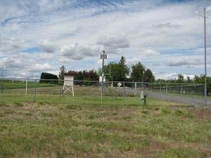
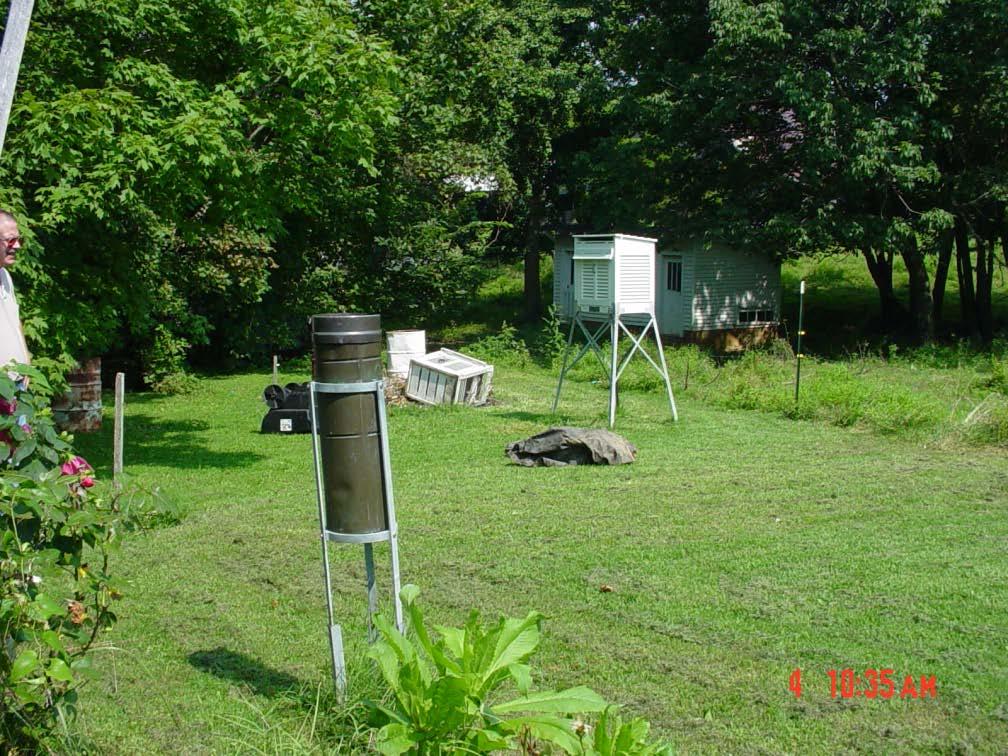
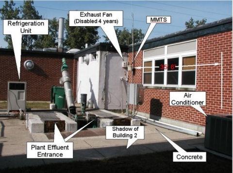
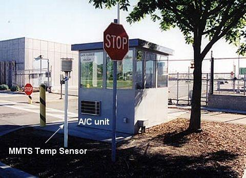
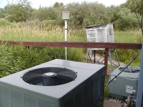
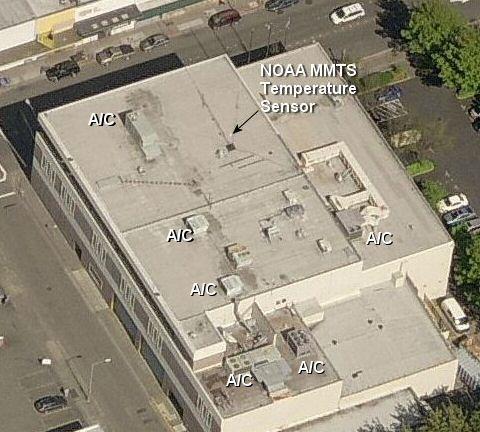
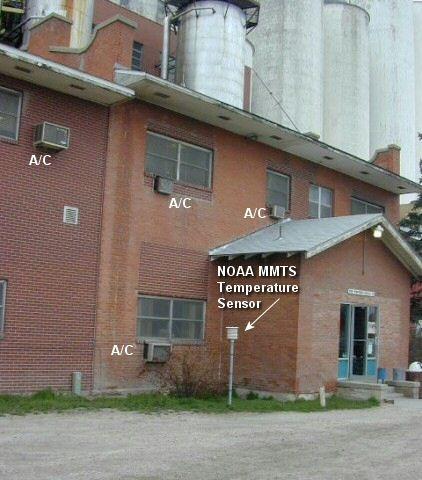
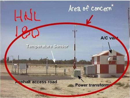
19 Variability and Weather Station Location Issues Uninterrupted wind Green and clipped grass For a long distance surrounding station. Ideal Represents Fully Irrigated Field
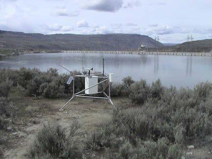
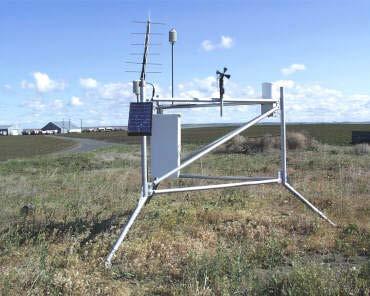
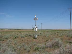
20 Agrimet
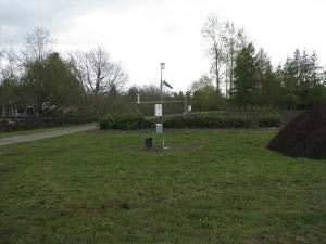
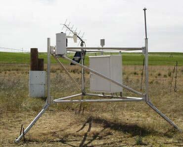
21 AgWeatherNet
22 AgWeatherNet
")
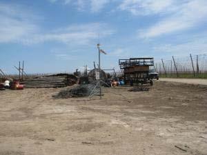
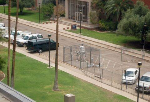
23 COOP (MMTS)
")
24 COOP (MMTS)
25
26

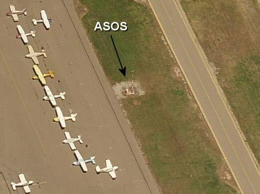
27 ASOS Stations
28 Estimating Crop Water Use (Evapotranspiration) Reference ET (Weather and climate) Water use of harvestable alfalfa Crop ET ET = K c c ET Crop Coefficient (Crop and growth stage) r
29 Crop Coefficient = ET/ET ref K c mid K c end K c K c ini /10/2013 Time of Season, days Credit: Richard Allen, UI
30 Crop Coefficients?
31 Crop Coefficients Thorough literature review. Started with Agrimet Based on field research using lysimeters in Kimberly, ID Similar climate to development area. Well documented sources Also some from FAO-56 Some from particular research projects.
32 Conversion for Use with ASCE Standardized Penman (Kimberly/ASCE)
33 Use Average R
34 Crop Coefficients Converted for use with the ASCE Standardized Penman-Monteith Converted to be based on CGDD (crop specific) instead of DOY Missing crops filled in from FAO-56 and others as documented
35 Existing WIG
36 New Full Penman-Monteith

37 Differences from Existing WIG Grass Seasonal ET
38 Summary In general, new estimates are 10-20% lower than existing estimates. Accuracy Based on the variability between stations that should have been the same, we feel that the results are within 10-15% of actual. No way to test this.


39 Year-to-Year Variability Questions? R. Troy Peters, P.E., Ph.D.
Regional Precipitation and ET Patterns: Impacts on Agricultural Water Management
 Regional Precipitation and ET Patterns: Impacts on Agricultural Water Management Christopher H. Hay, PhD, PE Ag. and Biosystems Engineering South Dakota State University 23 November 2010 Photo: USDA-ARS
The TexasET Network and Website User s Manual
 The TexasET Network and Website http://texaset.tamu.edu User s Manual By Charles Swanson and Guy Fipps 1 September 2013 Texas AgriLIFE Extension Service Texas A&M System 1 Extension Program Specialist;
Detecting Trends in Evapotranspiration in Colorado
 Detecting Trends in Evapotranspiration in Colorado W. Austin Clifford and Nolan J. Doesken Colorado Climate Center Department of Atmospheric Science Colorado State University Presented at Colorado Water
INTER-COMPARISON OF REFERENCE EVAPOTRANSPIRATION ESTIMATED USING SIX METHODS WITH DATA FROM FOUR CLIMATOLOGICAL STATIONS IN INDIA
 INODUCTION The reference evapotranspiration is one of the most important things to consider for irrigation management to crops. Evapotranspiration (ET) is important to irrigation management because crop
Appendix B. Evaluation of Water Use for Zuni Tribe PPIW Appendix B AMEC Earth and Environmental
 Appendix B AMEC s Independent Estimate of PPIW Crop Water Use Using the ASCE Standardized Reference Evapotranspiration via Direct Use of Weather Station Data, and Estimation of Crop Coefficients, and Net
Performance of Two Temperature-Based Reference Evapotranspiration Models in the Mkoji Sub-Catchment in Tanzania
 1 Performance of Two Temperature-Based Reference Evapotranspiration Models in the Mkoji Sub-Catchment in Tanzania Henry E. Igbadun 1, Henry F. Mahoo, Andrew K.P.R. Tarimo and Baanda A. Salim Department
Research Note COMPUTER PROGRAM FOR ESTIMATING CROP EVAPOTRANSPIRATION IN PUERTO RICO 1,2. J. Agric. Univ. P.R. 89(1-2): (2005)
: (2005)") Research Note COMPUTER PROGRAM FOR ESTIMATING CROP EVAPOTRANSPIRATION IN PUERTO RICO 1,2 Eric W. Harmsen 3 and Antonio L. González-Pérez 4 J. Agric. Univ. P.R. 89(1-2):107-113 (2005) Estimates of crop
Research Note COMPUTER PROGRAM FOR ESTIMATING CROP EVAPOTRANSPIRATION IN PUERTO RICO 1,2 Eric W. Harmsen 3 and Antonio L. González-Pérez 4 J. Agric. Univ. P.R. 89(1-2):107-113 (2005) Estimates of crop
Evapotranspiration. Rabi H. Mohtar ABE 325
 Evapotranspiration Rabi H. Mohtar ABE 325 Introduction What is it? Factors affecting it? Why we need to estimate it? Latent heat of vaporization: Liquid gas o Energy needed o Cooling process Saturation
Temperature based ET Method Selection for Burdwan District in WB, INDIA
 Temperature based ET Method Selection for Burdwan District in WB, INDIA Faruk Bin Poyen 1, Palash Kundu 2, Apurba Kumar Ghosh 1 1 Department of AEIE, UIT Burdwan University, Burdwan, India. 2 Department
5B.1 DEVELOPING A REFERENCE CROP EVAPOTRANSPIRATION CLIMATOLOGY FOR THE SOUTHEASTERN UNITED STATES USING THE FAO PENMAN-MONTEITH ESTIMATION TECHNIQUE
 DEVELOPING A REFERENCE CROP EVAPOTRANSPIRATION CLIMATOLOGY FOR THE SOUTHEASTERN UNITED STATES USING THE FAO PENMAN-MONTEITH ESTIMATION TECHNIQUE Heather A. Dinon*, Ryan P. Boyles, and Gail G. Wilkerson
METRIC tm. Mapping Evapotranspiration at high Resolution with Internalized Calibration. Shifa Dinesh
 METRIC tm Mapping Evapotranspiration at high Resolution with Internalized Calibration Shifa Dinesh Outline Introduction Background of METRIC tm Surface Energy Balance Image Processing Estimation of Energy
Lake Tahoe Watershed Model. Lessons Learned through the Model Development Process
 Lake Tahoe Watershed Model Lessons Learned through the Model Development Process Presentation Outline Discussion of Project Objectives Model Configuration/Special Considerations Data and Research Integration
1. Abstract. Estimation of potential evapotranspiration with minimal data dependence. A.Tegos, N. Mamassis, D. Koutsoyiannis
 European Geosciences Union General Assembly 29 Vienna, Austria, 19 24 April 29 Session HS5.3: Hydrological modelling. Adapting model complexity to the available data: Approaches to model parsimony Estimation
The Colorado Agricultural no Meteorological Network (CoAgMet) and Crop ET Reports
 and Crop ET Reports") C R O P S E R I E S Irrigation Quick Facts The Colorado Agricultural no. 4.723 Meteorological Network (CoAgMet) and Crop ET Reports A.A. Andales, T. A. Bauder and N. J. Doesken 1 (10/09) CoAgMet is a network
C R O P S E R I E S Irrigation Quick Facts The Colorado Agricultural no. 4.723 Meteorological Network (CoAgMet) and Crop ET Reports A.A. Andales, T. A. Bauder and N. J. Doesken 1 (10/09) CoAgMet is a network
The Colorado Climate Center at CSU. residents of the state through its threefold
 The CoAgMet Network: Overview History and How It Overview, Works N l Doesken Nolan D k and d Wendy W d Ryan R Colorado Climate Center Colorado State University First -- A short background In 1973 the federal
HISTORICAL EVOLUTION OF ET
 HISTORICAL EVOLUTION OF ET ESTIMATING METHODS A Century of Progress by Marvin E. Jensen 12 Mar 2010 ARS/CSU ET Workshop 1 INTRODUCTION This a partial condensation of a previous paper: Jensen & Allen (2000),
Estimating Summertime Evapotranspiration Across Indiana. Principal Investigators: Johnny Nykiel. Ryan Knutson. Jesse Steinweg-Woods
 Estimating Summertime Evapotranspiration Across Indiana Principal Investigators: Johnny Nykiel Undergraduate Department of Earth and Atmospheric Science Ryan Knutson Undergraduate Department of Earth and
Eric. W. Harmsen 1, John Mecikalski 2, Vanessa Acaron 3 and Jayson Maldonado 3
 Estimating Ground-Level Solar Radiation and Evapotranspiration In Puerto Rico Using Satellite Remote Sensing Eric. W. Harmsen 1, John Mecikalski 2, Vanessa Acaron 3 and Jayson Maldonado 3 1 Department
Variability of Reference Evapotranspiration Across Nebraska
 Know how. Know now. EC733 Variability of Reference Evapotranspiration Across Nebraska Suat Irmak, Extension Soil and Water Resources and Irrigation Specialist Kari E. Skaggs, Research Associate, Biological
Appendix C. AMEC Evaluation of Zuni PPIW. Appendix C. Page C-1 of 34
 AMEC s Independent Estimate of PPIW Crop Water Use Using the ASCE Standardized Reference Evapotranspiration via Gridded Meteorological Data, and Estimation of Crop Coefficients, and Net Annual Diversions
CIMIS. California Irrigation Management Information System
 CIMIS California Irrigation Management Information System What is CIMIS? A network of over 130 fully automated weather stations that collect weather data throughout California and provide estimates of
Promoting Rainwater Harvesting in Caribbean Small Island Developing States Water Availability Mapping for Grenada Preliminary findings
 Promoting Rainwater Harvesting in Caribbean Small Island Developing States Water Availability Mapping for Grenada Preliminary findings National Workshop Pilot Project funded by The United Nations Environment
Comparison of Different Evapotranspiration Estimation Techniques for Mohanpur, Nadia District, West Bengal
 ISSN (e): 2250 3005 Volume, 07 Issue, 04 April 2017 International Journal of Computational Engineering Research (IJCER) Comparison of Different Evapotranspiration Estimation Techniques for Mohanpur, Nadia
AgWeatherNet A Tool for Making Decisions Based on Weather
 AgWeatherNet A Tool for Making Decisions Based on Weather Gerrit Hoogenboom Director, AgWeatherNet & Professor of Agrometeorology Washington State University Prosser, Washington November 14, 2013 Washington
LOCAL CLIMATOLOGICAL DATA Monthly Summary July 2013
 Deg. Days Precip Ty Precip Wind Solar Hu- Adj. to Sea Level mid- ity Avg Res Res Peak Minute 1 fog 2 hvy fog 3 thunder 4 ice plt 5 hail 6 glaze 7 duststm 8 smk, hz 9 blw snw 1 2 3 4A 4B 5 6 7 8 9 12 14
Estimation of Reference Evapotranspiration by Artificial Neural Network
 Estimation of Reference Evapotranspiration by Artificial Neural Network A. D. Bhagat 1, P. G. Popale 2 PhD Scholar, Department of Irrigation and Drainage Engineering, Dr. ASCAE&T, Mahatma Phule Krishi
Google Earth Engine METRIC (GEM) Application for Remote Sensing of Evapotranspiration
 Application for Remote Sensing of Evapotranspiration") Google Earth Engine METRIC (GEM) Application for Remote Sensing of Evapotranspiration Nadya Alexander Sanchez, Quinn Hart, Justin Merz, and Nick Santos Center for Watershed Sciences University of California,
Google Earth Engine METRIC (GEM) Application for Remote Sensing of Evapotranspiration Nadya Alexander Sanchez, Quinn Hart, Justin Merz, and Nick Santos Center for Watershed Sciences University of California,
AgWeatherNet and WA Climate Nic Loyd Meteorologist and Associate in Research AgWeatherNet
 AgWeatherNet and WA Climate Nic Loyd Meteorologist and Associate in Research AgWeatherNet February 23, 2017 Lewis County WSU Extension; Chehalis, WA AgWeatherNet Background WA Climate: Past, Present, and
LOCAL CLIMATOLOGICAL DATA Monthly Summary September 2016
 Deg. Days Precip Ty Precip Wind Solar Hu- Adj. to Sea Level mid- ity Avg Res Res Peak 2 Minute 1 fog 2 hvy fog 3 thunder 4 ice plt 5 hail 6 glaze 7 duststm 8 smk, hz 9 blw snw 1 2 3 4A 4B 5 6 7 8 9 11
Volume XIV, Number 1 January 6, 2014
 Research & Extension for the Potato Industry of Idaho, Oregon, & Washington Andrew Jensen, Editor. ajensen@potatoes.com; 208-939-9965 www.nwpotatoresearch.com Volume XIV, Number 1 January 6, 2014 Accuracy
Accepted Manuscript. Research papers. Potential Crop Evapotranspiration and Surface Evaporation Estimates via a Gridded Weather Forcing Dataset
 Accepted Manuscript Research papers Potential Crop Evapotranspiration and Surface Evaporation Estimates via a Gridded Weather Forcing Dataset Clayton S. Lewis, L. Niel Allen PII: S0022-1694(16)30770-3
CliGen (Climate Generator) Addressing the Deficiencies in the Generator and its Databases William J Rust, Fred Fox & Larry Wagner
 Addressing the Deficiencies in the Generator and its Databases William J Rust, Fred Fox & Larry Wagner") CliGen (Climate Generator) Addressing the Deficiencies in the Generator and its Databases William J Rust, Fred Fox & Larry Wagner United States Department of Agriculture, Agricultural Research Service
CliGen (Climate Generator) Addressing the Deficiencies in the Generator and its Databases William J Rust, Fred Fox & Larry Wagner United States Department of Agriculture, Agricultural Research Service
Deciding the Embedding Nonlinear Model Dimensions and Data Size prior to Daily Reference Evapotranspiration Modeling
 Australian Journal of Basic and Applied Sciences, 4(11): 5668-5674, 2010 ISSN 1991-8178 Deciding the Embedding Nonlinear Model Dimensions and Data Size prior to Daily Reference Evapotranspiration Modeling
Changing Hydrology under a Changing Climate for a Coastal Plain Watershed
 Changing Hydrology under a Changing Climate for a Coastal Plain Watershed David Bosch USDA-ARS, Tifton, GA Jeff Arnold ARS Temple, TX and Peter Allen Baylor University, TX SEWRU Objectives 1. Project changes
Climatic Change Implications for Hydrologic Systems in the Sierra Nevada
 Climatic Change Implications for Hydrologic Systems in the Sierra Nevada Part Two: The HSPF Model: Basis For Watershed Yield Calculator Part two presents an an overview of why the hydrologic yield calculator
Justin Huntington, DRI Dan McEvoy, DRI, UNR
 ACCURACY OF EVAPORATION AND ET MODELS FOR TAHOE NOW AND IN THE FUTURE Justin Huntington, DRI Dan McEvoy, DRI, UNR Introduction Open Water Evaporation Open water evaporation is one of the most difficult
THE ASCE STANDARDIZED REFERENCE EVAPOTRANSPIRATION EQUATION. Appendices A - F
 THE ASCE STANDARDIZED REFERENCE EVAPOTRANSPIRATION EQUATION Appendices A - F Environmental and Water Resources Institute of the American Society of Civil Engineers Standardization of Reference Evapotranspiration
Assessment of Temperature based equations for ETo estimation by FAO Penman-Monteith Method for Betwa Basin, Central India
 Assessment of Temperature based equations for ETo estimation by FAO Penman-Monteith Method for Betwa Basin, Central India Reetesh Kumar Pyasi, and Ashish Pandey Abstract Feasibility of temperature based
Crop and Wetland Consumptive Use and Open Water Surface Evaporation for Utah. Prepared by Robert W. Hill, J. Burdette Barker and Clayton S.
 Crop and Wetland Consumptive Use and Open Water Surface Evaporation for Utah Prepared by Robert W. Hill, J. Burdette Barker and Clayton S. Lewis Crop and Wetland Consumptive Use and Open Water Surface
APPLICATION OF BACKPROPAGATION NEURAL NETWORK TO ESTIMATE EVAPOTRANSPIRATION FOR CHIANAN IRRIGATED AREA, TAIWAN
 USCID Fourth International Conference 1253 APPLICATION OF BACKPROPAGATION NEURAL NETWORK TO ESTIMATE EVAPOTRANSPIRATION FOR CHIANAN IRRIGATED AREA, TAIWAN Sheng-Feng Kuo 1 Ming-Hua Tsai 2 Wei-Taw Lin 3
Evapo-transpiration Losses Produced by Irrigation in the Snake River Basin, Idaho
 Nov 7, 2007 DRAFT Evapo-transpiration Losses Produced by Irrigation in the Snake River Basin, Idaho Wendell Tangborn and Birbal Rana HyMet Inc. Vashon Island, WA Abstract An estimated 8 MAF (million acre-feet)
Forecasting Daily Reference Evapotranspiration for Shepparton, Victoria, Australia using Numerical Weather Prediction outputs
 20th International Congress on Modelling and Simulation, Adelaide, Australia, 1 6 December 2013 www.mssanz.org.au/modsim2013 Forecasting Daily Reference Evapotranspiration for Shepparton, Victoria, Australia
DESCRIPTION OF ClimGen, A WEATHER GENERATION PROGRAM
 Introduction DESCRIPTION OF ClimGen, A WEATHER GENERATION PROGRAM Long-term series of daily weather data are often required for the analysis of weather-impacted systems (e.g., cropping management systems,
Int. J. of Sustainable Water & Environmental Systems Volume 8, No. 2 (2016)
") Int. J. of Sustainable Water & Environmental Systems Volume 8, No. (6) -8 Modelling Daily Reference Evapotranspiration in Middle South Saurashtra Region of India for Monsoon Season using Dominant Meteorological
Int. J. of Sustainable Water & Environmental Systems Volume 8, No. (6) -8 Modelling Daily Reference Evapotranspiration in Middle South Saurashtra Region of India for Monsoon Season using Dominant Meteorological
Calibration for Historical Crop ET Estimates A Process
 EVAPOTRANSPIRATION WORKSHOP Calibration for Historical Crop ET Estimates A Process Ivan A. Walter, P.E. Ivan s Engineering, Inc. 1 Kc ETstzd vs SCS BC Kc ET stzd is more accurate than SCS BC Kc -- Generate
Presentation Overview. Southwestern Climate: Past, present and future. Global Energy Balance. What is climate?
 Southwestern Climate: Past, present and future Mike Crimmins Climate Science Extension Specialist Dept. of Soil, Water, & Env. Science & Arizona Cooperative Extension The University of Arizona Presentation
AGRICULTURAL WATER RESOURCES DECISION SUPPORT SYSTEM AND EVAPOTRANSPIRATION TOOLBOX. L. Albert Brower, Curtis L. Hartzell, and Steffen P.
 AGRICULTURAL WATER RESOURCES DECISION SUPPORT SYSTEM AND EVAPOTRANSPIRATION TOOLBOX L. Albert Brower, Curtis L. Hartzell, and Steffen P. Meyer 1 ABSTRACT: There is a critical need for improvement in calculating
Indian Journal of Hill Farming
 Content list available at http://epubs.icar.org.in, www.kiran.nic.in; ISSN: 0970-6429 Indian Journal of Hill Farming June 2016, Volume 29, Issue 1, Page 79-86 Evaluation of Methods for Estimation of Reference
KEY WORDS: Palmer Meteorological Drought Index, SWAP, Kriging spatial analysis and Digital Map.
 PALMER METEOROLOGICAL DROUGHT CLASSIFICATION USING TECHNIQUES OF GEOGRAPHIC INFORMATION SYSTEM IN THAILAND S. Baimoung, W. Waranuchit, S. Prakanrat, P. Amatayakul, N. Sukhanthamat, A. Yuthaphan, A. Pyomjamsri,
Evaluation of Methodologies to Estimate Reference Evapotranspiration in Florida
 Proc. Fla. State Hort. Soc. 123:189 195. 2010. Evaluation of Methodologies to Estimate Reference Evapotranspiration in Florida E.M. Gelcer 1, C.W. Fraisse* 1, and P.C. Sentelhas 2 1University of Florida,
Crop Evapotranspiration (ET) Estimation Models: A Review and Discussion of the Applicability and Limitations of ET Methods
 Estimation Models: A Review and Discussion of the Applicability and Limitations of ET Methods") Journal of Agricultural Science; Vol. 7, No. 6; 015 ISSN 1916-975 E-ISSN 1916-9760 Published by Canadian Center of Science and Education Crop Evapotranspiration (ET) Estimation Models: A Review and Discussion
Journal of Agricultural Science; Vol. 7, No. 6; 015 ISSN 1916-975 E-ISSN 1916-9760 Published by Canadian Center of Science and Education Crop Evapotranspiration (ET) Estimation Models: A Review and Discussion
Weather and Climate of the Rogue Valley By Gregory V. Jones, Ph.D., Southern Oregon University
 Weather and Climate of the Rogue Valley By Gregory V. Jones, Ph.D., Southern Oregon University The Rogue Valley region is one of many intermountain valley areas along the west coast of the United States.
LOCAL CLIMATOLOGICAL DATA Monthly Summary November 2006
 Deg. Days Precip Ty Precip Wind Sun Hu- Adj. to Sea Level mid- ity Avg Res Res Peak Minute 1 fog 2 hvy fog 3 thunder 4 ice plt 5 hail 6 glaze 7 duststm 8 smk, hz 9 blw snw 1 2 3 4A 4B 5 6 7 8 9 12 14 15
Average Weather For Coeur d'alene, Idaho, USA
 Average Weather For Coeur d'alene, Idaho, USA Information courtesy of weatherspark.com Location This report describes the typical weather at the Coeur d'alene Air Terminal (Coeur d'alene, Idaho, United
BETWIXT Built EnvironmenT: Weather scenarios for investigation of Impacts and extremes. BETWIXT Technical Briefing Note 1 Version 2, February 2004
 Building Knowledge for a Changing Climate BETWIXT Built EnvironmenT: Weather scenarios for investigation of Impacts and extremes BETWIXT Technical Briefing Note 1 Version 2, February 2004 THE CRU DAILY
MxVision WeatherSentry Web Services Content Guide
 MxVision WeatherSentry Web Services Content Guide July 2014 DTN 11400 Rupp Drive Minneapolis, MN 55337 00.1.952.890.0609 This document and the software it describes are copyrighted with all rights reserved.
Spatial representation of evapotranspiration in the Mara basin: results derived from the SWAT model and remote sensing products
 Spatial representation of evapotranspiration in the Mara basin: results derived from the SWAT model and remote sensing products Alemayehu, T 1., van Griensven, A. 1,2, Kilonzo, F. 1,2, and Bauwens, W.
CONTEMPORARY RESEARCH IN INDIA (ISSN ): VOL. 7: ISSUE: 2 (2017)
: VOL. 7: ISSUE: 2 (2017)") CONTEMPORARY RESEARCH IN INDIA (ISSN 2231-2137): VOL. 7: ISSUE: 2 (17) ARIMA MODEL FOR FORECASTING REFERENCE CROP EVAPOTRANSPIRATION OF SOLAPUR REGION, MAHARASHTRA, INDIA D. T. Meshram 1, S. D. Gorantiwar
CONTEMPORARY RESEARCH IN INDIA (ISSN 2231-2137): VOL. 7: ISSUE: 2 (17) ARIMA MODEL FOR FORECASTING REFERENCE CROP EVAPOTRANSPIRATION OF SOLAPUR REGION, MAHARASHTRA, INDIA D. T. Meshram 1, S. D. Gorantiwar
The following files are available for the EPRI Kincaid Run Data Set:
 November 4, 2011 The following files are available for the EPRI Kincaid Run Data Set: Informational Files KincaidDiscussion.pdf: This file [42KB] Logic Behind Kincaid SF6-Arcs.pdf: This file describes
Estimation Methods of Reference Evapotranspiration at Unsampled Locations
 New Mexico Institute of Mining and Technology Masters Independent Study Estimation Methods of Reference Evapotranspiration at Unsampled Locations Author: Kyle Smith Supervisor:Dr. Oleg Makhnin Dr. Oleg
Comparative Study of Evapotranspiration Variation and its Relationship with Other Climatic Parameters in Asaba and Uyo
 Comparative Study of Evapotranspiration Variation and its Relationship with Other Climatic Parameters in Asaba and Uyo *1 Okwunna M. Umego, 2 Temitayo A. Ewemoje and 1 Oluwaseun A. Ilesanmi 1 Department
Average Weather In March For Fukuoka, Japan
 Average Weather In March For Fukuoka, Japan Location This report describes the typical weather at the Fukuoka Airport (Fukuoka, Japan) weather station over the course of an average March. It is based on
Eric. W. Harmsen Agricultural and Biosystems Engineering Department, University of Puerto Rico Mayaguez Campus
 AN OPERATIONAL WATER AND ENERGY BALANCE ALGORITHM FOR PUERTO RICO Eric. W. Harmsen Agricultural and Biosystems Engineering Department, University of Puerto Rico Mayaguez Campus DÉCIMA REUNIÓN NACIONAL
Crop coefficients for cotton in northeastern Louisiana
 Louisiana State University LSU Digital Commons LSU Master's Theses Graduate School 2009 Crop coefficients for cotton in northeastern Louisiana Sean Allen Hribal Louisiana State University and Agricultural
Review of ET o calculation methods and software
 Climate change and Bio-energy Unit (NRCB) Review of ET o calculation methods and software Technical report Delobel François February 2009 1 Table of Content List of figure... 4 1. Introduction... 8 2.
Weather History on the Bishop Paiute Reservation
 Weather History on the Bishop Paiute Reservation -211 For additional information contact Toni Richards, Air Quality Specialist 76 873 784 toni.richards@bishoppaiute.org Updated 2//214 3:14 PM Weather History
SWAT WEATHER DATABASE TOOL
 A SUPPORT SYSTEM FOR THE LONG-TERM ANALYSIS OF CLIMATE SCENARIOS WITH SWAT Arthur H. Essenfelder Centro Euro-Mediterraneo sui Cambiamenti Climatici CMCC 2017 INTERNATIONAL SWAT CONFERENCE 28 30 JUNE 2017,
Development of High Resolution Gridded Dew Point Data from Regional Networks
 Development of High Resolution Gridded Dew Point Data from Regional Networks North Central Climate Science Center Open Science Conference May 20, 2015 Ruben Behnke Numerical Terradynamic Simulation Group
Modified Blaney-Criddle method an empirical approach to estimate potential evaporation using air temperature
 Mine Closure 2009 A.B. Fourie, M. Tibbett (eds) 2009 Australian Centre for Geomechanics, Perth, ISBN 978-0-9804185-9-0 https://papers.acg.uwa.edu.au/p/908_35_zhan/ Modified Blaney-Criddle method an empirical
Generating reference evapotranspiration surfaces from the Hargreaves equation at watershed scale
 Hydrol. Earth Syst. Sci., 15, 2495 258, 211 www.hydrol-earth-syst-sci.net/15/2495/211/ doi:1.5194/hess-15-2495-211 Author(s) 211. CC Attribution 3. License. Hydrology and Earth System Sciences Generating
APPENDIX G-7 METEROLOGICAL DATA
 APPENDIX G-7 METEROLOGICAL DATA METEOROLOGICAL DATA FOR AIR AND NOISE SAMPLING DAYS AT MMR Monthly Normals and Extremes for Honolulu International Airport Table G7-1 MMR RAWS Station Hourly Data Tables
APPENDIX D WEATHER DATA INTEGRITY ASSESSMENT AND STATION SITING TABLE OF CONTENTS
 Appendix D: Weather Data Integrity Assessment Page D- i APPENDIX D WEATHER DATA INTEGRITY ASSESSMENT AND STATION SITING TABLE OF CONTENTS INTRODUCTION...1 WEATHER DATA INTEGRITY ASSESSMENT...1 WEATHER
CoCoRaHS Monitoring Colorado s s Water Resources through Community Collaborations
 CoCoRaHS Monitoring Colorado s s Water Resources through Community Collaborations Nolan Doesken Colorado Climate Center Atmospheric Science Department Colorado State University Presented at Sustaining
Appendix D. Model Setup, Calibration, and Validation
 . Model Setup, Calibration, and Validation Lower Grand River Watershed TMDL January 1 1. Model Selection and Setup The Loading Simulation Program in C++ (LSPC) was selected to address the modeling needs
Projection of Evapotranspiration from Regional Climate Models: Challenges
 Projection of Evapotranspiration from Regional Climate Models: Challenges Jayantha Obeysekera ( Obey ) Chief Modeler, SFWMD Affiliate Research Professor, CES, FAU Hydrology of the Everglades in the Context
Standardized precipitation-evapotranspiration index (SPEI): Sensitivity to potential evapotranspiration model and parameters
: Sensitivity to potential evapotranspiration model and parameters") Hydrology in a Changing World: Environmental and Human Dimensions Proceedings of FRIEND-Water 2014, Montpellier, France, October 2014 (IAHS Publ. 363, 2014). 367 Standardized precipitation-evapotranspiration
Hydrology in a Changing World: Environmental and Human Dimensions Proceedings of FRIEND-Water 2014, Montpellier, France, October 2014 (IAHS Publ. 363, 2014). 367 Standardized precipitation-evapotranspiration
Alberta Climate Information Service (ACIS) Definitions. Disclaimer. Overview
 Definitions. Disclaimer. Overview") Alberta Climate Information Service (ACIS) Definitions Disclaimer Please note that due to technical difficulties AF s IT team has only committed to having ACIS and Roping the web services achieve a 95%
Alberta Climate Information Service (ACIS) Definitions Disclaimer Please note that due to technical difficulties AF s IT team has only committed to having ACIS and Roping the web services achieve a 95%
Baton Rouge Climate Summary: July 2014
 Baton Rouge Climate Summary: July 2014 (based on available data as of 07 August 2014) July Weather Highlights: - 2014 s run of cooler-than-normal weather continues - three July cool fronts very uncommon
STANDARDIZED REFERENCE EVAPOTRANSPIRATION
 STANDARDIZED REFERENCE EVAPOTRANSPIRATION A NEW PROCEDURE FOR ESTIMATING REFERENCE EVAPOTRANSPIRATION IN ARIZONA Introduction The Arizona Meteorological Network (AZMET) has provided daily values of reference
Presented by Jerry A. Gomez, P.E. National Hydropower Association Northeast Regional Meeting - September 17, 2009
 Presented by Jerry A. Gomez, P.E. National Hydropower Association Northeast Regional Meeting - September 17, 2009 Defining Probable Maximum Precipitation (PMP) PMP is the theoretically greatest depth of
Redacted for Privacy
 AN ABSTRACT OF THE THESIS OF Antonio Martinez Cob for the degree of Doctor of Philosophy in Soil Science presented on May 4. 1990 Title: Multivariate Geos_tatistical Analysis of Evapotranspiration and
West Henrico Co. - Glen Allen Weather Center N W. - Koontz
 PAGE #1 Oct 2017 West Henrico Co. - Glen Allen Weather Center 37.6554 N. 77.5692 W. - Koontz 1 2 3 4 5 6 7 8 9 10 11 12 13 14 15 16 17 18 19 Oct Week TEMPERATURE F TEMPERATURE F SKY PRECIPITATION FROZ.
ClimateBC version history
 ClimateBC version history ClimateBC v5.60 (August 31, 2018) Improvements Historical monthly data from the Climate Research Unit (CRU ts4.01) for the years 1999-2016 have been replaced by our newly developed
A preliminary global survey of high elevation mountain stations and remarks on recent climatic changes at high altitudes in Asia
 A preliminary global survey of high elevation mountain stations and remarks on recent climatic changes at high altitudes in Asia What is a mountain station? Global HE station distribution PET as an estimator
Evaluation and generalization of temperature-based methods for calculating evaporation
 HYDROLOGICAL PROCESSES Hydrol. Process. 15, 35 319 (21) Evaluation and generalization of temperature-based methods for calculating evaporation C.-Y. Xu 1 * and V. P. Singh 2 1 Department of Earth Sciences,
Ultra-High Resolution Time Traveling AgMet Information from Seeding to Harvesting
 Ultra-High Resolution Time Traveling AgMet Information from Seeding to Harvesting - seamless data for prospect estimation of crop yields - Dec. 5, 2016 Jai-ho Oh & Kyung-Min Choi Dept. Env. & Atmos. Sci.,
5.1 THE GEM (GENERATION OF WEATHER ELEMENTS FOR MULTIPLE APPLICATIONS) WEATHER SIMULATION MODEL
 WEATHER SIMULATION MODEL") 5.1 THE GEM (GENERATION OF WEATHER ELEMENTS FOR MULTIPLE APPLICATIONS) WEATHER SIMULATION MODEL Clayton L. Hanson*, Gregory L. Johnson, and W illiam L. Frymire U. S. Department of Agriculture, Agricultural
5.1 THE GEM (GENERATION OF WEATHER ELEMENTS FOR MULTIPLE APPLICATIONS) WEATHER SIMULATION MODEL Clayton L. Hanson*, Gregory L. Johnson, and W illiam L. Frymire U. S. Department of Agriculture, Agricultural
Zachary Holden - US Forest Service Region 1, Missoula MT Alan Swanson University of Montana Dept. of Geography David Affleck University of Montana
 Progress modeling topographic variation in temperature and moisture for inland Northwest forest management Zachary Holden - US Forest Service Region 1, Missoula MT Alan Swanson University of Montana Dept.
Using Multivariate Adaptive Constructed Analogs (MACA) data product for climate projections
 data product for climate projections") Using Multivariate Adaptive Constructed Analogs (MACA) data product for climate projections Maria Herrmann and Ray Najjar Chesapeake Hypoxia Analysis and Modeling Program (CHAMP) Conference Call 2017-04-21
Using Multivariate Adaptive Constructed Analogs (MACA) data product for climate projections Maria Herrmann and Ray Najjar Chesapeake Hypoxia Analysis and Modeling Program (CHAMP) Conference Call 2017-04-21
BSYSE 456/556 Surface Hydrologic Processes and Modeling
 BSYSE 456/556 Surface Hydrologic Processes and Modeling Lab 9 (Prepared by Erin Brooks and Jan Boll, UI, and Joan Wu, WSU) P Introduction One of the most difficult tasks in watershed assessment and management
Evapotranspiration forecast using SWAT model and weather forecast model
 Evapotranspiration forecast using SWAT model and weather forecast model Pedro Chambel-Leitão (1), Carina Almeida (1), Eduardo Jauch (1), Rosa Trancoso (1), Ramiro Neves (1), José Chambel Leitão (2) (1)
Drought and Climate Extremes Indices for the North American Drought Monitor and North America Climate Extremes Monitoring System. Richard R. Heim Jr.
 Drought and Climate Extremes Indices for the North American Drought Monitor and North America Climate Extremes Monitoring System Richard R. Heim Jr. NOAA/NESDIS/National Climatic Data Center Asheville,
Updated Precipitation Frequency Estimates for Minnesota
 1 Updated Precipitation Frequency Estimates for Minnesota Presenter: Authors: (alphabetical order) Sanja Perica, Director Hydrometeorological Design Studies Center (HDSC), Office of Hydrology, National
Chiang Rai Province CC Threat overview AAS1109 Mekong ARCC
 Chiang Rai Province CC Threat overview AAS1109 Mekong ARCC This threat overview relies on projections of future climate change in the Mekong Basin for the period 2045-2069 compared to a baseline of 1980-2005.
Analyzing spatial and temporal variation of water balance components in La Vi catchment, Binh Dinh province, Vietnam
 Analyzing spatial and temporal variation of water balance components in La Vi catchment, Binh Dinh province, Vietnam Nguyen Duy Liem, Vo Ngoc Quynh Tram, Nguyen Le Tan Dat, Nguyen Kim Loi Nong Lam University-
A GROUND-BASED PROCEDURE FOR ESTIMATING LATENT HEAT ENERGY FLUXES 1 Eric Harmsen 2, Richard Díaz 3 and Javier Chaparro 3
 A GROUND-BASED PROCEDURE FOR ESTIMATING LATENT HEAT ENERGY FLUXES 1 Eric Harmsen 2, Richard Díaz 3 and Javier Chaparro 3 1. This material is based on research supported by NOAA-CREST and NASA-EPSCoR (NCC5-595).
Assessment of Reference Evapotranspiration by the Hargreaves Method in Southern Punjab Pakistan
 Available online www.ejaet.com European Journal of Advances in Engineering and Technology, 17, (1): -7 esearch Article ISSN: 39-5X Assessment of eference Evapotranspiration by the Hargreaves Method in
J F Freeman Ranch Publication Series No June, 2000
 J F Freeman Ranch Publication Series No. 3-2000 June, 2000 CLIMATOLOGY OF THE FREEMAN RANCH, HAYS COUNTY, TEXAS Richard Dixon Department of Geography Southwest Texas State University San Marcos, Texas
Hourly solar radiation estimation from limited meteorological data to complete missing solar radiation data
 211 International Conference on Environment Science and Engineering IPCBEE vol.8 (211) (211) IACSIT Press, Singapore Hourly solar radiation estimation from limited meteorological data to complete missing
SWIM and Horizon 2020 Support Mechanism
 SWIM and Horizon 2020 Support Mechanism Working for a Sustainable Mediterranean, Caring for our Future REG-7: Training Session #1: Drought Hazard Monitoring Example from real data from the Republic of