gvsig case studies in forestry and environment Mario Carrera Language and Communication Manager
|
|
|
- Martin Owen
- 6 years ago
- Views:
Transcription

1 gvsig case studies in forestry and environment Mario Carrera Language and Communication Manager 3rd NEAR EAST FORESTRY WEEK Hashemite Kingdom of Jordan, January 2014
2 Contents 1. What's gvsig 2. gvsig Community 3. gvsig Association 4. Case studies in forestry


3 1. What's gvsig gvsig is an open source development project to manage, use and produce geographical information. gvsig is a project with a very active community, that currently has a worldwide reach. It is also an investment in a supportive development model, based on the shared knowledge. This development model is materialized in the gvsig Association. gvsig invests strongly in the SDI, that are the system suitable for managing the geographical information in any organization.
4 1. What's gvsig gvsig Desktop: Characteristics gvsig Desktop is currently one of the most complete GIS. gvsig has nice vector data editing functions. Users can easily digitize lines by snapping vertices to existing nodes and generate correct topology. With an easy-to-configure locator map, gvsig immediately reveals where you are in your dataset. Some GIS professionals believe that gvsig is becoming close to replacing ESRI ArcMap software. (National Geospatial Technology Center of Excellence. 2010) Main characteristics: Multi-platform: Linux, Windows, Mac OS X Multi-language Simple interface: user friendly Customizable GIS + SDI client (Spatial Data Infrastructure / OGC standards)

5 1. What's gvsig gvsig Desktop: Characteristics


6 1. What's gvsig gvsig Desktop: Characteristics Vector: Local data loading Database management Data export Navigation Query and information Symbology and Labeling Annotations Geoprocessing Georeferencing Graphical editing Field calculator Layout constructor Layout templates Scripting,...

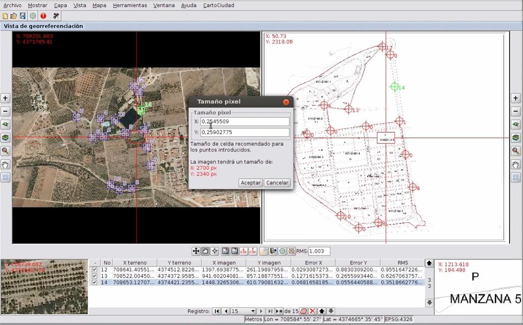
7 1. What's gvsig gvsig Desktop: Characteristics Raster and Remote Sensing: Bands Layer export and clip Colour tables and gradients Transparency by pixel and opacity Statistics, histograms filters Region of Interest (ROI) Geolocation Enhance Vectorization Raster reprojection Mosaics... and


 Location")
8 1. What's gvsig gvsig Desktop: Characteristics Spatial Data Infrastructure (SDI): WMS Service WFS Service WCS Service Searching serv. (Catalogue client) Location serv. (Gazetteer client)


9 1. What's gvsig gvsig Desktop: Characteristics
10 1. What's gvsig Symbols: Forestry For point symbols: - On one side the symbols collection used by the NPS (U.S. National Park Service). - On the other side we've used the Trees & Shrubs collection made by Jim Mossman.

11 1. What's gvsig Symbols: Forestry Complemented with line and fill symbols, used frequently in forestry maps


12 1. What's gvsig gvsig Mobile: Characteristics gvsig Mobile is a GIS complement to be used on field work. Main characteristics: Display: several formats, CRS management Symbology and Labeling GPS Support: manual and automatic Editing tools Selection and searching SDI/OGC access: WMS, WFS... Measurement and information...


13 1. What's gvsig gvsig Educa: Characteristics gvsig Educa is a customization of the gvsig Desktop Open Source GIS, adapted as a tool for the education of issues that have a geographic component. gvsig Educa provides educators with a tool that helps students to analyze and understand space, and which can be adapted to different levels or education systems. "If I can't picture it, I can't understand it (A. Einstein)"
14 Contents 1. What's gvsig 2. gvsig Community 3. gvsig Association 4. Case studies in forestry

15 2. gvsig Community Some data... Translated to more than 25 languages Downloaded in more than 100 countries Several mailing lists; users Conferences in Spain, Germany, Italy, United Kingdom, Brazil, Russia, France, Argentina, Venezuela, Uruguay, Chile... Countries where gvsig has been downloaded

16 2. gvsig Community Blog, Planet, Outreach, Twitter, Facebook... gvsig Association:
17 Contents 1. What's gvsig 2. gvsig Community 3. gvsig Association 4. Case studies in forestry
18 3. gvsig Association Who are we? It was born in Composed of companies and non business entities (universities, geographical institutes,...). It constitutes the biggest international network of experts in free geomatics. References and clients in more than twenty countries. Model based on the shared knowledge and the collaboration. Knowledge is transferred to the client. We offer learning, consulting, supporting, developments...
19 3. gvsig Association Clients and references: Some consulting examples Spatial Data Infrastructure. PDVSA (Venezuela) Migration from ArcGIS to gvsig. Munich City Council (Germany) GIS analysis for urban areas. UN-Habitat (Kenya) Multimodal transport geoportal in Valencia (Spain) gvsig development for cadastral management (Mexico) GIS for solid waste management in Basque Country (Spain) GIS for road management in the region of Valencia (Spain)
20 Contents 1. What's gvsig 2. gvsig Community 3. gvsig Association 4. Case studies in forestry

21 4. Case studies Application of gvsig in a study related to forest fire monitoring It al y Comparative of the vegetation renewal of Karst woodland and pine forest in an area damaged by a fire, with the natural evolution of the same vegetation typologies in unburnt areas.
 collaborated and shared data and knowledge on gvsig.")
22 4. Case studies gvsig in forestry, firefighting and environmental management in the provinces of Trieste, Gorizia (Italy) and Sežana (Slovenia) Sl Ita ov ly en ia The administrations of both countries (Italy and Slovenia) collaborated and shared data and knowledge on gvsig. They used gvsig Desktop for office work and gvsig Mobile for field work.

23 4. Case studies gvsig use applied to study the Ribeira river bank erosion (Brazil) B ra zi l Study of the changes at the Ribeira River bank, and the advance of the Atlantic Ocean over the continent.
, at both at low and high tide, at the estuary of the Minho")
24 4. Case studies Analysis of contaminants and salinity in the Minho river for the European Project Sp a in Determination of the spatial distribution of different physicochemical parameters (salinity, phosphate, ammonium, nitrate and nitrite), at both at low and high tide, at the estuary of the Minho river.

25 4. Case studies gvsig usage for defining forest stands Sp a in Delimitation of the forest stands in a hill, on an ortophoto, using gvsig. Data got during field work are included at the Geographic Information System.

26 4. Case studies gvsig applied to the management of the agricultural lands of the Lipetsk Region (Russia) R us si a Centralized storage of the information about agricultural lands and supporting of remote access to display spatial data and generate reports on the base of the developed web mapping application. gvsig Desktop is used as a client geospatial software to create the draft data sets and to edit final spatial data and their attributes.


27 4. Case studies gvsig for Forestry Management: SIFOMAP 3.0 C ub a Customized applications that allow to manage, administrate, update... the forestry heritage information. It's composed of different modules, like Forestry Management Planning, Sustainable Development Indicator, Forest Fire...

28 4. Case studies Spatial characterization of lightning strikes in Castilla y León (Spain) Sp a in The spatial analysis of lightning strikes allows to prevent and warn about natural disasters (forestry fires, hailstones...) at the agroforestry means, in order to minimize economic losses.

29 4. Case studies Spatial Data Infrastructures in developing countries: The climate change problem in Ebinat (Ethiopia) E th io pi a Management of the geographical information related to a real problem: drought and climate change. Analysis of the climatic conditions at the region and their relation with the type of farming.

30 4. Case studies gvsig applied to the monitoring of protected flora in the Region of Murcia Sp a in Monitoring of this species of flora, as well as the detection of new locations.

31 4. Case studies Use of gvsig to create potential distribution models of invading exotic species under different climate change scenarios Sp a in Analysis of the invading plants potential distribution at the Valencian Community, under different climate change scenarios in order to help the managers to confront these plagues in the future.
32 4. Case studies Other related case studies Using gvsig to compute light pollution from night satellite images (Spain) gvsig in a small ecological consulting firm, for representing plant or animal populations, extent and quality of vegetation types... (Australia) Variation of Neptune Grass in an area at the Calviá coast (Mallorca, Spain) Design and implementation of a GIS for underwater characterization (San Luis, Argentina) gvsig use on precision agriculture (Argentina) gvsig for modelling the Holocene landscape (Spain)
33 gvsig case studies in forestry and environment Mario Carrera Language and Communication Manager 3rd NEAR EAST FORESTRY WEEK Hashemite Kingdom of Jordan, January 2014
GODAN: Global Open Data for Agriculture and Nutrition
 GODAN: Global Open Data for Agriculture and Nutrition gvsig Suite: open source software for geographic information management in agriculture. Technology and case studies GODAN A short introduction... gvsig
gvsig a real tool for GIS technicians
 gvsig a real tool for GIS technicians Jorge Gaspar Sanz Salinas jsanz@prodevelop.es International Geodetic Students Meeting 05/05/08 Valencia Agenda of the project OK, but what can gvsig do for me now?
These modules are covered with a brief information and practical in ArcGIS Software and open source software also like QGIS, ILWIS.
 Online GIS Training and training modules covered are: 1. ArcGIS, Analysis, Fundamentals and Implementation 2. ArcGIS Web Data Sharing 3. ArcGIS for Desktop 4. ArcGIS for Server These modules are covered
gvsig Generalitat Valenciana March 29th 2017, Lisbon, Portugal
 gvsig Generalitat Valenciana March 29th 2017, Lisbon, Portugal Agenda Context State of play Design Governance Impact and results Sustainability Next Steps The importance of Geo Before starting... Geography
Discovery and Access of Geospatial Resources using the Geoportal Extension. Marten Hogeweg Geoportal Extension Product Manager
 Discovery and Access of Geospatial Resources using the Geoportal Extension Marten Hogeweg Geoportal Extension Product Manager DISCOVERY AND ACCESS USING THE GEOPORTAL EXTENSION Geospatial Data Is Very
GIS = Geographic Information Systems;
 What is GIS GIS = Geographic Information Systems; What Information are we talking about? Information about anything that has a place (e.g. locations of features, address of people) on Earth s surface,
ENV208/ENV508 Applied GIS. Week 1: What is GIS?
 ENV208/ENV508 Applied GIS Week 1: What is GIS? 1 WHAT IS GIS? A GIS integrates hardware, software, and data for capturing, managing, analyzing, and displaying all forms of geographically referenced information.
The Emerging Role of Enterprise GIS in State Forest Agencies
 The Emerging Role of Enterprise GIS in State Forest Agencies Geographic Information System (GIS) A geographic information system (GIS) is a computer software system designed to capture, store, manipulate,
ArcGIS. for Server. Understanding our World
 ArcGIS for Server Understanding our World ArcGIS for Server Create, Distribute, and Manage GIS Services You can use ArcGIS for Server to create services from your mapping and geographic information system
Techniques for Science Teachers: Using GIS in Science Classrooms.
 Techniques for Science Teachers: Using GIS in Science Classrooms. After ESRI, 2008 GIS A Geographic Information System A collection of computer hardware, software, and geographic data used together for
Existing Open Source Tools and Possibilities for Cadastre Systems
 Existing Open Source Tools and Possibilities for Cadastre Systems Gertrude Pieper Espada FIG Congress Sydney, 11-16 April 2010 What is FLOSS? What is open source? What open source software tools are available?
Features and Benefits
 Autodesk LandXplorer Features and Benefits Use the Autodesk LandXplorer software family to help improve decision making, lower costs, view and share changes, and avoid the expense of creating physical
Karsten Vennemann, Seattle. QGIS Workshop CUGOS Spring Fling 2015
 Karsten Vennemann, Seattle 2015 a very capable and flexible Desktop GIS QGIS QGIS Karsten Workshop Vennemann, Seattle slide 2 of 13 QGIS - Desktop GIS originally a GIS viewing environment QGIS for the
Free and Open Source Software for Cadastre and Land Registration : A Hidden Treasure? Gertrude Pieper Espada. Overview
 Free and Open Source Software for Cadastre and Land Registration : A Hidden Treasure? Gertrude Pieper Espada Overview FLOSS concepts Digital Land Administration systems FLOSS Database alternatives FLOSS
GEOMATICS. Shaping our world. A company of
 GEOMATICS Shaping our world A company of OUR EXPERTISE Geomatics Geomatics plays a mayor role in hydropower, land and water resources, urban development, transport & mobility, renewable energy, and infrastructure
SITMUN: Cooperating to Build Local SDIs in the Barcelona Region
 SITMUN: Cooperating to Build Local SDIs in the Barcelona Region Diputació de Barcelona Territory and Sustainability Area Territorial Information Systems Department INSPIRE CONFERENCE Barcelona, September
DP Project Development Pvt. Ltd.
 Dear Sir/Madam, Greetings!!! Thanks for contacting DP Project Development for your training requirement. DP Project Development is leading professional training provider in GIS technologies and GIS application
I&CLC2000 in support to new policy initiatives (INSPIRE, GMES,..)
") I&CLC2000 in support to new policy initiatives (INSPIRE, GMES,..) Manfred Grasserbauer, Director Joint Research Centre Institute for Environment and Sustainability 1 IMAGE 2000 European mosaic of satellite
I&CLC2000 in support to new policy initiatives (INSPIRE, GMES,..) Manfred Grasserbauer, Director Joint Research Centre Institute for Environment and Sustainability 1 IMAGE 2000 European mosaic of satellite
Innovation. The Push and Pull at ESRI. September Kevin Daugherty Cadastral/Land Records Industry Solutions Manager
 Innovation The Push and Pull at ESRI September 2004 Kevin Daugherty Cadastral/Land Records Industry Solutions Manager The Push and The Pull The Push is the information technology that drives research and
Corporate. Information. Railway Infrastructure Administrator. Year indracompany.com
 geospatial and mobility Corporate Geographic Information System of ADIF Railway Infrastructure Administrator. Year 2009-2010 Corporate Geographic Information System of ADIF ADIF. Spanish Administrator
GIS Workshop Data Collection Techniques
 GIS Workshop Data Collection Techniques NOFNEC Conference 2016 Presented by: Matawa First Nations Management Jennifer Duncan and Charlene Wagenaar, Geomatics Technicians, Four Rivers Department QA #: FRG
ISO Series Standards in a Model Driven Architecture for Landmanagement. Jürgen Ebbinghaus, AED-SICAD
 ISO 19100 Series Standards in a Model Driven Architecture for Landmanagement Jürgen Ebbinghaus, AED-SICAD 29.10.2003 The Company 100% SIEMENS PTD SIEMENS Business Services Shareholder & Strategic Business
SITR-IDT The Spatial Data Infrastructure of Sardinia Region
 ITALY LOCAL AUTHORITY FOR MUNICIPALITIES, FINANCES AND URBAN PLANNING REGIONAL DEPARTMENT FOR CARTOGRAPHY AND INFORMATION SYSTEMS SITR-IDT The Spatial Data Infrastructure of Sardinia Region Content of
NR402 GIS Applications in Natural Resources
 NR402 GIS Applications in Natural Resources Lesson 1 Introduction to GIS Eva Strand, University of Idaho Map of the Pacific Northwest from http://www.or.blm.gov/gis/ Welcome to NR402 GIS Applications in
Geospatial Fire Behavior Modeling App to Manage Wildfire Risk Online. Kenyatta BaRaKa Jackson US Forest Service - Consultant
 Geospatial Fire Behavior Modeling App to Manage Wildfire Risk Online Kenyatta BaRaKa Jackson US Forest Service - Consultant Fire Behavior Modeling and Forest Fuel Management Modeling Fire Behavior is an
PC ARC/INFO and Data Automation Kit GIS Tools for Your PC
 ESRI PC ARC/INFO and Data Automation Kit GIS Tools for Your PC PC ARC/INFO High-quality digitizing and data entry Powerful topology building Cartographic design and query Spatial database query and analysis
Funding systems used in Mexico to support institutional arrangements: INEGI case
 Funding systems used in Mexico to support institutional arrangements: INEGI case Sistemas de financiamiento usados en México, para soportar arreglos institucionales: Caso INEGI United Nations Committee
Bentley Map Advancing GIS for the World s Infrastructure
 Bentley Map Advancing GIS for the World s Infrastructure Presentation Overview Why would you need Bentley Map? What is Bentley Map? Where is Bentley Map Used? Red text signifies new things in Bentley Map
What is GIS and How Can It Help Me?
 esri European User Conference Madrid 2011 What is GIS and How Can It Help Me? Jaime Nieves Ignacio Vázquez esri spain «Knowing where things are, and why, is essential to rational decision making.» Jack
Overview of Geospatial Open Source Software which is Robust, Feature Rich and Standards Compliant
 Overview of Geospatial Open Source Software which is Robust, Feature Rich and Standards Compliant Cameron SHORTER, Australia Key words: Open Source Geospatial Foundation, OSGeo, Open Standards, Open Geospatial
Esri UC2013. Technical Workshop.
 Esri International User Conference San Diego, California Technical Workshops July 9, 2013 CAD: Introduction to using CAD Data in ArcGIS Jeff Reinhart & Phil Sanchez Agenda Overview of ArcGIS CAD Support
Lecture 1 Introduction to GIS. Dr. Zhang Spring, 2017
 Lecture 1 Introduction to GIS Dr. Zhang Spring, 2017 Topics of the course Using and making maps Navigating GIS Map design Working with spatial data Geoprocessing Spatial data infrastructure Digitizing
Implementing INSPIRE Geoportal in Turkey
 Implementing INSPIRE Geoportal in Turkey Gencay SERTER City and Regional Planner 1 Presentation Plan Introduction INSPIRE and Turkey Importance of al Spatial Planning Portal Logical&Legal Hierarchy GeoPortal
Popular Mechanics, 1954
 Introduction to GIS Popular Mechanics, 1954 1986 $2,599 1 MB of RAM 2017, $750, 128 GB memory, 2 GB of RAM Computing power has increased exponentially over the past 30 years, Allowing the existence of
Welcome to NR502 GIS Applications in Natural Resources. You can take this course for 1 or 2 credits. There is also an option for 3 credits.
 Welcome to NR502 GIS Applications in Natural Resources. You can take this course for 1 or 2 credits. There is also an option for 3 credits. The 1st credit consists of a series of readings, demonstration,
a national geological survey perspective François ROBIDA BRGM (French Geological Survey)
") a national geological survey perspective François ROBIDA BRGM (French Geological Survey) Pre-Conference Seminar on Socio-Economic Value of Geospatial for National and Regional Development 21 August 2017,
a national geological survey perspective François ROBIDA BRGM (French Geological Survey) Pre-Conference Seminar on Socio-Economic Value of Geospatial for National and Regional Development 21 August 2017,
Creating Basemaps to Manage Buildings and Facilities
 Esri International User Conference San Diego, California Technical Workshops July 26, 2012 Creating Basemaps to Manage Buildings and Facilities Mark Stewart and Tamara Yoder Topics for this Session Overview
A FOSS approach to Integrated Water Resource Management: the case study of Red-Thai Binh rivers system in Vietnam
 A FOSS approach to Integrated Water Resource Management: the case study of Red-Thai Binh rivers system in Vietnam Carolina Arias Munoz1, Maria Antonia Brovelli1, Simone Corti1, Marco Micotti2, Rodolfo
Teaching GIS for Land Surveying
 Teaching GIS for Land Surveying Zhanjing (John) Yu Evergreen Valley College, San Jose, California James Crossfield California State University at Fresno, Fresno California 7/13/2006 1 Outline of the Presentation
ArcGIS Pro: Essential Workflows STUDENT EDITION
 ArcGIS Pro: Essential Workflows STUDENT EDITION Copyright 2018 Esri All rights reserved. Course version 6.0. Version release date August 2018. Printed in the United States of America. The information contained
Enabling ENVI. ArcGIS for Server
 Enabling ENVI throughh ArcGIS for Server 1 Imagery: A Unique and Valuable Source of Data Imagery is not just a base map, but a layer of rich information that can address problems faced by GIS users. >
How local communities could profit from Habitats infrastructure
 Social Validation of INSPIRE Annex III Data Structures in EU Habitats How local communities could profit from Habitats infrastructure Andrea Scianna ( Icar CNR Italy ) consultant for Madonie Park Authority
ARCGIS PRO COURSE, APPLIED TO ENVIROMENTAL MANAGEMENT GIS. Course. Training. .com
 ARC PRO COURSE, APPLIED TO ENVIROMENTAL MANAGEMENT TYC Training Course.com TRAINING OVERVIEW This Arc Pro online course will provide a great deal of information about the link between earth s ecosystems
INDONESIA S S UPDATE: GEOSPATIAL INFORMATION FOR SUSTAINABLE DEVELOPMENT RELATED TO INA SDI Dr. Asep Karsidi, M.Sc
 INDONESIA S S UPDATE: GEOSPATIAL INFORMATION FOR SUSTAINABLE DEVELOPMENT RELATED TO INA SDI Dr. Asep Karsidi, M.Sc GEOSPATIAL INFORMATION AGENCY 08 August, 2012 OUTLINE 1. Transformation Bakosurtanal into
IMPERIAL COUNTY PLANNING AND DEVELOPMENT
 IMPERIAL COUNTY PLANNING AND DEVELOPMENT GEODATABASE USER MANUAL FOR COUNTY BUSINESS DEVELOPMENT GIS June 2010 Prepared for: Prepared by: County of Imperial Planning and Development 801 Main Street El
Among various open-source GIS programs, QGIS can be the best suitable option which can be used across partners for reasons outlined below.
 Comparison of Geographic Information Systems (GIS) software As of January 2018, WHO has reached an agreement with ESRI (an international supplier of GIS software) for an unlimited use of ArcGIS Desktop
STEREO ANALYST FOR ERDAS IMAGINE Stereo Feature Collection for the GIS Professional
 STEREO ANALYST FOR ERDAS IMAGINE Stereo Feature Collection for the GIS Professional STEREO ANALYST FOR ERDAS IMAGINE Has Your GIS Gone Flat? Hexagon Geospatial takes three-dimensional geographic imaging
Land Administration and Cadastre
 Geomatics play a major role in hydropower, land and water resources and other infrastructure projects. Lahmeyer International s (LI) worldwide projects require a wide range of approaches to the integration
Transactions on Information and Communications Technologies vol 18, 1998 WIT Press, ISSN
 STREAM, spatial tools for river basins, environment and analysis of management options Menno Schepel Resource Analysis, Zuiderstraat 110, 2611 SJDelft, the Netherlands; e-mail: menno.schepel@resource.nl
Design and implementation of a new meteorology geographic information system
 Design and implementation of a new meteorology geographic information system WeiJiang Zheng, Bing. Luo, Zhengguang. Hu, Zhongliang. Lv National Meteorological Center, China Meteorological Administration,
Institute of Statistical and Geographical Information of Jalisco State Subnational Statistical and Geographical System India.
 Institute of Statistical and Geographical Information of Jalisco State Subnational Statistical and Geographical System India. January 2017 Subnational Statistical and Geographical System National Statistical
Geometric Algorithms in GIS
 Geometric Algorithms in GIS GIS Visualization Software Dr. M. Gavrilova GIS Software for Visualization ArcView GEO/SQL Digital Atmosphere AutoDesk Visual_Data GeoMedia GeoExpress CAVE? Visualization in
GIS-based Smart Campus System using 3D Modeling
 GIS-based Smart Campus System using 3D Modeling Smita Sengupta GISE Advance Research Lab. IIT Bombay, Powai Mumbai 400 076, India smitas@cse.iitb.ac.in Concept of Smart Campus System Overview of IITB Campus
Data Aggregation with InfraWorks and ArcGIS for Visualization, Analysis, and Planning
 Data Aggregation with InfraWorks and ArcGIS for Visualization, Analysis, and Planning Stephen Brockwell President, Brockwell IT Consulting, Inc. Join the conversation #AU2017 KEYWORD Class Summary Silos
Geospatial SDI Portal for effective Governance of Pune METROPOLIS region
 Geospatial SDI Portal for effective Governance of Pune METROPOLIS region Mr. Praveen Gautam Senior Manager 19 th January 2018 PMRDA Overview Provide a Spatial Framework for the entire region with various
ArcGIS for INSPIRE. Marten Hogeweg
 ArcGIS for INSPIRE Marten Hogeweg Please Take Our Survey on the App Download the Esri Events app and find your event Select the session you attended Scroll down to find the feedback section Complete answers
CAD: Introduction to using CAD Data in ArcGIS. Kyle Williams & Jeff Reinhart
 CAD: Introduction to using CAD Data in ArcGIS Kyle Williams & Jeff Reinhart What we will accomplish today Overview of ArcGIS CAD Support Georeferencing CAD data for ArcGIS How Mapping Specification for
Applying ArcGIS Online for Establishing Hanoi Agriculture Map
 Applying ArcGIS Online for Establishing Hanoi Agriculture Map Thanh Xuan Nguyen Geography Department Hanoi National University of Education mrthanhxuan@gmail.com Tien Yin Chou GIS Research Center Feng
POSSIBILITY FOR APPLICATION OF GIS TECHNOLOGIES IN RTB BOR GROUP
 MINING AND METALLURGY INSTITUTE BOR UDK: 622 ISSN: 2334-8836 (Štampano izdanje) ISSN: 2406-1395 (Online) UDK: 681.33:622.343(045)=111 doi:10.5937/mmeb1603021v Nenad Vušović *, Marko Vuković **, Igor Svrkota
ADDRESSING THE DATA AND INFORMATION NEEDS FOR GOOD GOVERNANCE, SHARING EXPERIENCES FROM COTE D IVOIRE. 20 April 2016 to 22 April 2016 ADDIS ABABA
 20 April 2016 to 22 April 2016 ADDIS ABABA ADDRESSING THE DATA AND INFORMATION NEEDS FOR GOOD GOVERNANCE, SHARING EXPERIENCES FROM COTE D IVOIRE Dr. Edouard FONH-GBEI Director General of CNTIG, General
Introduction. Elevation Data Strategy. Status and Next Steps
 1 2 Introduction Elevation Data Strategy Status and Next Steps 3 Canada is the 2nd largest country in the world - 9.9 million sq km Surrounded by 3 oceans with 202 000 km of coastline Population over 35
ESRI Survey Summit August Clint Brown Director of ESRI Software Products
 ESRI Survey Summit August 2006 Clint Brown Director of ESRI Software Products Cadastral Fabric How does Cadastral fit with Survey? Surveyors process raw field observations Survey measurements define high-order
June 19 Huntsville, Alabama 1
 June 19 Huntsville, Alabama 1 Real-Time Geospatial Data: The Fusion of PI and ArcGIS Enabling Smarter Facilities Management OSIsoft and Esri Mapping and Location Analytics Platform Supporting Your Use
GIS PORTFOLIO MOHAMED MAGDY MOHAMED HUSSAIN GIS ENGINEER. UWF GIS ONLINE CERTIFICATE GIS Internship (GIS4944)
") 2012 GIS PORTFOLIO MOHAMED MAGDY MOHAMED HUSSAIN GIS ENGINEER UWF GIS ONLINE CERTIFICATE GIS Internship (GIS4944) Portfolio Table of Contents Subject... Page Personal statement/mission/philosophy... 1
2012 GIS PORTFOLIO MOHAMED MAGDY MOHAMED HUSSAIN GIS ENGINEER UWF GIS ONLINE CERTIFICATE GIS Internship (GIS4944) Portfolio Table of Contents Subject... Page Personal statement/mission/philosophy... 1
How to Pick a GIS. GIS Software Chapter 8 in Longley, Goodchild, Maguire, and Rhind,, 2001
 How to Pick a GIS GIS Software Chapter 8 in Longley, Goodchild, Maguire, and Rhind,, 2001 How to Pick a GIS Evolution of GIS software Architecture of GIS software Types of software Example products The
Implementation of INSPIRE Principles: Sardinia Region SDI State of the Art and Further Developments
 REGION OF SARDINIA (ITALY) LOCAL AUTHORITY FOR MUNICIPALITIES, FINANCES AND URBAN PLANNING DEPT. FOR THE REGIONAL SPATIAL DATA INFRASTRUCTURE Implementation of INSPIRE Principles: Sardinia Region SDI State
When Map Quality Matters
 When Map Quality Matters 50% 25% Powerful geospatial mapping tools for Adobe Creative Cloud and offline map solutions for mobile devices 20% When Map Quality Matters 10% We re focused on creating powerful
DEVELOPMENT OF GPS PHOTOS DATABASE FOR LAND USE AND LAND COVER APPLICATIONS
 DEVELOPMENT OF GPS PHOTOS DATABASE FOR LAND USE AND LAND COVER APPLICATIONS An Ngoc VAN and Wataru TAKEUCHI Institute of Industrial Science University of Tokyo 4-6-1 Komaba, Meguro-ku, Tokyo 153-8505 Japan
Esri Production Mapping: Map Automation & Advanced Cartography MADHURA PHATERPEKAR JOE SHEFFIELD
 Esri Production Mapping: Map Automation & Advanced Cartography MADHURA PHATERPEKAR JOE SHEFFIELD Traditional Cartography What you really want Cartographic Workflow Output Cartographic Data Symbology Layout
Esri and GIS Education
 Esri and GIS Education Organizations Esri Users 1,200 National Government Agencies 11,500 States & Regional Agencies 30,800 Cities & Local Governments 32,000 Businesses 8,500 Utilities 12,600 NGOs 11,000
gvsig: Open Source Solutions in spatial technologies
 gvsig: Open Source Solutions in spatial technologies gvsig is a tool for handling geographical information, a completely GIS client with license GNU GPL. Alvaro A. Anguix Alfaro, Gabriel Carrión Rico Conselleria
GEOGRAPHIC INFORMATION SYSTEMS AND IT SOLUTIONS FOR THE ENVIRONMENT
 GEOGRAPHIC INFORMATION SYSTEMS AND IT SOLUTIONS FOR THE ENVIRONMENT Mission We focus on Solutions is a worldwide operating business offering Geographic Information Systems and IT solutions to assist environmental
Are You on the Map for Geospatial Data Applications and Hosting?
 Are You on the Map for Geospatial Data Applications and Hosting? May 20, 2011 an East View update on happenings benefiting print, raster and vector geospatial data Rodney Buhrsmith, Chief Marketing Officer,
European Space Agency
 Guidelines - Guidelines how/when to interact during the WebEx session: - Due to the number of attendees, please keep always your webcam and microphone switched-off - You can use anytime the chat to all
ArcGIS 10.1 An Overview of the System
 ArcGIS 10.1 An Overview of the System ArcGIS 10.1 An Overview of the System Damian Spangrud Director of Solutions, Esri Redlands, CA USA ArcGIS 10.1 Web Cloud Online Mobile Enterprise Desktop ArcGIS 10.1
An Introduction to the Community Maps Information Model
 Esri International User Conference July 23 27 San Diego Convention Center An Introduction to the Community Maps Information Model Seth Sarakaitis Agenda Overview of Community Maps Program Information Models
Regional Centre for Mapping of Resources for Development (RCMRD), Nairobi, Kenya
, Nairobi, Kenya") Regional Centre for Mapping of Resources for Development (RCMRD), Nairobi, Kenya Introduction to GIS (2 weeks: 10 days) Intakes: 8 th January, 6 th February, 5th March, 3 rd. April 9 th, May 7 th, June
Regional Centre for Mapping of Resources for Development (RCMRD), Nairobi, Kenya Introduction to GIS (2 weeks: 10 days) Intakes: 8 th January, 6 th February, 5th March, 3 rd. April 9 th, May 7 th, June
Innovative GIS solutions
 Dušan Cibulka GIS Consultant / Analyst 5. - 6. June 2014 8 th Forum of Young Geoinformaticians 2014 Contents Our Vision and Philosophy Technologies we use Selected solutions implemented in projects: Renovation
Leveraging Your Geo-spatial Data Investments with Quantum GIS: an Open Source Geographic Information System
 Leveraging Your Geo-spatial Data Investments with Quantum GIS: an Open Source Geographic Information System Donald L. Schrupp Colorado Division of Wildlife (Retired) Danny Lewis Texas Parks and Wildlife
Careers in downstream satellite applications. Michael Lawrence Business Development Director. Deimos Space UK
 Careers in downstream satellite applications Michael Lawrence Business Development Director Deimos Space UK 1 Agenda 1. What is the downstream sector? 2. What kinds of jobs are available? 3. What do you
Production Line Tool Sets
 Production Line Tool Sets Tools for high-quality database production and cartographic output Production Line Tool Sets Production Line Tool Sets (PLTS) by ESRI are a collection of software applications
7 GEOMATICS BUSINESS SOLUTIONS - ANNUAL REPORT 2006
 7 GEOMATICS BUSINESS SOLUTIONS - ANNUAL REPORT 2006 The Planning and Economic Development Committee recommends the adoption of the recommendation contained in the following report November 30, 2006, from
Display data in a map-like format so that geographic patterns and interrelationships are visible
 Vilmaliz Rodríguez Guzmán M.S. Student, Department of Geology University of Puerto Rico at Mayagüez Remote Sensing and Geographic Information Systems (GIS) Reference: James B. Campbell. Introduction to
Development of Univ. of San Agustin Geographic Information System (USAGIS)
") , pp.170-176 http://dx.doi.org/10.14257/astl.2014.48.27 Development of Univ. of San Agustin Geographic Information System (USAGIS) Rosslin John H. Robles Chair, Computer Science Department, University
, pp.170-176 http://dx.doi.org/10.14257/astl.2014.48.27 Development of Univ. of San Agustin Geographic Information System (USAGIS) Rosslin John H. Robles Chair, Computer Science Department, University
You are Building Your Organization s Geographic Knowledge
 You are Building Your Organization s Geographic Knowledge And Increasingly Making it Available Sharing Data Publishing Maps and Geo-Apps Developing Collaborative Approaches Citizens Knowledge Workers Analysts
IRDAT Fvg, evolving a regional Spatial Data Infrastructure according to INSPIRE
 IRDAT Fvg, evolving a regional Spatial Data Infrastructure according to INSPIRE Tutti i diritti riservati. Proprietà INSIEL SpA. A. Benvenuti, A. Chiarandini Insiel (Italy) M. Lunardis - Friuli Venezia
ArcGIS Pro Q&A Session. NWGIS Conference, October 11, 2017 With John Sharrard, Esri GIS Solutions Engineer
 ArcGIS Pro Q&A Session NWGIS Conference, October 11, 2017 With John Sharrard, Esri GIS Solutions Engineer jsharrard@esri.com ArcGIS Desktop The applications ArcGIS Pro ArcMap ArcCatalog ArcScene ArcGlobe
Experiences and Directions in National Portals"
 FIG Seminar on e-land Administration Innsbruck/Austria 2-4 June 2004 "ESRI's Experiences and Directions in National Portals" Kevin Daugherty Cadastral/Land Records Manager ESRI Topic Points Technology
Zagreb Spatial Data Infrastructure. Sanja Batić, APIS IT Split, 14. rujna 2011.
 Zagreb Spatial Data Infrastructure Sanja Batić, APIS IT Split, 14. rujna 2011. Agenda Zagreb Spatial Data Infrastructure - ZIPP Guidelines for further ZIPP Geoportal development Conclusion 1964 The Centre
QGIS COURSE - ROUTE ANALYSIS, FINDING THE SHORT PATH IN QGIS ONLINE TRAINING. GIS Training. Course. .com
 Q COURSE - ROUTE ANALYSIS, FINDING THE SHORT PATH IN Q ONLINE TRAINING Training Course.com TYC COURSE GOALS The objective of this course is to initiate the student in route analysis using Q. The training
GIS Software. Evolution of GIS Software
 GIS Software The geoprocessing engines of GIS Major functions Collect, store, mange, query, analyze and present Key terms Program collections of instructions to manipulate data Package integrated collection
Using CAD data in ArcGIS
 Using CAD data in ArcGIS Phil Sanchez and Jeff Reinhart Esri UC 2014 Technical Workshop Agenda Overview of ArcGIS CAD Support Using CAD Datasets in ArcMap Georeferencing CAD data for ArcGIS Loading CAD
Write a report (6-7 pages, double space) on some examples of Internet Applications. You can choose only ONE of the following application areas:
 on some examples of Internet Applications. You can choose only ONE of the following application areas:") UPR 6905 Internet GIS Homework 1 Yong Hong Guo September 9, 2008 Write a report (6-7 pages, double space) on some examples of Internet Applications. You can choose only ONE of the following application
UPR 6905 Internet GIS Homework 1 Yong Hong Guo September 9, 2008 Write a report (6-7 pages, double space) on some examples of Internet Applications. You can choose only ONE of the following application
ARCGIS COURSE, BEGINNER LEVEL ONLINE TRAINING
 ARC COURSE, BEGINNER LEVEL ONLINE TRAINING Course.com TYC TRAINING OVERVIEW This course will qualify students to use Arc Desktop 10 and in particular, ArcMap, ArcCatalog and ArcTool Box, focusing on the
Technical Specifications. Form of the standard
 Used by popular acceptance Voluntary Implementation Mandatory Legally enforced Technical Specifications Conventions Guidelines Form of the standard Restrictive Information System Structures Contents Values
Digital Map of Mexico Platform and MxSIG. March 2017
 Digital Map of Mexico Platform and MxSIG March 2017 1 I. Digital Map of Mexico Platform Concept Evolution II. Digital Map of Mexico online Concept Capabilities Information available Other state units information
Thales Canada, System Division. BattleView: Integrating ArcGIS Into Canadian Army s Command And Control Application
 BattleView: Integrating ArcGIS Into Canadian Army s Command And Control Application BattleView Overview Canadian Army s command and control (C2) application Deployed in army headquarters unit and above
Sustainable and Harmonised Development for Smart Cities The Role of Geospatial Reference Data. Peter Creuzer
 Sustainable and Harmonised Development for Smart Cities The Role of Geospatial Reference Data Peter Creuzer 1. Introduction - Smart Cities and Geodata 2. Geodata in Germany 3. Examples 4. Data and Service
UNIT 4: USING ArcGIS. Instructor: Emmanuel K. Appiah-Adjei (PhD) Department of Geological Engineering KNUST, Kumasi
 Department of Geological Engineering KNUST, Kumasi") UNIT 4: USING ArcGIS Instructor: Emmanuel K. Appiah-Adjei (PhD) Department of Geological Engineering KNUST, Kumasi Getting to Know ArcGIS ArcGIS is an integrated collection of GIS software products ArcGIS
UNIT 4: USING ArcGIS Instructor: Emmanuel K. Appiah-Adjei (PhD) Department of Geological Engineering KNUST, Kumasi Getting to Know ArcGIS ArcGIS is an integrated collection of GIS software products ArcGIS
Exploit your geodata to enable smart cities and countries
 Exploit your geodata to enable smart cities and countries Carsten Rönsdorf, Head of Advisory Services Middle East Practice Manager Future Cities, standards and 3D 24 November 2014 Importance of Standards