CAD: Introduction to using CAD Data in ArcGIS. Kyle Williams & Jeff Reinhart
|
|
|
- Lee Thomas Whitehead
- 6 years ago
- Views:
Transcription


1


2 CAD: Introduction to using CAD Data in ArcGIS Kyle Williams & Jeff Reinhart
3 What we will accomplish today Overview of ArcGIS CAD Support Georeferencing CAD data for ArcGIS How Mapping Specification for CAD can help Loading CAD features into a Geodatabase Creating CAD Data (Export to CAD) CAD data support in ArcGIS Pro 1.1

4 CAD/GIS Interoperability Scenarios ArcGIS user who needs to - Display CAD data in maps Map - Load CAD data into their Geodatabase Load - Deliver GIS data in a CAD format Export ArcGIS


5 CAD in the Geospatial context CAD drawings are a large source of GIS data - Surveying - Cadastre - Civil engineering - Architecture - Landscape Architecture - Planning - Geodesign


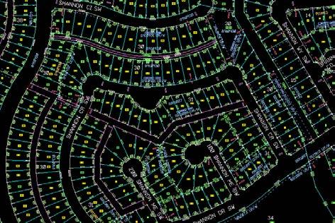
6 CAD Drawings Geometry, text, and symbols - comprise CAD entities/elements Organized into layers or levels Symbology represents information Can have data attached to entities
7 CAD Datasets in ArcGIS Geometry Attributes CAD entity geometry organized into feature classes Coordinate System CAD properties, tags, and database links are stored in attribute tables World File CAD data can be reprojected to overlay with other GIS layers CAD drawings can be transformed from local coordinates to projected coordinates


8 Direct-read CAD datasets in ArcGIS Translated on the fly as a virtual feature class CAD ArcGIS MyDrawing.dwg Text Geometry Properties User attributes MyDrawing.dwg Annotation Multipatch Points Polygons Spatial reference Georeference Metadata Embedded feature classes (DWG only) Polylines Attribute tables
9 Contents of a CAD Dataset City.dgn Annotation Multipatch Point Polygon Polyline Text, tags, and attribute definitions Polygons and is useful for 3D representation Points, blocks, and cells Closed areas such as polygons, ellipses, and circles Lines, polylines, and arcs City.prj Projection files define a coordinate system for a CAD dataset. They are recommended but not required.


10 Display Control Turn layers off and on to control feature display - Saved in the.mxd or.lyr - Apply to the entire dataset - Restore back to original rendering


11 Filter CAD Features Isolate the CAD data you need to work with using - Specific CAD Feature Classes - Drawing layer visibility - Definition Query


12 Filter CAD Features Use Definition Queries to create subsets - Saved in the.mxd or.lyr - Expressions can be saved to.exp files for re-use Drawing Layer Color Linetype Query Feature Layer
13 CAD Data Support in ArcGIS ESRI has long provided CAD support and integration tools Out of the box - No extension required Direct read - Conversion not required Current version support: - AutoCAD DWG/DXF: Up to 2016 (read/write) - MicroStation DGN: Up to V8i SELECT series 3


14 DEMO: Assigning coordinate systems and Georeferencing CAD in ArcGIS


15 Georeferencing Process Assigning a coordinate system Applying a transformation Stop Tracing Not all CAD datasets require these steps

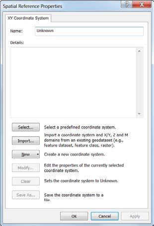
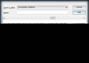
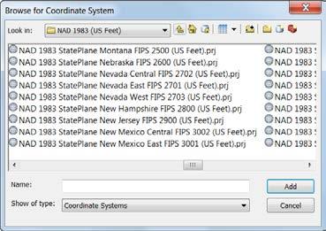

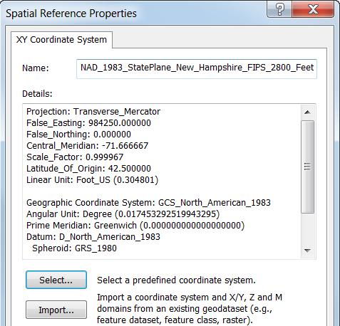
16 Assigning Coordinate Systems Defined at the CAD Dataset level Catalog window s Spatial Reference Properties dialog


17 Universal Projection and World Files Universal World File - ESRI_CAD.WLD - Applies identical transformation to all CAD files in workspace - Useful for set of tiled CAD drawings Universal Projection File - ESRI_CAD.PRJ - Applies same coordinate system to all CAD files in workspace


18 Georeferencing Toolbar Georeferencing toolbar use mouse pointer to move layer and create control points in map - Rotate, Scale, and Shift tools


19 Georeferencing Two-point Similarity transformation method - Move, Rotate, and Scale - Aspect ratio always maintained - Cannot skew or rubber sheet CAD drawing Transformation managed by World Files - ArcGIS is not modifying the CAD drawing *NOT required for drawings that are drawn in real-world coordinate location.

20 Georeferencing: World Files File based, two point transformation for CAD data Uses the.wld file extension Simple text file containing two lines with two pairs of coordinate values: <From X1, From Y1> <To X1, To Y1> <From X2, From Y2> <To X2, To Y2>


21 ArcGIS for AutoCAD Free Download from Esri Access to GIS content - Basemaps - Image services, Map Services - Location Services - LISP API Access to Feature Services - Direct editing GIS data - Subtype, domains Basemaps, Image services Map Services, Feature Services AutoCAD GIS content in AutoCAD Mapping Specification for CAD CAD Drawings
22 Mapping Specification for CAD (MSC) Provides improved interoperability between CAD and GIS Open source framework developed by ESRI - GIS feature classes + attributes - Coordinate systems Utilizes CAD data structures to define schema and store data Leveraged by ArcGIS Desktop CAD tools - CAD direct read/import tools - Export to CAD
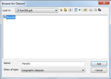
23 CAD data structure in ArcGIS Subset feature class AutoCAD Query - Layer, color, linestyle - Etc Invisible in AutoCAD Better than a SHP file City.dwg Annotation Multipatch Parcels Point Polygon Polyline Roads Text, tags, and attribute definitions Polygons and is useful for 3D representation MSC feature class that represents parcels (subset of polygons) Points, blocks, and cells Closed areas such as polygons, ellipses, and circles Lines, polylines, and arcs MSC feature class that represents roads (subset of polylines)
24 CAD/GIS Interoperability Scenarios ArcGIS user who needs to - Display CAD data in maps Map - Load CAD data into their Geodatabase Load - Deliver GIS data in a CAD format Export ArcGIS
25 Loading CAD data in ArcGIS Add to Geodatabase feature classes or create new Geodatabase from CAD - As-built updates - Editing requirements - Advanced Geodatabase tasks (i.e., Geometric Networks, Topology, etc.) Conversion supported by the Geoprocessing framework and ArcMap tools Can be combined with other Geoprocessing functions - Spatial Joins - Geometry manipulation


26 CAD Conversion Tools ArcMap - Export Data - Copy & Paste (Edit session) ArcToolbox Geoprocessing - Feature Class to Feature Class - Copy Features - Import CAD Annotation


27 CAD to Geodatabase Designed for bulk loading CAD datasets into a Geodatabase - Combines Copy Features, Merge and Import CAD Annotation into single tool - Works at the dataset level

28 Loading CAD data Demo: Campus example
29 Geoprocessing Scenarios CAD text inside polygons CAD to Geodatabase CAD text near lines Append to existing Geodatabase Line segments to polygons Merge with other layers
30 CAD/GIS Interoperability Scenarios ArcGIS user who needs to - Display CAD data in maps Map - Load CAD data into their Geodatabase Load - Deliver GIS data in a CAD format Export ArcGIS

31 Data Submittal Demo

 - Fields and default values, layers color,")
32 Export to CAD Output features to native CAD format - DGN V8 - DWG/DXF Release 14 to 2016 (ArcGIS ) Supports appending to existing CAD drawings Creates Seed files - CAD feature Classes (MSC) - Fields and default values, layers color, linestyles *Available at all license levels
33 Reserved CAD Fields Reserved CAD fields - Fields understood by Export to CAD - Creates shared cells, blocks, layers, colors - Creates MSC feature classes, fields, field values. Resources in help system

34 Accessing Services in Microstation MicroStation V8i has built-in WMS capabilities Web Mapping Services Imagery Web Feature Services Bentley Map works with Esri File Geodatabase?
35 Best Practices Tips and best practices for CAD & GIS - Seed/template file - Layer standards (Plan ahead) - Coordinate systems - Drawing in proper locations - Only use Model Space Export to CAD - template - Coffee and donuts
36 Demo: CAD support in ArcGIS PRO 1.1
37 ArcGIS Pro 1.1 CAD improvements Feature Layers organized by Level/layer Group layer created with the feature class name and a suffix "Group" Feature layers based on CAD layer/level names - Feature Class will be included with layer visibility turned off - Feature Layers for each Level/layer geometric type Feature Layers can be used as input to GP tools - Maintains Layer color with conversion - Honor CAD layer level visibility

38 ArcGIS Pro 1.1 CAD improvements Separate Feature Layers for Blocks and Shared Cells Group layer created with the feature class name and a suffix "Group" Feature layers based Shared Cells and Blocks - Microstations Shared Cells - AutoCAD Blocks Attributes values - schema of Shared Cell and Block only - Removed from CAD point feature class
39 ArcGIS Pro 1.1 CAD improvements Automatic Labeling of Annotation Points and Convert on Add CAD file support is simple feature classes - ANNOTATION features are currently added as a POINTS - Labeling of CAD POINT - Standard with other data sources Convert on Add Option (off by default) - Automatically converts CAD data to GDB - Simplifies data migration of conversion
40 What did we cover today? Overview of ArcGIS CAD Support Georeferencing CAD data for ArcGIS How Mapping Specification for CAD can help Loading CAD features into a Geodatabase Creating CAD Data (Export to CAD) CAD data support in ArcGIS Pro 1.1

41 More CAD at UC Session Title Date/Time Room CAD: Introduction to using CAD Data in ArcGIS CAD: The ArcGIS for AutoCAD CAD Plug in CAD: The ArcGIS for AutoCAD CAD Plug in Karen Hodge CAD: Introduction to using CAD Data in ArcGIS Wrap Up Tue 7/21/ :30 AM - 09:45 AM Tue 7/21/ :30 PM - 02:45 PM Wed 7/22/ :15 PM - 04:30 PM Thu 7/23/ :30 AM - 09:45 AM Session Title Date/Time Room CAD: Lining Up CAD Data in ArcGIS CAD: Lining Up CAD Data in ArcGIS Room 03 Room 03 Room 31 B Room 15 A Wed 7/22/ :00 AM - 10:30 AM Thu 7/23/ :00 AM - 10:30 AM Tech Theater 16 Exhibit Hall A Tech Theater 16 Exhibit Hall A
42 Want to learn more? Documentation - Related Esri Training and Tutorials - CAD in ArcGIS: - ArcGIS FOR AUTOCAD training video s: export-from-arcmap Additional Resources - Margaret Maher s book Lining up Data in ArcGIS
![Thank you Please fill out the session survey in your mobile app Select [CAD: Introduction to using CAD Data in ArcGIS] in the Mobile](/docs-images/73/68151421/images/43-1.jpg "App - Use the Search Feature to quickly find this title Click Technical Workshop Survey Answer a few short questions and enter any")
43 Thank you Please fill out the session survey in your mobile app Select [CAD: Introduction to using CAD Data in ArcGIS] in the Mobile App - Use the Search Feature to quickly find this title Click Technical Workshop Survey Answer a few short questions and enter any comments
Using CAD data in ArcGIS
 Using CAD data in ArcGIS Phil Sanchez and Jeff Reinhart Esri UC 2014 Technical Workshop Agenda Overview of ArcGIS CAD Support Using CAD Datasets in ArcMap Georeferencing CAD data for ArcGIS Loading CAD
Esri UC2013. Technical Workshop.
 Esri International User Conference San Diego, California Technical Workshops July 9, 2013 CAD: Introduction to using CAD Data in ArcGIS Jeff Reinhart & Phil Sanchez Agenda Overview of ArcGIS CAD Support
Strategies for Integrating CAD and BIM in ArcGIS. Don Kuehne Esri 3D Product Manager: CAD/BIM/AEC
 Strategies for Integrating CAD and BIM in ArcGIS Don Kuehne Esri 3D Product Manager: CAD/BIM/AEC CAD Digital Drawing CAD in ArcGIS Desktop CAD in Desktop CAD as Data CAD as a Map EXPORT TO CAD Create and
The File Geodatabase API. Craig Gillgrass Lance Shipman
 The File Geodatabase API Craig Gillgrass Lance Shipman Schedule Cell phones and pagers Please complete the session survey we take your feedback very seriously! Overview File Geodatabase API - Introduction
Geodatabase Management Pathway
 Geodatabase Management Pathway Table of Contents ArcGIS Desktop II: Tools and Functionality 3 ArcGIS Desktop III: GIS Workflows and Analysis 6 Building Geodatabases 8 Data Management in the Multiuser Geodatabase
GIS Software. Evolution of GIS Software
 GIS Software The geoprocessing engines of GIS Major functions Collect, store, mange, query, analyze and present Key terms Program collections of instructions to manipulate data Package integrated collection
How to create a new geodatabase using the extract data wizard. 1. How to Extract the Schema to create a Geodatabase using an existing design.
 How to create a new geodatabase using the extract data wizard The Extract Data Wizard can be used to create a new database based on an existing geodatabase. This tool may be used in the following cases:
Migrating Defense Workflows from ArcMap to ArcGIS Pro. Renee Bernstein and Jared Sellers
 Migrating Defense Workflows from ArcMap to ArcGIS Pro Renee Bernstein and Jared Sellers ArcGIS Desktop Desktop Web Device ArcMap ArcCatalog ArcScene ArcGlobe ArcGIS Pro portal Server Online Content and
Geodatabase An Introduction
 Federal GIS Conference 2014 February 10 11, 2014 Washington DC Geodatabase An Introduction Ralph Denkenberger esri Session Path The Geodatabase - What is it? - Why use it? - What types are there? Inside
Geodatabase: Best Practices. Robert LeClair, Senior Instructor
 Geodatabase: Best Practices Robert LeClair, Senior Instructor Agenda Geodatabase Creation Data Ownership Data Model Data Configuration Geodatabase Behaviors Data Validation Extending Performance Geodatabase
Geodatabase Essentials Part One - Intro to the Geodatabase. Jonathan Murphy Colin Zwicker
 Geodatabase Essentials Part One - Intro to the Geodatabase Jonathan Murphy Colin Zwicker Session Path The Geodatabase - What is it? - Why use it? - What types are there? Inside the Geodatabase Advanced
EEOS 381 -Spatial Databases and GIS Applications
 EEOS 381 -Spatial Databases and GIS Applications Lecture 5 Geodatabases What is a Geodatabase? Geographic Database ESRI-coined term A standard RDBMS that stores and manages geographic data A modern object-relational
These modules are covered with a brief information and practical in ArcGIS Software and open source software also like QGIS, ILWIS.
 Online GIS Training and training modules covered are: 1. ArcGIS, Analysis, Fundamentals and Implementation 2. ArcGIS Web Data Sharing 3. ArcGIS for Desktop 4. ArcGIS for Server These modules are covered
Creating Basemaps to Manage Buildings and Facilities
 Esri International User Conference San Diego, California Technical Workshops July 26, 2012 Creating Basemaps to Manage Buildings and Facilities Mark Stewart and Tamara Yoder Topics for this Session Overview
Performing Advanced Cartography with Esri Production Mapping
 Esri International User Conference San Diego, California Technical Workshops July 25, 2012 Performing Advanced Cartography with Esri Production Mapping Tania Pal & Madhura Phaterpekar Agenda Outline generic
Working with Land Records in ArcGIS. Amadea Azerki CA Cadastral Mapping Association October 15-16, 2009
 Working with Land Records in ArcGIS Amadea Azerki CA Cadastral Mapping Association October 15-16, 2009 Agenda An Overview of Land Records Resource Center Template Resources Editing Toolbar Configuration
Geodatabase Best Practices. Dave Crawford Erik Hoel
 Geodatabase Best Practices Dave Crawford Erik Hoel Geodatabase best practices - outline Geodatabase creation Data ownership Data model Data configuration Geodatabase behaviors Data integrity and validation
Local Government Basemaps using ArcGIS
 Local Government Basemaps using ArcGIS Steve Grisé Scott Oppmann Tuesday, July 14, 10:15-11:30am SDCC 30B Topics Basemaps for Local Government Essential Application-Driven New Ideas Design Strategies Discussion
Geodatabase An Overview
 Federal GIS Conference February 9 10, 2015 Washington, DC Geodatabase An Overview Ralph Denkenberger - esri Session Path The Geodatabase - What is it? - Why use it? - What types are there? Inside the Geodatabase
This paper outlines the steps we took to process the repository file into a Geodatabase Utility Data Model for Bloomfield Township s analysis.
 Title of Paper Importing CAD Drawings into a Utility Data Model Authors Names Kevin G. Broecker & James R. Miller Abstract This presentation covers the process needed to integrate data from a CAD drawing
Troubleshooting Replication and Geodata Services. Liz Parrish & Ben Lin
 Troubleshooting Replication and Geodata Services Liz Parrish & Ben Lin AGENDA: Troubleshooting Replication and Geodata Services Overview Demo Troubleshooting Q & A Overview of Replication Liz Parrish What
Esri EADA10. ArcGIS Desktop Associate. Download Full Version :
 Esri EADA10 ArcGIS Desktop Associate Download Full Version : http://killexams.com/pass4sure/exam-detail/eada10 Question: 85 Which format is appropriate for exporting map documents that require vector layers
CE 365K Exercise 1: GIS Basemap for Design Project Spring 2014 Hydraulic Engineering Design
 CE 365K Exercise 1: GIS Basemap for Design Project Spring 2014 Hydraulic Engineering Design The purpose of this exercise is for you to construct a basemap in ArcGIS for your design project. You may execute
ArcGIS Tools for Professional Cartography
 ArcGIS Tools for Professional Cartography By Makram Murad-al-shaikh M.S. Cartography Senior instructor ESRI Educational Services ICC - A Coruña - Spain, 9-16 July, 2005 Overview Overview of the ArcGIS
(THIS IS AN OPTIONAL BUT WORTHWHILE EXERCISE)
") PART 2: Analysis in ArcGIS (THIS IS AN OPTIONAL BUT WORTHWHILE EXERCISE) Step 1: Start ArcCatalog and open a geodatabase If you have a shortcut icon for ArcCatalog on your desktop, double-click it to start
PART 2: Analysis in ArcGIS (THIS IS AN OPTIONAL BUT WORTHWHILE EXERCISE) Step 1: Start ArcCatalog and open a geodatabase If you have a shortcut icon for ArcCatalog on your desktop, double-click it to start
Esri Defense Mapping: Cartographic Production. Bo King
 Esri Defense Mapping: Cartographic Production Bo King Agenda Esri Defense Mapping: Cartographic Production Solution Overview Desktop Cartographic Production Workflow - Create Rapid Graphic Product On Demand
ArcGIS Runtime: Migrating from ArcGIS Engine. Rex Hansen
 ArcGIS Runtime: Migrating from ArcGIS Engine Rex Hansen Thank You to Our Sponsors Migrating from ArcGIS Engine to ArcGIS Runtime ArcGIS Runtime API: new and evolved workflows on all platforms Windows Linux
ArcGIS Runtime: Migrating Your Apps from ArcGIS Engine. Eric Bader Lucas Danzinger Mike Branscomb
 ArcGIS Runtime: Migrating Your Apps from ArcGIS Engine Eric Bader Lucas Danzinger Mike Branscomb Migrating to ArcGIS Runtime ArcGIS Engine ArcGIS Runtime AppStudio for ArcGIS Apps: Collector, Workforce,
Geodatabase An Introduction
 2013 Esri International User Conference July 8 12, 2013 San Diego, California Technical Workshop Geodatabase An Introduction David Crawford and Jonathan Murphy Session Path The Geodatabase What is it?
Session Objectives. Learn how to: Bring georeferenced aerial imagery into Civil 3D. Connect to and import GIS data using various tools and techniques.
 GIS into Civil 3D Data 70th Annual Wisconsin Society of Land Surveyors' Institute January 24, 2019 1 Learn how to: Session Objectives Bring georeferenced aerial imagery into Civil 3D. Connect to and import
ArcGIS for AutoCAD Esri International User Conference July 8 12, 2013 San Diego, California Technical Workshop
 2013 Esri International User Conference July 8 12, 2013 San Diego, California Technical Workshop ArcGIS for AutoCAD Karen Hodge, Lead Developer Don Kuehne, Product Manager ArcGIS for AutoCAD is Free Plug-In
Leveraging ArcGIS Online Elevation and Hydrology Services. Steve Kopp, Jian Lange
 Leveraging ArcGIS Online Elevation and Hydrology Services Steve Kopp, Jian Lange Topics An overview of ArcGIS Online Elevation Analysis Using Elevation Analysis Services in ArcGIS for Desktop Using Elevation
DP Project Development Pvt. Ltd.
 Dear Sir/Madam, Greetings!!! Thanks for contacting DP Project Development for your training requirement. DP Project Development is leading professional training provider in GIS technologies and GIS application
GIS Data Production and Editing Pathway
 GIS Data Production and Editing Pathway Table of Contents ArcGIS Desktop II: Tools and Functionality 3 ArcGIS Desktop III: GIS Workflows and Analysis 6 Building Geodatabases 8 Creating and Maintaining
NR402 GIS Applications in Natural Resources
 NR402 GIS Applications in Natural Resources Lesson 1 Introduction to GIS Eva Strand, University of Idaho Map of the Pacific Northwest from http://www.or.blm.gov/gis/ Welcome to NR402 GIS Applications in
Using the File Geodatabase API. Lance Shipman David Sousa
 Using the File Geodatabase API Lance Shipman David Sousa Overview File Geodatabase API - Introduction - Supported Tasks - API Overview - What s not supported - Updates - Demo File Geodatabase API Provide
INTRODUCTION TO ARCGIS Version 10.*
 Week 3 INTRODUCTION TO ARCGIS Version 10.* topics of the week Overview of ArcGIS Using ArcCatalog Overview of ArcGIS Desktop ArcGIS Overview Scalable desktop applications ArcView ArcEditor ArcInfo ArcGIS
Introduction to ArcGIS Defense Solutions
 Introduction to ArcGIS Defense Solutions Military Analyst and Military Overlay Editor (MOLE) Presented by Candace Paulman, ESRI Federal User Conference 2008 3 ArcGIS Defense Solutions Logistics Cell phones
ArcMap - EXPLORING THE DATABASE Part I. SPATIAL DATA FORMATS Part II
 Week 5 ArcMap - EXPLORING THE DATABASE Part I SPATIAL DATA FORMATS Part II topics of the week Exploring the Database More on the Table of Contents Exploration tools Identify, Find, Measure, Map tips, Hyperlink,
GPS Mapping with Esri s Collector App. What We ll Cover
 GPS Mapping with Esri s Collector App Part 1: Overview What We ll Cover Part 1: Overview and requirements Part 2: Preparing the data in ArcGIS for Desktop Part 3: Build a web map in ArcGIS Online Part
GIS Functions and Integration. Tyler Pauley Associate Consultant
 GIS Functions and Integration Tyler Pauley Associate Consultant Contents GIS in AgileAssets products Displaying data within AMS Symbolizing the map display Display on Bing Maps Demo- Displaying a map in
Working with the Geodatabase
 Working with the Geodatabase Agenda What is the geodatabase? Benefits of the geodatabase Inside the geodatabase Geodatabase rules Demos Additional resources and training Q & A The Geodatabase is the foundation
Administering your Enterprise Geodatabase using Python. Jill Penney
 Administering your Enterprise Geodatabase using Python Jill Penney Assumptions Basic knowledge of python Basic knowledge enterprise geodatabases and workflows You want code Please turn off or silence cell
Geospatial Products V8i (SELECTseries 1)
") Geospatial Products V8i (SELECTseries 1) Keith Raymond Product Manager Geospatial Desktop Products Presentation Overview What are the various products? Why would you need them? Demonstrations 2 WWW.BENTLEY.COM
Geospatial Products V8i (SELECTseries 1) Keith Raymond Product Manager Geospatial Desktop Products Presentation Overview What are the various products? Why would you need them? Demonstrations 2 WWW.BENTLEY.COM
Bentley Geospatial update
 Bentley Geospatial update Tallinna, 01.11.2007 Timo Tuukkanen, Bentley Systems Issues today Bentley Map available now detailed introduction to Bentley Map Bentley Geo Web Publisher Bentley Web GIS update,
Introduction to ArcGIS Server - Creating and Using GIS Services. Mark Ho Instructor Washington, DC
 Introduction to ArcGIS Server - Creating and Using GIS Services Mark Ho Instructor Washington, DC Technical Workshop Road Map Product overview Building server applications GIS services Developer Help resources
Bentley Map Advancing GIS for the World s Infrastructure
 Bentley Map Advancing GIS for the World s Infrastructure Presentation Overview Why would you need Bentley Map? What is Bentley Map? Where is Bentley Map Used? Why would you need Bentley Map? Because your
ArcGIS Data Reviewer: Assessing Positional Accuracy. Roslyn Dunn
 ArcGIS Data Reviewer: Assessing Positional Accuracy Roslyn Dunn What is ArcGIS Data Reviewer? Data Quality Management for ArcGIS Provides - Rule-based validation - Interactive tools - Track errors Validate
Environmental Systems Research Institute
 Introduction to ArcGIS ESRI Environmental Systems Research Institute Redlands, California 2 ESRI GIS Development Arc/Info (coverage model) Versions 1-7 from 1980 1999 Arc Macro Language (AML) ArcView (shapefile
GIS CONCEPTS ARCGIS METHODS AND. 3 rd Edition, July David M. Theobald, Ph.D. Warner College of Natural Resources Colorado State University
 GIS CONCEPTS AND ARCGIS METHODS 3 rd Edition, July 2007 David M. Theobald, Ph.D. Warner College of Natural Resources Colorado State University Copyright Copyright 2007 by David M. Theobald. All rights
Managing Imagery and Raster Data Using Mosaic Datasets
 Esri International User Conference San Diego, California Technical Workshops July 25, 2012 Managing Imagery and Raster Data Using Mosaic Datasets Hong Xu, Prashant Mangtani Presentation Overview Introduction
An Introduction to the Community Maps Information Model
 Esri International User Conference July 23 27 San Diego Convention Center An Introduction to the Community Maps Information Model Seth Sarakaitis Agenda Overview of Community Maps Program Information Models
Outline. Chapter 1. A history of products. What is ArcGIS? What is GIS? Some GIS applications Introducing the ArcGIS products How does GIS work?
 Outline Chapter 1 Introducing ArcGIS What is GIS? Some GIS applications Introducing the ArcGIS products How does GIS work? Basic data formats The ArcCatalog interface 1-1 1-2 A history of products Arc/Info
UNIT 4: USING ArcGIS. Instructor: Emmanuel K. Appiah-Adjei (PhD) Department of Geological Engineering KNUST, Kumasi
 Department of Geological Engineering KNUST, Kumasi") UNIT 4: USING ArcGIS Instructor: Emmanuel K. Appiah-Adjei (PhD) Department of Geological Engineering KNUST, Kumasi Getting to Know ArcGIS ArcGIS is an integrated collection of GIS software products ArcGIS
UNIT 4: USING ArcGIS Instructor: Emmanuel K. Appiah-Adjei (PhD) Department of Geological Engineering KNUST, Kumasi Getting to Know ArcGIS ArcGIS is an integrated collection of GIS software products ArcGIS
Innovation. The Push and Pull at ESRI. September Kevin Daugherty Cadastral/Land Records Industry Solutions Manager
 Innovation The Push and Pull at ESRI September 2004 Kevin Daugherty Cadastral/Land Records Industry Solutions Manager The Push and The Pull The Push is the information technology that drives research and
ArcGIS Pro Q&A Session. NWGIS Conference, October 11, 2017 With John Sharrard, Esri GIS Solutions Engineer
 ArcGIS Pro Q&A Session NWGIS Conference, October 11, 2017 With John Sharrard, Esri GIS Solutions Engineer jsharrard@esri.com ArcGIS Desktop The applications ArcGIS Pro ArcMap ArcCatalog ArcScene ArcGlobe
Data Creation and Editing
 11.520:A Workshop on Geographical Information Systems 1.188: Urban Planning and Social Science Laboratory Data Creation and Editing Based in part on notes by Prof. Joseph Ferreira and Michael Flaxman Lulu
Margaret M. Maher Author of Lining Up Data in ArcGIS: a guide to map projections Second Edition
 CAD: Lining Up CAD Data in ArcGIS Margaret M. Maher Author of Lining Up Data in ArcGIS: a guide to map projections Second Edition There are different methods to resolve alignment issues: 1] Georeference
ST-Links. SpatialKit. Version 3.0.x. For ArcMap. ArcMap Extension for Directly Connecting to Spatial Databases. ST-Links Corporation.
 ST-Links SpatialKit For ArcMap Version 3.0.x ArcMap Extension for Directly Connecting to Spatial Databases ST-Links Corporation www.st-links.com 2012 Contents Introduction... 3 Installation... 3 Database
GIS Boot Camp for Education June th, 2011 Day 1. Instructor: Sabah Jabbouri Phone: (253) x 4854 Office: TC 136
 x 4854 Office: TC 136") GIS Boot Camp for Education June 27-30 th, 2011 Day 1 Instructor: Sabah Jabbouri Phone: (253) 833-9111 x 4854 Office: TC 136 Email: sjabbouri@greenriver.edu http://www.instruction.greenriver.edu/gis/ Summer
GIS Boot Camp for Education June 27-30 th, 2011 Day 1 Instructor: Sabah Jabbouri Phone: (253) 833-9111 x 4854 Office: TC 136 Email: sjabbouri@greenriver.edu http://www.instruction.greenriver.edu/gis/ Summer
Learning ArcGIS: Introduction to ArcCatalog 10.1
 Learning ArcGIS: Introduction to ArcCatalog 10.1 Estimated Time: 1 Hour Information systems help us to manage what we know by making it easier to organize, access, manipulate, and apply knowledge to the
Data Aggregation with InfraWorks and ArcGIS for Visualization, Analysis, and Planning
 Data Aggregation with InfraWorks and ArcGIS for Visualization, Analysis, and Planning Stephen Brockwell President, Brockwell IT Consulting, Inc. Join the conversation #AU2017 KEYWORD Class Summary Silos
What s New in ArcGIS 10.1 for Desktop. Karen Li Date: October 31, 2012
 What s New in ArcGIS 10.1 for Desktop Karen Li kli@esri.ca Date: October 31, 2012 Agenda This session is designed to help you understand: 1) What s new in mapping 2) What s new in geoprocessing 3) What
Getting Started with Community Maps
 Esri International User Conference San Diego, California Technical Workshops July 24, 2012 Getting Started with Community Maps Shane Matthews and Tamara Yoder Topics for this Session ArcGIS is a complete
Lecture 2. A Review: Geographic Information Systems & ArcGIS Basics
 Lecture 2 A Review: Geographic Information Systems & ArcGIS Basics GIS Overview Types of Maps Symbolization & Classification Map Elements GIS Data Models Coordinate Systems and Projections Scale Geodatabases
SCAUG Community Maps Building a Living Atlas of the World
 SCAUG Community Maps Building a Living Atlas of the World Mark Stewart Topics: SCAUG ArcGIS Online Overview Community Maps Overview Community Maps Workflow Update Process Utilizing Your Contribution Community
Geoprocessing Tools at ArcGIS 9.2 Desktop
 Geoprocessing Tools at ArcGIS 9.2 Desktop Analysis Tools Analysis Tools \ Extract Clip Analysis Tools \ Extract Select Analysis Tools \ Extract Split Analysis Tools \ Extract Table Select Analysis Tools
ArcGIS Data Reviewer: Quality Assessment for Elevation Raster Datasets. Roslyn Dunn
 ArcGIS Data Reviewer: Quality Assessment for Elevation Raster Datasets Roslyn Dunn What is ArcGIS Data Reviewer? Data Quality Management for ArcGIS Provides - Rule-based validation - Interactive tools
ArcGIS Pipeline Referencing An Introduction. Anjali Bhangay William Isley
 ArcGIS Pipeline Referencing An Introduction Anjali Bhangay William Isley Pipeline Referencing Overview Information Model Pipeline Referencing Overview Information Model ArcGIS Pro Pipeline Referencing
Performing Map Cartography. using Esri Production Mapping
 AGENDA Performing Map Cartography Presentation Title using Esri Production Mapping Name of Speaker Company Name Kannan Jayaraman Agenda Introduction What s New in ArcGIS 10.1 ESRI Production Mapping Mapping
Task 1: Start ArcMap and add the county boundary data from your downloaded dataset to the data frame.
 Exercise 6 Coordinate Systems and Map Projections The following steps describe the general process that you will follow to complete the exercise. Specific steps will be provided later in the step-by-step
ArcGIS Runtime: Migrating from ArcGIS Engine
 ArcGIS Runtime: Migrating from ArcGIS Engine Rex Hansen Mike Branscomb https://community.esri.com/community/developers/native-app-developers ArcGIS Runtime session tracks at DevSummit 2018 ArcGIS Runtime
GIS Workshop UCLS_Fall Forum 2014 Sowmya Selvarajan, PhD TABLE OF CONTENTS
 TABLE OF CONTENTS TITLE PAGE NO. 1. ArcGIS Basics I 2 a. Open and Save a Map Document 2 b. Work with Map Layers 2 c. Navigate in a Map Document 4 d. Measure Distances 4 2. ArcGIS Basics II 5 a. Work with
Python Raster Analysis. Kevin M. Johnston Nawajish Noman
 Python Raster Analysis Kevin M. Johnston Nawajish Noman Outline Managing rasters and performing analysis with Map Algebra How to access the analysis capability - Demonstration Complex expressions and optimization
ESRI Quality Solution
 ESRI Quality Solution Paul Hardy Business Development Consultant (NMCAs) ESRI Europe phardy@esri.com ESRI Quality Solution Geodatabase Integrity Schema constraints (Attribute Domains etc) Rich data types
GEG 5810 Geographic Information Systems I
 Eastern Illinois University NEW COURSE PROPOSAL CGS Agenda Item: 08-01 Proposal Effective Date: Fall 2008 GEG 5810 Geographic Information Systems I Please check one: X New course Revised course PART I:
GIS CONCEPTS ARCGIS METHODS AND. 2 nd Edition, July David M. Theobald, Ph.D. Natural Resource Ecology Laboratory Colorado State University
 GIS CONCEPTS AND ARCGIS METHODS 2 nd Edition, July 2005 David M. Theobald, Ph.D. Natural Resource Ecology Laboratory Colorado State University Copyright Copyright 2005 by David M. Theobald. All rights
CAD: Lining Up CAD Data in ArcGIS
 CAD: Lining Up CAD Data in ArcGIS Margaret M. Maher Author of Lining Up Data in ArcGIS: a guide to map projections Second Edition There are different methods to resolve alignment issues: 1] Georeference
Learning ArcGIS Geodatabase By Hussein Nasser
 Learning ArcGIS Geodatabase By Hussein Nasser If searching for a ebook Learning ArcGIS Geodatabase by Hussein Nasser in pdf format, then you've come to correct site. We presented the complete option of
Arboretum Explorer: Using GIS to map the Arnold Arboretum
 Arboretum Explorer: Using GIS to map the Arnold Arboretum Donna Tremonte, Arnold Arboretum of Harvard University 2015 Esri User Conference (UC), July 22, 2015 http://arboretum.harvard.edu/explorer Mission
ArcGIS Pro: Essential Workflows STUDENT EDITION
 ArcGIS Pro: Essential Workflows STUDENT EDITION Copyright 2018 Esri All rights reserved. Course version 6.0. Version release date August 2018. Printed in the United States of America. The information contained
Introduction to Coastal GIS
 Introduction to Coastal GIS Event was held on Tues, 1/8/13 - Thurs, 1/10/13 Time: 9:00 am to 5:00 pm Location: Roger Williams University, Bristol, RI Audience: The intended audiences for this course are
Lecture 2. Introduction to ESRI s ArcGIS Desktop and ArcMap
 Lecture 2 Introduction to ESRI s ArcGIS Desktop and ArcMap Outline ESRI What is ArcGIS? ArcGIS Desktop ArcMap Overview Views Layers Attribute Tables Help! Scale Tips and Tricks ESRI Environmental Systems
Task 1: Open ArcMap and activate the Spatial Analyst extension.
 Exercise 10 Spatial Analyst The following steps describe the general process that you will follow to complete the exercise. Specific steps will be provided later in the step-by-step instructions component
Esri Production Mapping: Map Automation & Advanced Cartography MADHURA PHATERPEKAR JOE SHEFFIELD
 Esri Production Mapping: Map Automation & Advanced Cartography MADHURA PHATERPEKAR JOE SHEFFIELD Traditional Cartography What you really want Cartographic Workflow Output Cartographic Data Symbology Layout
The Geodatabase Working with Spatial Analyst. Calculating Elevation and Slope Values for Forested Roads, Streams, and Stands.
 GIS LAB 7 The Geodatabase Working with Spatial Analyst. Calculating Elevation and Slope Values for Forested Roads, Streams, and Stands. This lab will ask you to work with the Spatial Analyst extension.
MERGING (MERGE / MOSAIC) GEOSPATIAL DATA
 GEOSPATIAL DATA") This help guide describes how to merge two or more feature classes (vector) or rasters into one single feature class or raster dataset. The Merge Tool The Merge Tool combines input features from input
This help guide describes how to merge two or more feature classes (vector) or rasters into one single feature class or raster dataset. The Merge Tool The Merge Tool combines input features from input
Fundamentals of ArcGIS Desktop Pathway
 Fundamentals of ArcGIS Desktop Pathway Table of Contents ArcGIS Desktop I: Getting Started with GIS 3 ArcGIS Desktop II: Tools and Functionality 5 Understanding Geographic Data 8 Understanding Map Projections
Working with ArcGIS: Classification
 Working with ArcGIS: Classification 2 Abbreviations D-click R-click TOC Double Click Right Click Table of Content Introduction The benefit from the use of geographic information system (GIS) software is
Incorporating ArcGIS Pro in your Curriculum
 AAG, Boston 2017 April 5, 2017 Incorporating ArcGIS Pro in your Curriculum Geri Miller Agenda Concerns Acknowledged Learning curve ArcGIS Pro does not have all the tools (perception) Licensing and offline
The File Geodatabase API. Dave Sousa, Lance Shipman
 The File Geodatabase API Dave Sousa, Lance Shipman Overview Introduction Supported Tasks API Overview What s not supported Updates Demo Introduction Example Video: City Engine Provide a non-arcobjects
Data Structures & Database Queries in GIS
 Data Structures & Database Queries in GIS Objective In this lab we will show you how to use ArcGIS for analysis of digital elevation models (DEM s), in relationship to Rocky Mountain bighorn sheep (Ovis
GIS-Enabled Modeling and Simulation (GEMS)
") www.mak.com info@mak.com 617-876-8085 Paper # 1015 GIS-Enabled Modeling and Simulation (GEMS) 10 January 2007 Tom Stanzione & Kevin Johnson tstanzione@mak.com, kevinj@mak.com Overview Objectives Technical
www.mak.com info@mak.com 617-876-8085 Paper # 1015 GIS-Enabled Modeling and Simulation (GEMS) 10 January 2007 Tom Stanzione & Kevin Johnson tstanzione@mak.com, kevinj@mak.com Overview Objectives Technical
Modeling Incident Density with Contours in ArcGIS Pro
 Modeling Incident Density with Contours in ArcGIS Pro By Mike Price, Entrada/San Juan, Inc. What you will need ArcGIS Pro 1.4 license or later ArcGIS Spatial Analyst license ArcGIS Online for organizational
Map image from the Atlas of Oregon (2nd. Ed.), Copyright 2001 University of Oregon Press
, Copyright 2001 University of Oregon Press") Map Layout and Cartographic Design with ArcGIS Desktop Matthew Baker ESRI Educational Services Redlands, CA Education UC 2008 1 Seminar overview General map design principles Working with map elements
Map Layout and Cartographic Design with ArcGIS Desktop Matthew Baker ESRI Educational Services Redlands, CA Education UC 2008 1 Seminar overview General map design principles Working with map elements
ArcGIS. for Server. Understanding our World
 ArcGIS for Server Understanding our World ArcGIS for Server Create, Distribute, and Manage GIS Services You can use ArcGIS for Server to create services from your mapping and geographic information system
E14- Integrating Civil Design, Mapping and Geospatial Data
 www.bentley.com E14- Integrating Civil Design, Mapping and Geospatial Data Lisa Whitson, Transportation and Local Infrastructure Professional Services, Bentley Systems USA GIS and Engineering Data Integration
Leveraging the OGC Capabilities of ArcGIS Server
 Leveraging the OGC Capabilities of ArcGIS Server Satish Sankaran Interoperability and Standards Team Yingqi Tang Server Team Jessica Parteno Geodatabase Team ArcGIS Server is Open & Interoperable Using
Teaching GIS for Land Surveying
 Teaching GIS for Land Surveying Zhanjing (John) Yu Evergreen Valley College, San Jose, California James Crossfield California State University at Fresno, Fresno California 7/13/2006 1 Outline of the Presentation
Bentley Map V8i (SELECTseries 3)
") Bentley Map V8i (SELECTseries 3) A quick overview Why Bentley Map Viewing and editing of geospatial data from file based GIS formats, spatial databases and raster Assembling geospatial/non-geospatial data
Bentley Map V8i (SELECTseries 3) A quick overview Why Bentley Map Viewing and editing of geospatial data from file based GIS formats, spatial databases and raster Assembling geospatial/non-geospatial data