Metro Vancouver Shaping Our Future. Regional Growth Strategy. Adopted by the Greater Vancouver Regional District Board on July 29, 2011
|
|
|
- Blake Blair
- 6 years ago
- Views:
Transcription

1 SUSTAINABLE REGION INITIATIVE... TURNING IDEAS INTO ACTION Regional Growth Strategy Bylaw No.1136, 2010 Metro Vancouver 2040 Shaping Our Future Adopted by the Greater Vancouver Regional District Board on July 29,
2 GREATER VANCOUVER REGIONAL DISTRICT BYLAW NO. 1136, 2010 A Bylaw to Adopt a Regional Growth Strategy for the Greater Vancouver Regional District WHEREAS Part 25 of the Local Government Act permits a regional district to undertake the development, adoption, implementation and monitoring of a Regional Growth Strategy, AND WHEREAS the Board of the Greater Vancouver Regional District by resolution on April 21, 2006, initiated the preparation of the Regional Growth Strategy pursuant to section 854 of the Local Government Act, NOW THEREFORE, the Board of the Greater Vancouver Regional District, in open meeting assembled, enacts as follows: 1. Pursuant to section 863(1) of the Local Government Act, the Metro Vancouver 2040 Regional Growth Strategy, attached hereto and forming part of this Bylaw, is hereby adopted. 2. The official citation of this bylaw is Greater Vancouver Regional District Regional Growth Strategy Bylaw Number 1136, This Bylaw may be cited as Metro Vancouver 2040 Regional Growth Strategy Bylaw. READ A FIRST TIME this 12 th day of November, 2010 READ A SECOND TIME this 12 th day of November, 2010 Public Hearing held the 24 th day of November, 2010; reconvened the 30 th day of November, 2010; reconvened the 1 st day of December 2010; reconvened and concluded the 2 nd day of December, SECOND READING RESCINDED this 14 th day of January, 2011 READ A SECOND TIME AS AMENDED this 14 th day of January, 2011 READ A THIRD TIME this.. day of....., 2011 RECONSIDERED, PASSED, AND FINALLY ADOPTED this.. day of....., 2011 Amended by the Greater Vancouver Regional District Regional Growth Strategy Amendment Bylaw No. 1150, 2011, on October 28, ii
3 ACCEPTED, BY RESOLUTION by the Village of Anmore on the 8 th day of March, 2011 by the Village of Belcarra on the 21 st day of February, 2011 by the City of Burnaby on the 7 th day of March, 2011 by the City of Coquitlam on the 25 th day of July, 2011 by the Corporation of Delta on the 7 th day of February, 2011 by the City of Langley on the 21 st day of February, 2011 by the Township of Langley on the 7 th day of March, 2011 by the Village of Lions Bay on the 24 th day of January, 2011 by the District of Maple Ridge on the 22 nd day of March, 2011 by the City of New Westminster on the 14 th day of March, 2011 by the City of North Vancouver on the 7 th day of March, 2011 by the District of North Vancouver on the 21 st day of March, 2011 by the City of Pitt Meadows on the 1 st day of March, 2011 by the City of Port Coquitlam on the 14 th day of March, 2011 by the City of Port Moody on the 8 th day of April, 2011 by the City of Richmond on the 28 th day of February, 2011 by the City of Surrey on the 28 th day of February, 2011 by the Tsawwassen First Nation on the 2 nd day of March, 2011 by the City of Vancouver on the 3 rd day of March, 2011 by the District of West Vancouver on the 7 th day of March, 2011 by the City of White Rock on the 7 th day of March, 2011 by the Fraser Valley Regional District on the 22 nd day of February, 2011 by the Squamish-Lillooet Regional District on the 28 th day of February, 2011 by the South Coast British Columbia Transportation Authority on the 11 th day of March, 2011 Paulette A.Vetleson CORPORATE SECRETARY Lois E. JackSON ChAIR iii
4 Vision Statement Sustainable Region Initiative Metro Vancouver has an opportunity and a vision to achieve what humanity aspires to on a global basis the highest quality of life embracing cultural vitality, economic prosperity, social justice and compassion, all nurtured in and by a beautiful and healthy natural environment. We will achieve this vision by embracing and applying the principles of sustainability, not least of which is an unshakeable commitment to the well-being of current and future generations and the health of our planet, in everything we do. As we share our efforts in achieving this vision, we are confident that the inspiration and mutual learning we gain will become vital ingredients in our hopes for a sustainable common future. Regional Growth Strategy Metro Vancouver is a region of diverse communities where people in all their infinite variety live, work and play, aspiring to create a region even more livable for future generations than it is for those who live here today. The pattern and form of development is seen as critical in maintaining harmony with nature, fostering community well-being and ensuring economic prosperity. Local and regional land use plans and transportation services and infrastructure are carefully integrated through inclusive and respectful planning processes which characterize Metro Vancouver s collaborative governance system. iv
5 Table of Contents A The Sustainability Framework: Context for the Regional Growth Strategy B Scope and Linkages to Other Plans C Challenges and Responses D Regional Land Use Designations and Overlays E Goals, Strategies and Actions GOAL 1 Create a Compact Urban Area STRATEGY 1.1 Contain urban development within the Urban Containment Boundary STRATEGY 1.2 Focus growth in Urban Centres and Frequent Transit Development Areas STRATEGY 1.3 Protect Rural areas from urban development GOAL 2 Support a Sustainable Economy STRATEGY 2.1 Promote land development patterns that support a diverse regional economy and employment close to where people live STRATEGY 2.2 Protect the supply of industrial land STRATEGY 2.3 Protect the supply of agricultural land and promote agricultural viability with an emphasis on food production GOAL 3 Protect the Environment and Respond to Climate Change Impacts STRATEGY 3.1 Protect Conservation and Recreation lands STRATEGY 3.2 Protect and enhance natural features and their connectivity STRATEGY 3.3 Encourage land use and transportation infrastructure that reduce energy consumption and greenhouse gas emissions, and improve air quality STRATEGY 3.4 Encourage land use and transportation infrastructure that improve the ability to withstand climate change impacts and natural hazard risks GOAL 4 Develop Complete Communities STRATEGY 4.1 Provide diverse and affordable housing choices STRATEGY 4.2 Develop healthy and complete communities with access to a range of services and amenities GOAL 5 Support Sustainable Transportation Choices STRATEGY 5.1 Coordinate land use and transportation to encourage transit, multiple-occupancy vehicles, cycling and walking STRATEGY 5.2 Coordinate land use and transportation to support the safe and efficient movement of vehicles for passengers, goods and services v
6 F Implementation G Performance Measures Appendix A Table A.1: Population, Dwelling Unit and Employment Projections for Metro Vancouver Subregions and Municipalities Table A.2: Housing Demand Estimates by Tenure for Metro Vancouver Subregions (10 Year Estimate).. 69 Table A.3: Rental Housing Demand Estimates by Household Income for Metro Vancouver Subregions (10 Year Estimate) Table A.4: Housing Demand Estimates by Tenure and Household Income for Metro Vancouver Subregions and Municipalities (10 Year Estimate) Appendix B Map B.1: Frequent Transit Network Concept (provided by TransLink) Map B.2: Major Road Network, Highways and Gateways (provided by TransLink) List of Maps Map 1: Metro Vancouver Municipalities and Electoral Area Map 2: Regional Land Use Designations Map 3: Urban Containment Boundary and General Urban Areas Map 4: Urban Centres Map 5: Rural Areas Map 6: Industrial and Mixed Employment Areas Map 7: Agricultural Areas Map 8: Conservation and Recreation Areas Map 9: Regional Recreation Greenway Network Map 10: Natural Features and Land Cover Map 11: Local Centres, Hospitals and Post-Secondary Institutions Map 12: Special Study Areas and Sewerage Extension Areas List of Figures Figure 1: The Metro Vancouver Sustainability Framework Figure 2: Metro Vancouver s Interconnected Plans Figure 3: How Land Use and Transportation Actions Address Climate Change Figure 4: Relationship Between the Regional Growth Strategy and Official Community Plans List of Tables Table 1: Linkages Between Metro Vancouver Plans Table 2: Metro Vancouver Dwelling Unit and Employment Growth Targets for Urban Centres and Frequent Transit Development Areas Table 3: Guidelines for Urban Centres and Frequent Transit Development Areas Table 4: Regional Growth Strategy Implementation Framework vi


7 A The Sustainability Framework: Context for the Regional Growth Strategy Since 2002 Metro Vancouver has formally put sustainability at the core of its operating and planning philosophy and advanced its role as a leader in the attempt to make the region one which is explicitly committed to a sustainable future. This comprehensive endeavour became known as the Sustainable Region Initiative, or more familiarly as the SRI. In 2008, Metro Vancouver s Board adopted a Sustainability Framework outlining its vision, mission, values, sustainability imperatives, and sustainability principles. Depicted in Figure 1, the Sustainability Framework provides the foundation for Metro Vancouver s suite of plans, including the Regional Growth Strategy
8 Figure 1 The Metro Vancouver Sustainability Framework REGIONAL VISION The highest quality of life embracing cultural vitality, economic prosperity, social justice and compassion, all nurtured in and by a beautiful and healthy natural environment. Achieved by an unshakeable commitment to the well-being of current and future generations and the health of our planet, in everything we do. METRO VANCOUVER ROLE AND MISSION Serve the region and attain excellence in meeting these responsibilities. Plan for the future by developing and using an integrated system of plans. Facilitate collaboration with local governments and citizens. VALUES Integrity is our foundation. Passion for our work and pride in our accomplishments are our drivers. Respect for the public and compassion in our relationships are our guideposts. SUSTAINABILITY IMPERATIVES Have regard for local and global consequences and long-term impacts. Recognize and reflect the interconnectedness and interdependence of systems. Be collaborative. SUSTAINABILITY PRINCIPLES Protect and enhance the natural environment. Provide for ongoing prosperity. Build community capacity and social cohesion....these are the foundation for Metro Vancouver s three interconnected roles: Services Providing services to local governments and their communities Policy Developing and using an integrated system of plans; includes some regulatory responsibilities Political Forum Building and facilitating collaborative processes among governments and citizens Drinking Water Liquid Waste Solid Waste UTILITIES Parks and Greenways Air Quality Climate Change and Energy Ecological Health ENVIRONMENT Cultural Grants and Information Affordable Housing Growth Management Food Regional Emergency Management PHYSICAL & SOCIAL DEVELOPMENT Labour Relations Other issues including: Transportation Policing Economic Development Ports Progress towards a sustainable region is measured by METRICS, TARGETS and KEY DELIVERABLES 2 which establish strategic priorities and key activities
9 B Scope and Linkages to Other Plans The Local Government Act establishes authority for the Regional Growth Strategy. The Local Government Act states that the purpose of a Regional Growth Strategy is to promote human settlement that is socially, economically and environmentally healthy and makes efficient use of public facilities and services, land and other resources. Regional Growth Parks & Greenways Housing Liquid Waste Air Quality Food System Solid Waste Finance Water FIGURE 2 Metro Vancouver s Interconnected Plans Metro Vancouver s Regional Growth Strategy is one plan among a suite of interconnected management plans developed around Metro Vancouver s Sustainability Framework. The Regional Growth Strategy focuses on land use policies to guide the future development of the region and support the efficient provision of transportation, regional infrastructure and community services. In combination with other management plans, Metro Vancouver s Regional Growth Strategy can help meet the region s priorities and mandates and support the long-term commitment to sustainability. The Regional Growth Strategy provides the land use framework for planning related to utilities (water, liquid waste and solid waste), transportation, housing and air quality. Reciprocally, the Drinking Water, Liquid Waste and Solid Waste Management Plans set the utility frameworks within which the Regional Growth Strategy must be developed. Further, the housing elements in the Regional Growth Strategy help implement the Metro Vancouver Affordable Housing Strategy while the environmental policies have important linkages with the Metro Vancouver Regional Parks and Greenways Plan. Similarly, the strategies and actions set out in the Regional Growth Strategy are intended to contribute to improvements in air quality and reductions in greenhouse gas emissions, as called for in the Air Quality Management Plan, by directing urban development in ways that encourage energy efficient built form and vehicle travel patterns. Table 1, Linkages Between Metro Vancouver Plans, summarizes major links where actions identified in other Metro Vancouver plans affect the Regional Growth Strategy, and conversely where actions in this Strategy make a contribution to the goals of the other Metro Vancouver plans. TransLink is the regional transportation authority responsible for planning, managing, and operating the regional transportation system. TransLink is required to provide a regional transportation system that supports Metro Vancouver s Regional Growth Strategy, air quality and greenhouse gas reduction objectives, and the economic development of the region. TransLink s long range plan (maps shown as reference in Appendix B), sets out transportation strategies for the road and transit networks as well as other matters affecting the regional transportation system, in support of the Regional Growth Strategy, provincial and regional environmental objectives, and the economic development of the transportation service region. The Regional Growth Strategy and regional transportation plans must be mutually reinforcing to be successful. If and when First Nations develop land management plans, Metro Vancouver and the respective First Nations and adjacent municipalities should endeavour to coordinate with each other to ensure, to the extent possible, that the Regional Growth Strategy, municipal Official Community Plans, and First Nations land management plans are respectful and supportive of each other. Other important partners include: the federal government and the province, other authorities and agencies, as well as residents, non-profit organizations and business associations. The federal government has jurisdiction and funding responsibilities for such matters as trade and transportation facilities, such as the ports and airports, and the provincial government for transportation planning, education and health facilities, which all have significant impacts on land use patterns. Both senior governments have funding responsibilities for affordable housing. 3
10 TABLE 1 Linkages Between Metro Vancouver Plans AIR QUALITY MANAGEMENT PLAN A compact urban area including transit-oriented development reduces greenhouse gas and common air contaminant emissions from transportation Reducing air emissions, including greenhouse gas emissions, is complementary to protecting the region s environment INPUT Regional GROWTH Strategy OUTPUT Complete communities promote walking, cycling, transit, and reduced trip distances which reduce greenhouse gas and common air contaminant emissions Protecting forests and green space through Rural / Agricultural / Conservation and Recreation areas contribute to better air quality and sequesters carbon DRINKING WATER MANAGEMENT PLAN Provision of clean, safe drinking water is integral to complete communities and a sustainable economy Protected watersheds protect the region s conservation lands INPUT Regional GROWTH Strategy OUTPUT A compact urban area generally uses infrastructure more efficiently and places less demands on the overall system Protection of conservation lands reinforces protection of sources of drinking water (i.e. watersheds) INTEGRATED SOLID WASTE AND RESOURCE MANAGEMENT PLAN Compact development makes collection of garbage, recycling, and compost more efficient Provision of waste management services is integral to complete communities and a sustainable economy INPUT Regional GROWTH Strategy OUTPUT Multi-unit dwellings generally produce less solid waste per capita, however, recycling rates from multiunit dwellings are significantly lower than single-detached units Encourages development that would be conducive to recovering resources from the solid waste stream (e.g. areas suitable for district energy) 4
11 Linkages Between Metro Vancouver Plans INTEGRATED LIQUID WASTE AND RESOURCE MANAGEMENT PLAN Provision of liquid waste services is integral to complete communities and a sustainable economy Coordinates expansion of sewerage infrastructure capacity with urban development INPUT Regional GROWTH Strategy OUTPUT Limits development and expansion of sewerage service into rural, agricultural or conservation and recreation areas which contributes to an effective and affordable service Encourages integrated stormwater management plans throughout the region Encourages development that would be conducive to recovering resources from the liquid waste stream (e.g. areas suitable for district energy) REGIONAL FOOD SYSTEM STRATEGY Promotes agricultural viability, especially for food production, and supports protection of agricultural lands INPUT Regional GROWTH Strategy OUTPUT Protects agricultural lands with an emphasis on food production PARKS AND GREENWAYS PLAN Protects and enhances recreation and conservation lands including natural features, biodiversity, and connectivity throughout the region Greenways and parks encourage walking and cycling INPUT Regional GROWTH Strategy OUTPUT Protects Conservation and Recreation areas and supports preservation and enhancement of active and passive parks and greenways systems, as well as other natural areas, regionally significant habitat, and public recreation facilities Compact urban growth reduces the ecological footprint of development (per capita) AFFORDABLE HOUSING STRATEGY Includes estimates of housing needs Affordable housing with a range of housing options is an essential part of complete communities INPUT Regional GROWTH Strategy OUTPUT Requires municipalities to prepare Housing Action Plans Supports higher densities and intensification which provide a diversity of (more affordable) housing options Note: Table for reference only, see section
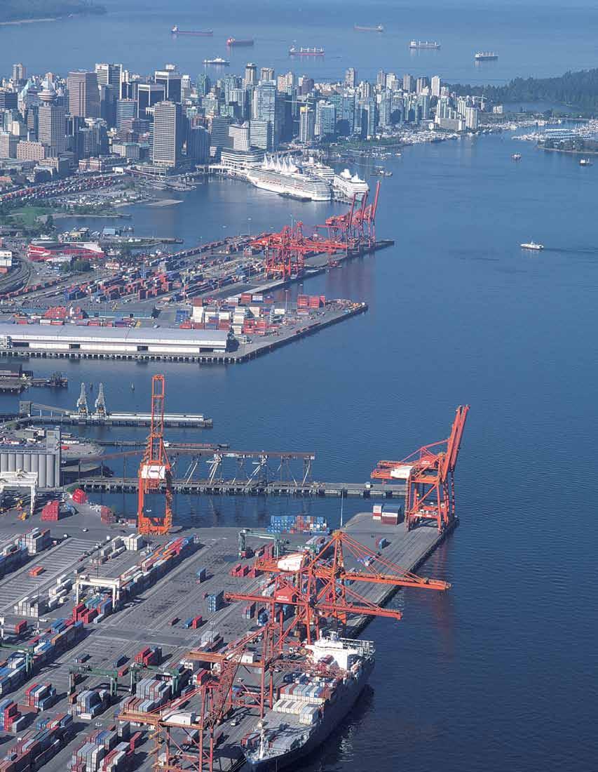
12 C Challenges and Responses Challenges Metro Vancouver has experienced substantial growth over the past decades, adding more than one million people in a generation. Strong population growth is likely to continue. The key challenge is to accommodate growth in ways which both advance livability and sustainability. To accomplish this, the Regional Growth Strategy addresses the following issues: Accommodating Growth To Advance Livability and Sustainability The region is expected to continue to grow by over 35,000 residents per year. Growth without sprawl implies greater density of development. Carefully structured, this can reduce congestion, improve the economics of transportation infrastructure and public services, increase the viability of retail and service centres, foster the creation of vibrant centres of culture and community activities, and maintain an attractive and diverse urban environment. Building Healthy, Complete Communities As the region s population both ages and grows in number, providing affordable and appropriate housing for residents at various stages of their lives is an ongoing challenge. Additionally, ensuring access to the key elements of a healthy social community shops, personal services, community activities, recreation, employment, culture, entertainment and a safe and attractive public environment requires careful planning primarily at the local scale, but also, to some extent, regionally. Supporting Economic Prosperity Metro Vancouver has a diversified economic base, including trade and commerce, manufacturing, goods distribution, professional services, tourism, education and agriculture. The region connects with, and serves, a resource-rich province and has strong gateway links to the North American and Asia-Pacific regions. The challenge for the Regional Growth Strategy is to ensure an adequate supply of space for industry and commerce throughout the region, located appropriately to their needs and in a manner that supports an efficient transportation system on which the economy depends. Protecting the Natural Environment Many of Metro Vancouver s natural assets are of national and international significance. Managed properly, they also provide the basics of life breathable air, potable water and nutritious food. The challenge is to protect these assets for the benefit of current and future generations in the face of a growing population and associated urban development and impacts which can threaten their integrity and quality. Responding to Climate Change Impacts and Natural Hazard Risks The major natural hazard risks facing the Metro Vancouver region include earthquakes, floods, and slope instability. Many of these are exacerbated by the global threat of climate change. The challenge is to prepare for and mitigate regional natural hazards and reduce the greenhouse gas emissions which can increase many of these risks, not only through mitigation strategies, but also through land use and transportation patterns generally. Protecting Agricultural Land to Support Food Production Comprising over 50,000 hectares of the region, agricultural lands are an important asset. The heightened importance of producing fresh, regionally grown food to meet economic, environmental, health and food security objectives reinforce the need to protect the region s rich agricultural lands. The challenge for the Regional Growth Strategy is to protect the agricultural land base and to encourage its active use for food production. Responses To respond to these challenges, the Regional Growth Strategy sets out a series of strategies and actions for Metro Vancouver and member municipalities arranged under five key goals intended to achieve the desired outcomes. 6

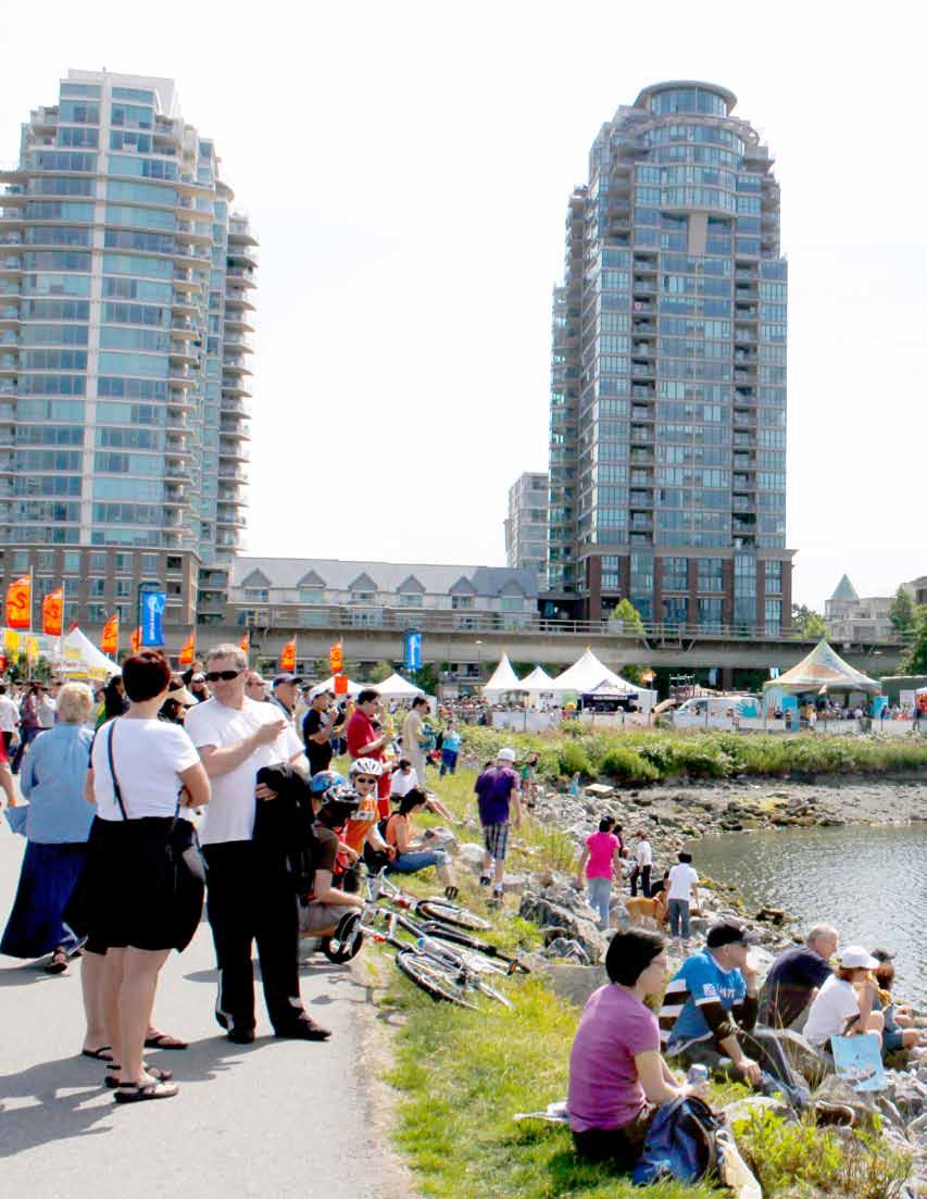
13 Goal 1 Create a Compact Urban Area Metro Vancouver s growth is concentrated in compact communities with access to a range of housing choices, and close to employment, amenities and services. Compact transitoriented development patterns help reduce greenhouse gas emissions and pollution, and support both the efficient use of land and an efficient transportation network. Goal 2 Support a Sustainable Economy The land base and transportation systems required to nurture a healthy business sector are protected and supported. This includes supporting regional employment and economic growth. Industrial and agricultural land is protected and commerce flourishes in Urban Centres throughout the region. Goal 3 Protect the Environment and Respond to Climate Change Impacts Metro Vancouver s vital ecosystems continue to provide the essentials of life clean air, water and food. A connected network of habitats is maintained for a wide variety of wildlife and plant species. Protected natural areas provide residents and visitors with diverse recreational opportunities. Strategies also help Metro Vancouver and member municipalities meet their greenhouse gas emission targets, and prepare for, and mitigate risks from, climate change and natural hazards. Goal 4 Goal 5 Develop Complete Communities Metro Vancouver is a region of communities with a diverse range of housing choices suitable for residents at any stage of their lives. The distribution of employment and access to services and amenities builds complete communities throughout the region. Complete communities are designed to support walking, cycling and transit, and to foster healthy lifestyles. Support Sustainable Transportation Choices Metro Vancouver s compact, transit-oriented urban form supports a range of sustainable transportation choices. This pattern of development expands the opportunities for transit, multiple-occupancy vehicles, cycling and walking, encourages active lifestyles, and reduces energy use, greenhouse gas emissions, household expenditure on transportation, and improves air quality. The region s road, transit, rail and waterway networks play a vital role in serving and shaping regional development, providing linkages among the region s communities and providing vital goods movement networks. Photo Sharon Doucette 7

14 MAP 1 Metro Vancouver Municipalities and Electoral Area Note: Map for reference only, see section
15 D Regional Land Use Designations and Overlays The following regional land use designations and overlays are key tools in achieving the five goals of the Regional Growth Strategy. They establish a long-term regional land use framework and provide the basis for defining matters of regional significance. The intent statements for the regional land use designations and overlays are to be read in conjunction with applicable strategies and actions under each goal and are to be interpreted by municipalities in their Regional Context Statements. The boundaries for the regional land use designations are established on a parcel-based map maintained by Metro Vancouver and are depicted on the Regional Land Use Designations map (Map 2). The general locations (not the parcel-based boundaries) of Urban Centre and Frequent Transit Development Area overlays, once defined by municipalities will be shown on Maps 2 and 4. The parcel-based boundaries of Urban Centre and Frequent Transit Development Area overlays, as determined by municipalities, will be depicted on a reference map, which will be maintained in association with, but not part of the Regional Growth Strategy. Urban Containment Boundary The Urban Containment Boundary is intended to establish a stable, long-term regionally defined area for urban development. The establishment of the Urban Containment Boundary will reinforce the protection of agricultural, conservation and rural areas, and provide predictability for locating urban uses, major regional transportation and infrastructure investment. Urban Land Use Designations General Urban General Urban areas are intended for residential neighbourhoods and centres, and are supported by shopping, services, institutions, recreational facilities and parks. Within General Urban areas, higher density trip-generating development is to be directed to Urban Centres and Frequent Transit Development Areas. General Urban areas are intended to emphasize place-making, an enriched public realm, and promote transit-oriented communities, where transit, multipleoccupancy vehicles, cycling and walking are the preferred modes of transportation. Industrial Industrial areas are primarily intended for heavy and light industrial activities, and appropriate accessory uses. Limited commercial uses that support industrial activities are appropriate. Residential uses are not intended. Mixed Employment Mixed Employment areas are intended for industrial, commercial and other employment related uses to help meet the needs of the regional economy. They are intended to continue to support industrial activities, and complement and support the planned function of Urban Centres and Frequent Transit Development Areas. Mixed Employment areas located within Urban Centres and Frequent Transit Development Areas provide locations for a range of employment activities and more intensive forms of commercial development. Mixed Employment areas located outside of Urban Centres and Frequent Transit Development Areas are primarily intended for industrial and commercial uses that would not normally be attracted to these locations. Mixed Employment areas located outside of Urban Centres and Frequent Transit Development Areas may contain office and retail uses provided that they are at lower densities than typically higher density Urban Centres and Frequent Transit Development Areas and in locations well served by transit or have committed expansions to transit service. Residential uses are not intended in Mixed Employment areas. Non-Urban Land Use Designations Rural Rural areas are intended to protect the existing character of rural communities, landscapes and environmental qualities. Land uses include low density residential development, small scale commercial, industrial, and institutional uses, and agricultural uses that do not require the provision of urban services such as sewer or transit. Rural areas are not intended as future urban development areas, and generally will not have access to regional sewer services. Agricultural Agricultural areas are intended primarily for agricultural uses, facilities and supporting services with an emphasis on food production where appropriate. These areas reinforce provincial and local objectives to protect the agricultural land base of the region. 9

16 Conservation and Recreation Conservation and Recreation areas are intended to protect significant ecological and recreation assets, including: drinking watersheds, conservation areas, wildlife management areas and ecological reserves, forests, wetlands, riparian corridors, major parks and recreation areas, ski hills and other tourist recreation areas. Urban Centre and Frequent Transit Development Area Overlays Within the Urban Containment Boundary, Urban Centres and Frequent Transit Development Areas may be overlaid on any regional land use designation. Urban Centre and Frequent Transit Development Area overlays and policies enable higher density residential and commercial development for General Urban areas, and higher density commercial development for Mixed Employment areas. Where overlays cover areas other than General Urban or Mixed Employment, the intent and policies of the underlying regional land use designations still apply. Urban Centres Urban Centres are intended to be the region s primary focal points for concentrated growth and transit service. They are intended as priority locations for employment and services, higher density housing, commercial, cultural, entertainment, institutional and mixed uses. Urban Centres are intended to emphasize place-making, an enriched public realm, and promote transit-oriented communities, where transit, cycling and walking are the preferred modes of transportation. Maps 2 and 4 show the Urban Centres locations. Urban Centres boundaries will be identified by municipalities in their Regional Context Statements in a manner generally consistent with the guidelines in Table 3 (Guidelines for Urban Centres and Frequent Transit Development Areas). Frequent Transit Development Areas Frequent Transit Development Areas are intended to be additional priority locations to accommodate concentrated growth in higher density forms of development. They are located at appropriate locations along TransLink s Frequent Transit Network. Frequent Transit Development Areas complement the network of Urban Centres, and are characterized by higher density residential, commercial and mixed uses, and may contain community, cultural and institutional uses. Urban design for these areas promotes transit-oriented communities where transit, cycling and walking are the preferred modes of transportation. Maps 2 and 4 will show the location of Frequent Transit Development Areas, once identified by municipalities in their Regional Context Statements. The Frequent Transit Development Area boundaries will be established by municipalities in their Regional Context Statements in a manner generally consistent with the guidelines in Table 3 (Guidelines for Urban Centres and Frequent Transit Development Areas). 10

17 Map 2: Regional Land Use Designations - 11

18 E Goals, Strategies and Actions Photo Sharon Doucette
19 Goal 1 Create a Compact Urban Area A commitment to a compact region reflects the recognition that sprawling urban development consumes the natural landscape, necessitates costly and inefficient urban infrastructure and adds to the global problems of greenhouse gases, peak oil and climate change. Strategies under this goal delineate between urban and non-urban areas through an Urban Containment Boundary. It is critical that growth within the Urban Containment Boundary be properly structured. This includes creating strong Urban Centres throughout the region that are well served by transit and the road network. These centres collectively make an important contribution to providing locations for employment and convenient access to shops and services close to home. Frequent Transit Development Areas, located in strategic areas along TransLink s Frequent Transit Network, provide an additional focus for growth, particularly for higher density residential, commercial, and mixed use development. Together, the Urban Centres and Frequent Transit Development Areas help shape transportation demand and optimize investments in the region s transportation system. Strategies to achieve this goal are: 1.1 Contain urban development within the Urban Containment Boundary 1.2 Focus growth in Urban Centres and Frequent Transit Development Areas 1.3 Protect Rural areas from urban development 13
20 STRATEGY 1.1 Contain urban development within the Urban Containment Boundary Metro Vancouver s role is to: Direct the Greater Vancouver Sewerage and Drainage District to not extend regional sewage services into the Rural, Agricultural or Conservation and Recreation areas, except for building footprints in cases where infrastructure is needed to address a public health issue, protect the region s natural assets, or to service agriculture or agri-industry Accept Regional Context Statements that accommodate all urban development within the areas defined by the Urban Containment Boundary, and that meet or work towards Action The role of municipalities is to: Adopt Regional Context Statements which: a) depict the Urban Containment Boundary on a map, generally consistent with the Regional Land Use Designations map (Map 2); Actions Requested of Other Governments and Agencies That the federal government and the province and their agencies direct urban, commercial and institutional facilities and investments within the Urban Containment Boundary, and to Urban Centres where appropriate That TransLink and the province continue to support a compact urban form within the Urban Containment Boundary when developing and implementing transportation plans, strategies and investments That TransLink and the province discourage the provision of infrastructure that would facilitate the dispersal of housing and employment outside the Urban Containment Boundary when preparing and implementing transportation plans, strategies and investments. b) provide municipal population, dwelling unit and employment projections, with reference to guidelines contained in Appendix Table A.1, and demonstrate how municipal plans will work towards accommodating the projected growth within the Urban Containment Boundary. 14

21 Map 3: Urban Containment Boundary and General Urban Areas - 15
22 STRATEGY 1.2 Focus growth in Urban Centres and Frequent Transit Development Areas Metro Vancouver s role is to: Explore, in collaboration with municipalities, other governments and agencies, the use of financial tools and other incentives to support the location of major commercial, office, retail, and institutional development in Urban Centres Work with municipalities, TransLink, other governments and agencies to support the development and delivery of effective regional transportation networks and services that support the growth and development of Urban Centres and Frequent Transit Development Areas Maintain a reference map to provide updated information on the location, extent, and population and employment capacity of Urban Centres and Frequent Transit Development Areas Monitor progress towards the targets set out in Table 2 (Metro Vancouver Dwelling Unit and Employment Growth Targets for Urban Centres and Frequent Transit Development Areas) for the Urban Centres and Frequent Transit Development Areas Accept Regional Context Statements that prioritize growth and focus higher density development primarily in Urban Centres, and additionally to Frequent Transit Development Areas, and that meet or work towards Action The role of municipalities is to: Adopt Regional Context Statements which: a) provide dwelling unit and employment projections that indicate the municipal share of planned growth and that contribute to achieving the regional share of growth for Urban Centres and Frequent Transit Development Areas as set out in Table 2 (Metro Vancouver Dwelling Unit and Employment Growth Targets for Urban Centres and Frequent Transit Development Areas); b) include policies for Urban Centres which: i) identify the general location, boundaries and types of Urban Centres on a map generally consistent with the guidelines set out in Table 3 (Guidelines for Urban Centres and Frequent Transit Development Areas) and the Regional Land Use Designations map (Map 2); ii) focus growth and development in Urban Centres, generally consistent with guidelines set out in Table 3 (Guidelines for Urban Centres and Frequent Transit Development Areas); iii) encourage office development through policies and/or other financial incentives, such as zoning that reserves capacity for office uses and density bonus provisions; iv) in coordination with the provision of transit service, establish or maintain reduced residential and commercial parking requirements in Urban Centres, where appropriate; 16
23 c) include policies for Frequent Transit Development Areas which: i) identify on a map, in consultation with TransLink, the general location and boundaries of Frequent Transit Development Areas that are generally consistent with: Table 3 (Guidelines for Urban Centres and Frequent Transit Development Areas); TransLink s Frequent Transit Network, which may be updated over time; other applicable guidelines and policies of TransLink for the Frequent Transit Network; ii) focus growth and development in Frequent Transit Development Areas, generally consistent with the guidelines set out in Table 3 (Guidelines for Urban Centres and Frequent Transit Development Areas); iii) in coordination with the provision of transit service, establish or maintain reduced residential and commercial parking requirements within Frequent Transit Development Areas, where appropriate; d) include policies for General Urban areas which: i) identify the General Urban areas and their boundaries on a map generally consistent with the Regional Land Use Designations map (Map 2); ii) ensure development in General Urban areas outside of Urban Centres and Frequent Transit Development Areas are generally lower density than development in General Urban areas within Urban Centres and Frequent Transit Development Areas; iii) where appropriate, identify small scale Local Centres in the General Urban areas that provide a mix of housing types, local-serving commercial activities and good access to transit. Local Centres are not intended to compete with or compromise the role of Urban Centres and should preferably be located within Frequent Transit Development Areas (see Map 11); iv) exclude non-residential major trip-generating uses, as defined in the Regional Context Statement, from those portions of General Urban areas outside of Urban Centres and Frequent Transit Development Areas; v) encourage infill development by directing growth to established areas, where possible; e) include policies that, for Urban Centres or Frequent Transit Development Areas that overlay Industrial, Mixed Employment, or Conservation and Recreation areas, the Industrial, Mixed Employment, and Conservation and Recreation intent and policies prevail, except that higher density commercial would be allowed in the Mixed Employment areas contained within the overlay area; f) for Urban Centres, Frequent Transit Development Areas and General Urban areas, include policies which: i) support continued industrial uses by minimizing the impacts of urban uses on industrial activities; ii) encourage safe and efficient transit, cycling and walking; iii) implement transit priority measures, where appropriate; iv) support district energy systems and renewable energy generation, where appropriate. Actions Requested of Other Governments and Agencies That the federal government and the province and their agencies direct major office and institutional development to Urban Centres and Frequent Transit Development Areas, where appropriate That TransLink, the federal government and the province and their agencies procurement, disposition and development plans and actions for land holdings support the goals of the Regional Growth Strategy That TransLink and the province, as appropriate: a) collaborate with municipalities and other stakeholders on the planning of new or expanded Frequent Transit Network corridors and stations; b) collaborate with municipalities to improve place-making, safety, access, and amenities for pedestrians, cyclists, and persons using mobility aids; c) work with municipalities to support the safe and efficient movement of people, goods and service vehicles, to, from, and within Urban Centres and Frequent Transit Development Areas (e.g. by enhancing the design and operation of the road network), where appropriate. 17
24 Table 2 Metro Vancouver Dwelling Unit and Employment Growth Targets for Urban Centres and Frequent Transit Development Areas Dwelling Units Target Target Target Growth # % # % # % # % # % Metropolitan Core 88,000 10% 110,000 10% 116,000 9% 119,000 8% 31,000 5% Surrey Metro Centre 8,300 1% 27,000 2% 36,000 3% 43,000 3% 34,700 6% Regional City Centres 71,000 8% 110,000 10% 142,000 11% 162,000 11% 91,000 16% Municipal Town Centres 49,000 6% 82,000 7% 106,000 8% 123,000 9% 74,000 13% Urban Centres Total 216,300 26% 329,000 29% 400,000 31% 447,000 31% 230,700 40% Frequent Transit Development Areas 217,000 26% 281,000 25% 337,000 26% 378,000 27% 161,000 28% General Urban Area 382,000 45% 486,000 43% 535,000 41% 561,000 39% 179,000 31% Rural, Agricultural, Conservation and Recreation 33,000 4% 34,000 3% 35,000 3% 36,000 3% 3,000 1% Metro Vancouver Total 848, % 1,130, % 1,307, % 1,422, % 574, % Employment Target Target Target Growth # % # % # % # % # % Metropolitan Core 256,000 22% 286,000 20% 302,000 19% 313,000 18% 57,000 10% Surrey Metro Centre 18,000 2% 31,000 2% 40,000 2% 49,000 3% 31,000 5% Regional City Centres 124,000 11% 177,000 12% 208,000 13% 237,000 14% 113,000 19% Municipal Town Centres 69,000 6% 107,000 7% 135,000 8% 163,000 9% 94,000 16% Urban Centres Total 467,000 40% 601,000 42% 685,000 42% 762,000 43% 295,000 50% Frequent Transit Development Areas 254,000 22% 323,000 22% 370,000 23% 412,000 24% 158,000 27% All Other Areas 437,000 38% 524,000 36% 567,000 35% 579,000 33% 142,000 24% Notes: 1. This table provides guidance to assist in regional and local planning. 2. Frequent Transit Development Area targets are conceptual and subject to future municipal and transit planning processes. 3. All Other Areas refers to areas outside of Urban Centres and Frequent Transit Development Areas. 18
25 Table 3 Guidelines for Urban Centres and Frequent Transit Development Areas TYPE OF URBAN CENTRES DESCRIPTION AND LAND USE CHARACTERISTICS TRANSPORTATION CHARACTERISTICS Region-Serving Centres Metropolitan Core The Region s Downtown Downtown Vancouver and Central Broadway Surrey Metro Centre Centre of Activity South of the Fraser River Regional City Centre Major regional centres, serving Metro Vancouver s subregions Coquitlam, Langley, Lonsdale (North Vancouver), Maple Ridge, Metrotown (Burnaby), New Westminster, Richmond Municipal Town Centre Hubs of activity within municipalities Aldergrove, Ambleside, Brentwood, Cloverdale, Edmonds, Guildford, Fleetwood, Inlet Centre, Ladner, Lougheed, Lynn Valley, Newton, Oakridge, Pitt Meadows, Port Coquitlam, Semiahmoo, Willoughby Frequent Transit Development Areas Focal areas for growth in alignment with TransLink s Frequent Transit Network Locations identified on the Regional Land Use Designations map (Map 2) Defined as appropriate locations generally within 800 metres of one or more rapid transit stations or within 400 metres of the intersection of two or more corridors on TransLink s Frequent Transit Network Regional-scale employment, services, business and commercial activities Major institutional, community, cultural and entertainment uses High and medium density housing (in General Urban only), including affordable housing choices Industrial uses Parks, greenspace and ecological areas The Metropolitan Core is the principal business, employment, cultural and entertainment location for the region Surrey Metro Centre and the Regional City Centres are major activity areas for the subregion Locations identified on the Regional Land Use Designations map (Map 2) Defined as appropriate locations generally within 800 metres of a rapid transit station or within 400 metres of TransLink s Frequent Transit Network Employment, services, business and commercial activities, typically serving the municipal or local area Institutional, community, cultural and entertainment uses High and medium density housing (in General Urban only), including affordable housing choices Industrial uses Parks, greenspace and ecological areas Services and activities oriented to the local needs of the surrounding communities Municipal focus for community and cultural activities Locations determined by municipalities, in consultation with TransLink, in accordance with local area plans Defined as appropriate locations generally within 800 metres of a rapid transit station or within 400 metres of TransLink s Frequent Transit Network Focus for medium and higher density housing (in General Urban only), including affordable housing choices, and mixed uses with concentrated growth at appropriate locations along TransLink s Frequent Transit Network Employment, services, business and commercial activities, and may include cultural, institutional, and community uses, typically serving the local area Industrial uses Parks, greenspace and ecological areas Regional and/or subregional transportation hubs with multiple Frequent Transit Network connections Provision of transit priority measures and other transit-supportive road infrastructure and operations Major Road Network access High quality, accessible walking and cycling environment Local transportation hubs with existing Frequent Transit Network service or potential for Frequent Transit Network service as warranted by ridership demand Provision of transit priority measures and other transit-supportive road infrastructure and operations Major Road Network access High quality, accessible walking and cycling environment Existing or planned Frequent Transit Network service Provision of transit priority measures and other transit-supportive road infrastructure and operations High quality, accessible walking and cycling environment Notes: These guidelines describe the broad land use and transportation characteristics of Urban Centres and Frequent Transit Development Areas and are not intended to identify or suggest specific levels of transportation facilities, service levels, or priorities. Transportation facilities and services, and their timing, will be determined through municipal, TransLink, and provincial planning processes. TransLink s Frequent Transit Network is a part of the regional transit system that provides frequent, reliable transit service on designated corridors throughout the day, everyday. The Frequent Transit Network comprises a family of services, including rapid transit (busways/rail) and frequent local and limited stop transit services. For more information refer to Appendix Map B.1: Frequent Transit Network Concept (provided by TransLink). TransLink s Major Road Network is a part of the regional road system, which includes provincial highways and federal transportation facilities. For more information refer to Appendix Map B.2: Major Road Network, Highways and Gateways (provided by TransLink). 19

26 Map 4: Urban Centres - 20

27 STRATEGY 1.3 Protect Rural areas from urban development Metro Vancouver s role is to: Direct the Greater Vancouver Sewerage and Drainage District not to extend regional sewer services into Rural areas, except for building footprints in cases where infrastructure is needed to address a public health issue, protect the region s natural assets, or to service agriculture or agriindustry Accept Regional Context Statements that protect Rural areas from urban development and that meet or work towards Action The role of municipalities is to: Adopt Regional Context Statements which: a) identify the Rural areas and their boundaries on a map generally consistent with the Regional Land Use Designations map (Map 2); b) limit development to a scale, form, and density consistent with the intent for the Rural land use designation, and that is compatible with on-site sewer servicing; c) include policies which: i) specify the allowable density and form, consistent with Action 1.3.1, for land uses within the Rural land use designation; ii) support agricultural uses within the Agricultural Land Reserve, and where appropriate, outside of the Agricultural Land Reserve. Photo globalairphotos.com 21

28 Map 5: Rural Areas - 22
29 23
30
31 Goal 2 Support a Sustainable Economy The Regional Growth Strategy builds on the region s existing economic strengths to provide for a prosperous future by supporting a diverse commercial and industrial base, encouraging economic development, and recognizing the region s role as a key gateway location. The Regional Growth Strategy is intended to support a sustainable economy and a number of its strategies are important in contributing to that goal. However, it is important to recognize that this is a Regional Growth Strategy concerned primarily with land use and transportation and not an economic development strategy. Urban Centres distributed throughout the region provide for more opportunities for commercial activities, services and employment to be close to where people live and achieve greater economic efficiencies and transportation access. Strategies are included to avoid the dispersal of major employment and major tripgenerating uses from Urban Centres and Frequent Transit Development Areas. Market pressure to convert industrial lands to office, retail and housing has resulted in a diminished supply of industrial land in the region, while demand for land for industrial activities continues to increase as the population and economy of the region grow. Many industries provide for the day-to-day needs of the region s population, such as repair and servicing activities, and renovation and construction functions for shops, homes, hotels and restaurants. Additional lands are needed for container storage, freight forwarding, warehouses, and other distribution functions. Meeting the needs of both a growing regional economy and an expanding international gateway for trade requires an adequate supply of industrial lands. Preserving the region s industrial lands supports businesses by allowing them to expand within the region and not face long transportation distances and costs which could lead to business inefficiencies. In response to the vulnerability of industrial land, strategies are included to protect and appropriately use the limited supply of industrial land in the region. Experience has shown that there are some economic activities which are not traditional industrial activities but are not readily accommodated or economically viable in Urban Centres or Frequent Transit Development Areas. These are important elements of the evolving regional economy. The Regional Growth Strategy provides for these activities to be accommodated in Mixed Employment areas, which are intended to complement Urban Centres, Frequent Transit Development Areas and Industrial areas without undermining the planned function of these areas. Major educational institutions, such as the University of British Columbia, Simon Fraser University, and the British Columbia Institute of Technology, and the numerous other post-secondary universities and colleges also have a vital role in the regional economy. They have key linkages with many sectors of the economy, including the health sector and the region s hospitals, provide research and innovation and spawn incubator industries. Map 11 shows the locations of post-secondary institutions, hospitals and Local Centres. Agriculture is also an important sector of the region s economy, covering a significant part of the region s land base. Strategies are included to strengthen the economic viability of the agricultural industry and to protect agricultural lands. Strategies to achieve this goal are: 2.1 Promote land development patterns that support a diverse regional economy and employment close to where people live 2.2 Protect the supply of industrial land 2.3 Protect the supply of agricultural land and promote agricultural viability with an emphasis on food production 25
32 STRATEGY 2.1 Promote land development patterns that support a diverse regional economy and employment close to where people live Metro Vancouver s role is to: Provide regional utility infrastructure to support the region s economic functions and to support efficient employment and settlement patterns Work with the federal government and the province and municipalities to investigate: a) fiscal measures to reinforce the attraction of investment and employment to locations identified in Action 2.1.3; b) fiscal reform to ensure the property tax system is equitable and supports sound land use decisions Accept Regional Context Statements that support economic activity appropriate to Urban Centres, Frequent Transit Development Areas, Industrial, Mixed Employment areas, Special Employment Areas, ports and airports, and that meet or work towards Action The role of municipalities is to: Adopt Regional Context Statements which: a) include policies that support appropriate economic development in Urban Centres, Frequent Transit Development Areas, Industrial and Mixed Employment areas; b) support the development of office space in Urban Centres, through policies such as zoning that reserves land for office uses, density bonus provisions to encourage office development, variable development cost charges, and/or other financial incentives; Actions Requested of Other Governments and Agencies That TransLink, the federal government and the province and their agencies develop and operate transportation infrastructure to support economic activity in Urban Centres, Frequent Transit Development Areas, Industrial, Mixed Employment areas and ports and airports That airports encourage the use of airport lands for industrial activities, discourage non-airport related commercial development on airport lands, and not expand beyond the Industrial and Mixed Employment areas specified on the Regional Land Use Designations map (Map 2) That Port Metro Vancouver encourage the use of port lands for industrial activities, discourage nonport related commercial development on port lands, and not expand beyond the Industrial and Mixed Employment areas specified on the Regional Land Use Designations map (Map 2) That the federal government and the province and their agencies develop a formal mechanism to collaborate with Metro Vancouver, TransLink, municipalities, and the private sector on a regional economic strategy to retain and attract investment and employment to the region That the Fraser Valley Regional District and the Squamish-Lillooet Regional District collaborate with Metro Vancouver on shared economic matters. c) include policies that discourage major commercial and institutional development outside of Urban Centres or Frequent Transit Development Areas; d) show how the economic development role of Special Employment Areas, post secondary institutions and hospitals are supported through land use and transportation policies. 26
33 STRATEGY 2.2 Protect the supply of industrial land Metro Vancouver s role is to: Monitor the supply of, and demand for, industrial land in the region with the objective of assessing whether there is sufficient capacity to meet the needs of the regional economy Work with the province, municipalities and other agencies to investigate industrial taxation rates and policies that support industrial activities Accept Regional Context Statements that protect and support the ongoing economic viability of industrial activities and that meet or work towards Action The role of municipalities is to: Adopt Regional Context Statements which: a) identify the Industrial areas and their boundaries on a map generally consistent with the Regional Land Use Designations map (Map 2); b) include policies for Industrial areas which: i) support and protect industrial uses; ii) support appropriate accessory uses, including commercial space and caretaker units; iii) exclude uses which are inconsistent with the intent of industrial areas, such as medium and large format retail, residential uses (other than industrial caretaker units where necessary), and stand-alone office uses that are not supportive of industrial activities; iv) encourage better utilization and intensification of industrial areas for industrial activities; c) identify the Mixed Employment areas and their boundaries on a map generally consistent with the Regional Land Use Designations map (Map 2); d) include policies for Mixed Employment areas which: i) support a mix of industrial, commercial, office and other related employment uses, while maintaining support for established industrial areas, including potential intensification policies for industrial activities, where appropriate; ii) allow large and medium format retail, where appropriate, provided that such development will not undermine the broad objectives of the Regional Growth Strategy; iii) support the regional objective of concentrating commercial and other major trip-generating uses in Urban Centres and Frequent Transit Development Areas; iv) where Mixed Employment areas are located within Urban Centres or Frequent Transit Development Areas, support higher density commercial development and allow employment and service activities consistent with the intent of Urban Centres or Frequent Transit Development Areas; v) allow low density infill / expansion based on currently accepted local plans and policies in Mixed Employment areas and support increases in density only where the Mixed Employment area has transit service or where an expansion of transit service has been identified in TransLink s strategic transportation plans for the planned densities; vi) exclude residential uses, except for an accessory caretaker unit; e) include policies which help reduce environmental impacts and promote energy efficiency. Actions Requested of Other Governments and Agencies That within the context of the regional objective of maintaining industrial activities in proximity to highway, rail, waterfront, port and/or airport facilities, request as appropriate TransLink, Port Metro Vancouver, the Vancouver International Airport Authority or the Ministry of Transportation and Infrastructure to review and comment on proposed Regional Context Statement or Regional Growth Strategy amendments for Industrial and Mixed Employment areas. Where a proposed amendment includes lands within the Agricultural Land Reserve, the Agricultural Land Commission will be consulted. 27

34 Map 6: Industrial and Mixed Employment Areas Note: The depicted road network, rail lines, and port / airport transportation facilities are shown for reference only
35 STRATEGY 2.3 Protect the supply of agricultural land and promote agricultural viability with an emphasis on food production Metro Vancouver s role is to: Direct the Greater Vancouver Sewerage and Drainage District to not extend regional sewage services into Agricultural areas, except for building footprints in cases where infrastructure is needed to address a public health issue, protect the region s natural assets, or to service agriculture or agriindustry Monitor the status of agricultural land, including the amount of actively farmed land, and other indicators, with the objective of promoting agricultural viability and food production in collaboration with the province and the Agricultural Land Commission In collaboration with the province and the Agricultural Land Commission, identify and pursue strategies and actions to increase actively farmed agricultural land, emphasize food production, reduce barriers to the economic viability of agricultural activities, ensure the management of farmlands is in concert with groundwater resources, and minimize conflicts among agricultural, recreation and conservation, and urban activities Work with the Agricultural Land Commission to protect the region s agricultural land base and not amend the Agricultural or Rural land use designation of a site if it is still part of the Agriculture Land Reserve, except to change it to an Agricultural land use designation Accept Regional Context Statements that protect the region s supply of agricultural land and promote agricultural viability with an emphasis on food production and that meet or work towards Action The role of municipalities is to: Adopt Regional Context Statements which: a) specify the Agricultural areas and their boundaries on a map generally consistent with the Regional Land Use Designations map (Map 2); b) include policies to support agricultural viability including those which: i) assign appropriate regional land use designations that support agricultural viability and discourage non-farm uses that do not complement agriculture; ii) discourage subdivision of agricultural land leading to farm fragmentation; iii) where feasible, and appropriate with other governments and agencies, maintain and improve transportation, drainage and irrigation infrastructure to support agricultural activities; iv) manage the agricultural-urban interface to protect the integrity and viability of agricultural operations (e.g. buffers between agricultural and urban areas or edge planning); v) demonstrate support for economic development opportunities for agricultural operations (e.g. processing, agri-tourism, farmers markets and urban agriculture); vi) encourage the use of agricultural land, with an emphasis on food production; vii) support educational programs that provide information on agriculture and its importance for the regional economy and local food systems. 29

36 Photo Sharon Doucette Actions Requested of Other Governments and Agencies That the province, utility companies and TransLink strive to avoid fragmentation of Agricultural areas when developing and operating utility and transportation infrastructure, but where unavoidable, consider mitigating the impacts, including possible enhancement to the areas That the Agricultural Land Commission consult with Metro Vancouver to ensure consistency between the Regional Growth Strategy and Agricultural Land Commission decisions and policies with respect to Agricultural Land Reserve exclusion, inclusion, and non-farm use applications That the federal government and the province and their agencies adopt financial measures to encourage agri-food economic development, including: a) agricultural tax policies that reinforce the continued use of agricultural lands for agriculture operations, with an emphasis on food production; b) incentive and education programs to encourage new farmers That the province, in consultation with municipalities, establish and enforce maximum residential floor area and setback regulations for development within the Agricultural Land Reserve, while recognizing existing municipal regulations That the province explore and implement fiscal tools and incentives to protect natural assets on agricultural lands. 30

37 Note: The Agricultural Land Reserve boundary and the Regional Growth Strategy Agricultural land use designation do not always coincide. Any Metro Vancouver Regional Park within the Agricultural Land Reserve has been designated as Conservation and Recreation in the Regional Growth Strategy. Map 7: Agricultural Areas 31 31

38 Photo Peter Battistoni
39 GOAL 3 Protect the Environment and Respond to Climate Change Impacts Metro Vancouver has a spectacular natural environment. Many of Metro Vancouver s ecosystems have global significance and provide both internationally important fish habitat and key feeding and resting points for migratory birds along the Pacific Flyway. The region s forests, fields, coastal and intertidal areas, wetlands, and watercourses together are integral pieces of a habitat network for fish and wildlife. The natural environment is important to livability and sustainability as well as our sense of place. The region s diverse open space in mountain, coastal and river areas offers recreation and healthy lifestyle opportunities for residents and visitors. The region s environment also provides essential ecosystem services such as clean drinking water. Protecting these natural features boosts the region s ecological health and resiliency in the face of climate change and natural hazard risks. The Conservation and Recreation land use designation is intended to help protect the important environmental and recreation areas throughout the region. Strategies and actions recognize the importance of providing connectivity throughout the region linking important natural features, and emphasize the collaborative effort needed to protect and enhance natural assets. A strategy in this section also addresses climate change, noting that to a large extent greenhouse gas reductions will be achieved by actions contained throughout the Regional Growth Strategy as well as by actions in other Metro Vancouver management plans. The most significant contributions of the Regional Growth Strategy to climate change mitigation will be made through a continued focus on urban containment and land use patterns that support sustainable transportation and reduce energy use. Policies on climate change adaptation, such as protection for at-risk coastal floodplain areas, are included. The strategy also addresses other natural hazards such as flooding, mudslides, interface fires, and earthquakes. Strategies to achieve this goal are: 3.1 Protect Conservation and Recreation lands 3.2 Protect and enhance natural features and their connectivity 3.3 Encourage land use and transportation infrastructure that reduce energy consumption and greenhouse gas emissions, and improve air quality 3.4 Encourage land use and transportation infrastructure that improve the ability to withstand climate change impacts and natural hazard risks 33
40 STRATEGY 3.1 Protect Conservation and Recreation lands Metro Vancouver s role is to: Direct the Greater Vancouver Sewerage and Drainage District to not extend regional sewage services into Conservation and Recreation areas, except for building footprints in cases where infrastructure is needed to address a public health issue, protect the region s natural assets, or to service agriculture or agri-industry Implement the Metro Vancouver Regional Parks and Greenways Plan in collaboration with municipalities, to identify, secure and enhance habitat and park lands and buffer, where feasible, park and conservation areas from activities in adjacent areas Accept Regional Context Statements that protect lands within the Conservation and Recreation areas and that meet or work towards Action The role of municipalities is to: Adopt Regional Context Statements which: a) identify Conservation and Recreation areas and their boundaries on a map generally consistent with the Regional Land Use Designations map (Map 2); b) include land use policies to support the protection of Conservation and Recreation areas that are generally consistent with the following: i) public service infrastructure, including the supply of high quality drinking water; ii) environmental conservation; iii) recreation, primarily outdoor; iv) education, research and training facilities and uses that serve conservation and/or recreation users; v) commercial uses, tourism activities, and public, cultural or community amenities that are appropriately located, scaled and consistent with the intent of the designation; vi) limited agriculture use, primarily soil-based; c) include policies, where appropriate, that effectively buffer Conservation and Recreation areas from activities in adjacent areas. 34

41 Actions Requested of Other Governments and Agencies That the province, utility companies and TransLink strive to avoid fragmentation of Conservation and Recreation areas when developing and operating utility and transportation infrastructure, but where unavoidable, consider mitigating the impacts, including possible enhancement to the areas That the province actively manage provincial park / environmental lands with the intent of enhancing natural assets and recreational opportunities That the federal government and the province and their agencies: a) recognize the Conservation and Recreation areas and ensure that activities within or adjacent to these areas are consistent with the intent of the Conservation and Recreation land use designation; b) strive to improve consultation and collaboration among all levels of government in the planning of Conservation and Recreation lands. 35

42 Map 8: Conservation and Recreation Areas - 36
43 STRATEGY 3.2 Protect and enhance natural features and their connectivity Metro Vancouver s role is to: In collaboration with other agencies, develop and manage the Metro Vancouver Regional Recreation Greenway Network, as conceptually shown on the Regional Recreation Greenway Network map (Map 9) Manage Metro Vancouver assets and collaborate with municipalities and other agencies to: a) protect, enhance and restore ecologically important systems, features and corridors and establish buffers along watercourses, coastlines, agricultural lands, and other ecologically important features, as conceptually shown on the Natural Features and Land Cover map (Map 10); b) incorporate into land use decision-making and land management practices planning tools, incentives, green technologies and infrastructure that support ecological innovation, minimize negative impacts on ecologically important features and maximize ecosystem function through restoration Accept Regional Context Statements that advance the protection and enhancement of a connected network of ecosystems, features and corridors throughout the region, and that meet or work towards Actions to The role of municipalities is to: Adopt Regional Context Statements which include policies and/or maps that indicate how ecologically important areas and natural features will be managed (as conceptually shown on Map 10) (e.g. steep slopes and ravines, intertidal areas and other natural features not addressed in Strategy 3.1) In collaboration with other agencies, develop and manage municipal components of the Metro Vancouver Regional Recreation Greenway Network and connect community trails, bikeways and greenways to the Regional Recreation Greenway Network where appropriate Identify where appropriate measures to protect, enhance and restore ecologically important systems, features, corridors and establish buffers along watercourses, coastlines, agricultural lands, and other ecologically important features (e.g. conservation covenants, land trusts, tax exemptions and ecogifting) Consider watershed and ecosystem planning and/or Integrated Stormwater Management Plans in the development of municipal plans. Actions Requested of Other Governments and Agencies That TransLink coordinate the development of a regional cycling network with Metro Vancouver s Regional Recreation Greenway Network That the federal government and the province collaborate to enhance endangered species and ecosystem protection legislation that identifies, protects and restores habitats and biodiversity. 37

44 The Regional Recreation Greenway Network map illustrates existing, planned and desired connections of regional significance. This map is conceptual and is not a regional land use designation. Although primarily intended for recreational purposes, these greenways are multi-functional, promote connectivity at a landscape level and offer ancillary ecological benefits by linking Conservation and Recreation areas, protecting natural assets along the corridors, and improving resiliency. They provide locations for recreational activities, and cycling and walking routes. Because of the variety of uses and intents, these greenways often vary in form, function, surfacing, land ownership and management arrangements. The Regional Recreation Greenway Network is a conceptual network, and greenway alignments are determined collaboratively with municipalities and other agencies. Note: Map for reference only, see section Map 9: Regional Recreation Greenway Network - 38

45 Note: Map for reference only, see section Map 10: Natural Features and Land Cover The Natural Features and Land Cover map illustrates the region s natural features and land cover. This map is conceptual and is not a regional land use designation. The region s natural assets are present within all regional land use designations and include globally significant mudflats and intertidal areas, a diversity of riparian corridors, wetlands, ravines, forests, soil and hedgerows in agricultural areas, and open space, backyards and street trees in urban settings. These features offer a variety of services such as habitat, biodiversity, stormwater management, flood protection, air and water cleansing, and recreation. - 39
46 STRATEGY 3.3 Encourage land use and transportation infrastructure that reduce energy consumption and greenhouse gas emissions, and improve air quality Metro Vancouver s role is to: Implement the strategies and actions of the Regional Growth Strategy which contribute to regional targets to reduce greenhouse gas emissions by 33 percent below 2007 levels by 2020 and 80 percent below 2007 levels by Figure 3 identifies examples of strategies and actions contained in the Regional Growth Strategy to address climate change Work with the federal government and the province, TransLink, municipalities, non-governmental organizations, and the private sector to: a) support the ongoing monitoring of energy consumption, greenhouse gas emissions, and air quality related to land use and transportation infrastructure; b) promote best practices and develop guidelines to support local government actions to reduce energy consumption and greenhouse gases, and improve air quality related to land use and transportation infrastructure (e.g. district heating systems and renewable energy opportunities) Accept Regional Context Statements that encourage land use and transportation infrastructure that reduce energy consumption and greenhouse gas emissions, and improve air quality, and that meet or work towards Action The role of municipalities is to: Adopt Regional Context Statements which: a) identify how municipalities will use their land development and transportation strategies to meet their greenhouse gas reduction targets and consider how these targets will contribute to the regional targets; b) identify policies and/or programs that reduce energy consumption and greenhouse gas emissions, and improve air quality from land use and transportation infrastructure, such as: existing building retrofits and construction of new buildings to green performance guidelines or standards, district energy systems, and energy recovery and renewable energy generation technologies, such as solar panels and geoexchange systems, and electric vehicle charging infrastructure; community design and facility provision that encourages transit, cycling and walking (e.g. direct and safe pedestrian and cycling linkages to the transit system); c) focus infrastructure and amenity investments in Urban Centres and Frequent Transit Development Areas, and at appropriate locations along TransLink s Frequent Transit Network; d) implement land use policies and development control strategies which support integrated storm water management and water conservation objectives. 40
47 Actions Requested of Other Governments and Agencies That TransLink, in collaboration with Metro Vancouver and municipalities, establish criteria for defining major development proposals, which are referenced in the South Coast British Columbia Transportation Authority Act, in order to help meet the objective of concentrating major trip-generating uses in areas well served by transit That TransLink pursue reductions of common air contaminants and greenhouse gas emissions from on-road transportation sources in support of regional air quality objectives and greenhouse gas reduction targets That TransLink manage its transit fleet and operations with the goal of increasing fuel efficiency and reducing common air contaminants and greenhouse gas emissions over time, in support of the Regional Growth Strategy and Air Quality Management Plan That the federal government and the province and their agencies establish further legislative and fiscal actions to help the public and private sectors to maximize reductions in energy consumption and greenhouse gas emissions, and improve air quality, such as: a) in the building sector, accelerate the modernization of the BC Building Code increase incentives for residential and commercial building retrofits support, where feasible and appropriate, energy recovery, renewable energy generation and district energy systems and related transmission needs b) in the transportation sector, enable the implementation of regional transportation demand management measures such as transportation user-based pricing increase funding for sustainable transportation infrastructure continue to advance stringent standards for onroad vehicle emissions and fuel carbon content.. Figure 3 How Land Use and Transportation Actions Address Climate Change Reduced vehicle kilometres travelled Green buildings Growth in centres and transit corridors Protected farmland Mixed use, transit-oriented communities Protected and managed natural areas Climate Actions reducing greenhouse gases and preparing for a low carbon future Work and play close to home Low-impact development Green infrastructure Efficient goods movement Transit, cycling and walking Note: Figure for reference only, see section The numbers relate to the applicable strategy in the Regional Growth Strategy 41
48 STRATEGY 3.4 Encourage land use and transportation infrastructure that improve the ability to withstand climate change impacts and natural hazard risks Metro Vancouver s role is to: Incorporate climate change and natural hazard risk assessments into the planning and location of Metro Vancouver utilities, assets and operations Work with the federal government and the province, TransLink and municipalities to: a) consider climate change impacts (e.g. sea level rise) and natural hazard risks (e.g. earthquake, flooding, erosion, subsidence, mudslides, interface fires) when extending utilities and transportation infrastructure that encourages land use development; b) research and promote best practices in adaptation to climate change as it relates to land use planning Accept Regional Context Statements that encourage land use, transportation and utility infrastructure which improve the ability to withstand climate change impacts and natural hazard risks and that meet or work towards Actions and The role of municipalities is to: Adopt Regional Context Statements that include policies to encourage settlement patterns that minimize risks associated with climate change and natural hazards (e.g. earthquake, flooding, erosion, subsidence, mudslides, interface fires) Consider incorporating climate change and natural hazard risk assessments into the planning and location of municipal utilities, assets and operations. Actions Requested of Other Governments and Agencies That the Integrated Partnership for Regional Emergency Management, in collaboration with the federal government and the province, and other agencies: a) identify areas that are vulnerable from climate change and natural hazard risks, such as those listed in Actions and 3.4.4; b) coordinate priority actions to address the vulnerabilities identified, including implementation and funding strategies That the federal government and the province, in collaboration with the Integrated Partnership for Regional Emergency Management and other agencies: a) provide financial assistance and timely data and information, such as flood hazard mapping, shoreline mapping, hydrological and hydraulic studies, to better enable local governments to fulfill their flood hazard management roles and responsibilities; b) provide a coordination role to address flood hazard issues and management decisions; c) implement appropriate preparatory actions to address the implications of long-term sea level rise on infrastructure planning, construction, and operations; d) review and improve the effectiveness of existing provincial legislation and guidelines regarding flood hazard management by municipalities. 42

49

50 Photo Photo Sharon Sharon Doucette Doucette
51 GOAL 4 Develop Complete Communities Complete communities are walkable, mixed use, transit-oriented communities where people can: find an appropriate place to live at all stages of their lives, earn a living, access the services they need, and enjoy social, cultural, educational and recreational pursuits. A diverse mix of housing types is fundamental to creating complete communities. This includes a mix of housing types and tenures that respond to an aging population, changing family and household characteristics and the full range of household incomes and needs across the region. Access to a wide range of services and amenities close to home, and a strong sense of regional and community identity and connection are also important to promote health and well-being. The development of complete communities is sought through two strategies. The first strategy is directed toward ensuring an adequate supply of housing to meet future demand. It is recognized that all levels of government have a role to play in creating opportunities for diverse housing options and that federal and provincial funding is essential to meet the estimated demand for affordable housing. The second strategy emphasizes the importance of designing neighbourhoods within urban areas, Urban Centres, and Local Centres that are accessible for people of all ages and physical ability, promote transit, cycling and walking, provide access to employment, social and cultural opportunities, parks, greenways and recreational opportunities, and promote healthy living. Strategies to achieve this goal are: 4.1 Provide diverse and affordable housing choices 4.2 Develop healthy and complete communities with access to a range of services and amenities 45
52 STRATEGY 4.1 Provide diverse and affordable housing choices Metro Vancouver s role is to: Pursue the strategies and actions set out in the Metro Vancouver Affordable Housing Strategy Assist municipalities in developing Housing Action Plans in accordance with Metro Vancouver s Affordable Housing Strategy, by providing analysis on regional demographics, household characteristics and market conditions, and work with municipalities to review and refine municipal housing priorities, policies and future demand estimates in the context of this analysis Monitor and report on the success of municipal Housing Action Plans in achieving regional housing demand estimates Advocate to the federal government and the province for incentives to stimulate private rental supply and capital and operating funds to support the construction of affordable, supportive and transitional housing across the region Support the Metro Vancouver Housing Corporation in increasing the number of affordable housing units in Metro Vancouver and assist municipalities in the management of units acquired through municipal processes Accept Regional Context Statements that achieve diverse and affordable housing options, and that meet or work towards Actions and The role of municipalities is to: Adopt Regional Context Statements which: a) include policies or strategies that indicate how municipalities will work towards meeting the estimated future housing demand as set out in Appendix Table A.4, which: i) ensure the need for diverse housing options is articulated in municipal plans and policies, including neighbourhood and area plans; ii) increase the supply and diversity of the housing stock through infill developments, more compact housing forms and increased density; iii) in collaboration with the federal government and the province, assist in increasing the supply of affordable rental units for households with low or low to moderate incomes through policies, such as density bonus provisions, inclusionary zoning or other mechanisms, particularly in areas that are well served by transit; iv) encourage and facilitate affordable housing development through measures such as reduced parking requirements, streamlined and prioritized approval processes, below market leases of publicly owned property, and fiscal measures Prepare and implement Housing Action Plans which: a) assess local housing market conditions, by tenure, including assessing housing supply, demand and affordability; b) identify housing priorities, based on the assessment of local housing market conditions, and consideration of changing household demographics, characteristics and needs; c) identify implementation measures within the jurisdiction and financial capabilities of municipalities, including actions set out in Action 4.1.7; d) encourage the supply of new rental housing and where appropriate mitigate or limit the loss of existing rental housing stock; e) identify opportunities to participate in programs with other levels of government to secure additional affordable housing units to meet housing needs across the continuum; f) cooperate with and facilitate the activities of the Metro Vancouver Housing Corporation under Action Actions Requested of Other Governments and Agencies That the federal government and the province and their agencies provide incentives to stimulate private sector investment in rental housing to help achieve market housing demand estimates as shown in Appendix Table A That the federal government and the province and their agencies provide capital funding to help achieve the low and moderate income housing demand estimates as shown in Appendix Table A That the federal government and the province and their agencies provide capital and operating funding for the development of supportive and transitional housing units. 46
53 STRATEGY 4.2 Develop healthy and complete communities with access to a range of services and amenities Metro Vancouver s role is to: Support municipalities in the development of healthy and complete communities through regional strategies on affordable housing, culture, food, and parks and recreation Provide technical advice and assistance on air quality aspects of land use and infrastructure decisions Collaborate with health authorities to advance measures to promote healthy living through land use policies. The role of municipalities is to: Include policies within municipal plans or strategies, that may be referenced in the Regional Context Statements, which: a) support compact, mixed use, transit, cycling and walking oriented communities; b) locate community, arts, cultural, recreational, institutional, medical/health, social service, education facilities and affordable housing development in Urban Centres or areas with good access to transit; c) provide public spaces and other place-making amenities for increased social interaction and community engagement; d) support active living through the provision of recreation facilities, parks, trails, and safe and inviting pedestrian and cycling environments; e) support food production and distribution throughout the region, including in urban areas, roof top gardens, green roofs and community gardens on private and municipally-owned lands and healthy food retailers, such as grocery stores and farmers markets near housing and transit services; g) support universally accessible community design; h) where appropriate, identify small scale Local Centres in General Urban areas that provide a mix of housing types, local-serving commercial activities and good access to transit. Local Centres are not intended to compete with or compromise the role of Urban Centres and should preferably be located within Frequent Transit Development Areas; i) recognize the Special Employment Areas as shown on the Local Centres, Hospitals and Post- Secondary Institutions map (Map 11). Special Employment Areas are located outside of Urban Centres and Frequent Transit Development Areas, and are region-serving, special purpose facilities that have a high level of related transportation activity due to employee, student, or passenger trips. Actions Requested of Other Governments and Agencies That the federal government and the province, their agencies and health authorities locate community, arts, cultural, recreational, institutional, medical/health, social service, education facilities and affordable housing development in Urban Centres or areas with good access to transit That any funding provided by the federal government and the province, their agencies and health authorities to other groups or organizations for the provisions of facilities mentioned in Action take into consideration the location of those facilities and prioritize funding for facilities in Urban Centres or areas with good access to transit That TransLink provide appropriate levels of transit service to Local Centres and Special Employment Areas, consistent with TransLink s strategic transportation plans. f) assess overall health implications of proposed new communities, infrastructure and transportation services, including air quality and noise, with input from public health authorities; 47
54 48 Map 11: Local Centres, Hospitals and Post-Secondary Institutions
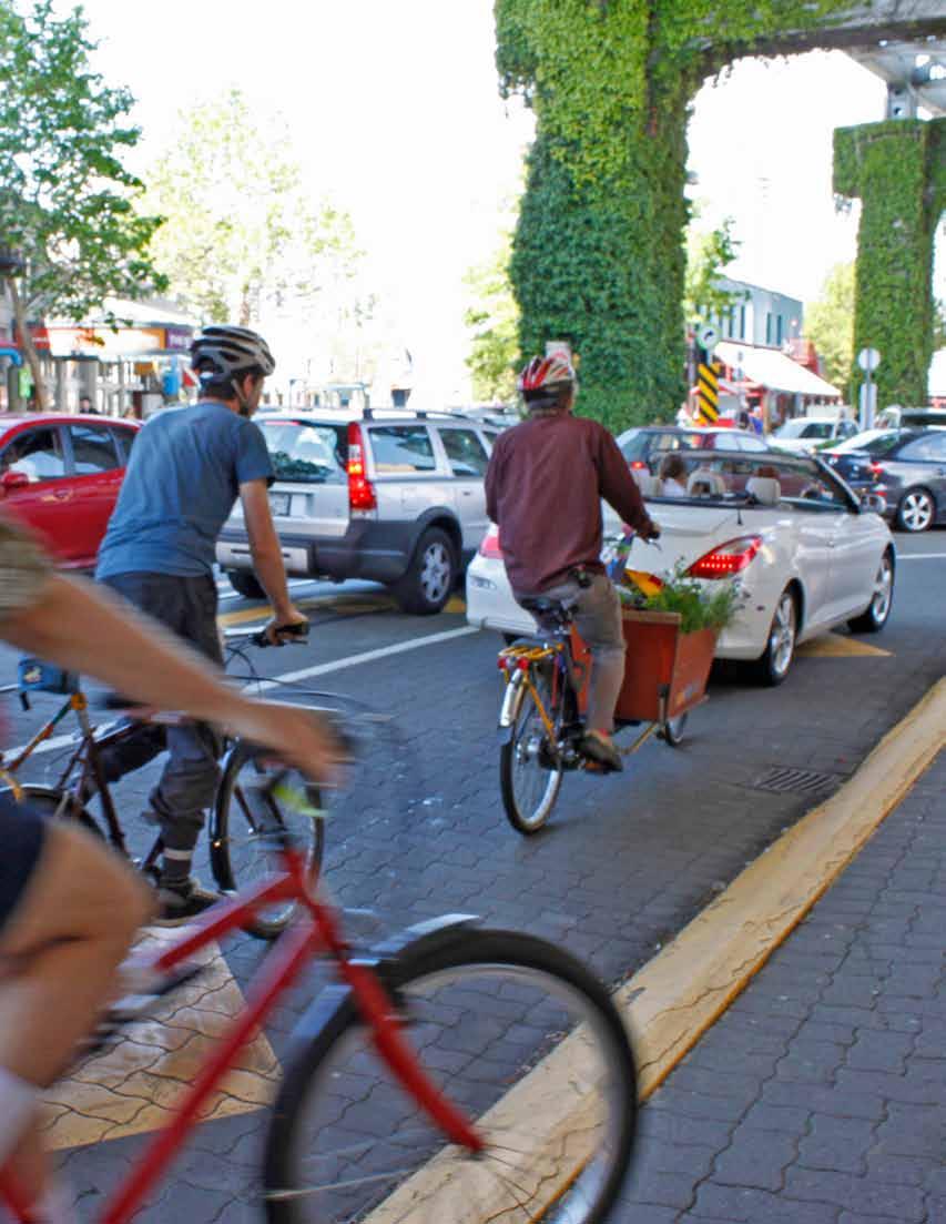
55

56 Photo Chuck Russell
57 GOAL 5 Support Sustainable Transportation Choices Land use influences travel patterns and transportation systems in turn influence land use and development. Achieving the goals of the Regional Growth Strategy requires the alignment of land use and transportation strategies. Accessible and sustainable transportation choices are supported by strategies for a compact urban area, and transit-oriented development patterns throughout the region with growth focused in Urban Centres and Frequent Transit Development Areas. This transit-oriented pattern of growth helps reduce vehicle use, traffic congestion, energy consumption and air emissions from on-road sources while fostering transit ridership. It also provides the region s residents with greater travel options and a cleaner environment. The first strategy identifies actions required to increase the proportion of trips by transit, cycling and walking, and other alternatives to single-occupant vehicle travel. Implementation of TransLink s Frequent Transit Network will be critical in reinforcing the network of transit-oriented Urban Centres and emerging Frequent Transit Development Areas, which support transit, cycling and walking, and also reduce trip distances. The second strategy recognizes the fundamental role that TransLink s Major Road Network, provincial highways, and federal transportation facilities play in shaping regional growth, moving people and goods among and between the region s communities and economic areas, and connecting the region with intra-provincial, national and international destinations. The strategy advocates for active management of the existing and planned capacity of the road network and the demands put on it. This minimizes the need for capital-intensive expansion in the future. Further, rail and marine transportation have the potential to play a larger role in the future for goods movement, so protecting rail rights-ofway and access points to waterways today is critical in preserving transportation options in the future. Metro Vancouver continues to work in partnership with municipalities, TransLink, Port Metro Vancouver, airport authorities, and the federal government and the province to coordinate decision-making to achieve the goals of the Regional Growth Strategy. TransLink prepares and implements strategic transportation plans for roads, transit and cycling and other regional transportation programs, as well as the region s long-term transportation strategy. The Regional Growth Strategy and TransLink s long-term transportation strategy comprise the region s long-term vision for the land use and transportation system. The province prepares provincial highway and transit plans which help to guide the development of regional transportation plans. Both the federal government and the province play significant roles in funding regional transit and goods movement infrastructure. Furthermore, Metro Vancouver advocates for reductions in transportation-related greenhouse gas emissions and common air contaminants. Strategies to achieve this goal are: 5.1 Coordinate land use and transportation to encourage transit, multiple-occupancy vehicles, cycling and walking 5.2 Coordinate land use and transportation to support the safe and efficient movement of vehicles for passengers, goods and services 51
58 STRATEGY 5.1 Coordinate land use and transportation to encourage transit, multiple-occupancy vehicles, cycling and walking Metro Vancouver s role is to: Acknowledge TransLink s mandate for the preparation and implementation of regional transportation system and demand management strategies and to provide input through the provision of land use, growth management and air quality information and forecasts, and, as appropriate, evaluation of land use and vehicle emissions impacts Communicate to TransLink that Metro Vancouver s objectives for the regional transportation system are: A. to support regional land use objectives, particularly those described in Strategy 1.2; B. to support energy consumption, greenhouse gas emission, and air quality objectives as described in Strategy 3.3, in part through transit ridership growth and mode shifting; and C. to support the safe and efficient movement of vehicles for passengers, goods, and services, as set out in Strategy 5.2. With respect to Objective A (regional land use objective), Metro Vancouver s priorities for the expansion of the Frequent Transit Network and other transit services are: i) staging rapid transit expansion (busways or rail), in the following priority corridors: Priority 1: Connecting Lougheed Municipal Town Centre, Inlet Municipal Town Centre, and Coquitlam Regional City Centre. Priority 2: Connecting Surrey Metro Centre to one or more of the following Urban Centres south of the Fraser River: Fleetwood Municipal Town Centre, Guildford Municipal Town Centre, Newton Municipal Town Centre, and Langley Regional City Centre; Connecting or extending the existing rapid transit network in the Broadway/Commercial Drive area to the Central Broadway area. ii) enhancing or extending the Frequent Transit Network and other transit services in the following regional corridors to reinforce Urban Centres and Frequent Transit Development Areas: enhanced service linking Maple Ridge Regional City Centre and Langley Regional City Centre to each other, to Port Coquitlam Municipal Town Centre and to Coquitlam Regional City Centre and to other Urban Centres south of the Fraser River; enhanced service linking the Lonsdale Regional City Centre to North Shore Municipal Town Centres and the Metro Core; enhanced service linking Semiahmoo Municipal Town Centre to other Urban Centres south of the Fraser River; With respect to Objective B (transit ridership growth and mode shifting), Metro Vancouver s priorities are to achieve an increased share of trips made by transit, multiple-occupancy vehicles, cycling, and walking, and reductions in energy consumption and air emissions from onroad transportation sources. Metro Vancouver will support TransLink s development of strategic transportation plans to achieve this objective, in context with TransLink s mandate to plan and manage the regional transportation system. Metro Vancouver acknowledges that: The role of TransLink is to bring forward plans and supplemental plans that are financially sustainable and appropriately balance actions and investments in support of the Regional Growth Strategy, Metro Vancouver s air quality objectives and greenhouse gas emission reduction targets, and the economic development of the region; 52

59 The role of the Regional Transportation Commissioner is to review TransLink s strategic transportation plans and may comment on the degree that the strategic transportation plans support the Regional Growth Strategy, Metro Vancouver s air quality objectives and greenhouse gas emission reduction targets, and the economic development of the region; and The role of the Mayors Council on Regional Transportation is to determine the acceptability of TransLink s supplemental plans. Metro Vancouver s role is to provide advice and input to TransLink, the Regional Transportation Commissioner, and the Mayors Council in the fulfillment of their roles in light of the above objectives and the circumstances of the day Collaborate with TransLink, municipalities, and the province to implement land use and transportation data collection programs, forecasting methodologies, and performance measures and/ or targets, as appropriate, in support of the development of future regional growth management, air quality management, and transportation strategies and plans. c) identify policies and actions to manage and enhance municipal infrastructure to support transit, multiple-occupancy vehicles, cycling and walking. Actions Requested of Other Governments and Agencies That TransLink, in collaboration with municipalities, Metro Vancouver, the federal government and the province, as appropriate: a) prepare and implement strategic transportation plans that support focused growth in Urban Centres and Frequent Transit Development Areas, and other appropriate areas along TransLink s Frequent Transit Network (as shown as reference in Appendix Map B.1); b) provide Metro Vancouver with adequate opportunity to provide input into TransLink s strategic planning and decision-making processes that would affect the achievement of Metro Vancouver s objectives and priorities as set out in Action 5.1.2; Pursue, in collaboration with municipalities and TransLink, the conversion of redundant rail rights-of-way for primarily transportation uses (e.g. greenways, cycling, transit) which support the Regional Growth Strategy, municipal plans, and TransLink s strategic transportation plans Accept Regional Context Statements that identify policies and actions that coordinate land use and transportation planning to support transit, multiple-occupancy vehicles, cycling and walking, and that meet or work towards Action The role of municipalities is to: Adopt Regional Context Statements which: a) identify land use and transportation policies and actions, and describe how they are coordinated, to encourage a greater share of trips made by transit, multiple-occupancy vehicles, cycling and walking, and to support TransLink s Frequent Transit Network; b) identify policies and actions that support the development and implementation of municipal and regional transportation system and demand management strategies, such as parking pricing and supply measures, transit priority measures, ridesharing, and car-sharing programs; 53
 prepare and implement regional transportation system and demand management strategies, such as ridesharing")
60 c) establish performance measures and/or targets that support an increased share of trips made by transit, multiple-occupancy vehicles, cycling and walking, and reductions in air emissions from onroad transportation sources, and monitor progress towards achieving these targets; d) prepare and implement regional transportation system and demand management strategies, such as ridesharing programs, transportation user-based pricing and regional parking policy; e) support the development of high quality and safe regional cycling networks serving Urban Centres, Frequent Transit Development Areas, and other areas of high commuter and/or recreational cycling potential That TransLink and the province, in collaboration with municipalities, as appropriate, evaluate the potential impacts on the region s Industrial areas, Agricultural areas, and Conservation and Recreation areas when planning rapid transit alignments, station locations, and associated transportation infrastructure That the province collaborate through Metro Vancouver s Intergovernmental Advisory Committee (or an alternative collaborative mechanism) with TransLink, municipalities, Metro Vancouver, Fraser Valley Regional District, Squamish-Lillooet Regional District, First Nations, and other relevant agencies and associations, in the planning of major interregional transportation facilities, such as inter-regional transit and provincial highways, and the role that they are intended to play to support the Regional Growth Strategy, Air Quality Management Plan, and economic development of the Lower Mainland That the federal government and the province support the Regional Growth Strategy through the: a) development of predictable and sustainable funding sources for a transportation system which work towards regional, provincial and national sustainability goals; b) shared funding for transportation infrastructure and operations, including the implementation and evaluation of innovative pilot projects That rail companies, in developing their plans and strategies for rail corridors and facilities in Metro Vancouver, coordinate and consult with municipalities, TransLink, Port Metro Vancouver and Metro Vancouver to support regional transportation and land use planning goals. 54
61 STRATEGY 5.2 Coordinate land use and transportation to support the safe and efficient movement of vehicles for passengers, goods and services Metro Vancouver s role is to: Support TransLink s preparation and implementation of a regional goods movement strategy through the provision of land use and growth management information and forecasts, and, as appropriate, evaluation of land use and vehicle emissions impacts Accept Regional Context Statements that identify coordinated land use and transportation policies and actions in support of the safe and efficient movement of vehicles for passengers, goods and services and that meet or work towards Action The role of municipalities is to: Adopt Regional Context Statements which: a) identify routes on a map for the safe and efficient movement of goods and service vehicles to, from, and within Urban Centres, Frequent Transit Development Areas, Industrial, Mixed Employment and Agricultural areas, Special Employment Areas, ports, airports, and international border crossings; b) identify land use and related policies and actions that support optimizing the efficient movement of vehicles for passengers, Special Employment Areas, goods and services on the Major Road Network, provincial highways, and federal transportation facilities; c) support the development of local and regional transportation system management strategies, such as the provision of information to operators of goods and service vehicles for efficient travel decisions, management of traffic flow using transit priority measures, coordinated traffic signalization, and lane management; Actions Requested of Other Governments and Agencies That TransLink, in collaboration with municipalities and other agencies as appropriate, support the safe and efficient movement of vehicles for passengers, goods and services through the: a) management and maintenance of the Major Road Network (as shown as reference in Appendix Map B.2), in consideration of the goals and policies of the Regional Growth Strategy for Urban Centres and Frequent Transit Development Areas; b) preparation and implementation of a regional goods movement strategy, in consideration of the goals and policies of the Regional Growth Strategy for Urban Centres and Frequent Transit Development Areas; c) preparation and implementation of regional transportation system and demand management strategies, in consideration of the goals and policies of the Regional Growth Strategy for Urban Centres and Frequent Transit Development Areas That TransLink, the province and partner agencies, as appropriate, support the protection of rail rights-of-way and access points to navigable waterways in order to reserve the potential for goods movement, in consideration of the potential impacts on air quality, habitat and communities That TransLink and the province, as appropriate, in collaboration with municipalities, seek to minimize impacts from within-and-through passenger, goods, and service vehicle movement on the environment and public health affecting the region and areas within the Lower Fraser Valley Airshed. d) identify policies and actions which support the protection of rail rights-of-way and access points to navigable waterways in order to reserve the potential for goods movement, in consideration of the potential impacts on air quality, habitat and communities. DRAFT NOVEMBER
 impacts on the achievement of the Regional Growth Strategy and the Air Quality")
62 5.2.7 That TransLink and the province, as appropriate, evaluate the following elements when contemplating future expansion of private vehicle capacity on major roads, highways, and bridges: a) transportation demand management strategies as alternatives to, or as integral with, such capacity expansion; b) impacts on the achievement of the Regional Growth Strategy and the Air Quality Management Plan, including potential cumulative impacts That the federal government and the province support the safe and efficient movement of vehicles for passengers, goods and services through shared funding, policies and regulations for: a) protection of rail rights-of-way and access points to navigable waterways; b) protective and mitigation measures on air quality, habitat and communities; c) applied research into transportation system and demand management-related technologies, policies, and regulations to optimize movement of vehicles for passengers, goods and services, in particular to airports, ports, and intermodal goodshandling facilities; d) survey instruments to obtain timely and comprehensive data on the travel patterns of residents, workers, and goods and service vehicles travelling within and through the Lower Mainland. 56
63 F Implementation 6.1 Regional Growth Strategy Implementation Framework Metro Vancouver and affected local governments will implement the Regional Growth Strategy within a collaborative decision-making framework. This framework is based on provisions set out in the Local Government Act and in recognition by Metro Vancouver and affected local governments that collaborative decision-making is necessary in order to achieve the visions and goals in this Regional Growth Strategy. The Regional Growth Strategy has been designed so that the more regionally significant an issue, the higher the degree of Metro Vancouver involvement in decision-making, and conversely, the less regionally significant an issue, the less Metro Vancouver involvement. This approach is intended to provide checks and balances on land use planning decisions made within Metro Vancouver and member municipalities. This collaborative decision-making process applies to: acceptance by affected local governments of the initial Regional Growth Strategy and subsequent amendments; acceptance by Metro Vancouver of initial municipal Regional Context Statements and subsequent amendments; ongoing Regional Growth Strategy and Regional Context Statement administration and procedures. Table 4 Regional Growth Strategy Implementation Framework Regionally significant Principles Examples Procedures Fundamental change to core goals/strategies Amend the goals or strategies; delete an entire goal; change the minor amendment process Type 1 Major 50% + 1 Board vote and acceptance by all affected local governments Region-wide significance for non-urban designations Change Urban Containment Boundary or Agricultural designation Type 2 Minor 2/3 Board vote and regional Public Hearing Region-wide significance for urban designations Large scale Industrial area designation change Type 3 Minor 50% + 1 Board vote, no regional Public Hearing Small scale urban designation changes Small scale Industrial area designation change, changes to Urban Centre boundaries Official Community Plan change only, no requirement to amend Regional Context Statement Local government autonomy Local planning matter with no regional significance Rezoning consistent with Official Community Plan Official Community Plan matters, no Regional Context Statement reference required Note: Table for reference only, see section
64 6.2 Regional Context Statements Within two years of the Metro Vancouver Board s adoption of the Regional Growth Strategy, each municipality must include in its Official Community Plan, and submit to the Metro Vancouver Board for acceptance, a Regional Context Statement. A municipality may submit its Regional Context Statement to the Metro Vancouver Board for acceptance either before or after the municipality holds its public hearing relating to its Official Community Plan amendment. Contents of Regional Context Statement The Regional Context Statement must identify the relationship between the Official Community Plan and the goals, strategies and actions identified in the Regional Growth Strategy. If applicable, the Regional Context Statement will identify how the Official Community Plan will be made consistent with the Regional Growth Strategy over time. Regional Context Statements that propose to add or delete Frequent Transit Development Areas must be accompanied by written comments from TransLink. Figure 4 Relationship Between the Regional Growth Strategy and Official Community Plans Regional Growth Strategy Regional Context Statement Official Community Plan Zoning Bylaw Development Permits Each municipality prepares an updated Official Community Plan (OCP) and Regional Context Statement (RCS) within two years of the adoption of a new Regional Growth Strategy. The RCS sets out the relationship between the Regional Growth Strategy and the municipality s OCP, and identifies how local actions will contribute to achieving Regional Growth Strategy goals. Municipalities must submit their RCS to the Metro Vancouver Board for acceptance. Note: Figure for reference only, see section Regional Context Statement Process If a municipality proposes an amendment to a Regional Context Statement it must submit to Metro Vancouver the council resolution, including a report, that sets out the municipality s proposed amendment to the Regional Context Statement If a municipality anticipates that its proposed Regional Context Statement, or amendment thereto, will not be accepted by the Metro Vancouver Board because it is not generally consistent with the Regional Growth Strategy, the municipality may submit concurrently a proposed amendment to the Regional Growth Strategy. The procedure for amendments to the Regional Growth Strategy is set out in section The Metro Vancouver Board will respond within 120 days by resolution, requiring a simple majority weighted vote, indicating whether it accepts a Regional Context Statement. If the Board refuses to accept a Regional Context Statement, the Board will indicate the provisions to which it objects and the reasons for its objections. Consistency with Regional Growth Strategy In considering acceptance of Regional Context Statements, the Metro Vancouver Board s expectation is that acceptable Regional Context Statements are generally consistent with the Regional Growth Strategy s goals, strategies, actions and the parcel-based regional land use designations depicted in the Regional Land Use Designations map (Map 2). Providing for Appropriate Municipal Flexibility A municipality may include language in its Regional Context Statement that permits amendments to the municipality s Official Community 58
65 Plan to adjust the boundaries of regional land use designations (or their equivalent Official Community Plan designation) within the Urban Containment Boundary, provided that: a) the municipality may re-designate land from one regional land use designation to another regional land use designation, only if the aggregate area of all proximate sites so re-designated does not exceed one hectare; b) notwithstanding section (a), for sites that are three hectares or less, the municipality may re-designate land: from Mixed Employment or Industrial to General Urban land use designation, if the site is located on the edge of an Industrial or Mixed Employment area and the developable portion of the site will be predominantly within 150 metres of an existing or approved rapid transit station on TransLink s Frequent Transit Network; or from Industrial to Mixed Employment land use designation if the developable portion of the site will be predominantly within 250 metres of an existing or approved rapid transit station on TransLink s Frequent Transit Network, provided that: the re-designation does not impede direct rail, waterway, road or highway access for industrial uses; and the aggregate area of all proximate sites that are re-designated does not exceed three hectares; c) the aggregate area of land affected by all re-designations under section (a) and (b) together cannot exceed two percent of the municipality s total lands within each applicable regional land use designation A municipality may include language in its Regional Context Statement that permits amendments to the municipality s Official Community Plan to adjust the boundaries of the municipality s Urban Centres and Frequent Transit Development Areas, provided such boundary adjustments meet the guidelines set out in Table 3 (Guidelines for Urban Centres and Frequent Transit Development Areas) of the Regional Growth Strategy Municipalities will notify Metro Vancouver of all adjustments, as permitted by sections and 6.2.8, as soon as practicable after the municipality has adopted its Official Community Plan amendment bylaw If a municipality includes language in its Regional Context Statement that permits amendments to the municipality s Official Community Plan to adjust the boundaries of regional land use designations within the Urban Containment Boundary or the boundaries of Urban Centres and Frequent Transit Development Areas, as permitted by sections and respectively, the prescribed adjustments do not require an amendment to the municipality s Regional Context Statement. All other adjustments to regional land use designation boundaries will require an amendment to the municipality s Regional Context Statement, which must be submitted to the Metro Vancouver Board for acceptance in accordance with the requirements of the Local Government Act. Request for Board Comment During Initial Two Year Period From the time that the Metro Vancouver Board adopts the Regional Growth Strategy until the first time that the Metro Vancouver Board accepts a municipality s Regional Context Statement, each municipality is requested to seek comment from the Metro Vancouver Board on proposed amendments to that municipality s Official Community Plan which are inconsistent with the Regional Growth Strategy. 6.3 Categories of Regional Growth Strategy Amendments Type 1 - Major Amendments to the Regional Growth Strategy The following Type 1 major amendments to the Regional Growth Strategy require an affirmative 50% + 1 weighted vote of the Metro Vancouver Board and acceptance by all affected local governments in accordance with section 857 of the Local Government Act: a) the addition or deletion of Regional Growth Strategy goals or strategies; b) an amendment to the process for making minor amendments to the Regional Growth Strategy, which is specified in sections and 6.3.4; c) the matters specified in section 857.1(4) of the Local Government Act. 59
66 6.3.2 All amendments to the Regional Growth Strategy other than the amendments specified in section are minor amendments (Type 2 and Type 3) for the purposes of section 857.1(2) of the Local Government Act. Type 2 - Minor Amendments to the Regional Growth Strategy (two-thirds weighted vote and regional public hearing required) The following Type 2 minor amendments require an affirmative two-thirds weighted vote of the Metro Vancouver Board and a regional public hearing: a) amendment to the Urban Containment Boundary; b) amendment of Agricultural or Conservation and Recreation land use designations, except as set out in section (e), (f) and (g); c) amendment from Rural land use designation to Industrial, Mixed Employment or General Urban land use designations; d) for sites located outside the Urban Containment Boundary that are designated Industrial or Mixed Employment, amendments to Industrial, Mixed Employment or General Urban land use designations; e) the addition or deletion of an Urban Centre; f) the addition or deletion of, or amendment to, the descriptions of the regional land use designations or actions listed under each strategy. Type 3 - Minor Amendments to the Regional Growth Strategy (simple majority weighted vote and no regional public hearing required) The following Type 3 minor amendments require an affirmative 50% + 1 weighted vote of the Metro Vancouver Board and do not require a regional public hearing: a) the addition or deletion of a Frequent Transit Development Area location; b) for sites within the Urban Containment Boundary, amendments from Industrial, Mixed Employment, Conservation and Recreation lands utilized only for commercial extensive recreation facilities, or General Urban land use designations to any other such regional land use designations; d) amendment from Rural land use designation to Agricultural or Conservation and Recreation land use designations; e) amendment from Conservation and Recreation land use designation to Agricultural land use designation; f) for sites that are contiguous with, or within, the Urban Containment Boundary and are not within the Agricultural Land Reserve, amendment from Agricultural or Rural land use designations to Industrial land use designation, and associated Urban Containment Boundary adjustments; g) for those sites that are identified as Special Study Areas on the Special Study Areas and Sewerage Extension Areas map (Map 12), an amendment to one or more of the regional land use designations set out in the Regional Growth Strategy and associated Urban Containment Boundary adjustments; h) housekeeping amendments to population, dwelling unit and employment projections, housing demand estimates, performance measures, tables, figures, grammar, or numbering, that do not alter the intent of the Regional Growth Strategy; i) amendments to mapping to incorporate maps included in accepted Regional Context Statements; j) all other amendments not identified in sections or Procedures for Regional Growth Strategy Amendments Who Can Apply for an Amendment The process to initiate amendments to the Regional Growth Strategy is by resolution of the Metro Vancouver Board. Municipalities may, by resolution, request amendments. The Metro Vancouver Board will not give first reading to an amendment bylaw which proposes to change a regional land use designation or Urban Containment Boundary unless or until the municipality or municipalities in which the subject site is located have requested that amendment or have been given the opportunity to formally comment on the proposed amendment. c) amendment from Industrial, Mixed Employment or General Urban land use designations to Rural, Agricultural or Conservation and Recreation land use designations; 60
67 Notification and Request for Comments For all proposed amendments to the Regional Growth Strategy the Metro Vancouver Board will: a) provide written notice of the proposed amendment to all affected local governments; b) provide a minimum of 30 days for affected local governments, and the appropriate agencies, to respond to the proposed amendment; c) post notification of the proposed amendment on the Metro Vancouver website, for a minimum of 30 days; d) if the proposed amendment is to change a site from Industrial or Mixed Employment to General Urban land use designation, provide written notice and a minimum of 30 days for Port Metro Vancouver, the Vancouver International Airport Authority, the Ministry of Transportation and Infrastructure and/or the Agricultural Land Commission, as appropriate, to respond to the proposed amendment. Procedures for Type 1 Major Amendments For Type 1 major amendments to the Regional Growth Strategy set out in section 6.3.1, the procedures set out in section 857 of the Local Government Act apply. Procedures for Type 2 Minor Amendments Requiring a Two-Third Weighted Vote For Type 2 minor amendments to the Regional Growth Strategy set out in section 6.3.3, the Metro Vancouver Board will: a) consider first and second reading of the amendment bylaw; b) provided the amendment bylaw receives an affirmative two-thirds weighted vote of the Metro Vancouver Board at first reading and second reading, refer the amendment bylaw to a public hearing; c) hold a public hearing to receive public comment on the amendment bylaw; Procedures for Type 3 Minor Amendments Requiring Simple Majority Weighted Vote For Type 3 minor amendments to the Regional Growth Strategy set out in section 6.3.4, the Metro Vancouver Board will: a) consider first, second and third reading of the amendment bylaw; b) provided the amendment bylaw receives an affirmative majority weighted vote of the Metro Vancouver Board at each of the first, second and third readings, consider final adoption of the amendment bylaw and, provided the amendment bylaw receives an affirmative simple majority weighted vote of the Metro Vancouver Board, adopt the amendment bylaw. 6.5 Coordination with First Nations Metro Vancouver will work with First Nations to facilitate the compatibility of Metro Vancouver s Regional Growth Strategy and First Nations planning and development initiatives Many First Nations communities have asserted aboriginal rights and title to traditional territories within the region, and are currently engaged in treaty negotiations and other processes. The implementation of the Regional Growth Strategy will proceed without prejudice to any aboriginal rights or title that may currently exist, or be defined further through treaty or other processes On Treaty Effective Date (April 3rd, 2009), Tsawwassen First Nation became a Treaty First Nation member of Metro Vancouver and its land use plan was deemed to be consistent with the Regional Growth Strategy until the date Tsawwassen First Nation amends or replaces that land use plan after the Effective Date. Section does not apply to Tsawwassen First Nation. A land use plan prepared by Tsawwassen First Nation after the Effective Date will include a statement equivalent to a Regional Context Statement as defined in the Local Government Act, identifying how its land use plan is consistent with the Regional Growth Strategy. d) consider third reading; e) provided the amendment bylaw receives an affirmative two-thirds weighted vote of the Metro Vancouver Board at third reading, consider final adoption of the amendment bylaw and, provided the amendment bylaw receives an affirmative two-thirds weighted vote of the Metro Vancouver Board, adopt the amendment bylaw. 61

68 6.6 Coordination with TransLink Metro Vancouver will work with TransLink with the objective that the Regional Growth Strategy and TransLink s regional transportation plans are compatible and complementary. Metro Vancouver will refer to TransLink for written comments Regional Context Statement amendments that would impact the regional transportation system or significantly affect the demand for regional transportation services As an affected local government, TransLink is required to consider acceptance of the Regional Growth Strategy and any proposed Type 1 major amendments, as set out in section Coordination with Other Governments and Agencies Metro Vancouver will work with the Fraser Valley Regional District, the Squamish-Lillooet Regional District, and the Islands Trust (regarding Bowen, Bowyer and Passage Islands) to facilitate the compatibility of regional growth planning and initiatives in Metro Vancouver and these neighbouring jurisdictions Metro Vancouver will collaborate with TransLink and the federal government and the province and their agencies on major investments in the regional transportation system, expansion of affordable housing options, and the location of public facilities that support the goals and strategies specified in the Regional Growth Strategy. Metro Vancouver will seek formal Implementation Agreements with these agencies to give effect to that intent. 6.8 Coordination with Greater Vancouver Boards After the Metro Vancouver Board has adopted this Regional Growth Strategy all bylaws adopted and all works and services undertaken by the Greater Vancouver Regional District, the Greater Vancouver Water District or the Greater Vancouver Sewerage and Drainage District must be consistent with the Regional Growth Strategy. The Greater Vancouver Sewerage and Drainage District and the Greater Vancouver Water District will not directly or indirectly supply, agree to supply, or authorize connections that enable the supply of services to a site that is developed or proposed to be developed after the date of adoption of the Regional Growth Strategy where the nature of that development is, in the sole judgment of the Greater Vancouver Regional District, inconsistent with the provisions of the Regional Growth Strategy For further clarity, sites within the Urban Containment Boundary which are designated General Urban, Industrial or Mixed Employment, would be eligible for sewerage services, subject to normal Greater Vancouver Sewerage and Drainage District technical considerations, provided that the proposed development complies with the applicable policies under those designations and any such Urban Centre and Frequent Transit Development Area overlays which might apply. For sites designated Rural, Agriculture, or Conservation and Recreation, policies 1.3.1, or apply, respectively. 6.9 Sewerage Area Extensions Notwithstanding any other provision in this Regional Growth Strategy, the area identified on Map 12 as Rural within the Sewerage Area includes part of the Salmon River Uplands in the Township of Langley that is contained within the Greater Vancouver Sewerage and Drainage District s (GVS&DD) Fraser Sewerage Area. For the areas identified on Map 12 as Sewerage Extension Areas known as North Salmon River Uplands and South Fernridge in the Township of Langley, sewer servicing will be permitted subject only to land uses being consistent with the applicable regional land use designation and normal GVS&DD technical considerations. 62
69 6.10 Special Study Areas Special Study Areas as depicted on the Specialty Study Areas and Sewerage Extension Areas map (Map 12) identify locations where, prior to the adoption of the Regional Growth Strategy, a municipality has expressed an intention to alter the existing land use, and is anticipating a future regional land use designation amendment. Pending Board approval of a regional land use designation amendment, the current regional land use designation applies within the Special Study Area. Amending a regional land use designation within a Special Study Area is a minor amendment under section of the Regional Growth Strategy. This includes associated adjustments to the Urban Containment Boundary for a Special Study Area If the Special Study Area involves lands within the Agricultural Land Reserve, then the municipality is required to consult with the Agricultural Land Commission during the preparation of the planning studies prior to initiating an application to exclude the lands from the Agricultural Land Reserve Jurisdiction This Regional Growth Strategy applies to all lands within the boundaries and jurisdiction of Metro Vancouver In accordance with the Agricultural Land Commission Act, in the event that there is an inconsistency between the regional land use designations or policies set out in the Regional Growth Strategy and the requirements of the Agricultural Land Commission Act or regulations and orders made pursuant thereto, the Agricultural Land Commission requirements will prevail Regional Growth Strategy Maps The official regional land use designation maps are maintained by Metro Vancouver and available for viewing on the Metro Vancouver website, and will be updated to incorporate changes to designation boundaries that result from regional amendment bylaws. The maps contained in the Regional Growth Strategy are small scale depictions of the official regional land use designation maps Where a regional land use designation boundary does not align with a legal boundary, the Agricultural Land Reserve boundary, a municipal Official Community Plan or zoning boundary, or a distinct geographic feature, the regional designation boundary is approximate, and the municipal boundary depicted in the accepted Regional Context Statement prevails Boundaries for Urban Centres and Frequent Transit Development Areas are to be defined by municipalities in municipal plans (e.g. Official Community Plans, Area Plans) and shown in Regional Context Statements. Where municipalities amend the boundaries of Urban Centres or Frequent Transit Development Areas and, in accordance with section 6.2.8, have not amended their Regional Context Statement, municipalities are requested to forward any change to boundaries of Urban Centres or Frequent Transit Development Areas to Metro Vancouver The areas for Special Study Areas and Sewerage Areas depicted on Map 12 are not to be expanded nor are new areas to be created. A Type 3 minor amendment to Map 12 is only permitted to delete Special Study Areas and may occur after the Regional Growth Strategy has been amended to change the regional land use designation of the Special Study Area or when a municipality extinguishes a Special Study Area Notwithstanding section , the Special Study Area in the District of West Vancouver may be expanded to include lands that are designated General Urban, are within the Urban Containment Boundary and are above the 1,200 foot contour Tables, Figures and Performance Measures Tables 2, A.1, A.2, A.3 and A.4 showing population, dwelling unit and employment projections, and housing demand estimates for Metro Vancouver and municipalities are included in the document as guidelines only. These tables are included in the Regional Growth Strategy as a reference for use when preparing Regional Context Statements and regional planning initiatives. Metro Vancouver, in collaboration with municipalities will maintain projections to monitor growth and will propose updates to tables in accordance with the amendment process set out in section following Board acceptance of municipal Regional Context Statements or a significant change in the growth projections assumptions The following figures and maps in the Regional Growth Strategy are included as reference only: Tables 1, 4, Figures 1, 2, 3, 4 and Maps 1, 9,10. 63

70 Pursuant to section 869 (1)(b) of the Local Government Act, Metro Vancouver will prepare an annual report on progress in meeting the goals of the Regional Growth Strategy through the monitoring of the performance measures identified in the Performance Measures section and in meeting other targets set out in the Regional Growth Strategy Interpretation In this document, unless the context requires otherwise, the term Metro Vancouver refers to the Greater Vancouver Regional District All terms used in the Regional Growth Strategy that are defined in the Local Government Act have the meanings given to such terms in the Local Government Act For the purposes of this Regional Growth Strategy, the Tsawwassen First Nation is considered to be a member municipality Guidelines The Metro Vancouver Board may periodically prepare guidelines to assist in the implementation of the Regional Growth Strategy, including but not limited to, guidelines for the preparation of Regional Context Statements, for amendment of a Regional Context Statement and / or Regional Growth Strategy, and, for establishing Frequent Transit Development Areas Affected local governments are the governments and authorities which are directly affected by the Regional Growth Strategy, namely the Metro Vancouver member municipalities (excluding Bowen Island Municipality), the Tsawwassen First Nation, the adjoining Regional Districts of Squamish- Lillooet Regional District and Fraser Valley Regional District, and the South Coast British Columbia Transportation Authority (also known as TransLink ). 64

71 Map 12: Special Study Areas and Sewerage Extension Areas - 65
72 G Performance Measures To assist in implementing the Regional Growth Strategy, Metro Vancouver will prepare an annual report on progress in meeting the goals of the Regional Growth Strategy. This measuring and monitoring will also allow for the informed future update of the Regional Growth Strategy as required. Goal 1: Create a Compact Urban Area Strategy 1.1: Contain urban development within the Urban Containment Boundary 1. Annual population, dwelling unit and employment growth in Metro Vancouver and member municipalities. 2. Percentage of residential and employment growth occurring within the Urban Containment Boundary. 3. Residential density within the Urban Containment Boundary. 4. Percentage of residential and employment growth occurring in established urban areas (lands within the Urban Containment Boundary that have been developed). 5. Number of new regional sewer connections outside of the Urban Containment Boundary. Strategy 1.2: Focus growth in Urban Centres and Frequent Transit Development Areas 1. Number and percentage of new dwelling units and population located within Urban Centre boundaries. 2. Number and percentage of new employment located within Urban Centre boundaries. 3. Number and area of Frequent Transit Development Area locations. 4. Number and percentage of new dwelling units and population located within Frequent Transit Development Area boundaries. 5. Number and percentage of new employment located within Frequent Transit Development Area boundaries. Strategy 1.3: Protect Rural areas from urban development 1. Number of net new dwelling units located in the Rural areas. 2. Residential density in the Rural areas. Goal 2: Support a Sustainable Economy Strategy 2.1: Promote land development patterns that support a diverse regional economy and employment close to where people live 1. Total number and growth of employment by sector for each subregion. 2. Employment to labour force ratio in each subregion. 3. Percentage of residents living and working within the same subregion. 4. Percentage of new office and retail development locating within and outside of Urban Centres and Frequent Transit Development Areas boundaries. Strategy 2.2: Protect the supply of industrial land 1. Number of hectares added to, or removed from, the Industrial and Mixed Employment areas. 2. Number of hectares in Industrial and Mixed Employment areas used for industrial uses. 3. Number of hectares in Industrial and Mixed Employment areas used for non-industrial uses. 4. Vacancy rate of industrial floorspace. 5. Industrial lease rates. 6. Industrial land prices. 7. Inventory of market ready industrial land. 8. Inventory of medium and long-term industrial land. 9. Employment in Industrial and Mixed Employment areas. Strategy 2.3: Protect the supply of agricultural land and promote agricultural viability with an emphasis on food production 1. Number of hectares within the Agricultural area. 2. Number of hectares and percentage of the Agricultural area used for agricultural activities. 3. Percentage of Agricultural area under active food production. 4. Value of gross annual farm receipts. 66
73 Goal 3: Protect the Environment and Respond to Climate Change Impacts Strategy 3.1: Protect Conservation and Recreation lands 1. Number of hectares in the Conservation and Recreation areas. Strategy 3.2: Protect and enhance natural features and their connectivity 1. Net change in the conservation status of animals and plants. 2. Number of municipalities with mapped and designated Environmentally Sensitive Areas. 3. Number of hectares of designated Environmentally Sensitive Areas. Strategy 3.3: Encourage land use and transportation infrastructure that reduce energy consumption and greenhouse gas emissions, and improve air quality 1. Tonnes of greenhouse gas emissions produced by buildings and transportation sources. 2. Volume of fuel sold for on-road transportation. 3. Share of trips by transit, multiple-occupancy vehicles, cycling and walking. 4. Number of dwellings / non-residential floorspace served by district energy systems. Goal 4: Develop Complete Communities Strategy 4.1: Provide diverse and affordable housing choices 1. Number of net new housing units by type, tenure, and average cost. 2. Total and number of net new rental units affordable to households with income below 50% of the median income for the region. 3. Total and number of net new rental units affordable to households with income between 50% to 80% of the median income for the region. 4. Total and number of net new rental and ownership units affordable to households with income 80% and higher of the median income for the region. 5. Total and number of net new supportive and transitional housing units. 6. Number of households in core housing need (households unable to find adequate housing without spending 30% or more of gross income on housing costs). 7. Number of municipalities that have adopted and begun to implement Housing Action Plans. Strategy 4.2: Develop healthy and complete communities with access to a range of services and amenities 1. Number of residents living within walking distance of a dedicated park or trail. 2. Hectares of dedicated park per 1,000 people living within the Urban Containment Boundary. 3. Number and percent of residents living within walking distance of a public community / recreation facility / centre. 4. Number and percent of residents living within walking distance of a grocery store. Goal 5: Support Sustainable Transportation Choices The following performance measures will be monitored in collaboration with TransLink, and the emphasis for Metro Vancouver will be on performance in relation to regional land use objectives. Strategy 5.1: Coordinate land use and transportation to encourage transit, multipleoccupancy vehicles, cycling and walking 1. Number of kilometres of Frequent Transit Network. 2. Total and per capita annual transit service hours. 3. Total and per capita auto driver, auto passenger, transit, cycle, and walk trips. 4. Volume of fossil fuel purchased within Metro Vancouver. 5. Mean trip distance by mode for journey to work. Strategy 5.2: Coordinate land use and transportation to support the safe and efficient movement of vehicles for passengers, goods and services 1. Travel time reliability on the Major Road Network. 2. Number and per capita of vehicle-related collisions, injuries, and fatalities. 67
74 Appendix A Table A.1 Population, Dwelling Unit and Employment Projections for Metro Vancouver Subregions and Municipalities SubRegion Total Population Total Dwelling Units Total Employment Municipality Metro Vancouver Total 2,195,000 2,780,000 3,129,000 3,400, ,000 1,130,000 1,307,000 1,422,000 1,158,000 1,448,000 1,622,000 1,753,000 Burnaby, New Westminster 271, , , , , , , , , , , ,000 Burnaby 210, , , ,000 81, , , , , , , ,000 New Westminster 60,500 80,000 92, ,000 28,040 37,100 42,600 47,000 28,000 37,000 44,000 48,000 Langley City, Langley Township 122, , , ,000 45,670 68,200 86,300 97,000 66,000 92, , ,000 Langley City 24,900 32,000 35,000 38,000 11,160 14,500 16,000 17,100 17,000 21,000 23,000 25,000 Langley Township 97, , , ,000 34,510 53,700 70,300 79,900 49,000 71,000 87, ,000 Maple Ridge, Pitt Meadows 88, , , ,000 32,020 44,300 52,700 60,300 28,000 42,000 50,000 57,000 Maple Ridge 71,500 95, , ,000 25,920 36,100 43,700 50,900 23,000 34,000 41,000 48,000 Pitt Meadows 16,600 22,000 23,000 24,000 6,100 8,200 9,000 9,400 5,000 8,000 9,000 9,000 Northeast Sector 205, , , ,400 73, , , ,000 75, , , ,470 Anmore 1,900 2,800 3,600 4, ,080 1, ,250 Belcarra , Coquitlam 119, , , ,000 42,960 67,700 86,700 94,100 46,000 70,000 86,000 94,000 Port Coquitlam 54,500 68,000 76,000 85,000 19,400 26,300 30,900 34,300 21,000 28,000 32,000 35,000 Port Moody 28,700 39,000 44,000 50,000 10,510 15,600 17,800 19,900 8,000 13,000 15,000 18,000 North Shore 181, , , ,000 72,370 84,340 93, ,490 77,310 91, , ,570 North Vancouver City 47,500 56,000 62,000 68,000 22,360 25,600 28,000 30,200 29,000 34,000 37,000 40,000 North Vancouver District 87,000 98, , ,000 31,260 37,500 41,500 45,000 27,000 33,000 36,000 40,000 West Vancouver 45,400 51,000 56,000 60,000 18,200 20,600 23,100 24,500 21,000 24,000 27,000 29,000 Lions Bay 1,400 1,600 1,900 2, Delta, Richmond, Tsawwassen 282, , , ,500 98, , , , , , , ,600 Delta 99, , , ,000 34,300 40,300 45,400 48,000 55,000 63,000 70,000 75,000 Richmond 182, , , ,000 64,000 88, , , , , , ,000 Tsawwassen First Nation 800 4,000 6,000 8, ,900 2,900 4, ,300 1,800 2,600 Surrey, White Rock 431, , , , , , , , , , , ,000 Surrey 413, , , , , , , , , , , ,000 White Rock 18,900 23,000 25,000 27,000 9,900 11,700 12,300 13,400 7,000 9,000 10,000 11,000 Vancouver, Electoral Area A 612, , , , , , , , , , , ,000 Vancouver 601, , , , , , , , , , , ,000 Electoral Area A 11,600 24,000 29,000 30,000 5,100 10,800 13,300 14,200 19,000 20,000 21,000 21,000 Notes: 1. These projections are to assist in long range planning and are guidelines only. 2. Metro Vancouver growth projections are provided as guidance to member municipalities and regional agencies. 3. Figures for the year of 2006 are based on Census of Canada 2006 and include estimated Census undercount. 4. Population projections for Metro Vancouver are based on provincial and Regional District projections prepared by the Province of British Columbia (BC Stats PEOPLE 33, July 2008). Population, dwelling and employment projections for subregions and municipalities were prepared by Metro Vancouver in consultation with member municipalities. 5. All figures in this table are rounded and may include minor inconsistencies for summary totals. 6. All municipal totals include Indian Reserve or First Nation communities located within municipal boundaries, with the exception of Tsawwassen First Nation. 68
75 Table A.2 Housing Demand Estimates by Tenure for Metro Vancouver Subregions (10 Year Estimate) Subregional Estimates Estimated TOTAL Housing Demand Notes: 1. These 10 year estimates are to commence the year of the adoption of the Regional Growth Strategy. 2. The housing demand estimate set out in Table A.2 are net additional units based on the population and household projections set out in Table A.1. The demand estimates assume an average regional increase of 18,560 households per year. 3. Estimated Ownership Demand: If future housing demand patterns remain consistent with the current tenure profile (65% ownership and 35% rental), it is anticipated that there will be the need for 120,700 ownership units or 12,070 units per year over the next 10 years. 4. Estimated Rental Demand: If the rental housing demand pattern remains consistent with the current tenure profile (65% ownership and 35% rental), there is the need for 64,900 rental housing units or 6,490 units per year over the next 10 years. 5. Anmore, Belcarra, and Lions Bay are not included in the table above given the modest levels of growth anticipated in these communities. 6. Estimated housing demand by municipality is included in Table A.4. Estimated Ownership Demand Estimated Rental Demand Metro Vancouver Total 185, ,700 64,900 Burnaby, New Westminster 27,300 17,700 9,600 Langley City, Langley Township 14,500 9,400 5,100 Maple Ridge, Pitt Meadows 8,200 5,300 2,900 Coquitlam, Port Coquitlam, Port Moody 23,500 15,300 8,200 North Shore 7,800 5,100 2,700 Richmond, Delta, Tsawwassen First Nation 19,700 12,800 6,900 Surrey, White Rock 51,200 33,300 17,900 Vancouver, Electoral Area A 33,400 21,800 11,600 69
76 Table A.3 Rental Housing Demand Estimates by Household Income for Metro Vancouver Subregions (10 Year Estimate) Low to Moderate Income Demand Moderate and Above income Demand Total Rental Demand Low Income Subregional Estimates Demand Metro Vancouver Total 21,400 25,400 18,100 64,900 Burnaby, New Westminster 3,100 3,700 2,800 9,600 Langley City, Langley Township 1,700 2,000 1,400 5,100 Maple Ridge, Pitt Meadows 1,000 1, ,900 Coquitlam, Port Coquitlam, Port Moody 2,700 3,200 2,300 8,200 North Shore 1,000 1, ,700 Richmond, Delta, Tsawwassen First Nation 2,300 2,700 1,900 6,900 Surrey, White Rock 5,800 7,100 5,000 17,900 Vancouver, Electoral Area A 3,800 4,600 3,200 11,600 Notes: 1. These 10 year estimates are to commence the year of the adoption of the Regional Growth Strategy. 2. It is anticipated that at least 25% of future demand will be for rental housing that is affordable to households with low to moderate incomes (below 80% of the median for the region). This translates into approximately 46,800 net additional units or 4,680 net additional units per year over the next 10 years (Columns 1 + 2). 3. Column 1 shows the estimated demand from households with low incomes. These include households with annual incomes which fall below 50% of the median income for the region and which typically require access to government-supported housing. To meet this demand, funding from other levels of government is required. 4. Column 2 shows the estimated demand from households with low to moderate incomes. These include households with annual incomes which fall between 50% and 80% of the median income for the region. Many of these households may require some level of government assistance to access affordable housing, whether it be government-supported or private market housing. 5. Column 3 shows the estimated demand from households with incomes which are above 80% of the median income for the region. These households typically have the resources needed to secure housing in the private market. While it is anticipated that these households will require rental housing, in some communities this demand could also be met in part through entry-level ownership opportunities. 6. Anmore, Belcarra, and Lions Bay are not included in the table above given the modest levels of growth anticipated in these communities. 7. Estimated housing demand by municipality is included in Table A.4. 70
77 Table A.4 Housing Demand Estimates by Tenure and Household Income for Metro Vancouver Subregions and Municipalities (10 Year Estimate) subregional Municipal Estimates TOTAL DEMAND Ownership Demand Rental Demand total Affordable rental demand Low Income rental Demand Moderate INCOME rental demand MARKET rental DEMAND Metro Vancouver Total 185, ,700 64,900 46,800 21,400 25,400 18,100 Burnaby, New Westminster 27,300 17,700 9,600 6,800 3,100 3,700 2,800 Burnaby 21,300 13,800 7,500 5,300 2,400 2,900 2,200 New Westminster 6,000 3,900 2,100 1, Langley City, Langley Township 14,500 9,400 5,100 3,700 1,700 2,000 1,400 Langley City 2,300 1, Langley Township 12,200 7,900 4,300 3,100 1,400 1,700 1,200 Maple Ridge, Pitt Meadows 8,200 5,300 2,900 2,100 1,000 1, Maple Ridge 6,600 4,300 2,300 1, Pitt Meadows 1,600 1, Coquitlam, Port Coquitlam, Port Moody 23,500 15,300 8,200 5,900 2,700 3,200 2,300 Coquitlam 14,800 9,600 5,200 3,700 1,700 2,000 1,500 Port Coquitlam 4,600 3,000 1,600 1, Port Moody 4,100 2,700 1,400 1, North Shore 7,800 5,100 2,700 2,000 1,000 1, North Vancouver City 2,400 1, North Vancouver District 4,000 2,600 1,400 1, West Vancouver 1, Delta, Richmond, Tsawwassen First Nation 19,700 12,800 6,900 5,000 2,300 2,700 1,900 Delta 3,000 1,900 1, Richmond 16,000 10,400 5,600 4,000 1,800 2,200 1,600 Tsawwassen First Nation Surrey, White Rock 51,200 33,300 17,900 12,900 5,800 7,100 5,000 Surrey 49,400 32,100 17,300 12,400 5,600 6,800 4,900 White Rock 1,800 1, Vancouver, Electoral Area A 33,400 21,800 11,600 8,400 3,800 4,600 3,200 Vancouver 30,700 20,000 10,700 7,700 3,500 4,200 3,000 Electoral Area A 2,700 1, Notes: 1. These 10 year estimates are to commence the year of the adoption of the Regional Growth Strategy. 2. Anmore, Belcarra, and Lions Bay are not included in the table above given the modest levels of growth anticipated in these communities. 3. Bowen Island is not included in the table above as it does not fall under the jurisdiction of the Regional Growth Strategy. 4. The estimated demand for affordable units comprises net additional demand from households with low to moderate incomes. 71

78 Appendix B This map illustrates a concept of the future Frequent Transit Network for Metro Vancouver, as described in TransLink s long-term strategy for the regional transportation system. Identification and development of specific Frequent Transit Network corridors and routes will be undertaken through TransLink s strategic planning processes with partner agencies. This map is for reference only. Map B.1: Frequent Transit Network Concept (provided by TransLink) - 72

79 This map illustrates the major roads, highways and gateways in Metro Vancouver, including the Major Road Network as of March 31, 2010, as described in TransLink s longterm strategy for the regional transportation system. This map is for reference only. Map B.2: Major Road Network, Highways and Gateways (provided by TransLink) - 73
CERTIFIED RESOLUTION. introduction: and dated May 29, 2017, as attached, as appropriate
 15322 Buena Vista Avenue, White Rock BC, Canada V4B 1Y6 www.whiterockcity.ca City of White Rock P: 604.541.22121 F: 604.541.9348 /2tC% City Clerk s Office IT E ROC K June 13,2017 Stephanie Lam, Deputy
Date: June 19, 2013 Meeting Date: July 5, Consideration of the City of Vancouver s Regional Context Statement
 Section E 1.5 To: From: Regional Planning and Agriculture Committee Lee-Ann Garnett, Senior Regional Planner Planning, Policy and Environment Department Date: June 19, 2013 Meeting Date: July 5, 2013 Subject:
Regional Snapshot Series: Transportation and Transit. Commuting and Places of Work in the Fraser Valley Regional District
 Regional Snapshot Series: Transportation and Transit Commuting and Places of Work in the Fraser Valley Regional District TABLE OF CONTENTS Complete Communities Daily Trips Live/Work Ratio Commuting Local
Managing Growth: Integrating Land Use & Transportation Planning
 Managing Growth: Integrating Land Use & Transportation Planning Metro Vancouver Sustainability Community Breakfast Andrew Curran Manager, Strategy June 12, 2013 2 Integrating Land Use & Transportation
Port Cities Conference: How Regional Planning can Help Support a Competitive Port. Christina DeMarco Metro Vancouver
 Port Cities Conference: How Regional Planning can Help Support a Competitive Port Christina DeMarco Metro Vancouver June 12. 2008 Metro Vancouver Regional Growth Management Three ways to help support the
Economic Activity Economic A ctivity
 5 Economic Economic Activity Activity ECONOMIC ACTIVITY 5.1 EMPLOYMENT... 5-7 5.1.1 OBJECTIVE... 5-7 5.1.2 POLICIES... 5-7 5.2 PROTECTING THE AREA OF EMPLOYMENT... 5-9 5.2.1 OBJECTIVE... 5-9 5.2.2 POLICIES...
Attachment 3. Updating UBC s Regional Context Statement. University of British Columbia CONSIDERATION MEMORANDUM OF CONSULTATION INPUT
 Attachment 3 University of British Columbia Updating UBC s Regional Context Statement CONSIDERATION MEMORANDUM OF CONSULTATION INPUT Campus and Community Planning February 24, 2014 1 CONSIDERATION MEMORANDUM
CORPORATION OF THE CITY OF COURTENAY COUNCIL MEETING AGENDA
 CORPORATION OF THE CITY OF COURTENAY COUNCIL MEETING AGENDA DATE: Monday, January 14, 2013 PLACE: City Hall Council Chambers TIME: 4:00 p.m. 1.00 ADOPTION OF MINUTES 1. Adopt January 7, 2013 Regular Council
CHAPTER 4 HIGH LEVEL SPATIAL DEVELOPMENT FRAMEWORK (SDF) Page 95
 Page 95") CHAPTER 4 HIGH LEVEL SPATIAL DEVELOPMENT FRAMEWORK (SDF) Page 95 CHAPTER 4 HIGH LEVEL SPATIAL DEVELOPMENT FRAMEWORK 4.1 INTRODUCTION This chapter provides a high level overview of George Municipality s
CHAPTER 4 HIGH LEVEL SPATIAL DEVELOPMENT FRAMEWORK (SDF) Page 95 CHAPTER 4 HIGH LEVEL SPATIAL DEVELOPMENT FRAMEWORK 4.1 INTRODUCTION This chapter provides a high level overview of George Municipality s
Local Area Key Issues Paper No. 13: Southern Hinterland townships growth opportunities
 Draft Sunshine Coast Planning Scheme Review of Submissions Local Area Key Issues Paper No. 13: Southern Hinterland townships growth opportunities Key Issue: Growth opportunities for Southern Hinterland
Integrated Infrastructure Planning & Spatial Mapping
 Integrated Infrastructure Planning & Spatial Mapping Presenter: Heidi Dixon, Principal Social Planner, DTPLI 23 May 2014 PART 1 PLAN MELBOURNE : Metropolitan Planning Strategy PART 2 Case Study: DTPLI
Council Workshop on Neighbourhoods Thursday, October 4 th, :00 to 4:00 p.m. Burlington Performing Arts Centre
 Council Workshop on Neighbourhoods Thursday, October 4 th, 2012 1:00 to 4:00 p.m. Burlington Performing Arts Centre Agenda Introductions Warm-Up Exercise Presentation Exercise Neighbourhood Planning Break
The National Spatial Strategy
 Purpose of this Consultation Paper This paper seeks the views of a wide range of bodies, interests and members of the public on the issues which the National Spatial Strategy should address. These views
Tourism. April State Planning Policy state interest guideline. Department of Infrastructure, Local Government and Planning
 Department of Infrastructure, Local Government and Planning State Planning Policy state interest guideline Tourism April 2016 Great state. Great opportunity. Preface Using this state interest guideline
Growth Management: Analysis of Comments Received and Responses Comments received as of October 16, 2017
 Growth Management: Analysis of Comments Received and s Comments received as of October 16, Comments informing the Region of Peel s growth management work have been summarized with responses below. These
CLAREMONT MASTER PLAN 2017: LAND USE COMMUNITY INPUT
 Planning and Development Department 14 North Street Claremont, New Hampshire 03743 Ph: (603) 542-7008 Fax: (603) 542-7033 Email: cityplanner@claremontnh.com www.claremontnh.com CLAREMONT MASTER PLAN 2017:
Proposed Scope of Work Village of Farmingdale Downtown Farmingdale BOA Step 2 BOA Nomination Study / Draft Generic Environmental Impact Statement
 Proposed Scope of Work Village of Farmingdale Downtown Farmingdale BOA Step 2 BOA Nomination Study / Draft Generic Environmental Impact Statement The scope of work that follows incorporates and covers
Social Indicators and Trends 2014
 Social Indicators and Trends 2014 Healthy City for All Target Add to the Greenest City Action Plan, a biodiversity target and a target related to toxins prevention. By 2025: every Vancouver neighbourhood
METRO VANCOUVER 2040: SHAPING OUR FUTURE PERFORMANCE MONITORING GUIDELINE
 METRO VANCOUVER 2040: SHAPING OUR FUTURE PERFORMANCE MONITORING GUIDELINE Progress toward NOVEMBER 30, 2017 2 Progress toward Shaping our Future TABLE OF CONTENTS Introduction and Background... 4 Metro
Together towards a Sustainable Urban Agenda
 Together towards a Sustainable Urban Agenda The City We (Youth) Want Preliminary findings from youth consultations Areas Issue Papers Policy Units 1.Social Cohesion and Equity - Livable Cities 2.Urban
South Okanagan Regional Growth Strategy South Okanagan Regional Growth Strategy BYLAW 2770, 2017
 South Okanagan Regional Growth Strategy South Okanagan Regional Growth Strategy BYLAW 2770, 2017 Bylaw History Bylaw No. 2421, 2007 (RGS) First and Second Reading June 21, 2007 Reread January 10, 2008
Measuring Disaster Risk for Urban areas in Asia-Pacific
 Measuring Disaster Risk for Urban areas in Asia-Pacific Acknowledgement: Trevor Clifford, Intl Consultant 1 SDG 11 Make cities and human settlements inclusive, safe, resilient and sustainable 11.1: By
Shaping Your Neighbourhood
 Shaping Your Neighbourhood Building a Core Sustainable Neighbourhood Action Plan Nov. 25 & 26, 2006 Welcome! Peter Russell Planner, Holland Barrs Planning Group Inc. Role in this project: Work with the
MPOs SB 375 LAFCOs SCAG Practices/Experiences And Future Collaborations with LAFCOs
 Connecting LAFCOs and COGs for Mutual Benefits MPOs SB 375 LAFCOs SCAG Practices/Experiences And Future Collaborations with LAFCOs Frank Wen, Manager Research & Analysis Land Use & Environmental Planning
Foreword. Vision and Strategy
 GREATER MANCHESTER SPATIAL FRAMEWORK Friends of Walkden Station Consultation Response January 2017 Foreword Friends of Walkden Station are a group of dedicated volunteers seeking to raise the status and
The CRP stresses a number of factors that point to both our changing demographics and our future opportunities with recommendations for:
 Plan Overview The CRP represents the first broad planning initiative covering Lake, Porter and LaPorte counties. Unlike previous plans released by NIRPC, which focused primarily on transportation, the
November 29, World Urban Forum 6. Prosperity of Cities: Balancing Ecology, Economy and Equity. Concept Note
 November 29, 2010 World Urban Forum 6 Prosperity of Cities: Balancing Ecology, Economy and Equity Concept Note 1 CONTENT Thematic Continuity Conceptualizing the Theme The 6 Domains of Prosperity The WUF
The 3V Approach. Transforming the Urban Space through Transit Oriented Development. Gerald Ollivier Transport Cluster Leader World Bank Hub Singapore
 Transforming the Urban Space through Transit Oriented Development The 3V Approach Gerald Ollivier Transport Cluster Leader World Bank Hub Singapore MDTF on Sustainable Urbanization The China-World Bank
King City URA 6D Concept Plan
 King City URA 6D Concept Plan King City s Evolution Among the fastest growing cities 2000 Census 1,949 2010 Census 3,111 60% increase 2016 Census estimate 3,817 23% increase Average annual rate 4.3% Surpassing
Urbanization and Sustainable Development of Cities: A Ready Engine to Promote Economic Growth and Cooperation
 Urbanization and Sustainable Development of Cities: A Ready Engine to Promote Economic Growth and Cooperation Wan Portia Hamzah Institute of Strategic and International Studies (ISIS) Malaysia 10 September
submission to plan melbourne
 submission to plan melbourne prepared by hansen partnership pty ltd december 2013 submission to plan melbourne hansen partnership pty ltd contents 1 introduction... 2 2 key issues facing melbourne...
PROPOSED UNESCO FUNDY BIOSPHERE RESERVE
 OVERVIEW PROPOSED UNESCO FUNDY BIOSPHERE RESERVE NEW BRUNSWICK, CANADA NOMINATION DOCUMENT April 10, 2007 The United Nations Educational, Scientific and Cultural Organization (UNESCO) Man and the Biosphere
Outline National legislative & policy context Regional history with ESSIM ESSIM Evaluation Phase Government Integration via RCCOM Regional ICOM Framew
 What MSP Implementation could change in the Maritimes Region Tim Hall, Regional Manager Oceans and Coastal Management Division Ecosystem Management Branch Fisheries and Oceans Canada Maritimes Region BIO
National Spatial Development Perspective (NSDP) Policy Coordination and Advisory Service
 Policy Coordination and Advisory Service") National Spatial Development Perspective (NSDP) Policy Coordination and Advisory Service 1 BACKGROUND The advances made in the First Decade by far supersede the weaknesses. Yet, if all indicators were
National Spatial Development Perspective (NSDP) Policy Coordination and Advisory Service 1 BACKGROUND The advances made in the First Decade by far supersede the weaknesses. Yet, if all indicators were
Subject: Note on spatial issues in Urban South Africa From: Alain Bertaud Date: Oct 7, A. Spatial issues
 Page 1 of 6 Subject: Note on spatial issues in Urban South Africa From: Alain Bertaud Date: Oct 7, 2009 A. Spatial issues 1. Spatial issues and the South African economy Spatial concentration of economic
Urban development. The compact city concept was seen as an approach that could end the evil of urban sprawl
 The compact city Outline 1. The Compact City i. Concept ii. Advantages and the paradox of the compact city iii. Key factor travel behavior 2. Urban sustainability i. Definition ii. Evaluating the compact
THE ROLE OF REGIONAL SPATIAL PLANNING IN SUPPORTING LONG-TERM ECONOMIC GROWTH IN NORTHERN IRELAND
 THE ROLE OF REGIONAL SPATIAL PLANNING IN SUPPORTING LONG-TERM ECONOMIC GROWTH IN NORTHERN IRELAND Jenny Pyper Director 6 th Annual ICLRD Conference 20 January 2011 PURPOSE OF REGIONAL PLANNING Framework
NEEDED: EQUITY IN REGIONAL PLANNING & FUNDING ALLOCATION
 NEEDED: EQUITY IN REGIONAL PLANNING & FUNDING ALLOCATION Metro Vancouver Should Act To End Decades of Destructive Funding- Favoritism For North of Fraser Public-Transit /Mega-Projects!! Broadway Subway
HORIZON 2030: Land Use & Transportation November 2005
 PROJECTS Land Use An important component of the Horizon transportation planning process involved reviewing the area s comprehensive land use plans to ensure consistency between them and the longrange transportation
SxD STUDIO MAPPING THE SPIKES TEAM VANAGAIN.
 SxD STUDIO MAPPING THE SPIKES 10.21.05 TEAM VANAGAIN. Elise Menard + Lesya Fesiak + Mo Rouhi + Xenia Semenianuk SxD STUDIO MAPPING THE SPIKES 10.21.05 Transportation Transit Ridership Population Density
Tackling urban sprawl: towards a compact model of cities? David Ludlow University of the West of England (UWE) 19 June 2014
 19 June 2014") Tackling urban sprawl: towards a compact model of cities? David Ludlow University of the West of England (UWE) 19 June 2014 Impacts on Natural & Protected Areas why sprawl matters? Sprawl creates environmental,
Tackling urban sprawl: towards a compact model of cities? David Ludlow University of the West of England (UWE) 19 June 2014 Impacts on Natural & Protected Areas why sprawl matters? Sprawl creates environmental,
16540/14 EE/cm 1 DG E 1A
 Council of the European Union Brussels, 5 December 2014 (OR. en) 16540/14 ENV 965 CULT 139 NOTE From: To: Subject: General Secretariat of the Council Delegations Charter of Rome on Natural and Cultural
MODULE 1 INTRODUCING THE TOWNSHIP RENEWAL CHALLENGE
 MODULE 1 INTRODUCING THE TOWNSHIP RENEWAL CHALLENGE FOCUS OF THE MODULE Township renewal challenges and developmental outcomes covered in this module: Historical origins of townships and the inherited
Delta Flood Protection Strategy Update. May 16, 2016
 Delta Flood Protection Strategy Update May 16, 2016 Presentation Overview 1. Background 2. Understanding the Dike Reaches/Issues 3. Future Dike Improvements 4. Next Steps Boundary Bay Village March 10,
Joint Planning Advisory Council July 19, 2011
 Joint Planning Advisory Council July 19, 2011 Global Cities Program Objectives Helping advance strategic thinking in a variety of critical areas. Facilitating informed decisionmaking on the part of public
Ireland 2040 Our Plan. National Planning Framework
 Ireland 2040 Our Plan National Planning Framework Submission on behalf of Waterford City and County Council Waterford City SE Regional Economic Driver (2040) 1 INTRODUCTION The National Planning Framework
Dark Sky Initiative Draft Terms of Reference
 Dark Sky Initiative Draft Terms of Reference July 2008 Table of Contents 1.0 Introduction 2 2.0 Initiative intent 2-3 3.0 Initiative goals 3 4.0 Legislation 3 5.0 Municipal Development Plan 3 6.0 Land
Regional Growth Strategy Work Session Growth Management Policy Board
 Regional Growth Strategy Work Session Growth Management Policy Board September 6, 2018 1 Overview Recap June GMPB work session Objectives and outcomes Regional geographies Growth scenarios Breakout Discussion:
East Bay BRT. Planning for Bus Rapid Transit
 East Bay BRT Planning for Bus Rapid Transit Regional Vision Draper Prison The Bottleneck is a State-Level issue, Salt Lake County 2050 Population: 1.5M Draper Prison hopefully with some State-Level funding!
Planning for the Shoreline
 Planning for the Shoreline A Summary of the roundtable discussion at Georgia Strait Alliance s second Waterfront Forum June 23, 2014 SFU Harbour Centre Vancouver, BC Planning for the Shoreline Georgia
Identifying Frequent Transit Development Areas
 Regional Growth Strategy Implementation Guideline #4 Identifying Frequent Transit Development Areas Guideline adopted by the Metro Vancouver Board April 26, 2013 SERVICES AND SOLUTIONS FOR A LIVABLE REGION
CHAPTER 2. Strategic Context
 CHAPTER 2 Strategic Aim: To facilitate the future development of Cork as a national gateway city within the integrated land use and transportation framework set out in the Cork Area Strategic Plan 2001
Haida Gwaii Queen Charlotte Islands
 Haida Gwaii Queen Charlotte Islands H E R I T A G E T O U R I S M STRATE GY January 2003 Haida Gwaii/Queen Charlotte Islands Heritage Tourism Strategy Working Group The Haida Gwaii/Queen Charlotte Islands
BIG IDEAS. Area of Learning: SOCIAL STUDIES Urban Studies Grade 12. Learning Standards. Curricular Competencies
 Area of Learning: SOCIAL STUDIES Urban Studies Grade 12 BIG IDEAS Urbanization is a critical force that shapes both human life and the planet. The historical development of cities has been shaped by geographic,
 BPC Policy No , IIM7fyilK Office of the District Clerk TRANSITION ZONE POLICY")
ENVISIONING OUR CITY: 2041 PUBLIC INFORMATION CENTRE #2 November 16, 2017
 ENVISIONING OUR CITY: 2041 PUBLIC INFORMATION CENTRE #2 November 16, 2017 Purpose of the Public Information Centre The City of Brantford is undertaking three studies to guide future development to 2041
Haslemere Design Statement
 For Beacon Hill, Critchmere, Grayswood, Haslemere, Hindhead and Shottermill Ensuring new development takes account of local character Contents Overview 3 1. Introduction 4 2. What makes Haslemere Special
Dublin Chamber submission on Dublin City Development Plan : Outdoor Advertising Strategy
 Dublin Chamber submission on Dublin City Development Plan 2011 2017: Outdoor Advertising Strategy January 2012 Key Points: Sustainable and appropriate advertising can play an important positive role in
INDUSTRIAL MARKET OVERVIEW
 INDUSTRIAL MARKET OVERVIEW Presented to: Metro Vancouver Planning Committee Presented by: Curtis Scott Manager, Market Intelligence Western Roy Pat Industrial Sales & Leasing Canada Vancouver PRESENTATION
Long Term Plan What is planned for Murchison?
 Long Term Plan 2018-2028 What is planned for Murchison? 1.0 Introduction The following information provides an overview of significant projects Council has planned for the Murchison settlement in the Long
GIS in Community & Regional Planning
 GIS in Community & Regional Planning The The role role of of GIS GIS in in Re-writing the the Zoning Bylaw for for the the City City of of Vernon LandInfo Technologies Presentation Overview The GIS Initiative
New Partners for Smart Growth: Building Safe, Healthy, and Livable Communities Mayor Jay Williams, Youngstown OH
 New Partners for Smart Growth: Building Safe, Healthy, and Livable Communities Mayor Jay Williams, Youngstown OH The City of Youngstown Youngstown State University Urban Strategies Inc. Youngstown needed
A Method for Mapping Settlement Area Boundaries in the Greater Golden Horseshoe
 A Method for Mapping Settlement Area Boundaries in the Greater Golden Horseshoe Purpose This paper describes a method for mapping and measuring the lands designated for growth and urban expansion in the
Making maps: Traditions and perceptions in Europe. European spatial planning and cartographic representations
 ESPON Create Europe! Making maps: Traditions and perceptions in Europe Dr. Stefanie Dühr University of the West of England, Bristol, UK European spatial planning and cartographic representations Scenarios.
Alluvium Consulting Australia Senior integrated water management specialist Position Description March 2018
 Alluvium Consulting Australia Senior integrated water management specialist Position Description March 2018 Overview of Alluvium We are an employee-owned consulting firm founded in 2006 to provide advice
Regional stakeholders strategy of Donegal County Council
 Regional stakeholders strategy of Donegal County Council Table of contents The template comprised five steps in the creation of this communication strategy: 1 Starting point. Communication objectives...
Vincent Goodstadt. Head of European Affairs METREX European Network
 Vincent Goodstadt Head of European Affairs METREX European Network METREX (Network of 50 European Metropolitan Regions and Areas ) Exchanging Knowledge (e.g. Benchmarking) Climate Change CO2/80/50 Expertise
Al Ain Cultural Heritage Management Strategy 1/102
 AL AIN CULTURAL HERITAGE MANAGEMENT STRATEGY EXECUTIVE SUMMARY The cultural heritage of Al Ain is rich and varied; it consists of tangible and intangible resources and incorporates archaeological sites,
State initiative following up the 2006 national planning report
 18 ness districts and public institutions, should be integrated with the opportunities for public transport services. State initiative following up the 2006 national planning report The Ministry of the
Committee Meeting November 6, 2018
 Committee Meeting November 6, 2018 Agenda Where we are in the process Land Use Plan Transportation Element Housing & Neighborhoods Elements Next Steps Schedule November 6: Plan Elements December: Plan
International Guidelines on Access to Basic Services for All
 International Guidelines on Access to Basic Services for All Presentation and initials lessons from implementation Accessibility to services in regions and cities : measures and policies, OECD 18 June
Introduction and Project Overview
 Greater New Orleans Regional Land Use Modeling GIS Techniques in a P olitical C ontext Louisiana Remote Sensing and GIS Workshop Wednesday, April 24, 2013 Working Towards a Shared Regional Vision Introduction
Date: March 31, 2014 PATE; fyril 2.3,2 >H
 aj BRAMPTON fifs Rower City XH-l-f r.t "»* City Council The Corporation of the City of Brampton SRAMPTON CITY COUNCIL Date: March 31, 2014 PATE; fyril 2.3,2 >H File: POO GR VisWhtoJed ^t'th-meeh'^a Subject:
Frequently Asked Questions
 What is the Regional Transit Engagement Series? As one of the fastest growing regions in the country, there is recognition that long-term transit planning efforts should be accelerated if we are to remain
convenience truth 4 concepts and their SYNTHESIS a convenience truth 5.0
 5.0 Concept 1 Interconnected Places: Use the framework of our arterials to both connect and distinguish urban places Vancouver s existing urban structure, based on the original streetcar city pattern,
Opportunities and challenges of HCMC in the process of development
 Opportunities and challenges of HCMC in the process of development Lê Văn Thành HIDS HCMC, Sept. 16-17, 2009 Contents The city starting point Achievement and difficulties Development perspective and goals
Comments about the 2014 Agglomeration Land Use and Development Plan, November 17, 2014
 Comments about the 2014 Agglomeration Land Use and Development Plan, November 17, 2014 By Tracey Arial The Agglomeration Land Use and Development Plan is a great opportunity to discuss Montreal s future
Vital city lively neighborhood living center
 From the ugliest place to heart of the suburb Vital city lively neighborhood living center Marja Straver - Nevalainen September 12 th, 2012 If you want to see the sun, t th look next to it to NL FI 10x
CONFERENCE STATEMENT
 CONFERENCE STATEMENT We, the elected representatives from Canada, Denmark/Greenland, Finland, Iceland, Norway, Russia, Sweden and the United States of America; In collaboration with the indigenous peoples
Land Accounts - The Canadian Experience
 Land Accounts - The Canadian Experience Development of a Geospatial database to measure the effect of human activity on the environment Who is doing Land Accounts Statistics Canada (national) Component
The Governance of Land Use
 The planning system The Governance of Land Use United Kingdom Levels of government and their responsibilities The United Kingdom is a unitary state with three devolved governments in Northern Ireland,
2 nd Semester. Core Courses. C 2.1 City and Metropolitan Planning. Module 1: Urban Structure and Growth Implications
 2 nd Semester Core Courses C 2.1 City and Metropolitan Planning Module 1: Urban Structure and Growth Implications Growth of cities; cities as engine of growth; urban sprawl; land value, economic attributes
APPLICATIONS OF EARTHQUAKE HAZARD MAPS TO LAND-USE AND EMERGENCY PLANNING EXAMPLES FROM THE PORTLAND AREA
 APPLICATIONS OF EARTHQUAKE HAZARD MAPS TO LAND-USE AND EMERGENCY PLANNING EXAMPLES FROM THE PORTLAND AREA O. Gerald Uba Metro, Portland, Oregon OVERVIEW The extent to which we understand "below ground"
Securing Our Future An Action Plan for Manitoba s Capital Region 2.0. PARTNERSHIP OF THE Manitoba Capital Region
 Securing Our Future An Action Plan for Manitoba s Capital Region 2.0 PARTNERSHIP OF THE Manitoba Capital Region 1 ii November 15, 2016 Today, Manitoba s Capital Region continues to draw on our unique advantages;
Land Use in the context of sustainable, smart and inclusive growth
 Land Use in the context of sustainable, smart and inclusive growth François Salgé Ministry of sustainable development France facilitator EUROGI vice president AFIGéO board member 1 Introduction e-content+
Discerning sprawl factors of Shiraz city and how to make it livable
 Discerning sprawl factors of Shiraz city and how to make it livable 1. Introduction: Iran territory has now been directly affected by urban land-uses which are shaping landscapes in cities and around them.
UN-GGIM: Strengthening Geospatial Capability
 Fifth Plenary Meeting of UN-GGIM: Europe Brussels, 6-7 June 2018 UN-GGIM: Strengthening Geospatial Capability Walking the talk to leave no one behind Greg Scott, UN-GGIM Secretariat Environmental Statistics
Summary. Recommendations on the Fifth Policy Document on Spatial Planning September 2001
 Summary Recommendations on the Fifth Policy Document on Spatial Planning September 2001 2 Introduction In December 2000 the Dutch Cabinet issued Part 1 of the Fifth National Policy Document on Spatial
GIS Geographical Information Systems. GIS Management
 GIS Geographical Information Systems GIS Management Difficulties on establishing a GIS Funding GIS Determining Project Standards Data Gathering Map Development Recruiting GIS Professionals Educating Staff
6 th GLOBAL SUMMIT ON URBAN TOURISM 4 6 December 2017, Kuala Lumpur (Malaysia)
") 6 th GLOBAL SUMMIT ON URBAN TOURISM 4 6 December 2017, Kuala Lumpur (Malaysia) SUMMARY/CONCLUSIONS Esencan TERZIBASOGLU Director Destination Management and Quality eterzibasoglu@unwto.org 6TH GLOBAL SUMMIT
6 th GLOBAL SUMMIT ON URBAN TOURISM 4 6 December 2017, Kuala Lumpur (Malaysia) SUMMARY/CONCLUSIONS Esencan TERZIBASOGLU Director Destination Management and Quality eterzibasoglu@unwto.org 6TH GLOBAL SUMMIT
Shall we Dense?: Policy Potentials. Summary. Simon McPherson Director SJB Urban Australia au
 Shall we dense? Shall we Dense?: Policy Potentials Simon McPherson Director SJB Urban Australia smcpherson@sjb.com. au Adam Haddow Director SJB Architects Australia ahaddow@sjb.com.au Summary This paper
Urban Planning Word Search Level 1
 Urban Planning Word Search Level 1 B C P U E C O S Y S T E M P A R E U O E U R B A N P L A N N E R T N S T D H E C O U N T Y G E R E R D W R E N I C I T Y C O U N C I L A A A S U G G C I L A G P R I R
Topic 4: Changing cities
 Topic 4: Changing cities Overview of urban patterns and processes 4.1 Urbanisation is a global process a. Contrasting trends in urbanisation over the last 50 years in different parts of the world (developed,
Briefing. H.E. Mr. Gyan Chandra Acharya
 Briefing by H.E. Mr. Gyan Chandra Acharya Under-Secretary-General and High Representative for the Least Developed Countries, Landlocked Developing Countries and Small Island Developing States Briefing
National Planning Framework Louth County Council Submission
 National Planning Framework 2040 Louth County Council Submission 10 th November 2017 2 Louth County Council Introduction The primacy of the Dublin / Belfast corridor in the urban network on the island
Land Use and Zoning Page 1 of 10 LAND USE AND ZONING
 LAND USE AND ZONING Land Use and Zoning Page 1 of 10 BACKGROUND The Clifton-Fruitvale planning area is about 3,962 acres (6.2 sq. miles) with a population of 14,000 residents. The density of the area is
THE ROLE OF GEOSPATIAL AT THE WORLD BANK
 THE ROLE OF GEOSPATIAL AT THE WORLD BANK INSPIRE Conference Barcelona, Spain September 26, 2016 Kathrine Kelm Senior Land Administration Specialist Global Land and Geospatial Unit The World Bank Group
What is Spatial Planning?
 Spatial Planning in the context of the Responsible Governance of Tenure What is Spatial Planning? Text-only version This course is funded by the European Union through the EU-FAO Improved Global Governance
PRIMA. Planning for Retailing in Metropolitan Areas
 PRIMA Planning for Retailing in Metropolitan Areas Metropolitan Dimension to sustainable retailing futures Metropolitan strategies Retailing in city and town centres will be a primary component of any
Outline. Tourism A Viable Option for Abandoned Mines?
 Tourism A Viable Option for Abandoned Mines? Pete Whitbread-Abrutat Post-Mining Alliance, Eden Project Outline Post-Mining Alliance Mining and tourism Aspects of mining and tourism Case studies Success