Council Workshop on Neighbourhoods Thursday, October 4 th, :00 to 4:00 p.m. Burlington Performing Arts Centre
|
|
|
- Meryl Horn
- 5 years ago
- Views:
Transcription
1 Council Workshop on Neighbourhoods Thursday, October 4 th, :00 to 4:00 p.m. Burlington Performing Arts Centre
2 Agenda Introductions Warm-Up Exercise Presentation Exercise Neighbourhood Planning Break (2:35 pm approx) Exercise The Mapping Challenge Wrap up/next Steps
3 Workshop Outcomes Start corporate discussion about neighbourhourhood planning and how the Official Plan can support this. Inform Staff Directions Report: will summarize discussion and present a work plan for developing a neighbourhood planning framework within the context of the Official Plan Review.
4 Warm Up Please come up with your own definition of neighbourhood planning.

5 Why has this Council Workshop been scheduled? Today is about starting a conversation about change change that builds on our current approach to city building while responding to our transforming city.
6 Neighbourhood Planning Rationale Given Burlington s stage of growth, time to rethink to Respond to changing demographics (i.e. aging population, increase in low-income and newcomer population, young families, etc.) Conformity to Provincial policy (Community Infrastructure/ Complete Communities) Conformity Region of Halton (Community Infrastructure Guidelines). Alignment with Strategic Plan (Vibrant Neighbourhoods and Prosperity) Staff directions - Indian Point and Roseland
7 Complete Communities meet people s needs for daily living throughout an entire lifetime by providing convenient access to an appropriate mix of jobs, local services, a full range of housing, and community infrastructure including affordable housing, schools, recreations, and open space for their residents. enable convenient access to public transportation and options for safe, nonmotorized travel.
8 Adding the Supports: Community Infrastructure Refers to lands, buildings, and structures that support the quality of life for people and communities by providing public services for: health education recreation socio-cultural activities security and safety affordable housing

9 Local Context Official Plan establishes urban structure. Categorizes land into urban and rural. Defines areas and provides policy direction for residential, employment, mixed use, commercial and open spaces. Layers on network system of transportation network, bike lanes. Is neighbourhoods another layer?

10 Strategic Plan Alignment Vibrant Neighbourhoods Enhanced public spaces Complete neighbourhoods Redeveloped aging retail areas into mixed use people spaces Walking and cycling friendly neighbourhoods Community safety and accessibility Prosperity Lifestyle opportunities Housing opportunities Mixed Use residential/commercial places


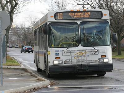

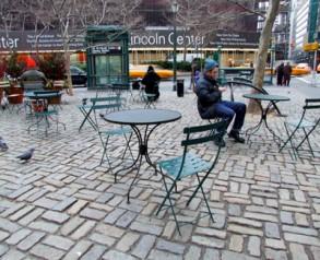


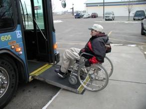

11 What we heard the public say about neighbourhoods Key elements that make a neighbourhood to me are People/ Community Safe, green, parks Affordable/inclusive Live/work/play Walking/taking transit Top elements that make a neighbourhood vibrant are Walkable/ cyclable streets Attractive Public spaces Accessible & Reliable transit Cultural facilities Trees Local shopping /amenities Accessibility and we re listening.
12 What is a neighbourhood? a geographically localised community within a larger city, town, or suburb. - wikipedia a district or community within a town or city. - oxford dictionary the people living near one another or a section lived in by neighbors and usually having distinguishing characteristics. - websters dictionary Researchers have not agreed on an exact definition. Neighbourhood is generally defined spatially as a specific geographic area and functionally as a set of social networks which face-to-face social interactions occur the personal settings and situations where residents seek to realise common values -The Aspen Institute
13 Neighbourhoods - key themes Specific geographically localized areas Distinct; having distinguishing characteristics Consists of people and social networks Context where face-to-face social interactions occur Context where residents may share some common goals/interests


")
14 Some ways to define neighbourhoods Social relationships Environmental and physical features Political structures Availability/limitations of data Walkabililty History Distinguishing characteristic (e.g. ethnic composition)

15 Neighbourhood Planning Framework Defined A conceptual structure that supports a common, over-arching approach for planning neighbourhoods.
16 Purpose of neighbourhood planning (NP) framework Managing change (e.g. intensification/severances) within neighbourhoods Analyzing community needs and gaps: land use, personal service amenities, etc. Coordinating community infrastructure Defining area character
17 Some common features of a NP Framework 1. Defines neighbourhoods and criteria for mapping 2. Delineates neighbourhoods (boundaries, mapping) 3. Provides some policy guidance for future planning
18 What could an NP framework do? Inform policy studies, OP reviews, zoning by-law updates, development projects, and area character studies and guidelines Identify neighbourhood profiles and priorities Make strategic use of scarce resources inform Council budget decisions Assist City departments with their long and short range planning (re: land, buildings, structures) and public service delivery considerations
19 What could an NP framework do? Enable collaborative planning that links land use, design, community services, and infrastructure planning Integrate social, economic, physical development, and land planning issues at a local neighbourhood level Engage citizens to build on local knowledge Empower and organize community
20 Range of NP Frameworks Toronto Seattle Burlington Vancouver Saskatoon Toronto Seattle Portland Houston Nanaimo Kingston Vancouver Guelph Mississauga Oakville Ottawa Vancouver Hamilton Increase in time & resources Data-oriented approach Neighbourhoods defined largely based on census tracts for data purposes Staff maintain and monitor database/ neighbourhood profiles May be Corporate or planning initiative Area/design-based approaches Planning focuses on specific neighbourhoods Some policy in OP May result in a range of planning tools: e.g. design guidelines, community improvement plans Typically planning initiative City-wide neighbourhood planning program Planning considers all neighbourhoods (although priority areas may be identified) Typically long range Results in neighbourhood plans Typically planning initiative, but may be corporate as well (e.g. a new team may be created)

21 Kingston Neighbourhood Profiles Framework Defined and named neighbourhoods Developed neighbourhood profiles using census data Official Plan includes neighbourhood policies Resources Low level engagement Corporately-developed framework Planning maintains data Benefits Data informs policy/planning work Improved coordination of service delivery Community empowerment/organization Reliable source of data for City, City s partnering organizations, & community


 - Monitoring program - Neighbourhood Connections Office: ongoing implementation Significant community involvement: 44")
22 Benefits Clear long range priorities for pilot neighbourhoods Increased collaboration with community and between departments Addressed priorities in City s Strategic Plan and Official Plan Community empowerment/organization Ottawa Neighbourhood Planning Initiative (NPI) Better Neighbourhoods Program Framework 2 pilot projects (2 to 3 years each) as part of the Neighbourhood Planning Initiative Defined neighbourhood boundaries early Developed Neighbourhoods Connections Office/ Better Neighbourhoods Program Resources Significant staff resourcing: - High level of engagement (staff attended 200+ meetings over 2 years) - Monitoring program - Neighbourhood Connections Office: ongoing implementation Significant community involvement: 44 community representatives
23 Ottawa s Neighbourhood Planning Topics Area history and character Built form Local Economy Community safety and services Community facilities Green Infrastructure: Parks & Open space, Trees, Environment, Public Art, Urban agriculture Diversity Heritage Retail Employment Transportation/Traffic/Transportation Demand Management
24 Elements of a NP Framework Corporate Vision Official Plan (mapping & policy) Data base (neighbourhood profiles) Interdepartmental collaboration (alignment) Neighbourhood involvement (engagement & empowerment)
25 Process Map Corporate Discussion: Future Neighbourhood Planning Framework Directions Report: Receive Council direction on the work plan Corporate Initiative? Planning Dept Other Depts Implement work plan on neighbourhoods Other NPF work Other studies, initiatives, master plans, etc. OP Review
26 Exercise No. 1: Neighbourhood Planning Discussion 1. Current Approach: Different departments are already doing work associated with neighbourhoods. What are the key features of the City s current approaches to neighbourhood planning that we would want to build on if we were to develop a neighbourhood planning framework? (e.g. population to service delivery/facility ratios; neighbourhood meetings) 2. Future Approach: Thinking to 2031, how would a future effective neighbourhood planning approach be different from what we have today? (e.g. neighbourhood profiles; mapping and policy; area-specific action plans) 3. How do we get there: What needs to happen in order for a made-in- Burlington approach to succeed? (e.g. additional funding and HR resources)
27 Exercise No. 2: The Mapping Challenge Step 1: Develop your definition of neighbourhood. Step 2: Based on your definition, identify criteria for mapping neighbourhoods. Step 3: Given your definition and criteria, please map the test case neighbourhood you have been given

28 Re-cap
29 Next Steps Staff will review the workshop discussion Directions report CDC discussion
30 Thank you for your participation
CERTIFIED RESOLUTION. introduction: and dated May 29, 2017, as attached, as appropriate
 15322 Buena Vista Avenue, White Rock BC, Canada V4B 1Y6 www.whiterockcity.ca City of White Rock P: 604.541.22121 F: 604.541.9348 /2tC% City Clerk s Office IT E ROC K June 13,2017 Stephanie Lam, Deputy
GOVERNMENT MAPPING WORKSHOP RECOVER Edmonton s Urban Wellness Plan Mapping Workshop December 4, 2017
 GOVERNMENT MAPPING WORKSHOP 12.4.17 RECOVER Edmonton s Urban Wellness Plan Mapping Workshop December 4, 2017 In July of 2017, City Council directed administration to develop RECOVER, Edmonton s Urban Wellness
Economic Activity Economic A ctivity
 5 Economic Economic Activity Activity ECONOMIC ACTIVITY 5.1 EMPLOYMENT... 5-7 5.1.1 OBJECTIVE... 5-7 5.1.2 POLICIES... 5-7 5.2 PROTECTING THE AREA OF EMPLOYMENT... 5-9 5.2.1 OBJECTIVE... 5-9 5.2.2 POLICIES...
CLAREMONT MASTER PLAN 2017: LAND USE COMMUNITY INPUT
 Planning and Development Department 14 North Street Claremont, New Hampshire 03743 Ph: (603) 542-7008 Fax: (603) 542-7033 Email: cityplanner@claremontnh.com www.claremontnh.com CLAREMONT MASTER PLAN 2017:
East Bay BRT. Planning for Bus Rapid Transit
 East Bay BRT Planning for Bus Rapid Transit Regional Vision Draper Prison The Bottleneck is a State-Level issue, Salt Lake County 2050 Population: 1.5M Draper Prison hopefully with some State-Level funding!
Date: March 31, 2014 PATE; fyril 2.3,2 >H
 aj BRAMPTON fifs Rower City XH-l-f r.t "»* City Council The Corporation of the City of Brampton SRAMPTON CITY COUNCIL Date: March 31, 2014 PATE; fyril 2.3,2 >H File: POO GR VisWhtoJed ^t'th-meeh'^a Subject:
The role of community in urban regeneration: mixed use areas approach in USA
 The role of community in urban regeneration: mixed use areas approach in USA Outline 1. Thesis 2. Main topics 3. Urban regeneration and community 4. Community involvement methods 5. Policies: EU vs USA
Integrated Infrastructure Planning & Spatial Mapping
 Integrated Infrastructure Planning & Spatial Mapping Presenter: Heidi Dixon, Principal Social Planner, DTPLI 23 May 2014 PART 1 PLAN MELBOURNE : Metropolitan Planning Strategy PART 2 Case Study: DTPLI
Shaping Your Neighbourhood
 Shaping Your Neighbourhood Building a Core Sustainable Neighbourhood Action Plan Nov. 25 & 26, 2006 Welcome! Peter Russell Planner, Holland Barrs Planning Group Inc. Role in this project: Work with the
submission to plan melbourne
 submission to plan melbourne prepared by hansen partnership pty ltd december 2013 submission to plan melbourne hansen partnership pty ltd contents 1 introduction... 2 2 key issues facing melbourne...
Date: June 19, 2013 Meeting Date: July 5, Consideration of the City of Vancouver s Regional Context Statement
 Section E 1.5 To: From: Regional Planning and Agriculture Committee Lee-Ann Garnett, Senior Regional Planner Planning, Policy and Environment Department Date: June 19, 2013 Meeting Date: July 5, 2013 Subject:
New Partners for Smart Growth: Building Safe, Healthy, and Livable Communities Mayor Jay Williams, Youngstown OH
 New Partners for Smart Growth: Building Safe, Healthy, and Livable Communities Mayor Jay Williams, Youngstown OH The City of Youngstown Youngstown State University Urban Strategies Inc. Youngstown needed
CHAPTER 4 HIGH LEVEL SPATIAL DEVELOPMENT FRAMEWORK (SDF) Page 95
 Page 95") CHAPTER 4 HIGH LEVEL SPATIAL DEVELOPMENT FRAMEWORK (SDF) Page 95 CHAPTER 4 HIGH LEVEL SPATIAL DEVELOPMENT FRAMEWORK 4.1 INTRODUCTION This chapter provides a high level overview of George Municipality s
CHAPTER 4 HIGH LEVEL SPATIAL DEVELOPMENT FRAMEWORK (SDF) Page 95 CHAPTER 4 HIGH LEVEL SPATIAL DEVELOPMENT FRAMEWORK 4.1 INTRODUCTION This chapter provides a high level overview of George Municipality s
Introduction and Project Overview
 Greater New Orleans Regional Land Use Modeling GIS Techniques in a P olitical C ontext Louisiana Remote Sensing and GIS Workshop Wednesday, April 24, 2013 Working Towards a Shared Regional Vision Introduction
Growth Management: Analysis of Comments Received and Responses Comments received as of October 16, 2017
 Growth Management: Analysis of Comments Received and s Comments received as of October 16, Comments informing the Region of Peel s growth management work have been summarized with responses below. These
Local Area Key Issues Paper No. 13: Southern Hinterland townships growth opportunities
 Draft Sunshine Coast Planning Scheme Review of Submissions Local Area Key Issues Paper No. 13: Southern Hinterland townships growth opportunities Key Issue: Growth opportunities for Southern Hinterland
Victorian Liveability Indicator Program: Definition, Measurement and Application
 Victorian Liveability Indicator Program: Definition, Measurement and Application Dr Hannah Badland Senior Research Fellow Place, Health, and Liveability Program Melbourne School of Population and Global
The purpose of this report is to recommend a Geographic Information System (GIS) Strategy for the Town of Richmond Hill.
 Strategy for the Town of Richmond Hill.") Staff Report for Committee of the Whole Meeting Department: Division: Subject: Office of the Chief Administrative Officer Strategic Initiatives SRCAO.18.12 GIS Strategy Purpose: The purpose of this report
Staff Report for Committee of the Whole Meeting Department: Division: Subject: Office of the Chief Administrative Officer Strategic Initiatives SRCAO.18.12 GIS Strategy Purpose: The purpose of this report
Tourism. April State Planning Policy state interest guideline. Department of Infrastructure, Local Government and Planning
 Department of Infrastructure, Local Government and Planning State Planning Policy state interest guideline Tourism April 2016 Great state. Great opportunity. Preface Using this state interest guideline
The Role of Urban Planning and Local SDI Development in a Spatially Enabled Government. Faisal Qureishi
 The Role of Urban Planning and Local SDI Development in a Spatially Enabled Government Faisal Qureishi 1 Introduction A continuous increase in world population combined with limited resources has lead
Proposed Scope of Work Village of Farmingdale Downtown Farmingdale BOA Step 2 BOA Nomination Study / Draft Generic Environmental Impact Statement
 Proposed Scope of Work Village of Farmingdale Downtown Farmingdale BOA Step 2 BOA Nomination Study / Draft Generic Environmental Impact Statement The scope of work that follows incorporates and covers
Vincent Goodstadt. Head of European Affairs METREX European Network
 Vincent Goodstadt Head of European Affairs METREX European Network METREX (Network of 50 European Metropolitan Regions and Areas ) Exchanging Knowledge (e.g. Benchmarking) Climate Change CO2/80/50 Expertise
ENVISIONING OUR CITY: 2041 PUBLIC INFORMATION CENTRE #2 November 16, 2017
 ENVISIONING OUR CITY: 2041 PUBLIC INFORMATION CENTRE #2 November 16, 2017 Purpose of the Public Information Centre The City of Brantford is undertaking three studies to guide future development to 2041
CORPORATION OF THE CITY OF COURTENAY COUNCIL MEETING AGENDA
 CORPORATION OF THE CITY OF COURTENAY COUNCIL MEETING AGENDA DATE: Monday, January 14, 2013 PLACE: City Hall Council Chambers TIME: 4:00 p.m. 1.00 ADOPTION OF MINUTES 1. Adopt January 7, 2013 Regular Council
Edexcel Geography Advanced Paper 2
 Edexcel Geography Advanced Paper 2 SECTION B: SHAPING PLACES Assessment objectives AO1 Demonstrate knowledge and understanding of places, environments, concepts, processes, interactions and change, at
The National Spatial Strategy
 Purpose of this Consultation Paper This paper seeks the views of a wide range of bodies, interests and members of the public on the issues which the National Spatial Strategy should address. These views
Tackling urban sprawl: towards a compact model of cities? David Ludlow University of the West of England (UWE) 19 June 2014
 19 June 2014") Tackling urban sprawl: towards a compact model of cities? David Ludlow University of the West of England (UWE) 19 June 2014 Impacts on Natural & Protected Areas why sprawl matters? Sprawl creates environmental,
Tackling urban sprawl: towards a compact model of cities? David Ludlow University of the West of England (UWE) 19 June 2014 Impacts on Natural & Protected Areas why sprawl matters? Sprawl creates environmental,
The 3V Approach. Transforming the Urban Space through Transit Oriented Development. Gerald Ollivier Transport Cluster Leader World Bank Hub Singapore
 Transforming the Urban Space through Transit Oriented Development The 3V Approach Gerald Ollivier Transport Cluster Leader World Bank Hub Singapore MDTF on Sustainable Urbanization The China-World Bank
NATURE AND EXTENT OF PROPOSED DEVELOPMENT. Amount of Development Development Zones Distribution of Density Policies
 NATURE AND EXTENT OF PROPOSED DEVELOPMENT Amount of Development Development Zones Distribution of Density Policies DRAFT POOLBEG PLANNING SCHEME Amount of Development 78 4.1 The rationale for the overall
HSC Geography. Year 2013 Mark Pages 10 Published Jul 4, Urban Dynamics. By James (97.9 ATAR)
") HSC Geography Year 2013 Mark 92.00 Pages 10 Published Jul 4, 2017 Urban Dynamics By James (97.9 ATAR) Powered by TCPDF (www.tcpdf.org) Your notes author, James. James achieved an ATAR of 97.9 in 2013 while
HSC Geography Year 2013 Mark 92.00 Pages 10 Published Jul 4, 2017 Urban Dynamics By James (97.9 ATAR) Powered by TCPDF (www.tcpdf.org) Your notes author, James. James achieved an ATAR of 97.9 in 2013 while
Developing Built Environment Indicators for Urban Oregon. Dan Rubado, MPH EPHT Epidemiologist Oregon Public Health Division
 Developing Built Environment Indicators for Urban Oregon Dan Rubado, MPH EPHT Epidemiologist Oregon Public Health Division What is the built environment? The built environment encompasses spaces and places
ikapa GDS White Paper Governance and Integration Department of the Premier Department of the Premier 2 December 2008
 ikapa GDS White Paper Governance and Integration Outline of presentation Western Cape Situation Strategic Framework Implementation Framework Alignment and implementation example Diversified economy Small
GIS Geographical Information Systems. GIS Management
 GIS Geographical Information Systems GIS Management Difficulties on establishing a GIS Funding GIS Determining Project Standards Data Gathering Map Development Recruiting GIS Professionals Educating Staff
Social Indicators and Trends 2014
 Social Indicators and Trends 2014 Healthy City for All Target Add to the Greenest City Action Plan, a biodiversity target and a target related to toxins prevention. By 2025: every Vancouver neighbourhood
Committee Meeting November 6, 2018
 Committee Meeting November 6, 2018 Agenda Where we are in the process Land Use Plan Transportation Element Housing & Neighborhoods Elements Next Steps Schedule November 6: Plan Elements December: Plan
King City URA 6D Concept Plan
 King City URA 6D Concept Plan King City s Evolution Among the fastest growing cities 2000 Census 1,949 2010 Census 3,111 60% increase 2016 Census estimate 3,817 23% increase Average annual rate 4.3% Surpassing
Outline National legislative & policy context Regional history with ESSIM ESSIM Evaluation Phase Government Integration via RCCOM Regional ICOM Framew
 What MSP Implementation could change in the Maritimes Region Tim Hall, Regional Manager Oceans and Coastal Management Division Ecosystem Management Branch Fisheries and Oceans Canada Maritimes Region BIO
Dublin City Schools Social Studies Graded Course of Study Grade 5 K-12 Social Studies Vision
 K-12 Social Studies Vision The Dublin City Schools K-12 Social Studies Education will provide many learning opportunities that will help students to: develop thinking as educated citizens who seek to understand
The importance of visioning in urban strategic planning By Peter Robinson. MILE Master Class Urban Strategic Planning March 2016
 The importance of visioning in urban strategic planning By Peter Robinson MILE Master Class Urban Strategic Planning March 2016 Typical strategic planning process Where are we now? Where are we going?
Frequently Asked Questions
 What is the Regional Transit Engagement Series? As one of the fastest growing regions in the country, there is recognition that long-term transit planning efforts should be accelerated if we are to remain
Recovery Renewal Rebuilding
 Recovery Renewal Rebuilding Federal Reserve Foreclosure Series Washington, D.C. October 20, 2008 Mayor Jay Williams, Youngstown OH The City of Youngstown Youngstown State University Urban Strategies Inc.
THE ROLE OF REGIONAL SPATIAL PLANNING IN SUPPORTING LONG-TERM ECONOMIC GROWTH IN NORTHERN IRELAND
 THE ROLE OF REGIONAL SPATIAL PLANNING IN SUPPORTING LONG-TERM ECONOMIC GROWTH IN NORTHERN IRELAND Jenny Pyper Director 6 th Annual ICLRD Conference 20 January 2011 PURPOSE OF REGIONAL PLANNING Framework
KUNMING FORUM ON UNITED NATIONS GLOBAL GEOSPATIAL INFORMATION MANAGEMENT CITIES OF THE FUTURE: SMART, RESILIENT
 KUNMING FORUM ON UNITED NATIONS GLOBAL GEOSPATIAL INFORMATION MANAGEMENT CITIES OF THE FUTURE: SMART, RESILIENT and SUSTAINABLE Yunnan Zhenzhuang Guest House, Kunming, China 10 12 May 2017 BACKGROUND CONCEPT
CITY OF CAMBRIDGE Growth & Intensification Study Secondary Plan Stakeholder Session June 26th, 2017
 CITY OF CAMBRIDGE Growth & Intensification Study Secondary Plan Stakeholder Session June 26th, 2017 Dillon Consulting Limited Watson & Associates Economists Curtis Planning Inc. Tim Welch Consulting Inc.
RETA 6422: Mainstreaming Environment for Poverty Reduction Category 2 Subproject
 RETA 6422: Mainstreaming Environment for Poverty Reduction Category 2 Subproject A. Basic Data 1. Subproject Title: Poverty-Environment Mapping to Support Decision Making 2. Country Director: Adrian Ruthenberg
Declaration Population and culture
 Declaration Population and culture The ministers of the parties to the Alpine Convention regard the socio-economic and socio-cultural aspects mentioned in Article 2, Paragraph 2, Item a., as being central
Transport Planning in Large Scale Housing Developments. David Knight
 Transport Planning in Large Scale Housing Developments David Knight Large Scale Housing Developments No longer creating great urban spaces in the UK (Hall 2014) Transport Planning Transport planning processes
Shall we Dense?: Policy Potentials. Summary. Simon McPherson Director SJB Urban Australia au
 Shall we dense? Shall we Dense?: Policy Potentials Simon McPherson Director SJB Urban Australia smcpherson@sjb.com. au Adam Haddow Director SJB Architects Australia ahaddow@sjb.com.au Summary This paper
2 nd Semester. Core Courses. C 2.1 City and Metropolitan Planning. Module 1: Urban Structure and Growth Implications
 2 nd Semester Core Courses C 2.1 City and Metropolitan Planning Module 1: Urban Structure and Growth Implications Growth of cities; cities as engine of growth; urban sprawl; land value, economic attributes
A Method for Mapping Settlement Area Boundaries in the Greater Golden Horseshoe
 A Method for Mapping Settlement Area Boundaries in the Greater Golden Horseshoe Purpose This paper describes a method for mapping and measuring the lands designated for growth and urban expansion in the
CORRIDORS OF FREEDOM Access Management (Ability) Herman Pienaar: Director City Transformation and Spatial Planning
 Herman Pienaar: Director City Transformation and Spatial Planning") CORRIDORS OF FREEDOM Access Management (Ability) 2016 Herman Pienaar: Director City Transformation and Spatial Planning PLANNING DEVELOPMENT PROCESS RATHER THAN A PLAN CAPITAL INVESTMENT DEVELOPMENT FACILITATION
CORRIDORS OF FREEDOM Access Management (Ability) 2016 Herman Pienaar: Director City Transformation and Spatial Planning PLANNING DEVELOPMENT PROCESS RATHER THAN A PLAN CAPITAL INVESTMENT DEVELOPMENT FACILITATION
Regional Growth Strategy Regional Staff Committee
 Regional Growth Strategy Regional Staff Committee June 21, 2018 1 Overview Summary of June Growth Management Policy Board Regional Growth Strategy Objectives Regional Geographies Regional Growth Strategy
Indicator : Average share of the built-up area of cities that is open space for public use for all, by sex, age and persons with disabilities
 Goal 11: Make cities and human settlements inclusive, safe, resilient and sustainable Target 11.7: By 2030, provide universal access to safe, inclusive and accessible, green and public spaces, in particular
Topic 4: Changing cities
 Topic 4: Changing cities Overview of urban patterns and processes 4.1 Urbanisation is a global process a. Contrasting trends in urbanisation over the last 50 years in different parts of the world (developed,
Neighborhood Locations and Amenities
 University of Maryland School of Architecture, Planning and Preservation Fall, 2014 Neighborhood Locations and Amenities Authors: Cole Greene Jacob Johnson Maha Tariq Under the Supervision of: Dr. Chao
It is clearly necessary to introduce some of the difficulties of defining rural and
 UNIT 2 CHANGING HUMAN ENVIRONMENTS G2 Theme 2 Investigating Settlement Change in MEDCs 2.1 What are the distinctive features of settlements? It is clearly necessary to introduce some of the difficulties
California Urban Infill Trip Generation Study. Jim Daisa, P.E.
 California Urban Infill Trip Generation Study Jim Daisa, P.E. What We Did in the Study Develop trip generation rates for land uses in urban areas of California Establish a California urban land use trip
Regional Economic Competitiveness Local Comprehensive Planning. An End-of-year Update to the Metropolitan Council Community Development Committee
 Regional Economic Competitiveness Local Comprehensive Planning An End-of-year Update to the Metropolitan Council Community Development Committee 12/21/2015 Regional Economic Competitiveness The ability
The ESPON Programme. Goals Main Results Future
 The ESPON Programme Goals Main Results Future Structure 1. Goals Objectives and expectations Participation, organisation and networking Themes addressed in the applied research undertaken in ESPON projects
R E SEARCH HIGHLIGHTS
 Canada Research Chair in Urban Change and Adaptation R E SEARCH HIGHLIGHTS Research Highlight No.8 November 2006 THE IMPACT OF ECONOMIC RESTRUCTURING ON INNER CITY WINNIPEG Introduction This research highlight
Regional Growth Strategy Work Session Growth Management Policy Board
 Regional Growth Strategy Work Session Growth Management Policy Board September 6, 2018 1 Overview Recap June GMPB work session Objectives and outcomes Regional geographies Growth scenarios Breakout Discussion:
Community and Infrastructure Services Committee
 REPORT TO: DATE OF MEETING: November 7, 2016 Community and Infrastructure Services Committee SUBMITTED BY: Cynthia Fletcher, Interim Executive Director INS 519-741- PREPARED BY: WARD(S) INVOLVED: 2600
Cultural Data in Planning and Economic Development. Chris Dwyer, RMC Research Sponsor: Rockefeller Foundation
 Cultural Data in Planning and Economic Development Chris Dwyer, RMC Research Sponsor: Rockefeller Foundation A Decade of Attempts to Quantify Arts and Culture Economic impact studies Community indicators
38th UNWTO Affiliate Members Plenary Session Yerevan, Armenia, 4 October 2016
 38th UNWTO Affiliate Members Plenary Session Yerevan, Armenia, 4 October 2016 17:00-19:00 Open Debate 5: City Tourism Introduced and Moderated by Dr. Donald Hawkins George Washington University World urban
Towards a City Model for Heritage-Led Regeneration and Tourism Development
 Towards a City Model for Heritage-Led Regeneration and Tourism Development Brian Smith, Secretary General European Association of Historic Towns and Regions Summary of Presentation Objective Background
City and SUMP of Ravenna
 City and SUMP of Ravenna Nicola Scanferla Head of Mobility Planning Unit, Municipality of Ravenna nscanferla@comune.ra.it place your logo here 19 April, 2017 1st Steering Committee Meeting, Nicosia, Cyprus
MPOs SB 375 LAFCOs SCAG Practices/Experiences And Future Collaborations with LAFCOs
 Connecting LAFCOs and COGs for Mutual Benefits MPOs SB 375 LAFCOs SCAG Practices/Experiences And Future Collaborations with LAFCOs Frank Wen, Manager Research & Analysis Land Use & Environmental Planning
OREGON POPULATION FORECAST PROGRAM
 OREGON POPULATION FORECAST PROGRAM PROGRAM OVERVIEW BACKGROUND Beginning in 1973 with the passage of Senate Bill (SB) 100, Oregon s growth management system has relied on population forecasts as the primary
Haslemere Design Statement
 For Beacon Hill, Critchmere, Grayswood, Haslemere, Hindhead and Shottermill Ensuring new development takes account of local character Contents Overview 3 1. Introduction 4 2. What makes Haslemere Special
The CRP stresses a number of factors that point to both our changing demographics and our future opportunities with recommendations for:
 Plan Overview The CRP represents the first broad planning initiative covering Lake, Porter and LaPorte counties. Unlike previous plans released by NIRPC, which focused primarily on transportation, the
The Governance of Land Use
 The planning system The Governance of Land Use United Kingdom Levels of government and their responsibilities The United Kingdom is a unitary state with three devolved governments in Northern Ireland,
Key Indicators for Territorial Cohesion & Spatial Planning Stakeholder Workshop - Project Update. 13 th December 2012 San Sebastián, Basque Country
 Key Indicators for Territorial Cohesion & Spatial Planning Stakeholder Workshop - Project Update 13 th December 2012 San Sebastián, Basque Country Key Aims Explore the use of territorial data in developing
Riocan Centre Study Area Frontenac Mall Study Area Kingston Centre Study Area
 OVERVIEW the biggest challenge of the next century (Dunham Jones, 2011). New books are continually adding methods and case studies to a growing body of literature focused on tackling this massive task.
Accessibility as an Instrument in Planning Practice. Derek Halden DHC 2 Dean Path, Edinburgh EH4 3BA
 Accessibility as an Instrument in Planning Practice Derek Halden DHC 2 Dean Path, Edinburgh EH4 3BA derek.halden@dhc1.co.uk www.dhc1.co.uk Theory to practice a starting point Shared goals for access to
EcoServ-GIS. EcoServ GIS Stage I. Why EcoServ GIS? 17/12/2012
 EcoServ-GIS Ecosystem Services Mapping: A Wildlife Trust GIS Toolkit to map ecosystem services at a county scale Dr Jonathan Winn Living Landscape Coordinator Durham Wildlife Trust Dr Chloe Bellamy Ecosystem
National planning report for Denmark
 National planning report for Denmark from the Minister for Environment and Energy Local identity and new challenges Summary 2000 1 CONTENTS 4 PREFACE: REGIONAL DEVELOPMENT AND SPATIAL PLANNING 6 1. BALANCED
Improving rural statistics. Defining rural territories and key indicators of rural development
 Improving rural statistics Defining rural territories and key indicators of rural development Improving rural statistics Improving Rural Statistics In 2016, the Global Strategy to improve Agricultural
Coordinated Transit and Land Use Planning in the Region of Waterloo
 Coordinated Transit and Land Use Planning in the Region of Waterloo Jeffrey M. Casello University of Waterloo Kevin Curtis Graham Vincent Region of Waterloo Transportation Research Board Best Practices:
Experience and perspectives of using EU funds and other funding for the implementation of district renovation projects
 Experience and perspectives of using EU funds and other funding for the implementation of district renovation projects Ministry of the Interior of Lithuania Regional policy department Administration, coordination,
Urban Climate Resilience
 Urban Climate Resilience in Southeast Asia Partnership Project Introduction Planning for climate change is a daunting challenge for governments in the Mekong Region. Limited capacity at the municipal level,
Measuring Disaster Risk for Urban areas in Asia-Pacific
 Measuring Disaster Risk for Urban areas in Asia-Pacific Acknowledgement: Trevor Clifford, Intl Consultant 1 SDG 11 Make cities and human settlements inclusive, safe, resilient and sustainable 11.1: By
Regional Snapshot Series: Transportation and Transit. Commuting and Places of Work in the Fraser Valley Regional District
 Regional Snapshot Series: Transportation and Transit Commuting and Places of Work in the Fraser Valley Regional District TABLE OF CONTENTS Complete Communities Daily Trips Live/Work Ratio Commuting Local
National Spatial Development Perspective (NSDP) Policy Coordination and Advisory Service
 Policy Coordination and Advisory Service") National Spatial Development Perspective (NSDP) Policy Coordination and Advisory Service 1 BACKGROUND The advances made in the First Decade by far supersede the weaknesses. Yet, if all indicators were
National Spatial Development Perspective (NSDP) Policy Coordination and Advisory Service 1 BACKGROUND The advances made in the First Decade by far supersede the weaknesses. Yet, if all indicators were
Appendix C: City of Mississauga Transportation Strategy Update
 Appendix C: City of Mississauga Transportation Strategy Update Transportation Strategy Update Transportation and Works Department Agenda - Objectives - What has changed? - Forecasted trends and issues
16540/14 EE/cm 1 DG E 1A
 Council of the European Union Brussels, 5 December 2014 (OR. en) 16540/14 ENV 965 CULT 139 NOTE From: To: Subject: General Secretariat of the Council Delegations Charter of Rome on Natural and Cultural
Rural Pennsylvania: Where Is It Anyway? A Compendium of the Definitions of Rural and Rationale for Their Use
 Rural Pennsylvania: Where Is It Anyway? A Compendium of the Definitions of Rural and Rationale for Their Use Pennsylvania Office of Rural Health 310 Nursing Sciences Building University Park, PA 16802
Urban Planning Word Search Level 1
 Urban Planning Word Search Level 1 B C P U E C O S Y S T E M P A R E U O E U R B A N P L A N N E R T N S T D H E C O U N T Y G E R E R D W R E N I C I T Y C O U N C I L A A A S U G G C I L A G P R I R
An online data and consulting resource of THE UNIVERSITY OF TOLEDO THE JACK FORD URBAN AFFAIRS CENTER
 An online data and consulting resource of THE JACK FORD URBAN AFFAIRS CENTER THE CENTER FOR GEOGRAPHIC INFORMATION SCIENCE AND APPLIED GEOGRAPHICS DEPARTMENT OF GEOGRAPHY AND PLANNING THE UNIVERSITY OF
Smart City Governance for effective urban governance. David Ludlow Assoc. Professor European Smart Cities University of the West of England, Bristol
 Smart City Governance for effective urban governance David Ludlow Assoc. Professor European Smart Cities University of the West of England, Bristol Complexities of urban territorial governance Complexities
Analysis of travel-to-work patterns and the identification and classification of REDZs
 Analysis of travel-to-work patterns and the identification and classification of REDZs Dr David Meredith, Teagasc, Spatial Analysis Unit, Rural Economy Development Programme, Ashtown, Dublin 15. david.meredith@teagasc.ie
Urban Geography. Unit 7 - Settlement and Urbanization
 Urban Geography Unit 7 - Settlement and Urbanization Unit 7 is a logical extension of the population theme. In their analysis of the distribution of people on the earth s surface, students became aware
Environmental Analysis, Chapter 4 Consequences, and Mitigation
 Environmental Analysis, Chapter 4 4.17 Environmental Justice This section summarizes the potential impacts described in Chapter 3, Transportation Impacts and Mitigation, and other sections of Chapter 4,
Applying Health Outcome Data to Improve Health Equity
 Applying Health Outcome Data to Improve Health Equity Devon Williford, MPH, Health GIS Specialist Lorraine Dixon-Jones, Policy Analyst CDPHE Health Equity and Environmental Justice Collaborative Mile High
Advanced Readings. Environment and Land Use Concentration The following seminars and studios would apply
 Community Development and Housing Concentration URP 720 Urban Housing Policies URP 722 Community Development and Housing URP 724 Urban Revitalization Studio URP 726 Citizen Participation Strategies URP
DBSA Knowledge Week Yusuf Patel South African Planning Institute
 Sustainable Human Settlements - Institutional Issues DBSA Knowledge Week Yusuf Patel South African Planning Institute 20 October 2010 Spatial Planning for Long Term Apartheid engineered spatial economy
CREATING LIVEABLE & SAFE CITIES FOR ALL
 CREATING LIVEABLE & SAFE CITIES FOR ALL Taking Transit to people s door steps PRERNA V. MEHTA, MANAGER, WRI INDIA RAJEEV G. MALAGI, SR. PROJECT ASSOCIATE, WRI INDIA A product of WRI Ross Center for Sustainable
Section 2. Indiana Geographic Information Council: Strategic Plan
 Section 2. Indiana Geographic Information Council: Strategic Plan Introduction A geographic information system (GIS) is an automated tool that allows the collection, modification, storage, analysis, and
TOWARDS STRATEGIC SPATIAL PLANNING IN JAMAICA: THE NATIONAL SPATIAL PLAN
 TOWARDS STRATEGIC SPATIAL PLANNING IN JAMAICA: THE NATIONAL SPATIAL PLAN JIEP 5th Biennial Conference on the Environment: Balancing National Development and Environmental Protection June 6, 2011 Jamaica
Sustainable Development Goal 11 and the New Urban Agenda: can planning deliver? Vanessa Watson University of Cape Town 2016
 Sustainable Development Goal 11 and the New Urban Agenda: can planning deliver? Vanessa Watson University of Cape Town 2016 .to reinvigorate the global political commitment to the sustainable development
Managing Growth: Integrating Land Use & Transportation Planning
 Managing Growth: Integrating Land Use & Transportation Planning Metro Vancouver Sustainability Community Breakfast Andrew Curran Manager, Strategy June 12, 2013 2 Integrating Land Use & Transportation