City of Milford GIS. Mark Goetz GIS Coordinator City of Milford MIS Department
|
|
|
- Joseph Fitzgerald
- 6 years ago
- Views:
Transcription

1 City of Milford GIS Mark Goetz GIS Coordinator City of Milford MIS Department
2 Community Statistics Approximately 25 square miles 2000 Population 52,305 Number of Parcels 22,500 Condominiums 3,000 Commercial/Industrial 1,400 Single-family residential 15,300 Exempt 720 Total Market Value (2000 Values) $5.09 Billion
3 City of Milford GIS GIS in MIS Brief History of GIS in Milford Examples Department Use Community Development Assessor Inland Wetlands Planning and Zoning Public Safety Health Police Fire
4 MIS Departmental Use Traditional city financial support, network support, , internet, databases and now GIS MIS Coordinator, Jean Lasczak Network Administrator, Liz Berggren GIS Coordinator, Mark Goetz GIS Clerk, Judy Keeler SCSU Interns (Chris keep them coming!!)
5 MIS Why GIS in MIS? GIS data centrally stored and accessed Coordinated MIS/GIS data activities Increased communication and cooperation between traditionally disparate departments, commissions and boards 1 ArcInfo License, 3 AutoCAD Map, 10 ArcView 3.x, 10 Generic Map Objects Viewers
6 History of GIS in the City of Milford 1996 RWA and City of Milford Cooperative Agreement to develop base GIS ~$100,000 each 1997 Data finalized. Beginning use in engineering, MIS and the Fire department 5 users 1998/1999 Partial Needs Assessment 2-3 users 1999 Assessor Tax Maps Digitized ~$60, users
7 History of GIS in the City of Milford 2000 Official inland wetland maps digitized Tree Inventory begins Parcels updated In-house revaluation completed 12 users 2001 Parcels updated GIS Coordinator hired Original Data reformatted 15 users
8 History of GIS in the City of Milford 2002 Parcels updated SBC/SNET Orthophotos licensed, $1,850. April 2001 photography date SCSU Intern closes paved features into polygons 2 Milford employees take advantage of wonderful 5 day ArcView GIS training at Uconn, $300 Tree Inventory completed 20 users 2003 Parcels updated 2 more Milford employees take advantage of wonderful 5 day ArcView GIS training at Uconn, $ users
9 Assessor Departmental Use The Assessor and three deputies value real estate, motor vehicles, and personal property, in order that each taxpayer bears their fair share of the tax burden. Vision Appraisal Systems CAMA software Built-in Map Objects GIS viewer Oracle RDBMS GIS integrated with RDBMS Parcels digitized into GIS in 1999 Updated bi-annually
10 Assessor Daily Work Benefits Locate parcels Pre-field inspection in conjunction w/ photos Acreage comparisons (Field card vs. GIS) Assistance to other departments with data requests Mass updates to CAMA database assisted with GIS selection sets Quality control of assessments using GIS and photos Comparison of other City GIS datasets with parcels such as wetlands, water features and topography for assessment purposes
11 Assessor Revaluation Benefits 2000 Revaluation done completely in-house 2004 Revaluation planned Savings in the millions of dollars over 12 years Paperless revaluation Analyze assessment ratios within GIS and make changes in the CAMA to flatten ratio Analyze trends within assessment neighborhoods
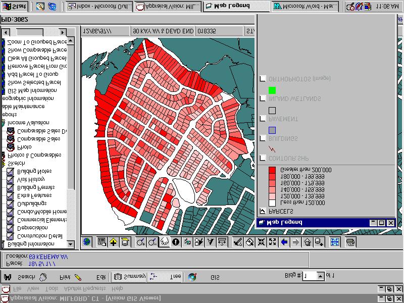
12 Neighborhood Analysis

13 Assessed Property Value Ranges

14 Property #1

15 Property #2
16 Assessor Future Continued progressive use of GIS and CAMA technologies Import Census and Local Zoning information from GIS into CAMA database (OPM reporting requirement)
17 Inland Wetlands Department Use The MIWA is responsible for the review and permitting of any work within an inland wetland or watercourse or within an upland review area around a wetland or watercourse. Official inland wetland maps digitized spring 2000 IW Compliance Officer Uconn 5 day ArcView GIS training. July 2002 Staff Clerk DEP ArcView GIS training. 3 nights in 3 weeks. January 2003
18 Inland Wetlands Daily Work Benefits Review of site plans against existing data in the GIS including upland review areas Answer citizen inqueries and complaints much quicker than before existence of GIS Printouts for field work Access to important datasets in one comprehensive environment: Parcels, Flood zones, wetlands, topography, pavement and orthophotography. great for looking for progressive (regressive) changes
19 Inland Wetlands Future Update official inland wetland maps with as-built digital data Watershed analysis
20 Planning and Zoning Department Use Use of Map Objects GIS viewer since Summer 2001 Access assessor parcel GIS and small portion of CAMA database, inland wetlands, buildings, pavement and FEMA Q3 flood zones Zoning Maps Digitized waiting on final approval Plan of Conservation and Development heavily influenced by GIS. (HMA consultant)
21 Plan of Conservation and Development As a prerequisite for all planning and analysis as part of the Plan of Conservation and Development Update, a digital base map was prepared in order to use Geographic Information System (GIS) technology. The digital file to create the base map as well as a link to data on a parcel basis contained in the Assessor s records was provided by the Milford Management Information Systems Department. Page 2, City of Milford, CT Plan of Conservation and Development
22 Planning and Zoning Daily Work Benefits Review of site plans against existing data in the GIS including flood zones and inland wetlands Answer citizen complaints much quicker than before existence of GIS Generate abutters lists with the click of a button

23 Map Objects Viewer

24 Search Assessor Information
25 Health Department Use Mosquito abatement program (4 years) Integrated Mosquito Control (consultant) Management of approximately 80 mosquito breeding sites throughout the city with larvacides GPS and handheld technologies Department in beginning phase of using GIS New Health Director proactively pursuing department-wide use of GIS Sanitarian Uconn 5 day GIS training. January 2003
26 Health Anticipated Benefits Quicker response to citizen inqueries and complaints Reduction in the number of hatched mosquitoes without spraying Ability to proactively respond to a number of emerging infectious diseases using GIS Analyze lead paint potential based on assessor s information (Year home built) Quicker response to beach closures by analyzing areas of poor water quality to locate source of pollutants
27 Police Department Use AVL began Spring 2002 Automated Vehicle Locator (AVL) Plant Equipment ORION MapStar GPS installed on all patrol vehicles GPS signal sent to dispatch via radio modem Location of patrol vehicles displayed on projection screen in dispatch

28 Police Dispatch Center

29 City of Milford GIS data in AVL

30 State-wide GIS data in AVL
31 Police Department Use GIS use began in the July of 2002 Lieutenant Uconn 5 day GIS training. July 2002 Beginning phases of Crime/Incident Analysis Pin maps and density maps Motor vehicle accidents Burglaries Defective street lights Traffic Accident Scene Analysis SWAT Team Incident Analysis
32 Police Future GIS in Mobile Data Terminals in Patrol vehicles More advanced GIS Crime/Incident Analysis
33 Police Anticipated Benefits Reduction in the number of burglaries and similar crimes Reduction in traffic accidents within the right of way
34 Fire Department Use Fire station wall maps and map books 6 years of use and maintenance of several GIS layers such as building footprints, golf courses, hydrants and gas/electric trunk lines Beginnings of a mobile computer project that includes GIS and pre-planning software Using existing City of Milford GIS data Pre-planning data maintained for nearly 8 years
35 Recap Multiple departments accessing GIS Data shared between departments Assessor data most widely used, both GIS and CAMA Inland wetlands by Planning and Zoning and Assessor Base GIS used by all Community Development and Public Safety initiatives
36 Conclusions Clear and extensive benefits from use of GIS Improved coordination and implementation in MIS Beneficial relationship developed in the Cooperative agreement with RWA Tremendous cost saving using SBC/SNET data products Wonderful training opportunities through the state schools including Uconn Geospatial Training Program GTP Availability of Interns through state schools including SCSU GIS is a fantastic tool for communication and decision making in a local government setting
GIS. in the City of Lewiston Maine
 GIS in the City of Lewiston Maine The purpose of this slideshow is to provide an overview of the city GIS and how it is used, maintained and accessed in-house as well as by the public. Please simply hit
GIS Needs Assessment. for. The City of East Lansing
 GIS Needs Assessment for The City of East Lansing Prepared by: Jessica Moy and Richard Groop Center for Remote Sensing and GIS, Michigan State University February 24, 2000 Executive Summary At the request
GIS Monroe Geographic Information System March 14, 2018
 GIS Monroe Geographic Information System March 14, 2018 Goals Maintain Enterprise/County-wide geo-database Increase spatial accuracy of data Build and acquire more data layers Increase use of GIS; as another
KING GEORGE COUNTY DEPARTMENT OF COMMUNITY DEVELOPMENT
 GIS REPORT 2016 KING GEORGE COUNTY DEPARTMENT OF COMMUNITY DEVELOPMENT Background The GIS (Geographic Information System) coordinator was hired in 2001 to develop a GIS for King George County. Prior to
GIS ADMINISTRATOR / WEB DEVELOPER EVANSVILLE-VANDERBURGH COUNTY AREA PLAN COMMISSION
 GIS ADMINISTRATOR / WEB DEVELOPER EVANSVILLE-VANDERBURGH COUNTY AREA PLAN COMMISSION SALARY RANGE INITIATION $43,277 SIX MONTHS $45,367 POSITION GRADE PAT VI The Evansville-Vanderburgh County Area Plan
GIS Geographical Information Systems. GIS Management
 GIS Geographical Information Systems GIS Management Difficulties on establishing a GIS Funding GIS Determining Project Standards Data Gathering Map Development Recruiting GIS Professionals Educating Staff
Local Government. VALOR GIS Specialist South Georgia RDC
 Lw Low Cost GIS Sl Solutions for Local Government By: Joe Bendis VALOR GIS Specialist South Georgia RDC SERUG 2008 GIS success through cooperation $ $ VALOR Today: 5 staff members dedicated to VALOR innovations,
E Geographic Information System. Created By: Freda Rocker Pearl River County Mapping
 E-9-1-1 Geographic Information System Created By: Freda Rocker Pearl River County Mapping frocker@pearlrivercounty.net Overview of Pearl River County E-9-1-1 Communications District GIS In 1998 the Pearl
IH 35 at Blanco River May 2015
 IH 35 at Blanco River May 2015 Presentation Objectives Background of historical damage assessment processes Introduction to Collector App ( Mat Peck) Collector App and Flood Damage Assessment (Katie Steele)
ArcGIS Pro 3D Workflows. Zena Pelletier
 ArcGIS Pro 3D Workflows Zena Pelletier 3D as a GIS capability Core part of the platform Desktop Web Device Combine 2D and 3D in the same web GIS architecture Reuse dynamic services across clients Securely
Appendix A. City of East Lansing Interview Report
 Department: City Clerk Meeting Participants: Sue Donnell, City Clerk Data Provider: The City Clerk s office maintains and updates all voting and election data. These data include legislative, school, and
WELCOME & INTRODUCTIONS
 GIS Monroe Geographic Information System January 31, 2018 WELCOME & INTRODUCTIONS Chip Thomas, Ritter GIS Sarah Schrader, Acct. Mgr., ESRI Chris Beyett, Solutions Engineer, ESRI Colleen Hinzmann, IT Director,
Applications of Map Book Software for Local Government Agencies. Melisa Bowman Lincoln Parish GIS
 Applications of Map Book Software for Local Government Agencies Melisa Bowman Lincoln Parish GIS North Central Louisiana Parish 472 Square Miles Population: 42,000 Ruston: Largest Municipality Home to
Annual TTFO Meeting April 10, 2018 Michael J. Wittman, P.S. Chief Surveyor / GIS Coordinator
 Annual TTFO Meeting April 10, 2018 Michael J. Wittman, P.S. Chief Surveyor / GIS Coordinator Text Book Definition: Layman Terms: An organized collection of hardware, software and geographic data designed
Information. Information Technology. Geographic. Services (GIS) 119 W Indiana Ave Deland, FL 32720
 119 W Indiana Ave Deland, FL 32720") Information Technology Geographic Information Services (GIS) 119 W Indiana Ave Deland, FL 32720 A GIS consists of 5 primary components: Hardware Software People Data Methods or Business Processes --- Hardware
Information Technology Geographic Information Services (GIS) 119 W Indiana Ave Deland, FL 32720 A GIS consists of 5 primary components: Hardware Software People Data Methods or Business Processes --- Hardware
FIRE DEPARMENT SANTA CLARA COUNTY
 DEFINITION FIRE DEPARMENT SANTA CLARA COUNTY GEOGRAPHIC INFORMATION SYSTEM (GIS) ANALYST Under the direction of the Information Technology Officer, the GIS Analyst provides geo-spatial strategic planning,
GIS and Governing Anchorage. GIS Critical for Efficient, Transparent Government How is GIS Program Doing Where can GIS Program Take us
 GIS and Governing Anchorage GIS Critical for Efficient, Transparent Government How is GIS Program Doing Where can GIS Program Take us Municipality of Anchorage Office of Economic And Community Development
GIS for Planning and Revenue Collection
 GIS for Planning and Revenue Collection Laban Karanja & Barbara Seje GIS for County Government Seminar Agenda Introduction County goals County Challenges GIS as a solution for County challenges What Counties
Integrating GIS into West Nile Virus Planning and Surveillance
 Integrating GIS into West Nile Virus Planning and Surveillance Fairfax County Health Department Adrian Joye, Environmental Health Specialist Agenda Background/Benefits Routes/Trap Locations Dead Bird Complaint
ArcGIS for Local Government. Local Government. Title Placed Here
 ArcGIS for ArcGIS for Local Government Local Government Title Placed Here ArcGIS for Local Government solutions.arcgis.com/local-government Copyright 2016 Esri. All rights reserved. 151760 G73000 Address
GIS Geographic Information Systems
 GIS Geographic Information Systems Connecting your Community Ruekert Mielke WAUKESHA WHO WE ARE DATE ESTABLISHED 1946 SERVING LOCAL PEOPLE. SOLVING LOCAL PROBLEMS. TYPE OF ORGANIZATION Ruekert & Mielke,
John Laznik 273 Delaplane Ave Newark, DE (302)
") Office Address: John Laznik 273 Delaplane Ave Newark, DE 19711 (302) 831-0479 Center for Applied Demography and Survey Research College of Human Services, Education and Public Policy University of Delaware
Office Address: John Laznik 273 Delaplane Ave Newark, DE 19711 (302) 831-0479 Center for Applied Demography and Survey Research College of Human Services, Education and Public Policy University of Delaware
The Use of Geographic Information Systems (GIS) by Local Governments. Giving municipal decision-makers the power to make better decisions
 by Local Governments. Giving municipal decision-makers the power to make better decisions") The Use of Geographic Information Systems (GIS) by Local Governments Giving municipal decision-makers the power to make better decisions Case Study: Examples of GIS Usage by Local Governments in North
The Use of Geographic Information Systems (GIS) by Local Governments Giving municipal decision-makers the power to make better decisions Case Study: Examples of GIS Usage by Local Governments in North
CITY OF RIVERSIDE USING HAZUS TO CREATE A EARTHQUAKE PLANNING GUIDE FOR A UNIFIED FIELD RESPONSE
 CITY OF RIVERSIDE USING HAZUS TO CREATE A EARTHQUAKE PLANNING GUIDE FOR A UNIFIED FIELD RESPONSE Presented by the Phil McCormick City of Riverside Office of Emergency Management HISTORY The City had several
 Boone County GIS has the right to inquire about and investigate the use of any requested products and deny access to anyone based on concerns relating to privacy, security, public health, public safety,
Cobb County GIS: Beyond the Map
 Cobb County GIS: Beyond the Map Charles Fail Tim Scharff Cobb County GIS SERUG 2008 1 Topics Cobb GIS Overview The Early Years Enterprise GIS Transition Putting It Together Looking Ahead SERUG 2008 2 Cobb
BOWIE SENIORS COMPUTER CLUB
 BOWIE SENIORS COMPUTER CLUB Meeting Minutes for May 5, 2016 Through the efforts of Program Chairman Dan Lee, we had Patrick T. Callahan, GIS Manager of the Prince George's County Office of Information
Comptroller GIS and Property Data. Ken Morrell Assessment Systems Manager Division of Property Assessments February 22, 2007
 Comptroller GIS and Property Data Ken Morrell Assessment Systems Manager Division of Property Assessments February 22, 2007 Comptroller Divisions Using and Supporting GIS Office of Local Government Implement
GIS for Integrated Pest Management. Christina Hailey. Abstract:
 GIS for Integrated Pest Management Christina Hailey Abstract: At its formation in 1965, Harris County Mosquito Control (Houston, Texas) (HCMC) was primarily involved in the prevention and control of mosquito-borne
If you aren t familiar with Geographical Information Systems (GIS), you. GIS, when combined with a database that stores response information,
, you. GIS, when combined with a database that stores response information,") Geographical Information Systems in EMS By William E. Ott If you aren t familiar with Geographical Information Systems (GIS), you should take a look at what GIS can offer you as an EMS manager. GIS, when
Geographical Information Systems in EMS By William E. Ott If you aren t familiar with Geographical Information Systems (GIS), you should take a look at what GIS can offer you as an EMS manager. GIS, when
for Effective Land Administration
 Role of Geospatial Technology in Land Information System(LIS) for Effective Land Administration Dr. Deb Jyoti Pal Sections Role of GIS in Land Records Proposed Work Flow Case Studies Role of GIS Creating
MAPPS 2012 Geospatial Products and Services Excellence Awards Awards Entry Form
 MAPPS 2012 Geospatial Products and Services Excellence Awards 2012 Awards Entry Form Please include a copy of this document with the project/product submission Entry Information Submission Number: 1741558
McHenry County Property Search Sources of Information
 Disclaimer: The information in this system may contain inaccuracies or typographical errors. The information in this system is a digital representation of information derived from original documents; as
TOWN OF JAMESTOWN TOWN COUNCIL RECOMMENDED BUDGET 2014/2015
 70001.000 COUNCIL GENERAL GOVERNMENT.101 Salaries (5) 10,455.62 11,300.00 11,300.00 11,300.00 11,300.00.302 Fees & Supplies 632.78 1,500.00 1,500.00 1,500.00 1,500.00.305 Advertising 0.00 2,500.00 2,500.00
CENSUS MAPPING WITH GIS IN NAMIBIA. BY Mrs. Ottilie Mwazi Central Bureau of Statistics Tel: October 2007
 CENSUS MAPPING WITH GIS IN NAMIBIA BY Mrs. Ottilie Mwazi Central Bureau of Statistics E-mail: omwazi@npc.gov.na Tel: + 264 61 283 4060 October 2007 Content of Presentation HISTORICAL BACKGROUND OF CENSUS
Village of Algonquin Geographic Information Systems. Village of Algonquin. Development Plan of Geographic Information Systems
 Village of Algonquin Development Plan of Geographic Information Systems 014-019 10/1/013 1 GIS Development Plan A. Purpose The purpose of this document is to outline a strategic plan for Geographic Information
Building a GIS with Limited Resources
 Building a GIS with Limited Resources VILLAGE OF LOMBARD Daniel Price, GIS Technician David Dratnol, Village Engineer About Lombard... 22 Miles from downtown Chicago 43,251 Residents (28th among 272 NIPC
THE BEST POLICY (SMART) DECISIONS COME FROM SPATIALLY CONNECTED GOVERNMENT
 DECISIONS COME FROM SPATIALLY CONNECTED GOVERNMENT") THE BEST POLICY (SMART) DECISIONS COME FROM SPATIALLY CONNECTED GOVERNMENT Andy Wilson Ordnance Survey International andy.wilson@osi.os.uk Geospatial World Forum, Rotterdam, May 24th Mapping is everywhere
THE BEST POLICY (SMART) DECISIONS COME FROM SPATIALLY CONNECTED GOVERNMENT Andy Wilson Ordnance Survey International andy.wilson@osi.os.uk Geospatial World Forum, Rotterdam, May 24th Mapping is everywhere
A GIS TOUR OF DES MOINES PRESENTED BY ANNA WHIPPLE, GIS MANAGER APRIL 20, 2015
 A GIS TOUR OF DES MOINES PRESENTED BY ANNA WHIPPLE, GIS MANAGER APRIL 20, 2015 Welcome to Des Moines! Capital of Iowa Among 100 largest metropolitan areas Insurance, biotech, healthcare, and entertainment
McHenry County Property Search Sources of Information
 Disclaimer: The information in this system may contain inaccuracies or typographical errors. The information in this system is a digital representation of information derived from original documents; as
City of Saginaw Right of Way Division Snow and Ice Removal Policy January 18, 2016
 Snow and Ice Removal Policy January 18, 2016 It is the policy of the to provide snowplowing and ice removal services in order to: Provide safe traveling conditions for motorists and pedestrians Assist
Creating a Pavement Management System Using GIS
 Christopher Castruita PPD 631 Prof. Barry Waite & Prof. Bonnie Shrewsbury Creating a Pavement Management System Using GIS Problem Definition As is the case with many cities, the city of La Cañada Flintridge
KING GEORGE COUNTY DEPARTMENT OF COMMUNITY DEVELOPMENT
 GIS REPORT 2017 KING GEORGE COUNTY DEPARTMENT OF COMMUNITY DEVELOPMENT Background The GIS (Geographic Information System) manager was hired in 2001 to develop a GIS for King George County. Prior to 2001,
ASSESSMENT. Industry Solutions Harness the Power of GIS for Property Assessment
 ASSESSMENT Industry Solutions Harness the Power of GIS for Property Assessment Esri Canada has thousands of customers worldwide who are using the transforming power of GIS technology to collect, maintain,
SoilView: Development of a Custom GIS Application for Publishing Soil Surveys
 SoilView: Development of a Custom GIS Application for Publishing Soil Surveys Allan Johnson and Mike Wigginton Abstract Currently, digital soils information can be obtained from many sources. Numerous
Corporate. Information. Railway Infrastructure Administrator. Year indracompany.com
 geospatial and mobility Corporate Geographic Information System of ADIF Railway Infrastructure Administrator. Year 2009-2010 Corporate Geographic Information System of ADIF ADIF. Spanish Administrator
Flood Hazard Zone Modeling for Regulation Development
 Flood Hazard Zone Modeling for Regulation Development By Greg Lang and Jared Erickson Pierce County GIS June 2003 Abstract The desire to blend current digital information with government permitting procedures,
URISA Exemplary Systems In Government (ESIG) Award Application
 Award Application") URISA Exemplary Systems In Government (ESIG) Award Application The Urban and Regional Information Systems Association (URISA) Exemplary Systems In Government (ESIG) Awards recognize exceptional achievements
URISA Exemplary Systems In Government (ESIG) Award Application The Urban and Regional Information Systems Association (URISA) Exemplary Systems In Government (ESIG) Awards recognize exceptional achievements
GIS = Geographic Information Systems;
 What is GIS GIS = Geographic Information Systems; What Information are we talking about? Information about anything that has a place (e.g. locations of features, address of people) on Earth s surface,
Geographic Information System Services. Strategic Plan FY
 Geographic Information System Services Strategic Plan FY 2011 2012 Drafted by: Gary Palmer, Assistant Town Manager Major Sections: History Mission, Vision, Values Strategic Issues Performance Measurement
Lesson: Don t Wait For the Storm
 Lesson: Don t Wait For the Storm Developing a GIS for Plaquemines Parish, Louisiana Presented by: Daniel Mellott, GISP Burk Kleinpeter, Inc. Where is Plaquemines Parish? 1998 GIS Feasibility Study User
An online data and consulting resource of THE UNIVERSITY OF TOLEDO THE JACK FORD URBAN AFFAIRS CENTER
 An online data and consulting resource of THE JACK FORD URBAN AFFAIRS CENTER THE CENTER FOR GEOGRAPHIC INFORMATION SCIENCE AND APPLIED GEOGRAPHICS DEPARTMENT OF GEOGRAPHY AND PLANNING THE UNIVERSITY OF
Agenda. Johnson County. Introduction What Is GIS? Needs Assessment Strategic Plan GIS Task force What do we need from you?
 Agenda Introduction What Is GIS? Needs Assessment Strategic Plan GIS Task force What do we need from you? Open Forum 1 Introduction Michael Sudac GIS Director 13 years GIS experience GIS Supervisor for
Developing a Campus-wide Base Map for Planning, Design and Construction. June 21, 2007
 Developing a Campus-wide Base Map for Planning, Design and Construction June 21, 2007 Presenters Berent Pippert UCR Project Manager Capital and Physical Planning Academic Planning and Budget 951-827-2431
POSITION DESCRIPTION. Position Title: Geographic Information Systems (GIS) Coordinator Department: Engineering
 Coordinator Department: Engineering") POSITION DESCRIPTION Position Title: Geographic Information Systems (GIS) Coordinator Department: Engineering Reports To: Engineering Supervisor FLSA Status: Exempt Date: April 2018 PRIMARY OBJECTIVE OF
POSITION DESCRIPTION Position Title: Geographic Information Systems (GIS) Coordinator Department: Engineering Reports To: Engineering Supervisor FLSA Status: Exempt Date: April 2018 PRIMARY OBJECTIVE OF
Enabling Success in Enterprise Asset Management: Case Study for Developing and Integrating GIS with CMMS for a Large WWTP
 Enabling Success in Enterprise Asset Management: Case Study for Developing and Integrating GIS with CMMS for a Large WWTP Allison Blake, P.E. 1*, Matthew Jalbert, P.E. 2, Julia J. Hunt, P.E. 2, Mazen Kawasmi,
Mapping Utilities with Mobile GIS Applications
 Mapping Utilities with Mobile GIS Applications Kristy M. Capobianco Reynolds, Smith and Hills, Inc. GIS Analyst Kristy.Capobianco@rsandh.com (904) 256-2251 2007 ESRI Southeast User Group Conference May
Techniques for Science Teachers: Using GIS in Science Classrooms.
 Techniques for Science Teachers: Using GIS in Science Classrooms. After ESRI, 2008 GIS A Geographic Information System A collection of computer hardware, software, and geographic data used together for
State Geographic Information Consolidation Implementation Plan
 State Geographic Information Consolidation Implementation Plan As Directed by Session Law 2008-0107 Section 6.13 Prepared By: State Chief Information Officer Geographic Information Coordinating Council
Enterprise GIS: Realizing a Return on Investment. EGUG Coeur D Alene, ID Tuesday, October 15, 2002
 Enterprise GIS: Realizing a Return on Investment EGUG 2002 - Coeur D Alene, ID Tuesday, October 15, 2002 Technology Technology is great fun, but we can drown in our technology. The fog of information can
Case Studies on Mega Cities
 Case Studies on Mega Cities Paul Kelly Director, Spatial Strategies Pty Ltd Vice Chair FIG Commission 3 The Case Study Cities Hong Kong SAR, China (Q) Tokyo, Japan (Q) Seoul, Korea (Q) Istanbul, Turkey
Bridging the Gap between Engineering and GIS
 Bridging the Gap between Engineering and GIS Presented by: Karen Stewart, B.Tech, GISP Manager of Geomatics Township of Langley February 13, 2006 Agenda Introduction History Goals Implementation Benefits
CALOTS Upgrade for Performance Monitoring
 CALOTS Upgrade for Performance Monitoring A project of the Southern California Association of Governments supported by the UCLA Lewis Center for Regional Policy Studies Agenda 1. Revisit Project Overview
Houston Plat Tracker puts the GIS in Land Development
 Houston Plat Tracker puts the GIS in Land Development Abstract: The Plat Tracker supports Houston's land development approval process. This home grown web-based system includes GIS research tools and a
GIS TECHNICIAN I GIS TECHNICIAN II
 GIS TECHNICIAN I GIS TECHNICIAN II CITY OF ROSEVILLE DEFINITION To perform a variety of technical office and field work duties related to the creation and maintenance of maps, tables, graphs and other
System Mapping Case Studies
 System Mapping Case Studies 1. Madison Getting Started Three Step Approach 2. Rocky Hill Maximizing resources 3. Putman Boots on the ground CT Map Rocky Hill Putnam Madison Madison Community Profile Getting
Examples of How Aerial Imagery Is Used in North Carolina. October 2007
 Examples of How Aerial Imagery Is Used in North Carolina October 2007 Table of Contributors Asheville Stormwater Utility Billing Camden County Tracking Permit Violations on Land Clearings CGIA Delineating
2016 APWA Snow Conference. Web-based GIS for Municipal Snow Operations
 2016 APWA Snow Conference Web-based GIS for Municipal Snow Operations Christopher M. Cignoli, P.E. - Director of Public Works, Springfield, MA Bob Houldson - Director IT Services for the Department of
2018 NASCIO Award Submission Category: Cross-Boundary Collaboration and Partnerships. Project Title: Tennessee Wildfires: A Coordinated GIS Response
 2018 NASCIO Award Submission Category: Cross-Boundary Collaboration and Partnerships Project Title: Tennessee Wildfires: A Coordinated GIS Response Sevier County, Tennessee State of Tennessee, Emergency
A Summary of State DOT GIS Activities. Presented at the 2000 AASHTO GIS-T Symposium Minneapolis, MN
 A Summary of State DOT GIS Activities Presented at the 2000 AASHTO GIS-T Symposium Minneapolis, MN Information Sources E-mail survey of state DOT GIS managers 49 State DOTs responded in 2000 Results compared
Crime Analysis. GIS Solutions for Intelligence-Led Policing
 Crime Analysis GIS Solutions for Intelligence-Led Policing Applying GIS Technology to Crime Analysis Know Your Community Analyze Your Crime Use Your Advantage GIS aids crime analysis by Identifying and
MODERNIZATION OF THE MUNICIPAL MAPPING USING HIGH END GNSS SYSTEM AND GIS SOFTWARE
 MODERNIZATION OF THE MUNICIPAL MAPPING USING HIGH END GNSS SYSTEM AND GIS SOFTWARE Mr. R. A. R. Khan Assistant Engineer, Sewerage Utility Management Centre (SUMC) Municipal Corporation Of Greater Mumbai
What s Happening in My Watershed?
 What s Happening in My Watershed? How Implementing a GIS system to Utilize Spatial Data and Digital Collection Techniques can help Solve Watershed Issues. Mindi J. Parsell City of Tulsa Stormwater Quality
Using GIS Data and GPS Mapping to Expedite Area Recovery from Natural Disasters
 Using GIS Data and GPS Mapping to Expedite Area Recovery from Natural Disasters Who is this guy? Thomas B Toby Sanford GIS Manager for GTPDD 13 years Bachelors Degree from Mississippi State University
The purpose of this report is to recommend a Geographic Information System (GIS) Strategy for the Town of Richmond Hill.
 Strategy for the Town of Richmond Hill.") Staff Report for Committee of the Whole Meeting Department: Division: Subject: Office of the Chief Administrative Officer Strategic Initiatives SRCAO.18.12 GIS Strategy Purpose: The purpose of this report
Staff Report for Committee of the Whole Meeting Department: Division: Subject: Office of the Chief Administrative Officer Strategic Initiatives SRCAO.18.12 GIS Strategy Purpose: The purpose of this report
Sharing GIS to Empower the End User David Wray, Roanoke County, Virginia
 Sharing GIS to Empower the End User David Wray, Roanoke County, Virginia Sharing GIS to Empower the End User Roanoke County, Virginia Roanoke County, Virginia Population: 92,901 Area: 251 Square Miles
THE PERSONAL GEODATABASE AS A BMP
 THE PERSONAL GEODATABASE AS A BMP FOR STORMWATER MANAGEMENT Charlynne T. Smith and Hugh A. Devine Center for Earth Observation, College of Natural Resources, NC State University, Raleigh, NC 27606 ABSTRACT
An Internet-Based Integrated Resource Management System (IRMS)
") An Internet-Based Integrated Resource Management System (IRMS) Third Quarter Report, Year II 4/1/2000 6/30/2000 Prepared for Missouri Department of Natural Resources Missouri Department of Conservation
An Internet-Based Integrated Resource Management System (IRMS) Third Quarter Report, Year II 4/1/2000 6/30/2000 Prepared for Missouri Department of Natural Resources Missouri Department of Conservation
GEOGRAPHIC INFORMATION SYSTEM ANALYST I GEOGRAPHIC INFORMATION SYSTEM ANALYST II
 CITY OF ROSEVILLE GEOGRAPHIC INFORMATION SYSTEM ANALYST I GEOGRAPHIC INFORMATION SYSTEM ANALYST II DEFINITION To perform professional level work in Geographic Information Systems (GIS) management and analysis;
County of Santa Cm2 PLANNING DEPARTMENT. 701 OCEAN STREET, qth FLOOR, SANTA CRUZ, CA (931) FAX: (831) TDD: (831)
 FAX: (831) TDD: (831)") County of Santa Cm2 515 PLANNING DEPARTMENT 701 OCEAN STREET, qth FLOOR, SANTA CRUZ, CA 96060 (931) 454-2590 FAX: (831) 454-2131 TDD: (831) 464-2123 ALVIN D. JAMES, DIRECTOR May 11, 1999 AGENDA: May 25,
County of Santa Cm2 515 PLANNING DEPARTMENT 701 OCEAN STREET, qth FLOOR, SANTA CRUZ, CA 96060 (931) 454-2590 FAX: (831) 454-2131 TDD: (831) 464-2123 ALVIN D. JAMES, DIRECTOR May 11, 1999 AGENDA: May 25,
Oakland County Parks and Recreation GIS Implementation Plan
 Oakland County Parks and Recreation GIS Implementation Plan TABLE OF CONTENTS 1.0 Introduction... 3 1.1 What is GIS? 1.2 Purpose 1.3 Background 2.0 Software... 4 2.1 ArcGIS Desktop 2.2 ArcGIS Explorer
Abstract. Keywords: Geographic information systems and digital data model. 1. Introduction
 Abstract GISMO - A Geographical Information System for a Municipality Office Ramzi A. Haraty and Youssef O. Kaddoura Lebanese American University P.O. Box 13-5053 Chouran Beirut, Lebanon 1102 2801 Email:
Google Maps and Beyond
 Google Maps and Beyond Aaron Paul First American Title apaul@firstam.com 2015 APRA Symposium Association of Professional Reserve Analysts May 2 nd, 2015 Google Maps and Beyond - Overview Business case
Write a report (6-7 pages, double space) on some examples of Internet Applications. You can choose only ONE of the following application areas:
 on some examples of Internet Applications. You can choose only ONE of the following application areas:") UPR 6905 Internet GIS Homework 1 Yong Hong Guo September 9, 2008 Write a report (6-7 pages, double space) on some examples of Internet Applications. You can choose only ONE of the following application
UPR 6905 Internet GIS Homework 1 Yong Hong Guo September 9, 2008 Write a report (6-7 pages, double space) on some examples of Internet Applications. You can choose only ONE of the following application
Report from the Geographic Information Coordinating Council
 Report from the Geographic Information Coordinating Council Presented by: Dr. Lee Mandell, Chair North Carolina Geographic Information Coordinating Council What is GIS? Geography plays a role in nearly
Geo-enabling a Transactional Real Estate Management System A case study from the Minnesota Dept. of Transportation
 Geo-enabling a Transactional Real Estate Management System A case study from the Minnesota Dept. of Transportation Michael Terner Executive Vice President Co-author and Project Manager Andy Buck Overview
Satellite Imagery: A Crucial Resource in Stormwater Billing
 Satellite Imagery: A Crucial Resource in Stormwater Billing May 10, 2007 Carl Stearns Engineering Technician Department of Public Works Stormwater Services Division Sean McKnight GIS Coordinator Department
May 31, Flood Response Overview
 May 31, 2013 Flood Response Overview Suppression 867 Personnel on three (3) shifts 289 Red Shift (A) 289 Blue Shift (B) 289 Green Shift (C) Department Overview Department Overview EMS: 40,934 False Alarm:
STATE GEOGRAPHIC INFORMATION DATABASE
 STATE GEOGRAPHIC INFORMATION DATABASE Data Information and Knowledge Management STATE GEOGRAPHIC INFORMATION DATABASE EXECUTIVE SUMMARY Utah has developed one of the most comprehensive statewide GIS resources
Optimizing work processes by using GIS in the ASFINAG. Peter Aubrecht ASFINAG Service GmbH, AUSTRIA EUC Croatia, Split 15 th October 2014
 Optimizing work processes by using GIS in the ASFINAG Peter Aubrecht ASFINAG Service GmbH, AUSTRIA EUC Croatia, Split 15 th October 2014 AGENDA The ASFINAG Group: Organisation and Tasks The ASFINAG Road
Developing a Subdivision Build- Out Study and Site Suitability Tool; Enabling Access Through a Web GIS Application
 Developing a Subdivision Build- Out Study and Site Suitability Tool; Enabling Access Through a Web GIS Application DOUG SEXTON GEOG 596A SUMMER 2017 ADVISOR: DR. JAMES O BRIEN Project Outline Introduction
PPT Slide. Slide 1 of 32. Notes:
 Slide 1 of 32 This presentaion will describe the background of establishing an agricultural district in Westchester County and how GIS was used to map the district. file:///volumes/web/www/ce/conferences/gis%20present/testfarm/sld001.htm[4/6/11
GIS for Crime Analysis. Building Better Analysis Capabilities with the ArcGIS Platform
 GIS for Crime Analysis Building Better Analysis Capabilities with the ArcGIS Platform Crime Analysis The Current State One of the foundations of criminological theory is that three things are needed for
geographic patterns and processes are captured and represented using computer technologies
 Proposed Certificate in Geographic Information Science Department of Geographical and Sustainability Sciences Submitted: November 9, 2016 Geographic information systems (GIS) capture the complex spatial
Digital Tax Maps Westport Island Project Summary
 Digital Tax Maps Westport Island Project Summary Presented to the: Mid-Coast Regional Planning Commission Creating GIS-Based Digital Tax Maps And Linked Assessment Records For Small Towns on a Budget Dennis
UTAH S STATEWIDE GEOGRAPHIC INFORMATION DATABASE
 UTAH S STATEWIDE GEOGRAPHIC INFORMATION DATABASE Data Information and Knowledge Management NASCIO Awards 2009 STATE GEOGRAPHIC INFORMATION DATABASE B. EXECUTIVE SUMMARY Utah has developed one of the most
Internal Audit Report
 Internal Audit Report Right of Way Mapping TxDOT Internal Audit Division Objective To determine the efficiency and effectiveness of district mapping procedures. Opinion Based on the audit scope areas reviewed,
Introduction to GIS. Dr. M.S. Ganesh Prasad
 Introduction to GIS Dr. M.S. Ganesh Prasad Department of Civil Engineering The National Institute of Engineering, MYSORE ganeshprasad.nie@gmail.com 9449153758 Geographic Information System (GIS) Information
United States Forest Service Makes Use of Avenza PDF Maps App to Reduce Critical Time Delays and Increase Response Time During Natural Disasters
 CASE STUDY For more information, please contact: Christine Simmons LFPR Public Relations www.lfpr.com (for Avenza) 949.502-7750 ext. 270 Christines@lf-pr.com United States Forest Service Makes Use of Avenza
Why You Should Invest in an Address Point Layer
 A GeoComm White Paper June 6, 2012 601 West Saint Germain St. St. Cloud, MN 56301 1.866.GEO.COMM Identifying 9-1-1 Caller Location By John Brosowsky, GeoComm Product Development Director Nathan Ekdahl,