BUILDING A STRONG SCIENCE ENTERPRISE
|
|
|
- Nelson Leslie Robertson
- 6 years ago
- Views:
Transcription


1 BUILDING A STRONG SCIENCE ENTERPRISE

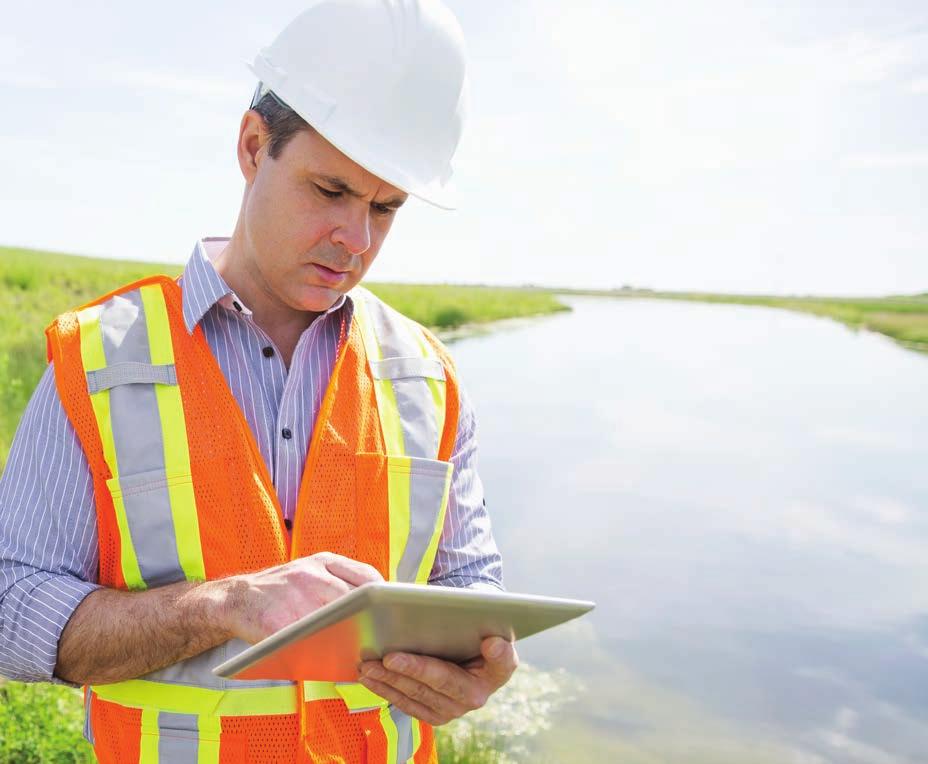
2 ADDRESSING SCIENTIFIC CHALLENGES WITH A MODERN APPROACH Science, regulatory, and statistical organizations face challenges that are more complex and unpredictable than ever before. As data becomes more spatially aware and computationally intensive, these organizations are increasingly pressured to be more interdisciplinary; challenged to analyze greater volumes of data; and in some instances, regulated to share data, research, and results with the public. While traditional intricacies persist, a new set of challenges create an environment where missions and priorities change daily driven by discrete events involving weather, population growth, and land management. Management of all these ancillary pressures can divert focus from primary mission objectives. As organizations work to mitigate ancillary pressures, it is becoming evident that the workflows and approaches that organizations have relied on for years are often outdated or inadequate to facilitate modern research and critical decision-making, which ultimately affects their daily operations and everyone s quality of life. Modern challenges require a modern approach to meeting them including building a science enterprise. A strong scientific enterprise yields new tools for analysis and investigation and increases the capacity to question, learn, and build on previous discoveries. Through science, organizations move toward innovative solutions not only for today s major problems but also for future problems. These solutions provide the foundation for economic growth and development and enhance our quality of life. Today, science, regulatory, and statistical agencies must be able to access data, collaborate to unify operations, and rapidly respond to crises while communicating with the public. Scientific Challenges of the Twenty-First Century Population and Economic Growth Clean Air and Water Sustainable Energy Land and Waste Management Food and Water Security Environmental Justice Climate Resilience Ecosystem Preservation and Management Chronic and Infectious Disease Control Space Exploration and Colonization Education Outreach and Accessibility Through the power of geospatial technology, organizations can now adopt an allencompassing, more integrative approach to science. With the right technology, data, people, and processes, every organization can develop a streamlined approach to creating an environment where the mission remains the focus.


3 THE SCIENCE ENTERPRISE VISION A science enterprise utilizes modern approaches and techniques to empower governments and organizations to meet the scientific challenges of the twenty-first century. It embraces a methodology that fosters collaboration to enhance data collection, analysis, sharing, and usability so that science professionals can make the most of existing resources and domain expertise to ensure success in their missions. It also employs a strategy that lowers mission costs while preserving mission performance, enabling scientists to focus on their critical research. The science enterprise strives to serve the community by clearly conveying its research results. A successful enterprise also makes every effort to transfer technologies to organizations and cultivate strong and lasting relationships among industries, academia, and governments so that the nation and community gain maximum scientific and economic benefits from the mission. As a result, stakeholders with shared interests can communicate to better understand the data and how to apply it to everyday situations, operations, and research allowing for a collaborative environment to prepare and deal with known and potential issues. In a science enterprise, organizations can confidently address the following: Communicating scientific results and outcomes in an impactful and easy-tounderstand approach Providing coordinated and reliable access to information and research products focused on serving the broader community Improving the value and use of, as well as access to, scientific data Better visualization, analysis, and interpretation of patterns Providing ways to share methods, techniques, and knowledge Leveraging commercial off-the-shelf (COTS) software, often in collaboration with free and open-source software, to accelerate scientific data exploration and analysis

4 BUILDING A STRONG SCIENCE ENTERPRISE Organizations around the world are turning to big data analytics, mobile technology, GPS-enabled devices, and live data sensors to develop a capability for delivering better services, accountability, and transparency. The science enterprise concept is built on the idea that technology helps governments and organizations manage the growing complexity of the scientific challenges of the twenty-first century. DATA DISSEM Natural Resources Eco Scientists are experts in the skills of the scientific method. They observe, leverage critical and creative thinking, collect data, and perform analysis, and more. A science enterprise builds on the core capabilities of a modern methodology to empower scientists with the following: Multiagency, interdepartmental collaboration Access to authoritative, actionable data from multiple resources Workflows for easily collecting, analyzing, sharing, and consuming data in the field and the office Secure, repeatable, reliable, and scalable capabilities CITIZENS POLICY MAKERS Agriculture Population Health Atmosphere Electronics Weath Complete analysis for understanding and solving problems Accurate, data-driven decision-making La ACADEMIA THE SCIENCE ENTERPRISE SUPPORTS A RANGE OF DOMAINS AND MISSIONS Agriculture Refine understanding of soil for optimal resource output Understand invasive pests effects on livestock Prioritize responsible use of land for optimal output Predict events with economic consequences Understand weaknesses in infrastructure Economics Understand the impacts of location on trade, tech transfer, supply chains, job creation, and entrepreneurship Analyze patterns in economic big data directly related to location Go beyond the graph visualize spatial patterns in compelling, easy-to-build maps Help communities become sustainable Environmental Management Monitor the community for impacts of pollution, weather, and hazards Create reasonable policy, implement regulations, and manage enforcement Help businesses comply effectively with regulations without inhibiting competitiveness or growth Devise water scarcity alleviation strategies Understand the interdependency of the earth s ecosystems and human impact on the environment Health and Social Science Produce quality statistical data on the population to magnify impact Leverage spatial data to highlight a changing cultural landscape to better serve citizen needs Establish relevant community services based on trends in economic and social growth

5 THE POWER OF GEOGRAPHY INATION Geography is the study of the world and all that is in it: its people, land, air, water, plants and animals, and relationships among each. What differentiates geographic science is location and space. Geographic thinking is based on understanding where something is and how that location influences its characteristics and relationships with other things. nomic Development er Community Development Facilities nd Management Jobs Hydrography / Oceanography STARTUPS COMMERCIAL COMPANIES GOVERNMENT EMPLOYEES Geographic information system (GIS) technology is expanding the application of scientific data for problem solving. With a single collection of tools, GIS is able to bridge the gap between curiosity-driven science and practical problem solving. A core skill of a scientist is to make observations, and GIS helps expand the usability of valuable research to a broader range of users. Maps are the preeminent means of recording and communicating information about location and spatial characteristics of the natural world, society, and culture. A mapcentric theme evolves at each stage, combining itself with other information layers, as well as the expertise of others, to result in a story. Maps gain value and inform others in three ways: By collecting and storing information By allowing users to analyze and revealing locational distributions and spatial patterns By presenting information and communicating findings Governments, businesses, and society as a whole must capture and curate large quantities of information about the environment and the location of natural resources and phenomenon, capital assets, and people. Maps are a means to recognize spatial distributions and relationships and make it possible to visualize and conceptualize patterns and processes that operate through space. They convey information and findings that are difficult to express verbally. GIS provides the unique ability to use location and maps as a way to fuse diverse data and systems and bring everything into a common view. Ultimately, it enables agencies to collaborate and share data through dynamic maps and online applications. At a glance, leaders can see the status of an incident or visualize patterns that may not have been seen before and direct an appropriate response. Maps provide an intuitive way to understand complex situations. When everyone operates from the same information, responders can best coordinate and unify their actions to complete the mission. Hydrography and Oceanography Understand and mitigate the factors that are harmful to marine and coastal environments as well as lakes, rivers, and groundwater Adopt responsible management practices while still making a profit in fisheries Conduct surveys to support fish restoration goals in both freshwater and saltwater environments Design communities that withstand storms, tsunamis, sea level rise, population growth, and ocean chemistry changes Natural Resources Improve inventory and land administration, evaluate conditions, and support sustainable forest planning and timber sales Identify new opportunities for mining and mineral exploration Produce sustainable energy Manage and mitigate hazards Weather, Atmosphere, and Climate Detect anomalies in weather patterns Map atmosphere in real time and better predict uncertainty Identify the trend in climatic shifts and their impacts on industry Help communities become resilient to natural weather phenomena
6 ArcGIS ONE PLATFORM, MANY MISSIONS A strong science enterprise leverages advancements in science and data acquisition to give data stewards an effective means to manage the high velocity, volume, and variety of earth observation data for mission support. Esri s ArcGIS software provides a proven geospatial platform to stand up a science enterprise. ArcGIS provides an efficient way to quickly enable users to leverage massive volumes of data to solve a variety of scientific questions and, ultimately, publish results. Esri technology is used to capture, manage, analyze, and share big data for faster and more impactful decisions. Collect and Manage Empower field staff to view and collect mission-critical data directly from their mobile devices. Likewise, engage citizen scientists to collect observations on biodiversity, hazards reporting, and field validation. Users can quickly create map-driven forms for everything from documenting damaged buildings and collecting soil samples to executing census surveys. Users can capture data and video along with their GPS location and push updates even if collection activities take them out of network range. ArcGIS tools include Collector for ArcGIS, Survey123 for ArcGIS, Navigator for ArcGIS, and Workforce for ArcGIS. As the twenty-first century progresses, organizations are increasingly augmenting field workflows with streaming earth observation data from multiple sources such as UAS. Cost effective management of big multidimensional data (including LAS, netcdf, and HDF) is possible with ArcGIS. ArcGIS greatly reduces the time it takes to go from data collection to analysis and sharing. ArcGIS tools include Drone2Map for ArcGIS, Esri GeoPortal Server, and spatiotemporal big data store. Analyze Integrate advanced computing and scientific modeling environments with GIS by using ArcGIS plug-ins for open-source statistical packages like the R Suite and ArcGIS API for Python automation and interoperability. Employ ArcGIS for applications in change monitoring, feature extraction, suitability analysis, and predictive and anomaly analysis. Conduct vector-based spatial and raster-based image analysis, interpolate missing data, forecast conditions based on spatial patterns, and automate advanced workflows. Organizations and governments use ArcGIS Desktop, ArcGIS Enterprise, ArcGIS Image Server, Raster Analytics, ArcGIS GeoEvent Server, and ArcGIS GeoAnalytics Server software-based analytics to bring the analysis to data too big to move, while delivering timely insight and actionable information in 2D and 3D. These components are routinely the foundation of a strong science enterprise because of their ability to be quickly configured and to scale in the cloud for large-scale analysis, thus eliminating costly customization and maintenance. Communicate Combine authoritative data with narrative text, images, graphs, and multimedia content using Esri Story Maps to tell your story and communicate key information in an easyto-understand way. Monitor, track, and report incidents in real time with Operations Dashboard for ArcGIS. From managing dayto-day activities to coordinating response to a crisis, Operations Dashboard provides focused views of live data that enable leaders to rapidly understand resources, activities, and issues and thus direct response. Lastly, transform executive briefings, environmental success stories, and complex scientific phenomena with compelling presentations geared to multiple audiences. Whether highlighting collections from a citizen science engagement or providing a summary of a completed study, ArcGIS as part of the science enterprise gives organizations a powerful tool for keeping peers, partners, and the public informed. Incorporate real-time data from many sensors Monitor the situation through real-time tracking, routing, and communications Gather, fuse, analyze, and share data Maintain and share the common operational picture ArcGIS Formulate and disseminate plans Manage the data


7 GETTING STARTED For almost 50 years, Esri has worked with the science community at all levels of government, academia, and industry. Our global team of dedicated professionals has decades of experience empowering people with geospatial technology to support various disciplines from atmospheric, environmental, oceanographic, and energy sciences. We provide more than just software and solutions we partner with organizations to ensure that they have the science enterprise they need to succeed now and in the future. Recognized as the global leader in geospatial technology with distributors worldwide, Esri is joined in supporting our customers science enterprises by over 2,000 industry partners that specialize in niche research and operational fields to guarantee our customers success. No matter where you re located, you ll find a wealth of subject matter experts that can help your science vision become a reality. Visit esri.com/federal for more details on the topics outlined in this document. If you would like to engage in learning more about topics outlined in this document, send an to an Esri team member at science@esri.com.

8 Esri inspires and enables people to positively impact their future through a deeper, geographic understanding of the changing world around them. Governments, industry leaders, academics, and nongovernmental organizations trust us to connect them with the analytic knowledge they need to make the critical decisions that shape the planet. For more than 40 years, Esri has cultivated collaborative relationships with partners who share our commitment to solving earth s most pressing challenges with geographic expertise and rational resolve. Today, we believe that geography is at the heart of a more resilient and sustainable future. Creating responsible products and solutions drives our passion for improving quality of life everywhere. Contact Esri 380 New York Street Redlands, California usa t f info@esri.com esri.com Offices worldwide esri.com/locations Copyright 2017 Esri. All rights reserved. Esri, the Esri globe logo, ArcGIS, Drone2Map, Geoportal, and esri. com are trademarks, service marks, or registered marks of Esri in the United States, the European Community, or certain other jurisdictions. Other companies and products or services mentioned herein may be trademarks, service marks, or registered marks of their respective mark owners. Printed in USA G74731
ArcGIS for Desktop. ArcGIS for Desktop is the primary authoring tool for the ArcGIS platform.
 ArcGIS for Desktop ArcGIS for Desktop ArcGIS for Desktop is the primary authoring tool for the ArcGIS platform. Beyond showing your data as points on a map, ArcGIS for Desktop gives you the power to manage
Better Topographic Map Production Using ArcGIS. A Comprehensive Solution for Mapping Organizations
 Better Topographic Map Production Using ArcGIS A Comprehensive Solution for Mapping Organizations The World Is Always Changing As a member of a national mapping organization, you know this is true. You
GIS for Crime Analysis. Building Better Analysis Capabilities with the ArcGIS Platform
 GIS for Crime Analysis Building Better Analysis Capabilities with the ArcGIS Platform Crime Analysis The Current State One of the foundations of criminological theory is that three things are needed for
ArcGIS. for Server. Understanding our World
 ArcGIS for Server Understanding our World ArcGIS for Server Create, Distribute, and Manage GIS Services You can use ArcGIS for Server to create services from your mapping and geographic information system
TRAITS to put you on the map
 TRAITS to put you on the map Know what s where See the big picture Connect the dots Get it right Use where to say WOW Look around Spread the word Make it yours Finding your way Location is associated with
Esri and GIS Education
 Esri and GIS Education Organizations Esri Users 1,200 National Government Agencies 11,500 States & Regional Agencies 30,800 Cities & Local Governments 32,000 Businesses 8,500 Utilities 12,600 NGOs 11,000
esri.com/apps Copyright 2017 Esri. All rights reserved.
 ArcGIS Apps esri.com/apps Copyright 2017 Esri. All rights reserved. 159913 G79379 ArcGIS Apps Survey123 for ArcGIS Included with ArcGIS Survey123 for ArcGIS Create survey style forms to capture accurate
Crime Analysis. GIS Solutions for Intelligence-Led Policing
 Crime Analysis GIS Solutions for Intelligence-Led Policing Applying GIS Technology to Crime Analysis Know Your Community Analyze Your Crime Use Your Advantage GIS aids crime analysis by Identifying and
Geography for the 2020 Round of Census
 Boundaries Key Census Data EA Id Population Male Female EA Id Area EA Id Num HH Avg HH size Geography for the 2020 Round of Census Linda Peters, Esri lpeters@esri.com Integration of Statistical and Geospatial
A Vision for ArcGIS Applying Geography Everywhere
 A Vision for ArcGIS Applying Geography Everywhere WELCOME PURPOSE A Network of GIS Professionals Are Awakening the World to the Power of Web GIS You Your WORK Making a Difference Your Work Open Maps and
GIS for Federal Government Solving National Challenges with Geospatial Technology
 GIS for Federal Government Solving National Challenges with Geospatial Technology Welcome to the Era of Place-Based Decision Making Over 70,000 national government professionals use geographic information
Creating a Staff Development Plan with Esri
 Creating a Staff Development Plan with Esri Michael Green David Schneider Guest Presenter: Shane Feirer, University of California Esri UC 2014 Technical Workshop Agenda What is a Staff Development Plan?
OFWIM 2017 Annual Conference What Does Web GIS Really Mean for Fish and Wildlife Agencies?
 Content Open Mapping OFWIM 2017 Annual Conference What Does Web GIS Really Mean for Fish and Wildlife Agencies? Imagery Spatial Analysis Mike Bialousz, Esri 3D Data Exploration Real-Time Apps Visualization
ArcGIS is Advancing. Both Contributing and Integrating many new Innovations. IoT. Smart Mapping. Smart Devices Advanced Analytics
 ArcGIS is Advancing IoT Smart Devices Advanced Analytics Smart Mapping Real-Time Faster Computing Web Services Crowdsourcing Sensor Networks Both Contributing and Integrating many new Innovations ArcGIS
Spatial Data Availability Energizes Florida s Citizens
 NASCIO 2016 Recognition Awards Nomination Spatial Data Availability Energizes Florida s Citizens State of Florida Agency for State Technology & Department of Environmental Protection Category: ICT Innovations
Reimaging GIS: Geographic Information Society. Clint Brown Linda Beale Mark Harrower Esri
 Reimaging GIS: Geographic Information Society Clint Brown Linda Beale Mark Harrower Esri 8 billion = Number of basemap requests per month on AGOL 14,000 = Unique requests per second 12,000 = New Items
Web GIS: Architectural Patterns and Practices. Shannon Kalisky Philip Heede
 Web GIS: Architectural Patterns and Practices Shannon Kalisky Philip Heede Web GIS Transformation of the ArcGIS Platform Desktop Apps Server GIS Web Maps Web Scenes Layers Web GIS Transformation of the
Advancing Geoscientific Capability. Geological Survey of Finland
 Advancing Geoscientific Capability Geological Survey of Finland GTK in brief The Geological Survey of Finland (GTK) is one of the largest European centres of excellence in assessment, research and the
The Pace of Change Is Accelerating Creating Many Challenges
 VISION The Pace of Change Is Accelerating Creating Many Challenges Evidence Threatening Our Natural World and Our Future as Humans Social Conflict Mass Migration Ocean Acidification Food Population Urbanization
Key Points Sharing fosters participation and collaboration Metadata has a big role in sharing Sharing is not always easy
 Sharing Resources Geoff Mortson esri, Inc. SDI Solutions Team Key Points Sharing fosters participation and collaboration Metadata has a big role in sharing Sharing is not always easy Data Sharing is Good
You are Building Your Organization s Geographic Knowledge
 You are Building Your Organization s Geographic Knowledge And Increasingly Making it Available Sharing Data Publishing Maps and Geo-Apps Developing Collaborative Approaches Citizens Knowledge Workers Analysts
Ministry of Health and Long-Term Care Geographic Information System (GIS) Strategy An Overview of the Strategy Implementation Plan November 2009
 Strategy An Overview of the Strategy Implementation Plan November 2009") Ministry of Health and Long-Term Care Geographic Information System (GIS) Strategy An Overview of the Strategy Implementation Plan November 2009 John Hill, Health Analytics Branch Health System Information
Ministry of Health and Long-Term Care Geographic Information System (GIS) Strategy An Overview of the Strategy Implementation Plan November 2009 John Hill, Health Analytics Branch Health System Information
Gov 2.0. Encourage citizen engagement, deliver transparency, and foster collaboration with ArcGIS.
 Gov 2.0 Encourage citizen engagement, deliver transparency, and foster collaboration with ArcGIS. F E D E R A L GIS A Platform for Open Government Upon taking office, President Barack Obama issued an open
Google Maps and Beyond
 Google Maps and Beyond Aaron Paul First American Title apaul@firstam.com 2015 APRA Symposium Association of Professional Reserve Analysts May 2 nd, 2015 Google Maps and Beyond - Overview Business case
June 19 Huntsville, Alabama 1
 June 19 Huntsville, Alabama 1 Real-Time Geospatial Data: The Fusion of PI and ArcGIS Enabling Smarter Facilities Management OSIsoft and Esri Mapping and Location Analytics Platform Supporting Your Use
Welcome. C o n n e c t i n g
 Welcome C o n n e c t i n g YOU D i s c i p l i n e s Why is This Meeting......So Important Now? OUR WORLD Is Increasingly Challenged The Evidence Is Clear We Need Better Understanding and More Collaboration
Demystifying ArcGIS Online. Karen Lizcano Esri
 Demystifying ArcGIS Online Karen Lizcano Esri An Integrated Web GIS Platform Desktop Web Device Powered by Services Managed via Portal Access from any Device Portal Server Online Content and Services ArcGIS
STEREO ANALYST FOR ERDAS IMAGINE Stereo Feature Collection for the GIS Professional
 STEREO ANALYST FOR ERDAS IMAGINE Stereo Feature Collection for the GIS Professional STEREO ANALYST FOR ERDAS IMAGINE Has Your GIS Gone Flat? Hexagon Geospatial takes three-dimensional geographic imaging
Implementing the Sustainable Development Goals: The Role of Geospatial Technology and Innovation
 Fifth High Level Forum on UN Global Geospatial Information Management Implementing the Sustainable Development Goals: The Role of Geospatial Technology and Innovation 28-30 November 2017 Sheraton Maria
Oregon Department of Transportation. Geographic Information Systems Strategic Plan
 Oregon Department of Transportation Geographic Information Systems Strategic Plan Adopted May, 2000 By the GIS Steering Committee Last printed 10/2/2012 4:20:00 PM Page Geographic Information Systems Strategic
What s the problem? A Modern Odyssey in Search of Relevance. The search for relevance. Some current drivers for new services. Some Major Applications
 A Modern Odyssey in Search of Relevance FIG Working Week, Athens, 24 May 2004 Paul Kelly ANZLIC Executive Director The search for relevance 1. New expectations for spatial services 2. Are we ready to meet
GIS Building Communities beyond National Borders (Building Successful Spatial Data Infrastructures) Nick Land, ESRI Europe
 Nick Land, ESRI Europe") GIS Building Communities beyond National Borders (Building Successful Spatial Data Infrastructures) Nick Land, ESRI Europe UK worst flooding in the last 60 years 350,000 households without drinking water
GIS Building Communities beyond National Borders (Building Successful Spatial Data Infrastructures) Nick Land, ESRI Europe UK worst flooding in the last 60 years 350,000 households without drinking water
USGS National Geospatial Program Understanding User Needs. Dick Vraga National Map Liaison for Federal Agencies July 2015
 + USGS National Geospatial Program Understanding User Needs Dick Vraga National Map Liaison for Federal Agencies July 2015 + Topics 2 Background Communities of Use User Surveys National Map Liaisons Partnerships
Production Line Tool Sets
 Production Line Tool Sets Tools for high-quality database production and cartographic output Production Line Tool Sets Production Line Tool Sets (PLTS) by ESRI are a collection of software applications
Discovery and Access of Geospatial Resources using the Geoportal Extension. Marten Hogeweg Geoportal Extension Product Manager
 Discovery and Access of Geospatial Resources using the Geoportal Extension Marten Hogeweg Geoportal Extension Product Manager DISCOVERY AND ACCESS USING THE GEOPORTAL EXTENSION Geospatial Data Is Very
Changes in Esri GIS, practical ways to be ready for the future
 Changes in Esri GIS, practical ways to be ready for the future John Sharrard, Esri April 16, 2015 The only thing that is constant is change. Heraclitus, ca. 500 B.C. My story (of experiencing change) Changes
Foundation Geospatial Information to serve National and Global Priorities
 Foundation Geospatial Information to serve National and Global Priorities Greg Scott Inter-Regional Advisor Global Geospatial Information Management United Nations Statistics Division UN-GGIM: A global
STATE GEOGRAPHIC INFORMATION DATABASE
 STATE GEOGRAPHIC INFORMATION DATABASE Data Information and Knowledge Management STATE GEOGRAPHIC INFORMATION DATABASE EXECUTIVE SUMMARY Utah has developed one of the most comprehensive statewide GIS resources
CHARTING SPATIAL BUSINESS TRANSFORMATION
 CHARTING SPATIAL BUSINESS TRANSFORMATION An in-depth look at the business patterns of GIS and location intelligence adoption in the private sector EXECUTIVE SUMMARY The global use of geographic information
GEOGRAPHIC INFORMATION SYSTEMS Session 8
 GEOGRAPHIC INFORMATION SYSTEMS Session 8 Introduction Geography underpins all activities associated with a census Census geography is essential to plan and manage fieldwork as well as to report results
ArcGIS Enterprise: What s New. Philip Heede Shannon Kalisky Melanie Summers Sam Williamson
 ArcGIS Enterprise: What s New Philip Heede Shannon Kalisky Melanie Summers Sam Williamson ArcGIS Enterprise is the new name for ArcGIS for Server What is ArcGIS Enterprise ArcGIS Enterprise is powerful
An introduction to ArcGIS Maps for Office. Scott Ball & Mike Flanagan
 An introduction to ArcGIS Maps for Office Scott Ball & Mike Flanagan Main takeaways for today Adding the where to your analysis You can learn a lot when you unlock the power of geography in your analytics
Strategic Plan
 2013-2015 Strategic Plan April 23, 2014 Introduction The Indiana Geographic Information Council's (IGIC) 2013-2015 Strategic Plan establishes a path of action to meet opportunities and challenges of applying
Esri India User Conference
 Esri India User Conference The Leela Ambience Convention Hotel, Delhi January 19 20, 2017 Keynote Speaker Jack Dangermond Founder and President, Esri Inc. Register Today esriindia.com/indiauc About Esri
Law Enforcement Solutions and Applications
 ArcGIS for Solutions and Applications Solutions and Applications ArcGIS for Platform ArcGIS for Collection of solutions and applications for law enforcement. Built on the ArcGIS platform. For any named
Realizing benefits of Spatial Data Infrastructure A user s perspective from Environment Agency - Abu Dhabi
 Realizing benefits of Spatial Data Infrastructure A user s perspective from Environment Agency - Abu Dhabi Anil Kumar Director, Environment Information Management 26 April 2012 Geospatial World Forum,
Observation (EO) & Geomatics in Canada
 & Geomatics in Canada") Innovating to Increase the Impact of Earth Observation (EO) & Geomatics in Canada Natural Resources Canada February 25, 2014 Prashant Shukle, Director General Canada Centre for Mapping and Earth Observation
Innovating to Increase the Impact of Earth Observation (EO) & Geomatics in Canada Natural Resources Canada February 25, 2014 Prashant Shukle, Director General Canada Centre for Mapping and Earth Observation
DATA SCIENCE SIMPLIFIED USING ARCGIS API FOR PYTHON
 DATA SCIENCE SIMPLIFIED USING ARCGIS API FOR PYTHON LEAD CONSULTANT, INFOSYS LIMITED SEZ Survey No. 41 (pt) 50 (pt), Singapore Township PO, Ghatkesar Mandal, Hyderabad, Telengana 500088 Word Limit of the
Geospatial natural disaster management
 Geospatial natural disaster management disasters happen. are you ready? Natural disasters can strike almost anywhere at any time, with no regard to a municipality s financial resources. These extraordinarily
Portal for ArcGIS: An Introduction
 Portal for ArcGIS: An Introduction Derek Law Esri Product Management Esri UC 2014 Technical Workshop Agenda Web GIS pattern Product overview Installation and deployment Security and groups Configuration
Ministry of ICT of I.R.IRAN
 The ECO 8/6 mill km 2 10 Slamic countries ~330 mill people Oil, Gas, Industries,Tourism 2 Issue transformation in last decade Problem solving needs more integrated approach More interaction &complexity
Oman NSDI Business Values and Future Directions. Hassan Alawi Alghazali Acting Director General National Spatial Data Infrastructure
 Oman NSDI Business Values and Future Directions Hassan Alawi Alghazali Acting Director General National Spatial Data Infrastructure Presentation Outline Geospatial Maturity Current Challenges NCSI s Role
ArcGIS for INSPIRE. Marten Hogeweg
 ArcGIS for INSPIRE Marten Hogeweg Please Take Our Survey on the App Download the Esri Events app and find your event Select the session you attended Scroll down to find the feedback section Complete answers
Alluvium Consulting Australia Senior integrated water management specialist Position Description March 2018
 Alluvium Consulting Australia Senior integrated water management specialist Position Description March 2018 Overview of Alluvium We are an employee-owned consulting firm founded in 2006 to provide advice
Introduction to ArcGIS Maps for Office. Greg Ponto Scott Ball
 Introduction to ArcGIS Maps for Office Greg Ponto Scott Ball Agenda What is Maps for Office? Platform overview What are Apps for the Office? ArcGIS Maps for Office features - Visualization - Geoenrichment
The Emerging Role of Enterprise GIS in State Forest Agencies
 The Emerging Role of Enterprise GIS in State Forest Agencies Geographic Information System (GIS) A geographic information system (GIS) is a computer software system designed to capture, store, manipulate,
The purpose of this report is to recommend a Geographic Information System (GIS) Strategy for the Town of Richmond Hill.
 Strategy for the Town of Richmond Hill.") Staff Report for Committee of the Whole Meeting Department: Division: Subject: Office of the Chief Administrative Officer Strategic Initiatives SRCAO.18.12 GIS Strategy Purpose: The purpose of this report
Staff Report for Committee of the Whole Meeting Department: Division: Subject: Office of the Chief Administrative Officer Strategic Initiatives SRCAO.18.12 GIS Strategy Purpose: The purpose of this report
Oakland County Parks and Recreation GIS Implementation Plan
 Oakland County Parks and Recreation GIS Implementation Plan TABLE OF CONTENTS 1.0 Introduction... 3 1.1 What is GIS? 1.2 Purpose 1.3 Background 2.0 Software... 4 2.1 ArcGIS Desktop 2.2 ArcGIS Explorer
Putting the U.S. Geospatial Services Industry On the Map
 Putting the U.S. Geospatial Services Industry On the Map December 2012 Definition of geospatial services and the focus of this economic study Geospatial services Geospatial services industry Allow consumers,
The Underutilization of GIS & How to Cure It. Adam Carnow Esri
 The Underutilization of GIS & How to Cure It Adam Carnow Esri What is GIS? A framework to organize, communicate, and understand the science of our world Business Intelligence (BI) is the set of
OC Enterprise GIS. Kevin Hills, PLS Cameron Smith, GISP. OC Survey
 OC Enterprise GIS Kevin Hills, PLS Cameron Smith, GISP OC Survey Discussion Points Background & Organizational Structure of OCPW Past practices prior to Enterprise Wide GIS License (ELA) Participating
Sustainability Adaptation Transparency Accountability. $400 FBC of fuel.
 Sustainability Adaptation Transparency Accountability $400 FBC of fuel. We need a sustainability platform Tools for organization, collaboration, policy, data collection, storage, analysis, understanding,
Leveraging Web GIS: An Introduction to the ArcGIS portal
 Leveraging Web GIS: An Introduction to the ArcGIS portal Derek Law Product Management DLaw@esri.com Agenda Web GIS pattern Product overview Installation and deployment Configuration options Security options
What Would John Snow Do (Today)? Part 1
? Part 1") What Would John Snow Do (Today)? Part 1 Tanya Bigos and Derek Law @Tanyabigos @GIS_Bandit Thurs Oct 19 th, 2017 Outline Overview of the ArcGIS Platform Whiteboard discussion Summary Questions A Whole New
What Would John Snow Do (Today)? Part 1 Tanya Bigos and Derek Law @Tanyabigos @GIS_Bandit Thurs Oct 19 th, 2017 Outline Overview of the ArcGIS Platform Whiteboard discussion Summary Questions A Whole New
ArcGIS Platform For NSOs
 ArcGIS Platform For NSOs Applying GIS and Spatial Thinking to Official Statistics Esri UC 2014 Demo Theater Applying GIS at the NSO Generic Statistical Business Process Model (GSBPM) 1 Specify Needs 2
a national geological survey perspective François ROBIDA BRGM (French Geological Survey)
") a national geological survey perspective François ROBIDA BRGM (French Geological Survey) Pre-Conference Seminar on Socio-Economic Value of Geospatial for National and Regional Development 21 August 2017,
a national geological survey perspective François ROBIDA BRGM (French Geological Survey) Pre-Conference Seminar on Socio-Economic Value of Geospatial for National and Regional Development 21 August 2017,
US National Spatial Data Infrastructure A Spatial Framework for Governance and Policy Development to Enable a Location-Based Digital Ecosystem
 GeoPlatform Workshop 7 Dec 2016, Department of the Interior Washington, D.C. US National Spatial Infrastructure A Spatial Framework for Governance and Policy Development to Enable a Location-Based Digital
Introduction to Portal for ArcGIS
 Introduction to Portal for ArcGIS Derek Law Product Management March 10 th, 2015 Esri Developer Summit 2015 Agenda Web GIS pattern Product overview Installation and deployment Security and groups Configuration
IMPLEMENTING GOVERNMENT-WIDE ENTERPRISE GIS; THE FEDERATED MODEL
 IMPLEMENTING GOVERNMENT-WIDE ENTERPRISE GIS; THE FEDERATED MODEL James E. Mitchell, Ph. D. IT GIS Manager Louisiana Department of Transportation and Development presented at the ESRI International Users
UTAH S STATEWIDE GEOGRAPHIC INFORMATION DATABASE
 UTAH S STATEWIDE GEOGRAPHIC INFORMATION DATABASE Data Information and Knowledge Management NASCIO Awards 2009 STATE GEOGRAPHIC INFORMATION DATABASE B. EXECUTIVE SUMMARY Utah has developed one of the most
ASSESSMENT. Industry Solutions Harness the Power of GIS for Property Assessment
 ASSESSMENT Industry Solutions Harness the Power of GIS for Property Assessment Esri Canada has thousands of customers worldwide who are using the transforming power of GIS technology to collect, maintain,
GIS and Governing Anchorage. GIS Critical for Efficient, Transparent Government How is GIS Program Doing Where can GIS Program Take us
 GIS and Governing Anchorage GIS Critical for Efficient, Transparent Government How is GIS Program Doing Where can GIS Program Take us Municipality of Anchorage Office of Economic And Community Development
BIM and INSPIRE, for a better integration of built infrastructures in their environment : the MINnD project
 BIM and INSPIRE, for a better integration of built infrastructures in their environment : the MINnD project François ROBIDA Christophe CASTAING Strasbourg, > 1 8 septembre 2017 ABOUT BIM Building Information
Getting Started with Community Maps
 Esri International User Conference San Diego, California Technical Workshops July 24, 2012 Getting Started with Community Maps Shane Matthews and Tamara Yoder Topics for this Session ArcGIS is a complete
Asset Management Planning. GIS and Asset Management Integration Readiness Assessment
 Asset Management Planning GIS and Asset Management Integration Readiness Assessment With too little data, you won t be able to make any conclusions that you trust. With loads of data you will find relationships
NOAA s Big Data Project: Vision and Approach
 NOAA s Big Data Project: Vision and Approach Andy Bailey, BDP Technical Lead NOAA Office of the Chief Information Officer What is NOAA? United States Government Agency NOAA ~ National Oceanic and Atmospheric
Empowered lives. Resilient nations. Data for People and Planet. powered by
 Empowered lives. Resilient nations. Data for People and Planet powered by Overview As we enter the fourth industrial revolution, technology is revolutionizing our ability to map nature. Satellite data
ArcGIS for INSPIRE. Marten Hogeweg Satish Sankaran
 ArcGIS for INSPIRE Marten Hogeweg Satish Sankaran Outline What is ArcGIS ArcGIS for INSPIRE Web GIS Case Studies Roadmap Q&A What is INSPIRE? INSPIRE is the legal framework for a European Spatial Data
Dublin City Schools Social Studies Graded Course of Study Grade 5 K-12 Social Studies Vision
 K-12 Social Studies Vision The Dublin City Schools K-12 Social Studies Education will provide many learning opportunities that will help students to: develop thinking as educated citizens who seek to understand
The Vaisala AUTOSONDE AS41 OPERATIONAL EFFICIENCY AND RELIABILITY TO A TOTALLY NEW LEVEL.
 The Vaisala AUTOSONDE AS41 OPERATIONAL EFFICIENCY AND RELIABILITY TO A TOTALLY NEW LEVEL. Weather Data Benefit For Society The four most important things about weather prediction are quality, reliability,
Climate Risk Visualization for Adaptation Planning and Emergency Response
 Climate Risk Visualization for Adaptation Planning and Emergency Response NCR Flood Fact Finding Workshop Ricardo Saavedra ricardo@vizonomy.com Social Media, Mobile, and Big Data St. Peter s Basilica,
MeteoGroup FleetGuard. The world s most comprehensive SaaS fleet management system
 MeteoGroup FleetGuard The world s most comprehensive SaaS fleet management system The fleet management challenge Whether you are fleet operator or charter owner, you bear great responsibility for revenue,
Chemical Safety as a Core ACS Value: Report on the 2018 Safety Summit
 Chemical Safety as a Core ACS Value: Report on the 2018 Safety Summit Introduction In December 2016, the ACS Board of Directors adopted safety as one of the Society s core values, thus affirming that the
Geological Survey of Canada Lands and Minerals Sector Natural Resources Canada OneGeology, June 2018
 Geological Survey of Canada Lands and Minerals Sector Natural Resources Canada OneGeology, June 2018 Geological Survey of Canada Mission The Geological Survey of Canada provides public geoscience knowledge
Oak Ridge Urban Dynamics Institute
 Oak Ridge Urban Dynamics Institute Presented to ORNL NEED Workshop Budhendra Bhaduri, Director Corporate Research Fellow July 30, 2014 Oak Ridge, TN Our societal challenges and solutions are often local
Land Use in the context of sustainable, smart and inclusive growth
 Land Use in the context of sustainable, smart and inclusive growth François Salgé Ministry of sustainable development France facilitator EUROGI vice president AFIGéO board member 1 Introduction e-content+
CHAPTER 22 GEOGRAPHIC INFORMATION SYSTEMS
 CHAPTER 22 GEOGRAPHIC INFORMATION SYSTEMS PURPOSE: This chapter establishes the administration and use of to improve the quality and accessibility of Department s spatial information and support graphical
Introduction to Portal for ArcGIS. Hao LEE November 12, 2015
 Introduction to Portal for ArcGIS Hao LEE November 12, 2015 Agenda Web GIS pattern Product overview Installation and deployment Security and groups Configuration options Portal for ArcGIS + ArcGIS for
Your web browser (Safari 7) is out of date. For more security, comfort and. the best experience on this site: Update your browser Ignore
 is out of date. For more security, comfort and. the best experience on this site: Update your browser Ignore") Your web browser (Safari 7) is out of date. For more security, comfort and Activityengage the best experience on this site: Update your browser Ignore Introduction to GIS What is a geographic information
Your web browser (Safari 7) is out of date. For more security, comfort and Activityengage the best experience on this site: Update your browser Ignore Introduction to GIS What is a geographic information
Proof of Concept for an Enterprise Environmental Spatial System Spatial Knowledge and Integrated Environmental System (SKIES)
") 2013 Esri International User Conference July 8 12, 2013 San Diego, California Proof of Concept for an Enterprise Environmental Spatial System Spatial Knowledge and Integrated Environmental System (SKIES)
2013 Esri International User Conference July 8 12, 2013 San Diego, California Proof of Concept for an Enterprise Environmental Spatial System Spatial Knowledge and Integrated Environmental System (SKIES)
Joanne N. Halls, PhD Dept. of Geography & Geology David Kirk Information Technology Services
 Joanne N. Halls, PhD Dept. of Geography & Geology David Kirk Information Technology Services Geographic Information Systems manage and analyze data to solve spatial problems. Real World Abstraction Analysis
An Industry Perspective. Bryn Fosburgh Vice President Trimble
 An Industry Perspective Bryn Fosburgh Vice President Trimble Who are we? Professionals & Consultants Geospatial Professionals working at or with: AEC Consultants Transportation Departments Construction
GOVERNMENT MAPPING WORKSHOP RECOVER Edmonton s Urban Wellness Plan Mapping Workshop December 4, 2017
 GOVERNMENT MAPPING WORKSHOP 12.4.17 RECOVER Edmonton s Urban Wellness Plan Mapping Workshop December 4, 2017 In July of 2017, City Council directed administration to develop RECOVER, Edmonton s Urban Wellness
Portal for ArcGIS: An Introduction. Catherine Hynes and Derek Law
 Portal for ArcGIS: An Introduction Catherine Hynes and Derek Law Agenda Web GIS pattern Product overview Installation and deployment Configuration options Security options and groups Portal for ArcGIS
Enabling ENVI. ArcGIS for Server
 Enabling ENVI throughh ArcGIS for Server 1 Imagery: A Unique and Valuable Source of Data Imagery is not just a base map, but a layer of rich information that can address problems faced by GIS users. >
Finding Common Ground Through GIS
 Finding Common Ground Through GIS Matthew Stone, MPH Special Unit for Technical Assistance Chronic Disease and Injury Control California Department of Public Health ESRI Health GIS Conference Scottsdale,
Lesson 16: Technology Trends and Research
 http://www.esri.com/library/whitepapers/pdfs/integrated-geoenabled-soa.pdf GEOG DL582 : GIS Data Management Lesson 16: Technology Trends and Research Overview Learning Objective Questions: 1. Why is integration
NOACA s DART: Web GIS Tools for Transportation Planning. Chad Harris, NOACA Bryan Baker, Tierra Plan LLC Kevin Knapp, Tierra Plan LLC
 NOACA s DART: Web GIS Tools for Transportation Planning Chad Harris, NOACA Bryan Baker, Tierra Plan LLC Kevin Knapp, Tierra Plan LLC NOACA DART: Data Analysis and Reporting Tool NOACA: Northeast Ohio Areawide
An online data and consulting resource of THE UNIVERSITY OF TOLEDO THE JACK FORD URBAN AFFAIRS CENTER
 An online data and consulting resource of THE JACK FORD URBAN AFFAIRS CENTER THE CENTER FOR GEOGRAPHIC INFORMATION SCIENCE AND APPLIED GEOGRAPHICS DEPARTMENT OF GEOGRAPHY AND PLANNING THE UNIVERSITY OF
Applying Health Outcome Data to Improve Health Equity
 Applying Health Outcome Data to Improve Health Equity Devon Williford, MPH, Health GIS Specialist Lorraine Dixon-Jones, Policy Analyst CDPHE Health Equity and Environmental Justice Collaborative Mile High