Department of Biological Sciences, Murray State University, Murray, Kentucky 42071, USA
|
|
|
- Arabella Welch
- 5 years ago
- Views:
Transcription


1 1 Department of Biological Sciences, Murray State University, Murray, Kentucky 42071, USA 2 Fondazione Edmund Mach, Research and Innovation Center, Department of Biodiversity and Molecular Ecology, GIS and Remote Sensing Unit, Via E. Mach 1, S. Michele all'adige, TN, Italy 3 School of Development, Azim Premji University, PES Institute of Technology Campus, Bangalore , India
2 Outline Invasive species, a pressing challenge for biodiversity and conservation Ground-based vs. remote sensing-based methods in early detection and rapid response Hyperspectral remote sensing facilitates invasion research Using time series to aid detection and mapping Tracking ecosystem changes with reflectance data Informing invasion risks with predictive models
 on Kentucky")
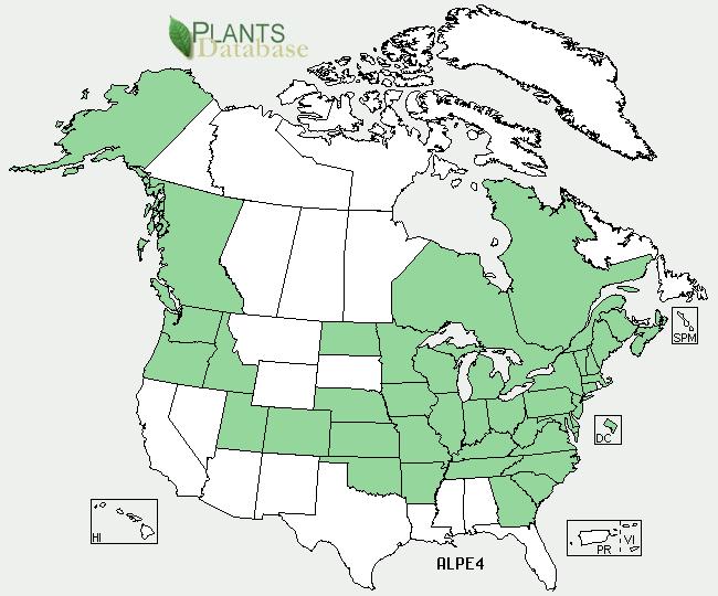
3 Alligator weed (Alternanthera philoxeroides) on Kentucky Lake
 in Georgia.")

4 Kudzu (Pueraria lobata) in Georgia. It has been spreading at the rate of 610 km 2 annually.

5 Garlic mustard (Alliaria petiolata)
6 Impacts of invasions Loss of biodiversity and ecosystem service Increase in species displacement and community changes Decline of native endemic species Invasions and extinctions are closely linked Complicate conservation management in natural areas Substantial socio-economic losses worldwide Hulme et al. (2013), Jeschke et al. (2014), Blackburn et al. (2014)
7 Tracking invasives: ground-based approach Ground-based methodologies are difficult to use for detecting and monitoring the spatial distribution of invasive species. Time consuming and costly Sampling, spatial, and taxonomic biases Often lack of temporal dimensions Lack of access in some targeted areas Impossible for large scale studies Only a few taxa can be thoroughly studied
8 Tracking invasives: remote sensing approach Remote sensing offers great opportunities for invasion ecologists to monitor spatial and temporal dynamics of invasive species. Cost-effective (some RS data are freely available) Provides complete spatial coverage for large or remote areas Offers possibilities to go back in time with archived data to document invasion patterns Provides current and consistent occurrence records for species distribution modeling to inform invasion risks.
9 Remote sensing approach- sensor types and availability Multispectral AVHRR, MODIS, Landsat TM, ETM+, Landsat 8, Aster, SPOT, IKONOS, Quickbird, Worldview-2, GeoEye-1,2, Pleiades- 1,2. Hyperspectral EO-1 Hyperion, AVIRIS, AISA, CASI, HyMap Aerial photos NAPP, NHAP, NAIP, USGS DOQ LiDAR and RADAR See Table 1 in He et al. (2011), Table 2 in Bradley (2014) and (Pettorelli et al. 2014) for spatial and spectral resolution, swath width, acquisition frequency, sources, cost, and availability of future sensors.
.")

10 Hyperspectral remote sensing Hyperspectral sensors measure the reflected spectrum at wavelengths between 350 and 2500 nm using contiguous bands of 5- to 10-nm bandwidths (Ustin et al. 2004). A hyperspectral cube. AVIRIS captures imagery from 224 spectral bands visualized as a stack of images 224 pixels deep (Source: NASA). Four spectrally distinct materials are separated using hyperspectral data (Bradley 2014).
. Identification to species level can be made possible based on subtle spectral features. (Kiang et al.")
11 Hyperspectral remote sensing Higher spectral resolution allows the differentiation of species based on biochemistry of leaves or canopy (Ustin et al. 2004). Identification to species level can be made possible based on subtle spectral features. (Kiang et al. 2007)

12 Using time series to incorporate phenology in detection and mapping The uniqueness in phenological signal of some invasive species provides a sound basis for identifying spectral differences between targeted species and co-occurring native vegetation. Perennial pepperweed (Lepidium latifolium) Field spectra of flowering and fruiting phenology of Lepidium (Andrew & Ustin 2008)

 Canopy components of yellow starthistle: stems,")
13 Using time series to incorporate phenology in detection and mapping The spectral characteristics of canopy components at different flowering stages including stems, buds, opening flowers, and post-flowers can be compared. Yellow starthistle (Centaurea solstitialis) Canopy components of yellow starthistle: stems, opening flowers, postflowers, and buds (Ge et al. 2006).
14 Using time series to incorporate phenology in detection and mapping Reflectance patterns of different canopy components at the full range from nm (Ge et al. 2006). Peak flowering stage was identified as the best time period for differentiating the spectral signature of this invasive species.

 Reddish-purple in early August")

15 Using time series to incorporate phenology in detection and mapping Significant changes in phenology can help ecologists determine the best timing to discriminate invasive species remotely. Purple loosestrife (Lythrum salicaria) Reddish-purple in early August Common reed (Phragmites australis) Bloom late, have brown to whitish tassels Cattail (Typha spp.) Bloom early, have brown inflorescences in August and September
16 Using time series to incorporate phenology in detection and mapping August as the best month for differentiating plant communities dominated by these three invasive species based on significant changes in their phenology (Laba et al. 2005).
 Understory invasive plants can be detected if they have phenologies distinct from overstory species. Bush honeysuckle (Lonicera maackii) (Wilfong et al. 2009, Shouse et al.")
17 Using time series to incorporate phenology in detection and mapping Invasive plants might be phenologically distinct from native species in a deciduous landscape (i.e. green up early, stay green longer, etc.) Understory invasive plants can be detected if they have phenologies distinct from overstory species. Bush honeysuckle (Lonicera maackii) (Wilfong et al. 2009, Shouse et al. 2013) Early spring and late fall provide opportunity for remote sensing (Bradley 2014)
.")
18 Using time series to incorporate phenology in detection and mapping In tropics, phenological differences between plant species can be captured by combining spectral information from different periods to improve detection and mapping accuracy. A multi-temporal spectral mixture analysis for invasive species mapping in Hawaiian rainforests with Hyperion (Fig. 1 in Somer & Anser 2013).
19 Using time series to incorporate phenology in detection and mapping The detection success increased systematically when compared the results of multi-temporal MESMA (Kappa = 0.78) with that of uni-temporal approach (Kappa = ). (Table 2 in Somer & Asner 2013)
, Hawaiian nitrogenfixing (HN), introduced non-fixing (I), and introduced nitrogen-fixing (IN) species (Asner et al.")
20 Tracking ecosystem changes with reflectance data Biogeochemical changes found at the foliar and canopy levels indicate not only where invasion has occurred, but also how it affects ecosystem structures. Mean reflectance of Hawaiian non-fixing (H), Hawaiian nitrogenfixing (HN), introduced non-fixing (I), and introduced nitrogen-fixing (IN) species (Asner et al. 2008)
21 Tracking ecosystem changes with reflectance data Changes in foliar nitrogen and water content captured by spectra directly indicate the biogeochemical impact of invasive species on the rainforest (Fig. 4 in Asner & Vitousek 2005).
22 Informing invasion risks with predictive models Developing spatially explicit distribution models for predicting the future spread of invasive species is a critical research area for invasion ecologists. These models provide timely information for resource managers and policy makers who need accurate species distribution maps for invasion risk analysis.
23 Informing invasion risks with predictive models Species distribution models may be correlative (ecological niche models) or mechanistic (physiologically-based demographic models). Generalized additive models Classification regression tree model Multivariate adaptive regression splines Random forest Maximum entropy Artificial Neural Network Bioclimatic envelope models
24 Informing invasion risks with predictive models Model input: Climatic, topographical and edaphic variables along with vegetation indices (MODIS NDVI) have been used as predictor variables for these predictive models. The use of hyperspectral data for invasive risk analysis is still rare even though hyperspectral data are a valuable input for quantitative models.
 assessed the invasion risk of Pepperweed in California s San Francisco Bay using both predictor and response variables derived from remote sensing: - Present/absent data of")
25 Informing invasion risks with predictive models Hyperspectral data deserve an increased attention from ecologists. Andrew and Ustin (2009) assessed the invasion risk of Pepperweed in California s San Francisco Bay using both predictor and response variables derived from remote sensing: - Present/absent data of pepperweed were extracted from a hyperspectral image (HyMap). - Predictor variables were derived from a LiDAR digital elevation model
26 Concluding remarks Spectral information provided by hyperspectral sensors can detect invaders at the species level across a range of community and ecosystem types. Despite its proven utility in mapping and modelling the distribution of invasive species, hyperspectral remote sensing is underused by invasion ecologists.
27 Concluding remarks Opportunities and challenges A call for high-level interdisciplinary training for both ecologists and geographers Integration of spatial scales used in remote sensing and field sampling (consistent timing and plot shape as well) Data availability, global coverage, and cost Open source algorithms and software Next-generation sensor development (such as HyspIRI, Hyperspectral and InfraRed Imager proposed by NASA)
28 Thank you!
Remote detection of giant reed invasions in riparian habitats: challenges and opportunities for management planning
 Remote detection of giant reed invasions in riparian habitats: challenges and opportunities for management planning Maria do Rosário Pereira Fernandes Forest Research Centre, University of Lisbon Number
Using Remote Sensing to Map the Evolution of Marsh Vegetation in the South Bay of San Francisco
 Using Remote Sensing to Map the Evolution of Marsh Vegetation in the South Bay of San Francisco Brian Fulfrost Design, Community and Environment (DC&E) 6 th Annual Bay-Delta Science Conference PROJECT
USING HYPERSPECTRAL IMAGERY
 USING HYPERSPECTRAL IMAGERY AND LIDAR DATA TO DETECT PLANT INVASIONS 2016 ESRI CANADA SCHOLARSHIP APPLICATION CURTIS CHANCE M.SC. CANDIDATE FACULTY OF FORESTRY UNIVERSITY OF BRITISH COLUMBIA CURTIS.CHANCE@ALUMNI.UBC.CA
Application of Remote Sensing and Global Positioning Technology for Survey and Monitoring of Plant Pests
 Application of Remote Sensing and Global Positioning Technology for Survey and Monitoring of Plant Pests David Bartels, Ph.D. USDA APHIS PPQ CPHST Mission Texas Laboratory Spatial Technology and Plant
REMOTE SENSING GREGORY P. ASNER CHO-YING HUANG REMOTE SENSING TECHNOLOGIES AND APPROACHES
 Cohen, A. N., and B. Foster. 2000. The regulation of biological pollution: Preventing exotic species invasions from ballast water discharges into California coastal water. Golden Gate University Law Review
Greening of Arctic: Knowledge and Uncertainties
 Greening of Arctic: Knowledge and Uncertainties Jiong Jia, Hesong Wang Chinese Academy of Science jiong@tea.ac.cn Howie Epstein Skip Walker Moscow, January 28, 2008 Global Warming and Its Impact IMPACTS
Hyperspectral Remote Sensing --an indirect trait measuring method
 Hyperspectral Remote Sensing --an indirect trait measuring method Jin Wu 05/02/2012 Outline Part 1: Terminologies & Tools of RS Techniques Part 2: RS Approaches to Estimating Leaf/Canopy Traits Part 3:
Mapping for a Changing California
 Mapping for a Changing California Spatial Data Science: - the 21 st century mapping toolkit - case studies in remote sensing and participatory informatics -where to get more information Maggi Kelly, University
GIS and Remote Sensing
 Spring School Land use and the vulnerability of socio-ecosystems to climate change: remote sensing and modelling techniques GIS and Remote Sensing Katerina Tzavella Project Researcher PhD candidate Technology
The Wide Dynamic Range Vegetation Index and its Potential Utility for Gap Analysis
 Summary StatMod provides an easy-to-use and inexpensive tool for spatially applying the classification rules generated from the CT algorithm in S-PLUS. While the focus of this article was to use StatMod
Sources of Imagery and GIS Data Layers (Last updated October 2005)
") Sources of Imagery and GIS Data Layers (Last updated October 2005) The question of where to find data is one often asked by beginners in precision agriculture and other geospatial projects. The following
Sources of Imagery and GIS Data Layers (Last updated October 2005) The question of where to find data is one often asked by beginners in precision agriculture and other geospatial projects. The following
MAPPING THE SPECTRAL AND SPATIAL CHARACTERISTICS OF MOUND SPRING WETLAND VEGETATION IN SOUTH AUSTRALIA: A NOVEL SPECTRALLY SEGMENTED PCA APPROACH
 MAPPING THE SPECTRAL AND SPATIAL CHARACTERISTICS OF MOUND SPRING WETLAND VEGETATION IN SOUTH AUSTRALIA: A NOVEL SPECTRALLY SEGMENTED PCA APPROACH Dr. Davina White, Postdoctoral Research Fellow Associate
Identifying Audit, Evidence Methodology and Audit Design Matrix (ADM)
") 11 Identifying Audit, Evidence Methodology and Audit Design Matrix (ADM) 27/10/2012 Exercise XXX 2 LEARNING OBJECTIVES At the end of this session participants will be able to: 1. Identify types and sources
11 Identifying Audit, Evidence Methodology and Audit Design Matrix (ADM) 27/10/2012 Exercise XXX 2 LEARNING OBJECTIVES At the end of this session participants will be able to: 1. Identify types and sources
Main conclusions Our review suggests that hyperspectral remote sensing can
 Diversity and Distributions, (Diversity Distrib.) (2011) 17, 381 392 A Journal of Conservation Biogeography BIODIVERSITY REVIEW 1 Department of Biological Sciences, Murray State University, Murray, KY
Geological Mapping Using EO Data for Onshore O&G Exploration
 Geological Mapping Using EO Data for Onshore O&G Exploration Michael Hall ESA Oil and Gas Workshop, Frascati, Italy michael.hall@infoterra-global.com Why use EO data for Geological Mapping? Availability
Capabilities and Limitations of Land Cover and Satellite Data for Biomass Estimation in African Ecosystems Valerio Avitabile
 Capabilities and Limitations of Land Cover and Satellite Data for Biomass Estimation in African Ecosystems Valerio Avitabile Kaniyo Pabidi - Budongo Forest Reserve November 13th, 2008 Outline of the presentation
GIS and Remote Sensing Applications in Invasive Plant Monitoring
 Matt Wallace NRS 509 Written Overview & Annotated Bibliography 12/17/2013 GIS and Remote Sensing Applications in Invasive Plant Monitoring Exotic invasive plants can cause severe ecological damage to native
ZRCSAZU. Remote sensing and Earth observation data at ZRC SAZU. dr. Tatjana Veljanovski Atrij ZRC Ljubljana
 ZRCSAZU Remote sensing and Earth observation data at ZRC SAZU dr. Tatjana Veljanovski 2016-06-08 Atrij ZRC Ljubljana Remote Sensing Department Remote Sensing Department 20 years of experience application,
This module presents remotely sensed assessment (choice of sensors and resolutions; airborne or ground based sensors; ground truthing)
") This module presents remotely sensed assessment (choice of sensors and resolutions; airborne or ground based sensors; ground truthing) 1 In this presentation you will be introduced to approaches for using
This module presents remotely sensed assessment (choice of sensors and resolutions; airborne or ground based sensors; ground truthing) 1 In this presentation you will be introduced to approaches for using
ANALYSIS AND VALIDATION OF A METHODOLOGY TO EVALUATE LAND COVER CHANGE IN THE MEDITERRANEAN BASIN USING MULTITEMPORAL MODIS DATA
 PRESENT ENVIRONMENT AND SUSTAINABLE DEVELOPMENT, NR. 4, 2010 ANALYSIS AND VALIDATION OF A METHODOLOGY TO EVALUATE LAND COVER CHANGE IN THE MEDITERRANEAN BASIN USING MULTITEMPORAL MODIS DATA Mara Pilloni
Lesson 4b Remote Sensing and geospatial analysis to integrate observations over larger scales
 Lesson 4b Remote Sensing and geospatial analysis to integrate observations over larger scales We have discussed static sensors, human-based (participatory) sensing, and mobile sensing Remote sensing: Satellite
Imaging Spectroscopy for vegetation functioning
 VTT TECHNICAL RESEARCH CENTRE OF FINLAND LTD Imaging Spectroscopy for vegetation functioning Matti Mõttus IBC-CARBON workshop Novel Earth Observation techniques for Biodiversity Monitoring and Research,
Weeds: the Great Biodiaspora. Weeds: the Great Biodiaspora
 Weed: A plant species (or any organism) not in its normal geographic distribution, spread by human activities, and usually with some negative impact to humans and/or native flora/vegetation/fauna What
VISUALIZATION URBAN SPATIAL GROWTH OF DESERT CITIES FROM SATELLITE IMAGERY: A PRELIMINARY STUDY
 CO-439 VISUALIZATION URBAN SPATIAL GROWTH OF DESERT CITIES FROM SATELLITE IMAGERY: A PRELIMINARY STUDY YANG X. Florida State University, TALLAHASSEE, FLORIDA, UNITED STATES ABSTRACT Desert cities, particularly
HYPXIM: a second generation high spatial resolution hyperspectral satellite for the assessment of plant biodiversity
 HYPXIM: a second generation high spatial resolution hyperspectral satellite for the assessment of plant biodiversity S. Jacquemoud (1), D. Sheeren (2), X. Briottet (3), V. Carrère (4), R. Marion (5) &
An Internet-based Agricultural Land Use Trends Visualization System (AgLuT)
") An Internet-based Agricultural Land Use Trends Visualization System (AgLuT) Prepared for Missouri Department of Natural Resources Missouri Department of Conservation 07-01-2000-12-31-2001 Submitted by
An Internet-based Agricultural Land Use Trends Visualization System (AgLuT) Prepared for Missouri Department of Natural Resources Missouri Department of Conservation 07-01-2000-12-31-2001 Submitted by
IDENTIFICATION OF TRENDS IN LAND USE/LAND COVER CHANGES IN THE MOUNT CAMEROON FOREST REGION
 IDENTIFICATION OF TRENDS IN LAND USE/LAND COVER CHANGES IN THE MOUNT CAMEROON FOREST REGION By Nsorfon Innocent F. April 2008 Content Introduction Problem Statement Research questions/objectives Methodology
Land cover research, applications and development needs in Slovakia
 Land cover research, applications and development needs in Slovakia Andrej Halabuk Institute of Landscape Ecology Slovak Academy of Sciences (ILE SAS) Štefánikova 3, 814 99 Bratislava, Slovakia Institute
Preparation of LULC map from GE images for GIS based Urban Hydrological Modeling
 International Conference on Modeling Tools for Sustainable Water Resources Management Department of Civil Engineering, Indian Institute of Technology Hyderabad: 28-29 December 2014 Abstract Preparation
HYPERSPECTRAL IMAGING
 1 HYPERSPECTRAL IMAGING Lecture 9 Multispectral Vs. Hyperspectral 2 The term hyperspectral usually refers to an instrument whose spectral bands are constrained to the region of solar illumination, i.e.,
Overview of Remote Sensing in Natural Resources Mapping
 Overview of Remote Sensing in Natural Resources Mapping What is remote sensing? Why remote sensing? Examples of remote sensing in natural resources mapping Class goals What is Remote Sensing A remote sensing
Many of remote sensing techniques are generic in nature and may be applied to a variety of vegetated landscapes, including
 Remote Sensing of Vegetation Many of remote sensing techniques are generic in nature and may be applied to a variety of vegetated landscapes, including 1. Agriculture 2. Forest 3. Rangeland 4. Wetland,
Data Fusion and Multi-Resolution Data
 Data Fusion and Multi-Resolution Data Nature.com www.museevirtuel-virtualmuseum.ca www.srs.fs.usda.gov Meredith Gartner 3/7/14 Data fusion and multi-resolution data Dark and Bram MAUP and raster data Hilker
Progress Report Year 2, NAG5-6003: The Dynamics of a Semi-Arid Region in Response to Climate and Water-Use Policy
 Progress Report Year 2, NAG5-6003: The Dynamics of a Semi-Arid Region in Response to Climate and Water-Use Policy Principal Investigator: Dr. John F. Mustard Department of Geological Sciences Brown University
Impact & Recovery of Wetland Plant Communities after the Gulf Oil Spill in 2010 and Hurricane Isaac in 2012
 Impact & Recovery of Wetland Plant Communities after the Gulf Oil Spill in 2010 and Hurricane Isaac in 2012 Introduction: The coastal wetlands, estuaries and lagoon systems of the Gulf Coast are a hotspot
Evaluating Urban Vegetation Cover Using LiDAR and High Resolution Imagery
 Evaluating Urban Vegetation Cover Using LiDAR and High Resolution Imagery Y.A. Ayad and D. C. Mendez Clarion University of Pennsylvania Abstract One of the key planning factors in urban and built up environments
Spanish national plan for land observation: new collaborative production system in Europe
 ADVANCE UNEDITED VERSION UNITED NATIONS E/CONF.103/5/Add.1 Economic and Social Affairs 9 July 2013 Tenth United Nations Regional Cartographic Conference for the Americas New York, 19-23, August 2013 Item
Detecting Landscape Changes in High Latitude Environments Using Landsat Trend Analysis: 2. Classification
 1 Detecting Landscape Changes in High Latitude Environments Using Landsat Trend Analysis: 2. Classification Ian Olthof and Robert H. Fraser Canada Centre for Mapping and Earth Observation Natural Resources
Chitra Sood, R.M. Bhagat and Vaibhav Kalia Centre for Geo-informatics Research and Training, CSK HPKV, Palampur , HP, India
 APPLICATION OF SPACE TECHNOLOGY AND GIS FOR INVENTORYING, MONITORING & CONSERVATION OF MOUNTAIN BIODIVERSITY WITH SPECIAL REFERENCE TO MEDICINAL PLANTS Chitra Sood, R.M. Bhagat and Vaibhav Kalia Centre
Arctic Tundra land cover and biomass change on the Central Yamal peninsula, Russia
 Arctic Tundra land cover and biomass change on the Central Yamal peninsula, Russia ArcticBiomass Workshop, 20-23 Ocrobertember 2015, Svalbard Kumpula, T.*, Verdonen, M*., Macias-Fauria, M***, Skarin A.****
GEOG Lecture 8. Orbits, scale and trade-offs
 Environmental Remote Sensing GEOG 2021 Lecture 8 Orbits, scale and trade-offs Orbits revisit Orbits geostationary (36 000 km altitude) polar orbiting (200-1000 km altitude) Orbits revisit Orbits geostationary
Mapping of foliar nitrogen mass from the gregarious sal and oak formations surrounding doon valley using hyperion data
 2018; 6(2): 2457-2462 P-ISSN: 2349 8528 E-ISSN: 2321 4902 IJCS 2018; 6(2): 2457-2462 2018 IJCS Received: 01-01-2018 Accepted: 02-02-2018 Dhruval Bhavsar Reeja S Deepak Kushwaha RMSI Pvt. Ltd., A-8, Sector
Vegetation Change Detection of Central part of Nepal using Landsat TM
 Vegetation Change Detection of Central part of Nepal using Landsat TM Kalpana G. Bastakoti Department of Geography, University of Calgary, kalpanagb@gmail.com Abstract This paper presents a study of detecting
Land Use MTRI Documenting Land Use and Land Cover Conditions Synthesis Report
 Colin Brooks, Rick Powell, Laura Bourgeau-Chavez, and Dr. Robert Shuchman Michigan Tech Research Institute (MTRI) Project Introduction Transportation projects require detailed environmental information
Climate Change and Invasive Plants in the Pacific Northwest
 Climate Change and Invasive Plants in the Pacific Northwest David W Peterson Becky K Kerns Ecosystem Dynamics and Environmental Change Team Threat Characterization and Management Program Pacific Northwest
Urban Tree Canopy Assessment Purcellville, Virginia
 GLOBAL ECOSYSTEM CENTER www.systemecology.org Urban Tree Canopy Assessment Purcellville, Virginia Table of Contents 1. Project Background 2. Project Goal 3. Assessment Procedure 4. Economic Benefits 5.
Vegetation Remote Sensing
 Vegetation Remote Sensing Huade Guan Prepared for Remote Sensing class Earth & Environmental Science University of Texas at San Antonio November 2, 2005 Outline Why do we study vegetation remote sensing?
ESM 186 Environmental Remote Sensing and ESM 186 Lab Syllabus Winter 2012
 ESM 186 Environmental Remote Sensing and ESM 186 Lab Syllabus Winter 2012 Instructor: Susan Ustin (slustin@ucdavis.edu) Phone: 752-0621 Office: 233 Veihmeyer Hall and 115A, the Barn Office Hours: Tuesday
Technical Drafting, Geographic Information Systems and Computer- Based Cartography
 Technical Drafting, Geographic Information Systems and Computer- Based Cartography Project-Specific and Regional Resource Mapping Services Geographic Information Systems - Spatial Analysis Terrestrial
AN INTEGRATED METHOD FOR FOREST CANOPY COVER MAPPING USING LANDSAT ETM+ IMAGERY INTRODUCTION
 AN INTEGRATED METHOD FOR FOREST CANOPY COVER MAPPING USING LANDSAT ETM+ IMAGERY Zhongwu Wang, Remote Sensing Analyst Andrew Brenner, General Manager Sanborn Map Company 455 E. Eisenhower Parkway, Suite
Eva Strand and Leona K. Svancara Landscape Dynamics Lab Idaho Coop. Fish and Wildlife Research Unit
 More on Habitat Models Eva Strand and Leona K. Svancara Landscape Dynamics Lab Idaho Coop. Fish and Wildlife Research Unit Area of occupancy Range - spatial limits within which a species can be found Distribution
Characterization of Coastal Wetland Systems using Multiple Remote Sensing Data Types and Analytical Techniques
 Characterization of Coastal Wetland Systems using Multiple Remote Sensing Data Types and Analytical Techniques Daniel Civco, James Hurd, and Sandy Prisloe Center for Land use Education and Research University
Remote Sensing Based Inversion of Gap Fraction for Determination of Leaf Area Index. Alemu Gonsamo 1 and Petri Pellikka 1
 Remote Sensing Based Inversion of Gap Fraction for Determination of Leaf Area Index Alemu Gonsamo and Petri Pellikka Department of Geography, University of Helsinki, P.O. Box, FIN- Helsinki, Finland; +-()--;
Data Dictionary for Network of Conservation Areas Transcription Reports from the Colorado Natural Heritage Program
 Data Dictionary for Network of Conservation Areas Transcription Reports from the Colorado Natural Heritage Program This Data Dictionary defines terms used in Network of Conservation Areas (NCA) Reports
WEED WATCH LEEANNE MILA EL DORADO COUNTY DEPARTMENT OF AGRICULTURE
 WEED WATCH LEEANNE MILA EL DORADO COUNTY DEPARTMENT OF AGRICULTURE YELLOW STARTHISTLE WHY DO WE CARE ABOUT INVASIVE WEEDS? HIGHLY AGGRESSIVE DISPLACE NATIVES AND DESIRABLE PLANTS DECREASE WILDLIFE HABITAT
History & Scope of Remote Sensing FOUNDATIONS
 History & Scope of Remote Sensing FOUNDATIONS Lecture Overview Introduction Overview of visual information Power of imagery Definition What is remote sensing? Definition standard for class History of Remote
SPATIAL AND TEMPORAL MODELLING OF ECOSYSTEM SERVICES
 SPATIAL AND TEMPORAL MODELLING OF ECOSYSTEM SERVICES Solen Le Clec h, T.Decaëns, S. Dufour, M. Grimaldi, N. Jégou and J. Oszwald ACES Conference 2016 Jacksonville, Florida (USA). December, 5-9th : issues
REMOTE SENSING ACTIVITIES. Caiti Steele
 REMOTE SENSING ACTIVITIES Caiti Steele REMOTE SENSING ACTIVITIES Remote sensing of biomass: Field Validation of Biomass Retrieved from Landsat for Rangeland Assessment and Monitoring (Browning et al.,
Quick Response Report #126 Hurricane Floyd Flood Mapping Integrating Landsat 7 TM Satellite Imagery and DEM Data
 Quick Response Report #126 Hurricane Floyd Flood Mapping Integrating Landsat 7 TM Satellite Imagery and DEM Data Jeffrey D. Colby Yong Wang Karen Mulcahy Department of Geography East Carolina University
Hyperspectral Data as a Tool for Mineral Exploration
 1 Hyperspectral Data as a Tool for Mineral Exploration Nahid Kavoosi, PhD candidate of remote sensing kavoosyn@yahoo.com Nahid Kavoosi Abstract In Geology a lot of minerals and rocks have characteristic
DAMAGE DETECTION OF THE 2008 SICHUAN, CHINA EARTHQUAKE FROM ALOS OPTICAL IMAGES
 DAMAGE DETECTION OF THE 2008 SICHUAN, CHINA EARTHQUAKE FROM ALOS OPTICAL IMAGES Wen Liu, Fumio Yamazaki Department of Urban Environment Systems, Graduate School of Engineering, Chiba University, 1-33,
Cross-Sensor Continuity Science Algorithm
 Cross-Sensor Continuity Science Algorithm - Long Term Vegetation Index and Phenology Workshop - Javzan Tsend-Ayush and Tomoaki Miura Department of Natural Resources and Environmental Management University
AGOG 485/585 /APLN 533 Spring Lecture 5: MODIS land cover product (MCD12Q1). Additional sources of MODIS data
. Additional sources of MODIS data") AGOG 485/585 /APLN 533 Spring 2019 Lecture 5: MODIS land cover product (MCD12Q1). Additional sources of MODIS data Outline Current status of land cover products Overview of the MCD12Q1 algorithm Mapping
AGOG 485/585 /APLN 533 Spring 2019 Lecture 5: MODIS land cover product (MCD12Q1). Additional sources of MODIS data Outline Current status of land cover products Overview of the MCD12Q1 algorithm Mapping
Remote Sensing I: Basics
 Remote Sensing I: Basics Kelly M. Brunt Earth System Science Interdisciplinary Center, University of Maryland Cryospheric Science Laboratory, Goddard Space Flight Center kelly.m.brunt@nasa.gov (Based on
The Weed Battle. Sage Fitch, Salt Lake County Weed Specialist
 The Weed Battle Noxious and Invasive Weed Management by The Salt Lake County Weed Program and The Bonneville CWMA Sage Fitch, Salt Lake County Weed Specialist Our program & our partners Who are we and
EFFECT OF ANCILLARY DATA ON THE PERFORMANCE OF LAND COVER CLASSIFICATION USING A NEURAL NETWORK MODEL. Duong Dang KHOI.
 EFFECT OF ANCILLARY DATA ON THE PERFORMANCE OF LAND COVER CLASSIFICATION USING A NEURAL NETWORK MODEL Duong Dang KHOI 1 10 Feb, 2011 Presentation contents 1. Introduction 2. Methods 3. Results 4. Discussion
Remote Sensing products and global datasets. Joint Research Centre, European Commission
 Remote Sensing products and global datasets Joint Research Centre, European Commission Setting the stage. Needs and requirements for integrated approach(es) for land degradation assessment. in Special
Monitoring and Change Detection along the Eastern Side of Qena Bend, Nile Valley, Egypt Using GIS and Remote Sensing
 Advances in Remote Sensing, 2013, 2, 276-281 http://dx.doi.org/10.4236/ars.2013.23030 Published Online September 2013 (http://www.scirp.org/journal/ars) Monitoring and Change Detection along the Eastern
Our New Great Lakes Flora
 Our New Great Lakes Flora... weeds, aliens, invasives... Flora of Wisconsin 2570 total species Michigan = 2717 Information source: Wisconsin State Herbarium wisflora.herbarium.wisc.edu Why are we (government,
Anjana Dewanji, Anindita Chatterjee & Achyut Kumar Banerjee. Agricultural & Ecological Research Unit Indian Statistical Institute Kolkata, India
 Anjana Dewanji, Anindita Chatterjee & Achyut Kumar Banerjee Agricultural & Ecological Research Unit Indian Statistical Institute Kolkata, India World wide distribution Distribution in India Present scenario
PLP 6404 Epidemiology of Plant Diseases Spring 2015
 PLP 6404 Epidemiology of Plant Diseases Spring 2015 Ariena van Bruggen, modified from Katherine Stevenson Lecture 8: Influence of host on disease development - plant growth For researchers to communicate
Chapter 10: The Future of GIS Why Speculate? 10.2 Future Data 10.3 Future Hardware 10.4 Future Software 10.5 Some Future Issues and Problems
 Chapter 10: The Future of GIS 10.1 Why Speculate? 10.2 Future Data 10.3 Future Hardware 10.4 Future Software 10.5 Some Future Issues and Problems Theme of the Course GIS's place in understanding geographic
Introduction to Geographic Information Systems (GIS): Environmental Science Focus
: Environmental Science Focus") Introduction to Geographic Information Systems (GIS): Environmental Science Focus September 9, 2013 We will begin at 9:10 AM. Login info: Username:!cnrguest Password: gocal_bears Instructor: Domain: CAMPUS
Introduction to Geographic Information Systems (GIS): Environmental Science Focus September 9, 2013 We will begin at 9:10 AM. Login info: Username:!cnrguest Password: gocal_bears Instructor: Domain: CAMPUS
GLOBAL/CONTINENTAL LAND COVER MAPPING AND MONITORING
 GLOBAL/CONTINENTAL LAND COVER MAPPING AND MONITORING Ryutaro Tateishi, Cheng Gang Wen, and Jong-Geol Park Center for Environmental Remote Sensing (CEReS), Chiba University 1-33 Yayoi-cho Inage-ku Chiba
USE OF SATELLITE IMAGES FOR AGRICULTURAL STATISTICS
 USE OF SATELLITE IMAGES FOR AGRICULTURAL STATISTICS National Administrative Department of Statistics DANE Colombia Geostatistical Department September 2014 Colombian land and maritime borders COLOMBIAN
1. Introduction. Jai Kumar, Paras Talwar and Krishna A.P. Department of Remote Sensing, Birla Institute of Technology, Ranchi, Jharkhand, India
 Cloud Publications International Journal of Advanced Remote Sensing and GIS 2015, Volume 4, Issue 1, pp. 1026-1032, Article ID Tech-393 ISSN 2320-0243 Research Article Open Access Forest Canopy Density
15 Non-Native Plants at Lake Mead National Recreation Area
 15 Non-Native Plants at Lake Mead National Recreation Area To report weed locations use non-native plant survey form and/or contact: Carrie Norman Exotic Plant Manager carrie_norman@nps.gov 702-293-8734
Our New Great Lakes Flora.... weeds, aliens, invasives...
 Our New Great Lakes Flora... weeds, aliens, invasives... Flora of Wisconsin 2570 total species Michigan = 2717 Information source: Wisconsin State Herbarium wisflora.herbarium.wisc.edu Arethusa bulbosa
Module 2.1 Monitoring activity data for forests using remote sensing
 Module 2.1 Monitoring activity data for forests using remote sensing Module developers: Frédéric Achard, European Commission (EC) Joint Research Centre (JRC) Jukka Miettinen, EC JRC Brice Mora, Wageningen
Mapping and Modeling for Regional Planning
 Mapping and Modeling for Regional Planning Carol W. Witham Sacramento Valley Chapter California Native Plant Society contributors: David Ackerly John Dittes Julie Evens Josephine Guardino Robert F. Holland
The Phenology of Plant Invasions: How temporal niches assemble plant communities. Elizabeth M. Wolkovich & Elsa E. Cleland Phenology Dublin
 The Phenology of Plant Invasions: How temporal niches assemble plant communities Elizabeth M. Wolkovich & Elsa E. Cleland Phenology 2010 - Dublin Plant invasions Phenology most commonly used as an indicator
GEOMATICS. Shaping our world. A company of
 GEOMATICS Shaping our world A company of OUR EXPERTISE Geomatics Geomatics plays a mayor role in hydropower, land and water resources, urban development, transport & mobility, renewable energy, and infrastructure
Attention: Jahan Kariyeva. Review of Remote Sensing Methods for Monitoring Wetlands in Northeastern Alberta FINAL REPORT
 Disclaimer The material in this publication does not imply the expression of any opinion on the part of any individual or organization other than the authors. Errors, omissions or inconsistencies in this
USE OF RADIOMETRICS IN SOIL SURVEY
 USE OF RADIOMETRICS IN SOIL SURVEY Brian Tunstall 2003 Abstract The objectives and requirements with soil mapping are summarised. The capacities for different methods to address these objectives and requirements
Remote sensing and Reflectance spectroscopy as useful tools for Uranium exploration
 Remote sensing and Reflectance spectroscopy as useful tools for Uranium exploration Fares Howari, PhD University of Texas at Austin Bureau of Economic Geology (BEG) and Center for International Energy
Predicting Risk of Invasive Species Occurrence Remote-Sensing Strategies
 Predicting Risk of Invasive Species Occurrence Remote-Sensing Strategies By Kendal E. Young and T. Scott Schrader Chapter 6 of Early Detection of Invasive Plants Principles and Practices Edited by Bradley
ENVS S102 Earth and Environment (Cross-listed as GEOG 102) ENVS S110 Introduction to ArcGIS (Cross-listed as GEOG 110)
 ENVS S110 Introduction to ArcGIS (Cross-listed as GEOG 110)") ENVS S102 Earth and Environment (Cross-listed as GEOG 102) 1. Describe the fundamental workings of the atmospheric, hydrospheric, lithospheric, and oceanic systems of Earth 2. Explain the interactions
ENVS S102 Earth and Environment (Cross-listed as GEOG 102) 1. Describe the fundamental workings of the atmospheric, hydrospheric, lithospheric, and oceanic systems of Earth 2. Explain the interactions
Seasonal and interannual relations between precipitation, soil moisture and vegetation in the North American monsoon region
 Seasonal and interannual relations between precipitation, soil moisture and vegetation in the North American monsoon region Luis A. Mendez-Barroso 1, Enrique R. Vivoni 1, Christopher J. Watts 2 and Julio
NR402 GIS Applications in Natural Resources. Lesson 9: Scale and Accuracy
 NR402 GIS Applications in Natural Resources Lesson 9: Scale and Accuracy 1 Map scale Map scale specifies the amount of reduction between the real world and the map The map scale specifies how much the
Landuse and Landcover change analysis in Selaiyur village, Tambaram taluk, Chennai
 Landuse and Landcover change analysis in Selaiyur village, Tambaram taluk, Chennai K. Ilayaraja Department of Civil Engineering BIST, Bharath University Selaiyur, Chennai 73 ABSTRACT The synoptic picture
EO-1 SVT Site: TUMBARUMBA, AUSTRALIA
 EO-1 SVT Site: TUMBARUMBA, AUSTRALIA Background Tumbarumba Tumbarumba Study Area is located in Southern NSW, Australia. (E 148º 15' S 35º 45') and covers 5, hectares of publicly owned Forest Gently undulating
Ecosystem Disturbance and
 Remote Sensing of Forest Health: Ecosystem Disturbance and Recovery Tracker (edart) Region 5 Remote Sensing Lab Michèle Slaton, Alex Koltunov, Carlos Ramirez edart Overview A group of automated and interactive
The NEON Imaging Spectrometer: Airborne Measurements of Vegetation Cover and Biochemistry for the Continental-scale NEON Observatory
 The NEON Imaging Spectrometer: Airborne Measurements of Vegetation Cover and Biochemistry for the Continental-scale NEON Observatory Thomas U. Kampe, Brian R. Johnson, Michele Kuester, Joel McCorkel National
Advanced Image Analysis in Disaster Response
 Advanced Image Analysis in Disaster Response Creating Geographic Knowledge Thomas Harris ITT The information contained in this document pertains to software products and services that are subject to the
Using High-Resolution Commercial Imagery in the Geosciences
 Using High-Resolution Commercial Imagery in the Geosciences George Roth Geospatial Support Specialist 2015 AGU Student & Early Career Scientist Conference San Francisco, CA December 13th, 2015 The Geoscience
The Road to Data in Baltimore
 Creating a parcel level database from high resolution imagery By Austin Troy and Weiqi Zhou University of Vermont, Rubenstein School of Natural Resources State and local planning agencies are increasingly
Application of Remote Sensing and GIS in Wildlife Habitat Mapping
 Justice Camillus Mensah December 6, 2011 NRS 509 Application of Remote Sensing and GIS in Wildlife Habitat Mapping Introduction Wildlife habitat represents the physical space within which an organism lives.
KNOWLEDGE-BASED CLASSIFICATION OF LAND COVER FOR THE QUALITY ASSESSEMENT OF GIS DATABASE. Israel -
 KNOWLEDGE-BASED CLASSIFICATION OF LAND COVER FOR THE QUALITY ASSESSEMENT OF GIS DATABASE Ammatzia Peled a,*, Michael Gilichinsky b a University of Haifa, Department of Geography and Environmental Studies,
Applications of Remote Sensing Systems. to MINERAL DEPOSIT DISCOVERY, DEVELOPMENT
 REMS 6022: Term Project Applications of Remote Sensing Systems to MINERAL DEPOSIT DISCOVERY, DEVELOPMENT and RECLAMATION Venessa Bennett OVERVIEW Remote Sensing data extensively used in all aspects of
Climate Change and Vegetation Phenology
 Climate Change and Vegetation Phenology Climate Change In the Northeastern US mean annual temperature increased 0.7 C over 30 years (0.26 C per decade) Expected another 2-6 C over next century (Ollinger,