Environmental Changes, Migration, and Remittances Affect Pastoralist Communities in Montane Central Asia
|
|
|
- Tracey Doyle
- 5 years ago
- Views:
Transcription


1 Environmental Changes, Migration, and Remittances Affect Pastoralist Communities in Montane Central Asia Geoffrey M. Henebry * Hannah Visiting Professor Center for Global Change & Earth Observations & Department of Geography, Environment, and Spatial Sciences Michigan State University * formerly Geospatial Sciences Center of Excellence, South Dakota State University Guangqing Chi Associate Professor of Rural Sociology and Demography and Public Health Sciences Department of Agricultural Economics, Sociology, and Education Pennsylvania State University Pavel Ya. Groisman Principal Hydrology Science & Services, Inc. Asheville, NC Global Challenges University Alliance International Workshop on Land Use, Policy and the Water-Energy-Food Nexus Research supported in part by NASA project NNX15AP81G. Thanks!

2 I. Central Asia is a Great Unknown Sufficient information (O/P) on Permafrost Knowledge Gaps in Asia from WGII report from IPCC AR5 Sufficient information (P) on Farming area In Central Asia, every other topic has limited information/no data yielding critical knowledge gaps making it difficult to draw conclusions about observed and potential impacts of climate change Hijioka et al Asia. Chapter 24 of WGII report of AR5

3 File:Caucasus_central_asia_political_map_2000.jpg
4 II. Schema of influence: montane agropastoralism Climatic Variation Climate Change Climate Oscillations Climatic Extremes Thermal Regime Moisture Regime Pasture Accessibility Resource Landscape Land Management Pasture State Land Cover & Terrain Attributes Natural Hazards Landslides/Avalanches; Drought; Floods; Earthquakes Labor Urban Areas Remittances Pastoralists & Rural Community Left- Behind Children Disaster Response Food Security
5 II. Schema of influence: montane agropastoralism Climatic Variation Climate Change Climate Oscillations Climatic Extremes Thermal Regime Moisture Regime Pasture Accessibility Resource Landscape Land Management Pasture State Land Cover & Terrain Attributes Natural Hazards Landslides/Avalanches; Drought; Floods; Earthquakes Labor Urban Areas Remittances Pastoralists & Rural Community Left- Behind Children Disaster Response Food Security
![III. Trends in water vapor transport into Central Asia Table 1: Water vapor flux into Central Asia during 1990-2017 Southward annual flux through 50 N [kg (m s) -1 ] Eastward annual flux through 50 E](/docs-images/88/116680674/images/6-0.jpg "[kg (m s) -1 ] Period 1990-1999 0.14 46.4 2000-2009 -0.48 43.4 2010-2017 1.11 39.6 Down 15% Extratropical cyclones bring water vapor into Central Asia during spring & summer.")
6 III. Trends in water vapor transport into Central Asia Table 1: Water vapor flux into Central Asia during Southward annual flux through 50 N [kg (m s) -1 ] Eastward annual flux through 50 E [kg (m s) -1 ] Period Down 15% Extratropical cyclones bring water vapor into Central Asia during spring & summer. Table 2: Mean number of cyclones with atmospheric pressure <1,000 hpa at its center during by season Region JFM AMJ JAS OND Annual Kazakhstan Kyrgyzstan Some evidence of increasing trend of cyclones. Groisman et al Dry land belt of Northern Eurasia: Contemporary environmental changes and their consequences. Environmental Research Letters, to appear.

![2001-2013 [Orange indicates significant negative trends in wetness] [Green indicates significant positive trends in wetness] de Beurs KM, GM Henebry, BC Owsley, I](/docs-images/88/116680674/images/7-1.jpg "Sokolik. 2015. Using multiple remote sensing perspectives to identify and attribute land surface dynamics in Central Asia 2001-2013.")
7 IV. Trends in the vegetated land surface Multiple vegetation indices show significant browning in Central Asia between [Browns indicate significant negative trends in vegetation] [Greens indicate significant positive trends in vegetation] Remotely sensed wetness index shows significant drying across Central Asia between [Orange indicates significant negative trends in wetness] [Green indicates significant positive trends in wetness] de Beurs KM, GM Henebry, BC Owsley, I Sokolik Using multiple remote sensing perspectives to identify and attribute land surface dynamics in Central Asia Remote Sensing of Environment 170:48-61.

8 V. Trends in snow seasonality in Kyrgyzstan Most of the annual precipitation in the Kyrgyz highlands falls outside of the growing season. Snow cover, snow amount, and timing of onset and melt all affect soil moisture availability that supports early growth in pastures. We determined the snow season using remotely sensed snow cover products from MODIS (500 m, 8-day composites, , Terra only). We evaluated trends in First Date of Snow, Last Date of Snow, Duration of the Snow Season using nonparametric methods.

9 Significant Trends in First Date of Snow across Kyrgyzstan Significantly earlier snow onset especially in Chuy and Osh oblasts FDoS earlier oblast (km 2 ) Batken 526 Chuy 2,079 Issyk-Kul -- Jalal-Abad 1534 Naryn 839 Osh 2,021 Talas 972 total 7,971 Tomaszewska MA, GM Henebry Changing snow seasonality in the highlands of Kyrgyzstan. Environmental Research Letters 13:

10 Significant Trends in Last Date of Snow across Kyrgyzstan Significantly earlier snow melt especially in Naryn and Issyk-Kul oblasts LDoS earlier oblast (km 2 ) Batken -- Chuy 401 Issyk-Kul 1,376 Jalal-Abad 759 Naryn 2,227 Osh -- Talas 222 total 4,985 Tomaszewska MA, GM Henebry Changing snow seasonality in the highlands of Kyrgyzstan. Environmental Research Letters 13:
 DoSS longer (km 2 ) oblast Batken -- 325 Chuy -- 701 Issyk-Kul 884 -- Jalal-Abad -- -- Naryn 872 -- Osh -- 701 Talas -- 357 total 1,757 2,084 Tomaszewska MA, GM Henebry. 2018.")
11 Significant Trends in Duration of Snow Season across Kyrgyzstan Shorter snow season to the east. Longer snow season to the west. DoSS shorter (km 2 ) DoSS longer (km 2 ) oblast Batken Chuy Issyk-Kul Jalal-Abad Naryn Osh Talas total 1,757 2,084 Tomaszewska MA, GM Henebry Changing snow seasonality in the highlands of Kyrgyzstan. Environmental Research Letters 13:

12 Potential impacts of changing snow seasonality include Disruption of ecological calendars & transhumance timing Earlier end to growing season in summer and spring/fall pastures, if moisture not supplemented by rainfall Earlier end of access to fall and winter pastures Increasing the difference in productivity between northern and southern aspect pastures Increasing the invasibility of pastures by non-palatable species that are active earlier in the growing season
, but it is highly mountainous (94%) with a population of ~6M that is mostly")
13 VI. Locating the stable natural resource base: highland pastures Like many mountain nations, the land area of Kyrgyzstan is limited (<200K km 2 ), but it is highly mountainous (94%) with a population of ~6M that is mostly rural.


14 Lots of livestock grazing the land: Horses, Cattle, Sheep, Goats, Yaks

15 The key livelihood in rural Kyrgyzstan is montane agropastoralism that relies on vertical transhumance the seasonal movement of herds to graze pastures at higher elevations. But where is the stable resource base of montane pastoralism? This question asks more than a static land cover map can provide. To answer, we need a time series analysis of the resource base.
16 The Convex Quadratic (CxQ) model of Land Surface Phenology (LSP) links a remotely sensed vegetation index (e.g., NDVI) to the temporal progression of accumulated growing degreedays (AGDD). The CxQ model has been successfully applied to a variety of settings and scales. de Beurs KM, GM Henebry Land surface phenology, climatic variation, and institutional change: Analyzing agricultural land cover change in Kazakhstan. Remote Sensing of Environment 89(4): NDVI NDVI = α + β AGDD + γ AGDD 2 PH = α (β 2 / 4 γ) TTP = -β/2 γ Thermal Time to Peak (TTP NDVI ) AGDD Peak Height (PH NDVI ) (1) Calculate the AGDD at 1 km resolution from MODIS land surface temperature products. (2) Calculate the NDVI at 30 m resolution from Landsat time series. (3) Fit CxQ model to each 30 m pixel time series year by year & across all years (4) Map out the resulting phenometrics.

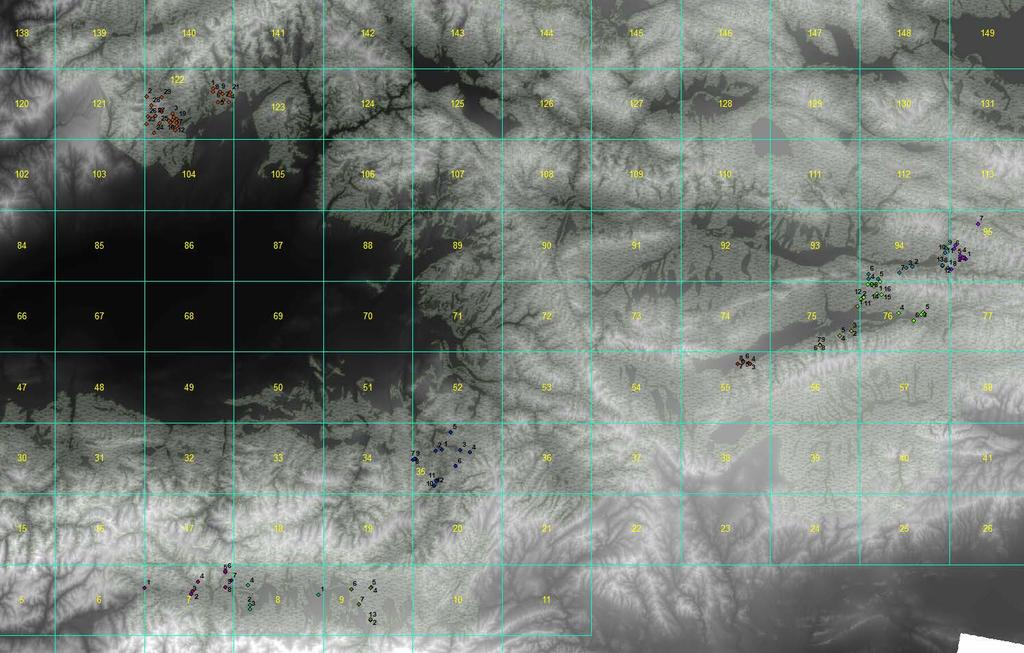
17 Finding Persistent Pastures in Four Focal Rayons Rayon Oblast Area (km 2 ) Population (n) Density (n/km 2 ) At-Bashy Naryn 15,354 ~49,000 ~3 Naryn Naryn 4,055 ~44,000 ~4 Alay Osh 6,821 ~72,000 ~11 Chong-Alay Osh 4,857 ~25,000 ~5
18

19
20

21 2014 Raw Landsat time series at 30 m White displays pixel with some number of valid observations Black displays no valid observations

22 2014 Grey scale displays the difference in number of obs between raw and filtered Landsat time series 69% pixels with good fits No fit in 5% due to low obs after filtering No fit in 8% due to wrong shape No fit in 19% due to too few obs on either side of peak

23 2014 Fitted Thermal Times to Peak Notice the gradient from ag fields in the lower right to the highlands in the upper center. SLC-off effects still evident, but not so strong.

24 2014 Fitted Peak Heights of NDVI Notice terrain effects

25 2014 Area Under the Curve Integrating under the fitted CxQ model
Multi scale trend analysis for evaluating climatic and anthropogenic effects on the vegetated land surface in Russia
 Multi scale trend analysis for evaluating climatic and anthropogenic effects on the vegetated land surface in Russia Kirsten de Beurs kdebeurs@ou.edu The University of Oklahoma Virginia Tech Students:
DROUGHT ASSESSMENT USING SATELLITE DERIVED METEOROLOGICAL PARAMETERS AND NDVI IN POTOHAR REGION
 DROUGHT ASSESSMENT USING SATELLITE DERIVED METEOROLOGICAL PARAMETERS AND NDVI IN POTOHAR REGION Researcher: Saad-ul-Haque Supervisor: Dr. Badar Ghauri Department of RS & GISc Institute of Space Technology
Dust Storms of the Canadian Prairies: A Dustier and Muddier Outlook
 Dust Storms of the Canadian Prairies: A Dustier and Muddier Outlook E Wheaton, University of Saskatchewan and Saskatchewan Research Council, and V Wittrock, Saskatchewan Research Council Invited presentation
East Africa The 2015 Season (Long Rains)
") East Africa The 2015 Season (Long Rains) EAST AFRICA SEASONAL ANALYSIS - 2015 HIGHLIGHTS The Long Rains season in the Horn of Africa has come to an end in May. With no further rainfall until the Short
East Africa The 2015 Season (Long Rains) EAST AFRICA SEASONAL ANALYSIS - 2015 HIGHLIGHTS The Long Rains season in the Horn of Africa has come to an end in May. With no further rainfall until the Short
El Nino 2015 in South Sudan: Impacts and Perspectives. Raul Cumba
 El Nino 2015 in South Sudan: Impacts and Perspectives Raul Cumba El Nino 2015-2016 The El Nino Event of 2015-2016 The 2015/16 El Nino Event Officially declared in March 2015 Now approaching peak intensity
Ganbat.B, Agro meteorology Section
 NATIONAL AGENCY FOR METEOROLOGY, HYDROLOGY AND ENVIRONMENT MONITORING OF MONGOLIA Ganbat.B, Agro meteorology Section OF INSTITUTE OF METEOROLOGY AND HYDROLOGY 2009 YEAR Location Climate Northern Asia,
CW3E Atmospheric River Update
 CW3E Atmospheric River Update Update on Late Season AR Forecast to Impact West Coast Later This Week - Little change from yesterday s forecast - Ensemble GFS members are still in good agreement of the
2012 drought being two of the most recent extreme events affecting our state. Unfortunately, the
 Problem and Research Objectives Iowa is plagued by catastrophic natural hazards on a yearly basis, with the 2008 flood and the 2012 drought being two of the most recent extreme events affecting our state.
I C P A C. IGAD Climate Prediction and Applications Centre Monthly Climate Bulletin, Climate Review for September 2017
 Bulletin Issue October 2017 I C P A C IGAD Climate Prediction and Applications Centre Monthly Climate Bulletin, Climate Review for September 2017 1. INTRODUCTION This bulletin reviews the September 2017
Climatic change in the Alps
 Climatic change in the Alps Prof. Martin Beniston Martin.Beniston@unige.ch Wengen-2006 Workshop Overview Introduction Current and future climate in the Alps Potential impacts Conclusions 1 Introduction
Atmospheric Moisture, Precipitation, and Weather Systems
 Atmospheric Moisture, Precipitation, and Weather Systems 6 Chapter Overview The atmosphere is a complex system, sometimes described as chaotic in nature. In this chapter we examine one of the principal
Spatiotemporal Analysis of the Impact of Climate Change on the State of Vegetation Cover in the Namahadi Catchment Area in South Africa
 Spatiotemporal Analysis of the Impact of Climate Change on the State of Vegetation Cover in the Namahadi Catchment Area in South Africa Paper Presented at the st International Conference on Natural Hazards
1. INTRODUCTION 2. HIGHLIGHTS
 Bulletin Issue January 2017 Issue Number: ICPAC/03/44 IGAD Climate Prediction and Applications Centre Seasonal Bulletin, Review for October to December (OND) Season 2016 For referencing within this bulletin,
Central Asia High Elevation International Geophysical (HEIG) Project, since 2015
 Project, since 2015") Central Asia High Elevation International Geophysical (HEIG) Project, since 2015 Under auspices of UNESCO: the International Geoscience Programme (IGCP), the US, Japan, Germany, China, France, Kazakhstan,
Central Asia High Elevation International Geophysical (HEIG) Project, since 2015 Under auspices of UNESCO: the International Geoscience Programme (IGCP), the US, Japan, Germany, China, France, Kazakhstan,
Presentation Overview. Southwestern Climate: Past, present and future. Global Energy Balance. What is climate?
 Southwestern Climate: Past, present and future Mike Crimmins Climate Science Extension Specialist Dept. of Soil, Water, & Env. Science & Arizona Cooperative Extension The University of Arizona Presentation
East Africa The 2015 Season (Long Rains)
") East Africa The 2015 Season (Long Rains) EAST AFRICA SEASONAL ANALYSIS - 2015 HIGHLIGHTS During March 2015, the early stages of the long rains ( Gu ) season, pronounced rainfall deficits were the norm
East Africa The 2015 Season (Long Rains) EAST AFRICA SEASONAL ANALYSIS - 2015 HIGHLIGHTS During March 2015, the early stages of the long rains ( Gu ) season, pronounced rainfall deficits were the norm
IAP Dynamical Seasonal Prediction System and its applications
 WCRP Workshop on Seasonal Prediction 4-7 June 2007, Barcelona, Spain IAP Dynamical Seasonal Prediction System and its applications Zhaohui LIN Zhou Guangqing Chen Hong Qin Zhengkun Zeng Qingcun Institute
Claim: Global warming is increasing the magnitude and frequency of droughts and floods. REBUTTAL
 Claim: Global warming is increasing the magnitude and frequency of droughts and floods. REBUTTAL Our use of fossil fuels to power our civilization is not causing droughts or floods. NOAA found there is
This table connects the content provided by Education Perfect to the NSW Syllabus.
 Education Perfect Geography provides teachers with a wide range of quality, engaging and innovative content to drive positive student learning outcomes. Designed by teachers and written by our in-house
Reanalysis data underestimate significant changes in growing season weather in Kazakhstan
 Environmental Research Letters Reanalysis data underestimate significant changes in growing season weather in Kazakhstan To cite this article: 2009 Environ. Res. Lett. 4 045020 View the article online
GGY 301: Research Methods
 GGY 301: Research Methods Course No GGY 301 Course Title Research Methods Core/Optional Core for Special Degree :This course provides students with a basic knowledge and understanding of the research methodology
Climate Change and Vegetation Phenology
 Climate Change and Vegetation Phenology Climate Change In the Northeastern US mean annual temperature increased 0.7 C over 30 years (0.26 C per decade) Expected another 2-6 C over next century (Ollinger,
Crop and pasture monitoring in Eritrea
 JRC SCIENTIFIC AND POLICY REPORTS Crop and pasture monitoring in Eritrea Kremti rainy season started with substantial delay Ana Pérez-Hoyos, Francois Kayitakire, Hervé Kerdiles, Felix Rembold, Olivier
forest tropical jungle swamp marsh prairie savanna pampas Different Ecosystems (rainforest)
") Different Ecosystems forest A region of land that is covered with many trees and shrubs. tropical jungle (rainforest) swamp A region with dense trees and a variety of plant life. It has a tropical climate.
Different Ecosystems forest A region of land that is covered with many trees and shrubs. tropical jungle (rainforest) swamp A region with dense trees and a variety of plant life. It has a tropical climate.
West and East Africa The 2014 Rainfall Season
 West and East Africa The 2014 Rainfall Season Highlights SAHEL The pronounced dryness that dominated the earlier stages of the season was alleviated by good rains in August. In September, rainfall was
Climate Dynamics (PCC 587): Hydrologic Cycle and Global Warming
: Hydrologic Cycle and Global Warming") Climate Dynamics (PCC 587): Hydrologic Cycle and Global Warming D A R G A N M. W. F R I E R S O N U N I V E R S I T Y O F W A S H I N G T O N, D E P A R T M E N T O F A T M O S P H E R I C S C I E N C
Climate Dynamics (PCC 587): Hydrologic Cycle and Global Warming D A R G A N M. W. F R I E R S O N U N I V E R S I T Y O F W A S H I N G T O N, D E P A R T M E N T O F A T M O S P H E R I C S C I E N C
Claim: Global warming is increasing the magnitude and frequency of droughts and floods.
 Claim: Global warming is increasing the magnitude and frequency of droughts and floods. REBUTTAL Our use of fossil fuels to power our civilization is not causing droughts or floods. NOAA found there is
East Africa: The 2016 Season
 HIGHLIGHTS The first growing season of 2016 (March-May, Long Rains in Kenya, Belg in Ethiopia) brought good rainfall across Ethiopia, Eritrea and Somaliland. This was a welcome reprieve for many regions
A severe dust event over the Mongolian Gobi in 3-5 March, 2016
 A severe dust event over the Mongolian Gobi in 3-5 March, 2016 Dr.D.Jugder and E.Munkhjargal Information and Research Institute of Meteorology, Hydrology and Environment The 4 th Session of East Asia winter
Keys to Climate Climate Classification Low Latitude Climates Midlatitude Climates High Latitude Climates Highland Climates Our Changing Climate
 Climate Global Climates Keys to Climate Climate Classification Low Latitude Climates Midlatitude Climates High Latitude Climates Highland Climates Our Changing Climate Keys to Climate Climate the average
West and East Africa The 2014 Rainfall Season
 West and East Africa The 2014 Rainfall Season HIGHLIGHTS SAHEL The pronounced dryness that dominated the earlier stages of the season until July was alleviated by good August rainfall. In September, rainfall
I C P A C. IGAD Climate Prediction and Applications Centre Monthly Climate Bulletin, Climate Review for April 2018
 No. ICPAC/02/312 Bulletin Issue May 2018 I C P A C IGAD Climate Prediction and Applications Centre Monthly Climate Bulletin, Climate Review for April 2018 1. INTRODUCTION This bulletin reviews the April
Snow processes and their drivers in Sierra Nevada (Spain), and implications for modelling.
, and implications for modelling.") Snow processes and their drivers in Sierra Nevada (Spain), and implications for modelling. M.J. Polo, M.J. Pérez-Palazón, R. Pimentel, J. Herrero Granada,02 de November 2016 SECTIONS 1. 2. 3. 4. 5. Introduction
Snow processes and their drivers in Sierra Nevada (Spain), and implications for modelling. M.J. Polo, M.J. Pérez-Palazón, R. Pimentel, J. Herrero Granada,02 de November 2016 SECTIONS 1. 2. 3. 4. 5. Introduction
INDIANA ACADEMIC STANDARDS FOR SOCIAL STUDIES, WORLD GEOGRAPHY. PAGE(S) WHERE TAUGHT (If submission is not a book, cite appropriate location(s))
 WHERE TAUGHT (If submission is not a book, cite appropriate location(s))") Prentice Hall: The Cultural Landscape, An Introduction to Human Geography 2002 Indiana Academic Standards for Social Studies, World Geography (Grades 9-12) STANDARD 1: THE WORLD IN SPATIAL TERMS Students
Prentice Hall: The Cultural Landscape, An Introduction to Human Geography 2002 Indiana Academic Standards for Social Studies, World Geography (Grades 9-12) STANDARD 1: THE WORLD IN SPATIAL TERMS Students
SPATIAL AND TEMPORAL MODELLING OF ECOSYSTEM SERVICES
 SPATIAL AND TEMPORAL MODELLING OF ECOSYSTEM SERVICES Solen Le Clec h, T.Decaëns, S. Dufour, M. Grimaldi, N. Jégou and J. Oszwald ACES Conference 2016 Jacksonville, Florida (USA). December, 5-9th : issues
DROUGHT RISK EVALUATION USING REMOTE SENSING AND GIS : A CASE STUDY IN LOP BURI PROVINCE
 DROUGHT RISK EVALUATION USING REMOTE SENSING AND GIS : A CASE STUDY IN LOP BURI PROVINCE K. Prathumchai, Kiyoshi Honda, Kaew Nualchawee Asian Centre for Research on Remote Sensing STAR Program, Asian Institute
Climate change in Central Asia:Tienshan trends and future
 Climate change in Central Asia:Tienshan trends and future Ysmail Dairov, Regional Mountain Centre of Central Asia 23 October 2012, Eger, Hungary 1 The Regional Mountain Centre of Central Asia was established
Observed changes in climate and their effects
 1 1.1 Observations of climate change Since the TAR, progress in understanding how climate is changing in space and time has been gained through improvements and extensions of numerous datasets and data
Central Asia on the New Silk Road: infrastructure, geography and society
 Central Asia on the New Silk Road: infrastructure, geography and society View from London Troy Sternberg School of Geography University of Oxford Host nation context Geography Society people, livelihoods,
How Patterns Far Away Can Influence Our Weather. Mark Shafer University of Oklahoma Norman, OK
 Teleconnections How Patterns Far Away Can Influence Our Weather Mark Shafer University of Oklahoma Norman, OK Teleconnections Connectedness of large-scale weather patterns across the world If you poke
Evolving 2014 Weather Patterns. Leon F. Osborne Chester Fritz Distinguished Professor of Atmospheric Sciences University of North Dakota
 Evolving 2014 Weather Patterns Leon F. Osborne Chester Fritz Distinguished Professor of Atmospheric Sciences University of North Dakota Northern Pulse Growers January 27, 2014 Minot, ND Outline Today s
ANALYSIS OF FLOODS AND DROUGHTS IN THE BAGO RIVER BASIN, MYANMAR, UNDER CLIMATE CHANGE
 ANALYSIS OF FLOODS AND DROUGHTS IN THE BAGO RIVER BASIN, MYANMAR, UNDER CLIMATE CHANGE Myo Myat Thu* MEE15631 ABSTRACT 1 Supervisor: Dr. Maskym Gusyev** Dr. Akira Hasegawa** This study investigates floods
Climate Chapter 19. Earth Science, 10e. Stan Hatfield and Ken Pinzke Southwestern Illinois College
 Climate Chapter 19 Earth Science, 10e Stan Hatfield and Ken Pinzke Southwestern Illinois College The climate system A. Climate is an aggregate of weather B. Involves the exchanges of energy and moisture
Greening of Arctic: Knowledge and Uncertainties
 Greening of Arctic: Knowledge and Uncertainties Jiong Jia, Hesong Wang Chinese Academy of Science jiong@tea.ac.cn Howie Epstein Skip Walker Moscow, January 28, 2008 Global Warming and Its Impact IMPACTS
Seasonal and interannual relations between precipitation, soil moisture and vegetation in the North American monsoon region
 Seasonal and interannual relations between precipitation, soil moisture and vegetation in the North American monsoon region Luis A. Mendez-Barroso 1, Enrique R. Vivoni 1, Christopher J. Watts 2 and Julio
Drought Impacts in the Southern Great Plains. Mark Shafer University of Oklahoma Norman, OK
 Drought Impacts in the Southern Great Plains Mark Shafer University of Oklahoma Norman, OK Causes of Drought: Large-Scale, Stationary High Pressure Air rotates clockwise around high pressure steers storms
An ENSO-Neutral Winter
 An ENSO-Neutral Winter This issue of the Blue Water Outlook newsletter is devoted towards my thoughts on the long range outlook for winter. You will see that I take a comprehensive approach to this outlook
Weather & Ocean Currents
 Weather & Ocean Currents Earth is heated unevenly Causes: Earth is round Earth is tilted on an axis Earth s orbit is eliptical Effects: Convection = vertical circular currents caused by temperature differences
West Africa: The 2015 Season
 HIGHLIGHTS The West Africa 2015 growing season developed under an evolving El Nino event that will peak in late 2015. This region tends to have seasonal rainfall deficits in the more marginal areas during
WHAT CAN MAPS TELL US ABOUT THE GEOGRAPHY OF ANCIENT GREECE? MAP TYPE 1: CLIMATE MAPS
 WHAT CAN MAPS TELL US ABOUT THE GEOGRAPHY OF ANCIENT GREECE? MAP TYPE 1: CLIMATE MAPS MAP TYPE 2: PHYSICAL AND/OR TOPOGRAPHICAL MAPS MAP TYPE 3: POLITICAL MAPS TYPE 4: RESOURCE & TRADE MAPS Descriptions
REMOTELY SENSED INFORMATION FOR CROP MONITORING AND FOOD SECURITY
 LEARNING OBJECTIVES Lesson 4 Methods and Analysis 2: Rainfall and NDVI Seasonal Graphs At the end of the lesson, you will be able to: understand seasonal graphs for rainfall and NDVI; describe the concept
El Niño, Climate Change and Water Supply Variability
 El Niño, Climate Change and Water Supply Variability Talk Overview El Niño and California California Climate Variability and Change Water Management in the Face of Change California s topography affects
Lecture Outlines PowerPoint. Chapter 20 Earth Science 11e Tarbuck/Lutgens
 Lecture Outlines PowerPoint Chapter 20 Earth Science 11e Tarbuck/Lutgens 2006 Pearson Prentice Hall This work is protected by United States copyright laws and is provided solely for the use of instructors
MET 3102-U01 PHYSICAL CLIMATOLOGY (ID 17901) Lecture 14
 Lecture 14") MET 3102-U01 PHYSICAL CLIMATOLOGY (ID 17901) Lecture 14 The hydrologic cycle evaporation vapor transport precipitation precipitation evaporation runoff Evaporation, precipitation, etc. in cm Vapor transported
MET 3102-U01 PHYSICAL CLIMATOLOGY (ID 17901) Lecture 14 The hydrologic cycle evaporation vapor transport precipitation precipitation evaporation runoff Evaporation, precipitation, etc. in cm Vapor transported
MPACT OF EL-NINO ON SUMMER MONSOON RAINFALL OF PAKISTAN
 MPACT OF EL-NINO ON SUMMER MONSOON RAINFALL OF PAKISTAN Abdul Rashid 1 Abstract: El-Nino is the dominant mod of inter- annual climate variability on a planetary scale. Its impact is associated worldwide
Zambia. General Climate. Recent Climate Trends. UNDP Climate Change Country Profiles. Temperature. C. McSweeney 1, M. New 1,2 and G.
 UNDP Climate Change Country Profiles Zambia C. McSweeney 1, M. New 1,2 and G. Lizcano 1 1. School of Geography and Environment, University of Oxford. 2. Tyndall Centre for Climate Change Research http://country-profiles.geog.ox.ac.uk
Derivation of phenometrics from high resolution RapidEye imagery of semi-arid grasslands in South Africa
 André Parplies Student Research Colloquium Derivation of phenometrics from high resolution RapidEye imagery of semi-arid grasslands in South Africa Introduction Introduction Study area Methodology Results
AP HUG REVIEW WELCOME TO 2 ND SEMESTER! Annette Parkhurst, M.Ed. January, 2015
 AP HUG REVIEW WELCOME TO 2 ND SEMESTER! Annette Parkhurst, M.Ed. January, 2015 Movement Globalization Latitude & Elevation Levels of Economic Activities CONNECTIONS Human Geography Human is the geography
GEOGRAPHY ADVANCED LEVEL
 GEOGRAPHY ADVANCED LEVEL The syllabus is based on the belief that geography makes a valuable contribution to education. This partly derives from the nature of the questions which geographers raise and
DEPARTMENT OF GEOGRAPHY B.A. PROGRAMME COURSE DESCRIPTION
 DEPARTMENT OF GEOGRAPHY B.A. PROGRAMME COURSE DESCRIPTION (3 Cr. Hrs) (2340100) Geography of Jordan (University Requirement) This Course pursues the following objectives: - The study the physical geographical
Tuition, Medical and Behaviour Support Service
 Tuition, Medical and Behaviour Support Service Curriculum Policy - Primary Geography Reviewed: October 2018 Next Review: October 2019 Responsibility: Andrea Snow AIMS AND PRINCIPLES The national curriculum
REMOTE SENSING OF PERMAFROST IN NORTHERN ENVIRONMENTS
 REMOTE SENSING OF PERMAFROST IN NORTHERN ENVIRONMENTS What is permafrost? What can we monitor with satellite data? Permafrost is an Essential Climate Variable About 25 % of the land surface is underlain
Global Forecast Map: IRI Seasonal Forecast for Precipitation (rain and snow) over May July 2011, issued on 21 April 2011.
 over May July 2011, issued on 21 April 2011.") 21 April 2011 -Global La Niña Update Produced by the Red Cross/Red Crescent Climate Centre and the International Research Institute for Climate and Society This update contains: - A global La Niña update
21 April 2011 -Global La Niña Update Produced by the Red Cross/Red Crescent Climate Centre and the International Research Institute for Climate and Society This update contains: - A global La Niña update
Hydrological change in the. regions of Central Asia
 Hydrological change in the mountainous and downstream regions of Central Asia Alexander I. Shiklomanov Water Systems Analysis Group University of New Hampshire International Workshop on the Northern Eurasia
I C P A C IGAD Climate Prediction & Applications centre
 s` I C P A C IGAD Climate Prediction & Applications centre Bulletin Issue July 2017 Issue Number: ICPAC/02/303 IGAD Climate Prediction and Applications Centre Monthly Climate Bulletin, June 2017 1. INTRODUCTION
Evaluation of a MODIS Triangle-based Algorithm for Improving ET Estimates in the Northern Sierra Nevada Mountain Range
 Evaluation of a MODIS Triangle-based Algorithm for Improving ET Estimates in the Northern Sierra Nevada Mountain Range Kyle R. Knipper 1, Alicia M. Kinoshita 2, and Terri S. Hogue 1 January 5 th, 2015
UNITED STATES AND SOUTH AMERICA OUTLOOK (FULL REPORT) Wednesday, April 18, 2018
 Wednesday, April 18, 2018") T-storm Weather Summary Coolness continues over the next week in much of the central U.S., most likely producing the coldest April since 1907 in the Corn Belt, but followed by seasonable to mild weather
T-storm Weather Summary Coolness continues over the next week in much of the central U.S., most likely producing the coldest April since 1907 in the Corn Belt, but followed by seasonable to mild weather
Using land surface phenology for spatio-temporal. temporal mining of image time series: a manifesto
 Using land surface phenology for spatio-temporal temporal mining of image time series: a manifesto Geoffrey M. Henebry Kirsten M. de Beurs Geographic Information Science Center of Excellence (GIScCE( GIScCE)
Future Climate Change
 Future Climate Change How do you know whether to trust a prediction about the future? All predictions are based on global circulation models (GCMs, AOGCMs) - model accuracy is verified by its ability to
Lecture Topics. 1. Vegetation Indices 2. Global NDVI data sets 3. Analysis of temporal NDVI trends
 Lecture Topics 1. Vegetation Indices 2. Global NDVI data sets 3. Analysis of temporal NDVI trends Why use NDVI? Normalize external effects of sun angle, viewing angle, and atmospheric effects Normalize
Geography Class XI Fundamentals of Physical Geography Section A Total Periods : 140 Total Marks : 70. Periods Topic Subject Matter Geographical Skills
 Geography Class XI Fundamentals of Physical Geography Section A Total Periods : 140 Total Marks : 70 Sr. No. 01 Periods Topic Subject Matter Geographical Skills Nature and Scope Definition, nature, i)
Analysis of Historical Pattern of Rainfall in the Western Region of Bangladesh
 24 25 April 214, Asian University for Women, Bangladesh Analysis of Historical Pattern of Rainfall in the Western Region of Bangladesh Md. Tanvir Alam 1*, Tanni Sarker 2 1,2 Department of Civil Engineering,
Meteorological alert system in NMS of Mongolia
 Meteorological alert system in NMS of Mongolia L.Oyunjargal, NAMEM Regional Workshop on Impact-based Forecasts in Asia Seoul, Korea, 07-09 NOV 2017 Weather related disasters 1. Strong wind and snow and
Sudan Seasonal Monitor
 Sudan Seasonal Monitor Sudan Meteorological Authority Federal Ministry of Agriculture and Forestry Issue 5 August 2010 Summary Advanced position of ITCZ during July to most north of Sudan emerged wide
Quenching the Valley s thirst: The connection between Sierra Nevada snowpack & regional water supply
 Quenching the Valley s thirst: The connection between Sierra Nevada snowpack & regional water supply Roger Bales, UC Merced Snow conditions Snow & climate change Research directions Sierra Nevada snow
6. State two factors and explain how each influences the weather in Ohio. Respond in the space provided in your Answer Document.
 6. State two factors and explain how each influences the weather in Ohio. Respond in the space provided in your Answer Document. (4 points) Sample Response for Item 6 (Extended Response): Other Correct
Flooding in Western North Carolina: Some Spatial, Hydrologic, and Seasonal Characteristics CAUTION!! Outline. Basic Flood Facts.
 Flooding in Western North Carolina: Some Spatial, Hydrologic, and Seasonal Characteristics J. Greg Dobson CAUTION!! National Environmental Modeling and Analysis Center RENCI at UNC-Asheville Engagement
ICPAC. IGAD Climate Prediction and Applications Centre Monthly Bulletin, May 2017
 s` ICPAC Bulletin Issue June 2017 Issue Number: ICPAC/02/302 IGAD Climate Prediction and Applications Centre Monthly Bulletin, May 2017 For referencing within this bulletin, the Greater Horn of Africa
Diagnosing the Climatology and Interannual Variability of North American Summer Climate with the Regional Atmospheric Modeling System (RAMS)
") Diagnosing the Climatology and Interannual Variability of North American Summer Climate with the Regional Atmospheric Modeling System (RAMS) Christopher L. Castro and Roger A. Pielke, Sr. Department of
Diagnosing the Climatology and Interannual Variability of North American Summer Climate with the Regional Atmospheric Modeling System (RAMS) Christopher L. Castro and Roger A. Pielke, Sr. Department of
UNITED STATES AND SOUTH AMERICA SNAPSHOT REPORT Thursday, December 21, 2017
 T-storm Weather Summary A small but key corn and soybean area in western Argentina was wetter than expected overnight. T-storms affect varying areas of South America at varying times into January, but
Weather and climate outlooks for crop estimates
 Weather and climate outlooks for crop estimates CELC meeting 2016-04-21 ARC ISCW Observed weather data Modeled weather data Short-range forecasts Seasonal forecasts Climate change scenario data Introduction
Winds and Global Circulation
 Winds and Global Circulation Atmospheric Pressure Winds Global Wind and Pressure Patterns Oceans and Ocean Currents El Nino How is Energy Transported to its escape zones? Both atmospheric and ocean transport
January 25, Summary
 January 25, 2013 Summary Precipitation since the December 17, 2012, Drought Update has been slightly below average in parts of central and northern Illinois and above average in southern Illinois. Soil
DROUGHT IN MAINLAND PORTUGAL
 DROUGHT IN MAINLAND Ministério da Ciência, Tecnologia e Ensino Superior Instituto de Meteorologia, I. P. Rua C Aeroporto de Lisboa Tel.: (351) 21 844 7000 e-mail:informacoes@meteo.pt 1749-077 Lisboa Portugal
Climate and the Atmosphere
 Climate and Biomes Climate Objectives: Understand how weather is affected by: 1. Variations in the amount of incoming solar radiation 2. The earth s annual path around the sun 3. The earth s daily rotation
Land cover research, applications and development needs in Slovakia
 Land cover research, applications and development needs in Slovakia Andrej Halabuk Institute of Landscape Ecology Slovak Academy of Sciences (ILE SAS) Štefánikova 3, 814 99 Bratislava, Slovakia Institute
2011 National Seasonal Assessment Workshop for the Eastern, Southern, & Southwest Geographic Areas
 2011 National Seasonal Assessment Workshop for the Eastern, Southern, & Southwest Geographic Areas On January 11-13, 2011, wildland fire, weather, and climate met virtually for the ninth annual National
Making Rain on Arid Regions The GESHEM Rain System
 Making Rain on Arid Regions The GESHEM Rain System Pr. L.BRENIG. Physics Department Université Libre de Bruxelles (ULB) Brussels. Belgium. lbrenig@ulb.ac.be WEX-2007 Sevilla The project consists in using
The Use of Random Geographic Cluster Sampling to Survey Pastoralists. Kristen Himelein, World Bank Addis Ababa, Ethiopia January 23, 2013
 The Use of Random Geographic Cluster Sampling to Survey Pastoralists Kristen Himelein, World Bank Addis Ababa, Ethiopia January 23, 2013 Paper This presentation is based on the paper by Kristen Himelein
Persistence of Soil Moisture in the Cariboo Mountains, BC
 Persistence of Soil Moisture in the Cariboo Mountains, BC Tullia Leona Upton University of Northern Brithish Columbia M.Sc. Candidate Natural Resources and Environmental Studies upton@unbc.ca Overview
Climate Change and Arizona s Rangelands: Management Challenges and Opportunities
 Climate Change and Arizona s Rangelands: Management Challenges and Opportunities Mike Crimmins Climate Science Extension Specialist Dept. of Soil, Water, & Env. Science & Arizona Cooperative Extension
Operation of National Intersectoral Working Group in Kyrgyzstan
 Department of Water Resources and Land Improvement of the Ministry of Agriculture and Land Improvement of the Kyrgyz Republic Operation of National Intersectoral Working Group in Kyrgyzstan Almaty, June
South, Southeast, and East Asia. Physical Geography
 South, Southeast, and East Asia Physical Geography Mountains v Mountains are important in Asia because they influence: A. Population patterns B. Movement of people and goods C. Climate Mountains v The
1 What Is Climate? TAKE A LOOK 2. Explain Why do areas near the equator tend to have high temperatures?
 CHAPTER 17 1 What Is Climate? SECTION Climate BEFORE YOU READ After you read this section, you should be able to answer these questions: What is climate? What factors affect climate? How do climates differ
Use of climate reanalysis for EEA climate change assessment. Blaz Kurnik. European Environment Agency (EEA)
") Use of climate reanalysis for EEA climate change assessment Blaz Kurnik European Environment Agency (EEA) 2016: EEA content priorities Circular economy Climate and Energy Sustainable Development Goals
Use of climate reanalysis for EEA climate change assessment Blaz Kurnik European Environment Agency (EEA) 2016: EEA content priorities Circular economy Climate and Energy Sustainable Development Goals
World Geography. WG.1.1 Explain Earth s grid system and be able to locate places using degrees of latitude and longitude.
 Standard 1: The World in Spatial Terms Students will use maps, globes, atlases, and grid-referenced technologies, such as remote sensing, Geographic Information Systems (GIS), and Global Positioning Systems
CW3E Atmospheric River Update and Outlook
 Summary by C. Hecht and F.M. Ralph 3 PM PT Thurs 19 Jan. 2017 CW3E Atmospheric River Update and Outlook Update on 3 ARs Forecast to Impact the West Coast Over Next Several Days - AR 1 made landfall over
Drought lesson plan ITEMS. Teachers lesson plan. Student assignments. About droughts. Real life stories. Droughts: Be prepared.
 Drought lesson plan The drought lesson plan provides teachers and students with an opportunity to investigate the Australian climate, water table and the impacts of drought through individual or classroom
CH. 3: Climate and Vegetation
 CH. 3: Climate and Vegetation GROUP WORK RUBRIC Score of 50 (5): Superior - 100% A 5 is superior work, and has completed all requirements of the assignments, it is in order and its presentation is almost
1 What Is Climate? TAKE A LOOK 2. Explain Why do areas near the equator tend to have high temperatures?
 CHAPTER 17 1 What Is Climate? SECTION Climate BEFORE YOU READ After you read this section, you should be able to answer these questions: What is climate? What factors affect climate? How do climates differ