REMOTE SENSING OF PERMAFROST IN NORTHERN ENVIRONMENTS
|
|
|
- Alexis Perkins
- 5 years ago
- Views:
Transcription
1 REMOTE SENSING OF PERMAFROST IN NORTHERN ENVIRONMENTS
2 What is permafrost? What can we monitor with satellite data? Permafrost is an Essential Climate Variable About 25 % of the land surface is underlain by permafrost

3 Permafrost? Ice-rich Permafrost Roughly 70% Ice by volume Active Layer Ice Wedge Roughly 100% Ice ~ 30cm Ice-rich Permafrost Roughly 70% Ice by volume AWI


4 Boreholes

5 Active layer monitoring
6 Complementing in-situ measurements? Filling gaps?? GTN-P - Permafrost temperature - Active layer depth
7 Changing permafrost Ground thermal regime changes due to Changes in air temperature and/or precipitation Surface disturbances Clearing of vegetation Removal of insulating organic layer Forest fires River channel migration Shoreline erosion Response to climate change depends on variations in local seasonal factors Snow cover Vegetation Surficial material Moisture content Drainage


8 Observable surface parameters Land Surface Temperature, status (frozen/unfrozen) Landcover & Disturbances Snow properties Soil moisture (near surface) Terrain


9 Surface expressions Source: C. Duguay, ESA DUE Permafrost Tutorial 2010
10 Observable indicators Mass movements Detachment slides Backward erosion due to coastal processes and human impact Mapping the resulting land cover change
11 Observable indicators Mass movements Detachment slides Backward erosion due to coastal processes and human impact Solifluction Rock glaciers Frost heave and subsidence repeated surveys with stereophotogrammetry, Lidar, SAR Interferrometry (thaw) lakes

12 Observable indicators
13 Observable indicators
14 Observable indicators Mass movements Detachment slides Backward erosion due to coastal processes and human impact Rock glaciers Frost heave and subsidence Solifluction Thermokarst (thaw) lakes Land cover classification
15 Yamal peninsula Siberia Thermokarst melt of ground ice, development of depressions and filling with water Taliks unfrozen ground under e.g. lakes due to heat capacity of water Therefore discussed as indicator for permafrost/climate change Slowly shrinking -> or sudden drainage when lake is tapped for some reason Seward Peninsula Alaska growing

16 Yamal peninsula Siberia Challenges for monitoring Small features good resolution needed Growing and shrinking also related to flooding after snowmelt or wet/dry periods very high temporal sampling needed Frequent cloud cover in the arctic radar data needed Slowly shrinking or sudden drainage when lake is tapped for some reason Seward Peninsula Alaska growing


17 Observable indicators Yoshikawa & Hinzman 2003 A. Bartsch 2008 Aerial photographs Ikonos A. Bartsch 2008 Monitoring over larger regions?

18 Romanovski 2009

19 cold.zgis.net

20 Observable indicators Science: Disappearing Arctic Lakes, 2005, Smith et al. Can we use global land cover maps?
 Hydrology Research Bartsch et al. (2007) J.")
21 Observable indicators Evaluation of global land cover products Bartsch et al. (2008) Hydrology Research Bartsch et al. (2007) J. Aquatic Conservation
 Hydrology Research Bartsch et al. (2007) J.")
22 Observable indicators Evaluation of global landcover products None water in MODIS ASAR WS Less than 10% of open water captured in MODIS landcover products in tundra environments Bartsch et al. (2008) Hydrology Research Bartsch et al. (2007) J. Aquatic Conservation

 Standard Global land cover datasets")
23 Water bodies and resolution Cloud cover dependent Muster et al (--- cumulative water area per patch size) Standard Global land cover datasets MODIS, MERIS, AVHRR Muster et al.
24 Water bodies and resolution Muster et al (--- cumulative water area per patch size) ASAR WS SAR Synthetic Apetrure Radar Wide wath mode can cover large areas Muster et al. Polar orbiting -> overlapping orbits

25 Lakes as indicators The assumption is that extent remains static during the snow free season North south snowmelt timing gradient Different timing of flooding, average snowmelt date 80 m 150 m Verified with 250 m Science: Disappearing Arctic Lakes, 2005, Smith et al. Bartsch 2010, Remote Sensing Bartsch et al. 2007, Remote Sensing of Environment

26 Lakes as indicators The assumption is that extent remains static during the snow free season North south snowmelt timing gradient Different timing of flooding, Science: Disappearing Arctic Lakes, 2005, Smith et al. Bartsch 2010, Remote Sensing Bartsch et al. 2007, Remote Sensing of Environment


27 Observable indicators Example of ASAR WS monthly coverage


28 Seasonal variations 7 July to 28th of August July to 21th of August 2008 Bartsch et al. 2012

29 June - July July-August Example from area with discontinuous permafrost Trofaier et al. 2013


30 Complementing in-situ measurements? Filling gaps?? GTN-P - Permafrost temperature - Active layer depth
31 Review of objectives Identification and assessment of permafrost relevant Earth Observation products and provision to permafrost scientists Establishing a monitoring system on mostly existing remote sensing products Supporting The GCOS implementation plan Global Terrestrial Network for Permafrost (GTN-P) National and intergovernmental bodies Scientific groups involved in climate change research


32 February ESA User consultation workshop at AWI June 2009 June 2010 March 2012 March 2014 Phase 1 User requirement engineering Monitoring strategy Design engineering System development Phase 2 Demonstration and validation Data dissemination Phase-out Preliminary service duration: 2 years May 2010 March 2011 February 2012 February 2014 Workshops
 to ground measurements Land surface temperature Surface moisture and status Show case")
33 ESA Data User Element Permafrost ( ) Service components e.g. Support Permafrost/ Climate Models Supply complementary information (time series) to ground measurements Land surface temperature Surface moisture and status Show case Potential of satellite data for derivation of surface indicators Subsidence Land surface hydrology.


34 Data access Datasets have a DOI -> are citable


35 Arctic Portal/GTN-P/PAGE21 sites borehole management system (

36 Land surface temperature Soliman et al. 2012

37 - 7 C isotherm, boundary between widespread discontinuous and continuous permafrost - 5 C isotherm boundary between sporadic and widespread discontinuous permafrost Hachem et al. 2009, MODIS LST

38 Surface status from scatterometer Metop ASCAT V. Naeimi, C. Paulik, A. Bartsch, W. Wagner, R. Kidd, J. Boike, and K. Elger (2012),IEEE Transactions on Geoscience and Remote Sensing

")
39 Surface status from scatterometer GTN-P borehole data (point versus 25km gridded ASCAT) Naeimi et al. 2012
: Remote Sensing of Environment Paulik et al.")
40 Surface status from synthetic aperture radar? From SAR thaw data (ENVISAT ASAR GM, 1km) Algorithm based on S.-E. Park, Bartsch, A., D. Sabel, W. Wagner, V. Naeimi, Y., Yamaguchi (2011): Remote Sensing of Environment Paulik et al. 2012
41 Summary Modelling required EO can be used for input or model evaluation Indicators Changes in land surface hydrology (longterm seasonal, suffiecient spatial and temporal resolution) Changes in terrain
Permafrost: Earth Observation Applications: Introduction
 Polar Meeting 3 Permafrost: Earth Observation Applications: Introduction Mark Drinkwater CNES, Paris, 22 23 May, 2013 Remote Sensing of Permafrost which Remote Sensing products? applicability to Permafrost
Polar Space Task Group Permafrost Review of Requirements, Achievements and Expected Data
 Permafrost Review of Requirements, Achievements and Expected Data Annett Bartsch HORIZON2020 project NUNATARYUK (lead AWI with focus on coastal erosion and infrastructure) Dedicated Pleiades acquisitions
Periglacial Geomorphology
 Periglacial Geomorphology Periglacial Geomorphology Periglacial: literally means around glacial - term introduced in 1909 to describe landforms and processes around glaciated areas. Periglacial environments:
FREEZE/THAW DETECTION IN PERMAFROST REGION WITH C-BAND SCATTEROMETERS
 FREEZE/THAW DETECTION IN PERMAFROST REGION WITH C-BAND SCATTEROMETERS Vahid Naeimi (1,2), Christoph Paulik (2), Wolfgang Wagner (2), Annett Bartsch (2) (1) German Remote Sensing Data Center (DFD-LA), German
Polar Space Task Group Permafrost Review of Requirements, Achievements and Expected Data
 Polar Permafrost Review of Requirements, Achievements and Expected Data Annett Bartsch Central Institute for Meteorology and Geodynamics, Vienna, Austria PSTG 5, DLR, Oct., Developments since last meeting
Arctic Tundra land cover and biomass change on the Central Yamal peninsula, Russia
 Arctic Tundra land cover and biomass change on the Central Yamal peninsula, Russia ArcticBiomass Workshop, 20-23 Ocrobertember 2015, Svalbard Kumpula, T.*, Verdonen, M*., Macias-Fauria, M***, Skarin A.****
Microwave remote sensing of soil moisture and surface state
 Microwave remote sensing of soil moisture and surface state Wouter Dorigo wouter.dorigo@tuwien.ac.at Department of Geodesy and Geo-information, Vienna University of Technology, Vienna, Austria Microwave
PERIGLACIAL PROCESSES & LANDFORMS
 PERIGLACIAL PROCESSES & LANDFORMS Periglacial processes all non-glacial processes in cold climates average annual temperature between -15 C and 2 C fundamental controlling factors are intense frost action
Lake ice cover and surface water temperature II: Satellite remote sensing
 Lake ice cover and surface water temperature II: Satellite remote sensing Claude Duguay University of Waterloo (Canada) Earth Observation Summer School ESA-ESRIN, Frascati, Italy (4-14 August 2014) Lecture
Guido Grosse in collaboration with Katey Walter, Lawrence Plug, Vladimir Romanovsky, Mary Edwards, Lee Slater, Meghan Tillapaugh and Melanie Engram
 Monitoring thaw lake dynamics using high-resolution remote sensing Examples from the Cape Espenberg area (Seward Peninsula) and the Kolyma lowland (Siberia) Guido Grosse in collaboration with Katey Walter,
ACTIVE LAYER MONITORING IN NORTHERN WEST SIBERIA
 ACTIVE LAYER MONITORING IN NORTHERN WEST SIBERIA A. V. Pavlov Earth Cryosphere Institute, B RAS 142452, Zeleny-village, 5-67, Noginsk district, Moscow region, Russia e-mail: emelnikov@glas.apc.org Abstract
Fate of permafrost in Denali National Park and Preserve - A modeling investigation
 Photo credit: Jacob W Frank Fate of permafrost in Denali National Park and Preserve - A modeling investigation Santosh K Panda, Sergey S Marchenko, Vladimir E Romanovsky Permafrost Laboratory, Geophysical
1 st Newsletter. IPA Task Force on Remote Sensing of Permafrost
 1 st Newsletter IPA Task Force on Remote Sensing of Permafrost Co Chairs: Guido Grosse (UAF; ffgg1@uaf.edu) & Claude Duguay (University of Waterloo; crduguay@uwaterloo.ca) http://www.permafrostwatch.org/news/ipa_taskforce_remotesensing.html
Permafrost-influenced Geomorphic Processes
 Section 4 Permafrost-influenced Geomorphic Processes Geomorphic processes vary greatly among ecoregions in northern Alaska, extending from the Beaufort Sea coast to the Brooks Range (Figure 4.1). Regional
Radar mapping of snow melt over mountain glaciers in High Mountain Asia Mentor: Tarendra Lakhankar Collaborators: Nir Krakauer, Kyle MacDonald and
 Radar mapping of snow melt over mountain glaciers in High Mountain Asia Mentor: Tarendra Lakhankar Collaborators: Nir Krakauer, Kyle MacDonald and Nick Steiner How are Glaciers Formed? Glaciers are formed
Snow Cover Applications: Major Gaps in Current EO Measurement Capabilities
 Snow Cover Applications: Major Gaps in Current EO Measurement Capabilities Thomas NAGLER ENVEO Environmental Earth Observation IT GmbH INNSBRUCK, AUSTRIA Polar and Snow Cover Applications User Requirements
GLOBPERMAFROST - HOW SPACE-BASED EARTH OBSERVATION SUPPORTS UNDERSTANDING OF PERMAFROST
 GLOBPERMAFROST - HOW SPACE-BASED EARTH OBSERVATION SUPPORTS UNDERSTANDING OF PERMAFROST Annett Bartsch (1, 2), Guido Grosse (3,8), Andreas Kääb (4), Sebastian Westermann (4), Tazio Strozzi, (5), Andreas
Assimilation of satellite derived soil moisture for weather forecasting
 Assimilation of satellite derived soil moisture for weather forecasting www.cawcr.gov.au Imtiaz Dharssi and Peter Steinle February 2011 SMOS/SMAP workshop, Monash University Summary In preparation of the
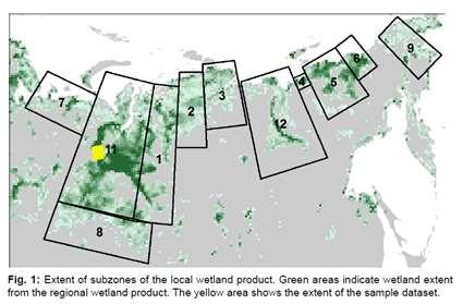
Pan-Arctic, Regional and Local Land Cover Products
 Pan-Arctic, Regional and Local Land Cover Products Marcel Urban (1), Stefan Pöcking (1), Sören Hese (1) & Christiane Schmullius (1) (1) Friedrich-Schiller University Jena, Department of Earth Observation,
C o p e r n i c u s L a n d M o n i t o r i n g S e r v i c e
 C o p e r n i c u s L a n d M o n i t o r i n g S e r v i c e Integration into existing Snow and Ice Services and draft product specifications Annett BARTSCH b.geos Copernicus High Resolution Snow and
Land Management and Natural Hazards Unit --- DESERT Action 1. Land Management and Natural Hazards Unit Institute for Environment and Sustainability
 Land Management and Natural Hazards Unit --- DESERT Action 1 Monitoring Drought with Meteorological and Remote Sensing Data A case study on the Horn of Africa Paulo Barbosa and Gustavo Naumann Land Management
ESA Status Report. ET-SAT-11, WMO, Geneva, CH, 4 April Prepared by Earth Observation Programmes Directorate
 ESA Status Report ET-SAT-11, WMO, Geneva, CH, 4 April 2017 Prepared by Earth Observation Programmes Directorate Presented by Ivan Petiteville, ESA, Earth Observation Programmes Issue/Revision: 0.0 Reference:
Using High-Resolution Airphotos for Assessing Landscape Change. Torre Jorgenson
 Using High-Resolution Airphotos for Assessing Landscape Change Torre Jorgenson It s All a Matter of Scale Landsat TM 28-m pixel Ikonos Fused 1-m pixel Digital Camera 0.2-m pixel Examples of Landscape
Global SWE Mapping by Combining Passive and Active Microwave Data: The GlobSnow Approach and CoReH 2 O
 Global SWE Mapping by Combining Passive and Active Microwave Data: The GlobSnow Approach and CoReH 2 O April 28, 2010 J. Pulliainen, J. Lemmetyinen, A. Kontu, M. Takala, K. Luojus, K. Rautiainen, A.N.
Soil frost from microwave data. Kimmo Rautiainen, Jouni Pulliainen, Juha Lemmetyinen, Jaakko Ikonen, Mika Aurela
 Soil frost from microwave data Kimmo Rautiainen, Jouni Pulliainen, Juha Lemmetyinen, Jaakko Ikonen, Mika Aurela Why landscape freeze/thaw? Latitudinal variation in mean correlations (r) between annual
Canadian Prairie Snow Cover Variability
 Canadian Prairie Snow Cover Variability Chris Derksen, Ross Brown, Murray MacKay, Anne Walker Climate Research Division Environment Canada Ongoing Activities: Snow Cover Variability and Links to Atmospheric
Pan-Arctic permafrost thermal conditions: Where does the Yamal Peninsula fit?
 Pan-Arctic permafrost thermal conditions: Where does the Yamal Peninsula fit? V. Romanovsky, A. Kholodov and S. Marchenko University of Alaska Fairbanks 1600 The Mammoth Steppe Concept: R. D. Guthrie,
 Permafrost http://www.cbc.ca/news/canada/story/2011/11/16/north-bigfix-permafrost.html 1. What is permafrost? Permafrost is a thick layer of permanently frozen ground. 2. Large parts of northeastern Russia
Pan-Arctic Land and Lake Surface Temperature from AATSR and MODIS: Products Development and Evaluation
 Pan-Arctic Land and Lake Surface Temperature from AATSR and MODIS: Products Development and Evaluation Homa Kheyrollah Pour Claude Duguay University of Waterloo 1 st Arctic Products Validation & Evolution
Observed State of the Global Climate
 WMO Observed State of the Global Climate Jerry Lengoasa WMO June 2013 WMO Observations of Changes of the physical state of the climate ESSENTIAL CLIMATE VARIABLES OCEANIC ATMOSPHERIC TERRESTRIAL Surface
Mass Wasting: The Work of Gravity
 Chapter 15 Lecture Earth: An Introduction to Physical Geology Twelfth Edition Mass Wasting: The Work of Gravity Tarbuck and Lutgens Chapter 15 Mass Wasting The Importance of Mass Wasting Slopes are the
Research highlights from permafrost research: Rock glacier mapping in the HKH region with Google Earth
 Research highlights from permafrost research: Rock glacier mapping in the HKH region with Google Earth M.-O. Schmid, P. Baral, S. Gruber, S. Shahi, T. Shrestha, D. Stumm, and P. Wester International Centre
Greening of Arctic: Knowledge and Uncertainties
 Greening of Arctic: Knowledge and Uncertainties Jiong Jia, Hesong Wang Chinese Academy of Science jiong@tea.ac.cn Howie Epstein Skip Walker Moscow, January 28, 2008 Global Warming and Its Impact IMPACTS
The use of earth observation technology to improve the characterization of ice and snow
 The use of earth observation technology to improve the characterization of ice and snow Swedish Meteorological and Hydrological Institute (SMHI) Outline: EO and ice/snow CryoLand North Hydrology EO in
Interferometric Synthetic Aperture Radar (InSAR) and GGOS. Andrea Donnellan NASA/JPL February 21, 2007
 and GGOS. Andrea Donnellan NASA/JPL February 21, 2007") Interferometric Synthetic Aperture Radar (InSAR) and GGOS Andrea Donnellan NASA/JPL February 21, 2007 Sources for Science Objectives Fourth component of EarthScope Involvement: NSF, NASA, USGS, Universities
Interferometric Synthetic Aperture Radar (InSAR) and GGOS Andrea Donnellan NASA/JPL February 21, 2007 Sources for Science Objectives Fourth component of EarthScope Involvement: NSF, NASA, USGS, Universities
Climate and cryosphere: What longterm obervations do modelers need? G. Krinner, LGGE/CNRS Grenoble
 Climate and cryosphere: What longterm obervations do modelers need? G. Krinner, LGGE/CNRS Grenoble Polar regions: High climate variability Projected timing of climate departure from recent variability,
The Great Ice Ages. Copyright abcteach.com 2001 Graphics from Art Today
 The Great Ice Ages The Great Ice Ages occurred during the Pleistocene epoch. The word epoch means time period. This period began about 2.5 million years ago and ended roughly 10,000 years ago. During the
EUMETSAT STATUS AND PLANS
 1 EUM/TSS/VWG/15/826793 07/10/2015 EUMETSAT STATUS AND PLANS François Montagner, Marine Applications Manager, EUMETSAT WMO Polar Space Task Group 5 5-7 October 2015, DLR, Oberpfaffenhofen PSTG Strategic
Floating Ice: Progress in Addressing Science Goals
 Polar Floating Ice: Progress in Addressing Science Goals Stephen Howell 1, Leif Toudal Pedersen 2 and Roberto Saldo 3 1 Environment Canada, Climate Research Division, Toronto, Canada 2 Danish Meteorological
ENVIRONMENTAL GEOSCIENCE UNIFORM SYLLABUS
 ENVIRONMENTAL GEOSCIENCE UNIFORM SYLLABUS The Association of Professional Engineers and Geoscientists of the Province of British Columbia Note: 1. This Syllabus May Be Subject To Change 2. These Courses
Infrastructure monitoring using SAR interferometry
 Infrastructure monitoring using SAR interferometry Hossein Nahavandchi Roghayeh Shamshiri Norwegian University of Science and Technology (NTNU), Department of Civil and Environmental Engineering Geodesy
Steve Colwell. British Antarctic Survey
 Global Climate Observing System (GCOS) Steve Colwell British Antarctic Survey Goal and Structure of GCOS The Goal of GCOS is to provide continuous, reliable, comprehensive data and information on the state
A projection of severe near-surface permafrost degradation during the 21st century
 GEOPHYSICAL RESEARCH LETTERS, VOL. 32, L24401, doi:10.1029/2005gl025080, 2005 A projection of severe near-surface permafrost degradation during the 21st century David M. Lawrence 1 and Andrew G. Slater
Dual-Frequency Ku- Band Radar Mission Concept for Snow Mass
 Dual-Frequency Ku- Band Radar Mission Concept for Snow Mass Chris Derksen Environment and Climate Change Canada Study Team: Climate Research Division/Meteorological Research Division, ECCC Canadian Space
Observations of surface dynamics with thermokarst initiation, Yukechi site, Central Yakutia
 Permafrost, Phillips, Springman & Arenson (eds) 2003 Swets & Zeitlinger, Lisse, ISBN 90 5809 582 7 Observations of surface dynamics with thermokarst initiation, Yukechi site, Central Yakutia A. Fedorov
Detecting Landscape Changes in High Latitude Environments Using Landsat Trend Analysis: 2. Classification
 1 Detecting Landscape Changes in High Latitude Environments Using Landsat Trend Analysis: 2. Classification Ian Olthof and Robert H. Fraser Canada Centre for Mapping and Earth Observation Natural Resources
Claude Duguay University of Waterloo
 Claude Duguay University of Waterloo with contributions from K. Kang and H. Kheyrollah Pour 2nd Annual EarthTemp Network Meeting Surface temperature in data-sparse and extreme regions 12-14 June 2013 Copenhagen,
Geography Class XI Fundamentals of Physical Geography Section A Total Periods : 140 Total Marks : 70. Periods Topic Subject Matter Geographical Skills
 Geography Class XI Fundamentals of Physical Geography Section A Total Periods : 140 Total Marks : 70 Sr. No. 01 Periods Topic Subject Matter Geographical Skills Nature and Scope Definition, nature, i)
European Space Agency
 Guidelines - Guidelines how/when to interact during the WebEx session: - Due to the number of attendees, please keep always your webcam and microphone switched-off - You can use anytime the chat to all
Observed changes in climate and their effects
 1 1.1 Observations of climate change Since the TAR, progress in understanding how climate is changing in space and time has been gained through improvements and extensions of numerous datasets and data
Using Earth Observation Data for Monitoring River Basins
 Using Earth Observation Data for Monitoring River Basins The NBI Experience By Milly Mbuliro GIS/ Remote Sensing Specialist Nile Basin Initiative Secretariat NBDF, 23 rd -25 th October, Kigali Convention
CLIMATE CHANGE AND REGIONAL HYDROLOGY ACROSS THE NORTHEAST US: Evidence of Changes, Model Projections, and Remote Sensing Approaches
 CLIMATE CHANGE AND REGIONAL HYDROLOGY ACROSS THE NORTHEAST US: Evidence of Changes, Model Projections, and Remote Sensing Approaches Michael A. Rawlins Dept of Geosciences University of Massachusetts OUTLINE
Experiences of using ECV datasets in ECMWF reanalyses including CCI applications. David Tan and colleagues ECMWF, Reading, UK
 Experiences of using ECV datasets in ECMWF reanalyses including CCI applications David Tan and colleagues ECMWF, Reading, UK Slide 1 Main points Experience shows benefit of integrated & iterative approach
By Charis Smith, Cassie Scruggs, Erol Chandler, & Shawna Fox Anderson
 By Charis Smith, Cassie Scruggs, Erol Chandler, & Shawna Fox Anderson What are the different types of ice? How was the ice identified? What can we draw from comparing Mars ice with the ice seen here on
Observing Snow: Conventional Measurements, Satellite and Airborne Remote Sensing. Chris Derksen Climate Research Division, ECCC
 Observing Snow: Conventional Measurements, Satellite and Airborne Remote Sensing Chris Derksen Climate Research Division, ECCC Outline Three Snow Lectures: 1. Why you should care about snow 2. How we measure
OBSERVATIONS OF PERMAFROST-LANDSCAPE DYNAMICS RELATED TO ANTHROPOGENIC DISTURBANCES, YUKECHI STUDY SITE, CENTRAL YAKUTIA
 OBSERVATIONS OF PERMAFROST-LANDSCAPE DYNAMICS RELATED TO ANTHROPOGENIC DISTURBANCES, YUKECHI STUDY SITE, CENTRAL YAKUTIA A.N. Fedorov, P.Ya. Konstantinov, I.S. Vassiliev, N.P. Bosikov, Ya.I. Torgovkin,
ZRCSAZU. Remote sensing and Earth observation data at ZRC SAZU. dr. Tatjana Veljanovski Atrij ZRC Ljubljana
 ZRCSAZU Remote sensing and Earth observation data at ZRC SAZU dr. Tatjana Veljanovski 2016-06-08 Atrij ZRC Ljubljana Remote Sensing Department Remote Sensing Department 20 years of experience application,
THE ACTION OF GLACIERS
 Surface processes THE ACTION OF GLACIERS Glaciers are enormous masses of ice which are formed due to accumulation, compaction and re-crystallisation of the snow deposited in very cold regions (the majority
CGMS Baseline. Sustained contributions to the Global Observing System. Endorsed by CGMS-46 in Bengaluru, June 2018
 CGMS Baseline Sustained contributions to the Global Observing System Best Practices for Achieving User Readiness for New Meteorological Satellites Endorsed by CGMS-46 in Bengaluru, June 2018 CGMS/DOC/18/1028862,
The elevations on the interior plateau generally vary between 300 and 650 meters with
 11 2. HYDROLOGICAL SETTING 2.1 Physical Features and Relief Labrador is bounded in the east by the Labrador Sea (Atlantic Ocean), in the west by the watershed divide, and in the south, for the most part,
Extent of Periglacial = Global Permafrost Permafrost: Soil and/or rock where temperatures remain below 0 degrees C for 2 or more years.
 Geog 1000 - Lecture 34 Periglacial Environments and Paleoclimatology http://scholar.ulethbridge.ca/chasmer/classes/ Today s Lecture (Pgs 422-434) 1. Exam questions from last week, and today 2. Extent of
Tandem-L: A Mission Proposal for Monitoring Dynamic Earth Processes
 Tandem-L: A Mission Proposal for Monitoring Dynamic Earth Processes A. Moreira, G. Krieger, M. Younis, I. Hajnsek, K. Papathanassiou, M. Eineder, P. Dekker, F. De Zan German Aerospace Center (DLR) Dynamic
THE USE OF MERIS SPECTROMETER DATA IN SEASONAL SNOW MAPPING
 THE USE OF MERIS SPECTROMETER DATA IN SEASONAL SNOW MAPPING Miia Eskelinen, Sari Metsämäki The Finnish Environment Institute Geoinformatics and Land use division P.O.Box 140, FI 00251 Helsinki, Finland
Periglacial processes, features & landscape development /4 Glacial Systems and landscapes
 Periglacial processes, features & landscape development 3.1.4.3/4 Glacial Systems and landscapes What you need to know Where periglacial landscapes are found and what their key characteristics are The
Climate Change Service
 Service Metadata for the Data Store Dick Dee, ECMWF C3S: data + expertise + operational Open and free access to climate data (observations, reanalyses, model predictions) Tools and best scientific practices
Satellite-based Lake Surface Temperature (LST) Homa Kheyrollah Pour Claude Duguay
 Homa Kheyrollah Pour Claude Duguay") Satellite-based Lake Surface Temperature (LST) Homa Kheyrollah Pour Claude Duguay Lakes in NWP models Interaction of the atmosphere and underlying layer is the most important issue in climate modeling
Satellite-based Lake Surface Temperature (LST) Homa Kheyrollah Pour Claude Duguay Lakes in NWP models Interaction of the atmosphere and underlying layer is the most important issue in climate modeling
Introduction to SMAP. ARSET Applied Remote Sensing Training. Jul. 20,
 National Aeronautics and Space Administration ARSET Applied Remote Sensing Training http://arset.gsfc.nasa.gov @NASAARSET Introduction to SMAP Jul. 20, 2016 www.nasa.gov Outline 1. Mission objectives 2.
The Earth Explorer Missions - Current Status
 EOQ N 66 July 2000 meteorology earthnet remote sensing solid earth future programmes Earth Observation Quarterly The Earth Explorer Missions - Current Status G. Mégie (1) and C.J. Readings (2) (1) Institut
Surface WAter Microwave Product Series [SWAMPS]
![Surface WAter Microwave Product Series [SWAMPS]](/thumbs/87/97403550.jpg "Surface WAter Microwave Product Series [SWAMPS]") Surface WAter Microwave Product Series [SWAMPS] Version 3.2 Release Date: May 01 2018 Contact Information: Kyle McDonald, Principal Investigator: kmcdonald2@ccny.cuny.edu Kat Jensen: kjensen@ccny.cuny.edu
Surface WAter Microwave Product Series [SWAMPS] Version 3.2 Release Date: May 01 2018 Contact Information: Kyle McDonald, Principal Investigator: kmcdonald2@ccny.cuny.edu Kat Jensen: kjensen@ccny.cuny.edu
MERIS and OSCAR: Online Services for Correcting Atmosphere in Radar
 National Aeronautics and Space Administration MERIS and OSCAR: Online Services for Correcting Atmosphere in Radar Eric Fielding and Evan Fishbein Jet Propulsion Laboratory, California Inst. of Tech. Zhenhong
Projects Funded in 2012
 Arctic Landscape Conservation Cooperative Advancing Science, Understanding Change. Projects Funded in 2012 The Big Picture In 2012, the Arctic LCC funded wholly, or in part, 16 projects and study planning
ECMWF. ECMWF Land Surface Analysis: Current status and developments. P. de Rosnay M. Drusch, K. Scipal, D. Vasiljevic G. Balsamo, J.
 Land Surface Analysis: Current status and developments P. de Rosnay M. Drusch, K. Scipal, D. Vasiljevic G. Balsamo, J. Muñoz Sabater 2 nd Workshop on Remote Sensing and Modeling of Surface Properties,
Director: Soroosh Sorooshian
 Director: Soroosh Sorooshian X. Gao B. Imam K. Hsu S. O Rourke D. Hohnbaum J. Li G.H. Park D. Braithwaite E. Pritchard B. Khakbaz W. Chu A. Behrangi Alex R. Sutlana Joey A. Zahraei Developing state-of-the-art
Permafrost Related Causes and. Consequences of the Sagavanirktok River Flooding in Spring 2015
 Permafrost-Related Causes and Consequences of the Sagavanirktok River Delta Flooding in Spring 2015 Permafrost Related Causes and Consequences of the Sagavanirktok River Flooding in Spring 2015 Yuri Shur
Product Guide: TerraSAR-X derived Cliff Top Retreat
 Product Guide: TerraSAR-X derived Cliff Top Retreat Stettner, Samuel 1), Bartsch, Annett 2),3), Widhalm, Barbara 2,3), Heim, Birgit 1), Günther, Frank 1), Morgenstern, Anne 1) 1) Alfred-Wegener-Institut,
Drought Monitoring with Hydrological Modelling
 st Joint EARS/JRC International Drought Workshop, Ljubljana,.-5. September 009 Drought Monitoring with Hydrological Modelling Stefan Niemeyer IES - Institute for Environment and Sustainability Ispra -
The known requirements for Arctic climate services
 The known requirements for Arctic climate services based on findings described in STT White paper 8/2015 Johanna Ekman / EC PHORS STT Regional drivers The Arctic region is home to almost four million people
Central Asia Regional Flash Flood Guidance System 4-6 October Hydrologic Research Center A Nonprofit, Public-Benefit Corporation
 http://www.hrcwater.org Central Asia Regional Flash Flood Guidance System 4-6 October 2016 Hydrologic Research Center A Nonprofit, Public-Benefit Corporation FFGS Snow Components Snow Accumulation and
Requirements Baseline Document
 ESA DUE Permafrost Requirements Baseline Document Vienna University of Technology Institute of Photogrammetry and Remote Sensing Gamma Remote Sensing and Consulting Department of Geography and Environmental
EUMETSAT SAF NETWORK. Lothar Schüller, EUMETSAT SAF Network Manager
 1 EUMETSAT SAF NETWORK Lothar Schüller, EUMETSAT SAF Network Manager EUMETSAT ground segment overview METEOSAT JASON-2 INITIAL JOINT POLAR SYSTEM METOP NOAA SATELLITES CONTROL AND DATA ACQUISITION FLIGHT
Satellite Remote Sensing of Permafrost and Seasonally Frozen Ground
 Satellite Remote Sensing of Permafrost and Seasonally Frozen Ground Claude R. Duguay 1, Tingjun Zhang 2, David W. Leverington 3, and Vladimir E. Romanovsky 1 Permafrost consists of ground materials that
GEOSC/METEO 597K Kevin Bowley Kaitlin Walsh
 GEOSC/METEO 597K Kevin Bowley Kaitlin Walsh Timeline of Satellites ERS-1 (1991-2000) NSCAT (1996) Envisat (2002) RADARSAT (2007) Seasat (1978) TOPEX/Poseidon (1992-2005) QuikSCAT (1999) Jason-2 (2008)
2 nd Asia CryoNet Workshop Current methods of measurement of the cryosphere in Asia consistency and issues
 2 nd Asia CryoNet Workshop Current methods of measurement of the cryosphere in Asia consistency and issues Dongqi Zhang, Cunde Xiao, Vladimir Aizen and Wolfgang Schöner Feb.5, 2016, Salekhard, Russia 1.
Tapped lakes as sediment traps in an Arctic delta
 Sediment Dynamics from the Summit to the Sea 407 (Proceedings of a symposium held in New Orleans, Louisiana, USA, 11 14 December 2014) (IAHS Publ. 367, 2014). Tapped lakes as sediment traps in an Arctic
Ice Observations on the Churchill River using Satellite Imagery
 CGU HS Committee on River Ice Processes and the Environment 15 th Workshop on River Ice St. John s, Newfoundland and Labrador, June 15-17, 2009 Ice Observations on the Churchill River using Satellite Imagery
The landforms of Svalbard
 The landforms of Svalbard Content Periglacial landforms -) ice-wedges -) rock glaciers -) pingos -) solifluction -) avalanches -) debris flows -) rock falls -) nivation -) aeolian landforms Glacial landforms
III. Publication III. c 2004 Authors
 III Publication III J-P. Kärnä, J. Pulliainen, K. Luojus, N. Patrikainen, M. Hallikainen, S. Metsämäki, and M. Huttunen. 2004. Mapping of snow covered area using combined SAR and optical data. In: Proceedings
Brita Horlings
 Knut Christianson Brita Horlings brita2@uw.edu https://courses.washington.edu/ess431/ Natural Occurrences of Ice: Distribution and environmental factors of seasonal snow, sea ice, glaciers and permafrost
Final User Workshop ESA Data User Element DUE Permafrost
 Final User Workshop ESA Data User Element DUE Permafrost February, 15 th - 17 th, 2012 Event Description The ESA Data User Element DUE Permafrost aims to establish a permafrost monitoring service based
Shrinking Thermokarst Ponds and Groundwater Dynamics in Discontinuous Permafrost near Council, Alaska
 PERMAFROST AND PERIGLACIAL PROCESSES Permafrost Periglac. Process. 14: 151 160 (2003) Published online in Wiley InterScience (www.interscience.wiley.com). DOI: 10.1002/ppp.451 Shrinking Thermokarst Ponds
Characterizing permafrost soil active layer dynamics and sensitivity to landscape spatial heterogeneity in Alaska
 Characterizing permafrost soil active layer dynamics and sensitivity to landscape spatial heterogeneity in Alaska Yonghong Yi 1 *, John S. Kimball 1, Richard Chen 2, Mahta Moghaddam 2, Rolf H. Reichle
Assimilation of Snow and Ice Data (Incomplete list)
") Assimilation of Snow and Ice Data (Incomplete list) Snow/ice Sea ice motion (sat): experimental, climate model Sea ice extent (sat): operational, U.S. Navy PIPs model; Canada; others? Sea ice concentration
Assimilation of Snow and Ice Data (Incomplete list) Snow/ice Sea ice motion (sat): experimental, climate model Sea ice extent (sat): operational, U.S. Navy PIPs model; Canada; others? Sea ice concentration
Assimilating terrestrial remote sensing data into carbon models: Some issues
 University of Oklahoma Oct. 22-24, 2007 Assimilating terrestrial remote sensing data into carbon models: Some issues Shunlin Liang Department of Geography University of Maryland at College Park, USA Sliang@geog.umd.edu,
NESDIS Global Automated Satellite Snow Product: Current Status and Planned Upgrades Peter Romanov
 NESDIS Global Automated Satellite Snow Product: Current Status and Planned Upgrades Peter Romanov NOAA-CREST, City University of New York (CUNY) Center for Satellite Applications and Research (STAR), NOAA/NESDIS
ADVANCEMENTS IN SNOW MONITORING
 Polar Space Task Group ADVANCEMENTS IN SNOW MONITORING Thomas Nagler, ENVEO IT GmbH, Innsbruck, Austria Outline Towards a pan-european Multi-sensor Snow Product SnowPEx Summary Upcoming activities SEOM
Climate Change Adaptation
 Climate Change Adaptation Adriána Hudecz, Technical University of Denmark ROADEX Final Seminar Rovaniemi, 25 April 2012 Climate Change Adaptation Outline: 1. Background/global climate change 2. Climate
International Arctic Research Center
 International Arctic Research Center IARC Project Reducing Uncertainty in Arctic Climate Change Prediction Distinguishing Natural and Anthropogenic Changes Testing Carbon Cycle Hydrologic Cycle Integration
DAMAGE DETECTION OF THE 2008 SICHUAN, CHINA EARTHQUAKE FROM ALOS OPTICAL IMAGES
 DAMAGE DETECTION OF THE 2008 SICHUAN, CHINA EARTHQUAKE FROM ALOS OPTICAL IMAGES Wen Liu, Fumio Yamazaki Department of Urban Environment Systems, Graduate School of Engineering, Chiba University, 1-33,
Terrestrial Climate Change Variables
 Terrestrial Climate Change Variables Content Terrestrial Climate Change Variables Surface Air Temperature Land Surface Temperature Sea Level Ice Level Aerosol Particles (acid rain) Terrestrial Climate
Sediment Deposition LET THE RIVER RUN T E A C H E R. Activity Overview. Activity at a Glance. Time Required. Level of Complexity.
 Activity at a Glance Grade: 6 9 Subject: Science Category: Physical Science, Earth Science Topic: Deposition, River Systems Time Required Two 45-minute periods Level of Complexity Medium Materials* TI-73