PERIGLACIAL PROCESSES & LANDFORMS
|
|
|
- Clemence McCoy
- 6 years ago
- Views:
Transcription
1 PERIGLACIAL PROCESSES & LANDFORMS Periglacial processes all non-glacial processes in cold climates average annual temperature between -15 C and 2 C fundamental controlling factors are intense frost action & ground surface free of snow cover for part of year Many periglacial features are related to permafrost Permafrost table: Effects of frost action & mass movements enhanced by inability of water released by thawing active layer to infiltrate permafrost Temperature fluctuations in permafrost to about m depth; zero annual amplitude minimum annual T -10 mean annual ground T C permafrost table maximum annual T level of zero annual amplitude Permafrost base of permafrost 1
 permafrost")
2 Slumping streambank underlain by permafrost, northern Brooks Range, Alaska Taliks: surface of ground active layer permafrost table (upper surface of permafrost) permafrost talik 2


3 Permafrost tends to mimic surface topography large river permafrost small lake large lake pf talik Effect of surface water on the distribution of permafrost taliks underlie water bodies Stream cutbank underlain by permafrost 3
 Because permafrost accumulation rates are in cm/yr, thick permafrost can be tens of thousands of years old Permafrost underlies 26% of the Earth s surface, in both continuous and")
4 Where annual temperature averages < 0 C, ground freezing during the winter goes deeper than summer thawing each year adds an increment & the permafrost grows until it is stopped by geothermal heat (~ 1 C/30 m decrease) Because permafrost accumulation rates are in cm/yr, thick permafrost can be tens of thousands of years old Permafrost underlies 26% of the Earth s surface, in both continuous and discontinuous (talik) types The southern limit of continuous permafrost Sporadic permafrost: 4


5 Periglacial zones are dominated by frost action & mass movement Frost action: formation of segregated ice talus slope, San Francisco Peaks, AZ alpine zone, Bighorn Mts., WY talus slope, Rocky Mountain N.P., CO 5


6 nivation hollows, Logan Pass Glacier National Park, MT southeastern Alaska avalanche scars, Cabinet Mts., MT Processes of Frost Action Frost wedging Frost heaving vertical displacement thrusting 6
 frost-push: Probably,")
 ice")
 frost cracking: needle")

7 Two hypotheses of explanation are i) frost-pull: ii) frost-push: Probably, both processes act together Surface form occurs as needle ice (piprake) ice crystals 1-3 cm long in unvegetated, loamy soils iii) frost cracking: needle ice, Nepal needle ice, n Sweden soil disturbed by needle ice, AZ needle ice, n Sweden 7

8 snow snakes, Snowy Mts., WY Two types of mass movements frost creep & solifluction dominate in cold regions Frost creep: Solifluction: gelifluction is a type when water is released from the active layer in summer, the permafrost prevents infiltration, & the saturated soils behave like viscous fluids, flowing on 1 slopes 8


9 Landforms associated with mass movements Solifluction lobes: central Alaska Blockfields: solifluction terraces, Glacier National Park, MT 9


10 Solifluction lobes on hillslopes in north-central Alaska Rock glaciers: Idaho 10


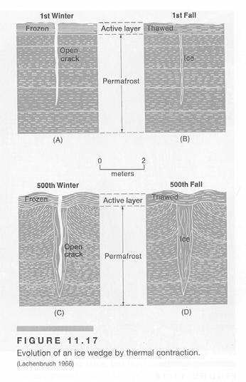
11 inactive rock glacier, Rawah Wilderness, CO mass movement/rock glacier, Indian Peaks, CO Other periglacial landforms Ice wedges & ice-wedge polygons ice wedges connect in polygonal pattern with diameters of meters to > 100 m; have some with ridges at boundary, others with troughs active ice wedges 11


12 Patterned ground in northern Alaska White Mountains, AZ 12

13 Hummocky terrain in northern Alaska Greenland 13


14 Pingos closed-system pingos open-system pingos pingos grow at 5 cm to > 1 m/yr pingos in the delta of the Mackenzie River, Canada 14


15 pingo on the coastal plain near Kotzebue, Alaska Thermokarst features ground ice is destroyed Thermokarst ponds on coastal plain near Kotzebue, Alaska 15

16 Patterned ground arrangement of surface materials into geometric shapes like polygons, circles, & stripes polygons: circles: stripes: polygons, n Sweden 16


17 Snowy Mts., WY central Alaska relict patterned ground, Trail Ridge, CO central Alaska Mount Katahdin, Maine 17


18 patterned ground on the coastal plain near Kotzebue, Alaska patterned ground, sw Brooks Range, Alaska 18


19 vegetation outlining patterned ground, sw Brooks Range, Alaska Patterned ground: pattern changes as slope increases from polygons through nets or steps into stripes origin; Permafrost presents special engineering difficulties 19


20 leaning high rise in Hay River, Canada Hay River, Canada utilidors, Inuvik, Canada bank erosion exposing permafrost, Mackenzie River delta, Canada 20
Periglacial Geomorphology
 Periglacial Geomorphology Periglacial Geomorphology Periglacial: literally means around glacial - term introduced in 1909 to describe landforms and processes around glaciated areas. Periglacial environments:
The landforms of Svalbard
 The landforms of Svalbard Content Periglacial landforms -) ice-wedges -) rock glaciers -) pingos -) solifluction -) avalanches -) debris flows -) rock falls -) nivation -) aeolian landforms Glacial landforms
Periglacial processes, features & landscape development /4 Glacial Systems and landscapes
 Periglacial processes, features & landscape development 3.1.4.3/4 Glacial Systems and landscapes What you need to know Where periglacial landscapes are found and what their key characteristics are The
Match up the pictures and key terms
 Match up the pictures and key terms 1 Plucking Striations 3 Roche Mountonnees 2 Chatter Marks 4 What is the difference between plucking and abrasion? Glacial Processes Erosion, Weathering and Deposition
Lecture 10 Glaciers and glaciation
 Lecture 10 Glaciers and glaciation Outline Importance of ice to people! Basics of glaciers formation, classification, mechanisms of movement Glacial landscapes erosion and deposition by glaciers and the
Extent of Periglacial = Global Permafrost Permafrost: Soil and/or rock where temperatures remain below 0 degrees C for 2 or more years.
 Geog 1000 - Lecture 34 Periglacial Environments and Paleoclimatology http://scholar.ulethbridge.ca/chasmer/classes/ Today s Lecture (Pgs 422-434) 1. Exam questions from last week, and today 2. Extent of
Glaciers form wherever snow and ice can accumulate High latitudes High mountains at low latitudes Ice temperatures vary among glaciers Warm
 The Cryosphere Glaciers form wherever snow and ice can accumulate High latitudes High mountains at low latitudes Ice temperatures vary among glaciers Warm (temperate) glaciers: at pressure melting point,
Evidence for Permafrost on Long Island
 Evidence for Permafrost on Long Island By Vesna Kundic and Gilbert N. Hanson Department of Geosciences Stony Brook University Permafrost or permanently frozen ground is soil or rock that remains below
Permafrost-influenced Geomorphic Processes
 Section 4 Permafrost-influenced Geomorphic Processes Geomorphic processes vary greatly among ecoregions in northern Alaska, extending from the Beaufort Sea coast to the Brooks Range (Figure 4.1). Regional
Preliminaries to Erosion: Weathering and Mass Wasting
 Preliminaries to Erosion: Weathering & Mass Wasting All things deteriorate in time. Virgil 1 Preliminaries to Erosion: Weathering and Mass Wasting Denudation The Impact of Weathering and Mass Wasting on
Test 2. Field Trips. BRING LUNCH & drink. Bathrooms few & far between. In lieu of lab on 24th and 26 th March
 Test 2 Part 1 will be returned today Part 2 grade on paper in Blue. Will be returned Thursday Add 1 point to score on test Distribution 14 As, 16 Bs, 7 Cs, 1 other Field Trips BRING LUNCH & drink. Bathrooms
Glacial processes and landforms NGEA01, 2014
 Glacial processes and landforms NGEA01, 2014 Cecilia Akselsson Department of Physical Geography and Ecosystem Science Lund University Geomorphological processes and landforms all over the world Periglacial
Mass Wasting: The Work of Gravity
 Chapter 15 Lecture Earth: An Introduction to Physical Geology Twelfth Edition Mass Wasting: The Work of Gravity Tarbuck and Lutgens Chapter 15 Mass Wasting The Importance of Mass Wasting Slopes are the
Some Periglacial Morphology in the Sagarmatha. (Everest) Region, Khumbu Himal*
 Region, Khumbu Himal*") Seppyo, 1976 S. Iwata 115 Some Periglacial Morphology in the Sagarmatha (Everest) Region, Khumbu Himal* Shuji Iwata** Abstract The periglacial morphology in the Sagarmatha region, Khumbu Himal, was surveyed
Seppyo, 1976 S. Iwata 115 Some Periglacial Morphology in the Sagarmatha (Everest) Region, Khumbu Himal* Shuji Iwata** Abstract The periglacial morphology in the Sagarmatha region, Khumbu Himal, was surveyed
Essential Questions. What is erosion? What is mass wasting?
 Erosion Essential Questions What is erosion? What is mass wasting? What is Erosion? Erosion The transportation of sediment from one area to another Caused mainly by running water but also caused by glaciers,
ACTIVE LAYER MONITORING IN NORTHERN WEST SIBERIA
 ACTIVE LAYER MONITORING IN NORTHERN WEST SIBERIA A. V. Pavlov Earth Cryosphere Institute, B RAS 142452, Zeleny-village, 5-67, Noginsk district, Moscow region, Russia e-mail: emelnikov@glas.apc.org Abstract
The Importance of Mass Wasting
 Mass Wasting: The Work of Gravity Earth Chapter 15 Chapter 15 Mass Wasting The Importance of Mass Wasting Slopes are the most common elements in our physical landscape Slopes may appear to be stable, but
EARTH S CHANGING SURFACE
 EARTH S CHANGING SURFACE Weathering Together, weathering and erosion work continuously to wear down the material on Earth s surface. weathering process that breaks down rock and other substances of Earth
REMOTE SENSING OF PERMAFROST IN NORTHERN ENVIRONMENTS
 REMOTE SENSING OF PERMAFROST IN NORTHERN ENVIRONMENTS What is permafrost? What can we monitor with satellite data? Permafrost is an Essential Climate Variable About 25 % of the land surface is underlain
Class Notes: Surface Processes
 Name: Date: Period: Surface Processes The Physical Setting: Earth Science Class Notes: Surface Processes I. Weathering and Soils Weathering -! Sediments -! Weathering occurs when rocks are exposed to:
Using High-Resolution Airphotos for Assessing Landscape Change. Torre Jorgenson
 Using High-Resolution Airphotos for Assessing Landscape Change Torre Jorgenson It s All a Matter of Scale Landsat TM 28-m pixel Ikonos Fused 1-m pixel Digital Camera 0.2-m pixel Examples of Landscape
Topic 2: Landscape Systems, Processes and Change
 Topic 2: Landscape Systems, Processes and Change Option 2A: Glaciated Landscapes and Change Overview Ice sheets and glaciers operate within a landscape system as glacial processes of erosion, transport
PHYSICAL GEOGRAPHY. By Brett Lucas
 PHYSICAL GEOGRAPHY By Brett Lucas WEATHERING & MASS WASTING Denudation Disintegration, wearing away, and removal of rock material Involves three activities: Weathering is the break down of rocks into smaller
Geog 1000 Lecture 17: Chapter 10
 Geog 1000 Lecture 17: Chapter 10 Landslides and Mass Movements Link to lectures: http://scholar.ulethbridge.ca/chasmer/classes/ Today s Lecture 1. Assignment 2 Due Pick up Assignment 1 if you don t have
SVALBARD. Environmental changes in Svalbard since the last glacial maximum THE ROLE OF PERMAFROST
 SVALBARD Environmental changes in Svalbard since the last glacial maximum THE ROLE OF PERMAFROST Bernd Etzelmüller, Oslo, Norway With contribution by Hanne H. Christiansen, UNIS, Svalbard Discussion points
Glacial Modification of Terrain
 Glacial Modification Part I Stupendous glaciers and crystal snowflakes -- every form of animate or inanimate existence leaves its impress upon the soul of man. 1 -Orison Swett Marden Glacial Modification
3 Erosion and Deposition by Ice
 CHAPTER 12 3 Erosion and Deposition by Ice SECTION Agents of Erosion and Deposition BEFORE YOU READ After you read this section, you should be able to answer these questions: What are glaciers? How do
What do you think? Should the development of cold environments continue? Is there a better way?
 What do you think? Should the development of cold environments continue? Is there a better way? What is the future for the development of cold environments? d) With reference to one or more examples, Outline
( Your responses must be complete, using terminology and concepts.
 Running head: ARTICLE SUMMARY 1 Question Topic: Summary of information about website http://www.tulane.edu/~sanelson/geol204/masswastproc.htm Pages: 3 Sources: 4 Format: APA Deadline: 24 hours Instructions:
Amazing Ice: Glaciers and Ice Ages
 Amazing Ice: Glaciers and Ice Ages Updated by: Rick Oches, Professor of Geology & Environmental Sciences Bentley University Waltham, Massachusetts Based on slides prepared by: Ronald L. Parker, Senior
Introduction: What is Mass Wasting? (1)
") Mass Wasting Introduction: What is Mass Wasting? (1) Mass wasting is the downslope movement of regolith and masses of rock under the pull of gravity. Mass wasting is a basic part of the rock cycle. Weathering,
Mass Wasting Introduction: What is Mass Wasting? (1) Mass wasting is the downslope movement of regolith and masses of rock under the pull of gravity. Mass wasting is a basic part of the rock cycle. Weathering,
WEATHERING, EROSION & DEPOSITION STUDY GUIDE
 WEATHERING, EROSION & DEPOSITION STUDY GUIDE Weathering: The difference between mechanical & chemical weathering is: Sort terms as being mechanical/physical or chemical weathering: acid rain, root splitting
Permafrost, Icy Soils & Landscapes, and Patterned Ground. By Bernard Hallet Quaternary Research Center - Dept. of Earth & Space Sciences
 Permafrost, Icy Soils & Landscapes, and Patterned Ground By Bernard Hallet Quaternary Research Center - Dept. of Earth & Space Sciences Patterns in Nature Patterns in nature can be aesthetically striking
Weathering, Erosion and Deposition
 Weathering, Erosion and Deposition Shaping the Earth s Surface Weathering the process of breaking down rocks into smaller fragments Erosion the transport of rock fragments from one location to another
AN ASSESSMENT OF GROUND ICE VOLUME NEAR EUREKA, NORTHWEST TERRITORIES
 AN ASSESSMENT OF GROUND ICE VOLUME NEAR EUREKA, NORTHWEST TERRITORIES Nicole J. Couture, Wayne H. Pollard Department of Geography McGill University 805 Sherbrooke St. W. Montreal, Quebec H3A 2K6 e-mail:
mountain rivers fixed channel boundaries (bedrock banks and bed) high transport capacity low storage input output
 high transport capacity low storage input output") mountain rivers fixed channel boundaries (bedrock banks and bed) high transport capacity low storage input output strong interaction between streams & hillslopes Sediment Budgets for Mountain Rivers Little
mountain rivers fixed channel boundaries (bedrock banks and bed) high transport capacity low storage input output strong interaction between streams & hillslopes Sediment Budgets for Mountain Rivers Little
EQ: Discuss main geographic landforms of the U.S. & Canada and examine varied landforms in relation to their lifestyles.
 EQ: Discuss main geographic landforms of the U.S. & Canada and examine varied landforms in relation to their lifestyles. Places & Terms for Discussion Appalachian Mountains Great Plains Canadian Shield
Mass Wasting. Revisit: Erosion, Transportation, and Deposition
 Mass Wasting Revisit: Erosion, Transportation, and Deposition While landslides are a normal part of erosion and surface processes, they can be very destructive to life and property! - Mass wasting: downslope
About the present study
 About the present study This study presents results obtained under the project Models of contemporary Periglacial Morphogenesis a first stage of Bulgarian Periglacial Programme a programme for observation
Social Studies. Chapter 2 Canada s Physical Landscape
 Social Studies Chapter 2 Canada s Physical Landscape Introduction Canada s geography its landforms and climate - has a great impact on Canadians sense of identity. Planet Earth The earth is divided into
Weathering, Erosion, Deposition
 Weathering, Erosion, Deposition The breakdown of rocks at or near the Earth s Surface. Physical Chemical - The breakdown of rock into smaller pieces without chemical change. - Dominant in moist /cold conditions
Weathering, Erosion, and Deposition Guided Notes
 1. Weathering, Erosion, and Deposition 2. Outline Section 1: Weathering Section 2: Erosion Section 3: Deposition Section 4: Case Study Weathering, Erosion, and Deposition Guided Notes 3. Section 1: Weathering
Sensitivity and responses to climate change in the Subantarctic periglacial environment
 Sensitivity and responses to climate change in the Subantarctic periglacial environment Permafrost, Phillips, Springman & Arenson (eds) Swets & Zeitlinger, Lisse, ISBN 9 589 58 7 J. Boelhouwers Department
Glaciers. (Shaping Earth s Surface, Part 6) Science 330 Summer 2005
 Science 330 Summer 2005") Glaciers (Shaping Earth s Surface, Part 6) Science 330 Summer 2005 1 Glaciers Glaciers are parts of two basic cycles Hydrologic cycle Rock cycle Glacier a thick mass of ice that originates on land from
Glaciers (Shaping Earth s Surface, Part 6) Science 330 Summer 2005 1 Glaciers Glaciers are parts of two basic cycles Hydrologic cycle Rock cycle Glacier a thick mass of ice that originates on land from
Mass Wasting. 3 Types of Mass Wasting
 Mass Wasting 3 Types of Mass Wasting Unless otherwise noted the artwork and photographs in this slide show are original and by Burt Carter. Permission is granted to use them for non-commercial, non-profit
2/23/2009. Visualizing Earth Science. Chapter Overview. Deserts and Drylands. Glaciers and Ice Sheets
 Visualizing Earth Science By Z. Merali and B. F. Skinner Chapter 6 Deserts, Glaciers and Ice Sheets Chapter Overview Deserts and Drylands Glaciers and Ice Sheets Deserts Geography Categorization of deserts
Unit 7.2 W.E.D. & Topography Test
 Name: Score: Unit 7.2 W.E.D. & Topography Test 1. 2. 3. 4. 5. 6. 7. 8. 9. 10. 11. 12. 13. 14. 15. 16. 17. 18. 19. 20. 21. 22. 23. 24. 25. 1. The formation of mountains is due mainly to while the destruction
38 Antarctic Dry Valleys:
 38 Antarctic Dry Valleys: 1. The Antarctic environment and the Antarctic Dry Valleys. 2. Cold-based glaciers and their contrast with wet-based glaciers. 3. Microclimate zones in the Antarctic Dry Valleys
How do glaciers form?
 Glaciers What is a Glacier? A large mass of moving ice that exists year round is called a glacier. Glaciers are formed when snowfall exceeds snow melt year after year Snow and ice remain on the ground
What is a Glacier? Types of Glaciers
 Alpine & Continental Glaciers Glacial Mass Balance Glacial Ice Formation Glacial Movement & Erosion Erosional and Depositional Landforms The Pleistocene Epoch Geomorphology of SW Manitoba Chapter 17 1
Glaciers Earth 9th Edition Chapter 18 Glaciers: summary in haiku form Key Concepts Glaciers Glaciers Glaciers Glaciers
 1 2 3 4 5 6 7 8 9 10 11 12 13 14 Earth 9 th Edition Chapter 18 : summary in haiku form Ten thousand years thence big glaciers began to melt - called "global warming." Key Concepts and types of glaciers.
Chapter 2. Wearing Down Landforms: Rivers and Ice. Physical Weathering
 Chapter 2 Wearing Down Landforms: Rivers and Ice Physical Weathering Weathering vs. Erosion Weathering is the breakdown of rock and minerals. Erosion is a two fold process that starts with 1) breakdown
OBSERVATIONS OF PERMAFROST-LANDSCAPE DYNAMICS RELATED TO ANTHROPOGENIC DISTURBANCES, YUKECHI STUDY SITE, CENTRAL YAKUTIA
 OBSERVATIONS OF PERMAFROST-LANDSCAPE DYNAMICS RELATED TO ANTHROPOGENIC DISTURBANCES, YUKECHI STUDY SITE, CENTRAL YAKUTIA A.N. Fedorov, P.Ya. Konstantinov, I.S. Vassiliev, N.P. Bosikov, Ya.I. Torgovkin,
Chapter 2. Denudation: Rivers and Ice
 Chapter 2. Denudation: Rivers and Ice DENUDATION: process that lowers level of land - caused by rivers, glaciers, waves & wind - involves processes of WEATHERING & EROSION Weathering Def: breakdown of
Erosion and Deposition
 Erosion and Deposition Erosion Sediment natural forces move rock/soil from one place to another. gravity, water, wind, glaciers, waves are causes material moved by erosion Deposition when erosion lays
A Geological Tour of Tumbledown Mountain, Maine
 Maine Geologic Facts and Localities April, 1998 A Geological Tour of Tumbledown Mountain, Maine 44 45 3.21 N, 70 32 50.24 W Text by Robert G. Marvinney, Department of Agriculture, Conservation & Forestry
Global Level GIS. Geocryological Map of the USSR, 1: , 1991
 Geocryological Map of the USSR, 1: 2 500 000, 1991 (Editor E.D.Ershov, Moscow State University, Faculty of Geology, Geocryological department) Global Level GIS Compiled for almost 20 years; Based on modeling
Chapter 3 Erosion and Deposition. The Big Question:
 Chapter 3 Erosion and Deposition The Big Question: 1 Design a way to represent and describe the 4 types of mass movement. You may use pictures, diagrams, list, web, chart, etc 2 Chapter 3: Erosion and
MASS MOVEMENTS, WIND, AND GLACIERS
 Date Period Name MASS MOVEMENTS, WIND, AND GLACIERS SECTION.1 Mass Movements In your textbook, read about mass movements. Use each of the terms below just once to complete the passage. avalanche creep
1. Which type of climate has the greatest amount of rock weathering caused by frost action? A) a wet climate in which temperatures remain below
 a wet climate in which temperatures remain below") 1. Which type of climate has the greatest amount of rock weathering caused by frost action? A) a wet climate in which temperatures remain below freezing B) a wet climate in which temperatures alternate
1. Which type of climate has the greatest amount of rock weathering caused by frost action? A) a wet climate in which temperatures remain below freezing B) a wet climate in which temperatures alternate
Weathering & Erosion
 Name Test Date Hour Earth Processes#1 - Notebook Weathering & Erosion LEARNING TARGETS I can explain the process of weathering. I can explain why weathering is important. I can describe the difference
Chapter 12 Weathering and Erosion
 Chapter 12 Weathering and Erosion Multiple Choice Select the definition that most nearly defines the given word. 1. Landform A. chemical combination of metallic elements with oxygen B. layer of weathered
Weathering, Erosion, Deposition, and Landscape Development
 Weathering, Erosion, Deposition, and Landscape Development I. Weathering - the breakdown of rocks into smaller particles, also called sediments, by natural processes. Weathering is further divided into
Surface Processes on the Earth. Rocks, Weathering, Erosion and Soil
 Surface Processes on the Earth Rocks, Weathering, Erosion and Soil ROCKS AND ROCK CYCLE Rock types Three main types of rock Igneous Metamorphic Sedimentary Igneous Form when magma or lava cools and hardens
Topic 6: Weathering, Erosion and Erosional-Deposition Systems (workbook p ) Workbook Chapter 4, 5 WEATHERING
 Workbook Chapter 4, 5 WEATHERING") Topic 6: Weathering, Erosion and Erosional-Deposition Systems (workbook p. 95-125) Workbook Chapter 4, 5 THE BIG PICTURE: Weathering, erosion and deposition are processes that cause changes to rock material
Topic 6: Weathering, Erosion and Erosional-Deposition Systems (workbook p. 95-125) Workbook Chapter 4, 5 THE BIG PICTURE: Weathering, erosion and deposition are processes that cause changes to rock material
Chapter 1 Section 2. Land, Water, and Climate
 Chapter 1 Section 2 Land, Water, and Climate Vocabulary 1. Landforms- natural features of the Earth s land surface 2. Elevation- height above sea level 3. Relief- changes in height 4. Core- most inner
BCS 311: Land and Environments of the Circumpolar World I Module 4: Northern Landscapes
 BCS 311: Land and Environments of the Circumpolar World I Module 4: Northern Landscapes Developed by Alec Aitken Department of Geography & Planning University of Saskatchewan Saskatoon, Saskatchewan, Canada
Study guide for GEOL 454 Final Exam
 Study guide for GEOL 454 Final Exam KARST Requirements for karst topography: Carbonates (limestone, dolomite) Groundwater Groundwater terms you should understand zone of aeration (vadose zone) capillary
GEOG 1010A. Come to the PASS workshop with your mock exam complete. During the workshop you can work with other students to review your work.
 It is most beneficial to you to write this mock midterm UNDER EXAM CONDITIONS. This means: Complete the midterm in 1.5 hours. Work on your own. Keep your notes and textbook closed. Attempt every question.
Day 3 Weathering and Erosion.notebook. October 02, Section 7.2. Erosion and Deposition. Objectives
 Objectives Describe the relationship of gravity to all agents of erosion. Contrast the features left from different types of erosion. Analyze the impact of living and nonliving things on the processes
Bell Ringer. Are soil and dirt the same material? In your explanation be sure to talk about plants.
 Bell Ringer Are soil and dirt the same material? In your explanation be sure to talk about plants. 5.3 Mass Movements Triggers of Mass Movements The transfer of rock and soil downslope due to gravity is
Earth s Dynamic Surface
 Earth s Dynamic Surface Key Concepts What is the difference between physical and chemical weathering? How do water, ice, and wind change Earth s surface? Changing Earth s Surface What do you think? Read
Fate of permafrost in Denali National Park and Preserve - A modeling investigation
 Photo credit: Jacob W Frank Fate of permafrost in Denali National Park and Preserve - A modeling investigation Santosh K Panda, Sergey S Marchenko, Vladimir E Romanovsky Permafrost Laboratory, Geophysical
PREDICTION OF FROST HEAVE INDUCED DEFORMATION OF DYKE KA-7 IN NORTHERN QUEBEC
 PREDICTION OF FROST HEAVE INDUCED DEFORMATION OF DYKE KA-7 IN NORTHERN QUEBEC J.-M. Konrad 1, M. Shen 1, R. Ladet 2 1. Dept. of Civil Engineering UniversitŽ Laval,QuŽbec, Canada, G1K 7P4 2. Hydro-QuŽbec,
CONTENTS. 3 Large-scale topography 26 Ocean basins: the marriage of conduction and isostasy 28 Plate tectonics overview 36
 CONTENTS Preface Acknowledgements page xi xv 1 Introduction to the study of surface processes 2 The global context 4 Overview of geomorphology 5 Guiding principles 6 Conservation 6 Transport rules 7 Event
Tapped lakes as sediment traps in an Arctic delta
 Sediment Dynamics from the Summit to the Sea 407 (Proceedings of a symposium held in New Orleans, Louisiana, USA, 11 14 December 2014) (IAHS Publ. 367, 2014). Tapped lakes as sediment traps in an Arctic
What factors affect the angle of a slope?
 Climate Rock type and Structure What factors affect the angle of a slope? Aspect Fast mass movements Slides: Slides are movements along the SLIP PLANE, i.e. a line of weakness in the rock or soil structure.
Mass Wasting and Landscape Evolution
 Mass Wasting and Landscape Evolution 11-8-06 Uplift is a tectonic process Three types of uplift: 1. Collisional uplift 2. isostatic uplift 3. Extensional uplif. A physical experiment in isostasy: [crust
Mass Movements, Wind, and Glaciers
 Mass Movements,, and Glaciers SECTION 8.1 Mass Movement at Earth s Surface In your textbook, read about mass movement. Use each of the terms below just once to complete the passage. avalanche creep landslide
Page 1. Name:
 Name: 1) Which property would best distinguish sediment deposited by a river from sediment deposited by a glacier? thickness of sediment layers age of fossils found in the sediment mineral composition
Analyzing our Topic IF SO, MAKE THE CHANGES AND BE READY TO REPORT OUT!
 Analyzing our Topic Look at the opening slide. Does anything there (words, pictures) make you want to change your thoughts from the smarties and chalk activities? IF SO, MAKE THE CHANGES AND BE READY TO
Finite element modelling of the creep behaviour of a small glacier under low stresses F. Azizi," S. Jim^ & W.B. Whalley"
 Finite element modelling of the creep behaviour of a small glacier under low stresses F. Azizi," S. Jim^ & W.B. Whalley" o/ o/ ABSTRACT Knowledge of the creep properties of ice or ice-rich materials is
The Cassiar Mountains
 The Cassiar Mountains Introduction Topography Dease Plateau Dease Lake, BC Stikine Ranges Eve Cone Mount Edziza Provincial Park Mount Ash, BC 2 125m Ketchika Ranges Muskwa- Ketchika Management Area Sifton
Read Across America. Listen as I read for facts about Volcanoes. In the Shadow of the Volcano
 Read Across America Listen as I read for facts about Volcanoes. In the Shadow of the Volcano Constructive & Destructive Processes Earth s surface is always changing. Blowing wind and flowing water causes
Permafrost: Earth Observation Applications: Introduction
 Polar Meeting 3 Permafrost: Earth Observation Applications: Introduction Mark Drinkwater CNES, Paris, 22 23 May, 2013 Remote Sensing of Permafrost which Remote Sensing products? applicability to Permafrost
Glacial Systems and Landscapes
 AQA Geography A-level Glacial Systems and Landscapes PMT Education Written by Jeevan Singh Glacial Systems and Landscapes Factors of Climate Change Glacial landscapes have a low level of resilience; they
1. Any process that causes rock to crack or break into pieces is called physical weathering. Initial product = final product
 Weathering 1. Any process that causes rock to crack or break into pieces is called physical weathering. Initial product = final product End Result of physical weathering is increased surface area. 2. Physical
Waterbury Dam Disturbance Mike Fitzgerald Devin Rowland
 Waterbury Dam Disturbance Mike Fitzgerald Devin Rowland Abstract The Waterbury Dam was completed in October 1938 as a method of flood control in the Winooski Valley. The construction began in April1935
Be able to understand the processes which occurred during the last ice age.
 Glaciation Learning Intentions Be able to understand the processes which occurred during the last ice age. Be able to describe and explain the formation of features formed during glacial periods. 1 Water
Surface Events & Landforms. Mrs. Green
 Surface Events & Landforms Mrs. Green Bell Work 1) Which event MOST likely causes the slowest change to the surface of Earth? a) Earthquake b) Landslide c) Volcano d) Wind 2) When cold weather freezes
Landscape. Review Note Cards
 Landscape Review Note Cards Last Ice Age Pleistocene Epoch that occurred about 22,000 Years ago Glacier A large, long lasting mass of ice which forms on land and moves downhill because of gravity. Continental
PHYSICAL GEOGRAPHY. By Brett Lucas
 PHYSICAL GEOGRAPHY By Brett Lucas GLACIAL PROCESSES Glacial Processes The Impact of Glaciers on the Landscape Glaciations Past and Present Types of Glaciers Glacier Formation and Movement The Effects of
Changes to Land 5.7B. landforms: features on the surface of Earth such as mountains, hills, dunes, oceans and rivers
 All the landforms on Earth have changed over time and continue to change. Many of the changes were caused by wind, moving water, and moving ice. Mountains have grown and shrunk. Rivers have cut away land
Changing Earth s Surface
 Name Date Class Changing Earth s Surface What processes wear down and build up Earth s surface? What causes the different types of mass movement? Erosion is the process by which natural forces move weathered
Permafrost & climate change in northern Finland Dr Steve Gurney
 Permafrost & climate change in northern Finland Dr Steve Gurney Senior Lecturer in Geomorphology University of Reading, UK Docent in cold climate geomorphology University of Turku, Finland Topics Introduction
Think about the landforms where you live. How do you think they have changed over time? How do you think they will change in the future?
 reflect All the landforms on Earth have changed over time and continue to change. Many of the changes were caused by wind, moving water, and moving ice. Mountains have grown and shrunk. Rivers have cut
1. The map below shows a meandering river. A A' is the location of a cross section. The arrows show the direction of the river flow.
 1. The map below shows a meandering river. A A' is the location of a cross section. The arrows show the direction of the river flow. Which cross section best represents the shape of the river bottom at
Landscape evolution. An Anthropic landscape is the landscape modified by humans for their activities and life
 Landforms Landscape evolution A Natural landscape is the original landscape that exists before it is acted upon by human culture. An Anthropic landscape is the landscape modified by humans for their activities
Final Report. March
 Inuvik to Tuktoyaktuk Highway - Baseline Data Acquisition Program Final Report Prepared for: Government of the Northwest Territories Department of Transportation Yellowknife, NT Prepared by: KAVIK-STANTEC
Weathering and Erosion
 Weathering and Erosion OBJECTIVE: Explain how erosion and deposition shape Earth s surface by matching and using models How do erosion and deposition shape Earth s surface? Deposition Formation Transported