GIS at the Midwestern Regional Climate Center: A peek behind the curtain. Zoe Zaloudek, Geospatial Application Developer
|
|
|
- Dortha Bennett
- 5 years ago
- Views:
Transcription


1 GIS at the Midwestern Regional Climate Center: A peek behind the curtain Zoe Zaloudek, Geospatial Application Developer CPASW, May 2018

2 What is the MRCC?


3 GIS-based Maps and Products Regional Mesonet Program (static) 1x / day Vegetation Impact Program (static & interactive) Station Data 3x / day Advisory Status every ½ hour Accumulated Winter Season Severity Index (interactive) Every hour on the :20 Bi-National Precipitation (interactive) 1x / day
4 Start Python Script Time and recurrence depends on product Overall Process

 Direct")
5 Overall Process Start Python Script Time and recurrence depends on product Get Input Data Custom CSV / TXT Web Services (ACIS) Direct Download (NWS)
6 Make GIS Data Feature (point/polygon) Raster (grid) Overall Process
7 Overall Process Make GIS Data Feature (point/polygon) Raster (grid) Create Static Maps

 Create Static Maps")
8 Overall Process Make GIS Data Feature (point/polygon) Raster (grid) Create Static Maps Copy to GIS Server

9 Regional Mesonet Program

10 Gather Input Data Regional Mesonet Program
11 Create Points Regional Mesonet Program

12 Create Buffers Regional Mesonet Program

13 Create Rasters Regional Mesonet Program


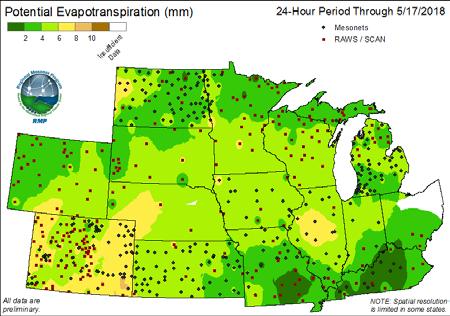
14 Create Static Maps Regional Mesonet Program

15 Regional Mesonet Program

16 Vegetation Impact Program

17 Vegetation Impact Program

18 Gather Input Data Vegetation Impact Program

19 Create Points Vegetation Impact Program
20 Create Thiessen Polygons Vegetation Impact Program
21 Create Rasters Vegetation Impact Program

22 Create Static Maps / Copy to GIS Server Vegetation Impact Program

23 Vegetation Impact Program

24 Vegetation Impact Program
25 Vegetation Impact Program

26 Vegetation Impact Program
27 Vegetation Impact Program

28 Gather Input Data Vegetation Impact Program
29 Update Polygons Vegetation Impact Program
30 Create Static Maps / Copy to GIS Server Vegetation Impact Program

31 Vegetation Impact Program

32 Vegetation Impact Program
33 Accumulated Winter Season Severity Index

34 Gather Input Data Accumulated Winter Season Severity Index
35 Update Points Accumulated Winter Season Severity Index
36 Copy to GIS Server Accumulated Winter Season Severity Index

37 Accumulated Winter Season Severity Index

38 Accumulated Winter Season Severity Index
39 Accumulated Winter Season Severity Index


40 Accumulated Winter Season Severity Index
41 Bi-National Precipitation

42 Gather Input Data Bi-National Precipitation

43 Create Points (CaPA) Bi-National Precipitation
44 Create Raster (CaPA) Bi-National Precipitation
45 Create Points (MPE) Bi-National Precipitation

46 Create Raster (MPE) Bi-National Precipitation

47 Create Merged Raster Bi-National Precipitation

48 Create Merged Raster Bi-National Precipitation

49 Create Merged Raster Bi-National Precipitation
50 Create Merged Raster Bi-National Precipitation
51 Create Merged Raster Bi-National Precipitation

52 Create Merged Raster Bi-National Precipitation

53 Copy to GIS Server Bi-National Precipitation

54 Bi-National Precipitation

55 Bi-National Precipitation
56 Bi-National Precipitation

57 Bi-National Precipitation


58 Thanks! Zoe Zaloudek, GISP, CFM
The GeoCLIM software for gridding & analyzing precipitation & temperature. Tamuka Magadzire, FEWS NET Regional Scientist for Southern Africa
 The GeoCLIM software for gridding & analyzing precipitation & temperature Tamuka Magadzire, FEWS NET Regional Scientist for Southern Africa Outline What is GeoCLIM GeoCLIM Development Team GeoCLIM: objectives
GIS Tools, Data, & Methods in the Weekly US Drought Monitor
 GIS Tools, Data, & Methods in the Weekly US Drought Monitor International Workshop on Agromet and GIS Applications for Agricultural Decision Making Jeju, South Korea December 5, 2016 Eric Luebehusen USDA/OCE/WAOB
Esri Production Mapping: Map Automation & Advanced Cartography MADHURA PHATERPEKAR JOE SHEFFIELD
 Esri Production Mapping: Map Automation & Advanced Cartography MADHURA PHATERPEKAR JOE SHEFFIELD Traditional Cartography What you really want Cartographic Workflow Output Cartographic Data Symbology Layout
GIS in Water Resources Midterm Exam Fall 2016 There are four questions on this exam. Please do all four. They are not all of equal weight.
 Page 1 of 7 Name: GIS in Water Resources Midterm Exam Fall 2016 There are four questions on this exam. Please do all four. They are not all of equal weight. Question 1. (20%) (a) Three key functions of
Transboundary water management with Remote Sensing. Oluf Jessen DHI Head of Projects, Water Resources Technical overview
 Transboundary water management with Remote Sensing Oluf Jessen DHI Head of Projects, Water Resources Technical overview ozj@dhigroup.com Transboundary water management Water management across national
USGS ATLAS. BACKGROUND
 USGS ATLAS. BACKGROUND 1998. Asquith. DEPTH-DURATION FREQUENCY OF PRECIPITATION FOR TEXAS. USGS Water-Resources Investigations Report 98 4044. Defines the depth-duration frequency (DDF) of rainfall annual
Operational MRCC Tools Useful and Usable by the National Weather Service
 Operational MRCC Tools Useful and Usable by the National Weather Service Vegetation Impact Program (VIP): Frost / Freeze Project Beth Hall Accumulated Winter Season Severity Index (AWSSI) Steve Hilberg
Generating Scheduled Rasters using Python
 Generating Scheduled Rasters using Python Kevin B. Cary, GISP Department of Geography and Geology Western Kentucky University 1906 College Heights Blvd #31066 Bowling Green, KY 42101 1066 July 2, 2015
Title: High resolution geographical information system for assessing vineyard site suitability
 Title: High resolution geographical information system for assessing vineyard site suitability Progress Report Grant Code: 2009-16 Name(s), mailing and email address(s) of principal investigators: Principle
Geometric Algorithms in GIS
 Geometric Algorithms in GIS GIS Visualization Software Dr. M. Gavrilova GIS Software for Visualization ArcView GEO/SQL Digital Atmosphere AutoDesk Visual_Data GeoMedia GeoExpress CAVE? Visualization in
Leon Creek Watershed October 17-18, 1998 Rainfall Analysis Examination of USGS Gauge Helotes Creek at Helotes, Texas
 Leon Creek Watershed October 17-18, 1998 Rainfall Analysis Examination of USGS Gauge 8181400 Helotes Creek at Helotes, Texas Terrance Jackson MSCE Candidate University of Texas San Antonio Abstract The
Map Name(s) and Date(s) Historical Map - Segment A13. Order Details. Site Details 459 Dover Road, Walmer, DEAL, Kent, CT14 7PG. Customer Ref: 28927
 and Date(s) Historical Map - Segment A13. Order Details. Site Details 459 Dover Road, Walmer, DEAL, Kent, CT14 7PG. Customer Ref: 28927") Ordnance Survey Plan Published 1973-1974 Source map scale - 1:1,250 The historical maps shown were reproduced from maps predominantly held at the scale adopted for England, Wales and Scotland in the 1840`s.
Ordnance Survey Plan Published 1973-1974 Source map scale - 1:1,250 The historical maps shown were reproduced from maps predominantly held at the scale adopted for England, Wales and Scotland in the 1840`s.
USDA s Operational GIS & related processes for International Weather & Crop Assessements
 USDA s Operational GIS & related processes for International Weather & Crop Assessements International Workshop on Agromet and GIS Applications for Agricultural Decision Making Jeju, South Korea December
Development of a GIS Interface for WEPP Model Application to Great Lakes Forested Watersheds
 Development of a GIS Interface for WEPP Model Application to Great Lakes Forested Watersheds J.R. Frankenberger 1, S. Dun 2, D.C. Flanagan 1, J.Q. Wu 2, W.J. Elliot 3 1 USDA-ARS, West Lafayette, IN 2 Washington
Exelis and Esri Technologies for Defense and National Security. Cherie Muleh
 Exelis and Esri Technologies for Defense and National Security Cherie Muleh Cherie.Muleh@exelisinc.com ENVI IMAGERY AND DATA BECOME KNOWLEDGE > Add information from imagery to your GIS > Automated workflows
ArcGIS Pro: Analysis and Geoprocessing. Nicholas M. Giner Esri Christopher Gabris Blue Raster
 ArcGIS Pro: Analysis and Geoprocessing Nicholas M. Giner Esri Christopher Gabris Blue Raster Agenda What is Analysis and Geoprocessing? Analysis in ArcGIS Pro - 2D (Spatial xy) - 3D (Elevation - z) - 4D
Bentley Map Advancing GIS for the World s Infrastructure
 Bentley Map Advancing GIS for the World s Infrastructure Presentation Overview Why would you need Bentley Map? What is Bentley Map? Where is Bentley Map Used? Why would you need Bentley Map? Because your
GeoSpatial Tools and Analysis David Currie
 GeoSpatial Tools and Analysis David Currie GeoSpatial Tools and Analysis Data for Good Sept 23, 2014 Focus on open source tools Bias towards remote sensing topics Some examples from completed projects
The advantages of the services on the web-gis:
 The advantages of the services on the web-gis: Availability - Get access to the system can be in any place and at any time, it is enough to have at his workplace Internet access. Easy - Work in an ordinary
Disseminating Fire Weather/Fire Danger Forecasts through a Web GIS. Andrew Wilson Riverside Fire Lab USDA Forest Service
 Disseminating Fire Weather/Fire Danger Forecasts through a Web GIS Andrew Wilson Riverside Fire Lab USDA Forest Service Hawaii Fire Danger System Supporters Hawaii Department of Forestry & Wildlife Pacific
Scripting and Geoprocessing for Raster Analysis Multiyear Crop Analysis
 Authors: David T. Hansen and Barbara Simpson Scripting and Geoprocessing for Raster Analysis Multiyear Crop Analysis Presented by David T. Hansen and Barbara Simpson at the ESRI User Conference, 2012,
What is CERA? Coastal Emergency Risks Assessment
 What is CERA? Coastal Emergency Risks Assessment Visualization tool using OGC standards Displays the outputs from the ADCIRC storm surge model or other coastal models Represents the maps on interactive
FOREST FIRE HAZARD MODEL DEFINITION FOR LOCAL LAND USE (TUSCANY REGION)
") FOREST FIRE HAZARD MODEL DEFINITION FOR LOCAL LAND USE (TUSCANY REGION) C. Conese 3, L. Bonora 1, M. Romani 1, E. Checcacci 1 and E. Tesi 2 1 National Research Council - Institute of Biometeorology (CNR-
FOREST FIRE HAZARD MODEL DEFINITION FOR LOCAL LAND USE (TUSCANY REGION) C. Conese 3, L. Bonora 1, M. Romani 1, E. Checcacci 1 and E. Tesi 2 1 National Research Council - Institute of Biometeorology (CNR-
Using netcdf and HDF in ArcGIS. Nawajish Noman Dan Zimble Kevin Sigwart
 Using netcdf and HDF in ArcGIS Nawajish Noman Dan Zimble Kevin Sigwart Outline NetCDF and HDF in ArcGIS Visualization and Analysis Sharing Customization using Python Demo Future Directions Scientific Data
Using the EartH2Observe data portal to analyse drought indicators. Lesson 4: Using Python Notebook to access and process data
 Using the EartH2Observe data portal to analyse drought indicators Lesson 4: Using Python Notebook to access and process data Preface In this fourth lesson you will again work with the Water Cycle Integrator
CHAPTER VII FULLY DISTRIBUTED RAINFALL-RUNOFF MODEL USING GIS
 80 CHAPTER VII FULLY DISTRIBUTED RAINFALL-RUNOFF MODEL USING GIS 7.1GENERAL This chapter is discussed in six parts. Introduction to Runoff estimation using fully Distributed model is discussed in first
A Geographic Information System Based Model John L Marshall Geography 562 GIS Coastal Resources - Final Project: Fall 2017 University of Washington
 EFFECTS OF OYSTER CULTURE ON NATIVE EELGRASS AND RELATED NATURAL RESOURCES IN THE PUGET SOUND A Geographic Information System Based Model John L Marshall Geography 562 GIS Coastal Resources - Final Project:
Make it Spatial. Josh Tanner. Theresa Burcsu. Tools, techniques, and tips for incorporating GIS into your research
 Make it Spatial Tools, techniques, and tips for incorporating GIS into your research Theresa Burcsu Josh Tanner Oregon GIS Framework Coordinator GIS Analyst & Web Administrator Geospatial Enterprise Office
ArcGIS Enterprise: What s New. Philip Heede Shannon Kalisky Melanie Summers Shreyas Shinde
 ArcGIS Enterprise: What s New Philip Heede Shannon Kalisky Melanie Summers Shreyas Shinde ArcGIS Enterprise is the new name for ArcGIS for Server ArcGIS Enterprise Software Components ArcGIS Server Portal
Python Raster Analysis. Kevin M. Johnston Nawajish Noman
 Python Raster Analysis Kevin M. Johnston Nawajish Noman Outline Managing rasters and performing analysis with Map Algebra How to access the analysis capability - Demonstration Complex expressions and optimization
GIS in Water Resources Midterm Exam Fall 2012 There are five questions on this exam. Please do all five.
 Page 1 of 6 Name: Key GIS in Water Resources Midterm Exam Fall 2012 There are five questions on this exam. Please do all five. Question 1 (a) You have worked with the location of Utah State University
Web GIS Based Disaster Portal Project ESRI INDIA
 Web GIS Based Disaster Portal Project ESRI INDIA Contents Requirements Overview Product Technology Used KSNDMC Application Architecture Tool Developed Benefits for the End User Problems faced during implementation
PostGIS Cookbook. open source I community experience distilled
 PostGIS Cookbook Over 80 task-based recipes to store, organize, manipulate, and analyze spatial data in a PostGIS database Paolo Corti Thomas J Kraft Stephen Vincent Mather Bborie Park PUBLISHING open
Applied Cartography and Introduction to GIS GEOG 2017 EL. Lecture-1 Chapters 1 and 2
 Applied Cartography and Introduction to GIS GEOG 2017 EL Lecture-1 Chapters 1 and 2 What is GIS? A Geographic Information System (GIS) is a computer system for capturing, storing, querying, analyzing and
Among various open-source GIS programs, QGIS can be the best suitable option which can be used across partners for reasons outlined below.
 Comparison of Geographic Information Systems (GIS) software As of January 2018, WHO has reached an agreement with ESRI (an international supplier of GIS software) for an unlimited use of ArcGIS Desktop
GIS in Weather and Society
 GIS in Weather and Society Olga Wilhelmi Institute for the Study of Society and Environment National Center for Atmospheric Research WAS*IS November 8, 2005 Boulder, Colorado Presentation Outline GIS basic
Using GIS in Preparing Combat Climatological Products and Services
 Using GIS in Preparing Combat Climatological Products and Services By Mr. Bruce Burleson, GIS Manager And Captain Daniel Wunder, Special Programs Officer Air Force Combat Climatology Center Asheville,
Precipitation. Standardized Precipitation Index. NIDIS Intermountain West Regional Drought Early Warning System January 3, 2017
 1/3/2017 NIDIS Drought and Water Assessment NIDIS Intermountain West Regional Drought Early Warning System January 3, 2017 Precipitation The images above use daily precipitation statistics from NWS COOP,
Working with Temporal Data in ArcGIS
 Working with Temporal Data in ArcGIS By Aileen Buckley, Esri Research Cartographer Time is an important dimension in many types of geospatial visualizations and analyses. The temporal aspect adds when
Analyzing and Visualizing Precipitation and Soil Moisture in ArcGIS
 Analyzing and Visualizing Precipitation and Soil Moisture in ArcGIS Wenli Yang, Pham Long, Peisheng Zhao, Steve Kempler, and Jennifer Wei * NASA Goddard Earth Science Data and Information Services Center
Using OGC standards to improve the common
 Using OGC standards to improve the common operational picture Abstract A "Common Operational Picture", or a, is a single identical display of relevant operational information shared by many users. The
No. of Days. ArcGIS 3: Performing Analysis ,431. Building 3D cities Using Esri City Engine ,859
 What s New? Creating Story Maps with ArcGIS Field Data Collection and Management Using ArcGIS Get Started with Insights for ArcGIS Introduction to GIS Using ArcGIS & ArcGIS Pro: Essential Workflow Migrating
No. of Days. ArcGIS Pro for GIS Professionals ,431. Building 3D cities Using Esri City Engine ,859
 What s New? Creating Story Maps with ArcGIS Field Data Collection and Management Using ArcGIS Get Started with Insights for ArcGIS Introduction to GIS Using ArcGIS & ArcGIS Pro: Essential Workflow Migrating
ArcGIS Role in Maxent Modeling
 ArcGIS Role in Maxent Modeling Christopher Woods Christopher.R.Woods @leidos.com Carpinteria, CA Modeling Remember that all models are wrong; the practical question is how wrong do they have to be to not
Intro to GIS In Review
 Intro to GIS In Review GIS Analysis Winter 2016 GIS A quarter in review Geographic data types Acquiring GIS data Projections / Coordinate systems Working with attribute tables Data classification Map design
NIDIS Intermountain West Regional Drought Early Warning System February 7, 2017
 NIDIS Drought and Water Assessment NIDIS Intermountain West Regional Drought Early Warning System February 7, 2017 Precipitation The images above use daily precipitation statistics from NWS COOP, CoCoRaHS,
Web-enabled GIS Services
 Austin Davis Research Geographer US Army Engineer Research and Development Center, Environmental Laboratory (EL) Waterways Experiment Station (WES), Vicksburg, Mississippi Environmental Systems Branch
Forecast Predictions of Winds, Waves and Storm Surge during Hurricane Arthur (2014)
") Forecast Predictions of Winds, Waves and Storm Surge during Hurricane Arthur (2014) R Cyriac 1, JC Dietrich 1, JG Fleming 2, BO Blanton 3, RA Luettich Jr 4, C Kaiser 5 1 Dept. of Civil, Construction, and
Forecast Predictions of Winds, Waves and Storm Surge during Hurricane Arthur (2014) R Cyriac 1, JC Dietrich 1, JG Fleming 2, BO Blanton 3, RA Luettich Jr 4, C Kaiser 5 1 Dept. of Civil, Construction, and
Innovation. The Push and Pull at ESRI. September Kevin Daugherty Cadastral/Land Records Industry Solutions Manager
 Innovation The Push and Pull at ESRI September 2004 Kevin Daugherty Cadastral/Land Records Industry Solutions Manager The Push and The Pull The Push is the information technology that drives research and
VCCS Geospatial Institute 2011
 John McGee Jennifer McKee With support from: NSF DUE-0903270 Acquiring and Downloading Digital Data in partnership with: Geospatial Technician Education Through Virginia s Community Colleges (GTEVCC) Review
GeoSUR SRTM 30-m / TPS
 GeoSUR SRTM 30-m / TPS Wm Matthew Cushing (USGS) 16 May 2013 U.S. Department of the Interior U.S. Geological Survey SRTM Mission Shuttle Radar Topography Mission (SRTM) Space Shuttle Endeavour during the
National Weather Service Flood Forecast Needs: Improved Rainfall Estimates
 National Weather Service Flood Forecast Needs: Improved Rainfall Estimates Weather Forecast Offices Cleveland and Northern Indiana Ohio River Forecast Center Presenter: Sarah Jamison, Service Hydrologist
Fusion of Geodesy and GIS at NOAA s National Geodetic Survey
 Fusion of Geodesy and GIS at NOAA s National Geodetic Survey Esri Survey Summit July 6-9, 2013 San Diego, CA Michael Dennis, RLS, PE michael.dennis@noaa.gov The Plan Background NGS Data Explorer New Datasheet
Geospatial Fire Behavior Modeling App to Manage Wildfire Risk Online. Kenyatta BaRaKa Jackson US Forest Service - Consultant
 Geospatial Fire Behavior Modeling App to Manage Wildfire Risk Online Kenyatta BaRaKa Jackson US Forest Service - Consultant Fire Behavior Modeling and Forest Fuel Management Modeling Fire Behavior is an
2.7 A PROTOTYPE VERIFICATION SYSTEM FOR EXAMINING NDFD FORECASTS
 2.7 A PROTOTYPE VERIFICATION SYSTEM FOR EXAMINING NDFD FORECASTS Valery J. Dagostaro*, Wilson A. Shaffer, Michael J. Schenk, Jerry L. Gorline Meteorological Development Laboratory Office of Science and
Evaluating Physical, Chemical, and Biological Impacts from the Savannah Harbor Expansion Project Cooperative Agreement Number W912HZ
 Evaluating Physical, Chemical, and Biological Impacts from the Savannah Harbor Expansion Project Cooperative Agreement Number W912HZ-13-2-0013 FY 2016 - First Quarterly Report January 1, 2016 Submitted
ArcGIS Pro: Essential Workflows STUDENT EDITION
 ArcGIS Pro: Essential Workflows STUDENT EDITION Copyright 2018 Esri All rights reserved. Course version 6.0. Version release date August 2018. Printed in the United States of America. The information contained
Location Suitability Analysis
 2010 Fall 406 Final Project Location Suitability Analysis New Burger stores in San Fernando Valley Presenter: Rich Lee I. Introduction In-N-Out Burger is famous in South West America. Established in 1948
Introduction to ArcGIS Defense Solutions
 Introduction to ArcGIS Defense Solutions Military Analyst and Military Overlay Editor (MOLE) Presented by Candace Paulman, ESRI Federal User Conference 2008 3 ArcGIS Defense Solutions Logistics Cell phones
ECMWF Web re-engineering project
 ECMWF Web re-engineering project Baudouin Raoult Peter Bispham, Andy Brady, Jose Louis Casado, Ricardo Correa, Sylvie Lamy-Thepaut, Tim Orford, David Richardson, Cihan Sahin, Stephan Siemen, Carlos Valiente,
Delineation of Watersheds
 Delineation of Watersheds Adirondack Park, New York by Introduction Problem Watershed boundaries are increasingly being used in land and water management, separating the direction of water flow such that
Midwest and Great Plains Climate- Drought Outlook 21 August 2014
 Midwest and Great Plains Climate- Drought Outlook 21 August 2014 Dr. Jeff Andresen State Climatologist Michigan State University andresen@msu.edu 517-432-4756 Flooding along I-696 in Warren, MI 11 AUG
Karsten Vennemann, Seattle. QGIS Workshop CUGOS Spring Fling 2015
 Karsten Vennemann, Seattle 2015 a very capable and flexible Desktop GIS QGIS QGIS Karsten Workshop Vennemann, Seattle slide 2 of 13 QGIS - Desktop GIS originally a GIS viewing environment QGIS for the
ArcGIS is Advancing. Both Contributing and Integrating many new Innovations. IoT. Smart Mapping. Smart Devices Advanced Analytics
 ArcGIS is Advancing IoT Smart Devices Advanced Analytics Smart Mapping Real-Time Faster Computing Web Services Crowdsourcing Sensor Networks Both Contributing and Integrating many new Innovations ArcGIS
Online visualization of multi-dimensional spatiotemporal
 Online visualization of multi-dimensional spatiotemporal data Visualization of weather data of Germany in a large time scale Keni Han Final presentation Supervisor: Dr.-Ing. Mathias Jahnke Univ.Prof. Mag.rer.nat.
Université du Québec à Montréal!
 Université du Québec à Montréal! PhD candidate: Alejandro Di Luca! Director: René Laprise! Co director: Ramon de Elia! May 28th 2009! !! Wide range of atmospheric phenomena...!! Important dependence between
High Resolution Indicators for Local Drought Monitoring
 High Resolution Indicators for Local Drought Monitoring REBECCA CUMBIE, STATE CLIMATE OFFICE OF NC, NCSU Monitoring Drought Multiple indicators, multiple sources Local detail important 1 Point-Based Climate-Division
UK Contribution to the European CORINE Land Cover
 Centre for Landscape andwww.le.ac.uk/clcr Climate Research CENTRE FOR Landscape and Climate Research UK Contribution to the European CORINE Land Cover Dr Beth Cole Corine Coordination of Information on
New England Climate Indicator Maps
 New England Climate Indicator Maps Maps of New England depicting region-wide change in 26 climate indicators for current conditions compared to end of the century for two different global greenhouse gas
v WMS Tutorials GIS Module Importing, displaying, and converting shapefiles Required Components Time minutes
 v. 11.0 WMS 11.0 Tutorial Importing, displaying, and converting shapefiles Objectives This tutorial demonstrates how to import GIS data, visualize it, and convert it into WMS coverage data that could be
Climate Monitoring, Climate Watch Advisory. E. Rodríguez-Camino, AEMET
 Climate Monitoring, Climate Watch Advisory E. Rodríguez-Camino, AEMET WMO International Workshop on Global Review of Regional Climate Outlook Forums, Ecuador, 5 7 September 2017 Outline Introduction. Elements
Digital Map of Mexico Platform and MxSIG. March 2017
 Digital Map of Mexico Platform and MxSIG March 2017 1 I. Digital Map of Mexico Platform Concept Evolution II. Digital Map of Mexico online Concept Capabilities Information available Other state units information
ParkServe. The Trust for Public Land s. Emmalee Dolfi Gabriel Patterson-King ESRI User Conference 2017
 The Trust for Public Land s ParkServe Automating Large-Scale Data Transformation, QA/QC and Analysis Emmalee Dolfi Gabriel Patterson-King ESRI User Conference 2017 Our mission The Trust for Public Land
YYT-C3002 Application Programming in Engineering GIS I. Anas Altartouri Otaniemi
 YYT-C3002 Application Programming in Engineering GIS I Otaniemi Overview: GIS lectures & exercise We will deal with GIS application development in two lectures. Because of the versatility of GIS data models
Climate Information for Managing Risk. Victor Murphy NWS Southern Region Climate Service Program Mgr. June 12, 2008
 Climate Information for Managing Risk Victor Murphy Climate Service Program Mgr. June 12, 2008 Currently From Fort Worth, TX but climate challenges abound everywhere as does the need to mitigate impacts
eccharts Ensemble data and recent updates Cihan Sahin, Sylvie Lamy-Thepaut, Baudouin Raoult Web development team, ECMWF
 eccharts Ensemble data and recent updates Cihan Sahin, Sylvie Lamy-Thepaut, Baudouin Raoult Web development team, ECMWF cihan.sahin@ecmwf.int ECMWF June 8, 2015 Outline eccharts Ensemble data in eccharts
Watershed Application of WEPP and Geospatial Interfaces. Dennis C. Flanagan
 Watershed Application of WEPP and Geospatial Interfaces Dennis C. Flanagan Research Agricultural Engineer USDA-Agricultural Research Service Adjunct Professor Purdue Univ., Dept. of Agric. & Biol. Eng.
Geospatial Products V8i (SELECTseries 1)
") Geospatial Products V8i (SELECTseries 1) Keith Raymond Product Manager Geospatial Desktop Products Presentation Overview What are the various products? Why would you need them? Demonstrations 2 WWW.BENTLEY.COM
Geospatial Products V8i (SELECTseries 1) Keith Raymond Product Manager Geospatial Desktop Products Presentation Overview What are the various products? Why would you need them? Demonstrations 2 WWW.BENTLEY.COM
Salisbury University: Eric Flint, John O Brien, & Alex Nohe
 Salisbury University: Eric Flint, John O Brien, & Alex Nohe Open Source (Public) Geographic Information System GNU General Public License Guarantees public s ability to download, modify and share software
Spatial Effects on Current and Future Climate of Ipomopsis aggregata Populations in Colorado Patterns of Precipitation and Maximum Temperature
 A. Kenney GIS Project Spring 2010 Amanda Kenney GEO 386 Spring 2010 Spatial Effects on Current and Future Climate of Ipomopsis aggregata Populations in Colorado Patterns of Precipitation and Maximum Temperature
Role of Arc GIS in developing Real Time and Forecasting Water Resource System ANMOL BHARDWAJ 1, ANIL VYAS 2 1
 Role of Arc GIS in developing Real Time and Forecasting Water Resource System ANMOL BHARDWAJ 1, ANIL VYAS 2 1 Project Associate, Indian Institute of Technology Roorkee 2 ADE National Hydrology Project,
The National Integrated Land System (NILS) Larry Money June 24, 2005
 Larry Money June 24, 2005") The National Integrated Land System (NILS) Larry Money June 24, 2005 Purpose/Goal Functional Components Design Data Question BLM s Responsibilities (OMB A-16) Public Land Records Public land conveyance
The National Integrated Land System (NILS) Larry Money June 24, 2005 Purpose/Goal Functional Components Design Data Question BLM s Responsibilities (OMB A-16) Public Land Records Public land conveyance
Evaluating Physical, Chemical, and Biological Impacts from the Savannah Harbor Expansion Project Cooperative Agreement Number W912HZ
 Evaluating Physical, Chemical, and Biological Impacts from the Savannah Harbor Expansion Project Cooperative Agreement Number W912HZ-13-2-0013 Second Quarterly Report - 2017 Submitted by Sergio Bernardes
Application and verification of ECMWF products 2008
 Application and verification of ECMWF products 2008 RHMS of Serbia 1. Summary of major highlights ECMWF products are operationally used in Hydrometeorological Service of Serbia from the beginning of 2003.
Introduction to IsoMAP Isoscapes Modeling, Analysis, and Prediction
 Introduction to IsoMAP Isoscapes Modeling, Analysis, and Prediction What is IsoMAP To the user, and online workspace for: Accessing, manipulating, and analyzing, and modeling environmental isotope data
Geoprocessing Tools at ArcGIS 9.2 Desktop
 Geoprocessing Tools at ArcGIS 9.2 Desktop Analysis Tools Analysis Tools \ Extract Clip Analysis Tools \ Extract Select Analysis Tools \ Extract Split Analysis Tools \ Extract Table Select Analysis Tools
Using GIS Online for tracking development of roadway construction plans. Tom Cox Viraj Perera
 Using GIS Online for tracking development of roadway construction plans Tom Cox Viraj Perera 9 Districts District 6 Located in the Capital City Springfield, IL LAND OF LINCOLN Home to: Abraham Lincoln
Gridded Traffic Density Estimates for Southern
 Gridded Traffic Density Estimates for Southern California, 1995-2014 User Notes authored by Beau, 11/28/2017 METADATA: Each raster file contains Traffic Density data for one year (1995, 2000, 2005, 2010,
Updated Precipitation Frequency Estimates for Minnesota
 1 Updated Precipitation Frequency Estimates for Minnesota Presenter: Authors: (alphabetical order) Sanja Perica, Director Hydrometeorological Design Studies Center (HDSC), Office of Hydrology, National
NIDIS Intermountain West Drought Early Warning System August 8, 2017
 NIDIS Drought and Water Assessment 8/8/17, 4:43 PM NIDIS Intermountain West Drought Early Warning System August 8, 2017 Precipitation The images above use daily precipitation statistics from NWS COOP,
Globally Estimating the Population Characteristics of Small Geographic Areas. Tom Fitzwater
 Globally Estimating the Population Characteristics of Small Geographic Areas Tom Fitzwater U.S. Census Bureau Population Division What we know 2 Where do people live? Difficult to measure and quantify.
GIS for Surveyors: Wetland Studies and Solutions, Inc.
 GIS for Surveyors: Concepts, Solutions, and Applications ` New Jersey Society of Professional Land Surveyors (NJSPLS) SurvCon 2013, Atlantic City, New Jersey Presented by John Cooke and Yeoanny A. Venetsanos,
Analyzing Multidimensional Scientific Data in ArcGIS. Nawajish Noman Deng Ding
 Analyzing Multidimensional Scientific Data in ArcGIS Nawajish Noman Deng Ding Outline Part I - ArcGIS Platform - Scientific Multidimensional Data - Ingest and Data Management Part II - Data Exploration
Leveraging ArcGIS Online Elevation and Hydrology Services. Steve Kopp, Jian Lange
 Leveraging ArcGIS Online Elevation and Hydrology Services Steve Kopp, Jian Lange Topics An overview of ArcGIS Online Elevation Analysis Using Elevation Analysis Services in ArcGIS for Desktop Using Elevation
Copyright The McGraw-Hill Companies, Inc. Permission required for reproduction or display.
 Chapter 15. SPATIAL INTERPOLATION 15.1 Elements of Spatial Interpolation 15.1.1 Control Points 15.1.2 Type of Spatial Interpolation 15.2 Global Methods 15.2.1 Trend Surface Models Box 15.1 A Worked Example
GIS in Water Resources Midterm Quiz Fall There are 5 questions on this exam. Please do all 5. They are of equal credit.
 Name: GIS in Water Resources Midterm Quiz Fall 2003 There are 5 questions on this exam. Please do all 5. They are of equal credit. 1. Data Representation (a) In ArcGIS, vector and tabular data have a number
SuperGIS Server 3.3 Functionality Matrix
 Functionality Matrix Apr 2017 Functionality Matrix SuperGIS Server, a comprehensive and server-based GIS, is designed for the organizations to create, manage, integrate and distribute a variety of GIS
Current Status of the Stratospheric Ozone Layer From: UNEP Environmental Effects of Ozone Depletion and Its Interaction with Climate Change
 Goals Produce a data product that allows users to acquire time series of the distribution of UV-B radiation across the continental USA, based upon measurements from the UVMRP. Provide data in a format
YOPP archive: needs of the verification community
 YOPP archive: needs of the verification community B. Casati, B. Brown, T. Haiden, C. Coelho Talk Outline: P1 model and observation data P2 observation uncertainty P2 matched model and observation: time
AUTOMATED ONLINE ECOLOGICAL MODELING AND EVALUATION FOR EVERGLADES MANAGEMENT AND RESTORATION
 AUTOMATED ONLINE ECOLOGICAL MODELING AND EVALUATION FOR EVERGLADES MANAGEMENT AND RESTORATION Leonard Pearlstine 1 Suresh Goldconda 2 Kevin Suir 3 Alicia LoGalbo 1 Craig Conzelmann 3 Janice Parsons 1 1