ArcGIS Enterprise: What s New. Philip Heede Shannon Kalisky Melanie Summers Shreyas Shinde
|
|
|
- Georgia Hicks
- 5 years ago
- Views:
Transcription


1 ArcGIS Enterprise: What s New Philip Heede Shannon Kalisky Melanie Summers Shreyas Shinde

2 ArcGIS Enterprise is the new name for ArcGIS for Server
3 ArcGIS Enterprise Software Components ArcGIS Server Portal for ArcGIS ArcGIS Data Store ArcGIS Web Adaptor All of these components existed in the software pre-10.5
4 The Base ArcGIS Enterprise Deployment The base ArcGIS Enterprise deployment is the term for the essential configuration of the ArcGIS Enterprise software components that creates a distributed GIS in your infrastructure. ArcGIS Server Portal for ArcGIS ArcGIS Data Store ArcGIS Web Adaptor
5 ArcGIS Enterprise: Server Roles The ArcGIS Server software component is licensed based on the capabilities it provides. At 10.5 there are five different server licensing roles. Once you ve established your base deployment you can add additional servers to meet the challenges you are facing ArcGIS Server
6 ArcGIS Enterprise: Server Roles ArcGIS Server GIS Server Image Server GeoEvent Server GeoAnalytics Server Business Analyst Server
7 ArcGIS Enterprise Named User Levels Prior to ArcGIS 10.5 there was only one named user level.
8 ArcGIS Enterprise Named User Levels This pre-10.5 named user is now called a Level 2 named user. Remember this is the user level required to complete the configuration of the base ArcGIS Enterprise deployment.
9 ArcGIS Enterprise Named User Levels New at 10.5 is a Level 1 named user. Members that are Level 1 named users are viewer only they cannot own or create content.
10 New features in GIS Server Features, enhancements, and improvements to the ArcGIS GIS Server role within ArcGIS Enterprise
11 ArcGIS Enterprise GIS Service Enhancements Publish true curves in your feature services.
12 ArcGIS Enterprise Geodatabase Enhancements Register geodatabase views using the new Register with Geodatabase geoprocessing tool. Improves map performance Includes the ability to create metadata for registered views New + Improved RASTERBLOB storage type for mosaic datasets Log tables within PostgreSQL and SQL Server are now temporary tables, eliminating resource contention for users accessing the database Geometry attributes are now stored directly within the business table for gdbs in SQL Server.
13 ArcGIS Enterprise Geocoding Enhancements Batch geocode with a new GeocodingTools service in the REST API. Asynchronous geocode Output is written to your portal as a hosted feature service or as file items.
14 New in Setup and Configuration
15 ArcGIS Enterprise Data Store Configuration Wizard Easily configure your ArcGIS Data Store with the data store configuration wizard. Configure your data store as relational, tile cache, or spatiotemporal or as a combination of types. Remember, at 10.5 you must use ArcGIS Data Store as your registered managed database with your hosting server.
16 ArcGIS Enterprise ArcGIS Python API Automate and script ArcGIS Perform spatial analysis integrated with your base ArcGIS Enterprise deployment Update content in your portal Script administrative tasks Clone users, content, groups
17 What s New in Portal for ArcGIS
18 ArcGIS Enterprise Software Components Portal for ArcGIS is a software component of ArcGIS Enterprise Portal for ArcGIS
19 New in Portal for ArcGIS Living Atlas of the World content is now available in Portal for ArcGIS GeoAnalytics Tools and Raster Analysis Tools can be enabled in the Analysis palette in the map viewer for ArcGIS Enterprise deployments that include GeoAnalytics Server and Image Server, respectively Portal to Portal Collaboration introduces Distributed GIS to ArcGIS The ArcGIS Python API allows for scripting and automation of content, users, groups, and portal administration You can access your apps from within Portal with the new Apps button My Stories a new way to manage your story maps There is more support for open standards, including the ability to publish hosted WFS layers Improvements to the map and scene viewer New smart mapping styles New and improved configurable app templates AND MORE!
20 A tour of what s new Shannon Kalisky
21 Distributed GIS Behind the scenes of Portal to Portal Collaboration

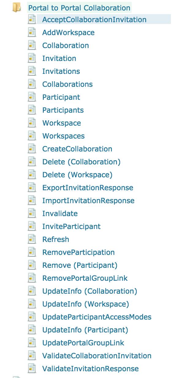
22 Portal to Portal Collaboration Shreyas Shinde


23 Establishing trust conceptual diagram Desktop Web Device Desktop Web Device 1. Host Portal admin creates a collaboration and invites a Guest Portal 2. An invitation is downloaded and sent to the Guest Portal admin Host Portal Guest Portal 3. Guest Portal admin accepts the invitation, downloads and sends a response to the Host Portal Admin Server Online Content and Services 4. Host Portal admin accepts the response and trust is established between both Portals Server Online Content and Services Trusted Collaboration
24 Establishing trust Need HTTP connectivity between portal Admin credentials are never exchanged Invitation and response files are used to exchange PKI-style public keys Keys are used to generate collaboration tokens - There are no accounts created specifically for collaboration For portals with web-tier authentication, web-tier credentials need to be provided during key exchange - IWA (NTLM) service account - PKI - service account certificates

25 Linking a group to collaboration workspace - conceptual diagram Desktop Web Device Desktop Web Device Transportation Dept. Host Street Maintenance Group Receive Collaboration Workspace Street Closures Group Send Public Works Dept. Guest Server Online Content and Services Trusted Collaboration Server Online Content and Services

26 Collaboration workspaces At least one A conceptual space where collaborated content is collected and shared with participating Portals Associated with an event, project or theme Links portal group to collaboration Access mode is defined per workspace
27 Synchronization Desktop Web Device 1. Identify items that need to be replicated and serialize them into package file Desktop Web Device Host Portal 2. Import items from package file into Host portal 3. Ask host to package items needed by Guest and then download the package Guest Portal Server Online Content and Services 4. Import items from downloaded package into Guest portal Server Online Content and Services
28 Synchronization Only items that have been modified or missing are exchanged Scheduled or immediately Item IDS of items are consistent across portals Any type of Portal item can be shared to a collaboration Shared layer items reference the original service and are read only

29 API
30 Publishing with ArcGIS Pro

31 Publishing to ArcGIS Enterprise Melanie Summers
32 More sessions Drawing Millions of Features in ArcGIS: Advanced Techniques - Friday, March 10, 10:00 am 11:00 am, Mojave Learning Center
33 GeoAnalytics Server at a glance
34 GeoAnalytics Server ArcGIS has a new way of processing vector and tabular data with both spatial (location) and temporal (time) components that is designed for fast distributed analytics and storage

35 GeoAnalytics Server Adding to ArcGIS GeoAnalytics adds to existing ArcGIS analysis capabilities Geoprocessing GeoAnalytics Web GIS Layers Portal Distributed analytics and storage more new extends

36 GeoAnalytics Server Rich Collection of Analysis Tools Summarize Data Aggregate Points Join Features Reconstruct Tracks Summarize Attributes Summarize Within Find Locations Find Similar Locations Analyze Patterns Calculate Density Create Space Time Cube Find Hot Spots Use Proximity Create Buffers Manage Data Copy to Data Store

37 GeoAnalytics Server Familiar User Interfaces ArcGIS Pro Map Viewer
38 GeoAnalytics Server Developer Interfaces Geoprocessing Service - REST API - ArcGIS Python API
39 More sessions on GeoAnalytics Server Big Data and ArcGIS: an Introduction to ArcGIS GeoAnalytics Server - Thursday, March 9, 10:30 am - 11:30 am, Mojave Learning Center
40 Image Server Raster Analytics at a Glance
41 Image Server Raster Analytics ArcGIS has a new way to create and execute spatial analysis models and raster processing chains which leverages distributed storage and analytics


42 Image Server Raster Analytics: Adding to ArcGIS Raster Analytics adds to existing ArcGIS concepts Dynamic Raster Models Geoprocessing Models / spatial analysis Server-based distributed processing and storage Web GIS Layers Portal on-the-fly processing powerful analytics Scalable distributed analytics with persisted storage more more new extends


 - Large")

43 Image Server Solve New Problems with Raster Analytics Run models against data that is too big for single desktop - Global rasters (big geography) - Large Scale (high resolution) - Large Collections (many) Run models and meet time constraints months weeks days hours minutes


44 Minutes Image Server Test Case: Terrain Suitability global terrain suitability raster terrain suitability model compute slope compute aspect remap overlay hours 600 Global SRTM 90m minutes esri virtual machine 16GB RAM, 8 cores, NAS storage Raster Analytics Processors


 5 hours 45")
")
45 Image Server Test Case: Solar Power Plant Suitability Mean Rainfall suitability model 30m National Solar Plant Suitability Raster Mean Temperature Elevation Landcover ArcGIS Desktop (ArcGIS Pro) 5 hours 45 minutes ArcGIS Enterprise on AWS 8 c3.2xlarge instances (8 vcpus, 16GB RAM) Raster Analytics 9 minutes


46 Image Server Test Case: Landsat processing Infrastructure Input Collection Processing Output (foreach) input scene ArcGIS Enterprise on AWS mask no data Landsat GLS Multispectral Scenes S3 storage top of atmosphere correction Thematic Rasters 7422 Thematic Rasters Distributed Raster Datastore modified soil adjusted vegetation index Distributed Raster Analytics Cluster single node AWS c3.8xlarge 60GB RAM, 32 cores, 500GB SSD 200 Raster Analytics Processors remap to classes output thematic raster 2 hours 48 minutes 44 scenes per minute ¾ scene per second 360b pixels

47
ArcGIS Enterprise: What s New. Philip Heede Shannon Kalisky Melanie Summers Sam Williamson
 ArcGIS Enterprise: What s New Philip Heede Shannon Kalisky Melanie Summers Sam Williamson ArcGIS Enterprise is the new name for ArcGIS for Server What is ArcGIS Enterprise ArcGIS Enterprise is powerful
ArcGIS GeoAnalytics Server: An Introduction. Sarah Ambrose and Ravi Narayanan
 ArcGIS GeoAnalytics Server: An Introduction Sarah Ambrose and Ravi Narayanan Overview Introduction Demos Analysis Concepts using GeoAnalytics Server GeoAnalytics Data Sources GeoAnalytics Server Administration
Introduction to ArcGIS GeoAnalytics Server. Sarah Ambrose & Noah Slocum
 Introduction to ArcGIS GeoAnalytics Server Sarah Ambrose & Noah Slocum Agenda Overview Analysis Capabilities + Demo Deployment and Configuration Questions ArcGIS GeoAnalytics Server uses the power of distributed
ArcGIS is Advancing. Both Contributing and Integrating many new Innovations. IoT. Smart Mapping. Smart Devices Advanced Analytics
 ArcGIS is Advancing IoT Smart Devices Advanced Analytics Smart Mapping Real-Time Faster Computing Web Services Crowdsourcing Sensor Networks Both Contributing and Integrating many new Innovations ArcGIS
Overview of ArcGIS Enterprise August 24, Dan Haag ESRI
 Overview of ArcGIS Enterprise August 24, 2017 Dan Haag ESRI Sharing to a portal ArcGIS 10.3 portal Central destination for all of your geospatial assets in Web GIS - ArcGIS Online organization and/or Portal
Introduction to Portal for ArcGIS
 Introduction to Portal for ArcGIS Derek Law Product Management March 10 th, 2015 Esri Developer Summit 2015 Agenda Web GIS pattern Product overview Installation and deployment Security and groups Configuration
What s New. August 2013
 What s New. August 2013 Tom Schwartzman Esri tschwartzman@esri.com Esri UC2013. Technical Workshop. What is new in ArcGIS 10.2 for Server ArcGIS 10.2 for Desktop Major Themes Why should I use ArcGIS 10.2
Introduction to Portal for ArcGIS. Hao LEE November 12, 2015
 Introduction to Portal for ArcGIS Hao LEE November 12, 2015 Agenda Web GIS pattern Product overview Installation and deployment Security and groups Configuration options Portal for ArcGIS + ArcGIS for
Leveraging Web GIS: An Introduction to the ArcGIS portal
 Leveraging Web GIS: An Introduction to the ArcGIS portal Derek Law Product Management DLaw@esri.com Agenda Web GIS pattern Product overview Installation and deployment Configuration options Security options
ArcGIS Enterprise: Administration Workflows STUDENT EDITION
 ArcGIS Enterprise: Administration Workflows STUDENT EDITION Copyright 2019 Esri All rights reserved. Course version 1.1. Version release date April 2019. Printed in the United States of America. The information
Portal for ArcGIS: An Introduction. Catherine Hynes and Derek Law
 Portal for ArcGIS: An Introduction Catherine Hynes and Derek Law Agenda Web GIS pattern Product overview Installation and deployment Configuration options Security options and groups Portal for ArcGIS
Spatial Analysis with Web GIS. Rachel Weeden
 Spatial Analysis with Web GIS Rachel Weeden Agenda Subhead goes here Introducing ArcGIS Online Spatial Analysis Workflows Scenarios Other Options Resources ArcGIS is a Platform Making mapping and analytics
Portal for ArcGIS: An Introduction
 Portal for ArcGIS: An Introduction Derek Law Esri Product Management Esri UC 2014 Technical Workshop Agenda Web GIS pattern Product overview Installation and deployment Security and groups Configuration
Web GIS Administration: Tips and Tricks
 EdUC 2017 July 8 th, 2017 Web GIS Administration: Tips and Tricks Geri Miller Agenda Concerns Acknowledged User Management Content Management Monitoring Licensing and logins Sophistication of IT support
Enabling Web GIS. Dal Hunter Jeff Shaner
 Enabling Web GIS Dal Hunter Jeff Shaner Enabling Web GIS In Your Infrastructure Agenda Quick Overview Web GIS Deployment Server GIS Deployment Security and Identity Management Web GIS Operations Web GIS
Web GIS: Architectural Patterns and Practices. Shannon Kalisky Philip Heede
 Web GIS: Architectural Patterns and Practices Shannon Kalisky Philip Heede Web GIS Transformation of the ArcGIS Platform Desktop Apps Server GIS Web Maps Web Scenes Layers Web GIS Transformation of the
Demystifying ArcGIS Online. Karen Lizcano Esri
 Demystifying ArcGIS Online Karen Lizcano Esri An Integrated Web GIS Platform Desktop Web Device Powered by Services Managed via Portal Access from any Device Portal Server Online Content and Services ArcGIS
DP Project Development Pvt. Ltd.
 Dear Sir/Madam, Greetings!!! Thanks for contacting DP Project Development for your training requirement. DP Project Development is leading professional training provider in GIS technologies and GIS application
Web GIS Deployment for Administrators. Vanessa Ramirez Solution Engineer, Natural Resources, Esri
 Web GIS Deployment for Administrators Vanessa Ramirez Solution Engineer, Natural Resources, Esri Agenda Web GIS Concepts Web GIS Deployment Patterns Components of an On-Premises Web GIS Federation of Server
Administering your Enterprise Geodatabase using Python. Jill Penney
 Administering your Enterprise Geodatabase using Python Jill Penney Assumptions Basic knowledge of python Basic knowledge enterprise geodatabases and workflows You want code Please turn off or silence cell
Data Aggregation with InfraWorks and ArcGIS for Visualization, Analysis, and Planning
 Data Aggregation with InfraWorks and ArcGIS for Visualization, Analysis, and Planning Stephen Brockwell President, Brockwell IT Consulting, Inc. Join the conversation #AU2017 KEYWORD Class Summary Silos
Web GIS & ArcGIS Pro. Zena Pelletier Nick Popovich
 Web GIS & ArcGIS Pro Zena Pelletier Nick Popovich Web GIS Transformation of the ArcGIS Platform Desktop Apps GIS Web Maps Web Scenes Layers Evolution of the modern GIS Desktop GIS (standalone GIS) GIS
Esri WebGIS Highlights of What s New, and the Road Ahead
 West Virginia GIS Conference WVU, Morgantown, WV Esri WebGIS Highlights of What s New, and the Road Ahead Mark Scott, Solutions Engineer, Esri Local Government Team May 5 th, 2016 West Virginia GIS Conference
ArcGIS. for Server. Understanding our World
 ArcGIS for Server Understanding our World ArcGIS for Server Create, Distribute, and Manage GIS Services You can use ArcGIS for Server to create services from your mapping and geographic information system
ArcGIS Deployment Pattern. Azlina Mahad
 ArcGIS Deployment Pattern Azlina Mahad Agenda Deployment Options Cloud Portal ArcGIS Server Data Publication Mobile System Management Desktop Web Device ArcGIS An Integrated Web GIS Platform Portal Providing
ArcGIS Pro: Analysis and Geoprocessing. Nicholas M. Giner Esri Christopher Gabris Blue Raster
 ArcGIS Pro: Analysis and Geoprocessing Nicholas M. Giner Esri Christopher Gabris Blue Raster Agenda What is Analysis and Geoprocessing? Analysis in ArcGIS Pro - 2D (Spatial xy) - 3D (Elevation - z) - 4D
ArcGIS Earth for Enterprises DARRON PUSTAM ARCGIS EARTH CHRIS ANDREWS 3D
 ArcGIS Earth for Enterprises DARRON PUSTAM ARCGIS EARTH CHRIS ANDREWS 3D ArcGIS Earth is ArcGIS Earth is a lightweight globe desktop application that helps you explore any part of the world and investigate
Network Analysis Services in ArcGIS Enterprise. Deelesh Mandloi
 Network Analysis Services in ArcGIS Enterprise Deelesh Mandloi Slides from this demo theater http://esriurl.com/uc17nas Agenda Network Analyst concepts ArcGIS Enterprise publishing workflow - Geoprocessing
Introduction to ArcGIS Server Development
 Introduction to ArcGIS Server Development Kevin Deege,, Rob Burke, Kelly Hutchins, and Sathya Prasad ESRI Developer Summit 2008 1 Schedule Introduction to ArcGIS Server Rob and Kevin Questions Break 2:15
ELF products in the ArcGIS platform
 ELF products in the ArcGIS platform Presentation to: Author: Date: NMO Summit 2016, Dublin, Ireland Clemens Portele 18 May 2016 The Building Blocks 18 May, 2016 More ELF users through affiliated platforms
Getting Started with Community Maps
 Esri International User Conference San Diego, California Technical Workshops July 24, 2012 Getting Started with Community Maps Shane Matthews and Tamara Yoder Topics for this Session ArcGIS is a complete
Technology Exposition Pradeep Thomas Partha Gosh Sreekumar MD Nilendu Purohit Ajit Babar Santanu Dutta
 Technology Exposition Pradeep Thomas Partha Gosh Sreekumar MD Nilendu Purohit Ajit Babar Santanu Dutta ArcGIS Product Components An Integrated System Pro Real-Time Mobile Enterprise Big Data Imagery Continuously
ArcGIS Pro Q&A Session. NWGIS Conference, October 11, 2017 With John Sharrard, Esri GIS Solutions Engineer
 ArcGIS Pro Q&A Session NWGIS Conference, October 11, 2017 With John Sharrard, Esri GIS Solutions Engineer jsharrard@esri.com ArcGIS Desktop The applications ArcGIS Pro ArcMap ArcCatalog ArcScene ArcGlobe
Administering Your Enterprise Geodatabase using Python. Gerhard Trichtl
 Administering Your Enterprise Geodatabase using Python Gerhard Trichtl What is the Geodatabase What is the Geodatabase A physical store of geographic data - Scalable storage model supported on different
Exelis and Esri Technologies for Defense and National Security. Cherie Muleh
 Exelis and Esri Technologies for Defense and National Security Cherie Muleh Cherie.Muleh@exelisinc.com ENVI IMAGERY AND DATA BECOME KNOWLEDGE > Add information from imagery to your GIS > Automated workflows
Esri Training by Microcenter Prepare to Innovate. Microcenter Course Catalog
 Esri Training by Microcenter Prepare to Innovate 2015 Instructor-Led Courses Microcenter Course Catalog ArcGIS Foundational Courses Designed to meet the learning needs of professionals whose GIS experience
Geodatabase Replication for Utilities Tom DeWitte Solution Architect ESRI Utilities Team
 Geodatabase Replication for Utilities Tom DeWitte Solution Architect ESRI Utilities Team 1 Common Data Management Issues for Utilities Utilities are a distributed organization with the need to maintain
ArcGIS Online Routing and Network Analysis. Deelesh Mandloi Matt Crowder
 ArcGIS Online Routing and Network Analysis Deelesh Mandloi Matt Crowder Introductions Who are we? - Members of the Network Analyst development team Who are you? - Network Analyst users? - ArcGIS Online
Working with ArcGIS Online
 Esri International User Conference San Diego, CA Technical Workshops July 12, 2011 Working with ArcGIS Online Bern Szukalski, Deane Kensok Topics for this Session ArcGIS Online Overview ArcGIS Online Content
Web GIS Patterns and Practices
 FedGIS Conference February 24 25, 2016 Washington, DC Web GIS Patterns and Practices Philip Heede Jay Theodore Witt Mathot Web GIS Transformation of the ArcGIS Platform Desktop Apps Web Maps Web Scenes
Esri User Conference 2018 Video Topics
 Esri User Conference 2018 Video Topics 3D GIS 3D Across ArcGIS 3D Analysis Tools in ArcGIS Pro 3D Cartographic Techniques: An Introduction 3D Data: Lidar Point Clouds and 3D Mesh 3D Feature and Sub-Surface
European Location Framework data in the ArcGIS platform
 European Location Framework data in the ArcGIS platform Presentation to: Author: Date: INSPIRE Conference 2016 Clemens Portele 26 September 2016 Why ELF? Global (e.g. UN GGIM) Regional Europe (INSPIRE
ArcGIS Enterprise: Out-of-the-Box Spatial Analysis. Vicki Cove Hilary Curtis
 ArcGIS Enterprise: Out-of-the-Box Spatial Analysis Vicki Cove Hilary Curtis Agenda What is spatial analysis? Spatial analysis with ArcGIS Enterprise Analysis demos: - Sunflower proximity to bees - Tourists
ArcGIS Data Reviewer: Quality Assessment for Elevation Raster Datasets. Roslyn Dunn
 ArcGIS Data Reviewer: Quality Assessment for Elevation Raster Datasets Roslyn Dunn What is ArcGIS Data Reviewer? Data Quality Management for ArcGIS Provides - Rule-based validation - Interactive tools
Geodatabase Programming with Python
 DevSummit DC February 11, 2015 Washington, DC Geodatabase Programming with Python Craig Gillgrass Assumptions Basic knowledge of python Basic knowledge enterprise geodatabases and workflows Please turn
GIS CONCEPTS ARCGIS METHODS AND. 3 rd Edition, July David M. Theobald, Ph.D. Warner College of Natural Resources Colorado State University
 GIS CONCEPTS AND ARCGIS METHODS 3 rd Edition, July 2007 David M. Theobald, Ph.D. Warner College of Natural Resources Colorado State University Copyright Copyright 2007 by David M. Theobald. All rights
ArcGIS 10.1 An Overview of the System
 ArcGIS 10.1 An Overview of the System ArcGIS 10.1 An Overview of the System Damian Spangrud Director of Solutions, Esri Redlands, CA USA ArcGIS 10.1 Web Cloud Online Mobile Enterprise Desktop ArcGIS 10.1
Data Aggregation with InfraWorks and ArcGIS for Visualization, Analysis, and Planning
 CI125230 Data Aggregation with InfraWorks and ArcGIS for Visualization, Analysis, and Planning Stephen Brockwell Brockwell IT Consulting Inc. Sean Kinahan Brockwell IT Consulting Inc. Learning Objectives
Geodatabase: Best Practices. Robert LeClair, Senior Instructor
 Geodatabase: Best Practices Robert LeClair, Senior Instructor Agenda Geodatabase Creation Data Ownership Data Model Data Configuration Geodatabase Behaviors Data Validation Extending Performance Geodatabase
Introduction to ArcGIS Maps for Office. Greg Ponto Scott Ball
 Introduction to ArcGIS Maps for Office Greg Ponto Scott Ball Agenda What is Maps for Office? Platform overview What are Apps for the Office? ArcGIS Maps for Office features - Visualization - Geoenrichment
Why GIS & Why Internet GIS?
 Why GIS & Why Internet GIS? The Internet bandwagon Internet mapping (e.g., MapQuest) Location-based services Real-time navigation (e.g., traffic) Real-time service dispatch Business Intelligence Spatial
ESRI Survey Summit August Clint Brown Director of ESRI Software Products
 ESRI Survey Summit August 2006 Clint Brown Director of ESRI Software Products Cadastral Fabric How does Cadastral fit with Survey? Surveyors process raw field observations Survey measurements define high-order
A Vision for ArcGIS Applying Geography Everywhere
 A Vision for ArcGIS Applying Geography Everywhere WELCOME PURPOSE A Network of GIS Professionals Are Awakening the World to the Power of Web GIS You Your WORK Making a Difference Your Work Open Maps and
ArcGIS Runtime: Migrating Your Apps from ArcGIS Engine. Eric Bader Lucas Danzinger Mike Branscomb
 ArcGIS Runtime: Migrating Your Apps from ArcGIS Engine Eric Bader Lucas Danzinger Mike Branscomb Migrating to ArcGIS Runtime ArcGIS Engine ArcGIS Runtime AppStudio for ArcGIS Apps: Collector, Workforce,
What Would John Snow Do (Today)? Part 1
? Part 1") What Would John Snow Do (Today)? Part 1 Tanya Bigos and Derek Law @Tanyabigos @GIS_Bandit Thurs Oct 19 th, 2017 Outline Overview of the ArcGIS Platform Whiteboard discussion Summary Questions A Whole New
What Would John Snow Do (Today)? Part 1 Tanya Bigos and Derek Law @Tanyabigos @GIS_Bandit Thurs Oct 19 th, 2017 Outline Overview of the ArcGIS Platform Whiteboard discussion Summary Questions A Whole New
SCAUG Community Maps Building a Living Atlas of the World
 SCAUG Community Maps Building a Living Atlas of the World Mark Stewart Topics: SCAUG ArcGIS Online Overview Community Maps Overview Community Maps Workflow Update Process Utilizing Your Contribution Community
Innovation. The Push and Pull at ESRI. September Kevin Daugherty Cadastral/Land Records Industry Solutions Manager
 Innovation The Push and Pull at ESRI September 2004 Kevin Daugherty Cadastral/Land Records Industry Solutions Manager The Push and The Pull The Push is the information technology that drives research and
Migrating Defense Workflows from ArcMap to ArcGIS Pro. Renee Bernstein and Jared Sellers
 Migrating Defense Workflows from ArcMap to ArcGIS Pro Renee Bernstein and Jared Sellers ArcGIS Desktop Desktop Web Device ArcMap ArcCatalog ArcScene ArcGlobe ArcGIS Pro portal Server Online Content and
Network Analysis with ArcGIS Online. Deelesh Mandloi Dmitry Kudinov
 Deelesh Mandloi Dmitry Kudinov Introductions Who are we? - Network Analyst Product Engineers Who are you? - Network Analyst users? - ArcGIS Online users? - Trying to figure out what is ArcGIS Online? Slides
UNIT 4: USING ArcGIS. Instructor: Emmanuel K. Appiah-Adjei (PhD) Department of Geological Engineering KNUST, Kumasi
 Department of Geological Engineering KNUST, Kumasi") UNIT 4: USING ArcGIS Instructor: Emmanuel K. Appiah-Adjei (PhD) Department of Geological Engineering KNUST, Kumasi Getting to Know ArcGIS ArcGIS is an integrated collection of GIS software products ArcGIS
UNIT 4: USING ArcGIS Instructor: Emmanuel K. Appiah-Adjei (PhD) Department of Geological Engineering KNUST, Kumasi Getting to Know ArcGIS ArcGIS is an integrated collection of GIS software products ArcGIS
Geodatabase Management Pathway
 Geodatabase Management Pathway Table of Contents ArcGIS Desktop II: Tools and Functionality 3 ArcGIS Desktop III: GIS Workflows and Analysis 6 Building Geodatabases 8 Data Management in the Multiuser Geodatabase
Geodatabase Programming with Python John Yaist
 Geodatabase Programming with Python John Yaist DevSummit DC February 26, 2016 Washington, DC Target Audience: Assumptions Basic knowledge of Python Basic knowledge of Enterprise Geodatabase and workflows
ArcGIS Earth an Intro
 ArcGIS Earth an Intro Chris Andrews Product Manager, 3D and ArcGIS Earth Brian Sims 3D Content Lead 3D across the Esri product family ArcGIS Pro 3D Analyst CityEngine ArcGIS for Server ArcGIS Online ArcGIS
ArcGIS Runtime: Migrating from ArcGIS Engine. Rex Hansen
 ArcGIS Runtime: Migrating from ArcGIS Engine Rex Hansen Thank You to Our Sponsors Migrating from ArcGIS Engine to ArcGIS Runtime ArcGIS Runtime API: new and evolved workflows on all platforms Windows Linux
Karsten Vennemann, Seattle. QGIS Workshop CUGOS Spring Fling 2015
 Karsten Vennemann, Seattle 2015 a very capable and flexible Desktop GIS QGIS QGIS Karsten Workshop Vennemann, Seattle slide 2 of 13 QGIS - Desktop GIS originally a GIS viewing environment QGIS for the
Changes in Esri GIS, practical ways to be ready for the future
 Changes in Esri GIS, practical ways to be ready for the future John Sharrard, Esri April 16, 2015 The only thing that is constant is change. Heraclitus, ca. 500 B.C. My story (of experiencing change) Changes
October 2011 ArcGIS 10 for Server Functionality Matrix
 October 2011 ArcGIS 10 for Server Functionality Matrix Esri, 380 New York St., Redlands, CA 92373-8100 USA TEL 909-793-2853 FAX 909-793-5953 E-MAIL info@esri.com WEB www.esri.com Copyright 2011 Esri All
The Platform Generation. Derek Law and Ebony Wicks
 The Platform Generation Derek Law and Ebony Wicks GIS Provides the Framework and Process For Applying Geography Analysis and Interpretation Design and Planning Creating Understanding Modeling and Predicting
94-802Z: Geographic Information Systems Summer 2018
 94-802Z: Geographic Information Systems Summer 2018 Instructor: Professor Kristen Kurland Teaching Assistant(s): (Office hours to be posted on Canvas) TBA Class Web Site: http:/www.cmu.edu/canvas
Introduction to ArcGIS Server - Creating and Using GIS Services. Mark Ho Instructor Washington, DC
 Introduction to ArcGIS Server - Creating and Using GIS Services Mark Ho Instructor Washington, DC Technical Workshop Road Map Product overview Building server applications GIS services Developer Help resources
The File Geodatabase API. Craig Gillgrass Lance Shipman
 The File Geodatabase API Craig Gillgrass Lance Shipman Schedule Cell phones and pagers Please complete the session survey we take your feedback very seriously! Overview File Geodatabase API - Introduction
ArcGIS Platform For NSOs
 ArcGIS Platform For NSOs Applying GIS and Spatial Thinking to Official Statistics Esri UC 2014 Demo Theater Applying GIS at the NSO Generic Statistical Business Process Model (GSBPM) 1 Specify Needs 2
Esri Overview for Mentor Protégé Program:
 Agenda Passionate About Helping You Succeed Esri Overview for Mentor Protégé Program: Northrop Grumman CSSS Jeff Dawley 3 September 2010 Esri Overview ArcGIS as a System ArcGIS 10 - Map Production - Mobile
Geodatabase Best Practices. Dave Crawford Erik Hoel
 Geodatabase Best Practices Dave Crawford Erik Hoel Geodatabase best practices - outline Geodatabase creation Data ownership Data model Data configuration Geodatabase behaviors Data integrity and validation
Leveraging ArcGIS Online Elevation and Hydrology Services. Steve Kopp, Jian Lange
 Leveraging ArcGIS Online Elevation and Hydrology Services Steve Kopp, Jian Lange Topics An overview of ArcGIS Online Elevation Analysis Using Elevation Analysis Services in ArcGIS for Desktop Using Elevation
No. of Days. Building 3D cities Using Esri City Engine ,859. Creating & Analyzing Surfaces Using ArcGIS Spatial Analyst 1 7 3,139
 Q3 What s New? Creating and Editing Data with ArcGIS Pro Editing and Maintaining Parcels Using ArcGIS Spatial Analysis Using ArcGIS Pro User Workflows for ArcGIS Online Organizations Q3-2018 ArcGIS Desktop
OFWIM 2017 Annual Conference What Does Web GIS Really Mean for Fish and Wildlife Agencies?
 Content Open Mapping OFWIM 2017 Annual Conference What Does Web GIS Really Mean for Fish and Wildlife Agencies? Imagery Spatial Analysis Mike Bialousz, Esri 3D Data Exploration Real-Time Apps Visualization
GPS Mapping with Esri s Collector App. What We ll Cover
 GPS Mapping with Esri s Collector App Part 1: Overview What We ll Cover Part 1: Overview and requirements Part 2: Preparing the data in ArcGIS for Desktop Part 3: Build a web map in ArcGIS Online Part
No. of Days. ArcGIS 3: Performing Analysis ,431. Building 3D cities Using Esri City Engine ,859
 What s New? Creating Story Maps with ArcGIS Field Data Collection and Management Using ArcGIS Get Started with Insights for ArcGIS Introduction to GIS Using ArcGIS & ArcGIS Pro: Essential Workflow Migrating
No. of Days. ArcGIS Pro for GIS Professionals ,431. Building 3D cities Using Esri City Engine ,859
 What s New? Creating Story Maps with ArcGIS Field Data Collection and Management Using ArcGIS Get Started with Insights for ArcGIS Introduction to GIS Using ArcGIS & ArcGIS Pro: Essential Workflow Migrating
Geoprocessing Tools at ArcGIS 9.2 Desktop
 Geoprocessing Tools at ArcGIS 9.2 Desktop Analysis Tools Analysis Tools \ Extract Clip Analysis Tools \ Extract Select Analysis Tools \ Extract Split Analysis Tools \ Extract Table Select Analysis Tools
Geodatabase An Introduction
 2013 Esri International User Conference July 8 12, 2013 San Diego, California Technical Workshop Geodatabase An Introduction David Crawford and Jonathan Murphy Session Path The Geodatabase What is it?
Make it Spatial. Josh Tanner. Theresa Burcsu. Tools, techniques, and tips for incorporating GIS into your research
 Make it Spatial Tools, techniques, and tips for incorporating GIS into your research Theresa Burcsu Josh Tanner Oregon GIS Framework Coordinator GIS Analyst & Web Administrator Geospatial Enterprise Office
Reimaging GIS: Geographic Information Society. Clint Brown Linda Beale Mark Harrower Esri
 Reimaging GIS: Geographic Information Society Clint Brown Linda Beale Mark Harrower Esri 8 billion = Number of basemap requests per month on AGOL 14,000 = Unique requests per second 12,000 = New Items
The Pace of Change Is Accelerating Creating Many Challenges
 VISION The Pace of Change Is Accelerating Creating Many Challenges Evidence Threatening Our Natural World and Our Future as Humans Social Conflict Mass Migration Ocean Acidification Food Population Urbanization
Geography for the 2020 Round of Census
 Boundaries Key Census Data EA Id Population Male Female EA Id Area EA Id Num HH Avg HH size Geography for the 2020 Round of Census Linda Peters, Esri lpeters@esri.com Integration of Statistical and Geospatial
Esri s Living Atlas of the World Community Maps
 Esri s Living Atlas of the World Community Maps Seth Sarakaitis Wednesday May 7, 2014 ArcGIS Living Atlas Concept Living Atlas Content Tour Contributing to the Living Atlas (Community Maps) Seth Sarakaitis
GIS CONCEPTS ARCGIS METHODS AND. 2 nd Edition, July David M. Theobald, Ph.D. Natural Resource Ecology Laboratory Colorado State University
 GIS CONCEPTS AND ARCGIS METHODS 2 nd Edition, July 2005 David M. Theobald, Ph.D. Natural Resource Ecology Laboratory Colorado State University Copyright Copyright 2005 by David M. Theobald. All rights
Managing Imagery and Raster Data Using Mosaic Datasets
 Esri International User Conference San Diego, California Technical Workshops July 25, 2012 Managing Imagery and Raster Data Using Mosaic Datasets Hong Xu, Prashant Mangtani Presentation Overview Introduction
Time Series Analysis with SAR & Optical Satellite Data
 Time Series Analysis with SAR & Optical Satellite Data Thomas Bahr ESRI European User Conference Thursday October 2015 harris.com Motivation Changes in land surface characteristics mirror a multitude of
CAPE FARM MAPPER - an integrated spatial portal
 CAPE FARM MAPPER - an integrated spatial portal Skukuza Dr Mike Wallace June 2017 Overview of GIS applications in WCDoA Spatial information and technology has become indispensable across a wide range of
EEOS 381 -Spatial Databases and GIS Applications
 EEOS 381 -Spatial Databases and GIS Applications Lecture 5 Geodatabases What is a Geodatabase? Geographic Database ESRI-coined term A standard RDBMS that stores and manages geographic data A modern object-relational
Strategies for Integrating CAD and BIM in ArcGIS. Don Kuehne Esri 3D Product Manager: CAD/BIM/AEC
 Strategies for Integrating CAD and BIM in ArcGIS Don Kuehne Esri 3D Product Manager: CAD/BIM/AEC CAD Digital Drawing CAD in ArcGIS Desktop CAD in Desktop CAD as Data CAD as a Map EXPORT TO CAD Create and
You are Building Your Organization s Geographic Knowledge
 You are Building Your Organization s Geographic Knowledge And Increasingly Making it Available Sharing Data Publishing Maps and Geo-Apps Developing Collaborative Approaches Citizens Knowledge Workers Analysts
Enabling ENVI. ArcGIS for Server
 Enabling ENVI throughh ArcGIS for Server 1 Imagery: A Unique and Valuable Source of Data Imagery is not just a base map, but a layer of rich information that can address problems faced by GIS users. >
Analyzing Multidimensional Scientific Data in ArcGIS. Nawajish Noman Deng Ding
 Analyzing Multidimensional Scientific Data in ArcGIS Nawajish Noman Deng Ding Outline Part I - ArcGIS Platform - Scientific Multidimensional Data - Ingest and Data Management Part II - Data Exploration
Road Ahead: Linear Referencing and UPDM
 Road Ahead: Linear Referencing and UPDM Esri European Petroleum GIS Conference November 7, 2014 Congress Centre, London Your Work Making a Difference ArcGIS Is Evolving Your GIS Is Becoming Part of an
ArcGIS Data Reviewer Advanced Data Validation Concepts. Francisco Perez & Shankar Chandrasekaran
 ArcGIS Data Reviewer Advanced Data Validation Concepts Francisco Perez & Shankar Chandrasekaran rkshop Agenda Importance of Data Quality What is ArcGIS Data Reviewer? Automated Validation Extending Automated
NR402 GIS Applications in Natural Resources
 NR402 GIS Applications in Natural Resources Lesson 1 Introduction to GIS Eva Strand, University of Idaho Map of the Pacific Northwest from http://www.or.blm.gov/gis/ Welcome to NR402 GIS Applications in
Analyzing the Operational Environment
 Esri International User Conference July 23 27 San Diego Convention Center Analyzing the Operational Environment Matthew Funk (Esri) David Mitchell (Esri) Tim Burley (Helyx SIS) Geospatial Enterprise for