Geographers Tools: Location Systems Prof. Anthony Grande Hunter College Geography
|
|
|
- Drusilla Burns
- 5 years ago
- Views:
Transcription
1 5 Geographers Tools: Location Systems Prof. Anthony Grande Hunter College Geography Lecture design, content and presentation AFG 0119 Individual images and illustrations may be subject to prior copyright.
2 EXTRA CREDIT Extra Credit Atlas Exercise for Exam I is available on the course home page. Submit answers using the blue Scantron sheet by Feb. 19, Once you have completed the exercise, transfer your answers to the blue Scantron sheet using a #2 pencil. Completely erase all mistakes and stray marks. LATE answer sheets will NOT be accepted. 2
3 Location Systems To portray data spatially, we need a way to accurately locate places on the earth s surface. This is the GRID SYSTEM. Composed of lines of latitude and longitude. Allows us to see locations, patterns, and interrelationships. Allows us to measure distance. Allows us to determine area. Earth s Grid: system of points on the surface connected by intersecting lines of latitude and longitude. 3

4 LATITUDE: Distance measured in degrees NORTH and SOUTH of the EQUATOR. It is the result of geometric calculations using the equatorial plane of the earth (equator) as its base. (The equator is at the center point in the movement of the sun s vertical rays on the earth s surface.) The measured angle of the plumb line from the earth s surface to the center of the equatorial plane equals latitude. Latitude Lines of latitude Lines of latitude are parallel to the equatorial base and to each other. They are equally spaced They never cross. They never converge. 4


5 Latitude Latitude is also astronomical. You can measure the angle of the sun above the horizon or the height of the North Star at night using a sextant. The angle equals latitude. 5

6 Latitude There are seven lines of latitude we need to know All are based on astronomical observations. 90 N = North Pole 66.5 N = Arctic Circle 23.5 N = Tropic of Cancer 0 = Equator 23.5 S = Tropic of Capricorn 66.5 S = Antarctic Circle 90 S = South Pole 6
 at the poles.")
7 Longitude LONGITUDE: Distance measured in degrees east and west of the 0 line which has been designated the Prime Meridian. All other lines of longitude are called meridians and each one extends from the North Pole to the South Pole. They all converge (touch) at the poles. Thus, the distance between meridians varies with latitude from the pole to the equator. Meridians are man-made phenomena based on the geometry of circles (360º) Meridians of longitude The 0 line of longitude is known as the Greenwich Meridian.


8 Why Greenwich Meridian? At one time, countries defined their prime meridian by the location of the observatory telescope that was used to gather the astronomical data Britain published the first nautical almanac. Its detailed maps, charts and tables, all based on the 0 meridian at London, became widely used. 1870s and 1880s a series of international conferences was convened to the address prime meridian issue. The result was a worldwide acceptance of the Greenwich Meridian as the Prime Meridian (0 ). <<< 0 Prime Meridian Greenwich Meridian 8


9 Drawing Longitude Meridians of longitude are marked by first dividing the equatorial circle into 360 segments, then dividing every circle of latitude into 360 segments and finally connecting all likenumbered degrees. There two meridians we need to know: 0 = Prime Meridian 180 = International Date Line (IDL follows along 180 but not exactly.) FYI: 0 and 180 are neither E or W 9
 set for the time at 0 (the Prime Meridian or GMT) and one set locally by the angle of the sun. The difference in time between them indicates distance from the Prime Meridian.")
10 Finding Longitude To determine your longitude on the earth s surface you need two accurate clocks. One clock (chronometer) set for the time at 0 (the Prime Meridian or GMT) and one set locally by the angle of the sun. The difference in time between them indicates distance from the Prime Meridian. Each 60 min = 15 of longitude. Each 30 min = 7.5 of longitude. Each 15 min = 3.75 of longitude. Each 4 min = 1 of longitude. 10
11 Latitude and Longitude L A T I T U D E 11
12 Latitude and Longitude L O N G I T U D E 12

13 Latitude and Longitude L O N G L A T I T U D E T U D E 13


14 Latitude and Longitude Latitude + Longitude = Earth s Grid min summary video 14
15 Latitude and Longitude We can divide the earth s grid into four quadrants: north+west north+east south+west south+east REMEMBER: Latitude is only designated NORTH or SOUTH. Longitude is only designated EAST or WEST. N & W S & W N & E S & E 15

16 Reading Latitude and Longitude When locating places on the earth, we start where the base lines of latitude and longitude cross: 0, 0 Equator N & W N & E 0, 0 First we count lines north or south of the equator. S & W S & E Then we count lines east or west of the prime meridian. 16


17 watch?v=aln7gxf1thy NW Quadrant NE Quadrant SW Quadrant 0, 0 SE Quadrant 17
18 TIME The longitude of a location is determined by time differential. You need to know the difference between local or sun time and prime meridian time (GMT). NOTE: It is the same time (hour of the day) along any meridian from the North Pole to the South Pole. 18
19 TIME ZONES Standard Time Zone: an area of the earth that is 15 of longitude wide ( hrs of one rotation = 15 /hr), where all clocks are set when solar noon occurs at the zone s central meridian. Each 15 of longitude = 1 hour (60 min) of time. Each 7.5 of longitude = 30 minutes. Each 3.75 of longitude = 15 minutes. Each 1 of longitude = 4 minutes. Time zones are based on calculating longitude. Concept created in 1883 by US railroad companies for scheduling purposes. Linked to International Meridian Conference of 1884 Officially adopted by countries starting in the 1920s. 19
 created by")


20 TIME ZONES There are 24 world standard time zones, each 15 wide and equal to one hour. Numerous off-standard zones (half hour, multi-hour, sun) created by governments. Over 30 irregular-shaped zones due to political borders. The International Date Line generally follows the 180 meridian but not exactly in order to keep political units in the same date. When the line is crossed the date changes, e.g., 3 PM Tuesday becomes 3 PM Wednesday, or vice versa, depending on direction of movement. 20

21 TIME ZONES NY N W S E Earth s rotation is from west to east EARLIER Add or subtract the number of zones between current location and area in question. LATER 21


22 Global Positioning System An array of 29 (24 active) satellites orbits 12,500 miles above the earth. Need to be in contact with 3 to 4 satellites to get a fix on a location: latitude, longitude and elevation. 22
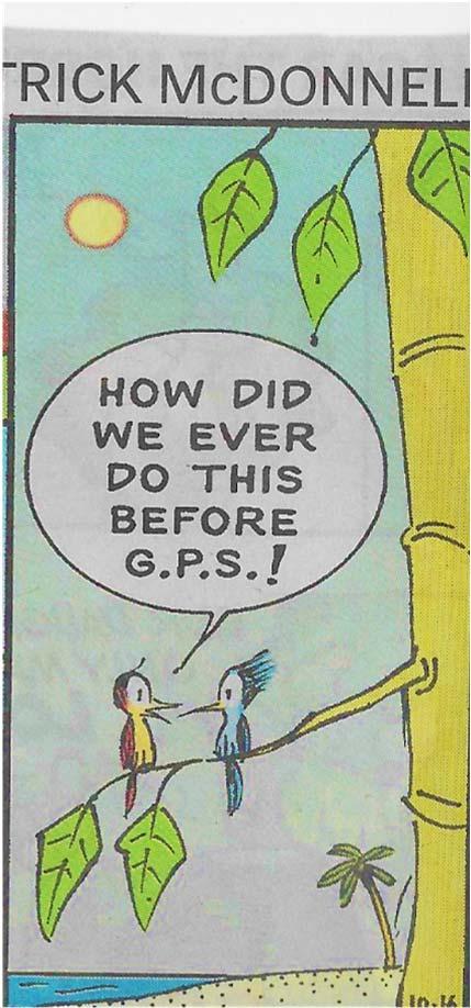
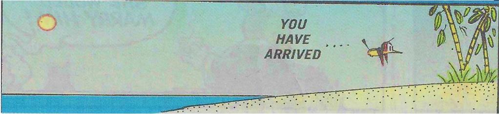
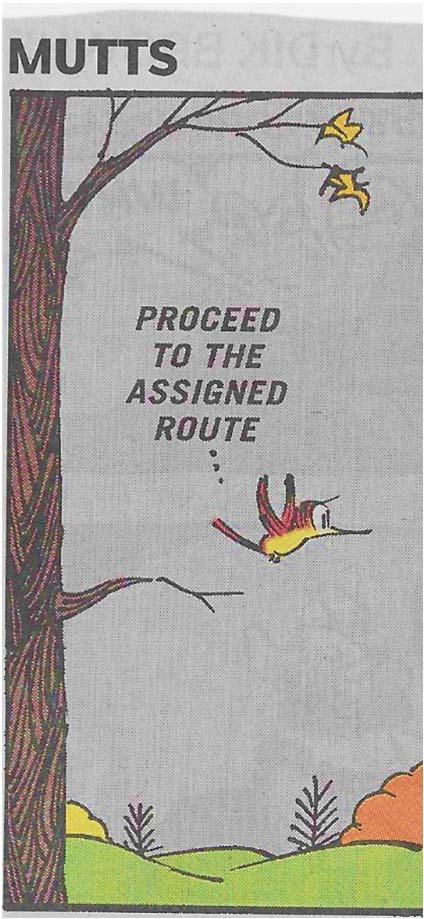
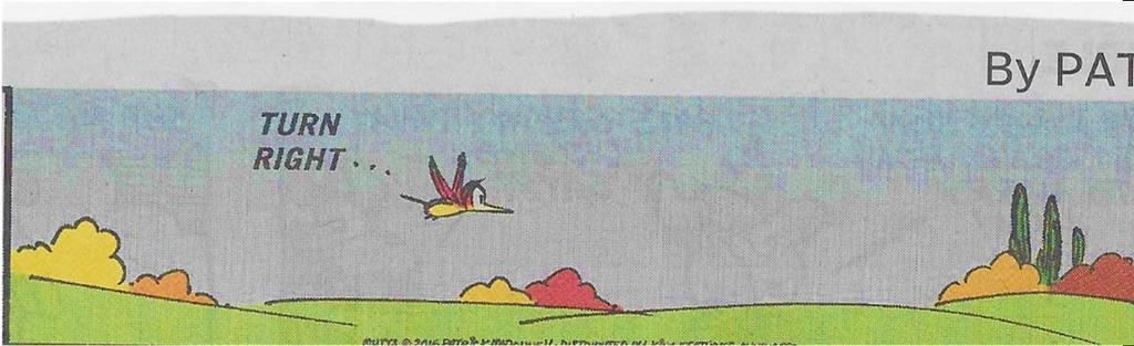
23 GPS Dependence 23

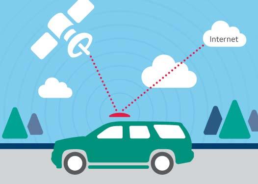

24 Using GPS 2 min GPS ad 24


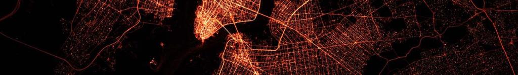
25 Using GPS-enabled Apps to Track Your Location Data reviewed by the NYTimes shows over 235 million locations captured from more than 1.2 million unique devices during a three-day period in


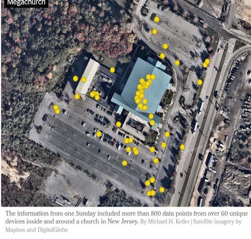
26 Tracking GPS enabled Devices: aka, Tracking People 26

27 EXTRA CREDIT Extra Credit Atlas Exercise for Exam I is available on the course home page. Submit answers using the blue Scantron sheet by Feb. 19, Once you have completed the exercise, transfer your answers to the blue Scantron sheet using a #2 pencil. Completely erase all mistakes and stray marks. LATE answer sheets will NOT be accepted. 27
28 N E X T Parts of Maps 28
EXTRA CREDIT Extra Credit Atlas Exercise for Exam I is available on the course home page
 EXTRA CREDIT Extra Credit Atlas Exercise for Exam I is available on the course home page. Submit answers to me using the blue Scantron sheet by Feb. 19, 2019. Once you have completed the exercise, transfer
CHAPTER 2 SKILL SHEET 2: CELESTIAL NAVIGATION
 CHAPTER 2 SKILL SHEET 2: CELESTIAL NAVIGATION Before the invention of GPS technology, how were people on ships far at sea, out of the sight of land, able to tell where they were? For thousands of years
EXTRA CREDIT. 6 Geographers Tools. Maps and their Parts MAP MAKING QUANDRY MAP MAKING
 EXTRA CREDIT Extra Credit Atlas Exercise for Exam I is available on the course home page. Submit answers to me using the blue Scantron sheet by Feb. 19, 2019. Once you have completed the exercise, transfer
EXTRA CREDIT. 6 Geographers Tools. Maps and their Parts MAP MAKING QUANDRY MAP MAKING 2/15/19 MAP PROJECTIONS MAP PROJECTIONS
 EXTRA CREDIT Extra Credit Atlas Exercise for Exam I is available on the course home page. Submit answers to me using the blue Scantron sheet by Feb. 19, 2019. Once you have completed the exercise, transfer
Downloaded from
 Geo Globe : Latitudes and Longitudes 1.Suppose the time at 30 east is 2 p.m. then what is the time at Greenwich? (A) 2 p.m. (B) 12 p.m. (C) 1 p.m. (D) Cannot find 2.What does the term 'Grid' mean
Module 2: Mapping Topic 2 Content: Determining Latitude and Longitude Notes
 Introduction In order to more easily locate points on a globe or map, cartographers designed a system of imaginary vertical lines (also called parallels) and horizontal lines (also called meridians) that
Recall: The scale transformation
 Recall: The scale transformation Geography 12: Maps and Spatial Reasoning Lecture 3: Map Projection Basics Professor Keith Clarke 1:400M The real world A representation of the world A cartographic problem
 Name Period Parent Signature Geography/Map Skills Study Guide *For extra practice with these skills, check out Mr. Kath s website: http://rkath.weebly.com/activities--links.html Continents and Oceans of
UNIT 1: THE PLANET EARTH
 UNIT 1: THE PLANET EARTH How many planets are there in our Solar System? What is the Equator? Why does life exist in our planet? Does The Earth move? What is a map? 1. Planet Earth TOPICS 2. Movements
THE EARTH AND ITS REPRESENTATION
 UNIT 7 THE EARTH AND ITS REPRESENTATION TABLE OF CONTENTS 1 THE EARTH AND THE SOLAR SYSTEM... 2 2 THE EARTH S MOVEMENTS... 2 2.1 Rotation.... 2 2.2 The revolution of the Earth: seasons of the year....
GEOGRAPHY STD.9 LATITUDE & LONGITUDE
 GEOGRAPHY STD.9 LATITUDE & LONGITUDE 1. What is the Earth Grid? A. The complete network of meridians & parallels is called the earth Grid. 2. What is Latitude? A. The latitude of a place is the distance
A Sky Full of Stars - II.
 A Sky Full of Stars - II. Learning Objectives! What is the latitude of the Equator and of the Earth s North and South Poles? What is the declination of the Celestial Equator and of the Celestial Poles?!
Cardinal and Intermediate Directions:
 Name Period Parent Signature Due Date: (TBA) Geography/Map Skills Study Guide Continents and Oceans of the World: Label the continents (7) and oceans (4) on the lines below the map. 1 11 3 5 4 8 2 9 10
The Earth is a Rotating Sphere
 The Earth is a Rotating Sphere The Shape of the Earth Earth s Rotation ( and relative movement of the Sun and Moon) The Geographic Grid Map Projections Global Time The Earth s Revolution around the Sun
Cartesian Coordinates Need two dimensional system 2 number lines perpendicular to each other X-axis is horizontal Y-axis is vertical Position relative
 General Physical Science Chapter 15 Place and Time Space and Time Einstein Space and time related Single entity Time is the 4 th dimension! Cartesian Coordinates Need some system to tell us where something
LAB C - GEOGRAPHIC GRID AND TIME
 Introduction LAB C - GEOGRAPHIC GRID AND TIME In this lab the student will learn to determine latitude and longitude, to plot the location of various places on a geographic grid, and to calculate the difference
Chapter 1 Test on Geography Skills
 Name Score Chapter 1 Test on Geography Skills Part 1 Matching (14 pts.) Match each term in Column B with its correct definition in Column A by clearly writing the number in the blank space provided. Two
GLOBE : LATITUDES AND LONGITUDES
 2 Figure 2.1 : Globe Let s Do Take a big round potato or a ball. Pierce a knitting needle through it. The needle resembles the axis shown in a globe. You can now move the potato or the ball around this
Time Zones. Doug Fischer Geog 106 LRS
 Time Zones Doug Fischer Geog 106 LRS Learning goals Students should be able to Explain time zones as a function of longitude Calculate time differences between different locations Demonstrate corrections
Chapter S1 Celestial Timekeeping and Navigation. How do we define the day, month, year, and planetary time periods?
 Chapter S1 Celestial Timekeeping and Navigation S1.1 Astronomical Time Periods Our goals for learning:! How do we define the day, month, year, and planetary time periods?! How do we tell the time of day?!
Map Skills Unit. Note taking unit
 Map Skills Unit Note taking unit Introduction To learn about the Earth, we are going to learn about two geographic tools you can use.globes and maps. Globe A globe is a round model of the planet Earth
 Name Period Parent Signature Foundational Skills Study Guide *For extra practice with these skills, check out Mr. Kath s website: http://rkath.weebly.com/activities--links.html Continents and Oceans of
The Earth and its representation
 GEOGRAPHY UNIT 1 The Earth and its representation THE SOLAR SYSTEM AND THE EARTH THE SOLAR SYSTEM The solar system is a planetary system. Is a group of astronomical objects who surround a star, in this
Celestial Sphere Spectroscopy (Something interesting; e.g., advanced data analyses with IDL)
") AST326, 2010 Winter Semester Celestial Sphere Spectroscopy (Something interesting; e.g., advanced data analyses with IDL) Practical Assignment: analyses of Keck spectroscopic data from the instructor (can
AST326, 2010 Winter Semester Celestial Sphere Spectroscopy (Something interesting; e.g., advanced data analyses with IDL) Practical Assignment: analyses of Keck spectroscopic data from the instructor (can
Geographic Grid -Latitudes and Longitudes
 GEOGRAPHY STD 9 Geographic Grid -Latitudes and Longitudes 2018-2019 Q1. Define Geographic Grid. The network of latitudes and longitudes are known as Geographic Grid. They help us to locate places on the
Chapter 1 Introduction to the Earth
 Chapter 1 Introduction to the Earth What is Geography? The study of the earth as the home of humankind. Greek - Eratosthenes Father of Geography Geo means Earth Graphy means to write Study how things are
LOCATING CELESTIAL OBJECTS: COORDINATES AND TIME. a. understand the basic concepts needed for any astronomical coordinate system.
 UNIT 2 UNIT 2 LOCATING CELESTIAL OBJECTS: COORDINATES AND TIME Goals After mastery of this unit, you should: a. understand the basic concepts needed for any astronomical coordinate system. b. understand
Earth s Orbit. Sun Earth Relationships Ridha Hamidi, Ph.D. ESCI-61 Introduction to Photovoltaic Technology
 1 ESCI-61 Introduction to Photovoltaic Technology Sun Earth Relationships Ridha Hamidi, Ph.D. Spring (sun aims directly at equator) Winter (northern hemisphere 23.5 tilts away from sun) 2 Solar radiation
Geometry of Earth Sun System
 12S56 Geometry of Earth Sun System Figure below shows the basic geometry Northern Hemisphere Winter ω equator Earth s Orbit Ecliptic ω ω SUN equator Northern Hemisphere Spring Northern Hemisphere Fall
PHYSICAL GEOGRAPHY. By Brett Lucas
 PHYSICAL GEOGRAPHY By Brett Lucas INTRODUCTION Introduction to Earth Geography as a Field of Learning Geography is from two Greek words, Geo Earth, and Graphien to write. Elements/Branches of Geography
Key Issue #1. How do geographers describe where things are? 2014 Pearson Education, Inc.
 Key Issue #1 How do geographers describe where things are? Learning Outcomes 1.1.1: Explain differences between early maps and contemporary maps. 1.1.2: Describe the role of map scale and projections and
7a LATITUDE LONGITUDE.notebook. September 19, 2017
 1 PANGEA Add a pangea link to here 2 There are 4 hemispheres Hemispheres are divided using the Equator (north and south) and Prime Meridian (west and east) 3 4 Northern Hemisphere Equator SOUTHERN OCEAN
The Earth-Moon-Sun System
 chapter 7 The Earth-Moon-Sun System section 2 Time and Seasons What You ll Learn how to calculate time and date in different time zones how to distinguish rotation and revolution what causes seasons Before
Lesson 20: The Earth in its Orbit
 291 Lesson 20: The Earth in its Orbit Recall that the Earth s orbit around the un is an ellipse which is almost a perfect circle. The average distance from the un to the Earth is 152,100,000 km (to the
Geographic Grid. Locations Feature 1 Feature 2 Feature 3
 Geographic Grid Name The geographic grid refers to the internationally-recognized system of latitude and longitude used to location positions on Earth's surface. Accurate use of this coordinate system
HOW TO TRAVEL ON EARTH WITHOUT GETTING LOST
 HOW TO TRAVEL ON EARTH WITHOUT GETTING LOST Using a globe to learn how a position on Earth can be described. Rui Dilão, Instituto Superior Técnico Curriculum topic latitude, longitude, coordinate system
Lecture #03. January 20, 2010, Wednesday
 Lecture #03 January 20, 2010, Wednesday Causes of Earth s Seasons Earth-Sun geometry Day length Solar angle (beam spread) Atmospheric beam depletion Shape and Size of the Earth North Pole E Geoid: not
Modern Navigation. Thomas Herring
 12.215 Modern Navigation Thomas Herring Review of Monday s Class Spherical Trigonometry Review plane trigonometry Concepts in Spherical Trigonometry Distance measures Azimuths and bearings Basic formulas:
Chapter S1 Lecture. The Cosmic Perspective Seventh Edition. Celestial Timekeeping and Navigation Pearson Education, Inc.
 Chapter S1 Lecture The Cosmic Perspective Seventh Edition Celestial Timekeeping and Navigation 2014 Pearson Education, Inc. Celestial Timekeeping and Navigation 2014 Pearson Education, Inc. S1.1 Astronomical
Latitude, Longitude, and Time Zones
 Latitude, Longitude, and Time Zones Typical Graph This is an example of a typical graph. It is made up of points that are connected by a line. Y axis Typical Graph (4,7) Each point has two values: An X
UNIT 1 THE BASICS OF GEOGRAPHY
 UNIT 1 THE BASICS OF GEOGRAPHY CHAPTER 1 LOOKING AT THE EARTH 1 Section 1.1: The 5 Themes of Geography.Geography comes from a Greek word meaning writing about or describing the earth. Geography is: Geographers
Latitude and Longitude. Begin
 Latitude and Longitude Begin The Earth is divided in two halves, the top half is called the northern hemisphere, and the bottom half is called the southern hemisphere. The dividing line between the two
Parts of a Map. Map Skills. The Title. There are 4 main parts of a map: The Title The Compass Rose The Map Key The Scale
 Map Skills Parts of a Map There are 4 main parts of a map: The Title The Compass Rose The Map Key The Scale The Title The title of the map is usually at the top and describes the topic of the map Example:
Globes, Maps, and Atlases. Plus, A Whole Bunch of Other Way Cool Geographic Information!!!
 Globes, Maps, and Atlases Plus, A Whole Bunch of Other Way Cool Geographic Information!!! Globes Are the Most Accurate Portrayal of the Earth The earth is about 24,900 miles in circumference, and about
OCN 201 LAB FALL 2003 POLYNESIAN AND WESTERN NAVIGATION
 Name: OCN 201 LAB FALL 2003 POLYNESIAN AND WESTERN NAVIGATION INTRODUCTION People have been sailing the seas for thousands of years, during most of which time they relied on the sun and the stars to navigate
Introduction To Modern Astronomy I: Solar System
 ASTR 111 003 Fall 2007 Lecture 02 Sep. 10, 2007 Introduction To Modern Astronomy I: Solar System Introducing Astronomy (chap. 1-6) Planets and Moons (chap. 7-15) Chap. 16: Our Sun Chap. 28: Search for
Planet Earth. Part 2
 Planet Earth Part 2 Sun, Earth and Moon Motions The Solar System revolves around the Milky Way galaxy center. The Sun rotates on its own axis. Earth revolves around the Sun (1 year) and rotates on its
Map Skills and Geographic Tools
 Name: Period: Map Skills and Geographic Tools TEKS: 8.9C interpret topographic maps and satellite views to identify land and erosional features and predict how these features may be reshaped by weathering
Latitude and Longitude:
 Latitude and Longitude: Finding Locations on Planet Earth. With thanks and credit to Step.com Typical Graph This is an example of a typical graph. It is made up of points that are connected by a line.
First Exam: New Date. 6 Geographers Tools. Maps and their Parts 2/16/2018 MAP MAKING MAP PROJECTIONS MAP PROJECTIONS MAP MAKING QUANDRY
 First Exam: ew ate Friday, March 2, 2018. ombination of multiple choice questions and map interpretation. ring a #2 pencil with eraser. ased on class lectures supplementing chapter 1. Review lecture slides.
3. The Sun s Position
 3. The Sun s Position In order to understand how to collect energy from the sun, one must first be able to predict the location of the sun relative to the collection device. In this chapter we develop
HNRS 227 Fall 2007 Chapter 14. Earth in Space presented by Prof. Geller 25 October 2007
 HNRS 227 Fall 2007 Chapter 14 Earth in Space presented by Prof. Geller 25 October 2007 Key Points of Chapter 14 Shape, Size and Motions of the Earth Rotation and Revolution Precession Coordinate Systems
Mapping Earth s Surface Chapter 2 Section 3
 Mapping Earth s Surface Chapter 2 Section 3 Day 1 Objective I will understand maps can be used to find locations on Earth and to represent information about features on Earth s Surface I will understand
1. Geospatial technology rarely links geospatial data to nonspatial data. a. True *b. False
 Chapter 2 Where in the Geospatial World Are You? 1. Geospatial technology rarely links geospatial data to nonspatial data. 2. For geospatial technology to work, every location on Earth must be: a. inhabited
The due date for submitting this assignment has passed. As per our records you have not submitted this. Both statement 1 and statement 2 are true
 X reviewer3@nptel.iitm.ac.in Courses» Higher Surveying Unit 4 - Week 2 Announcements Course Ask a Question Progress Mentor FAQ Course outline How to access the portal Week 0 Week 1 Week 2 Quiz : Assignment
ASTRONOMICAL NAVIGATION
 Basic terms ASTRONOMICAL NAVIGATION *astronomical navigation *compilation *astronomical tabels *celestial observations *solution of a sight * Sun/Moon/star sight *spherical trigonometry *PZX triangle *celestial
FIND PLACES ON GLOBES USING LATITUDE
 GLOBES, MAPS & GRAPHS FIND PLACES ON GLOBES USING LATITUDE AND LONGITUDE LINES FIND PLACES ON MAPS USING A GRID SYSTEM NAME SEVERAL TYPES OF MAP PROJECTIONS AND EXPLAIN THEIR BENEFITS AND SHORTCOMINGS
A Warm Up Exercise. The Motion of the Sun. A Warm Up Exercise. A Warm Up Exercise. A Warm Up Exercise
 A Warm Up Exercise The Motion of the Sun Which of the following is NOT true of a circumpolar star? a) It rises and sets from my latitude b) Its direction can be far North c) Its direction can be far South
Introduction to Geography
 Introduction to Geography ropic of Cancer 3½ N Arctic Circle 90 N Prime Meridian 0 Arctic Ocean Mississippi R. Appalachian Mts. Europe Rocky Mountains N. America Atlantic Gulf of Ocean Mexico Caribbean
Understanding Positional Astronomy Part 2 Celestial Co-ordinates Difficulty: Intermediate
 Exercise: Understanding Positional Astronomy Part 2 Celestial Co-ordinates Difficulty: Intermediate Objectives In Part 1 you learned about Celestial Sphere and how the stars appear to move across the night
Earth s Time Zones. Time Zones In The United States
 Name: Mr. DeLeo Date: Period: Earth s Time Zones Goal: Students will understand why humans have developed time zones on Earth, and how to figure out time at different positions on Earth. Background: One
Seasons & Time.
 Seasons & Time Earth s Movements Rotation Movement of Earth Around the Sun Elliptical Orbit Revolution 24 Hours (1 Day) 365 Days (1 Year) The Earth s Revolution & the Tilt of the axis cause variations
PY 124: Terrestrial Position from Celestial Observations
 The linked image cannot be displayed. The file may have been moved, renamed, or deleted. Verify that the link points to the correct file and location. The linked image cannot be displayed. The file may
Know the Lingo LATITUDE LONGITUDE
 Station Alpha SS.6.G.1.1 Use latitude and longitude coordinates to understand the relationship between people and places on the Earth - - - - - - - - - - - - - - - - - - - - - - - - - - - Know the Lingo
Cartography the art of making maps
 Cartography the art of making maps A map is a drawing or a picture of the earths surface, showing how things are related to each other by distance, direction and size. Maps are used for: Navigation Distance
WHERE ARE YOU? LOCATING BY THE SUN
 WHERE ARE YOU? LOCATING BY THE SUN Sakari Ekko EAAE Summer School Working Group (Finland) Abstract In this workshop, we first find our location on the globe by the Sun and Polaris, the Pole Star. After
Astrology Class Madison, Wisconsin. 43 North 89 West. September Daylight
 Astrology Class Madison, Wisconsin 43 North 89 West 7 32 September 21 2005 Daylight Astrology Class Madison, Wisconsin September 21,2005 7:32 43 North 89 West Names & Planetary Character Luminaries Symbols
Chapter 6: Latitude by Noon Sight
 Chapter 6: Latitude by oon ight When the sun is crossing the meridian of the boat, it is straight south or north of the boat and at its highest altitude over the horizon for the day. The local meridian
Seasonal Path of the Sun and Latitude
 Seasonal Path of the Sun and Latitude Overview This lesson is a modification of what Dave Hess and I, Stan Skotnicki, use in our Earth Science classes at Cheektowaga Central High School. It is an extension
LONGITUDE AND LATITUDE. Semi great circles joining the true or geographic poles of the earth (true meridians).
.") MERIDIANS OF LONGITUDE LONGITUDE AND LATITUDE Semi great circles joining the true or geographic poles of the earth (true meridians). They are measured from 0 to 180 degrees East and West of the PRIME MERIDIAN,
MERIDIANS OF LONGITUDE LONGITUDE AND LATITUDE Semi great circles joining the true or geographic poles of the earth (true meridians). They are measured from 0 to 180 degrees East and West of the PRIME MERIDIAN,
EARTH SCIENCE KEY UNIT 2-H
 EARTH SCIENCE KEY UNIT 2-H UNIT 2 MODELS & DIMENSIONS OF EARTH I. Model = ANYTHING THAT REPRESENTS THE PROPERTIES OF AN OBJECT OR SYSTEM A. Types and examples of models: 1. PHYSICAL Provides us with information
The Spinning Earth Key Stage 2
 The Spinning Earth Key Stage 2 Topics covered: Earth, Sun, day and night, time, angles, fractions Teacher s Notes In this activity pupils are introduced to the rotating Earth and the concept of longitude.
Tonight. {01} The map. Relative space. What does a map do? Types of maps GEOG 201 2/17/2010. Instructor: Pesses 1
 Tonight {01} The map What makes a map Measuring the Earth Map Interpretation & GPS Spring 2010 M. Pesses What does a map do? Shows where things are Shows spatial (topological) relationships Shows patterns,
Mid Term Prep-Shape of the Earth
 1. The Earth is slightly flattened from a perfect spherical shape because of A) its rotation B) the pull of the sun and moon C) storms on the sun's surface D) its molten core 2. The diagrams below represent
GEOGRAPHY. Map Skills. Mrs. Pere ~ 2013
 GEOGRAPHY Map Skills Mrs. Pere ~ 2013 WHAT IS A GLOBE? A globe is a model of the Earth. North Pole Equator South Pole WHAT IS A MAP? A map is a flat drawing of a place. THE IMPORTANT PARTS OF A MAP 1.
World Time-Day Calculator Lab
 Background: Time zones around the Earth are bounded by imaginary lines called lines of longitude, or meridians. On a globe or map of the world, they are the lines that are perpendicular to the equator.
First Exam: New Date. 6 Geographers Tools Maps and their Parts 9/14/2017 MAP MAKING MAP MAKING MAP PROJECTIONS MAP PROJECTIONS
 6 Geographers Tools Maps and their Parts Prof. nthony Grande Hunter ollege Geography Lecture design, content and presentation FG 0917. Individual images and illustrations may be subject to prior copyright.
Stamp Area. Earth Science - Note Packet #7. The shape of the Earth. The Earth is shaped like a ball or a. To go completely around the Earth,.
 Name: Earth Science - Note Packet #7 Mr. LaFranca s - Period Aim: What are time zones and why are they important? Date: Stamp Area Do Now: Why do you think East Coast football games start at 1:00 and West
ASTRONOMICAL COORDINATE SYSTEMS CELESTIAL SPHERE
 ASTRONOMICAL COORDINATE SYSTEMS CELESTIAL SPHERE To the naked eye, stars appear fixed on the sky with respect to one another. These patterns are often grouped into constellations. Angular measurements
Maps. 3. Which altitude of Polaris could be observed in New York State?
 Name: Date: 1. For an observer in New York State, the altitude of Polaris is 43 above the northern horizon. This observer s latitude is closest to the latitude of A. New York City B. Utica 3. Which altitude
Written as per the latest syllabus prescribed by the Maharashtra State Bureau of Textbook Production and Curriculum Research, Pune.
 Written as per the latest syllabus prescribed by the Maharashtra State Bureau of Textbook Production and Curriculum Research, Pune. STD. VIII Geography Salient Features Written as per the new textbook.
Practice Questions: Shape of the Earth
 Practice Questions: Shape of the Earth 1. The Earth is slightly flattened from a perfect spherical shape because of A) its rotation B) the pull of the sun and moon C) storms on the sun's surface D) its
Spherical Geometry HSC. Name:
 Spherical Geometry HSC Name: C:\Documents and Settings\tracey_h-butters\Desktop\mathematics\year_levels\math_stage6\General\hsc\spherical_geometry\spherical_geo_notes.doc 1 HSC CAPACITY MATRIX GENERAL
Pool Canvas. Add. Creation Settings. Chapter 1--Objectives and Tools of World Regional Geography. Description Instructions.
 1 of 6 TEST BANK > CONTROL PANEL > POOL MANAGER > POOL CANVAS Pool Canvas Add, modify, and remove questions. Select a question type from the Add Question drop-down list and click Go to add questions. Use
For most observers on Earth, the sun rises in the eastern
 632 CHAPTER 25: EARTH, SUN, AND SEASONS WHAT IS THE SUN S APPARENT PATH ACROSS THE SKY? For most observers on Earth, the sun rises in the eastern part of the sky. The sun reaches its greatest angular altitude
SUN SIGHT REDUCTION CALCULATIONS
 SUN SIGHT REDUCTION CALCULATIONS Date: Ship s time: GMT at sight: h m s DR Position: Lat º N/S Long º E/W Ass Position: Lat º N/S Long º E/W GHA: º Decl: º N/S d = +/- Incrmnt º Corr: +/- GHA: º Decl:
FRIOT'S EXPLANATION OF THE TIP OF THE EARTH'S CONTRIBUTION TO THE EQUATION OF TIME
 FRIOT'S EXPLANATION OF THE TIP OF THE EARTH'S CONTRIBUTION TO THE EQUATION OF TIME For this explanation it has been assumed that the reader is knowledgeable of certain facts and scientific understandings.
TIME. Astronomical time Time is defined by astronomical cycles. The day is the average time from noon to noon (the solar day).
.") ASTRONOMY READER TIME 2.1 TIME Astronomical time Time is defined by astronomical cycles. The day is the average time from noon to noon (the solar day). The month was originally based on the average time
ASTRONOMY READER TIME 2.1 TIME Astronomical time Time is defined by astronomical cycles. The day is the average time from noon to noon (the solar day). The month was originally based on the average time
2. Environmental issues in the relationship of humankind to the environment
 Course Goals to Understand 1. Processes operating on the earth s surface Atmosphere Lithosphere Hydrosphere Biosphere 2. Environmental issues in the relationship of humankind to the environment 3. Science
Why VOCABULARY? clues
 It s GHSGT Time! Why VOCABULARY? Social Studies is all about MAKING CONNECTIONS Key Terms provide relational clues to guide you in answering test questions! The more WORDS you know, the smarter you are
THE EARTH. MERIDIANS AND PARALLELS
 THE EARTH. MERIDIANS AND PARALLELS 1=Circle of latitude 2=Meridian (geography) A circle of latitude, on the Earth, is an imaginary east-west circle connecting all locations (not taking into account elevation)
Downloaded from
 I II III IV V VI Define the following terms:- a) Orbitb) Meteoroids c) Celestial bodies GEOGRAPHY ASSIGNMENTS The Earth In The Solar System d) Satellite e) Comets Give one word answers:- a) Blue planet
US History, Ms. Brown Need Help? or Call
 Name Course: US History/Ms. Brown Homeroom: 7th Grade US History Standard #7H102; 7H103 Do Now Day #6 Aims: SWBAT define and use essential geographic vocabulary such as hemisphere, equator, longitude,
European Union Can you label the twenty-seven countries of the EU on the map attached? (Do not revise the capitals.)
") NAME: FORM: YEAR 5 SUMMER EXAM REVISION QUESTIONS 2016 The exam will be forty minutes long. Answers will be short sentences or just one-word answers. The exam will be based upon the work that you have
NAME: FORM: YEAR 5 SUMMER EXAM REVISION QUESTIONS 2016 The exam will be forty minutes long. Answers will be short sentences or just one-word answers. The exam will be based upon the work that you have
Mid Term Prep-Latitude and Longitude
 1. What is the approximate altitude of Polaris at Syracuse, New York? A) 43 B) 47 C) 76 D) 90º 2. If an observer on Earth views Polaris on the horizon, the observer is located at the A) equator (0 ) B)
How do we describe a location on Earth? Geodetic reference system
 How do we describe a location on Earth? Geodetic reference system How do we define the shape of the earth? Definition of the sphere: A three-dimensional surface, all points of which are equidistant from
Latitude and Longitude
 U n i t 3 M a p p i n g P a g e 1 Latitude and Longitude Note: These coordinates are always expressed LATITUDE/LONGITUDE!!! Coordinate System: Using and to find your position on Earth. LATITUDE LATITUDE
Angles and Directions. Angles and Directions. CIVL 1112 Surveying - Azimuths and Bearings 1/8
 IVL 1112 Surveying - zimuths and earings 1/8 The most common relative directions are left, right, forward(s), backward(s), up, and down. x y z In planar geometry, an angle is the figure formed by two rays,
CHAPTER 20 SIGHT REDUCTION
 CHAPTER 20 SIGHT REDUCTION BASIC PRINCIPLES 2000. Introduction Reducing a celestial sight to obtain a line of position consists of six steps: 1. Correcting sextant altitude (hs) to obtain observed altitude
SAMPLE. Succeeding in Social Studies 5 6 TH IN A SERIES OF 7. Years 5 9. Written by Valerie Marett. CORONEOS PUBLICATIONS Item No 508
 AUSTRALIAN HOMESCHOOLING SERIES Succeeding in Social Studies 5 6 TH IN A SERIES OF 7 Years 5 9 Written by Valerie Marett CORONEOS PUBLICATIONS Item No 508 Contents Notes to Parents.2 Latitude and Longitude...3