Submittal/Approval Letter
|
|
|
- Ami Turner
- 6 years ago
- Views:
Transcription
1 Submittal/Approval Letter To: Patrick Muench, P.E. Date: May 1, 2017 Turnpike Design Engineer Financial Project ID: & New Construction ( ) RRR ( ) Federal Aid : Not Applicable Project Name: Turnpike Mainline (SR 91) Resurfacing and Safety Improvements from MM to MM State Road : 91 Co./Sec./Sub.: 94/470/000 Begin Project MP: End Project MP: Full Federal Oversight: Yes ( ) No ( ) Request for: Design Exception ( ), Design Variation ( ) Community Aesthetic Feature: Conceptual ( ), Final ( ) Re-submittal: Yes ( ) No( ) Original Ref# - - Requested for the following element(s): ( ) Design Speed ( ) Lane Width ( ) Shoulder Width ( ) Cross Slope ( ) Design Loading Structural Capacity ( ) Vertical Clearance ( ) Maximum Grade ( ) Stopping Sight Distance ( ) Superelevation ( ) Horizontal Curve Radius ( ) Other This project consists of resurfacing and safety improvements for the Florida s Turnpike Mainline (SR 91) from MM to MM , County Mile Post County Mile Post , in St. Lucie County ( ) for a total length of miles. The main objective of the project is to extend the life of the existing pavement through milling and resurfacing of the existing northbound and southbound travel lanes, inside and outside shoulders, and the paved median openings. Safety improvements will include construction of ground-in rumble strips, repair of all guardrail openings for maintenance access and adjustment or replacement of guardrail as necessary, cross slope correction to meet governing criteria, shoulder drop-off correction along the edge of pavement, replacement of noncompliant signing within the project limits, bridge deck repair at the L-20 and Angle Road/Belcher canal bridges, bridge railing retrofit at the Picos Road, CR 68, and Minute Maid Road overpass bridges, and repairs to the existing box culverts and farm crossings. SR 91 is classified as a Rural Principal Arterial Expressway and is part of the National Highway System (NHS) and the State Highway System (SHS). SR 91 is also a Strategic Intermodal System (SIS) Corridor with a Limited Access Right-of-Way of 400 feet. The corridor has a posted and design speed of 70 MPH. The existing typical section is a four-lane, divided, rural facility with two 12 ft. lanes, an 8 ft. inside shoulder with 4 ft. paved, and a 12 ft. outside shoulder with 10 ft. paved, in each direction. The northbound and southbound roadways are separated by a 40-ft. median. An existing median double-faced guardrail with rub rail, predominantly located adjacent to the southbound inside shoulder, runs along the median within the project limits. In some locations, such as the segment between the Belcher Canal and L-20 Canal bridges, standard guardrail is located adjacent to the median shoulders and the outside shoulders for the northbound and southbound directions. The seven bridges within the project limits meet AASHTO criteria for total bridge width. Three of the bridges along SR 91 mainline: the northbound bridge over Angle Road/Belcher Canal (Structure No ), and the northbound and southbound bridges over the L-20 Canal (Structure Nos and ), meet FDOT criteria. The four remaining bridges: the southbound bridge over Angle Road/Belcher Canal (Structure No ), Picos Road (Structure No ), County Road 68 (Structure No ), and Minute Maid Road (Structure No ) do not meet FDOT total bridge width criteria. Since the overall width of the existing southbound SR 91 bridge over Angle Road/Belcher Canal (Structure No ) is /8, which is less than the FDOT required minimum of 40-0, the outside shoulder width on the bridge will only be /8, and therefore noncompliant with FDOT requirement of 10 ft. In addition, the shoulder widths on both sides of the roadway at the three bridges crossing over SR 91 at Picos Road (Structure No ), County Road 68 (Structure No ), and Minute Maid Road (Structure No ) do not meet FDOT criteria. As discussed in the progress meeting of 01/24/17, the design year AADT for the three roads crossing over SR 91 is not available. The only traffic information available is raw traffic data from the PTMS sites in the vicinity of the project. Furthermore, the design speed for the three facilities, has been estimated based on the posted speeds
2 along the corridor. Due to the lack of available information, the use of low volumes for the three roadways was recommended in the meeting. As indicated in Table 2.1, the required bridge shoulder widths for undivided collector highways is eight (8) feet on both sides for facilities with low traffic volumes. The existing shoulder widths of three (3) feet for both sides of Structures Nos and , and two (2) feet for both sides of Structure No , are not compliant with FDOT requirement of eight (8) feet. For these bridges to remain in place without improvements, a Design Variation will be required. Since total bridge width and bridge shoulder width are closely related, the deficiency in total bridge width will be addressed under this Design Variation request for noncompliant bridge shoulder widths. No quantifiable benefit in terms of safety, operational performance, or level of service can be derived from implementing any of the improvements discussed in this report. Furthermore, maintaining the current shoulder widths will eliminate any negative impacts on environmental concerns, community considerations, budget, or schedule. Therefore, the approval of this Design Variation is requested for the bridge shoulder widths for the outside shoulder for the southbound SR 91 mainline bridge over Angle Road/Belcher Canal (Structure No ), as well as the shoulders for the Picos Road (Structure No ), County Road 68 (Structure No ), and Minute Maid Road (Structure No ) Bridges, as identified in Table 2.1 of this document, to remain as existing. Recommended by: Digitally signed by Houman Assari Houman Assari Date: :22:43-04'00' Houman Assari, P.E., Responsible Professional Engineer Approvals: Patrick Muench Digitally signed by Patrick Muench DN: cn=patrick Muench, o=florida Department of Transportation, ou=florida's Turnpike Enterprise, =patrick.muench@dot.state.f l.us, c=us Date: :30:14-04'00' Date Patrick Muench, P.E., Turnpike Design Engineer 05/22/17 Date 5/1/2017 Russell D Snyder Digitally signed by Russell D Snyder DN: c=us, o=identrust ACES Business Representative, ou=florida DEPARTMENT OF TRANSPORTATION, cn=russell D Snyder, =A01097C FEE2E1C900002D8F Date: :12:13-04'00' Date 5/11/17 Russ Snyder, P.E., Turnpike Structures Design Engineer N/A Date N/A Date Michael Shepard, P.E., State Roadway Design Engineer State Structures Design Engineer N/A Date N/A Date State Chief Engineer FHWA Division Administrator

3 Request for FTE Design Exceptions & Variations Checklist Date: 05/01/2017 District: Florida's Turnpike Enterprise Project Name: Turnpike Mainline (SR 91) Resurfacing and Safety Improvements from MM to MM Project Section Exemption BMP: BMP: EMP: EMP: FPID: & Requested Control Element(s): New Construction RRR Design Speed* Horizontal Curve Radius Lane Width Vertical Clearance** Superelevation Shoulder Widths Maximum Grade Stopping Sight Distance Other *Requires supplementary review (i.e. Planning/Structures/etc) **Requires Utility Accommodation Manual (UAM) Exception Submittals Design Loading Structural Capacity* Cross Slopes Submittal/Approval Letter (independent file from report) Short description of project, applicable criteria and reason for variation request Applicable signature fields, names, and titles listed Page #/ NA S/A Letter Design Exception/Variation Report Report Cover Project Title, FPID, digital sign, seal and date Project description General project information, typical section, begin/end milepost, county section number Include Work Mix, To From, Objectives, Obstacles and Schedule. Description of the variation element and applicable criteria (AASHTO and Department value or standard) Detailed explanation of why the criteria or standard cannot be complied with or is not applicable Description of any proposed value for project and why it is appropriate Amount and character of traffic using the facility Description of the anticipated impact on Operations, Adjacent Sections, Level Of Service, Safety, Long and Short Term Effects Is the variation temporary or permanent? Description of the anticipated Cumulative Effects A plan view or aerial photo of the variation location Showing right of way lines, and property lines of adjacent property. A photo of the area. Typical section or cross section of variation/exception location The milepost and station location of the variation/exception Any related work programmed or in future work plans 1 Cover 1, 2, 3 4, F A D B A w/ MM 4 Page 1
4 The Project Schedule Management (PSM) Project Schedule Activities submitted < Phase I Phase I Phase II Phase II Phase III Phase III Phase IV > Phase IV Letting: All mitigating efforts An explanation of what if any associated existing or future Limitations as a result of public or legal commitments. Description and explanation of any practical alternatives, the selected treatment and why. Comments on the most recent 5 year crash history Including all pertinent crash reports Is the location of the variation on the High Crash List? Description of the anticipated Cost (Social and to the Department Benefit/Cost) Summary Conclusions I Page #/ NA 7 5, E 6, H 8 Summary description of included support documentation such as: Location map or description Typical section Aerial or Photo logs when they best illustrate the element issues Crash History and analysis Plan sheets in the area of the variation elements Profiles in the area of vertical alignment variation elements Tabulation of pole offsets for horizontal clearance variation Applicable Signed and Sealed Engineering Support Documents For the specified conditions the following additional documentation is required: For design speed on FIHS/SIS Provide typical sections at mid blocks and at intersections. For lane width Provide locations of alternative routes that meet criteria Proposal for handling drainage Proposed signing and pavement markings For shoulder width Proposal for handling stalled vehicles Proposal for handling drainage For bridge width Plan view of the approaching roadways Existing bridge plans (these may be submitted electronically) For a bridge with a design inventory load rating less than 1.0 Written evaluation and recommendation by the Office of Maintenance is required Load rating calculations for the affected structure For vertical clearance Locations of alternative routes that meet criteria A, B, D, E N/A N/A 6 N/A N/A N/A Page 2
5 For cross slope Proposal for handling drainage Details on how the cross slope impacts intersections For conditions that may adversely affect the roadway s capacity Provide the comments on compatibility of the design and operation with the adjacent sections Effects on capacity (proposed criteria vs. AASHTO) using an acceptable capacity analysis procedure Calculate reduction for design year, level of service For superelevation Provide the side friction factors for the curve for each lane of different cross slope at the PC of the curve, the point of maximum cross slope, and the PT of the curve using the following equation. f = (V 2 15Re)/(V 2 e+15r) For areas with crash histories or when a benefit to cost analysis is requested Provide a time value analysis between the benefit to society quantified in dollars and the costs to society quantified in dollars over the life of the Exception/Variation. Roadside Safety Analysis Program (RSAP) Historical Crash Method (HCM) Page #/ NA N/A N/A N/A N/A Page 3

6 Turnpike Mainline (SR 91) Resurfacing and Safety Improvements from MM to MM St. Lucie County, Florida FPID s and Contract C9R86 BRIDGE SHOULDER WIDTH DESIGN VARIATION Prepared For: Florida Department of Transportation Florida s Turnpike Enterprise MAY 2017 Prepared By: Propel Engineering, Inc. Houman Assari Digitally signed by Houman Assari Date: :20:43-04'00' 6685 Forest Hill Boulevard, Suite 205 Responsible Engineer: Greenacres, FL Houman Assari, PE Certification of Authorization No State of Florida, Professional Engineer Vendor No. F License No This item has been electronically signed and sealed by Houman Assari, PE on 05/01/2017 using a Digital Signature. Printed copies of this document are not considered signed and sealed and the signature must be verified on any electronic copies.
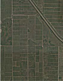
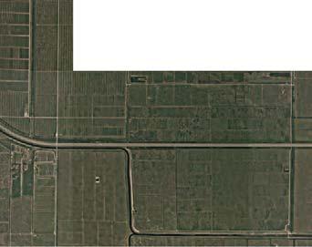
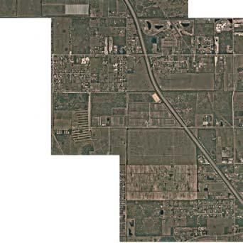
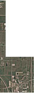
7 TABLE OF CONTENTS 1.0 Project Description Description of the Design Variation Design Criteria American Association of State Highway and Transportation Officials (AASHTO) Florida Department of Transportation (FDOT) Proposed Criteria Justification Operational s Crash History Analysis Benefit/Cost Analysis Accommodation of Disabled Vehicles Spread Analysis Right-of-Way Impacts Community Impacts Environmental Impacts Mitigation Summary Conclusions... 8 APPENDICES Appendix A: Appendix B: Appendix C: Appendix D: Appendix E: Appendix F: Appendix G: Appendix H: Appendix I: Location Map Typical Sections As-Built Plans Photo Log Crash History Traffic Data Spread Analysis Cost Estimate Project Schedule
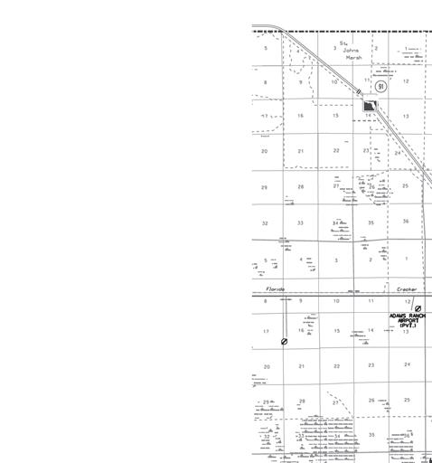
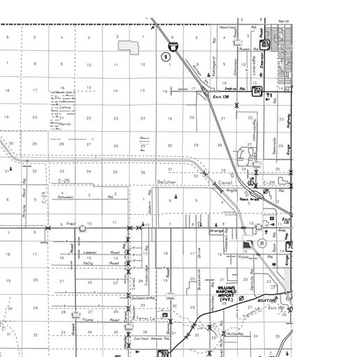
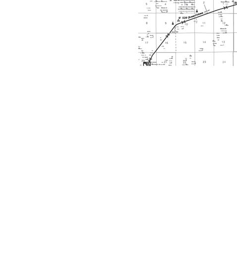
8 Bridge Shoulder Width Design Variation FPID Nos: & Project Description This project consists of resurfacing and safety improvements for the Florida s Turnpike Mainline (SR 91) from MM to MM , County Mile Post County Mile Post , in St. Lucie County ( ) for a total length of miles. The main objective of the project is to extend the life of the existing pavement through milling and resurfacing of the existing northbound and southbound travel lanes, inside and outside shoulders, and the paved median openings. Safety improvements will include construction of ground-in rumble strips, repair of all guardrail openings for maintenance access and adjustment or replacement of guardrail as necessary, cross slope correction to meet governing criteria, shoulder drop-off correction along the edge of pavement, replacement of non-compliant signing within the project limits, bridge deck repair at the L-20 and Angle Road/Belcher canal bridges, bridge railing retrofit at the Picos Road, CR 68, and Minute Maid Road overpass bridges, and repairs to the existing box culverts and farm crossings. SR 91 is classified as a Rural Principal Arterial Expressway and is part of the National Highway System (NHS) and the State Highway System (SHS). SR 91 is also a Strategic Intermodal System (SIS) Corridor with a Limited Access Right-of-Way of 400 feet. The corridor has a posted and design speed of 70 MPH. The existing typical section is a four-lane, divided, rural facility with two 12 ft. lanes, an 8 ft. inside shoulder with 4 ft. paved, and a 12 ft. outside shoulder with 10 ft. paved, in each direction. The northbound and southbound roadways are separated by a 40- ft. median. An existing median double-faced guardrail with rub rail, predominantly located adjacent to the southbound inside shoulder, runs along the median within the project limits. In some locations, such as the segment between the Belcher Canal and L-20 Canal bridges, standard guardrail is located adjacent to the median shoulders and the outside shoulders for the northbound and southbound directions. The project is currently scheduled for letting on 01/09/2018, with a production date of 10/06/2017. There are currently no major obstacles to meeting this schedule. The project schedule is included in Appendix I of this document. 2.0 Description of the Design Variation There are seven bridges within the project limits, four of which are a part of SR 91 Mainline. The SR 91 northbound and southbound travel ways have separate bridges at the Angle Road/Belcher Canal and the L-20 Canal crossings. Structure Nos and cross the Angle Road/Belcher Canal and, and Structure Nos and cross over the L-20 Canal. The remaining bridges on the project are the three overpasses across SR 91 at Picos Road (Structure No ), County Road 68 (Structure No ), and Minute Maid Road (Structure No ). Based on information gathered from field reviews, the design survey for the project, and a review of the as-built plans, the bridges were evaluated for compliance with American Association of State Highway and Transportation Officials (AASHTO), and Florida Department of Transportation (FDOT) criteria for bridge shoulder width. The results of the evaluation have been summarized in Table 2.1. The seven bridges within the project limits meet AASHTO criteria for total bridge width. Three of the bridges along SR 91 mainline: the northbound bridge over Angle Road/Belcher Canal (Structure No ), and the northbound and southbound bridges over the L-20 Canal (Structure Nos and ), meet FDOT criteria. The four remaining bridges: the southbound bridge over Angle Road/Belcher Canal (Structure No ), Picos Road (Structure No ), County Road 68 (Structure No ), and Minute Maid Road (Structure No ) do not meet FDOT total bridge width criteria. Since the overall width of the existing southbound SR 91 bridge over Angle Road/Belcher Canal (Structure No ) is /8, which is less than the FDOT required minimum of 40-0, the outside shoulder width on the bridge will only be /8, and therefore noncompliant with FDOT requirement of 10 ft. Turnpike Mainline (SR 91) Resurfacing and Safety Improvements from MM to MM
9 Bridge Shoulder Width Design Variation FPID Nos: & In addition, the shoulder widths on both sides of the roadway at the three bridges crossing over SR 91 at Picos Road (Structure No ), County Road 68 (Structure No ), and Minute Maid Road (Structure No ) do not meet FDOT criteria. As discussed in the progress meeting of 01/24/17, the design year AADT for the three roads crossing over SR 91 is not available. The only traffic information available is raw traffic data from the PTMS sites in the vicinity of the project. Furthermore, the design speed for the three facilities, has been estimated based on the posted speeds along the corridor. Due to the lack of available information, the use of low volumes for the three roadways was recommended in the meeting. As indicated in Table 2.1, the required bridge shoulder widths for undivided collector highways is eight (8) feet on both sides for facilities with low traffic volumes. The existing shoulder widths of three (3) feet for both sides of Structures Nos and , and two (2) feet for both sides of Structure No , are not compliant with FDOT requirement of eight (8) feet. For these bridges to remain in place without improvements, a Design Variation will be required. Since total bridge width and bridge shoulder width are closely related, the deficiency in total bridge width will be addressed under this Design Variation request for noncompliant bridge shoulder widths. The Design Variation locations have been included in Appendix A of this document. Table 2.1 Summary of Bridge Shoulder Widths Bridge No. Mile Marker Road Name Bridge Length (ft.) Existing/*Proposed Shoulder Width Required Shoulder Width (ft.) AASHTO FDOT Recommendation Picos Road over SR 91 CR 68 over SR 91 SR 91 NB over Belcher Canal SR 91 SB over Belcher Canal SR 91 NB over L-20 Canal SR 91 SB over L-20 Canal Minute Maid Rd. over SR (LT) 2 8 Design Variation (LT & RT) (LT & RT) 3-0 (RT) (2) (4) Design Variation 2-0 (LT) 2 8 Design Variation (LT & RT) (LT & RT) 2-0 (RT) (2) (4) Design Variation *6-4 Median 4 Median 6 Median Shoulder to Remain 4 Outside 10 Outside *10-0 Outside (1) (3) Shoulder to Remain *6-0 Median 4 Median 6 Median Shoulder to Remain 4 Outside 10 Outside *9-11 1/8 Outside (1) (3) Design Variation *6-1 Median 4 Median 6 Median Shoulder to Remain 4 Outside 10 Outside *10-0 Outside (1) (3) Shoulder to Remain *6-0 Median 4 Median 6 Median Shoulder to Remain 4 Outside 10 Outside *10-0 Outside (1) (3) Shoulder to Remain 3-0 (LT) 2 8 Design Variation (LT & RT) (LT & RT) 3-0 (RT) (2) (4) Design Variation (1) AASHTO A Policy on Design Standards Interstate System (2005), Cross Section, Page 5 (2) AASHTO A Policy on Geometric Design of Highways and Streets (2011), Section 7.2.5, Bridges to Remain in Place, Page 7-6 (3) FDOT Plans Preparation Manual, Volume 1, Chapter 2, Figure (4) FDOT Plans Preparation Manual, Volume 1, Chapter 2, Figure Turnpike Mainline (SR 91) Resurfacing and Safety Improvements from MM to MM
10 Bridge Shoulder Width Design Variation FPID Nos: & Design Criteria 3.1 American Association of State Highway and Transportation Officials (AASHTO) A Policy on Design Standards Interstate System (2005) (AASHTO IS) Bridges and Other Structures, Cross Section, Page 5: The width of all bridges, including grade separation structures, measured between rails, parapets, or barriers shall equal the full paved width of the approach roadways. The approach roadway includes the width of paved shoulders. Long bridges, defined as bridges having an overall length in excess of 200 ft., may have a lesser width. Such bridges shall be analyzed individually. On long bridges, offsets to parapet, rail or barrier shall be at least 4 ft. measured from the edge of the nearest traffic lane on both the left and the right. A Policy on Geometric Design of Highways and Streets (2011) Section 7.2.5, Structures, Bridges to remain in place: For an existing bridge to remain in place, it should have adequate structural strength and a width at least equal to the width of the traveled way plus 2 ft. clearance on each side. 3.2 Florida Department of Transportation (FDOT) Plans Preparation Manual (PPM) (January 2017) Volume 1, Chapter 2, Figure , Partial Bridge Sections: The required bridge shoulder widths for a divided highway with two lanes are six (6) feet for the inside shoulder and ten (10) feet for the outside shoulder. Volume 1, Chapter 2, Figure , Bridge Section: The required bridge shoulder widths for undivided collector highways is eight (8) feet on both sides for facilities with low traffic volumes. Volume 1, Chapter 2, Table Shoulder Widths and Cross Slopes Freeways The required shoulder widths for the approach roadways to the bridges on two-lane freeways without shoulder gutter, are eight (8) feet for the median shoulder with four (4) feet paved, and twelve (12) feet for the outside shoulder with ten (10) feet paved. Volume 1, Chapter 2, Table Shoulder Widths and Cross Slopes Undivided Collectors The required shoulder widths for the approach roadways to the bridges on two-lane, two-way undivided collectors are eight (8) feet with five (5) feet paved for facilities with low traffic volumes. 4.0 Proposed Criteria The proposed design is to allow the outside shoulder width for the southbound SR 91 mainline bridge over Angle Road/Belcher Canal (Structure No ) to be at a width of /8. Furthermore, the shoulder widths for the bridges on Picos Road (Structure No ) and Minute Maid Road (Structure No ) will be 3-0, and County Road 68 Bridge (Structure No ) will have shoulder widths of 2-0. Additionally, the proposed design will allow the existing bridge widths for the southbound SR 91 mainline bridge over Angle Road/Belcher Canal (Structure No ), Picos Road (Structure No ), County Road 68 (Structure No ), and Minute Maid Road (Structure No ) to remain as existing. Turnpike Mainline (SR 91) Resurfacing and Safety Improvements from MM to MM
11 Bridge Shoulder Width Design Variation FPID Nos: & Justification The main objective of the project is to extend the service life of the existing asphalt pavement and improve safety related features along the corridor. The proposed design provides a balance between pavement improvements and vehicular traffic operation while maintaining the safety of the traveling public. 5.1 Operational s A project Traffic Data Report was provided by FTE. The Traffic Data results were as follows: Table SR 91 Traffic Data Two-Way AADT Trucks (DDHV) Traffic Factors K STD (%) D (%) T 24 (%) DHT (%) 32,500 33,900 45, The design and posted speed within the project limits is 70 mph. The Traffic Data is included in Appendix F of this document. The extent of the substandard shoulder width along SR 91 mainline, as identified in this variation, is limited to one segment of ft. with an actual deficiency of less than one inch. As indicated in the FHWA publication Mitigation Strategies for Design Exceptions, dated July 2007, shoulder width may have an impact on traffic operations and highway capacity on high-speed facilities, since narrow shoulder widths may reduce free-flow speeds and driver comfort. There will be a reduction in free-flow speed when the lateral clearance for outside shoulders is less than six (6) feet. Since the narrow shoulder width is greater than six (6) feet within the variation limits, no adverse impacts on the existing capacity and operation of the facility are anticipated if the /8 outside shoulder on Structure No remains in place. The remaining segments of the substandard design elements referenced in this variation are at three crossings over SR 91 at Picos Road (structure no ), County Road 68 (structure no ), and Minute Maid Road (structure no ). As illustrated in Table 2.1, the lengths of the substandard bridge widths and bridge shoulder widths on the crossover bridges range between ft. and ft. Since the narrow bridge and shoulder widths are an existing condition, no additional adverse impacts on the existing capacity and operation of the facility are anticipated if the current bridge widths and shoulder widths are maintained. The capacity of roadway is dependent on the number of lanes and the posted speed limit along the corridor. The scope of this project is limited to milling and resurfacing, therefore these elements will remain the same. Furthermore, the limited length of the substandard segments will not impede maintenance, law enforcement, and disabled vehicles from locating a suitable refuge area. There are additional design elements that are not in compliance with AASHTO and FDOT criteria, namely Vertical Clearance and Cross slope/superelevation, that occur in the vicinity of the areas established for this design variation, however, no cumulative effects impacting the operation of the facility are expected. Based on the analysis performed, no long or short term adverse impacts are anticipated on operations, Level of Service, or adjacent roadway sections for the areas identified in this Design Variation, which is expected to be in place through the design life of the project. SR 91 from MM 152 to MM 193 is to be evaluated for widening by year 2035 which may ultimately eliminate the substandard shoulder widths along SR 91. A Project Development and Environment (PD&E) study would be required, which may address the shoulder width deficiency, prior to design and construction. Turnpike Mainline (SR 91) Resurfacing and Safety Improvements from MM to MM
12 Bridge Shoulder Width Design Variation FPID Nos: & Crash History Analysis Safety considerations associated with narrow shoulder widths on bridges are reduced recovery areas and storage space for disabled vehicles, maintenance operations, law enforcement activities, and stormwater management. The most recent 5-year crash history from the years 2011 through 2015 was reviewed. The crash data is included in Appendix E of this document. This report covers crash data, field investigations, and assessments of the existing conditions along the corridor. The data provided includes the location of each crash, the type of crash, the date, and the existing conditions. The analysis of the crash history revealed a total of 376 crashes along SR 91 within the project limits. There have been 15 crashes on SR 91 mainline that have occurred within the limits established for this design variation, including one with a fatality. Four of the crashes involved collisions with the roadside barriers, however, none of these crashes were within the limits of bridge over Angle Road/Belcher Canal (Structure No ). Furthermore, all these crashes were with barriers on the median side, however, the only location identified as requiring a variation for bridge shoulder width along the mainline is the outside shoulder on Structure No The long form crash reports for these four crashes were reviewed to determine whether the narrow bridge shoulder width may have been a contributing factor to any of the crashes. In addition, the long form crash report for the accident with the fatality was reviewed to ensure that the narrow bridge shoulder width was not involved in the crash in any way. A summary of the crash is provided below: Table Summary of Detailed Crash Report Crash ID Year Location Summary Remarks MM (L1) Vehicle 1 was traveling southbound on State Road 91 in the inside lane. For an unknown reason, Vehicle 1 traveled onto the eastern shoulder and Driver 1 steered the Vehicle 1 back to the right, overcorrected, and subsequently lost control of Vehicle 1. Vehicle 1 traveled across both southbound lanes and onto the western shoulder of southbound State Road 91. Vehicle 1 then rotated counterclockwise and traveled back across both southbound lanes and struck the center median guardrail with the left side of Vehicle 1. Occupant 2 was ejected from Vehicle 1 through the left side window and struck the metal guardrail. Occupant 2 came to final rest in the inside lane facing north. Vehicle 1 continued to rotate counterclockwise and struck the center median guardrail a second and third time before traveling across both southbound lanes and struck the metal guardrail on the western shoulder. Vehicle 1 came to final rest on the western shoulder of southbound State Road 91 facing north. Occupant 2 was pronounced deceased on the scene. The Crash was not attributed to the narrow bridge shoulders on the outside of the bridge. Based on the available information, a correlation between the crashes and narrow bridge shoulder width could not be found. The analysis further revealed that the narrow shoulder locations, as identified in this Design Variation, are not on the Turnpike s Top 30 Crash List. From the foregoing information presented, it is reasonable to conclude that the crashes would not be mitigated by widening the narrow shoulders, and safety is not compromised. Turnpike Mainline (SR 91) Resurfacing and Safety Improvements from MM to MM
13 Bridge Shoulder Width Design Variation FPID Nos: & Benefit/Cost Analysis The widening of the existing bridges to achieve compliant bridge shoulder widths will require improvements at the bridge termini including widening of the shoulders at the bridge approaches, embankment placement with regrading and stabilizing of the slopes, and upgrading of the guardrail and their connection to the proposed bridge railings. The estimated cost to construct these improvements is $2,980, A cost estimate has been prepared for the widening of each of the bridges which have been included in Appendix H of this document. There are no anticipated social costs associated with the design elements discussed in this report. A Benefit/Cost analysis would result in a B/C ratio of zero since there were no crashes found to be attributed to the narrow bridge shoulder width in the analysis of the most recent 5-year crash history. 5.4 Accommodation of Disabled Vehicles The extent of the substandard shoulder width along SR 91 mainline, as identified in this variation, is limited to one segment of ft., and the actual deficiency of less than one inch. The slight deficiency and the limited length of the substandard segment will not impede maintenance, law enforcement, and disabled vehicles from locating a suitable refuge area in the vicinity of the substandard shoulder width. The lengths of the substandard bridge shoulder widths on the crossover bridges range between ft. and ft. Since the narrow bridge shoulder widths are an existing condition, no additional adverse impacts on the existing capacity and operation of the facility are anticipated if the current bridge widths and shoulder widths are maintained. As is the case with SR 91 mainline, the limited length of the substandard segments will not impede maintenance, law enforcement, and disabled vehicles from easily locating suitable refuge areas beyond the limits of the bridges. 5.5 Spread Analysis Spread calculations were performed to ensure that existing spread calculations meet FTE criteria and no adverse impacts on the operation of the roadways are realized as a result of the narrow shoulder widths. The analysis pertains to the approaches to the southbound SR 91 mainline bridge over Angle Road/Belcher Canal. The spread criteria at this location has been met. This area represents the most critical location as the longest segment with the largest contributing area and with low longitudinal slopes. Spread is not considered to be an issue at Picos Road, CR 68, and Minute Maid Bridges due to the short limit of the curbed section at the crest of the vertical curve, significantly wider shoulders beyond the bridge limits, and steeper longitudinal slopes. The spread analysis results are included in Appendix G of this document. 5.6 Right-of-Way Impacts Whether any of the Improvements to correct the shoulder width deficiency are implemented or the existing bridge shoulder widths are allowed to remain in place, no right-of-way impacts are anticipated. 5.7 Community Impacts Since the substandard shoulder widths are an existing condition, no adverse community impacts are expected if the existing shoulder widths are maintained. However, if any of the Improvements to correct the shoulder width deficiency are implemented, the additional work will impact the maintenance of traffic on SR 91 as well as the three roadways crossing over SR 91, thereby increasing the cost and extending the construction duration of the project. This will ultimately result in additional disturbance to the FTE consumers, and the local community. Turnpike Mainline (SR 91) Resurfacing and Safety Improvements from MM to MM
14 Bridge Shoulder Width Design Variation FPID Nos: & Environmental Impacts With the implementation of the Improvements to correct the shoulder width deficiency, there may be impacts on the environmentally sensitive areas adjacent to the roadway as a result of placement of required embankment. Furthermore, Gopher tortoise burrows were observed during our field visits which will require coordination with Florida Fish and Wildlife Conservation Commission (FWC). The appropriate habitats must be surveyed during design to confirm whether the burrows are active. If the burrows are impacted, a relocation permit will be required prior to moving the tortoise. Relocation permitting does not typically occur until approximately 90 days prior to the start of construction in the area. Since the substandard shoulder widths are an existing condition, no adverse environmental impacts are expected if the existing shoulder widths are maintained. 5.9 Mitigation There are existing warning signs along the mainline in both northbound and southbound directions to notify the travelling public of reduced shoulder widths. To enhance the safety regarding the narrow bridges and shoulder widths, the existing signs are to be replaced by new signs (W5-2 with supplemental W16-3aP Panels). To reduce crash severity should a driver leave the travel lanes, crashworthy approach guardrail and connections to the existing bridge railings are already in place. Additional mitigation strategies as outlined in the FHWA publication include recessed pavement markings, delineators, object markers, high visibility bridge railing, and bridge lighting are either infeasible for application at the bridges on this project, or impractical based on the scope of this resurfacing project. There are no associated existing or future limitations as a result of legal or public commitments are known for this project. Turnpike Mainline (SR 91) Resurfacing and Safety Improvements from MM to MM
15 Bridge Shoulder Width Design Variation FPID Nos: & Summary Conclusions The main objective of the project is to extend the life of the existing pavement through milling and resurfacing of the existing northbound and southbound travel lanes, inside and outside shoulders and the paved median openings. Additional safety related improvements will also be provided along the corridor. The proposed design provides a balance between pavement improvements and vehicular traffic operation while maintaining the safety of the traveling public. The widening of the existing bridges to achieve bridge shoulder widths that meet the FDOT criteria will increase the construction cost significantly as well as impact the construction duration and schedule. Furthermore, FTE s customers would be impacted by the extended construction duration. Widening of the bridges will negatively impact the budget and the schedule, however, since there are no documented crashes citing narrow bridge or bridge shoulder width as the contributing cause, the benefit/cost ratio for widening the bridges will be zero. No quantifiable benefit in terms of safety, operational performance, or level of service can be derived from implementing any of the improvements discussed in this report. Furthermore, maintaining the current shoulder widths will eliminate any negative impacts on environmental concerns, community considerations, budget, or schedule. Therefore, the approval of this Design Variation is requested for the bridge shoulder widths for the outside shoulder for the southbound SR 91 mainline bridge over Angle Road/Belcher Canal (Structure No ), as well as the shoulders for the Picos Road (Structure No ), County Road 68 (Structure No ), and Minute Maid Road (Structure No ) Bridges, as identified in Table 2.1 of this document, to remain as existing. The outside shoulder width for the southbound SR 91 mainline bridge over Angle Road/Belcher Canal (Structure No ) will be /8. Furthermore, the shoulder widths for the bridges on Picos Road (Structure No ) and Minute Maid Road (Structure No ) will be 3-0, and County Road 68 Bridge (Structure No ) will have shoulder widths of 2-0. Turnpike Mainline (SR 91) Resurfacing and Safety Improvements from MM to MM
16


17
18

19
20
21
22
23
24
25
26
27
28
29
30
31
32


")
 Resurfacing and Safety")
33 Bridge Width and Bridge Shoulder Width Design Variation FPID Nos: & Figure 1 - SB SR 91 Mainline (Bridge No ) Figure 3 - Picos Road Bridge (Bridge No ) Figure 2 - Picos Road Eastbound Shoulder (Bridge No ) Figure 4 - Eastbound Picos Road (Bridge No ) Turnpike Mainline (SR 91) Resurfacing and Safety Improvements from to

 Figure 7 - Northbound Shoulder Minute Maid")
 Figure 6 - Westbound Shoulder CR 68 (Bridge")
 Turnpike Mainline (SR 91) Resurfacing")
34 Bridge Width and Bridge Shoulder Width Design Variation FPID Nos: & Figure 5 Eastbound Shoulder CR 68 (Bridge No ) Figure 7 - Northbound Shoulder Minute Maid Road (Bridge No ) Figure 6 - Westbound Shoulder CR 68 (Bridge No ) Figure 8 - Southbound Shoulder Minute Maid Road (Bridge No ) Turnpike Mainline (SR 91) Resurfacing and Safety Improvements from to
35
36 Exemption from Florida Public Records Section 119, Florida Statutes: The information contained in the Crash Analysis Reporting (C.A.R.) system has been compiled from information collected for the purpose of identifying, evaluating, or planning safety enhancements. This system and its products identify information used for the purpose of developing highway safety construction improvement projects which may be implemented utilizing Federal-aid highway funds. Since this information is collected for the above-mentioned purpose it is exempt from disclosure as a public record pursuant to Federal law. Any document displaying this exemption from public records shall be used only for those purposes deemed appropriate by the Department. See Title 23 United States Section 409. Crash Event Crash Date Crsh Loc Final MP On Roadway Turnpike MM First Harmful Event Accident Side Of Road Lane Of Accident Road Surface Lighting Event Weather Work Zone Related First Road Alcohol Involved In Acc. Harmful Event Seq 01 Cd Point Of Impact Movement Direction Of Travel First Driver Action Cd Veh #2 Point Of Impact Veh #2 Movement Veh #2 Direction Of Travel Total Of Vehicle Total Of Fatality Total of Injuries /2/ L S S /2/ R N /5/ R S N /6/ R S N /6/ L S S /6/ L E 2 1 S /13/ R N N /20/ R S N /30/ L S /13/ R S N /18/ L S 21 6 S /21/ L S S /27/ R S N /5/ L S S /9/ L S S /9/ L S S /14/ R N N /16/ R S N /17/ M M S S /17/ R N N /22/ M M S /10/ L S 7 1 S /15/ L S /27/ L S S /1/ R S N /7/ R S N /13/ R N N /22/ R N /24/ L S S /30/ L S S /3/ L S S /5/ M M S N /12/ R S N /23/ M M S /26/ L S S /26/ L S S /30/ L S S /21/ R N N /22/ L S S /24/ L S S 2 0 0
37 Crash Event Crash Date Crsh Loc Final MP On Roadway Turnpike MM First Harmful Event Accident Side Of Road Lane Of Accident Road Surface Lighting Event Weather Work Zone Related First Road Alcohol Involved In Acc. Harmful Event Seq 01 Cd Point Of Impact Movement Direction Of Travel First Driver Action Cd Veh #2 Point Of Impact Veh #2 Movement Veh #2 Direction Of Travel Total Of Vehicle Total Of Fatality Total of Injuries /4/ L S S /7/ L S S /13/ R N N /25/ M M N /2/ M M N /16/ L N S /22/ R N N /26/ L S S /1/ M M N /6/ R N N /8/ R N /13/ L S S /15/ L S S /18/ L S S /22/ R S N /31/ M M S /3/ L S S /16/ L S S S /16/ R N N /27/ L S S /5/ R S N /10/ R N N /15/ L X S /16/ L S S /22/ R S N /24/ R S N /27/ L S S /1/ L S S /2/ R N N /8/ M M N N /14/ L S S /15/ R N /11/ L S 13 1 S /15/ R S N /17/ R N 3 1 N /1/ L S /2/ R N N /6/ R S N N /29/ L S S /29/ L S S /16/ R S N 4 1 N /22/ L S S /27/ M M S /27/ R S N /9/ L N S /14/ R N N /15/ M M N /26/ L S S
38 Crash Event Crash Date Crsh Loc Final MP On Roadway Turnpike MM First Harmful Event Accident Side Of Road Lane Of Accident Road Surface Lighting Event Weather Work Zone Related First Road Alcohol Involved In Acc. Harmful Event Seq 01 Cd Point Of Impact Movement Direction Of Travel First Driver Action Cd Veh #2 Point Of Impact Veh #2 Movement Veh #2 Direction Of Travel Total Of Vehicle Total Of Fatality Total of Injuries /29/ R N N /31/ L S S /15/ R S N /28/ R N 11 1 N /2/ R S N /4/ L S S /13/ L S S /13/ L S N /15/ R N /16/ R N N /20/ R S N /29/ L S /29/ L S /7/ M M N /7/ L S S /11/ L S /17/ L S S S /17/ R S N /21/ R N /25/ R S N /1/ L S S /8/ L S /13/ R S N /14/ L S S /15/ R S N /29/ M M S /30/ R S N N /1/ M M N /4/ L S S S /8/ M M N /11/ R N N /12/ L S S /13/ L S /21/ L S S /26/ M M N /7/ R N N /7/ L S S /11/ R S N /22/ R N N /22/ M M S 13 1 S /31/ R S N /2/ R N /3/ R S N /17/ R N N /20/ M M S /21/ L S S /22/ M M S /25/ M M S
39 Crash Event Crash Date Crsh Loc Final MP On Roadway Turnpike MM First Harmful Event Accident Side Of Road Lane Of Accident Road Surface Lighting Event Weather Work Zone Related First Road Alcohol Involved In Acc. Harmful Event Seq 01 Cd Point Of Impact Movement Direction Of Travel First Driver Action Cd Veh #2 Point Of Impact Veh #2 Movement Veh #2 Direction Of Travel Total Of Vehicle Total Of Fatality Total of Injuries /28/ M M N /5/ R S N N /23/ R N N /23/ R S N /23/ R N /24/ L N /24/ M M S S /4/ L S S /8/ L S S /12/ R N 1 1 N /18/ R N N /18/ M M N /22/ R N N /31/ M M N /4/ L S S /15/ R S N /16/ R N N /16/ L S S /22/ R S S /27/ L S S /27/ R N N /28/ L S /4/ L N S /4/ M M S /9/ R N N /10/ L S S /18/ L S S /27/ R N N /27/ L S 12 1 S /31/ R S N /3/ R S N /6/ M M N /11/ M M N /18/ M M S /20/ M M S /23/ R S N /23/ L S S /25/ L S S /27/ L S S /28/ L S S /29/ R N N /3/ R N N /4/ M M E /9/ R N N /15/ R N N /17/ M M S /18/ L S S /25/ M M S /1/ M M N
40 Crash Event Crash Date Crsh Loc Final MP On Roadway Turnpike MM First Harmful Event Accident Side Of Road Lane Of Accident Road Surface Lighting Event Weather Work Zone Related First Road Alcohol Involved In Acc. Harmful Event Seq 01 Cd Point Of Impact Movement Direction Of Travel First Driver Action Cd Veh #2 Point Of Impact Veh #2 Movement Veh #2 Direction Of Travel Total Of Vehicle Total Of Fatality Total of Injuries /2/ M M S S /4/ L S S /8/ R N /15/ R S N /19/ M M N /24/ L S S /1/ M M S /3/ L O 21 1 S /3/ L S S /18/ M M S /23/ L S S /23/ L S S S /5/ R N /6/ R S N /6/ L S S /7/ L S S /7/ R S N N /14/ L N S /18/ M M S /24/ M M S /1/ R N N /1/ L S S /1/ R N N /1/ R S N /20/ M M S S /26/ M M N /29/ M M S /1/ L S S /1/ M M N /1/ L S S /1/ L S S /1/ R N N /9/ L S N /9/ M M N /25/ L S /25/ L S S /14/ M M N /14/ L S S /16/ R N /23/ R N N /28/ R N N /2/ R N N /3/ M M N /6/ L S /6/ L S /10/ R N 4 1 N /22/ R N N /25/ L S S 2 0 0
41 Crash Event Crash Date Crsh Loc Final MP On Roadway Turnpike MM First Harmful Event Accident Side Of Road Lane Of Accident Road Surface Lighting Event Weather Work Zone Related First Road Alcohol Involved In Acc. Harmful Event Seq 01 Cd Point Of Impact Movement Direction Of Travel First Driver Action Cd Veh #2 Point Of Impact Veh #2 Movement Veh #2 Direction Of Travel Total Of Vehicle Total Of Fatality Total of Injuries /29/ L S S /30/ M M S /6/ M M S /17/ M M S /21/ M M N /2/ L S S /2/ L S /2/ M M S /14/ L S S S /14/ L S S /16/ M M S /26/ L S S /30/ R N N /8/ R S N /11/ L S S /12/ R S N /23/ L S S /24/ M M S /29/ L S S /30/ M M S /8/ M M S /10/ L S S /18/ L S S /19/ R N N /26/ R S S /27/ R S N /27/ L S N /28/ L S /3/ M M S /16/ L S S S /26/ M M S /26/ R S 15 1 S /5/ R N N /13/ M M N /18/ L S S /24/ R S N /27/ R S N /9/ R S N /9/ M M N /12/ M M S /15/ R N N /18/ L S S /19/ R N N /20/ R N N /22/ M M O /27/ R N N /31/ R N N /5/ L S S /9/ M M S
42 Crash Event Crash Date Crsh Loc Final MP On Roadway Turnpike MM First Harmful Event Accident Side Of Road Lane Of Accident Road Surface Lighting Event Weather Work Zone Related First Road Alcohol Involved In Acc. Harmful Event Seq 01 Cd Point Of Impact Movement Direction Of Travel First Driver Action Cd Veh #2 Point Of Impact Veh #2 Movement Veh #2 Direction Of Travel Total Of Vehicle Total Of Fatality Total of Injuries /18/ L S S /21/ M M N /23/ L S S /30/ R S N /2/ R N N /5/ L S S /5/ M M S /11/ R S N /15/ R N /16/ R S S /1/ R N N /2/ R N N /2/ L S W /13/ L S /18/ M M N /21/ M M N /31/ L S S /13/ R N /14/ L S S /22/ R N N /23/ L S /28/ R N N /7/ L S 1 1 S /13/ L S S /16/ L S /23/ R N N /24/ L S S /26/ R S N /29/ R S S /29/ R N N /29/ R N N /1/ R N 4 1 N /3/ R N N /3/ L S S /14/ L S S /15/ R S N /19/ R S N /19/ M M S /14/ R S S /23/ R S N /24/ R S S /27/ L S S /27/ M M S /28/ L S S /28/ M M N 21 1 N /31/ L S /2/ L S S /3/ M M U 1 0 0
43 Crash Event Crash Date Crsh Loc Final MP On Roadway Turnpike MM First Harmful Event Accident Side Of Road Lane Of Accident Road Surface Lighting Event Weather Work Zone Related First Road Alcohol Involved In Acc. Harmful Event Seq 01 Cd Point Of Impact Movement Direction Of Travel First Driver Action Cd Veh #2 Point Of Impact Veh #2 Movement Veh #2 Direction Of Travel Total Of Vehicle Total Of Fatality Total of Injuries /13/ M M S /13/ L S /18/ L S /18/ R S N N /19/ R N /19/ R N /19/ R N /24/ L S 3 1 S /28/ L S 3 1 S /29/ L S S /9/ L S S /16/ M M N /20/ L S S /21/ R N N /5/ M M N S /5/ M M S /5/ L S S /5/ M M N /9/ R N N /9/ L S S 11 8 S /12/ R N /26/ R N /7/ M M N /12/ R N /15/ R S N /17/ L S S /22/ L S S /25/ M M S /25/ L S S /30/ L S /6/ M M N /13/ L S S /17/ L U 13 1 S /19/ R N /27/ M M N /28/ R N N /30/ L S S /3/ M M S /3/ L S S /4/ R N N /7/ R S S /10/ R S N /18/ R S N /22/ M M S /24/ R N /25/ M M S S 2 0 1
44
45
 Calculations_Update State Road: Counties: FY 2016 Turnpike Annual Traffic Trends Report AECOM")
46 Traffic and Revenue Consultant Florida s Turnpike Enterprise Florida Department of Transportation MEMORANDUM Date: To: From: Copies: Subject: FPN: Typical Section Traffic Data and Equivalent Single Axle Loading (ESAL) Calculations_Update State Road: Counties: FY 2016 Turnpike Annual Traffic Trends Report AECOM P.O. Box Florida s Turnpike Milepost 263, Building 5315 Ocoee, Florida Tel:
Submittal/Approval Letter
 Submittal/Approval Letter To: Patrick Muench, P.E. Date: June 14, 2017 Turnpike Design Engineer Financial Project ID: 436517-1-52-01 & 436517-3-52-01 New Construction ( ) RRR ( ) Federal Aid : Not Applicable
Submittal/Approval Letter
 Submittal/Approval Letter To: Patrick Muench, P.E. Date: May 1, 2017 Turnpike Design Engineer Financial Project ID: 436517-1-52-01 & 436517-3-52-01 New Construction ( ) RRR ( ) Federal Aid : Not Applicable
Market Street PDP. Nassau County, Florida. Transportation Impact Analysis. VHB/Vanasse Hangen Brustlin, Inc. Nassau County Growth Management
 Transportation Impact Analysis Market Street PDP Nassau County, Florida Submitted to Nassau County Growth Management Prepared for TerraPointe Services, Inc. Prepared by VHB/Vanasse Hangen Brustlin, Inc.
I-95/I-85 INTERCHANGE ROADWAY SAFETY ASSESSMENT
 FINAL REPORT I-95/I-85 INTERCHANGE ROADWAY SAFETY ASSESSMENT Prepared for: Prepared by: 117306012.B MARCH 2013 Final Report March 2013 I-95/I-85 Interchange ROADWAY SAFETY ASSESSMENT Prepared for: Prepared
Subject: Desert Palisades Specific Plan - Tram Way Access Sight Distance
 Endo Engineering Traffic Engineering Air Quality Studies Noise Assessments July 13, 2015 Mr. Ed Freeman Pinnacle View, LLC P.O. Box 1754 Lake Oswego, OR 97035-0579 Subject: Desert Palisades Specific Plan
Active Traffic & Safety Management System for Interstate 77 in Virginia. Chris McDonald, PE VDOT Southwest Regional Operations Director
 Active Traffic & Safety Management System for Interstate 77 in Virginia Chris McDonald, PE VDOT Southwest Regional Operations Director Interstate 77 at Fancy Gap Mountain Mile markers 0-15 Built in late
ROADWAY DESIGN CALCULATIONS
 ROADWAY DESIGN CALCULATIONS Interim Interchange at SR 400 (I-4) and Daryl Carter Parkway FPID: 441113-1-52-01 60% (Phase II) Prepared by: AECOM Technical Services, Inc. 150 North Orange Avenue, Suite 200
Brandywine Road Speed Study FINAL REPORT
 Brandywine Road Speed Study FINAL REPORT City of Albuquerque Brandywine Road Speed Study Final Report Albuquerque, New Mexico City of Albuquerque May, 2016 Brandywine Road Speed Study Final Report City
EXAMINATION OF THE SAFETY IMPACTS OF VARYING FOG DENSITIES: A CASE STUDY OF I-77 IN VIRGINIA
 0 0 0 EXAMINATION OF THE SAFETY IMPACTS OF VARYING FOG DENSITIES: A CASE STUDY OF I- IN VIRGINIA Katie McCann Graduate Research Assistant University of Virginia 0 Edgemont Road Charlottesville, VA 0 --
JEP John E. Jack Pflum, P.E. Consulting Engineering 7541 Hosbrook Road, Cincinnati, OH Telephone:
 JEP John E. Jack Pflum, P.E. Consulting Engineering 7541 Hosbrook Road, Cincinnati, OH 45243 Email: jackpflum1@gmail.com Telephone: 513.919.7814 MEMORANDUM REPORT Traffic Impact Analysis Proposed Soccer
Snow and Ice Control POLICY NO. P-01/2015. CITY OF AIRDRIE Snow and Ice Control Policy
 Page 1 CITY OF AIRDRIE Snow and Ice Control Effective Date: Approved By: Approved On: March 17, 2015 City Council March 16, 2015 Revision Date: Resolution #: ------ PURPOSE: The City of Airdrie is responsible
Traffic Impact Study
 Traffic Impact Study Statham DRI One University Parkway Prepared for: Barrow County Prepared by: October 2012 Table of Contents Executive Summary i Section 1. Introduction 1 Project Description 1 Methodology
PW 001 SNOW REMOVAL AND SANDING FOR ROADWAYS AND SIDEWALKS October 6, 2014 (#223-14) Original October 19, 2015; October 15, 2018 Public Works
 Original October 19, 2015; October 15, 2018 Public Works") Policy Statement: The Village of Kitscoty will provide snow and ice control on municipal streets and sidewalks according to determined priorities. Purpose: To provide direction and information to employees
Policy Statement: The Village of Kitscoty will provide snow and ice control on municipal streets and sidewalks according to determined priorities. Purpose: To provide direction and information to employees
March Grade Crossing Analysis
 March 2014 Grade Crossing Analysis T E C H N I C A L M E M O R A N D U M South Florida Freight and Passenger Rail Enhancement Study Phase 1A - Rehabilitate Existing Northwood Connection; FPID: 434948-1
TRANSPORTATION IMPACT STUDY WHEELER STREET CLOSURE
 TRANSPORTATION IMPACT STUDY WHEELER STREET CLOSURE Village of Greene, Chenango County, New York Prepared for: VILLAGE OF GREENE 49 Genesee Street Greene, NY 13778 Prepared by: LARSON DESIGN GROUP 1000
MEMORANDUM. The study area of the analysis was discussed with City staff and includes the following intersections:
 MEMORANDUM DATE: JULY 6, 2012 TO: FROM: RE: CC: MELANIE KNIGHT BRAD BYVELDS/ JENNIFER LUONG 1050 SOMERSET STREET PRELIMINARY TRAFFIC ANALYSIS OUR FILE NO. 111152 NEIL MALHOTRA The purpose of this memo
VIRGINIA S I-77 VARIABLE SPEED LIMIT SYSTEM FOR LOW VISIBILITY CONDITIONS
 VIRGINIA S I-77 VARIABLE SPEED LIMIT SYSTEM FOR LOW VISIBILITY CONDITIONS Christopher D. McDonald, PE, PTOE Regional Operations Director, Southwest Region NRITS and ITS Arizona Annual Conference October
CVS Derwood. Local Area Transportation Review
 CVS Derwood Montgomery County, Maryland May 27, 2016 Local Area Transportation Review Prepared for: JC Bar Properties, Inc. Steve Fleming, PE 415 Fallowfield Road, Suite 301 Camp Hill, Pennsylvania 17011
CITY OF NEW LONDON WINTER ROAD & SIDEWALK MAINTENANCE POLICY
 CITY OF NEW LONDON WINTER ROAD & SIDEWALK MAINTENANCE POLICY GENERAL The purpose of this policy is to set up acceptable procedures and policies for the winter maintenance of public areas in the City of
TRAFFIC IMPACT STUDY. Platte Canyon Villas Arapahoe County, Colorado (Arapahoe County Case Number: Z16-001) For
 For") TRAFFIC IMPACT STUDY For Platte Canyon Villas Arapahoe County, Colorado (Arapahoe County Case Number: Z16-001) February 2015 Revised: August 2015 April 2016 July 2016 September 2016 Prepared for: KB Home
TRAFFIC IMPACT STUDY For Platte Canyon Villas Arapahoe County, Colorado (Arapahoe County Case Number: Z16-001) February 2015 Revised: August 2015 April 2016 July 2016 September 2016 Prepared for: KB Home
Woodford County Erosion Prevention Plan and Permit. Application #
 Woodford County Erosion Prevention Plan and Permit Application # Date Instructions: Applicant will complete Parts A and B, and attach a proposed site diagram. This diagram must be completed in accordance
Factors Affecting the Severity of Injuries Sustained in Collisions with Roadside Objects
 Factors Affecting the Severity of Injuries Sustained in Collisions with Roadside Objects Presenter: Ashirwad Barnwal Adviser: Dr. Peter T. Savolainen Source: clipartbest.com 1 Overview Background Research
April 10, Mr. Curt Van De Walle, City Manager City of Castle Hills 209 Lemonwood Drive Castle Hills, Texas 78213
 Mr. Curt Van De Walle, City Manager City of Castle Hills 209 Lemonwood Drive Castle Hills, Texas 78213 Subject: Revised Castle Hills BASIS Charter School Traffic Impact Analysis Review City of Castle Hills,
CITY OF EAST PEORIA SNOW AND ICE CONTROL PROGRAM INTRODUCTION
 CITY OF EAST PEORIA SNOW AND ICE CONTROL PROGRAM INTRODUCTION The responsibility for providing snow and ice control on East Peoria s 240 lane miles of streets and alleys rests with the Street Divisions
Focused Traffic Analysis for the One Lincoln Park Project
 September 15, 2015 Mr. Bill Johnson Coldwell Banker 511 Sir Francis Drake Boulevard Greenbrae, CA 94904 Focused Traffic Analysis for the One Lincoln Park Project Dear Mr. Johnson; As requested, W-Trans
WEBER ROAD RESIDENTIAL DEVELOPMENT Single Family Residential Project
 WEBER ROAD RESIDENTIAL DEVELOPMENT Single Family Residential Project WEBER ROAD RESIDENTIAL DEVELOPMENT TRAFFIC IMPACT STUDY TABLE OF CONTENTS 1.0 Executive Summary Page 2.0 Introduction 2.1 DEVELOPMENT
TAKE ROLL CALL TO DETERMINE IF THERE IS A QUORUM OF MEMBERS PRESENT
 LAWRENCE SIGN CODE BOARD OF APPEALS AGENDA JULY 5, 2018 6:35 P.M., CITY COMMISSION MEETING ROOM, FIRST FLOOR OF CITY HALL, SIXTH AND MASSACHUSETTS STREET, LAWRENCE, KANSAS CALL THE MEETING TO ORDER TAKE
Local Calibration Factors for Implementing the Highway Safety Manual in Maine
 Local Calibration Factors for Implementing the Highway Safety Manual in Maine 2017 Northeast Transportation Safety Conference Cromwell, Connecticut October 24-25, 2017 MAINE Darryl Belz, P.E. Maine Department
FINAL REPORT. City of Toronto. Contract Project No: B
 City of Toronto SAFETY IMPACTS AND REGULATIONS OF ELECTRONIC STATIC ROADSIDE ADVERTISING SIGNS TECHNICAL MEMORANDUM #2B BEFORE/AFTER COLLISION ANALYSIS AT MID-BLOCK LOCATIONS FINAL REPORT 3027 Harvester
SPEED LIMIT STUDY ELDRON BLVD NE & SE FROM AMERICANA BLVD NE TO BAYSIDE LAKES BLVD. Engineering and Traffic Investigation Conducted by:
 SPEED LIMIT STUDY ELDRON BLVD NE & SE FROM AMERICANA BLVD NE TO BAYSIDE LAKES BLVD Engineering and Traffic Investigation Conducted by: Elia Twigg, P.E. Kwabena Ofosu, Ph.D., P.E. Public Works Department
MODELING OF 85 TH PERCENTILE SPEED FOR RURAL HIGHWAYS FOR ENHANCED TRAFFIC SAFETY ANNUAL REPORT FOR FY 2009 (ODOT SPR ITEM No.
 MODELING OF 85 TH PERCENTILE SPEED FOR RURAL HIGHWAYS FOR ENHANCED TRAFFIC SAFETY ANNUAL REPORT FOR FY 2009 (ODOT SPR ITEM No. 2211) Submitted to: Ginger McGovern, P.E. Planning and Research Division Engineer
Table of Contents Introduction... 4 Study Area... 5
 Table of Contents Introduction... 4 Study Area... 5 Streets and s... 5 Traffic Volumes... 8 Recent and Anticipated Development... 10 Crash Analysis... 10 Projected Traffic Volumes... 11 Trip Generation...
TRAFFIC ALERT FOR WEEK OF February 4 8, 2008
 TRAFFIC ALERT FOR WEEK OF February 4 8, 2008 Highway work zones in the Staunton District The following is a list of highway work that might affect traffic in the Staunton transportation district during
A Study of Red Light Cameras in Kansas City, MO
 A Study of Red Light s in Kansas City, MO Prepared by the Special Operations Division Executive Summary This paper will analyze the crash data for the 29 red light cameras located in 17 intersections in
Weather Responsive Traffic Management. WYDOT VSL Project. October 2011
 Weather Responsive Traffic Management Portland, OR WYDOT VSL Project October 2011 Variable Speed Limits I 80 Background Information >50% of I 80 traffic in Wyoming is commercial vehicles Rural AADT 11,000
PENNSTATE COMMONWEALTH OF PENNSYLVANIA DEPARTMENT OF TRANSPORTATION
 COMMONWEALTH OF PENNSYLVANIA DEPARTMENT OF TRANSPORTATION PENNDOT RESEARCH EFFECTIVENESS OF SPEED MINDERS IN REDUCING DRIVING SPEEDS ON RURAL HIGHWAYS IN PENNSYLVANIA PennDOT/MAUTC Partnership Research
City of Saginaw Right of Way Division Snow and Ice Removal Policy January 18, 2016
 Snow and Ice Removal Policy January 18, 2016 It is the policy of the to provide snowplowing and ice removal services in order to: Provide safe traveling conditions for motorists and pedestrians Assist
FY 2010 Continuing i Planning Program Product Report. Local Transportation and Traffic Data. Wood-Washington-Wirt Interstate Planning Commission
 FY 2010 Continuing i Planning Program Product Report Local Transportation and Traffic Data Travel Time and Delay Data for Belpre and Marietta, Ohio Wood-Washington-Wirt Interstate Planning Commission CONTINUING
Freeway Work Zone Lane Capacity
 Report Title Report Date: 2009 Freeway Work Zone Lane Capacity Principle Investigator Vendor Name and Address Name Drakopoulos, Alex «Vendor» Affiliation Marquette University Address 263 Haggerty Hall
Standard Highway Sign Border Specifications
 Standard Highway Sign Border Specifications A Radius Radius B C SIGN SIZE SIGN SIZE Variable Radius B C SIGN SIZE BORDER WIDTHS A B C CORNER RADIUS 18 4 30 36 48 60.375.375.375 1.375.375.438 1.5.5.375.65
Rock Scaling Recommendations Logan Creek Drive Cut Slope
 Rock Scaling Recommendations Logan Creek Drive Cut Slope US 50, Milepost DO 8.47 to DO 8.61 Douglas County, Nevada January 2008 MATERIALS DIVISION STATE OF NEVADA DEPARTMENT OF TRANSPORTATION MATERIALS
CONTINUING PLANNING PROGRAM LOCAL TRANSPORTATION AND TRAFFIC DATA PRODUCT REPORT [OH Corridors]
![CONTINUING PLANNING PROGRAM LOCAL TRANSPORTATION AND TRAFFIC DATA PRODUCT REPORT [OH Corridors]](/thumbs/94/120123757.jpg "CONTINUING PLANNING PROGRAM LOCAL TRANSPORTATION AND TRAFFIC DATA PRODUCT REPORT [OH Corridors]") CONTINUING PLANNING PROGRAM LOCAL TRANSPORTATION AND TRAFFIC DATA PRODUCT REPORT [OH Corridors] Travel Time and Delay Analysis for Belpre (OH) and Marietta (OH) Fiscal Year 2009 Report WOOD WASHINGTON
CONTINUING PLANNING PROGRAM LOCAL TRANSPORTATION AND TRAFFIC DATA PRODUCT REPORT [OH Corridors] Travel Time and Delay Analysis for Belpre (OH) and Marietta (OH) Fiscal Year 2009 Report WOOD WASHINGTON
The Sunland Park flyover ramp is set to close the week of March 19 until early summer
 March 2, 2018 The Sunland Park flyover ramp is set to close the week of March 19 until early summer GO 10 is targeting the week of March 19 to close the Sunland Park Drive flyover entrance ramp to I 10
Checklist: Deposing the Driver in an Auto Accident
 Checklist: Deposing the Driver in an Auto Accident 1. PERSONAL BACKGROUND All names ever used Present and past residences for 10 years If the deponent has rented a residence, get the name and address of
Appendix I: Traffic Study
 City of Fontana Sierra Lakes Commerce Center Draft EIR Appendix I: Traffic Study FirstCarbon Solutions H:\Client (PN JN)\0144\01440050\EIR\1 ADEIR\01440050 Sec99 99 Appendix Dividers.doc THIS PAGE INTENTIONALLY
CUSTER COUNTY SNOW REMOVAL PROCEDURES
 CUSER COUNY SNOW REMOVAL PROCEDURES Prioritization of Plow Routes County-maintained roads are plowed based upon the following prioritization criteria: 1. Arterial Roadways and School Bus routes: Arterial
TRAFFIC IMPACT STUDY MANUFACTURING COMPANY
 TRAFFIC IMPACT STUDY For MANUFACTURING COMPANY Prepared For: Airway Heights, WA Prepared By: SUNBURST ENGINEERING, P. S. 4310 S. Ball Dr. Veradale, WA 99037 April, 2013 TRAFFIC IMP ACT STUDY Manufacturing
Winter Storm Response - January 2016 Due to the uncertainty of the event, we must be prepared
 Winter Storm Response - January 2016 Due to the uncertainty of the event, we must be prepared 1 Highway Patrol Winter Storm Operations 48 Hours Pre-Storm Met with State Emergency Management Team to discuss
1.0 INTRODUCTION AND SUMMARY...
 TABLE OF CONTENTS 1.0 INTRODUCTION AND SUMMARY... 1 1.1 Purpose and Study Objective... 1 1.2 Executive Summary... 1 2.0 ROADWAY CONDITIONS... 5 2.1 Granville Parkway (South Intersection)... 8 2.2 Tuscany
City of Brainerd, Minnesota Snowplowing Policy
 City of Brainerd, Minnesota Snowplowing Policy 1. Introduction The city of Brainerd, Minnesota, finds that it is in the best interest of the residents of the city to assume basic responsibility for control
MANUAL FOR ROCKFALL INVENTORY PREPARED BY:
 MANUAL FOR ROCKFALL INVENTORY PREPARED BY: THE OHIO DEPARTMENT OF TRANSPORTATION OFFICE OF GEOTECHNICAL ENGINEERING 1980 WEST BROAD STREET COLUMBUS, OHIO 43223 DECEMBER 2016 TABLE OF CONTENTS SECTION 100
Updating the Urban Boundary and Functional Classification of New Jersey Roadways using 2010 Census data
 Updating the Urban Boundary and Functional Classification of New Jersey Roadways using 2010 Census data By: Glenn Locke, GISP, PMP 1 GIS-T May, 2013 Presentation Overview Purpose of Project Methodology
US 20 Highway Safety Study
 US 20 Highway Safety Study Corvallis City Limits to Springhill Road, Albany Prepared for Prepared by December 2016 US 20 HIGHWAY SAFETY STUDY FINAL REPORT Benton County, Oregon Prepared for: Oregon Department
COUNCIL POLICY MANUAL
 COUNCIL POLICY MANUAL SECTION: PUBLIC WORKS SUBJECT: SNOW & ICE CONTROL POLICY 2012/2013 GOAL: Pages: 1 of 10 Approval Date: Dec. 3, 2012 Res. # 1001/2012 To annually identify the winter maintenance costs
Critchfield Rd / SR-129
 NOVEMBER 27, 2017 Critchfield Rd / SR-129 Intersection Safety Study Alternatives Report CRITCHFIELD INTERSECTION SAFETY STUDY Contents Introduction...1 Purpose...2 Existing Conditions...2 Proposed Alternatives...2
HSIP FUNDING APPLICATION
 Page 1 Holmes County County Road 52; 1.19 to 5.48 DATE 5/1/2013 Project Information: COUNTY Holmes County LOCATION TYPE PROJECT SERVICE LIFE 20 years SEGMENT INFORMATION ROUTE County Road 52 BEGIN SLM
Effect of Environmental Factors on Free-Flow Speed
 Effect of Environmental Factors on Free-Flow Speed MICHAEL KYTE ZAHER KHATIB University of Idaho, USA PATRICK SHANNON Boise State University, USA FRED KITCHENER Meyer Mohaddes Associates, USA ABSTRACT
Enterprise Linear Referencing at the NYS Department of Transportation
 Enterprise Linear Referencing at the NYS Department of Transportation One Highway Network to Support Many Business Processes May 9, 2018 May 9, 2018 2 Agenda An overview of Linear Referencing How NYSDOT
Using Public Information and Graphics Software in Graduate Highway Safety Research at Worcester Polytechnic Institute
 Using Public Information and Graphics Software in Graduate Highway Safety Research at Worcester Polytechnic Institute C.E. Conron, C. Silvestri, A. Gagne, M.H. Ray Department of Civil and Environmental
MIAMI-DADE TRANSPORTATION PLANNING ORGANIZATION TRANSPORTATION IMPROVEMENT PROGRAM REGIONALLY SIGNIFICANT TRANSPORTATION IMPROVEMENTS
 DT2511563 2511563 FROM PORT OF MIAMI PORT OF MIAMI TUNNEL TO SR 836/I-395 0.5 NEW ROAD CONSTRUCTION $2,514,664 $790,186 - DESIGN/BUILD LF 2,766 2,849 2,935 3,023 3,113 DESIGN/BUILD GMR 22,152 22,990 24,338
Organized Chain-Up and VSL
 Organized Chain-Up and VSL Jim Mahugh, PE WSDOT SC Region Traffic Engineer North/West Passage VSL Peer Exchange January 28, 2015 Snoqualmie Pass 2 Limits of VSL EB: MP 48.12 to 66.56 WB: MP 46.69 to 66.90
CHAPTER 3. CAPACITY OF SIGNALIZED INTERSECTIONS
 CHAPTER 3. CAPACITY OF SIGNALIZED INTERSECTIONS 1. Overview In this chapter we explore the models on which the HCM capacity analysis method for signalized intersections are based. While the method has
Transforming the Maricopa County Department of Transportation (MCDOT) GIS-based Transportation Asset Inventory System June 30, 2016
 GIS-based Transportation Asset Inventory System June 30, 2016") Transforming the Maricopa County Department of Transportation (MCDOT) GIS-based Transportation Asset Inventory System June 30, 2016 Presented By Steve Hossack, GIS Database Administrator 2016 Esri User
Transforming the Maricopa County Department of Transportation (MCDOT) GIS-based Transportation Asset Inventory System June 30, 2016 Presented By Steve Hossack, GIS Database Administrator 2016 Esri User
PENNSYLVANIA DEPARTMENT OF TRANSPORTATION ENGINEERING DISTRICT 3-0
 PENNSYLVANIA DEPARTMENT OF TRANSPORTATION ENGINEERING DISTRICT 3-0 LYCOMING COUNTY S.R.15, SECTION C41 FINAL HYDROLOGIC AND HYDRAULIC REPORT STEAM VALLEY RUN STREAM RELOCATION DATE: June, 2006 REVISED:
EVALUATION OF SAFETY PERFORMANCES ON FREEWAY DIVERGE AREA AND FREEWAY EXIT RAMPS. Transportation Seminar February 16 th, 2009
 EVALUATION OF SAFETY PERFORMANCES ON FREEWAY DIVERGE AREA AND FREEWAY EXIT RAMPS Transportation Seminar February 16 th, 2009 By: Hongyun Chen Graduate Research Assistant 1 Outline Introduction Problem
FINAL Traffic Report for the Proposed Golden Valley Road and Newhall Ranch Road Projects in the City of Santa Clarita, California May 5, 2005
 FINAL Traffic Report for the Proposed Golden Valley Road and Newhall Ranch Road Projects in the City of Santa Clarita, California May 5, 2005 Prepared For: EDAW, Inc. 1420 Kettner Boulevard, Suite 620
Monroe County: Key West and Lower Keys
 FDOT PROJECT UPDATES June 15-21, 2015 Monroe County: Key West and Lower Keys Monroe County projects website: www.fdotmonroe.com Opt Out: If you no longer wish to receive these weekly notifications, please
Freeway Work Zone Lane Capacity
 Freeway Work Zone Lane Capacity Thomas Notbohm, P.E. Wisconsin Department of Transportation Thomas.Notbohm@dot.state.wi.us Alex Drakopoulos Department of Civil & Environmental Engineering Marquette University,
West Tennessee Construction June 14-21, 2017
 FOR IMMEDIATE RELEASE Wednesday, June 14, 2017 CONTACT: Nichole Lawrence CELL: 731-225-6041 West Tennessee Construction June 14-21, 2017 BENTON COUNTY, I-40 Truck Climbing Lane Wednesday, June 7 through
MnDOT Method for Calculating Measures of Effectiveness (MOE) From CORSIM Model Output
 From CORSIM Model Output") MnDOT Method for Calculating Measures of Effectiveness (MOE) From CORSIM Model Output Rev. April 29, 2005 MnDOT Method for Calculating Measures of Effectiveness (MOE) From CORSIM Model Output Table of
MnDOT Method for Calculating Measures of Effectiveness (MOE) From CORSIM Model Output Rev. April 29, 2005 MnDOT Method for Calculating Measures of Effectiveness (MOE) From CORSIM Model Output Table of
RESOLUTION NOW, THEREFORE, BE IT RESOLVED BY THE BOARD OF SUPERVISORS OF THE CORKSCREW FARMS COMMUNITY DEVELOPMENT DISTRICT:
 RESOLUTION 2017-08 A RESOLUTION OF THE BOARD OF SUPERVISORS OF THE CORKSCREW FARMS COMMUNITY DEVELOPMENT DISTRICT APPROVING PROPOSED BUDGET(S) FOR FISCAL YEAR 2017/2018 AND SETTING A PUBLIC HEARING THEREON
MONTGOMERY COUNTY SNOW PLAN
 2018 2019 MONTGOMERY COUNTY SNOW PLAN COMMUNICATION DURING SNOW/ICE SITUATIONS Communication will be established prior/during all winter storms between the Sheriff s Office, Public Works Department, and
Case Histories and Practical Examples
 SUMMER SCHOOL SIIV 2012 - ROAD SAFETY MANAGEMENT Theoretical principles and practical application in the framework of the European Directive 2008/96/CE Catania 24-28 September 2012 Case Histories and Practical
National Rural ITS Conference 2006
 National Rural ITS Conference 2006 Design of Automated Variable Speed Limits and Lane Assignments in Rural Areas Presented by: Tom Blaine P. E., POE New Mexico Department of Transportation Intelligent
III. FORECASTED GROWTH
 III. FORECASTED GROWTH In order to properly identify potential improvement projects that will be required for the transportation system in Milliken, it is important to first understand the nature and volume
NATHAN HALE HIGH SCHOOL PARKING AND TRAFFIC ANALYSIS. Table of Contents
 Parking and Traffic Analysis Seattle, WA Prepared for: URS Corporation 1501 4th Avenue, Suite 1400 Seattle, WA 98101-1616 Prepared by: Mirai Transportation Planning & Engineering 11410 NE 122nd Way, Suite
2015 Grand Forks East Grand Forks TDM
 GRAND FORKS EAST GRAND FORKS 2015 TRAVEL DEMAND MODEL UPDATE DRAFT REPORT To the Grand Forks East Grand Forks MPO October 2017 Diomo Motuba, PhD & Muhammad Asif Khan (PhD Candidate) Advanced Traffic Analysis
SYSTEMATIC EVALUATION OF RUN OFF ROAD CRASH LOCATIONS IN WISCONSIN FINAL REPORT
 SYSTEMATIC EVALUATION OF RUN OFF ROAD CRASH LOCATIONS IN WISCONSIN FINAL REPORT DECEMBER 2004 DISCLAIMER This research was funded by the Wisconsin Department of Transportation. The contents of this report
APPLICATION TO AMEND THE FUTURE LAND USE MAP (FLUM) SMALL SCALE
 SMALL SCALE") DEPARTMENT OF DEVELOPMENT & PLANNING 825 Ohio Avenue - Lynn Haven, FL 32444 (850) 265-2961 - (850) 265-3478 APPLICATION TO AMEND THE FUTURE LAND USE MAP (FLUM) SMALL SCALE Deadline to submit is 30 days
DEPARTMENT OF DEVELOPMENT & PLANNING 825 Ohio Avenue - Lynn Haven, FL 32444 (850) 265-2961 - (850) 265-3478 APPLICATION TO AMEND THE FUTURE LAND USE MAP (FLUM) SMALL SCALE Deadline to submit is 30 days
RESOLUTION NO
 RESOLUTION NO. 14-31 A RESOLUTION OF THE CITY COMMISSION OF THE CITY OF TREASURE ISLAND APPROVING THE EXECUTION OF A WORK AUTHORIZATION WITH MICHAEL BAKER JR., INC ENGINEERING TO COMPLETE ENGINEERING AND
Office of Enterprise Technology
 Office of Enterprise Technology Transforming the Maricopa Department of Transportation (MCDOT) GIS-based Transportation Asset Inventory System January 21, 2016 Presented By Steve Hossack, GIS Database
Expanding the GSATS Model Area into
 Appendix A Expanding the GSATS Model Area into North Carolina Jluy, 2011 Table of Contents LONG-RANGE TRANSPORTATION PLAN UPDATE 1. Introduction... 1 1.1 Background... 1 1.2 Existing Northern Extent of
Traffic Impact Analysis. for the STARBUCKS STORE. Located at 9900 BALBOA BOULEVARD. Submitted to CITY OF LOS ANGELES. January 2017.
 Traffic Impact Analysis for the STARBUCKS STORE Located at 9900 BALBOA BOULEVARD Submitted to CITY OF LOS ANGELES January 2017 Submitted By January 5, 2017 Ken A. Aitchison, P.E. Transportation Engineering
FDOT Level 2 Roundabout b/c Evaluation
 FDOT Level 2 Roundabout b/c Evaluation This spreadsheet tool compares the cost of a roundabout to the cost of a traditional intersection, as specified by the user. A traditional intersection is defined
Transportation and Road Weather
 Portland State University PDXScholar TREC Friday Seminar Series Transportation Research and Education Center (TREC) 4-18-2014 Transportation and Road Weather Rhonda Young University of Wyoming Let us know
S.170 th Street Micro-Simulation Seattle-Tacoma International Airport Port of Seattle/Aviation Planning
 Seattle-acoma International Airport Port of Seattle/Aviation Planning Port of Seattle PO OF SEAE Aviation Planning Airport Operations January 24, 2013 Summary he Port is planning to relocate the cell phone
MINNESOTA DEPARTMENT OF TRANSPORTATION OFFICE OF LAND MANAGEMENT SURVEYING AND MAPPING SECTION PHOTOGRAMMETRY UNIT
 JULY 1, 2001 MINNESOTA DEPARTMENT OF TRANSPORTATION OFFICE OF LAND MANAGEMENT SURVEYING AND MAPPING SECTION PHOTOGRAMMETRY UNIT SPECIAL PROVISIONS FOR: GROUP 3: DIGITAL TERRAIN MODEL/DIGITAL ELEVATION
Weather Responsive Traffic Management. Wyoming DOT Variable Speed Limit (VSL) Project. March 2012
 Project. March 2012") Weather Responsive Traffic Management Wyoming DOT Variable Speed Limit (VSL) Project March 2012 I-80 Background Information >50% of I-80 traffic in Wyoming is commercial vehicles Rural AADT 11,000 vehicles
Weather Responsive Traffic Management Wyoming DOT Variable Speed Limit (VSL) Project March 2012 I-80 Background Information >50% of I-80 traffic in Wyoming is commercial vehicles Rural AADT 11,000 vehicles
HPMS Rule on Collecting Pavement Condition Data. Roger Smith Sui Tan
 HPMS Rule on Collecting Pavement Condition Data Roger Smith Sui Tan Final Rule Issued January Affects Local agencies that have non-state NHS roads/ street For which you report HPMS data to Caltrans 2 Final
SECTION DESCRIPTION PAGE I. BUDGET INTRODUCTION... 1 II. FISCAL YEAR 2017 BUDGET ANALYSIS... 2 III. PROPOSED OPERATING BUDGET... 3
 2018 SECTION DESCRIPTION PAGE I. BUDGET INTRODUCTION... 1 II. FISCAL YEAR 2017 BUDGET ANALYSIS... 2 III. PROPOSED OPERATING BUDGET... 3 IV. GENERAL FUND 001 DESCRIPTIONS... 4 V. DEBT SERVICE FUNDS... 6
The last three sections of the main body of this report consist of:
 Threatened and Endangered Species Geological Hazards Floodplains Cultural Resources Hazardous Materials A Cost Analysis section that provides comparative conceptual-level costs follows the Environmental
Minimum Standards for Wetland Delineations
 Minimum Standards for Wetland Delineations Jason Gipson Chief, Utah/Nevada Regulatory Branch Sacramento District Regulatory Program Workshop 16 Mar 2016 US Army Corps of Engineers Delineation Report Minimum
D Yes ~ No D To Be Determined
 Project Development and Environmental Analysis Branch Project Data Sheets TIP No.: R-5858 Sent Date: Oct. 8 th 2017 WBS No.: 475546.1.1 Revision Date: Federal Aid No: Meeting Date: Nov. 7 th 2017 Division:
Investigation of Driver Speed Choice and Crash Characteristics During Low Visibility Events
 Investigation of Driver Speed Choice and Crash Characteristics During Low Visibility Events http://www.virginiadot.org/vtrc/main/online_reports/pdf/17-r4pdf KATIE McCANN Operations Planning Analyst Operations
New Jersey Department of Transportation Extreme Weather Asset Management Pilot Study
 New Jersey Department of Transportation Extreme Weather Asset Management Pilot Study Overview Prepared for: June 26, 2018 Introduction Overview of Pilot Study New Jersey s Climate New Jersey s Transportation
Chapter 3 Snow & Ice Training Program Annual Review Checklist Wing Plow Operational Guidelines
 Chapter 3 Snow & Ice Training Program Annual Review Checklist Wing Plow Operational Guidelines Snow & Ice Training Program WSDOT employees are our most important resource and providing a safe environment
IOWA COUNTY ORDINANCE NO. 22 IOWA COUNTY SNOW & ICE POLICY
 IOWA COUNTY ORDINANCE NO. 22 IOWA COUNTY SNOW & ICE POLICY AN ORDINANCE REPEALING ESTABLISHING THE POLICY AND LEVEL OF SERVICE IN RESPECT TO CLEARANCE OF SNOW AND ICE AND MAINTENANCE OF IOWA COUNTY S SECONDARY
DISPOSITION OF FATAL CRASH
 STATE OF FLORIDA DEPARTMENT OF TRANSPORTATION DISPOSITION OF FATAL CRASH DISTRICT SIX INITIAL REVIEW Relevant Studies/CTPs R Relevant Programmed Projects N/A FM No. 436310-1: SW 87 Avenue and SW 4 Street
North Carolina s First Quadrant Left: History and Lessons Learned
 North Carolina s First Quadrant Left: History and Lessons Learned Michael P. Reese, P.E. (Corresponding Author) Congestion Management Section Project Engineer North Carolina Department of Transportation
KAISER SOUTH NORTHERN VIRGINIA HUB TRAFFIC IMPACT STUDY PRINCE WILLIAM COUNTY, VIRGINIA TABLE OF CONTENTS. Section 2 BACKGROUND INFORMATION 12
 KAISER SOUTH NORTHERN VIRGINIA HUB TRAFFIC IMPACT STUDY PRINCE WILLIAM COUNTY, VIRGINIA TABLE OF CONTENTS Page EXECUTIVE SUMMARY 1 Purpose of Report and Study Objectives... 1 Site Location and Study Area...