Progress Report: Sentinel Asia Success Story in the Philippines
|
|
|
- Rebecca Green
- 5 years ago
- Views:
Transcription
1 Progress Report: Sentinel Asia Success Story in the Philippines 3 rd Joint Project Team Meeting on the Sentinel Asia STEP-2 July 6-8, 2010 Hyatt Hotel, Manila, Philippines Renato U. Solidum Jr. Director Philippine Institute of Volcanology and Seismology Department of Science and Technology
2 Sentinel Asia Success Story in the Philippines Objectives (1) Establish a pioneering example using Sentinel Asia initiative as a Success Story in the region (2) Effectively apply information delivered by Sentinel Asia for emergency response (3) Share the pioneering example to other members (4) Demonstrate usefulness of Sentinel Asia in the region


3 Prone to many natural hazards and have been affected by past disasters Sentinel Asia recognizes that the Philippines has sufficient experience and mechanism in disaster management Philippines has signified interest to promote utilization of Sentinel Asia Why in the Philippines?
4 Implementation scenario General To make end users in the Philippines learn about the Sentinel Asia Initiative and its usefulness. Preparation phase Philippine participants prepare for potential disasters by making hazard maps for landslides, floods and lahars using ALOS data, in cooperation with Japan, so that communities in the Philippines can increase its awareness and preparedness for potential disasters. Emergency phase Philippine participants ask Sentinel Asia Initiative for Emergency Observation Request (EOR) so that they may properly identify/detect and assess the affected areas when a disaster strikes for effective disaster response. This will also validate the usefulness of ALOS imagery. Duration: early Sentinel Asia Success Story in the Philippines
5 Framework Sentinel Asia Success Story in the Philippines Japan Delegation Focal Point of Activity in Philippines Advisory Agencies Agreement PCASTRD- DOST NDCC Contract JAXA PHIVOLCS Advice Implementing Agencies RESTEC (L. Support) NAMRIA PAGASA MGB OCD Disaster Information Dissemination End User Agencies NTT Data/PASCO (T. Support) The local government, Rescue Authority and Press etc
6 Role of each Team in Preparation Phase Team JAPAN Prepare for the Philippines ALOS Data over the Study Area Support for Base Map and Hazard Map creation Team PHILIPPINES Implement data analysis Base Map, Hazard Map Dissemination of achievement to end users Organize regional Workshop Prepare ALOS data Prepare technical support Support regional Workshop Joint Project Contribution to Sentinel Asia Share Base Map and Hazard Map to SA Establish utilization network based on Sentinel Asia
7 Role of each Team in Emergency Phase Team JAPAN Team PHILIPPINES Prepare to the Philippines ALOS Data for EOR Support for Change Detection Prepare ALOS data Prepare technical support Accept EOR in the case of disaster occurred Joint Project Initiate EOR in the case of disaster occurred To implement data analysis Change Detection Apply achievement to disaster response Dissemination of achievement to end users Contribution to Sentinel Asia Prepare onsite information to SA Share Change Detection to SA Utilization Report
8 Implementation Schedule DEC. 08 JAN. 09 FEB. 09 MAR. 09 Introduction Phase Kick off meting 12/M Production Pase 1st on site visit 2nd on site visit 3rd on site visit Finalization Phase Workshop Summarize Evaluation 3/M Year 2009 Year 2010 Operational Phase


 Flood -")
9 Creating Hazard Maps with the use of ALOS Satellite Data Sentinel Asia Success Story in the Philippines Flood - Antique Province (MGB) Lahar Mayon Volcano (PHIVOLCS) Flood - Iloilo City (PAGASA)


10 Study area 1: Mayon Volcano (PHIVOLCS) 2462m high; most active volcano in the Philippines; 49 historical eruptions frequent occurrences of lahars ~100,000 people live along slopes 466mm rainfall in 12 hours 30November 2006 caused lahars; deposited 31 million m 3 of debris, 1-4 m thick in 12 km 2 area; caused death of close to 1,000


11 Digital Elevation Model ALOS PRISM smooth SRTM detailed PRISM Modeling of Lahars by LAHARZ software USGS Open Source Software


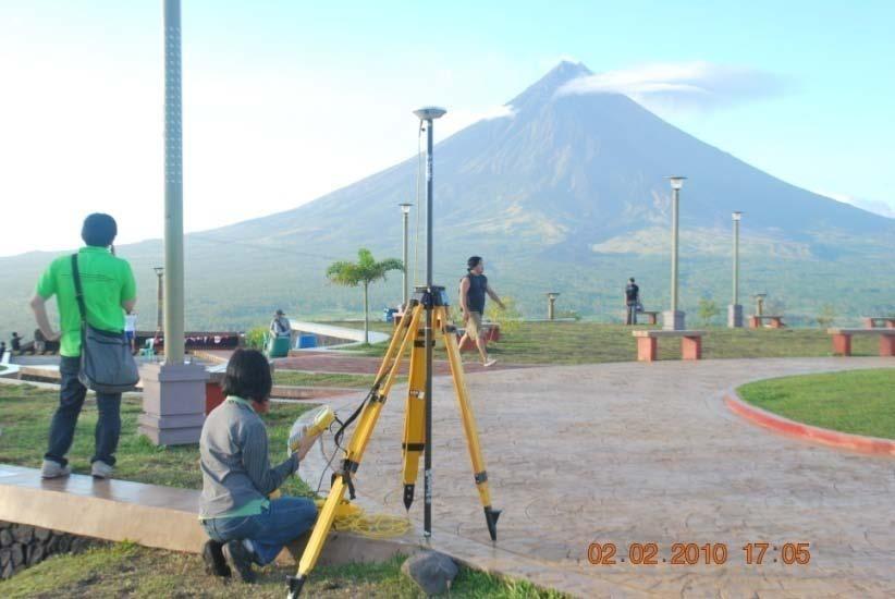
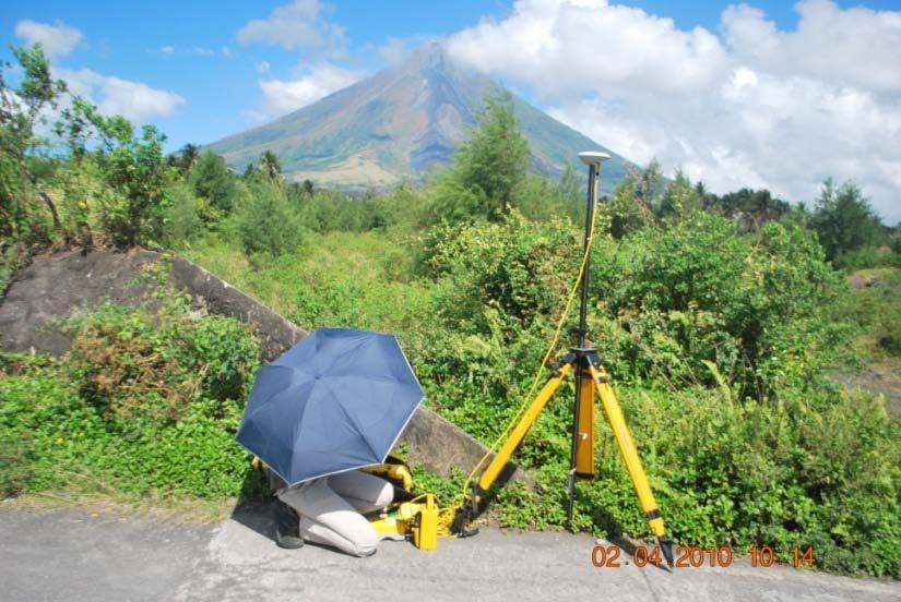
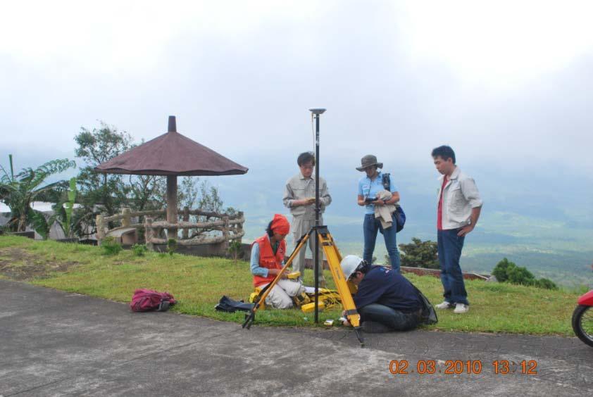
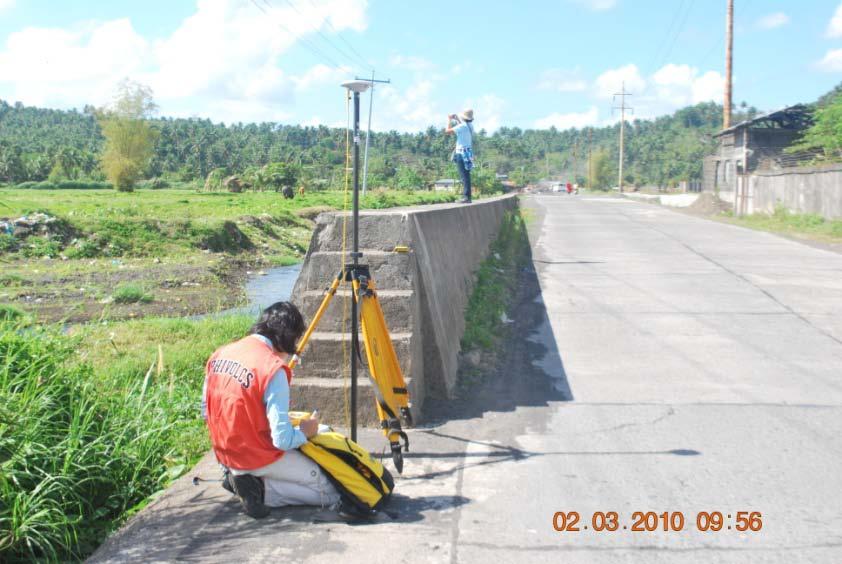
12 Fieldwork at Mayon (Feb 2010) FIELD VALIDATION: to collect Ground Control Points for DEM Validation Insrument used: Trimble 5700 GPS
")

13 Lahar Modeling Results 2000 Lahar Hazard Map (PHIVOLCS) Areas Susceptible to Lahars Identified through Modeling (PHIVOLCS)

14 Revised Mayon Volcano Lahar Hazard Map March 2010

")

15 Study area 2: Iloilo City (PAGASA) Sentinel Asia Success Story in the Philippines ALOS Satellite Image Flood Hazard Map Iloilo City (PAGASA) Topography based on DEM Highly susceptible Moderately susceptible Low susceptibility


16 Study area 3: Antique (MGB) Sentinel Asia Success Story in the Philippines Flood Hazard Map of Antique


17 Technical Training Sentinel Asia Success Story in the Philippines February day technical training per agency: PHIVOLCS, PAGASA and MGB August technical training for OCD, NAMRIA, MGB, PAGASA, PHIVOLCS


18 Workshops Participants JAXA, PHIVOLCS, PAGASA, MGB, NAMRIA, OCD, PCASTRD and local disaster managers 1 st Workshop Introduction of Project; 20 March 2009, Makati City; 2 nd Workshop Sharing of preliminary results and information; Ilo-ilo City 3 rd Workshop Presentation of results, SA systems operation, open source tools for image overlaying to local maps; Manila City

19 Emergency Observation When disaster happens, Sentinel Asia can accept Emergency Observation Request from users, and Space Agency observes disaster afflicted area by Satellite. Then satellite imagery are provided to users.


20 EOR: Flooding related to SW monsoon rains in Botolan, Zambales, Luzon Island, August 8, 2009 Objectives: 1. Determine extent and cause of flooding in A Botolan; threatened by lahars and floods after 1991 eruption of Pinatubo 2. Determine changes in the river system 3. Recommend actions to the local government 10 Flooded villages: 1.5 m high


21 EOR: Flooding related to SW monsoon rains in Botolan, Zambales, Luzon Island, August 8, 2009 Flooded areas Overflow point; dike breached January 27, 2009 August 11, 2009


22 Mayon Volcano December 2009 Eruption Eruption: December 14-29, 2009 Explosions Lava flow Lava collapse and pyroclastic flow Intense seismic activity, 20 Dec


23 EOR: Mayon Volcano December 2009 Eruption Lava Flow Monitoring hazard monitoring monitoring of volume of erupted materials for volcanic activity assessment ALOS Dec 25, 2009 Lava Flow: 4.4km Helicopter, Jan 6, 2009 Lava Flow: 4.7 km


 Narrow Band Problems SA contents")

24 Utilization of WINDS in Sentinel Asia WINDS Observation System Tsunami Observation Data Archived Data Value-added Products Earthquake Flood Volcano Wildfire INTERNET High Speed Communication ( Mbps) Narrow Band Problems SA contents transmitted via WINDS Disaster Management Agencies in the Asia-Pacific Region Local Mirroring to user From JAXA
25 Utilization of WINDS in Distribution of Data From JAXA Thailand Japan Central Server Regional ServerPhilippines Regional Server ASTI-DOST receives data via WINDS and forwards data to PHIVOLCS PHIVOLCS-DOST receives downloaded data from ASTI and/or download from ASTI server forwards data to partner Disaster Management agencies

26 Possible Tie-up with JICA-JST Project led by NIED and PHIVOLCS 5

27 Component 2: Evaluation of earthquake generation potential Evaluation of Earthquake Generation Potential Cotabato Trench Philippine Trench Philippine Fault Coupling Model Coupling Model Recurrence time and Magnitude Recurrence time and Magnitude, Fault segment Geological and Geomorphological Approach Terrace structure Tsunami deposit Fault Trenching Topography Plate velocity and coupling Strain accumulation process Geophysical Approach GPS Campaign and Continuous observations


28 Component 3: Integrated real-time volcano monitoring Broadband seismic monitoring of underground magma movements Infrasound observation for detection and size estimation of eruptions GPS observations for estimation of deformation and pressure source Electromagnetic observations to monitor thermal structure CCD Live cam Satellite telemetry to Manila VSAT Broadband/Infrasound, GPS, Electromagnetic Broadband only Manila Installation of a system of comprehensive monitoring of the precursors


29 Possible Study Areas Active volcanoes and faults by interferometry Manila Bay West Valley Fault Taal Volcano Taal Volcano Source: HIGP, Univ. Hawaii Mayon Volcano
30 THANK YOU! PHIVOLCS Building, CP Garcia Ave. UP Campus, Diliman, Quezon City Tel (632) ; (632) ; Fax (632)
INTRODUCTION OF A SUCCESS STORY IN THE PHILIPPINES
 INTRODUCTION OF A SUCCESS STORY IN THE PHILIPPINES Arturo S. Daag Department of Science and Technology Philippine Institute of Volcanology and Seismology (DOST-PHIVOLCS) Establishment of Sentinel Asia
Contribution of Sentinel Asia Activities to Disaster Management in Asia Pacific Region: Sentinel Asia Success Story in the Philippines Project
 Contribution of Sentinel Asia Activities to Disaster Management in Asia Pacific Region: Sentinel Asia Success Story in the Philippines Project Arturo Daag PHIVOLCS, PHILIPPINES 13 October 2015 Bangkok
International Symposium on Earthquake & Tsunami Disaster Reduction, March 14-15, 2012, Sendai, Japan
 International Symposium on Earthquake & Tsunami Disaster Reduction, March 14-15, 2012, Sendai, Japan E h Enhancement t off earthquake th k and d volcano monitoringg in the Philippines: Progress report
Overview of Philippine Geohazards Programs
 Overview of Philippine Geohazards Programs 53 rd CCOP Annual Session CCOP-IUGS Task Group on Geohazards Joint Seminar Cebu City, PHILIPPINES October 18, 2017 Renato U. Solidum, Jr. Department of Science
Utilization of Satellite for Disaster Management with a Focus on the Sentinel Asia
 2013/01/23 Asian Conference on Reduction 2013 Utilization of Satellite for Management with a Focus on the Sentinel Asia Ichiro NAITO JAXA Space Applications and Promotion Center Management Support Systems
JICA s Experiences of Connecting Japanese Science & Technologies for Disaster Risk Reduction in Developing Countries
 JICA s Experiences of Connecting Japanese Science & Technologies for Disaster Risk Reduction in Developing Countries Junji WAKUI Deputy Director General, Group Leader Disaster Risk Reduction Group Global
GEOLOGIC HAZARDS AND DISASTER REDUCTION EFFORTS IN THE PHILIPPINES
 GEOLOGIC HAZARDS AND DISASTER REDUCTION EFFORTS IN THE PHILIPPINES 23 rd Asia-Pacific Advanced Network Meeting January 22-26, 2007 Renato U. Solidum Jr Director Philippine Institute of Volcanology and
Current tsunami research activities in the Philippines
 DOST PHIVOLCS Current tsunami research activities in the Philippines Graciano P. Yumul, Jr. 1,2, Carla B. Dimalanta 1 and Bart Bautista 3 1 National Institute of Geological Sciences, University of the
GEO-VIII November Geohazard Supersites and Natural Laboratories Progress Report. Document 9
 GEO-VIII 16-17 November 2011 Geohazard Supersites and Natural Laboratories Progress Report Document 9 This document is submitted to GEO-VIII for information. Geohazard Supersites and Natural Laboratories
Sentinel Asia System Operation for Disaster Management in Sri Lanka Major General L.B.R. Mark (Retd) Director General Disaster Management Centre
 Director General Disaster Management Centre") Sentinel Asia System Operation for Disaster Management in Sri Lanka Major General L.B.R. Mark (Retd) Director General Disaster Management Centre Government of Sri Lanka OUTLINE Background Disasters in
Sentinel Asia System Operation for Disaster Management in Sri Lanka Major General L.B.R. Mark (Retd) Director General Disaster Management Centre Government of Sri Lanka OUTLINE Background Disasters in
4 th Joint Project Team Meeting for Sentinel Asia 2011
 A Revisit on the Structural Flood Mitigation Measure with the Application of Remote Sensing and GIS in Gin River Basin, Sri Lanka 4 th Joint Project Team Meeting for Sentinel Asia 2011 Geoinformatics Center
Sentinel Asia Data Provider Node Report
 Sentinel Asia Data Provider Node Report Joint Project Team Meeting for Sentinel Asia STEP3 (JPTM2018) 23 24 January 2018, Taipei, Taiwan Yuji TAKADA Space Applications and Operations Center (SAOC) Japan
The Magnitude 7.2 Earthquake from the West Valley Fault: Implications for Metro Manila and Nearby Provinces
 The Magnitude 7.2 Earthquake from the West Valley Fault: Implications for Metro Manila and Nearby Provinces First DRI Collegiate Conference in the Philippines 16 March 2017 Renato U. Solidum, Jr. Department
Establishment of WINDS Ground Station in Sri Lanka. By G.K.D. Amarawardena Additional Secretary Ministry of Disaster Management Sri Lanka
 Establishment of WINDS Ground Station in Sri Lanka By G.K.D. Amarawardena Additional Secretary Ministry of Disaster Management Sri Lanka Contents Background SAS Implementation Progress of WINDS establishment
MARITON V. BORNAS, MSc. Philippine Institute of Volcanology & Seismology C.P. Garcia Ave., Univ. of the Philippines Campus Diliman 1101 Quezon City
 OVERVIEW OF PINATUBO LAHARS & RELATED FLOODING IN CENTRAL LUZON MARITON V. BORNAS, MSc. Philippine Institute of Volcanology & Seismology C.P. Garcia Ave., Univ. of the Philippines Campus Diliman 1101 Quezon
EARTHQUAKE SOURCE PARAMETERS FOR SUBDUCTION ZONE EVENTS CAUSING TSUNAMIS IN AND AROUND THE PHILIPPINES
 EARTHQUAKE SOURCE PARAMETERS FOR SUBDUCTION ZONE EVENTS CAUSING TSUNAMIS IN AND AROUND THE PHILIPPINES Joan Cruz SALCEDO Supervisor: Tatsuhiko HARA MEE09186 ABSTRACT We have made a set of earthquake source
NGIAs' roles in successful disaster response
 The Second UN-GGIM-AP Plenary Meeting NGIAs' roles in successful disaster response Japan Teheran Iran 28 October 2013 Shin-ichi SAKABE, Director of International Affairs Division Geospatial Information
AND THE COOPERATION WITH SENTINEL ASIA FOR DISASTER MANAGEMENT
 Ministry of Natural resources and Environment National Remote Sensing DEpartment NATIONAL REMOTE SENSING DEPARTMENT (NRSD) AND THE COOPERATION WITH SENTINEL ASIA FOR DISASTER MANAGEMENT By: Dr. Chu Hai
KARI Activation for the International Disasters
 KARI Activation for the International Disasters 5 th Joint Project Team Meeting for Sentinel Asia STEP2 (JPTM2012) 14 th Nov 2012 Boyeol Yoon Senior Researcher, Satellite Information Research Center (SIRC)
Philippines: Mining or Food?
 Philippines: Mining or Food? by Robert Goodland and Clive Wicks for The Working Group on Mining in the Philippines Annex G: Geohazards and Earthquakes1 in the Philippines Sustainable development is development
Debris Avalanches. Debris avalanche deposits on a volcano in Chile. All of the area in the foreground is buried by a thick debris avalanche.
 Debris Avalanches Volcanoes are not very stable structures. From time to time, they collapse producing large rock and ash avalanches that travel at high speeds down valleys. Collapse maybe caused by an
Juban is faced with several major, major,major,major, major Natural Disasters and Hazards..
 Juban Hazards Juban Disaster Risk Reduction and Management Council (JMDRRMC) Juban Hazard Profile Juban is faced with natural multigeohazards / disasters. >>> Typhoons / Floods Bicol Region typhoon belt
LECTURE #11: Volcanoes: Monitoring & Mitigation
 GEOL 0820 Ramsey Natural Disasters Spring, 2018 LECTURE #11: Volcanoes: Monitoring & Mitigation Date: 15 February 2018 I. What is volcanic monitoring? the continuous collection of one or more data sources
PROFILING OF MAJOR RIVER SYSTEMS AROUND MAYON VOLCANO USING AIRSAR IMAGES
 PROFILING OF MAJOR RIVER SYSTEMS AROUND MAYON VOLCANO USING AIRSAR IMAGES Rowena B. QUIAMBAO, Ronnie C. Torres Philippine Institute of Volcanology & Seismology C.P. Garcia Street, University of the Philippines
JCOMM-CHy Coastal Inundation Forecasting Demonstration Project (CIFDP)
") WMO World Meteorological Organization Working together in weather, climate and water JCOMM-CHy Coastal Inundation Forecasting Demonstration Project (CIFDP) Coastal Flooding & Vulnerable Populations Coastal
WMO World Meteorological Organization Working together in weather, climate and water JCOMM-CHy Coastal Inundation Forecasting Demonstration Project (CIFDP) Coastal Flooding & Vulnerable Populations Coastal
GENERAL. CHAPTER 1 BACKGROUND AND PURPOSE OF THE GUIDELINES Background of the Guidelines Purpose of the Guidelines...
 GENERAL CHAPTER 1 BACKGROUND AND PURPOSE OF THE GUIDELINES... 1 1.1 Background of the Guidelines... 1 1.2 Purpose of the Guidelines... 3 CHAPTER 2 APPLICATION OF THE GUIDELINES... 3 2.1 Potential Users
Sri Lanka Enhancing the Role of ICTs for Disaster Risk Management
 Workshop on ICT for Promoting Inclusive and Disaster Resilient Development Ulaanbaatar, Mongolia Sri Lanka Enhancing the Role of ICTs for Disaster Risk Management Kanchana Thudugala Programme Head, eservices
Sentinel Asia Tsunami Working Group
 Sentinel Asia Tsunami Working Group Co-Chairman: Prof. Shunichi Koshimura Abdul Muhari, PhD 4 th Joint Project Team Meeting (JPTM 2017): Sentinel Asia STEP 3 Abdul MUHARI, PhD Ministry of Marine Affairs
ABSTRACT. Keywords: Flood hazard mapping, hydro-geomorphic method, hydrologic modelling method, return period, rainfall runoff inundation.
 EVALUATION OF FLOOD-PRONE AREAS IN BICOL RIVER BASIN, PHILIPPINES: COMPARISON OF FLOOD HAZARD MAPPING USING HYDRO- GEOMORPHIC AND HYDROLOGIC MODELLING METHODS Emar Guevara Basilan MEE13630 Supervisor:
Location Option Details. 1. Florida
 1. Florida Florida has the smallest number of earthquaes in the United States. Florida is the U.S. location where hurricanes are most frequent. Of the six deadliest hurricanes to hit the continental U.S.,
10 emergency observation requests were successfully processed during the period
 ISRO s Inputs for the Sentinel Asia DPN and JPT meeting being held during 13-16, 16, November 2012 November 2012 Sentinel Asia Activity Spectrum - A dedicated Sentinel Asia server established at NRSC,
An Application of Hydrometeorological Information
 An Application of Hydrometeorological Information Weather-proof Café: Hydro-meteorological information in managing weather risks 17 19 November 2012 National Taiwan University, Chinese Taipei Nikos Viktor
Improvement of Hazard Assessment and Management in the Philippines
 Improvement of Hazard Assessment and Management in the Philippines (2014 Summer Training Course for Slope Land Disaster Reduction) Ian Alejandrino (Philippines) Nguyen Manh Hieu (Vietnam) Presentation
Disaster Management and Spatial Data An Experience of Sri Lanka for Joint project team meeting 2012
 Disaster Management and Spatial Data An Experience of Sri Lanka for Joint project team meeting 2012 1 by Padma Kumara Withana Provincial Surveyor General Uva Province 2 Out line ü Introduction ü Natural
Satellite Remote Sensing for Ocean
 Satellite Remote Sensing for Ocean August 17, 2017 Masatoshi Kamei RESTEC All rights reserved RESTEC 2015 Contents 1. About RESTEC and Remote Sensing 2. Example of Remote Sensing Technology 3. Remote Sensing
FINAL EXAM December 20 th, here at 1:00 3:00 pm
 FINAL EXAM December 20 th, here at 1:00 3:00 pm REVIEW SESSION December 11 th at 6:00-7:30 pm Morrill I Auditorium (Room N375) Same as last time Don t forget your online course evaluations! Major Volcanic
Analysis of Positional Displacement in Bohol Island on Aftermath of the 2013 Central Visayas Earthquake from GNSS Surveys
 Analysis of Positional Displacement in Bohol Island on Aftermath of the 2013 Central Visayas Earthquake from GNSS Surveys Louie P. BALICANTA, Enrico C. PARINGIT and Joemarie S. CABALLERO, Philippines Key
Applied Geoscience and Technology Division SOPAC. Joy Papao, Risk Information Systems Officer
 Joy Papao, Risk Information Systems Officer Secretariat of the Pacific Community SPC 22 Pacific Island States Head office in Noumea, New Caledonia 2 Regional offices (Pohnpei and Honiara) 600 staff 9 Technical
Data Provider Node Report
 Data Provider Node Report March 8, 2017 Joint Project Team Meeting for Sentinel Asia STEP3 (JPTM2017) Hani, Vietnam Yuji Takada Space Application and Operations Center Japan Aerospace Exploration Agency
Lessons from the 2004 Sumatra earthquake and the Asian tsunami
 Lessons from the 2004 Sumatra earthquake and the Asian tsunami Kenji Satake National Institute of Advanced Industrial Science and Technology Outline 1. The largest earthquake in the last 40 years 2. Tsunami
held on 4 June 2013 Prof. Yoshimori Honkura, Program Officer of Japan Science and Technology Agency (JST) Jakarta, Indonesia Pan Pacific Hotel)
 Jakarta, Indonesia Pan Pacific Hotel)") Overview of the Outcomes from e-asia JRP Disaster Prevention Workshop held on 4 June 2013 Prof. Yoshimori Honkura, Program Officer of Japan Science and Technology Agency (JST) Jakarta, Indonesia (@Sari
Overview of the Outcomes from e-asia JRP Disaster Prevention Workshop held on 4 June 2013 Prof. Yoshimori Honkura, Program Officer of Japan Science and Technology Agency (JST) Jakarta, Indonesia (@Sari
History of International Training in Seismology and Earthquake Engineering at IISEE
 History of International Training in Seismology and Earthquake Engineering at IISEE Activities of International Institute of Seismology and Earthquake Engineering (IISEE), BRI - Training for young researchers/engineers
Progress Report. Flood Hazard Mapping in Thailand
 Progress Report Flood Hazard Mapping in Thailand Prepared By: Mr. PAITOON NAKTAE Chief of Safety Standard sub-beuro Disaster Prevention beuro Department of Disaster Prevention and Mitigation THAILAND E-mail:
SEISMIC RISK ASSESSMENT IN ARMENIA
 SEISMIC RISK ASSESSMENT IN ARMENIA Hovhannes Khangeldyan Head of National Crisis Management Center Rescue Service Ministry of Emergency Situations of the Republic of Armenia Tokyo, 2016 ARMENIA: GEOGRAPHICAL
Figure 8-21 Distribution of Lava Flow for the Model
 Figure 8-21 Distribution of Lava Flow for the Model 2) Pyroclastic Flow The energy cone model was used for the simulation. a. The angle of inclination of Energy Line, φ, from the summit was 5.3 degrees
19. Esan Continuously Monitored by JMA
 19. Esan Continuously Monitored by JMA Latitude: 41 48'17" N, Longitude: 141 09'58" E, Elevation: 618 m (Esan) (Triangulation Point) Overview of Esan, taken from east side on March 13, 2009 by the Japan
Capacity Building in Applications of Remote Sensing and GIS for Disaster Management
 Capacity Building in Applications of Remote Sensing and GIS for Disaster Management M.K. Hazarika, L. Samarakoon, N. Senevirathne, J.S.M. Fowze and R. de Silva Project Researcher GeoInformatics Center
UNIVERSITY GADJAH MADA EUBIOS YOUTH LOOKING BEYOND DISASTER (LBD5) FORUM 4-8 SEPTEMBER, Hosted by: Universitas Gadjah Mada
 FORUM 4-8 SEPTEMBER, Hosted by: Universitas Gadjah Mada") UNIVERSITY GADJAH MADA EUBIOS YOUTH LOOKING BEYOND DISASTER (LBD5) FORUM 4-8 SEPTEMBER, 2014 Hosted by: Universitas Gadjah Mada Outline LBD program Brief Information of Universitas Gadjah Mada, Indonesia
UNIVERSITY GADJAH MADA EUBIOS YOUTH LOOKING BEYOND DISASTER (LBD5) FORUM 4-8 SEPTEMBER, 2014 Hosted by: Universitas Gadjah Mada Outline LBD program Brief Information of Universitas Gadjah Mada, Indonesia
Orting Community College Proposal
 Orting Community College Proposal Cedric, Celina, Francine, Sarah, Samuel GEO CORP Located in Washington, 42 miles south of Seattle. Situated between two rivers on fertile plains. Built on lahar deposits.
Tracking Down the Source
 Tracking Down the Source Overview: In this lesson, students use online databases and Google Earth to track down the source of a tsunami. (NOTE: Please teach the GIT Lesson on placemarks prior to this lesson.)
Hazards in the Seattle Area. Disaster Questions. Where Were You? Where Were You? Volcanoes St. Helens Adams, Rainier, Glacier, Baker
 Hazards in the Seattle Area Volcanoes St. Helens Adams, Rainier, Glacier, Baker Earthquakes Outer coast Puget Sound (Seattle Fault & others) Tsunami Outer coast Puget Sound (Seattle Fault & others) Disaster
March 2007 The Survey Department of Sri Lanka
 Contribution of Survey Department of Sri Lanka for Mitigation of Disasters in Sri Lanka K.A.U.N.Kasthuri Deputy Surveyor General (Information Technology) March 2007 The Survey Department of Sri Lanka 1
The challenge of risk communication how risk communication is the key to triggering action: Experiences from the Philippines and PNG
 The challenge of risk communication how risk communication is the key to triggering action: Experiences from the Philippines and PNG Dr Andrew Jones on behalf of the Regional Development Group and partners
Rainfall-Flood Hazard along the Cagayan River in Carmen
 -Flood Hazard along the Cagayan River in Carmen Things to watch out for when rain falls intensity 12 December 2013, Cagayan de Oro City Hall 3 +1 main questions I What do we need to understand about rainfall
New A-Level Physical Geography
 Half Term 1 3.1 Physical Geography: 3.1.5 Hazards: Plate Tectonics This optional section of our specification focuses on the lithosphere and the atmosphere, which intermittently but regularly present natural
Interpretive Map Series 24
 Oregon Department of Geology and Mineral Industries Interpretive Map Series 24 Geologic Hazards, and Hazard Maps, and Future Damage Estimates for Six Counties in the Mid/Southern Willamette Valley Including
NATURAL HAZARDS MODULE
 NATURAL HAZARDS MODULE Table of Content Vocabulary... 86 Background Infromation... 87 Introduction... 89 Group activity... 90 Worksheets: Oral history... 93 Written history... 95 Mordern planning... 96
What Are Disasters? The Rescue Kids Trio!
 The Rescue Kids Trio! What Are Disasters? This manual was made possible through funding by the Council of Local Authorities for International Relations. Disasters and emergency preparedness Emergency preparedness
How the earthquakes and landslides affect Quito, my place. Ecuador is located on the Northwestern part of the South-American plate which is being
 How the earthquakes and landslides affect Quito, my place. Ecuador is located on the Northwestern part of the South-American plate which is being subducted by the Nazca plate. Due to this subduction a
Tectonic Processes and Hazards Enquiry Question 1: Why are some locations more at risk from tectonic hazards?
 Tectonic Processes and Hazards Enquiry Question 1: Why are some locations more at risk from tectonic hazards? Key words Basalt Andesite Rhyolite Benioff Zone Subduction zone Crustal fracturing Definition
Report of the Working Group 2 Data Sharing and Integration for Disaster Management *
 UNITED NATIONS E/CONF.104/6 ECONOMIC AND SOCIAL COUNCIL Twentieth United Nations Regional Cartographic Conference for Asia and the Pacific Jeju, 6-9 October 2015 Item 5 of the provisional agenda Report
EMERGENCY PLANNING IN NORTHERN ALGERIA BASED ON REMOTE SENSING DATA IN RESPECT TO TSUNAMI HAZARD PREPAREDNESS
 EMERGENCY PLANNING IN NORTHERN ALGERIA BASED ON REMOTE SENSING DATA IN RESPECT TO TSUNAMI HAZARD PREPAREDNESS Barbara Theilen-Willige Technical University of Berlin, Institute of Applied Geosciences Department
Indian Ocean Tsunami Warning System: Example from the 12 th September 2007 Tsunami
 Indian Ocean Tsunami Warning System: Example from the 12 th September 2007 Tsunami Charitha Pattiaratchi 1 Professor of Coastal Oceanography, The University of Western Australia Email: chari.pattiaratchi@uwa.edu.au
Tsunami Risk Mitigation Strategy for Thailand. Kjell Karlsrud Norwegian Geotechnical Institute (NGI)
") Tsunami Risk Mitigation Strategy for Thailand Kjell Karlsrud Norwegian Geotechnical Institute (NGI) The project was undertaken by NGI in cooperation with: NORSAR, UiB, UiO, NIBR, B.Heyerdahl, NTNU, Sintef
Tsunami Risk Mitigation Strategy for Thailand Kjell Karlsrud Norwegian Geotechnical Institute (NGI) The project was undertaken by NGI in cooperation with: NORSAR, UiB, UiO, NIBR, B.Heyerdahl, NTNU, Sintef
NORTH VISTA SECONDARY SCHOOL HUMANITIES DEPARTMENT SECONDARY 3 EXPRESS HUMANITIES (GEOGRAPHY) 2272/02 CONTENT OUTLINE Term 1
 2272/02 CONTENT OUTLINE Term 1") NORTH VISTA SECONDARY SCHOOL HUMANITIES DEPARTMENT SECONDARY 3 EXPRESS HUMANITIES (GEOGRAPHY) 2272/02 CONTENT OUTLINE 2019 Term 1 Week Learning Outcomes Skills to be covered Assignment Test Project 1-2
NORTH VISTA SECONDARY SCHOOL HUMANITIES DEPARTMENT SECONDARY 3 EXPRESS HUMANITIES (GEOGRAPHY) 2272/02 CONTENT OUTLINE 2019 Term 1 Week Learning Outcomes Skills to be covered Assignment Test Project 1-2
PAGASA s Expectations of New-generation Satellites for Hazard Monitoring
 Country Report Philippines PAGASA s Expectations of New-generation Satellites for Hazard Monitoring VICENTE P. PALCON, JR. (Assistant Weather Services Chief) Weather Division- PAGASA DOST Email: vppalconjr@pagasa.dost.gov.ph
Homework III. Volcanological Exercises
 Page 1 of 5 EENS 3050 Tulane University Natural Disasters Prof. Stephen A. Nelson Homework III. Volcanological Exercises This page last updated on 16-Feb-2018 1. In your work as an insurance company executive
Applying Hazard Maps to Urban Planning
 Applying Hazard Maps to Urban Planning September 10th, 2014 SAKAI Yuko Disaster Management Expert JICA Study Team for the Metro Cebu Roadmap Study on the Sustainable Urban Development 1 Contents 1. Outline
EAS 116 Earthquakes and Volcanoes
 EAS 116 Earthquakes and Volcanoes J. Haase Forecasting Volcanic Eruptions Assessment of Volcanic Hazard Is that volcano active? Mount Lassen: 12000 BP and 1915 Santorini, IT: 180,000 BP, 70,000 BP, 21000
Also, when Cascade volcanoes do erupt, high-speed avalanches of pyroclastic flows
 INTRODUCTION A volcano is a vent through which molten rock escapes to the Earth s surface. Unlike other mountains, which are pushed up from below, volcanoes are built by surface accumulation of their eruptive
Overview of Early Warning Systems and the role of National Meteorological and Hydrological Services
 Overview of Early Warning Systems and the role of National Meteorological and Hydrological Services South Africa Second Experts Symposium on Multi-Hazard Early Warning Systems With focus on the Role of
Committee on Earth Observation Satellites. The CEOS Volcano Demonstrator Rationale and Implementation
 Committee on Earth Observation Satellites The CEOS Volcano Demonstrator Rationale and Implementation Why focus on volcanoes? Over 300,000 people have been killed by volcanoes since the 1600s Globally,
Australia Government Geospatial Capacity Building Efforts in Asia and the Pacific. Dr John Dawson
 Australia Government Geospatial Capacity Building Efforts in Asia and the Pacific Dr John Dawson Presentation Overview About Geoscience Australia Examples of Geospatial Capacity Building Activity Geodesy
Geohazard Supersites and Natural Laboratories
 Geohazard Supersites and Natural Laboratories FRINGE 2011, Frascati, Italy, September 19, 2011 Wolfgang Lengert, ESA Falk Amelung, University of Miami, GEO task lead Craig Dobson, NASA, CEOS task lead
The Rapid Earthquake Damage Assessment System (REDAS) Software
 Software") Proceedings of the Ninth Pacific Conference on Earthquake Engineering Building an Earthquake-Resilient Society 14-16 April, 2011, Auckland, New Zealand The Rapid Earthquake Damage Assessment System (REDAS)
Proceedings of the Ninth Pacific Conference on Earthquake Engineering Building an Earthquake-Resilient Society 14-16 April, 2011, Auckland, New Zealand The Rapid Earthquake Damage Assessment System (REDAS)
Earthquake prediction through Kannan-Mathematical-Model Analysis and Dobrovolsky-based clustering Technique
 Earthquake prediction through Kannan-Mathematical-Model Analysis and Dobrovolsky-based clustering Technique Jacenth Mejia 1*, Kurt Rojas 1, Nadia Valeza 1, and Al Rey Villagracia 1 1 Physics Department,
Debris flow: categories, characteristics, hazard assessment, mitigation measures. Hariklia D. SKILODIMOU, George D. BATHRELLOS
 Debris flow: categories, characteristics, hazard assessment, mitigation measures Hariklia D. SKILODIMOU, George D. BATHRELLOS Natural hazards: physical phenomena, active in geological time capable of producing
RADAR Remote Sensing Application Examples
 RADAR Remote Sensing Application Examples! All-weather capability: Microwave penetrates clouds! Construction of short-interval time series through cloud cover - crop-growth cycle! Roughness - Land cover,
Philippines NSDI Foundation Data Program. Andrew Bashfield
 Philippines NSDI Foundation Data Program Andrew Bashfield 1 Overview Part 1: Building the NSDI Framework Part 2: Collecting Foundation Datasets 2 Building the NSDI Framework Background & NDSI Overview
Global Map: A Tool for Disaster Mitigation for the Asia and Pacific Region
 Global Map: A Tool for Disaster Mitigation for the Asia and Pacific Region D. R. Fraser Taylor Chair, International Steering Committee for Global Mapping (ISCGM) fraser_taylor@carleton.ca www. 18 th United
Georeferencing and Satellite Image Support: Lessons learned, Challenges and Opportunities
 Georeferencing and Satellite Image Support: Lessons learned, Challenges and Opportunities Shirish Ravan shirish.ravan@unoosa.org UN-SPIDER United Nations Office for Outer Space Affairs (UNOOSA) UN-SPIDER
RESAP Progress Report
 RESAP Progress Report December 2016 to October 2017 Presentation to the Twenty-first session of the Intergovernmental Consultative Committee on the Regional Space Applications Programme for Sustainable
Natural Disasters in Member Countries (2002 Summary)
") 4.2 Member Countries and their Disaster Characteristics: Table 5: Natural Disasters in Member Countries (2002 Summary) (Country/Disaster Type/Disaster Characteristics) Data Country DisType Count of TotAff
4.2 Member Countries and their Disaster Characteristics: Table 5: Natural Disasters in Member Countries (2002 Summary) (Country/Disaster Type/Disaster Characteristics) Data Country DisType Count of TotAff
Seismic Activity and Crustal Deformation after the 2011 Off the Pacific Coast of Tohoku Earthquake
 J-RAPID Symposium March 6-7, 2013 Seismic Activity and Crustal Deformation after the 2011 Off the Pacific Coast of Tohoku Earthquake Y. Honkura Tokyo Institute of Technology Japan Science and Technology
Country Report. KAZAKHSTAN DAN of SENTINEL ASIA INITIATIVE
 Country Report KAZAKHSTAN DAN of SENTINEL ASIA INITIATIVE Putrajaya, 2011 LAND RESOURCES OF KAZAKHSTAN Area 2,72 mln km 2 Population 16 Mln Land use Area Mln. ha % Territory of Republic 272,4 Agriculture
APEC Research Center for Typhoon and Society (ACTS) 2013 Activity Plan: Asia-Pacific Weather Radar Data Exchange and Network for Landfall Typhoons
 2013 Activity Plan: Asia-Pacific Weather Radar Data Exchange and Network for Landfall Typhoons") 01/ISTWG/01 Agenda Item: Sub Group D APEC Research Center for Typhoon and Society (ACTS) 01 Activity Plan: Asia-Pacific Weather Radar Data Exchange and Network for Landfall Typhoons Purpose: Information
01/ISTWG/01 Agenda Item: Sub Group D APEC Research Center for Typhoon and Society (ACTS) 01 Activity Plan: Asia-Pacific Weather Radar Data Exchange and Network for Landfall Typhoons Purpose: Information
Capacity Building Activities at CRECTEALC. Ing. Jerjes Molina Blancas Professor and Developer.
 Capacity Building Activities at CRECTEALC Ing. Jerjes Molina Blancas Professor and Developer. Centro Regional de Enseñanza de Ciencia y Tecnología del Espacio para América Latina y el Caribe (CRECTEALC)
Application of a GIS for Earthquake Hazard Assessment and Risk Mitigation in Vietnam
 Application of a GIS for Earthquake Hazard Assessment and Risk Mitigation in Vietnam Nguyen Hong Phuong Earthquake Information and Tsunami Warning Centre, VAST OUTLINE Introduction Fault Source Model and
GUIDELINES FOR CONSTRUCTION TECHNOLOGY TRANSFER DEVELOPMENT OF WARNING AND EVACUATION SYSTEM AGAINST SEDIMENT DISASTERS IN DEVELOPING COUNTRIES
 GUIDELINES FOR CONSTRUCTION TECHNOLOGY TRANSFER DEVELOPMENT OF WARNING AND EVACUATION SYSTEM AGAINST SEDIMENT DISASTERS IN DEVELOPING COUNTRIES MARCH 2004 Ministry of Land, Infrastructure and Transport
STATUS OF HAZARD MAPS VULNERABILITY ASSESSMENTS AND DIGITAL MAPS
 JapanInternational Cooperation Agency STATUS OF HAZARD MAPS VULNERABILITY ASSESSMENTS AND DIGITAL MAPS ANGUILLA REPORT THE CARIBBEAN DISASTER EMERGENCY RESPONSE AGENCY () Table of Contents Page Preface
The Earthquake of Padang, Sumatra of 30 September 2009 scientific information and update
 The Earthquake of Padang, Sumatra of 30 September 2009 scientific information and update 01-October-2009 Christophe Vigny Directeur de recherches at CNRS Laboratoire de Géologie Geoscience Dept. Of ENS,
Volcanoes. Introduction
 Volcanoes Introduction Display Slide V-0 Explain that a volcano is a vent through which molten rock escapes to the Earth s surface. Unlike other mountains, which are pushed up from below, volcanoes are
Formulation of the Strategy for Disaster Risk Reduction and Emergency Preparedness and Response of the Asia-Pacific Region
 2008/SOM3/TFEP/SEM/006 Formulation of the Strategy for Disaster Risk Reduction and Emergency Preparedness and Response of the Asia-Pacific Region 2009-2015 Submitted by: Thailand Emergency Management CEOs
1) Which area has experienced the highest number of fatalities caused by natural disasters? a) North America b) Africa c) Europe d) Asia e) Australia
 Which area has experienced the highest number of fatalities caused by natural disasters? a) North America b) Africa c) Europe d) Asia e) Australia") SIO15 Midterm 1, Monday Oct. 29, 2018 TEST VARIATION: A 1) Which area has experienced the highest number of fatalities caused by natural disasters? a) North America b) Africa c) Europe d) Asia e) Australia
SIO15 Midterm 1, Monday Oct. 29, 2018 TEST VARIATION: A 1) Which area has experienced the highest number of fatalities caused by natural disasters? a) North America b) Africa c) Europe d) Asia e) Australia
Satellite-based applications for water resources management in Asia and Pacific region
 Satellite-based applications for water resources management in Asia and Pacific region Ko Hamamoto Japan Aerospace Exploration Agency The views expressed in this paper/presentation are the views of the
Oregon APA Legal Issues Workshop December 7, Tricia Sears, DLCD With information from Bill Burns, DOGAMI
 Oregon APA Legal Issues Workshop December 7, 2018 Tricia Sears, DLCD With information from Bill Burns, DOGAMI How this Topic Arrived WE FREQUENTLY HEAR CONCERNS ABOUT LIABILITY AND TAKINGS. Current federal
- facilitate the preparation of landslide inventory and landslide hazard zonation maps for the city, - development of precipitation thresholds,
 Date of Submission 29.03.2012 IPL Project Proposal Form 2012 (MAXIMUM: 3 PAGES IN LENGTH) 1. Project Title: (2 lines maximum)-introducing Community-based Early Warning System for Landslide Hazard Management
"The Natural Disasters, like The Sumatra Tsunami had taught us before -BUT" U Than Myint President Myanmar Engineering Society
 "The Natural Disasters, like The Sumatra Tsunami had taught us before -BUT" U Than Myint President Myanmar Engineering Society Present Day Regional Tectonic Setting of South East Asia Tsunami-generated
The PREVIEW project: general objectives and an overview of the landslides platform
 The PREVIEW project: general objectives and an overview of the landslides platform Risk Mitigation for Earthquakes and Landslides Giacomo Falorni Earth Sciences Dept. University of Firenze 19-20 July 2007
Overview of Consequences of the Tsunami in Thailand and Roles and Activities of the Department of Mineral Resources after the 26 December 2004 Tsunami
 Overview of Consequences of the Tsunami in Thailand and Roles and Activities of the after the 26 December 2004 Tsunami By Mr.Worawoot Tantiwanit, Thailand 1 Earthquake in NW of North Sumatra Island 580