The Magnitude 7.2 Earthquake from the West Valley Fault: Implications for Metro Manila and Nearby Provinces
|
|
|
- Margaret Catherine Patterson
- 5 years ago
- Views:
Transcription
1 The Magnitude 7.2 Earthquake from the West Valley Fault: Implications for Metro Manila and Nearby Provinces First DRI Collegiate Conference in the Philippines 16 March 2017 Renato U. Solidum, Jr. Department of Science and Technology Philippine Institute of Volcanology and Seismology
2 The Philippines is prone to large earthquakes and tsunamis.


3 Earthquake Activity in the Philippines (~90 destructive earthquakes for past 400 years)


4 Recent Large Earthquakes M6.9 Negros Earthquake February 2012 M7.9 Moro Gulf Earthquake and Tsunami August 1976 M7.8 Luzon Earthquake July 16, 1990 M7.2 Bohol Earthquake October 2013


5 FEBRUARY 10, 2017 M6.7 SURIGAO DEL NORTE EARTHQUAKE
6 Earthquake Disaster Losses Life loss or Injury Damage to house, building, property, contents, equipment = financial loss for replacement Loss of function, lifelines Loss of public services Loss of revenues from business interruption Loss of business or livelihood
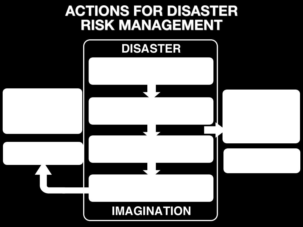
7 Why are there significant disaster losses?

8 Disaster Imagination
9
10 Metropolitan Manila and nearby provinces can be significantly affected by strong earthquakes and tsunamis


11 Latest Damaging Earthquake in Metro Manila M 7.3 Casiguran, Aurora Earthquake, 02 August 1968 Ruby Tower in Manila collapsed 268 killed, 260 injured

12 Earthquake Generators in Metro Manila and Vicinity Active Faults Trenches

13 The Valley Fault System West Valley Fault (WVF) ~ 100 km = M7.2 East Valley Fault ~ 10 km = M6.2 WVF moved 4 times generating major earthquakes in past 1400 years based on trenching; movement interval ~ 400 to 600 years


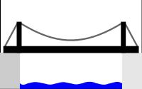
14 Earthquake Hazard Surface Faulting House, Mindoro, Philippines 1994 Road, Luzon, Philippines 1990 School ground, Sichuan, China 2008 Bridge,Taiwan 1999


15 West Valley Fault and Transport Systems Transects: Major roads (ex. C5, Ortigas, Marcos) SLEX Rail Line Near SLEX interchange: Alabang Susana

16 STRENGTH OF EARTHQUAKE: MAGNITUDE VERSUS INTENSITY INTENSITY Effect or felt strength at the surface MAGNITUDE Energy released during earthquake.

17 PHIVOLCS Earthquake Intensity Scale (PEIS) I - Scarcely Perceptible II - Slightly Felt III - Weak IV - Moderately Strong V - Strong VI VII VIII IX X - Very Strong - Destructive - Very Destructive - Devastating - Completely Devastating


18 Ground Shaking (West Valley Fault Earthquake) (Risk Analysis Project, 2013: PHIVOLCS, GA supported by AusAID) PAMPANGA PAMPANGA BULACAN BULACAN NCR RIZAL NCR RIZAL CAVITE CAVITE LAGUNA LAGUNA M7.2 M6.5


19 Earthquake Hazard Ground Shaking Freeway, California USA 1989 From USGS Hotel, Baguio, Philippines 1990 Interchange, California USA 1994 From cessnaclub172.com Electricity, Kathmandu, Nepal 2015
20 Building Damage & Casualty Estimates FOR METRO MANILA FROM A M7.2 WEST VALLEY FAULT EARTHQUAKE Residential Building (1,325,896) Damage Heavy -168,300 (12.7%) Partly - 339,800 (25.6%) Public Buildings Damage Heavy % Partly % Storey Building Damage Heavy - 11% Partly - 27% Storey Damage Heavy - 2% Partly - 12% Population (9,932,560) Casualty Dead 33,500 (0.3%) Injured 113,600 (1.1%) Additional Deaths by Fire 18,000 Metro Manila Earthquake Impact Reduction Study, 2004 JICA, PHIVOLCS, MMDA
21 Building Damage & Casualty Estimates FOR METRO MANILA FROM A WEST VALLEY FAULT EARTHQUAKE M7.2 M6.5 Total Floor Area in Complete 88,142,000 65,407,000 to Collapsed Damage (sqm) Total Floor Area in Slight 172,924, ,799,000 to Extensive Damage (sqm) Total Fatalities (Death) 31,000 23,000 Total Injuries Very Serious 14,000 10,000 Serious 112,000 85,171 Slight 385, ,000 Total Economic Losses (millions of PhP) 2,269,000 1,773,000 Risk Analysis Project, 2013 PHIVOLCS, UP-ICE, GA (AusAID)
22 Casualty Estimates FOR METRO MANILA AND SURROUNDING PROVINCES FROM A WEST VALLEY FAULT M7.2 EARTHQUAKE LOCATION FATALITIES VERY SERIOUS INJURY Metro Manila 34,714 17,782 Bulacan 2,848 1,137 Rizal 3,266 1,640 Cavite 4,128 1,961 Laguna 3,094 1,462 Pampanga TOTAL 48,237 24,232 PHIVOLCS Estimate


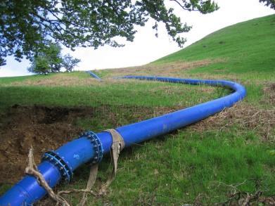
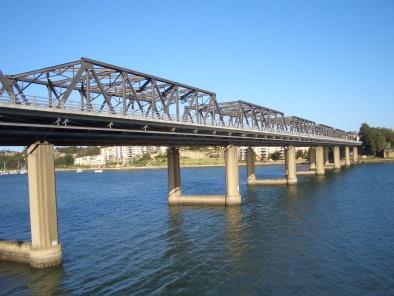


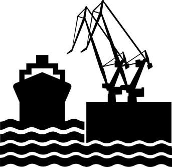
23 Damages on Lifelines Water Bridges Power Roads Telecommunication Ports

24 Liquefaction Potential M7.2 West Valley Fault Earthquake LEGEND High Moderate Areas underlain by loose and water-saturated sediments prone to liquefaction. (READY for GMMA Project, 2013)


25 Earthquake Hazard Liquefaction Bridge, Luzon, Philippines1990 Port, Kobe Japan 1995 From wordpress.org Road, Mindoro, Philippines1994 From wozawanderer.blogspot.com Water pipe, New Zealand, 2010
26 How do we prepare?
27 Risk Reduction in Metro Manila (MMEIRS, 2004) Develop national governance and business systems that are resistant to strong earthquakes Improve resiliency of urban structures and settlements Enhance current risk and emergency management Enhance community disaster management capacities Formulate reconstruction system Promote research and technology development
28 Earthquake-resilient national systems Assess and improve integrity buildings against earthquake and fire hazards Implement back-up systems, back-up sites, or mirror sites for data security and other critical operations Deconcentrate (transfer) operations to strategically-located sub-offices (national government and businesses)
29 Earthquake-resistant urban structures Strengthen houses and buildings against earthquake, tsunami and fire hazards Develop and introduce affordable seismic retrofitting measures to home owners Evaluate seismic performance of public buildings and retrofit public buildings with low rating Assess seismic performance of lifelines (water, power, communication and transport facilities (roads, bridges, ports, rail) and retrofit if necessary
30 Enhanced risk and emergency management Increase proportion of fire stations per square area Establish auxiliary fire-fighting capability of private organizations Establish emergency supply system of water, food, Improve hospital capacities Establish metro-wide emergency road network Establish heavy equipment arrangements for road clearing Establish emergency protocol for road-use priority between Batangas Port and Subic-Clark to Metro Manila Retrofit Manila port to earthquake- and tsunami- resistant construction
31 Enhanced risk and emergency management Redundancies in transport systems must be developed to lower the exposure to risk Establish new roads to Metro Manila from the north and south Decongest Port of Manila operations. Batangas Port to the south and Subic Port to the north must be developed and utilized. Second airport (example Clark) outside of Metro Manila and vicinity be fully developed and utilized

 Continuity Plans in government")
32 Increased community resilience Increase disaster imagination by communities through vulnerability and capacity assessment Conduct regular simulation exercises at all levels (national level to local chief executives and staffs involved in disaster management Encourage development of Business (Service) Continuity Plans in government and private sector
33 Reconstruction Plan Develop a reconstruction plan for Metro Manila and vicinity Develop transport facility reconstruction plan Conduct regular emergency operation exercise for lifeline Develop lifeline facility reconstruction plan
34 SUMMARY A large earthquake from the West Valley Fault can significantly affect Metro Manila and vicinity. We need to understand and appreciate the hazards and risks to prepare and respond appropriately. A whole of society approach is need to prepare for the Big One. Every organization must have a business continuity plan prepare not to be severely affected, prepare that you can operate immediately and be able to respond!


35 THANK YOU.
Overview of Philippine Geohazards Programs
 Overview of Philippine Geohazards Programs 53 rd CCOP Annual Session CCOP-IUGS Task Group on Geohazards Joint Seminar Cebu City, PHILIPPINES October 18, 2017 Renato U. Solidum, Jr. Department of Science
Land Use Planning and Management
 Implications of Nepal Earthquake on the Preparedness of Metro Manila and other Megacities Land Use Planning and Management Mario R. Delos Reyes UP-SURP Outline Implications of Tragic Nepal Earthquake Disaster,
Social Vulnerability in Metro Manila: Implications for Preparedness and Response "
 Social Vulnerability in Metro Manila: Implications for Preparedness and Response " Earthquake Resilience Conference: Collaboration and Coordination in Preparedness and Response" 20-21 May 2015" Antonia
Pacific Catastrophe Risk Assessment And Financing Initiative
 Pacific Catastrophe Risk Assessment And Financing Initiative TIMOR-LESTE September Timor-Leste is expected to incur, on average, 5.9 million USD per year in losses due to earthquakes and tropical cyclones.
Pacific Catastrophe Risk Assessment And Financing Initiative
 Pacific Catastrophe Risk Assessment And Financing Initiative VANUATU September 211 Country Risk Profile: VANUATU is expected to incur, on average, 48 million USD per year in losses due to earthquakes and
Pacific Catastrophe Risk Assessment And Financing Initiative
 Pacific Catastrophe Risk Assessment And Financing Initiative PALAU September is expected to incur, on average,.7 million USD per year in losses due to earthquakes and tropical cyclones. In the next 5 years,
Initiative. Country Risk Profile: papua new guinea. Better Risk Information for Smarter Investments PAPUA NEW GUINEA.
 Pacific Catastrophe Risk Assessment And Financing Initiative PAPUA NEW GUINEA September 211 Country Risk Profile: papua new is expected to incur, on average, 85 million USD per year in losses due to earthquakes
Pacific Catastrophe Risk Assessment And Financing Initiative
 Pacific Catastrophe Risk Assessment And Financing Initiative TUVALU is expected to incur, on average,. million USD per year in losses due to earthquakes and tropical cyclones. In the next 5 years, has
M-6.2 EARTHQUAKE NORCIA, ITALY AUGUST 24, 01:36:33 UTC
 M-6.2 EARTHQUAKE NORCIA, ITALY AUGUST 24, 2016 @ 01:36:33 UTC EARTHQUAKE REPORT - NORCIA, ITALY M-6.2, 24 August 2016 The M-6.2 earthquake had a shallow depth (10 km) and struck approximately 10 km SE
M-8.1 EARTHQUAKE 87KM SW OF PIJIJIAPAN, MEXICO EXACT LOCATION: N W DEPTH: 69.7KM SEPTEMBER 7, 11:49 PST
 M-8.1 EARTHQUAKE 87KM SW OF PIJIJIAPAN, MEXICO EXACT LOCATION: 15.068 N 93.715 W DEPTH: 69.7KM SEPTEMBER 7, 2017 @ 11:49 PST Photo: Luis Alberto Cruz / AP Photo: Carlos Jasso 1 THE 2017 CHIAPAS MEXICO
Earthquake Damage Scenario
 Chapter 2. Earthquake Damage Scenario CHAPTER 2. EARTHQUAKE DAMAGE SCENARIO 2.1 Earthquake Scenario Setting and Ground Motion 2.1.1 Fault in the Philippines The Philippines is located in latitude 5 to
HAZUS-MH: Earthquake Event Report
 HAZUS-MH: Earthquake Event Report Region Name: El Paso County Earthquake Scenario: El Paso County Random EQ Print Date: February 08, 2006 Disclaimer: The estimates of social and economic impacts contained
Progress Report: Sentinel Asia Success Story in the Philippines
 Progress Report: Sentinel Asia Success Story in the Philippines 3 rd Joint Project Team Meeting on the Sentinel Asia STEP-2 July 6-8, 2010 Hyatt Hotel, Manila, Philippines Renato U. Solidum Jr. Director
Mathematical models for estimating earthquake casualties and damage cost through regression analysis using matrices
 Journal of Physics: Conference Series OPEN ACCESS Mathematical models for estimating earthquake casualties and damage cost through regression analysis using matrices To cite this article: J D Urrutia et
SEISMIC RISK ASSESSMENT IN ARMENIA
 SEISMIC RISK ASSESSMENT IN ARMENIA Hovhannes Khangeldyan Head of National Crisis Management Center Rescue Service Ministry of Emergency Situations of the Republic of Armenia Tokyo, 2016 ARMENIA: GEOGRAPHICAL
SCENARIO DESIGN ON THE IMPACT OF A HIGH-MAGNITUDE EARTHQUAKE IN THE CITY OF LIMA, PERU
 SCENARIO DESIGN ON THE IMPACT EARTHQUAKE IN THE CITY OF LIMA, Methodology Determination of the characteristics of the probable earthquake (magnitude, intensity, acceleration). Seismic geotechnical soil
Surviving the Big One: Understanding and Preparing for a Major Earthquake in Western Oregon
 Surviving the Big One: Understanding and Preparing for a Major Earthquake in Western Oregon May 21, 2013 City of Salem Salem Public Library Althea Rizzo, Geological Hazards Program Coordinator Oregon Emergency
The 2013 Bohol earthquake in central Philippines: Hazards and source fault characteristics
 The 2013 Bohol earthquake in central Philippines: Hazards and source fault characteristics Noelynna T. Ramos1, Kathrine V. Maxwell1, Betchaida D. Payot1, Nichole Anthony D. Pacle1, Carla B. Dimalanta1,
Earthquake Hazards. Tsunami
 Earthquake Hazards Tsunami Measuring Earthquakes Two measurements that describe the power or strength of an earthquake are: Intensity a measure of the degree of earthquake shaking at a given locale based
Important Concepts. Earthquake hazards can be categorized as:
 Lecture 1 Page 1 Important Concepts Monday, August 17, 2009 1:05 PM Earthquake Engineering is a branch of Civil Engineering that requires expertise in geology, seismology, civil engineering and risk assessment.
APPLICATIONS OF EARTHQUAKE HAZARD MAPS TO LAND-USE AND EMERGENCY PLANNING EXAMPLES FROM THE PORTLAND AREA
 APPLICATIONS OF EARTHQUAKE HAZARD MAPS TO LAND-USE AND EMERGENCY PLANNING EXAMPLES FROM THE PORTLAND AREA O. Gerald Uba Metro, Portland, Oregon OVERVIEW The extent to which we understand "below ground"
M 7.1 EARTHQUAKE 5KM ENE OF RABOSO, MEXICO EXACT LOCATION: N W DEPTH: 51.0KM SEPTEMBER 19, 1:14 LOCAL TIME
 M 7.1 EARTHQUAKE 5KM ENE OF RABOSO, MEXICO EXACT LOCATION: 18.584 N 98.399 W DEPTH: 51.0KM SEPTEMBER 19, 2017 @ 1:14 LOCAL TIME Photo: Eduardo Verdugo / AP Photo: Alfredo Estrella/ Agence France-Presse/
Damage Estimation
 Final Report 13.4.2 Damage Estimation The definition of human casualty estimation is shown in Table 13.4.1. Casualties were calculated for scenario earthquakes Model 08, Model 13 and Model 18. In this
Formation of the Final Report
 Formation of the Final Report The Final Report is comprised of the following volumes: Volume 1: Executive Summary Volume 2: Main Report 1 Volume 3: Main Report 2 Volume 4: Main Report 3 Volume 5: Supporting
Earthquake Hazards. Tsunami
 Earthquake Hazards Tsunami Review: What is an earthquake? Earthquake is the vibration (shaking) and/or displacement of the ground produced by the sudden release of energy. The point inside the Earth where
GEOLOGIC HAZARDS AND DISASTER REDUCTION EFFORTS IN THE PHILIPPINES
 GEOLOGIC HAZARDS AND DISASTER REDUCTION EFFORTS IN THE PHILIPPINES 23 rd Asia-Pacific Advanced Network Meeting January 22-26, 2007 Renato U. Solidum Jr Director Philippine Institute of Volcanology and
Natural Disasters Spring, LECTURE #8: Earthquake Disasters: Monitoring & Mitigation. Date: 1 Feb 2018 (lecturer: Dr.
 GEOL 0820 Ramsey Natural Disasters Spring, 2018 LECTURE #8: Earthquake Disasters: Monitoring & Mitigation Date: 1 Feb 2018 (lecturer: Dr. Shawn Wright) I. Exam I - Reminder Feb 6 th next class details:
International Symposium on Earthquake & Tsunami Disaster Reduction, March 14-15, 2012, Sendai, Japan
 International Symposium on Earthquake & Tsunami Disaster Reduction, March 14-15, 2012, Sendai, Japan E h Enhancement t off earthquake th k and d volcano monitoringg in the Philippines: Progress report
Earthquakes in Oregon: Past, Present & Future. Earthquakes in OREGON: Are we ready for the Big One?
 Earthquakes in Oregon: Past, Present & Future Earthquakes in OREGON: Are we ready for the Big One? Scott Burns Portland State University Department of Geology New Yorker Article: 7/20/15 The Really Big
Current tsunami research activities in the Philippines
 DOST PHIVOLCS Current tsunami research activities in the Philippines Graciano P. Yumul, Jr. 1,2, Carla B. Dimalanta 1 and Bart Bautista 3 1 National Institute of Geological Sciences, University of the
Earthquakes and Earth s Interior
 - What are Earthquakes? Earthquakes and Earth s Interior - The shaking or trembling caused by the sudden release of energy - Usually associated with faulting or breaking of rocks - Continuing adjustment
Magnitude 6.3 SOUTH ISLAND OF NEW ZEALAND
 A magnitude 6.3 earthquake shook the southern New Zealand city of Christchurch. At least 100 people are reported dead, and there are reports of collapsed buildings, cracked streets and flooding due to
Tectonic Processes and Hazards Enquiry Question 1: Why are some locations more at risk from tectonic hazards?
 Tectonic Processes and Hazards Enquiry Question 1: Why are some locations more at risk from tectonic hazards? Key words Basalt Andesite Rhyolite Benioff Zone Subduction zone Crustal fracturing Definition
DAGUPAN CITY EXPERIENCES, GOOD PRACTICES, CHALLENGES AND LESSONS LEARNED ON DISASTER RISK MANAGEMENT
 DAGUPAN CITY EXPERIENCES, GOOD PRACTICES, CHALLENGES AND LESSONS LEARNED ON DISASTER RISK MANAGEMENT Reducing Vulnerability to Climate Change Impacts and Related Natural Disasters in East Asia 12 and 13
Comprehensive Emergency Management Plan
 Comprehensive Emergency Management Plan Section 6-Earthquake Annex Blank Intentionally 2 CEMP Annex 6 1 Earthquake Annex I. PURPOSE II. SITUATION The earthquake annex is a hazard-specific annex to be used
Impact of Cyclone Nargis
 Lessons Learnt from Nargis Recovery for the Next Disaster International Recovery Forum (2011) 12, JAN 2011, Kobe, Japan Home for over 100 national races. Profile of Myanmar The 2 nd largest country in
Earthquake Hazards. Tsunami
 Earthquake Hazards Tsunami Review: What is an earthquake? Earthquake is the vibration (shaking) and/or displacement of the ground produced by the sudden release of energy. The point inside the Earth where
Earthquake Risk in Canada and the National Building Code
 Earthquake Risk in Canada and the National Building Code Tuna Onur, Ph.D. Onur Seemann Consulting, Inc. NICC, Vancouver, BC, 28-30 September 2016 Southwestern Canada: Cascadia Subduction Zone + Crustal
Seismic Hazard Abatement Program
 Seismic Hazard Abatement Program Recommendations To take the first steps toward a seismic mitigation program for older existing buildings To improve our current regulatory system for implementation of
Final Presentation on Disaster Risk Management in Japan. Through ADRC V. R Programme. Main Findings and Action Plan:
 Final Presentation on Disaster Risk Management in Japan Through ADRC V. R Programme Main Findings and Action Plan: Problem/Hazard and Disaster in Japan Good Practiced on Disaster Risk Management in Japan
Lecture Outline Wednesday-Monday April 18 23, 2018
 Lecture Outline Wednesday-Monday April 18 23, 2018 Questions? Lecture Final Exam Lecture Section 1 Friday May 4, 8:00-10:00am Lecture Section 2 Friday May 4, 3:10-5:10 pm Final Exam is 70% new material
Homework Assignment II. Seismological Exercises Fall 2014
 Page 1 of 8 EENS 3050 Tulane University Natural Disasters Prof. Stephen A. Nelson Homework Assignment II. Seismological Exercises Fall 2014 This page last updated on 03-Sep-2014 Answer the following questions.
Borah Peak Earthquake HAZUS Scenario Project Executive Summary Idaho Bureau of Homeland Security Idaho Geological Survey Western States Seismic
 Borah Peak Earthquake HAZUS Scenario Project Executive Summary Idaho Bureau of Homeland Security Idaho Geological Survey Western States Seismic Policy Council 12/30/2008 The HAZUS-MH analysis of the Borah
GENERAL. CHAPTER 1 BACKGROUND AND PURPOSE OF THE GUIDELINES Background of the Guidelines Purpose of the Guidelines...
 GENERAL CHAPTER 1 BACKGROUND AND PURPOSE OF THE GUIDELINES... 1 1.1 Background of the Guidelines... 1 1.2 Purpose of the Guidelines... 3 CHAPTER 2 APPLICATION OF THE GUIDELINES... 3 2.1 Potential Users
Strong Motion, Damage, and Loss of Wenchuan Earthquake
 Strong Motion, Damage, and Loss of Wenchuan Earthquake Zifa Wang Institute of Engineering Mechanics, China Earthquake Administration August 18, 2008 Acknowledgement This presentation uses a number of pictures
FOURTH GRADE HAZARDS 1 WEEK LESSON PLANS AND ACTIVITIES
 FOURTH GRADE HAZARDS 1 WEEK LESSON PLANS AND ACTIVITIES PLATE TECTONIC CYCLE OVERVIEW OF FOURTH GRADE VOLCANOES WEEK 1. PRE: Comparing different structures of volcanoes. LAB: Modeling three types of volcanoes.
Earthquake Hazards in Henderson
 Earthquake Hazards in Henderson Craig M. depolo Nevada Bureau of Mines and Geology Nevada Hazard Mitigation Planning Committee November 15, 2012 Earthquake Truths The consequences of bad earthquakes to
Earthquakes. & Expansive Soils
 Earthquakes & Expansive Soils January 22, 2009 Plan Update Flanagan & Associates, LLC Consultants Tulsa, OK www.rdflanagan.com rdflanagan@rdflanagan.com Plan can be reviewed at: www.rdflanagan.com/.html
Philippines: Mining or Food?
 Philippines: Mining or Food? by Robert Goodland and Clive Wicks for The Working Group on Mining in the Philippines Annex G: Geohazards and Earthquakes1 in the Philippines Sustainable development is development
Seismic Hazard Switzerland. When, where, and how often does certain shaking occur in Switzerland?
 Seismic Hazard Switzerland When, where, and how often does certain shaking occur in Switzerland? Hazard The hazard map shows where and how often certain incidents of horizontal acceleration are likely.
Yumei Wang, DOGAMI Geohazards Engineer, PE. Oct. 21, M6.3. Y Wang, DOGAMI, 2014
 Earthquake Risks in Multnomah County Yumei Wang, DOGAMI Geohazards Engineer, PE Oct. 21, 2014 2011 M6.3 Y Wang, DOGAMI, 2014 Outline I. Oregon s Earthquake Setting II. Seismic Vulnerabilities - URM & Weak
Tuesday 4 June 2013 Afternoon
 Tuesday 4 June 2013 Afternoon GCSE GEOGRAPHY B B561/01/02/RB Sustainable Decision Making (SDM) (Foundation and Higher Tier) RESOURCE BOOKLET *B521990613* This Resource Booklet should be available to candidates
Mw 7.8, Southwest of Sumatra, Indonesia Wed, 2 March 2016 at 12:49:48 UTC M /03/03
 Earthquake overview AFGHANISTA N PAKISTA N INDIA A moment magnitude (Mw) 7.8 earthquake struck in South West, Indonesia. The epicentre was centered about 800 km West South West of Padang, Sumatra province,
7.8M Earthquake in Nepal Situation Report No. 1
 EUROPEAN COMMISSION JOINT RESEARCH CENTRE Institute for the Protection and Security of the Citizen Global Security and Crisis Management Unit Sunday, 26 April 2015 7.8M Earthquake in Nepal Situation Report
Deadly Earthquake Strikes Peru
 Deadly Earthquake Strikes Peru KEY POINTS On 14 January 2018, a magnitude-7.1 earthquake struck off the coast of Peru. At least two people have been reported dead, with dozens more left injured or homeless.
The challenge of risk communication how risk communication is the key to triggering action: Experiences from the Philippines and PNG
 The challenge of risk communication how risk communication is the key to triggering action: Experiences from the Philippines and PNG Dr Andrew Jones on behalf of the Regional Development Group and partners
Lesson 8. Natural Disasters
 Lesson 8 Natural Disasters 1 Reading is NOT a spectator sport! 2 Reading requires active participation! 3 PREDICT Try to figure out what information will come next and how the selection might end. 4 Natural
Earthquake Hazards in Douglas County
 Earthquake Hazards in Douglas County Craig M. depolo Nevada Bureau of Mines and Geology Nevada Hazard Mitigation Planning Committee August 9, 2012 Earthquake Truths The consequences of bad earthquakes
Homework Assignment II. Seismological Exercises Spring 2018
 Page 1 of 8 EENS 3050 Tulane University Natural Disasters Prof. Stephen A. Nelson Homework Assignment II. Seismological Exercises Spring 2018 This page last updated on 30-Jan-2018 Answer the following
THE STUDY ON 4S TECHNOLOGY IN THE COMMAND OF EARTHQUAKE DISASTER EMERGENCY 1
 THE STUDY ON 4S TECHNOLOGY IN THE COMMAND OF EARTHQUAKE DISASTER EMERGENCY 1 Zhou Wensheng 1, Huang Jianxi 2, Li Qiang 3, Liu Ze 3 1 Associate Professor, School of Architecture, Tsinghua University, Beijing.
Ground motion intensity map of the Tainan earthquake (Central Weather Bureau).
.") Taiwan lies on the boundary between the Eurasian Plate and the Philippine Sea Plate, which are converging at 80 mm per year. The island is the result of uplift caused by the collision of the northern end
Taiwan lies on the boundary between the Eurasian Plate and the Philippine Sea Plate, which are converging at 80 mm per year. The island is the result of uplift caused by the collision of the northern end
A RECONNAISANCE REPORT THE PISCO, PERU EARTHQUAKE OF AUGUST 15, 2007
 Pisco Earthquake, Peru, August 15, 2007 A RECONNAISANCE REPORT ON THE PISCO, PERU EARTHQUAKE OF AUGUST 15, 2007 Jörgen Johansson Tatiana Torres Paola Mayorca Edwin Leon 2007 Pisco, Peru Earthquake Reconnaissance
Magnitude 7.1 PHILIPPINES
 A magnitude 7.1 earthquake struck in the southeastern Philippines just after 8 am local time Tuesday morning killing 82 people and reducing a 17 th century church to rubble. Offices and schools were closed
WESTERN STATES SEISMIC POLICY COUNCIL POLICY RECOMMENDATION Earthquake and Tsunami Planning Scenarios
 WESTERN STATES SEISMIC POLICY COUNCIL POLICY RECOMMENDATION 18-1 Earthquake and Tsunami Planning Scenarios Policy Recommendation 18-1 WSSPC strongly encourages states, provinces, territories, First Nations,
KNOWLEDGE NOTE 5-1. Risk Assessment and Hazard Mapping. CLUSTER 5: Hazard and Risk Information and Decision Making. Public Disclosure Authorized
 Public Disclosure Authorized Public Disclosure Authorized Public Disclosure Authorized Public Disclosure Authorized KNOWLEDGE NOTE 5-1 CLUSTER 5: Hazard and Risk Information and Decision Making Risk Assessment
2018 REVIEW OF DISASTER EVENTS
 2018 REVIEW OF DISASTER EVENTS Supplementary Information* BRUSSELS, 24 January, 2019 In 2018, there were 281 climate-related and geophysical events recorded in the EM-DAT (International Disaster Database)
Bangladesh in Risk of Earthquake: What Can Be Done. Presented By : Md.Jahangir Alam Coordinator, Disaster Management Unit Dhaka Ahsania Mission
 Bangladesh in Risk of Earthquake: What Can Be Done Presented By : Md.Jahangir Alam Coordinator, Disaster Management Unit Dhaka Ahsania Mission What are Earthquakes? The shaking /ground vibration caused
In the early morning hours of
 Figure 1. Brace that Chimney! Bracing of masonry chimneys is very difficult to do properly and has generally been ineffective in preventing their failure during earthquakes. While replacement of the chimney
4/22/2011. Skill sharing session AVC what makes the ground tremble? What to do before. What to do during. What to do after
 Skill sharing session AVC 2011 Session Objectives what makes the ground tremble? What to do before What to do during What to do after Definition of earthquake Earthquake causes Characteristic of earthquake
Seismic vulnerability in Latinamerica Speaker: Rafael Osiris de León Sciences Academy of Dominican Republic.
 Seismic vulnerability in Latinamerica Speaker: Rafael Osiris de León Sciences Academy of Dominican Republic. IANAS GENERAL ASSEMBLY Punta Cana, 16-20 July, 2013 TECTONIC PLATES AND EARTHQUAKES Pacific
Special Report: California Earthquake Preparedness and Vulnerabilities
 Special Report: California Earthquake Preparedness and Vulnerabilities January 2017 Earthquakes are common occurrences in California even more common than most residents realize. In 2014, California was
1 of 27. Boardworks Ltd Earthquakes
 1 of 27 Earthquakes Teacher s notes and Flash files Most slides contain notes to accompany the presentation. This icon indicates that the notes contain particularly detailed instructions or extension activities.
DEVELOPING A TRANSPORTATION PLAN FOR EVACUATION OF BUILDUP AREAS IN CASE OF EARTHQUAKE "CASE STUDY"
 DEVELOPING A TRANSPORTATION PLAN FOR EVACUATION OF BUILDUP AREAS IN CASE OF EARTHQUAKE "CASE STUDY" Osama A. Abaza Associate Professor, Civil Engineering Dept., University of Alaska Anchorage, Anchorage,
THE PACIFIC NORTHWEST LIES WITHIN ONE OF THE MOST DANGEROUS SEISMIC ZONES IN THE WORLD
 THE PACIFIC NORTHWEST LIES WITHIN ONE OF THE MOST DANGEROUS SEISMIC ZONES IN THE WORLD. THE RISKS ARE ENORMOUS, BUT PUBLIC OFFICIALS AND ENGINEERS ARE SCRAMBLING TO ENHANCE THE REGION S EARTHQUAKE RESILIENCY
Earthquakes. Dr. Mark van der Meijde INTERNATIONAL INSTITUTE FOR GEO-INFORMATION SCIENCE AND EARTH OBSERVATION
 Earthquakes Dr. Mark van der Meijde vandermeijde@itc.nl INTERNATIONAL INSTITUTE FOR GEO-INFORMATION SCIENCE AND EARTH OBSERVATION Topics to handle Theory of earthquakes Mechanism Strength Measurements
NATURAL HAZARDS MISSION AREA SAFRR Project: Science Applica>on for Risk Reduc>on
 NATURAL HAZARDS MISSION AREA SAFRR Project: Science Applica>on for Risk Reduc>on The Scenario 1 Natural Hazards: Earthquake Volcanic Erup>on Landslide Flood Geomagne>c Storm Wildfire Tsunami Coastal Erosion
Resiliency Assessed by Comparing Scenarios
 Resiliency Assessed by Comparing Scenarios Robert A. Bauer Illinois State Geological Survey Use HAZUS to estimate losses from nearby strong events vs. NLE-11 New Madrid Catastrophic M7.7 and NLE-11 Mt.
2.3 Notes: Earthquake Damage Can Be Reduced
 2.3 Notes: Earthquake Damage Can Be Reduced Earthquakes can cause severe damage and loss of life Each year, there is about one earthquake with a magnitude of or higher-this is an extremely earthquake.
Name: KEY California Geology. Unit IX Earthquakes
 Unit IX Earthquakes Name: KEY California Geology The following assignment is based on information presented in Unit IX. Be sure to read the paragraphs (Note 1) provided before you attempt to answer the
ADDITIONAL RESOURCES. Duration of resource: 30 Minutes. Year of Production: Stock code: VEA Resource written by: Andrew Clarke BA Dip Tchg
 ADDITIONAL RESOURCES The destructive and unexpected nature of earthquakes has remained a constant threat since civilisation began. Suitable for all secondary audiences, this two-part program firstly examines
Individual Self-help Housing Reconstruction with Relocation: Transformation of Built Environment after the Great East Japan Earthquake
 Individual Self-help Housing Reconstruction with Relocation: Transformation of Built Environment after the Great East Japan Earthquake Tamiyo Kondo, Kobe University tamiyok@people.kobe-u.ac.jp Yuka Karatani,
Earthquakes An introduction to earthquake monitoring techniques
 Earthquakes An introduction to earthquake monitoring techniques TEACHER S COPY Aims To understand what an earthquake is and where they occur To gain an insight into how earthquakes are recorded and how
Earthquakes, an overview. Christa G. von Hillebrandt-Andrade Puerto Rico Seismic Network University of PR-Mayagüez
 Earthquakes, an overview Christa G. von Hillebrandt-Andrade Puerto Rico Seismic Network University of PR-Mayagüez Earthquakes?!?!?! Myth #1 The main danger associated with Earthquakes are the fissures
7.3 Magnitude Earthquake Strikes Iran-Iraq Border
 7.3 Magnitude Earthquake Strikes Iran-Iraq Border KEY POINTS A magnitude 7.3 earthquake has struck the Iran-Iraq border with at least 348 fatalities reported. Thousands more have been injured and many
ENSURE. Coordinator: Hormoz MODARESSI Website:
 ENSURE Coordinator: Hormoz MODARESSI h.modaressi@brgm.fr Website: http://ensureproject.eu/ The project is financed by the European Commission under the 7th Framework Programme for Research and Technological
TYPHOON HAIYAN. Known as typhoon Yolanda in the Philippines. Most powerful storm to make landfall in recorded history
 TYPHOON HAIYAN Known as typhoon Yolanda in the Philippines Most powerful storm to make landfall in recorded history Worst hit provinces: Leyte and Eastern Samar with a combined population of 2.3 M Experienced
Estimation of Damage Ratios of Wooden Houses and Water Distribution Pipelines in an Earthquake Scenario for the Tokyo Metropolitan Region
 The 2011 World Congress on Advances in Structural Engineering and Mechanics (ASEM'11 + ) Seoul, Korea, 18-22 September, 2011 Estimation of Damage Ratios of Wooden Houses and Water Distribution Pipelines
Summary of the Presentation
 CBMS & GIS Utilization in Planning for Disaster Risk Reduction & Management (DRRM) and Climate Change Adaptation (CCA) Presented by: ENGR. MARIVIC J. NIERRAS, EnP Planning Officer IV and Officer-In-Charge
Earthquakes. Copyright 2006 InstructorWeb
 Earthquakes Earthquakes cause the earth to shake! Earthquakes are caused by a fault line under the earth's crust. You do not have to be right under a fault line to feel an earthquake. You could be miles
Disaster Risk Assessment: Opportunities for GIS and data management with Open DRI
 Disaster Risk Assessment: Opportunities for GIS and data management with Open DRI Jacob Opadeyi Department of Geomatics Engineering and Land Management, The University of the West Indies, St. Augustine,
Validation of COSMO model 24 h forecast rainfall using rain gauges estimated precipitation during occurrence of Typhoon Santi
 African Journal of Agricultural Science and Technology (AJAST) Vol. 3, Issue 6, pp. 286-293. June, 2015 http://www.oceanicjournals.org/ajast ISSN 2311-5882 2015 Oceanic Journals Full Length research Paper
Three Fs of earthquakes: forces, faults, and friction. Slow accumulation and rapid release of elastic energy.
 Earthquake Machine Stick-slip: Elastic Rebound Theory Jerky motions on faults produce EQs Three Fs of earthquakes: forces, faults, and friction. Slow accumulation and rapid release of elastic energy. Three
Interpretive Map Series 24
 Oregon Department of Geology and Mineral Industries Interpretive Map Series 24 Geologic Hazards, and Hazard Maps, and Future Damage Estimates for Six Counties in the Mid/Southern Willamette Valley Including
Geographic Information Systems
 Geographic Information Systems What is a Geographic Information System (GIS)? definition of GIS - An internally referenced, automated, spatial information system for data mapping, management, and analysis
2014/TPTWG/WKSP/013 Responding to Global Earthquake Hazards
 2014/TPTWG/WKSP/013 Responding to Global Earthquake Hazards Submitted by: United States Workshop on Improving Global Supply Chain Resilience: Advancing the Seven APEC Principles in Your Organization Christchurch,
Trends of Natural Disasters in the Asia- Pacific Region and the Direction of Disaster Management
 2016 APEC SCCC, Arequipa, Peru Session 6 - Human Security: Food, Health, Natural Disasters and Environmental Issues Trends of Natural Disasters in the Asia- Pacific Region and the Direction of Disaster
How to Use This Presentation
 How to Use This Presentation To View the presentation as a slideshow with effects select View on the menu bar and click on Slide Show. To advance through the presentation, click the right-arrow key or
REAL-TIME ASSESSMENT OF EARTHQUAKE DISASTER IN YOKOHAMA BASED ON DENSE STRONG-MOTION NETWORK
 REAL-TIME ASSESSMENT OF EARTHQUAKE DISASTER IN YOKOHAMA BASED ON DENSE STRONG-MOTION NETWORK Saburoh MIDORIKAWA 1 And Susumu ABE 2 SUMMARY This paper describes a system for REal-time Assessment of earthquake
NPTEL Online - IIT Kanpur. Course Name Geotechnical Earthquake Engineering. Department IIT Kanpur
 NPTEL Online - IIT Kanpur Course Name Geotechnical Earthquake Engineering Department Instructor Civil Engineering Department IIT Kanpur Prof. N.R. Patra Module 1 INTRODUCTION TO GEOTECHNICAL ENGINEERING