Earthquake Hazards in Henderson
|
|
|
- Letitia McCoy
- 5 years ago
- Views:
Transcription
1 Earthquake Hazards in Henderson Craig M. depolo Nevada Bureau of Mines and Geology Nevada Hazard Mitigation Planning Committee November 15, 2012

2
3 Earthquake Truths The consequences of bad earthquakes to unprepared communities are unacceptable. We know how to plan for, prepare for, and mitigate against disastrous earthquake effects. We know how to minimize injuries and property loss.

4 The USGS integrates (1) faults, (2) earthquakes, and (3) geodetic data into its probabilistic seismic hazard analysis.
5 The Earthquake Hazard Earthquake faults occur throughout Nevada, and potential losses from earthquakes are high for many communities. NBMG Map 167, Quaternary Faults in Nevada, is available as a poster and as an interactive map (Open-File Report 09-9) on line at You can use it to locate your home or business.
 Active faults are nearly everywhere in Nevada. A magnitude 6.0 earthquake can occur anywhere in Nevada. 50 km www.")
6 Age of Latest Fault Rupture < 150 years (historical) < 15,000 years < 130,000 years < 750,000 years < 1,800,000 years (Quaternary) Active faults are nearly everywhere in Nevada. A magnitude 6.0 earthquake can occur anywhere in Nevada. 50 km

7

8 NBMG Open-File Report 09-9

9

10

11

12
 Earthquakes have occurred")
13 Wells 21 Feb 08 M = 6.0 (2) Earthquakes have occurred throughout Nevada.

14

15

16
")
17 Reservoir-Induced Earthquakes U.S. Bureau of Reclamation (1993)
18 Earthquakes within Las Vegas Valley Jan. 8, 1989 M3.5 N. Las Vegas Feb. 3, 2001 M3.5 W. Las Vegas V.
 Geodetic data indicate that the Nevada is gaining")

19 Kreemer et al. (2012) Geodetic data indicate that the Nevada is gaining about 0.2 acre of area per year through crustal extension, and that western Nevada is accommodating ~20% of the North American- Pacific plate interaction.


20 West of the San Andreas fault in California, the Pacific Plate is moving northwest relative to the North American Plate. Kreemer et al. (2012)
21 The hazard: expressed in terms of probability of an earthquake of a given magnitude occurring within 50 years and within 50 km (31 miles) of the community. % Probability of > or = magnitude Community Dayton >90 ~ Carson City >90 ~ Reno >90 ~ Incline Village >90 ~ Stateline >90 ~ Fallon ~ Henderson 50-60% ~30% 12% 4-5% <0.5% Las Vegas ~ <0.5 Elko ~ Wells ~ Laughlin ~ <0.5 Data are from the USGS at Values for magnitude 5.5 are extrapolated between 5.0 and 6.0.
22 Earthquake faults occur throughout Nevada, and potential losses from earthquakes are high for many communities. NBMG Open-File Report 09-8, Estimated Losses from Earthquakes near Nevada Communities, demonstrates that the consequences of earthquakes can be huge in Nevada, particularly if individuals are not prepared. HAZUS scenarios for magnitude 5.0, 5.5, 6.0, 6.5, and 7.0 earthquakes near 38 communities in Nevada
23 Earthquake RISKS in Nevada NBMG OFR-09-8 used the Federal Emergency Management Agency s loss-estimation model, HAZUS-MH, and the U.S. Geological Survey s probabilistic seismic hazard analysis.


24 These loss estimates are useful in hazard-mitigation planning, in building scenarios for emergency response and recovery exercises, and in helping emergency managers and the Governor make decisions on official disaster declarations after an actual earthquake.
25 Uncertainties in the location of epicenters, depths, and magnitude, combined with changing population, uncertainties in local effects (soil and rock types, assumptions about attenuation, basin geometry, liquefaction potential, and directivity), make loss estimates generally consistent within one order of magnitude (a factor of 10), although experience with urban earthquakes in the US has generally yielded numbers within a factor of 2 or 3 of the actual damages.

26 2008 Mw 6.0 Wells Earthquake
27 HAZUS estimates for total economic loss from a magnitude 6.0 earthquake and probability of an earthquake of this magnitude or greater occurring within 50 years and within 31 mi (50 km) of the community. Estimated Community Total Economic Loss Probability M6 in 50 yrs w/in 31 mi Las Vegas $7.2 billion 12% Henderson $2.5 billion 12% Reno $1.9 billion 67% Carson City $650 million 70% Minden $340 million 67% Elko $160 million 10-15% Fallon $110 million 35% Wells $30 million 12% Total economic loss is from HAZUS. Probabilities are from the USGS at


28 Wells 12% chance M6 earthquake occurred Feb. 21, 2008

29
30 Earthquake faults occur throughout Nevada, and potential losses from earthquakes are high for many communities. The consequences of earthquakes can be huge in Nevada, particularly if individuals are not prepared. A. Be prepared to respond. B. Mitigate structural risks, largely through building codes and avoiding faults and areas of liquefaction. C. Mitigate nonstructural risks.
31 Unreinforced Masonry Buildings


32 Unreinforced masonry building (URM) that collapsed during the Wells earthquake on 21 February 2008 View from back, 20 May 2009 View from front, 20 May 2009

33

34

35

36
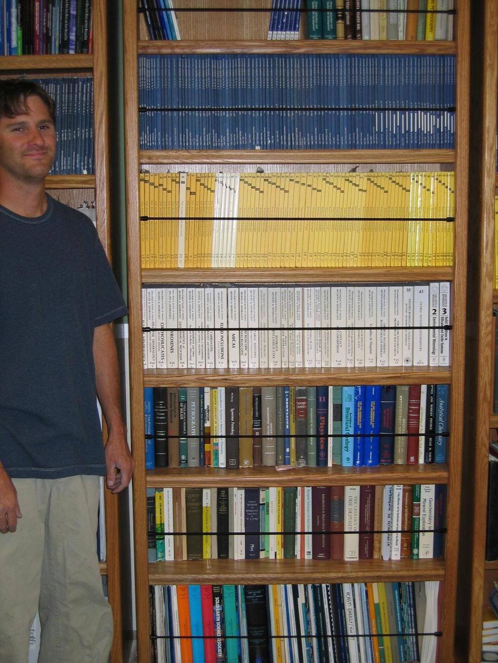
37 Definition of potential unreinforced masonry (URM) buildings in Nevada: buildings listed by County Assessors or State Public Works as built before 1974 with brick, stone, or block masonry structure. Caution: This is a preliminary study based on data provided by the County Assessors and the State of Nevada. We know there are errors in the database: URMs missed - not recorded as masonry structures URMs missed ones on federal or Indian lands URMs counted due to wrong building type in the database Wrong locations due to poor address coding Misidentifications due to lack of construction date Buildings that may have been seismically retrofitted Buildings that have been removed. Recommendation 1 (draft): Jurisdictions (cities, counties, state) should use this County Assessors data to follow up with on-theground inspections and checks of building plans. Individuals should determine if their buildings are URMs.
38 Potential URMs in Nevada totals* 7,354 Residential 16,145 Commercial & Public (city and county) 98 State-owned 23,597 TOTAL* * The total does not include buildings owned by the federal government.

39 Potential URMs Residential Commercial & Public State-owned

40

41 Henderson potential URMs 206 Residential 129 Commercial & Public 0 State-owned 335 TOTAL

42


43 Clark County & Henderson Parcel Map Parcel Classification for IBC NEHRP C & D classes C+ class for NEHRP B velocities with soft surface Entire map online at Dr. John Louie Nevada Seismological Laboratory


44 ShakeZoning: Adding Faults and Basin Geology Black Hills Fault in Google Earth with USGS Qfaults trace USGS Basin Map Las Vegas BHF Dr. John Louie Nevada Seismological Laboratory

45 Adding Physics Black Hills M6.5 scenario Short trace but 4-m scarps noted Viscoelastic finitedifference solution 0.5-Hz frequency 0.20-km grid spacing A few hours on our small cluster Mode conversion, rupture directivity, reverberation, trapping in basins Dr. John Louie Nevada Seismological Laboratory
 >140 cm/sec PGV over 60 cm/sec (yellow) bleeds into LVV through Railroad Pass Serious event for")
46 Black Hills M6.5 Scenario Results Max Peak Ground Velocity (PGV) >140 cm/sec PGV over 60 cm/sec (yellow) bleeds into LVV through Railroad Pass Serious event for a short fault Unlikely, but adds to hazard probabilistically Need to know how unlikely Dr. John Louie Nevada Seismological Laboratory

47 Nonstructural damage often can be easily prevented.


48 Earthquake-secure bookshelves in the office of the State Geologist


49 Secured computers at the Clark County Building Department

50

51
52 Thank you! And thanks to Jon Price, Gary Johnson, Christine Ballard, Heather Armeno, Irene Seeley, Linda D. Goar, and Jordan T. Hastings for their work on the open-file reports (OF 09-8 and 09-9), which are available as online documents at From there, go to online documents at then scroll down to OF 09-8 or Link to the fault map from OF 09-9.
53 Web Addresses Earthquake Fault Map
Earthquake Hazards in Douglas County
 Earthquake Hazards in Douglas County Craig M. depolo Nevada Bureau of Mines and Geology Nevada Hazard Mitigation Planning Committee August 9, 2012 Earthquake Truths The consequences of bad earthquakes
Earthquake Hazards in Washoe County
 Earthquake Hazards in Washoe County Craig M. depolo Nevada Bureau of Mines and Geology Nevada Hazard Mitigation Planning Committee August 13, 2013 Earthquake Truths The consequences of damaging earthquakes
Borah Peak Earthquake HAZUS Scenario Project Executive Summary Idaho Bureau of Homeland Security Idaho Geological Survey Western States Seismic
 Borah Peak Earthquake HAZUS Scenario Project Executive Summary Idaho Bureau of Homeland Security Idaho Geological Survey Western States Seismic Policy Council 12/30/2008 The HAZUS-MH analysis of the Borah
Layers (Layers in italics indicate group layers.) MyHazards MyPlan* Floods and Drought Landslides - USGS
 MyHazards MyPlan* Floods and Drought Landslides - USGS") MyHazards and MyPlan WebApps for Nevada Geohazards Over 100 hazard layers related to floods, fires, earthquakes, radon, and other supporting reference layers. Powerful educational and decision-making tools
MyHazards and MyPlan WebApps for Nevada Geohazards Over 100 hazard layers related to floods, fires, earthquakes, radon, and other supporting reference layers. Powerful educational and decision-making tools
Interpretive Map Series 24
 Oregon Department of Geology and Mineral Industries Interpretive Map Series 24 Geologic Hazards, Earthquake and Landslide Hazard Maps, and Future Earthquake Damage Estimates for Six Counties in the Mid/Southern
WESTERN STATES SEISMIC POLICY COUNCIL POLICY RECOMMENDATION Earthquake and Tsunami Planning Scenarios
 WESTERN STATES SEISMIC POLICY COUNCIL POLICY RECOMMENDATION 18-1 Earthquake and Tsunami Planning Scenarios Policy Recommendation 18-1 WSSPC strongly encourages states, provinces, territories, First Nations,
HAZUS-MH: Earthquake Event Report
 HAZUS-MH: Earthquake Event Report Region Name: El Paso County Earthquake Scenario: El Paso County Random EQ Print Date: February 08, 2006 Disclaimer: The estimates of social and economic impacts contained
In the early morning hours of
 Figure 1. Brace that Chimney! Bracing of masonry chimneys is very difficult to do properly and has generally been ineffective in preventing their failure during earthquakes. While replacement of the chimney
SEISMIC HAZARD ANALYSIS. Instructional Material Complementing FEMA 451, Design Examples Seismic Hazard Analysis 5a - 1
 SEISMIC HAZARD ANALYSIS Instructional Material Complementing FEMA 451, Design Examples Seismic Hazard Analysis 5a - 1 Seismic Hazard Analysis Deterministic procedures Probabilistic procedures USGS hazard
NEVADA EARTHQUAKE SAFETY COUNCIL c/o Nevada Bureau of Mines and Geology (775) Ext 126. February 17, 2009
 Ext 126. February 17, 2009") NEVADA EARTHQUAKE SAFETY COUNCIL c/o Nevada Bureau of Mines and Geology (775) 784-6691 Ext 126 University on Nevada, Reno (775) 784-1709 Fax Mail Stop 178 e-mail: jprice@unr.edu Reno, Nevada 89557-0088
NEVADA EARTHQUAKE SAFETY COUNCIL c/o Nevada Bureau of Mines and Geology (775) 784-6691 Ext 126 University on Nevada, Reno (775) 784-1709 Fax Mail Stop 178 e-mail: jprice@unr.edu Reno, Nevada 89557-0088
Seismic Hazard Abatement Program
 Seismic Hazard Abatement Program Recommendations To take the first steps toward a seismic mitigation program for older existing buildings To improve our current regulatory system for implementation of
Finding Fault Geologic History from a Road Cut
 Finding Fault Geologic History from a Road Cut Elisabeth M. Price, DD LaPointe, and Jonathan G. Price 4 July 2005 Introduction Earth science is an important science to present to students because it directly
Mitigation Strategies for Earthquake Surface Rupture Hazard in the Basin and Range Province
 Mitigation Strategies for Earthquake Surface Rupture Hazard in the Basin and Range Province 1992 Landers, California Earthquake The Mitigation of Earthquake Surface Faulting in the Basin and Range Province:
Risk Identification using Hazus
 Risk Identification using Hazus City of Boston, Suffolk County, MA Dave Shortman, GISP, CFM 6/21/2016 Agenda Objective Project Location Hazus Overview Hazus Level 2 Risk Assessment Comparison and Reporting
Earthquake Faults, Historical Earthquakes, and Earthquake Preparedness. Craig depolo Nevada Bureau of Mines and Geology
 Earthquake Faults, Historical Earthquakes, and Earthquake Preparedness Craig depolo Nevada Bureau of Mines and Geology Earthquake Jack in the Box Analog Earthquake Faults = box and spring (bigger the
Usually, only a couple of centuries of earthquake data is available, much shorter than the complete seismic cycle for most plate motions.
 Earthquake Hazard Analysis estimate the hazard presented by earthquakes in a given region Hazard analysis is related to long term prediction and provides a basis to expressed hazard in probabilistic terms.
9. GEOLOGY, SOILS, AND MINERALS
 June 28, 2018 Page 9-1 9. GEOLOGY, SOILS, AND MINERALS This EIR chapter describes the existing geological, soil, and mineral conditions in the planning area. The chapter includes the regulatory framework
Foreshocks to Major Earthquakes In Nevada. Craig M. depolo Nevada Bureau of Mines and Geology
 Foreshocks to Major Earthquakes In Nevada Craig M. depolo Nevada Bureau of Mines and Geology Review foreshocks, particularly the 2008 Mogul earthquake, foreshock statistics and implications, multiple earthquakes
Development of U. S. National Seismic Hazard Maps and Implementation in the International Building Code
 Development of U. S. National Seismic Hazard Maps and Implementation in the International Building Code Mark D. Petersen (U.S. Geological Survey) http://earthquake.usgs.gov/hazmaps/ Seismic hazard analysis
Magnitude 6.3 SOUTH ISLAND OF NEW ZEALAND
 A magnitude 6.3 earthquake shook the southern New Zealand city of Christchurch. At least 100 people are reported dead, and there are reports of collapsed buildings, cracked streets and flooding due to
Downtown Anchorage Seismic Risk Assessment & Land Use Regulations to Mitigate Seismic Risk
 Prepared for: The Municipality of Anchorage Planning Department and the Geotechnical Advisory Commission Downtown Anchorage Seismic Risk Assessment & Land Use Regulations to Mitigate Seismic Risk Prepared
Comparing physics-based Next-Level ShakeZoning computations with USGS ShakeMap statistics for So NV earthquake scenarios
 Comparing physics-based Next-Level ShakeZoning computations with USGS ShakeMap statistics for So NV earthquake scenarios WILLIAM H. SAVRAN, BRADY FLINCHUM, GABRIEL PLANK, COLTON DUDLEY, NICHOLAS PRINA,
Estimation of Short Term Shelter Needs FEMA Earthquake HAZUS Model
 July 2017 ESRI International Users Conference Estimation of Short Term Shelter Needs FEMA Earthquake HAZUS Model Techniques & Results Douglas Schenk / Sampa Patra GIS Group / Information Services Division
LANDUSE APPLICATIONS OF EARTHQUAKE HAZARD MAPS CALIFORNIA EXPERIENCE
 LANDUSE APPLICATIONS OF EARTHQUAKE HAZARD MAPS CALIFORNIA EXPERIENCE Thomas C. Vlasic Vice President Spangle Associates Portola Valley, California INTRODUCTION The focus of this report is primarily on
Geothermal Systems: Geologic Origins of a Vast Energy Resource
 Geothermal Systems: Geologic Origins of a Vast Energy Resource Energy From the Earth Energy-Land-Water Connections Speaker Series James E. Faulds, PhD Nevada State Geologist and Professor Nevada Bureau
Basic Seismological Characterization for Platte County, Wyoming. James C. Case Wyoming State Geological Survey July, 2002 BACKGROUND
 Basic Seismological Characterization for Platte County, Wyoming by James C. Case Wyoming State Geological Survey July, 2002 BACKGROUND Seismological characterizations of an area can range from an analysis
Preliminary Earthquake Risk Management Strategy Plan of Eskisehir, Turkey by using GIS
 Preliminary Earthquake Risk Management Strategy Plan of Eskisehir, Turkey by using GIS Metin Altan, Ferah Özturk and Can Ayday Space and Satellite Sciences Research Institute Anadolu University, TURKEY
M 7.1 EARTHQUAKE 5KM ENE OF RABOSO, MEXICO EXACT LOCATION: N W DEPTH: 51.0KM SEPTEMBER 19, 1:14 LOCAL TIME
 M 7.1 EARTHQUAKE 5KM ENE OF RABOSO, MEXICO EXACT LOCATION: 18.584 N 98.399 W DEPTH: 51.0KM SEPTEMBER 19, 2017 @ 1:14 LOCAL TIME Photo: Eduardo Verdugo / AP Photo: Alfredo Estrella/ Agence France-Presse/
Seth J. Wittke Wyoming State Geological Survey
 Seth J. Wittke Wyoming State Geological Survey Project initiation Data manipulation Scenarios Creating the IMS Lessons learned County-wide block level probabilistic models created in 2004 for state mitigation
Arthur Frankel, William Stephenson, David Carver, Jack Odum, Robert Williams, and Susan Rhea U.S. Geological Survey
 Probabilistic Seismic Hazard Maps for Seattle: 3D Sedimentary Basin Effects, Nonlinear Site Response, and Uncertainties from Random Velocity Variations Arthur Frankel, William Stephenson, David Carver,
M-8.1 EARTHQUAKE 87KM SW OF PIJIJIAPAN, MEXICO EXACT LOCATION: N W DEPTH: 69.7KM SEPTEMBER 7, 11:49 PST
 M-8.1 EARTHQUAKE 87KM SW OF PIJIJIAPAN, MEXICO EXACT LOCATION: 15.068 N 93.715 W DEPTH: 69.7KM SEPTEMBER 7, 2017 @ 11:49 PST Photo: Luis Alberto Cruz / AP Photo: Carlos Jasso 1 THE 2017 CHIAPAS MEXICO
Cascadia megathrust earthquakes: reducing risk through science, engineering, and planning
 Cascadia megathrust earthquakes: reducing risk through science, engineering, and planning NSF Hazards SEES EAR-1331412 Urban Science and Engineering Workshop 21 July 2014 Everything to do with M9 Cascadia
Guidelines for Site-Specific Seismic Hazard Reports for Essential and Hazardous Facilities and Major and Special-Occupancy Structures in Oregon
 Guidelines for Site-Specific Seismic Hazard Reports for Essential and Hazardous Facilities and Major and Special-Occupancy Structures in Oregon By the Oregon Board of Geologist Examiners and the Oregon
NEVADA EARTHQUAKE SAFETY COUNCIL c/o Nevada Bureau of Mines and Geology (775) Ext 126
 Ext 126") TO: FROM: NEVADA EARTHQUAKE SAFETY COUNCIL c/o Nevada Bureau of Mines and Geology (775) 784-6691 Ext 126 University on Nevada, Reno (775) 784-1709 Fax Mail Stop 178 e-mail: jprice@unr.edu Reno, Nevada
TO: FROM: NEVADA EARTHQUAKE SAFETY COUNCIL c/o Nevada Bureau of Mines and Geology (775) 784-6691 Ext 126 University on Nevada, Reno (775) 784-1709 Fax Mail Stop 178 e-mail: jprice@unr.edu Reno, Nevada
GPS Strain & Earthquakes Unit 4: GPS strain analysis examples Student exercise
 GPS Strain & Earthquakes Unit 4: GPS strain analysis examples Student exercise Example 1: Olympic Peninsula Name: Please complete the following worksheet to estimate, calculate, and interpret the strain
New USGS Maps Identify Potential Ground- Shaking Hazards in 2017
 New USGS Maps Identify Potential Ground- Shaking Hazards in 2017 New USGS Maps Identify Potential Ground-Shaking Hazards in 2017 The central U.S. faces continued hazards from human-induced earthquakes
158 Reducing Earthquake Losses
 ndex A Accelerographs, 64 Active control systems, 83-84 Active mass damping, 83 Active tendons, 83 Advocates, role of, 116 Air Force Office of Scientific Research, 133 Alaska, 42-43 Alquist-Priolo Act,
By Chris Mikes and David Fleck Digital Terrain Analysis GEOG 593. Overview
 Earthquake and Infrastructure Damage Analysis in Multnomah and Clackamas Counties: The Application of LiDAR In The Development of an Emergency Response Plan By Chris Mikes and David Fleck Digital Terrain
4.1 Hazard Identification: Natural Hazards
 data is provided in an annex, it should be assumed that the risk and potential impacts to the affected jurisdiction are similar to those described here for the entire Sacramento County Planning Area. This
Preview Mode: ON Earthquake Risk in Stable, Intraplate Regions: the Case. of Perth, Australia. Historical Seismicity in the Perth Region
 Preview Mode: ON Earthquake Risk in Stable, Intraplate Regions: the Case Editor s note: There is often a tendency to discount earthquake risk in of Perth, Australia 02.2010 AIRCurrents regions where earthquakes
Homework Assignment II. Seismological Exercises Fall 2014
 Page 1 of 8 EENS 3050 Tulane University Natural Disasters Prof. Stephen A. Nelson Homework Assignment II. Seismological Exercises Fall 2014 This page last updated on 03-Sep-2014 Answer the following questions.
HAZARD IDENTIFICATION AND VULNERABILITY ANALYSIS (HIVA) Walla Walla County, Washington EARTHQUAKE
 Walla Walla County, Washington EARTHQUAKE") HAZARD IDENTIFICATION AND VULNERABILITY ANALYSIS (HIVA) Walla Walla County, Washington Hazard Overview EARTHQUAKE An earthquake is caused by a sudden slip on a fault. Stresses in the earth's outer layer
HAZARD IDENTIFICATION AND VULNERABILITY ANALYSIS (HIVA) Walla Walla County, Washington Hazard Overview EARTHQUAKE An earthquake is caused by a sudden slip on a fault. Stresses in the earth's outer layer
PAHRUMP REGIONAL PLANNING DISTRICT MASTER PLAN 2010
 CHAPTER TWENTY SEISMIC SAFETY PLAN (This Plan is from the 1999 Pahrump Regional Planning District Master Plan) Pursuant to NRS 278.160, this topic consists of an identification and appraisal of seismic
Updated MCE R & MCE G Ground Motions in 2015 NEHRP Provisions (& ASCE/SEI 7-16)
") Updated MCE R & MCE G Ground Motions in 2015 NEHRP Provisions (& ASCE/SEI 7-16) EERI 2016 Seminar ASCE Geotechnical on Next Generation & Structural Engineering Attenuation Congress Models Nicolas Luco
Updated MCE R & MCE G Ground Motions in 2015 NEHRP Provisions (& ASCE/SEI 7-16) EERI 2016 Seminar ASCE Geotechnical on Next Generation & Structural Engineering Attenuation Congress Models Nicolas Luco
Interpretive Map Series 24
 Oregon Department of Geology and Mineral Industries Interpretive Map Series 24 Geologic Hazards, and Hazard Maps, and Future Damage Estimates for Six Counties in the Mid/Southern Willamette Valley Including
APPLICATIONS OF EARTHQUAKE HAZARD MAPS TO LAND-USE AND EMERGENCY PLANNING EXAMPLES FROM THE PORTLAND AREA
 APPLICATIONS OF EARTHQUAKE HAZARD MAPS TO LAND-USE AND EMERGENCY PLANNING EXAMPLES FROM THE PORTLAND AREA O. Gerald Uba Metro, Portland, Oregon OVERVIEW The extent to which we understand "below ground"
4.5 GEOLOGY, SOILS AND SEISMICITY
 4.5 This section summarizes information on geology, soils and seismic hazards, and mineral resources in the Truckee area, as well as potential area-wide geologic hazards and regional seismic characteristics
Name Date Class. radiate in all directions, carrying some of the. of plate boundaries have different usual patterns of.
 Chapter Outline Earthquakes CHAPTER 6 Lesson 1: Earthquakes and Plate Boundaries A. What is an earthquake? 1. A(n) is the rupture and sudden movement of rocks along a fault. A fault is a fracture surface
5. Environmental Analysis
 5.11 This section of the Draft Environmental Impact Report (DEIR) evaluated potential impacts to mineral resources from implementation of the General Plan. 5.11.1 Environmental Setting Minerals are defined
Resiliency Assessed by Comparing Scenarios
 Resiliency Assessed by Comparing Scenarios Robert A. Bauer Illinois State Geological Survey Use HAZUS to estimate losses from nearby strong events vs. NLE-11 New Madrid Catastrophic M7.7 and NLE-11 Mt.
Earthquakes. & Expansive Soils
 Earthquakes & Expansive Soils January 22, 2009 Plan Update Flanagan & Associates, LLC Consultants Tulsa, OK www.rdflanagan.com rdflanagan@rdflanagan.com Plan can be reviewed at: www.rdflanagan.com/.html
PROJECT SITE. Ione St. VICINITY MAP. Sutter. Creek. Jackson. Newman Ridge Quarry Project Amador County, California. Scale in Miles. Old. Rd.
 124 Old Hwy. Ione Michigan Bar Irish Hill Ione Sutter Creek Ridge PROJECT SITE Dutschke Mile Dr. 124 Sutter Loch Lane Res. Old Five Stockton Castle Oaks Golf Club Marlette Ione St. 124 Charles Howard Park
DEPARTMENT OF GEOLOGY AND MINERAL INDUSTRIES WAYS & MEANS SUBCOMMITTEE ON NATURAL RESOURCES MARCH 2, 2017
 DEPARTMENT OF GEOLOGY AND MINERAL INDUSTRIES WAYS & MEANS SUBCOMMITTEE ON NATURAL RESOURCES MARCH 2, 2017 1 ABOUT DOGAMI AGENCY MISSION, VISION & GOALS 2 Lidar image of a stream network along the Umpqua
The Magnitude 7.2 Earthquake from the West Valley Fault: Implications for Metro Manila and Nearby Provinces
 The Magnitude 7.2 Earthquake from the West Valley Fault: Implications for Metro Manila and Nearby Provinces First DRI Collegiate Conference in the Philippines 16 March 2017 Renato U. Solidum, Jr. Department
IV. ENVIRONMENTAL IMPACT ANALYSIS E. GEOLOGY AND SOILS
 IV. ENVIRONMENTAL IMPACT ANALYSIS E. GEOLOGY AND SOILS The following section is a summary of the geotechnical report conducted for the Proposed Project. The Geotechnical Engineering Investigation (the
Overview. Tools of the Trade. USGS Decision-Making Tools for Pre-Earthquake Mitigation and Post-Earthquake Response
 USGS Decision-Making Tools for Pre-Earthquake Mitigation and Post-Earthquake Response Tools of the Trade DAVID WALD United States Geological Survey NEHRP Workshop: Developing Earthquake Scenarios Sept
Unique Site Conditions and Response Analysis Challenges in the Central and Eastern U.S.
 Unique Site Conditions and Response Analysis Challenges in the Central and Eastern U.S. James R. Martin, C. Guney Olgun, & Morgan Eddy Civil and Environmental Engineering World Institute for Disaster Risk
COMMUNITY DEVELOPMENT DEPARTMENT POLICY & PROCEDURE
 COMMUNITY DEVELOPMENT DEPARTMENT POLICY & PROCEDURE Policy No: DSP-OO3 Release Date: January 1, 2014 Effective Date: January 1, 2014 Revision Date: March 1, 2018 TITLE: The City Policy for Site Specific
Effects of Surface Geology on Seismic Motion
 4 th IASPEI / IAEE International Symposium: Effects of Surface Geology on Seismic Motion August 23 26, 2011 University of California Santa Barbara EFFECTS OF LOCAL GEOLOGY ON EARTHQUAKE GROUND MOTIONS:
RISK ASSESSMENT COMMUNITY PROFILE NATURAL HAZARDS COMMUNITY RISK PROFILES. Page 13 of 524
 RISK ASSESSMENT COMMUNITY PROFILE NATURAL HAZARDS COMMUNITY RISK PROFILES Page 13 of 524 Introduction The Risk Assessment identifies and characterizes Tillamook County s natural hazards and describes how
Impact : Changes to Existing Topography (Less than Significant)
") 4.2 Land Resources 4.2.1 Alternative A Proposed Action Impact 4.2.1-1: Changes to Existing Topography (Less than Significant) Development of the project site would involve grading and other earthwork as
4.2 Land Resources 4.2.1 Alternative A Proposed Action Impact 4.2.1-1: Changes to Existing Topography (Less than Significant) Development of the project site would involve grading and other earthwork as
Earthquakes. Earthquake Magnitudes 10/1/2013. Environmental Geology Chapter 8 Earthquakes and Related Phenomena
 Environmental Geology Chapter 8 Earthquakes and Related Phenomena Fall 2013 Northridge 1994 Kobe 1995 Mexico City 1985 China 2008 Earthquakes Earthquake Magnitudes Earthquake Magnitudes Richter Magnitude
4.5 GEOLOGY AND SEISMICITY
 4.5 GEOLOGY AND SEISMICITY INTRODUCTION This section identifies the potential for geologic and seismic hazards to occur on or near the proposed project site. Issues of concern include suitability of soil
SEISMIC HAZARD ANALYSIS
 SEISMIC HAZARD ANALYSIS Instructional Material Complementing FEMA 451, Design Examples Seismic Hazard Analysis 5a - 1 This topic addresses deterministic and probabilistic seismic hazard analysis, ground
Summary. The development of an open-source 3-d modeling
 Assembling a Nevada 3-d velocity model: earthquake-wave propagation in the Basin & Range, and seismic shaking predictions for Las Vegas John N. Louie,* University of Nevada, Reno Summary The development
Homework Assignment II. Seismological Exercises Spring 2018
 Page 1 of 8 EENS 3050 Tulane University Natural Disasters Prof. Stephen A. Nelson Homework Assignment II. Seismological Exercises Spring 2018 This page last updated on 30-Jan-2018 Answer the following
Earthquakes.
 Earthquakes http://thismodernworld.com/comic-archive Elastic rebound http://projects.crustal.ucsb.edu/understanding/elastic/rebound.html Elastic rebound Rocks store energy elastically When stored stress
5.2. IDENTIFICATION OF NATURAL HAZARDS OF CONCERN
 5.2. IDENTIFICATION OF NATURAL HAZARDS OF CONCERN To provide a strong foundation for mitigation strategies considered in Sections 6 and 9, County considered a full range of natural hazards that could impact
Geotechnical Extreme Events Reconnaissance Report:
 Geotechnical Extreme Events Reconnaissance Report: The Performance of Structures in Densely Urbanized Areas Affected by Surface Fault Rupture During the August 24, 2014 M6 South Napa Earthquake, California,
Shallow Shear-Wave Velocities Based on Refraction Microtremor Measurements in Areas Damaged by the 2008 M w 6.0 Wells, Nevada Earthquake
 Nevada Bureau of Mines and Geology Special Publication 36 Shallow Shear-Wave Velocities Based on Refraction Microtremor Measurements in Areas Damaged by the 2008 M w 6.0 Wells, Nevada Earthquake by Jim
The Coming Bay Area Earthquake Update
 The Coming Bay Area Earthquake - 2010 Update Scenario for a Magnitude 7.0 Earthquake on the Hayward Fault Northern California Chapter of the Earthquake Engineering Research Institute Janiele Maffei SE
CITY OF RIVERSIDE USING HAZUS TO CREATE A EARTHQUAKE PLANNING GUIDE FOR A UNIFIED FIELD RESPONSE
 CITY OF RIVERSIDE USING HAZUS TO CREATE A EARTHQUAKE PLANNING GUIDE FOR A UNIFIED FIELD RESPONSE Presented by the Phil McCormick City of Riverside Office of Emergency Management HISTORY The City had several
Analysis Of Earthquake Records of Istanbul Earthquake Rapid Response System Stations Related to the Determination of Site Fundamental Frequency
 Analysis Of Earthquake Records of Istanbul Earthquake Rapid Response System Stations Related to the Determination of Site Fundamental Frequency A. C. Zulfikar, H. Alcik & E. Cakti Bogazici University,Kandilli
5. Environmental Analysis
 5.9 MINERAL RESOURCES 5.9.1 Methodology The California Geological Survey Mineral Resources Project provides information about California s nonfuel mineral resources. The primary focus of the Mineral Resources
B.2 Sources for Hazard Identification, Profiling, and Ranking (Section 3) Overview of Sussex County s History of Hazards
 Overview of Sussex County s History of Hazards") Appendix B Sources B.1 Sources for Planning Process (Section 2) FEMA. Mitigation Planning Guidance (386 Series). Available on the web at: http://www.fema.gov/plan/mitplanning/planning_resources.shtm FEMA
Appendix B Sources B.1 Sources for Planning Process (Section 2) FEMA. Mitigation Planning Guidance (386 Series). Available on the web at: http://www.fema.gov/plan/mitplanning/planning_resources.shtm FEMA
COMPREHENSIVE GIS-BASED SOLUTION FOR ROAD BLOCKAGE DUE TO SEISMIC BUILDING COLLAPSE IN TEHRAN
 COMPREHENSIVE GIS-BASED SOLUTION FOR ROAD BLOCKAGE DUE TO SEISMIC BUILDING COLLAPSE IN TEHRAN B. Mansouri 1, R. Nourjou 2 and K.A. Hosseini 3 1 Assistant Professor, Dept. of Emergency Management, International
IV. ENVIRONMENTAL IMPACT ANALYSIS G. GEOLOGY AND SOILS
 IV. ENVIRONMENTAL IMPACT ANALYSIS G. GEOLOGY AND SOILS The following section is a summary of the geotechnical report conducted for the proposed project. The Report of Geotechnical Investigation Proposed
Refraction Microtremor for Shallow Shear Velocity in Urban Basins
 Refraction Microtremor for Shallow Shear Velocity in Urban Basins John Louie, Nevada Seismological Lab UNR students: J. B. Scott, T. Rasmussen, W. Thelen, M. Clark Collaborators: S. Pullammanappallil &
How to communicate Cascadia Subduction Zone earthquake hazards
 How to communicate Cascadia Subduction Zone earthquake hazards Tom Brocher Research Geophysicist Earthquake Science Center U.S. Geological Survey Menlo Park, California Seattle Post-Intelligencer Lessons
Magnitude 6.9 GULF OF CALIFORNIA
 A pair of strong earthquakes struck off the coast of Mexico early Thursday only minutes apart. The magnitude 6.9 and 6.2 were centered about 85 miles northeast of Guerrero Negro in the Mexican state of
Seismic Hazard Switzerland. When, where, and how often does certain shaking occur in Switzerland?
 Seismic Hazard Switzerland When, where, and how often does certain shaking occur in Switzerland? Hazard The hazard map shows where and how often certain incidents of horizontal acceleration are likely.
Baldwin County, Alabama
 2015 Baldwin County, Alabama Multi-Hazard Mitigation Plan I. Comprehensive Plan A multi-jurisdiction plan City of Bay Minette City of Daphne Town of Elberta City of Fairhope City of Foley City of Gulf
(First Edition: prepared on 29/12/2003)
") (First Edition: prepared on 29/12/2003) Dr Sassan Eshghi 1 and Dr Mehdi Zaré 2 International Institute of Earthquake Engineering and Seismology, Tehran, P.O.Box: 19395/3913, IRAN e-mails: 1)s.eshghi@iiees.ac.ir,
(First Edition: prepared on 29/12/2003) Dr Sassan Eshghi 1 and Dr Mehdi Zaré 2 International Institute of Earthquake Engineering and Seismology, Tehran, P.O.Box: 19395/3913, IRAN e-mails: 1)s.eshghi@iiees.ac.ir,
Low-Latency Earthquake Displacement Fields for Tsunami Early Warning and Rapid Response Support
 Low-Latency Earthquake Displacement Fields for Tsunami Early Warning and Rapid Response Support Hans-Peter Plag, Geoffrey Blewitt Nevada Bureau of Mines and Geology and Seismological Laboratory University
Three Fs of earthquakes: forces, faults, and friction. Slow accumulation and rapid release of elastic energy.
 Earthquake Machine Stick-slip: Elastic Rebound Theory Jerky motions on faults produce EQs Three Fs of earthquakes: forces, faults, and friction. Slow accumulation and rapid release of elastic energy. Three
A New National Flood Inundation Mapping Science Initiative
 A New National Flood Inundation Mapping Science Initiative William Guertal, PhD. Director, USGS Indiana and Kentucky Water Science Centers U.S. Department of the Interior U.S. Geological Survey Courtesy
The L.A. Earthquake Sourcebook
 The L.A. Earthquake Sourcebook If searched for the ebook The L.A. Earthquake Sourcebook in pdf format, then you have come on to the faithful website. We furnish complete option of this ebook in doc, DjVu,
Treatment of Epistemic Uncertainty in PSHA Results
 Treatment of Epistemic Uncertainty in PSHA Results Norm Abrahamson University of California, Berkeley Pacific Gas & Electric PSHA Workshop, Lenzburg, Switzerland, Sep 7, 2017 Haz(GM > z)= Nscenarios i=1
Implementation of the Alquist-Priolo Earthquake Fault Zoning Act in Los Angeles County
 Implementation of the Alquist-Priolo Earthquake Fault Zoning Act in Los Angeles County Charles Nestle County of Los Angeles Dept. of Public Works Surface Fault Rupture Workshop May 10, 2013 What Work is
Surviving the Big One: Understanding and Preparing for a Major Earthquake in Western Oregon
 Surviving the Big One: Understanding and Preparing for a Major Earthquake in Western Oregon May 21, 2013 City of Salem Salem Public Library Althea Rizzo, Geological Hazards Program Coordinator Oregon Emergency
Geophysics 189 Natural Hazards Homework 2 Earthquake Locations and Hazards Due February 15, 2005
 Geophysics 189 Natural Hazards Homework 2 Earthquake Locations and Hazards Due February 15, 2005 Objective: The objective of this homework is to give you experience using real seismograms to locate an
ENGINEER S CERTIFICATION OF FAULT AREA DEMONSTRATION (40 CFR )
") PLATTE RIVER POWER AUTHORITY RAWHIDE ENERGY STATION BOTTOM ASH TRANSFER (BAT) IMPOUNDMENTS LARIMER COUNTY, CO ENGINEER S CERTIFICATION OF FAULT AREA DEMONSTRATION (40 CFR 257.62) FOR COAL COMBUSTION RESIDUALS
PLATTE RIVER POWER AUTHORITY RAWHIDE ENERGY STATION BOTTOM ASH TRANSFER (BAT) IMPOUNDMENTS LARIMER COUNTY, CO ENGINEER S CERTIFICATION OF FAULT AREA DEMONSTRATION (40 CFR 257.62) FOR COAL COMBUSTION RESIDUALS
GPS Strain & Earthquakes Unit 5: 2014 South Napa earthquake GPS strain analysis student exercise
 GPS Strain & Earthquakes Unit 5: 2014 South Napa earthquake GPS strain analysis student exercise Strain Analysis Introduction Name: The earthquake cycle can be viewed as a process of slow strain accumulation
GEOLOGY, SOILS, AND SEISMICITY
 4.9 GEOLOGY, SOILS, AND SEISMICITY 4.9.1 Introduction Information about the geological conditions and seismic hazards in the study area was summarized in the FEIR, and was based on the Geotechnical Exploration
The Impact of the 2010 Darfield (Canterbury) Earthquake on the Geodetic Infrastructure in New Zealand 1
 Earthquake on the Geodetic Infrastructure in New Zealand 1") The Impact of the 2010 Darfield (Canterbury) Earthquake on the Geodetic Infrastructure in New Zealand 1 Graeme BLICK, John BEAVAN, Chris CROOK, Nic DONNELLY Keywords: Darfield Earthquake, control, survey,
The Impact of the 2010 Darfield (Canterbury) Earthquake on the Geodetic Infrastructure in New Zealand 1 Graeme BLICK, John BEAVAN, Chris CROOK, Nic DONNELLY Keywords: Darfield Earthquake, control, survey,
Las Vegas Valley is a fault-bounded basin containing hundreds of metres of Tertiary and Quaternary sediments derived from lacustrine, paludal, and
 Land Subsidence (Proceedings of the Fourth International Symposium on Land Subsidence, May 1991). IAHS Publ. no. 200, 1991. Elevation Changes Associated with Subsidence in Las Vegas Valley, Nevada JOHN
HAZUS-MH: A Predictable Hurricane Risk Assessment Tool for the City of Houston and Harris County
 HAZUS-MH: A Predictable Hurricane Risk Assessment Tool for the City of Houston and Harris County Presented by Melvin G. Spinks, P.E., President Annie Ding, PhD, GISP October 29, 2008 Rice University Contents
Vertical to Horizontal (V/H) Ratios for Large Megathrust Subduction Zone Earthquakes
 Ratios for Large Megathrust Subduction Zone Earthquakes") Vertical to Horizontal (V/H) Ratios for Large Megathrust Subduction Zone Earthquakes N.J. Gregor Consultant, Oakland, California, USA N.A. Abrahamson University of California, Berkeley, USA K.O. Addo BC
Vertical to Horizontal (V/H) Ratios for Large Megathrust Subduction Zone Earthquakes N.J. Gregor Consultant, Oakland, California, USA N.A. Abrahamson University of California, Berkeley, USA K.O. Addo BC
Hawke s Bay Liquefaction Hazard Report - Frequently Asked Questions
 Hawke s Bay Liquefaction Hazard Report - Frequently Asked Questions What is liquefaction? Liquefaction occurs when an earthquake shakes up water-logged sediments. As a result, the soil behaves like a liquid
Article from: Risk Management. March 2009 Issue 15
 Article from: Risk Management March 2009 Issue 15 XXXXXXXXXXXXX RISK IDENTIFICATION Preparing for a New View of U.S. Earthquake Risk By Prasad Gunturi and Kyle Beatty INTRODUCTION The United States Geological