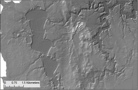
Lidar data in water resources applications
|
|
|
- Jewel Stevens
- 6 years ago
- Views:
Transcription

1 Lidar data in water resources applications Paola Passalacqua CE 394K 3 Guest Lecture, November 15 th, 2012


 from the last pulse LiDAR data by filtering the vegetation points (Slatton et al.")
2 Airborne Lidar Airborne laser altimetry technology (lidar, Light Detection And Ranging) provides highresolution topographical data, which can significantly contribute to a better representation of land surface. A valuable characteristic of this technology, which marks advantages over the traditional topographic survey techniques, is the capability to derive a high-resolution Digital Terrain Model (DTM) from the last pulse LiDAR data by filtering the vegetation points (Slatton et al., 2007). Slide courtesy of Dr. Paolo Tarolli, University of Padova, Italy


3 Airborne Lidar Slide courtesy of Dr. Paolo Tarolli, University of Padova, Italy

4 Airborne Lidar x,y,z Slide courtesy of Dr. Paolo Tarolli, University of Padova, Italy


5 Forest canopy Filter Processing First return/ Echo-waveform DSM 3D Buildings Raw LIDAR Multi-Spectral Filter Processing Land cover related to each vegetation types Filter Processing Last Return x,y,z DTM TIN Contour maps Slide courtesy of Dr. Paolo Tarolli, University of Padova, Italy

6 Topographic Lidar λ = 1064 nm Green LiDAR λ = 532 nm + λ =1064 nm Slide courtesy of Dr. Paolo Tarolli, University of Padova, Italy It is important to remember that the deep water surfaces normally do not reflect the signal: however this is not true in case of presence of floating sediments or when using bathymetric lidar. The bathymetric lidar, that is based on the same principles as topographic lidar, emits laser beams in two wavelengths: an infrared (1064 nm) and a green one (532 nm). The infrared wavelength is reflected on the water surface, while the green one penetrates the water and is reflected by the bottom surface or other objects in the water. Due to this reason the bathymetric lidar is also called green lidar.
.")
7 Fonte: During optimal environment condition, when the water is clear, the green lidar survey may reach 50 m water depth with an horizontal accuracy of ±2.5 m, and vertical accuracy of ±0.25 m. This technology is growing fast, and some of the first applications in rivers are coming out (Hilldale and Raff, 2008; McKean et al., 2009). Slide courtesy of Dr. Paolo Tarolli, University of Padova, Italy
 Provides ~ 24%-30% of the TSS entering the Minnesota River Le Sueur Lake Pepin Minnesota River")

8 Example 1: Le Sueur River basin Minnesota River Basin Le Sueur River located in south-central Minnesota, covers an area of 2880 km 2 (87% row-crop agriculture) Provides ~ 24%-30% of the TSS entering the Minnesota River Le Sueur Lake Pepin Minnesota River major source of sediment for Lake Pepin (~85% of TSS load) Turbidity and related nutrients levels of Lake Pepin are far in excess of EPA standards State of Minnesota required to determine the sources of pollution and take management and policy actions NCED Research

9 Example 2: Limiting factors analysis of Coho salmon River networks produce a highly structured pattern of process and morphology downstream. This structure can be exploited to predict habitat and carrying capacity of species throughout the watershed. Ripple: spatially explicit model that links quantitatively topography, habitat carrying capacity and population dynamics for an entire watershed. GEO MODULE HAB MODULE POP MODULE GEO module: uses DEM to compute local slope and drainage area NCED Research
10 Example 3: Drainage density as a signature of climate Climate exerts a quantifiable control over the degree of channel dissection Lithology and relief are important cofactors Melton, M.A., ONR Tech Report, 1957 The problem of resolution: Strong discrepancy between channels as mapped in the field and as deduced from topographic maps (Morisawa, [1957; 1961]; Schneider [1961]). Schneider, W.J., J. Geophys. Res., 1961


11 Digital elevation data Data resolution available until recently m. Grigno basin, Italy Resolution 30 m x 30 m Data source: University of Padova Tirso basin, Italy Resolution 100 m x 100 m Data source: University of Padova Tanaro basin, Italy Resolution 90 m x 90 m Data source: University of Padova

12 Rio Cordon basin, Selva di Cadore, Italy Slide courtesy of Dr. Paolo Tarolli, University of Padova, Italy

13 The role of data resolution DTM 10x10 m Slide courtesy of Dr. Paolo Tarolli, University of Padova, Italy
14 The role of data resolution DTM 1x1 m Slide courtesy of Dr. Paolo Tarolli, University of Padova, Italy

15 Lidar DTMs: Solving the resolution problem? Availability of meter and sub-meter resolution topographic data Topographic patterns can be resolved over large areas at resolutions commensurate with the scale of governing processes Importance of objective extraction of geomorphic feature Opportunity to measure drainage density


16 Challenges in geomorphic feature extraction Channel initiation Identification of accurate centerline Presence of roads and bridges Artificial drainage ditches Small signal to noise ratio Identification of channel banks Measurement of bluffs
17 GeoNet: NCED toolbox for channel network extraction


18 GeoNet: Nonlinear filtering 1. Nonlinear filtering: Enhance features of interest, while smoothing small scale features. Perona and Malik [1990],,,, h x y t c x y t h t c 1 1 h / 2 Smooth Bumps Keep Channel

19 GeoNet: Statistical signature of geomorphic transitions 2. Skeleton of likely channelized pixels: Set of pixels with curvature above threshold, identified from quantile-quantile plot of curvature. k th The deviation of the pdf from Gaussian can be interpreted as transition from hillslope to valley [Lashermes et al,. 2007].

20 Channel extraction: geodesics 2. Geodesic minimization: Channels are extracted as paths of minimum cost The cost function ψ represents the cost of traveling between point a and point b in terms of a function of area (A), slope (S), curvature (κ) and skeleton (Skel): f 1 ( A, S,, Skel) 1 e. g., A b Channel head Outlet a


21 Channel initiation and channel disruptions Passalacqua, P., P. Tarolli, and E. Foufoula-Georgiou, Water Resour. Res, 2010

22 Flat lands and channel morphology Le Sueur River major source of sediment to the Minnesota River. Both listed as impaired for turbidity by USEPA. Need to identify sediment sources


23 Roads and ditches

24 Identification of likely channelized pixels in engineered landscapes Passalacqua, P., P. Belmont, and E. Foufoula-Georgiou, Water Resour. Res., 2012


25 Curvature analysis to distinguish channels and roads κ = γ = 2 h h h Passalacqua, P., P. Belmont, and E. Foufoula-Georgiou, Water Resour. Res., 2012

26 Differentiating natural versus artificial features Passalacqua, P., P. Belmont, and E. Foufoula-Georgiou, Water Resour. Res., 2012

27 Channel network extraction and bridge crossings Passalacqua, P., P. Belmont, and E. Foufoula-Georgiou, Water Resour. Res., 2012

28 Automatic extraction of channel morphology Height 60 m Automatic extraction of channel cross-section Detection of bank location Identification of geomorphic bankfull water surface elevation Measurements of channel width and of bank and bluff height


29 Automatic extraction of channel morphology Source: P. Belmont Source: C. Jennings Passalacqua, P., P. Belmont, and E. Foufoula-Georgiou, Water Resour. Res., 2012
. GeoNet drainage delineation.")
30 Codependence of vegetation and drainage density Field mapped channel heads on slope gradient map (Imaizumi et al. [2010]). GeoNet drainage delineation.

31 Preliminary results: Codependence of vegetation and drainage density

32 Preliminary results: Codependence of vegetation and drainage density


33 Multi-resolution analysis of landscapes to understand landscape forming processes characteristic scales The first scaling break represents the length scale of the highly convex regions(i.e. the ridges) The second scaling break represents the hillslope length scale. Slide courtesy of Harish Sangireddy, UT Austin


34 Feature extraction from point cloud Six test sites were studied for testing the methodology. The data for the test sites was obtained from TNRIS Slide courtesy of Harish Sangireddy, UT Austin


35 Feature extraction from point cloud Site 1 has only streams and surrounding farmlands dry stream Slide courtesy of Harish Sangireddy, UT Austin


36 Feature extraction from point cloud Site 2 has roads, streams, marshy areas, small culvert and drains by the roadside stream marshy area road Slide courtesy of Harish Sangireddy, UT Austin


37 Feature extraction from point cloud Detects points around the water gaps and maps the geometry of stream properly Probable floodplain stream Slide courtesy of Harish Sangireddy, UT Austin


38 Feature extraction from point cloud When the elevation difference is very small in the region, the model identifies all low lying areas as water surfaces farmland drain road tree Site 5 Slide courtesy of Harish Sangireddy, UT Austin
39 Acknowledgements Work supported by: NSF EAR (NCED) NSF EAR NSF BCS / (PIs Stark and Passalacqua) Collaborators (in random order): Tien Do Trung, Colin Stark, Guillermo Sapiro, Bill Dietrich, Efi Foufoula-Georgiou, Nachiket Gokhale, Paolo Tarolli, Patrick Belmont, Harish Sangireddy, David Maidment, Yuichi S. Hayakawa, Fumitoshi Imaizumi, Tsuyoshi Hattanji, Lin Zhou.
Lidar data in water resources applications. Paola Passalacqua CE 374K Lecture, April 5 th, 2012
 Lidar data in water resources applications Paola Passalacqua CE 374K Lecture, April 5 th, 2012 Airborne Lidar Airborne laser altimetry technology (LiDAR, Light Detection And Ranging) provides high-resolution
GIS feature extraction tools in diverse landscapes
 CE 394K.3 GIS in Water Resources GIS feature extraction tools in diverse landscapes Final Project Anna G. Kladzyk M.S. Candidate, Expected 2015 Department of Environmental and Water Resources Engineering
Automatic geomorphic feature extraction from lidar in flat and engineered landscapes
 WATER RESOURCES RESEARCH, VOL. 48, W03528, doi:10.1029/2011wr010958, 2012 Automatic geomorphic feature extraction from lidar in flat and engineered landscapes Paola Passalacqua, 1 Patrick Belmont, 2 and
Height Above Nearest Drainage in Houston THE UNIVERSITY OF TEXAS AT AUSTIN
 Height Above Nearest Drainage in Houston THE UNIVERSITY OF TEXAS AT AUSTIN Jeff Yuanhe Zheng GIS in Water Resources December 2 nd, 2016 Table of Contents 1.0 Introduction... 1 2.0 Project Objective...
Testing space scale methodologies for automatic geomorphic feature extraction from lidar in a complex mountainous landscape
 WATER RESOURCES RESEARCH, VOL. 46,, doi:10.1029/2009wr008812, 2010 Testing space scale methodologies for automatic geomorphic feature extraction from lidar in a complex mountainous landscape Paola Passalacqua,
Modeling Upland and Channel Sources of Sediment in the Le Sueur River Watershed, Minnesota
 Modeling Upland and Channel Sources of Sediment in the Le Sueur River Watershed, Minnesota Solomon Folle and David Mulla Department of Soil, Water and Climate University of Minnesota August 6, 2009 5 th
Workshops funded by the Minnesota Environment and Natural Resources Trust Fund
 Workshops funded by the Minnesota Environment and Natural Resources Trust Fund Conservation Applications of LiDAR Data Workshops funded by: Minnesota Environment and Natural Resources Trust Fund Presented
How Do Human Impacts and Geomorphological Responses Vary with Spatial Scale in the Streams and Rivers of the Illinois Basin?
 How Do Human Impacts and Geomorphological Responses Vary with Spatial Scale in the Streams and Rivers of the Illinois Basin? Bruce Rhoads Department of Geography University of Illinois at Urbana-Champaign
Welcome to NetMap Portal Tutorial
 Welcome to NetMap Portal Tutorial Potential Applications What Can you do with the Portal? At least 25 things! 1) Locate the best potential fish habitats. 2) Identify biological hotspots. 3) Map floodplain
Floodplain Morphometry Extraction from a High Resolution Digital Elevation Model: a Simple Algorithm for Regional Analysis Studies
 Floodplain Morphometry Extraction from a High Resolution Digital Elevation Model: a Simple Algorithm for Regional Analysis Studies B. A. Dodov and E. Foufoula-Georgiou Abstract In this paper we introduce
Hydrological feature extraction from LiDAR. Grant Pearse 28 March 2017
 Hydrological feature extraction from LiDAR Grant Pearse 28 March 2017 Overview Hydrology and Forestry Background & Motivation Extract more value from LiDAR Case study Geraldine Practical Overview Hydrology
UTILIZING LIDAR DATA FOR DETECTION OF CHANNEL MIGRATION TAYLOR VALLEY, ANTARCTICA ID: C34A-05
 Martin, M., Commonwealth Glacier, Dry Valleys, Digital Image, Oceanwide Expeditions UTILIZING LIDAR DATA FOR DETECTION OF CHANNEL MIGRATION TAYLOR VALLEY, ANTARCTICA ID: C34A-05 M. Camille Barlow, Jennifer
Basin characteristics
 Basin characteristics From hydrological processes at the point scale to hydrological processes throughout the space continuum: point scale à river basin The watershed characteristics (shape, length, topography,
Waterborne Environmental, Inc., Leesburg, VA, USA 2. Syngenta Crop Protection, LLC, North America 3. Syngenta Crop Protection, Int.
 Application of High Resolution Elevation Data (LiDAR) to Assess Natural and Anthropogenic Agricultural Features Affecting the Transport of Pesticides at Multiple Spatial Scales Josh Amos 1, Chris Holmes
Overview of fluvial and geotechnical processes for TMDL assessment
 Overview of fluvial and geotechnical processes for TMDL assessment Christian F Lenhart, Assistant Prof, MSU Research Assoc., U of M Biosystems Engineering Fluvial processes in a glaciated landscape Martin
GeoFlood: large scale flood inundation mapping based on high resolution terrain analysis
 1 2 3 4 5 6 7 8 9 10 11 12 13 14 15 16 17 18 GeoFlood: large scale flood inundation mapping based on high resolution terrain analysis Xing Zheng 1, David R. Maidment 1, David G. Tarboton 2, Yan Y. Liu
Channel network extraction from high resolution topography using wavelets
 GEOPHYSICAL RESEARCH LETTERS, VOL. 34, L23S04, doi:10.1029/2007gl031140, 2007 Channel network etraction from high resolution topography using wavelets Bruno Lashermes, 1 Efi Foufoula-Georgiou, 1 and William
Governing Rules of Water Movement
 Governing Rules of Water Movement Like all physical processes, the flow of water always occurs across some form of energy gradient from high to low e.g., a topographic (slope) gradient from high to low
MISSOURI LiDAR Stakeholders Meeting
 MISSOURI LiDAR Stakeholders Meeting East-West Gateway June 18, 2010 Tim Haithcoat Missouri GIO Enhanced Elevation Data What s different about it? Business requirements are changing.fast New data collection
MODULE 7 LECTURE NOTES 5 DRAINAGE PATTERN AND CATCHMENT AREA DELINEATION
 MODULE 7 LECTURE NOTES 5 DRAINAGE PATTERN AND CATCHMENT AREA DELINEATION 1. Introduction Topography of the river basin plays an important role in hydrologic modelling, by providing information on different
low turbidity high turbidity
 What is Turbidity? Turbidity refers to how clear the water is. The greater the amount of total suspended solids (TSS) in the water, the murkier it appears and the higher the measured turbidity. Excessive
ENGRG Introduction to GIS
 ENGRG 59910 Introduction to GIS Michael Piasecki March 17, 2014 Lecture 08: Terrain Analysis Outline: Terrain Analysis Earth Surface Representation Contour TIN Mass Points Digital Elevation Models Slope
Watershed Delineation in GIS Environment Rasheed Saleem Abed Lecturer, Remote Sensing Centre, University of Mosul, Iraq
 Watershed Delineation in GIS Environment Rasheed Saleem Abed Lecturer, Remote Sensing Centre, University of Mosul, Iraq Abstract: The management and protection of watershed areas is a major issue for human
Stream Geomorphology. Leslie A. Morrissey UVM July 25, 2012
 Stream Geomorphology Leslie A. Morrissey UVM July 25, 2012 What Functions do Healthy Streams Provide? Flood mitigation Water supply Water quality Sediment storage and transport Habitat Recreation Transportation
Drainage Basin Geomorphology. Nick Odoni s Slope Profile Model
 Drainage Basin Geomorphology Nick Odoni s Slope Profile Model Odoni s Slope Profile Model This model is based on solving the mass balance (sediment budget) equation for a hillslope profile This is achieved
Distinct landscape features with important biologic, hydrologic, geomorphic, and biogeochemical functions.
 1 Distinct landscape features with important biologic, hydrologic, geomorphic, and biogeochemical functions. Have distinguishing characteristics that include low slopes, well drained soils, intermittent
Watershed concepts for community environmental planning
 Purpose and Objectives Watershed concepts for community environmental planning Dale Bruns, Wilkes University USDA Rural GIS Consortium May 2007 Provide background on basic concepts in watershed, stream,
CR AAO Bridge. Dead River Flood & Natural Channel Design. Mitch Koetje Water Resources Division UP District
 CR AAO Bridge Dead River Flood & Natural Channel Design Mitch Koetje Water Resources Division UP District Old County Road AAO Bridge Map courtesy of Marquette County Silver Lake Basin McClure Basin
ENGRG Introduction to GIS
 ENGRG 59910 Introduction to GIS Michael Piasecki November 17, 2017 Lecture 11: Terrain Analysis Outline: Terrain Analysis Earth Surface Representation Contour TIN Mass Points Digital Elevation Models Slope
Squaw Creek. General Information
 General Information is a tributary to the Salmon River. It enters the north side of the river about 0 miles downstream of North Fork, Idaho. The study reach is about a 30 ft length of stream about 2 miles
Creating Watersheds and Stream Networks. Steve Kopp
 Creating Watersheds and Stream Networks Steve Kopp Workshop Overview Demo Data Understanding the tools Elevation Data Types DEM : Digital Elevation Model bare Earth DSM : Digital Surface Model Data Structure
Remote Sensing and Geospatial Application for Wetlands Mapping, Assessment, and Mitigation
 Remote Sensing and Geospatial Application for Wetlands Mapping, Assessment, and Mitigation Hydrology Soils MSU Seminar Series Remote Sensing and Geospatial Applications September 4, 2002 Vegetation NEPA
Topographic Maps. Take Notes as you view the slides
 Topographic Maps Take Notes as you view the slides Lesson Objectives Define a topographic map and state its uses. Describe how contour lines show the elevations, shape, and slope of the land. Identify
mountain rivers fixed channel boundaries (bedrock banks and bed) high transport capacity low storage input output
 high transport capacity low storage input output") mountain rivers fixed channel boundaries (bedrock banks and bed) high transport capacity low storage input output strong interaction between streams & hillslopes Sediment Budgets for Mountain Rivers Little
mountain rivers fixed channel boundaries (bedrock banks and bed) high transport capacity low storage input output strong interaction between streams & hillslopes Sediment Budgets for Mountain Rivers Little
Why Geomorphology for Fish Passage
 Channel Morphology - Stream Crossing Interactions An Overview Michael Love Michael Love & Associates mlove@h2odesigns.com (707) 476-8938 Why Geomorphology for Fish Passage 1. Understand the Scale of the
Lidar-derived Hydrography as a Source for the National Hydrography Dataset
 Lidar-derived Hydrography as a Source for the National Hydrography Dataset Lidar-Derived Hydrography, Bathymetry, and Topobathymetry in the National Hydrography Dataset and 3-Dimensional Elevation Program
Analysis of Road Sediment Accumulation to Monumental Creek using the GRAIP Method
 Analysis of Road Sediment Accumulation to Monumental Creek using the GRAIP Method Introduction (from http://www.neng.usu.edu/cee/faculty/dtarb/graip/#over): The Geomorphologic Road Analysis and Inventory
Cell Size Dependence of Threshold Conditions for the Delineation of Drainage Networks from Gridded Elevation Data
 Proceedings of Geomorphometry. Zurich, Switzerland, August - September, Cell Size Dependence of Threshold Conditions for the Delineation of Drainage Networks from Gridded Elevation Data P. Tarolli, G.
Floodplain modeling. Ovidius University of Constanta (P4) Romania & Technological Educational Institute of Serres, Greece
 Romania & Technological Educational Institute of Serres, Greece") Floodplain modeling Ovidius University of Constanta (P4) Romania & Technological Educational Institute of Serres, Greece Scientific Staff: Dr Carmen Maftei, Professor, Civil Engineering Dept. Dr Konstantinos
Floodplain modeling Ovidius University of Constanta (P4) Romania & Technological Educational Institute of Serres, Greece Scientific Staff: Dr Carmen Maftei, Professor, Civil Engineering Dept. Dr Konstantinos
Earth Science Chapter 6 Section 2 Review
 Name: Class: Date: Earth Science Chapter 6 Section Review Multiple Choice Identify the choice that best completes the statement or answers the question. 1. Most streams carry the largest part of their
Application of an Enhanced, Fine-Scale SWAT Model to Target Land Management Practices for Maximizing Pollutant Reduction and Conservation Benefits
 Application of an Enhanced, Fine-Scale SWAT Model to Target Land Management Practices for Maximizing Pollutant Reduction and Conservation Benefits Amanda Flynn, Todd Redder, Joe DePinto, Derek Schlea Brian
Targeted water storage to maintain productive land and restore clean water
 Targeted water storage to maintain productive land and restore clean water Patrick Belmont Department of Watershed Sciences Utah State University Photo credit: Carrie Jennings None of our work would be
Using Remote Sensing to Analyze River Geomorphology
 Using Remote Sensing to Analyze River Geomorphology Seeing Water from Space Workshop August 11 th, 2015 George Allen geoallen@unc.edu Rivers impact: Geology Ecology Humans The atmosphere River Geomorphology
Surface Processes Focus on Mass Wasting (Chapter 10)
") Surface Processes Focus on Mass Wasting (Chapter 10) 1. What is the distinction between weathering, mass wasting, and erosion? 2. What is the controlling force in mass wasting? What force provides resistance?
Surface Processes Focus on Mass Wasting (Chapter 10) 1. What is the distinction between weathering, mass wasting, and erosion? 2. What is the controlling force in mass wasting? What force provides resistance?
ADDRESSING GEOMORPHIC AND HYDRAULIC CONTROLS IN OFF-CHANNEL HABITAT DESIGN
 ADDRESSING GEOMORPHIC AND HYDRAULIC CONTROLS IN OFF-CHANNEL HABITAT DESIGN Conor Shea - Hydrologist U.S. Fish and Wildlife Service Conservation Partnerships Program Arcata, CA Learning Objectives Examine
Chapter 6 Mapping and Online Tools
 Chapter 6 Mapping and Online Tools The stream site you monitor is just part of a much larger system. When analyzing stream health, it is important to take a holistic view by considering the entire watershed.
08/01/2012. LiDAR. LiDAR Benefits. LiDAR-BASED DELINEATION OF WETLAND BORDERS. CCFFR-2012 Society for Canadian Limnologists:
 LiDAR CCFFR-2012 Society for Canadian Limnologists: Science for Wetland Policy and Management LiDAR-BASED DELINEATION OF WETLAND BORDERS Distance from laser to ground and back again: Determined as laser-pulse
Spatial Survey of Surface Soil Moisture in a Sub-alpine Watershed Colloquium Presentation, University of Denver, Department of Geography
 Thank you all for coming today. I will be talking about my thesis work concerning the spatial distribution of soil moisture in an alpine catchment. But first we need some background in soil moisture. Why
Flow regime, floodplain inundation and floodplain waterbody connectivity at Congaree National Park
 Flow regime, floodplain inundation and floodplain waterbody connectivity at Congaree National Park John Kupfer Dept. of Geography Univ. of South Carolina Kimberly Meitzen Duke University Nature Conservancy
An objective approach for feature extraction: distribution analysis and statistical descriptors for scale choice and channel network identification
 Hydrol. Earth Syst. Sci., 15, 1387 1402, 2011 doi:10.5194/hess-15-1387-2011 Author(s) 2011. CC Attribution 3.0 License. Hydrology and Earth System Sciences An objective approach for feature extraction:
Digital Elevation Models. Using elevation data in raster format in a GIS
 Digital Elevation Models Using elevation data in raster format in a GIS What is a Digital Elevation Model (DEM)? Digital representation of topography Model based on scale of original data Commonly a raster
Lesson 4b Remote Sensing and geospatial analysis to integrate observations over larger scales
 Lesson 4b Remote Sensing and geospatial analysis to integrate observations over larger scales We have discussed static sensors, human-based (participatory) sensing, and mobile sensing Remote sensing: Satellite
The Future of Soil Mapping using LiDAR Technology
 The Future of Soil Mapping using LiDAR Technology Jessica Philippe Soil Scientist/GIS Specialist March 24, 2016 Natural Resources Conservation Service Helping People Help the Land Area 12-STJ covers parts
Laboratory Exercise #3 The Hydrologic Cycle and Running Water Processes
 Laboratory Exercise #3 The Hydrologic Cycle and Running Water Processes page - 1 Section A - The Hydrologic Cycle Figure 1 illustrates the hydrologic cycle which quantifies how water is cycled throughout
CE 394K/CEE6440 GIS in Water Resources Fall 2018 Final Exam Solution
 CE 394K/CEE6440 GIS in Water Resources Fall 2018 Final Exam Solution 3. Austin Population The figure below shows two feature classes, one being the extent of the 1:24,000 Austin East topographic map and
FRACTAL RIVER BASINS
 FRACTAL RIVER BASINS CHANCE AND SELF-ORGANIZATION Ignacio Rodriguez-Iturbe Texas A & M University Andrea Rinaldo University of Padua, Italy CAMBRIDGE UNIVERSITY PRESS Contents Foreword Preface page xiii
PHASE 1 STUDIES UPDATE EROSION WORKING GROUP
 PHASE 1 STUDIES UPDATE EROSION WORKING GROUP Presented By MICHAEL WOLFF, PG Erosion Study Area Manager West Valley Demonstration Project Quarterly Public Meeting February 24, 2016 OUTLINE Study 1 Terrain
Objective extraction of channel heads from high resolution topographic data
 1 Objective extraction of channel heads from high resolution topographic data 2 Fiona J. Clubb* 1 3 Simon M. Mudd 1 4 David T. Milodowski 1 5 Martin D. Hurst 2 6 Louise J. Slater 3 7 8 1 School of Geosciences,
STUDY GUIDE FOR CONTENT MASTERY. Surface Water Movement
 Surface Water SECTION 9.1 Surface Water Movement In your textbook, read about surface water and the way in which it moves sediment. Complete each statement. 1. An excessive amount of water flowing downslope
Figure 0-18: Dendrogeomorphic analysis of streambank erosion and floodplain deposition (from Noe and others, 2015a)
") Appendix 9A: Stream to River During the development of the Phase 6 Watershed Model, multiple methods for determining coefficients were often attempted. In some cases, the methods are averaged or otherwise
Appendix 9A: Stream to River During the development of the Phase 6 Watershed Model, multiple methods for determining coefficients were often attempted. In some cases, the methods are averaged or otherwise
Impact of DEM Resolution on Topographic Indices and Hydrological Modelling Results
 Impact of DEM Resolution on Topographic Indices and Hydrological Modelling Results J. Vaze 1, 2 and J. Teng 1, 2 1 Department of Water and Energy, NSW, Australia 2 ewater Cooperative Research Centre, Australia
THE ROLE OF GEOCOMPUTATION IN THE HYDROLOGICAL SCIENCES
 INTERNATIONAL SYMPOSIUM ON GEOCOMPUTATION AND ANALYSIS THE ROLE OF GEOCOMPUTATION IN THE HYDROLOGICAL SCIENCES JOHN P. WILSON UNIVERSITY OF SOUTHERN CALIFORNIA GIS RESEARCH LABORATORY Outline Background
Field Methods to Determine/ Verify Bankfull Elevation, XS Area & Discharge
 Module # 6 Field Methods to Determine/ Verify Bankfull Elevation, XS Area & Discharge Iowa s River Restoration Toolbox Level 1 / Base Training Overview of Basic Field Data Collection Site Map Cross Sections
STREAM MORPHOLOGICAL ANALYSIS BY AIRBORNE LASER ALTIMETRY AND FRACTAL DIMENSION
 STREAM MORPHOLOGICAL ANALYSIS BY AIRBORNE LASER ALTIMETRY AND FRACTAL DIMENSION Mon-Shieh Yang 1* Ming-Chee Wu 2 and Jin-King Liu 3 1 Department of Earth Sciences, National Cheng Kung University, No.1
Monitoring Headwater Streams for Landscape Response to
 Monitoring Headwater Streams for Landscape Response to Climate Change Matthew Connor, PhD Connor nvironmental, nc. www.oe-i.com icom Healdsburg, California verview Headwater stream geomorphology Response
Connecting Process and Form: New Results on Scaling and Implications for Modeling and Prediction in Ungauged Basins
 Connecting Process and Form: New Results on Scaling and Implications for Modeling and Prediction in Ungauged Basins Efi Foufoula-Georgiou University of Minnesota Grenoble November, 2006 HYDROLOGY AND EARTH-SURFACE
A Simple Drainage Enforcement Procedure for Estimating Catchment Area Using DEM Data
 A Simple Drainage Enforcement Procedure for Estimating Catchment Area Using DEM Data David Nagel, John M. Buffington, and Charles Luce U.S. Forest Service, Rocky Mountain Research Station Boise Aquatic
Chapter 11. Rivers: Shaping our landscape
 Chapter 11 Rivers: Shaping our landscape Learning outcomes In this presentation you will learn: Common terms associated with rivers About the three stages of a river About the processes of river erosion
Pierce Cedar Creek Institute GIS Development Final Report. Grand Valley State University
 Pierce Cedar Creek Institute GIS Development Final Report Grand Valley State University Major Goals of Project The two primary goals of the project were to provide Matt VanPortfliet, GVSU student, the
Flood protection structure detection with Lidar: examples on French Mediterranean rivers and coastal areas
 Flood protection structure detection with Lidar: examples on French Mediterranean rivers and coastal areas Céline Trmal 1,a, Frédéric Pons 1 and Patrick Ledoux 1 1 Cerema, Direction Territoriale Méditerranée,
Lidar-based roadside ditch mapping in York and Lancaster Counties, Pennsylvania
 Lidar-based roadside ditch mapping in York and Lancaster Counties, Pennsylvania Chesapeake Bay Program Partnership s (CBP) Roadside Ditch Management Team (RDMT) aims to address the urgent need for an inventory
Assessment of the Incidence of Landslides Using Numerical Information
 PAPER Assessment of the Incidence of Landslides Using Numerical Information Atsushi HASEGAWA Takehiro OHTA, Dr. Sci. Assistant Senior Researcher, Senior Researcher, Laboratory Head, Geology Laboratory,
CAUSES FOR CHANGE IN STREAM-CHANNEL MORPHOLOGY
 CAUSES FOR CHANGE IN STREAM-CHANNEL MORPHOLOGY Chad A. Whaley, Department of Earth Sciences, University of South Alabama, MobileAL, 36688. E-MAIL: caw408@jaguar1.usouthal.edu The ultimate goal of this
Abstracts - Technical Presentations 1 st Joint LiDAR Workshop 29 June 2016
 Abstracts - Technical Presentations 1 st Joint LiDAR Workshop 29 June 2016 10:30 AM Title: The Finer details: Processing algorithm adjustment and point cloud/survey data statistics in wetlands. Authors:
Evaluating Urban Vegetation Cover Using LiDAR and High Resolution Imagery
 Evaluating Urban Vegetation Cover Using LiDAR and High Resolution Imagery Y.A. Ayad and D. C. Mendez Clarion University of Pennsylvania Abstract One of the key planning factors in urban and built up environments
Solutions to Flooding on Pescadero Creek Road
 Hydrology Hydraulics Geomorphology Design Field Services Photo courtesy Half Moon Bay Review Solutions to Flooding on Pescadero Creek Road Prepared for: San Mateo County Resource Conservation District
MONITORING AND MODELING NATURAL AND ANTHROPOGENIC TERRAIN CHANGE
 MONITORING AND MODELING NATURAL AND ANTHROPOGENIC TERRAIN CHANGE Spatial analysis and simulations of impact on landscape processess Helena MITASOVA, Russell S. HARMON, David BERNSTEIN, Jaroslav HOFIERKA,
Tom Ballestero University of New Hampshire. 1 May 2013
 Tom Ballestero University of New Hampshire 1 May 2013 1 Hydrology 2 Basic Hydrology Low flows most common Flows that fill the stream to the banks and higher are much less common Filling the stream to the
Towards a process-oriented HRU-concept in SWAT: Catchment-related control on baseflow and storage of landscape units in medium to large river basins.
 Towards a process-oriented HRU-concept in SWAT: Catchment-related control on baseflow and storage of landscape units in medium to large river basins. Martin Volk 1), J.G. Arnold 2), P.M. Allen 3), Pei-Yu
GRAPEVINE LAKE MODELING & WATERSHED CHARACTERISTICS
 GRAPEVINE LAKE MODELING & WATERSHED CHARACTERISTICS Photo Credit: Lake Grapevine Boat Ramps Nash Mock GIS in Water Resources Fall 2016 Table of Contents Figures and Tables... 2 Introduction... 3 Objectives...
Dan Miller + Kelly Burnett, Kelly Christiansen, Sharon Clarke, Lee Benda. GOAL Predict Channel Characteristics in Space and Time
 Broad-Scale Models Dan Miller + Kelly Burnett, Kelly Christiansen, Sharon Clarke, Lee Benda GOAL Predict Channel Characteristics in Space and Time Assess Potential for Fish Use and Productivity Assess
Surface Water and Stream Development
 Surface Water and Stream Development Surface Water The moment a raindrop falls to earth it begins its return to the sea. Once water reaches Earth s surface it may evaporate back into the atmosphere, soak
Using object oriented technique to extract jujube based on landsat8 OLI image in Jialuhe Basin
 Journal of Image Processing Theory and Applications (2016) 1: 16-20 Clausius Scientific Press, Canada Using object oriented technique to extract jujube based on landsat8 OLI image in Jialuhe Basin Guotao
Continues wavelet transform for extraction of topographic features from high-resolution digital elevation model
 Continues wavelet transform for extraction of topographic features from high-resolution digital elevation model VAHID NOURANI Associate Prof., Dept. of Water Resources Eng., Faculty of Civil Eng., Univ.
UPDATING AND REFINEMENT OF NATIONAL 1: DEM. National Geomatics Center of China, Beijing
 UPDATING AND REFINEMENT OF NATIONAL 1:500000 DEM Jian-jun LIU a, Dong-hua WANG a, Yao-ling SHANG a, Wen-hao ZHAO a Xi KUAI b a National Geomatics Center of China, Beijing 100830 b School of Resources and
Gradients in Restored Streams and the Implications on Hyporheic
 Examining Higher Hydraulic Gradients in Restored Streams and the Implications on Hyporheic Exchange Hong-Hanh Chu and Dr. Ted Endreny, g y, Department of Environmental Resources Engineering, SUNY ESF Overview
Chris Lenhart, John Nieber, Ann Lewandowski, Jason Ulrich TOOLS AND STRATEGIES FOR REDUCING CHANNEL EROSION IN MINNESOTA
 Chris Lenhart, John Nieber, Ann Lewandowski, Jason Ulrich TOOLS AND STRATEGIES FOR REDUCING CHANNEL EROSION IN MINNESOTA Background and approach Channel loading major source of sediment in much of MN River
Basin-scale analysis of long-term sediment-generation rates derived from 10 Be in river sediment:
 Basin-scale analysis of long-term sediment-generation rates derived from 10 Be in river sediment: The Susquehanna River basin and beyond Joanna M. Reuter M.S. Proposal April 30, 2003 Paul Bierman, advisor
Positional accuracy of the drainage networks extracted from ASTER and SRTM for the Gorongosa National Park region - Comparative analysis
 Positional accuracy of the drainage networks extracted from ASTER and SRTM for the Gorongosa National Park region - Comparative analysis Tiago CARMO 1, Cidália C. FONTE 1,2 1 Departamento de Matemática,
UGRC 144 Science and Technology in Our Lives/Geohazards
 UGRC 144 Science and Technology in Our Lives/Geohazards Flood and Flood Hazards Dr. Patrick Asamoah Sakyi Department of Earth Science, UG, Legon College of Education School of Continuing and Distance Education
Integrating LiDAR data into the workflow of cartographic representation.
 Integrating LiDAR data into the workflow of cartographic representation. Cartographic Workflow I. 1 2 3 4 5 Surveying Vector (Nat. GDB) GPS, Laser Range Finder Yes/ No Scanning old maps LiDARflights Capture
Minnesota River Turbidity Stakeholder Committee New Ulm Library, August 27, 20090
 Identifying sediment sources in the Minnesota River Basin Peter Wilcock Dept of Geography & Environmental Engineering National Center for Earth Surface Dynamics Johns Hopkins University Minnesota River
Understanding the effects of roads in upland settings on hydrology, geomorphology and water quality
 Understanding the effects of roads in upland settings on hydrology, geomorphology and water quality Beverley Wemple Department of Geography and Rubenstein School of Environment & Natural Resources The
Gully Erosion Part 1 GULLY EROSION AND ITS CAUSES. Introduction. The mechanics of gully erosion
 Gully Erosion Part 1 GULLY EROSION AND ITS CAUSES Gully erosion A complex of processes whereby the removal of soil is characterised by incised channels in the landscape. NSW Soil Conservation Service,
PART 2:! FLUVIAL HYDRAULICS" HYDROEUROPE
 PART 2:! FLUVIAL HYDRAULICS" HYDROEUROPE 2009 1 HYDROEUROPE 2009 2 About shear stress!! Extremely complex concept, can not be measured directly!! Computation is based on very primitive hypotheses that
LiDAR APPLICATIONS REMS6090. Assignment 2 HYDROLOGICAL APPLICATIONS of LiDAR DATA Due Date April 8, Venessa Bennett W
 LiDAR APPLICATIONS REMS6090 Assignment 2 HYDROLOGICAL APPLICATIONS of LiDAR DATA Due Date April 8, 2015 Venessa Bennett W0279429 1.0 Introduction High accuracy Digital Elevation Models (DEM) derived from
Background. Points of Discussion. Hydrographic Models
 Airborne Laser Remote Sensing Technology: Providing Essential Hydrologic Information in the 21 st Century Warwick Hadley, Optech Incorporated Presented by: Warwick Hadley Sales Manager, Middle East and
The Rio Chagres: A Multidisciplinary Profile of a Tropical Watershed. GIS-based Stream Network Analysis for The Chagres Basin, Republic of Panama
 The Rio Chagres: A Multidisciplinary Profile of a Tropical Watershed R. Harmon (Ed.), Springer/Kluwer, p.83-95 GIS-based Stream Network Analysis for The Chagres Basin, Republic of Panama David Kinner 1,2,
Turkey, Egypt and Italy
 Remote sensing techniques in geoarchaeological research; Case studies in Turkey, Egypt and Italy V. De Laet*, G. Verstraeten, E. Paulissen Center for Archaeological Sciences, K.U.Leuven Celestijnenlaan
Revisiting scaling laws in river basins: New considerations across hillslope and fluvial regimes
 WATER RESOURCES RESEARCH, VOL. 47,, doi:10.1029/2010wr009252, 2011 Revisiting scaling laws in river basins: New considerations across hillslope and fluvial regimes Chandana Gangodagamage, 1,2 Patrick Belmont,