Middle Cape Fear Local Watershed Plan
|
|
|
- Gervase Porter
- 5 years ago
- Views:
Transcription

1 Middle Cape Fear Local Watershed Plan Technical Memorandum 2: Field Assessment Report North Carolina Department of Environment and Natural Resources Ecosystem Enhancement Program Prepared By: December 2003
2 Middle Cape Fear Local Watershed Plan Technical Memorandum 2: Field Assessment Report Prepared For: NC Department of Environment and Natural Resources, Ecosystem Enhancement Program December 2003 Prepared By Buck Engineering PC William A. Harman, PG Principal in Charge Steve Bevington Senior Scientist Daniel Taylor Project Engineer Suzanne J. Unger, PE Project Manager Greg Price Senior Biologist Julie Elmore Environmental Scientist Marco Hilhorst Environmental Scientist
3 Table of Contents 1 Introduction Background Watershed Assessment Approach Stream Functions Terrestrial Functions Methods and Procedures Overview & Site Selection Stream Classification Bankfull Stage Bankfull Hydraulic Geometry Relationships (Regional Curves) Identification of Bankfull Indicators Stability Assessment Channel Pattern Stream Profile and Bed Features Channel Dimension Relations Vertical stability Lateral Stability Channel Evolution Aquatic and Terrestrial Habitat Assessment Riparian Buffer and Wetland Extents and Conditions Reach Results by Subwatershed Harris Lake & Tributaries WOM1 Big Branch at Woods Creek Road (SR 1154) WOT16 Little Branch of White Oak Creek at Holly Springs-Apex Road (SR1153) LWOM2 Little White Oak Creek upstream of Friendship Road (SR 1149) BM4 Buckhorn Creek at Sweet Springs Road (SR 1117) BT12 UT to Buckhorn Creek at Buckhorn Duncan Road (SR 1119) Parkers Creek Subwatershed PM1 Parkers Creek at Wade Stephenson Road (SR 1407) PM2 Parkers Creek at Ball Road (SR 1450) PM3 Parkers Creek off gravel road at end of Thomas Steed Lane (SR 1418) Avents Creek Subwatershed UAT16 UT to Avents Creek at Revel Road (SR 1427) LAM2 Avents Creek at Cokesbury Road (SR 1403) LAT7 Mill Creek at River Road (SR 1418) outside Raven Rock State Park Hector Creek Subwatershed LHT4 Coopers Branch at Kipling Road (SR 1403) LHT8 UT to Hector Creek at Christian Light Road (SR 1412) LHM3 Hector Creek at Christian Light Road (SR 1412) Kenneth Creek Subwatershed ii
4 KM2 Kenneth Creek downstream of Wagstaff Road (SR 1100) KM5 Kenneth Creek at Chalybeate Springs Road (SR 1441) KT13 UT to Kenneth Creek upstream of Wagstaff Road (SR 1100) KT19 UT to Kenneth Creek downstream of Academy St in Fuquay- Varina KT19T1 UT to Kenneth Creek along Wade Ave in Fuquay-Varina Neills Creek Subwatershed MNM1 Neills Creek at Cokesbury Road (SR 1403) UNM1 Neills Creek at Chalybeate Springs Road (SR 1441) UNT13 UT to Neills Creek at Chalybeate Springs Road (SR 1441) Additional Visual Assessment Sites Conclusions Sinuosity Channel Dimensions Bank Height Ratios References iii
5 List of Figures Figure 1.1 Vicinity Map Figure 1.2 Local Watershed Plan Project Flow Chart Figure 1.3 Overview of the Watershed Assessment Approach Figure 1.4 Factors Influencing Stream Stability (after Lane, 1955) Figure 2.1 Location of Study Sites Figure 2.2 Rosgen Stream Classification System Figure 2.3 Comparison of Bankfull Cross-Sectional Areas at Project Riffles with the North Carolina Urban and Rural Piedmont Regional Curves (Doll et al. (2000) and Harman et al. (1999)) Figure 2.4 Morphological Parameters Plan View (Dimension) Figure 2.5 Morphological Parameters Cross-Section View (Dimension) Figure 2.6 Channel Evolution Model (Simon, 1989) Figure 3.1 Stability Ratings Figure 4.1 Distribution of Study Reach Sinuosity by Subwatershed Figure 4.2 Distribution of Study Reach Width to Depth ratios by Subwatershed Figure 4.3 Distribution of Study Reach Bank Height Ratios by Subwatershed List of Tables Table 2.1 Table 2.2 Table 3.1 Conversion of Width/Depth Ratios to Adjective Ranking of Stability from Stability Conditions (Rosgen, 2001) Conversion of Bank Height Ratio (Degree of Incision) to Adjective Rankings of Stability (Rosgen, 2001) Summary of Visual Assessment Data Appendices Appendix 1 Appendix 2 Appendix 3 Geomorphological Survey Data for Study Reaches Habitat Data Photo Log iv
6 1 Introduction 1.1 Background The North Carolina Wetlands Restoration Program (NCWRP) contracted with Buck Engineering in 2002 to perform a technical assessment of three 14-digit hydrologic units (HUs) in the Middle Cape Fear River Basin. This work is being completed as part of the Local Watershed Planning (LWP) initiative that is currently administered by the North Carolina Ecosystem Enhancement Program (EEP). This Technical Memorandum presents a discussion of methods and monitoring procedures, summary of field analyses, and photo log for assessment activities in these watersheds. The three HUs are parallel drainages to the Cape Fear River and are located within portions of Chatham, Wake, and Harnett Counties (Figure 1.1). The total land area for the HUs totals approximately 180 square miles. The watersheds include parts of the towns of Apex, Holly Springs, and Fuquay-Varina and the portion of Raven Rock State Park that is north and east of the Cape Fear River. Major streams in the HUs include: tributaries to Harris Lake (White Oak Creek, Little White Oak Creek, Buckhorn Creek, Utley Creek, and Cary Branch), Parkers Creek, Mill Creek, Avents Creek, Hector Creek, Kenneth Creek, Neills Creek, and Dry Creek. For the purposes of this study, the three hydrologic units were further divided into subwatersheds based on their drainage system in order to develop more manageable units for analysis and management. Using GIS, the three watersheds were divided into 19 subwatersheds, ranging in size from 3.6 to 16.5 square miles. Refer to Technical Memorandum 1 for an overview of the project subwatersheds. The information presented in this memorandum supplements the watershed characterization that was submitted to EEP in Technical Memorandum 1 (Figure 1.2). The detailed field data described here will assist in later stages of the project. This information will be used in the implementation of a model to estimate watershed response to land use changes. The final product of this effort will be an assessment of watershed functions, determination of sources of degradation, and identification and prioritization of watershed management strategies to address functional deficits. 1-1


7
8 Figure 1.2 Local Watershed Plan Project Flow Chart 1.2 Watershed Assessment Approach The assessment of watershed functions requires consideration of processes at both the watershed and reach-specific scales (Figure 1.3). These processes work together to influence water quality, hydrology, and instream and terrestrial habitats. Watershed scale factors including geology, land use, hydrology, and sediment supply were considered in the characterization presented in Technical Memorandum 1. Reach-specific factors were the focus of field data collected for this report and included assessment of channel condition, streambank stability, and terrestrial habitat Stream Functions One of the most important pieces of reach-specific data collected for this report was the determination of vertical and lateral stability. Vertical stability is associated with a stream that is not incising or cutting down below its existing stream bed. Lateral stability is associated with a stream that is not eroding its banks. 1-3
9 Figure 1.3 Overview of the Watershed Assessment Approach Vertical and lateral stability affect the ability of a stream to transport water and sediment. A stable stream can transport the water and sediment load supplied by its watershed without significantly changing its character. This ability to transport water and sediment is vital to the functionality of the stream. Channel instability can occur when scouring causes the channel to incise (degradation) or excessive sedimentation raises the channel bed (aggradation). Of the two, incision is the more destructive to the morphology of the channel. Figure 1.4 demonstrates the relationships that influence vertical and lateral stability. The product of sediment load and sediment size is proportional to the product of stream slope and discharge or stream power (Lane, 1955). Changes to any of the variables may result in adjustments within the stream channel. For example, in rapidly urbanizing areas of the study watershed, stream discharge has increased in concert with the increase of impervious surfaces and storm water drainage. This increased runoff has resulted in channel incision in these areas, as described later in this report. In more rural areas of the watershed, upland erosion has caused an increase in sediment load. There was evidence of channel aggradation at a number of rural study sites. 1-4

10 Figure 1.4 Factors Influencing Stream Stability (after Lane, 1955) A stream s ability to transport water and sediment directly affects bedform diversity. Bedform adjustments such as the creation of riffles, scouring of pools, undercutting of banks, distribution of bed material, and formation of depositional bedforms occur in response to the interaction of water flow and sediment within the stream channel. In turn, bedform complexity affects aquatic habitat. Bedforms, along with organic matter, provide the instream habitat for fish and benthic organisms. A complex diversity of bedforms is required to support a diversity of species. Bedform influences the size range of interstical spaces that provide living space and cover for benthic organisms. Fish use pools and other bedform features for spawning, breeding, feeding, and growth to maturity Terrestrial Functions Terrestrial functions are determined by processes at the watershed level including land use, geology, and soils. The terrestrial assessment included consideration of bank stability, riparian buffer conditions, and the extent of wetlands. These measures address both floodplain functions (storing water and sediment, filtering pollutants) and habitat functions. Information regarding threatened and endangered species, habitat types, and gap analysis within the study area can be found in Technical Memorandum
11 2 Methods and Procedures 2.1 Overview & Site Selection Environmental variables related to watershed function were sampled throughout the study area to produce quantitative measures of stream, wetland, and buffer conditions. Tasks included watershed delineation, stream classification, longitudinal profile and crosssection surveys, bed sediment sampling, analysis of the Rosgen bank erosion hazard index, and evaluation of riparian vegetation. These study components were used to characterize each study stream s stability, identify areas sensitive to disturbance, and document the baseline conditions of the stream channel. Some parameters were collected at regular intervals throughout the watersheds while others were collected at representative study sites. The 22 study sites were chosen based on field reconnaissance at all road-crossings of streams throughout the watersheds (Figure 2.1). Sites were chosen because of how well they represented typical conditions within the project sub-watersheds. Streams were not necessarily chosen because they were of high quality; rather, functioning, nonfunctioning, and functioning-but-threatened study streams were chosen to represent actual conditions and allow for extrapolation to a sub-watershed level. 2.2 Stream Classification The purpose of the Rosgen stream classification system (1996) is to categorize streams based on channel morphology so that consistent, reproducible, and quantitative descriptions can be made. Through field measurements, variations in stream processes are clustered into distinct stream types. Rosgen lists the specific objectives of stream classification as follows: 1. Predict a river s behavior from its appearance. 2. Develop specific hydraulic and sediment relationships for a given stream type. 3. Provide a mechanism to extrapolate site-specific data to stream reaches having similar characteristics. 4. Provide a consistent frame of reference for communicating stream morphology and condition among a variety of disciplines and interested parties. The Rosgen stream classification consists of four levels of detail ranging from broad qualitative descriptions to detailed quantitative assessments. Level I is a geomorphic characterization that categorizes streams as A, B, C, D, DA, E, F, or G. Level II is called the morphological description and requires field measurements. Level II assigns a number (1-6) to each stream type describing the dominant bed material. Level III is an assessment of the stream condition and its stability. This requires an assessment and prediction of channel erosion, riparian condition, channel modification, and other factors. 2-1


12

13 Level IV is verification of predictions made in Level III and consists of sediment transport stream flow and stability measurements. This study incorporates measurements of Level I, II, and a portion of Level III. A hierarchical key to the Rosgen stream classification is shown in Figure 2.2. The criteria and measurements used to classify the stream are discussed below. Figure 2.2. Rosgen Stream Classification System (Rosgen, 1996) The majority of streams in the watershed classify as E channels using the Rosgen classification system. The E stream types are slightly entrenched, exhibit low width-todepth ratios, and have high sinuosities. These streams typically occur in alluvial valleys with low elevational relief. Although they are often stable systems, the E stream types are very sensitive to disturbance and can be rapidly adjusted to other stream types over a short period of time (Rosgen, 1996). 2.3 Bankfull Stage Bankfull stage and its corresponding discharge are the primary variables used in the geomorphological assessment of a stream. Bankfull is the incipient point of flooding where floodwaters leave the active channel and spill onto the floodplain. The bankfull discharge, known as the channel forming discharge or the effective discharge, is thought 2-3
14 to be the flow which moves the most sediment over time. Field indicators of the bankfull stage include the back of point bars, significant breaks in slope, changes in vegetation, the highest scour line, or the top of the bank (Leopold, 1994). The most consistent bankfull indicators are the highest scour line and the back of the point bar or lateral bar. The indicator is rarely the top of the bank, lowest scour mark, or bar Bankfull Hydraulic Geometry Relationships (Regional Curves) Hydraulic geometry relationships are often used to predict channel morphology features and their corresponding dimensions. The stream channel hydraulic geometry theory developed by Leopold and Maddock (1953) describes the interrelations between dependent variables such as width, depth, and area as functions of independent variables such as watershed area or discharge. These relationships can be developed at a single cross-section or across many stations along a reach (Merigliano, 1997). Hydraulic geometry relationships are empirically derived and can be developed for a specific river or extrapolated to a watershed in the same physiographic region with similar rainfall/runoff relationships (FISRWG, 1998). Regional regression curves for bankfull discharge and dimensions were first developed by Dunne and Leopold (1978) and relate bankfull channel dimensions to drainage area. A primary purpose for developing regional curves is to aid in identifying bankfull stage and dimension in un-gaged watersheds and to help estimate the bankfull dimension and discharge for natural channel designs (Rosgen, 1994). Gage station analyses throughout the United States have shown that the bankfull discharge has an average return interval of 1.5 years or 66.7% annual exceedence probability on the maximum annual series (Dunne and Leopold, 1978; Leopold, 1994). Research from the Piedmont of North Carolina have shown an average bankfull return interval of 1.4 years for rural streams (Harman, 1999) and 1.3 years for urban streams (Doll, 2000) Identification of Bankfull Indicators Bankfull indicators along each study reach were flagged and their elevation above the current water surface level noted. Once a consistent bankfull indicator was identified, cross sectional areas at several stable riffles were measured. Figure 2.3 shows a comparison of bankfull cross sectional areas along the study reaches with the North Carolina Piedmont urban and regional curves (Doll et al. (2000) and Harman et al. (1999)). Figure 2.3 shows that riffle cross sectional area for the study sites match well with the rural Piedmont curve. The points that plot above the rural regression line (closer to the urban regional curve) are from urbanizing sub-watersheds. 2-4
15 Project Riffles Overlaid With North Carolina Urban and Rural Piedmont Regional Curve 1000 Bankfull Cross-Sectional Area (ft 2 ) Drainage Area (mi 2 ) 2BM4 2WOM1 2WOT16 3LAM2 3LAT7 3PM1 3PM2 3PM3 3UAT16 4KM1 4KM5 4KT13 4KT19 4KT19T1 4MNM1 2BT12 2LWOM2 3LHM3 3LHT4 3LHT8 4UNM1 4UNT13 Rural Regression Urban Regression Figure 2.3. Comparison of Bankfull Cross-Sectional Areas at Project Riffles with the North Carolina Urban and Rural Piedmont Regional Curves (Doll et al. (2000) and Harman et al. (1999)) 2.4 Stability Assessment An assessment of channel condition and streambank stability was conducted on each of the study reaches. Buck Engineering used a modified stream channel stability assessment methodology developed by Rosgen (2001). This method consists of the following components: Channel Pattern Pattern for each of the study reaches was assessed by measuring the meander width ratio, radius of curvature ratio, sinuosity, and meander wavelength ratio (Figure 2.4). The meander width ratio (MWR) is the meander belt width divided by the bankfull channel width. The radius of curvature ratio is ratio of radius of curvature to bankfull width. The meander wavelength ratio is the meander width or belt width divided by the bankfull channel width. These dimensionless ratios were compared to existing reference reach data for the same valley and stream type to determine where channel adjustment has likely occurred due to instability. 2-5
16 Figure 2.4 Morphological Parameters Plan View (Dimension) Stream Profile and Bed Features A longitudinal profile was created for study reaches by measuring elevations along the thalweg (lowest point) of the bed, water surface, bankfull, and low bank height along the reach. Each profile was approximately 20 bankfull widths in length. Profile information can be used to determine changes in river slope compared to valley slope and facet slope, which are sensitive to sediment transport, competence (a measure of the heaviest particles a stream can carry), and the balance of energy. A longitudinal profile is measured to determine changes in water surface slope along the entire reach and each facet. Slope changes are directly related to sediment transport processes. Natural streams have sequences of riffles and pools or steps and pools that maintain the channel slope and stability. A riffle is a bed feature or facet with gravel or larger size particles where the water depth is relatively shallow and the slope is steeper than the average water surface slope of the reach. Riffle/pool sequences are most often found in streams with mean gradients below 3% (Knighton, 1984). Step/pool sequences are generally found in higher gradient streams. Steps are vertical or near vertical drops often formed by large boulders, bedrock knickpoints, or debris jams. Runs are bed features generally found between riffles and pools. Runs have a slope slightly higher than the average water surface but with smaller gradients than riffles or steps. Glides are the only bed feature in which the channel bed slopes uphill from the pool to the riffle. 2-6
17 2.4.3 Channel Dimension Relations Two riffle and one pool cross-section were surveyed for each study reach. All cross sectional measurements depend on determination of the stream s bankfull stage. Bankfull verification is discussed in Section 2.3. Key parameters developed for each cross section included stream width to depth ratio (W/D), entrenchment ratio (ER), and bank height ratio (BHR) (Figure 2.5). The relationship of each of these parameters to stream stability is briefly outlined below. The W/D ratio, the bankfull width of a stream divided by its mean bankfull depth, provides an indication of departure from stable stream dimension. A cross section with an increasing W/D ratio over time indicates accelerated stream bank erosion, excessive sediment deposition, possible stream flow changes, and/or alteration of channel shape. Table 1 shows the relationship between the degree of W/D ratio increases and channel stability developed by Rosgen (2001). Table 2.1. Conversion of Width/Depth Ratios to Adjective Ranking of Stability from Stability Conditions (Rosgen, 2001) Stability Rating Ratio of W/D Increase Very stable 1.0 Stable Moderately unstable Unstable > 1.4 While an increase in W/D ratio compared to a stable reference channel is associated with channel widening, a decrease in width/depth ratio can be associated with channel incision. Hence, for incised channels, the ratio of channel W/D ratio to reference reach W/D ratio will be less than 1.0. The reduction in W/D ratio indicates increased shear stress. If this occurs during incision, the channel will make an adjustment toward an unstable condition. 2-7

18 Figure 2.5 Morphological Parameters Cross-Section View (Dimension) 2-8
19 The BHR is measured as the ratio of the lowest bank height divided by a maximum bankfull depth. Table 2 shows the relationship between BHR and vertical stability developed by Rosgen (2001). Table 2.2. Conversion of Bank Height Ratio (Degree of Incision) to Adjective Rankings of Stability (Rosgen, 2001) Stability Rating Bank Height Ratio Stable (low risk of degradation) Moderately unstable Unstable (high risk of degradation) Highly unstable > 1.5 The ER is calculated by dividing the flood-prone width (width measured at twice the maximum bankfull depth) by the bankfull width. If the entrenchment ratio is less than 1.4 (+/- 0.2), the stream is considered entrenched and therefore particularly susceptible to erosion during large flood events because flood flows are transported in the channel rather than along a wide floodplain (Rosgen, 1996) Vertical stability Streambed vertical stability was assessed throughout each study reach by measuring bank height ratios and entrenchment ratios in the field Lateral Stability The degree of lateral containment (confinement) and potential lateral accretion was determined in the field by measuring the meander width ratio and Bank Erosion Hazard Index (BEHI) (Rosgen, 2001) throughout each study reach. The meander width ratio (MWR) provides insight into channel adjustment processes depending on stream type and degree of confinement. For example, an E stream type with a low meander width ratio would indicate that the stream was likely channelized at some point in the past. Depending on the amount of riparian vegetation, the stream may work to increase meander belt width through erosional and depositional processes. These processes are particularly destructive (through bank erosion) if the bank height ratio is high. The BEHI integrates measurements of bank height, root depth, rooting density, bank angle, surface protection, and soil stratigraphy to determine the potential for a stream bank to erode. BEHI data were collected along both stream banks of study reaches. 2-9
20 From the field measurements described above, BEHI values were calculated and index values selected from a rating guide. The index values were summed to provide a bank erosion potential score. The values were adjusted depending on the bank material as shown on the rating guide and the site was categorized as having very low, low, moderate, high, very high, or extreme bank erosion potential. In addition to the BEHI score, the relative shear stress next to the stream bank was assessed. This was based both on measurements of stream sinuosity and on a visual assessment where stream banks are rated for their relative shear stress based upon their exposure to high velocity flows during bankfull events. For example, stream banks located on the inside of a bend were assessed as relatively low areas of shear stress while banks located on the outside of a bend generally received a high relative shear stress assessment Channel Evolution Simon s channel evolution model (1989) was used to characterize the incised study reaches into one or more of following six evolutionary steps: 1) sinuous, premodified, 2) disturbance, 3) degradation, 4) degradation and widening, 5) aggradation and widening, and 6) quasi equilibrium (not aggrading or degrading, but vulnerable to change) (Figure 2.6). 2-10

21 Figure 2.6 Channel Evolution Model (Simon, 1989) 2.5 Aquatic and Terrestrial Habitat Assessment Each study reach channel was evaluated for stream and terrestrial habitat features and habitat quality based upon the modified Mecklenburg Habitat Assessment Protocol (CH2M Hill, 2001). Quantitative habitat scores were developed for each reach. Starting from the downstream end of each study reach, channel habitat was evaluated for instream cover, benthic substrate, riffle embeddedness, pool substrate, channel alteration, sediment deposition, riffle and pool frequency, channel flow, and bank stability. These data were used to determine a qualitative habitat score for each reach. Scores are on a scale of 1 to 200. These scores are relative measures of stream habitat as the protocol does not have specific rankings or classifications associated with the quantitative scores. However, these relative scores provide a basis to compare habitat quality at different sites within the watershed and are a baseline number to which future habitat conditions may be compared. 2-11
22 2.6 Riparian Buffer and Wetland Extents and Conditions Buffer conditions within 100 feet of all blue line streams (as shown on a US Geological Survey 7.5 minute quadrangle map) were estimated based on GIS resources. This general assessment of buffer conditions throughout the study area was then enhanced with specific field data collected at each study site. Existing wetlands adjacent to study sites were generally assessed to determine their water quality and habitat functionality as well as their connectivity with the active floodplain. For the 11 field sites where mapped National Wetlands Inventory (NWI) wetlands were present, observed wetland conditions were compared to the extent that appears on NWI maps. This permitted a limited ground-truthing of the NWI as a resource. Riparian areas adjacent to each study reach were walked to determine the width and condition of any stream buffer (intact, stressed, or sensitive), identify adjacent land use / land cover, and document riparian conditions. The width of existing buffers was noted and photographs were taken of the immediate riparian zone. Riparian vegetation was described in terms of species composition, dominant species per stratum layer (canopy, understory/shrub, vine, herbaceous), and age-class distribution (seedlings, saplings, mature). Results of buffer conditions were mapped and compared to GIS-generated estimates. Results of the general buffer and wetland assessment were used to prepare input to the watershed Soil and Water Assessment Tool (SWAT) model application. Key model parameters used for calibration included floodplain hydraulic storage, channel erodibility, and channel cover. 2-12
23 3 Reach Results by Subwatershed Reach results were organized by subwatershed and are presented below and in Figure 3.1. More detailed data showing reach-specific results are presented in Appendices 1 and 2, and photos of all sites are included in Appendix 3. The subwatershed summaries provide detail on a scale relevant to many land management decisions and provide area descriptions that are being used to calibrate a water quality model for the watershed. Key hydraulic model inputs parameterized with these data include tributary and main channel width, mean depth, width to depth ratio, channel slope, channel vegetative cover, and bank stability. 3.1 Harris Lake & Tributaries Due to the dominant extent of the Harris Lake impoundment in its watershed, the study sites within hydrologic unit are discussed together in this section rather than by their respective subwatersheds. Five reaches within the Harris Lake hydrologic unit were chosen as study sites. Drainage areas for the reaches ranged from 1.7 to 8.9 mi 2. Three of the study sites were fairly stable E channels, with low bank height ratios and forested riparian areas. However, two of these sites are particularly vulnerable to instability. They are downstream of growing urban areas (Holly Springs and Apex) and have likely been subject to historic land disturbance, such as silviculture. Erosional areas are present on the banks of both reaches. The two remaining sites are unstable G channels (gulleys). Both reaches have high bank height ratios that do not allow the stream to access its floodplain during flood events. The site along Little White Oak Creek is just downstream of US 1 and likely is impacted by the highway. The Buckhorn Creek reach was probably altered in the past WOM1 Big Branch at Woods Creek Road (SR 1154) Big Branch of White Oak Creek at Woods Creek Road (SR 1154) is a Rosgen E4 channel with a drainage area of 3.1 mi 2. The watershed includes part of the Town of Apex and is bisected by US 1. North of US 1, the watershed is predominantly agricultural with some residential development in the area around Apex. South of US 1, the watershed is predominantly forested. Land cover is forested in the vicinity of the study reach. 3-1


24
25 Overall Assessment of Geomorphic Function The study reach is vertically stable, as indicated by low bank height ratios and high entrenchment ratios. The stream exhibits moderate lateral stability. It is well forested along the streambanks; however, there are areas of erosion on the outside of meander bends with little vegetation. This is likely due to the tight radius of curvature ratios associated with this very sinuous reach. The stream bed may have been more laterally stable prior to the development of Apex Dimension The survey results of this reach indicated a Rosgen E4 stream type at three different riffle locations. E channels have a width to depth ratio of less than 12. The three surveyed cross-sections had bank height ratios of 1.2, 1.1, and 1.0, which are within the range for vertical stability (Rosgen, 2001). In an E4 stream type, the entrenchment ratio is expected to be greater than 2.2. Entrenchment ratios on the study reach were greater than 2.2, indicative of a stream with access to a wide floodplain Pattern The surveyed section of Big Branch indicated a sinuosity of approximately 2.5. In the Piedmont of North Carolina this is considered to be very sinuous. Dense root mats are needed to hold soil in place around tight bends. This vegetation is crucial to the stability of streams in the Eastern Piedmont and Coastal Plain where sandy, silty soils are abundant Profile This reach has sufficient bedform diversity. There were pools every 60 to 120 feet. When compared to the width of the bankfull channel, a stable stream generally spaces its pools within a ratio of approximately three to eight times the bankfull width (Rinaldi and Johnson, 1997). The study reach had an average pool to pool spacing ratio to bankfull widths of 6.5, which is within the expected range for a stable stream. The ratio of maximum pool depth to bankfull depth was 1.9, within the range of stability (Clinton, 2001) Habitat Productive habitats expected for this particular stream type comprise 50% to 70% of the reach. The reach received a moderate rating by NCDWQ for benthic habitat in March 2003 for the colonization of insects and snails. Seventy percent of the stream was embedded with sediment and silt (particle sizes less than 2.0 mm in diameter), which decreases habitat function. 3-3
26 The channel appears to have been disturbed at some point, possibly by silvicultural activities that caused embeddedness, but it is believed this disturbance occurred more than 20 years ago. A variety of vegetation was present and covered 70% to 90% of the streambank surface. This vegetative cover is crucial for lateral stability given the stream s sinuosity of 2.5. However, even with the forested land cover, 50% of the reach is considered to be moderately eroding. Sediment from eroding stream banks, as indicated by areas with very high BEHI rating, are a threat to habitat in this reach as fine materials are introduced and mass wasting limits vegetative cover from growing on the banks WOT16 Little Branch of White Oak Creek at Holly Springs-Apex Road (SR1153) Little Branch at Holly Springs-Apex Road, a tributary to White Oak Creek, is a Rosgen E4 channel with a drainage area of 5.8 mi 2. The stream is on the property of a Wake County Landfill and is adjacent to the Wake County Firearms Education Center and a Wildlife Resources Commission game land. Its watershed includes part of the Town of Holly Springs as well as the new NC 55 Bypass. The headwaters have experienced significant residential growth in the last decade Overall Assessment of Geomorphic Function The study reach is vertically stable, as evidenced by low bank height ratios and high entrenchment ratios. However, the streambanks are exhibiting erosion and the riparian buffer lacking vegetation in some areas. Although the reach is mostly forested, there is severe bank erosion on the meander bends. The instability is likely due to historical land disturbing activities, such as silviculture. There are signs of logging activity within the past 15 years as indicated by the age of the young hardwood understory. The reach is a potential candidate for a restoration project. The stream may have been altered at one time, as evidenced by the automobile parts that were present along sections of the streambanks in the vicinity of the road. It also appears that there has been flooding upstream of the road. Water backing up behind the culvert has caused the pavement on the top of the culvert to warp and buckle Dimension The survey results of this reach indicated a Rosgen E4 stream type at two different riffle locations. The three surveyed cross-sections had bank height ratios of 1.0, which is the optimal bank height ratio for a stable stream. A bank height ratio of 1.0 means that bankfull flow events have access to the stream s floodplain. In a stable E4 stream, the entrenchment ratio is expected to be greater than 2.2. Entrenchment ratios on this reach were greater than
27 Pattern The surveyed section of this reach indicated a sinuosity of approximately 1.3. Reference reach conditions show a sinuosity range between 1.2 and 1.5 for stable streams (Rinaldi and Johnson, 1997). Therefore, the reach is within the range of stability for pattern Profile This stream segment has sufficient bedform diversity with many moderately deep pools. Woody debris is present in the stream and contributes to the number of pools. The water surface at the bottom of the reach is quite flat due to the presence of several woody debris jams. The study reach had an average pool to pool spacing to bankfull width ratio of 6.3, which is within the expected range for a stable stream (Clinton, 2001). The ratio of maximum pool depth to bankfull depth was 2.1, within the range of stability Habitat Productive habitats that are expected for this particular stream type comprise 70% of the reach. Substrate at this site is primarily gravel, with some sand. In March 2003, the reach received a moderate rating by NCDWQ for benthic habitat for the colonization of insects and snails. Fine sediment and silt surround the living spaces around and between the gravel. The channel was considered to have been disturbed, but it is believed this disturbance occurred more than 20 years ago. A variety of vegetation is present, but grasses are the predominant vegetative cover along the streambanks. Densely rooted vegetation is crucial for lateral stability. The grass-dominated buffer, which comprised 50-60% of the stream reach, was experiencing bank erosion. Sediment from eroding stream banks, as indicated by streambank blow outs and areas of very high BEHI rating, are a threat to habitat in this reach as fine materials are introduced and mass wasting limits bank cover LWOM2 Little White Oak Creek upstream of Friendship Road (SR 1149) Little White Oak Creek upstream of Friendship Road is a Rosgen G5c channel with a drainage area of 1.7 mi 2. The reach is on the property of a Progress Energy Substation. Construction at the substation was taking place during field visits. The watershed is primarily forested, although US 1 stretches across the lower portion of the watershed. There is also some residential development in the headwater areas Overall Assessment of Geomorphic Function The surveyed reach is an unstable stream for more than 1,000 feet in length. The stream reach would be appropriate for a restoration project. The streambanks exhibit significant erosion. Sediment is impacting aquatic habitat and the presence of lateral bar and point 3-5
28 bar formation indicates that the stream has a high sediment load. Most of the bed material sampled was a coarse/very coarse sand mixture. It is likely that these impacts are due to the proximity of US 1 and other upstream development pressures Dimension The survey results of this reach indicated a Rosgen G5c stream type at two different riffle locations. G5c means that the channel is incised with a slope less than 2% (letter c ) and a sandy substrate (number 5 ). G channels are typically V shaped, narrow at the bottom and wider at the top. When associated with a stream bed substrate which is easily mobilized, such as sand, this channel shape can lead to significant pressure on the bed of the channel causing erosive down cutting, habitat loss, and streambank erosion. Since channel adjustments are constantly occurring in a sand bed G channel, the stream is most often considered to be in a state of dis-equilibrium and therefore is not stable. Dense woody vegetation growing on the streambanks can slow lateral adjustments, but often the stream bed has or will down cut beneath the rooting depth of the woody vegetation, leaving the stream to continue to adjust, undermining the trees and causing them to fall into the stream channel. The two surveyed cross-sections had bank height ratios of 2.3 and 1.9, which are not optimal bank height ratios for a stable stream because the stream does not have access to its floodplain during moderate to large flood events. The lack of access to the floodplain prevents the stream from dissipating the energy associated with high flows. Excess stress occurs at bank height ratios greater than 1.2 to 1.3 and can be seen in the form of moderate bank erosion or scour along the toe of the streambank, causing bank sloughing. In this case, bank height ratios of approximately 2.0 are contributing to the very high and extreme areas of bank erosion. When the stream rises with runoff from a rain event, the water is completely contained within the walls of the streambanks. The observed bank erosion is the result of the increased energy associated with high energy flows. The anticipated channel succession for this stream reach is Gc F C E Pattern The surveyed section of this reach indicated a sinuosity of approximately 1.7. This is an unusual sinuosity for a G stream type. Upstream runoff (possibly from US 1 and other developmental pressures) has increased the flow within the channel and has caused the down cutting that resulted in a Gc channel with high bank height ratios. Meander width ratios were 0.5 to 3.6 for the reach. Based on a sinuosity of 1.7, the channel will likely evolve to an F channel in the near future This stream has apparently stopped down cutting and has started eroding the stream banks to build a new floodplain at a lower elevation. Erosion will continue until the belt width is 2.5 to 3.0 times greater than the bankfull width (Harman, pers. comm.). Ultimately, vegetation will colonize the floodplain and quasi-equilibrium will likely 3-6
29 follow. However, this process will take a considerable amount of time under natural circumstances, and would contribute large amounts of sediment to downstream stream reaches in the interim Profile The slope of a sand bed stream can be used to estimate its vertical stability. If the slope is greater than 1%, the stream bed is probably experiencing significant down-cutting during strong flow events. This reach has a slope of 0.3% and showed signs of aggradation (side bars and point bars). There is a culvert at the downstream end of the reach, providing grade control. Sand bed streams do not exhibit the same pool formations as gravel bed streams. Pool formation and the maintenance of sufficient pool depths in sand bed streams generally occur as a result of structures or obstructions to the flow within the stream channel. Woody debris, meander bends, or exposed roots are the most natural causes of scour pools in sand bed streams. As a result, pools do not occur at the regular geometric intervals that are seen in gravel bed streams, which in stable situations only have pool formations on the outside of meander bends in similarly low gradient systems (Knighton, 1998). There is a culvert at the downstream end of the reach which provides grade control for a good portion of the reach and prevents further incision. Scour pools are present in this reach and are caused by woody debris. The average pool depth is not greater than two times the average riffle depth, which is common for sand bed streams. A possible conclusion is that there is a heavy sediment regime entering the reach and filling the pools Habitat A habitat assessment performed on this reach indicated that only 50% of the reach exhibits productive habitats such as woody debris, overhanging vegetation, undercut root banks, and deep scour pools. The substrate was dominated by sand and stable woody debris. Ninety percent of the reach was embedded by small grain sand and silt, with moderate deposition in the pools. A minimal amount of the stream substrate was exposed. The reach did not appear to have been altered within the last 20 years BM4 Buckhorn Creek at Sweet Springs Road (SR 1117) Buckhorn Creek at Sweet Springs Road is a Rosgen G4/5c channel with a drainage area of 8.9 mi 2. This reach is located upstream of Harris Lake. The watershed is predominantly forested in the vicinity of the lake and developed (residential and agricultural) in the upstream areas. The reach is located near railroad tracks. 3-7
30 Overall Assessment of Geomorphic Function The study reach is deeply incised but exhibits only moderate erosion due to the presence of mature riparian vegetation. Silt deposits were present near the edges of the water surface. The stream appears to have been straightened for agricultural purposes, as evidenced by its low sinuosity. Bedform diversity along the reach is limited. The only surveyed pool occurred at a bedrock outcrop and the reach was almost entirely a series of runs and riffles. Instream habitat was rated poor due, in part, to severely embedded substrate Dimension The survey results of this reach indicated a Rosgen G4/5c stream type at two different riffle locations. The two surveyed cross-sections had bank height ratios of 2.5 and 2.6, which are not optimal bank height ratios for a stable stream because the stream does not have access to its floodplain during flood events. The lack of access to the floodplain prevents the stream from dissipating the energy associated with high flows. Excess stress occurs at bank height ratios greater than 1.2 to 1.3 and can cause moderate bank erosion or scour along the toe of the streambank, causing bank sloughing. Bank height ratios around 2.0 are contributing to the very high and extreme areas of bank erosion. When the stream rises with runoff from a rain event, the water is completely contained within the streambanks. The observed bank erosion is the result of the increased energy associated with the flow. The anticipated channel succession for this stream reach is Gc F C E. This stream was similar to 2LWOM2, but not as far along in the evolutionary process Pattern The surveyed section of this reach indicated a sinuosity of approximately This means the channel is essentially straight. Straight G channels within the surrounding landform and topography are not natural. Stable streams typically have gentle meanders and a stable dimension with regular access to a floodplain. The characteristics of this particular reach are most likely the result of anthropogenic changes to the stream channel. The stream will likely continue to seek equilibrium by eroding streambanks to create a more stable pattern Profile The slope of this reach was 0.2%, which means it is a relatively low gradient stream. Effects of sedimentation were observed in the bi-modal distribution of the reach s substrate. It is essentially a coarse gravel bed stream that is inundated with sand particles. 3-8
31 This stream segment has limited bedform diversity. Runs were the dominant stream feature. There was a pool every 113 to 404 feet. When compared to the width of the bankfull channel, a stable stream generally spaces its pools within a ratio of approximately three to eight times the bankfull width (Rinaldi and Johnson, 1997). This reach had an average pool to pool spacing ratio to bankfull widths of 8.2, which is slightly higher than the expected range for a stable stream. Pool to pool spacing is typically high in G stream types. This relatively straight reach lacks the meander bends which are typically present in Piedmont streams. Without meander bends in low gradient streams, pools only form from debris or knick points. The pool cross-section was taken near a rock outcropping which forms a scour pool. The average pool depths were around two feet below water surface; one pool had a water surface depth of three feet. These pool depths are excellent for fish and other aquatic habitats Habitat Productive habitats expected for this stream type made up 50% to 70% of the reach. The riffle substrate was a mixture of gravel and/or stable woody debris. Twenty percent of the stream is embedded by small sediments (less than 2mm) and silt. Twenty to 50% of the channel substrate was affected by sand or silt accumulation. There was slight deposition in the pools as well. Some channel alteration has likely taken place, but probably occurred more than 20 years ago. A variety of vegetation was present and covered 70% to 90% of the streambank surface. The surrounding land cover is forested. The streambanks are moderately stable due the presence of riparian vegetation, with small areas of erosion or bank slumping. Thirty to 40% of the stream exhibited some erosional areas. NCDWQ assessed this reach with a low habitat score of 56 due to severe erosion, numerous breaks in the riparian zone, infrequent riffles, and embedded substrate BT12 UT to Buckhorn Creek at Buckhorn Duncan Road (SR 1119) The unnamed tributary to Buckhorn Creek at Buckhorn Duncan Road is a Rosgen E5/1 channel with a drainage area of 1.9 mi 2. The watershed is primarily forested near the study reach, but is mostly agricultural in upstream areas, as well as some urban encroachment Overall Assessment of Geomorphic Function This study reach was unique for the study area because of its steeper slope and bedrock controls. Bed material consisted of bedrock with fine to medium sands. Upstream of the study reach, bed material included cobble. The reach has a low sinuosity, which is likely due to its topography rather than channelization. This stream is both vertically and laterally stable due to the presence of bedrock and mature vegetation. 3-9
32 Dimension The survey results of this reach indicated a Rosgen E5/1 stream type at two different riffle locations. E5/1 means that the channel is narrow and deep with a gentle slope and a predominantly sandy substrate (5). However, the gradient of the stream is controlled by bedrock (1). E channels have a width to depth ratio of less than 12. The stream does not have a very wide floodplain which means that it is slightly entrenched. The surveyed entrenchment ratios were 2.2 and 4.3. The three surveyed cross-sections had bank height ratios of 1.2 to 1.4, which are slightly above the range for vertical stability. Heavy runoff or strong storm flows that are contained in the channel without access to the floodplain can cause significant stress on the stream bed and on the streambanks. Excess stress occurs at bank height ratios greater than 1.2 to 1.3 and can cause moderate bank erosion or scour along the toe of the streambank, causing bank sloughing Pattern The surveyed section of this reach indicated a sinuosity of approximately 1.1. The relatively straight pattern observed on this particular reach is most likely due to the surrounding topography. The stream is somewhat confined within its valley and bedrock controls the stream bed Profile The topography of the area is not indicative of many of the streams surveyed for this report. The slope of this reach was 1.1% with bedrock control. If the stream were purely a sand bed stream, this slope would most likely cause significant problems such as down cutting of the bed which would result in higher bank height ratios, and entrenchment ratios. The bedrock found in this reach is responsible for the steep riffle and flat pools seen in the profile. The riffle areas are four to eight times steeper than the average water surface slope. The pools have a flat water surface. They are considerably longer and wider than other stream segments surveyed. The average pool depth is two feet, which is similar to what has been observed in other study reaches. The sandy substrate has filled in portions of the pools. 3-10
33 Habitat Productive habitats made up 50% of the stream. The substrate was composed of a mixture of gravel/sand and bedrock. Fine sediment and silt surrounded and filled 25% to 50% of the living spaces around the substrate. Bedrock is an impediment to typical habitat features since it does not allow for the increased surface area and interstitial spaces of boulders, cobbles, and coarse gravels. Twenty to 50% of the stream bottom was affected by deposition with slight deposition seen in the pools. There was no evidence of former channel disturbance. Seventy to 90% of the streambank surface was covered by vegetation. The streambanks were moderately stable with small areas of erosion. Ten to 20% of the streambanks had erosional areas. Land use surrounding the study reach is forested. 3.2 Parkers Creek Subwatershed Three reaches along the mainstem of Parkers Creek were chosen as study sites. Drainage areas for the reaches ranged from 0.8 to 6.3 mi 2. Land use in the Parkers Creek watershed is predominantly forested and agricultural. The three study sites are fairly stable E channels, with forested riparian areas. The most upstream site may have been relocated in the past, but the reach has developed a well-vegetated floodplain that protects its banks despite low sinuosity. The most downstream site has high bank heights, but is also protected by well-vegetated banks PM1 Parkers Creek at Wade Stephenson Road (SR 1407) Parkers Creek at Wade Stephenson Road is a Rosgen E4 channel with a drainage area of 0.8 mi 2. The watershed is predominantly forested and agricultural, with some residential development along Wade Stephenson Road. The study site was adjacent to a residence with a large yard, but the rest of the immediate watershed was forested Overall Assessment of Geomorphic Function The study reach is stable, despite its low sinuosity. Vertical stability was indicated by low bank height ratios and high entrenchment ratios. This is often not true because straighter streams have higher slopes and therefore more energy to erode their bed and banks. Vertical stability on the reach is a result of a stable watershed upstream and a culvert below the study reach which provides grade control. The reach is also laterally stable as evidenced by low bank height ratios and BEHI scores. Lateral stability is provided by a well vegetated floodplain and is supported by the low banks. 3-11
34 Dimension The survey results of this reach indicated a Rosgen E4 stream type at two different riffle locations. E4 means that the channel has low width to depth ratios with a gentle slope and a gravel substrate. The surveyed cross-sections had bank height ratios of 1.2 and 1.0, which are within the range for vertical stability. In an E4 stream type the entrenchment ratio is expected to be greater than 2.2. Entrenchment ratios on the study reach were greater than Pattern The surveyed section of this reach indicated a sinuosity of approximately Therefore the stream is essentially straight. It appears that the stream is a property line and was probably straightened in the past. The vegetation was thick along the channel, but was not mature on the left bank Profile This stream segment had sufficient bedform diversity. There was a pool every 20 to 75 feet. When compared to the width of the bankfull channel, a stable stream generally spaces its pools within a ratio of approximately three to eight times the bankfull width (Rinaldi and Johnson, 1997). The reach had an average pool to pool spacing ratio to bankfull widths of 3.8, which is within the expected range for a stable stream. The average pool depths were not more than two feet deep below water surface, but the pool depth was greater than twice that of the riffle depth. In a straight E4 stream type obstructions, such as woody debris, are needed to create scour Habitat Productive habitats expected for the stream type were seen in 70% of the reach. The substrate was composed of a mixture of small cobble and coarse gravel. Twenty percent of the stream is imbedded with small sediments less than 2mm in diameter and silt. There appears to have been very little channel alteration, and any alterations occurred more than 20 years ago. Riffles were present, and less than 25% of the channel substrate was exposed. A variety of vegetation was present and covers 70% of the streambank surface with a few barren areas. The right bank is manicured grass, while the left bank is forested. NCDWQ assessed this reach with a high habitat score of 85 due to little erosion and good canopy cover (since such a small stream), combined with a rocky substrate that was not embedded PM2 Parkers Creek at Ball Road (SR 1450) Parkers Creek at Ball Road is a Rosgen C/E4 channel with a drainage area of 3.9 mi 2. The watershed is predominantly forested and agricultural with some residential 3-12
35 development along roadways. Land use adjacent to the study reach is forested, although it appears to have been previously altered for agricultural or silvicultural purposes Overall Assessment of Geomorphic Function The study reach is moderately stable, although there are a few areas with severe bank erosion. Downstream of these areas, the relative amount of erosional areas decreases. Mid channel bars have formed in some locations. The stream is fairly sinuous, with an adequate pool and riffle sequence. There were also some good point bars present Dimension The survey results of this reach indicated a Rosgen E4 stream type at the upstream riffle and a C4 at the more downstream location. The C4 cross section appears to be wider than is typical for the study reach due to the presence of a bedrock outcropping on the bank. Therefore the E4 riffle was accepted as the more relevant measurement. The average width to depth ratio for the reach was 12.1, indicating that the stream could be classified as an E or C channel. The two surveyed cross-sections had bank height ratios of 1.4 and 1.6, which are not considered to be vertically stable. Heavy runoff or strong storm flows that are contained in the channel without access to the floodplain can cause significant stress on both the stream bed and streambanks. Excess stress occurs at bank height ratios greater than 1.2 to 1.3 and can be seen in the form of moderate bank erosion or scour along the toe of the streambank, causing bank sloughing Pattern The surveyed section of this reach indicated a sinuosity of approximately 1.4. This is within the range of stability for this particular stream type. Reference reach conditions from stable streams show a range between 1.2 and 1.5 for sinuosity. Vegetation is crucial to stability in a sinuous stream. This reach has an adequate vegetated wooded buffer where the root density is deep enough to maintain its meander pattern Profile Pool formation occurred on the outside of meander bends in this reach. This is ideal from a habitat standpoint because the bends generate minor scour against the rooted bank. This minor scour creates undercut root banks which serve as excellent aquatic habitat for macroinvertebrates and fish. Pools were two to three feet below the bankfull elevation within the surveyed section, twice the mean depth of the riffles, another positive indicator for aquatic habitat and stream stability. There was adequate bedform diversity within this stream reach. 3-13
36 Habitat Productive habitats expected for this stream type were present in 70% of the reach. The substrate was dominated by cobble, coarse gravel, and sand. Fine sediment (less than 2mm) and silt surrounds and fills 50 to 70% of the living spaces around and in between gravel and cobble. Fifty to 65% of the stream bed is affected with moderate deposition in pools. Habitats are smothered by sand, silt, and fine gravel. Water reaches the base of both lower banks and a minimal amount of substrate is exposed. Signs of channel comprise less than 10% of the surveyed section and likely occurred more than 20 years ago. Vegetation surrounding the streambanks is densely wooded forest. NCDWQ noted a location with massive bank failure during their assessment. They assessed this reach with a habitat score of 63, relatively low compared to other reaches in this hydrologic unit PM3 Parkers Creek off gravel road at end of Thomas Steed Lane (SR 1418) Parkers Creek near Thomas Steed Lane is a Rosgen E4 channel with a drainage area of 6.3 mi 2. Compared to the upstream study sites on Parkers Creek, the immediate watershed is considerably more forested. The surrounding land is owned by Weyerhaeuser, a forest products company. It does not appear that logging has occurred near the study site in more than 10 to 15 years Overall Assessment of Geomorphic Function This reach has good habitat and stable banks, although the bank height ratios are high. From the photos and cross sections, the slopes of the banks seem to be low and vegetative cover is good. These features help to maintain channel stability. Sinuosity is within the range of stability and the stream exhibits sufficient bedform diversity. The substrate is composed of a mixture of cobble and gravel, with very little embeddedness. Sediment deposition was not observed in the pools Dimension The survey results of this reach indicated a Rosgen E4 stream type at two different riffle locations. E4 means that the channel has low width to depth ratios with a gentle slope and a gravel substrate. The two surveyed cross-sections had bank height ratios of 1.4 and 1.5, which are not considered to be vertically stable. Heavy runoff or strong storm flows that are contained in the channel without access to the floodplain can cause significant stress on the stream bed and on the streambanks. Excess stress occurs at bank height ratios greater than 1.2 to 1.3 and can be seen in the form of moderate bank erosion or scour along the toe of the streambank, causing bank sloughing. 3-14
37 In an E4 stream type the entrenchment ratio is expected to be greater than 2.2. Entrenchment ratios on this reach were greater than 2.2. Even though a hillslope encroached on the floodplain of the left bank, the stream had adequate access to a floodplain along the right bank Pattern The surveyed section of this reach indicated a sinuosity of approximately 1.3. This is within the range of stability for this particular stream type. Reference reach conditions show a range between 1.2 and 1.5 for sinuosity. Vegetation is crucial to stability in a sinuous stream. This reach has an adequate vegetated wooded buffer where the root density is able to maintain the meander pattern exhibited in this reach Profile This stream segment had sufficient bedform diversity. There was a pool every 55 to 150 feet. When compared to the width of the bankfull channel, a stable stream generally spaces its pools within a ratio of approximately three to eight times the bankfull width (Rinaldi and Johnson, 1997). This reach had an average pool to pool spacing ratio to bankfull widths of 4.5, which is within the expected range for a stable stream. The average pool depths were not more than two feet deep below water surface, but the pool depth was greater than twice that of the riffle depth Habitat Productive habitats expected for the stream type comprised more than 70% of the stream reach. All habitat types were common. The substrate was composed of a mixture of cobble and gravel with stable woody debris. There was little or no embeddedness present by fine silt and/or sediment surrounding and covering rocks. Very little sediment deposition was noted in the pools. There was no evidence of channel alteration. A variety of vegetation was present and covered 70 to 90% of the streambank surface. Some open areas with unstable vegetation were present, but accounted for less than 10% of the total reach length. Less than 10% of the banks were affected by erosion. 3.3 Avents Creek Subwatershed Three study sites were selected in this subwatershed: a mainstem reach along Avents Creek and two tributaries, including Mill Creek. Drainage areas for the reaches ranged from 0.7 to 9.5 mi 2. Land use in the subwatershed is primarily forested and agricultural. Two of the three study reaches were classified as E channels. The most upstream site was moderately unstable, likely due to straightening of the channel in the past. The mainstem site outside Raven Rock State Park was very stable, with bedrock control and adjacent forested land use. The Mill Creek study site was likely impacted by silviculture historically, as evidenced by its bowl shape; however, the dense riparian vegetation is having a positive impact on the stream as it evolves towards a higher state of stability. 3-15
38 UAT16 UT to Avents Creek at Revel Road (SR 1427) The unnamed tributary to Avents Creek at Revel Road is a Rosgen E4 channel with a drainage area of 0.7 mi 2. Its watershed is primarily agricultural with some residential development and forested areas. The reach runs alongside the yard of a private residence Overall Assessment of Geomorphic Function While this study reach is vertically stable, as evidenced by low bank height ratios, it has a straight channel, and lacks both sufficient bedform diversity and an adequate riparian buffer. The stream was likely moved to the edge of an agricultural field sometime in the past. There are areas of moderately unstable streambanks where erosion is present, indicating lateral instability Dimension The survey results of this reach indicated a Rosgen E4 stream type at two different riffle locations. E4 means that the channel is narrow and deep with a gentle slope and a gravel substrate. The two surveyed cross-sections had bank height ratios of 1.0 which is considered to be the optimal value for vertical stability. A bank height ratio of 1.0 means that bankfull flow events have access to the stream s floodplain. In an E4 stream type, the entrenchment ratio is expected to be greater than 2.2. Entrenchment ratios on this reach were greater than Pattern The surveyed section of this reach indicated a sinuosity of approximately 1.1. This is slightly below the range of stability for this stream type. Reference reach conditions show a range between 1.2 and 1.5 for sinuosity Profile This stream segment does not have sufficient bedform diversity. Pools are shallow and not fully developed, meaning that there is not a significantly deeper section between runs and glides. This lack of bedform diversity can most likely be correlated with the low observed sinuosity. Without meander bends, stable woody debris, or steep riffles to create scour, pool formation is minimal. The average pool depths were not more than two feet deep below water surface, and the pool depth was not greater than twice that of the riffle depth Habitat Productive habitats expected for this stream type made up 50 to 70% of the reach. The substrate was predominantly coarse gravel with some small cobble and some sand. Fine 3-16
39 sediment and silt surrounded and filled 25 to 50% of the living spaces around and in between the gravel. Twenty to 50% of the stream bed substrate was affected by sand or silt accumulation and there was slight deposition in the pools. Seventy percent of the streambank surface was covered by vegetation, which was typically composed of grasses and forbs rather than deep-rooted vegetation. The reach was likely moved to the edge of the adjacent row-crop field. Land cover is manicured lawn along the left bank and an old field along the right bank. There are areas of moderately unstable streambanks and some visible bank slumping LAM2 Avents Creek at Cokesbury Road (SR 1403) Avents Creek at Cokesbury Road is a Rosgen E4/1 channel with a drainage area of 9.5 mi 2. Its watershed is primarily agricultural and forested, with most of the forested areas along streams. The study reach is in a very rural area near Raven Rock State Park Overall Assessment of Geomorphic Function This reach is vertically and laterally stable, with low bank height ratios, sufficient sinuosity, and good riparian vegetation. The stream has bedrock controls which may account for its lack of bedform diversity. Little embeddedness was observed, indicating good instream habitat. Point bars have formed and exhibit recent deposition. Vegetation was mostly forested (more than 20 years from last disturbance) with riparian buffers more than 50 feet wide Dimension The survey results of this reach indicated a Rosgen E4/1 stream type at two different riffle locations. E4/1 means that the channel is narrow and deep with a gentle slope and a gravel substrate with bedrock influence that affects grade control. Cobble is also present but is not the dominant particle size class. The two surveyed cross-sections had bank height ratios of 1.0 which is considered to be the optimal value for vertical stability. A bank height ratio of 1.0 means that bankfull flow events have access to the stream s floodplain. In an E4 stream type the entrenchment ratio is expected to be greater than 2.2. Entrenchment ratios on this reach were greater than Pattern The surveyed section of this reach indicated a sinuosity of approximately 1.3. This is within the range of stability for this particular stream type. Reference reach conditions show a range between 1.2 and 1.5 for sinuosity. 3-17
40 Profile This stream segment does not have sufficient bedform diversity. The main pool through the surveyed reach was shallow and not fully developed, meaning that there was not a significantly deeper section between the run and the glide. This pool was 140 feet long, and its maximum depth was 2 feet. The last pool on the reach was over 3 feet deep and had excellent habitat. Runs are the dominant stream feature on this reach. From the standpoint of bedform diversity this is not ideal. The lack of bedform diversity is most likely a result of the bedrock influence. Bedrock has provided grade control for the reach which is a good from a stability perspective, but has created a riffle/pool sequence that is less than optimal Habitat Productive habitats expected for this stream type were present and comprise greater than 70% of the reach. The substrate was a diverse mixture of gravel, cobble, sand, and bedrock. It was approximately 40% embedded by sand less than 2mm in diameter. The channel was likely straightened near the road. Bends and combinations of riffle/runs and glide/pools were more frequent further downstream. Water reached the base of both lower banks and there was a minimal amount of channel substrate exposed. Vegetation covered more than 90% of the streambank surface. The surrounding land cover is forested. Less than 10% of the banks were affected by erosion LAT7 Mill Creek at River Road (SR 1418) outside Raven Rock State Park Mill Creek at River Road is a Rosgen C/Bc channel with a drainage area of 2.7 mi 2. The surrounding land is owned by Weyerhaeuser, a forest products company. The study site is just outside Raven Rock State Park. Its watershed is primarily agricultural and forested, with most of the forested areas located along streams. Agricultural land uses are more prevalent upstream within the watershed; areas immediately adjacent to the study reach are predominantly forested Overall Assessment of Geomorphic Function Cross-sections along the study reach were classified as Rosgen B type streams, which are generally found in areas with steeper slopes where energy is dissipated through a series of step-pools. The Bc classification is due to the stream s entrenchment ratio. The slope is similar to that of an E or C, therefore the c subscript is assigned to the classification. The dense vegetation observed in this area is having a positive impact on the stability of the stream. Historically the stream was probably severely degraded by more destructive forms of land use, such as silviculture. Without adequate vegetation to stabilize the stream, it likely went through a series of adjustments or successional stages of degradation and now appears to be trending towards stability. 3-18
41 Dimension The survey results of this reach indicated a C/Bc stream type. This means that the stream has a relatively small floodplain and width to depth ratios greater than twelve. B channels are wide and shallow at the bottom and grow increasingly wider towards the tops of the streambanks. Past erosion of the streambanks produced a bowl-shaped valley inside a former alluvial valley. The two surveyed cross-sections had bank height ratios of 2.2 and 2.3, which are not optimal bank height ratios for a stable stream. Heavy runoff or strong storm flows that are contained in the channel without access to the floodplain can cause significant stress on the stream bed and on the streambanks. Extreme stress occurs at bank height ratios greater than 2.0 and can be seen in the form of significant bank erosion. In a situation where bank height ratios greater than 2.0 are combined with entrenchment ratios less than 2.0, the stream does not have access to its floodplain during strong storm flows and banks are relatively steep. Entrenchment ratios for this stream were 1.4 and 1.6, which means the stream is moderately entrenched and cannot dissipate the energy associated with high storm flows Pattern The surveyed section of this reach indicated a sinuosity of approximately 1.6. This is slightly above the range of reaches that were stable in the region. Reference reach conditions show a range between 1.2 and 1.5 for sinuosity. This stream was classified as C/Bc based on dimension; however, the stream pattern is more typical of a meandering stream type. The classification chart does not completely encompass every scenario. The slightly elevated sinuosity is not causing any adverse effects on stream stability Profile This stream segment had sufficient bedform diversity. There was a pool every 75 to 110 feet along the surveyed reach. When compared to the width of the bankfull channel, a stable stream generally spaces its pools within a ratio of approximately three to eight times the bankfull width (Rinaldi and Johnson, 1997). The study reach had an average pool to pool spacing to bankfull widths ratio of 4.1, which is within the expected range for a stable stream. The average pool depths were not more than two feet deep below water surface, but the pool depth was greater than twice that of the riffle depth. The water surface slope was 0.6% Habitat Productive habitats made up more than 70% of the reach with many habitat types present. The substrate was composed of cobble and coarse gravel. Less than 20% of the reach was affected by sedimentation with sediment accumulation in the pools only. Water reached the base of both lower banks and there was a minimal amount of channel substrate exposed. Ninety percent of the streambank surface was covered by 3-19
42 native/natural vegetation. Less than 10% of the streambanks were affected by erosion. The land cover is forested on both sides of the stream. 3.4 Hector Creek Subwatershed Three study sites were selected in this subwatershed: a mainstem reach along Hector Creek and two tributaries, including Coopers Branch. Drainage areas for the reaches ranged from 0.2 to 17.3 mi 2. Land use in the subwatershed is primarily forested and agricultural, with some residential areas. The three study reaches were fairly stable with good riparian vegetation. The unnamed tributary to Hector Creek was laterally and vertically stable upstream, but became incised as it approached its confluence with Hector Creek LHT4 Coopers Branch at Kipling Road (SR 1403) Coopers Branch at Kipling Road is a Rosgen C4 channel with a drainage area of 2.1 mi 2. The watershed is predominantly forested and agricultural. Surrounding land use was mainly forest, with scattered residential areas Overall Assessment of Geomorphic Function The study reach is not actively down cutting, due in part to bedrock control and the presence of dense riparian vegetation. Although there is sufficient instream habitat, there are large, deep silt deposits in the pools and some bar formation, which can be a sign of aggradation. Bank height ratios are relatively high, indicating some lateral instability because larger flows do not have access to a floodplain to dissipate energy. Special note: The landowner expressed interest in preservation Dimension The survey of this stream indicated a Rosgen C4 stream type. This means that the stream is wide and shallow with a gentle slope, meandering pattern, and gravel substrate. A C- type channel is considered to have a width to depth ratio greater than 12. This reach had width to depth ratios between 16.3 and Most of the streams surveyed in the Middle Cape Fear have narrow and deep channels. The wider channel may encourage the formation of large point bars and other depositional features associated with aggradation. The two surveyed cross-sections had bank height ratios of 1.4 and 1.5, which are not considered to be the optimal value for vertical stability. A bank height ratio of 1.0 means that bankfull flow events have access to the stream s floodplain. Heavy runoff or strong storm flows that are contained in the channel without access to the floodplain can cause significant stress on both the stream bed and streambanks. Excess stress occurs at bank height ratios greater than 1.2 to 1.3 and can be seen in the form of moderate bank 3-20
43 erosion or scour along the toe of the streambank, causing bank sloughing. In a C4 stream type, the entrenchment ratio is expected to be greater than 2.2. Entrenchment ratios on this reach were greater than Pattern The surveyed section of this reach indicated a sinuosity of approximately 1.8. This is above the typical range of reaches that were stable in the region. Reference reach conditions show a range between 1.2 and 1.5 for sinuosity. The reach is currently stable because of the influence of bedrock on the stream channel. However, even with bedrock influence, the riparian buffer is especially critical to maintaining stability on such a sinuous reach. If the rooting depth and density are disturbed due to poor riparian zone management, bank heights will likely increase and the stream will not be able to dissipate energy during high flow events. As a result, the stream banks may undergo significant adjustment Profile This stream segment had sufficient bedform diversity and a slope of 0.1%. There was a pool every 100 to 130 feet. When compared to the width of the bankfull channel, a stable C4 stream generally spaces its pools within a ratio of five to seven times the bankfull width. The study reach had an average pool to pool spacing to bankfull widths ratio of five, which is within the expected range for a stable stream. The average pool depths were more than two feet deep below water surface, and the pool depth was greater than twice that of the riffle depth Habitat Productive habitats are present for 60% of the reach. The substrate is composed of a bimodal distribution of very coarse gravel and fine sand. The fine sand filled the interstitial living spaces around and between the gravel and cobble to a minimal degree of 25% or less with some silt accumulation in the pools. Water reaches the base of both lower banks and a minimal amount of substrate was exposed. A variety of vegetation was present and covered 90% of the streambank surface. Some open areas with unstable vegetation were present. Evidence of channel disturbing activities was present, but these activities likely occurred more than 20 years ago. Approximately 10% of the stream banks were affected by erosional processes. NCDWQ assessed the habitat score of the study reach as 86. This was one of the higher habitat scores assessed as part of this project LHT8 UT to Hector Creek at Christian Light Road (SR 1412) The unnamed tributary to Hector Creek at Christian Light Road is a Rosgen E5 channel with a drainage area of 0.2 mi 2. This small stream is adjacent to Christian Light Road for 3-21
44 the majority of its length and upstream portions of the stream appear to have been channelized. As the stream enters the Hector Creek floodplain, it flows away from the road and through a pasture where it is relatively unconstrained until its confluence with Hector Creek. Aside from the road drainage, the watershed is a mix of forested areas and pasture land Overall Assessment of Geomorphic Function The stream was surveyed closer to the confluence with Hector Creek than originally planned so that survey results would capture the transition of the stream from a stable to unstable channel as it drops off of Hector Creek s broad floodplain near the confluence. Above the confluence the stream is laterally and vertically stable, but exhibits moderate vertical instability as it nears the lower grade of the Hector Creek channel. Impervious surface from the road likely results in flashy flows within the tributary that contribute to its instability near the confluence Dimension The survey results of this reach indicated a Rosgen E5 stream type at the most upstream riffle location. The median particle was coarse sand. At the lower end of the study reach, the channel was incised and the cross section indicated a G5 channel with a bank height ratio of 2.2 and an entrenchment ratio of 2.0. Although the entrenchment ratio is higher than typically classified for a G channel, the G classification was chosen due to the cause of the incision and the valley morphology. This lower section of the reach is unstable. However, roots from mature trees on the banks of the tributary offer significant protection to the upstream reach and provide both lateral and vertical stability to the majority of the study area Pattern The surveyed section of this reach indicated a sinuosity of just less than 1.2. Reference reach conditions show a range between 1.2 and 1.5 for sinuosity. This means that the reach was relatively straight and on the low end of conditions typically found to be stable. However, the stream is more sinuous immediately upstream of the study reach. The low observed sinuosity is likely due to channelization of the stream in the past for agricultural purposes Profile The study reach had good bedform diversity. Pools are formed by meander bends at the top of the reach and by scour around tree roots near the confluence with Hector Creek. The study reach had an average pool to pool spacing ratio to bankfull width of 16.5, which is high. However, pool to pool space above the confluence with Hector Creek was within the expected range for a stable stream. 3-22
45 Habitat The stream demonstrated relatively good habitat throughout the study area with a quantitative score of 135 points. Since animals are not fenced out of the stream, habitat may be threatened by pasture management practices LHM3 Hector Creek at Christian Light Road (SR 1412) Hector Creek at Christian Light Road is a Rosgen E4/3/1 channel with a drainage area of 17.3 mi 2. The watershed is primarily forested with some agricultural land use and limited residential development. Surrounding land use is forest and agriculture, but with no cattle access at this location Overall Assessment of Geomorphic Function The study site is both vertically and laterally stable with low bank height ratios and wellvegetated streambanks. However, sinuosity is low. It is likely that the stream was channelized in the past and is in the process of recovery. There were only a few areas of erosion observed Dimension The survey results of this reach indicated a Rosgen E4/3/1 stream type at two different riffle locations. The 4/3/1 indicates that the stream had a tri-modal distribution of substrate material influencing the bedform of the stream. The median particle was coarse gravel. Small cobble was also abundant as well as bedrock. The two surveyed cross-sections had bank height ratios of 1.0, which is considered to be the optimal value for vertical stability. A bank height ratio of 1.0 means that bankfull flow events have access to the stream s floodplain. In an E4 stream type, the entrenchment ratio is expected to be greater than 2.2. Entrenchment ratios on this reach were greater than Pattern The surveyed section of this reach indicated a sinuosity of approximately This sinuosity is well below the values observed on stable streams. Reference reach conditions show a range between 1.2 and 1.5 for sinuosity. The low sinuosity is likely due to the stream having been channelized in the past for either agricultural or silvicultural purposes. 3-23
46 Profile This stream segment does not have sufficient bedform diversity. The reach was most likely channelized in the past and, as a result, there are few areas where pools can form. Bedrock has an influence on a number of the pools. The riffles were steeper than the overall water surface with a 0.6% slope as compared to a slope of 0.2%. A shallow pool that might also be characterized as a run overwhelmed the first half of the reach, stretching for about 145 feet. When compared to the width of the bankfull channel, a stable E4 stream generally spaces its pools within a ratio of approximately three to eight times the bankfull width (Rinaldi and Johnson, 1997). The study reach had an average pool to pool spacing to bankfull width ratio of 11, which is beyond the expected range for a stable stream Habitat Productive habitats made up 50% of the reach. The substrate was composed of cobble, gravel, and bedrock. Fine silt and sediment surrounded 30 to 50% of the living spaces between the gravel and cobble. Fifty percent of the channel bottom was affected by sand or silt accumulation, and there was some deposition in the pools. Water reached the base of both lower banks and a minimal amount of channel substrate was exposed. A variety of vegetation was present and covered 80% of the streambanks. The banks were moderately stable with small areas of erosion or bank slumping visible. The land cover surrounding the stream is comprised of early successional growth on disturbed land, with a forested vegetated buffer zone that is 30 to 50 feet wide. NCDWQ assessed the study reach with a habitat score of 86, on the upper range of scores assessed for the project. 3.5 Kenneth Creek Subwatershed Five reaches within the Kenneth Creek subwatershed were chosen as study sites, including three mainstem reaches and two tributaries. Drainage areas for the reaches ranged from 0.1 to 16.6 mi 2. Land use in the subwatershed is urban and residential in the vicinity of Fuquay-Varina and primarily agricultural downstream. The upstream reaches closest to urban influences showed the greatest signs of instability or potential future instability, with inadequate riparian vegetation, streambank erosion, and incision. The downstream reaches were more stable, likely due to denser riparian vegetation KM2 Kenneth Creek downstream of Wagstaff Road (SR 1100) Kenneth Creek at Wagstaff Road is a Rosgen E4 channel with a drainage area of 4.2 mi 2. The study reach is located about 1.7 miles southwest of downtown Fuquay-Varina within a rural residential area. The reach flows along a greenway/nature trail and is also adjacent to a Progress Energy right-of-way. The Town is currently working with the NC 3-24
47 Department of Transportation (NCDOT) to pave the trail. In addition, the NC Ecosystem Enhancement Program is working with the Town and NCDOT to implement a stream restoration project along this section of Kenneth Creek. The project will restore dimension, pattern, and profile along the reach Overall Assessment of Geomorphic Function Overall, Kenneth Creek within the study area is moderately stable, with the reach just downstream of the study reach exhibiting greater stability than the study reach. However, due to the lack of riparian vegetation, rapid growth within its watershed, lack of grade control, and existing erosion at a number of tight bends, the stream is likely to evolve towards a less stable state over time. It has been documented in the literature that urbanization increases peak discharge. This shift in the hydrograph may also cause the bankfull channel to enlarge, either through bank erosion, bed degradation, or both. Enlargement is more pronounced in stream reaches without bedrock grade control such as the study reach. Therefore, even though the existing channel is moderately stable, without grade control and a wide wellvegetated floodplain, the reach will likely incise as urbanization increases Dimension The survey results of this reach indicated a Rosgen E4 stream type at two different riffle locations. E4 means that the channel is narrow and deep with a gentle slope and a gravel substrate. The two surveyed cross-sections had bank height ratios of 1.0, which is considered to be vertically stable. Bankfull flow events have access to the stream s floodplain. In an E4 stream type the entrenchment ratio is expected to be greater than 2.2. Entrenchment ratios on the study reach were greater than Pattern The surveyed section of Kenneth Creek indicated a sinuosity of approximately 1.6. Reference reach conditions show a range between 1.2 and 1.5 for sinuosity. This means that the reach was very sinuous. Erosion was present in the tight bends. Kenneth Creek had a high BEHI score along the study reach. Although the stream has a sinuosity higher than the reference or stable conditions, the radius of curvature ratios are lower than what is typically observed for streams in this setting. The low ratios are indicative of tight bends that have a high potential for erosion Profile This stream segment has sufficient bedform diversity. When compared to the width of the bankfull channel, a stable E4 stream generally spaces its pools within a ratio of approximately three to eight times the bankfull width (Rinaldi and Johnson, 1997). The 3-25
48 study reach had an average pool to pool spacing to bankfull widths ratio of 5.5, which is within the expected range for a stable stream. The slope of the stream is 0.6% Habitat Less than 50% of the reach had productive habitats. The substrate was a mixture of cobble and gravel with fine sediments filling the living spaces around and between the gravel and cobble. There was also some deposition in the pools. There was evidence of channel alterations, but they appear to have occurred more than 20 years ago. Water filled more than 75% of the channel, exposing 25% of the substrate on bars. Twenty percent of the streambanks were covered by vegetation. The average stubble height was less than 2 inches. Eighty to 90% of the streambanks were experiencing erosion KM5 Kenneth Creek at Chalybeate Springs Road (SR 1441) Kenneth Creek at Chalybeate Springs Road is a Rosgen E4 channel with a drainage area of 16.6 mi 2. The watershed includes the Town of Fuquay-Varina which is located in the headwaters area. The study site is approximately five miles downstream of the urban area and is also downstream of the point source discharge from the Fuquay-Varina wastewater treatment plant. Adjacent land use is agricultural and silvicultural with a recent nearby clear-cut. The site is on the border of the Northern Outer Piedmont and Rolling Coastal Plain ecoregions Overall Assessment of Geomorphic Function The study reach is moderately stable although bank height ratios are greater than reference E4 channels, indicating the potential for streambank erosion. Good vegetation with rooting depths below bankfull is likely responsible for the stability of this channel. The adjacent agricultural field is a potential buffer restoration opportunity. In addition, best management practices could be implemented including a field border and grassed waterway. These practices would reduce nutrient input into ditches that drain into the study reach Dimension The survey results of this reach indicated a Rosgen E4 stream type at two different riffle locations. E4 means that the channel is narrow and deep with a gentle slope and gravel substrate. The two surveyed cross-sections had bank height ratios of 1.3 and 1.5, which are not optimal bank height ratios for a stable stream because the stream does not have access to its floodplain during flood events. This prevents the stream from dissipating the energy associated with high flows. Excess stress occurs at bank height ratios greater than 1.2 to 1.3 and can be seen in the form of moderate bank erosion or scour along the toe of the streambank, causing bank sloughing. Bank height ratios greater than 1.5 are associated with increased stress on the stream channel and high bank erosion. In an E4 3-26
49 stream type the entrenchment ratio is expected to be greater than 2.2. The entrenchment ratios for this stream were greater than Pattern The surveyed section of this reach indicated a sinuosity of approximately 1.2. Reference reach conditions show a range between 1.2 and 1.5 for sinuosity. The pattern for this stream is therefore considered to be within the range for stability Profile This stream segment has sufficient bedform diversity; however, the pools are relatively shallow. The slope of the stream is 0.2%. When compared to the width of the bankfull channel, a stable E4 stream generally spaces its pools within a ratio of approximately three to eight times the bankfull width (Rinaldi and Johnson, 1997). The study reach had an average pool to pool spacing to bankfull widths ratio of 2.8, which is slightly below the expected range for a stable stream. Bedform diversity on this reach is not sufficient. This reach is representative of larger streams with a low slope and sand bed substrate Habitat Productive habitats make up over 70% of the reach. The substrate is composed of a mixture of cobble, gravel, and some stable woody debris. Fine sediment surrounds and fills 20 to 30% of the living spaces around and in between the gravel and cobble. There is some deposition in the pools. The channel shows no evidence of former disturbance. Water reaches the base of both lower banks and a minimal amount of substrate is exposed. A variety of vegetation is present and covers 80% of the streambank surface. Disruption of the vegetation is evident but does not affect the full plant growth potential. The streambanks are moderately stable with small areas of erosion and some visible bank slumping. Most areas are stable with only slight potential for erosion at flood stages. The land cover associated with the reach was forested on one side and crop fields on the other side. NCDWQ assessed the reach with a habitat score of 69 using the Coastal Plain assessment form KT13 UT to Kenneth Creek upstream of Wagstaff Road (SR 1100) The unnamed tributary to Kenneth Creek upstream of Wagstaff Road in Fuquay-Varina is a Rosgen E4 channel with a drainage area of 1.1 mi 2. The watershed drains the area just west of downtown and is currently experiencing residential development. The reach flows along a greenway/nature trail adjacent to a future subdivision. The Town is currently working with the NC Department of Transportation to pave the trail. 3-27
50 Overall Assessment of Geomorphic Function This stream was moderately incised but functioning well. However, it is very vulnerable to the removal of the riparian vegetation Dimension The survey results of this reach indicated a Rosgen E4 stream type at two different riffle locations. E4 means that the channel is narrow and deep with a gentle slope and a gravel substrate. The surveyed cross-sections had bank height ratios of 1.3 and 1.5, which are not optimal bank height ratios because the stream does not have access to its floodplain during flood events. This prevents the stream from dissipating the energy associated with high flows. Excess stress occurs at bank height ratios greater than 1.2 to 1.3 and can be seen in the form of moderate bank erosion or scour along the toe of the streambank, causing bank sloughing. Bank height ratios greater than 1.5 are associated with increased stress on the stream channel and high bank erosion. In an E4 stream type the entrenchment ratio is expected to be greater than 2.2. Entrenchment ratios for the study reach were 5.3 and Pattern The surveyed section of this reach indicated a sinuosity of approximately 1.7. Reference reach conditions show a range between 1.2 and 1.5 for sinuosity. The pattern for this stream is therefore considered to be beyond the range for stability. However, the dense riparian vegetation is helping to hold the soils in place, resisting erosion Profile This stream segment has sufficient bedform diversity; however, the pools, on average throughout the reach, are not two times greater than the average depth of the riffles. This is most likely due to the bedrock and large cobble substrate which prevent deep scour. When compared to the width of the bankfull channel a stable E4 stream generally spaces its pools within a ratio of approximately three to eight times the bankfull width (Rinaldi and Johnson, 1997). The study reach had an average pool to pool spacing to bankfull widths ratio of 6.8, which is within the expected range for a stable stream. The slope of the stream is 0.8% Habitat Productive habitats were common for 70% of the reach. The substrate was a mixture of gravel, cobble, and stable woody debris. Twenty percent of the bottom was affected by sand or silt accumulation, and there was slight deposition in the pools. Water reaches the base of both lower banks and a minimal amount of the channel substrate is exposed. The channel exhibits signs of past disturbance; however, it is likely that the disturbance is more than 20 years old. A variety of vegetation is present with 70% of the streambank surface covered. There were a few barren or thin areas present with fewer plant species. 3-28
51 Twenty to 30% of the streambanks have erosional areas. Most banks are stable with only slight potential for erosion at flood stages. The land cover associated with the stream is forested KT19 UT to Kenneth Creek downstream of Academy St in Fuquay-Varina The unnamed tributary to Kenneth Creek downstream of Academy St in Fuquay-Varina is a Rosgen G5/1c channel with a drainage area of 0.1 mi 2. Upstream of the road, the stream is an incised E channel. The entire drainage for the study reach is within the downtown area of Fuquay-Varina, and land cover is therefore predominantly impervious Overall Assessment of Geomorphic Function The study reach is an unstable channel that is impacted by its urban setting. The stream is moderately entrenched and very straight, and therefore cannot dissipate the energy associated with high storm flows. It has down-cut to bedrock and is eroding its banks. Aquatic habitat is inundated with silt and fine sediment. Although a wooded riparian buffer is present, it is comprised of early successional growth that is associated with disturbed land Dimension The survey results of this reach indicated a Rosgen G5/1c stream type at two different riffle locations. G5c means that the channel is incised with a slope less than 2% (letter c ) and a sand substrate with bedrock comprising the majority of the channel bottom (number 5/1 ). G channels are typically narrow at the bottom and slightly wider at the top. When associated with substrate such as small gravel or sand which is easily mobilized, G channels can exhibit significant down-cutting, habitat loss, and streambank erosion. In this case, the stream has already down-cut to bedrock; therefore, any further vertical degradation will take place at the bedrock s geologic erosional rate. Since adjustments are constantly occurring in G channels, these streams are most often considered to be in a state of dis-equilibrium and therefore not stable. Dense woody vegetation growing on the streambanks, as in this case, can slow lateral degradation and channel adjustments. However, often the stream bed has or will down-cut beneath the rooting depth of any woody vegetation that is present. This allows the stream to continue to adjust, undermining the trees and causing them to fall into the stream channel. The two surveyed cross-sections had bank height ratios of 3.0, which are not optimal bank height ratios for a stable stream. Heavy runoff or strong storm flows that are contained in the channel without access to the floodplain can cause significant stress on the stream bed and on the streambanks. Extreme stress occurs at bank height ratios greater than 2.0 and can be seen in the form of significant bank erosion. In a situation where bank height ratios greater than 2.0 are combined with entrenchment ratios less than 2.0, the stream does not have access to its floodplain during strong storm flows. 3-29
52 Entrenchment ratios for this stream were 1.5 and 1.4, which means the stream is moderately entrenched and cannot dissipate the energy associated with high storm flows Pattern The surveyed section of this reach indicated a sinuosity of approximately This means the channel is relatively straight. Straight G channels associated with the landform and topography surrounding this reach are not natural. Typical streams have gentle meanders and a stable dimension with regular access to a floodplain. The parameters found in this particular reach are most likely the result of anthropogenic changes to the stream channel. The stream will continue to seek equilibrium by eroding its streambanks to seek a more stable pattern Profile The slope of this reach was 1.6%, steeper than most reaches surveyed in the middle Cape Fear study area. This stream segment had very little bedform diversity. The reach was dominated by riffle/run features with pools comprising less than 20% of the reach. When compared to the width of the bankfull channel, a stable stream generally spaces its pools within a ratio of approximately three to eight times the bankfull width (Rinaldi and Johnson, 1997). The study reach had an average pool to pool spacing ratio to bankfull widths of 14.8, which is higher than the expected range for a stable stream. This is most likely a result of the lack of channel pattern, which increases slope and lengthens riffles and runs where pools should be. The average pool depths were around two feet deep below water surface. The stream has very little pattern; therefore, the pools are associated with knick points and debris Habitat More than 90% of the stream has been dredged or otherwise altered. The banks are boxcut or stabilized with rip-rap and no longer have native vegetation. The riparian buffer is comprised of early successional growth that is associated with disturbed land. It has few trees and shrubs. The stream was channelized and is U-shaped as a result. Instream habitat has been significantly altered. Productive habitats made up less than 50% of the stream reach. The substrate was a mixture of sand and bedrock. Fine sediment and silt surrounded and filled more than 75% of the living spaces available. Eighty to 90% of the channel substrate was affected with heavy deposition from coarse and fine gravel and sand. Pools were almost absent due to substantial deposition. Water filled more than 75% of the active channel. The streambanks are unstable. There was little to no vegetative cover on the streambanks, and many bare spots were present. Mass erosion and bank failure are evident. Erosion and pronounced undercutting are present. Seventy to 80% of the streambank has erosional areas. 3-30
53 KT19T1 UT to Kenneth Creek along Wade Ave in Fuquay-Varina The unnamed tributary to Kenneth Creek along Wade Ave in Fuquay-Varina is a Rosgen E5 channel with a drainage area of 0.6 mi 2. The watershed drains a predominantly residential area within Fuquay-Varina and its headwaters include a portion of the downtown area. The study reach is forested along one streambank and adjacent to manicured lawns on the other. There is a sewer crossing just upstream of a culvert near the study reach Overall Assessment of Geomorphic Function The study reach is an unstable channel that is experiencing aggradation. Bank height ratios and sinuosity are both greater than expected for a stable channel. The adjacent riparian vegetation does not provide adequate cover. Most habitats are smothered by sand. The streambanks as a whole are moderately unstable Dimension The survey results of this reach indicated a Rosgen E5 stream type at two riffle locations. An E5 channel is narrow and deep with a gentle slope and a predominantly sandy substrate. The two surveyed cross-sections had bank height ratios of 1.2 and 1.3, which are considered to be slightly above the range for vertically stability. Heavy runoff or strong storm flows that are contained in the channel without access to the floodplain can cause significant stress on the stream bed and on the streambanks. Excess stress occurs at bank height ratios greater than 1.2 to 1.3 and can be seen in the form of moderate bank erosion or scour along the toe of the streambank, causing bank sloughing. In an E5 stream type the entrenchment ratio is expected to be greater than 2.2. Entrenchment ratios for the study reach were greater than 2.2 in both surveyed cross-sections Pattern The surveyed section of this reach indicated a sinuosity of approximately 1.7. This means the channel is relatively sinuous. Stable streams generally have gentle meanders and a stable dimension with regular access to a floodplain. Reference reach conditions show a range between 1.2 and 1.5 for sinuosity. The pattern for this stream is therefore considered above the range for stability, although a sinuosity higher than 1.5 does not automatically indicate instability. The floodplain is wide and flat in the immediate vicinity of the stream, which allows for a higher sinuosity. However, the sinuosity makes the stream more vulnerable to disturbance. The positive aspect of the above-average sinuosity is that there is increased habitat diversity Profile This stream segment has sufficient bedform diversity. When compared to the width of the bankfull channel, a stable E5 stream generally spaces its pools within a ratio of 3-31
54 approximately three to eight times the bankfull width (Rinaldi and Johnson, 1997). The study reach had an average pool to pool spacing to bankfull widths ratio of 4.9, which is within the expected range for a stable stream. The slope of the stream is 0.5% Habitat Sixty percent of the reach had productive habitats, and three of the seven expected habitat types were absent. Water reaches the base of both lower banks and a minimal amount of channel substrate is exposed. Sixty percent of the streambank surface is covered by vegetation, which is typically composed of scattered shrubs, grasses, and forbs. Thin or bare spots are visible and closely cropped, meaning less than half the plant stubble height is remaining. Sixty percent of the banks have erosional areas and the streambanks as a whole are moderately unstable. The riparian vegetation and surrounding land cover is forested and manicured lawn. Forty to 80% of the area has been dredged or otherwise altered. The disturbance may have occurred less than 20 years ago. 3.6 Neills Creek Subwatershed Three reaches within the Neills Creek subwatershed were chosen as study sites, including two mainstem reaches and one tributary. Drainage areas for the reaches ranged from 4.0 to 31.4 mi 2. The large drainage area was at a site along Neills Creek downstream of the confluence with Kenneth Creek. The other two study sites were located upstream of this confluence where land use is primarily rural. The downstream site exhibits both vertical and lateral stability, but there are questions as to whether the stream is supporting its functions due to aggradation. The two upstream sites varied significantly. One reach had a straight channel, but its banks were protected by mature riparian vegetation and the stream had access to its floodplain during bankfull events. The other reach is located along a pasture with poor riparian vegetation, and is eroding its banks MNM1 Neills Creek at Cokesbury Road (SR 1403) Neills Creek at Cokesbury Road is a Rosgen E5 channel with a drainage area of 31.4 mi 2, the largest among the study reaches in this project. The area includes the entire Kenneth Creek watershed, which drains Fuquay-Varina, as well as the upper portion of the Neills Creek watershed. The upper Neills Creek watershed is predominantly agricultural and residential, with less development than the Kenneth Creek watershed. The study site is downstream of the Fuquay-Varina wastewater treatment plant. 3-32
55 Overall Assessment of Geomorphic Function This study reach is geomorphically stable, as evidenced by low bank height ratios, appropriate sinuosity, and sufficient bedform diversity. The riparian buffer is also forested in a stage of late successional growth with a variety of vegetation. Despite the stream s stability, there are questions as to whether it is supporting all its functions. An adjacent landowner suggests the stream has filled in with sand over the last twenty years to a depth of approximately two feet. Although NCDWQ assessed the reach using Coastal Plain criteria, the site lies on the border between the Northern Outer Piedmont and Rolling Coastal Plain ecoregions. The only way to determine whether the sandy substrate is appropriate for the valley would be to bore into the streambed and determine whether there is evidence of gravel beneath the sand. Additionally, the study reach may be experiencing water quality problems as a result of the Fuquay-Varina wastewater treatment plant discharge. NCDWQ personnel observed a sewage smell during two separate trips to the site Dimension The survey results of this reach indicated a Rosgen E5 stream type at two different riffle locations. E5 means that the channel is narrow and deep with a gentle slope and a predominantly sandy substrate. The two surveyed cross-sections had bank height ratios of 1.0, which is considered to be vertically stable. A bank height ratio of 1.0 means that bankfull flow events have access to the stream s floodplain. In an E stream type the entrenchment ratio is expected to be greater than 2.2. Entrenchment ratios for the study reach were greater than 2.2 at both cross-sections Pattern The surveyed section of this reach indicated a sinuosity of approximately 1.3. Reference reach conditions show a range between 1.2 and 1.5 for sinuosity. The pattern for this stream is therefore considered to be within the range for stability Profile This stream segment has sufficient bedform diversity. When compared to the width of the bankfull channel a stable E5 stream generally spaces its pools within a ratio of approximately three to eight times the bankfull width (Rinaldi and Johnson, 1997). The study site had an average pool to pool spacing to bankfull widths ratio of 4.5, which is within the expected range for a stable stream. The slope of the stream is 0.14%. 3-33
56 Habitat Productive habitats make up more than 70% of the reach. There was less than 10% embeddedness. There was no evidence of channel disturbance. Water reaches both lower banks and a minimal amount of channel substrate is exposed. A variety of vegetation is present and covers 90% of the streambank surface. Some disruption is evident but not affecting full growth potential. Streambanks are stable and erosion is minimal, with less than 10% of the banks affected by bank erosion. The riparian buffer and surrounding land cover is forested in a stage of late successional growth with a variety of vegetation. NCDWQ assessed this site with a habitat score of 70 using the Coastal Plain form UNM1 Neills Creek at Chalybeate Springs Road (SR 1441) Neills Creek at Chalybeate Springs Road is a Rosgen E4 channel with a drainage area of 4.0 mi 2. The watershed is predominantly forested along stream channels with agricultural and urban development in other locations, including part of the Town of Angier. Very few roads cross the watershed. The study site is upstream of the confluence with Kenneth Creek; therefore, it is not influenced by the discharge from the Fuquay-Varina wastewater treatment plant Overall Assessment of Geomorphic Function The stream classified as a Rosgen E4 stream type based on its narrow and deep channel dimension. However, the stream is much straighter than reference reach quality E4 streams. A straight stream in an alluvial valley is often an indication of channelization. A higher sinuosity is needed to dissipate energy and to form deep pools in the outside of meander bends. Riffles are formed in the crossover sections between pools. This alternating diversity of riffles and pools is critical for a fully functioning stream channel, both in terms of stream stability and aquatic habitat creation. However, even though this stream was relatively straight, the bedform diversity for the reach was sufficient in the profile. Even though the channel was straight, the stream was vertically stable, as indicated by low bank height ratios and high entrenchment ratios. This is often not true because straighter streams have higher slopes and therefore more energy to erode the bed and banks. The reach is also laterally stable as evidenced by low bank height ratios and BEHI scores. Lateral stability is provided by a well vegetated floodplain and is supported by the low banks. Low banks are key factors for lateral stability when combined with densely rooted woody vegetation because the root depths equal the bank height. Overall, the stream was vertically and laterally stable. However, since the stream was much straighter than a reference reach quality E4, it was not functioning at the highest habitat potential. Greater sinuosity would create a better diversity of riffles and pools. 3-34
57 Furthermore, there are several factors that could contribute to channel instability in the future. These include the removal of riparian vegetation and development of the watershed. The watershed drains part of Angier and also contains the small Fuquay- Angier airfield. If the watershed continues to develop the stream may incise or widen as it enlarges to handle the additional runoff. The fact that the channel is straight increases the risk of future instability Dimension The survey results of this reach indicated a Rosgen E4 stream type at two different riffle locations. E4 means that the channel is narrow and deep with a gentle slope and a predominantly gravel substrate. The two surveyed cross-sections had bank height ratios of 1.0 and 1.2, which are considered to be vertically stable. A bank height ratio of 1.0 means that bankfull flow events have access to the stream s floodplain. In an E4 stream type the entrenchment ratio is expected to be greater than 2.2. Entrenchment ratios for the study reach were greater than 2.2 in both cases Pattern The surveyed section of this reach indicated a sinuosity of approximately This means the channel is relatively straight. Stable streams should have gentle meanders and a stable dimension with regular access to a floodplain. Reference reach conditions show a range between 1.2 and 1.5 for sinuosity. The pattern for this stream is therefore considered to be below the range for stability Profile This stream segment has limited bedform diversity with many shallow pools. When compared to the width of the bankfull channel, a stable E4 stream generally spaces its pools within a ratio of approximately three to eight times the bankfull width (Rinaldi and Johnson, 1997). The study reach had an average pool to pool spacing to bankfull widths ratio of 4.9, which is within the expected range for a stable stream. However, the pools are relatively shallow because there is insufficient sinuosity to maintain deep pools. The slope of the stream is 0.5% Habitat Productive habitats make up greater than 70% of the reach. The substrate is dominated by coarse gravel with some sand and cobble. Fine sediment and silt surround and fill 40% of the living spaces around and in between the gravel and cobble. Some signs of anthropogenic channel disturbance are evident, but the disturbance likely occurred more than 20 years ago. Less than 20% of the channel is affected by sediment deposition with some accumulation in runs and pools. Water reaches the base of both lower banks and a minimal amount of the substrate is exposed. More than 90% of the streambank surface is covered by native and natural vegetation. The streambanks are stable. Less than 10% are 3-35
58 affected by bank erosion. The riparian buffer and surrounding land cover is forested in a stage of late successional growth with a variety of vegetation. NCDWQ performed benthic macroinvertebrate sampling at this site and had results that are difficult to explain given the habitat assessment. The stream at this location was stated to have an unusual substrate composed of nearly equal parts rubble, gravel, and sand that were highly embedded. The benthic community was so sparse that there was some question at the time of collection as to whether the stream may have stopped flowing the prior year. However, all other streams in the area appeared to have a similar fauna, and there is no geological reason why this stream should have dried up. NCDWQ assessed habitat with a score of UNT13 UT to Neills Creek at Chalybeate Springs Road (SR 1441) The unnamed tributary to Neills Creek at Chalybeate Springs Road is a Rosgen C/E4 channel with a drainage area of 2.3 mi 2. The watershed is predominantly agriculture and forest land with some sparse rural residential land tracts. The study reach is located along a horse pasture, across Chalybeate Springs Road from site 4UNM1. Multiple landowners are involved with ownership and maintenance of the horse pasture. The reach has been channelized (verified by landowner on site) Overall Assessment of Geomorphic Function This study reach is vertically stable, but it is laterally unstable and lacks sufficient riparian vegetation. The reach is impacted by private driveway dual culverts. The outfall pool of the culverts was three to five times wider than the average bankfull width of the rest of the reach. Both banks are eroding directly downstream of the culverts. The pool below the culverts had a water surface depth of over 3.5 feet deep. The reach has also been channelized. Remnant meander scrolls are evident on the right floodplain. The streambanks are moderately unstable. The riparian vegetation and land cover is an active horse pasture, consisting of planted grasses and forbs with some scattered trees. The herbaceous cover is impacted by grazing from horses which are not excluded from the stream. However, the horses were only accessing the stream in two locations, so only a small percentage of bank erosion was as a result of hoof sheer. Riffles are short and most of them exist as transverse bars, rather than holding grade perpendicular to the flow of the stream. This is likely a symptom of the stream attempting to create pattern. Undercut rooted herbaceous banks are present, and in some locations appear to be stable. As long as the toe of the slope is not compromised, and the bank angle remains gentle, these undercut areas offer aquatic habitat Dimension The survey results of this reach indicated a Rosgen C4 channel in the area directly downstream from the driveway culvert and an E4 channel for the remainder of the study 3-36
59 reach. C4 means that the channel is wide and shallow with a predominantly gravel substrate. The unusual width of the channel downstream of the culvert is likely the result of the channel adjustment that has occurred as the stream was subjected to strong discharge flows. Below the dual culvert outfalls, there is little to no riparian vegetation to help protect the bank against scour. In this particular case, the C4 stream type is not stable. There is a wide side bar associated with the surveyed riffle, which the horses are also utilizing as an access to the stream. E4 means that the channel is narrow and deep with a gentle slope and a predominantly gravel substrate. A narrow channel is considered to have a width to depth ratio of less than 12. This riffle had a width to depth ratio of 7.2. The two surveyed cross-sections had bank height ratios of 1.0 and 1.1, which are considered to be vertically stable. A bank height ratio of 1.0 means that bankfull flow events have access to the stream s floodplain. In an E4 stream type the entrenchment ratio is expected to be greater than 2.2. Entrenchment ratios for the study reach were greater than 2.2 in both cases Pattern The surveyed section of this reach indicated a sinuosity of approximately 1.1. This means the channel is relatively straight. Stable streams should have gentle meanders and a stable dimension with regular access to a floodplain. Reference reach conditions show a range between 1.2 and 1.5 for sinuosity. The pattern for this stream is therefore considered to be outside the range for stability. However, pattern is beginning to form within the channel itself. Riffles, in the form of traverse bars, force flow directly into some banks. Also, two herbaceous inner berm benches are forming at the toe of the streambanks further downstream from the culvert Profile This stream segment has sufficient bedform diversity. When compared to the width of the bankfull channel a stable C/E4 stream generally spaces its pools within a ratio of approximately three to eight times the bankfull width (Rinaldi and Johnson, 1997). The study reach had an average pool to pool spacing to bankfull widths ratio of 3.3, which is within the expected range for a stable stream. The slope of the stream is 0.4% Habitat Only two of the seven productive habitats are present. Pools are deep and there are some undercut root banks. The two observed habitats are present for less than 50% of the reach. The substrate is dominated by gravel. There is little to no embeddedness present by fine silt, with the exception of the pool directly downstream of the dual culverts. The entire stream reach has been dredged or otherwise altered within the last 20 years. Banks are box cut in some locations. Twenty to 30% of the stream bed is affected by sand or silt accumulation. There is slight deposition in the pools with some bar formation. Water 3-37
60 fills 75% of the available channel and some substrate is exposed on bars. Seventy percent of the banks are covered with predominantly herbaceous summer seasonal vegetation. Thin or bare spots are visible and the vegetation on top of the streambanks is closely cropped as a result of the horse grazing. The streambanks are moderately unstable. Medium areas of erosion or bank slumping are visible. The riparian vegetation and land cover is active horse pasture, consisting of planted grasses and forbs with some scattered trees. 3.7 Additional Visual Assessment Sites In addition to the study reaches described above, a number of other sites were visually assessed while performing field studies. These sites were not selected for intensive study for one or more reasons, including similarity to other sites, beaver ponds, or lack of landowner permission. A brief visual assessment was performed at these locations to estimate vertical and lateral stability (Figure 3.2). Assessment determinations are based on best professional judgment. The visual assessment sites ranged from stable reaches with well-vegetated banks to unstable reaches with mid-channel bars and eroding banks. Table 3.1 summarizes the findings at these sites. A number of the reaches are potential project sites for restoration, preservation, or best management practice implementation. 3-38


61
62 Table 3.1. Summary of Visual Assessment Data Stream 2WOT17 UT to White Oak Creek at Woods Creek Road (SR 1154) 2CBT8 Norris Branch at Avent Ferry Road (SR 1115) 2CBM1 Cary Branch at Holleman s Crossroads Rex Road (SR 1127) 3UAM3 Avents Creek at Oakridge River Road (SR 1418) 3LAM3 Avents Creek at River Road (SR 1418) 3UHM4 Hector Creek at Baptist Grove Road (SR 1427) 3LHT6 UT to Hector Creek at Kipling Road (SR 1403) 3LHM2 Hector Creek at Kipling Road (SR 1403) 4KT19_DS1 UT to Kenneth Creek at Holland Road in Fuquay-Varina 4KT19_DS2 UT to Kenneth Creek at Angier Road in Fuquay-Varina 4UNT13T6 UT to Neills Creek at Rawls Church Road (SR 1415) Drainage Stability Assessment Comments Area (mi 2 ) Harris Lake Subwatershed 0.9 Vertical and lateral Straight channel stability 1.3 Vertical and lateral stability 3.8 Vertical instability, moderate lateral instability Avents Creek Subwatershed 6.1 Vertical stability, moderate lateral instability 14.1 Moderate vertical stability, moderate lateral instability Hector Creek Subwatershed 9.3 Moderate vertical stability, moderate lateral instability 0.9 Moderate vertical stability, moderate lateral instability 11.3 Vertical instability, lateral instability Kenneth Creek Subwatershed 0.9 Moderate vertical stability, moderate lateral instability 2.3 Vertical instability, moderate lateral instability Neills Creek Subwatershed 0.6 Vertical instability, lateral instability Narrow riparian buffer Well-vegetated, water appears milky, beaver dam upstream Lack of bedform diversity Within Raven Rock State Park, channel is incised Cattle have access to stream, midchannel bars Incised channel, adjacent clear-cut within 25 years Incised and overlywide channel Non-native understory vegetation Non-native understory vegetation Culvert is in poor condition 3-40
63 4 Conclusions Generally, streams in the study area show signs of departure from stability with many streams exhibiting moderate incision and somewhat less sinuosity than reference streams. However, due in large part to well-vegetated riparian areas found in much of the watershed, stable channel dimensions are often maintained and the majority of surveyed cross sections are laterally stable at present. 4.1 Sinuosity Streams in the watershed are, as a whole, less sinuous than the C and E channels that would be expected in undisturbed settings in the watershed. In fact, only one study reach out of the 22 sites surveyed was found to be highly sinuous (Big Branch in the Harris Lake watershed). The median value of sinuosity for all study sites is 1.3 which is just above the minimum value expected for a Rosgen C stream type and just above the 1.2 break for meandering and non-meandering streams (Soar and Thorne, 2001). The study reaches in the Neills Creek and Parkers Creek subwatersheds have relatively straight channels compared to the other subwatersheds (Figure 4.1). The straight channels found in these watersheds are likely the result of channelization for agriculture and, to a lesser extent, development purposes. The presence of many straightened channels in the watershed is a threat to both water quality due to sedimentation and habitat quality due to limited bedform diversity. Figure 4.1. Distribution of Study Reach Sinuosity by Subwatershed 4-1
64 4.2 Channel Dimensions Channel dimensions in the study reaches throughout the watershed are generally very good. Only in the Hectors Creek subwatershed were any cross-sections found with an unstable and overly wide cross-section. In general, streams showed a very low width to depth ratio with a median value for all subwatersheds of 8.5 (Figure 4.2). Low width to depth ratios below 8.0 can be an indication of instability if combined with channel incision; however, many streams with width to depth ratios below 8.0 can be quite stable as long as deep rooted, woody riparian vegetation is in place. Many of the surveyed cross sections are laterally stable and have low width to depth cross-section channels, but have moderate bank height ratios. Maintenance of existing riparian vegetation will be key in management of these moderately incised streams so as to prevent them from becoming unstable and subsequently large sources of sediment. Figure 4.2. Distribution of Study Reach Width to Depth ratios by Subwatershed Note lines at W/D ratios of 8 and 15 indicating the general range of stable values. Streams can be stable below a W/D ratio of 8 if stream banks are well vegetated and flood flows can access a wide floodplain. 4-2
65 4.3 Bank Height Ratios Bank height ratios for streams in the watershed are quite high with a median value for all surveyed cross sections of 1.2 and the upper quartile of 1.6. Bank height ratios above 1.2 generally indicate channel instability; therefore, the incision of streams in the watershed is a notable threat to water quality and habitat. This is particularly true in the Harris, Avents, and Hectors creeks subwatersheds (Figure 4.3). On the other extreme, the Neills Creek subwatershed was found to contain streams with bank height ratios at or very near 1.0. Figure 4.3. Distribution of Study Reach Bank Height Ratios by Subwatershed Note line at a bank height ratio of 1.2 indicating general threshold of stability. 4-3
66 5 References CH2M Hill Mecklenburg Habitat Assessment Protocol: Final Report. Prepared for the Mecklenburg County Department of Environmental Protection, Charlotte, North Carolina. Clinton, D.R Stream morphology relationships from reference streams in North Carolina. Thesis (M.S.) - North Carolina State University. Doll, B.A., D.E. Wise-Frederick, C.M. Buckner, S.D. Wilkerson, W.A. Harman and R.E. Smith Hydraulic Geometry Relationships for Urban Streams Throughout the Piedmont of North Carolina. Riparian Ecology and Management in Multi- Land Use Watersheds. American Water Resources Association Summer Symposium. Portland, Oregon. Dates: September 28-31, Pp: Dunne, T. and L. B. Leopold, Water in Environmental Planning. New York: W. H. Freeman and Company. Federal Interagency Stream Restoration Working Group (FISRWG) Stream Corridor Restoration: Principles, Processes and Practices. National Technical Information Service, Springfield, VA. Harman, W.A., G.D. Jennings, J.M. Patterson, D.R. Clinton, L.O. Slate, A.G. Jessup, J.R. Everhart, and R.E. Smith Bankfull Hydraulic Geometry Relationships for North Carolina Streams. Wildland Hydrology. AWRA Symposium Proceedings. Edited by: D.S. Olsen and J.P. Potyondy. American Water Resources Association. June 30-July 2, Bozeman, MT. Knighton, David Fluvial Forms and Processes. Rutledge, Chapman, and Hall, Inc. New York, NY. Lane, E.W Design of stable channels. Transactions of the American Society of Civil Engineers. Paper No pp Leopold, L.B., A View of the River. Harvard University Press, Cambridge, Mass. Leopold, L.B., and T. Maddock Jr., The Hydraulic Geometry of Stream Channels and Some Physiographic Implications. U.S. Geological Survey Professional Paper 252, 57 pp. Merigliano, M.F Hydraulic Geometry and Stream Channel Behavior: An Uncertain Link. Journal of the American Water Resources Association 33(6): Rinaldi and Johnson Stream Meander Restoration. Journal of the American Water Resources Association 33(4):
67 Rosgen, D. L A Classification of Natural Rivers. Catena 22: Rosgen, D. L Applied river morphology. Wildlife Hydrology, Pagosa Springs, CO. Rosgen, D. L A Stream Stability Assessment Methodology, Federal Interagency Sediment (FISC) Conference 2001, Reno, NV, March, Simon, A A model of channel response in disturbed alluvial channels. Earth Surface Processes and Landforms 14(1): Soar, Philip J., and Colin R. Thorne Channel Restoration Design for Meandering Rivers. US Army Corps of Engineers, ERDC/CHL CR
68 Appendix 1 Geomorphological Survey Data for Study Reaches
69 SURVEY DATA Stream BKF BKF Max BKF Feature Type BKF Area Width Depth Depth W/D BH Ratio ER BKF Elev TOB Elev Riffle G4c BM4 - Buckhorn Creek at Sweet Springs Cross-Section Station Bankfull Floodprone 120 2BM4 - Buckhorn Creek at Sweet Springs Cross-Section Station Bankfull Floodprone
70 Stream BKF BKF Max BKF Feature Type BKF Area Width Depth Depth W/D BH Ratio ER BKF Elev TOB Elev Riffle G4c BM4 - Buckhorn Creek at Sweet Springs Cross-Section Station Bankfull Floodprone 101 2BM4 - Buckhorn Creek at Sweet Springs Longitudinal Profile TW WS
71 Stream BKF BKF Max BKF Feature Type BKF Area Width Depth Depth W/D BH Ratio ER BKF Elev TOB Elev Riffle E BT12 - Un-named Tributary to Buckhorn at Buckhorn Duncan Cross-Section Station Bankfull Floodprone Stream BKF BKF Max BKF Feature Type BKF Area Width Depth Depth W/D BH Ratio ER BKF Elev TOB Elev Pool BT12 - Un-named Tributary to Buckhorn at Buckhorn Duncan Cross-Section Station Bankfull Floodprone
72 Stream BKF BKF Max BKF Feature Type BKF Area Width Depth Depth W/D BH Ratio ER BKF Elev TOB Elev Riffle E BT12 - Un-named Tributary to Buckhorn at Buckhorn Duncan Cross-Section Station Bankfull Floodprone 98 2BT12 - Un-named Tributary to Buckhorn at Buckhorn Duncan Longitudinal Profile TW WS
73 Stream BKF BKF Max BKF Feature Type BKF Area Width Depth Depth W/D BH Ratio ER BKF Elev TOB Elev Pool LWOM2 Little White Oak, upstream of Friendship Cross-Section Station Bankfull Floodprone Stream BKF BKF Max BKF Feature Type BKF Area Width Depth Depth W/D BH Ratio ER BKF Elev TOB Elev Riffle Gc Elevation 2LWOM2 Little White Oak, upstream of Friendship 102 Cross-Section Station Station Bankfull Floodprone
74 Stream BKF BKF Max BKF Feature Type BKF Area Width Depth Depth W/D BH Ratio ER BKF Elev TOB Elev Riffle Gc Elevation LWOM2 Little White Oak, upstream of Friendship Cross-Section Station Station Bankfull Floodprone 97 2LWOM2- Little White Oak, upstream of Friendship Longitudinal Profile Chart TW WS
75 Stream BKF BKF Max BKF Feature Type BKF Area Width Depth Depth W/D BH Ratio ER BKF Elev TOB Elev Riffle E WOM1 Big Branch at Woods Creek Cross-Section Station Bankfull Floodprone Stream BKF BKF Max BKF Feature Type BKF Area Width Depth Depth W/D BH Ratio ER BKF Elev TOB Elev Riffle E WOM1 Big Branch at Woods Creek Cross-Section Station Bankfull Floodprone
76 Stream BKF BKF Max BKF Feature Type BKF Area Width Depth Depth W/D BH Ratio ER BKF Elev TOB Elev Pool WOM1 Big Branch at Woods Creek Cross-Section Station Bankfull Floodprone 95 2WOM1 Big Branch at Woods Creek Longitudinal Profile TW WS
77 Stream BKF BKF Max BKF Feature Type BKF Area Width Depth Depth W/D BH Ratio ER BKF Elev TOB Elev Riffle E WOT16 UT White Holly Springs Apex Cross-Section Station Bankfull Floodprone Stream BKF BKF Max BKF Feature Type BKF Area Width Depth Depth W/D BH Ratio ER BKF Elev TOB Elev Pool WOT16 UT White Holly Springs Apex 110 Cross-Section Station Bankfull Floodprone
78 Stream BKF BKF Max BKF Feature Type BKF Area Width Depth Depth W/D BH Ratio ER BKF Elev TOB Elev Riffle E WOT16 UT White Holly Springs Apex Cross-Section Station Bankfull Floodprone 97 2WOT16 - UT White Holly Springs Apex Longitudinal Profile TW WS
79 Stream BKF BKF Max BKF Feature Type BKF Area Width Depth Depth W/D BH Ratio ER BKF Elev TOB Elev Riffle E LAM2 - Avents Creek at Cokesbury Cross-Section Station Bankfull Floodprone Stream BKF BKF Max BKF Feature Type BKF Area Width Depth Depth W/D BH Ratio ER BKF Elev TOB Elev Pool LAM2 - Avents Creek at Cokesbury Cross-Section Station Bankfull Floodprone
80 Stream BKF BKF Max BKF Feature Type BKF Area Width Depth Depth W/D BH Ratio ER BKF Elev TOB Elev Riffle E LAM2 Avents Creek at Cokesbury Cross-Section Station Bankfull Floodprone 100 3LAM2 - Avents Creek at Cokesbury Longitudinal Profile TW WS
81 Stream BKF BKF Max BKF Feature Type BKF Area Width Depth Depth W/D BH Ratio ER BKF Elev TOB Elev Riffle Bc LAT7 Mill Creek at River (Raven Rock) Cross-Section Station Bankfull Floodprone Stream BKF BKF Max BKF Feature Type BKF Area Width Depth Depth W/D BH Ratio ER BKF Elev TOB Elev Pool LAT7 Mill Creek at River (Raven Rock) Cross-Section Station Bankfull Floodprone
82 Stream BKF BKF Max BKF Feature Type BKF Area Width Depth Depth W/D BH Ratio ER BKF Elev TOB Elev Riffle Bc LAT7 Mill Creek at River (Raven Rock) Cross-Section Station Bankfull Floodprone 3LAT7 - Mill Creek at River (Raven Rock) Longitudinal Profile TW WS
83 Stream BKF BKF Max BKF Feature Type BKF Area Width Depth Depth W/D BH Ratio ER BKF Elev TOB Elev Riffle E LHM3 Hector Creek at Christian Light Cross-Section Bankfull Floodprone Stream BKF BKF Max BKF Feature Type BKF Area Width Depth Depth W/D BH Ratio ER BKF Elev TOB Elev Pool LHM3 Hector Creek at Christian Light Cross-Section Station Bankfull Floodprone
84 Stream BKF BKF Max BKF Feature Type BKF Area Width Depth Depth W/D BH Ratio ER BKF Elev TOB Elev Riffle E LHM3 Hector Creek at Christian Light Cross-Section Station Bankfull Floodprone 101 3LHM3 - Hector Creek at Christian Light Longitudinal Profile TW WS
85 Stream BKF BKF Max BKF Feature Type BKF Area Width Depth Depth W/D BH Ratio ER BKF Elev TOB Elev Riffle C LHT4 Coopers Branch at Kipling Cross-Section Station Bankfull Floodprone Stream BKF BKF Max BKF Feature Type BKF Area Width Depth Depth W/D BH Ratio ER BKF Elev TOB Elev Pool LHT4 Coopers Branch at Kipling Cross-Section Station Bankfull Floodprone
86 Stream BKF BKF Max BKF Feature Type BKF Area Width Depth Depth W/D BH Ratio ER BKF Elev TOB Elev Riffle C LHT4 Coopers Branch at Kipling Cross-Section Station Bankfull Floodprone 101 3LHT4 - Coopers Branch at Kipling Longitudinal Profile TW WS
87 Stream BKF BKF Max BKF Feature Type BKF Area Width Depth Depth W/D BH Ratio ER BKF Elev TOB Elev Riffle E LHT8 Un-named Tributary to Hector Creek at Christian Light Cross-Section Station Bankfull Floodprone Stream BKF BKF Max BKF Feature Type BKF Area Width Depth Depth W/D BH Ratio ER BKF Elev TOB Elev Riffle G LHT8 Un-named Tributary to Hector Creek at Christian Light Cross-Section Station Bankfull Floodprone
88 Stream BKF BKF Max BKF Feature Type BKF Area Width Depth Depth W/D BH Ratio ER BKF Elev TOB Elev Pool LHT8 Un-named Tributary to Hector Creek at Christian Light Cross-Section Station Bankfull Floodprone 103 3LHT8 - Un-named Tributary to Hector Creek at Christian Light Longitudinal Profile TW WS
89 Stream BKF BKF Max BKF Feature Type BKF Area Width Depth Depth W/D BH Ratio ER BKF Elev TOB Elev Riffle E PM1 Parkers Creek at Wade Stephenson Cross-Section Station Bankfull Floodprone Stream BKF BKF Max BKF Feature Type BKF Area Width Depth Depth W/D BH Ratio ER BKF Elev TOB Elev Pool PM1 Parkers Creek at Wade Stephenson Cross-Section Station Bankfull Floodprone
90 Stream BKF BKF Max BKF Feature Type BKF Area Width Depth Depth W/D BH Ratio ER BKF Elev TOB Elev Riffle E PM1 Parkers Creek at Wade Stephenson Cross-Section Station Bankfull Floodprone 99 3PM1 - Parkers Creek at Wade Stephenson Longitudinal Profile TW WS
91 Stream BKF BKF Max BKF Feature Type BKF Area Width Depth Depth W/D BH Ratio ER BKF Elev TOB Elev Riffle C PM2 - Parkers Creek at Ball Cross-Section Station Bankfull Floodprone Stream BKF BKF Max BKF Feature Type BKF Area Width Depth Depth W/D BH Ratio ER BKF Elev TOB Elev Pool PM2 Parkers Creek at Ball Cross-Section Station Bankfull Floodprone
92 Stream BKF BKF Max BKF Feature Type BKF Area Width Depth Depth W/D BH Ratio ER BKF Elev TOB Elev Riffle E PM2 Parkers Creek at Ball Cross-Section Station Bankfull Floodprone 101 3PM2 - Parkers Creek at Ball Longitudinal Profile TW WS
93 Stream BKF BKF Max BKF Feature Type BKF Area Width Depth Depth W/D BH Ratio ER BKF Elev TOB Elev Riffle E PM3 Parkers Creek off Thomas Sneed Cross-Section Station Bankfull Floodprone Stream BKF BKF Max BKF Feature Type BKF Area Width Depth Depth W/D BH Ratio ER BKF Elev TOB Elev Riffle E PM3 Parkers Creek off Thomas Sneed Cross-Section Station Bankfull Floodprone
94 Stream BKF BKF Max BKF Feature Type BKF Area Width Depth Depth W/D BH Ratio ER BKF Elev TOB Elev Pool PM3 Parkers Creek off Thomas Sneed Cross-Section Station Bankfull Floodprone PM3 Parkers Creek off Thomas Sneed Longitudinal Profile TW WS
95 Stream BKF BKF Max BKF Feature Type BKF Area Width Depth Depth W/D BH Ratio ER BKF Elev TOB Elev Riffle E UAT16 Un-named Tributary to Avents Creek at Revel Cross-Section Station Bankfull Floodprone Stream BKF BKF Max BKF Feature Type BKF Area Width Depth Depth W/D BH Ratio ER BKF Elev TOB Elev Riffle E UAT16 Un-named Tributary to Avents Creek at Revel Cross-Section Station Bankfull Floodprone
96 Stream BKF BKF Max BKF Feature Type BKF Area Width Depth Depth W/D BH Ratio ER BKF Elev TOB Elev Pool UAT16 Un-named Tributary to Avents Creek at Revel Cross-Section Station Bankfull Floodprone 98 3UAT16 Un-named Tributary to Avents Creek at Revel Longitudinal Profile TW WS
97 Stream BKF BKF Max BKF Feature Type BKF Area Width Depth Depth W/D BH Ratio ER BKF Elev TOB Elev Pool KM2 Kenneth Creek at Wagstaff Cross-Section Station Bankfull Floodprone Stream BKF BKF Max BKF Feature Type BKF Area Width Depth Depth W/D BH Ratio ER BKF Elev TOB Elev Riffle E KM2 Kenneth Creek at Wagstaff Cross-Section Station Bankfull Floodprone
98 Stream BKF BKF Max BKF Feature Type BKF Area Width Depth Depth W/D BH Ratio ER BKF Elev TOB Elev Riffle E KM2 Kenneth Creek at Wagstaff Cross-Section Station Bankfull Floodprone 83 4KM2 Kenneth Creek at Wagstaff Longitudinal Profile TW WS
99 Stream BKF BKF Max BKF Feature Type BKF Area Width Depth Depth W/D BH Ratio ER BKF Elev TOB Elev Riffle E KM5 Kenneth Creek at Chalybeate Springs Cross-Section Station Bankfull Floodprone Stream BKF BKF Max BKF Feature Type BKF Area Width Depth Depth W/D BH Ratio ER BKF Elev TOB Elev Pool KM5 Kenneth Creek at Chalybeate Springs Cross-Section Station Bankfull Floodprone
100 Stream BKF BKF Max BKF Feature Type BKF Area Width Depth Depth W/D BH Ratio ER BKF Elev TOB Elev Riffle E KM5 Kenneth Creek at Chalybeate Springs Cross-Section Station Bankfull Floodprone 102 4KM5 - Kenneth Creek at Chalybeate Springs Longitudinal Profile TW WS
101 Stream BKF BKF Max BKF Feature Type BKF Area Width Depth Depth W/D BH Ratio ER BKF Elev TOB Elev Riffle E KT13 Un-named Tributary to Kenneth Creek at Wagstaff Cross-Section Station Bankfull Floodprone Stream BKF BKF Max BKF Feature Type BKF Area Width Depth Depth W/D BH Ratio ER BKF Elev TOB Elev Pool KT13 Un-named Tributary to Kenneth Creek at Wagstaff 94 Cross-Section Station Bankfull Floodprone
102 Stream BKF BKF Max BKF Feature Type BKF Area Width Depth Depth W/D BH Ratio ER BKF Elev TOB Elev Riffle E KT13 Un-named Tributary to Kenneth Creek at Wagstaff Cross-Section Station Bankfull Floodprone KT13 Un-named Tributary to Kenneth Creek at Wagstaff Longitudinal Profile TW WS
103 Stream BKF BKF Max BKF Feature Type BKF Area Width Depth Depth W/D BH Ratio ER BKF Elev TOB Elev Riffle G5c KT19 Un-named Tributary at Academy Cross-Section Station Bankfull Floodprone Stream BKF BKF Max BKF Feature Type BKF Area Width Depth Depth W/D BH Ratio ER BKF Elev TOB Elev Pool KT19 Un-named Tributary at Academy Cross-Section Station Bankfull Floodprone
104 Stream BKF BKF Max BKF Feature Type BKF Area Width Depth Depth W/D BH Ratio ER BKF Elev TOB Elev Riffle G5c KT19 Un-named Tributary at Academy Cross-Section Station Bankfull Floodprone KT19 Un-named Tributary at Academy Longitudinal Profile TW WS
105 Stream BKF BKF Max BKF Feature Type BKF Area Width Depth Depth W/D BH Ratio ER BKF Elev TOB Elev Riffle E > KT19T1 Un-named Tributary to Kenneth Creek at Wade Cross-Section Station Bankfull Floodprone Stream BKF BKF Max BKF Feature Type BKF Area Width Depth Depth W/D BH Ratio ER BKF Elev TOB Elev Pool KT19T1 Un-named Tributary to Kenneth Creek at Wade Cross-Section Station Bankfull Floodprone
106 Stream BKF BKF Max BKF Feature Type BKF Area Width Depth Depth W/D BH Ratio ER BKF Elev TOB Elev Riffle E > KT19T1 Un-named Tributary to Kenneth Creek at Wade Cross-Section Station Bankfull Floodprone 98 4KT19T1 Un-named Tributary to Kenneth Creek at Wade Longitudinal Profile TW WS
107 Stream BKF BKF Max BKF Feature Type BKF Area Width Depth Depth W/D BH Ratio ER BKF Elev TOB Elev Pool MNM1 Neills Creek at Cokesbury Cross-Section Station Bankfull Floodprone Stream BKF BKF Max BKF Feature Type BKF Area Width Depth Depth W/D BH Ratio ER BKF Elev TOB Elev Riffle E MNM1 Neills Creek at Cokesbury Cross-Section Station Bankfull Floodprone
108 Stream BKF BKF Max BKF Feature Type BKF Area Width Depth Depth W/D BH Ratio ER BKF Elev TOB Elev Riffle E MNM1 Neills Creek at Cokesbury Cross-Section Station Bankfull Floodprone MNM1 Neills Creek at Cokesbury Longitudinal Profile TW WS
109 Stream BKF BKF Max BKF Feature Type BKF Area Width Depth Depth W/D BH Ratio ER BKF Elev TOB Elev Riffle E UNM1 Neills Creek at Chalybeate Springs Cross-Section Station Bankfull Floodprone Stream BKF BKF Max BKF Feature Type BKF Area Width Depth Depth W/D BH Ratio ER BKF Elev TOB Elev Pool UNM1 Neills Creek at Chalybeate Springs Cross-Section Station Bankfull Floodprone
110 Stream BKF BKF Max BKF Feature Type BKF Area Width Depth Depth W/D BH Ratio ER BKF Elev TOB Elev Riffle E UNM1 Neills Creek at Chalybeate Springs Cross-Section Station Bankfull Floodprone 98 4UNM1 Neills Creek at Chalybeate Springs Longitudinal Profile TW WS
111 Stream BKF BKF Max BKF Feature Type BKF Area Width Depth Depth W/D BH Ratio ER BKF Elev TOB Elev Riffle C UNT13 Un-named Tributary to Neills Creek at Chalybeate Springs 103 Cross-Section Station Bankfull Floodprone Stream BKF BKF Max BKF Feature Type BKF Area Width Depth Depth W/D BH Ratio ER BKF Elev TOB Elev Riffle E UNT13 Un-named Tributary to Neills Creek at Chalybeate Springs Cross-Section Station Bankfull Floodprone
112 Stream BKF BKF Max BKF Feature Type BKF Area Width Depth Depth W/D BH Ratio ER BKF Elev TOB Elev Pool UNT13 Un-named Tributary to Neills Creek at Chalybeate Springs Cross-Section Station Bankfull Floodprone 97 4UNT13 Un-named Tributary to Neills Creek at Chalybeate Springs Longitudinal Profile 96 TW WS
113 Appendix 2 Habitat Data
114 Habitat Assessment Worksheet: Riffle/Run Prevalent Stream Stream: Buckhorn Creek Date: 6/10/2003 Point of Assessment: 2BM4 County: Wake River Basin: Cape Fear Assessor Greg Price Assessor Marco Hilhorst Parameter Score Score Instream Cover (fish) Productive habitats expected for the stream type make up 50-70% of the reach Epifaunal Substrate riffle substrate is a mixture of gravel stones and or stable woody debris Embeddedness % of the stream is embedded by small sediments (less than 2 mm) and silt Channel Alteration some alteration has taken place, but greater than 20 years ago Sediment Deposition % of the bottom is affected by sand or silt accumulation. There is slight deposition in pools Frequency of Riffles Channel Flow Status water reaches the base of both lower banks and there is a minimal amount of substrate exposed Bank Vegetative Protection Left Bank 6 7 a variety of vegetation is present and covers 70-90% of streambank surface. Right Bank 6 7 a variety of vegetation is present and covers 70-90% of streambank surface. Bank Stability Left Bank 6 6 Moderately stable banks with small areas of erosion or bank slumping visible.30-40% has erosional areas. Right Bank 6 6 Moderately stable banks with small areas of erosion or bank slumping visible.30-40% has erosional areas. Vegetated Buffer Zone Width Left Bank 9 9 Forest Right Bank 9 9 Forest Total Score: Vegetation Notes: TREES Red Cedar American Beech HERBS/VINES Red Maple Red Oak Ironwood/Sourwood Panicum Poison Ivy Tulip Poplar Sweet Gum Willow Oak Microstegium Virginia Creeper Green Ash River Birch White Oak Christmas Fern Sycamore Saplings Flowering Dogwood American Holly Redbud Grape
115 Habitat Assessment Worksheet: Riffle/Run Prevalent Stream Stream: Buckhorn Buckhorn Duncan Rd Date: 7/21/2003 Point of Assessment: 2BT12 County: Wake River Basin: Cape Fear Assessor Assessor M. Hilhorst Jessica Rohrbach Parameter Score Score Instream Cover (fish) 13 6 Productive habitats make up 50% of the stream Epifaunal Substrate the substrate is composed of a mixture of gravel stones and bedrock Embeddedness fine sediment and silt surrounds and fills 25-50% of the living spaces around and in the substrate Channel Alteration no evidenc of disturbance Sediment Deposition % of the bottom is affected by deposition with slight deposition in pools Frequency of Riffles riffles are present Channel Flow Status water reaches the base of both lower banks and minimal amount of channel substrate is exposed. Bank Vegetative Protection Left Bank % of the streambank surface is covered by vegetation Right Bank % of the streambank surface is covered by vegetation Bank Stability Left Bank 8 7 streambanks are moderately stable with small areas of erosion or banks slumping visible. Right Bank % of bank has erosional areas Vegetated Buffer Zone Width Left Bank 9 10 Forest Right Bank Forest Total Score: Vegetation Notes: TREES SHRUBS/UNDERSTORY HERBS/VINES Red Maple River Birch Sassafrass Grape Vine Ironwood/Sourwood Sweet Gum Smilax American Holly Christmas Fern Oak sp.
116 Habitat Assessment Worksheet: Riffle/Run Prevalent Stream Stream: Little White Oak Date: 6/19/2003 Point of Assessment: 2LWOM2 County: Wake River Basin: Cape Fear Assessor Assessor M. Wight Marco Hilhorst Parameter Score Score Instream Cover (fish) Productive habitats make up only 50% of the reach Epifaunal Substrate 6 6 substrate is dominated by sand/gravel stones and stable woody debris Embeddedness % of the reach is embedded by sediment and silt Channel Alteration % or less of the reach has been altered Sediment Deposition % of the the stream bottom is affected with moderate deposition in pools Frequency of Riffles Channel Flow Status minimal amount of channel substrate is exposed Bank Vegetative Protection Left Bank % of the streambank surface is covered by vegetation, typically scattered shrubs, grasses, & forbs Right Bank % of the streambank surface is covered by vegetation, typically scattered shrubs, grasses, & forbs Bank Stability Left Bank 4 5 moderately unstable banks with 50% of the bank area experiencing erosion Right Bank 5 4 moderately unstable banks with 50% of the bank area experiencing erosion Vegetated Buffer Zone Width Left Bank 10 9 Forest Right Bank Forest Total Score: Vegetation Notes: TREES HERBS/VINES Red Maple White Oak Panicum Briar Tulip Poplar American Holly Microstegium Privet Sweet Gum American Beech Christmas Fern Flowering Dogwood Ironwood/Sourwood Grape Red Cedar Poison Ivy
117 Habitat Assessment Worksheet: Riffle/Run Prevalent Stream Stream: Big Branch at Woods Creek Rd (SR1154) Date: 5/2/2003 Point of Assessment: 2WOM1 County: Wake River Basin: Cape Fear Assessor Assessor J.Rohrbach Marco Hilhorst Parameter Score Score Instream Cover (fish) Productive habitat(s) expected for stream type make up 50-70% of the reach Epifaunal Substrate moderate rating for benthic habitat for insects and snails to colonize (may not be pertinent in sand bed stream) Embeddedness % embededness with sediment and silt, particle sizes less than 2mm. Channel Alteration channel disturbance is greater than 20 years old. Sediment Deposition 10 7 habitats smoothered by sand, silt, and small gravel Frequency of Riffles may not be pertinent due to sand bed stream Channel Flow Status less than 25% of the channel substrate is exposed Bank Vegetative Protection Left Bank 6 8 a variety of vegetation is present and covers 70-90% of the streambank surface Right Bank 6 8 a variety of vegetation is present and covers 70-90% of the streambank surface Bank Stability Left Bank % of the bank has small areas of erosion Right Bank % of the bank has small areas of erosion Vegetated Buffer Zone Width Left Bank 9 9 Forest Right Bank 9 9 Forest Total Score: Vegetation Notes: New York Fern (?) TREES Red Oak SHRUBS/UNDERSTORY HERBS/VINES Cardinal Flower (?) Red Maple Sweet Gum Ironwood/Sourwood Panicum Virginia Creeper Tulip Poplar River Birch Dogwood Deciduous Holly Microstegium Smilax Sycamore Blueberry Giant Cane Christmas Fern Clad Loblolly Pine American Holly Grape Heartleaf White Oak Water Oak Jack-in Pulpit Carex
118 Habitat Assessment Worksheet: Riffle/Run Prevalent Stream Stream: Tributary to White Oak Creek Date: 6/10/2003 Point of Assessment: 2WOT16 County: Wake River Basin: Cape Fear Assessor Greg Price Assessor Marco Hilhorst Parameter Score Score Instream Cover (fish) % of the stream has productive habitats expected for the stream type Epifaunal Substrate 12 6 mixture of gravel stones, woody debris Embeddedness fine sediment and silt surround the living spaces around and between gravel Channel Alteration Disturbance is more than 20 years old Sediment Deposition % of the bottom is affected with moderate deposition in pools. Habitats are smothered by sand. Frequency of Riffles Channel Flow Status <25% of the channel substrate is exposed Bank Vegetative Protection Left Bank % vegetation cover is typically shrubs grasses and forbs Right Bank % vegetation cover is typically shrubs grasses and forbs Bank Stability Left Bank % of the bank has erosional areas Right Bank % of the bank has erosional areas Vegetated Buffer Zone Width Left Bank 9 8 old field. Herbaceous and shrub species. Few if any trees Right Bank 9 9 old field. Herbaceous and shrub species. Few if any trees Total Score: Vegetation Notes: TREES HERBS/VINES Red Maple Red Oak Ironwood/Sourwood Panicum Virginia Creeper Tulip Poplar Sweet Gum Willow Oak Microstegium Sycamore Saplings Green Ash River Birch White Oak Christmas Fern Flowering Dogwood American Holly Redbud Grape Red Cedar American Beech Poison Ivy
119 Habitat Assessment Worksheet: Riffle/Run Prevalent Stream Stream: Avents Creek at Cokesbury Rd Date: 7/18/2003 Point of Assessment: 3LAM2 County: Harnett River Basin: Cape Fear Assessor Assessor M. Hilhorst Marshall Wight Parameter Score Score Instream Cover (fish) productive habitats expected for the stream type make up more than 70% of the reach Epifaunal Substrate the substrate is a diverse mixture of gravel, cobble, sand and bedrock Embeddedness % embeddedness by sediment less than 2mm in diameter Channel Alteration no evidence of disturbance with bends and combination of riffle/runs and glide/pools frequent Sediment Deposition % of the stream bottom is affected with moderate deposition in pools. Frequency of Riffles Channel Flow Status water reaches the base of both lower banks and there is aminimal amount of channel substrate exposed. Bank Vegetative Protection Left Bank 10 9 more than 90% of the streambank surface is covered by native/natural vegetation. Right Bank 10 9 Bank Stability Left Bank 9 9 less than 10% of the banks are affected by erosion Right Bank 9 8 Vegetated Buffer Zone Width Left Bank 9 10 Forest Right Bank Forest Total Score: Vegetation Notes: TREES Ironwood River Birch Dogwood American Holly HERBS/VINES Smilax Microstegium Christmas Fern Carex
120 Habitat Assessment Worksheet: Riffle/Run Prevalent Stream Stream: Mill Raven Rock State Park Date: 6/10/2003 Point of Assessment: 3LAT7 County: Harnett River Basin: Cape Fear Assessor Greg Price Assessor Marco Hilhorst Parameter Score Score Instream Cover (fish) Productive habitats expected for the stream type make up more than 70% of the reach Epifaunal Substrate substrate composed of cobble and course gravel Embeddedness % embeddedness by sediment less than 2mm Channel Alteration one said no alteration, the other said alteration older than 20 years Sediment Deposition less than 20% pool accumulation with accumulation in pools only Frequency of Riffles Channel Flow Status water reaches the bae of both lower banks and minimal amount of channel substrate is exposed. Bank Vegetative Protection Left Bank % of the streambank surface is covered by native/natural vegetation Right Bank % of the streambank surface is covered by native/natural vegetation Bank Stability Left Bank 9 9 less than 10% of the banks are affected by erosion Right Bank 9 9 less than 10% of the banks are affected by erosion Vegetated Buffer Zone Width Left Bank 10 9 forested Right Bank 9 9 forested Total Score: HERBS/VINES Vegetation Notes: Panicum TREES SHRUBS/UNDERSTORY Microstegium Virginia Creeper Red Maple Red Oak Ironwood/Sourwood Christmas Fern Smilax Tulip Poplar Sweet Gum Dogwood Deciduous Holly Grape Clad Sycamore River Birch Blueberry Giant Cane Jack-in Pulpit Heartleaf Loblolly Pine American Holly New York Fern (?) Carex White Oak Water Oak Cardinal Flower (?)
121 Habitat Assessment Worksheet: Riffle/Run Prevalent Stream Stream: Hector Creek Date: 7/24/2003 Point of Assessment: 3LHM3 County: Harnett River Basin: Cape Fear Assessor Assessor M. Hilhorst Jessica Rohrbach Parameter Score Score Instream Cover (fish) Productive habitats make up only 50% of the reach Epifaunal Substrate cobble, gravel, and bedrock Embeddedness % embeddedness Fine silt and sediment surround the living spaces between the gravel and cobble Channel Alteration % of the channel has been disturbed, but the disturbance occurred more than 20 years ago Sediment Deposition % of the bottom is affected by sand or silt accumulation, there is slight deposition in the pools Frequency of Riffles Channel Flow Status water reaches the base of both lower banks and a minimal amount of channel substrate is exposed. Bank Vegetative Protection Left Bank 9 7 A variety of vegetation is present and covers 80% of the stream bank surface Right Bank 9 7 Bank Stability Left Bank 8 8 the stream banks are moderately stable with small areas of erosion or bank slumping is visible Right Bank 8 8 Vegetated Buffer Zone Width Left Bank 8 7 early successional growth on disturbed land, forested vegetated buffer zone feet wide Right Bank 5 7 Total Score: Vegetation Notes: TREES HERBS/VINES Alder Red Maple Yellow Root American Holly Christmas Fern River Birch River Cane Ironwood Tulip Poplar
122 Habitat Assessment Worksheet: Riffle/Run Prevalent Stream Stream: Cooper Creek at Kipling Rd (Lower Hectors Creek Trib) Date: 7/21/2003 Point of Assessment: 3LHT4 County: Harnett River Basin: Cape Fear Assessor Assessor M. Hilhorst Jessica Rohrbach Parameter Score Score Instream Cover (fish) Productive habitats comprise 60% of the reach Epifaunal Substrate substrate is composed of a tri model distribution of small cobble, course gravel, and fine sand Embeddedness fine sediment and silt surrounds and fills 25% of the living spaces aroudn and between gravel and cobble Channel Alteration disturbance is greater than 20 years old Sediment Deposition % of the bottom is affected by sand or silt accumulation with slight deposition seen in pools Frequency of Riffles Channel Flow Status water reaches the base of both lower banks and a minimal amount of substrate is exposed. Bank Vegetative Protection Left Bank 9 7 A variety of vegetation is present and covers 90% of the stream bank surface. Right Bank 9 7 Some open areas with unstable vegetation is present Bank Stability Left Bank 9 7 Around 10% of the stream banks area affected by erosional areas Right Bank 9 7 Around 10% of the stream banks area affected by erosional areas Vegetated Buffer Zone Width Left Bank 10 8 forested land cover Right Bank 10 8 forested land cover Total Score: Vegetation Notes: TREES SHRUBS/UNDERSTORY HERBS/VINES American Holly Ironwood/Sourwood Giant Cane Smilax Jewel Weed Red Maple Dogwood Virginia Willow Microstegium False Nettle Elm Pine sp. Christmas Fern Tulip Poplar Yellow Root Oak sp. Poison Ivy
123 Habitat Assessment Worksheet: Riffle/Run Prevalent Stream Stream: Trib to Hector Creek Date: 7/24/2003 Point of Assessment: 3LHT8 County: Harnett River Basin: Cape Fear Assessor Assessor J.Rohrbach Marco Hilhorst Parameter Score Score Instream Cover (fish) Productive habitats make up less than 50% of the reach Epifaunal Substrate substrate is dominated by cobble Embeddedness % embeddedness by sediment and silt Channel Alteration % of the reach is affected by alteration but it is greater than 20 years old Sediment Deposition % of the bottom is affected by sand or silt accumulation. Frequency of Riffles Channel Flow Status water fills greater than 85% of the channel Bank Vegetative Protection Left Bank % plant cover with a few barren or thin areas present Right Bank % plant cover with a few barren or thin areas present Bank Stability Left Bank 9 9 less than 10% of the bank is affected by erosion Right Bank 9 9 less than 10% of the bank is affected by erosion Vegetated Buffer Zone Width Left Bank 6 8 early succession growth, predominantly shrubs with a few trees Right Bank 8 8 early succession growth, predominantly shrubs with a few trees Total Score: Vegetation Notes: TREES HERBS/VINES Alder Red Maple Yellow Root American Holly Christmas Fern River Birch River Cane Ironwood Tulip Poplar
124 Habitat Assessment Worksheet: Riffle/Run Prevalent Stream Stream: Parkers Creek at Wade Stevenson Rd Date: 2/6/2003 Point of Assessment: 3PM1 County: Harnett River Basin: Cape Fear Assessor Greg Price Assessor Marco Hilhorst Parameter Score Score Instream Cover (fish) productive habitat expected for the stream type is seen in 70% of the reach Epifaunal Substrate mixture of cobble and course gravel Embeddedness % of the stream was imbedded by small sediments <2mm and silt Channel Alteration very little channel alteration, what was altered was altered >20 years ago Sediment Deposition less than 20% of the reach is affected by sediment deposition Frequency of Riffles riffles are present Channel Flow Status less than 25% of the channel substrate is exposed Bank Vegetative Protection Left Bank 6 6 a variety of vegetation is present and covers 70% of the streambank surface with a few barren areas Right Bank 5 5 Bank Stability Left Bank 7 8 moderately stable banks with small areas of erosion or bank slumping visible. Right Bank 7 8 Vegetated Buffer Zone Width Left Bank 9 9 forest Right Bank 6 6 planted lawn grass Total Score: Vegetation Notes: TREES Red Maple Sweet Gum HERBS/VINES White Oak Tulip Poplar Honeysuckle Swamp Chestnut Oak Green Ash Christmas Fern American Holly Northern Red Oak Arundinaria Dogwood Elm
125 Habitat Assessment Worksheet: Riffle/Run Prevalent Stream Stream: Parkers Creek at Ball Rd Date: 2/6/2003 Point of Assessment: 3PM2 County: Harnett River Basin: Cape Fear Assessor Greg Price Assessor Marco Hilhorst Parameter Score Score Instream Cover (fish) productive habitats expected for this stream type were present in 70% of the reach Epifaunal Substrate the substrate was dominated by cobble and gravel with sand Embeddedness fine sediment and silt surrounds and fills 50-75% of the living spaces around and inbetween gravel and cobble Channel Alteration Any human disturbance of the channel is more than 20 years old and comprises less than 10% of the channel Sediment Deposition % of the stream bed is affected with moderate deposition in pools. Habitats are smoothered by sand, silt and fine gravel Frequency of Riffles Channel Flow Status water reaches the base of both lower banks and a minimal amount of the substrate is exposed. Bank Vegetative Protection Left Bank % of the streambank surface is covered by vegetation Right Bank % of the streambank surface is covered by vegetation Bank Stability Left Bank 3 5 the banks are moderately unstable with 40% of the bank area experiencing some erosion Right Bank 3 5 the banks are moderately unstable with 40% of the bank area experiencing some erosion Vegetated Buffer Zone Width Left Bank 9 9 forested Right Bank 9 9 forested Total Score: Vegetation Notes: SHRUBS/UNDERSTORY HERBS/VINES TREES Dogwood Red Cedar Spicebush Lycopodium Carex Red Oak American Holly Loblolly Pine Giant Cane Microstegium Smilax Tulip Poplar Green Ash Hickory Christmas Fern Sycamore Beech Saplings Ironwood/Sourwood Carex River Birch Red Maple Crossvine
126 Habitat Assessment Worksheet: Riffle/Run Prevalent Stream Stream: Parker's Creek Date: 6/10/2003 Point of Assessment: 3PM3 County: Harnett River Basin: Cape Fear Assessor Greg Price Assessor Marco Hilhorst Parameter Score Score Instream Cover (fish) productive habitats expected for the stream type make up >70% of the stream. All habitats are common Epifaunal Substrate mixture of cobble and gravel with stable woody debris Embeddedness Little or no embeddedness present by fine silt and or sediment surrounding and covering rocks Channel Alteration no evidence of channel disturbance Sediment Deposition very little sediment deposition detected Frequency of Riffles Channel Flow Status water reaches the base of both lower banks and minimal amount of channel substrate is exposed Bank Vegetative Protection Left Bank 7 9 a variety of vegetation is presentand covers 70-90% of the streambank surface. Right Bank 7 9 Some open areas with unstable vegetation are present, but less than 10% Bank Stability Left Bank 8 9 less than 10% of the bank is affected by erosion Right Bank 8 9 Vegetated Buffer Zone Width Left Bank 10 9 forested Right Bank 10 9 forested Total Score: Vegetation Notes: Hickory SHRUBS/UNDERSTORY HERBS/VINES TREES Souther Red Oak Ironwood/Sourwood Ostuga Virginica Panicum Cohosh Red Maple Sweet Gum Dogwood Red Cedar Microstegium Jack-in Pulpit Tulip Poplar River Birch Blueberry Witch Hazel Christmas Fern Running Cedar Cucumber Tree Northern Red Oak American Holly Wild Azalea Grape Maple leaf Viburnium Loblolly Pine American Beech Pawpaw Poison Ivy
127 Habitat Assessment Worksheet: Riffle/Run Prevalent Stream Stream: Tributary to Avents Creek Date: 2/6/2003 Point of Assessment: 3UAT16 County: Harnett River Basin: Cape Fear Assessor Greg Price Assessor Marco Hilhorst Parameter Score Score Instream Cover (fish) productive habitats expected for this stream type make up 50-70% of the reach Epifaunal Substrate substrate is predominantly course gravel with some small cobble and some sand Embeddedness fine sediment and silt surround and fill 25-50% of the living spaces around and in between the gravel Channel Alteration 9 9 the reach has been disturbed and disturbance may be less than 20 years old Sediment Deposition % of the stream bed substrate is affected by sand or silt accumulation, there is slight deposition in the pools Frequency of Riffles Channel Flow Status less than 25% of the channel substrate is exposed Bank Vegetative Protection Left Bank % of the streambank surface is covered by vegetation, typically composed of grases and forbs Right Bank 6 6 Bank Stability Left Bank 5 5 moderately unstable bank, the frequency and size of raw areas are such that high water events Right Bank 5 5 have eroded some areas of the bank. Some bank slumping is visible. Vegetated Buffer Zone Width Left Bank 3 3 planted lawn grass Right Bank 4 4 old field Total Score: Vegetation Notes: TREES Red Maple White Oak Sweet Gum River Birch HERBS/VINES Privet Honey Suckle
128 Habitat Assessment Worksheet: Riffle/Run Prevalent Stream Stream: Kenneth Creek downstream of Wagstaff Rd. Date: 1/21/2003 Point of Assessment: 4KM1 County: Wake River Basin: Cape Fear Assessor Assessor S. Unger Greg Price/John Hutton B. Duncan Parameter Score Score Instream Cover (fish) 7 6 Less than 50% of the reach has productive habitats Epifaunal Substrate 12 7 substrate is a mixture of cobble and gravel Embeddedness 10 9 fine sediments surround and fill 50% of the living spaces around and in between gravel and cobble Channel Alteration some channel alterations have taken place, but more than 20 years ago. Sediment Deposition % of the bottom is affected by sand ofr silt accumulation. Some habitats are smoothered by fines. Frequency of Riffles Channel Flow Status water fills 75% of the available channel. 25% of the substrate is exposed Bank Vegetative Protection Left Bank % of the streambanks are covered by vegetation. 2 inches or less of average stubble height remain. Right Bank 1 1 Bank Stability Left Bank % of the streambanks are experiencing erosional areas. Right Bank % of the streambanks are experiencing erosional areas. Vegetated Buffer Zone Width Left Bank 5 4 Planted lawn grass Right Bank 5 4 Planted lawn grass Total Score: Vegetation Notes: TREES SHRUBS/UNDERSTORY HERBS/VINES Sweet Gum Privet Arundinaria White Oak Crossvine American Holly Honeysuckle Red Maple Christmas Fern
129 Habitat Assessment Worksheet: Riffle/Run Prevalent Stream Stream: Kenneth Creek at Chalybeate Springs Date: 2/6/2003 Point of Assessment: 4KM5 County: Harnett River Basin: Cape Fear Assessor Greg Price Assessor Marco Hilhorst Parameter Score Score Instream Cover (fish) Productive habitats make up over 70% of the reach Epifaunal Substrate substrate is composed of a mixture of cobble, gravel and or woody debris Embeddedness fine sediment surrounds and fills 20-30% of the living spaces around and inbetween gravel, cobble. Channel Alteration no evidence of disturbance Sediment Deposition Frequency of Riffles Channel Flow Status water reaches the base of both lower banks and a minimal amount of substrate is exposed. Bank Vegetative Protection Left Bank 7 7 a variety of vegetation is present and covers 80% of streambank surface. Right Bank 7 7 Disruption is evident but not affecting full plant growth potential. Bank Stability Left Bank 6 5 moderately stable banks with small areas of erosion or bank slumping visible. Right Bank 6 5 Most areas are stable with only slight potential for erosion at flood stages. Vegetated Buffer Zone Width Left Bank 9 9 Forest Right Bank 5 5 active pasture Total Score: Vegetation Notes: SHRUBS/UNDERSTORY HERBS/VINES Cardinal Flower (?) TREES Ironwood/Sourwood Panicum Virginia Creeper Red Maple Red Oak Dogwood Deciduous Holly Microstegium Smilax Tulip Poplar Sweet Gum Blueberry Giant Cane Christmas Fern Clad Sycamore River Birch American Holly Grape Heartleaf Loblolly Pine Water Oak Jack-in Pulpit Carex
130 White Oak New York Fern (?)
131 Habitat Assessment Worksheet: Riffle/Run Prevalent Stream Stream: UT TO Kenneth Creek upstream of Wagstaff Rd Date: 1/21/2003 Point of Assessment: 4KT13 County: Wake River Basin: Cape Fear Assessor Assessor S. Unger Greg Price/John Hutton B. Duncan Parameter Score Score Instream Cover (fish) Productive habitats common for 70% of the reach Epifaunal Substrate the substrate is a mixture of gravel, cobble, and stable woody debris Embeddedness There is little to no embeddedness present by fine silt and or sediment surrounding and covering rocks Channel Alteration Channel disturbance is more than 20 years old Sediment Deposition % of the bottom is affected by sand or silt accumulation, there is slight deposition in the pools. Frequency of Riffles Channel Flow Status Water reaches the base of both lower banks and a minimal amount of the channel substrate is exposed. Bank Vegetative Protection Left Bank 8 5 A variety of vegetation is present with 70% of the streambank surface covered with Right Bank 8 5 a few barren or thin areas present with fewer plant species Bank Stability Left Bank % of the streambanks have bank erosional areas. Right Bank % of the streambanks have bank erosional areas. Vegetated Buffer Zone Width Left Bank 9 8 land cover near stream is forest Right Bank 9 9 land cover near stream is forest Total Score: Vegetation Notes: TREES SHRUBS/UNDERSTORY HERBS/VINES Sweet Gum Privet Arundinaria White Oak Crossvine American Holly Honeysuckle Red Maple Christmas Fern
132 Habitat Assessment Worksheet: Riffle/Run Prevalent Stream Stream: UT to Kenneth Creek at Academy St Date: 1/21/2003 Point of Assessment: 4KT19 County: Wake River Basin: Cape Fear Assessor Assessor J. Hutton Greg Price Parameter Score Score Instream Cover (fish) 8 8 Productive habitats expected for stream type make up <50% Epifaunal Substrate 6 6 Substrate is a mixture of sand and bedrock Embeddedness 2 3 Fine sediment and silt surrounds and fills more than 75% of the living spaces available Channel Alteration 1 5 more than 90% of the stram site has been dredged or otherwise altered. Sediment Deposition % of the bottom is affected with heavy deposition from coarse and fine gravel and sand. No pools Frequency of Riffles 7 6 Channel Flow Status water fills more than 75% of the available channel Bank Vegetative Protection Left Bank 1 2 Little to no vegetative cover on the stream banks with many bare spots and rock Right Bank 1 2 Bank Stability Left Bank 1 1 stream banks are unstable. Mass erosion and bank failure is evident. Erosion and pronounced Right Bank 1 1 undercutting is present % of the stream bank has erosional areas Vegetated Buffer Zone Width Left Bank 5 5 Buffer area is comprised of early successional growth on disturbed land with a few trees and shrubs Right Bank 5 5 Buffer area is comprised of early successional growth on disturbed land with a few trees and shrubs Total Score: The banks are box-cut or stabilized with rip-rap or no longer have native vegetation. Instream habitat is highly altered. Vegetation Notes: TREES SHRUBS/UNDERSTORY HERBS/VINES Tulip Poplar Loblolly Pine Azalea Briar Water Oak Sycamore Sapplings Ivy Gum American Holly Dogwood
133 Habitat Assessment Worksheet: Riffle/Run Prevalent Stream Stream: UT to Kenneth Creek at Wade St Date: 1/21/2003 Point of Assessment: 4KT19T1 County: Wake River Basin: Cape Fear Assessor Assessor J. Hutton Greg Price Parameter Score Score Instream Cover (fish) Productive habitats make up approximately 60% of the reach. Most habitats are smothered by sand. Epifaunal Substrate substrate is comprised of small gravel stones and sand Embeddedness 8 7 Fine sediment and silt surround and fill 60% of the living spaces around and in between the gravel Channel Alteration 9 8 somewhat channelized % of the area has been dredged or otherwise altered. Sediment Deposition % of the bottom is affected with moderate deposition in the pools. Frequency of Riffles water reaches the base of both lower banks and minimal amount of channel substrate is exposed. Channel Flow Status Bank Vegetative Protection Left Bank % of the stream bank surface is covered by vegetation, which is typically composed of scattered Right Bank 4 4 shrubs, grasses, and forbs. Thin or bare spots are visible and closely cropped. Bank Stability Left Bank % of the banks have erosional areas. Stream banks are moderately unstable. Right Bank 4 4 Vegetated Buffer Zone Width Left Bank 5 6 pasture/agriculture Right Bank 6 7 Total Score: Vegetation Notes: TREES SHRUBS/UNDERSTORY HERBS/VINES Loblolly Pine Privet Briar White Oak Ivy Gum Red Maple
134 Habitat Assessment Worksheet: Riffle/Run Prevalent Stream Stream: Neill's Creek AT SR1403 Harnett Central Rd Date: 2/6/2003 Point of Assessment: 4MNM1 County: Harnett River Basin: Cape Fear Assessor Greg Price Assessor Marco Hilhorst Parameter Score Score Instream Cover (fish) Productive habitats make up >70% of the reach Epifaunal Substrate mixture of gravel and sand Embeddedness less than 10% embeddedness Channel Alteration no evidence of channel disturbance Sediment Deposition less than 20% of the bottom is affected by sand or silt accumulation Frequency of Riffles Channel Flow Status water reaches both lower banks and a minimal amount of channel substrate is exposed Bank Vegetative Protection Left Bank 8 9 a variety of vegetation is present and covers 90% of the stream bank surface, some disruption is evident. Right Bank 8 8 a variety of vegetation is present and covers 90% of the stream bank surface, some disruption is evident. Bank Stability Left Bank 9 9 Banks are stable, erosion is minimal, less than 10% is affected by bank erosion Right Bank 9 9 Banks are stable, erosion is minimal, less than 10% is affected by bank erosion Vegetated Buffer Zone Width Left Bank forested vegetative buffer zone > than 50 feet wide later successional stage. Right Bank forested vegetative buffer zone > than 50 feet wide later successional stage. Total Score: Vegetation Notes: TREES SHRUBS/UNDERSTORY HERBS/VINES American Beech Red Oak American Holly Smilax River Birch Loblolly Pine Privet Crossvine Red Maple Giant Cane Ironwood/Sourwood Mountain Laurel
135 Habitat Assessment Worksheet: Riffle/Run Prevalent Stream Stream: UT to Neill's Creek Date: 7/16/2003 Point of Assessment: 4UNM1 County: Harnett River Basin: Cape Fear Assessor M.Hilhorst Assessor Marshall Wight Parameter Score Score Instream Cover (fish) Productive habitats make up >70% of the reach Epifaunal Substrate the substrate is dominanted by course gravel with some sand and cobble Embeddedness fine sediment and silt surround and fill 40% of the living spaces around an in between the gravel Channel Alteration some man-made channel disturbance has occurred, but the disturbance is more than 20 years old. Sediment Deposition less than 20 % of the channel is affected by sediment deposition with some accumulation in runs and pools Frequency of Riffles Channel Flow Status Water reaches the base of both lower banks and a minimal amount of the substrate is exposed Bank Vegetative Protection Left Bank 9 10 More than 90% of the stream bank surface is covered by native/natural vegetation. Right Bank 9 9 Bank Stability Left Bank 9 8 banks are stable. Less than 10% is affected by bank erosion Right Bank 9 8 Vegetated Buffer Zone Width Left Bank forest Right Bank forest Total Score: Vegetation Notes: TREES HERBS/VINES Water Oak Sweet Gum Panicum River Birch White Oak Microstegium Flowering Dogwood Christmas Fern Red Cedar
136 Habitat Assessment Worksheet: Riffle/Run Prevalent Stream Stream: UT to Neills Creek Date: 7/30/2003 Point of Assessment: 4UNT13 County: Harnett River Basin: Cape Fear Lat./Long. Coordinates: Assessor Assessor J. Elmore Marshall Wight Parameter Score Score Instream Cover (fish) 5 5 Only 2 of the 7 productive habitats are present and comprise less than 50% of the reach Epifaunal Substrate 6 7 the substrate is dominanted by gravel Embeddedness there is little to no embeddedness present by fine silt, with the exception of one pool Channel Alteration 3 8 More than 90% of the stream site has been dredged or otherwise altered. Banks are box-cut. Sediment Deposition % of the bottom is affected by sand or silt accumulation. There is some bar formation Frequency of Riffles Channel Flow Status water fills 75% of the available channel, some substrate is exposed on bars Bank Vegetative Protection Left Bank % of the banks are covered with vegetation. Thin or bare spots are visible and there is closely cropped Right Bank 2 7 vegetation with less than 1/2 the plant stubble height remaining. Bank Stability Left Bank 5 8 moderately unstable banks in some locations. Medium areas of erosion or bank slumping is visible. Right Bank 5 7 Vegetated Buffer Zone Width Left Bank 2 2 riparian vegetation and land cover is active horse pasture, consisting of planted grasses and forbs with Right Bank 2 2 some scattered trees. Total Score: Vegetation Notes: TREES Black Willow Cedar HERBS/VINES Fescue forbs
137 Appendix 3 Photo Log


138 2WOM1 Pool 2WOM1 Riffle 2WOT16 - Pool 2WOT16 - Riffle 2LWOM2 2LWOM2


139 2BM4 - Riffle 2BM4 - Pool 2BT12 - Bedrock 2BT12 3PM1 - Pool 3PM1 - Riffle


140 3PM1 100 ft Downstream of Road 3PM2 - Pool 3PM2 - Riffle 3PM3 - Pool 3PM3 - Riffle 3UAT16


141 3LAM2 - Pool 3LAM2 - Riffle 3LAT7 - Riffle 3LAT7 - Pool 3LHT4 Riffle 3LHT8


142 3LHM3 4KM1 4KM5 4KM5 4KT13 4KT13


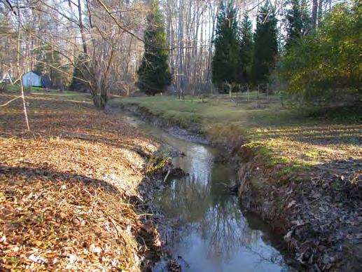


143 4KT19 - Riffle 4KT19 - Pool 4KT19T1 4KT17T1 4MNM1 4MNM1


144 4UNM1 4UNT13
145 3UAM3 3LAM3 - Upstream 3LAM3 - Downstream 3UHM4 - Upstream 3UHM4 - Downstream
146 3LHT6 3LHM2 - Upstream 3LHM2 - Downstream


147 3UAM3 3LAM3 - Upstream 3LAM3 - Downstream 3UHM4 - Upstream 3UHM4 - Downstream


148 3LHT6 3LHM2 - Upstream 3LHM2 - Downstream
Stream Classification
 Stream Classification Why Classify Streams? Communication Tool Describe Existing Conditions & Trends Describe Restoration Goals Research Tool Morphologic Stream Classification Systems Schumm (1977) Alluvial
Riparian Assessment. Steps in the right direction... Drainage Basin/Watershed: Start by Thinking Big. Riparian Assessment vs.
 Riparian Assessment vs. Monitoring Riparian Assessment What is a healthy stream? Determine stream/riparian health Determine change or trend, especially in response to mgmt Classification = designation
PolyMet NorthMet Project
 RS 26 Draft-01 December 8, 2005 RS26 Partridge River Level 1 Rosgen Geomorphic Survey Rosgen Classification Partridge River from Headwaters to Colby Lake Prepared for PolyMet NorthMet Project December
Why Geomorphology for Fish Passage
 Channel Morphology - Stream Crossing Interactions An Overview Michael Love Michael Love & Associates mlove@h2odesigns.com (707) 476-8938 Why Geomorphology for Fish Passage 1. Understand the Scale of the
APPENDIX A REACH DECRIPTIONS. Quantico Creek Watershed Assessment April 2011
 APPENDIX A REACH DECRIPTIONS Basin 615, South Fork of Quantico Creek - Project Reach Descriptions Reach Name: 615-A Coordinates (NAD 83, Virginia State Plane North): 11796510.57, 6893938.95 to 11801555.79,
Ways To Identify Background Verses Accelerated Erosion
 Ways To Identify Background Verses Accelerated Erosion Establish Background Condition From Old Ground Photos, Aerial Photos, and Maps Compare Rate Over Time At the Same Location, or for Reaches Channel
CASE STUDIES. Introduction
 Introduction The City of Winston-Salem faces the challenge of maintaining public infrastructure (e.g., water and sewer lines, storm drains, roads, culverts and bridges) while minimizing the potential impacts
Rosgen Classification Unnamed Creek South of Dunka Road
 Rosgen Classification Unnamed Creek South of Dunka Road Prepared for Poly Met Mining Inc. September 2013 Rosgen Classification Unnamed Creek South of Dunka Road Prepared for Poly Met Mining Inc. September
OBJECTIVES. Fluvial Geomorphology? STREAM CLASSIFICATION & RIVER ASSESSMENT
 STREAM CLASSIFICATION & RIVER ASSESSMENT Greg Babbit Graduate Research Assistant Dept. Forestry, Wildlife & Fisheries Seneca Creek, Monongahela National Forest, West Virginia OBJECTIVES Introduce basic
Stream Geomorphology. Leslie A. Morrissey UVM July 25, 2012
 Stream Geomorphology Leslie A. Morrissey UVM July 25, 2012 What Functions do Healthy Streams Provide? Flood mitigation Water supply Water quality Sediment storage and transport Habitat Recreation Transportation
Aquifer an underground zone or layer of sand, gravel, or porous rock that is saturated with water.
 Aggradation raising of the streambed by deposition that occurs when the energy of the water flowing through a stream reach is insufficient to transport sediment conveyed from upstream. Alluvium a general
Assessment. Assessment
 2001 SPRINGBROOK CREEK RESTORATION - THREE YEAR POST-CONSTRUCTION REVIEW - Presented by Bruce Henderson and Andy Harris 2005 River Restoration Northwest Symposium Skamania Lodge, Washington www.hendersonlandservices.com
Why Stabilizing the Stream As-Is is Not Enough
 Why Stabilizing the Stream As-Is is Not Enough Several examples of alternatives to the County s design approach have been suggested. A common theme of these proposals is a less comprehensive effort focusing
May 7, Roger Leventhal, P.E. Marin County Public Works Laurel Collins Watershed Sciences
 May 7, 2013 Roger Leventhal, P.E. Marin County Public Works Laurel Collins Watershed Sciences Background Funded in 2009 under EPA 2100 Grant for $30k and managed by SFEP Project Goals: Update original
Vermont Stream Geomorphic Assessment. Appendix E. River Corridor Delineation Process. VT Agency of Natural Resources. April, E0 - April, 2004
 Vermont Stream Geomorphic Assessment Appendix E River Corridor Delineation Process Vermont Agency of Natural Resources - E0 - River Corridor Delineation Process Purpose A stream and river corridor delineation
NATURAL RIVER. Karima Attia Nile Research Institute
 NATURAL RIVER CHARACTERISTICS Karima Attia Nile Research Institute NATURAL RIVER DEFINITION NATURAL RIVER DEFINITION Is natural stream of water that flows in channels with ih more or less defined banks.
ADDRESSING GEOMORPHIC AND HYDRAULIC CONTROLS IN OFF-CHANNEL HABITAT DESIGN
 ADDRESSING GEOMORPHIC AND HYDRAULIC CONTROLS IN OFF-CHANNEL HABITAT DESIGN Conor Shea - Hydrologist U.S. Fish and Wildlife Service Conservation Partnerships Program Arcata, CA Learning Objectives Examine
Appendix E Rosgen Classification
 Appendix E Stream Type s Using the morphometric parameters described above, stream reaches are classified into 7 major stream types (Aa+ through G) based on s (1996) criteria. The relevant stream classifications
DETAILED DESCRIPTION OF STREAM CONDITIONS AND HABITAT TYPES IN REACH 4, REACH 5 AND REACH 6.
 DETAILED DESCRIPTION OF STREAM CONDITIONS AND HABITAT TYPES IN REACH 4, REACH 5 AND REACH 6. The Eklutna River was divided into study reaches (figure 1) prior to this site visit. Prominent geologic or
NATURE OF RIVERS B-1. Channel Function... ALLUVIAL FEATURES. ... to successfully carry sediment and water from the watershed. ...dissipate energy.
 1 2 Function... Sevier River... to successfully carry sediment and water from the watershed....dissipate energy. 3 ALLUVIAL FEATURES 4 CHANNEL DIMENSION The purpose of a stream is to carry water and sediment
Watershed Assessment of River Stability and Sediment Supply: Advancing the Science of Watershed Analysis
 Watershed Assessment of River Stability and Sediment Supply: Advancing the Science of Watershed Analysis 2009 MWEA Annual Conference Rob Myllyoja, CET rmyllyoja@hrc-engr.com Watershed Assessment of River
Step 5: Channel Bed and Planform Changes
 Step 5: Channel Bed and Planform Changes When disturbed, streams go through a series of adjustments to regain equilibrium with the flow and sediment supply of their watersheds. These adjustments often
Fish Passage at Road Crossings
 Fish Passage at Road Crossings 1 Crossing Design Workshop Outline 1:00 to 2:00 Intro, Design Overview, Channel Width 2:00 to 2:15 Break 2:15 to 3:15 No-Slope, Stream Simulation Design 3:15 to 3:30 Break
Tom Ballestero University of New Hampshire. 1 May 2013
 Tom Ballestero University of New Hampshire 1 May 2013 1 Hydrology 2 Basic Hydrology Low flows most common Flows that fill the stream to the banks and higher are much less common Filling the stream to the
Limitation to qualitative stability indicators. the real world is a continuum, not a dichotomy ~ 100 % 30 % ~ 100 % ~ 40 %
 Stream Stability Assessment & BEHI Surveys Joe Rathbun MDEQ Water Resources Division rathbunj@michigan.gov 517--373 517 373--8868 Stability Stream can transport its water and sediment inputs without changing
Natural Shoreline Landscapes on Michigan Inland Lakes
 Natural Shoreline Landscapes on Michigan Inland Lakes Excerpts from Chapters 2 and 3 Photo Photo by Jane by Jane Herbert Herbert Did you know? Twenty-four species of amphibians, 25 species of reptiles,
Diagnostic Geomorphic Methods for Understanding Future Behavior of Lake Superior Streams What Have We Learned in Two Decades?
 Diagnostic Geomorphic Methods for Understanding Future Behavior of Lake Superior Streams What Have We Learned in Two Decades? Faith Fitzpatrick USGS WI Water Science Center, Middleton, WI fafitzpa@usgs.gov
Rapid Geomorphic Assessments: RGA s
 Establishing Current Reference Conditions Rates and concentrations of suspended-sediment transport vary over time and space due to factors such as precipitation characteristics and discharge, geology,
How Do Human Impacts and Geomorphological Responses Vary with Spatial Scale in the Streams and Rivers of the Illinois Basin?
 How Do Human Impacts and Geomorphological Responses Vary with Spatial Scale in the Streams and Rivers of the Illinois Basin? Bruce Rhoads Department of Geography University of Illinois at Urbana-Champaign
Technical Supplement 3E. Rosgen Stream Classification Technique Supplemental Materials. (210 VI NEH, August 2007)
") Technical Supplement 3E (210 VI NEH, August 2007) Issued August 2007 Cover photo: The Rosgen stream classification system uses morphometric data to characterize streams. Advisory Note Techniques and approaches
Technical Supplement 3E (210 VI NEH, August 2007) Issued August 2007 Cover photo: The Rosgen stream classification system uses morphometric data to characterize streams. Advisory Note Techniques and approaches
Avoiding Geohazards in the Mid-Atlantic Highlands by Using Natural Stream Principles
 Avoiding Geohazards in the Mid-Atlantic Highlands by Using Natural Stream Principles J. Steven Kite, WVU Neal Carte, WVDOT Will Harman, Michael Baker Corp. Donald D. Gray, WVU Photo: W. Gillespie North
Session C1 - Applying the Stream Functions Pyramid to Geomorphic Assessments and Restoration Design
 University of Massachusetts - Amherst ScholarWorks@UMass Amherst International Conference on Engineering and Ecohydrology for Fish Passage International Conference on Engineering and Ecohydrology for Fish
Business. Meteorologic monitoring. Field trip? Reader. Other?
 Business Meteorologic monitoring Field trip? Reader Other? Classification Streams Characterization Discharge measurements Why classify stream channels? Why Classify Stream Channels? Provides a common language
(3) Sediment Movement Classes of sediment transported
 Sediment Movement Classes of sediment transported") (3) Sediment Movement Classes of sediment transported Dissolved load Suspended (and wash load ) Important for scouring algae Bedload (5-10% total load Moves along bed during floods Source of crushing for
(3) Sediment Movement Classes of sediment transported Dissolved load Suspended (and wash load ) Important for scouring algae Bedload (5-10% total load Moves along bed during floods Source of crushing for
Overview of fluvial and geotechnical processes for TMDL assessment
 Overview of fluvial and geotechnical processes for TMDL assessment Christian F Lenhart, Assistant Prof, MSU Research Assoc., U of M Biosystems Engineering Fluvial processes in a glaciated landscape Martin
GENERAL SUMMARY BIG WOOD RIVER GEOMORPHIC ASSESSMENT BLAINE COUNTY, IDAHO
 GENERAL SUMMARY BIG WOOD RIVER GEOMORPHIC ASSESSMENT BLAINE COUNTY, IDAHO Prepared For Trout Unlimited 300 North Main Street, Hailey, Idaho, 83333 Prepared By P. O. Box 8578, 140 E. Broadway, Suite 23,
Geomorphic Assessment of City Center Athletic Club Development Impacts on Existing Stream Channel Stability, Lenexa, KS.
 Ozarks Environmental and Water Resources Institute (OEWRI) Geomorphic Assessment of City Center Athletic Club Development Impacts on Existing Stream Channel Stability, Lenexa, KS. Final report to Olsson
Step 6: Rapid Habitat Assessment (RHA)
") Step 6: Rapid Habitat Assessment (RHA) Background Physical processes, combined with chemical constituents and biological interactions, are what determine biological productivity and diversity; and, in
Step 6: Rapid Habitat Assessment (RHA) Background Physical processes, combined with chemical constituents and biological interactions, are what determine biological productivity and diversity; and, in
Application of Fluvial Geomorphologic Techniques At Abandoned Mine Sites 1. David A. Greenfield 2 Dennis M. Palladino 3
 Application of Fluvial Geomorphologic Techniques At Abandoned Mine Sites 1 David A. Greenfield 2 Dennis M. Palladino 3 ABSTRACT Watersheds that have been severely impacted by mining can no longer transport
Working with Natural Stream Systems
 Working with Natural Stream Systems Graydon Dutcher Delaware County Soil & Water Conservation District Stream Corridor Management Program Tropical Storm Sandy October 29,2012 What is a Watershed?
Four Mile Run Levee Corridor Stream Restoration
 Four Mile Run Levee Corridor Stream Restoration 30% Design Summary U.S. Army Corps of Engineers, Baltimore District Presentation Outline Four Mile Run 1.) Historic Perspective 2.) Existing Conditions 3.)
APPENDIX E. GEOMORPHOLOGICAL MONTORING REPORT Prepared by Steve Vrooman, Keystone Restoration Ecology September 2013
 APPENDIX E GEOMORPHOLOGICAL MONTORING REPORT Prepared by Steve Vrooman, Keystone Restoration Ecology September 2 Introduction Keystone Restoration Ecology (KRE) conducted geomorphological monitoring in
Dolores River Watershed Study
 CHAPTER 4: RIVER AND FLOODPLAIN ISSUES The Dolores River falls into a category of streams in Colorado that share some unique characteristics. Like some other mountain streams in the state, it has a steep
Gully Erosion Part 1 GULLY EROSION AND ITS CAUSES. Introduction. The mechanics of gully erosion
 Gully Erosion Part 1 GULLY EROSION AND ITS CAUSES Gully erosion A complex of processes whereby the removal of soil is characterised by incised channels in the landscape. NSW Soil Conservation Service,
Upper Truckee River Restoration Lake Tahoe, California Presented by Brendan Belby Sacramento, California
 Upper Truckee River Restoration Lake Tahoe, California Presented by Brendan Belby Sacramento, California Mike Rudd (Project Manager), Charley Miller & Chad Krofta Declines in Tahoe s Water Clarity The
Appendix III-A Descriptions of Channel Habitat Types
 Appendix III-A Descriptions of Channel Habitat Types Table of Contents Channel Habitat Typing Background... 3 Small Estuarine Channel (ES)... 7 Large Estuarine Channel (EL)... 9 Low Gradient Large Floodplain
Griswold Creek August 22, 2013
 Creek August 22, 2013 1 Lake Erie Protection Fund Creek Study ver Evaluate the overall condition of Creek Determine stable channel dimensions & appropriate restoration techniques Starting Stat gpoint for
CR AAO Bridge. Dead River Flood & Natural Channel Design. Mitch Koetje Water Resources Division UP District
 CR AAO Bridge Dead River Flood & Natural Channel Design Mitch Koetje Water Resources Division UP District Old County Road AAO Bridge Map courtesy of Marquette County Silver Lake Basin McClure Basin
Sixteen Mile Creek Tributaries Meander Belt Width Assessment November 2009
 SIXTEEN MILE CREEK TRIBUTARIES THE CATHOLIC CEMETERIES OF THE DIOCESE OF HAMILTON -MEANDER BELT WIDTH ASSESSMENT - Report to: Attention: From: Director of Cemeteries Catholic Cemeteries of the Diocese
SCOPE OF PRESENTATION STREAM DYNAMICS, CHANNEL RESTORATION PLANS, & SEDIMENT TRANSPORT ANALYSES IN RELATION TO RESTORATION PLANS
 DESIGN METHODS B: SEDIMENT TRANSPORT PROCESSES FOR STREAM RESTORATION DESIGN PETER KLINGEMAN OREGON STATE UNIVERSITY CIVIL ENGINEERING DEPT., CORVALLIS 2 ND ANNUAL NORTHWEST STREAM RESTORATION DESIGN SYMPOSIUM
Technical Memorandum. To: From: Copies: Date: 10/19/2017. Subject: Project No.: Greg Laird, Courtney Moore. Kevin Pilgrim and Travis Stroth
 Technical Memorandum To: From: Greg Laird, Courtney Moore Kevin Pilgrim and Travis Stroth 5777 Central Avenue Suite 228 Boulder, CO 80301 www.otak.com Copies: [Electronic submittal] Date: 10/19/2017 Subject:
Assignment 1. Measuring River Characteristics- Vernon Creek. Applied Fluvial Geomorphology Field Techniques EESc 435
 Assignment 1 Measuring River Characteristics- Vernon Creek Applied Fluvial Geomorphology Field Techniques EESc 435 Amanda Jardine 30100093 Jaime McDonald 14177083 Erica Massey 50870088 April 28, 2012 Introduction
A GEOMORPHOLOGICAL APPROACH TO RESTORATION OF INCISED RIVERS. David L. Rosgen 1
 Proceedings of the Conference on Management of Landscapes Disturbed by Channel Incision, 1997 S.S.Y. Wang, E.J. Langendoen and F.D. Shields, Jr. (eds.) ISBN 0-937099-05-8 A GEOMORPHOLOGICAL APPROACH TO
(3) Sediment Movement Classes of sediment transported
 Sediment Movement Classes of sediment transported") 9/17/15 (3) Sediment Movement Classes of sediment transported Dissolved load Suspended load Important for scouring algae Bedload (5-10% total load) Moves along bed during floods Source of crushing for
9/17/15 (3) Sediment Movement Classes of sediment transported Dissolved load Suspended load Important for scouring algae Bedload (5-10% total load) Moves along bed during floods Source of crushing for
PHASE 1 STREAM GEOMORPHIC ASSESSMENT. Castleton River, Rutland County Vermont. Final Report
 PHASE 1 STREAM GEOMORPHIC ASSESSMENT Castleton River, Rutland County Vermont Final Report September 15, 2005 TABLE OF CONTENTS INTRODUCTION.. 3 STUDY AREA BACKGROUND... 5 METHODOLOGY 5 DATA INPUTS/STUDY
Kaskaskia Morphology Study Headwaters to Lake Shelbyville
 Kaskaskia Morphology Study Headwaters to Lake Shelbyville KWA Mini Summit 5 March 2012 1 Kaskaskia Morphology Study Headwaters to Lake Shelbyville Conducted by U.S. Army Corps of Engineers, St. Louis District
The last three sections of the main body of this report consist of:
 Threatened and Endangered Species Geological Hazards Floodplains Cultural Resources Hazardous Materials A Cost Analysis section that provides comparative conceptual-level costs follows the Environmental
Field Methods to Determine/ Verify Bankfull Elevation, XS Area & Discharge
 Module # 6 Field Methods to Determine/ Verify Bankfull Elevation, XS Area & Discharge Iowa s River Restoration Toolbox Level 1 / Base Training Overview of Basic Field Data Collection Site Map Cross Sections
The how, why, and lessons learned
 The how, why, and lessons learned emulates natural river systems integrates fluvial processes over temporal and spatial scales of self-formed and self-maintained natural rivers reestablish the physical,
Wetland & Floodplain Functional Assessments and Mapping To Protect and Restore Riverine Systems in Vermont. Mike Kline and Laura Lapierre Vermont DEC
 Wetland & Floodplain Functional Assessments and Mapping To Protect and Restore Riverine Systems in Vermont Mike Kline and Laura Lapierre Vermont DEC NWI+ Hydro-Geomorphic Characterization of Wetlands and
Little Blackfoot TPA 2009 Sediment and Habitat Assessment QAQC Review March 9, 2010
 Little Blackfoot TPA 2009 Sediment and Habitat Assessment QAQC Review March 9, 2010 1.0 PROJECT OVERVIEW Sediment and habitat monitoring in the Little Blackfoot TPA was conducted in July of 2009 as outlined
!"#$%&&'()*+#$%(,-./0*)%(!
*+#$%(,-./0*)%(!") 8:30 Sign in Hoosic River Revival Coalition!"#$%&&'()*+#$%(,-./0*)%(! 12-#30+4/#"5-(60 9:00 Welcome and Introductions 9:15 Goals for Today s Program: A Description of the Planning Process 9:30 First Session:
8:30 Sign in Hoosic River Revival Coalition!"#$%&&'()*+#$%(,-./0*)%(! 12-#30+4/#"5-(60 9:00 Welcome and Introductions 9:15 Goals for Today s Program: A Description of the Planning Process 9:30 First Session:
Habitat Assessment. Peggy Compton UW-Extension Water Action Volunteers Program Coordinator
 Habitat Assessment Peggy Compton UW-Extension Water Action Volunteers Program Coordinator Adapted from a presentation by Jean Unmuth, Water Quality Biologist, WI DNR dnr.wi.gov www.uwex.edu erc.cals.wisc.edu
Stream Simulation: A Simple Example
 Stream Simulation: A Simple Example North Thompson Creek, CO Paul T. Anderson U.S.D.A. Forest Service Here s How We Started May 2011 2-1 USDA-Forest Service Here s How We Finished Forest Service Aquatic
Bank Erosion and Morphology of the Kaskaskia River
 Bank Erosion and Morphology of the Kaskaskia River US Army Corps Of Engineers St. Louis District Fayette County Soil and Water Conservation District Team Partners : Carlyle Lake Ecosystem Partnership Vicinity
Do you think sediment transport is a concern?
 STREAM RESTORATION FRAMEWORK AND SEDIMENT TRANSPORT BASICS Pete Klingeman 1 What is Your Restoration Project Like? k? Do you think sediment transport is a concern? East Fork Lewis River, WA Tidal creek,
Birch Creek Geomorphic Assessment and Action Plan
 Birch Creek Geomorphic Assessment and Action Plan Jim Webster Tim Hanrahan, PhD, CFM Jesse Schwartz, PhD Zach Hill January 22, 2015 White Eagle Grange This Project is a First Step in Strategy Planning
SECTION G SEDIMENT BUDGET
 SECTION G SEDIMENT BUDGET INTRODUCTION A sediment budget has been constructed for the for the time period 1952-2000. The purpose of the sediment budget is to determine the relative importance of different
C. STUDENT FIELD DATA SHEETS
 C. STUDENT FIELD DATA SHEETS Student Name Date Time Stream Location Parameter to find Your Group s Results Units trial trial average Transparency cm Water Temperature Air Temperature Weather N sunny N
Implementing a Project with 319 Funds: The Spring Brook Meander Project. Leslie A. Berns
 Implementing a Project with 319 Funds: The Spring Brook Meander Project Leslie A. Berns "...to acquire... and hold lands... for the purpose of protecting and preserving the flora, fauna and scenic beauties...
Case Study 2: Twenty-mile Creek Rock Fords
 Case Study : Twenty-mile Creek Rock Fords Location Crossing Description Washington. Okanagan National Forest. Methow Valley Ranger District. Chewuch river basin, East Chewuch Road. The Twenty-mile Creek
Fluvial Geomorphology
 Geomorphic Components of Riparian Ecosystems W. Barry Southerland, Ph.D. Fluvial Geomorphologist, CPESC #514 West National Technology Support Center Water Quality and Quantity Technology Development Team
Conceptual Model of Stream Flow Processes for the Russian River Watershed. Chris Farrar
 Conceptual Model of Stream Flow Processes for the Russian River Watershed Chris Farrar Several features of creeks affect the interactions between surface and groundwater. This conceptual model uses the
PENNSYLVANIA DEPARTMENT OF TRANSPORTATION ENGINEERING DISTRICT 3-0
 PENNSYLVANIA DEPARTMENT OF TRANSPORTATION ENGINEERING DISTRICT 3-0 LYCOMING COUNTY S.R.15, SECTION C41 FINAL HYDROLOGIC AND HYDRAULIC REPORT STEAM VALLEY RUN STREAM RELOCATION DATE: June, 2006 REVISED:
River Response. Sediment Water Wood. Confinement. Bank material. Channel morphology. Valley slope. Riparian vegetation.
 River Response River Response Sediment Water Wood Confinement Valley slope Channel morphology Bank material Flow obstructions Riparian vegetation climate catchment vegetation hydrological regime channel
Important Copyright Information
 Important Copyright Information The following content is provided for educational purposes by the workshop presenter. This content may or may not have been peer reviewed. Information, opinions and recommendations
Solutions to Flooding on Pescadero Creek Road
 Hydrology Hydraulics Geomorphology Design Field Services Photo courtesy Half Moon Bay Review Solutions to Flooding on Pescadero Creek Road Prepared for: San Mateo County Resource Conservation District
Upper Mississippi River Basin Environmental Management Program Workshop
 Presentation to the Upper Mississippi River Basin Environmental Management Program Workshop by Michael Rodgers River Engineer US Army Corps of Engineers, St. Louis District August 17, 2007 Engineering
Erosion Surface Water. moving, transporting, and depositing sediment.
 + Erosion Surface Water moving, transporting, and depositing sediment. + Surface Water 2 Water from rainfall can hit Earth s surface and do a number of things: Slowly soak into the ground: Infiltration
Dan Miller + Kelly Burnett, Kelly Christiansen, Sharon Clarke, Lee Benda. GOAL Predict Channel Characteristics in Space and Time
 Broad-Scale Models Dan Miller + Kelly Burnett, Kelly Christiansen, Sharon Clarke, Lee Benda GOAL Predict Channel Characteristics in Space and Time Assess Potential for Fish Use and Productivity Assess
GEOL 652. Poudre River Fieldtrip
 GEOL 652. Poudre River Fieldtrip One of the more difficult variables to measure and/or estimate when studying flow in natural channels is that of roughness. Roughness, usually approximated with Manning
BUREAU OF CLEAN WATER. Appendix C Biological Field Methods C1. Habitat Assessment DECEMBER 2013
 BUREAU OF CLEAN WATER Appendix C Biological Field Methods C1. Assessment DECEMBER 2013 HABITAT ASSESSMENT The Department has adopted the habitat assessment methods outlined in EPA s Rapid Bioassessment
River Morphology. EAD 511 River management
 River Morphology EAD 511 River management Introduction FLUVIAL GEOMORPHOLOGY Webster's New World Dictionary defines fluvial as: of, found in, or produced by a river or rivers. The same reference defines
Carmel River Bank Stabilization at Rancho San Carlos Road Project Description and Work Plan March 2018
 Carmel River Bank Stabilization at Rancho San Carlos Road Project Description and Work Plan March 2018 EXISTING CONDITION The proposed Carmel River Bank Stabilization at Rancho San Carlos Road Project
3/3/2013. The hydro cycle water returns from the sea. All "toilet to tap." Introduction to Environmental Geology, 5e
 Introduction to Environmental Geology, 5e Running Water: summary in haiku form Edward A. Keller Chapter 9 Rivers and Flooding Lecture Presentation prepared by X. Mara Chen, Salisbury University The hydro
Vermont Stream Geomorphic Assessment. Appendix J. Vermont Regional Hydraulic Geometry Curves
 Vermont Stream Geomorphic Assessment Appendix J Vermont Regional Hydraulic Geometry Curves River Management Program Vermont Water Quality Division November, 2001 Natural Resources - J0 - VT Agency of Background
BZ471, Steam Biology & Ecology Exam 1
 BZ471, Exam1, p.1 BZ471, Steam Biology & Ecology Exam 1 Name Matching. Select the single best (most precise) answer for each of the following. Use each answer no more than once. No partial credit is given.
Surface Water and Stream Development
 Surface Water and Stream Development Surface Water The moment a raindrop falls to earth it begins its return to the sea. Once water reaches Earth s surface it may evaporate back into the atmosphere, soak
Geomorphic Assessment of the Middle and Lower Swan Lake Watershed, Calhoun Division of Two Rivers National Wildlife Refuge.
 Geomorphic Assessment of the Middle and Lower Swan Lake Watershed, Calhoun Division of Two Rivers National Wildlife Refuge Report Figures 33 34 Figure 1. Location of Middle and Lower Swan Lake watersheds
Instream Erosion Control General
 Instream Erosion Control General EROSION CONTROL TECHNIQUES Revegetation Temperate Climates Short-Term Non Vegetation Wet Tropics Long-Term Weed Control [1] Semi-Arid Zones Permanent [1] Weed control attributes
Geomorphic Importance of Winter Peak Flows and Annual Snowmelt Hydrographs in a Sierra Nevada Boulder-Bedrock River
 Geomorphic Importance of Winter Peak Flows and Annual Snowmelt Hydrographs in a Sierra Nevada Boulder-Bedrock River Scott McBain and Bill Trush McBain & Trush, Inc. Clavey River and Cherry Creek vicinity
Appendix K.2: Sediment Management Excerpt from South Orange County Hydromodification Management Plan
 Appendix K.2: Sediment Management Excerpt from South Orange County Hydromodification Management Plan 4 Sediment Supply Management Requirements Permit Order R9-2013-0001 as amended by Order No. R9-2015-0001Section
When Creek Meets Valley Wall: Prioritizing Erosion Mitigation alongside the Oshawa Landfill
 1 When Creek Meets Valley Wall: Prioritizing Erosion Mitigation alongside the Oshawa Landfill Robin McKillop 1, Dan McParland 1 & Cassie Scobie 2 TRIECA conference March 22-23, 2017 1 Palmer Environmental
River Nith restoration, cbec UK Ltd, October 2013 APPENDIX A
 APPENDIX A FLUVIAL AUDIT METHOD STATEMENT Fluvial Audit Methodology INTRODUCTION The procedure used to characterize the geomorphic and sedimentary regimes of the River Till is an adaptation of the Fluvial
Summary. Streams and Drainage Systems
 Streams and Drainage Systems Summary Streams are part of the hydrologic cycle and the chief means by which water returns from the land to the sea. They help shape the Earth s surface and transport sediment
The Equilibrium Channel & Channel Change. Peter Wilcock 3 August 2016
 The Equilibrium Channel & Channel Change Peter Wilcock 3 August 2016 1 The search for common empirical attributes of streams Luna B. Leopold M. Gordon ( Reds ) Wolman Watts Branch, MD A meandering stream
Stream Restoration and Environmental River Mechanics. Objectives. Pierre Y. Julien. 1. Peligre Dam in Haiti (deforestation)
") Stream Restoration and Environmental River Mechanics Pierre Y. Julien Malaysia 2004 Objectives Brief overview of environmental river mechanics and stream restoration: 1. Typical problems in environmental
Stream Restoration and Environmental River Mechanics Pierre Y. Julien Malaysia 2004 Objectives Brief overview of environmental river mechanics and stream restoration: 1. Typical problems in environmental
Summary of Hydraulic and Sediment-transport. Analysis of Residual Sediment: Alternatives for the San Clemente Dam Removal/Retrofit Project,
 Appendix N SUMMARY OF HYDRAULIC AND SEDIMENT-TRANSPORT ANALYSIS OF RESIDUAL SEDIMENT: ALTERNATIVES FOR THE SAN CLEMENTE DAM REMOVAL/RETROFIT PROJECT, CALIFORNIA the San Clemente Dam Removal/Retrofit Project,
Channel Assessments of Selected Watersheds within TFL 52
 Channel Assessments of Selected Watersheds within TFL 52 prepared for: West Fraser Mills Ltd. Quesnel, BC prepared by: John Berry, M.Sc., R.P.F. Victoria, BC Channel Assessments TFL 52 Summary SUMMARY
GEOL 1121 Earth Processes and Environments
 GEOL 1121 Earth Processes and Environments Wondwosen Seyoum Department of Geology University of Georgia e-mail: seyoum@uga.edu G/G Bldg., Rm. No. 122 Seyoum, 2015 Chapter 6 Streams and Flooding Seyoum,