Sustainability reporting for ports
|
|
|
- Colin Cannon
- 5 years ago
- Views:
Transcription
 Prof. dr. Michaël Dooms (michael.dooms@vub.ac.be) March 2015")
1 Sustainability reporting for ports Exploratory research on boundaries, stakeholders and benchmarking Magali Geerts Prof. dr. Michaël Dooms March 2015
2 Introduction (1) Several ports already publish a sustainability report or have it integrated in their annual report. Reporting about relevant corporate environmental and social responsibility issues forms an essential basis for the license to operate for a port, the basis for development and operations of ports. BUT What should be the reporting boundaries for a sustainability report on the port level? Port Authority activities Port and industry area activities Supply chain High influence Medium influence Limited influence Limited impact Reasonable impact High impact Source: Adapted from the annual report 2015 of Port of Rotterdam
3 Introduction (2) Other issues: Stakeholder inclusion: In the process of Sustainability Reporting On a permanent basis Benchmarking
4 Introduction (2) Academic / scientific background: Stakeholder theory angle Institutional theory angle Port collaboration angle Port governance angle
5 Methodology Selection of 10 leading Sustainability Reports (or likewise); Explorative, qualitative exercise; In-depth reading of boundaries and performance indicators, construction of a table using the Rotterdam approach ; Selection of a limited set of performance indicators* / areas ( traditionally most used) in 4 perspectives (Economic/Environment/Social/Governance) Emergence of tendencies / conflicts / food for thought * We focused exclusively of the reporting of quantitative indicators
6 Antwerp Rotterdam Bremen Hamburg Gothenburg Valencia Porto Nave (BR) Transnet (SA) Vancouver (CAN) Los Angeles (US) The list of 10
7 Stakeholders and boundaries (1) How far do Port Authorities go in their analysis about stakeholders? Do they report about boundaries? Port of Antwerp Port of Rotterdam Port of Bremen Port of Göthenburg Port of Valencia Chapter on stakeholder relations : Different stakeholder groups identification / Key concerns of the stakeholders / Form of dialogue / Actions taken by the port List of stakeholders that were involved in the development of the sustainability report + opinion of the stakeholders regarding the previous sustainability report Reference to the scope of the annual report Geographic/activity approach to boundaries: Port Authority and Industry cluster Chapter on experience/perception of the port by the public, also special indicator Chapter on stakeholder relations : Different stakeholder groups identification/ Key concerns of the stakeholders / Form of dialogue / Actions taken by the port Reputational research through public opinions Stakeholder satisfaction index (unique exercise in 2012) Permanent Community liaison committees and complaint management Reference to the scope of the annual report Chapter on stakeholder relations : Different stakeholder groups identification / Key concerns of the stakeholders / Form of dialogue Chapter on significant sustainability aspects and report boundaries : 16 sustainability aspects are determined and boundaries of influence along the logistics chain are defined for future purposes. Reference to boundaries as a footnote for the current KPI s Indicator on impacts of operations on local communities Chapter on sustainable relations : Different stakeholder groups identification / Form of dialogue / Expectations of the stakeholders / Actions taken by the port Stakeholders expectations about the port integrated into the sustainability report Satisfaction indicators based on some stakeholders groups: employee and customer Reference to boundaries as a footnote in the KPI chapter List of stakeholders are identified, but limited information about the concrete concerns and actions taken to indulge them. Reference to boundaries is integrated in the titles of the indicators. Description of the port authority s policy in terms of its relations with its social environment.
8 Stakeholders and boundaries (2) Port Metro Vancouver Port of Hamburg Port of Portonave Transnet South Africa Port of Los Angeles Boundaries clearly reported report using a broader port-wide boundary and aligned over performance indicators within the topics Extensive list of material topics and link to stakeholders Consultation of stakeholders through a recently completed strategy exercise Permanent Community liaison committees and complaint management Geographic/activity approach to boundaries: The area in which the HPA exerts influence on, rents and manages properties and land, and is responsible for roads, waterways, rails and sites See themselves as an urban infrastructure company (p.12) Stakeholder survey with >100 stakeholders participating (structured description of issues), TIDE project survey >800 (local community), + CRI index of Bertelsmann Institute Private integrated port/terminal operator: boundary discussion limited (subsidiaries) Lots of attention to stakeholder identification and description, extensive list of topics and stakeholders interests Creation of an Ombudsman position both for internal and external stakeholders Extensive social programs Extensive discussion on stakeholders and links to strategic objectives and risk (but no link to indicators), for each stakeholder (presented as a boundaries discussion => stakeholders as boundaries) State-Owned integrated company for port management and operation as well as rail transport (and boundaries as such implicitly described) Stakeholder consultation limited to ex-ante consultation for projects Boundaries: combination of the POLA Harbor Department and the activities of the tenants Stakeholder description provided, identification of a dominant core: tenants, regulators, local communities Description of multi-channels of stakeholder inclusion Large attention to both core and non-core business CSR related investments
9 Boundaries analysis (cont.) What was our approach for the boundaries analysis? ~ Rotterdam approach Boundaries based on type of activitities: Boundary 1 = Infrastructure management activities under the responsibility of the Port Authority Boundary 2 = Port related activities linked to cargo handling and other industry located in the port area Boundary 3 = Port related activities linked to the total supply chain or indicators linked to the region
10 Boundaries analysis What are the boundaries for the most common performance indicators? Port Authority activities Port and industry area Supply chain TOTAL ECONOMIC: ENVIRONMENTAL: SOCIAL: GOVERNANCE: TOTAL Direct economic value Traffic volumes Investments made R&D expenses Modal split Operational performance Energy consumption CO2 emissions Other port activity related emissions Direct/Indirect employment Safety / Accident rate Training Is there a formal measurement/mechanism in place to examine the perceptions of local communities? (1) Surveys on perception / Complaints line / Ombudsperson (2) Consultation for projects, strategy, reporting
11 Boundaries analysis What are the boundaries for the most common performance indicators? Port Authority activities Port and industry area Logistics chain TOTAL ECONOMIC: Direct economic value /30 Traffic volumes /10 Investments made /30 R&D expenses /20 Modal split /10 Operational performance /30 ENVIRONMENTAL: Energy consumption /20 CO2 emissions /30 Other port activity related emissions /20 SOCIAL: Direct/Indirect employment /30 Safety / Accident rate /20 Training /30 GOVERNANCE: Is there a formal (1) Surveys on perception / Complaints line / 7/10 ports measurement/mechanism in place to Ombudsperson (3/5 ports) examine the perceptions of local (2) Consultation for projects, strategy, reporting (5/5 10/10 ports communities? ports) TOTAL
12 Boundaries analysis (cont.) What about benchmarking? Are there ports that already do this? And which indicators then? Direct economic value: Port of Antwerp Traffic volumes: Port of Antwerp / Port of Rotterdam / Port of Bremen / Portonave Other port activity related emissions: Port of Antwerp Direct/indirect employment: Port of Antwerp CR reputation: Port of Hamburg Internal benchmarking: Transnet
13 Boundaries analysis (cont.) SOME REMARKS: What lessons can be learned? Many ways to develop boundaries: o Geographical o Organizational / Legal (scope of activities as determined by law) o Stakeholders as boundaries o Business ecosystem approach o Supply chain approach Multiple boundaries per indicator, potentially leading to certain confusion o E.g. economic impacts All sustainability reports that are based on the GRI principles, are obliged to report about the boundaries of the report. Yet, this seems not a guarantee to fully understand the boundaries of the different indicators.
14 Let s vote on it?! Which is the most relevant criterion to define boundaries for a port sustainability report? o Geographical o Organizational / Legal o Stakeholders o Business ecosystem o Supply chain (value creating activities as boundaries)
15 Boundaries analysis (cont.) What lessons can be learned? The Rotterdam model can be adapted in the following way: (1) keeping 3 levels, but rather purely based on activities (review basis to determine the scope) Level 1: impact of port infrastructure management and development Level 2: impact of cargo handling, logistics services and industrial activities within the port area (including the hinterland interface) Level 3: impact of upstream and downstream supply chain activities taking place outside the port borders (2) adding a 4th level, but organizational and geographic boundaries are kept Level 1: Port authority organization Level 2: Port area/cluster (including industry/logistics), (including the hinterland interface) Level 3: Level 2 + local/regional community Level 4: impact of upstream and downstream supply chain activities taking place outside the port borders and local/regional community
16 Boundaries analysis (cont.) What lessons can be learned? Thoughts/concerns on (1): o Geographical / organization perspective less or not present any more o Integrated models (i.e. reporting consolidated on Level 1 + Level 2) like Porto Nave and Transnet might need to split certain reportings on indicators (Level 1 / Level 2) o Is however governance/management model proof (any governance model can fit) o More difficult to identify local community impacts (level 1, level 2 or level 3?) Thoughts/concerns on (2): o Mix and potential confusion between governance models remains, as a result difficult comparisons across ports Recommendation: at the beginning of each SR, clearly position the governance/management model of the port in question (landlord, tool, service) (Bremen, Valencia). o Is however largely consistent with the dominant model used nowadays
17 Conclusion General issues: Need to identify dominant or core set of stakeholders? (POLA, Transnet) Need to harmonize the boundaries problem? Is it really a problem? Can it be solved by being more transparent per indicator? Some underdeveloped indicator areas and a lot of variety regarding the dimension under which indicators belong: o Logistic Chain and Operational performance (Vancouver, Transnet, Rotterdam) o Investments (public + private): seldom consolidated numbers o Many approaches to economic value (incl. trade value, gross added value, taxes, ), especially outside the boundary of the organization Trade-off between qualitative and quantitative indicators/information
18 In Sum Organizational / legal boundaries provoke issues on the level of management model inclusivity (private vs public, landlord vs service) Geographical boundaries provoke issues on spatial contexts (urban vs coastal / nature areas; water areas) Stakeholder based boundaries provoke issues in terms of different salience/materiality of stakeholders and their issues Look for the elements with are the most generic to all ports, i.e. the activities carried out: Maritime & land logistics chains (sea => port => hinterland and vice versa) and associated activities Industry within the area Bremen approach comes close

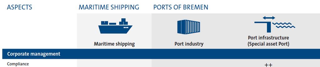

19 Case Bremen
20 Conclusion (cont.) General issues: Benchmarking: o Only limited attention, mainly on traffic evolution and market shares in the range, country or broader region (competitive benchmarking) o Probably somewhat out of scope if the SR serves communication with primarily local stakeholders? o If developed, need to cope with potential bad news (i.e. not reaching the benchmark or underperforming against industry averages). o If developed, collaboration with global stakeholders might be needed (UNCTAD, etc). Existence of other sources on the port level (annual reports, other reports) and beyond
21 Question? Should port sustainability reports pay attention to benchmarking? A. Yes, as much as possible B. Yes, but only against general industry averages C. Yes, but only for certain aspects (e.g. Market Share), and with head-to-head comparison D. No, not at all
22 Limitations The Asian perspective of boundaries? More transparency on indicator calculations might shed new light on some conclusions on boundaries (i.e. sometimes our own judgment was needed) Cfr. need to be more transparent on definition and calculations cfr. GRI supplement airports More direct engagement with ports Hidden elements: some indicators, data or information might be existing, but not reported.
23 PPRN relevance & collaboration Expanding the data collection, overcoming language barriers through collaboration (joint DB?) Global survey on port sustainability reporting (?) Both academic and managerial relevance Academic: growing body of literature on sustainability reporting (how, why, motives, etc.) Managerial: concrete industry interest
24 Contact drs. Magali Geerts Research Associate prof. dr. Michaël Dooms Project Director Michael.Dooms@vub.ac.be Skype michaeldooms
6 th GLOBAL SUMMIT ON URBAN TOURISM 4 6 December 2017, Kuala Lumpur (Malaysia)
") 6 th GLOBAL SUMMIT ON URBAN TOURISM 4 6 December 2017, Kuala Lumpur (Malaysia) SUMMARY/CONCLUSIONS Esencan TERZIBASOGLU Director Destination Management and Quality eterzibasoglu@unwto.org 6TH GLOBAL SUMMIT
6 th GLOBAL SUMMIT ON URBAN TOURISM 4 6 December 2017, Kuala Lumpur (Malaysia) SUMMARY/CONCLUSIONS Esencan TERZIBASOGLU Director Destination Management and Quality eterzibasoglu@unwto.org 6TH GLOBAL SUMMIT
EUSAIR on sea topics from Slovenian perspective
 MINISTRY OF FOREIGN AFFAIRS REPUBLIC OF SLOVENIA EUSAIR on sea topics from Slovenian perspective Mag. Andreja Jerina National Coordinator 4 EU MRS: 270 millions of population 19 MS 12 non MS Sea basin
The National Spatial Strategy
 Purpose of this Consultation Paper This paper seeks the views of a wide range of bodies, interests and members of the public on the issues which the National Spatial Strategy should address. These views
The Governance of Land Use
 The planning system Levels of government and their responsibilities The Governance of Land Use Country fact sheet Germany Germany is a federal country with four levels of government. Below the national
National Perspectives - Portugal. Margarida Almodovar
 National Perspectives - Portugal Margarida Almodovar margarida.almodovar@mam.gov.pt from base line to the external limit of the continental shelf behind 200 miles and according to UNCLOS definitions Economic
COSTA RICA Limon City-Port Project
 photos by Stefania Abakerli COSTA RICA Limon City-Port Project 2008 2013 Cecilia Corvalan William Reuben Stefania Abakerli Background Request from GoCR following Caldera-Port Concession Reform Since the
Spatially Enabled Society
 International Seminar on Land Administration Trends and Issues in Asia and the Pacific Region Spatially Enabled Society Abbas Rajabifard Vice Chair PCGIAP-WG3 Vice-President (President Elect), GSDI Association
Geological information for Europe : Towards a pan-european Geological Data Infrastructure
 Geological information for Europe : Towards a pan-european Geological Data Infrastructure Integrating geoscientific information for EU competitiveness Co-funded by the European Union European societal
The National Policy Strategy for Infrastructure and Spatial Planning CODE24 CONFERENCE. Emiel Reiding
 The National Policy Strategy for Infrastructure and Spatial Planning Emiel Reiding Structure of presentation 1. Spatial planning in the Netherlands 2. National Policy Strategy Aims National interests 3.
GIS Geographical Information Systems. GIS Management
 GIS Geographical Information Systems GIS Management Difficulties on establishing a GIS Funding GIS Determining Project Standards Data Gathering Map Development Recruiting GIS Professionals Educating Staff
On transport and other infrastructure knitting regions together
 Published as: WITLOX, F. (2011) On transport and other infrastructure knitting regions together. In: A. VAN RENTERGHEM (Ed.) Polycentric Regions facing Global Challenges. A Role for Strategic Spatial Planning
EA SEA-WAY Project. 7 th Coordination Meeting. WP5 Development of sustainable passenger transport models for the Adriatic basin and capacity building
 EA SEA-WAY Project 7 th Coordination Meeting WP5 Development of sustainable passenger transport models for the Adriatic basin and capacity building 3 rd Cross Border Board Ravenna, January 26, 2016 The
The Development of Trade Transit Corridors in Africa s Landlocked Countries
 The Development of Trade Transit Corridors in Africa s Landlocked Countries I. Introduction Africa has 15 landlocked countries that face specific challenges. Botswana, Burkina Faso, Burundi, Chad, Central
RURAL-URBAN PARTNERSHIPS: AN INTEGRATED APPROACH TO ECONOMIC DEVELOPMENT
 RURAL-URBAN PARTNERSHIPS: AN INTEGRATED APPROACH TO ECONOMIC DEVELOPMENT William Tompson Head of the Urban Development Programme OECD Public Governance and Territorial Development Directorate JAHRESTAGUNG
Urban-Rural Partnerships in Europe
 Disclaimer: The views expressed in this document are those of the author, and do not necessarily reflect the views and policies of the Asian Development Bank (ADB), its Board of Directors, or the governments
Declaration Population and culture
 Declaration Population and culture The ministers of the parties to the Alpine Convention regard the socio-economic and socio-cultural aspects mentioned in Article 2, Paragraph 2, Item a., as being central
CONFERENCE STATEMENT
 CONFERENCE STATEMENT We, the elected representatives from Canada, Denmark/Greenland, Finland, Iceland, Norway, Russia, Sweden and the United States of America; In collaboration with the indigenous peoples
CONFERENCE STATEMENT
 Final draft CONFERENCE STATEMENT We, the elected representatives of Canada, Denmark/Greenland, the European Parliament, Finland, Iceland, Norway, Russia, Sweden and the United States of America; In collaboration
High-Level Euro-Asia Regional Meeting on Improving Cooperation on Transit, Trade Facilitation and the 2030 Agenda for Sustainable Development
 High-Level Euro-Asia Regional Meeting on Improving Cooperation on Transit, Trade Facilitation and the 2030 Agenda for Sustainable Development Date: 7 to 9 March 2017 Sheraton Hanoi Hotel Hanoi, Vietnam
TERRITORIAL IMPACT ASSESSMENT: AN APPROACH TO IMPROVE THE VERTICAL AND HORIZONTAL INTEGRATION OF EU POLICIES
 TERRITORIAL IMPACT ASSESSMENT: AN APPROACH TO IMPROVE THE VERTICAL AND HORIZONTAL INTEGRATION OF EU POLICIES Naja Marot & Mojca Golobič Biotehnical Faculty, University of Ljubljana, Slovenia RSA Workshop
ATPC ATPC. No. 10. African Trade Policy Centre. Briefing. I. Introduction. The Development of Trade Transit Corridors in Africa s Landlocked Countries
 September 2010 ATPC ATPC Briefing No. 10 African Trade Policy Centre The Development of Trade Transit Corridors in Africa s Landlocked Countries Economic Commission for Africa I. Introduction Africa has
Marine Spatial Planning as an important tool for implementing the MSFD
 Marine Spatial Planning as an important tool for implementing the MSFD Risto Kalliola Tallinn, Nov. 16 th 2012 DEPARTMENT OF GEOGRAPHY AND GEOLOGY University of Turku, Finland Ten principles to provide
The inland water related tourism in South Africa by 2030 in the light of global change
 The inland water related tourism in South Africa by 2030 in the light of global change KSA 2 Water-Linked Ecosystems T4: Green economy and sustainable (green) innovations K5/2620 How can natural capital
SUBJECT: Non paper on the size, nature and dynamics of the blue economy, 15 September 2015, prepared by DG MARE
 SUBJECT: Non paper on the size, nature and dynamics of the blue economy, 15 September 2015, prepared by DG MARE Comments Directorate-General for Maritime Policy (DGPM) and Statistics Portugal (INE) 24
PIANC. The World Association for Waterborne Transport Infrastructure. PIANC EnviCom WG150 A practical guide for a sustainable port
 PIANC The World Association for Waterborne Transport Infrastructure PIANC EnviCom WG150 A practical guide for a sustainable port Chairman: Tiedo Vellinga Port of Rotterdam, TU Delft, EnviCom Co-chairman:
Planning for Economic and Job Growth
 Planning for Economic and Job Growth Mayors Innovation Project Winter 2012 Meeting January 21, 2012 Mary Kay Leonard Initiative for a Competitive Inner City AGENDA The Evolving Model for Urban Economic
Planning for the Shoreline
 Planning for the Shoreline A Summary of the roundtable discussion at Georgia Strait Alliance s second Waterfront Forum June 23, 2014 SFU Harbour Centre Vancouver, BC Planning for the Shoreline Georgia
Lanceringsevent Smart Hub Vlaams-Brabant Brussels Airport optimaliseren door in te zetten op digitalisering en technologie
 Lanceringsevent Smart Hub Vlaams-Brabant Brussels Airport optimaliseren door in te zetten op digitalisering en technologie Geert Keirens, directeur Air Cargo Belgium / Guy Taelemans, zaakvoerder, XPRT
Governance and performance of open spatial data policies in the context of INSPIRE
 Governance and performance of open spatial data policies in the context of INSPIRE Dr. Glenn Vancauwenberghe Delft University of Technology Dr. ir. Bastiaan van Loenen Delft University of Technology 1
Proposed Scope of Work Village of Farmingdale Downtown Farmingdale BOA Step 2 BOA Nomination Study / Draft Generic Environmental Impact Statement
 Proposed Scope of Work Village of Farmingdale Downtown Farmingdale BOA Step 2 BOA Nomination Study / Draft Generic Environmental Impact Statement The scope of work that follows incorporates and covers
Building the Sustainable Network of Settlements on the Caspian Sea Region of Kazakhstan
 Building the Sustainable Network of Settlements on the Caspian Sea Region of Kazakhstan Introduction The Ecological Zoning and Identification of Ecological Capacity of Natural and Socio- Economic Potential
Measurement of the Urban-Housing Deficit:
 Measurement of the Urban-Housing Deficit: Strategies, tools and sources of information The International Network for Urban and Regional Statistics Standing Committee of the International Association for
How to measure Territorial Cohesion and Cooperation?
 How to measure territorial cohesion and cooperation? How to measure Territorial Cohesion and Cooperation? Brussels: 21 February Growth, Development or Cohesion? Economic Competitiveness Social Cohesion
Briefing. H.E. Mr. Gyan Chandra Acharya
 Briefing by H.E. Mr. Gyan Chandra Acharya Under-Secretary-General and High Representative for the Least Developed Countries, Landlocked Developing Countries and Small Island Developing States Briefing
DRAFT PROGRAM Registration of participants, welcome coffee, exhibition tour
 DRAFT PROGRAM 20 Feb 2018 09.00-10.00 Registration of participants, welcome coffee, exhibition tour 10.00 12.00 ROUND TABLE: INTERNATIONAL COOPERATION IN THE ARCTIC PROJECTS: CHALLENGES AND OPPORTUNITIES
Introduction to IMP: need and added value
 Introduction to IMP: need and added value Christophe Le Visage Consultant Stratégies Mer et Littoral 1 Summary IMP : Why? The case for integration 1 What is IMP? 2 Content, process IMP: Added Value 3 2
Marine Spatial Planning in Hellas; Recent Facts and Perspectives
 XXV FIG CONGRESS Engaging the Challenges, Enhancing the Relevance Kuala Lumpur, Malaysia 16 21 June 2014 Marine Spatial Planning in Hellas; Recent Facts and Perspectives Mrs. Chaiditsa BOLANOU Surveying
a) Imbedding flexibility b) Different incentives for different locations? 1. What are we trying to achieve?
 Imbedding flexibility b) Different incentives for different locations? 1. What are we trying to achieve?") 2 1. What are we trying to achieve? a) Growth as fast as possible (spatially neutral) b) Growth as fast as possible, in as many places as possible c) Shift in the pattern of geographic distribution of
2 1. What are we trying to achieve? a) Growth as fast as possible (spatially neutral) b) Growth as fast as possible, in as many places as possible c) Shift in the pattern of geographic distribution of
SPLAN-Natura Towards an integrated spatial planning approach for Natura th January, 2017 Brussels. Commissioned by DG Environment
 SPLAN-Natura 2000 Towards an integrated spatial planning approach for Natura 2000 Commissioned by DG Environment 17 th January, 2017 Brussels V. Simeonova (Ph.D.) Drivers towards integrating Biodiversity
GIS Capability Maturity Assessment: How is Your Organization Doing?
 GIS Capability Maturity Assessment: How is Your Organization Doing? Presented by: Bill Johnstone Principal Consultant Spatial Vision Group November 8, 2018 1. Motivation for Capability Maturity Models
GOVERNMENT MAPPING WORKSHOP RECOVER Edmonton s Urban Wellness Plan Mapping Workshop December 4, 2017
 GOVERNMENT MAPPING WORKSHOP 12.4.17 RECOVER Edmonton s Urban Wellness Plan Mapping Workshop December 4, 2017 In July of 2017, City Council directed administration to develop RECOVER, Edmonton s Urban Wellness
II Podkarpackie Territorial Forum
 II Podkarpackie Territorial Forum Regional Cluster-based Policy: Some Theoretical and Practical Aspects Zbigniew Bochniarz Evans School of Public Affairs University of Washington Seattle, U.S.A. March
Economic and Social Council
 United Nations Economic and Social Council Distr.: General 18 July 2016 Original: English Committee of Experts on Global Geospatial Information Management Sixth session New York, 3-5 August 2016 Item 2
Maritime Spatial Planning
 Maritime Spatial Planning The Dutch experience Kopenhagen 28 november 2012 Lodewijk.Abspoel@minienm.nl North Sea 2 Outline History of MSP in the Netherlands Spatial Plan for the Dutch EEZ, principles and
The Baltic Sea Region Maritime Spatial Planning Data Expert Sub-group. First Report 2015/2016/
 The Baltic Sea Region Maritime Spatial Planning Data Expert Sub-group First Report 2015/2016/2017 21.04.2017. Contents 1. Glossary 2 2. Introduction. 3 3. MSP Data. 5 3.1. Input Data. 5 3.2 Output Data.
About the Presenter. Dr. Nassim Al-Abed. Transport
 1. معلومات أساسية عن الداي رة Abu Dhabi Department of Transport Enterprise GIS Application GeoTRANS Presented by: Dr. Nassim Al-AbedAbed GIS Section March 28, 2011 24th Annual GIS-T Symposium Hershey,
38th UNWTO Affiliate Members Plenary Session Yerevan, Armenia, 4 October 2016
 38th UNWTO Affiliate Members Plenary Session Yerevan, Armenia, 4 October 2016 17:00-19:00 Open Debate 5: City Tourism Introduced and Moderated by Dr. Donald Hawkins George Washington University World urban
Maritime Spatial Planning: Transboundary Cooperation in the Celtic Seas Looking Ahead
 Maritime Spatial Planning: Transboundary Cooperation in the Celtic Seas Looking Ahead Looking ahead MSP in the context of the European Maritime and Fisheries Fund (EMFF) and beyond SIMCelt Final Conference
Overcoming Complexities on the Interface of Infrastructure and Land Use
 Date 22-11-2013 1 Overcoming Complexities on the Interface of Infrastructure and Land Use Towards design preconditions for integrated regional development Niels Heeres & Jos Arts University of Groningen,
The World Bank Haiti Business Development and Investment Project (P123974)
") Public Disclosure Authorized LATIN AMERICA AND CARIBBEAN Haiti Trade & Competitiveness Global Practice IBRD/IDA Specific Investment Loan FY 2013 Seq No: 10 ARCHIVED on 06-Jul-2017 ISR27112 Implementing
Public Disclosure Authorized LATIN AMERICA AND CARIBBEAN Haiti Trade & Competitiveness Global Practice IBRD/IDA Specific Investment Loan FY 2013 Seq No: 10 ARCHIVED on 06-Jul-2017 ISR27112 Implementing
Proposal for a DIRECTIVE OF THE EUROPEAN PARLIAMENT AND OF THE COUNCIL. establishing an infrastructure for spatial information in the Community
 Proposal for a DIRECTIVE OF THE EUROPEAN PARLIAMENT AND OF THE COUNCIL establishing an infrastructure for spatial information in the Community INSPIRE http://inspire.jrc.it/ Alessandro Annoni 1 EU Commission
WORLD COUNCIL ON CITY DATA
 WORLD COUNCIL ON CITY DATA WCCD ISO 37120 STANDARDIZED CITY DATA TO MEET UN SDG TARGETS UN WORLD DATA FORUM Presented by: James Patava www.dataforcities.org @wccitydata PUBLICATION OF THE FIRST ISO STANDARD
Marine Spatial Planning in the Baltic Sea Region
 Marine Spatial Planning in the Baltic Sea Region Towards coherence and cross-border solutions in Baltic Maritime Spatial Plans Coordinator & Project manager Dr Ingela Isaksson Swedish Agency for Marine
UN-GGIM: Strengthening Geospatial Capability
 Fifth Plenary Meeting of UN-GGIM: Europe Brussels, 6-7 June 2018 UN-GGIM: Strengthening Geospatial Capability Walking the talk to leave no one behind Greg Scott, UN-GGIM Secretariat Environmental Statistics
Blue Growth: The Adriatic and Ionian Region
 Blue Growth: The Adriatic and Ionian Region Maritime Clusters: types of support and areas for cooperation AQUAE VENICE 2015 EXPO Matteo Bocci, Ecorys Venice, 28 th September 2015 Structure of this intervention
AMS E-GOS Local governance and performance of open data policies at municipal level
 AMS E-GOS Local governance and performance of open data policies at municipal level Frederika Welle Donker Knowledge Centre Open Data TU Delft f.m.welledonker@tudelft.nl 1 Knowledge Centre Open Data Research
Statistical-geospatial integration - The example of Sweden. Marie Haldorson Director, Statistics Sweden
 Statistical-geospatial integration - The example of Sweden Marie Haldorson Director, Statistics Sweden Spatial data and geospatial applications at Statistics Sweden Long tradition GI integrated in production
CHAPTER 22 GEOGRAPHIC INFORMATION SYSTEMS
 CHAPTER 22 GEOGRAPHIC INFORMATION SYSTEMS PURPOSE: This chapter establishes the administration and use of to improve the quality and accessibility of Department s spatial information and support graphical
TEN-T North Sea-Baltic Corridor improvements. Regional Workshop, 13/09/2016, Poznan, Poland
 TEN-T North Sea-Baltic Corridor improvements Regional Workshop, 13/09/2016, Poznan, Poland Contents Introduction to VASAB, NSB CoRe project and WP4 Group of Activities 4.1. Group of Activities 4.2. Structure
GENERAL RECOMMENDATIONS. Session 7. Breakout discussion. discuss on regional and interregional. proposals 1. COLLABORATION BETWEEN PROGRAMMES
 Session 7 24 July 2016, 9.00-11.00 Breakout discussion on regional and interregional joint project proposals Mr Shahbaz Khan summarized the two days of presentations and exchanges and requested the participants
How is public transport performing in Australia
 How is public transport performing in Australia CILTA Moving People Thursday 17 March 2011 Professor Corinne Mulley Institute of Transport and Logistics Studies Outline Measuring performance Australia
Economic Benefit Study on Value of Spatial Information Australian Experience
 Economic Benefit Study on Value of Spatial Information Australian Experience Dr Zaffar Sadiq Mohamed-Ghouse Director, International Relations Cooperative Research Centre for Spatial Information zsadiq@crcsi.com.au
Conclusions and further thoughts on changes within ESTEP as preparation for the broader discussion within ESTEP
 European Steel Technology Platform Avenue de Cortenbergh, 172 B-1000 Brussels Belgium T +32 (2) 738 79 47 F+32 (2) 738 79 56 klaus.peters@estep.eu http://cordis.europa.eu/estep/ Klaus Peters, SG ESTEP
The Productive Efficiency of Ports: Lessons from the Pacific Rim Seaport s Corporatization and Strategic Management
 Working Paper 2007-03 The Productive Efficiency of Ports: Lessons from the Pacific Rim Seaport s Corporatization and Strategic Management SangHyun Cheon Prepared for the Pacific Rim Research Program Institute
Land Use in the context of sustainable, smart and inclusive growth
 Land Use in the context of sustainable, smart and inclusive growth François Salgé Ministry of sustainable development France facilitator EUROGI vice president AFIGéO board member 1 Introduction e-content+
MR. George ALEXAKIS, parallel session 3. "Mediterranean Sea Region. laying the conditions. for sustainable growth and jobs"
 parallel session 3 "Mediterranean Sea Region laying the conditions for sustainable growth and jobs" MR. George ALEXAKIS, elected Regional Councillor of Crete, Greece and representative of Crete in CRPM.
Presentation by Thangavel Palanivel Senior Strategic Advisor and Chief Economist UNDP Regional Bureau for Asia-Pacific
 Presentation by Thangavel Palanivel Senior Strategic Advisor and Chief Economist UNDP Regional Bureau for Asia-Pacific The High-Level Euro-Asia Regional Meeting on Improving Cooperation on Transit, Trade
Economic and Social Urban Indicators: A Spatial Decision Support System for Chicago Area Transportation Planning
 Economic and Social Urban Indicators: A Spatial Decision Support System for Chicago Area Transportation Planning Piyushimita Thakuriah (Vonu), P.S. Sriraj, Paul Metaxatos, Inshu Minocha & Tanushri Swarup
PLANNING (PLAN) Planning (PLAN) 1
 Planning (PLAN) 1") Planning (PLAN) 1 PLANNING (PLAN) PLAN 500. Economics for Public Affairs Description: An introduction to basic economic concepts and their application to public affairs and urban planning. Note: Cross-listed
Planning (PLAN) 1 PLANNING (PLAN) PLAN 500. Economics for Public Affairs Description: An introduction to basic economic concepts and their application to public affairs and urban planning. Note: Cross-listed
Statement. H.E Dr. Richard Nduhuura Permanent Representative of the Republic of Uganda to the United Nations New York
 Page1 UGANDA Permanent Mission of Uganda To the United Nations New York Tel : (212) 949 0110 Fax : (212) 687-4517 Statement By H.E Dr. Richard Nduhuura Permanent Representative of the Republic of Uganda
TRANSPORT CHALLENGES AND OPPORTUNITIES FOR LANDLOCKED COUNTRIES FOR ACHIEVING SUSTAINABLE DEVELOPMENT GOALS
 TRANSPORT CHALLENGES AND OPPORTUNITIES FOR LANDLOCKED COUNTRIES FOR ACHIEVING SUSTAINABLE DEVELOPMENT GOALS Robert Earley, consultant 11 th Intergovernmental Regional Environmentally Sustainable Transport
Green Chemistry Member Survey April 2014
 Green Chemistry Member Survey April 2014 www.greenchemistryandcommerce.org Summary In 2014, the Green Chemistry & Commerce Council surveyed its business members to gain a better understanding of their
Maritime Spatial Planning in Germany and Mecklenburg-Vorpommern
 Integrated Sea Use Planning Followings the Ecosystem Approach 2.10.08 Maritime Spatial Planning in Germany and Mecklenburg-Vorpommern by Helmuth von Nicolai Spatial Planning Department Ministry of Transport,
BOSNIA AND HERZEGOVINA
 Studies to support the development of sea basin cooperation in the Mediterranean, Adriatic and Ionian, and Black Sea CONTRACT NUMBER MARE/2012/07 - REF. NO 2 REPORT 1 - ANNEX 2.2 COUNTRY FICHE - ANNEX
Central Baltic Programme
 Central Baltic Programme 2014-2020 About the Central Baltic Programme 2014-2020 Builds on the Central Baltic INTERREG IV A Programme 2007-2013 Cross-border cooperation projects in the central Baltic Sea
Local Area Key Issues Paper No. 13: Southern Hinterland townships growth opportunities
 Draft Sunshine Coast Planning Scheme Review of Submissions Local Area Key Issues Paper No. 13: Southern Hinterland townships growth opportunities Key Issue: Growth opportunities for Southern Hinterland
MODELS AND TOOLS FOR GOVERNANCE OF
 Working Papers Collection No. 1/2015 MODELS AND TOOLS FOR GOVERNANCE OF THE ADRIATIC AND IONIAN SEAS www.unimc.it/maremap NATIONAL POLITICS AND EU POLITICS: THE MARITIME SPATIAL PLANNING AND INTEGRATED
Digitalization in Shipping
 Digitalization in Shipping Tom Sundell VP Products, NAPA www.napa.fi NAPA Solutions for Safe and Efficient Ship Operations NAPA A very short introduction to NAPA NAPA for safety and efficiency of the industry
National Disaster Management Centre (NDMC) Republic of Maldives. Location
 Republic of Maldives. Location") National Disaster Management Centre (NDMC) Republic of Maldives Location Country Profile 1,190 islands. 198 Inhabited Islands. Total land area 300 sq km Islands range b/w 0.2 5 sq km Population approx.
National Disaster Management Centre (NDMC) Republic of Maldives Location Country Profile 1,190 islands. 198 Inhabited Islands. Total land area 300 sq km Islands range b/w 0.2 5 sq km Population approx.
Indicator: Proportion of the rural population who live within 2 km of an all-season road
 Goal: 9 Build resilient infrastructure, promote inclusive and sustainable industrialization and foster innovation Target: 9.1 Develop quality, reliable, sustainable and resilient infrastructure, including
DEFINING AND MEASURING WORLD-METRO REGIONS FOR INTERNATIONAL COMPARISONS
 DEFINING AND MEASURING WORLD-METRO REGIONS FOR INTERNATIONAL COMPARISONS Mario Piacentini, OECD 27th Scorus Conference, 11-13 August 2010, Latvia Why we need comparable measures of city performance Growing
The purpose of this report is to recommend a Geographic Information System (GIS) Strategy for the Town of Richmond Hill.
 Strategy for the Town of Richmond Hill.") Staff Report for Committee of the Whole Meeting Department: Division: Subject: Office of the Chief Administrative Officer Strategic Initiatives SRCAO.18.12 GIS Strategy Purpose: The purpose of this report
Staff Report for Committee of the Whole Meeting Department: Division: Subject: Office of the Chief Administrative Officer Strategic Initiatives SRCAO.18.12 GIS Strategy Purpose: The purpose of this report
Entrepreneurship on islands and other peripheral regions. Specific Contract No 6511 implementing Framework contract No CDR/DE/16/2015/
 Entrepreneurship on islands and other peripheral regions Specific Contract No 6511 implementing Framework contract No CDR/DE/16/2015/ Aims of this study: To analyse the particular challenges and obstacles
Navigable maritime and river waterways in the seaside - Danube Delta area and the connected rural development
 SUMMARY OF Ph-D Thesis, with title RESEARCH STUDIES ON MANAGEMENT IMPROVEMENT OF MARITIME AND RIVER TRANSPORT ACTIVITY IN THE COASTAL AND DANUBE DELTA AREA FROM AN ENVIROMENTAL, ECONOMIC AND SOCIAL PERSPECTIVE
Statement of Mr. Sandagdorj Erdenebileg, Chief, Policy Development, Coordination, Monitoring and Reporting Service, UN-OHRLLS.
 Statement of Mr. Sandagdorj Erdenebileg, Chief, Policy Development, Coordination, Monitoring and Reporting Service, UN-OHRLLS at the Botswana National Workshop on the Vienna Programme of Action 27 th October
PAN AMERICAN INSTITUTE OF GEOGRAPHY AND HISTORY Specialized Organization of the OAS
 PAN AMERICAN INSTITUTE OF GEOGRAPHY AND HISTORY Specialized Organization of the OAS 10 th UNRCC Americas United Nations, New York, 20 August 2013 PAIGH, SIRGAS, PC-IDEA and GeoSUR 2013-2015 Joint Action
DELIVERING ECOSYSTEM- BASED MARINE SPATIAL PLANNING IN PRACTICE
 DELIVERING ECOSYSTEM- BASED MARINE SPATIAL PLANNING IN PRACTICE A first assessment for the UK and Ireland January 08 GLOBAL WARMING IMAGES / WWF ABOUT WWF WWF is the world s leading independent conservation
Chemical Safety as a Core ACS Value: Report on the 2018 Safety Summit
 Chemical Safety as a Core ACS Value: Report on the 2018 Safety Summit Introduction In December 2016, the ACS Board of Directors adopted safety as one of the Society s core values, thus affirming that the
Vincent Goodstadt. Head of European Affairs METREX European Network
 Vincent Goodstadt Head of European Affairs METREX European Network METREX (Network of 50 European Metropolitan Regions and Areas ) Exchanging Knowledge (e.g. Benchmarking) Climate Change CO2/80/50 Expertise
Putting the U.S. Geospatial Services Industry On the Map
 Putting the U.S. Geospatial Services Industry On the Map December 2012 Definition of geospatial services and the focus of this economic study Geospatial services Geospatial services industry Allow consumers,
Strengthening the cooperation in the region: Carpathian, Tisa,, Danube and Black Sea areas
 Strengthening the cooperation in the region: Carpathian, Tisa,, Danube and Black Sea areas 14th October 2009 SEE Annual Conference Advancing development through transnational cooperation in South East
The Euroregion, which puts into practice the determination for active cooperation, has led to concrete actions such as:
 Contribution of the Euroregion Pyrenees-Mediterranean to the conclusions of the 5th report on economic, social and territorial cohesion: the future of the cohesion policy A. Introduction The Euroregion
COURSE SYLLABUS. Urban Development Theories Jan Fransen (IHS EUR), Dritan Shutina (POLIS) Total in class hours. 1. General Course Description
, Dritan Shutina (POLIS) Total in class hours. 1. General Course Description") COURSE SYLLABUS Subject: Lecturer: Urban Development Theories Jan Fransen (IHS EUR), Dritan Shutina (POLIS) Lectures Exercises Discussions Total in class hours Assignment Credits 7 hours 7 hours 4 hours
COURSE SYLLABUS Subject: Lecturer: Urban Development Theories Jan Fransen (IHS EUR), Dritan Shutina (POLIS) Lectures Exercises Discussions Total in class hours Assignment Credits 7 hours 7 hours 4 hours
Alluvium Consulting Australia Senior integrated water management specialist Position Description March 2018
 Alluvium Consulting Australia Senior integrated water management specialist Position Description March 2018 Overview of Alluvium We are an employee-owned consulting firm founded in 2006 to provide advice
Opportunities and challenges of HCMC in the process of development
 Opportunities and challenges of HCMC in the process of development Lê Văn Thành HIDS HCMC, Sept. 16-17, 2009 Contents The city starting point Achievement and difficulties Development perspective and goals
MPOs SB 375 LAFCOs SCAG Practices/Experiences And Future Collaborations with LAFCOs
 Connecting LAFCOs and COGs for Mutual Benefits MPOs SB 375 LAFCOs SCAG Practices/Experiences And Future Collaborations with LAFCOs Frank Wen, Manager Research & Analysis Land Use & Environmental Planning
Thilo Becker
 Friedrich List Faculty of Transport and Traffic Science, Chair of Transport Ecology CAN THE CONCEPT OF ENVIRONMENTAL JUSTICE IN TRANSPORT BE TRANSFERRED TO CITIES OF THE SOUTH? A CASE STUDY OF NAIROBI
NOAA Nautical Charts and Coastal and Marine Spatial Planning. Meredith Westington Chief Geographer NOAA/NOS/Office of Coast Survey
 NOAA Nautical Charts and Coastal and Marine Spatial Planning Meredith Westington Chief Geographer NOAA/NOS/Office of Coast Survey Ocean Policy Task Force What is CMSP? A comprehensive, adaptive, integrated,
Towards an International Data Set for MST
 Towards an International Data Set for MST Carl Obst, UNWTO Consultant 15 October, 2018 Background and context The key role of the Measuring the Sustainability of Tourism (MST) project is to support more
Country Fiche Sweden Updated May 2018
 Country Fiche Sweden Updated May 2018 1. General information 2 the territorial sea (12-nm zone) 70,000 km2 the Exclusive Economic Zone 60,000 km2 the EEZ is limited to the central line between adjacent