Maritime Spatial Planning
|
|
|
- Abraham Holland
- 5 years ago
- Views:
Transcription


1 Maritime Spatial Planning The Dutch experience Kopenhagen 28 november 2012

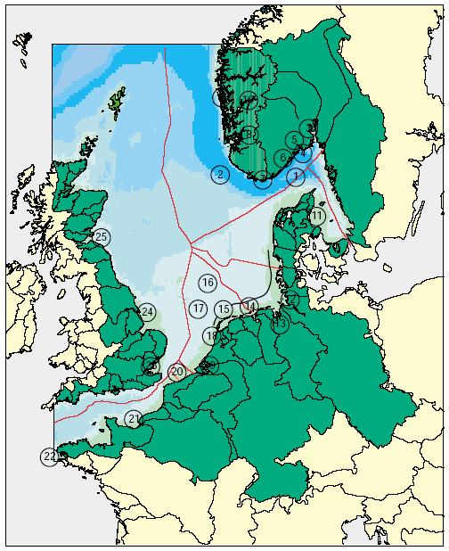
2 North Sea 2


3 Outline History of MSP in the Netherlands Spatial Plan for the Dutch EEZ, principles and the making of Knowledge management Lessons learned Future developments, cross border cooperation 3

 urgencies and")
4 History of MSP in the Netherlands Freedom, Mare Liberum First come, first serve Sectoral policies Bisectoral agreements Increasing pressure and complexity Need for integrated approach Management plan: reactive, based on zoning and permits Integrated maritime policy document Spatial plan, forward looking, based on (actual and future) urgencies and practical issues 4
5 Future oriented way of planning 2009 IMP and Spatial Plan for the North Sea in Dutch National Water Plan, approved by cabinet 2010/2011: parliament No sectoral objectives but dividing space Main principle: sustainable development 5
 consultation Decisions according to people democratic principles Formal consultation (SEA/FS) Sustainable development planet")
6 Mutual gains approach:stakeholder participation and sustainable development Open negotiations lead to sustainable custom made solutions Interests instead of positions and fixed targets Joint Fact Finding More alternatives Informal (cross border) consultation Decisions according to people democratic principles Formal consultation (SEA/FS) Sustainable development planet profit 6


7 The making of: identifying spatial pressures and possible conflicts 7
8 The making of: ambitions and interests Sustainable use in balance with ecosystem Wind energy, oil and gas, shipping, sand extraction, military activities are of national interest Designation of wind energy areas: space for 6000 MW Enough space for sand extraction (coastal defense) Respect Natura 2000 areas, no significant effects etc. Strive for: No constructions within 12 miles zone 2 NM between wind areas and shipping routes No wind mills 5 NM around platforms 8


9 Combination of maps The making of: combine maps Identify 80 % that everybody agree upon and 20 % that is subject of discussion. 9
")
10 Wind energy sets urgency for forward looking MSP Spatial claims for 77 initiatives (2th round) Financial support for approximate 4 windfarms Uncertainty High administrative load Wind energy areas to be designated (3th round) 10

11 Lessons learned - I sense of urgency Felt by stakeholders and politicians Wind energy was driving force For an integrated and forward looking plan Providing certainty for all users institutional aspects stakeholder participation 11

12 Lessons learned - II sense of urgency institutional aspects Government institutes work closely together One department responsible for coordination Of policy making and implementation With legally binding instruments stakeholder participation 12
 Separating facts and fictions: knowledge base for: Political decisions 13")
13 Lessons learned - III sense of urgency institutional aspects stakeholder participation Building up confidence Government facilitates process Gathering table for developing alternatives Involving stakeholders in studies (ecological, alteratives, cost/benefits e.g.) Separating facts and fictions: knowledge base for: Political decisions 13

14 MSP guiding principle 10 A strong data and knowledge base MSP has to be based on sound information and scientific knowledge. Planning needs to evolve with knowledge - adaptive management EMODNET or a digital aquarium Little is known of the sea, and of the impact of human activitities, especially cumulative impacts Sound politcal decision making requires a sound evidence base, and incorporates also information and opinions Quality assurance and joint fact finding/research are part of good stakeholder management Plans based on environmental impact analysis, cost-benefit analysis, safety assessments etc 14 Ministry of Infrastructure and the Environment

15 The importance of a common language 15 Ministry of Infrastructure and the Environment

16 MSP in the Netherlands Next planning phase starts 2012/2013 Stock taking of visions, developments & trends Taking the North Sea s societal significance as a starting point Implement a well-balanced approach to ecological, economic and sociocultural interests on the one hand and long-term food and energy supply on the other hand Consultation cross border on horizon 2040: in depth analysis Strenghtening MSP tools to enhance polictical decision making and licencing/permetting. 16 Ministry of Infrastructure and the Environment 19 November 2012

17 Analysing future use Outline each sector s objectives which are then integrated into common objectives, taking into account the significance of the North Sea to Dutch society. Formulate challenging but realistic ambitions for the North Sea development. Examples: Heating two million residences through the use of seawater Using the North Sea as a large-scale heat exchanger Increasing production of food and other types of high-quality organic materials harvested from the North Sea, while simultaneously reducing overfishing and pollution 17 Ministry of Infrastructure and the Environment 19 November 2012
?")
18 MSP: cross border co-operation near future Manage ongoing activities in a cross-border context New MSP cycle starts starts in 2012/2013 Analysis: future developments Inventory: what is at stake / who has which stake? Identify possible spatial conflicts and opportunities to optimize space Are we conducting the proper research (scoping the research agenda)? Do we accept each others methodology? What do we think of the results? Points of attention: Language, knowing who s who, getting to know the stakeholders even better 18 Ministry of Infrastructure and the Environment 19 November 2012

19 Thank you for listening Time for Q&A s. More info: 19 Ministry of Infrastructure and the Environment
20 20
Implementation of the Political Declaration on energy cooperation between the North Seas Countries. Support Group 1 on Maritime Spatial Planning
 Implementation of the Political Declaration on energy cooperation between the North Seas Countries Support Group 1 on Maritime Spatial Planning Work Programme 1. Work area as outlined in Annex I to the
MARINE PLANNING IN THE NETHERLANDS
 MARINE PLANNING IN THE NETHERLANDS Hermien Busschbach Ministry of Transport, Public Works and Water Management (DG Water) Bremen, 2 May 2007 Marine Planning in the Netherlands OUTLINE policy context; international
Maritime Spatial Planning in Germany and Mecklenburg-Vorpommern
 Integrated Sea Use Planning Followings the Ecosystem Approach 2.10.08 Maritime Spatial Planning in Germany and Mecklenburg-Vorpommern by Helmuth von Nicolai Spatial Planning Department Ministry of Transport,
Maritime Spatial Planning: Transboundary Cooperation in the Celtic Seas Looking Ahead
 Maritime Spatial Planning: Transboundary Cooperation in the Celtic Seas Looking Ahead Looking ahead MSP in the context of the European Maritime and Fisheries Fund (EMFF) and beyond SIMCelt Final Conference
1. Baltic SCOPE Towards coherence and cross-border solutions in Baltic Maritime Spatial Plans
 NSHC 32th Conference Explanatory Note Dublin, Ireland Item E.2 MSP 21-23 June 2016 Germany Cross border MSP for the EEZ, a case study from the Baltic Sea The Federal Maritime and Hydrographic Agency of
Identification of maritime spatial planning best practices in the Baltic Sea Region and other EU maritime regions
 Identification of maritime spatial planning best practices in the Baltic Sea Region and other EU maritime regions PLAN BOTHNIA Baltic Sea Region Stakeholder Meeting Jacek Zaucha, Magdalena Matczak Two
SPLAN-Natura Towards an integrated spatial planning approach for Natura th January, 2017 Brussels. Commissioned by DG Environment
 SPLAN-Natura 2000 Towards an integrated spatial planning approach for Natura 2000 Commissioned by DG Environment 17 th January, 2017 Brussels V. Simeonova (Ph.D.) Drivers towards integrating Biodiversity
Marine Spatial Planning as an important tool for implementing the MSFD
 Marine Spatial Planning as an important tool for implementing the MSFD Risto Kalliola Tallinn, Nov. 16 th 2012 DEPARTMENT OF GEOGRAPHY AND GEOLOGY University of Turku, Finland Ten principles to provide
Marine Spatial Planning Leslie-Ann McGee Battelle Memorial Institute
 Marine Spatial Planning Leslie-Ann McGee Battelle Memorial Institute Rev061708 1 Marine Spatial Planning What is it? Why is it different? Where is it currently being employed? What is happening in the
VISION FOR THE FUTURE: Marine Spatial Planning in Belgium
 VISION FOR THE FUTURE: Marine Spatial Planning in Belgium Fanny Douvere, Consultant Intergovernmental Oceanographic Commission UNESCO, Paris, France PlanCoast Conference on Marine Spatial Planning Supetar
Marine/Maritime Spatial Planning Andrej Abramić
 Marine/Maritime Spatial Planning Andrej Abramić EcoAqua SUMMER SCHOOL: Ecosystem approach to aquaculture 26-29th of October 2015 Research and Technology to enhance excellence in Aquaculture development
Marine Spatial Planning in the Baltic Sea Region
 Marine Spatial Planning in the Baltic Sea Region Towards coherence and cross-border solutions in Baltic Maritime Spatial Plans Coordinator & Project manager Dr Ingela Isaksson Swedish Agency for Marine
Maritime Spatial Planning in the Baltic Sea Region
 Maritime Spatial Planning in the Baltic Sea Region Talis Linkaits Head of VASAB Secretariat 20 May 2015 Helsinki A cooperation of ministers of the 11 Baltic Sea Region countries responsible for spatial
Findings and recommendations from Central Baltic case
 W 1/1 Recommendations on transboundary planning from Baltic SCOPE Findings and recommendations from Central Baltic case Ingūna Urtāne Director of Spatial Planning Department of the Ministry of Environmental
Country Fiche Estonia
 Country Fiche Estonia Deleted: October Updated May 2018 Deleted: 7 1. General information Size of internal waters (to the baseline) and territorial sea (12-nm zone from the baseline) approximately 25 200
EUSAIR on sea topics from Slovenian perspective
 MINISTRY OF FOREIGN AFFAIRS REPUBLIC OF SLOVENIA EUSAIR on sea topics from Slovenian perspective Mag. Andreja Jerina National Coordinator 4 EU MRS: 270 millions of population 19 MS 12 non MS Sea basin
CONFERENCE STATEMENT
 Final draft CONFERENCE STATEMENT We, the elected representatives of Canada, Denmark/Greenland, the European Parliament, Finland, Iceland, Norway, Russia, Sweden and the United States of America; In collaboration
MODELS AND TOOLS FOR GOVERNANCE OF
 Working Papers Collection No. 1/2015 MODELS AND TOOLS FOR GOVERNANCE OF THE ADRIATIC AND IONIAN SEAS www.unimc.it/maremap NATIONAL POLITICS AND EU POLITICS: THE MARITIME SPATIAL PLANNING AND INTEGRATED
Introduction to IMP: need and added value
 Introduction to IMP: need and added value Christophe Le Visage Consultant Stratégies Mer et Littoral 1 Summary IMP : Why? The case for integration 1 What is IMP? 2 Content, process IMP: Added Value 3 2
Country Fiche Estonia
 Country Fiche Estonia Updated October 2017 1. General information Size of internal waters (to the baseline) and territorial sea (12-nm zone from the baseline) approximately 25 200 km 2. Exclusive economic
Offshore Energy and Maritime Spatial Planning in the German EEZ
 Offshore Energy and Maritime Spatial Planning in the German EEZ Bettina Käppeler, BSH Federal Maritime and Hydrographic Agency On Duty for Shipping and Seas German Exclusive Economic Zone EEZ not part
Marine Spatial Planning (MSP): A practical approach to ecosystembased
: A practical approach to ecosystembased") Marine Spatial Planning (MSP): A practical approach to ecosystembased management Erik Olsen, Institute of Marine Research, Norway Fanny Douvere, International Oceanographic Commission Overview Why we need
Marine Spatial Planning (MSP): A practical approach to ecosystembased management Erik Olsen, Institute of Marine Research, Norway Fanny Douvere, International Oceanographic Commission Overview Why we need
Country Fiche Latvia Updated October 2016
 Country Fiche Latvia Updated October 2016 1. General information Marine area under Latvian jurisdiction includes inland sea waters, Territorial sea (12 nautical miles from the baseline) and exclusive economic
Implementing the Sustainable Development Goals: The Role of Geospatial Technology and Innovation
 Fifth High Level Forum on UN Global Geospatial Information Management Implementing the Sustainable Development Goals: The Role of Geospatial Technology and Innovation 28-30 November 2017 Sheraton Maria
Geological information for Europe : Towards a pan-european Geological Data Infrastructure
 Geological information for Europe : Towards a pan-european Geological Data Infrastructure Integrating geoscientific information for EU competitiveness Co-funded by the European Union European societal
Maritime Spatial Planning Framework Directive Supported by INSPIRE
 Maritime Spatial Planning Framework Directive Supported by INSPIRE Andrej Abramić, Vanda Nunes de Lima, Paul Smits, Emanuele Bigagli, Chris Schubert European Commission Joint Research Centre Institute
Marine Spatial Planning Experience from Mecklenburg-Vorpommern (Germany) By Susan Toben
 By Susan Toben") Marine Spatial Planning Experience from Mecklenburg-Vorpommern (Germany) By Susan Toben Ministry of Transport, Building and Regional Development Mecklenburg Vorpommern PlanCoast Lead Partner Administrative
Marine Spatial Planning Experience from Mecklenburg-Vorpommern (Germany) By Susan Toben Ministry of Transport, Building and Regional Development Mecklenburg Vorpommern PlanCoast Lead Partner Administrative
Policy framework The Netherlands and the Polar Regions, Summary and priorities
 Policy framework The Netherlands and the Polar Regions, 2011-2015 Summary and priorities The policy outlined in this Policy Framework for the Polar Regions (2011-2015) is part of the government s orientation
National Perspectives - Portugal. Margarida Almodovar
 National Perspectives - Portugal Margarida Almodovar margarida.almodovar@mam.gov.pt from base line to the external limit of the continental shelf behind 200 miles and according to UNCLOS definitions Economic
Ministry of ICT of I.R.IRAN
 The ECO 8/6 mill km 2 10 Slamic countries ~330 mill people Oil, Gas, Industries,Tourism 2 Issue transformation in last decade Problem solving needs more integrated approach More interaction &complexity
BURGAS CASE STUDY: LAND-SEA INTERACTIONS. Dr. Margarita Stancheva
 BURGAS CASE STUDY: LAND-SEA INTERACTIONS Dr. Margarita Stancheva Name of presentation NEED FOR COHERENCE BETWEEN LAND AND SEA ACTIVITIES Name presenter Burgas is the fourth largest city in Bulgaria and
MSP Process drawings and descriptions
 MSP Process drawings and descriptions 12 December 2016 2 Table of Contents 1. Belgium... 3 2. The Netherlands... 5 3. Germany... 7 4. Denmark... 9 5. Scotland... 11 6. Sweden... 13 7. Norway... 15 1. Belgium
Towards international cooperation in the development of Marine Spatial Plans for the North Pacific: economic, social, and environmental dimensions
 Towards international cooperation in the development of Marine Spatial Plans for the North Pacific: economic, social, and environmental dimensions A.V. Sereda, V.B. Lobanov V.I. Il ichev Pacific Oceanological
Towards coherent maritime spatial planning in the Baltic Sea Region, transnational and project perspective Talis Linkaits Head of VASAB Secretariat
 3 June 2013 Riga PartiSEApate Workshop MSP as Tool for Underwater Cultural Heritage Management in the Baltic Sea Towards coherent maritime spatial planning in the Baltic Sea Region, transnational and project
Marine Spatial Planning: A Tool for Implementing Ecosystem-Based Management
 Marine Spatial Planning: A Tool for Implementing Ecosystem-Based Management Steven Murawski, Ph.D., Ecosystem Goal Team Lead National Oceanic and Atmospheric Administration NOAA November 16, 2009 1 To
MR. George ALEXAKIS, parallel session 3. "Mediterranean Sea Region. laying the conditions. for sustainable growth and jobs"
 parallel session 3 "Mediterranean Sea Region laying the conditions for sustainable growth and jobs" MR. George ALEXAKIS, elected Regional Councillor of Crete, Greece and representative of Crete in CRPM.
BURGAS CASE STUDY: LAND-SEA INTERACTIONS
 BURGAS CASE STUDY: LAND-SEA INTERACTIONS Dr. Margarita Stancheva IO-BAS, Bulgaria Name of presentation CROSS BORDER MARITIME SPATIAL PLANNING IN THE BLACK SEA ROMANIA AND BULGARIA (MARSPLAN BS) Project
DELIVERING ECOSYSTEM- BASED MARINE SPATIAL PLANNING IN PRACTICE
 DELIVERING ECOSYSTEM- BASED MARINE SPATIAL PLANNING IN PRACTICE A first assessment for the UK and Ireland January 08 GLOBAL WARMING IMAGES / WWF ABOUT WWF WWF is the world s leading independent conservation
CONFERENCE STATEMENT
 CONFERENCE STATEMENT We, the elected representatives from Canada, Denmark/Greenland, Finland, Iceland, Norway, Russia, Sweden and the United States of America; In collaboration with the indigenous peoples
Marine Spatial Planning in Hellas; Recent Facts and Perspectives
 XXV FIG CONGRESS Engaging the Challenges, Enhancing the Relevance Kuala Lumpur, Malaysia 16 21 June 2014 Marine Spatial Planning in Hellas; Recent Facts and Perspectives Mrs. Chaiditsa BOLANOU Surveying
Natura 2000 and spatial planning. Executive summary
 Natura 2000 and spatial planning Executive summary DISCLAIMER The information and views set out in this study are those of the author(s) and do not necessarily reflect the official opinion of the Commission.
Ecosystem-Based Approach in MSP
 Ecosystem-Based Approach in MSP 16th Meeting of the joint HELCOM-VASAB Maritime Spatial Planning Working Group Ministry of Environment Aleksanterinkatu 7, Helsinki 8.-9. May 2018 Prof. Dr. jur. Gerold
The Arctic Council - 20 years Anniversary
 The Arctic Council - 20 years Anniversary The Arctic Council in a Global Context - the Road Ahead Norræna húsið, 9. september 2016 Panel discussion Lilja Alfreðsdóttir, Minister for Foreign Affairs of
VISION FOR THE ARCTIC KIRUNA, SWEDEN 15 MAY 2013
 VISION FOR THE ARCTIC KIRUNA, SWEDEN 15 MAY 2013 KIRUNA 15 MAY 2013 We, the eight Arctic States together with the six Arctic Indigenous Peoples Organizations, have met today at the end of the first round
Evaluation of Spatial Planning as a Tool for Integrated Marine Management Status, Obstacles and Research Gaps
 Evaluation of Spatial Planning as a Tool for Integrated Marine Management Status, Obstacles and Research Gaps Baltic MSP Forum Riga 17.-18. June 2014 A. Morf & A. Grimvall: Swedish Institute for the Marine
Country Fiche Sweden Updated May 2018
 Country Fiche Sweden Updated May 2018 1. General information 2 the territorial sea (12-nm zone) 70,000 km2 the Exclusive Economic Zone 60,000 km2 the EEZ is limited to the central line between adjacent
Outline National legislative & policy context Regional history with ESSIM ESSIM Evaluation Phase Government Integration via RCCOM Regional ICOM Framew
 What MSP Implementation could change in the Maritimes Region Tim Hall, Regional Manager Oceans and Coastal Management Division Ecosystem Management Branch Fisheries and Oceans Canada Maritimes Region BIO
Country Fiche Latvia.
 Country Fiche Latvia 1. General information Marine waters under Latvian jurisdiction include inland sea waters, territorial sea (12 nautical miles from the baseline) and exclusive economic zone (EEZ) waters.
Status of implementation of the INSPIRE Directive 2016 Country Fiches. COUNTRY FICHE Netherlands
 Status of implementation of the INSPIRE Directive 2016 Country Fiches COUNTRY FICHE Netherlands Introduction... 1 1. State of Play... 2 1.1 Coordination... 2 1.2 Functioning and coordination of the infrastructure...
How to integrate maritime cultural heritage into maritime spatial planning?
 2ND SUBMARINER Conference #BetterOff Blue17 Creating synergies for a biobased society How to integrate maritime cultural heritage into maritime spatial planning? Susanne Altvater, s.pro 28.09.2017 #BetterOffBlue17
Statement of Mr. Sandagdorj Erdenebileg, Chief, Policy Development, Coordination, Monitoring and Reporting Service, UN-OHRLLS.
 Statement of Mr. Sandagdorj Erdenebileg, Chief, Policy Development, Coordination, Monitoring and Reporting Service, UN-OHRLLS at the Botswana National Workshop on the Vienna Programme of Action 27 th October
The National Policy Strategy for Infrastructure and Spatial Planning CODE24 CONFERENCE. Emiel Reiding
 The National Policy Strategy for Infrastructure and Spatial Planning Emiel Reiding Structure of presentation 1. Spatial planning in the Netherlands 2. National Policy Strategy Aims National interests 3.
Education in Maritime Spatial Planning European Maritime Days May 22, 2012 Gothenburg
 Education in Maritime Spatial Planning European Maritime Days May 22, 2012 Gothenburg Paula Lindroos, director Baltic Centre for Sustainable Development Uppsala University BUP in Summary A regional university
Croatian physical planning system and strategic approach to MSP
 W 1/7 Past two years all over the Europe: case studies 2 Croatian physical planning system and strategic approach to MSP Vesna Marohnić Kuzmanović Head of Department Croatian Institute for Spatial Development
ADRIPLAN: an EU funded pilot project on MSP in the Adriatic Ionian Region Pierpaolo Campostrini CORILA and CNR-ISMAR
 ADRIPLAN: an EU funded pilot project on MSP in the Adriatic Ionian Region Pierpaolo Campostrini CORILA and CNR-ISMAR ADRiatic Ionian maritime spatial PLANning ADRIPLAN PROJECT ADRIPLAN has the objective
Cross-border Maritime Spatial Plan for the Black sea - Romania and Bulgaria project
 Cross-border Maritime Spatial Plan for the Black sea - Romania and Bulgaria project in Romania and Bulgaria Plan Presentation A first step in the management of the marine areas of Romania and Bulgaria
HELSINKI COMMISSION Baltic Marine Environment Protection Commission
 HELSINKI COMMISSION Baltic Marine Environment Protection Commission HELCOM RECOMMENDATION 24/10 Adopted 25 June 2003, having regard to Article 20, Paragraph 1 b) of the 1992 Helsinki Convention IMPLEMENTATION
MESMA: An integrated tool box to support an ecosystem based spatial management of marine areas
 MESMA: An integrated tool box to support an ecosystem based spatial management of marine areas Stelzenmüller, V., Stamford, T., Vassilopoulou, V., Kastanevakis, S., Vincx, M, Vanaverbeke, J., Rabaut, M.,
Implementing Rio+20: Integrated Planning For Sustainable Coastal Area Management In the Caribbean Region
 Expert Group Meeting Implementing Rio+20: Integrated Planning For Sustainable Coastal Area Management In the Caribbean Region Address by Ronny Jumeau Seychelles Ambassador for Climate change And SIDS Issues
Norway s Integrated Ocean Management (IOM) Policies and Plans - A Brief Presentation
 Policies and Plans - A Brief Presentation") OGS/- 20.08.2014. Paper based on an up-dated version of the author's presentation at the seminar "Økosystembasert tilnærming i Norge" ("Ecosystems-based Approach in Norway"), organized by the Tromsø University,
OGS/- 20.08.2014. Paper based on an up-dated version of the author's presentation at the seminar "Økosystembasert tilnærming i Norge" ("Ecosystems-based Approach in Norway"), organized by the Tromsø University,
NOAA Nautical Charts and Coastal and Marine Spatial Planning. Meredith Westington Chief Geographer NOAA/NOS/Office of Coast Survey
 NOAA Nautical Charts and Coastal and Marine Spatial Planning Meredith Westington Chief Geographer NOAA/NOS/Office of Coast Survey Ocean Policy Task Force What is CMSP? A comprehensive, adaptive, integrated,
Aquaculture Spatial Planning: The case of Greece
 Aquaculture Spatial Planning: The case of Greece Nikos Anagnopoulos Panhellenic Association for Small-Medium sized Aquaculture Enterprises Panhellenic Association for Small-Medium sized Aquaculture Enterprises
International Guidelines on Access to Basic Services for All
 International Guidelines on Access to Basic Services for All Presentation and initials lessons from implementation Accessibility to services in regions and cities : measures and policies, OECD 18 June
Implementation Status & Results Report Red Sea and Gulf of Aden Strategic Ecosystem Management GEF Project (P113794)
") Public Disclosure Authorized MIDDLE EAST AND NORTH AFRICA Middle East and North Africa Environment & Natural Resources Global Practice Global Environment Project Specific Investment Loan FY 2014 Seq No:
Public Disclosure Authorized MIDDLE EAST AND NORTH AFRICA Middle East and North Africa Environment & Natural Resources Global Practice Global Environment Project Specific Investment Loan FY 2014 Seq No:
Natura 2000 in the marine environment: state of implementation and next steps
 Life on the blue planet: biodiversity research and the new European marine policies EPBRS European Platform on Biodiversity Research Strategy Porto, Portugal 7-9 November 2007 Natura 2000 in the marine
INSPIRE Monitoring and Reporting Implementing Rule Draft v2.1
 INSPIRE Infrastructure for Spatial Information in Europe INSPIRE Monitoring and Reporting Implementing Rule Draft v2.1 Title INSPIRE Monitoring and Reporting Implementing Rule v2.1 Creator DT Monitoring
THE SEVILLE STRATEGY ON BIOSPHERE RESERVES
 THE SEVILLE STRATEGY ON BIOSPHERE RESERVES 1 VISION FOR BIOSPHERE RESERVES IN THE 21 ST CENTURY The international Seville Conference on Biosphere Reserves, organised by UNESCO, adopted a two-pronged approach,
Iceland and the Arctic: The Politics of Territoriality. Valur Ingimundaron Professor of Contemporary History, University of Iceland
 Iceland and the Arctic: The Politics of Territoriality Valur Ingimundaron Professor of Contemporary History, University of Iceland Drivers of Icelandic Arctic Policies Geostrategic Position Economic Interests
A National Ocean Policy for Malaysia: Rationale and Proposed Components. Mohd Nizam Basiron and Cheryl Rita Kaur Maritime Institute of Malaysia
 A National Ocean Policy for Malaysia: Rationale and Proposed Components Mohd Nizam Basiron and Cheryl Rita Kaur Maritime Institute of Malaysia Outline of Presentation Objectives of Presentation Introduction
National Land Use Policy and National Integrated Planning Framework for Land Resource Development
 Title National Land Use Policy and National Integrated Planning Framework for Land Resource Development Duration: 32 Weeks Objective: Adoption of appropriate land use planning approaches to: Maintain the
The Future of Tourism in Antarctica: Challenges for Sustainability
 The Future of Tourism in Antarctica: Challenges for Sustainability Machiel Lamers Thesis summary In the last decade, Antarctic tourism has grown rapidly both in terms of volume and diversity. This growth
HELCOM-VASAB Maritime Spatial Planning Working Group Twelfth Meeting Gdansk, Poland, February 2016
 HELCOM-VASAB Maritime Spatial Planning Working Group Twelfth Meeting Gdansk, Poland, 24-25 February 2016 Document title MSP exhibition stands at the European Maritime Day 2016 Code 7-3-Add.1 Category INF
Information System as a Tool for Marine Spatial Planning The SmartSea Vision and a Prototype
 Information System as a Tool for Marine Spatial Planning The SmartSea Vision and a Prototype Ari Jolma Marine Research Centre Finnish Environment Institute May 10, 2017 ISESS 2017, Zadar, Croatia Contents
Maritime Spatial Planning in the Baltic Sea Region
 Maritime Spatial Planning in the Baltic Sea Region Past, present, perspective Talis Linkaits VASAB Secretariat XIX International Environmental Forum 22 March 2018, Saint Petersburg A cooperation of ministers
Economic and Social Council
 United Nation E/C.20/2012/4/Add.1 Economic and Social Council Distr.: General 2 July 2012 Original: English Committee of Experts on Global Geospatial Information Management Second session New York, 13-15
MARITIME SPATIAL PLANNING FOR SUSTAINABLE BLUE ECONOMIES
 MARITIME SPATIAL PLANNING FOR SUSTAINABLE BLUE ECONOMIES Content of newsletter Alternative scenarios for Blue Growth (p. 4) Map based platform to help communication (p. 5) Booklets of marine nature and
maritime spatial planning in the baltic sea
 maritime spatial planning in the baltic sea it starts with chaos the chaos goes on and on how did we do it before? but what if this was not an option? what should the tribes do instead? how would
The Baltic Sea Region Maritime Spatial Planning Data Expert Sub-group. First Report 2015/2016/
 The Baltic Sea Region Maritime Spatial Planning Data Expert Sub-group First Report 2015/2016/2017 21.04.2017. Contents 1. Glossary 2 2. Introduction. 3 3. MSP Data. 5 3.1. Input Data. 5 3.2 Output Data.
Mediteranean sea issues in the view of ESPON ESaTDOR project and Marine Spatial Planning in Slovenia
 DIREKTORAT ZA PROSTOR, GRADITEV IN STANOVANJA Mediteranean sea issues in the view of ESPON ESaTDOR project and Marine Spatial Planning in Slovenia BlueMed meeting of stakeholders on a micro-regional level
PLAN BOTHNIA MSP 1/2011 PLAN BOTHNIA. PLAN BOTHNIA short description (document 3/1) PLAN BOTHNIA MSP 1 Pori, Finland, March
 PLAN BOTHNIA MSP 1 Pori, Finland, March") PLAN BOTHNIA Co-Financed Under European Integrated maritime Policy PLAN BOTHNIA short description (document 3/1) PLAN BOTHNIA MSP 1 Pori, Finland, March 7-8 2011 PLAN BOTHNIA MSP 1/2011 Agenda Item 3 Introduction
PLAN BOTHNIA Co-Financed Under European Integrated maritime Policy PLAN BOTHNIA short description (document 3/1) PLAN BOTHNIA MSP 1 Pori, Finland, March 7-8 2011 PLAN BOTHNIA MSP 1/2011 Agenda Item 3 Introduction
Country Fiche Lithuania
 Country Fiche Lithuania Updated June 2018 1. General information The Lithuanian maritime space is delimited by the Decree of the Government of the Republic of Lithuania of 6 December, 2004, No. 1597 and
The Danish Maritime Spatial Data Infrastructure (MSDI) Geodata of the Sea
 Geodata of the Sea") MSDI/MSP The Danish Maritime Spatial Data Infrastructure (MSDI) Geodata of the Sea Components of an infrastructure: DATA - metadata, datasets FUNCTIONALITY - spatial data services, web services and other
MSDI/MSP The Danish Maritime Spatial Data Infrastructure (MSDI) Geodata of the Sea Components of an infrastructure: DATA - metadata, datasets FUNCTIONALITY - spatial data services, web services and other
Alps Results from the ESPON Project. Common spatial perspectives for the Alpine area. Towards a common vision
 Results from the ESPON Project Alps 2050 Common spatial perspectives for the Alpine area. Towards a common vision Tobias Chilla, University of Erlangen Cooperation Alps 2020+ 1 & 2 October 2018 Salzburg
REGIONAL SDI DEVELOPMENT
 REGIONAL SDI DEVELOPMENT Abbas Rajabifard 1 and Ian P. Williamson 2 1 Deputy Director and Senior Research Fellow Email: abbas.r@unimelb.edu.au 2 Director, Professor of Surveying and Land Information, Email:
Spatially enabling e-government through geo-services
 Spatially enabling e-government through geo-services Mauro Salvemini EUROGI PRESIDENT Professor at Sapienza Università di Roma (IT) 1 About the presentation Few information about Eurogi ; Some essential
Seymour Centre 2017 Education Program 2071 CURRICULUM LINKS
 Suitable for: Stage 5 Stage 6 HSC Subject Links: Seymour Centre 2017 Education Program 2071 CURRICULUM LINKS Science Stage Content Objective Outcomes Stage 5 Earth and Space ES3: People use scientific
Emerging tensions between blue growth and good environmental status
 Emerging tensions between blue growth and good environmental status Dr Peter Jones, Reader in Environmental Governance, Dept of Geography, University College London www.bnycharters.com Slides @PJSJones
Community Engagement in Cultural Routes SiTI Higher Institute on Territorial Systems for Innovation Sara Levi Sacerdotti
 Transnational Workshop Wroclaw, 7th-8th December 2016 Community Engagement in Cultural Routes SiTI Higher Institute on Territorial Systems for Innovation Sara Levi Sacerdotti levi@siti.polito.it TAKING
Tackling MSP integration challenges in the BSR
 Towards sustainable governance of Baltic marine space 2015 2018 BALTSPACE Towards sustainable governance of Baltic marine space Tackling MSP integration challenges in the BSR Michael Gilek, Södertörn University,
Statutory framework of the world network of biosphere reserves UNESCO General Conference 1996
 Statutory framework of the world network of biosphere reserves UNESCO General Conference 1996 Keywords: conservation, protected areas, biosphere reserves, policies, strategies. For the Mountain Forum's
AMS E-GOS Local governance and performance of open data policies at municipal level
 AMS E-GOS Local governance and performance of open data policies at municipal level Frederika Welle Donker Knowledge Centre Open Data TU Delft f.m.welledonker@tudelft.nl 1 Knowledge Centre Open Data Research
Presentation by Thangavel Palanivel Senior Strategic Advisor and Chief Economist UNDP Regional Bureau for Asia-Pacific
 Presentation by Thangavel Palanivel Senior Strategic Advisor and Chief Economist UNDP Regional Bureau for Asia-Pacific The High-Level Euro-Asia Regional Meeting on Improving Cooperation on Transit, Trade
PART A Project summary
 PART A Project summary A.1 Project identification Project title Project acronym Name of the lead partner organisation in English Specific objective Demonstrattion AF DAF Partner 1.1. Improving innovation
PartiSEApate Conference
 Baltic Maritime Spatial Planning Forum PartiSEApate Conference C r e a t i n g c o m m o n u n d e r s t a n d i n g B a l t i c M a r i t i m e S p a t i a l P l a n n i n g F o r u m B a l t i c M a
GIS Geographical Information Systems. GIS Management
 GIS Geographical Information Systems GIS Management Difficulties on establishing a GIS Funding GIS Determining Project Standards Data Gathering Map Development Recruiting GIS Professionals Educating Staff
Implementation of the ESPON 2020 cooperation program. 16 January 2017 Anneloes van Noordt
 Implementation of the ESPON 2020 cooperation program 16 January 2017 Anneloes van Noordt Outline! ESPON Cooperation Program! Specific Objectives! Applied Research! Targeted Analysis! Database & Tools!
MARINE SPATIAL PLANNING GOVERNANCE ISSUES. Taller SOI Lima, Perú February 24, 2015 Andrea Ramírez / Heins Bent
 MARINE SPATIAL PLANNING GOVERNANCE ISSUES Taller SOI Lima, Perú February 24, 2015 Andrea Ramírez / Heins Bent MARINE SPATIAL PLANNING Marine spatial planning (MSP) is a framework that provides a means
POLISH LAW ON MSP. Andrzej Cieślak Maritime Office in Gdynia
 POLISH LAW ON MSP Andrzej Cieślak Maritime Office in Gdynia Preconditions Ownership/management of allsea areas (internal sea waters, territorial sea, EEZ): the State, and in its name the Minister responsible
Coastal Mapping Follow on? Bruno Frachon Corine Lochet Gaël Morvan
 Coastal Mapping Follow on? Bruno Frachon Corine Lochet Gaël Morvan Shared objectives; IHO DG MARE CPMR Development of a Joint European Coastal Mapping Programme (JECMaP) within the IHO EU network with
2018/1 The integration of statistical and geospatial information. The Regional Committee of UN-GGIM: Americas:
 The following are the conclusions and recommendations of the Regional Committee of the United Nations on Global Geospatial Information Management for the Americas, during its Fifth Session, Thursday 8