Jun Chen 1, 2 National Geomatics Center of China NGCC. International Society for Photogrammetry and Remote Sensing ISPRS May12, 2017, Kunming
|
|
|
- Adela Taylor
- 5 years ago
- Views:
Transcription


1 Jun Chen 1, 2 National Geomatics Center of China NGCC 2 International Society for Photogrammetry and Remote Sensing ISPRS May12, 2017, Kunming Contents Introduction GlobeLand30 as Example Role and Utilization Outlook 1


2 Geospatial Data for SDGs A number of SDG indicators may be measured using geospatial data and their integration with statistical data. Obtaining reliable geospatial data is becoming crucial for preparing national reports and global reporting. Geospatial Data for SDGs In principle, reliable geospatial data be collected by each member nation with a set of technical requirements. (i.e., spatial resolutions, thematic accuracy and temporal periodicity) Example of core geospatial data Some countries may have a shortage of these core data, while some others might lack the requisite data capture capacities. 2
3 Contribution of International(Global) Data One possible solution is to utilize international (global) data to augment or even provide the data for certain SDG indicators National data Official data products generated by authoritative agencies of a nation Covering the nation s territory International (Global) Data Developed by international/national organizations and private companies Covering the whole earth or large regions Examine possible contribution of international (global) data by Examine GlobeLand30 as an example Discuss the role and utilization Contents Introduction GlobeLand30 as Example Role and Utilization Outlook 3


4 2.1 GlobeLand30 1 st 30-m earth land cover map with 10classes and two years (2000,2010) Chen et.al Global land cover mapping at 30m resolution: a POK-based operational approachisprs J. P&RS, 103 (2015): 7-27 Kunming 4

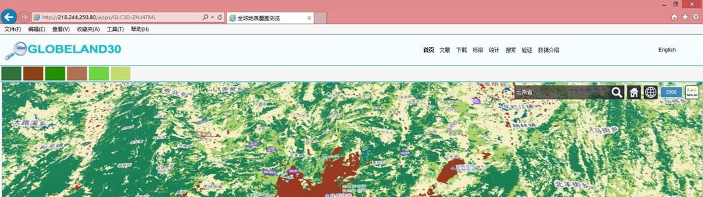

5 Kunming Shangri-La ( 香格里拉 ) 5
 1st")


6 Dali ( 大理 ) 1st Turning of Yangtze River ( 长江第一湾 )! "#$%& '&%( )%*&+,& -./0 6

7 2.2 Accuracy Assessment Third-party experts selected more than 150,000 samples and gave a global accuracy around 80% Class 2010 User acc. Area % Total accur. Region Map sheets samples Asia Europe Africa America Oceanic Total croplands 83.06% forest 89.00% grass 76.88% shrub 72.52% wetland 79.63% water 92.09% artificial 86.97% bareland 77.33% Ice 75.86% % 10.18% Accuracy Assessment Some other experts conducted national or regional accuracy assessments regional Sample size accuracy Investigators sources Water,N. Europe 91% ETH/IIASA GIM, Dec., 2014 Country/area Accuracy Sources Germany 92% Int. J Digital Earth, 2016(on line) Greece(Thessaly Region ) 91% Land, 2015, 4,1-18 Iran(6 study sites ) 77.9% Habitat International,2016,1-7 Italy(8 areas) >80% Remote Sensing, 2015(7), China 82.3% ISPRS J P&RS

8 2.3 GlobeLand30 s Users Globeland30 was donated to UN in Sept. 2014, New York, by Chinese government, and has so far more than 6000 users from 120 countries Chen et.al., 2014, China: Open access to Earth land-cover map, Nature, 514:434, 23 Oct Examples of International Users Over 260 agencies More than 300 Univ.(49 in Times TOP 100, 7 in TOP 10) Users UN systems NGO GOV Research institutes Universities Name of Organizations FAO:UNEP:UNCCD:UN-Habitat:UNMIS:ESCAP:UN Unit in Mali:UNESCO Islamabad, WWF : TNC, The Nature Conservancy) : Conservation International, USGS:NASA:GSFC:USGS:European Commission, JRC: DFZ: IIASA: INPE: Indian Institute of Science: Space Research Institute of Ukraine:IERSD/NOA, Harvard:Yale:Un. Maryland:Colombia Uni., 8


9 2.4 Applications 1. Status and change analysis 2. Cause and consequence analysis 3. Coupling with Earth System Models 4. Generating new data sets 1) Status and change analysis Statistical analysis of global artificial surface Chen J, et al Spatial distribution and ten years change of global built-up areas derived from GlobeLand30. Acta Geodaetica et Vartographica Sinica, 44(11),
 Cropland (c) intensity for year i Grassland")

 Kühling, I., et al. 2016.")


10 Status and change analysis Land use change in West Siberia Land use intensity (LUI) Cropland (c) intensity for year i Grassland (g) intensity for year i Spatial-temporal of LUI Decreasing intensity on grassland ( LUI units per year) Intensification on cropland ( LUI units per year) Kühling, I., et al Spatio-temporal analysis of agricultural land-use intensity across the Western Siberian grain belt. Science of the Total Environment, 544, ) Cause and consequence analysis Land use efficiency analysis: global divergence Rich resource Artificial surface area per capita Transition type intensive use GDP per capita Li R, et al., Spatio-temporal pattern analysis of artificial surface use efficiency based on Globeland30. Scientia Sinica Terrae, 46:


11 Cause and consequence analysis Urban expansion: intrinsic characteristics Urban expansion intensity index (UEII) Characteristics of urban expansion Peak FWHM Goodness of fitting of cities Yu X, et al A method characterizing urban expansion based on land cover map at 30 m resolution. Science China Earth Sciences, 59: Cause and consequence analysis Relationship between urban form and air quality Artificial surface from GlobeLand30 Landscape metrics Relationship between urban form and air quality She Q, et al., Air quality and its response to satellite-derived urban form in the Yangtze River Delta, China. Ecological Indicators, 75,


12 3) Coupling with Earth System Models GlobeLand30 in climate model (BCC-CSM) Convert GLC to climate model types Surface temperature difference simulated by 30m and 0.5;GLC With the new 30m LC data, the model biases between simulations and observations in the BCC climate model with original LC datasets were effectively reduced. Shi X L, et al., Climate effects of the GlobeLand30 on the BCC climate model simulations. Science China Earth Sciences, 59: Coupling with Earth System Models GlobeLand30 for SWAT model Soil and Water Assessment Tool (SWAT) model Water Yield Water Consumption Sun, F., et al Mapping water vulnerability of the Yangtze River Basin: Environment Management, 58:


13 4) Generating new data sets Create integrated global land cover map Globecover LC-CCI multinomial logistic regression Probability Integration MODIS Simple kriging GlobeLand30 Tsendbazar et al., 2016, Integrating global land cover datasets for deriving user specific maps. International Journal of Digital Earth Generating new data sets Nepal land cover mapping and statistics Forest, Shrub, Grassland, Wetland, Cropland, Artificial surface, Snow/ice Cao X, et al Land Cover Mapping and spatial pattern analysis with remote sensing in Nepal. Journal of Geo-information Science, 18(10):
14 Contents Introduction GlobeLand30 as Example Role and Utilization Outlook National versus International (Global) Data National data :generated by national experts and can be expected to be more accurate and have a better thematic resolution than global products. International (Global) Data: may have higher consistency across space, thereby allowing a better comparability across countries and easier data handling as a single dataset. Global data sets may have some limitations, such as lower temporal resolution and fewer thematic classes. 14


15 3.1 Role of International (Global) Data 1) as Supplement to National Data: Global datasets with relatively fine spatial resolution can offer a potential alternative when reliable national data not available It is also possible to integrate national and global data sets for more effective SDGs monitoring, especially if the data have similar spatial resolutions Role of International (Global) Data 2) Used for Trans-boundary or Cross-border areas:high quality global data sets facilitate operations that cover the transboundary or cross-border area <=>?>@A B=C D=> EDBC Natural disasters, displaced populations, environmental change, water shortages, pandemics, and widespread malnutrition do not stop at national borders or the water s edge. 15

16 Role of International (Global) Data 3) Supporting Global Reporting : Global data sets can serve as a sound basis for supporting the preparation of global reporting. Cao X, et al Preliminary analysis of spatiotemporal pattern of global land surface water. Science China: Earth Sciences, 57: Utilisation of International (Global) Data There are several issues to be considered when selecting suitable international (global) data sources for use in the computation of SDG indicators and national reporting: Data quality Data conversion/ augmentation Scale and integration Measure issues Securing national ownership 16

 Disaggregation: generate a dataset with a more refined thematic content by combining global data and ancillary data sources.")
 2) Aggregation : downscale")
17 4.1 Data Quality Data quality refers to geometric, thematic accuracy, as well as temporal aspects, and has significant influence on reliability of measures for SDG indicators SRTM DEM problems: data voids - radar shadows It is necessary to conduct a thorough evaluation of the uncertainty of the data before utilisation 4.2 Scaling and integration Some data sets might not be in the appropriate scale for a particular SDG indicator. 1) Disaggregation: generate a dataset with a more refined thematic content by combining global data and ancillary data sources. GlobeLand30 DMSP/OLS 30-m population density Lu Nan, et al., Estimation of 30-m resolution population density for Shandong Province, Acta Geodaetica et Cartographica Sinica, 2015,44(12) 2) Aggregation : downscale high-resolution national and international datasets into desirable scales. This process is also called generalization in cartographic community. 17
 (b) tree cover map for the year 2000 (from the annual global tree cover maps) shown in light green (c) extracted natural forest tree cover after integrating the")

18 4.3 Scaling and integration 3) Data integration: improve the quality of existing national data by adding intrenational (global) data (a) Dry Dipterocarp forest and Eucalyptus plantation in the year 2000 (from the national land use map) (b) tree cover map for the year 2000 (from the annual global tree cover maps) shown in light green (c) extracted natural forest tree cover after integrating the national land use map and the annual global tree cover maps Johnson, Brian A., Applied Geography 62 (2015) 294e Analytical models and Tools Analytical models, metrics and tools need to be developed for computing or deriving SDG indicators/ indices from geospatial data or combination with statistical data. 17 Goals 169 Targets 230 Indicators Understanding and formulation of indicators Measuring Monitoring Analytical modelsand tools Geospatial and statistical data Sensitivity analysis and uncertainty analysis need also be considered to test the efficacy and robustness of the Computing approaches 18
 data ASEAN(10 Countries), South Asia(8Countries), Central Asia (5 Countries), Western Asia(15 Countries),")
19 4.4 Securing national ownership In cases of unavailability of national data sources, national involvement needs to be secured in the information flow Develop GlobeLand Encourage and support national authorities to join the validation and even production of the international (global) data ASEAN(10 Countries), South Asia(8Countries), Central Asia (5 Countries), Western Asia(15 Countries), Eastern Africa (18 Countries) Contents Introduction GlobeLand30 as Example Role and Utilization Outlook 19

20 5.1 Global Status Surveying Topographic map is the most fundamental data, and a joint survey was completed by UN-GGIM and ISPRS in countries/regions replied the UNGGIM- ISPRS Questionnaire by 2015 Various scale ranges have greatly increased between 1986 and 2012 [Konecny et al., 2015]. Global Topographic Mapping Topographic map is the most fundamental data, and a joint survey was completed by UN-GGIM and ISPRS in Estimated global coverage 30% for 1:25,000 topographic map 75% for 1: mapping. A number of countries are capable of updating their national topographic data at one- to two-year cycle, some other countries may be from 10 to 30 years old. 20

21 Land Cover Data Global land cover mapping has witnessed significant progress in spatial and temporal resolutions, as well as thematicaccuracy, Product Spatial resolution Coverage of years Contents/ accuracy GlobeLand30 30 m 2000, classes/ 80.3% Global tree cover 30m Annual (2000-) One class(forest)/ ESA Land Cover CCI Global Land Cover data sets with fine resolution 300m , and classes/ 74%( ) DEM Data DEM datasets have been collected at a global scale with the help of earth observation sensors Global DEM data sets available Product Spacing Vertical accuracy Year Remarks SRTM 30m/90m m 2000 Generated by Shuttle IfSAR, covering 56FN to 60F ASTER 30m 7 14 m Generated by ASTER and gaps filled with SRTM GDEM 2011 World DEM 12m 2m (rel) 4m (abs) 2014 Generated by TanDEM-X; DSM and DTM commercially available at cost ALOS World 3D 30m 5 m 2016 Generated by LOS PRISM; freely available and based on 5 m global DEM which is available commercially at cost Dowman, 2017, Digital Earth 21
22 Image Data Another main data source is satellite imagery in many different formats/resolutions and with often quite frequent updates. Examples of free satellite data Satellite Spatial resolution SDG Landsat 8 Sentinel 1 15 meters/30 meters/100 meters (panchromatic/multispectral/thermal) Strip Map Mode: 80 km swath, 5 x 5 m Interferometric Wide Swath: 250 km swath, 5 x 20 m spatial Extra-Wide Swath Mode: 400 km swath, 20 x 40 m spatial Wave-Mode: 20 x 20 km, 5 x 5 m spatial resolution. SDG-6: Water SDG-15: Forest SDG-6: Water SDG-15: Forest Sentinel 2 ZY 13 spectral bands: four bands at 10 m, six bands at 20 m and three bands at 60 m spatial resolution. The orbital swath width is 290 km. SDG-6: Water SDG-15: Forest 5.2 Collaborative Information Service A one-stop community-based collaborative information service needs to be set up by connecting all available global, regional and national geospatial data services. An implementation could be started developed from a collaborative global land cover information service (CoGland). Browsing Download Statistics Validation Tagging Discovery updating Users CoGland Users Service-Oriented Computing GlobeLand30 Data USGS Corine Africa CDL Chen et al.,2017. Digital Earth 22

23 Questions and comments? 23
IAEG-SDGs WGGI Task Team Dec. 7, 2017, New York
 IAEG-SDGs WGGI Task Team Dec. 7, 2017, New York Contents What are G/A data? Role of G/A data Utilization Recommendations Outlook National Geospatial Data for SDGs Official data products generated by authoritative
Global Land Cover Mapping
 Global Land Cover Mapping and its application in SDGs Prof. Chen Jun 1, Dr. He Chaoying 2 1 National Geomatics Center of China (NGCC) 2 Ministry of Natural Resources, P.R.China May 30, 2018, Copenhagen
Geo-spatial Statistics with Globalland30
 UN International Workshop on Integrating Geospatial and Statistical Information Geo-spatial Statistics with Globalland30 Jun Chen 1,2 Lijun Chen 1, Ran Li 1 1 National Geomatics Center, China 2 International
Application and impacts of the GlobeLand30 land cover dataset on the Beijing Climate Center Climate Model
 IOP Conference Series: Earth and Environmental Science PAPER OPEN ACCESS Application and impacts of the GlobeLand30 land cover dataset on the Beijing Climate Center Climate Model To cite this article:
Spanish national plan for land observation: new collaborative production system in Europe
 ADVANCE UNEDITED VERSION UNITED NATIONS E/CONF.103/5/Add.1 Economic and Social Affairs 9 July 2013 Tenth United Nations Regional Cartographic Conference for the Americas New York, 19-23, August 2013 Item
Working Together to Create an UN GGIM GlobeLand30 Platform
 3rd UN GGIM High Level Forum Beijing, China, 22 24 October 2014 Working Together to Create an UN GGIM GlobeLand30 Platform Jun Chen 1,2 1 National Geomatics Center, NASG, China 2 ISPRS Oct. 24. 2014, Beijing
National Remote Sensing Center of China. Space Technology for Sustainable Development in China Status, Achievements and Futures.
 National Remote Sensing Center of China Space Technology for Sustainable Development in China Status, Achievements and Futures Jing Li National Remote Sensing Center of China Ministry of Science and Technology,
GIS and Remote Sensing
 Spring School Land use and the vulnerability of socio-ecosystems to climate change: remote sensing and modelling techniques GIS and Remote Sensing Katerina Tzavella Project Researcher PhD candidate Technology
The Combination of Geospatial Data with Statistical Data for SDG Indicators
 Session x: Sustainable Development Goals, SDG indicators The Combination of Geospatial Data with Statistical Data for SDG Indicators Pier-Giorgio Zaccheddu Fabio Volpe 5-8 December2018, Nairobi IAEG SDG
GEOMATICS. Shaping our world. A company of
 GEOMATICS Shaping our world A company of OUR EXPERTISE Geomatics Geomatics plays a mayor role in hydropower, land and water resources, urban development, transport & mobility, renewable energy, and infrastructure
Urban areas & climate change
 Urban areas & climate change Paolo Gamba University of Pavia University of Pavia The UNIPV TLC & RS Lab is a dynamic research group developing in the past years many techniques devoted to the analysis
ACCURACY ASSESSMENT OF ASTER GLOBAL DEM OVER TURKEY
 ACCURACY ASSESSMENT OF ASTER GLOBAL DEM OVER TURKEY E. Sertel a a ITU, Civil Engineering Faculty, Geomatic Engineering Department, 34469 Maslak Istanbul, Turkey sertele@itu.edu.tr Commission IV, WG IV/6
GLL THE STUDY OF METHODS FOR CORRECTING GLOBAL DIGITAL TERRAIN MODELS USING REMOTE SENSING DATA. I. Kolb, M. Lucyshyn, M. Panek
 GLL http://dx.doi.org/10.15576/gll/2013.3.59 Geomatics, Landmanagement and Landscape No. 3 2013, 59 66 THE STUDY OF METHODS FOR CORRECTING GLOBAL DIGITAL TERRAIN MODELS USING REMOTE SENSING DATA Ihor Kolb,
Geospatial Information Management in the Americas: Lessons for the Post-2015 development agenda
 Geospatial Information Management in the Americas: Lessons for the Post-2015 development agenda Rolando Ocampo President, UN-GGIM: Americas October 2014 The integration of statistical and geographical
Building a validation database for land cover products from high spatial resolution images
 Building a validation database for land cover products from high spatial resolution images The Land Cover project of the ESA Climate Change Initiative Bontemps Sophie 1, Achard Frédéric 2, Lamarche Céline
Patrick Leinenkugel. German Aerospace Center (DLR) Vortrag > Autor > Dokumentname > Datum
 Vortrag > Autor > Dokumentname > Datum") Characterisation of land surface phenology and land cover for the Mekong Basin on the basis of multitemporal and multispectral satellite data from the MODIS Sensor Patrick Leinenkugel German Aerospace
Characterisation of land surface phenology and land cover for the Mekong Basin on the basis of multitemporal and multispectral satellite data from the MODIS Sensor Patrick Leinenkugel German Aerospace
Lead WG: ICWG IV/III: Global Mapping: Updating, Verification and Interoperability
 Report on Scientific Initiative Project: An ISPRS contribution to Transforming Our World: augmentation of GlobeLand30 with additional data for monitoring United Nations Sustainable Development Goals Lead
Swedish examples on , and
 Swedish examples on 11.2.1, 11.3.1 and 11.7.1 Marie Haldorson, Director Seminar in Nairobi 7 Dec 2018 SDG Indicator Tests by Countries in Europe GEOSTAT 3: ESS Project with a purpose to guide countries
Compact guides GISCO. Geographic information system of the Commission
 Compact guides GISCO Geographic information system of the Commission What is GISCO? GISCO, the Geographic Information System of the COmmission, is a permanent service of Eurostat that fulfils the requirements
Economic and Social Council 2 July 2015
 ADVANCE UNEDITED VERSION UNITED NATIONS E/C.20/2015/11/Add.1 Economic and Social Council 2 July 2015 Committee of Experts on Global Geospatial Information Management Fifth session New York, 5-7 August
Land Accounts - The Canadian Experience
 Land Accounts - The Canadian Experience Development of a Geospatial database to measure the effect of human activity on the environment Who is doing Land Accounts Statistics Canada (national) Component
Introduction. Elevation Data Strategy. Status and Next Steps
 1 2 Introduction Elevation Data Strategy Status and Next Steps 3 Canada is the 2nd largest country in the world - 9.9 million sq km Surrounded by 3 oceans with 202 000 km of coastline Population over 35
Developing a global, people-based definition of cities and settlements
 Developing a global, people-based definition of cities and settlements Cooperation between: Directorate General for Regional and, Joint Research Centre, EUROSTAT (European Commission, European Union) OECD,
VISUALIZATION URBAN SPATIAL GROWTH OF DESERT CITIES FROM SATELLITE IMAGERY: A PRELIMINARY STUDY
 CO-439 VISUALIZATION URBAN SPATIAL GROWTH OF DESERT CITIES FROM SATELLITE IMAGERY: A PRELIMINARY STUDY YANG X. Florida State University, TALLAHASSEE, FLORIDA, UNITED STATES ABSTRACT Desert cities, particularly
NATIONAL MAPPING EFFORTS: THE PHILIPPINES
 NATIONAL MAPPING EFFORTS: THE PHILIPPINES Dr. RIJALDIA N. SANTOS DENR National Mapping and Resource Information Authority (NAMRIA) May 30, 2018 Land Cover/Land Use Changes (LC/LUC) and Its Impacts on Environment
Supplementary material: Methodological annex
 1 Supplementary material: Methodological annex Correcting the spatial representation bias: the grid sample approach Our land-use time series used non-ideal data sources, which differed in spatial and thematic
Earth Observations as a Tool To Achieve Sustainable Development Goals
 The image part with relationship ID rid3 was not found in the file. 16/10/2017 Earth Observations as a Tool To Achieve Sustainable Development Goals LI Jing, China GEO On behalf of the Group on Earth Observations
System of Environmental-Economic Accounting. Advancing the SEEA Experimental Ecosystem Accounting. Extent Account (Levels 1 and 2)
") Advancing the SEEA Experimental Ecosystem Accounting Extent Account (Levels 1 and 2) Overview: The Extent Account 1. Learning objectives 2. Review of Level 0 (5m) What is it? Why do we need it? What does
Advancing the SEEA Experimental Ecosystem Accounting Extent Account (Levels 1 and 2) Overview: The Extent Account 1. Learning objectives 2. Review of Level 0 (5m) What is it? Why do we need it? What does
Remote Sensing products and global datasets. Joint Research Centre, European Commission
 Remote Sensing products and global datasets Joint Research Centre, European Commission Setting the stage. Needs and requirements for integrated approach(es) for land degradation assessment. in Special
EU collaborations with NASA LCLUC Program & Current Priorities
 & Current Priorities ioannis Manakos, Dr. Centre for Research and Technology Hellas Information Technologies Institute Visual Analytics, Virtual & Augmented Reality Laboratory European Association of Remote
The Global Statistical Geospatial Framework and the Global Fundamental Geospatial Themes
 The Global Statistical Geospatial Framework and the Global Fundamental Geospatial Themes Sub-regional workshop on integration of administrative data, big data and geospatial information for the compilation
Hydrologic Modelling of the Upper Malaprabha Catchment using ArcView SWAT
 Hydrologic Modelling of the Upper Malaprabha Catchment using ArcView SWAT Technical briefs are short summaries of the models used in the project aimed at nontechnical readers. The aim of the PES India
Module 3 Indicator Land Consumption Rate to Population Growth Rate
 Regional Training Workshop on Human Settlement Indicators Module 3 Indicator 11.3.1 Land Consumption Rate to Population Growth Rate Dennis Mwaniki Global Urban Observatory, Research and Capacity Development
SDG s and the role of Earth Observation
 SDG s and the role of Earth Observation Christian Heipke IPI - Institute for Photogrammetry and GeoInformation Leibniz Universität Hannover Germany Secretary General, ISPRS 1. No Poverty 2. Zero Hunger
Using Geographic Information Systems and Remote Sensing Technology to Analyze Land Use Change in Harbin, China from 2005 to 2015
 Using Geographic Information Systems and Remote Sensing Technology to Analyze Land Use Change in Harbin, China from 2005 to 2015 Yi Zhu Department of Resource Analysis, Saint Mary s University of Minnesota,
2018/1 The integration of statistical and geospatial information. The Regional Committee of UN-GGIM: Americas:
 The following are the conclusions and recommendations of the Regional Committee of the United Nations on Global Geospatial Information Management for the Americas, during its Fifth Session, Thursday 8
Measuring and Monitoring SDGs in Portugal: Ratio of land consumption rate to population growth rate Mountain Green Cover Index
 Measuring and Monitoring SDGs in Portugal: 11.3.1Ratio of land consumption rate to population growth rate 15.4.2 Mountain Green Cover Index United Nations World Geospatial Information Congress João David
MANUAL ON THE BSES: LAND USE/LAND COVER
 6. Environment Protection, Management and Engagement 2. Environmental Resources and their Use 5. Human Habitat and Environmental Health 1. Environmental Conditions and Quality 4. Disasters and Extreme
This is trial version
 Journal of Rangeland Science, 2012, Vol. 2, No. 2 J. Barkhordari and T. Vardanian/ 459 Contents available at ISC and SID Journal homepage: www.rangeland.ir Full Paper Article: Using Post-Classification
Sharthi Laldaparsad Statistics South Africa, Policy Research & Analysis. Sub-regional workshop on integration of administrative data,
 Sub-regional workshop on integration of administrative data, big data and geospatial information for the compilation of SDG indicators and International Workshop on Global Fundamental Geospatial Data Themes
National Geographic Institute (IGN)
") (IGN) National Centre of Geographic Information (CNIG) Tenth United Nations Regional Cartographic Conference of the Americas New York, 19-23 August 2013 Spanish National Land Observation Program (PNOT)
(IGN) National Centre of Geographic Information (CNIG) Tenth United Nations Regional Cartographic Conference of the Americas New York, 19-23 August 2013 Spanish National Land Observation Program (PNOT)
Pan-Arctic Digital Elevation Model (DEM)
") Pan-Arctic Digital Elevation Model (DEM) Tazio Strozzi and Maurizio Santoro Gamma Remote Sensing, Gümligen, Switzerland Annett Bartsch et al. Institute of Photogrammetry and Remote Sensing, TU Wien, Austria
Pan-Arctic Digital Elevation Model (DEM) Tazio Strozzi and Maurizio Santoro Gamma Remote Sensing, Gümligen, Switzerland Annett Bartsch et al. Institute of Photogrammetry and Remote Sensing, TU Wien, Austria
Foundation Geospatial Information to serve National and Global Priorities
 Foundation Geospatial Information to serve National and Global Priorities Greg Scott Inter-Regional Advisor Global Geospatial Information Management United Nations Statistics Division UN-GGIM: A global
Integration of Geo spatial and Statistical Information: The Nepelese Experience
 Integration of Geo spatial and Statistical Information: The Nepelese Experience Krishna Raj B.C. Joint Secretary Ministry of Land Reform and Management, Nepal 11 June, 2014 Presentation Outline The Country
Part : General Situation of Surveying and Mapping. The Development of Surveying and Mapping in China. The contents
 The Development of Surveying and Mapping in China Dr. Ping Xiao China.P.R The contents Part : General Situation of Surveying and Mapping 1. The legal systems of surveying and mapping 2. The technologies
The International Society for Photogrammetry and Remote Sensing Study on the Status of Mapping on the World
 Joint ISPRS Project with the United Nations Committee of Experts on Geospatial Information Management UN-GGIM Secretariat, New York The International Society for Photogrammetry and Remote Sensing Study
sentinel-2 COLOUR VISION FOR COPERNICUS
 sentinel-2 COLOUR VISION FOR COPERNICUS SATELLITES TO SERVE By providing a set of key information services for a wide range of practical applications, Europe s Copernicus programme is providing a step
UPDATING AND REFINEMENT OF NATIONAL 1: DEM. National Geomatics Center of China, Beijing
 UPDATING AND REFINEMENT OF NATIONAL 1:500000 DEM Jian-jun LIU a, Dong-hua WANG a, Yao-ling SHANG a, Wen-hao ZHAO a Xi KUAI b a National Geomatics Center of China, Beijing 100830 b School of Resources and
Introduction of the Asia-Oceania Global Earth Observation System of Systems (AOGEOSS) GEO Initiative(GI-22 )
 GEO Initiative(GI-22 )") Introduction of the Asia-Oceania Global Earth Observation System of Systems (AOGEOSS) GEO Initiative(GI-22 ) Prof. Xiang ZHOU Institute of Remote Sensing and Digital Earth, CAS 11 May 2017 Kunming, China
Introduction of the Asia-Oceania Global Earth Observation System of Systems (AOGEOSS) GEO Initiative(GI-22 ) Prof. Xiang ZHOU Institute of Remote Sensing and Digital Earth, CAS 11 May 2017 Kunming, China
Copernicus Land HRL Imperviousness: 2012 dataset, indicator Title
 Copernicus Land HRL Imperviousness: 2012 dataset, 06-09 indicator and outlook Title 2015+ Tobias LANGANKE First name SURNAME Project manager, Copernicus Position land services Name European of the Environment
Mapping forests in monsoon Asia with ALOS PALSAR 50-m mosaic images and MODIS
 1 Supplementary Information 2 3 Mapping forests in monsoon Asia with ALOS PALSAR 50-m mosaic images and MODIS imagery in 2010 4 5 6 7 8 9 10 11 Yuanwei Qin, Xiangming Xiao, Jinwei Dong, Geli Zhang, Partha
Working Group 3 on Regional SDI. Activity Report. for. The 5th UN-GGIM-AP Plenary Meeting
 Regional Committee of United Nations Global Geospatial Information Management for Asia and the Pacific (UN-GGIM-AP) Working Group 3 on Regional SDI Activity Report for The 5th UN-GGIM-AP Plenary Meeting
Southern African Land Cover ( )
") Southern African Land Cover (2013-14) (Hill-shaded 3D version) Data Users Report and Meta Data (version 1.2) A Commercial Spatial Data Product Developed by GeoTerraImage (Pty) Ltd, South Africa (www.geoterraimage.com)
Southern African Land Cover (2013-14) (Hill-shaded 3D version) Data Users Report and Meta Data (version 1.2) A Commercial Spatial Data Product Developed by GeoTerraImage (Pty) Ltd, South Africa (www.geoterraimage.com)
Spati-temporal Changes of NDVI and Their Relations with Precipitation and Temperature in Yangtze River Catchment from 1992 to 2001
 Spati-temporal Changes of NDVI and Their Relations with Precipitation and Temperature in Yangtze River Catchment from 1992 to 2001 ZHANG Li 1, CHEN Xiao-Ling 1, 2 1State Key Laboratory of Information Engineering
Second Administrative Level Boundaries (SALB) initiative & geographic names in cartography. Geospatial Information Section
 initiative & geographic names in cartography. Geospatial Information Section") Second Administrative Level Boundaries (SALB) initiative & geographic names in cartography Geospatial Information Section Introduction Goals Global agenda How does SALB work? Latest News on geographic
Second Administrative Level Boundaries (SALB) initiative & geographic names in cartography Geospatial Information Section Introduction Goals Global agenda How does SALB work? Latest News on geographic
Adding value to Copernicus services with member states reference data
 www.eurogeographics.org Adding value to Copernicus services with member states reference data Neil Sutherland neil.sutherland@os.uk GIS in the EU 10 November 2016 Copyright 2016 EuroGeographics 61 member
Session 9 Spatial Decision Support Systems (SDSS)
") Session 9 Spatial Decision Support Systems (SDSS) Lead facilitator Dr. Gerard Kelly Learning Objectives The aim of this session is to review and understand the applications of a GIS-based spatial decision
Session 9 Spatial Decision Support Systems (SDSS) Lead facilitator Dr. Gerard Kelly Learning Objectives The aim of this session is to review and understand the applications of a GIS-based spatial decision
QUESTIONNAIRE THE CURRENT STATUS OF MAPPING IN THE WORLD
 QUESTIONNAIRE ON THE CURRENT STATUS OF MAPPING IN THE WORLD The questionnaire is intended to take stock of the current status of mapping in the world. The information collected will eventually be used
Country Report of Spain *
 Committee of Experts on Global Geospatial Information Management Second Session New York, United Nations (UN), 13 15 de August de 2012 Country Report of Spain * * Submitted by: Mr. Antonio Arozarena, Deputy
Historical background
 Space Technology for Disaster Management in Sri Lanka: Country profile, national perspectives & vision. Professor Ranjith Premalal De Silva Vice Chancellor Uva Wellassa University of Sri Lanka October
The Geospatial Information Management (GIM) INSPIRE Data Specification and COPERNICUS In situ data
 INSPIRE Data Specification and COPERNICUS In situ data") INSPIRE conference Barcelona 29 September 2016 INSPIRing a sustainable environment The Geospatial Information Management (GIM) INSPIRE Data Specification and COPERNICUS In situ data Antonio Arozarena,
INSPIRE conference Barcelona 29 September 2016 INSPIRing a sustainable environment The Geospatial Information Management (GIM) INSPIRE Data Specification and COPERNICUS In situ data Antonio Arozarena,
The International Society for Photogrammetry and Remote Sensing Study on the Status of Mapping on the World
 Joint ISPRS Project with the United Nations Committee of Experts on Geospatial Information Management UN GGIM Secretariat, New York The International Society for Photogrammetry and Remote Sensing Study
8 th Meeting of IAEG-SDGs 5 8 November 2018, Stockholm, Sweden. Meetings. Report
 Meetings 8 th Meeting of IAEG-SDGs Between April 2018 and November 2018, the Working Group on Geospatial Information of the IAEG- SDGs held two online meetings; presented a report to the United Nations
Joint International Mechanical, Electronic and Information Technology Conference (JIMET 2015)
") Joint International Mechanical, Electronic and Information Technology Conference (JIMET 2015) Extracting Land Cover Change Information by using Raster Image and Vector Data Synergy Processing Methods Tao
Joint International Mechanical, Electronic and Information Technology Conference (JIMET 2015) Extracting Land Cover Change Information by using Raster Image and Vector Data Synergy Processing Methods Tao
Geospatial workflows and potential applications to the Sustainable Development Goals of countries in West Asia
 Geospatial workflows and potential applications to the Sustainable Development Goals of countries in West Asia Ameer Abdulla, PhD Senior Advisor, European Topic Center for Spatial Analysis, Spain Associate
Sentinel Asia System Operation for Disaster Management in Sri Lanka Major General L.B.R. Mark (Retd) Director General Disaster Management Centre
 Director General Disaster Management Centre") Sentinel Asia System Operation for Disaster Management in Sri Lanka Major General L.B.R. Mark (Retd) Director General Disaster Management Centre Government of Sri Lanka OUTLINE Background Disasters in
Sentinel Asia System Operation for Disaster Management in Sri Lanka Major General L.B.R. Mark (Retd) Director General Disaster Management Centre Government of Sri Lanka OUTLINE Background Disasters in
Earth Observation & GeoSpatial Information for Monitoring Urban SDG Indicators. Global Urbanization Trend
 Earth Observation & GeoSpatial Information for Monitoring Urban SDG Indicators Yifang Ban, Professor Director, Division of Geoinformatics Vice Chair, Department for Urban Planning and Environment KTH Royal
The Combination of Geospatial Data with Statistical Data for SDG Indicators
 Session 3: Sustainable Development Goals, SDG indicators The Combination of Geospatial Data with Statistical Data for SDG Indicators Pier-Giorgio Zaccheddu (with the assistance of Francisco Vala & Cátia
Extent. Level 1 and 2. October 2017
 Extent Level 1 and 2 October 2017 Overview: Extent account 1. Learning objectives 2. Review of Level 0 (5m) 3. Level 1 (Compilers): Concepts (15m) Group exercise and discussion (15m) 4. Level 2 (Data Providers)
Applications of GIS and Remote Sensing for Analysis of Urban Heat Island
 Chuanxin Zhu Professor Peter V. August Professor Yeqiao Wang NRS 509 December 15, 2016 Applications of GIS and Remote Sensing for Analysis of Urban Heat Island Since the last century, the global mean surface
Dynamic Land Cover Dataset Product Description
 Dynamic Land Cover Dataset Product Description V1.0 27 May 2014 D2014-40362 Unclassified Table of Contents Document History... 3 A Summary Description... 4 Sheet A.1 Definition and Usage... 4 Sheet A.2
Module 2.1 Monitoring activity data for forests using remote sensing
 Module 2.1 Monitoring activity data for forests using remote sensing Module developers: Frédéric Achard, European Commission (EC) Joint Research Centre (JRC) Jukka Miettinen, EC JRC Brice Mora, Wageningen
C N E S, U M R I R I S A
 M O N I T O R I N G U R B A N A R E A S W I T H S E N T I N E L - 2. APPLICATION TO THE UPDATE OF THE COPERNICUS HIGH RESOLUTION LAYER IMPERVIOUSNESS DEGREE O c t o b e r 2 5 th 2016, Brussels A n t o
Infrastructure monitoring using SAR interferometry
 Infrastructure monitoring using SAR interferometry Hossein Nahavandchi Roghayeh Shamshiri Norwegian University of Science and Technology (NTNU), Department of Civil and Environmental Engineering Geodesy
Global City Definition
 Regional Training Workshop on Human Settlement Indicators Global City Definition Dennis Mwaniki Global Urban Observatory, Research and Capacity Development Branch, UN-Habitat Bangkok, Thailand Outline
Building Institutional Capacity for Multi-Hazard Early Warning in Asia and the Pacific Subtitle
 Building Institutional Capacity for Multi-Hazard Early Warning in Asia and the Pacific Subtitle Title Keran Wang Chief, Space Applications Section ICT and Disaster Risk Reduction Division 22 May 2018 Pillar
Spatial Planning Platform Meeting
 Spatial Planning Platform Meeting August 1 st 2018 Part II Session 1 Design and Implementation of National and Regional Planning for Inclusive Growth Spatial info from space based technologies RESTEC (Remote
Land Monitoring Core Service Implementation Group (LMCS IG) - Results and Outlook
 - Results and Outlook") Land Monitoring Core Service Implementation Group (LMCS IG) - Results and Outlook Pr. Dietmar Grünreich, President of BKG, Germany Chairman of the GMES LMCS IG Outline 1 Introduction 2 Preparatory Projects
Land Monitoring Core Service Implementation Group (LMCS IG) - Results and Outlook Pr. Dietmar Grünreich, President of BKG, Germany Chairman of the GMES LMCS IG Outline 1 Introduction 2 Preparatory Projects
Expert Meeting: for Preparedness and Emergency Reponse. Land cover, land grabbing and. crowdsourcing
 Expert Meeting: Crowdsource Mapping for Preparedness and Emergency Reponse Land cover, land grabbing and drought: opportunities for crowdsourcing Why is it so important to improve global land cover? Originally
Copernicus Overview. Major Emergency Management Conference Athlone 2017
 Copernicus Overview Major Emergency Management Conference Athlone 2017 Copernicus is a European programme implemented by the European Commission. The services address six thematic areas: land, marine,
Urban land cover and land use extraction from Very High Resolution remote sensing imagery
 Urban land cover and land use extraction from Very High Resolution remote sensing imagery Mengmeng Li* 1, Alfred Stein 1, Wietske Bijker 1, Kirsten M.de Beurs 2 1 Faculty of Geo-Information Science and
Supporting GPSC Cities with Satellite Earth Observation for Sustainable Urban Development
 Supporting GPSC Cities with Satellite Earth Observation for Sustainable Urban Development Global Platform for Sustainable Cities African Regional Workshop 14 May 2018 AfDB Headquarters Abidjan, Côte d'ivoire
UN GGIM and National SDI Strategy
 MSDI Open Forum on 26 th January 2016 Contributing to the successful delivery of MSDI UN GGIM and National SDI Strategy Hiroshi Murakami Deputy Administrator Geospatial Information Authority of Japan Geospatial
Challenges and Potentials of Place Based Information Management in Nepal"
 Nineteenth United Nations Regional Cartographic Conference for Asia and the Pacific, Bangkok, Thailand, 29 October 1 November 2012 Challenges and Potentials of Place Based Information Management in Nepal"
Applied spatial data for sustainable development strategy in Germany
 Applied spatial data for sustainable development strategy in Germany Stephan Arnold Areal Statistics, Federal Statistical Office, Germany Federal Statistical Office Headquarter: Wiesbaden Branch Office:
Development of Global Map for GEOSS SBAs US-09-03a
 Development of Global Map for GEOSS SBAs US-09-03a UIC User Engagement Session 2 November, 2010 Yoshikazu FUKUSHIMA Secretariat General of International Steering Committee for Global Mapping Geospatial
Copernicus Space Component Status & Evolution
 Copernicus Space Component Status & Evolution ESCAP, Bangkok 09 October 2017 Simon Jutz Head of the ESA Copernicus Space Office Directorate of Earth Observation Programmes 28 satellites in development
INTEGRATION OF HIGH RESOLUTION QUICKBIRD IMAGES TO GOOGLEEARTH
 INTEGRATION OF HIGH RESOLUTION QUICKBIRD IMAGES TO GOOGLEEARTH M. Alkan a, *, U.G. Sefercik a, M. Oruç a a ZKU, Engineering Faculty, 67100 Zonguldak, Turkey - (mehmetalkan44@yahoo.com) Interactive Sessions,
ESA-GLOBCOVER - A Global Land Cover Service at 300 m from ENVISAT MERIS Time Series
 October 15, 2008 (Jena Germany) ESA-GLOBCOVER - A Global Land Cover Service at 300 m from ENVISAT MERIS Time Series Defourny P.1, Bontemps S., Vancutsem C.1, Pekel J.F.1,, Vanbogaert E.1, Bicheron P.2,
DEM-based Ecological Rainfall-Runoff Modelling in. Mountainous Area of Hong Kong
 DEM-based Ecological Rainfall-Runoff Modelling in Mountainous Area of Hong Kong Qiming Zhou 1,2, Junyi Huang 1* 1 Department of Geography and Centre for Geo-computation Studies, Hong Kong Baptist University,
Global land cover maps validation: current strategy for CCI Land Cover
 THE LAND COVER COMPONENT OF THE ESA CLIMATE CHANGE INITIATIVE Global land cover maps validation: current strategy for CCI Land Cover Defourny P. (1), Brockmann C. (3), Bontemps S. (1), Achard F. (2), Boettcher
From PCGIAP to UN GGIM AP: A Regional Perspective on GGIM
 Regional Committee of United Nations Global Geospatial Information Management for Asia and the Pacific (UN-GGIM-AP) Established by a United Nations Resolution From PCGIAP to UN GGIM AP: A Regional Perspective
AGOG 485/585 /APLN 533 Spring Lecture 5: MODIS land cover product (MCD12Q1). Additional sources of MODIS data
. Additional sources of MODIS data") AGOG 485/585 /APLN 533 Spring 2019 Lecture 5: MODIS land cover product (MCD12Q1). Additional sources of MODIS data Outline Current status of land cover products Overview of the MCD12Q1 algorithm Mapping
AGOG 485/585 /APLN 533 Spring 2019 Lecture 5: MODIS land cover product (MCD12Q1). Additional sources of MODIS data Outline Current status of land cover products Overview of the MCD12Q1 algorithm Mapping
Development of Geospatial Information in Indonesia: Progress & Challenge
 Development of Geospatial Information in Indonesia: Progress & Challenge Dr. Nurwadjedi Sarbini Deputy of Thematic Geospatial Information Geospatial Information Agency (BIG) Geosmart Asia, September 29
West meets East: Monitoring and modeling urbanization in China Land Cover-Land Use Change Program Science Team Meeting April 3, 2012
 West meets East: Monitoring and modeling urbanization in China Land Cover-Land Use Change Program Science Team Meeting April 3, 2012 Annemarie Schneider Center for Sustainability and the Global Environment,
Land Cover Project ESA Climate Change Initiative. Processing chain for land cover maps dedicated to climate modellers.
 Land Cover Project ESA Climate Change Initiative Processing chain for land cover maps dedicated to climate modellers land_cover_cci S. Bontemps 1, P. Defourny 1, V. Kalogirou 2, F.M. Seifert 2 and O. Arino
SIGMA thematic map validation
 LPVE 2018 1 LPVE 2018 2 SIGMA GIS validation tools Thematic map validation plugin with 3 tools: Estimate sample size tool Estimate sample size using map class accuracies tool Build confusion matrix - tool
EO Information Services in support of Satellite Tools for Building Flood Defence Systems in Guyana
 EO Information Services in support of Satellite Tools for Building Flood Defence Systems in Guyana F. N. Koudogbo and A. Arnaud Altamira Information J. Leen, Eurosense World Bank HQ, Washington DC Date
Spatial Disaggregation of Land Cover and Cropping Information: Current Results and Further steps
 CAPRI CAPRI Spatial Disaggregation of Land Cover and Cropping Information: Current Results and Further steps Renate Koeble, Adrian Leip (Joint Research Centre) Markus Kempen (Universitaet Bonn) JRC-AL
Using MERIS and MODIS for Land Cover Mapping in the Netherlands
 Using MERIS and for Land Cover Mapping in the Netherlands Raul Zurita Milla, Michael Schaepman and Jan Clevers Wageningen University, Centre for Geo-Information, NL Introduction Actual and reliable information