Spatial Planning Platform Meeting
|
|
|
- Felicia Stafford
- 5 years ago
- Views:
Transcription


1 Spatial Planning Platform Meeting August 1 st 2018 Part II Session 1 Design and Implementation of National and Regional Planning for Inclusive Growth Spatial info from space based technologies RESTEC (Remote Sensing Technology Center of Japan) Yuzuru Kushiyama


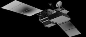
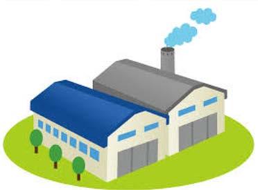


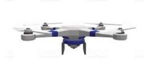
2 What Remote Sensing is? Satellite Airplane UAV Rain Atmosphere House Forest Factory Sea/Water Remote Sensing is a measuring technology for land/sea from satellite etc. 2
3 History of RESTEC 1975 Aug. RESTEC was established as foundation 1978 Satellite data distribution business for Landsat imagery Remote sensing training funded by JICA * Operational support business for NASDA *2 receiving station 1998 RESTEC s ordinary remote sensing training business 2011 Sep. Headquarters moved to Toranomon 2013 Solution Service Department was organized *1: Japan International Cooperation Agency *2: NASDA(National Space Development Agency of Japan) becomes JAXA (Japan Aerospace Exploration Agency) in


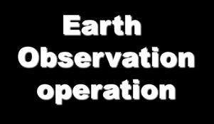
4 RESTEC Five Activities Think Tank/ Consulting Solution Businesses Capacity Building Research and Development Earth Observation operation 4
5 National Land Numerical Information (Land Use Map) National Land Numerical Information is a kind of land use map. Project to construct National Land Information started in Nowadays, the Policy Bureau of the MLIT provides the National Land Numerical Information. It supports national development plan, national land use planning and national spatial strategy. 5

6 What kinds of Land Use are in? It is classified into 12 categories of usage in 100 m mesh on the map. We are here. Land Use of Fukuoka City Categories Paddy Field Other Agriculture Field Forest Bare Soil Building/House Road Rail Road Other Land Use River/Lake Beach Sea Water Golf Corse Color 6
7 History of Land Use Map The land use map has been created from aerial photo or satellite image : Created from topographic map and information government owns 1985 : Update 1991: Update using topographic map and satellite(landsat) image by image interpretation, NVI (normalized vegetation index) etc. 1997: Update 2006: Update using the satellite image (ALOS, ASTER) 2014: Update the satellite image (SPOT, RapidEye) 7


8 Flow Chart of Land Use Map Creation Mesh area is classified into the categories using satellite image and topographic map etc. It is reviewed/validated using ground truth data. Previous Land Use Map Satellite Image Vegetation/Water etc. Area Data Classified to Land Use Type Iteration Review/Validation Ground Truth Data Topographic Map 1:25,000 scale 8


9 Trend of Land Use in Tokyo It is possible to monitor the trend of land use. Comparing land use map in 16yrs, we find that urban and residential increase and bare soil decreases. Categories Water Forest Grass Bare Soil Urban Residential Industry 9


")

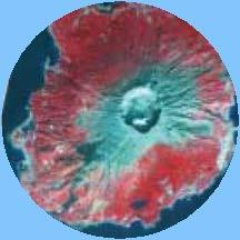
10 Illegal Logging Detection using Satellite Technology in Brazil It is possible to detect logging area by using satellite data. Advantages using satellite data are to detect it widely and cyclical observation. The technology was transferred through the training program funded by JICA. JAXA,METI JAXA,METI Before (JERS-1, 1995) After (ALOS-1, 2006) JAXA,METI Analyzed by RESTEC JAXA,METI Analyzed by RESTEC JAXA,METI Analyzed by JAXA 10
 http://sedac.ciesin.columbia.")
11 Examples of Useful Data for Land Use Planning and Monitoring Please access to NASA/Socioeconomic Data and Applications Center (sedac) 11
 http://sedac.ciesin.columbia.")
12 Examples of Useful Data for Land Use Planning and Monitoring Please access to NASA/Socioeconomic Data and Applications Center (sedac) 12


13 Examples of Useful Data for Land Use Planning and Monitoring Please access to 13


14 Examples of Useful Data for Land Use Planning and Monitoring Contribution of products/data for your interest area and scale. SRTM * /AW3D30 ** Open data AW3D Standard DSM *** /DTM **** 5m AW3D Enhanced DSM/DTM 0.5-2m AW3D Building Polygon(Shape/Height) Topography Country/Province level Country scale Topography and building etc. City/town/village level Landscape simulation Urban planning etc. Micro-Scale * SRTM: Shuttle Radar Topography Mission ** AW3D: Advanced World 3D Map 30m *** DSM: Digital Surface Model **** DTM: Digital Terrain Model Please access to 14


15 Thank you for your attention. Please access to our web site. 15
Satellite Remote Sensing for Ocean
 Satellite Remote Sensing for Ocean August 17, 2017 Masatoshi Kamei RESTEC All rights reserved RESTEC 2015 Contents 1. About RESTEC and Remote Sensing 2. Example of Remote Sensing Technology 3. Remote Sensing
How to Construct Urban Three Dimensional GIS Model based on ArcView 3D Analysis
 How to Construct Urban Three Dimensional GIS Model based on ArcView 3D Analysis Ko Ko Lwin Division of Spatial Information Science Graduate School of Life and Environmental Sciences University of Tsukuba
GEOMATICS. Shaping our world. A company of
 GEOMATICS Shaping our world A company of OUR EXPERTISE Geomatics Geomatics plays a mayor role in hydropower, land and water resources, urban development, transport & mobility, renewable energy, and infrastructure
Ramani Geosystems. Putting Africa On The Map. Authorized Resellers
 Ramani Geosystems Putting Africa On The Map Authorized Resellers Ramani Profile Started in 1999 Aerial, Land Surveying & Mapping Solutions + 10 Countries in the region + 80 Staff working in projects Asset
ESRI GIS For Mining Seminar, 10 th August, 2016, Nairobi, Kenya. Spatial DATA Solutions for Mining
 ESRI GIS For Mining Seminar, 10 th August, 2016, Nairobi, Kenya Spatial DATA Solutions for Mining Spatial Data Solutions for Mining Spatial - Data that identifies the geographic location of features &
ESTIMATING LAND VALUE AND DISASTER RISK IN URBAN AREA IN YANGON, MYANMAR USING STEREO HIGH-RESOLUTION IMAGES AND MULTI-TEMPORAL LANDSAT IMAGES
 ESTIMATING LAND VALUE AND DISASTER RISK IN URBAN AREA IN YANGON, MYANMAR USING STEREO HIGH-RESOLUTION IMAGES AND MULTI-TEMPORAL LANDSAT IMAGES Tanakorn Sritarapipat 1 and Wataru Takeuchi 1 1 Institute
GIS and Remote Sensing
 Spring School Land use and the vulnerability of socio-ecosystems to climate change: remote sensing and modelling techniques GIS and Remote Sensing Katerina Tzavella Project Researcher PhD candidate Technology
QUESTIONNAIRE THE CURRENT STATUS OF MAPPING IN THE WORLD
 QUESTIONNAIRE ON THE CURRENT STATUS OF MAPPING IN THE WORLD The questionnaire is intended to take stock of the current status of mapping in the world. The information collected will eventually be used
Portfolio of karteco Cadastral Survey Department
 Portfolio of karteco Cadastral Survey Department 01-2016 Who we are? karteco Environmental & Energy Engineering Consultancy Founding members: Apostolos Karteris Dr. Environmental Engineer Marinos Karteris
March 2007 The Survey Department of Sri Lanka
 Contribution of Survey Department of Sri Lanka for Mitigation of Disasters in Sri Lanka K.A.U.N.Kasthuri Deputy Surveyor General (Information Technology) March 2007 The Survey Department of Sri Lanka 1
Application of high-resolution (10 m) DEM on Flood Disaster in 3D-GIS
 DEM on Flood Disaster in 3D-GIS") Risk Analysis V: Simulation and Hazard Mitigation 263 Application of high-resolution (10 m) DEM on Flood Disaster in 3D-GIS M. Mori Department of Information and Computer Science, Kinki University, Japan
Risk Analysis V: Simulation and Hazard Mitigation 263 Application of high-resolution (10 m) DEM on Flood Disaster in 3D-GIS M. Mori Department of Information and Computer Science, Kinki University, Japan
ENGRG Introduction to GIS
 ENGRG 59910 Introduction to GIS Michael Piasecki March 17, 2014 Lecture 08: Terrain Analysis Outline: Terrain Analysis Earth Surface Representation Contour TIN Mass Points Digital Elevation Models Slope
Digital Elevation Model (DEM) Generation from Stereo Images
 Generation from Stereo Images") Pertanika J. Sci. & Technol. 19 (S): 77-82 (2011) ISSN: 0128-7680 Universiti Putra Malaysia Press Digital Elevation Model (DEM) Generation from Stereo Images C. E. Joanna Tan *, M. Z. Mat Jafri, H. S.
Pertanika J. Sci. & Technol. 19 (S): 77-82 (2011) ISSN: 0128-7680 Universiti Putra Malaysia Press Digital Elevation Model (DEM) Generation from Stereo Images C. E. Joanna Tan *, M. Z. Mat Jafri, H. S.
Contents. Introduction Study area Data and Methodology Results Conclusions
 Modelling Spatial Changes in Suburban Areas of Istanbul Using Landsat 5 TM Data Şinasi Kaya(Assoc. Prof. Dr. ITU) Elif Sertel(Assoc. Prof. Dr. ITU) Dursun Z. Şeker(Prof. Dr. ITU) 1 Contents Introduction
ENGRG Introduction to GIS
 ENGRG 59910 Introduction to GIS Michael Piasecki November 17, 2017 Lecture 11: Terrain Analysis Outline: Terrain Analysis Earth Surface Representation Contour TIN Mass Points Digital Elevation Models Slope
ACCURACY ASSESSMENT OF ASTER GLOBAL DEM OVER TURKEY
 ACCURACY ASSESSMENT OF ASTER GLOBAL DEM OVER TURKEY E. Sertel a a ITU, Civil Engineering Faculty, Geomatic Engineering Department, 34469 Maslak Istanbul, Turkey sertele@itu.edu.tr Commission IV, WG IV/6
Fugro Geospatial: Turning Spatial Data into Knowledge
 Fugro Geospatial: Turning Spatial Data into Knowledge 2016 Fugro Geospatial, GIS and Consultants Locations Variety of Collection Platforms Traditional Mapping Traditional Mapping Imagery Photogrammetric
Land cover/land use mapping and cha Mongolian plateau using remote sens. Title. Author(s) Bagan, Hasi; Yamagata, Yoshiki. Citation Japan.
 Bagan, Hasi; Yamagata, Yoshiki. Citation Japan.") Title Land cover/land use mapping and cha Mongolian plateau using remote sens Author(s) Bagan, Hasi; Yamagata, Yoshiki International Symposium on "The Imp Citation Region Specific Systems". 6 Nove Japan.
Title Land cover/land use mapping and cha Mongolian plateau using remote sens Author(s) Bagan, Hasi; Yamagata, Yoshiki International Symposium on "The Imp Citation Region Specific Systems". 6 Nove Japan.
SOLUTIONS ADVANCED GIS. TekMindz are developing innovative solutions that integrate geographic information with niche business applications.
 ADVANCED GIS SOLUTIONS TekMindz are developing innovative solutions that integrate geographic information with niche business applications. TEK INDZ TM GIS Services Overview At the leading edge of geospatial
The Road to Data in Baltimore
 Creating a parcel level database from high resolution imagery By Austin Troy and Weiqi Zhou University of Vermont, Rubenstein School of Natural Resources State and local planning agencies are increasingly
INVESTIGATION LAND USE CHANGES IN MEGACITY ISTANBUL BETWEEN THE YEARS BY USING DIFFERENT TYPES OF SPATIAL DATA
 INVESTIGATION LAND USE CHANGES IN MEGACITY ISTANBUL BETWEEN THE YEARS 1903-2010 BY USING DIFFERENT TYPES OF SPATIAL DATA T. Murat Celikoyan, Elif Sertel, Dursun Zafer Seker, Sinasi Kaya, Uğur Alganci ITU,
Sentinel Asia Tsunami Working Group
 Sentinel Asia Tsunami Working Group Co-Chairman: Prof. Shunichi Koshimura Abdul Muhari, PhD 4 th Joint Project Team Meeting (JPTM 2017): Sentinel Asia STEP 3 Abdul MUHARI, PhD Ministry of Marine Affairs
Progress and Land-Use Characteristics of Urban Sprawl in Busan Metropolitan City using Remote sensing and GIS
 Progress and Land-Use Characteristics of Urban Sprawl in Busan Metropolitan City using Remote sensing and GIS Homyung Park, Taekyung Baek, Yongeun Shin, Hungkwan Kim ABSTRACT Satellite image is very usefully
Contribution to global Earth observation from satellites
 Contribution to global Earth observation from satellites - JAXA s Earth Observation strategy - April 16, 2008 Makoto Kajii Japan Aerospace Exploration Agency Earth Observation Summits and GEOSS 1 st EO
State of Israel Ministry of Housing and Construction Survey of Israel. The Hydrological project case
 State of Israel Ministry of Housing and Construction Survey of Israel The Hydrological project case Survey of Israel Content Introduction To the Survey of Israel The operation assumptions The main responsibilities
DAMAGE DETECTION OF THE 2008 SICHUAN, CHINA EARTHQUAKE FROM ALOS OPTICAL IMAGES
 DAMAGE DETECTION OF THE 2008 SICHUAN, CHINA EARTHQUAKE FROM ALOS OPTICAL IMAGES Wen Liu, Fumio Yamazaki Department of Urban Environment Systems, Graduate School of Engineering, Chiba University, 1-33,
Arctic Observing Systems Challenges, New opportunities and Integration
 Arctic Observing Systems Challenges, New opportunities and Integration Japan Norway Arctic Science Week 03 June 2016 By Stein Sandven, NERSC Building an integrated Arctic Observing System Need to collect,
Kimberly J. Mueller Risk Management Solutions, Newark, CA. Dr. Auguste Boissonade Risk Management Solutions, Newark, CA
 1.3 The Utility of Surface Roughness Datasets in the Modeling of United States Hurricane Property Losses Kimberly J. Mueller Risk Management Solutions, Newark, CA Dr. Auguste Boissonade Risk Management
Evaluating Flood Hazard Potential in Danang City, Vietnam Using FOSS4G
 Free and Open Source Software for Geospatial (FOSS4G) Conference Proceedings Volume 15 Seoul, South Korea Article 28 2015 Evaluating Flood Hazard Potential in Danang City, Vietnam Using FOSS4G An Tran
EFFECT OF ANCILLARY DATA ON THE PERFORMANCE OF LAND COVER CLASSIFICATION USING A NEURAL NETWORK MODEL. Duong Dang KHOI.
 EFFECT OF ANCILLARY DATA ON THE PERFORMANCE OF LAND COVER CLASSIFICATION USING A NEURAL NETWORK MODEL Duong Dang KHOI 1 10 Feb, 2011 Presentation contents 1. Introduction 2. Methods 3. Results 4. Discussion
Investigation of the Effect of Transportation Network on Urban Growth by Using Satellite Images and Geographic Information Systems
 Presented at the FIG Congress 2018, May 6-11, 2018 in Istanbul, Turkey Investigation of the Effect of Transportation Network on Urban Growth by Using Satellite Images and Geographic Information Systems
THE USE OF GEOMATICS IN CULTURAL HERITAGE AND ARCHAEOLOGY FOR VARIOUS PURPOSES
 THE USE OF GEOMATICS IN CULTURAL HERITAGE AND ARCHAEOLOGY FOR VARIOUS PURPOSES FEBRUARY 2013 AL BEIDA GEOPLAN CONTENT Company Profile Concept Objectives and Strategies Data Production Methods Data Samples
Comparison in terms of accuracy of DEMs extracted from SRTM/X-SAR data and SRTM/C-SAR data: A Case Study of the Thi-Qar Governorate /AL-Shtra City
 International Journal of Current Engineering and Technology E-ISSN 2277 4106, P-ISSN 2347 5161 2016 INPRESSCO, All Rights Reserved Available at http://inpressco.com/category/ijcet Research Article Comparison
22 nd May 2016, Aerial Survey report on inundation damages and sediment disasters
 15 th Jun, 2016 JICA Survey Team 22 nd May 2016, Aerial Survey report on inundation damages and sediment disasters *This report is compiled based on an aerial survey. *The content of this report may change
QUANTITATIVE ASSESSMENT OF DIGITAL TOPOGRAPHIC DATA FROM DIFFERENT SOURCES
 QUANTITATIVE ASSESSMENT OF DIGITAL TOPOGRAPHIC DATA FROM DIFFERENT SOURCES N. Yastıklı a, F. Esirtgen b, U. G. Sefercik c a YTU, Department of Geomatic Engineering, Davutpasa Campus, 31, Istanbul, Turkey
Intelligent City Management
 Intelligent City Management Based on Land Cover Feature Changes Detected by Satellite Imagery Twenty First Century Aerospace Technology (21AT) www.21at.com.cn Geospatial World Forum 2016 Outline 01 Introduction
FLOOD ANALYSIS USING SATELLITE DATA AND GEOMORPHOLOGICAL SURVEY MAP SHOWING CLASSIFICATION OF FLOOD-INUNDATED AREAS
 FLOOD ANALYSIS USING SATELLITE DATA AND GEOMORPHOLOGICAL SURVEY MAP SHOWING CLASSIFICATION OF FLOOD-INUNDATED AREAS Yasuharu YAMADA* *Japan International Research Center for Agricultural Sciences (JIRCAS),
Aerial Photography and Imagery Resources Guide
 Aerial Photography and Imagery Resources Guide Cheyenne and Laramie County Cooperative GIS Created and Maintained by the GIS Coordinator for the Cooperative GIS Program March 2011 CHEYENNE / LARAMIE COUNTY
East View Geospatial Products and Services
 East View Geospatial Products and Services Sevastopol, Ukraine 1:100,000 vector data Map Sourcing East View Geospatial (EVG) delivers a comprehensive suite of map sourcing and services at various scales
Aerial Photography and Imagery Resources Guide
 Aerial Photography and Imagery Resources Guide Cheyenne and Laramie County Cooperative GIS Created and Maintained by the GIS Coordinator for the Cooperative GIS Program May 2016 CHEYENNE / LARAMIE COUNTY
Looking at Communities: Comparing Urban and Rural Neighborhoods
 Looking at Communities: Comparing Urban and Rural Neighborhoods OVERVIEW & OBJECTIVES Our urban areas have become so dominant that frequently the children we teach have no connection with and very few
THE REVISION OF 1:50000 TOPOGRAPHIC MAP OF ONITSHA METROPOLIS, ANAMBRA STATE, NIGERIA USING NIGERIASAT-1 IMAGERY
 I.J.E.M.S., VOL.5 (4) 2014: 235-240 ISSN 2229-600X THE REVISION OF 1:50000 TOPOGRAPHIC MAP OF ONITSHA METROPOLIS, ANAMBRA STATE, NIGERIA USING NIGERIASAT-1 IMAGERY 1* Ejikeme, J.O. 1 Igbokwe, J.I. 1 Igbokwe,
Module 4 Educator s Guide Overview
 Module 4 Educator s Guide Overview Paths Module Overview This module looks at many different kinds of paths and considers why paths are where they are and how they look from space. Paths are usually not
FLOOD HAZARD AND RISK ASSESSMENT IN MID- EASTERN PART OF DHAKA, BANGLADESH
 FLOOD HAZARD AND RISK ASSESSMENT IN MID- EASTERN PART OF DHAKA, BANGLADESH Muhammad MASOOD MEE07180 Supervisor: Prof. Kuniyoshi TAKEUCHI ABSTRACT An inundation simulation has been done for the mid-eastern
STEREO ANALYST FOR ERDAS IMAGINE Stereo Feature Collection for the GIS Professional
 STEREO ANALYST FOR ERDAS IMAGINE Stereo Feature Collection for the GIS Professional STEREO ANALYST FOR ERDAS IMAGINE Has Your GIS Gone Flat? Hexagon Geospatial takes three-dimensional geographic imaging
AUTOMATED BUILDING DETECTION FROM HIGH-RESOLUTION SATELLITE IMAGE FOR UPDATING GIS BUILDING INVENTORY DATA
 13th World Conference on Earthquake Engineering Vancouver, B.C., Canada August 1-6, 2004 Paper No. 678 AUTOMATED BUILDING DETECTION FROM HIGH-RESOLUTION SATELLITE IMAGE FOR UPDATING GIS BUILDING INVENTORY
Yrd. Doç. Dr. Saygın ABDİKAN Öğretim Yılı Güz Dönemi
 Yabancı Dil III (YDL285) Introduction to Geomatics Yrd. Doç. Dr. Saygın ABDİKAN 2017-2018 Öğretim Yılı Güz Dönemi 1 géomatique Geo (Earth) + informatics Geodesy + Geoinformatics Geomatics: The mathematics
EXTRACTION OF FLOODED AREAS DUE THE 2015 KANTO-TOHOKU HEAVY RAINFALL IN JAPAN USING PALSAR-2 IMAGES
 EXTRACTION OF FLOODED AREAS DUE THE 2015 KANTO-TOHOKU HEAVY RAINFALL IN JAPAN USING PALSAR-2 IMAGES F. Yamazaki a, *, W. Liu a a Chiba University, Graduate School of Engineering, Chiba 263-8522, Japan
Preparation of Database for Urban Development
 Preparation of Database for Urban Development By PunyaP OLI, 1. Chairman, ERMC (P) Ltd., Kathmandu, Nepal. Email: punyaoli@ermcnepal.com 2. Coordinator, Himalayan College of Geomatic Engineering and Land
USING GIS CARTOGRAPHIC MODELING TO ANALYSIS SPATIAL DISTRIBUTION OF LANDSLIDE SENSITIVE AREAS IN YANGMINGSHAN NATIONAL PARK, TAIWAN
 CO-145 USING GIS CARTOGRAPHIC MODELING TO ANALYSIS SPATIAL DISTRIBUTION OF LANDSLIDE SENSITIVE AREAS IN YANGMINGSHAN NATIONAL PARK, TAIWAN DING Y.C. Chinese Culture University., TAIPEI, TAIWAN, PROVINCE
Southern African Land Cover ( )
") Southern African Land Cover (2013-14) (Hill-shaded 3D version) Data Users Report and Meta Data (version 1.2) A Commercial Spatial Data Product Developed by GeoTerraImage (Pty) Ltd, South Africa (www.geoterraimage.com)
Southern African Land Cover (2013-14) (Hill-shaded 3D version) Data Users Report and Meta Data (version 1.2) A Commercial Spatial Data Product Developed by GeoTerraImage (Pty) Ltd, South Africa (www.geoterraimage.com)
OBJECT-BASED CLASSIFICATION USING HIGH RESOLUTION SATELLITE DATA AS A TOOL FOR MANAGING TRADITIONAL JAPANESE RURAL LANDSCAPES
 OBJECT-BASED CLASSIFICATION USING HIGH RESOLUTION SATELLITE DATA AS A TOOL FOR MANAGING TRADITIONAL JAPANESE RURAL LANDSCAPES K. Takahashi a, *, N. Kamagata a, K. Hara b a Graduate School of Informatics,
DATA APPLIANCE FOR ARCGIS
 DATA APPLIANCE FOR ARCGIS Data Appliance for ArcGIS Provides Access to Multi-Scale Basemaps Down to Medium Scale Levels Worldwide And Large Scale for Most of the World The Data Appliance includes Several
System of Environmental-Economic Accounting. Advancing the SEEA Experimental Ecosystem Accounting. Extent Account (Levels 1 and 2)
") Advancing the SEEA Experimental Ecosystem Accounting Extent Account (Levels 1 and 2) Overview: The Extent Account 1. Learning objectives 2. Review of Level 0 (5m) What is it? Why do we need it? What does
Advancing the SEEA Experimental Ecosystem Accounting Extent Account (Levels 1 and 2) Overview: The Extent Account 1. Learning objectives 2. Review of Level 0 (5m) What is it? Why do we need it? What does
INTEGRATION OF HIGH RESOLUTION QUICKBIRD IMAGES TO GOOGLEEARTH
 INTEGRATION OF HIGH RESOLUTION QUICKBIRD IMAGES TO GOOGLEEARTH M. Alkan a, *, U.G. Sefercik a, M. Oruç a a ZKU, Engineering Faculty, 67100 Zonguldak, Turkey - (mehmetalkan44@yahoo.com) Interactive Sessions,
ENV208/ENV508 Applied GIS. Week 1: What is GIS?
 ENV208/ENV508 Applied GIS Week 1: What is GIS? 1 WHAT IS GIS? A GIS integrates hardware, software, and data for capturing, managing, analyzing, and displaying all forms of geographically referenced information.
THE DEVELOPMENT OF THE METHOD FOR UPDATING LAND SURFACE DATA BY USING MULTI-TEMPORALLY ARCHIVED SATELLITE IMAGES
 THE DEVELOPMENT OF THE METHOD FOR UPDATING LAND SURFACE DATA BY USING MULTI-TEMPORALLY ARCHIVED SATELLITE IMAGES Y. Usuda a, N. Watanabe b, H. Fukui a a Graduate School of Media and Governance, Keio Univ.,
3D Seismic Hazard and Risk Maps for Earthquake Awareness of Citizens with Aids of GIS and Remote Sensing Technologies
 3D Seismic Hazard and Risk Maps for Earthquake Awareness of Citizens with Aids of GIS and Remote Sensing Technologies Saburoh Midorikawa Tokyo Institute of Technology In Japan, seismic hazard and risk
A Study On The Usabılıty Of Dıgıtal Elevatıon Models Obtaıned From Open Sources In The Productıon Of Contours: Comparıson Of Alos And Srtm Dem Data
 A Study On The Usabılıty Of Dıgıtal Elevatıon Models Obtaıned From Open Sources In The Productıon Of Contours: Comparıson Of Alos And Srtm Dem Data S.Cabuk a, A.C. Kiracı, M.Kaya, M.Erdogan, O.Eker, A.Okul
ASIA GEOSPATIAL FORUM 2011 Eco-Friendly Walk Score Calculator Choosing a Place to Live with GIS
 ASIA GEOSPATIAL FORUM 2011 Eco-Friendly Walk Score Calculator Choosing a Place to Live with GIS Ko Ko Lwin and Yuji Murayama Division of Spatial Information Science Graduate School of Life and Environmental
RADAR Remote Sensing Application Examples
 RADAR Remote Sensing Application Examples! All-weather capability: Microwave penetrates clouds! Construction of short-interval time series through cloud cover - crop-growth cycle! Roughness - Land cover,
An Internet-based Agricultural Land Use Trends Visualization System (AgLuT)
") An Internet-based Agricultural Land Use Trends Visualization System (AgLuT) Second half yearly report 01-01-2001-06-30-2001 Prepared for Missouri Department of Natural Resources Missouri Department of
An Internet-based Agricultural Land Use Trends Visualization System (AgLuT) Second half yearly report 01-01-2001-06-30-2001 Prepared for Missouri Department of Natural Resources Missouri Department of
ESTIMATION OF LANDFORM CLASSIFICATION BASED ON LAND USE AND ITS CHANGE - Use of Object-based Classification and Altitude Data -
 ESTIMATION OF LANDFORM CLASSIFICATION BASED ON LAND USE AND ITS CHANGE - Use of Object-based Classification and Altitude Data - Shoichi NAKAI 1 and Jaegyu BAE 2 1 Professor, Chiba University, Chiba, Japan.
Historical background
 Space Technology for Disaster Management in Sri Lanka: Country profile, national perspectives & vision. Professor Ranjith Premalal De Silva Vice Chancellor Uva Wellassa University of Sri Lanka October
Planning Road Networks in New Cities Using GIS: The Case of New Sohag, Egypt
 Planning Road Networks in New Cities Using GIS: The Case of New Sohag, Egypt Mostafa Abdel-Bary Ebrahim, Egypt Ihab Yehya Abed-Elhafez, Kingdom of Saudi Arabia Keywords: Road network evaluation; GIS, Spatial
DEPENDENCE OF URBAN TEMPERATURE ELEVATION ON LAND COVER TYPES. Ping CHEN, Soo Chin LIEW and Leong Keong KWOH
 DEPENDENCE OF URBAN TEMPERATURE ELEVATION ON LAND COVER TYPES Ping CHEN, Soo Chin LIEW and Leong Keong KWOH Centre for Remote Imaging, Sensing and Processing, National University of Singapore, Lower Kent
What is GIS? Introduction to data. Introduction to data modeling
 What is GIS? Introduction to data Introduction to data modeling 2 A GIS is similar, layering mapped information in a computer to help us view our world as a system A Geographic Information System is a
Estimation of the area of sealed soil using GIS technology and remote sensing
 From the SelectedWorks of Przemysław Kupidura 2010 Estimation of the area of sealed soil using GIS technology and remote sensing Stanisław Białousz Przemysław Kupidura Available at: https://works.bepress.com/przemyslaw_kupidura/14/
Dr. S.SURIYA. Assistant professor. Department of Civil Engineering. B. S. Abdur Rahman University. Chennai
 Hydrograph simulation for a rural watershed using SCS curve number and Geographic Information System Dr. S.SURIYA Assistant professor Department of Civil Engineering B. S. Abdur Rahman University Chennai
Urban Tree Canopy Assessment Purcellville, Virginia
 GLOBAL ECOSYSTEM CENTER www.systemecology.org Urban Tree Canopy Assessment Purcellville, Virginia Table of Contents 1. Project Background 2. Project Goal 3. Assessment Procedure 4. Economic Benefits 5.
DEPARTMENT OF GEOGRAPHY B.A. PROGRAMME COURSE DESCRIPTION
 DEPARTMENT OF GEOGRAPHY B.A. PROGRAMME COURSE DESCRIPTION (3 Cr. Hrs) (2340100) Geography of Jordan (University Requirement) This Course pursues the following objectives: - The study the physical geographical
Spanish national plan for land observation: new collaborative production system in Europe
 ADVANCE UNEDITED VERSION UNITED NATIONS E/CONF.103/5/Add.1 Economic and Social Affairs 9 July 2013 Tenth United Nations Regional Cartographic Conference for the Americas New York, 19-23, August 2013 Item
Data Visualization and Evaluation
 Data Visualization and Evaluation Juan Paulo Ramírez, Ph.D. University of Nebraska 5th Annual Environmental Evaluators Networking Forum June 2010 Purpose and Objectives Purpose Introduce to program evaluators
o 3000 Hannover, Fed. Rep. of Germany
 1. Abstract The use of SPOT and CIR aerial photography for urban planning P. Lohmann, G. Altrogge Institute for Photogrammetry and Engineering Surveys University of Hannover, Nienburger Strasse 1 o 3000
The Spatial Information Corridor Contributes to UNISPACE+50. JIANG HUI Director of Internation Cooperation Department
 The Spatial Information Corridor Contributes to UNISPACE+50 JIANG HUI Director of Internation Cooperation Department 01 02 03 What is Belt & Road Spatial Information Corridor? China put forward the "Belt
CHAPTER 2 REMOTE SENSING IN URBAN SPRAWL ANALYSIS
 9 CHAPTER 2 REMOTE SENSING IN URBAN SPRAWL ANALYSIS 2.1. REMOTE SENSING Remote sensing is the science of acquiring information about the Earth's surface without actually being in contact with it. This
PLACE-BASED INFORMATION MANAGEMENT FOR ECONOMIC GROWTH ADMINISTRATION OF LAND AFFAIRS, GEODESY AND CARTOGRAPHY
 PLACE-BASED INFORMATION MANAGEMENT FOR ECONOMIC GROWTH ADMINISTRATION OF LAND AFFAIRS, GEODESY AND CARTOGRAPHY 5 October 2012 CONTENTS Current situation of Geospatial information in Mongolia Usage of geospatial
VISUALIZING THE SMART CITY 3D SPATIAL INFRASTRUCTURE GEOSMART ASIA- 30 SEP, 2015
 www.aamgroup.com VISUALIZING THE SMART CITY 3D SPATIAL INFRASTRUCTURE GEOSMART ASIA- 30 SEP, 2015 Agenda AAM What is a Smart City? Data Acquisition 3D Modelling Benefits Questions AAM AAM is a Geospatial
Utilization and Provision of Geographical Name Information on the Basic Map of Japan*
 UNITED NATIONS WORKING PAPER GROUP OF EXPERTS NO. 1/9 ON GEOGRAPHICAL NAMES Twenty-eight session 28 April 2 May 2014 Item 9 of the Provisional Agenda Activities relating to the Working Group on Toponymic
EO Information Services. Assessing Vulnerability in the metropolitan area of Rio de Janeiro (Floods & Landslides) Project
 Project") EO Information Services in support of Assessing Vulnerability in the metropolitan area of Rio de Janeiro (Floods & Landslides) Project Ricardo Armas, Critical Software SA Haris Kontoes, ISARS NOA World
EO Information Services in support of Assessing Vulnerability in the metropolitan area of Rio de Janeiro (Floods & Landslides) Project Ricardo Armas, Critical Software SA Haris Kontoes, ISARS NOA World
Object Based Imagery Exploration with. Outline
 Object Based Imagery Exploration with Dan Craver Portland State University June 11, 2007 Outline Overview Getting Started Processing and Derivatives Object-oriented classification Literature review Demo
China-U.S. Collaboration on Rapid Urbanization. Jonathan Fink Vice President for Research and Economic Affairs Arizona State University August, 2004
 China-U.S. Collaboration on Rapid Urbanization Jonathan Fink Vice President for Research and Economic Affairs Arizona State University August, 2004 Why have an urban system science research agenda? More
Profile. GeoSpatial Technology Division
 Profile GeoSpatial Technology Division The Company Mandalay Technology is the leading technology and engineering company in Myanmar with energetic and capable people providing innovative solutions and
Applying Hazard Maps to Urban Planning
 Applying Hazard Maps to Urban Planning September 10th, 2014 SAKAI Yuko Disaster Management Expert JICA Study Team for the Metro Cebu Roadmap Study on the Sustainable Urban Development 1 Contents 1. Outline
McHenry County Property Search Sources of Information
 Disclaimer: The information in this system may contain inaccuracies or typographical errors. The information in this system is a digital representation of information derived from original documents; as
Geo-Spatial Technologies Application To Customs
 Geo-Spatial Technologies Application To Customs Hammamet September 26 th, 2017 GE-Data: previous experience Agenda Leveraging data through geography Geomatics GIS databases Information products and tools
Effective Utilization of Synthetic Aperture Radar (SAR) Imagery in Rapid Damage Assessment
 Imagery in Rapid Damage Assessment") Effective Utilization of Synthetic Aperture Radar (SAR) Imagery in Rapid Damage Assessment Case Study Pakistan Floods SUPARCO M. Maisam Raza, Ahmad H. Rabbani SEQUENCE Flood Monitoring using Satellite
Effective Utilization of Synthetic Aperture Radar (SAR) Imagery in Rapid Damage Assessment Case Study Pakistan Floods SUPARCO M. Maisam Raza, Ahmad H. Rabbani SEQUENCE Flood Monitoring using Satellite
CHAPTER VII FULLY DISTRIBUTED RAINFALL-RUNOFF MODEL USING GIS
 80 CHAPTER VII FULLY DISTRIBUTED RAINFALL-RUNOFF MODEL USING GIS 7.1GENERAL This chapter is discussed in six parts. Introduction to Runoff estimation using fully Distributed model is discussed in first
Land Use MTRI Documenting Land Use and Land Cover Conditions Synthesis Report
 Colin Brooks, Rick Powell, Laura Bourgeau-Chavez, and Dr. Robert Shuchman Michigan Tech Research Institute (MTRI) Project Introduction Transportation projects require detailed environmental information
Presentation of the different land cover mapping activities in the French Guiana
 Presentation of the different land cover mapping activities in the French Guiana LCCS Land Cover Classification System 9 to 13 March 2015 Paramaribo - Suriname INTRODUCTION French Guiana : 8 046 427 ha
Positional Accuracy of the Google Earth Imagery In The Gaza Strip
 Positional Accuracy of the Google Earth Imagery In The Gaza Strip Maher A. El-Hallaq Associate Professor of Surveying Civil Engineering Department The Islamic University of Gaza, Palestine mhallaq@iugaza.edu.ps
Contribution of Sentinel Asia Activities to Disaster Management in Asia Pacific Region: Sentinel Asia Success Story in the Philippines Project
 Contribution of Sentinel Asia Activities to Disaster Management in Asia Pacific Region: Sentinel Asia Success Story in the Philippines Project Arturo Daag PHIVOLCS, PHILIPPINES 13 October 2015 Bangkok
!" &#'(&) %*!+,*" -./0"1$ 1% % % - % 8 99:; < % % % % = 1. % % 2 /0 2 8 $ ' 99!; & %% % 2,A 1% %,1 % % % 2 3 %3 % / % / "1 % ; /0 % 2% % % %36
 %*!+,* -./01$ 1% % % - % 8 99:; < % % % % = 1. % % 2 /0 2 8 $ ' 99!; & %% % 2,A 1% %,1 % % % 2 3 %3 % / % / 1 % ; /0 % 2% % % %36") !" #$ &#'(&) *!+,*" - /0"1$ 1 1/0/// 0/02 /04"1 /0//,1$ 5/ - ( 6/027/ ///0 (/0// // - /002220(2 8 99:; < (/ = 1 2 /0$17899; 2 /0 2 8 $ 99?6 @ ' 99!; & 2,A 1,1 2 / / "1 -,14/02- ; /0 2 6,; B,1$ 2"1/0
!" #$ &#'(&) *!+,*" - /0"1$ 1 1/0/// 0/02 /04"1 /0//,1$ 5/ - ( 6/027/ ///0 (/0// // - /002220(2 8 99:; < (/ = 1 2 /0$17899; 2 /0 2 8 $ 99?6 @ ' 99!; & 2,A 1,1 2 / / "1 -,14/02- ; /0 2 6,; B,1$ 2"1/0
A Comprehensive Inventory of the Number of Modified Stream Channels in the State of Minnesota. Data, Information and Knowledge Management.
 A Comprehensive Inventory of the Number of Modified Stream Channels in the State of Minnesota Data, Information and Knowledge Management Glenn Skuta Environmental Analysis and Outcomes Division Minnesota
Spatial Analysis and Modeling of Urban Land Use Changes in Lusaka, Zambia: A Case Study of a Rapidly Urbanizing Sub- Saharan African City
 Spatial Analysis and Modeling of Urban Land Use Changes in Lusaka, Zambia: A Case Study of a Rapidly Urbanizing Sub- Saharan African City January 2018 Matamyo SIMWANDA Spatial Analysis and Modeling of
WGIA7 9th July, Noriko KISHIMOTO
 Utilizing Global Map for addressing Climate Change WGIA7 9th July, 2009 Seoul, Republic of Korea Noriko KISHIMOTO n-kishimoto@gsi.go.jp Geographic Survey Institute, JAPAN Outline of the Global Map What
Geospatial Data, Services, and Products. National Surveying, mapping and geospatial conference
 Geospatial Data, Services, and Products Federal Programs -- USDA NRCS National Surveying, mapping and geospatial conference March 15, 2016 NRCS Applications using Geosaptial Products & Services Field
FOREST CHANGE DETECTION BY MEANS OF REMOTE SENSING TECHNIQUES FROM THE EU PROJECT CORINE LAND COVER
 FORESTRY IDEAS, 2010, vol. 16, 1 (39) FOREST CHANGE DETECTION BY MEANS OF REMOTE SENSING TECHNIQUES FROM THE EU PROJECT CORINE LAND COVER Youlin Tepeliev and Radka Koleva* University of Forestry, Faculty
INTRODUCTION OF A SUCCESS STORY IN THE PHILIPPINES
 INTRODUCTION OF A SUCCESS STORY IN THE PHILIPPINES Arturo S. Daag Department of Science and Technology Philippine Institute of Volcanology and Seismology (DOST-PHIVOLCS) Establishment of Sentinel Asia
Land Administration and Cadastre
 Geomatics play a major role in hydropower, land and water resources and other infrastructure projects. Lahmeyer International s (LI) worldwide projects require a wide range of approaches to the integration