Object based modelling of habitats with EO data: Semantic and technical challenges to achieve interoperability
|
|
|
- Jacob Hunt
- 5 years ago
- Views:
Transcription
1 Object based modelling of habitats with EO data: Semantic and technical challenges to achieve interoperability Michael Bock, DLR Space Agency Folie 1 Vortrag > Autor > Dokumentname >

2 Outline : How do we interpret the real world based description of habitats to achieve comparability Geometric interoperability of datasets Folie 2


3 How do we interpret the real world? Folie 3
4 Basic elements of a semantic description Classification -> Assignment of a class Characterisation -> Description by features Integration & interoperability: Thematic integration in a semantic data model Geometric integration in a spatial data model Scale: -> Minimum mapping unit & width Folie 4
5 Basic elements of habitat typologies Land Cover Land Use Function Floristic Physiognomy Ecology Evolution, Topography Biogeography Grassland / herbaceous vegegtation Grassland, extensiv, mowed, one cut Flood protection area, bird protection Sociological plant communitiy Life form, e.g. Helophytes nutrient content (e.g. eutrophic) water content & water regime Hangmoor ( slope bog ) Schluchtwald ( forest ) Fen (England) Zwischenmoor (Germany) Folie 5


6 Through which glasses we are looking? Sensor- und object features Folie 6


7 Seasonal variation Wet herb/grass fields and Purple moorgrass degeneration Outline Folie 7


8 NDVI Time series Spot 5 Feb. April June - August Tag im Jahr GFY Day in the year Purple moorgrass Day in the year Wet grasslands Tag im Jahr NSb NSa Tag im Jahr Folie 8


9 Spatial variation Various representations of sedge reeds Outline Folie 9


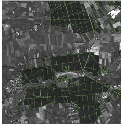
10 Mapping scales Outline Forest map in different scales and change? IKONOS State Biotopmap Forest Map Spot based Forest Map Ikonos based Both EO based maps Accuracy > 85 % Bock et al 2008: Exemplary Results form the ESA funded GSE Forest Monitoring Folie 10
11 Geobia From image objects to target objects. BOCK M & LESSING R (2000): Remote Sensing, Building of objects and Determination of quality. In: Cremers & Greve (Eds): Umweltinformatik 2000, , Meropolis. Marburg. Folie 11


12 From image obects to.. Folie 12


13 to a semantic habitat data model Folie 13


14 Every object is described by an ontology Folie 14
15 Extraction of habitat characteristics UK Broad Habitats Fen, marsh and swamp This broad habitat type is characterised by a variety of vegetation types that are found on minerotrophic (groundwater-fed), permanently, seasonally or periodically waterlogged peat, peaty soils, or mineral soils. Fens are peatlands which receive water and nutrients from groundwater and surface run-off, as well as from rainfall. Flushes are associated with lateral water movement, and springs with localised upwelling of water. Marsh is a general term usually used to imply waterlogged soil; it is used more specifically here to refer to fen meadows and rush-pasture communities on mineral soils and shallow peats. Swamps are characterised by tall emergent vegetation. Reedbeds (i.e. swamps dominated by stands of common reed Phragmites australis) are also included in this type. Folie 15


16 The UK Broad habitat Fen, marsh and swamp is described very broad. Folie 16


17 Object model of Deciduous forest as defined by the BNTK &implemented in DeCover ontology DELPHI IMM GmbH Folie 17
18 The approach of semantic interoperability every dataset has a definition of every object (catalog of objects) between the definitions of the objects it is possible to find comparable features, e.g. minimum mapping unit or the character of the highest percentage of landcover (e.g. vegetation) the interoperability approach describes every object with a set of basic features and establishes herewith a comparabilty Simple cross-links between nomenclatures can be extented by using the similarity of the attributes DELPHI IMM GmbH From Presentation: Interoperability between different datasets, Rolf Lessing, Delphi-IMM 2010 Folie 18 18
19 Options of geometric and thematic Integration of GSE- Forest Data to update the Federal DLM-DE Forest Layer 1. Pure thematic integration: Keep the borders of the DLM-DE Forest objects and assign the GSE Forest class if the similarty is high 2. Complete geometric integration: of the GSE Forest Data by keeping the existing forest border lines 3. Combined approach: Thematic integration if the percentual share of a forest type is high Geometric Integration in the remaining areas Bock et al 2008: FP7 B4G funded research -> Feasibility study DLM-DE Update Folie 19


20 Flowchart of methodology Area depend threshold Bock et al 2008: FP7 B4G funded research -> Feasibility study DLM-DE Update Folie 20


21 Mostly thematic integration for the BKG Bock et al 2008: Example of Feasibility study DLM-DE Update for the BKG Folie 21


22 Geometric Integration and zonal class assignment Bock et al 2008: Example of Feasibility study DLM-DE Update Folie 22


23 Bock et al 2008: Example of Feasibility study DLM-DE Update for the BKG Folie 23


24 Grassland Monitoring Integration in the BNTK 1:10000 Biotope and land use map 10m object based classification Bock 2007: Contract work at DFD for the LANU- Schleswig- Holstein Folie 24


25 Bock et al : Funded by FP5 project SPIN, FP6 Geoland and LANU-SH Folie 25
26 s I Common LULC and Habitat nomenclatures are likely defined by a large mixture of descriptors (floristic, ecology, physiognomy, evolution, biogeography, topography) but often not suited to be mapped by remote sensing directly. Systematic semantic Modelling of real world objects and use of ontology's for habitat description is essential: to assure that we know what elements reference data and target class are composed of to achieve interoperability to other comparative data sets in space and time to build up transferable rule sets with Geobia Folie 26
27 s II Geometric integration of EO derived data with existing datasets that are already in operational use is essential Monitoring and update of existing LULC and habitat maps requires to keep the existing outlines as far as possible. A combination of zonal attributes and geometric integration is suitable for most Land use and Land Cover type Semantic and geometric interoperability is an important issue if spatial datasets are combined or updated Folie 27

28 Related Actions The EIONET EAGL Group work on a improvement of current LULC Data models for monitoring in Europe A list of pure LC classes was defined at last meeting Dez Current task of EAGL is to develop a whole list of attributes that will define each of the pure land cover classes Minutes of meetings and further information are available at: Folie 28
29 Related Actions a LCCS plugin for ecognition is planned! Folie 29


30 Folie 30 Vortrag > Autor > Dokumentname >
INTEROPERABILITY BETWEEN DIFFERENT DATASETS
 Dr. Rolf Lessing [ rolf.lessing@delphi imm.de ] INTEROPERABILITY BETWEEN DIFFERENT DATASETS What are the challenges? geodatasets are very expensive, because: There are many different datasets, because
The German GMES extension to support land cover data systems: Status and outlook
 The German GMES extension to support land cover data systems: Status and outlook Bergen, 2nd July 2010 Oliver Buck, EFTAS GmbH Co-Funded by the Federal Ministry of Economics and Technology (BMWi) via the
Supplementary material: Methodological annex
 1 Supplementary material: Methodological annex Correcting the spatial representation bias: the grid sample approach Our land-use time series used non-ideal data sources, which differed in spatial and thematic
EAGLE concept, as part of the HELM vision
 EAGLE concept, as part of the HELM vision EAGLE working group Barbara Kosztra (Hungary), Stephan Arnold (Germany), Lena Hallin-Pihlatie & Elise Järvenpää (Finland) 16.06.2014 HELM / EAGLE Workshop - INSPIRE
THE OVERALL EAGLE CONCEPT
 Sentinel Hub THE OVERALL EAGLE CONCEPT GEBHARD BANKO, 30. MAY 2018, COPENHAGEN ISO TC 211, STANDARDS IN ACTION SEMINAR CONTENT Background and Motivation Criteria and Structure of Data Model Semantic decomposition
Patrick Leinenkugel. German Aerospace Center (DLR) Vortrag > Autor > Dokumentname > Datum
 Vortrag > Autor > Dokumentname > Datum") Characterisation of land surface phenology and land cover for the Mekong Basin on the basis of multitemporal and multispectral satellite data from the MODIS Sensor Patrick Leinenkugel German Aerospace
Characterisation of land surface phenology and land cover for the Mekong Basin on the basis of multitemporal and multispectral satellite data from the MODIS Sensor Patrick Leinenkugel German Aerospace
Towards a harmonised land monitoring system: NRC bottom-up activities in EAGLE and HELM H
 B. Kosztra Towards a harmonised land monitoring system: NRC bottom-up activities in EAGLE and HELM H Gebhard Banko Environment Agency Austria Geoland 2 Forum 18.-19. October 2012 Copenhagen 1 1 NRC * opinion
SWOS (The Satellite-based Wetland Observation Service) Satellite images for peatland monitoring and management Kathrin Weise, Jena-Optronik GmbH
 Satellite images for peatland monitoring and management Kathrin Weise, Jena-Optronik GmbH") This project has received funding from the European Union s Horizon 2020 research and innovation programme under grant agreement No 642088 SWOS (The Satellite-based Wetland Observation Service) Satellite
This project has received funding from the European Union s Horizon 2020 research and innovation programme under grant agreement No 642088 SWOS (The Satellite-based Wetland Observation Service) Satellite
Environmental Science
 Environmental Science A Study of Interrelationships Cui Jiansheng Hebei University of Science and Technology CH06 Kinds of Ecosystems and Communities Chapter Objectives After reading this chapter, you
UK Contribution to the European CORINE Land Cover
 Centre for Landscape andwww.le.ac.uk/clcr Climate Research CENTRE FOR Landscape and Climate Research UK Contribution to the European CORINE Land Cover Dr Beth Cole Corine Coordination of Information on
Taunton River Salt Marsh Assessment Results from 2014 season
 Taunton River Salt Marsh Assessment Results from 2014 season December, 2014 During the late summer and fall of 2014, Save The Bay evaluated salt marshes in Assonet Bay, Freetown and Broad Cove in Dighton
New Results of Critical Load Calculation including Biodiversity
 33 rd ICP M & M Task Force Meeting New Results of Critical Load Calculation including Biodiversity Hans-Dieter Nagel, Angela Schlutow & Yolandi Bouwer (OEKO-DATA) Markus Geupel & Thomas Scheuschner (UBA)
Introduction. Ecology is the scientific study of the interactions between organisms and their environment.
 Introduction Ecology is the scientific study of the interactions between organisms and their environment. 1. The interactions between organisms and their environments determine the distribution and abundance
Pan-Arctic, Regional and Local Land Cover Products
 Pan-Arctic, Regional and Local Land Cover Products Marcel Urban (1), Stefan Pöcking (1), Sören Hese (1) & Christiane Schmullius (1) (1) Friedrich-Schiller University Jena, Department of Earth Observation,
An Automated Object-Oriented Satellite Image Classification Method Integrating the FAO Land Cover Classification System (LCCS).
.") An Automated Object-Oriented Satellite Image Classification Method Integrating the FAO Land Cover Classification System (LCCS). Ruvimbo Gamanya Sibanda Prof. Dr. Philippe De Maeyer Prof. Dr. Morgan De
An Automated Object-Oriented Satellite Image Classification Method Integrating the FAO Land Cover Classification System (LCCS). Ruvimbo Gamanya Sibanda Prof. Dr. Philippe De Maeyer Prof. Dr. Morgan De
State-of-play... The EAGLE concept conceptual basis for a future European Land Monitoring Framework
 State-of-play... The EAGLE concept conceptual basis for a future European Land Monitoring Framework Stephan Arnold, Geir-H. Strand, Barbara Kosztra, Tomas Soukup, Gebhard Banko, Gerard Hazeu, Geoff Smith,
CHAPTER 6 & 7 VOCABULARY
 CHAPTER 6 & 7 VOCABULARY 1. Biome 2. Climate 3. Latitude 4. Altitude 5. Emergent layer 6. Epiphyte 7. Understory 8. Permafrost 9. Wetland 10.Plankton 11.Nekton 12.Benthos 13.Littoral zone 14.Benthic zone
The LISA extension to INSPIRE LC/LU data model: The Austrian experience
 The LISA extension to INSPIRE LC/LU data model: The Austrian experience Gebhard Banko, Environment Agency Austria Roland Grillmayer, Environment Agency Austria Wolfgang Stemberger, GeoVille INSPIRE KEN
The EAGLE Concept - Paving the way for a new European Land Monitoring System
 The EAGLE Concept - Paving the way for a new European Land Monitoring System Stephan Arnold, Barbara Kosztra, Gebhard Banko, Geoff Smith, Christoph Perger, Michael Bock, Geir-Harald Strand, Cesar Martinez,
An Update on Land Use & Land Cover Mapping in Ireland
 An Update on Land Use & Land Cover Mapping in Ireland Progress Towards a National Programme Kevin Lydon k.lydon@epa.ie Office of Environmental Assessment, Environmental Protection Agency, Johnstown Castle,
MODELLING LAND USE CHANGE ON A REGIONAL SCALE
 MODELLING LAND USE CHANGE ON A REGIONAL SCALE W. Lahmer 1, A. Becker 1, B. Pfützner 2 1 Potsdam Institute for Climate Impact Research, Telegrafenberg, D-14412 Potsdam, Germany 2 Bureau for Applied Hydrology
Habitats habitat concept, identification, methodology for habitat mapping, organization of mapping
 Habitats habitat concept, identification, methodology for habitat mapping, organization of mapping Rastislav Lasák & Ján Šeffer Training Implementation of Habitats Directive - Habitats and Plants 1 What
Land Monitoring Core Service Implementation Group (LMCS IG) - Results and Outlook
 - Results and Outlook") Land Monitoring Core Service Implementation Group (LMCS IG) - Results and Outlook Pr. Dietmar Grünreich, President of BKG, Germany Chairman of the GMES LMCS IG Outline 1 Introduction 2 Preparatory Projects
Land Monitoring Core Service Implementation Group (LMCS IG) - Results and Outlook Pr. Dietmar Grünreich, President of BKG, Germany Chairman of the GMES LMCS IG Outline 1 Introduction 2 Preparatory Projects
EAGLE Data Model and Outcomes of HELM (Harmonised European Land Monitoring)
") EAGLE Data Model and Outcomes of HELM (Harmonised European Land Monitoring) Contribution towards better land information harmonisation and INSPIRE compliance EAGLE working group Stephan Arnold, Barbara
EAGLE Data Model and Outcomes of HELM (Harmonised European Land Monitoring) Contribution towards better land information harmonisation and INSPIRE compliance EAGLE working group Stephan Arnold, Barbara
Utility of National Spatial Data for Conservation Design Projects
 Utility of National Spatial Data for Conservation Design Projects Steve Williams Biodiversity and Spatial Information Center North Carolina State University PIF CDW St. Louis, MO April 11, 2006 Types of
SIF_7.1_v2. Indicator. Measurement. What should the measurement tell us?
 Indicator 7 Area of natural and semi-natural habitat Measurement 7.1 Area of natural and semi-natural habitat What should the measurement tell us? Natural habitats are considered the land and water areas
Worldwide inventory of landscapes through segmentation of global land cover dataset
 Worldwide inventory of landscapes through segmentation of global land cover dataset J. Nowosad* 1 and T. F. Stepinski 1 1 University of Cincinnati, Cincinnati, OH, 45221, USA * Email: nowosad.jakub@gmail.com
Earth s Major Terrerstrial Biomes. *Wetlands (found all over Earth)
") Biomes Biome: the major types of terrestrial ecosystems determined primarily by climate 2 main factors: Depends on ; proximity to ocean; and air and ocean circulation patterns Similar traits of plants
Biomes Biome: the major types of terrestrial ecosystems determined primarily by climate 2 main factors: Depends on ; proximity to ocean; and air and ocean circulation patterns Similar traits of plants
Visualising Types of Uncertainty in Spatial Information
 Visualising Types of Uncertainty in Spatial Information Peter Fisher City University, London National Academy of Sciences, 3-4 March 2005 Outline Issues The Problem The variety and levels of uncertainty
Land Cover Project ESA Climate Change Initiative. Processing chain for land cover maps dedicated to climate modellers.
 Land Cover Project ESA Climate Change Initiative Processing chain for land cover maps dedicated to climate modellers land_cover_cci S. Bontemps 1, P. Defourny 1, V. Kalogirou 2, F.M. Seifert 2 and O. Arino
EO Information Services. Assessing Vulnerability in the metropolitan area of Rio de Janeiro (Floods & Landslides) Project
 Project") EO Information Services in support of Assessing Vulnerability in the metropolitan area of Rio de Janeiro (Floods & Landslides) Project Ricardo Armas, Critical Software SA Haris Kontoes, ISARS NOA World
EO Information Services in support of Assessing Vulnerability in the metropolitan area of Rio de Janeiro (Floods & Landslides) Project Ricardo Armas, Critical Software SA Haris Kontoes, ISARS NOA World
Representative Reference Area Akehurst, Venner meadow, Burnette lake, Fork meadow, paradise meadow, Rimrock swamp, Goose Carex,
 Description This mixed sedge wetland community is the most common wetland type in BC s interior rangelands. These sedge species are able to tolerate anaerobic soil conditions for the entire growing season.
RHOSYDD LLANPUMSAINT SITE OF SPECIAL SCIENTIFIC INTEREST
 RHOSYDD LLANPUMSAINT SITE OF SPECIAL SCIENTIFIC INTEREST Sam Bosanquet 2008 YOUR SPECIAL SITE AND ITS FUTURE Your Special Site and its Future is part of our commitment to improve the way we work with Site
Strategies of wetland restoration in the Waasen/Hanság (northern Burgenland)
") 5 th Symposium Conference Volume for Research in Protected Areas pages 131-135 10 to 12 June 2013, Mittersill Strategies of wetland restoration in the Waasen/Hanság (northern Burgenland) Barbara Dillinger
5 th Symposium Conference Volume for Research in Protected Areas pages 131-135 10 to 12 June 2013, Mittersill Strategies of wetland restoration in the Waasen/Hanság (northern Burgenland) Barbara Dillinger
Chapter 7 Part III: Biomes
 Chapter 7 Part III: Biomes Biomes Biome: the major types of terrestrial ecosystems determined primarily by climate 2 main factors: Temperature and precipitation Depends on latitude or altitude; proximity
Ms. A. Mormando's Class *
 8 th Grade Science Essential Standard: 8.E.1.1 Explain the structure of the hydrosphere including: Water distribution on Earth; Local river basin and water availability Stream - A stream is a body of water
Soil Formation. Lesson Plan: NRES B2-4
 Soil Formation Lesson Plan: NRES B2-4 1 Anticipated Problems 1. What are five different factors that affect soil formation? 2. What are some different types of parent material that affect soils? 3. What
Wisconsin River Floodplain Project: Overview and Plot Metadata
 Wisconsin River Floodplain Project: Overview and Plot Metadata CLASS I. DATA SET DESCRIPTORS Data set identity: Plot-level variable information for Wisconsin River Floodplain Project. Relevant for following
Dynamic Land Cover Dataset Product Description
 Dynamic Land Cover Dataset Product Description V1.0 27 May 2014 D2014-40362 Unclassified Table of Contents Document History... 3 A Summary Description... 4 Sheet A.1 Definition and Usage... 4 Sheet A.2
The Combination of Geospatial Data with Statistical Data for SDG Indicators
 Session x: Sustainable Development Goals, SDG indicators The Combination of Geospatial Data with Statistical Data for SDG Indicators Pier-Giorgio Zaccheddu Fabio Volpe 5-8 December2018, Nairobi IAEG SDG
ESA-GLOBCOVER - A Global Land Cover Service at 300 m from ENVISAT MERIS Time Series
 October 15, 2008 (Jena Germany) ESA-GLOBCOVER - A Global Land Cover Service at 300 m from ENVISAT MERIS Time Series Defourny P.1, Bontemps S., Vancutsem C.1, Pekel J.F.1,, Vanbogaert E.1, Bicheron P.2,
BIOS 230 Landscape Ecology. Lecture #32
 BIOS 230 Landscape Ecology Lecture #32 What is a Landscape? One definition: A large area, based on intuitive human scales and traditional geographical studies 10s of hectares to 100s of kilometers 2 (1
forest tropical jungle swamp marsh prairie savanna pampas Different Ecosystems (rainforest)
") Different Ecosystems forest A region of land that is covered with many trees and shrubs. tropical jungle (rainforest) swamp A region with dense trees and a variety of plant life. It has a tropical climate.
Different Ecosystems forest A region of land that is covered with many trees and shrubs. tropical jungle (rainforest) swamp A region with dense trees and a variety of plant life. It has a tropical climate.
System of Environmental-Economic Accounting. Advancing the SEEA Experimental Ecosystem Accounting. Extent Account (Levels 1 and 2)
") Advancing the SEEA Experimental Ecosystem Accounting Extent Account (Levels 1 and 2) Overview: The Extent Account 1. Learning objectives 2. Review of Level 0 (5m) What is it? Why do we need it? What does
Advancing the SEEA Experimental Ecosystem Accounting Extent Account (Levels 1 and 2) Overview: The Extent Account 1. Learning objectives 2. Review of Level 0 (5m) What is it? Why do we need it? What does
IAEG SDGs WG GI, , Mexico City
 IAEG SDGs WG GI, 12-14.12.2016, Mexico City UN-GGIM:Europe s perspective and activities to support better integration of geospatial information and statistics and the UN SDG monitoring Pier-Giorgio Zaccheddu,
Land Management and Natural Hazards Unit --- DESERT Action 1. Land Management and Natural Hazards Unit Institute for Environment and Sustainability
 Land Management and Natural Hazards Unit --- DESERT Action 1 Monitoring Drought with Meteorological and Remote Sensing Data A case study on the Horn of Africa Paulo Barbosa and Gustavo Naumann Land Management
Problems arising during the implementation of CLC2006
 Problems arising during the implementation of CLC2006 George Büttner, Barbara Kosztra ETC-LUSI / FÖMI (HU) EIONET WG meeting on Land Monitoring IGN Portugal, 10-12 March 2010 Contents of presentation Present
Environmental Science: Biomes Test
 Name: Date: Pd. VERSION 1 Environmental Science: Biomes Test 1. Eland are large herbivores with loose skin under the throat and neck. This patch of skin aids in lowering the body temperature when temperatures
Harrison 1. Identifying Wetlands by GIS Software Submitted July 30, ,470 words By Catherine Harrison University of Virginia
 Harrison 1 Identifying Wetlands by GIS Software Submitted July 30, 2015 4,470 words By Catherine Harrison University of Virginia cch2fy@virginia.edu Harrison 2 ABSTRACT The Virginia Department of Transportation
Vegetation and Terrestrial Wildlife
 Vegetation and Terrestrial Wildlife Vegetation Plant Communities Disturbance Unique Communities Wildlife Amphibians and Reptiles Birds Mammals Terrestrial Ecology: Vegetation Goals of vegetation sampling
Land Use MTRI Documenting Land Use and Land Cover Conditions Synthesis Report
 Colin Brooks, Rick Powell, Laura Bourgeau-Chavez, and Dr. Robert Shuchman Michigan Tech Research Institute (MTRI) Project Introduction Transportation projects require detailed environmental information
2.6.3 Forms of standing open water
 Fig. 33 Distinctive forms created by oioi restiad rushland, New River Estuary, Southland. These pikelets are elevating themselves above the level of mudflats and tidal channels as the rushes trap sediment.
NATIONAL VEGETATION CLASSIFICATION STANDARD, VERSION 2 WORKING DRAFT
 NATIONAL VEGETATION CLASSIFICATION STANDARD, VERSION 2 WORKING DRAFT Subcommittee Federal Geographic Data Committee SUMMMARY NatureServe version 31 August 2006 INTRODUCTION The United States Federal Geographic
Observations on Surface Water in the Seminary Fen in Spring, Prepared 6/4/13 by Sam Wetterlin; updated 7/28/13
 Observations on Surface Water in the Seminary Fen in Spring, 2013 Prepared 6/4/13 by Sam Wetterlin; updated 7/28/13 Ordinarily, a calcareous fen is primarily dependent on upwelling mineral-rich, oxygen-poor
o 3000 Hannover, Fed. Rep. of Germany
 1. Abstract The use of SPOT and CIR aerial photography for urban planning P. Lohmann, G. Altrogge Institute for Photogrammetry and Engineering Surveys University of Hannover, Nienburger Strasse 1 o 3000
RADAR BACKSCATTER AND COHERENCE INFORMATION SUPPORTING HIGH QUALITY URBAN MAPPING
 RADAR BACKSCATTER AND COHERENCE INFORMATION SUPPORTING HIGH QUALITY URBAN MAPPING Peter Fischer (1), Zbigniew Perski ( 2), Stefan Wannemacher (1) (1)University of Applied Sciences Trier, Informatics Department,
Unit E: Basic Principles of Soil Science. Lesson 2: Understanding Soil Formation
 Unit E: Basic Principles of Soil Science Lesson 2: Understanding Soil Formation Important Terms Alluvium Bedrock Chemical weathering Climate Glacial till Loess Native vegetation Organic matter Outwash
DEVELOPMENT OF DIGITAL CARTOGRAPHIC DATABASE FOR MANAGING THE ENVIRONMENT AND NATURAL RESOURCES IN THE REPUBLIC OF SERBIA
 DEVELOPMENT OF DIGITAL CARTOGRAPHIC BASE FOR MANAGING THE ENVIRONMENT AND NATURAL RESOURCES IN THE REPUBLIC OF SERBIA Dragutin Protic, Ivan Nestorov Institute for Geodesy, Faculty of Civil Engineering,
Chapter 52 An Introduction to Ecology and the Biosphere
 Chapter 52 An Introduction to Ecology and the Biosphere Ecology The study of the interactions between organisms and their environment. Ecology Integrates all areas of biological research and informs environmental
Remote Sensing of Wetlands: Strategies and Methods Presentation for the Canadian Institute of Forestry
 Remote Sensing of Wetlands: Strategies and Methods Presentation for the Canadian Institute of Forestry Michael A. Merchant Ducks Unlimited Canada, Boreal Program February 21 st, 2019 Edmonton, AB m_merchant@ducks.ca
Spatial Disaggregation of Land Cover and Cropping Information: Current Results and Further steps
 CAPRI CAPRI Spatial Disaggregation of Land Cover and Cropping Information: Current Results and Further steps Renate Koeble, Adrian Leip (Joint Research Centre) Markus Kempen (Universitaet Bonn) JRC-AL
Global Land Cover Mapping
 Global Land Cover Mapping and its application in SDGs Prof. Chen Jun 1, Dr. He Chaoying 2 1 National Geomatics Center of China (NGCC) 2 Ministry of Natural Resources, P.R.China May 30, 2018, Copenhagen
Seasonal and interannual relations between precipitation, soil moisture and vegetation in the North American monsoon region
 Seasonal and interannual relations between precipitation, soil moisture and vegetation in the North American monsoon region Luis A. Mendez-Barroso 1, Enrique R. Vivoni 1, Christopher J. Watts 2 and Julio
CadasterENV Sweden Time series in support of a multi-purpose land cover mapping system at national scale
 CadasterENV Sweden Time series in support of a multi-purpose land cover mapping system at national scale Mats Rosengren, Camilla Jönsson ; Metria AB Marc Paganini ; ESA ESRIN Background CadasterENV Sweden
Organism Species Population Community Ecosystem
 Name: Date: Period: Ecosystems and Their Interactions S8.B.3.1 Getting the idea The environment is everything that surrounds an organism. Organisms cooperate and compete with each other to get everything
UK NEA Economic Analysis Report Cultural services: Mourato et al. 2010
 Appendix A Hedonic regressions: Further data description The environmental data used to construct variables for the hedonic regressions come from the Centre for Ecology and Hydrology, the Generalised Land
LAND COVER CATEGORY DEFINITION BY IMAGE INVARIANTS FOR AUTOMATED CLASSIFICATION
 LAND COVER CATEGORY DEFINITION BY IMAGE INVARIANTS FOR AUTOMATED CLASSIFICATION Nguyen Dinh Duong Environmental Remote Sensing Laboratory Institute of Geography Hoang Quoc Viet Rd., Cau Giay, Hanoi, Vietnam
Exploring the scale dependence of landscape metrics when estimated by satellite imagery: An example of the SPIN EU project in Kerkini Lake, Greece.
 Exploring the scale dependence of landscape metrics when estimated by satellite imagery: An example MedWet/Codde Workshop EKBY, 2 April 2006 THE RATIONALE Pattern change affects and is affected by ecological
Applied spatial data for sustainable development strategy in Germany
 Applied spatial data for sustainable development strategy in Germany Stephan Arnold Areal Statistics, Federal Statistical Office, Germany Federal Statistical Office Headquarter: Wiesbaden Branch Office:
An Internet-based Agricultural Land Use Trends Visualization System (AgLuT)
") An Internet-based Agricultural Land Use Trends Visualization System (AgLuT) Second half yearly report 01-01-2001-06-30-2001 Prepared for Missouri Department of Natural Resources Missouri Department of
An Internet-based Agricultural Land Use Trends Visualization System (AgLuT) Second half yearly report 01-01-2001-06-30-2001 Prepared for Missouri Department of Natural Resources Missouri Department of
Extent. Level 1 and 2. October 2017
 Extent Level 1 and 2 October 2017 Overview: Extent account 1. Learning objectives 2. Review of Level 0 (5m) 3. Level 1 (Compilers): Concepts (15m) Group exercise and discussion (15m) 4. Level 2 (Data Providers)
C o p e r n i c u s L a n d M o n i t o r i n g S e r v i c e
 C o p e r n i c u s L a n d M o n i t o r i n g S e r v i c e Submodule D: stability of protected areas & related pressures: Natura2000 sites Copernicus EU Copernicus EU Copernicus EU www.copernicus.eu
Ground Water Control of Tree Island Origin, Genesis and Destruction. By John F. Meeder and Peter W. Harlem SERC,FIU
 Ground Water Control of Tree Island Origin, Genesis and Destruction By John F. Meeder and Peter W. Harlem SERC,FIU Functional Definition Our functional definition of a Tree Island is; an isolated scrub
Creating ponds for Marsh Clubmoss Lycopodielle inundata
 Creating ponds for Marsh Clubmoss Lycopodielle inundata Freshwater Habitats Trust 1. What is Marsh Clubmoss? Marsh Clubmoss Lycopodiella inundata is not a true moss but a primitive non-flowering plant
Capabilities and Limitations of Land Cover and Satellite Data for Biomass Estimation in African Ecosystems Valerio Avitabile
 Capabilities and Limitations of Land Cover and Satellite Data for Biomass Estimation in African Ecosystems Valerio Avitabile Kaniyo Pabidi - Budongo Forest Reserve November 13th, 2008 Outline of the presentation
Validation and verification of land cover data Selected challenges from European and national environmental land monitoring
 Validation and verification of land cover data Selected challenges from European and national environmental land monitoring Gergely Maucha head, Environmental Applications of Remote Sensing Institute of
a national geological survey perspective François ROBIDA BRGM (French Geological Survey)
") a national geological survey perspective François ROBIDA BRGM (French Geological Survey) Pre-Conference Seminar on Socio-Economic Value of Geospatial for National and Regional Development 21 August 2017,
a national geological survey perspective François ROBIDA BRGM (French Geological Survey) Pre-Conference Seminar on Socio-Economic Value of Geospatial for National and Regional Development 21 August 2017,
Landscapes & Hydric Soils Bruce Vasilas University of Delaware
 Landscapes & Hydric Soils Bruce Vasilas University of Delaware Hydric soils are defined as soils that formed under conditions of saturation, flooding, or ponding long enough during the growing season to
ZRCSAZU. Remote sensing and Earth observation data at ZRC SAZU. dr. Tatjana Veljanovski Atrij ZRC Ljubljana
 ZRCSAZU Remote sensing and Earth observation data at ZRC SAZU dr. Tatjana Veljanovski 2016-06-08 Atrij ZRC Ljubljana Remote Sensing Department Remote Sensing Department 20 years of experience application,
Soil is formed from the weathering of rocks. Weathering: the breaking down of parent material (rock). There are 3 types of weathering:
. There are 3 types of weathering:") Soil is formed from the weathering of rocks. Weathering: the breaking down of parent material (rock). There are 3 types of weathering: Physical, Chemical Biological. The natural forces carry this out:
Soil is formed from the weathering of rocks. Weathering: the breaking down of parent material (rock). There are 3 types of weathering: Physical, Chemical Biological. The natural forces carry this out:
EVALUATION OF AVHRR NDVI FOR MONITORING INTRA-ANNUAL AND INTERANNUAL VEGETATION DYNAMICS IN A CLOUDY ENVIRONMENT (SCOTLAND, UK)
") EVALUATION OF AVHRR NDVI FOR MONITORING INTRA-ANNUAL AND INTERANNUAL VEGETATION DYNAMICS IN A CLOUDY ENVIRONMENT (SCOTLAND, UK) S. Brand a,, T.J. Malthus b a Institute of Photogrammetry and Remote Sensing,
EVALUATION OF AVHRR NDVI FOR MONITORING INTRA-ANNUAL AND INTERANNUAL VEGETATION DYNAMICS IN A CLOUDY ENVIRONMENT (SCOTLAND, UK) S. Brand a,, T.J. Malthus b a Institute of Photogrammetry and Remote Sensing,
Appendix E: Cowardin Classification Coding System
 Appendix E: Cowardin Classification Coding System The following summarizes the Cowardin classification coding system and the letters and numbers used to define the USFWS NWI wetland types and subtypes:
Prediction of soil properties with NIR data and site descriptors using preprocessing and neural networks
 Prediction of soil properties with NIR data and site descriptors using preprocessing and neural networks Matt Aitkenhead Malcolm Coull Jean Robertson 1 Introduction to NSIS A component of the Scottish
Lecture 7. Our Sun. Ecology. Mushroom. Introduction. Food Chain. Food Chain. Circle of Life
 Introduction Mushroom George Wong, mycologist Office Hour: TBA Office: St. John 612B Telephone: X63940 Email: biol101@hawaii hawaii.edu Lecture 7 Our Sun Ecology How organisms interact with each other
Biomes and Ecosystems
 Name Biomes and Ecosystems Date How do Earth s biomes and ecosystems differ? Before You Read Before you read the chapter, think about what you know about biomes and ecosystems Record your thoughts in the
Land Use and Land Cover Semantics - Principles, Best Practices and Prospects. Ola Ahlqvist
 Acknowledgements: Dalia Varanka, USGS; Steffen Fritz, IIASA, Austria; Helle Skånes, Stockholm University-NORDSCAPE; Krzysztof Janowicz, UCSB Land Use and Land Cover Semantics - Principles, Best Practices
SOIL: DEFINITION, FORMATION! & LAYERS"
 SOIL: DEFINITION, FORMATION & LAYERS" What Is Soil? soil - upper-most (relatively thin) layer of Earth s crust, which supports terrestrial plants, animals, & microorganisms basic natural resource that
Appendix J Vegetation Change Analysis Methodology
 Appendix J Vegetation Change Analysis Methodology Regional Groundwater Storage and Recovery Project Draft EIR Appendix-J April 2013 APPENDIX J- LAKE MERCED VEGETATION CHANGE ANALYSIS METHODOLOGY Building
Standardization of the land cover classes using FAO Land Cover Classification System (LCCS)
") Sofia, 17-18 September 2008, LPIS Workshop LPIS applications and quality 1 Standardization of the land cover classes using FAO Land Cover Classification System (LCCS) Pavel MILENOV Agriculture Unit, JRC
Sofia, 17-18 September 2008, LPIS Workshop LPIS applications and quality 1 Standardization of the land cover classes using FAO Land Cover Classification System (LCCS) Pavel MILENOV Agriculture Unit, JRC
ARCH PROJET Activity 1 -Synthesis-
 ARCH PROJET Activity 1 -Synthesis- CONTENT 1 ARCH project context... 3 1.1. General context... 3 1.2. The ARCH Project... 3 1.3. The Project ARCH partners... 3 1.4. The ARCH project content... 4 2 Activity
Dr Werner Herrmann TÜV Rheinland Energie und Umwelt GmbH Cologne, Germany
 Impact of Soiling on PV Module Performance for Various Climates Dr Werner Herrmann TÜV Rheinland Energie und Umwelt GmbH 51101 Cologne, Germany werner.herrmann@de.tuv.com http://www.tuv.com/solarpower
Landcover Dynamics in the Niger Inland Delta (Mali)
") Fakultät Forst-, Geo- Hydrowissenschaften Institut f. Photogrammetrie & Fernerkundung, Professur Fernerkundung Landcover Dynamics in the Niger Inland Delta (Mali) A Classification Approach for MERIS Data
Fakultät Forst-, Geo- Hydrowissenschaften Institut f. Photogrammetrie & Fernerkundung, Professur Fernerkundung Landcover Dynamics in the Niger Inland Delta (Mali) A Classification Approach for MERIS Data
Open call for tenders No EEA/MDI/14/001
 1 April 2014 Clarification No 1 Reference: Title: Open call for tenders No EEA/MDI/14/001 Copernicus Initial Operations 2011-2013 - Land Monitoring Service Local Component: riparian zones Question 1 Section
Overview of Remote Sensing in Natural Resources Mapping
 Overview of Remote Sensing in Natural Resources Mapping What is remote sensing? Why remote sensing? Examples of remote sensing in natural resources mapping Class goals What is Remote Sensing A remote sensing
Providing Marine Data. The German Marine Data Infrastructure (MDI-DE) as an example for best practice
 as an example for best practice") Providing Marine Data The German Marine Data Infrastructure (MDI-DE) as an example for best practice Data Originators 18 Agencies and Institutions in the EEZ and 12 Mile Zone Federal Government BSH Schleswig-Holstein
Providing Marine Data The German Marine Data Infrastructure (MDI-DE) as an example for best practice Data Originators 18 Agencies and Institutions in the EEZ and 12 Mile Zone Federal Government BSH Schleswig-Holstein
CHAPTER VII FULLY DISTRIBUTED RAINFALL-RUNOFF MODEL USING GIS
 80 CHAPTER VII FULLY DISTRIBUTED RAINFALL-RUNOFF MODEL USING GIS 7.1GENERAL This chapter is discussed in six parts. Introduction to Runoff estimation using fully Distributed model is discussed in first
The future of the Lowland Belizean Savannas?.
 The future of the Lowland Belizean Savannas?. Using cluster analysis to explore multivariate spatial patterns in savanna soils PETER FURLEY & SARAH BEADLE UK Belize association 15 th November 2014 Outline
World Geography 3202 Practice Multiple Choice Unit 3 Ecosystems. Outcomes:
 Outcomes: SCO 3.1: The student will be expected to demonstrate an understanding that an ecosystem consists of a complex network of organisms, including the following delineations: 3.1.1 Define the term
National Wetland Inventory
 Photo Interpretation Guide For Updating The National Wetland Inventory In Minnesota August 2011 National Wetland Inventory Introduction 1.1 Purpose of Photo Interpretation Guide 1 1.2 Contact information
AGOG 485/585 /APLN 533 Spring Lecture 5: MODIS land cover product (MCD12Q1). Additional sources of MODIS data
. Additional sources of MODIS data") AGOG 485/585 /APLN 533 Spring 2019 Lecture 5: MODIS land cover product (MCD12Q1). Additional sources of MODIS data Outline Current status of land cover products Overview of the MCD12Q1 algorithm Mapping
AGOG 485/585 /APLN 533 Spring 2019 Lecture 5: MODIS land cover product (MCD12Q1). Additional sources of MODIS data Outline Current status of land cover products Overview of the MCD12Q1 algorithm Mapping