Habitats habitat concept, identification, methodology for habitat mapping, organization of mapping
|
|
|
- Rebecca Davis
- 5 years ago
- Views:
Transcription
1 Habitats habitat concept, identification, methodology for habitat mapping, organization of mapping Rastislav Lasák & Ján Šeffer Training Implementation of Habitats Directive - Habitats and Plants 1
2 What is all about? EU wants to protect nature in Europe. EU has prepared directives to fulfill this idea: Bird Directive - Council Directive 79/409/EEC of 2 April 1979 on the conservation of wild birds Habitat Directive - Council Directive 92/43/EEC of 21 May 1992 on the conservation of natural habitats and of wild fauna and flora Water Framework Directive - Directive 2000/60/EC of the European Parliament and of the Council of 23 October 2000 establishing a framework for Community action in the field of water policy EU member states are required to follow these directives Training Implementation of Habitats Directive - Habitats and Plants 2


3 Habitat Directive Council Directive 92/43/EEC of 21 May 1992 on the conservation of natural habitats and of wild fauna and flora EU member states are mandatory to create a network of sites for protecting of natural habitats and wild species listed in annexes of the Directive: over 230 habitat types over 1000 wild species Accessing countries can add new habitats or species Training Implementation of Habitats Directive - Habitats and Plants 3
4 What is habitat in general? A habitat (in 18 th century from Latin word habitáre= it dwells ) is an ecological or environmental area that is inhabited by a particular species of animal, plant, or other type of organism. (It does not need to be a geographic area) According Merriam-Webster and Oxford Dictionary it can be defined as the natural environment of an organism, the place in which it is natural for it to live and grow. This is similar in meaning to a biotope (defined by Ernst Haeckel in 19 th century from Greek bios= life and topos= place ), an area of uniform environmental conditions associated with a particular community of plants and animals. (In Slovakia we translate Habitat Directive to Smernica o biotopoch ) Training Implementation of Habitats Directive - Habitats and Plants 4


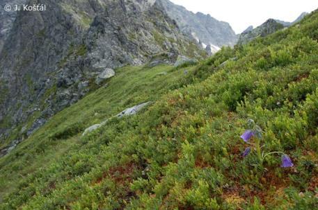

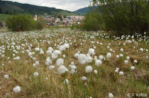


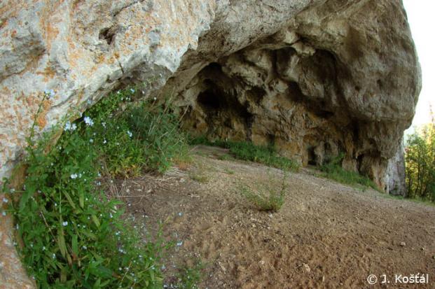


5 Many different habitats in nature Training Implementation of Habitats Directive - Habitats and Plants 5
 Training Implementation of Habitats Directive - Habitats and Plants")
6 Many different habitats need classification Forest Alluvial forest (Salicion albae) Alluvial forest with Salix alba (Salicetum albae) Training Implementation of Habitats Directive - Habitats and Plants 6
 Training Implementation of Habitats Directive - Habitats and")
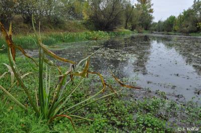
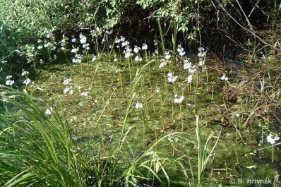
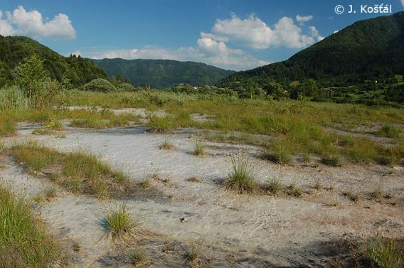
7 Many different habitats need classification 2 Grassland Hay meadow mesic grassland (Arrhenatherion elatioris) Hay meadow mesic grassland with Polygala comosa (Anthoxantho-Agrostietum tenuis) Training Implementation of Habitats Directive - Habitats and Plants 7
8 Habitats classification in EU Palearctic Habitat Classification Hierarchical classification of habitats of European Community elaborated by Devillers and Devillers-Terschuren It is a main backbone for classifications in CORINE-BIOTOPES project. EUNIS (European Nature Information System) Classification Hierarchical comprehensive pan-european system to facilitate the harmonised description and collection of data across Europe elaborated by EEA (European Environmental Agency) in Covers all types of habitats natural, semi-natural and artificial Classification of habitats from Habitat Directive Annex I Covers only natural habitats Hierarchical system but higher levels are for grouping only 8
9 EUNIS habitat type hierarchical view (all habitat types) 9
10 Habitat Annex I Directive hierarchical view (only natural habitats) 10
11 How Habitat Directive defines habitats? Natural habitats means terrestrial or aquatic areas distinguished by geographic, abiotic and biotic features, whether entirely natural or semi-natural. European Nature Information System (EUNIS) addition to this definition: a place where plants or animals normally live, characterized primarily by its physical features (topography, plant or animal physiognomy, soil characteristics, climate, water quality etc.) and secondarily by the species of plants and animals that live there. 11
12 What do mean those names of habitats in the Habitat Directive Annex I? (Or how to identify habitats?) Interpretation Manual of European Union Habitats Elaborated by Habitats Committee in cooperation with national experts Last version is EUR27 from July 2007 (after EUR25, EUR15 and EUR12 versions) Habitats description, characteristic species, correspondence with other classifications, associated habitat types, references 12

13 Example from Interpretation Manual of EU Habitats 13


14 Interpretation of habitats definition on National Catalogues of habitats Designate classification level for habitat/biotope Cover all, not only natural, habitat types of country Very important for field mapping national level 14
15 Habitat mapping Why to map? To be able to delineate SAC (Special Areas of Conservation) To be able to prepare management plans for sites To be able to monitor and report status of habitats/species Member states are required to fulfill these tasks 15
16 Habitat mapping How to map? Habitat mapping methodology requires: 1. Definition of mapping units => list of habitats 2. Definition of mapping objects => field map 3. Choosing correct method for data gathering => field form, steps of field work 4. All mapped data digitalization => mappers and central databases, GIS steps 5. Setting up proper logistic for overall process => personal, financial and time management All points correlate together Everything depends on purpose of mapping 16
17 Habitat mapping 1. Definition of mapping units Level of hierarchical classification have to be designated Biotopes from national catalogue, if exists Or 3 rd level of EUNIS classification Or alliances from Syntaxonomical classification As absolute minimum are habitats from Annex I of Habitat Directive List of mapping units with description and characteristic species is main output of this point 17
18 Habitat mapping 2. Definition of mapping objects The main purpose of this step, is to get information layer, which will be used for identification of habitats in the field Homogenous polygons have to be delineated onto aerial photos Objective delineation of borders of habitat types is in majority cases mission impossible due mosaic and ecotone character of distribution of habitat (vegetation) types. By delineation of homogenous habitats we can use clear physiognomic borders between different habitats (e.g. forest shrub, forest grasslands, terrestrial water habitats). We can use also human made borders as roads, fences, settlements, etc. The mapped polygons will be in majority cases habitat complexes. Aerial photo map with delineated homogenous areas 18

19 Example of habitats field view Training Implementation of Habitats Directive - Habitats and Plants 19
20 Example of habitats bird view Training Implementation of Habitats Directive - Habitats and Plants 20

21 This project is funded by the European Union Example of delineation of homogenous areas Training Implementation of Habitats Directive - Habitats and Plants 21
22 This project is funded by the European Union Example of delineation of homogenous areas 2 Training Implementation of Habitats Directive - Habitats and Plants 22

23 Delineated homogenous areas for field mapping 23


24 Habitat mapping 3. Choosing correct method for data gathering Criteria for evaluation Species list Site inventory Types of biological data Semi-quant. Releves & hab. mapping Pres./abs. Grid sampling Biomass Quantitative charactrtist. Individuals Populations size Sampling area large large medium small small Cost of sampling low low medium high high Precision low low medium high high Statistic evaluation no yes yes yes yes Bias of monitoring results low low medium medium high 24
25 Habitat mapping 3. Choosing correct method for data gathering Field mapping form Detailed steps of mapping 25
26 Example of field mapping form used in field work 26
27 Habitat mapping 4. All mapped data digitalization User friendly mappers databases (MS Access) digital representation of the field form habitat checklist ensure correct entry species checklist correction of typos or synonyms steps for area border correction Data manager database (MS Access) Central database for collecting all mappers data mappers names list GIS environment field maps digitalization 27

28 Example of digitalized field mapping form filled in database 28

29 Habitat mapping 5. Setting up proper logistic for overall process Mapper 1 field mapping Mapper data 2 field mapping Mapper data 3 field Several mapping field forms data Several field forms Several field forms Mapper 1 database Database Mapper form 2 database Database Mapper form 3 database Database form Central Database All mappers databases and their GIS Layers Field map Field map Field map Field map GIS processing DataFlow Manager(s) Outputs Data evaluation Maps of distribution Status monitoring Others
30 Habitats habitat concept, identification, methodology for habitat mapping, organization of mapping Thank you for your attention Rastislav Lasák, GIS and Database Expert, DAPHNE Institute of applied ecology, Slovakia Training Implementation of Habitats Directive - Habitats and Plants
SIF_7.1_v2. Indicator. Measurement. What should the measurement tell us?
 Indicator 7 Area of natural and semi-natural habitat Measurement 7.1 Area of natural and semi-natural habitat What should the measurement tell us? Natural habitats are considered the land and water areas
Directorate E: Sectoral and regional statistics Unit E-4: Regional statistics and geographical information LUCAS 2018.
 EUROPEAN COMMISSION EUROSTAT Directorate E: Sectoral and regional statistics Unit E-4: Regional statistics and geographical information Doc. WG/LCU 52 LUCAS 2018 Eurostat Unit E4 Working Group for Land
HELSINKI COMMISSION Baltic Marine Environment Protection Commission
 HELSINKI COMMISSION Baltic Marine Environment Protection Commission HELCOM RECOMMENDATION 24/10 Adopted 25 June 2003, having regard to Article 20, Paragraph 1 b) of the 1992 Helsinki Convention IMPLEMENTATION
Ecological networks and coherence according to article 10 of the Habitats Directive
 Ecological networks and coherence according to article 10 of the Habitats Directive Introduction Within the scientific community ecological coherence next to habitat quality has long been acknowledged
C o p e r n i c u s L a n d M o n i t o r i n g S e r v i c e
 C o p e r n i c u s L a n d M o n i t o r i n g S e r v i c e Submodule D: stability of protected areas & related pressures: Natura2000 sites Copernicus EU Copernicus EU Copernicus EU www.copernicus.eu
Route to Biotope Data Standardization for the Protected Areas in Turkey
 INSPIRE 2016 CONFERENCE Directorate General for Protection of Natural Assets Directorate General of Geographical Information Systems Route to Biotope Data Standardization for the Protected Areas in Turkey
Discussion paper on spatial units
 Discussion paper on spatial units for the Forum of Experts in SEEA Experimental Ecosystem Accounting 2018 Version: 8 June 2018 Prepared by: SEEA EEA Revision Working Group 1 on spatial units (led by Sjoerd
ARCH PROJET Activity 1 -Synthesis-
 ARCH PROJET Activity 1 -Synthesis- CONTENT 1 ARCH project context... 3 1.1. General context... 3 1.2. The ARCH Project... 3 1.3. The Project ARCH partners... 3 1.4. The ARCH project content... 4 2 Activity
LUCAS: current product and its evolutions
 LUCAS: current product and its evolutions Workshop Land Use and Land Cover products: challenges and opportunities Brussels 15 Nov 2017 Eurostat E4: estat-dl-lucas@ec.europa.eu Contents 1) The context 2)
Estimation of the area of sealed soil using GIS technology and remote sensing
 From the SelectedWorks of Przemysław Kupidura 2010 Estimation of the area of sealed soil using GIS technology and remote sensing Stanisław Białousz Przemysław Kupidura Available at: https://works.bepress.com/przemyslaw_kupidura/14/
Image Interpretation and Landscape Analysis: The Verka River Valley
 Image Interpretation and Landscape Analysis: The Verka River Valley Terms of reference Background The local government for the region of Scania has a need for improving the knowledge about current vegetation
Validation and verification of land cover data Selected challenges from European and national environmental land monitoring
 Validation and verification of land cover data Selected challenges from European and national environmental land monitoring Gergely Maucha head, Environmental Applications of Remote Sensing Institute of
Proposal for a DIRECTIVE OF THE EUROPEAN PARLIAMENT AND OF THE COUNCIL. establishing an infrastructure for spatial information in the Community
 Proposal for a DIRECTIVE OF THE EUROPEAN PARLIAMENT AND OF THE COUNCIL establishing an infrastructure for spatial information in the Community INSPIRE http://inspire.jrc.it/ Alessandro Annoni 1 EU Commission
BIOS 230 Landscape Ecology. Lecture #32
 BIOS 230 Landscape Ecology Lecture #32 What is a Landscape? One definition: A large area, based on intuitive human scales and traditional geographical studies 10s of hectares to 100s of kilometers 2 (1
MEMORANDUM OF UNDERSTANDING FOR THE ESTABLISHMENT OF A CARPATHIAN INTEGRATED BIODIVERSITY INFORMATION SYSTEM
 MEMORUM OF UNDERSTING FOR THE ESTABLISHMENT OF A CARPATHIAN INTEGRATED BIODIVERSITY INFORMATION SYSTEM BETWEEN DAPHNE - INSTITUTE OF APPLIED ECOLOGY (hereinafter referred to DAPHNE) EUROPEAN ACADEMY BOLZANO
Chitra Sood, R.M. Bhagat and Vaibhav Kalia Centre for Geo-informatics Research and Training, CSK HPKV, Palampur , HP, India
 APPLICATION OF SPACE TECHNOLOGY AND GIS FOR INVENTORYING, MONITORING & CONSERVATION OF MOUNTAIN BIODIVERSITY WITH SPECIAL REFERENCE TO MEDICINAL PLANTS Chitra Sood, R.M. Bhagat and Vaibhav Kalia Centre
Land Use and Land cover statistics (LUCAS)
") EUROPEAN COMMISSION EUROSTAT Directorate E: Sectoral and regional statistics Doc. ENV/DIMESA/7.1/2012 Original in EN Agenda point 7.1 Land Use and Land cover statistics (LUCAS) DIMESA Directors' Meeting
EUROPEAN COMMISSION EUROSTAT Directorate E: Sectoral and regional statistics Doc. ENV/DIMESA/7.1/2012 Original in EN Agenda point 7.1 Land Use and Land cover statistics (LUCAS) DIMESA Directors' Meeting
COMBINING ENUMERATION AREA MAPS AND SATELITE IMAGES (LAND COVER) FOR THE DEVELOPMENT OF AREA FRAME (MULTIPLE FRAMES) IN AN AFRICAN COUNTRY:
 FOR THE DEVELOPMENT OF AREA FRAME (MULTIPLE FRAMES) IN AN AFRICAN COUNTRY:") COMBINING ENUMERATION AREA MAPS AND SATELITE IMAGES (LAND COVER) FOR THE DEVELOPMENT OF AREA FRAME (MULTIPLE FRAMES) IN AN AFRICAN COUNTRY: PRELIMINARY LESSONS FROM THE EXPERIENCE OF ETHIOPIA BY ABERASH
COMBINING ENUMERATION AREA MAPS AND SATELITE IMAGES (LAND COVER) FOR THE DEVELOPMENT OF AREA FRAME (MULTIPLE FRAMES) IN AN AFRICAN COUNTRY: PRELIMINARY LESSONS FROM THE EXPERIENCE OF ETHIOPIA BY ABERASH
UNSD SEEA-EEA revision 2020
 UNSD SEEA-EEA revision 2020 Area 1: Spatial units; introduction Sjoerd Schenau, Patrick Bogaart, Edwin Horlings London group meeting, October 2018 Overview Spatial units in SEEA EEA Main revision issues
THE OVERALL EAGLE CONCEPT
 Sentinel Hub THE OVERALL EAGLE CONCEPT GEBHARD BANKO, 30. MAY 2018, COPENHAGEN ISO TC 211, STANDARDS IN ACTION SEMINAR CONTENT Background and Motivation Criteria and Structure of Data Model Semantic decomposition
ESBN. Working Group on INSPIRE
 ESBN Working Group on INSPIRE by Marc Van Liedekerke, Endre Dobos and Paul Smits behalf of the WG members WG participants Marc Van Liedekerke Panos Panagos Borut Vrščaj Ivana Kovacikova Erik Obersteiner
System of Environmental-Economic Accounting. Advancing the SEEA Experimental Ecosystem Accounting. Extent Account (Levels 1 and 2)
") Advancing the SEEA Experimental Ecosystem Accounting Extent Account (Levels 1 and 2) Overview: The Extent Account 1. Learning objectives 2. Review of Level 0 (5m) What is it? Why do we need it? What does
Advancing the SEEA Experimental Ecosystem Accounting Extent Account (Levels 1 and 2) Overview: The Extent Account 1. Learning objectives 2. Review of Level 0 (5m) What is it? Why do we need it? What does
UK Contribution to the European CORINE Land Cover
 Centre for Landscape andwww.le.ac.uk/clcr Climate Research CENTRE FOR Landscape and Climate Research UK Contribution to the European CORINE Land Cover Dr Beth Cole Corine Coordination of Information on
SEEA Experimental Ecosystem Accounting
 SEEA Experimental Ecosystem Accounting Sokol Vako United Nations Statistics Division Training for the worldwide implementation of the System of Environmental Economic Accounting 2012 - Central Framework
EAGLE Data Model and Outcomes of HELM (Harmonised European Land Monitoring)
") EAGLE Data Model and Outcomes of HELM (Harmonised European Land Monitoring) Contribution towards better land information harmonisation and INSPIRE compliance EAGLE working group Stephan Arnold, Barbara
EAGLE Data Model and Outcomes of HELM (Harmonised European Land Monitoring) Contribution towards better land information harmonisation and INSPIRE compliance EAGLE working group Stephan Arnold, Barbara
Mapping of marine habitats in shallow coastal areas in Denmark
 6 th Workshop Seabed Acoustics, Rostock, November 14/15, 2013 P11-1 Mapping of marine habitats in shallow coastal areas in Denmark Dr. Zyad Al-Hamdani Geological Survey of Denmark and Greenland - GEUS
The mapping of habitats: an indispensable tool to the planning and management of protected areas in Catalonia
 The mapping of habitats: an indispensable tool to the planning and management of protected areas in Catalonia Palau de Congressos de Catalunya Barcelona, 27 September 2016 Introduction Agoodcartographic
INSPIRE - A Legal framework for environmental and land administration data in Europe
 INSPIRE - A Legal framework for environmental and land administration data in Europe Dr. Markus Seifert Bavarian Administration for Surveying and Cadastre Head of the SDI Office Bavaria Delegate of Germany
Compact guides GISCO. Geographic information system of the Commission
 Compact guides GISCO Geographic information system of the Commission What is GISCO? GISCO, the Geographic Information System of the COmmission, is a permanent service of Eurostat that fulfils the requirements
INSPIRE Basics. Vlado Cetl European Commission Joint Research Centre. https://ec.europa.eu/jrc/
 INSPIRE Basics Vlado Cetl European Commission Joint Research Centre https://ec.europa.eu/jrc/ Serving society Stimulating innovation Supporting legislation Outline SDI? Why European SDI? INSPIRE Policy
Carpathians Unite mechanism of consultation and cooperation for implementation of the Carpathian Convention
 Carpathians Unite mechanism of consultation and cooperation for implementation of the Carpathian Convention Zbigniew Niewiadomski, UNEP/GRID-Warsaw Centre First Joint Meeting of the Carpathian Convention
Land cover research, applications and development needs in Slovakia
 Land cover research, applications and development needs in Slovakia Andrej Halabuk Institute of Landscape Ecology Slovak Academy of Sciences (ILE SAS) Štefánikova 3, 814 99 Bratislava, Slovakia Institute
structure and function ( quality ) can be assessed based on these observations. Future prospects will be assessed based on natural and anthropogenic
 can be assessed based on these observations. Future prospects will be assessed based on natural and anthropogenic") I. Requirements for monitoring and assessment of the conservation status of Natura 2000 habitat types in The Netherlands Anne M. Schmidt (Alterra; anne.schmidt@wur.nl) The European member states are obliged
I. Requirements for monitoring and assessment of the conservation status of Natura 2000 habitat types in The Netherlands Anne M. Schmidt (Alterra; anne.schmidt@wur.nl) The European member states are obliged
Substance Name: 2,2-bis(4'-hydroxyphenyl)-4- methylpentane EC Number: CAS Number: SUPPORT DOCUMENT FOR IDENTIFICATION OF
-4- methylpentane EC Number: CAS Number: SUPPORT DOCUMENT FOR IDENTIFICATION OF") Substance Name: 2,2-bis(4'-hydroxyphenyl)-4- methylpentane EC Number: 401-720-1 CAS Number: 6807-17-6 SUPPORT DOCUMENT FOR IDENTIFICATION OF 2,2-BIS(4'-HYDROXYPHENYL)-4-METHYLPENTANE AS A SUBSTANCE OF
Substance Name: 2,2-bis(4'-hydroxyphenyl)-4- methylpentane EC Number: 401-720-1 CAS Number: 6807-17-6 SUPPORT DOCUMENT FOR IDENTIFICATION OF 2,2-BIS(4'-HYDROXYPHENYL)-4-METHYLPENTANE AS A SUBSTANCE OF
NATIONAL VEGETATION CLASSIFICATION STANDARD, VERSION 2 WORKING DRAFT
 NATIONAL VEGETATION CLASSIFICATION STANDARD, VERSION 2 WORKING DRAFT Subcommittee Federal Geographic Data Committee SUMMMARY NatureServe version 31 August 2006 INTRODUCTION The United States Federal Geographic
Land Use in the context of sustainable, smart and inclusive growth
 Land Use in the context of sustainable, smart and inclusive growth François Salgé Ministry of sustainable development France facilitator EUROGI vice president AFIGéO board member 1 Introduction e-content+
16540/14 EE/cm 1 DG E 1A
 Council of the European Union Brussels, 5 December 2014 (OR. en) 16540/14 ENV 965 CULT 139 NOTE From: To: Subject: General Secretariat of the Council Delegations Charter of Rome on Natural and Cultural
Object Oriented Classification Using High-Resolution Satellite Images for HNV Farmland Identification. Shafique Matin and Stuart Green
 Object Oriented Classification Using High-Resolution Satellite Images for HNV Farmland Identification Shafique Matin and Stuart Green REDP, Teagasc Ashtown, Dublin, Ireland Correspondence: shafique.matin@teagasc.ie
An Update on Land Use & Land Cover Mapping in Ireland
 An Update on Land Use & Land Cover Mapping in Ireland Progress Towards a National Programme Kevin Lydon k.lydon@epa.ie Office of Environmental Assessment, Environmental Protection Agency, Johnstown Castle,
INSPIRE Directive. Status June 2007
 INSPIRE Directive INfrastructure for SPatial InfoRmation in Europe Status June 2007 European Commission Directorate-General Environment Research, Science and Innovation Unit Rue de la Loi, 200 1049 Brussels
Assessing state-wide biodiversity in the Florida Gap analysis project
 University of Nebraska - Lincoln DigitalCommons@University of Nebraska - Lincoln Nebraska Cooperative Fish & Wildlife Research Unit -- Staff Publications Nebraska Cooperative Fish & Wildlife Research Unit
Progress of UN-GGIM: Europe Working Group A on Core Data
 INSPIRE KEN 13 December 2016 Progress of UN-GGIM: Europe Working Group A on Core Data François Chirié, Dominique Laurent, IGN France Plan Introduction Objectives of the working group with respect to INSPIRE
National Adaptation Geo-information System (NAGiS) project in Hungary
 project in Hungary") National Adaptation Geo-information System (NAGiS) project in Hungary Mr. Péter Kajner Hungarian Mining and Geological Survey (MBFSZ) National Adaptation Center Department CGE webinar: Geo-information
National Adaptation Geo-information System (NAGiS) project in Hungary Mr. Péter Kajner Hungarian Mining and Geological Survey (MBFSZ) National Adaptation Center Department CGE webinar: Geo-information
SDI Development in Georgia. Mari Khardziani Head of International Relations Unit National Agency of Public Registry
 SDI Development in Georgia Mari Khardziani Head of International Relations Unit National Agency of Public Registry Kehl, Germany September 5, 2017 2 National Agency of Public Registry Legal Entity of Public
An internet based tool for land productivity evaluation in plot-level scale: the D-e-Meter system
 An internet based tool for land productivity evaluation in plot-level scale: the D-e-Meter system Tamas Hermann 1, Ferenc Speiser 1 and Gergely Toth 2 1 University of Pannonia, Hungary, tamas.hermann@gmail.com
Draft Resolution X.00
 CONVENTION ON WETLANDS (Ramsar, Iran, 1971) 37 th Meeting of the Standing Committee Gland, Switzerland, 2-6 June 2008 Agenda item 8.8 DOC. SC37-25 Draft Resolution X.00 Biogeographic regionalisation in
Infrastructure for Spatial Information in Europe (INSPIRE)
") Infrastructure for Spatial Information in Europe (INSPIRE) 2011 GISCO Working Party 8-9.3.2012 INSPIRE is about improving access to spatial information: the environment doesn t stop at borders EU Geoportal
Infrastructure for Spatial Information in Europe (INSPIRE) 2011 GISCO Working Party 8-9.3.2012 INSPIRE is about improving access to spatial information: the environment doesn t stop at borders EU Geoportal
Progress of UN-GGIM: Europe Working Group A on Core Data
 PolicyKEN Budapest 29 November 2016 Progress of UN-GGIM: Europe Working Group A on Core Data François Chirié, Dominique Laurent, IGNF Core data context Background and purpose Aim of Work Group A to propose
Open Data meets Big Data
 Open Data meets Big Data Max Craglia, Sven Schade, Anders Friis European Commission Joint Research Centre www.jrc.ec.europa.eu Serving society Stimulating innovation Supporting legislation JRC is Technical
EAGLE concept, as part of the HELM vision
 EAGLE concept, as part of the HELM vision EAGLE working group Barbara Kosztra (Hungary), Stephan Arnold (Germany), Lena Hallin-Pihlatie & Elise Järvenpää (Finland) 16.06.2014 HELM / EAGLE Workshop - INSPIRE
Assessing Michigan s Biological diversity. Michigan Natural Features Inventory MSU Extension
 Assessing Michigan s Biological diversity John Paskus,, Amy Derosier,, Edward Schools, and Helen Enander Michigan Natural Features Inventory MSU Extension Goal Provide scientifically based information
Accounting Units for Ecosystem Accounts Paper prepared by Alessandra Alfieri, Daniel Clarke, and Ivo Havinga United Nations Statistics Division
 DEPARTMENT OF ECONOMIC AND SOCIAL AFFAIRS STATISTICS DIVISION UNITED NATIONS Expert Meeting on Ecosystem Accounts London, UK 5-7 December 2011 Accounting Units for Ecosystem Accounts Paper prepared by
ACRONYMS AREAS COUNTRIES MARINE TERMS
 Natura 2000 ACRONYMS AREAS COUNTRIES MARINE TERMS DEFINITION A European network of protected sites under the European Habitats and Birds Directives, aiming to protect the most valuable and threatened European
Unit 5.2. Ecogeographic Surveys - 1 -
 Ecogeographic Surveys Unit 5.2 Ecogeographic Surveys - 1 - Objectives Ecogeographic Surveys - 2 - Outline Introduction Phase 1 - Project Design Phase 2 - Data Collection and Analysis Phase 3 - Product
Work Group A «Core Data» Report and Update François Chirié, Dominique Laurent, France
 JOINT UN-GGIM: EUROPE ESS MEETING ON THE INTEGRATION OF STATISTICAL AND GEOSPATIAL INFORMATION LUXEMBOURG 11 MARCH 2016 Work Group A «Core Data» Report and Update François Chirié, Dominique Laurent, France
Towards a harmonised land monitoring system: NRC bottom-up activities in EAGLE and HELM H
 B. Kosztra Towards a harmonised land monitoring system: NRC bottom-up activities in EAGLE and HELM H Gebhard Banko Environment Agency Austria Geoland 2 Forum 18.-19. October 2012 Copenhagen 1 1 NRC * opinion
Extent. Level 1 and 2. October 2017
 Extent Level 1 and 2 October 2017 Overview: Extent account 1. Learning objectives 2. Review of Level 0 (5m) 3. Level 1 (Compilers): Concepts (15m) Group exercise and discussion (15m) 4. Level 2 (Data Providers)
LAND COVER CHANGES IN ROMANIA BASED ON CORINE LAND COVER INVENTORY
 LAND COVER CHANGES IN ROMANIA BASED ON CORINE LAND COVER INVENTORY 1990 2012 JENICĂ HANGANU, ADRIAN CONSTANTINESCU * Key-words: CORINE Land Cover inventory, Land cover changes, GIS. Abstract. From 1990
Methodology for an Assessment of Europe's Biodiversity (MN2.1 Sub-Project)
") MN2.1 Report, page 1 Methodology for an Assessment of Europe's Biodiversity (MN2.1 Sub-Project) Final Draft submitted to the European Environment Agency January 1997 by the European Topic Centre on Nature
MN2.1 Report, page 1 Methodology for an Assessment of Europe's Biodiversity (MN2.1 Sub-Project) Final Draft submitted to the European Environment Agency January 1997 by the European Topic Centre on Nature
Geological information for Europe : Towards a pan-european Geological Data Infrastructure
 Geological information for Europe : Towards a pan-european Geological Data Infrastructure Integrating geoscientific information for EU competitiveness Co-funded by the European Union European societal
MESMA: An integrated tool box to support an ecosystem based spatial management of marine areas
 MESMA: An integrated tool box to support an ecosystem based spatial management of marine areas Stelzenmüller, V., Stamford, T., Vassilopoulou, V., Kastanevakis, S., Vincx, M, Vanaverbeke, J., Rabaut, M.,
Resolution XIII.23. Wetlands in the Arctic and sub-arctic
 13th Meeting of the Conference of the Contracting Parties to the Ramsar Convention on Wetlands Wetlands for a Sustainable Urban Future Dubai, United Arab Emirates, 21-29 October 2018 Resolution XIII.23
econtentplus GS Soil
 econtentplus GS Soil General aims Assessment and strategic development of INSPIRE compliant Geodata-Services for European Soil Data BPN on basis of the EU 2007/2/EC (INSPIRE) Directive for Annex III theme
CORINE LAND COVER CROATIA
 CORINE LAND COVER CROATIA INTRO Primary condition in making decisions directed to land cover and natural resources management is presence of knowledge and high quality information about biosphere and its
1.1 What is Site Fingerprinting?
 Site Fingerprinting Utilizing GIS/GPS Technology 1.1 What is Site Fingerprinting? Site fingerprinting is a planning tool used to design communities where protection of natural resources is the primary
Manual Railway Industry Substance List. Version: March 2011
 Manual Railway Industry Substance List Version: March 2011 Content 1. Scope...3 2. Railway Industry Substance List...4 2.1. Substance List search function...4 2.1.1 Download Substance List...4 2.1.2 Manual...5
EUROPEAN DIPLOMA-HOLDING AREAS AND THE GEOPARK INITIATIVE IN HUNGARY
 dr. Rozalia Szekeres Erdine, dr. Annamaria Kopek, Gyorgy Dudas, Jozsef Vers and Imre Szarvas EUROPEAN DIPLOMA-HOLDING AREAS AND THE GEOPARK INITIATIVE IN HUNGARY Ipolytarnóc Novohrad-Nógrád Geopark Tihany
SITMUN: Cooperating to Build Local SDIs in the Barcelona Region
 SITMUN: Cooperating to Build Local SDIs in the Barcelona Region Diputació de Barcelona Territory and Sustainability Area Territorial Information Systems Department INSPIRE CONFERENCE Barcelona, September
THE SEVILLE STRATEGY ON BIOSPHERE RESERVES
 THE SEVILLE STRATEGY ON BIOSPHERE RESERVES 1 VISION FOR BIOSPHERE RESERVES IN THE 21 ST CENTURY The international Seville Conference on Biosphere Reserves, organised by UNESCO, adopted a two-pronged approach,
Presentation of the different land cover mapping activities in the French Guiana
 Presentation of the different land cover mapping activities in the French Guiana LCCS Land Cover Classification System 9 to 13 March 2015 Paramaribo - Suriname INTRODUCTION French Guiana : 8 046 427 ha
National Cartographic Center
 National Cartographic Center NCC activities and accomplishments Activities of national organizations, institutions and universities in field of geomatics Large scale maps Medium scale maps Small scale
Development of Webbased. Tool for Tennessee
 Development of Webbased Farm Mapping Tool for Tennessee Southern Region Water Quality Conference, Oct. 24 2005 Forbes Walker and Alan Jolly Biosystems Engineering and SOIL SCIENCE Nutrient Management Planning
Report on the establishment of UN GGIM: Europe Item 14. 4th session of the Committee of Experts on UN-GGIM
 Report on the establishment of UN GGIM: Europe Item 14 1 Why regional European committees of UN GGIM? In the ECOSOC resolution 2011/24 on the UN GGIM: Emphasizes the importance of promoting national, regional
Conserving freshwater ecosystem values in Tasmania, Australia: identification and application of freshwater conservation management priority areas
 Conserving freshwater ecosystem values in Tasmania, Australia: identification and application of freshwater conservation management priority areas Danielle Hardie 1 and Peter Davies 2 1 Department of Primary
GEOGRAPHY (GE) Courses of Instruction
 Courses of Instruction") GEOGRAPHY (GE) GE 102. (3) World Regional Geography. The geographic method of inquiry is used to examine, describe, explain, and analyze the human and physical environments of the major regions of the
GEOGRAPHY (GE) GE 102. (3) World Regional Geography. The geographic method of inquiry is used to examine, describe, explain, and analyze the human and physical environments of the major regions of the
Development of an International Arctic Observations Assessment Framework
 Development of an International Arctic Observations Assessment Framework Dr. Steven Lev, Dr. Jason Gallo Briefing for the Sustaining Arctic Observing Networks (SAON) April 7, 2017 International Partners
Harmonised approaches for landslide susceptibility mapping in Europe
 Harmonised approaches for landslide susceptibility mapping in Europe J. Hervás Institute for Environment and Sustainability, Joint Research Centre (JRC), European Commission, Ispra, Italy A. Günther Federal
Ecosystem Indicators. Age Poom. Environmental Management Master Course CAU Ecology Centre SS 2006
 Ecosystem Indicators Age Poom Environmental Management Master Course CAU Ecology Centre SS 2006 Indicator definitions Purpose of development and use of indicators Characteristics and requirements of indicators
Land Monitoring Core Service Implementation Group (LMCS IG) - Results and Outlook
 - Results and Outlook") Land Monitoring Core Service Implementation Group (LMCS IG) - Results and Outlook Pr. Dietmar Grünreich, President of BKG, Germany Chairman of the GMES LMCS IG Outline 1 Introduction 2 Preparatory Projects
Land Monitoring Core Service Implementation Group (LMCS IG) - Results and Outlook Pr. Dietmar Grünreich, President of BKG, Germany Chairman of the GMES LMCS IG Outline 1 Introduction 2 Preparatory Projects
Strategies for biodiversity conservation
 Institute of Earth Systems University of Malta Strategies for biodiversity conservation Louis F. Cassar PhD Elisabeth Conrad PhD The conservation imperative: perspective Biodiversity hotspot High endemism
Plan4all (econtentplus project)
") Plan4all (econtentplus project) Karel CHARVAT 1, Tomáš MILDORF 2 1 Help service remote sensing, Ltd., Černoleská 1600, 256 01 Benešov u Prahy, Czech Republic charvat@bnhelp.cz 2 Department of Mathematics
Plan4all (econtentplus project) Karel CHARVAT 1, Tomáš MILDORF 2 1 Help service remote sensing, Ltd., Černoleská 1600, 256 01 Benešov u Prahy, Czech Republic charvat@bnhelp.cz 2 Department of Mathematics
Net Landscape Ecological Potential of Europe. and change Jean-Louis Weber, Rania Spyropoulou, EEA Tomas Soukup, Ferran Páramo, ETCLUSI
 21 April 2008 JLW-SSP Net Landscape Ecological Potential of Europe and change 1990-2000 Jean-Louis Weber, Rania Spyropoulou, EEA Tomas Soukup, Ferran Páramo, ETCLUSI Introduction Ecosystem integrity 1
Spanish national plan for land observation: new collaborative production system in Europe
 ADVANCE UNEDITED VERSION UNITED NATIONS E/CONF.103/5/Add.1 Economic and Social Affairs 9 July 2013 Tenth United Nations Regional Cartographic Conference for the Americas New York, 19-23, August 2013 Item
INSPIRE Monitoring and Reporting Implementing Rule Draft v2.1
 INSPIRE Infrastructure for Spatial Information in Europe INSPIRE Monitoring and Reporting Implementing Rule Draft v2.1 Title INSPIRE Monitoring and Reporting Implementing Rule v2.1 Creator DT Monitoring
UNITED NATIONS E/CONF.96/CRP. 5
 UNITED NATIONS E/CONF.96/CRP. 5 ECONOMIC AND SOCIAL COUNCIL Eighth United Nations Regional Cartographic Conference for the Americas New York, 27 June -1 July 2005 Item 5 of the provisional agenda* COUNTRY
Creating an e-flora for South Africa
 SANBI POLICY DOCUMENT DIVISION: Biosystematics Research and Biodiversity Collections EFFECTIVE DATE: 1 April 2014 Compiler: Marianne le Roux & Janine Victor POLICY NUMBER: LAST AMENDED: Creating an e-flora
Classification of ecosystem types: Experiences and perspectives from Statistics Canada
 Classification of ecosystem types: Experiences and perspectives from Statistics Canada Jennie Wang, François Soulard, Mark Henry, Marcelle Grenier Environmental Accounts and Statistics Program Statistics
Summary Description Municipality of Anchorage. Anchorage Coastal Resource Atlas Project
 Summary Description Municipality of Anchorage Anchorage Coastal Resource Atlas Project By: Thede Tobish, MOA Planner; and Charlie Barnwell, MOA GIS Manager Introduction Local governments often struggle
Country Report of Spain *
 Committee of Experts on Global Geospatial Information Management Second Session New York, United Nations (UN), 13 15 de August de 2012 Country Report of Spain * * Submitted by: Mr. Antonio Arozarena, Deputy
The Infrastructure for Spatial Information in the European Community vs. regional SDI: the shortest way for reaching economic and social development
 The Infrastructure for Spatial Information in the European Community vs. regional SDI: the shortest way for reaching economic and social development Mauro Salvemini EUROGI PRESIDENT Professor at Sapienza
Landslide susceptibility assessment over Europe according to the Tier 1 approach: Experiment and perspectives
 Landslide susceptibility assessment over Europe according to the Tier 1 approach: Experiment and perspectives Andreas Günther 1 & Paola Reichenbach 2 1 Bundesanstalt für Geowissenschaften und Rohstoffe
THE DIGITAL TERRAIN MAP LIBRARY: AN EXPLORATIONIST S RESOURCE
 THE DIGITAL TERRAIN MAP LIBRARY: AN EXPLORATIONIST S RESOURCE By I.C.L. Webster, P.J. Desjardins and W.E. Kilby KEYWORDS: digital terrain maps, digital terrain stability maps, surficial geology, GIS, raster
INTRODUCTION. In March 1998, the tender for project CT.98.EP.04 was awarded to the Department of Medicines Management, Keele University, UK.
 INTRODUCTION In many areas of Europe patterns of drug use are changing. The mechanisms of diffusion are diverse: introduction of new practices by new users, tourism and migration, cross-border contact,
Emerging Trends in Institutional Arrangements Europe - Finland
 Emerging Trends in Institutional Arrangements Europe - Finland Arvo Kokkonen Deputy Director General National Land Survey of Finland 1 Contents Facts about Finland National Land Survey of Finland European
Standardization of the land cover classes using FAO Land Cover Classification System (LCCS)
") Sofia, 17-18 September 2008, LPIS Workshop LPIS applications and quality 1 Standardization of the land cover classes using FAO Land Cover Classification System (LCCS) Pavel MILENOV Agriculture Unit, JRC
Sofia, 17-18 September 2008, LPIS Workshop LPIS applications and quality 1 Standardization of the land cover classes using FAO Land Cover Classification System (LCCS) Pavel MILENOV Agriculture Unit, JRC
Study on Arctic Lay and Traditional Knowledge
 Framework Contract No MARE/2012/07 Support to the Implementation of the Integrated Maritime Policy of the EU Specific Contract No 3 Study on Arctic Lay and Traditional Knowledge 18 October 2013 1 The project
A Case Study for Semantic Translation of the Water Framework Directive and a Topographic Database
 A Case Study for Semantic Translation of the Water Framework Directive and a Topographic Database Angela Schwering * + Glen Hart + + Ordnance Survey of Great Britain Southampton, U.K. * Institute for Geoinformatics,
EU-level landslide susceptibility assessment
 in the context t of the Soil Thematic Strategy t Andreas Günther 1, Miet Van Den Eeckhaut 2, Paola Reichenbach h 3, Javier Hervás 2 & Jean-Philippe Malet 4 1 Federal Institute for Geosciences and Natural
Biodiversity Blueprint Overview
 Biodiversity Blueprint Overview Climate Variability Climate projections for the Glenelg Hopkins Regions suggest that the weather will be hotter and drier in the coming years which will impact on land use,
Landslide Hazard Assessment Methodologies in Romania
 A Scientific Network for Earthquake, Landslide and Flood Hazard Prevention SciNet NatHazPrev Landslide Hazard Assessment Methodologies in Romania In the literature the terms of susceptibility and landslide