An Automated Object-Oriented Satellite Image Classification Method Integrating the FAO Land Cover Classification System (LCCS).
|
|
|
- Avice Watkins
- 5 years ago
- Views:
Transcription
1 An Automated Object-Oriented Satellite Image Classification Method Integrating the FAO Land Cover Classification System (LCCS). Ruvimbo Gamanya Sibanda Prof. Dr. Philippe De Maeyer Prof. Dr. Morgan De Dapper
2 PRESENTATION SCHEDULE Justification Objectives Background Study area and data preprocessing Methodology Results Classification Automation Application on other data types Conclusions and future research directions
3 JUSTIFICATION demand for tangible landscape objects at several scales which are internally relatively homogeneous on which one can apply spatial statistics and, assess changes.. classification quality is directly dependent on the quality of extracted objects or pixels. object-oriented image classification is based on the fact that important semantic information necessary to interpret an image is not represented in single pixels, but in meaningful image objects and their mutual relations. Recent applications of image understanding techniques require increased robustness, better reliability and high automation of the algorithms. In Land Use and Land Cover (LULC) studies automation of the classification process reduces the time input into technical analysis thus making more processed data available to end-users and decision makers.
4 OBJECTIVES To develop a standardized, object-oriented classification method, with automation capabilities. develop a method based on linking object-oriented image analysis with the FAO Land Cover Classification System. test the automation capabilities of this technique on other same-sensor/date images. apply the method on different satellite images.
5 Multi-resolution Image Segmentation (MS) MS is patented procedure for image objects extraction, allowing the segmentation of an image into a network of homogeneous image object primitives at any chosen resolution. MS is a bottom-up region-merging technique starting with one-pixel objects, smaller image objects are merged into bigger ones. Object-Oriented Image Analysis Image object primitives serve as building blocks and information carriers for subsequent classifications. intrinsic features colour, texture and form of objects. topological features geometric relationships between the objects or the whole scene left, right, or being in a certain distance to a certain object. context features objects semantic relationship e.g. a park is almost 100% sorrounded by urban areas.

6


7 . Segmentation with scale parameter: 15 b. Segmentation with scale parameter: 21 c. Thematic layer- Cadastral information d. Final classified objects
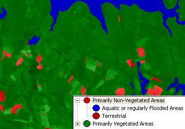
8 Basic Concepts of the FAO LCCS Comprehensive methodology for description, characterization, classification and comparison of most land cover features identified anywhere in the world, at any scale or level of detail Created in response to a need for: A harmonized and standardized collection and reporting on the status of land cover Availability of land cover data for a wide range of applications and users Comparison and correlation of land cover classes between different systems/approaches

9 The LCCS is based on a standardized a priori classification system classes are defined before any data collection actually takes place. The advantage is that classes are standardized independent of the area or means used. All land covers can be accommodated in this highly flexible system; serve as a universally applicable reference base for land cover and land use derived from satellite imagery. contributing towards data harmonization and standardization.

10
11 Class Levels in the Classification Hierachy.


12 STUDY AREA
13 Feature Selection Spectral Information mean standard deviation ratio brightness minimum & maximum values Shape area compactness rectangular fit density shape index. Relational Features Texture (Texture after Haralick) LCCS Classifiers cover water seasonality leaf type and leaf phenology stratification or layering and spatial distribution (macropattern) classifiers
14 LCCS Determine class at dichotomous Level Proceed to class determination at Modular-hierarchical Level ecognition Perform feature selection and threshold values for splitting classes Class names are recorded in legend If field data is present, use known objects to select feature threshold values Perform class-related classification for two classes at any time Record Protocol steps with the best classification result Analyze result, if misclassified objects are present, then go back to threshold refinement Record standardized end-class names with LCCS Map Code, Basic Classifier & Modifier Final classified image & legend produced with same LCCS class names. Other Image Processing Software Perform color matching if necessary for same-day objects Perform radiometric normalization If multi-temporal objects Import georectififed Image Save final protocol and class hierarchy for use in automation Automation Load class Hierarchy & execute protocol x images classified Accuracy Assessment Figure 1. Synopsis of the Method
15 Field Reconnaissance High quality training data are essential for accurate land cover classification of any sort. To insure high spatial and thematic precision of collected data, field sampling was conducted in a GIS framework. For each point, species composition, level and type of management, soil characteristics, topography, forest layers and canopy characteristics were collected. Object Verification Objects were selected systematically based on the use of road transects. At every 20 km point along major roads then identified on the image. Objects extracted from the image were then verified in the field. Threshold determination - objects with different feature values (e.g NDVI values) were used to conclusively determine the threshold values.


16 CLASSIFICATION METHOD


17 Fig. 2a-b. Dichotomous and modular-hierarchical level classification of the ASTER image.


18


19 Fig. 4. Classification of an individual object: Final Class Name - Open (40 (20-10) % Forest (Woodland).


20 AUTOMATION Preliminary Steps Image geo-rectification Colour matching Sun elevation adjustments Scale parameter of 8 ASTER image taken x sec after base image Scale parameter of 20


21 LANDSAT TM CLASSIFICATION
22
23 CONCLUSION AND FUTURE RESEARCH This technique produced highly distinct classes and class definitions are clear and unambiguous. It offers more capabilities due to the large number of classifiers and features available in both LCCS and ecognition, which can be combined. The method will be applied to other satellite data including IKONOS and SPOT images. Change detection employing this object-oriented and standardized approach is under investigation. Thank you!

24
AN INVESTIGATION OF AUTOMATIC CHANGE DETECTION FOR TOPOGRAPHIC MAP UPDATING
 AN INVESTIGATION OF AUTOMATIC CHANGE DETECTION FOR TOPOGRAPHIC MAP UPDATING Patricia Duncan 1 & Julian Smit 2 1 The Chief Directorate: National Geospatial Information, Department of Rural Development and
DEVELOPMENT OF DIGITAL CARTOGRAPHIC DATABASE FOR MANAGING THE ENVIRONMENT AND NATURAL RESOURCES IN THE REPUBLIC OF SERBIA
 DEVELOPMENT OF DIGITAL CARTOGRAPHIC BASE FOR MANAGING THE ENVIRONMENT AND NATURAL RESOURCES IN THE REPUBLIC OF SERBIA Dragutin Protic, Ivan Nestorov Institute for Geodesy, Faculty of Civil Engineering,
Rome, 15 October 2013 III ecognition Day. Development of land cover map based on object-oriented classifiers
 Rome, 15 October 2013 III ecognition Day Development of land cover map based on object-oriented classifiers Introduction Land cover information is generated from remote sensing data through different classification
Object-Oriented Oriented Method to Classify the Land Use and Land Cover in San Antonio using ecognition Object-Oriented Oriented Image Analysis
 Object-Oriented Oriented Method to Classify the Land Use and Land Cover in San Antonio using ecognition Object-Oriented Oriented Image Analysis Jayar S. Griffith ES6973 Remote Sensing Image Processing
Module 2.1 Monitoring activity data for forests using remote sensing
 Module 2.1 Monitoring activity data for forests using remote sensing Module developers: Frédéric Achard, European Commission (EC) Joint Research Centre (JRC) Jukka Miettinen, EC JRC Brice Mora, Wageningen
The Road to Data in Baltimore
 Creating a parcel level database from high resolution imagery By Austin Troy and Weiqi Zhou University of Vermont, Rubenstein School of Natural Resources State and local planning agencies are increasingly
OBJECT BASED IMAGE ANALYSIS FOR URBAN MAPPING AND CITY PLANNING IN BELGIUM. P. Lemenkova
 Fig. 3 The fragment of 3D view of Tambov spatial model References 1. Nemtinov,V.A. Information technology in development of spatial-temporal models of the cultural heritage objects: monograph / V.A. Nemtinov,
Object Based Land Cover Extraction Using Open Source Software
 Object Based Land Cover Extraction Using Open Source Software Abhasha Joshi 1, Janak Raj Joshi 2, Nawaraj Shrestha 3, Saroj Sreshtha 4, Sudarshan Gautam 5 1 Instructor, Land Management Training Center,
Trimble s ecognition Product Suite
 Trimble s ecognition Product Suite Dr. Waldemar Krebs October 2010 Trimble Geospatial in the Image Processing Chain Data Acquisition Pre-processing Manual/Pixel-based Object-/contextbased Interpretation
KNOWLEDGE-BASED CLASSIFICATION OF LAND COVER FOR THE QUALITY ASSESSEMENT OF GIS DATABASE. Israel -
 KNOWLEDGE-BASED CLASSIFICATION OF LAND COVER FOR THE QUALITY ASSESSEMENT OF GIS DATABASE Ammatzia Peled a,*, Michael Gilichinsky b a University of Haifa, Department of Geography and Environmental Studies,
Overview of Remote Sensing in Natural Resources Mapping
 Overview of Remote Sensing in Natural Resources Mapping What is remote sensing? Why remote sensing? Examples of remote sensing in natural resources mapping Class goals What is Remote Sensing A remote sensing
LAND COVER CATEGORY DEFINITION BY IMAGE INVARIANTS FOR AUTOMATED CLASSIFICATION
 LAND COVER CATEGORY DEFINITION BY IMAGE INVARIANTS FOR AUTOMATED CLASSIFICATION Nguyen Dinh Duong Environmental Remote Sensing Laboratory Institute of Geography Hoang Quoc Viet Rd., Cau Giay, Hanoi, Vietnam
COMBINING ENUMERATION AREA MAPS AND SATELITE IMAGES (LAND COVER) FOR THE DEVELOPMENT OF AREA FRAME (MULTIPLE FRAMES) IN AN AFRICAN COUNTRY:
 FOR THE DEVELOPMENT OF AREA FRAME (MULTIPLE FRAMES) IN AN AFRICAN COUNTRY:") COMBINING ENUMERATION AREA MAPS AND SATELITE IMAGES (LAND COVER) FOR THE DEVELOPMENT OF AREA FRAME (MULTIPLE FRAMES) IN AN AFRICAN COUNTRY: PRELIMINARY LESSONS FROM THE EXPERIENCE OF ETHIOPIA BY ABERASH
COMBINING ENUMERATION AREA MAPS AND SATELITE IMAGES (LAND COVER) FOR THE DEVELOPMENT OF AREA FRAME (MULTIPLE FRAMES) IN AN AFRICAN COUNTRY: PRELIMINARY LESSONS FROM THE EXPERIENCE OF ETHIOPIA BY ABERASH
Object-based feature extraction of Google Earth Imagery for mapping termite mounds in Bahia, Brazil
 OPEN ACCESS Conference Proceedings Paper Sensors and Applications www.mdpi.com/journal/sensors Object-based feature extraction of Google Earth Imagery for mapping termite mounds in Bahia, Brazil Sunhui
AGOG 485/585 /APLN 533 Spring Lecture 5: MODIS land cover product (MCD12Q1). Additional sources of MODIS data
. Additional sources of MODIS data") AGOG 485/585 /APLN 533 Spring 2019 Lecture 5: MODIS land cover product (MCD12Q1). Additional sources of MODIS data Outline Current status of land cover products Overview of the MCD12Q1 algorithm Mapping
AGOG 485/585 /APLN 533 Spring 2019 Lecture 5: MODIS land cover product (MCD12Q1). Additional sources of MODIS data Outline Current status of land cover products Overview of the MCD12Q1 algorithm Mapping
A Method to Improve the Accuracy of Remote Sensing Data Classification by Exploiting the Multi-Scale Properties in the Scene
 Proceedings of the 8th International Symposium on Spatial Accuracy Assessment in Natural Resources and Environmental Sciences Shanghai, P. R. China, June 25-27, 2008, pp. 183-188 A Method to Improve the
This is trial version
 Journal of Rangeland Science, 2012, Vol. 2, No. 2 J. Barkhordari and T. Vardanian/ 459 Contents available at ISC and SID Journal homepage: www.rangeland.ir Full Paper Article: Using Post-Classification
GLOBAL/CONTINENTAL LAND COVER MAPPING AND MONITORING
 GLOBAL/CONTINENTAL LAND COVER MAPPING AND MONITORING Ryutaro Tateishi, Cheng Gang Wen, and Jong-Geol Park Center for Environmental Remote Sensing (CEReS), Chiba University 1-33 Yayoi-cho Inage-ku Chiba
A MULTI-SCALE OBJECT-ORIENTED APPROACH TO THE CLASSIFICATION OF MULTI-SENSOR IMAGERY FOR MAPPING LAND COVER IN THE TOP END.
 A MULTI-SCALE OBJECT-ORIENTED APPROACH TO THE CLASSIFICATION OF MULTI-SENSOR IMAGERY FOR MAPPING LAND COVER IN THE TOP END. Tim Whiteside 1,2 Author affiliation: 1 Natural and Cultural Resource Management,
AUTOMATIC LAND-COVER CLASSIFICATION OF LANDSAT IMAGES USING FEATURE DATABASE IN A NETWORK
 AUTOMATIC LAND-COVER CLASSIFICATION OF LANDSAT IMAGES USING FEATURE DATABASE IN A NETWORK G. W. Yoon*, S. I. Cho, G. J. Chae, J. H. Park ETRI Telematics Research Group, Daejeon, Korea (gwyoon, chosi, cbase,
Impacts of sensor noise on land cover classifications: sensitivity analysis using simulated noise
 Impacts of sensor noise on land cover classifications: sensitivity analysis using simulated noise Scott Mitchell 1 and Tarmo Remmel 2 1 Geomatics & Landscape Ecology Research Lab, Carleton University,
IMPROVING REMOTE SENSING-DERIVED LAND USE/LAND COVER CLASSIFICATION WITH THE AID OF SPATIAL INFORMATION
 IMPROVING REMOTE SENSING-DERIVED LAND USE/LAND COVER CLASSIFICATION WITH THE AID OF SPATIAL INFORMATION Yingchun Zhou1, Sunil Narumalani1, Dennis E. Jelinski2 Department of Geography, University of Nebraska,
VISUALIZATION URBAN SPATIAL GROWTH OF DESERT CITIES FROM SATELLITE IMAGERY: A PRELIMINARY STUDY
 CO-439 VISUALIZATION URBAN SPATIAL GROWTH OF DESERT CITIES FROM SATELLITE IMAGERY: A PRELIMINARY STUDY YANG X. Florida State University, TALLAHASSEE, FLORIDA, UNITED STATES ABSTRACT Desert cities, particularly
Joint International Mechanical, Electronic and Information Technology Conference (JIMET 2015)
") Joint International Mechanical, Electronic and Information Technology Conference (JIMET 2015) Extracting Land Cover Change Information by using Raster Image and Vector Data Synergy Processing Methods Tao
Joint International Mechanical, Electronic and Information Technology Conference (JIMET 2015) Extracting Land Cover Change Information by using Raster Image and Vector Data Synergy Processing Methods Tao
CHAPTER 1 THE UNITED STATES 2001 NATIONAL LAND COVER DATABASE
 CHAPTER 1 THE UNITED STATES 2001 NATIONAL LAND COVER DATABASE Collin Homer*, Jon Dewitz, Joyce Fry, and Nazmul Hossain *U.S. Geological Survey (USGS) Center for Earth Resources Observation and Science
Use of Corona, Landsat TM, Spot 5 images to assess 40 years of land use/cover changes in Cavusbasi
 New Strategies for European Remote Sensing, Olui (ed.) 2005 Millpress, Rotterdam, ISBN 90 5966 003 X Use of Corona, Landsat TM, Spot 5 images to assess 40 years of land use/cover changes in Cavusbasi N.
USING GIS CARTOGRAPHIC MODELING TO ANALYSIS SPATIAL DISTRIBUTION OF LANDSLIDE SENSITIVE AREAS IN YANGMINGSHAN NATIONAL PARK, TAIWAN
 CO-145 USING GIS CARTOGRAPHIC MODELING TO ANALYSIS SPATIAL DISTRIBUTION OF LANDSLIDE SENSITIVE AREAS IN YANGMINGSHAN NATIONAL PARK, TAIWAN DING Y.C. Chinese Culture University., TAIPEI, TAIWAN, PROVINCE
Capabilities and Limitations of Land Cover and Satellite Data for Biomass Estimation in African Ecosystems Valerio Avitabile
 Capabilities and Limitations of Land Cover and Satellite Data for Biomass Estimation in African Ecosystems Valerio Avitabile Kaniyo Pabidi - Budongo Forest Reserve November 13th, 2008 Outline of the presentation
Digital Change Detection Using Remotely Sensed Data for Monitoring Green Space Destruction in Tabriz
 Int. J. Environ. Res. 1 (1): 35-41, Winter 2007 ISSN:1735-6865 Graduate Faculty of Environment University of Tehran Digital Change Detection Using Remotely Sensed Data for Monitoring Green Space Destruction
Preparation of LULC map from GE images for GIS based Urban Hydrological Modeling
 International Conference on Modeling Tools for Sustainable Water Resources Management Department of Civil Engineering, Indian Institute of Technology Hyderabad: 28-29 December 2014 Abstract Preparation
Object Oriented Classification Using High-Resolution Satellite Images for HNV Farmland Identification. Shafique Matin and Stuart Green
 Object Oriented Classification Using High-Resolution Satellite Images for HNV Farmland Identification Shafique Matin and Stuart Green REDP, Teagasc Ashtown, Dublin, Ireland Correspondence: shafique.matin@teagasc.ie
Training on national land cover classification systems. Toward the integration of forest and other land use mapping activities.
 Training on national land cover classification systems Toward the integration of forest and other land use mapping activities. Guiana Shield 9 to 13 March 2015, Paramaribo, Suriname Background Sustainable
Land cover classification of QuickBird multispectral data with an object-oriented approach
 Land cover classification of QuickBird multispectral data with an object-oriented approach E. Tarantino Polytechnic University of Bari, Italy Abstract Recent satellite technologies have produced new data
THE REVISION OF 1:50000 TOPOGRAPHIC MAP OF ONITSHA METROPOLIS, ANAMBRA STATE, NIGERIA USING NIGERIASAT-1 IMAGERY
 I.J.E.M.S., VOL.5 (4) 2014: 235-240 ISSN 2229-600X THE REVISION OF 1:50000 TOPOGRAPHIC MAP OF ONITSHA METROPOLIS, ANAMBRA STATE, NIGERIA USING NIGERIASAT-1 IMAGERY 1* Ejikeme, J.O. 1 Igbokwe, J.I. 1 Igbokwe,
Building a validation database for land cover products from high spatial resolution images
 Building a validation database for land cover products from high spatial resolution images The Land Cover project of the ESA Climate Change Initiative Bontemps Sophie 1, Achard Frédéric 2, Lamarche Céline
EFFECT OF ANCILLARY DATA ON THE PERFORMANCE OF LAND COVER CLASSIFICATION USING A NEURAL NETWORK MODEL. Duong Dang KHOI.
 EFFECT OF ANCILLARY DATA ON THE PERFORMANCE OF LAND COVER CLASSIFICATION USING A NEURAL NETWORK MODEL Duong Dang KHOI 1 10 Feb, 2011 Presentation contents 1. Introduction 2. Methods 3. Results 4. Discussion
1st EARSeL Workshop of the SIG Urban Remote Sensing Humboldt-Universität zu Berlin, 2-3 March 2006
 1 AN URBAN CLASSIFICATION APPROACH BASED ON AN OBJECT ORIENTED ANALYSIS OF HIGH RESOLUTION SATELLITE IMAGERY FOR A SPATIAL STRUCTURING WITHIN URBAN AREAS Hannes Taubenböck, Thomas Esch, Achim Roth German
Submitted to: Central Coalfields Limited Ranchi, Jharkhand. Ashoka & Piparwar OCPs, CCL
 Land Restoration / Reclamation Monitoring of more than 5 million cu. m. (Coal + OB) Capacity Open Cast Coal Mines of Central Coalfields Limited Based on Satellite Data for the Year 2013 Ashoka & Piparwar
Land Cover Classification Over Penang Island, Malaysia Using SPOT Data
 Land Cover Classification Over Penang Island, Malaysia Using SPOT Data School of Physics, Universiti Sains Malaysia, 11800 Penang, Malaysia. Tel: +604-6533663, Fax: +604-6579150 E-mail: hslim@usm.my, mjafri@usm.my,
Landuse and Landcover change analysis in Selaiyur village, Tambaram taluk, Chennai
 Landuse and Landcover change analysis in Selaiyur village, Tambaram taluk, Chennai K. Ilayaraja Department of Civil Engineering BIST, Bharath University Selaiyur, Chennai 73 ABSTRACT The synoptic picture
Access to global land cover reference datasets and their suitability for land cover mapping activities
 Access to global land cover reference datasets and their suitability for land cover mapping activities Brice Mora, N.E.Tsendbazar, M.Herold LPVE meeting, Frascati, January 29, 2014 Outlook 1. Background
Urban land cover and land use extraction from Very High Resolution remote sensing imagery
 Urban land cover and land use extraction from Very High Resolution remote sensing imagery Mengmeng Li* 1, Alfred Stein 1, Wietske Bijker 1, Kirsten M.de Beurs 2 1 Faculty of Geo-Information Science and
AUTOMATIC EXTRACTION OF ALUVIAL FANS FROM ASTER L1 SATELLITE DATA AND A DIGITAL ELEVATION MODEL USING OBJECT-ORIENTED IMAGE ANALYSIS
 AUTOMATIC EXTRACTION OF ALUVIAL FANS FROM ASTER L1 SATELLITE DATA AND A DIGITAL ELEVATION MODEL USING OBJECT-ORIENTED IMAGE ANALYSIS Demetre P. Argialas, Angelos Tzotsos Laboratory of Remote Sensing, Department
Research on Topographic Map Updating
 Research on Topographic Map Updating Ivana Javorovic Remote Sensing Laboratory Ilica 242, 10000 Zagreb, Croatia Miljenko Lapaine University of Zagreb, Faculty of Geodesy Kaciceva 26, 10000 Zagreb, Croatia
Combination of Microwave and Optical Remote Sensing in Land Cover Mapping
 Combination of Microwave and Optical Remote Sensing in Land Cover Mapping Key words: microwave and optical remote sensing; land cover; mapping. SUMMARY Land cover map mapping of various types use conventional
IMAGE CLASSIFICATION TOOL FOR LAND USE / LAND COVER ANALYSIS: A COMPARATIVE STUDY OF MAXIMUM LIKELIHOOD AND MINIMUM DISTANCE METHOD
 IMAGE CLASSIFICATION TOOL FOR LAND USE / LAND COVER ANALYSIS: A COMPARATIVE STUDY OF MAXIMUM LIKELIHOOD AND MINIMUM DISTANCE METHOD Manisha B. Patil 1, Chitra G. Desai 2 and * Bhavana N. Umrikar 3 1 Department
Establishment of the watershed image classified rule-set and feasibility assessment of its application
 Establishment of the watershed classified rule-set and feasibility assessment of its application Cheng-Han Lin 1,*, Hsin-Kai Chuang 2 and Ming-Lang Lin 3, Wen-Chao Huang 4 1 2 3 Department of Civil Engineer,
Suitability Mapping For Locating Special Economic Zone
 Suitability Mapping For Locating Special Economic Zone by Sudhir Gupta, Vinay Pandit, K.S.Rajan in Remote Sensing and Photogrammetry Society Conference, 5-7 September 2008, Falmouth, United Kingdom Report
Submitted to Central Coalfields Limited BHURKUNDA OCP, CCL
 Land Restoration / Reclamation Monitoring of Open Cast Coal Mines of Central Coalfields Limited producing less than 5 m cu m. (Coal+ OB) based on Satellite Data for the Year 2013 BHURKUNDA OCP, CCL Submitted
High resolution mapping of urban areas using SPOT-5 images and ancillary data
 International Journal of Environment and Geoinformatics 2(2), 63-76 (2015) High resolution mapping of urban areas using SPOT-5 images and ancillary data Elif Sertel 1*, Semih Sami Akay 2 1 Istanbul Technical
USING LANDSAT IN A GIS WORLD
 USING LANDSAT IN A GIS WORLD RACHEL MK HEADLEY; PHD, PMP STEM LIAISON, ACADEMIC AFFAIRS BLACK HILLS STATE UNIVERSITY This material is based upon work supported by the National Science Foundation under
Land Cover and Asset Mapping Operational Change Detection
 Land Cover and Asset Mapping Operational Change Detection Andreas Müller DLR DFD with the support of Charly Kaufmann, Allan Nielsen, Juliane Huth ESA Oil & Gas Workshop, 13-14 September 2010 Folie 1 TWOPAC
REMOTE SENSING APPLICATION IN FOREST MONITORING: AN OBJECT BASED APPROACH Tran Quang Bao 1 and Nguyen Thi Hoa 2
 REMOTE SENSING APPLICATION IN FOREST MONITORING: AN OBJECT BASED APPROACH Tran Quang Bao 1 and Nguyen Thi Hoa 2 1 Department of Environment Management, Vietnam Forestry University, Ha Noi, Vietnam 2 Institute
Application of Topology to Complex Object Identification. Eliseo CLEMENTINI University of L Aquila
 Application of Topology to Complex Object Identification Eliseo CLEMENTINI University of L Aquila Agenda Recognition of complex objects in ortophotos Some use cases Complex objects definition An ontology
Land cover/land use mapping and cha Mongolian plateau using remote sens. Title. Author(s) Bagan, Hasi; Yamagata, Yoshiki. Citation Japan.
 Bagan, Hasi; Yamagata, Yoshiki. Citation Japan.") Title Land cover/land use mapping and cha Mongolian plateau using remote sens Author(s) Bagan, Hasi; Yamagata, Yoshiki International Symposium on "The Imp Citation Region Specific Systems". 6 Nove Japan.
Title Land cover/land use mapping and cha Mongolian plateau using remote sens Author(s) Bagan, Hasi; Yamagata, Yoshiki International Symposium on "The Imp Citation Region Specific Systems". 6 Nove Japan.
Land cover classification methods
 Land cover classification methods This document provides an overview of land cover classification using remotely sensed data. We will describe different options for conducting land cover classification
AUTOMATED BUILDING DETECTION FROM HIGH-RESOLUTION SATELLITE IMAGE FOR UPDATING GIS BUILDING INVENTORY DATA
 13th World Conference on Earthquake Engineering Vancouver, B.C., Canada August 1-6, 2004 Paper No. 678 AUTOMATED BUILDING DETECTION FROM HIGH-RESOLUTION SATELLITE IMAGE FOR UPDATING GIS BUILDING INVENTORY
Land cover classification methods. Ned Horning
 Land cover classification methods Ned Horning Version: 1.0 Creation Date: 2004-01-01 Revision Date: 2004-01-01 License: This document is licensed under a Creative Commons Attribution-Share Alike 3.0 Unported
Cloud analysis from METEOSAT data using image segmentation for climate model verification
 Cloud analysis from METEOSAT data using image segmentation for climate model verification R. Huckle 1, F. Olesen 2 Institut für Meteorologie und Klimaforschung, 1 University of Karlsruhe, 2 Forschungszentrum
Object-based classification of multi-sensor optical imagery to generate terrain surface roughness information for input to wind risk simulation
 Object-based classification of multi-sensor optical imagery to generate terrain surface roughness information for input to wind risk simulation Alan Forghani*, Bob Cechet**, Krishna Nadimpalli** *Australian
Evaluating performances of spectral indices for burned area mapping using object-based image analysis
 Evaluating performances of spectral indices for burned area mapping using object-based image analysis Taskin Kavzoglu 1 *, Merve Yildiz Erdemir 1, Hasan Tonbul 1 1 Gebze Technical University, Department
SPATIAL AND TEMPORAL MODELLING OF ECOSYSTEM SERVICES
 SPATIAL AND TEMPORAL MODELLING OF ECOSYSTEM SERVICES Solen Le Clec h, T.Decaëns, S. Dufour, M. Grimaldi, N. Jégou and J. Oszwald ACES Conference 2016 Jacksonville, Florida (USA). December, 5-9th : issues
M.C.PALIWAL. Department of Civil Engineering NATIONAL INSTITUTE OF TECHNICAL TEACHERS TRAINING & RESEARCH, BHOPAL (M.P.), INDIA
, INDIA") INVESTIGATIONS ON THE ACCURACY ASPECTS IN THE LAND USE/LAND COVER MAPPING USING REMOTE SENSING SATELLITE IMAGERY By M.C.PALIWAL Department of Civil Engineering NATIONAL INSTITUTE OF TECHNICAL TEACHERS
INVESTIGATIONS ON THE ACCURACY ASPECTS IN THE LAND USE/LAND COVER MAPPING USING REMOTE SENSING SATELLITE IMAGERY By M.C.PALIWAL Department of Civil Engineering NATIONAL INSTITUTE OF TECHNICAL TEACHERS
Vegetation Change Detection of Central part of Nepal using Landsat TM
 Vegetation Change Detection of Central part of Nepal using Landsat TM Kalpana G. Bastakoti Department of Geography, University of Calgary, kalpanagb@gmail.com Abstract This paper presents a study of detecting
HIERARCHICAL IMAGE OBJECT-BASED STRUCTURAL ANALYSIS TOWARD URBAN LAND USE CLASSIFICATION USING HIGH-RESOLUTION IMAGERY AND AIRBORNE LIDAR DATA
 HIERARCHICAL IMAGE OBJECT-BASED STRUCTURAL ANALYSIS TOWARD URBAN LAND USE CLASSIFICATION USING HIGH-RESOLUTION IMAGERY AND AIRBORNE LIDAR DATA Qingming ZHAN, Martien MOLENAAR & Klaus TEMPFLI International
1 Introduction: 2 Data Processing:
 Darren Janzen University of Northern British Columbia Student Number 230001222 Major: Forestry Minor: GIS/Remote Sensing Produced for: Geography 413 (Advanced GIS) Fall Semester Creation Date: November
The Redwood National and State Parks Vegetation Classification and Mapping Project Map Data Sets Completed and Delivered! 1
 The Redwood National and State Parks Vegetation Classification and Mapping Project Map Data Sets Completed and Delivered! 1 By Ken Stumpf and Leonel Arguello The Redwood National and State Parks Vegetation
CONCEPTUAL DEVELOPMENT OF AN ASSISTANT FOR CHANGE DETECTION AND ANALYSIS BASED ON REMOTELY SENSED SCENES
 CONCEPTUAL DEVELOPMENT OF AN ASSISTANT FOR CHANGE DETECTION AND ANALYSIS BASED ON REMOTELY SENSED SCENES J. Schiewe University of Osnabrück, Institute for Geoinformatics and Remote Sensing, Seminarstr.
Accuracy Assessment of Per-Field Classification Integrating Very Fine Spatial Resolution Satellite Imagery with Topographic Data
 Accuracy Assessment of Per-Field Classification Integrating Very Fine Spatial Resolution Satellite Imagery with Topographic Data Mauro CAPRIOLI and Eufemia TARANTINO POLYTECHNIC UNIVERSITY OF BARI Via
VCS MODULE VMD0018 METHODS TO DETERMINE STRATIFICATION
 VMD0018: Version 1.0 VCS MODULE VMD0018 METHODS TO DETERMINE STRATIFICATION Version 1.0 16 November 2012 Document Prepared by: The Earth Partners LLC. Table of Contents 1 SOURCES... 2 2 SUMMARY DESCRIPTION
Regional Centre for Mapping of Resources for Development (RCMRD), Nairobi, Kenya
, Nairobi, Kenya") Regional Centre for Mapping of Resources for Development (RCMRD), Nairobi, Kenya Introduction GIS ( 2 weeks: 10 days) Intakes: 7 th Jan, 4 th Feb,4 th March, 1 st April 6 th May, 3 rd June, 1 st July,
Regional Centre for Mapping of Resources for Development (RCMRD), Nairobi, Kenya Introduction GIS ( 2 weeks: 10 days) Intakes: 7 th Jan, 4 th Feb,4 th March, 1 st April 6 th May, 3 rd June, 1 st July,
LAND USE MAPPING FOR CONSTRUCTION SITES
 LAND USE MAPPING FOR CONSTRUCTION SITES STATEMENT OF THE PROBLEM Monitoring of existing construction sites within the limits of the City of Columbia is a requirement of the city government for: 1) Control
Many of remote sensing techniques are generic in nature and may be applied to a variety of vegetated landscapes, including
 Remote Sensing of Vegetation Many of remote sensing techniques are generic in nature and may be applied to a variety of vegetated landscapes, including 1. Agriculture 2. Forest 3. Rangeland 4. Wetland,
International Journal of Remote Sensing, in press, 2006.
 International Journal of Remote Sensing, in press, 2006. Parameter Selection for Region-Growing Image Segmentation Algorithms using Spatial Autocorrelation G. M. ESPINDOLA, G. CAMARA*, I. A. REIS, L. S.
Defining microclimates on Long Island using interannual surface temperature records from satellite imagery
 Defining microclimates on Long Island using interannual surface temperature records from satellite imagery Deanne Rogers*, Katherine Schwarting, and Gilbert Hanson Dept. of Geosciences, Stony Brook University,
Remote detection of giant reed invasions in riparian habitats: challenges and opportunities for management planning
 Remote detection of giant reed invasions in riparian habitats: challenges and opportunities for management planning Maria do Rosário Pereira Fernandes Forest Research Centre, University of Lisbon Number
Land Cover Project ESA Climate Change Initiative. Processing chain for land cover maps dedicated to climate modellers.
 Land Cover Project ESA Climate Change Initiative Processing chain for land cover maps dedicated to climate modellers land_cover_cci S. Bontemps 1, P. Defourny 1, V. Kalogirou 2, F.M. Seifert 2 and O. Arino
ZRCSAZU. Remote sensing and Earth observation data at ZRC SAZU. dr. Tatjana Veljanovski Atrij ZRC Ljubljana
 ZRCSAZU Remote sensing and Earth observation data at ZRC SAZU dr. Tatjana Veljanovski 2016-06-08 Atrij ZRC Ljubljana Remote Sensing Department Remote Sensing Department 20 years of experience application,
Satellite remote sensing of wildlife habitats using a multi-scale, object-based, decision-tree classifier (MOOSC)
") Satellite remote sensing of wildlife habitats using a multi-scale, object-based, decision-tree classifier (MOOSC) JANET NICHOL, MAN SING WONG Department of Land Surveying and Geo-Informatics, The Hong
Satellite remote sensing of wildlife habitats using a multi-scale, object-based, decision-tree classifier (MOOSC) JANET NICHOL, MAN SING WONG Department of Land Surveying and Geo-Informatics, The Hong
Cell-based Model For GIS Generalization
 Cell-based Model For GIS Generalization Bo Li, Graeme G. Wilkinson & Souheil Khaddaj School of Computing & Information Systems Kingston University Penrhyn Road, Kingston upon Thames Surrey, KT1 2EE UK
DEPENDENCE OF URBAN TEMPERATURE ELEVATION ON LAND COVER TYPES. Ping CHEN, Soo Chin LIEW and Leong Keong KWOH
 DEPENDENCE OF URBAN TEMPERATURE ELEVATION ON LAND COVER TYPES Ping CHEN, Soo Chin LIEW and Leong Keong KWOH Centre for Remote Imaging, Sensing and Processing, National University of Singapore, Lower Kent
o 3000 Hannover, Fed. Rep. of Germany
 1. Abstract The use of SPOT and CIR aerial photography for urban planning P. Lohmann, G. Altrogge Institute for Photogrammetry and Engineering Surveys University of Hannover, Nienburger Strasse 1 o 3000
Community Identification Based on Multispectral Image Classification for Local Electric Power Distribution Systems
 Community Identification Based on Multispectral Image Classification for Local Electric Power Distribution Systems TATIYA LUEMONGKOL and THANATCHAI KULWORAWANICHPONG Power System Research Unit School of
Advanced Image Analysis in Disaster Response
 Advanced Image Analysis in Disaster Response Creating Geographic Knowledge Thomas Harris ITT The information contained in this document pertains to software products and services that are subject to the
ASSESSING THEMATIC MAP USING SAMPLING TECHNIQUE
 1 ASSESSING THEMATIC MAP USING SAMPLING TECHNIQUE University of Tehran, Faculty of Natural Resources, Karaj-IRAN E-Mail: adarvish@chamran.ut.ac.ir, Fax: +98 21 8007988 ABSTRACT The estimation of accuracy
The Positional and Thematic Accuracy for Analysis of Multi-Temporal Satellite Images on Mangrove Areas
 The Positional and Thematic Accuracy for Analysis of Multi-Temporal Satellite Images on Mangrove Areas Paulo Rodrigo Zanin¹, Carlos Antonio O. Vieira² ¹Universidade Federal de Santa Catarina, Campus Universitário
PROANA A USEFUL SOFTWARE FOR TERRAIN ANALYSIS AND GEOENVIRONMENTAL APPLICATIONS STUDY CASE ON THE GEODYNAMIC EVOLUTION OF ARGOLIS PENINSULA, GREECE.
 PROANA A USEFUL SOFTWARE FOR TERRAIN ANALYSIS AND GEOENVIRONMENTAL APPLICATIONS STUDY CASE ON THE GEODYNAMIC EVOLUTION OF ARGOLIS PENINSULA, GREECE. Spyridoula Vassilopoulou * Institute of Cartography
Classification trees for improving the accuracy of land use urban data from remotely sensed images
 Classification trees for improving the accuracy of land use urban data from remotely sensed images M.T. Shalaby & A.A. Darwish Informatics Institute of IT, School of Computer Science and IT, University
Droughts are normal recurring climatic phenomena that vary in space, time, and intensity. They may affect people and agriculture at local scales for
 I. INTRODUCTION 1.1. Background Droughts are normal recurring climatic phenomena that vary in space, time, and intensity. They may affect people and agriculture at local scales for short periods or cover
Object Based Imagery Exploration with. Outline
 Object Based Imagery Exploration with Dan Craver Portland State University June 11, 2007 Outline Overview Getting Started Processing and Derivatives Object-oriented classification Literature review Demo
Managing uncertainty when aggregating from pixels to parcels: context sensitive mapping and possibility theory
 Department of Geography Managing uncertainty when aggregating from pixels to parcels: context sensitive mapping and possibility theory Dr Lex Comber ajc36@le.ac.uk www.le.ac.uk/gg/staff/academic_comber.htm
The Wide Dynamic Range Vegetation Index and its Potential Utility for Gap Analysis
 Summary StatMod provides an easy-to-use and inexpensive tool for spatially applying the classification rules generated from the CT algorithm in S-PLUS. While the focus of this article was to use StatMod
USE OF RADIOMETRICS IN SOIL SURVEY
 USE OF RADIOMETRICS IN SOIL SURVEY Brian Tunstall 2003 Abstract The objectives and requirements with soil mapping are summarised. The capacities for different methods to address these objectives and requirements
URBAN EXPANSION AND ITS ENVIRONMENTAL IMPACT ANALYSIS USING HIGH RESOLUTION REMOTE SENSING DATA: A CASE STUDY IN THE GREATER MANKATO AREA INTRODUCTION
 URBAN EXPANSION AND ITS ENVIRONMENTAL IMPACT ANALYSIS USING HIGH RESOLUTION REMOTE SENSING DATA: A CASE STUDY IN THE GREATER MANKATO AREA Fei Yuan, Assistant Professor Department of Geography Minnesota
CHARACTERIZATION OF THE LAND-COVER AND LAND-USE BY SHAPE DESCRITORS IN TWO AREAS IN PONTA GROSSA, PR, BR. S. R. Ribeiro¹*, T. M.
 CHARACTERIZATION OF THE LAND-COVER AND LAND-USE BY SHAPE DESCRITORS IN TWO AREAS IN PONTA GROSSA, PR, BR S. R. Ribeiro¹*, T. M. Hamulak 1 1 Department of Geography, State University of Ponta Grossa, Brazil
Geographic Information Systems (GIS) in Environmental Studies ENVS Winter 2003 Session III
 in Environmental Studies ENVS Winter 2003 Session III") Geographic Information Systems (GIS) in Environmental Studies ENVS 6189 3.0 Winter 2003 Session III John Sorrell York University sorrell@yorku.ca Session Purpose: To discuss the various concepts of space,
Geographic Information Systems (GIS) in Environmental Studies ENVS 6189 3.0 Winter 2003 Session III John Sorrell York University sorrell@yorku.ca Session Purpose: To discuss the various concepts of space,
A DATA FIELD METHOD FOR URBAN REMOTELY SENSED IMAGERY CLASSIFICATION CONSIDERING SPATIAL CORRELATION
 The International Archives of the Photogrammetry, Remote Sensing and Spatial Information Sciences, Volume XLI-B7, 016 XXIII ISPRS Congress, 1 19 July 016, Prague, Czech Republic A DATA FIELD METHOD FOR
Regional Centre for Mapping of Resources for Development (RCMRD), Nairobi, Kenya
, Nairobi, Kenya") Regional Centre for Mapping of Resources for Development (RCMRD), Nairobi, Kenya Introduction to GIS (2 weeks: 10 days) Intakes: 8 th January, 6 th February, 5th March, 3 rd. April 9 th, May 7 th, June
Regional Centre for Mapping of Resources for Development (RCMRD), Nairobi, Kenya Introduction to GIS (2 weeks: 10 days) Intakes: 8 th January, 6 th February, 5th March, 3 rd. April 9 th, May 7 th, June
ESTIMATION OF LANDFORM CLASSIFICATION BASED ON LAND USE AND ITS CHANGE - Use of Object-based Classification and Altitude Data -
 ESTIMATION OF LANDFORM CLASSIFICATION BASED ON LAND USE AND ITS CHANGE - Use of Object-based Classification and Altitude Data - Shoichi NAKAI 1 and Jaegyu BAE 2 1 Professor, Chiba University, Chiba, Japan.
Methods review for the Global Land Cover 2000 initiative Presentation made by Frédéric Achard on November 30 th 2000
 Methods review for the Global Land Cover 2000 initiative Presentation made by Frédéric Achard on November 30 th 2000 1. Contents Objectives Specifications of the GLC-2000 exercise Strategy for the analysis