Interactive Visualisation of Statistical Data with the CentropeSTATISTICS Cross-Border Geoportal
|
|
|
- Steven Montgomery
- 6 years ago
- Views:
Transcription
 (Planning Association")
1 Interactive Visualisation of Statistical Data with the CentropeSTATISTICS Cross-Border Geoportal Manfred Schrenk Clemens Beyer CORP Consulting, Research, Projects Vienna, Austria on behalf of the Planungsgemeinschaft Ost (PGO) (Planning Association East)
: Burgenland, Lower Austria, Vienna Cities: Eisenstadt, St.")
2 CENTROPE Partner Regions Czech Republic Region: South Moravia City: Brno Slovak Republic Region: Bratislava, Trnava Cities: Bratislava, Trnava Hungary Region (county): Györ-Moson-Sopron, Vas Cities: Györ, Sopron Austria Region (federal states): Burgenland, Lower Austria, Vienna Cities: Eisenstadt, St. Pölten, Vienna Interested: Wiener Neustadt
3 Challenges Centrope MAP Challenges Legal planning responsibilities on different levels Data responsibilities on different levels Administrative boundaries = data boundaries No common data infrastructure available, only isolated applications


4 CentropeMAP Website multi-language website: German English Hungarian Czech Slovak regular newsletter mailings (twice a year)
 map generation on the")
5 CentropeMAP Geoportal datasets come directly from project partners no redundancy, always up-to-date functions: Zoom, Pan, Query, Search, Measurement hundreds of layers for the whole region and sub-regions background maps from simplified views to high-resolution satellite images and aerial views (ortho-photos) map generation on the fly

6 Examples elevation, road network, railway network, urban fabric, inland waters

7 Examples satellite image

8 Examples 3D view by semi-transparent hillshade over satellite image

9 Examples Corine Land Cover Level 2 (Lake Neusiedl area)


")
10 Examples European Urban Atlas (Vienna Region)
 Czech Republic: CZSO Czech Statistical Office Český statistický úřad (ČSÚ)")
11 CentropeSTATISTICS: Project Partners CentropeSTATISTICS is a cross-border database project of these co-operating statistics offices/departments in the Centrope Region (on behalf of PGO Planungsgemeinschaft Ost/Eastern Austrian Planning Association, and technically led by CORP COnsulting Research Projects) Czech Republic: CZSO Czech Statistical Office Český statistický úřad (ČSÚ) Slovak Republic: Statistical Office of the SR Štatistický úrad Slovenskej republiky Hungary: HCSO - Hungarian Central Statistical Office KSH Központi Statisztikai Hivatal Austria: Statistics Departments of the three Austrian federal states Burgenland, Lower Austria and Vienna Workshops: national meetings of Austrian statistician group and international workshops with partners from all countries (every year)

12 CentropeSTATISTICS-Funktionen Viele Daten in Zeitreihen verfügbar Karten- und Diagrammerzeugung benutzerdefinierte Steuerung von Inhalt und Layout Speicher- und Exportmöglichkeit Dynamische Datenbankabfragen Kartenerzeugung on the fly


13 CentropeSTATISTICS-Benutzerschnittstelle Kartenerzeugung on the fly
14 CentropeSTATISTICS Data Annual population data Population by five-year age groups, total Population by five-year age groups, female Population by five-year age groups, male Population Indicator: Migration Balance since 2002 Immigration, emigration, migration balance (absolute) Population: Births and Deaths by year Number of births by period and territory Number of deaths by period and territory Population by year Population Indicators (age groups) Population density (inhabitants per square kilometre) by year Population Indicators: Population Change by year


 to be continued.")
15 CentropeSTATISTICS Data Census Data 2011 Marital status of population by year Education of population by municipality Population by economic activity and year Breakdown of economically active population by type of activity Economically active persons by NACE sector of activity Commuters in and out by municipality Buildings per municipality by building period Population by Citizenship (AT, CZ, HU, SK, EU, other) to be continued... Harmonised Datasets for 4 Countries
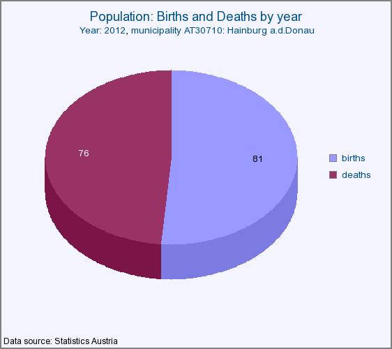


16 CentropeSTATISTICS Charts pie charts bar charts columns charts line charts Live Chart Creation point charts
17 Thank you for your attention! Manfred Schrenk Clemens Beyer
Cross-Border Geodata Infrastructure with User-Defined Thematic Maps
 Cross-Border Geodata Infrastructure with User-Defined Thematic Maps Manfred Schrenk* Clemens Beyer* Walter Pozarek** * CEIT ALANOVA Central European Institute of Technology, Dept. for Urbanism, Transport,
CentropeMAP and CentropeSTATISTICS Cross-Border Geodata Infrastructure with User-Defined Thematic Maps
 CentropeMAP and CentropeSTATISTICS Cross-Border Geodata Infrastructure with User-Defined Thematic Maps on behalf of the Planungsgemeinschaft Ost (PGO) (Eastern Austrian Planning Association) Manfred Schrenk*
CentropeSTATISTICS Working Interactively with Cross-Border Statistic Data Clemens Beyer, Walter Pozarek, Manfred Schrenk
 Clemens Beyer, Walter Pozarek, Manfred Schrenk (Dipl.-Ing. Clemens Beyer, CEIT ALANOVA, Concorde Business Park 2/F, 2320 Schwechat, Austria, c.beyer@ceit.at) (Dipl.-Ing. Walter Pozarek, PGO Planungsgemeinschaft
Figure 1: The Centrope Region. Source: April 2010.
 CentropeMAP and CentropeSTATISTICS Cross-Border Geodata Infrastructure with User-Defined Thematic Maps Clemens Beyer, Walter Pozarek, Manfred Schrenk (Dipl.-Ing. Clemens Beyer, CEIT ALANOVA gemeinnützige
Bratislava Umland Management
 Bratislava Umland Management Coordination of the spatial development of the city of Bratislava and the neighboring Austrian municipalities Metropolisation of River basins, between threats and opportunities
Fragmented competences, for example: spatial planning
 Fragmented competences, for example: spatial planning Republic / Federal Chancellery, Austrian Conference on Spatial Planning (ÖROK): Strategy Provinces (Bundesländer): Legislation, supervision monitoring
European Landscape Convention in the Slovak Republic
 13th COUNCIL OF EUROPE MEETING OF THE WORKSHOPS FOR THE EUROPEAN LANDSCAPE CONVENTION European Landscape Convention in the Slovak Republic Mrs. Ida Vanáková, state advisor, Department of Spatial Planning
Compact guides GISCO. Geographic information system of the Commission
 Compact guides GISCO Geographic information system of the Commission What is GISCO? GISCO, the Geographic Information System of the COmmission, is a permanent service of Eurostat that fulfils the requirements
State of the Art. in Spatial Planning Data Harmonisation & Spatial Data Infrastructure (SDI) Julia Neuschmid, CEIT ALANOVA
 Julia Neuschmid, CEIT ALANOVA") INSPIRE Conference, June 2010, Krakow State of the Art in Spatial Planning Data Harmonisation & Spatial Data Infrastructure (SDI) Julia Neuschmid, CEIT ALANOVA Co-funded by the Community programme econtentplus
INSPIRE Conference, June 2010, Krakow State of the Art in Spatial Planning Data Harmonisation & Spatial Data Infrastructure (SDI) Julia Neuschmid, CEIT ALANOVA Co-funded by the Community programme econtentplus
Schwechat
 Schwechat 08.04.2014 1 Fragmented competences, for example: spatial planning Republic / Federal Chancellery, Austrian Conference on Spatial Planning (ÖROK): Strategy Provinces (Bundesländer): Legislation,
The Governance of Land Use
 The Governance of Land Use Country fact sheet Austria The planning system Levels of government and their responsibilities Austria is a federal state with three levels of government; the national level,
The Governance of Land Use
 The Governance of Land Use Country fact sheet Czech Republic The planning system Levels of government and their responsibilities The Czech Republic is a unitary state with 3 levels of government: the national
INTEGRATED HEAVY RAIN RISK MANAGEMENT
 INTEGRATED HEAVY RAIN RISK MANAGEMENT Newsletter #1 June 2017 November 2017 RAINMAN finally started 2 What do we plan to do 3 Kick-off meeting in Vienna 5 Scoping workshop on risk assessment and mapping
INSPIRE Basics. Vlado Cetl European Commission Joint Research Centre. https://ec.europa.eu/jrc/
 INSPIRE Basics Vlado Cetl European Commission Joint Research Centre https://ec.europa.eu/jrc/ Serving society Stimulating innovation Supporting legislation Outline SDI? Why European SDI? INSPIRE Policy
Newsletter. Nr. 5 / June Special Issue HLanData Pilot Projects
 Nr. 5 / June 2012 Newsletter Special Issue HLanData Pilot Projects Pilot 1: Land Use and Land Cover Data Analysis System for Intermediate-Level Users The main objective of PILOT 1 is to demonstrate the
POPULATION ATLAS OF SLOVAKIA
 POPULATION ATLAS OF SLOVAKIA Jozef Mládek Department of Human Geography and Demogeography Faculty of Nature Sciences Comenius University Bratislava mladek@fns.uniba.sk Jana Marenčáková University of Central
Globally Estimating the Population Characteristics of Small Geographic Areas. Tom Fitzwater
 Globally Estimating the Population Characteristics of Small Geographic Areas Tom Fitzwater U.S. Census Bureau Population Division What we know 2 Where do people live? Difficult to measure and quantify.
New Prospects for Peripheral Rural Regions Helmut Hiess Glasgow, 19th of May 2010
 New Prospects for Peripheral Rural Regions Helmut Hiess Glasgow, 19th of May 2010 ÖROK: Organisation & Tasks Austrian Conference on Spatial Planning (ÖROK, since 1971): Joint organisation by Federal level,
The Governance of Land Use
 The planning system Levels of government and their responsibilities The Governance of Land Use Country fact sheet Germany Germany is a federal country with four levels of government. Below the national
The Governance of Land Use
 The Governance of Land Use COUNTRY FACT SHEET SPAIN The planning system Levels of government and their responsibilities Spain is defined by the OECD as a quasi-federal state with 4 levels of government;
Spatial information for urban planning and management case study Zagreb Darko ŠIŠKO, Vlado CETL, Tomislav CICELI. Strasbourg, September 7th, 2017
 Spatial information for urban planning and management case study Zagreb Darko ŠIŠKO, Vlado CETL, Tomislav CICELI Strasbourg, September 7th, 2017 Contents: Cities & INSPIRE Cities in Croatian NSDI City
WMO/WWRP FDP: INCA CE
 WMO/WWRP FDP: INCA CE Yong Wang ZAMG, Austria This project is implemented through the CENTRAL EUROPE Programme co-financed by the ERDF INCA CE: implementation over Central Europe A Nowcasting Initiative
Carpathians Unite mechanism of consultation and cooperation for implementation of the Carpathian Convention
 Carpathians Unite mechanism of consultation and cooperation for implementation of the Carpathian Convention Zbigniew Niewiadomski, UNEP/GRID-Warsaw Centre First Joint Meeting of the Carpathian Convention
Interoperability of Spatial Planning Data
 INSPIRE Conference 2010, Krakow, Poland Interoperability of Spatial Planning Data European Network of Best Practices for Interoperability of Spatial Planning Information Tomas Mildorf mildorf@centrum.cz
Techniques for Science Teachers: Using GIS in Science Classrooms.
 Techniques for Science Teachers: Using GIS in Science Classrooms. After ESRI, 2008 GIS A Geographic Information System A collection of computer hardware, software, and geographic data used together for
The Governance of Land Use
 The planning system Levels of government and their responsibilities The Governance of Land Use COUNTRY FACT SHEET NORWAY Norway is a unitary state with three levels of government; the national level, 19
SDI Implementation at the Local Administration Level of Germany
 Hartmut MÜLLER and Stephan von St. VITH, Germany Key words: SDI, Municipality, egovernment, Geospatial Basic Data SUMMARY Germany is a federal republic consisting of 16 states (so called "Laender"). At
How can we assure that local decision makers have the right statistics
 How can we assure that local decision makers have the right statistics Petra Kuncová Czech Statistical Office How can we assure.? 1. We have to be in contact with regional users incl. local decision makers
BUILDING SOUND AND COMPARABLE METRICS FOR SDGS: THE CONTRIBUTION OF THE OECD DATA AND TOOLS FOR CITIES AND REGIONS
 BUILDING SOUND AND COMPARABLE METRICS FOR SDGS: THE CONTRIBUTION OF THE OECD DATA AND TOOLS FOR CITIES AND REGIONS STATISTICAL CAPACITY BUILDING FOR MONITORING OF SUSTAINABLE DEVELOPMENT GOALS Lukas Kleine-Rueschkamp
GRID map of Household and Population data in Kosovo. European Forum for Geostatistics, 5 7 October 2009, in The Hague, Netherlands
 GRID map of Household and Population data in Kosovo European Forum for Geostatistics, 5 7 October 2009, in The Hague, Netherlands SUMMARY Introduction Data sources Methods Results, & Maps WebGIS Description
Pegaso map viewer workshop
 PEGASO / 05 Deliverable Plan 2010-12-23 Pegaso Project People for Ecosystem based Governance in Assessing Sustainable development of Ocean and coast Funded by the European Union under FP7 ENV.2009.2.2.1.4
GEOGRAPHICAL NAMES AS PART OF THE GLOBAL, REGIONAL AND NATIONAL SPATIAL DATA INFRASTRUCTURES
 GEOGRAPHICAL NAMES AS PART OF THE GLOBAL, REGIONAL AND NATIONAL SPATIAL DATA INFRASTRUCTURES Željko HEĆIMOVIĆ, Željka JAKIR, Zvonko ŠTEFAN, Danijela KUKIĆ zeljko.hecimovic@cgi.hr, zeljka.jakir@cgi.hr,
Sustainable and Harmonised Development for Smart Cities The Role of Geospatial Reference Data. Peter Creuzer
 Sustainable and Harmonised Development for Smart Cities The Role of Geospatial Reference Data Peter Creuzer 1. Introduction - Smart Cities and Geodata 2. Geodata in Germany 3. Examples 4. Data and Service
Grant Agreement No. EIE/07/595/SI BEn
 Biomass energy register for sustainable site development for European regions Grant Agreement No. EIE/07/595/SI2.499697 BEn Biomass energy register for sustainable site development for European regions
INCA CE: Integrating Nowcasting with crisis management and risk prevention in a transnational framework
 INCA CE: Integrating Nowcasting with crisis management and risk prevention in a transnational framework Yong Wang ZAMG, Austria This project is implemented through the CENTRAL EUROPE Programme co-financed
SPATIAL ANALYSIS OF POPULATION DATA BASED ON GEOGRAPHIC INFORMATION SYSTEM
 SPATIAL ANALYSIS OF POPULATION DATA BASED ON GEOGRAPHIC INFORMATION SYSTEM Liu, D. Chinese Academy of Surveying and Mapping, 16 Beitaiping Road, Beijing 100039, China. E-mail: liudq@casm.ac.cn ABSTRACT
Plan4all (econtentplus project)
") Plan4all (econtentplus project) Karel CHARVAT 1, Tomáš MILDORF 2 1 Help service remote sensing, Ltd., Černoleská 1600, 256 01 Benešov u Prahy, Czech Republic charvat@bnhelp.cz 2 Department of Mathematics
Plan4all (econtentplus project) Karel CHARVAT 1, Tomáš MILDORF 2 1 Help service remote sensing, Ltd., Černoleská 1600, 256 01 Benešov u Prahy, Czech Republic charvat@bnhelp.cz 2 Department of Mathematics
Land Use Planning and Agriculture: Austrian Experiences and Challenges I
 Land Use Planning and Agriculture: Austrian Experiences and Challenges I SULANET Summer School 2016 Walter Seher BOKU Vienna 1 Land Use Planning and Agriculture 2 Land Use Planning and Agriculture Agriculture
Labour Market Areas in Italy. Sandro Cruciani Istat, Italian National Statistical Institute Directorate for territorial and environmental statistics
 Labour Market Areas in Italy Sandro Cruciani Istat, Italian National Statistical Institute Directorate for territorial and environmental statistics Workshop on Developing European Labour Market Areas Nuremberg,
BURGAS CASE STUDY: LAND-SEA INTERACTIONS
 BURGAS CASE STUDY: LAND-SEA INTERACTIONS Dr. Margarita Stancheva IO-BAS, Bulgaria Name of presentation CROSS BORDER MARITIME SPATIAL PLANNING IN THE BLACK SEA ROMANIA AND BULGARIA (MARSPLAN BS) Project
How proximity to a city influences the performance of rural regions by Lewis Dijkstra and Hugo Poelman
 n 01/2008 Regional Focus A series of short papers on regional research and indicators produced by the Directorate-General for Regional Policy Remote Rural Regions How proximity to a city influences the
I&CLC2000 in support to new policy initiatives (INSPIRE, GMES,..)
") I&CLC2000 in support to new policy initiatives (INSPIRE, GMES,..) Manfred Grasserbauer, Director Joint Research Centre Institute for Environment and Sustainability 1 IMAGE 2000 European mosaic of satellite
I&CLC2000 in support to new policy initiatives (INSPIRE, GMES,..) Manfred Grasserbauer, Director Joint Research Centre Institute for Environment and Sustainability 1 IMAGE 2000 European mosaic of satellite
Model development for WebAtlas system applying in administration management.
 Model development for WebAtlas system applying in administration management. Bui Ngoc Quy, Vo Ngọc Dung, Nguyen Danh Duc, University of mining and geology, Viet Nam Key words: Webatlas, Web Map, Electronic
Prediction of land use and transport changes in dynamic environments modelling the bipolar Vienna Bratislava metropolitan region
 Prediction of land use and transport changes in dynamic environments modelling the bipolar Vienna Bratislava metropolitan region CUPUM 07 11-13 July 2007 Iguassu Falls, Brasilia The region Vienna Bratislava:
SITMUN: Cooperating to Build Local SDIs in the Barcelona Region
 SITMUN: Cooperating to Build Local SDIs in the Barcelona Region Diputació de Barcelona Territory and Sustainability Area Territorial Information Systems Department INSPIRE CONFERENCE Barcelona, September
Urban-rural relations in Europe
 Urban-rural relations in Europe Typology of urban and rural characteristics developed by the ESPON 1.1.2 project Kaisa Schmidt-Thomé 14.12.2006 Sevilla JRC/IPTS Rural typologies -workshop ESPON 2006 Programme
Cross-border territorial monitoring: Luxembourg
 Cross-border territorial monitoring: Luxembourg Thierry Hengen Policy Advisor on cross-border development and observation Project manager GIS-GR Ministry of Sustainable Development and Infrastructure -
Eurostat regional yearbook using statistical maps and graphs to tell a story. Teodóra Brandmüller and Åsa Önnerfors, Eurostat
 Eurostat regional yearbook 2015 - using statistical maps and graphs to tell a story Teodóra Brandmüller and Åsa Önnerfors, Eurostat Gross domestic product (GDP) at current market prices per inhabitant
The Added Value of Geospatial Data in a Statistical Office. Pedro Diaz Munoz Director Sectoral and Regional Statistics EUROSTAT European Commission
 The Added Value of Geospatial Data in a Statistical Office Pedro Diaz Munoz Director Sectoral and Regional Statistics EUROSTAT European Commission Why integrate Responsibility of all the information we
Development of modal split modeling for Chennai
 IJMTES International Journal of Modern Trends in Engineering and Science ISSN: 8- Development of modal split modeling for Chennai Mr.S.Loganayagan Dr.G.Umadevi (Department of Civil Engineering, Bannari
Understanding China Census Data with GIS By Shuming Bao and Susan Haynie China Data Center, University of Michigan
 Understanding China Census Data with GIS By Shuming Bao and Susan Haynie China Data Center, University of Michigan The Census data for China provides comprehensive demographic and business information
1 ST High Level Forum on United Nations Global Geoespatial Information Management GEOGRAPHIC REFERENCING OF ECONOMIC UNITS. México
 1 ST High Level Forum on United Nations Global Geoespatial Information Management Thematic Seminar 27 October, Korea 2011. GEOGRAPHIC REFERENCING OF ECONOMIC UNITS México CONTENTS Introduction Census Cartography
Work Packages. RECROS Project development workshop. Prague, 30 th April 2015
 Work Packages Prague, 30 th April 2015 Main principles - remarks Protected areas, regions, cities, not only comparison cities/rural areas HU most of cities have their climate strategies good contacts to
INSPIRE - A Legal framework for environmental and land administration data in Europe
 INSPIRE - A Legal framework for environmental and land administration data in Europe Dr. Markus Seifert Bavarian Administration for Surveying and Cadastre Head of the SDI Office Bavaria Delegate of Germany
Coimisiún na Scrúduithe Stáit State Examinations Commission
 Coimisiún na Scrúduithe Stáit State Examinations Commission LEAVING CERTIFICATE EXAMINATION GEOGRAPHY HIGHER LEVEL SAMPLE PAPER N.B. Remember to return this paper with your answer-book. Otherwise, marks
epub WU Institutional Repository
 epub WU Institutional Repository Karl-Johan Lundquist and Michaela Trippl Towards Cross-Border Innovation Spaces. A theoretical analysis and empirical comparison of the Öresund region and the Centrope
Measures Also Significant Factors of Flood Disaster Reduction
 Non-Structual Measures Also Significant Factors of Flood Disaster Reduction Babiaková Gabriela, Leškov ková Danica Slovak Hydrometeorological Institute, Bratislava Hydrological Forecasts and Warning Department
Spotlight on Population Resources for Geography Teachers. Pat Beeson, Education Services, Australian Bureau of Statistics
 Spotlight on Population Resources for Geography Teachers Pat Beeson, Education Services, Australian Bureau of Statistics Population Population size Distribution Age Structure Ethnic composition Gender
Sharing soil information with the help of INSPIRE, key challenges with soil data management
 Sharing soil information with the help of INSPIRE, key challenges with soil data management Katharina Feiden e-mail: gssoil@portalu.de GS Soil: project outline GS Soil: Assessment and strategic development
CENSUS MAPPING WITH GIS IN NAMIBIA. BY Mrs. Ottilie Mwazi Central Bureau of Statistics Tel: October 2007
 CENSUS MAPPING WITH GIS IN NAMIBIA BY Mrs. Ottilie Mwazi Central Bureau of Statistics E-mail: omwazi@npc.gov.na Tel: + 264 61 283 4060 October 2007 Content of Presentation HISTORICAL BACKGROUND OF CENSUS
BURGAS CASE STUDY: LAND-SEA INTERACTIONS. Dr. Margarita Stancheva
 BURGAS CASE STUDY: LAND-SEA INTERACTIONS Dr. Margarita Stancheva Name of presentation NEED FOR COHERENCE BETWEEN LAND AND SEA ACTIVITIES Name presenter Burgas is the fourth largest city in Bulgaria and
The Governance of Land Use
 The planning system The Governance of Land Use United Kingdom Levels of government and their responsibilities The United Kingdom is a unitary state with three devolved governments in Northern Ireland,
Database integration ti
 The Project EuroGeoNames Created by Dutch- and German-speaking Division (DGSD) of United Nations Group of Experts on Geographical Names (UNGEGN) Database integration ti Database source scale Database updating
Key Indicators for Territorial Cohesion and Spatial Planning in Preparing Territorial Development Strategies
 ESPON Evidence in a North European Context Challenges and Opportunities for Territorial Development and Cohesion in a North European Macro Region, 10-11 April, 2014, Vilnius, Lithuania Key Indicators for
INCA-CE: The Challenge of Severe Weather Warnings. Yong Wang, ZAMG
 INCA-CE: The Challenge of Severe Weather Warnings Yong Wang, ZAMG Severe Weather and Impact The need of civil society and economy Save Life! Save Cost! Reduce Risks and impacts! The Challenge of Severe
AP Human Geography AP EXAM Free Response Questions and Possible Future Questions
 AP Human Geography AP EXAM Free Response Questions and Possible Future Questions FRQ Exam Questions: Population & Migration 2003- European Migration and Demographic Transition Model 2004- Population Pyramids
Atlas on spatial structures and processes in the Alps
 Atlas on spatial structures and processes in the Alps Third project meeting in Grenoble on 25 th -27 th of January 2007 Content Overall goals / Addressed persons Basic conditions (financial and time conditions,
SPIMA Spatial dynamics and strategic planning in metropolitan areas
 Targeted Analysis SPIMA Spatial dynamics and strategic planning in metropolitan areas Executive Summary Conference version 1 February 2018 0 1. Background To address the challenges of metropolitan development
The Governance of Land Use
 The Governance of Land Use Country fact sheet Poland The planning system Levels of government and their responsibilities Poland has 4 levels of government; the national government, 16 regional governments
Emerging Trends in Institutional Arrangements Europe - Finland
 Emerging Trends in Institutional Arrangements Europe - Finland Arvo Kokkonen Deputy Director General National Land Survey of Finland 1 Contents Facts about Finland National Land Survey of Finland European
Status of implementation of the INSPIRE Directive 2016 Country Fiches. COUNTRY FICHE Estonia
 Status of implementation of the INSPIRE Directive 2016 Country Fiches COUNTRY FICHE Estonia Introduction... 1 1. State of Play... 2 1.1 Coordination... 2 1.2 Functioning and coordination of the infrastructure...
CHANGES IN THE STRUCTURE OF POPULATION AND HOUSING FUND BETWEEN TWO CENSUSES 1 - South Muntenia Development Region
 TERITORIAL STATISTICS CHANGES IN THE STRUCTURE OF POPULATION AND HOUSING FUND BETWEEN TWO CENSUSES 1 - South Muntenia Development Region PhD Senior Lecturer Nicu MARCU In the last decade, a series of structural
How to Construct Urban Three Dimensional GIS Model based on ArcView 3D Analysis
 How to Construct Urban Three Dimensional GIS Model based on ArcView 3D Analysis Ko Ko Lwin Division of Spatial Information Science Graduate School of Life and Environmental Sciences University of Tsukuba
European Regional and Urban Statistics
 European Regional and Urban Statistics Dr. Berthold Feldmann berthold.feldmann@ec.europa.eu Eurostat Structure of the talk Regional statistics in the EU The tasks of Eurostat Regional statistics Urban
Dar es Salaam - Reality Check Workshop
 Dar es Salaam - Reality Check Workshop hosted by GIZ and Dar es Salaam City Council Introduction: Key Urban Characteristics of Dar es Salaam Challenges and Opportunities for Resilient Development in the
City definitions. Sara Ben Amer. PhD Student Climate Change and Sustainable Development Group Systems Analysis Division
 City definitions Sara Ben Amer PhD Student Climate Change and Sustainable Development Group Systems Analysis Division sbea@dtu.dk Contents 1. Concept of a city 2. Need for the city definition? 3. Challenges
Andrea Uszkai. László Jóna THE AUTOMOTIVE INDUSTRY REGIONAL DEVELOPMENT CHALLENGES IN CENTRAL AND EASTERN EUROPE
 September, th International Academic Conference, Antibes ISBN 978-8-8797--, IISES Andrea Uszkai HAS Centre for Economic and Regional Studies Institute of Regional Studies West-Hungarian Scientific Department,
The SDI-EDU project: Towards INSPIRE Awareness Raising on Example of Spatial Data Harmonization
 The SDI-EDU project: Towards INSPIRE Awareness Raising on Example of Spatial Data Harmonization Karel Janecka Otakar Cerba, Karel Jedlicka, Jan Jezek Faculty of Applied Sciences, University of West Bohemia
Merging statistics and geospatial information
 Merging statistics and geospatial information Demography / Commuting / Spatial planning / Registers Mirosław Migacz Chief GIS Specialist Janusz Dygaszewicz Director Central Statistical Office of Poland
1. Which agency in your state is PRIMARILY responsible for archiving geospatial data and managing archived geo records? (choose one) nmlkj.
 nmlkj.") Survey Intro Kentucky, North Carolina, and Utah are partnering with the Library of Congress as part of the National Digital Information Infrastructure and Preservation Program (NDIIPP) to examine the current
Survey Intro Kentucky, North Carolina, and Utah are partnering with the Library of Congress as part of the National Digital Information Infrastructure and Preservation Program (NDIIPP) to examine the current
Efficient Utilization of a Low-Power Research Reactor
 Efficient Utilization of a Low-Power Research Reactor Technical Meeting on the Role of Universities in Preserving and Managing Nuclear Knowledge IAEA, 10-14.12. 14.12. 2007 H.Böck boeck@ati.ac.at M.Villa
Turkey National Report
 UNITED NATIONS Working Paper GROUP OF EXPERTS ON No. 26 GEOGRAPHICAL NAMES Twenty-third Session Vienna, 28 March 4 April 2006 Item 5 of the Provisional Agenda: Reports of the division Turkey National Report
Socio-Economic Atlas of Tajikistan. The World Bank THE STATE STATISTICAL COMMITTEE OF THE REPUBLIC OF TAJIKISTAN
 Socio-Economic Atlas of Tajikistan The World Bank THE STATE STATISTICAL COMMITTEE OF THE REPUBLIC OF TAJIKISTAN 1) Background Why there is a need for socio economic atlas? Need for a better understanding
Strengthening the cooperation in the region: Carpathian, Tisa,, Danube and Black Sea areas
 Strengthening the cooperation in the region: Carpathian, Tisa,, Danube and Black Sea areas 14th October 2009 SEE Annual Conference Advancing development through transnational cooperation in South East
INDOT Office of Traffic Safety
 Intro to GIS Spatial Analysis INDOT Office of Traffic Safety Intro to GIS Spatial Analysis INDOT Office of Traffic Safety Kevin Knoke Section 130 Program Manager Highway Engineer II Registered Professional
SDI Development in Georgia. Mari Khardziani Head of International Relations Unit National Agency of Public Registry
 SDI Development in Georgia Mari Khardziani Head of International Relations Unit National Agency of Public Registry Kehl, Germany September 5, 2017 2 National Agency of Public Registry Legal Entity of Public
EUROPEAN DIPLOMA-HOLDING AREAS AND THE GEOPARK INITIATIVE IN HUNGARY
 dr. Rozalia Szekeres Erdine, dr. Annamaria Kopek, Gyorgy Dudas, Jozsef Vers and Imre Szarvas EUROPEAN DIPLOMA-HOLDING AREAS AND THE GEOPARK INITIATIVE IN HUNGARY Ipolytarnóc Novohrad-Nógrád Geopark Tihany
APPLYING URBAN COMPACTNESS METRICS ON PAN-EUROPEAN DATASETS
 APPLYING URBAN COMPACTNESS METRICS ON PAN-EUROPEAN DATASETS D. Stathakis a, *, G. Tsilimigkas b a University or Thessaly, Department of Planning and Regional Development, Pedion Areos, 38334, Volos, Hellenic
Populating urban data bases with local data
 Populating urban data bases with local data (ESPON M4D, Géographie-cités, June 2013 delivery) We present here a generic methodology for populating urban databases with local data, applied to the case of
National Disaster Management Centre (NDMC) Republic of Maldives. Location
 Republic of Maldives. Location") National Disaster Management Centre (NDMC) Republic of Maldives Location Country Profile 1,190 islands. 198 Inhabited Islands. Total land area 300 sq km Islands range b/w 0.2 5 sq km Population approx.
National Disaster Management Centre (NDMC) Republic of Maldives Location Country Profile 1,190 islands. 198 Inhabited Islands. Total land area 300 sq km Islands range b/w 0.2 5 sq km Population approx.
Urban Expansion and Loss of Agricultural Land: A Remote Sensing Based Study of Shirpur City, Maharashtra
 Cloud Publications International Journal of Advanced Remote Sensing and GIS 2017, Volume 6, Issue 1, pp. 2097-2102 ISSN 2320 0243, Crossref: 10.23953/cloud.ijarsg.113 Research Article Open Access Urban
Changes in population and industries in the rural areas of Finland: from analysis of administrative regions to a GIS based approach
 Toivo Muilu*, Jarmo Rusanen** * University of Oulu, Department of Geography, Agrifood Research Finland, Ruukki Research Station P.O. Box 3000, FIN-90014, Finland toivo.muilu@oulu.fi ** University of Oulu,
Corporate. Information. Railway Infrastructure Administrator. Year indracompany.com
 geospatial and mobility Corporate Geographic Information System of ADIF Railway Infrastructure Administrator. Year 2009-2010 Corporate Geographic Information System of ADIF ADIF. Spanish Administrator
National Adaptation Geo-information System (NAGiS) project in Hungary
 project in Hungary") National Adaptation Geo-information System (NAGiS) project in Hungary Mr. Péter Kajner Hungarian Mining and Geological Survey (MBFSZ) National Adaptation Center Department CGE webinar: Geo-information
National Adaptation Geo-information System (NAGiS) project in Hungary Mr. Péter Kajner Hungarian Mining and Geological Survey (MBFSZ) National Adaptation Center Department CGE webinar: Geo-information
Data in Brief 4 (2015) Contents lists available at ScienceDirect. Data in Brief. journal homepage:
 Contents lists available at ScienceDirect. Data in Brief. journal homepage:") Data in Brief 4 (2015) 630 635 Contents lists available at ScienceDirect Data in Brief journal homepage: www.elsevier.com/locate/dib Data Article Statistics about torrents in Lower Austria, status from
Data in Brief 4 (2015) 630 635 Contents lists available at ScienceDirect Data in Brief journal homepage: www.elsevier.com/locate/dib Data Article Statistics about torrents in Lower Austria, status from
Effects of a non-motorized transport infrastructure development in the Bucharest metropolitan area
 The Sustainable City IV: Urban Regeneration and Sustainability 589 Effects of a non-motorized transport infrastructure development in the Bucharest metropolitan area M. Popa, S. Raicu, D. Costescu & F.
D ESK A TLAS.COM MAPS N YSTROM NYSTROM. Name
 MAPS A TLAS.COM Exploring NystromDeskAtlas.com The resources in NystromDeskAtlas.com will help you learn more about our world. The site s maps, graphs, photos, and links offer a wealth of information about
Vienna urban development - seestadt aspern as urban future lab
 Vienna urban development - seestadt aspern as urban future lab PERMACULTURE DESIGN COURSE * 2012 * ASPERN SEESTADT 1 Christof Schremmer, ÖIR Austrian Institute for Regional Studies and Spatial Planning
Policy Paper Alabama Primary Care Service Areas
 Aim and Purpose Policy Paper Alabama Primary Care Service Areas Produced by the Office for Family Health Education & Research, UAB School of Medicine To create primary care rational service areas (PCSA)
Integration of Geo spatial and Statistical Information: The Nepelese Experience
 Integration of Geo spatial and Statistical Information: The Nepelese Experience Krishna Raj B.C. Joint Secretary Ministry of Land Reform and Management, Nepal 11 June, 2014 Presentation Outline The Country