SWOS - Satellite-based Wetland Observation Service
|
|
|
- Virginia Holt
- 5 years ago
- Views:
Transcription

1 This project has received funding from the European Union s Horizon 2020 research and innovation programme under grant agreement No SWOS - Satellite-based Wetland Observation Service SWOS at the 9th European Ramsar Meeting, Olomouc, 22 Feb.2018 Kathrin Weise, Jena-Optronik GmbH SWOS project team partners 6 user organisation / NGOs, 3 universities and 4 companies. 1
2 SWOS is a service SWOS at Ramsar Pre-COP Europe


 Wetlands give us ecosystem services")


3 Wetland Ecosystem services Wetlands are the most fragile and threatened ecosystems 64% of wetlands lost since % of freshwater plants and animals dissappeard in the last 40 years (WWF Living Planet report) Wetlands give us ecosystem services for free! Water supply & purification Erosion control Flood and drought risk reduction Food supply Recreation areas Climate change mitigation / Carbon sequestration The Millennium Ecosystem Assessment gave wetlands a value of US$15 trillion in 1997 ( SWOS at Ramsar Pre-COP Europe
4 SWOS is a service Satellite data for wetland mapping: 1. World wide available 2. Long term programs for the next 20 years 3. Historical data from 70ies 4. Weather independent (Radar data) 5. For free SWOS at Ramsar Pre-COP Europe
5 The European Copernicus Sentinel Satellites Program S-1 A/B/C/D S-1 A/B 2nd Generation S-2 A/B/C/D S-2 A/B 2nd Generation S-3 A/B/C/D S-3 A/B 2nd Generation S-4 A/B (on MTG) S-5 Precursor S-5 A/B/C (on MetOp-SG) S-6 (J-CS) A/B

6 SWOS at Ramsar Pre-COP Europe
 25.12.")

 1972 (Landsat MSS)")

 SWOS at Ramsar")
7 Landsat and S2 for wetland monitoring (Landsat-8) (Sentinel-2) (Sentinel-2) 7 The temporal scale: Monitoring of short term changes / wetland characteristics (Azraq Oasis, Jordan) 1972 (Landsat MSS) 1988 (Landsat TM) 2005 (Landsat TM) The temporal scale: Monitoring of long term changes / decreasing water table (Dead Sea, Jordan/Israel) SWOS at Ramsar Pre-COP Europe
 to prevent further fires.")
8 Peatland Fires in Russia, Tver After extensive peat and forest fires in 2010, affecting especially Moscow region, Russia has rewetted 65,000 ha of drained peatlands in the Moscow region (involving 100million Euro) to prevent further fires. Peat fire Landsat SWOS at Ramsar ETM (RGB), Pre-COP Europe ( USGS)

 SWOS at Ramsar Pre-COP Europe")
9 Russia, Tundra, Nenets Autonomous Okrug The Nenets Autonomous Okrug (NAO) and the Komi Republic contains the main part of frozen or permafrost peatlands in north-east Russia, these areas are considered to be the key carbon pool of the globe Melting Process, R: , G: , B: , VV polarization, descending orbit ( Contains modified Copernicus Sentinel - data 2017) SWOS at Ramsar Pre-COP Europe


10 SWOS at Ramsar Pre-COP Europe Landsat 8,

11 Sentinel -2 RGB = 4,3,2 Acquisition date: 12. Mai 2016 Koos Karrendorf SWOS at Ramsar Pre-COP Europe

12 SWOS at Ramsar Pre-COP Europe
13 SWOS is a service Maps and indicators production Software delivery Training/Capacity Building Service components Portal (Middleware/Data broker/clients) SWOS at Ramsar Pre-COP Europe
14 SWOS is a service Maps and indicators production Software delivery Training/Capacity Building Service components Portal (Middleware/Data broker/clients) SWOS at Ramsar Pre-COP Europe

15 From Satellite images to maps S1 + Landsat / S2 for wetland monitoring: 1. Land Use Land Cover 2. Land Use Land Cover Change 3. Surface water dynamics 4. Inventory and delineation 5. Surface temperature 6. Water quality 7. Soil Moisture From maps to indicators: 1. Total wetlands extent 2. Change in wetland area 3. Change to Agriculture & Urbanization 4. Wetlands artificialization and degradation 5. Status of Wetland Threats 6. Extent of Open Water 7. Status and Trend of Water Quality 8. Ecosystem Fragmentation 9. Wetland Ecosystem Services SWOS at Ramsar Pre-COP Europe

16 SWOS test sites SWOS at Ramsar Pre-COP Europe


17 Delimitation of the mapping area Define standards for delimitation of the mapping area delineation of wetlands definition and crosswalk between nomenclatures and mapping scales Limits of the natural reserve vs the area of hydrological cycle. SWOS at Ramsar Pre-COP Europe
 SWOS at Ramsar Pre-COP Europe 2018-03-22 18")
18 Delineation of Wetlands Define standards for delimitation of the mapping area delineation of wetlands definition and crosswalk between nomenclatures and mapping scales Wetland Inventory and Delineation / SDG6.6.1 reporting, Qued Sebou catchment (Morocco) SWOS at Ramsar Pre-COP Europe


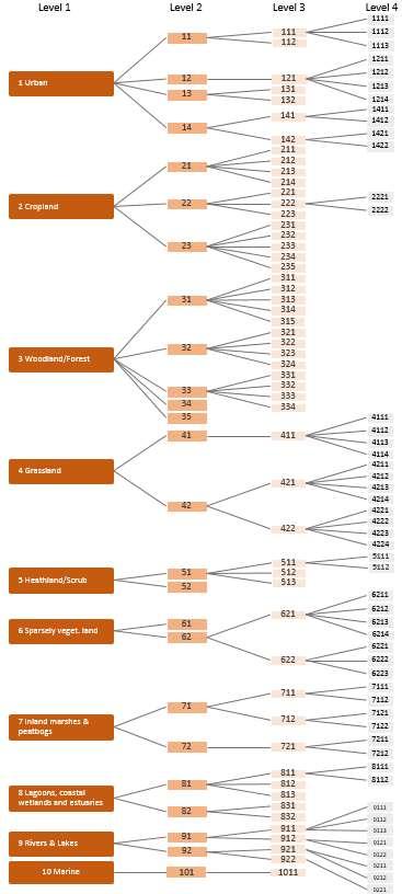
19 Nomenclatures in SWOS MAES class tree Established crosswalks 19
20 SWOS is a service Maps and indicators production Software delivery Training/Capacity Building Service components Portal (Middleware/Data broker/clients) SWOS at Ramsar Pre-COP Europe
 Integr")
21 SWOS Software Toolbox Functions EO data processing (Optical + SAR) Map product generation Indicator calculation Easy integration of Local knowledge for supervised classification and interpretation Standardized nomenclatures Available as Standalone version (GUI & command line) Integrated in external software e.g. ArcGIS, Interaction of external tools GEOclassifier Cloud processing Deliver the infrastructure to locate and connect wetland information (SWOS GEOportal) derive wetland maps and indicators (SWOS software toolbox and GEOportal) GEOclassifier SWOS at Ramsar Pre-COP Europe

22 Nomenclatures in GEOclassifier SWOS at Ramsar Pre-COP Europe
 with 50 participants from 23 countries Maps and indicators production Software delivery Training/Capacity Building Service components")
23 SWOS is a service SWOS Training WS in Munich next week (16-18 Jan. 2018) with 50 participants from 23 countries Maps and indicators production Software delivery Training/Capacity Building Service components Portal (Middleware/Data broker/clients) SWOS at Ramsar Pre-COP Europe
24 SWOS is a service Maps and indicators production Software delivery Training/Capacity Building Service components Portal (Middleware/Data broker/clients) SWOS at Ramsar Pre-COP Europe

25 SWOS Portal SWOS Portal = GEOwetlands Community Portal Access to SWOS products global and European wetland related data sources Analysis functions SWOS at Ramsar Pre-COP Europe


26 SWOS Portal
27 SWOS is a service Maps and indicators production Software delivery Training/Capacity Building Portal (Middleware/Data broker/clients) Service components Service demonstration via Multilevel Service cases SWOS at Ramsar Pre-COP Europe
28 SWOS Service Cases - Approach Definition of a service cases via the following five key elements: Users Policy context (e.g. EU Habitats Directive, Ramsar Convention, MAES) Information needs (e.g. Habitats Directive Article 17 reporting) User requirements (e.g. baseline year, spatial resolution, nomenclature) Matching SWOS products and their specifications 28
29 Service Case list 1. Integrated Risk and Water Management, Ewaso, Kenya 2. Senegal basin Wetland management policy, Senegal 3. Monitoring of water and wetlands policies, Niger basin, Mali 4. Iraqi Wetland management and restoration, Hawizeh marshes, Iraq 5. EU Water Directives, Europe 6. Habitats Directive Article 17 reporting 7. Peatland monitoring, Sweden 8. Ramsar Convention on Wetlands, example Greece 9. MAES wetland ecosystem and ecosystem service mapping, Spain 10. Assessment of land transformation to shape national wetland policies 11. Sustainable Development Goal Monitoring, Global 12. Transboundary wetland monitoring of water quality and pressures 13. Delineation and wetland restoration 14. Biodiversity Strategy to 2020: ecosystem services, Attica Region, Greece 29

30 Service Case SDG Target 6.6 By 2020, protect and restore water-related ecosystems, including mountains, forests, wetlands, rivers, aquifers and lakes Indicator Change in the extent of water-related ecosystems over time 2030 Agenda for Sustainable Development: 17 goals, 169 targets, 232 Indicators New norms to integrate the principles of sustainable development into country policies and programs 30
 1.4 Open Water Bodies (SDG 6.6.1) 1.5 River Water Bodies (SDG 6.6.1) 1.6 selected classes area 31")
31 GEOclassifier Indicators for SDG Total Wetlands Extent Information about the wetland surface at a predefined level using LULC maps. Sub-indicators: 1.0 Total Wetlands extent 1.1 Natural wetland extent 1.2 Artificial wetland extent 1.3 Vegetated Wetlands Extent (SDG 6.6.1) 1.4 Open Water Bodies (SDG 6.6.1) 1.5 River Water Bodies (SDG 6.6.1) 1.6 selected classes area 31
32 Service Case Ramsar reporting Ramsar Convention on Wetlands National reporting Users Ramsar convention on wetlands / NfP Policy context Article 2.1 of the Ramsar Convention Information needs User requirements SWOS products The boundaries of each wetland shall be precisely described and also delimited on a map Wetland boundaries may incorporate (especially where these have importance as waterfowl habitat): Riparian zones Coastal zones adjacent to wetlands, Islands or bodies of marine water deeper than six meters at low tide 32
33 Service Case example 8. Ramsar Convention on Wetlands National reporting Users Ramsar convention on wetlands / NfP Policy context Annex III of the Ramsar Information Sheet Information needs User requirements SWOS products Extent mapping beyond Ramsar designated boundaries Delineate wetland and non-wetland parts of the Ramsar site and depict the wetland boundary with respect to the site s boundary Depict on a map the Ramsar wetland types Depict key hydrological features: Wetland extent in the wet and in the dry seasons. Depict land uses land cover types in the catchment(s) area 33


 The Spatial Planning and Resource")
34 Service Case Ramsar reporting Greece Ecosystem Maps of the Greek RAMSAR SITES and their catchment areas ( ) 1 Evros Delta 2 Vistonida, Ismarida and adjoining lagoons 3 Nestos Delta and adjoining lagoons 4 Lakes Volvi and Koronia 5 Artificial Lake Kerkini 6 Axios, Loudias, Aliakmon Delta 7 Prespa Lakes 8 Amvrakikos gulf 9 Messolonghi lagoons 10 Kotychi lagoons Indicator: Wetland extent inside the Ramsar Site THE TARGETED POLICIES Ramsar Convention Reporting obligations: Update the Greek Ramsar Information Sheets Upload the Greek Ramsar maps to the Ramsar web page EU Mapping and Assessment of Ecosystems and their Services SDG Indicator 6.6.1: Change in extent of water-related ecosystems National Policy and Law: Specific Environmental Studies for the designation of NATURA2000 sites Designation of small wetlands outside protected areas The Environmental Impact Assessments -directive 85/337 (needs for monitoring wetland extent) The Spatial Planning and Resource Management 34
35 The value of Wetlands Wetlands give us ecosystem services for free! SWOS delivers infrastructure for monitoring and provides a basis for decision making and actions! SWOS at Ramsar Pre-COP Europe
36 For more information, contact phone +49 (0) SWOS at Ramsar Pre-COP Europe

37 Excursion - Poodří Sentinel-2 SWOS at Ramsar (RGB), Pre-COP Europe ( Copernicus Sentinel-2 data 2017) 37

38 Excursion - Poodří Sentinel-2 SWOS at Ramsar (RGB), Pre-COP Europe ( Copernicus Sentinel-2 data 2018) 38

39 Excursion - Litovelské Pomoraví Sentinel-2 SWOS at Ramsar (RGB), Pre-COP Europe ( Copernicus Sentinel-2 data 2017) 39

40 Excursion - Litovelské Pomoraví Sentinel-2 SWOS at Ramsar (RGB), Pre-COP Europe ( Copernicus Sentinel-2 data 2017) 40

41 Excursion - Litovelské Pomoraví Sentinel-2 SWOS at Ramsar (RGB), Pre-COP Europe ( Copernicus Sentinel-2 data 2017) 41

42 Excursion - Litovelské Pomoraví Sentinel-2 SWOS at Ramsar (RGB), Pre-COP Europe ( Copernicus Sentinel-2 data 2017) 42

43 Excursion - Litovelské Pomoraví Sentinel-2 SWOS at Ramsar (RGB), Pre-COP Europe ( Copernicus Sentinel-2 data 2018) 43
SWOS (The Satellite-based Wetland Observation Service) Satellite images for peatland monitoring and management Kathrin Weise, Jena-Optronik GmbH
 Satellite images for peatland monitoring and management Kathrin Weise, Jena-Optronik GmbH") This project has received funding from the European Union s Horizon 2020 research and innovation programme under grant agreement No 642088 SWOS (The Satellite-based Wetland Observation Service) Satellite
This project has received funding from the European Union s Horizon 2020 research and innovation programme under grant agreement No 642088 SWOS (The Satellite-based Wetland Observation Service) Satellite
WETLAND-RADAR Wetland vegetation mapping using X- and C- band SAR time series data
 Funded by DLR within the joint C/X Band Initiative of CSA & DLR (FKZ 50EE1511, FKZ 50EE1512) WETLAND-RADAR Wetland vegetation mapping using X- and C- band SAR time series data Symposium Neue Perspektiven
EuroGEOSS Protected Areas Pilot
 EuroGEOSS Protected Areas Pilot Max Craglia European Commission Joint Research Centre Part 1: the present MyNatura2000 Mobile app. Awareness raising & volunteered data collection. Natura2000 covers 18%
From GlobWetland II to GlobWetland Africa
 From GlobWetland II to GlobWetland Africa STRP 18, Gland, September 2014 Marc Paganini, European Space Agency Directorate of Earth Observations Programs Where can EO technology play a role? Wetlands Inventory:
Resolution XIII.23. Wetlands in the Arctic and sub-arctic
 13th Meeting of the Conference of the Contracting Parties to the Ramsar Convention on Wetlands Wetlands for a Sustainable Urban Future Dubai, United Arab Emirates, 21-29 October 2018 Resolution XIII.23
Geospatial workflows and potential applications to the Sustainable Development Goals of countries in West Asia
 Geospatial workflows and potential applications to the Sustainable Development Goals of countries in West Asia Ameer Abdulla, PhD Senior Advisor, European Topic Center for Spatial Analysis, Spain Associate
GLOBWETLAND AFRICA TOOLBOX
 The GlobWetland Africa Toolbox is an open source and free-of-charge software toolbox for inventorying, mapping, monitoring and assessing wetlands. The toolbox comes with end-to-end processing workflows
sentinel-2 COLOUR VISION FOR COPERNICUS
 sentinel-2 COLOUR VISION FOR COPERNICUS SATELLITES TO SERVE By providing a set of key information services for a wide range of practical applications, Europe s Copernicus programme is providing a step
Copernicus Today and Tomorrow GEO Week Group on Earth Observation Geneva, 16 January 2014 The Copernicus Space Infrastructure
 Copernicus Today and Tomorrow GEO Week Group on Earth Observation Geneva, 16 January 2014 The Copernicus Space Infrastructure Thomas Beer, Policy Coordinator, Copernicus Space Office, ESA-ESRIN, Frascati
Ecosystems Chapter 4. What is an Ecosystem? Section 4-1
 Ecosystems Chapter 4 What is an Ecosystem? Section 4-1 Ecosystems Key Idea: An ecosystem includes a community of organisms and their physical environment. A community is a group of various species that
Copernicus Space Component Status & Evolution
 Copernicus Space Component Status & Evolution ESCAP, Bangkok 09 October 2017 Simon Jutz Head of the ESA Copernicus Space Office Directorate of Earth Observation Programmes 28 satellites in development
Kyoto and Carbon Initiative - the Ramsar / Wetlands International perspective
 Kyoto and Carbon Initiative - the Ramsar / Wetlands International perspective (the thoughts of Max Finlayson, as interpreted by John Lowry) Broad Requirements Guideline(s) for delineating wetlands (specifically,
Copernicus Overview and Emergency Management Service
 Copernicus Overview and Emergency Management Service Frédéric BASTIDE European Commission Open informal session of the United Nations Inter-Agency Meeting on Outer Space Activities 12 March 2013, Geneva
CHAPTER 6 & 7 VOCABULARY
 CHAPTER 6 & 7 VOCABULARY 1. Biome 2. Climate 3. Latitude 4. Altitude 5. Emergent layer 6. Epiphyte 7. Understory 8. Permafrost 9. Wetland 10.Plankton 11.Nekton 12.Benthos 13.Littoral zone 14.Benthic zone
Group on Earth Observations (GEO) Cold Regions Work Plan Item WA-01-C3
 Cold Regions Work Plan Item WA-01-C3") EC Panel of Experts on Polar Observations, Research and Services Group on Earth Observations (GEO) Cold Regions Work Plan Item WA-01-C3 Barbara J. Ryan Secretariat Director Lanzhou, China 13 March 2013
EC Panel of Experts on Polar Observations, Research and Services Group on Earth Observations (GEO) Cold Regions Work Plan Item WA-01-C3 Barbara J. Ryan Secretariat Director Lanzhou, China 13 March 2013
Mapping and Assessment of Ecosystems and their Services
 Mapping and Assessment of Ecosystems and their Services ALTER-Net Conference 2013: Science underpinning the EU 2020 Biodiversity Strategy. April 2013 Gent Joachim MAES 1 This presentation is based on the
C o p e r n i c u s a n d W I G O S
 C o p e r n i c u s a n d W I G O S Jean-Noël Thépaut & Mark Dowell 24 October 2017 GEO XIV, Washington DC, 23-28 October 2017 T h e C o p e r n i c u s P r o g r a m m e Copernicus is the European Union
Essential Biodiversity Variables Workshop
 Essential Biodiversity Variables Workshop Dr. Maurice Borgeaud ESA Earth Observation Programmes ESA ESRIN 27 February 2012 The European Space Agency To provide for and promote, for exclusively peaceful
Biodiversity Blueprint Overview
 Biodiversity Blueprint Overview Climate Variability Climate projections for the Glenelg Hopkins Regions suggest that the weather will be hotter and drier in the coming years which will impact on land use,
The story of sharing environmental data
 The story of sharing environmental data Kallio, Pyhälahti, Harju, Teiniranta, Lahtinen, Finnish Environment Institute SYKE OKFestival, Finnish Open Data, 18. Sep 2012 Contents Call for environmental knowledge
SCENT: A Smart Toolbox for Engaging Citizens into a People Centric Observation Web. INSPIRE 2016 Conference Barcelona, 28 September 2016
 SCENT: A Smart Toolbox for Engaging Citizens into a People Centric Observation Web INSPIRE 2016 Conference Barcelona, 28 September 2016 Summary SCENT Facts & figures Motivation SCENT @ a glance SCENT objectives
Emergency Management Service (EMS) mapping
 mapping") GMES Emergency Management Service (EMS) mapping Frédéric BASTIDE GMES unit, European Commission UN-SPIDER Expert Meeting: "Crowdsource Mapping for Disaster Risk Management and Emergency Response" 3-5 December,
GMES Emergency Management Service (EMS) mapping Frédéric BASTIDE GMES unit, European Commission UN-SPIDER Expert Meeting: "Crowdsource Mapping for Disaster Risk Management and Emergency Response" 3-5 December,
EO4SEE - THE PATHFINDER OF OPERATIONAL SATELLITE MONITORING FOR THE REGION OF THE BLACK SEA AND CENTRAL EUROPE
 EO4SEE: Pathfinder assessment for regional high volume data access, processing and information service delivery platforms - South East Region EO4SEE - THE PATHFINDER OF OPERATIONAL SATELLITE MONITORING
RANGE AND ANIMAL SCIENCES AND RESOURCES MANAGEMENT - Vol. II - Catchment Management A Framework for Managing Rangelands - Hugh Milner
 CATCHMENT MANAGEMENT A FRAMEWORK FOR MANAGING RANGELANDS Hugh Milner International Water Management Consultant, Australia Keywords: Rangeland management; catchments and watersheds; catchment management
Moreton Bay and Key Geographic Concepts Worksheet
 Moreton Bay and Key Geographic Concepts Worksheet The Australian Curriculum: Geography draws on seven key geographic concepts: place scale space environment change interconnection sustainability They are
I&CLC2000 in support to new policy initiatives (INSPIRE, GMES,..)
") I&CLC2000 in support to new policy initiatives (INSPIRE, GMES,..) Manfred Grasserbauer, Director Joint Research Centre Institute for Environment and Sustainability 1 IMAGE 2000 European mosaic of satellite
I&CLC2000 in support to new policy initiatives (INSPIRE, GMES,..) Manfred Grasserbauer, Director Joint Research Centre Institute for Environment and Sustainability 1 IMAGE 2000 European mosaic of satellite
Transboundary water management with Remote Sensing. Oluf Jessen DHI Head of Projects, Water Resources Technical overview
 Transboundary water management with Remote Sensing Oluf Jessen DHI Head of Projects, Water Resources Technical overview ozj@dhigroup.com Transboundary water management Water management across national
European Topic Centre on Land Urban and Soil Systems. Green Infrastructure at EEA
 Green Infrastructure at EEA A SPATIAL APPROACH TO MAPPING GI Stefan Kleeschulte, ETC ULS GI and territorial cohesion 2011 first EEA report on Green Infrastructure Underlining the need to develop tools
Copernicus Overview. Major Emergency Management Conference Athlone 2017
 Copernicus Overview Major Emergency Management Conference Athlone 2017 Copernicus is a European programme implemented by the European Commission. The services address six thematic areas: land, marine,
Remote sensing of forest and land cover at the AUA GIS & Remote Sensing Lab
 AUA GIS AND REMOTE SENSING LAB An initiative of the AUA Acopian Center for the Environment and the AUA College of Science and Engineering http://ace.aua.am/gis-and-remote-sensing Remote sensing of forest
ROLE OF SPATIAL PLANNING TOOLS AT MESO-SCALE IN THE MANAGEMENT OF NATURAL RESOURCES, LESSONS LEARNT FROM AFRICAN COUNTRIES
 6th Nov, 2012 ROLE OF SPATIAL PLANNING TOOLS AT MESO-SCALE IN THE MANAGEMENT OF NATURAL RESOURCES, LESSONS LEARNT FROM AFRICAN COUNTRIES Masoom Hamdard Environmental Planning and Assessment for Adaptation
UN COPUOS 52 nd session of the Scientific and Technical Subcommittee. COPERNICUS - an European Achievement. S. Jutz Head, ESA Copernicus Space Office
 UN COPUOS 52 nd session of the Scientific and Technical Subcommittee COPERNICUS - an European Achievement S. Jutz Head, ESA Copernicus Space Office 11 Feb 2015, Vienna 1 2 What is Copernicus? European
IAEG SDGs WG GI, , Mexico City
 IAEG SDGs WG GI, 12-14.12.2016, Mexico City UN-GGIM:Europe s perspective and activities to support better integration of geospatial information and statistics and the UN SDG monitoring Pier-Giorgio Zaccheddu,
Coastal Vulnerability and Risk Parameters
 European Water 11/12: 3-7, 2005. 2005 E.W. Publications Coastal Vulnerability and Risk Parameters E. Doukakis National Technical University of Athens-Dept. of Rural and Surveying Engineering, Lab. of Higher
The Copernicus Climate Change (C3) service: State of play
 service: State of play") Enterprise and Industry The Copernicus Climate Change (C3) service: State of play B. Pinty (a) & J-N. Thépaut (b) (a) Copernicus G.2 unit (b) ECMWF CCI October2014 Legal frame & MS consultations Publica6on
Enterprise and Industry The Copernicus Climate Change (C3) service: State of play B. Pinty (a) & J-N. Thépaut (b) (a) Copernicus G.2 unit (b) ECMWF CCI October2014 Legal frame & MS consultations Publica6on
Future perspectives for EO in Development
 Future perspectives for EO in Development Meeting at ESA/ESRIN in Frascati 11 th of September 2018 #WorldInCommon AGENCE FRANÇAISE DE DÉVELOPPEMENT FRENCH DEVELOPMENT AGENCY 01. What is AFD? France s international
European Space Agency
 Guidelines - Guidelines how/when to interact during the WebEx session: - Due to the number of attendees, please keep always your webcam and microphone switched-off - You can use anytime the chat to all
Mapping Water Resources and Reservoirs for Climate Resilience in Zambezi River Basin
 Mapping Water Resources and Reservoirs for Climate Resilience in Zambezi River Basin Corné van der Sande, NEO BV Senior Advisor Earth Observation Services for Monitoring Drought and Water Resources in
Green areas: numerous positive effects for sustainable metropolis Satellite images : an easy way to map vegetation
 Green areas: numerous positive effects for sustainable metropolis Satellite images : an easy way to map vegetation Copernicus Training and Information Session 10 and 11 may 2017 in Lund, Sweden Dominique
Current experiences in the use of satellite information in development aid activities
 Current experiences in the use of satellite information in development aid activities Meeting at ESA/ESRIN in Frascati 16 th of September 2017 #WorldInCommon AGENCE FRANÇAISE DE DÉVELOPPEMENT FRENCH DEVELOPMENT
Snow Cover Applications: Major Gaps in Current EO Measurement Capabilities
 Snow Cover Applications: Major Gaps in Current EO Measurement Capabilities Thomas NAGLER ENVEO Environmental Earth Observation IT GmbH INNSBRUCK, AUSTRIA Polar and Snow Cover Applications User Requirements
sentinel-3 A BIGGER PICTURE FOR COPERNICUS
 sentinel-3 A BIGGER PICTURE FOR COPERNICUS SATELLITES TO SERVE By providing a set of key information services for a wide range of practical applications, Europe s Copernicus programme has been put in place
Spanish national plan for land observation: new collaborative production system in Europe
 ADVANCE UNEDITED VERSION UNITED NATIONS E/CONF.103/5/Add.1 Economic and Social Affairs 9 July 2013 Tenth United Nations Regional Cartographic Conference for the Americas New York, 19-23, August 2013 Item
EU collaborations with NASA LCLUC Program & Current Priorities
 & Current Priorities ioannis Manakos, Dr. Centre for Research and Technology Hellas Information Technologies Institute Visual Analytics, Virtual & Augmented Reality Laboratory European Association of Remote
The Role of EO Consultants and SMEs within GMES. Geoff Smith
 The Role of EO Consultants and SMEs within GMES Geoff Smith Enable clients to deliver useful, accurate and reliable environmental information from EO. Positioned to bridge the gaps between technology development,
Geospatial technology for land cover analysis
 Home Articles Application Environment & Climate Conservation & monitoring Published in : Middle East & Africa Geospatial Digest November 2013 Lemenkova Polina Charles University in Prague, Faculty of Science,
Geographic Information Infrastructure and Policy Framework for Sustainable Mountain Development in the Hindu Kush-Himalayas
 Geo SMART ASIA 2017 22-24 August, Kualalampur Geographic Information Infrastructure and Policy Framework for Sustainable Mountain Development in the Hindu Kush-Himalayas Basanta Shrestha, Director Strategic
Use of climate reanalysis for EEA climate change assessment. Blaz Kurnik. European Environment Agency (EEA)
") Use of climate reanalysis for EEA climate change assessment Blaz Kurnik European Environment Agency (EEA) 2016: EEA content priorities Circular economy Climate and Energy Sustainable Development Goals
Use of climate reanalysis for EEA climate change assessment Blaz Kurnik European Environment Agency (EEA) 2016: EEA content priorities Circular economy Climate and Energy Sustainable Development Goals
SDG s and the role of Earth Observation
 SDG s and the role of Earth Observation Christian Heipke IPI - Institute for Photogrammetry and GeoInformation Leibniz Universität Hannover Germany Secretary General, ISPRS 1. No Poverty 2. Zero Hunger
Land Use / Land Cover Mapping in
 Land Use / Land Cover Mapping in Eastern and Southern African Regions RCMRD Experience by 6/24/2013, Nairobi Kenya Dr. Tesfaye Korme Director of RS, GIS and Mapping, RCMRD I. About RCMRD, Its Vision and
Copernicus for Coastal Zone Monitoring and Management
 Copernicus for Coastal Zone Monitoring and Management DG-Grow, 29 June 2017 User Requirement Perspective: Monitoring of coastal zones, pressures and impacts on nature and people Courtesy: J. Ekebom storm
Greening of Arctic: Knowledge and Uncertainties
 Greening of Arctic: Knowledge and Uncertainties Jiong Jia, Hesong Wang Chinese Academy of Science jiong@tea.ac.cn Howie Epstein Skip Walker Moscow, January 28, 2008 Global Warming and Its Impact IMPACTS
Chapter 2 Geography Study Guide
 Chapter 2 Geography Study Guide Multiple Choice Identify the letter of the choice that best completes the statement or answers the question. 1. What is the largest and deepest ocean? a. the Indian Ocean
Earth Observation for development. Geoff Sawyer, EARSC Secretary General 12 April 201, WB, Washington,
 Earth Observation for development Geoff Sawyer, EARSC Secretary General 12 April 201, WB, Washington, what is EARSC? There is no sustainable developmeny without adequate information about the state of
An Internet-based Agricultural Land Use Trends Visualization System (AgLuT)
") An Internet-based Agricultural Land Use Trends Visualization System (AgLuT) Second half yearly report 01-01-2001-06-30-2001 Prepared for Missouri Department of Natural Resources Missouri Department of
An Internet-based Agricultural Land Use Trends Visualization System (AgLuT) Second half yearly report 01-01-2001-06-30-2001 Prepared for Missouri Department of Natural Resources Missouri Department of
Open Data meets Big Data
 Open Data meets Big Data Max Craglia, Sven Schade, Anders Friis European Commission Joint Research Centre www.jrc.ec.europa.eu Serving society Stimulating innovation Supporting legislation JRC is Technical
System of Environmental-Economic Accounting. Advancing the SEEA Experimental Ecosystem Accounting. Extent Account (Levels 1 and 2)
") Advancing the SEEA Experimental Ecosystem Accounting Extent Account (Levels 1 and 2) Overview: The Extent Account 1. Learning objectives 2. Review of Level 0 (5m) What is it? Why do we need it? What does
Advancing the SEEA Experimental Ecosystem Accounting Extent Account (Levels 1 and 2) Overview: The Extent Account 1. Learning objectives 2. Review of Level 0 (5m) What is it? Why do we need it? What does
Arctic Observing Systems Challenges, New opportunities and Integration
 Arctic Observing Systems Challenges, New opportunities and Integration Japan Norway Arctic Science Week 03 June 2016 By Stein Sandven, NERSC Building an integrated Arctic Observing System Need to collect,
HELSINKI COMMISSION Baltic Marine Environment Protection Commission
 HELSINKI COMMISSION Baltic Marine Environment Protection Commission HELCOM RECOMMENDATION 24/10 Adopted 25 June 2003, having regard to Article 20, Paragraph 1 b) of the 1992 Helsinki Convention IMPLEMENTATION
Urban areas & climate change
 Urban areas & climate change Paolo Gamba University of Pavia University of Pavia The UNIPV TLC & RS Lab is a dynamic research group developing in the past years many techniques devoted to the analysis
CopernicusEU. the EU's Earth Observation Programme. Sara Zennaro Atre Delegation of the European Union to Japan
 Copernicus the EU's Earth Observation Programme Sara Zennaro Atre Delegation of the European Union to Japan Status Overview, Sept 2016 & Ocean Policies Seminar 4 October 2016 ollow us on: Copernicus EU
CLLD Cooperation OFFER
 Title of the proposed project (English) CLLD Cooperation OFFER PARKS PROTECTION III - Management, Protection and Economic Development in Protected Areas Type of project (select as many as you want) Cooperation
Earth Observation and GEOSS in Horizon Copernicus for Raw Material Workshop 5 th September 2016
 Earth Observation and GEOSS in Horizon 2020 Copernicus for Raw Material Workshop 5 th September 2016 Gilles OLLIER Head of Sector -Earth observation Directorate Environment Unit I.4 Climate Actions and
Satellite data for hydrological forecasting
 Satellite data for hydrological forecasting Current use at ECMWF and perspective Shopping list! Our current tools does not allow direct use, but could be modified Christel Prudhomme Christel.prudhomme@ecmwf.int
Wetland Programmes. Biodiversity assessments in determining wetland conservation priorities: a catchment approach. Dr. Piet-Louis Grundling
 CHIEF DIRECTORATE NATURAL RESOURCE MANAGEMENT PROGRAMMES: Wetland Programmes Biodiversity assessments in determining wetland conservation priorities: a catchment approach Dr. Piet-Louis Grundling Environmental
Supporting GPSC Cities with Satellite Earth Observation for Sustainable Urban Development
 Supporting GPSC Cities with Satellite Earth Observation for Sustainable Urban Development Global Platform for Sustainable Cities African Regional Workshop 14 May 2018 AfDB Headquarters Abidjan, Côte d'ivoire
THE COPERNICUS PROGRAMME
 THE COPERNICUS PROGRAMME Jolyon Martin, Sentinel Data Access Manager & Sentinel-5P Operations Manager, ESA Pierre Potin, Sentinel-1 Mission Manager, ESA Earth Observation Showcase Emerging Applications
Land Accounts - The Canadian Experience
 Land Accounts - The Canadian Experience Development of a Geospatial database to measure the effect of human activity on the environment Who is doing Land Accounts Statistics Canada (national) Component
Virginia Shoreline Mapping Tools
 Virginia Shoreline Mapping Tools December 15, 2017 Karen Duhring Center for Coastal Resources Management Virginia Institute of Marine Science College of William & Mary Virginia Shoreline Mapping Tools
The U.S. National Integrated Drought Information System. Roger S. Pulwarty National Oceanic and Atmospheric Administration USA
 The U.S. National Integrated Drought Information System Roger S. Pulwarty National Oceanic and Atmospheric Administration USA Drought: Weather-climate continuum and adaptation deficits 2010 2011 2012 2015
Management Planning & Implementation of Communication Measures for Terrestrial Natura 2000 Sites in the Maltese Islands Epsilon-Adi Consortium
 Management Planning & Implementation of Communication Measures for Terrestrial Natura 2000 Sites in the Maltese Islands Epsilon-Adi Consortium Briefing Meetings, February 2013 CT3101/2011, MEPA, Malta
C o p e r n i c u s L a n d M o n i t o r i n g S e r v i c e
 C o p e r n i c u s L a n d M o n i t o r i n g S e r v i c e Submodule D: stability of protected areas & related pressures: Natura2000 sites Copernicus EU Copernicus EU Copernicus EU www.copernicus.eu
United States Multi-Hazard Early Warning System
 United States Multi-Hazard Early Warning System Saving Lives Through Partnership Lynn Maximuk National Weather Service Director, Central Region Kansas City, Missouri America s s Weather Enterprise: Protecting
LAND COVER CHANGES IN ROMANIA BASED ON CORINE LAND COVER INVENTORY
 LAND COVER CHANGES IN ROMANIA BASED ON CORINE LAND COVER INVENTORY 1990 2012 JENICĂ HANGANU, ADRIAN CONSTANTINESCU * Key-words: CORINE Land Cover inventory, Land cover changes, GIS. Abstract. From 1990
Ecological Land Cover Classification For a Natural Resources Inventory in the Kansas City Region, USA
 Ecological Land Cover Classification For a Natural Resources Inventory in the Kansas City Region, USA by Applied Ecological Services, Inc. In cooperation with the Mid-America Regional Council 600 Broadway,
Establishment of the Hellenic Ecosystem Services Partnership (HESP) research group: Drafting the national agenda for the implementation of the
 research group: Drafting the national agenda for the implementation of the") Establishment of the Hellenic Ecosystem Services Partnership (HESP) research group: Drafting the national agenda for the implementation of the ES concept in Greece Establishment of the Hellenic Ecosystem
Establishment of the Hellenic Ecosystem Services Partnership (HESP) research group: Drafting the national agenda for the implementation of the ES concept in Greece Establishment of the Hellenic Ecosystem
Remote Sensing products and global datasets. Joint Research Centre, European Commission
 Remote Sensing products and global datasets Joint Research Centre, European Commission Setting the stage. Needs and requirements for integrated approach(es) for land degradation assessment. in Special
Space for Sustainable Development
 Space for Sustainable Development ESA s contribution to the Where, What, and How of Data Dr. Christoph Aubrecht Directorate of Earth Observation Programmes Science, Applications and Future Technologies
This table connects the content provided by Education Perfect to the NSW Syllabus.
 Education Perfect Geography provides teachers with a wide range of quality, engaging and innovative content to drive positive student learning outcomes. Designed by teachers and written by our in-house
A Comprehensive Inventory of the Number of Modified Stream Channels in the State of Minnesota. Data, Information and Knowledge Management.
 A Comprehensive Inventory of the Number of Modified Stream Channels in the State of Minnesota Data, Information and Knowledge Management Glenn Skuta Environmental Analysis and Outcomes Division Minnesota
Observation (EO) & Geomatics in Canada
 & Geomatics in Canada") Innovating to Increase the Impact of Earth Observation (EO) & Geomatics in Canada Natural Resources Canada February 25, 2014 Prashant Shukle, Director General Canada Centre for Mapping and Earth Observation
Innovating to Increase the Impact of Earth Observation (EO) & Geomatics in Canada Natural Resources Canada February 25, 2014 Prashant Shukle, Director General Canada Centre for Mapping and Earth Observation
Airbus DS Consortium Risk and Recovery. Airbus DS Corporate Presentation
 Airbus DS Consortium Risk and Recovery 1 January, 2017 Airbus DS Corporate Presentation 2 SERTIT s Copernicus EMS mapping service Risk & Recovery and Rapid Mapping Based on our 24/7/365 operational rapid
Remote Sensing and GIS Application in Change Detection Study Using Multi Temporal Satellite
 Cloud Publications International Journal of Advanced Remote Sensing and GIS 2013, Volume 2, Issue 1, pp. 374-378, Article ID Tech-181 ISSN 2320-0243 Case Study Open Access Remote Sensing and GIS Application
Effective Utilization of Synthetic Aperture Radar (SAR) Imagery in Rapid Damage Assessment
 Imagery in Rapid Damage Assessment") Effective Utilization of Synthetic Aperture Radar (SAR) Imagery in Rapid Damage Assessment Case Study Pakistan Floods SUPARCO M. Maisam Raza, Ahmad H. Rabbani SEQUENCE Flood Monitoring using Satellite
Effective Utilization of Synthetic Aperture Radar (SAR) Imagery in Rapid Damage Assessment Case Study Pakistan Floods SUPARCO M. Maisam Raza, Ahmad H. Rabbani SEQUENCE Flood Monitoring using Satellite
C o p e r n i c u s L a n d M o n i t o r i n g S e r v i c e
 C o p e r n i c u s L a n d M o n i t o r i n g S e r v i c e Integration into existing Snow and Ice Services and draft product specifications Annett BARTSCH b.geos Copernicus High Resolution Snow and
Development of an International Arctic Observations Assessment Framework
 Development of an International Arctic Observations Assessment Framework Dr. Steven Lev, Dr. Jason Gallo Briefing for the Sustaining Arctic Observing Networks (SAON) April 7, 2017 International Partners
UNIT 5: ECOLOGY Chapter 15: The Biosphere
 CORNELL NOTES Directions: You must create a minimum of 5 questions in this column per page (average). Use these to study your notes and prepare for tests and quizzes. Notes will be stamped after each assigned
Regional Flash Flood Guidance and Early Warning System
 WMO Training for Trainers Workshop on Integrated approach to flash flood and flood risk management 24-28 October 2010 Kathmandu, Nepal Regional Flash Flood Guidance and Early Warning System Dr. W. E. Grabs
Chapter 32. Australia & New Zealand
 Chapter 32 Australia & New Zealand Lesson 1: Physical Geography of Australia & New Zealand Landforms Australia lies between the Pacific and Indian Oceans in the Southern Hemisphere. Although an island,
Securing EUMETSAT s Mission from an Evolving Space Environment
 Securing EUMETSAT s Mission from an Evolving Space Environment ESPI 12 th Autumn Conference Andrew Monham 1 EUMETSAT: Intergovernmental Organisation of 30 Member States Presentation Contents AUSTRIA BELGIU
SPLAN-Natura Towards an integrated spatial planning approach for Natura th January, 2017 Brussels. Commissioned by DG Environment
 SPLAN-Natura 2000 Towards an integrated spatial planning approach for Natura 2000 Commissioned by DG Environment 17 th January, 2017 Brussels V. Simeonova (Ph.D.) Drivers towards integrating Biodiversity
Monitoring of grass cutting with Sentinel-1 time series
 Monitoring of grass cutting with Sentinel-1 time series pilot results and vision for operational service based on big data tools and cloud computing Kaupo Voormansik 21st MARS Conference November 25, 2015
ESA Status Report. ET-SAT-11, WMO, Geneva, CH, 4 April Prepared by Earth Observation Programmes Directorate
 ESA Status Report ET-SAT-11, WMO, Geneva, CH, 4 April 2017 Prepared by Earth Observation Programmes Directorate Presented by Ivan Petiteville, ESA, Earth Observation Programmes Issue/Revision: 0.0 Reference:
GMES and AFRICA Support Programme 1st technical committee meeting
 GMES and AFRICA Support Programme 1st technical committee meeting Developing an Earth Observation Operational Application for Coastal Ecosystems Mapping, Monitoring and Assessment of the Northern African
EUMETSAT. A global operational satellite agency at the heart of Europe. Presentation for the Spanish Industry Day Madrid, 15 March 2012
 EUMETSAT A global operational satellite agency at the heart of Europe Presentation for the Spanish Industry Day Madrid, Angiolo Rolli EUMETSAT Director of Administration EUMETSAT objectives The primary
Natura 2000 in the marine environment: state of implementation and next steps
 Life on the blue planet: biodiversity research and the new European marine policies EPBRS European Platform on Biodiversity Research Strategy Porto, Portugal 7-9 November 2007 Natura 2000 in the marine
Open call for tenders No EEA/MDI/14/001
 1 April 2014 Clarification No 1 Reference: Title: Open call for tenders No EEA/MDI/14/001 Copernicus Initial Operations 2011-2013 - Land Monitoring Service Local Component: riparian zones Question 1 Section
Land Use in the context of sustainable, smart and inclusive growth
 Land Use in the context of sustainable, smart and inclusive growth François Salgé Ministry of sustainable development France facilitator EUROGI vice president AFIGéO board member 1 Introduction e-content+
Towards eenvironment Prague, March GMES Space Component. Josef Aschbacher Head, ESA GMES Space Office
 Towards eenvironment Prague, 25-27 March 2009 GMES Space Component Josef Aschbacher Head, ESA GMES Space Office Prague from Space Segment 2 05 Nov 2003 CNES 2003 GISAT 2007 ESA GSELAND GMES is an EU led
Journal of Asian Scientific Research STUDYING OF THE ENVIRONMENTAL CHANGES IN MARSH AREA USING LANDSAT SATELLITE IMAGES
 Journal of Asian Scientific Research journal homepage: http://aessweb.com/journal-detail.php?id=5003 STUDYING OF THE ENVIRONMENTAL CHANGES IN MARSH AREA USING LANDSAT SATELLITE IMAGES Salah A. H. Saleh