THE COPERNICUS PROGRAMME
|
|
|
- Cody Moore
- 6 years ago
- Views:
Transcription


1 THE COPERNICUS PROGRAMME Jolyon Martin, Sentinel Data Access Manager & Sentinel-5P Operations Manager, ESA Pierre Potin, Sentinel-1 Mission Manager, ESA Earth Observation Showcase Emerging Applications Powered by Innovative Technologies 26th October 2017, Satellite Applications Catapult, Harwell


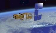
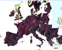
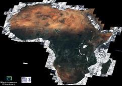
2 What is Copernicus? Catapult Open European response to global needs: to manage the environment, to mitigate the effects of climate change and to ensure civil security In-Situ Data Space Component Services Component

3 What is Copernicus? Catapult Open


4 Copernicus Users Catapult Open Policymakers Start-Up Companies Scientists Decision Makers Space Enthusiasts Large Institutional User Organisations Students Private Persons Value-Adding Companies Public Authorities

5 Copernicus/GMES Facts & Figures >100,000 Number of self-registered users (Open Data Hub) > 7 B invested by ESA and EU till this day 20 0 to pay for access to Sentinel data 6 service domains 2014 covered start of Copernicus operational phase new satellites & instruments specifically developed for the operational needs of Copernicus 10 of public return for every 1 spent by the European tax payer on Copernicus 83,000 jobs generated by Copernicus by 2030


6 Copernicus Components & Competences Overall Programme Coordination: Space Component Coordinators: Partners: Industries National Space Agencies Private companies EUMETSAT Services Component EMSA and FRONTEX SatCen EMCWF Service operators JRC Mercator Océan EEA In-situ data are supporting the Space and Services Components


7 Copernicus Services Component Marine Climate Change Land Services Component Security Atmosphere Emergency Management
8 Copernicus Space Component: Role of ESA Coordinator of overall Copernicus Space Component Definition of overall architecture and plan for future evolutions Coordinating access to Copernicus missions from national, EUMETSAT and third party satellite owners Development and procurement Agency for dedicated space infrastructure Development of first spacecraft and Ground Segment Procurement of recurrent elements Operator of Sentinel-1, Sentinel-2, Sentinel-3 (land) and Sentinel-5 precursor EUMETSAT is operator of Sentinel-3 (marine), Sentinel-4, Sentinel-5 and Sentinel-6
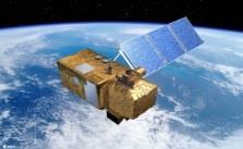
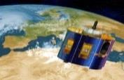
9 Copernicus Space Component: the dedicated Sentinels S1A/B: Radar Mission 3 Apr 2014/25 Apr 2016 S2A/B: High Resolution Optical Mission 23 June 2015/7 March 2017 S3A/B: Medium Resolution Imaging and Altimetry Mission 16 Feb 2016/2018 S4A/B: Geostationary Atmospheric Chemistry Mission 2021/2027 S5P: Low Earth Orbit Atmospheric Chemistry Mission 13 Oct 2017 S5A/B/C: Low Earth Orbit Atmospheric Chemistry Mission 2021/2027 S6A/B: Altimetry Mission 2020/2025
10 with a long-term operational perspective (with Next Gen) Access to Contributing Missions S-1 A/B/C/D S-1 Next Generation S-2 A/B/C/D S-2 Next Generation S-3 A/B/C/D S-3 Next Generation S-4 A/B (on MTG) S-5 Precursor S-5 A/B/C (on MetOp-SG) S-6 A/B


11 Copernicus Contributing Missions PROBA-V SPOT (VGT) COSMO-Skymed TerraSAR X Tandem-X Radarsat DMC Pléiades Copernicus Contributing Missions Cryosat Deimos-2 RapidEye SPOT (HRS) Atmospheric missions MetOp Jason and many more! Meteosat 2 nd Generation


12 Advantages of Sentinel Satellites Most comprehensive EO system in the world Fully operational system Complementary to Contributing Missions Free Sentinel data Long-term observations


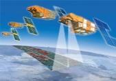
13 S-6 S-1 S-5 First Generation Sentinels constellation S-5p S-2 S-3 S-4
 6 days repeat cycle at Equator with 2 satellites 7 years design life time,")
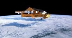
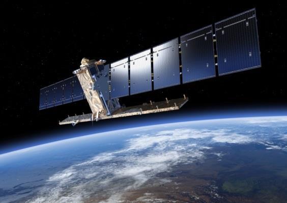
14 Sentinel-1 C-band SAR mission Mission profile: C-Band SAR at 5.4 GHz, multi-polarisation Sun synchronous orbit at 693 km mean altitude 250 km swath width (Interferometric Wideswath mode) 6 days repeat cycle at Equator with 2 satellites 7 years design life time, consumables for 12 years 4 nominal mutually exclusive operation modes Mission objectives: Ice and marine, land monitoring Support to crisis management
 Terrain Observation by Progressive Scans (TOPS)")
15 Image Acquisition in Interferometric Wide Swath mode (IW) Terrain Observation by Progressive Scans (TOPS)


16 Sentinel-1 observation scenario Main thematic domains & components Land cover: agriculture, forestry, hydrology, etc. Maritime surveillance European coverage Sea-ice, icebergs, lake-ice Emergency Calibration/validatio n Ground deformation: Tectonic, volcanoes, landslides, subsidence (InSAR applications) Sea state Security Ice sheets, glaciers, permafrost, snow, etc Global land mapping PR actions (infrequent)

17 Catapult Open


18 Sentinel-1 applications ever increasing Sea ice and iceberg monitoring Maritime surveillance: oil spill monitoring, ship detection, illegal fisheries, etc. Sea state: wind, wave Land use, agriculture, forestry, logging, land classification, urban planning Ground deformation: subsidence, landslides, earthquakes, volcanoes, infrastructure monitoring Ice sheets, glaciers, climate change Emergency management Soil moisture, wetland Snow, permafrost, avalanches,


19 Regular Ice Charts based on Sentinel-1 imagery routinely generated by CMEMS

20 Sea Ice Concentration Charts based on Sentinel-1 imagery routinely generated by CMEMS Greenland Svalbard High resolution sea ice concentration charts (early September 2017) Generated using E.U. Copernicus Marine Service Information The Copernicus Marine Environment Monitoring Service provides daily high resolution sea ice concentrations derived from Sentinel-1 mission data.

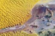
21 Regular Iceberg detection maps based on Sentinel-1 imagery routinely generated by CMEMS Daily maps of position of icebergs
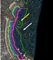
22 Monitoring ice sheets with Sentinel-1 A routine observatory of ice sheet margins

 for IUU")
 fisheries detection")

 usually associated with IUU")

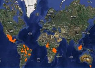
23 Fisheries Surveillance for WARFP World Bank project developed within the West Africa Regional Fisheries Project (WARFP) for IUU (Illegal, Unlicensed and Unreported) fisheries detection Detection correlated with cooperative transponder data (green) and non-cooperative data (red) usually associated with IUU activities (vessels engaged in fishing in restricted areas/eezs without authorisation). Sentinel-1A 30/09/2015


24 Sentinel-1 is operationally used by EMSA since June 2016 for the CleanSeaNet service CleanSeaNet: the European satellite-based oil pollution and vessel detection monitoring system Operated by the European Maritime and Safety Agency (EMSA) Sentinel-1 currently represents 85 % of satellite imagery used for CleanSeaNet Sentinel-1A TOPS EW HH/HV acquired on 25 April 2014


25 Multiple flowlines spills Identified East of Catapult the Open USAN FPSO (Floating Production Storage and Offloading) vessels, Nigeria, Gulf of Guinea Sentinel- 1A imagery,


26 Offshore Oil and Gas Monitoring Up to 50 Sentinel-1 images are being used each month to track upstream icebergs from several offshore platforms Iceberg and ship detections are correlated with satellite AIS Ice edge information also integrated into the product
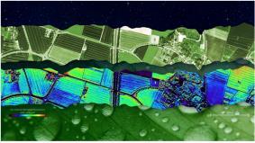
27 Combined sigma_0 and coherence (both VV) for a part of Flevoland, using both S1A and S1B Sep > Feb 2017 (courtesy: Guido Lemoine, JRC) - Coherence varies spectacularly due to soil cultivation in the autumn period - Towards end of Nov, the change in coherence slows down, and most fields show high coherence because they are essentially stable bare soil (bright video frames). - Over Jan and Feb, coherence blurs due to snow and frost/thaw affects, but the coherence patterns remain stable until late Feb

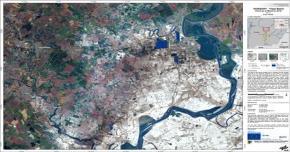
28 Flood delineation map based on Sentinel-1 data Copernicus Emergency Management Service Flood in Cumbria, UK, Dec 2015 Copernicus Service information (2015)/CEMS

29 Example of Land Deformation monitoring Ground displacement of the San Francisco Bay Area measured by Sentinel-1 Hot spots are clearly observed, including the Hayward fault running north south of the central-right side of the image. Subsidence of the newly reclaimed land in the San Rafael Bay on the left is also visible, while an uplift of land is visible in the lower right, possibly a result of a recovering groundwater level after a four-year long drought that ended in autumn Contains modified Copernicus Sentinel data ( ) / ESA SEOM INSARAP study / PPO.labs / Norut / NGU

30 San Francisco Millennium Tower sinking Catapult Open Data from the Sentinel-1 satellites acquired between 22 Feb 2015 and 20 Sep 2016 show that Millennium Tower in San Francisco is sinking by about 40 mm a year in the line of sight the direction that the satellite is looking at the building. This translates into a vertical subsidence of almost 50 mm a year, assuming no tilting. The coloured dots represent targets observed by the radar. The colour scale ranges from 40 mm a year away from radar (red) to 40 mm a year towards radar (blue). Green represents stable targets. Contains modified Copernicus Sentinel data ( ) / ESA SEOM INSARAP study / PPO.labs / Norut / NGU
 with 2 satellites 7 years design life time, consumables for 12 years 10, 20 and 60 m spatial resolution Mission objectives: Generic land cover maps Risk mapping")
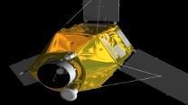
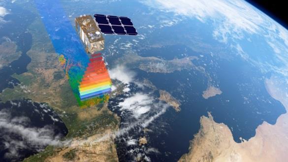
31 Sentinel-2 Superspectral imaging mission Mission profile Multispectral instrument with 13 spectral bands (VIS, NIR & SWIR) Sun synchronous orbit at 786 km mean altitude 290 km swath width 5 days repeat cycle at Equator (cloud free) with 2 satellites 7 years design life time, consumables for 12 years 10, 20 and 60 m spatial resolution Mission objectives: Generic land cover maps Risk mapping and disaster relief
32 Sentinel-2: 13 Spectral Bands SWIR VIS NIR SWIR VNIR Visible B1 B9 B10 60 m Aerosols Water-vapour Cirrus B5 B7 B8a Snow / ice / cloud discrimination 20 m Vegetation Red-edge B6 B11 B12 10 m 400 nm B2 B3 B4 B8 600 nm 800 nm Continuity with SPOT5 multispectral 1000 nm 1200 nm 1400 nm 1600 nm 1800 nm 2000 nm 2200 nm 2400 nm Spectral bands versus spatial resolution


33 Ever increasing range of Applications Forests & Carbon, Vegetation monitoring Agriculture, Fluorescence & biophysical parameters European Land cover, human impact, high resolution layers Global Land use & land cover Water quality, Wetlands Glaciers & Ice Regional to Urban Applications Coastal zones/bathymetry Emergency management Geology & Geomorphology


34 Copernicus Land Core Services Land cover/ use characteristics Forest: Tree Cover Density [%] European Riparian Zones Sources: EEA; GAF AG
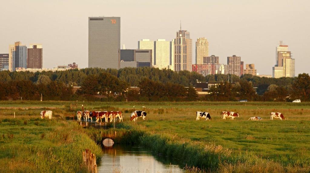


35 Developing a sustainable urban environment Sentinel 2
Copernicus Today and Tomorrow GEO Week Group on Earth Observation Geneva, 16 January 2014 The Copernicus Space Infrastructure
 Copernicus Today and Tomorrow GEO Week Group on Earth Observation Geneva, 16 January 2014 The Copernicus Space Infrastructure Thomas Beer, Policy Coordinator, Copernicus Space Office, ESA-ESRIN, Frascati
UN COPUOS 52 nd session of the Scientific and Technical Subcommittee. COPERNICUS - an European Achievement. S. Jutz Head, ESA Copernicus Space Office
 UN COPUOS 52 nd session of the Scientific and Technical Subcommittee COPERNICUS - an European Achievement S. Jutz Head, ESA Copernicus Space Office 11 Feb 2015, Vienna 1 2 What is Copernicus? European
Sentinel-1 Mission Status
 Sentinel-1 Mission Status Pierre Potin, Sentinel-1 Mission Manager, ESA Luca Martino, Technical Support Engineer, ESA... and the Sentinel-1 operations team PSTG SAR Coordination Working Group 14 December
Towards eenvironment Prague, March GMES Space Component. Josef Aschbacher Head, ESA GMES Space Office
 Towards eenvironment Prague, 25-27 March 2009 GMES Space Component Josef Aschbacher Head, ESA GMES Space Office Prague from Space Segment 2 05 Nov 2003 CNES 2003 GISAT 2007 ESA GSELAND GMES is an EU led
Sentinel-1 Mission Status
 Sentinel-1 Mission Status Pierre Potin, Sentinel-1 Mission Manager 5TH GEOGLAM RAPP Workshop 16-17 May 2017, ESRIN Sentinel-1: Copernicus radar imaging mission for ocean, land, emergency Part of the Copernicus
CopernicusEU. the EU's Earth Observation Programme. Sara Zennaro Atre Delegation of the European Union to Japan
 Copernicus the EU's Earth Observation Programme Sara Zennaro Atre Delegation of the European Union to Japan Status Overview, Sept 2016 & Ocean Policies Seminar 4 October 2016 ollow us on: Copernicus EU
Copernicus Schaffung einer europäischen Kapazität für die operationelle Erdbeobachtung
 Copernicus Schaffung einer europäischen Kapazität für die operationelle Erdbeobachtung ESOC, Darmstadt, 23 April 2015 Simon Jutz, ESA Head, Copernicus Space Office (EOP-CO) Earth Observation Programmes
Infrastructure monitoring using SAR interferometry
 Infrastructure monitoring using SAR interferometry Hossein Nahavandchi Roghayeh Shamshiri Norwegian University of Science and Technology (NTNU), Department of Civil and Environmental Engineering Geodesy
Satelliten- gestuetzte Erdbeobachtung
 Satelliten- gestuetzte Erdbeobachtung SPIK 2018, Bern 21. Maerz 2018 Dr. Thomas Beer, ESA- ESRIN Politik Koordinator im Copernicus Weltraum- Buero Issue/Revision: 0.0 Reference: Status: ESA UNCLASSIFIED
ESA Status Report. ET-SAT-11, WMO, Geneva, CH, 4 April Prepared by Earth Observation Programmes Directorate
 ESA Status Report ET-SAT-11, WMO, Geneva, CH, 4 April 2017 Prepared by Earth Observation Programmes Directorate Presented by Ivan Petiteville, ESA, Earth Observation Programmes Issue/Revision: 0.0 Reference:
Copernicus Space Component Status & Evolution
 Copernicus Space Component Status & Evolution ESCAP, Bangkok 09 October 2017 Simon Jutz Head of the ESA Copernicus Space Office Directorate of Earth Observation Programmes 28 satellites in development
Emergency Management Service (EMS) mapping
 mapping") GMES Emergency Management Service (EMS) mapping Frédéric BASTIDE GMES unit, European Commission UN-SPIDER Expert Meeting: "Crowdsource Mapping for Disaster Risk Management and Emergency Response" 3-5 December,
GMES Emergency Management Service (EMS) mapping Frédéric BASTIDE GMES unit, European Commission UN-SPIDER Expert Meeting: "Crowdsource Mapping for Disaster Risk Management and Emergency Response" 3-5 December,
ESA s Earth Observation Programmes
 ESA s Earth Observation Programmes 2015 DRAGON Symposium Interlaken, 23 June 2015 Maurice Borgeaud Head of the Department Science, Applications, and Future Technologies ESA Earth Observation Programmes
The ESA Earth observation programmes overview and outlook
 The ESA Earth observation programmes overview and outlook Dr. Volker Liebig Director, ESA EO Programmes ILA 2008, Berlin ENVISAT mission: 6 years! Bam earthquake Tectonic uplift (Andaman) Arctic 2007 First
Copernicus Overview and Emergency Management Service
 Copernicus Overview and Emergency Management Service Frédéric BASTIDE European Commission Open informal session of the United Nations Inter-Agency Meeting on Outer Space Activities 12 March 2013, Geneva
Opportunities for advanced Remote Sensing; an outsider s perspective
 Opportunities for advanced Remote Sensing; an outsider s perspective Ramon Hanssen Delft University of Technology 1 Starting questions Can we do more with the data we are already acquire? What s in stock
Copernicus the European Space Programme for Earth Observation
 Copernicus the European Space Programme for Earth Observation http://www.copernicus.eu http://www.esa.int An Introduction Rome 2017 by Giorgio Bagnasco Issue/Revision: 0.0 Reference: ESA UNCLASSIFIED Status:
Earth Observation + Artificial Intelligence = Smart Society 2.0
 Earth Observation + Artificial Intelligence = Smart Society 2.0 Dag Anders Moldestad Norwegian Space Centre Dag.anders.moldestad@spacecentre.no 22 51 18 09 Automatic sea ice analysis based on AMSR2 & Sentinel-1
Status report on current and future satellite systems by EUMETSAT Presented to CGMS-44, Plenary session, agenda item D.1
 Status report on current and future satellite systems by EUMETSAT Presented to CGMS-44, Plenary session, agenda item D.1 CGMS-44-EUMETSAT-WP-19.ppt, version 1 (# 859110), 8 June 2016 MISSION PLANNING YEAR...
European Space Agency
 Guidelines - Guidelines how/when to interact during the WebEx session: - Due to the number of attendees, please keep always your webcam and microphone switched-off - You can use anytime the chat to all
sentinel-2 COLOUR VISION FOR COPERNICUS
 sentinel-2 COLOUR VISION FOR COPERNICUS SATELLITES TO SERVE By providing a set of key information services for a wide range of practical applications, Europe s Copernicus programme is providing a step
Copernicus Space Component
 Copernicus Space Component Core and Collaborative Ground Segment, Operations Concept, Data Access Simon.Jutz (@esa.int) Head, Copernicus Space Office European Space Agency, Earth Observation Programmes
Sentinel-1/-2/-3 Overview and Status
 Sentinel-1/-2/-3 Overview and Status Meeting with Austrian Partners 27 May 2014, Vienna Slide 1 Copernicus Components Coordinators: Partners: Space Component Industries National Space Agencies Private
An Update on EUMETSAT Programmes and Plans. Dieter Klaes on behalf of EUMETSAT teams
 An Update on EUMETSAT Programmes and Plans Dieter Klaes on behalf of EUMETSAT teams 1 21 st International TOVS Study Conference (ITSC), Darmstadt, Germany, 29 November 2017 5 December 2017 Current EUMETSAT
Marine Situational Awareness and Environmental Monitoring using Satellites
 1 The Ny-ålesund Symposium 2013 The Changing Arctic Opportunity or Threat Marine Situational Awareness and Environmental Monitoring using Satellites Rolf Skatteboe President, Kongsberg Satellite Services
National Satellite Data Centre and Finnish Sentinel Collaborative Ground Segment. Jyri Heilimo Finnish Meteorological Instute
 National Satellite Data Centre and Finnish Sentinel Collaborative Ground Segment Jyri Heilimo Finnish Meteorological Instute Sodankylä National Satellite Data Centre National satellite data centre providing
sentinel-3 A BIGGER PICTURE FOR COPERNICUS
 sentinel-3 A BIGGER PICTURE FOR COPERNICUS SATELLITES TO SERVE By providing a set of key information services for a wide range of practical applications, Europe s Copernicus programme has been put in place
Overview and Status of ESA Earth Observation Programmes
 Overview and Status of ESA Earth Observation Programmes Maurice Borgeaud, ESA Head of the Science, Applications and Future Technologies Department Directorate of Earth Observation Programmes ADM-Aeolus
SENTINEL 1 Mission status and contribution to PSTG
 PSTG SAR WG meeting, 12 September 2016, ESTEC SENTINEL 1 Mission status and contribution to PSTG First Sentinel1B Images 28 April 2016 Sentinel-1B Launch from Kourou, 25 April 2016 Sentinel 1 Mission Operations
Status of the Sentinel-5 Precursor Presented by C. Zehner S5p, S4, and S5 Missions Manager - ESA
 Status of the Sentinel-5 Precursor Presented by C. Zehner S5p, S4, and S5 Missions Manager - ESA European response to global needs: to manage the environment, to mitigate the effects of climate change
METEOSAT THIRD GENERATION
 METEOSAT THIRD GENERATION FACTS AND FIGURES MONITORING WEATHER AND CLIMATE FROM SPACE A HIGHLY INNOVATIVE GEOSTATIONARY SATELLITE SYSTEM FOR EUROPE AND AFRICA The Meteosat Third Generation (MTG) system
Sentinels for Climate Services
 Sentinels for Climate Services PP. Mathieu, J. Wagemann & many colleagues.. with many thanks to them! ESA/ESRIN pierre.philippe.mathieu@esa.int ECMWF, Obs Requirements 1 for C3S, 1 Jul 2015 (v05) 1. The
The Copernicus Climate Change (C3) service: State of play
 service: State of play") Enterprise and Industry The Copernicus Climate Change (C3) service: State of play B. Pinty (a) & J-N. Thépaut (b) (a) Copernicus G.2 unit (b) ECMWF CCI October2014 Legal frame & MS consultations Publica6on
Enterprise and Industry The Copernicus Climate Change (C3) service: State of play B. Pinty (a) & J-N. Thépaut (b) (a) Copernicus G.2 unit (b) ECMWF CCI October2014 Legal frame & MS consultations Publica6on
EUMETSAT Satellite Status
 EUMETSAT Satellite Status Dr. K. Dieter Klaes EUMETSAT 1 ET-SAT Meeting 4-6 April 2017, WMO, Geneva, Switzerland EUMETSAT is an intergovernmental organisation with 30 Member States and 1 Cooperating State
A.2 Copernicus, Sentinels und Meer. Daten der Sentinel Satelliten - Datenprodukte und Anwendungsbeispiele
 Nationales Forum fuer Fernerkundung und Copernicus, 3. 5. Nov 2015, Berlin A.2 Copernicus, Sentinels und Meer Daten der Sentinel Satelliten - Datenprodukte und Anwendungsbeispiele Simon Jutz, Head, ESA
Floating Ice: Progress in Addressing Science Goals
 Polar Floating Ice: Progress in Addressing Science Goals Stephen Howell 1, Leif Toudal Pedersen 2 and Roberto Saldo 3 1 Environment Canada, Climate Research Division, Toronto, Canada 2 Danish Meteorological
EUMETSAT STATUS AND PLANS
 1 EUM/TSS/VWG/15/826793 07/10/2015 EUMETSAT STATUS AND PLANS François Montagner, Marine Applications Manager, EUMETSAT WMO Polar Space Task Group 5 5-7 October 2015, DLR, Oberpfaffenhofen PSTG Strategic
Arctic Observing Systems Challenges, New opportunities and Integration
 Arctic Observing Systems Challenges, New opportunities and Integration Japan Norway Arctic Science Week 03 June 2016 By Stein Sandven, NERSC Building an integrated Arctic Observing System Need to collect,
GI Technology for Disaster Management
 GI Technology for Disaster Management 17 th ICC on the Regional Space Applications Programme for Sustainable Development (RESAP) 26 th Nov 2013 Bangkok Thailand Period and time of seasonal in thailand
Securing EUMETSAT s Mission from an Evolving Space Environment
 Securing EUMETSAT s Mission from an Evolving Space Environment ESPI 12 th Autumn Conference Andrew Monham 1 EUMETSAT: Intergovernmental Organisation of 30 Member States Presentation Contents AUSTRIA BELGIU
Julia Figa-Saldaña & Klaus Scipal
 Julia Figa-Saldaña & Klaus Scipal julia.figa@eumetsat.int klaus.scipal@esa.int Meeting, Outline MetOp/EPS status MetOp/EPS Second Generation status 2016 scatterometer conference Other European ocean programme
Status of ESA EO Programmes
 Status of ESA EO Programmes 54 th ESSC Plenary Meeting 24 November 2017 Maurice Borgeaud, ESA Head of the ESA Earth Observation Science, Applications and Climate Department Issue/Revision: 0.0 Reference:
EUMETSAT SAF NETWORK. Lothar Schüller, EUMETSAT SAF Network Manager
 1 EUMETSAT SAF NETWORK Lothar Schüller, EUMETSAT SAF Network Manager EUMETSAT ground segment overview METEOSAT JASON-2 INITIAL JOINT POLAR SYSTEM METOP NOAA SATELLITES CONTROL AND DATA ACQUISITION FLIGHT
CNES actions towards risk mitigation and climate change monitoring
 United nations / Germany International Conference: International cooperation Towards Low-Emission and Resilient Societies 22-24 Nov 2017, Bonn CNES actions towards risk mitigation and climate change monitoring
A state of the art and user driven Copernicus service Physics and Biogeochemistry
 C M E M S P r e s e n t a n d F u t u r e R e q u i r e m e n t s f o r I n - S i t u a n d S a t e l l i t e O b s e r v a t i o n s Antonio REPPUCCI; Pierre Yves LE TRAON Mercator Ocean International
C o p e r n i c u s a n d W I G O S
 C o p e r n i c u s a n d W I G O S Jean-Noël Thépaut & Mark Dowell 24 October 2017 GEO XIV, Washington DC, 23-28 October 2017 T h e C o p e r n i c u s P r o g r a m m e Copernicus is the European Union
Copernicus Opportunities and Challenges in Europe s eyes on Earth
 Copernicus Opportunities and Challenges in Europe s eyes on Earth Gunter Schreier Deputy Director DLR German Remote Sensing Data Center - Earth Observation Center Rotterdam 25. Mai 2016 Sentinel - Missions
RADAR Remote Sensing Application Examples
 RADAR Remote Sensing Application Examples! All-weather capability: Microwave penetrates clouds! Construction of short-interval time series through cloud cover - crop-growth cycle! Roughness - Land cover,
Marine Monitoring. The Copernicus Marine Service
 Marine The Copernicus Marine Service Why is the marine sector so important? Marine Blue Economy, 5 million jobs, gross added value almost 500bn/year 90% of international trade is maritime Half of the world's
COMBINING EUMETSAT AND SENTINEL MISSIONS TO CREATE NEW OPPORTUNITIES MONITORING WEATHER AND CLIMATE FROM SPACE
 COPERNICUS @EUMETSAT COMBINING EUMETSAT AND SENTINEL MISSIONS TO CREATE NEW OPPORTUNITIES MONITORING WEATHER AND CLIMATE FROM SPACE COPERNICUS A EUROPEAN RESPONSE TO THE CHALLENGE OF GLOBAL MONITORING
Polar Space Task Group Space Agency Report
 Polar Agency Report EUMETSAT WMO HQ, Geneva 16-18 October, 2018 EUMETSAT News EPS OSI SAF products Sentinel-3 PSTG8 Meeting, WMO, 16-18 Oct., 2018 EUMETSAT Polar System: Metop- C Launch Preparation Metop-C
U s i n g t h e E S A / E U M E T C A S T N a v i g a t o r s
 U s i n g t h e E S A / E U M E T C A S T N a v i g a t o r s Copernicus User Uptake Information Sessions Copernicus EU Copernicus EU Copernicus EU www.copernicus.eu I N T R O D U C T I O N O F U S E C
The Copernicus Sentinel-5 Mission: Daily Global Data for Air Quality, Climate and Stratospheric Ozone Applications
 SENTINEL-5 The Copernicus Sentinel-5 Mission: Daily Global Data for Air Quality, Climate and Stratospheric Ozone Applications Yasjka Meijer RHEA for ESA, Noordwijk, NL 15/04/2016 Co-Authors: Jörg Langen,
EUMETSAT Activities Related to Climate
 EUMETSAT Activities Related to Climate Jörg Schulz joerg.schulz@eumetsat.int Slide: 1 What we do USER REQUIREMENTS European National Meteorological Services Operating Agency! European Space Industry Private
Copernicus the EU's Earth Observation Programme
 Copernicus the EU's Earth Observation Programme Cristina Ananasso Copernicus Unit I2 DG GROW Status Overview, Nov 2016 Horizon 2020 Info Day - Rome Follow us on: Copernicus EU CopernicusEU www.copernicus.eu
The Future of Remote Sensing
 The Future of Remote Sensing BELSPO - 30 Years of Remote Sensing Research 17 September 2015, Brussels Research and Michael Berger Earth Observation Sector Directorate Climate Action and Resource Efficiency
Operational ice charting in mid-latitudes using Near-Real-Time SAR imagery
 Operational ice charting in mid-latitudes using Near-Real-Time SAR imagery Sergey Vernyayev Ice Engineer ICEMAN.KZ Carles Debart Project Manager Energy, Environment and Security Yevgeniy Kadranov Ice charting
Geoscience Australia Report on Cal/Val Activities
 Medhavy Thankappan Geoscience Australia Agency Report I Berlin May 6-8, 2015 Outline 1. Calibration / validation at Geoscience Australia Corner reflector infrastructure for SAR calibration (for information)
Snow Cover Applications: Major Gaps in Current EO Measurement Capabilities
 Snow Cover Applications: Major Gaps in Current EO Measurement Capabilities Thomas NAGLER ENVEO Environmental Earth Observation IT GmbH INNSBRUCK, AUSTRIA Polar and Snow Cover Applications User Requirements
«Data management and visualization issues of the Copernicus satellite data»
 «Data management and visualization issues of the Copernicus satellite data» Dr. Panos Lolonis Member of the Scientific Council NATIONAL CADASTRE AND MAPPING AGENCY S.A. 288 Mesogion Ave 155 62 Holaros
EO4SEE - THE PATHFINDER OF OPERATIONAL SATELLITE MONITORING FOR THE REGION OF THE BLACK SEA AND CENTRAL EUROPE
 EO4SEE: Pathfinder assessment for regional high volume data access, processing and information service delivery platforms - South East Region EO4SEE - THE PATHFINDER OF OPERATIONAL SATELLITE MONITORING
Space for Sustainable Development
 Space for Sustainable Development ESA s contribution to the Where, What, and How of Data Dr. Christoph Aubrecht Directorate of Earth Observation Programmes Science, Applications and Future Technologies
Supporting GPSC Cities with Satellite Earth Observation for Sustainable Urban Development
 Supporting GPSC Cities with Satellite Earth Observation for Sustainable Urban Development Global Platform for Sustainable Cities African Regional Workshop 14 May 2018 AfDB Headquarters Abidjan, Côte d'ivoire
COPERNICUS SPACE DATA OFFER FOR PUBLIC AUTHORITIES DISTRIBUTED BY ESA
 COPERNICUS SPACE DATA OFFER FOR PUBLIC AUTHORITIES DISTRIBUTED BY ESA The Copernicus Space Component Data Access (CSC-DA) service - financed by the EU and operated by ESA - grants National Public Authorities
AUTOMATED DATA PROCESSING FOR MARITIME AND FLOODS APPLICATIONS
 YOUR HUB FOR GEOSPATIAL APPLICATIONS AUTOMATED DATA PROCESSING FOR MARITIME AND FLOODS APPLICATIONS Angelucci Maria, Daffina Filippo, Grandoni Domenico, Quattrociocchi Dino Automated Data Processing (Smart
Committee on Earth Observation Satellites. The CEOS Volcano Demonstrator Rationale and Implementation
 Committee on Earth Observation Satellites The CEOS Volcano Demonstrator Rationale and Implementation Why focus on volcanoes? Over 300,000 people have been killed by volcanoes since the 1600s Globally,
Status DLR (TerraSAR X / TanDEM X)
") SAR Coordination Working Meeting 5 Status DLR (TerraSAR X / TanDEM X) Dana Floricioiu, Achim Roth Imaging Requirements for TerraSAR X & TanDEM X Missions Ice Sheets: TSX supports Greenland outlet glaciers,
SAR Coordination Working Meeting 5 Status DLR (TerraSAR X / TanDEM X) Dana Floricioiu, Achim Roth Imaging Requirements for TerraSAR X & TanDEM X Missions Ice Sheets: TSX supports Greenland outlet glaciers,
MONITORING THE ATMOSPHERE, OCEAN AND CLIMATE FROM SPACE
 MONITORING THE ATMOSPHERE, OCEAN AND CLIMATE FROM SPACE TRANSFORMING OUR WORLD MONITORING WEATHER AND CLIMATE FROM SPACE MONITORING THE ATMOSPHERE, OCEAN AND CLIMATE FROM SPACE FOR TRANSFORMING OUR WORLD
Current Status of the ALOS-2 Operation and PALSAR-2 Calibration Activities
 Current Status of the ALOS-2 Operation and PALSAR-2 Calibration Activities Takeshi Motohka, Ryo Natsuaki, Yukihiro Kankaku, Shinichi Suzuki, Masanobu Shimada (JAXA) Osamu Isoguchi (RESTEC) CEOS SAR CALVAL
Earth Observation and Renewable Energy
 ESMAP Knowledge Exchange Forum 2013 November 21 The Hague, Netherlands Earth Observation and Renewable Energy Zoltan Bartalis Earth Observation Exploitation Engineer Science, Applications and Future Technologies
IPSENTINEL. The Collaborative Infrastructure for Sentinel Data in Portugal. IPSentinel
 IPSENTINEL The Collaborative Infrastructure for Sentinel Data in Portugal 1 MISSION The Directorate-General for the Territory Development (DGT) and the Portuguese Institute for the Sea and the Atmosphere
EUMETSAT. A global operational satellite agency at the heart of Europe. Presentation for the Spanish Industry Day Madrid, 15 March 2012
 EUMETSAT A global operational satellite agency at the heart of Europe Presentation for the Spanish Industry Day Madrid, Angiolo Rolli EUMETSAT Director of Administration EUMETSAT objectives The primary
MERSEA Marine Environment and Security for the European Area
 MERSEA Marine Environment and Security for the European Area Development of a European system for operational monitoring and forecasting of the ocean physics, biogeochemistry, and ecosystems, on global
TerraSAR-X and TanDEM-X Applications for Maritime Domain Awereness
 TerraSAR-X and TanDEM-X Applications for Maritime Domain Awereness Dr. Stephan Brusch German Aerospace Center DLR Remote Sensing Technology Institute DLR Oberpfaffenhofen (Germany) Dr. Jürgen Drescher
DLR s TerraSAR-X contributes to international fleet of radar satellites to map the Arctic and Antarctica
 DLR s TerraSAR-X contributes to international fleet of radar satellites to map the Arctic and Antarctica The polar regions play an important role in the Earth system. The snow and ice covered ocean and
Meteorological Missions
 Meteorological Missions Guido Levrini ESA GSC Space Segment Programme Manager Page 1 Introduction ESA initiated Europe s entry into satellite meteorology with the development and launch of the first Meteosat
Monitoring Sea Ice with Space-borne Synthetic Aperture Radar
 Monitoring Sea Ice with Space-borne Synthetic Aperture Radar Torbjørn Eltoft UiT- the Arctic University of Norway CIRFA A Centre for Research-based Innovation cirfa.uit.no Sea ice & climate Some basic
Essential Biodiversity Variables Workshop
 Essential Biodiversity Variables Workshop Dr. Maurice Borgeaud ESA Earth Observation Programmes ESA ESRIN 27 February 2012 The European Space Agency To provide for and promote, for exclusively peaceful
Remote Sensing I: Basics
 Remote Sensing I: Basics Kelly M. Brunt Earth System Science Interdisciplinary Center, University of Maryland Cryospheric Science Laboratory, Goddard Space Flight Center kelly.m.brunt@nasa.gov (Based on
GEOG Lecture 8. Orbits, scale and trade-offs
 Environmental Remote Sensing GEOG 2021 Lecture 8 Orbits, scale and trade-offs Orbits revisit Orbits geostationary (36 000 km altitude) polar orbiting (200-1000 km altitude) Orbits revisit Orbits geostationary
Interferometric Synthetic Aperture Radar (InSAR) and GGOS. Andrea Donnellan NASA/JPL February 21, 2007
 and GGOS. Andrea Donnellan NASA/JPL February 21, 2007") Interferometric Synthetic Aperture Radar (InSAR) and GGOS Andrea Donnellan NASA/JPL February 21, 2007 Sources for Science Objectives Fourth component of EarthScope Involvement: NSF, NASA, USGS, Universities
Interferometric Synthetic Aperture Radar (InSAR) and GGOS Andrea Donnellan NASA/JPL February 21, 2007 Sources for Science Objectives Fourth component of EarthScope Involvement: NSF, NASA, USGS, Universities
Satellite Remote Sensing for Ocean
 Satellite Remote Sensing for Ocean August 17, 2017 Masatoshi Kamei RESTEC All rights reserved RESTEC 2015 Contents 1. About RESTEC and Remote Sensing 2. Example of Remote Sensing Technology 3. Remote Sensing
Geological Mapping Using EO Data for Onshore O&G Exploration
 Geological Mapping Using EO Data for Onshore O&G Exploration Michael Hall ESA Oil and Gas Workshop, Frascati, Italy michael.hall@infoterra-global.com Why use EO data for Geological Mapping? Availability
A BRIEF INTRODUCTION TO COPERNICUS AND CAMS
 A BRIEF INTRODUCTION TO COPERNICUS AND CAMS Juan Garcés de Marcilla Director of Copernicus Services European Centre for Medium-Range Weather Forecasts Copernicus EU Copernicus EU Copernicus EU www.copernicus.eu
Osservazione della terra da piattaforme remore ed in-situ fisse e mobili. Massimo Caccia CNR - ISSIA
 Osservazione della terra da piattaforme remore ed in-situ fisse e mobili Massimo Caccia CNR - ISSIA massimo.caccia@ge.issia.cnr.it 1 Research themes geo-physical monitoring environmental hazards monitoring
C O P E R N I C U S F O R G I P R O F E S S I O N A L S
 C O P E R N I C U S F O R G I P R O F E S S I O N A L S Downstream Applications MALTA 2017-06-26 Pascal Lory, EUROGI EU EU EU www.copernicus.eu S c o p e Identifying urban housing density: Stella Ofori-Ampofo,
The DEIMOS Earth Observation System and the PanGeo Alliance. Contribution to CSCDA Data WareHouse 2. Fabrizio Pirondini CEO, Elecnor Deimos Imaging
 The DEIMOS Earth Observation System and the PanGeo Alliance Contribution to CSCDA Data WareHouse 2 Fabrizio Pirondini CEO, Elecnor Deimos Imaging Copernicus Space Component Data Access Workshop ESRIN,
HY-2A Satellite User s Guide
 National Satellite Ocean Application Service 2013-5-16 Document Change Record Revision Date Changed Pages/Paragraphs Edit Description i Contents 1 Introduction to HY-2 Satellite... 1 2 HY-2 satellite data
New NASA Ocean Observations and Coastal Applications
 New NASA Ocean Observations and Coastal Applications Duane Armstrong Chief, Applied Science & Technology Project Office August 20, 2014 1 Outline NASA s new Earth Science Ocean Science Missions for 2014
National Remote Sensing Center of China. Space Technology for Sustainable Development in China Status, Achievements and Futures.
 National Remote Sensing Center of China Space Technology for Sustainable Development in China Status, Achievements and Futures Jing Li National Remote Sensing Center of China Ministry of Science and Technology,
Future perspectives for EO in Development
 Future perspectives for EO in Development Meeting at ESA/ESRIN in Frascati 11 th of September 2018 #WorldInCommon AGENCE FRANÇAISE DE DÉVELOPPEMENT FRENCH DEVELOPMENT AGENCY 01. What is AFD? France s international
Remote Sensing products and global datasets. Joint Research Centre, European Commission
 Remote Sensing products and global datasets Joint Research Centre, European Commission Setting the stage. Needs and requirements for integrated approach(es) for land degradation assessment. in Special
Status of EUMETSAT Operational Services & EUMETCast Africa Dissemination Baseline Updates
 Status of EUMETSAT Operational Services & EUMETCast Africa Dissemination Baseline Updates Sally Wannop User Relations Manager 1 8th WMO RAIDEG meeting 1-2 November 2017 # 951881 Overview EUMETCast Overview
FMI Arctic Space Centre. Jyri Heilimo Finnish Meteorological Institute
 FMI Arctic Space Centre Jyri Heilimo Finnish Meteorological Institute FMI - Arctic Space Center Studies of atmospheric phenomena and their interaction with biosphere and cryosphere in high latitudes Hydrology,
The International Charter Space and Major Disasters is further strengthening its contribution to disaster management worldwide.
 28 September 2012 Issue 3 The International Charter Space and Major Disasters is further strengthening its contribution to disaster management worldwide. Building on a decade of success in making satellite
ESA UNCLASSIFIED For Official Use
 First revision (draft for Commission review) 15.06.2015 See track changes Second update following comments from Commission 15.08.2015 See track changes Third and final update following final comments from
EUMETSAT Climate Activities
 EUMETSAT Climate Activities Jörg Schulz EUMETSAT s Role in Climate Monitoring EUMETSAT has a prominent role in the world for providing services relevant to climate: EUMETSAT maintains some of the longest
Next generation of EUMETSAT microwave imagers and sounders: new opportunities for cloud and precipitation retrieval
 Next generation of EUMETSAT microwave imagers and sounders: new opportunities for cloud and precipitation retrieval Christophe Accadia, Sabatino Di Michele, Vinia Mattioli, Jörg Ackermann, Sreerekha Thonipparambil,
ZRCSAZU. Remote sensing and Earth observation data at ZRC SAZU. dr. Tatjana Veljanovski Atrij ZRC Ljubljana
 ZRCSAZU Remote sensing and Earth observation data at ZRC SAZU dr. Tatjana Veljanovski 2016-06-08 Atrij ZRC Ljubljana Remote Sensing Department Remote Sensing Department 20 years of experience application,
Sentinel-1A SAR Interferometry Verification
 Sentinel-1A SAR Interferometry Verification Dirk Geudtner1, Pau Prats2, Nestor Yaguee-Martinez2, Andrea Monti Guarnieri3, Itziar Barat1, Björn Rommen1 and Ramón Torres1 1ESA ESTEC 2DLR, Microwave and Radar