Multi-Satellite 3D Winds Land/Atmosphere Requirements
|
|
|
- Martin Lindsey
- 5 years ago
- Views:
Transcription


1 Multi-Satellite 3D Winds Land/Atmosphere Requirements James L Carr* Carr Astronautics 6404 Ivy Lane, #333 Greenbelt, MD August 22-23, 2017 NOAA Workshop *jcarr@carrastro.com
2 Multi-Satellite 3D Winds Capability Name: Multi-Satellite 3D-Winds Capability Developer (NOAA funding organization): Self Partnerships in Development: CIMSS Capability Brief Description/Status: Optical flow of cloud/moisture tracers with parallax from multiple satellites enables retrievals of wind vectors with heights. Algorithm has been prototyped and tested. As presented at the 2017 NOAA Workshop 2
3 Multi-Satellite 3D Winds Derived Motion Wind height assignments are as important as the wind vectors themselves. Accurate and reliable height assignments can now be derived from parallax observations thanks to the high-quality Image Navigation and Registration (INR) now being achieved across the GOES constellation. We have a prototype 3D-Wind product and have crosscompared our parallax heights against CLAVR-x and CALIPSO with good results. As presented at the 2017 NOAA Workshop 3
4 Multi-Satellite 3D Winds What RFI gap can capability address? 2d How will capability complement or replace existing capabilities? Improves on wind height assignments by directly assigning heights to optical tracers used to derive wind vectors from first principles. What cost efficiencies are inherent to the capability? Extends on an existing GOES L2 Product (Derived Motion Winds) while using existing observing assets. True Enterprise Algorithm. As presented at the 2017 NOAA Workshop 4

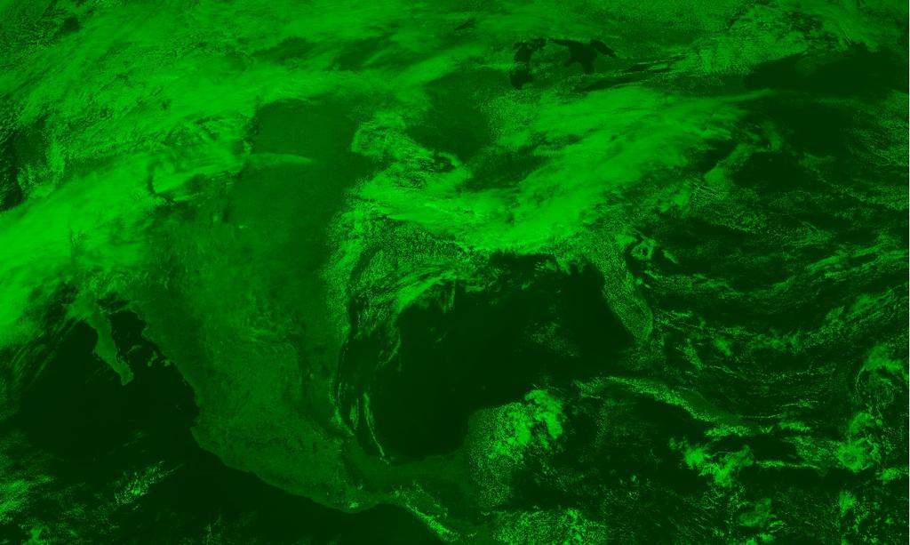
5 Initial Work with Cloud-Top Heights Initial work was directed at Cloud-Top Height (CTH) maps using stereo methods with GOES-13, 14 & 15 while GOES-14 operated during Hurricane Sandy Use VIS Channel for fine resolution As presented at the 2017 NOAA Workshop 5
.")
6 CLAVR-x Comparison Comparison with radiometric CLAVR-x algorithm shows anomalies probably because high thin layer makes assignment, but wind tracers are optically thick Some improvements since in radiometric methods to accommodate layering (Yue Li, et. al NOAA Satellite Conference). As presented at the 2017 NOAA Workshop 6

7 CALIPSO Comparison As presented at the 2017 NOAA Workshop 7
8 3D-Wind Prototype Algorithm We work with G-16 ABI Band 2 and the VIS Bands from the G-13 and G-15 Imagers Multi-satellite pairs/triplets provide height information from parallax Multi-temporal triplets provide optical flow of cloud motion 3D-geometric model solution provides wind vector with a height assignment Simultaneity correction improves accuracy of height assignments As presented at the 2017 NOAA Workshop 8


9 Multi-Temporal/Satellite Triplets G-16 Time G-15 Remapped into G-16 Fixed Grid + 5 minutes G-13 Remapped into G-16 Fixed Grid Longitude longitude = longitude = minutes G-16 As presented at the 2017 NOAA Workshop 9


10 Multi-Temporal Triplet RGB Composite Color separation shows motion Same clouds seen from same satellite at three times As presented at the 2017 NOAA Workshop 10


11 Multi-Satellite Triplet RGB Composite Color separation shows height Nearly Simultaneous Three-Satellite Composite Two Satellites Used Two Satellites Used Three Satellites Used Same cloud seen from the East, Center, West Satellite As presented at the 2017 NOAA Workshop Same cloud seen from the East, Center Satellite 11
")

12 Feature Matching for Tracers We measure feature correspondence with Normalized Cross Correlation (NCC) Interpolate on correlation surface for subpixel precision on relative shift As presented at the 2017 NOAA Workshop 12

13 Autocorrelation Screens for Valid Tracers If autocorrelation doesn t work, cross-correlation won t As presented at the 2017 NOAA Workshop 13

14 Adjustment for Non-Simultaneity Tracer motion can falsely look like parallax if multisatellite images are not simultaneous. As presented at the 2017 NOAA Workshop 14

15 Calibration of Height Assignments Calibrate clear sky over land three-satellite heights versus GLOBE terrain to remove any biases due to relative INR errors which tend to be slowly varying Calibrate two-satellite heights against three-satellite heights for the same slope and bias Over Terrain As presented at the 2017 NOAA Workshop 15

16 Prototype 3D-Winds Product As presented at the 2017 NOAA Workshop 16

17 Constellations for Enterprise 3D-Winds TEMPO GOES-R + S + EPIC + VIIRS As presented at the 2017 NOAA Workshop 17
18 Future Plans Work with GOES-S once it enters Post-Launch Testing Extend to IR & WV winds Experiment with LEO+GEO combinations Collaborate with CIMSS for more validation and comparison against operational products Participate in Cloud & Winds community meetings and exercises Exploit coverage by TEMPO once in orbit Our Goal: Introduce as a real capability within the NOAA weather enterprise. As presented at the 2017 NOAA Workshop 18
19 Multi-Satellite 3D Winds Additional Information: Inter-Comparisons between Radiometric and Geometric Cloud Top Height Products, H. Madani, J. Carr, Andrew Heidinger, and Steve Wanzong, American Geophysical Union, December Stereo Cloud Top Height Products for the GOES-R Era, H. Madani, and J. Carr, NOAA Satellite Conference, April As presented at the 2017 NOAA Workshop 19
COMPARISON OF THE OPTIMAL CLOUD ANALYSIS PRODUCT (OCA) AND THE GOES-R ABI CLOUD HEIGHT ALGORITHM (ACHA) CLOUD TOP PRESSURES FOR AMVS
 AND THE GOES-R ABI CLOUD HEIGHT ALGORITHM (ACHA) CLOUD TOP PRESSURES FOR AMVS") Proceedings for the 13 th International Winds Workshop 27 June - 1 July 2016, Monterey, California, USA COMPARISON OF THE OPTIMAL CLOUD ANALYSIS PRODUCT (OCA) AND THE GOES-R ABI CLOUD HEIGHT ALGORITHM
Proceedings for the 13 th International Winds Workshop 27 June - 1 July 2016, Monterey, California, USA COMPARISON OF THE OPTIMAL CLOUD ANALYSIS PRODUCT (OCA) AND THE GOES-R ABI CLOUD HEIGHT ALGORITHM
GEOMETRIC CLOUD HEIGHTS FROM METEOSAT AND AVHRR. G. Garrett Campbell 1 and Kenneth Holmlund 2
 GEOMETRIC CLOUD HEIGHTS FROM METEOSAT AND AVHRR G. Garrett Campbell 1 and Kenneth Holmlund 2 1 Cooperative Institute for Research in the Atmosphere Colorado State University 2 EUMETSAT ABSTRACT Geometric
Introducing Atmospheric Motion Vectors Derived from the GOES-16 Advanced Baseline Imager (ABI)
") Introducing Atmospheric Motion Vectors Derived from the GOES-16 Advanced Baseline Imager (ABI) Jaime Daniels NOAA/NESDIS, Center for Satellite Applications and Research Wayne Bresky, Andrew Bailey, Americo
Introducing Atmospheric Motion Vectors Derived from the GOES-16 Advanced Baseline Imager (ABI) Jaime Daniels NOAA/NESDIS, Center for Satellite Applications and Research Wayne Bresky, Andrew Bailey, Americo
DERIVING ATMOSPHERIC MOTION VECTORS FROM AIRS MOISTURE RETRIEVAL DATA
 DERIVING ATMOSPHERIC MOTION VECTORS FROM AIRS MOISTURE RETRIEVAL DATA David Santek 1, Sharon Nebuda 1, Christopher Velden 1, Jeff Key 2, Dave Stettner 1 1 Cooperative Institute for Meteorological Satellite
SATELLITE MONITORING OF THE CONVECTIVE STORMS
 SATELLITE MONITORING OF THE CONVECTIVE STORMS FORECASTERS POINT OF VIEW Michaela Valachová, EUMETSAT Workshop at ECMWF User Meeting Reading, 13 June 2017 Central Forecasting Office, Prague michaela.valachova@chmi.cz
REPORT FROM THE INTERNATIONAL CLOUDS WORKING GROUP (ICWG)
") Proceedings for the 13 th International Winds Workshop 27 June - 1 July 2016, Monterey, California, USA REPORT FROM THE INTERNATIONAL CLOUDS WORKING GROUP (ICWG) Dong Wu 1, Bryan Baum 2, Andrew Heidinger
Proceedings for the 13 th International Winds Workshop 27 June - 1 July 2016, Monterey, California, USA REPORT FROM THE INTERNATIONAL CLOUDS WORKING GROUP (ICWG) Dong Wu 1, Bryan Baum 2, Andrew Heidinger
Polar winds from highly elliptical orbiting satellites: a new perspective
 Polar winds from highly elliptical orbiting satellites: a new perspective 10 th International Winds Workshop Tokyo, Japan, Feb -6, 010 L. Garand 1, N. Wagneur 1, R. Sarrazin 1, D. Santek, J. Key 1 Environment
Cross-calibration of Geostationary Satellite Visible-channel Imagers Using the Moon as a Common Reference
 Cross-calibration of Geostationary Satellite Visible-channel Imagers Using the Moon as a Common Reference Thomas C. Stone U.S. Geological Survey, Flagstaff AZ, USA 27 30 August, 2012 Motivation The archives
GLOBAL ATMOSPHERIC MOTION VECTOR INTER-COMPARISON STUDY
 GLOBAL ATMOSPHERIC MOTION VECTOR INTER-COMPARISON STUDY Iliana Genkova (1), Regis Borde (2), Johannes Schmetz (2), Chris Velden (3), Ken Holmlund (2), Mary Forsythe (4), Jamie Daniels (5), Niels Bormann
Himawari-8 BUFR Development for Winds Processing and Radiances Cloud Mask, Cloud Phase, Cloud Height
 Sandy Supplemental Grant Recipient Quarterly Progress Report Himawari-8 BUFR Development for Winds Processing and Radiances Award Number: NA14NES4830006 The National Oceanic and Atmospheric Administration
McIDAS Activities Within The NASA Langley Research Center Clouds And Radiation Group
 McIDAS Activities Within The NASA Langley Research Center Clouds And Radiation Group Kristopher Bedka Science Systems and Applications Inc @ NASA LaRC In Collaboration With (in alphabetical order) J. K.
NWP SAF AMV monitoring: the 7th Analysis Report (AR7)
") Document NWPSAF-MO-TR-032 Version 1.0 24/05/16 NWP SAF AMV monitoring: the 7th Analysis Report (AR7) Francis Warrick Met Office, UK NWP SAF AMV monitoring: the 7th Analysis Report (AR7) Francis Warrick
Document NWPSAF-MO-TR-032 Version 1.0 24/05/16 NWP SAF AMV monitoring: the 7th Analysis Report (AR7) Francis Warrick Met Office, UK NWP SAF AMV monitoring: the 7th Analysis Report (AR7) Francis Warrick
Application of Himawari-8 AHI Data to the GOES-R Rainfall Rate Algorithm
 Application of Himawari-8 AHI Data to the GOES-R Rainfall Rate Algorithm Yaping Li 1, Robert Kuligowski 2 and Yan Hao 1 1. IMSG at NOAA/NESDIS/STAR 2. NOAA/NESDIS/STAR, College Park, MD 1 GOES-R Baseline
CLAVR-x is the Clouds from AVHRR Extended Processing System. Responsible for AVHRR cloud products and other products at various times.
 CLAVR-x in CSPP Andrew Heidinger, NOAA/NESDIS/STAR, Madison WI Nick Bearson, SSEC, Madison, WI Denis Botambekov, CIMSS, Madison, WI Andi Walther, CIMSS, Madison, WI William Straka III, CIMSS, Madison,
Feature-tracked 3D Winds from Satellite Sounders: Derivation and Impact in Global Models
 Feature-tracked 3D Winds from Satellite Sounders: Derivation and Impact in Global Models David Santek, Anne-Sophie Daloz 1, Samantha Tushaus 1, Marek Rogal 1, Will McCarty 2 1 Space Science and Engineering
Measuring Carbon Dioxide from the A-Train: The OCO-2 Mission
 Measuring Carbon Dioxide from the A-Train: The OCO-2 Mission David Crisp, OCO-2 Science Team Leader for the OCO-2 Science Team Jet Propulsion Laboratory, California Institute of Technology March 2013 Copyright
Inter-tropical Convergence Zone (ITCZ) analysis using AIRWAVE retrievals of TCWV from (A)ATSR series and potential extension of AIRWAVE to SLSTR
 analysis using AIRWAVE retrievals of TCWV from (A)ATSR series and potential extension of AIRWAVE to SLSTR") Inter-tropical Convergence Zone (ITCZ) analysis using AIRWAVE retrievals of TCWV from (A)ATSR series and potential extension of AIRWAVE to SLSTR Enzo Papandrea (SERCO, CNR-ISAC, Enzo.Papandrea@serco.com)
Inter-tropical Convergence Zone (ITCZ) analysis using AIRWAVE retrievals of TCWV from (A)ATSR series and potential extension of AIRWAVE to SLSTR Enzo Papandrea (SERCO, CNR-ISAC, Enzo.Papandrea@serco.com)
Himawari-8 BUFR Development for Winds Processing and Radiances - Packaging for Algorithm Integration Team (AIT)
") Sandy Supplemental Grant Recipient Quarterly Progress Report Himawari-8 BUFR Development for Winds Processing and Radiances - Packaging for Algorithm Integration Team (AIT) Award Number: NA14NWS4830052
Sandy Supplemental Grant Recipient Quarterly Progress Report Himawari-8 BUFR Development for Winds Processing and Radiances - Packaging for Algorithm Integration Team (AIT) Award Number: NA14NWS4830052
ERA-CLIM2-WP3: Satellite data reprocessing and inter-calibration
 ERA-CLIM2-WP3: Satellite data reprocessing and inter-calibration Rob Roebeling, Jörg Schulz, Marie Doutriaux- Boucher, Alessio Lattanzio, Viju John, and Andrey Bogdanov Thanks to: Christian Marquardt and
Height correction of atmospheric motion vectors (AMVs) using lidar observations
 using lidar observations") Height correction of atmospheric motion vectors (AMVs) using lidar observations Kathrin Folger and Martin Weissmann Hans-Ertel-Centre for Weather Research, Data Assimilation Branch Ludwig-Maximilians-Universität
Height correction of atmospheric motion vectors (AMVs) using lidar observations Kathrin Folger and Martin Weissmann Hans-Ertel-Centre for Weather Research, Data Assimilation Branch Ludwig-Maximilians-Universität
OSSE to infer the impact of Arctic AMVs extracted from highly elliptical orbit imagery
 OSSE to infer the impact of Arctic AMVs extracted from highly elliptical orbit imagery L. Garand 1 Y. Rochon 1, S. Heilliette 1, J. Feng 1, A.P. Trishchenko 2 1 Environment Canada, 2 Canada Center for
Operational Generation And Assimilation Of Himawari-8. Atmospheric Motion Vectors
 Operational Generation And Assimilation Of Himawari-8 Atmospheric Motion Vectors John Le Marshall 1, David Howard 1, Xingbao Wang 1, Yi Xiao 1, Jim Jung 2, Jaime Daniels 4,Steve Wanzong 2, Joan Fernon
CSPP Geo. CSPP/IMAPP Users Group Meeting 2015 Darmstadt, Germany 15 April 2015
 CSPP Geo Graeme Martin, Liam Gumley, Nick Bearson, Jessica Braun, Geoff Cureton, Ray Garcia, Tommy Jasmin, Scott Mindock, Kathy Strabala University of Wisconsin Madison, Space Science & Engineering Center
Arctic Weather Every 10 Minutes: Design & Operation of ABI for PCW
 Arctic Weather Every 10 Minutes: Design and Operation of ABI for PCW Dr. Paul C. Griffith and Sue Wirth 31st Space Symposium, Technical Track, Colorado Springs, Colorado This document is not subject to
STATUS OF JAPANESE METEOROLOGICAL SATELLITES AND RECENT ACTIVITIES OF MSC
 STATUS OF JAPANESE METEOROLOGICAL SATELLITES AND RECENT ACTIVITIES OF MSC Daisaku Uesawa Meteorological Satellite Center, Japan Meteorological Agency Abstract MTSAT-1R is the current operational Japanese
NESDIS Polar (Region) Products and Plans. Jeff Key NOAA/NESDIS Madison, Wisconsin USA
 Products and Plans. Jeff Key NOAA/NESDIS Madison, Wisconsin USA") NESDIS Polar (Region) Products and Plans Jeff Key NOAA/NESDIS Madison, Wisconsin USA WMO Polar Space Task Group, 2 nd meeting, Geneva, 12 14 June 2012 Relevant Missions and Products GOES R ABI Fractional
NESDIS Polar (Region) Products and Plans Jeff Key NOAA/NESDIS Madison, Wisconsin USA WMO Polar Space Task Group, 2 nd meeting, Geneva, 12 14 June 2012 Relevant Missions and Products GOES R ABI Fractional
Estimation of ocean contribution at the MODIS near-infrared wavelengths along the east coast of the U.S.: Two case studies
 GEOPHYSICAL RESEARCH LETTERS, VOL. 32, L13606, doi:10.1029/2005gl022917, 2005 Estimation of ocean contribution at the MODIS near-infrared wavelengths along the east coast of the U.S.: Two case studies
GENERATION OF HIMAWARI-8 AMVs USING THE FUTURE MTG AMV PROCESSOR
 GENERATION OF HIMAWARI-8 AMVs USING THE FUTURE MTG AMV PROCESSOR Manuel Carranza 1, Régis Borde 2, Masahiro Hayashi 3 1 GMV Aerospace and Defence S.A. at EUMETSAT, Eumetsat Allee 1, D-64295 Darmstadt,
NEW APPROACH FOR HEIGHT ASSIGNMENT AND STRINGENT QUALITY CONTROL TESTS FOR INSAT DERIVED CLOUD MOTION VECTORS. P. N. Khanna, S.
 NEW APPROACH FOR HEIGHT ASSIGNMENT AND STRINGENT QUALITY CONTROL TESTS FOR INSAT DERIVED CLOUD MOTION VECTORS P. N. Khanna, S. Prasad India Meteorological Department, Lodhi Road, New Delhi 110003. ABSTRACT
Detailed Cloud Motions from Satellite Imagery Taken at Thirty Second One and Three Minute Intervals
 Detailed Cloud Motions from Satellite Imagery Taken at Thirty Second One and Three Minute Intervals James F.W. Purdom NOAA/NESDIS/RAMM Branch CIRA Colorado State University W. Laporte Avenue Fort Collins,
POLAR WINDS FROM VIIRS
 POLAR WINDS FROM VIIRS Jeff Key 1, Richard Dworak, David Santek, Wayne Bresky 3, Steve Wanzong, Jaime Daniels 4, Andrew Bailey 3, Christopher Velden, Hongming Qi, Pete Keehn 5, and Walter Wolf 4 1 NOAA/National
EVALUATION OF TWO AMV POLAR WINDS RETRIEVAL ALGORITHMS USING FIVE YEARS OF REPROCESSED DATA
 EVALUATION OF TWO AMV POLAR WINDS RETRIEVAL ALGORITHMS USING FIVE YEARS OF REPROCESSED DATA Roger Huckle, Marie Doutriaux-Boucher, Rob Roebeling, and Jörg Schulz EUMETSAT, Eumetsat-Allee 1, Darmstadt,
Recent Changes in the Derivation of Geostationary AMVs at EUMETSAT. Manuel Carranza Régis Borde Marie Doutriaux-Boucher
 Recent Changes in the Derivation of Geostationary AMVs at EUMETSAT Manuel Carranza Régis Borde Marie Doutriaux-Boucher Summary Introduction to EUMETSAT s geostationary AMVs Recent changes: Cross-Correlation
Atmospheric Motions Derived From Space Based Measurements: A Look To The Near Future. James F.W. Purdom
 Atmospheric Motions Derived From Space Based Measurements: A Look To The Near Future James F.W. Purdom Director, Office of Research and Applications NOAA/NESDIS 1. Introduction This short note addresses
AMVS: PAST PROGRESS, FUTURE CHALLENGES
 Proceedings for the 13 th International Winds Workshop 27 June - 1 July 2016, Monterey, California, USA AMVS: PAST PROGRESS, FUTURE CHALLENGES Mary Forsythe, James Cotton, Francis Warrick Met Office, FitzRoy
MSG system over view
 MSG system over view 1 Introduction METEOSAT SECOND GENERATION Overview 2 MSG Missions and Services 3 The SEVIRI Instrument 4 The MSG Ground Segment 5 SAF Network 6 Conclusions METEOSAT SECOND GENERATION
AMV height retrievals from stereo and IR techniques
 AMV height retrievals from stereo and IR techniques Dong L. Wu 1, Kevin J. Mueller 2, David Liu 3, and Jie Gong 4 1. NASA/Goddard Space Flight Center (GSFC) 2. Jet Propulsion Lab (JPL), California Institute
MISR 17.6 km Gridded Cloud Motion Vectors: Overview and Assessment
 MISR 17.6 km Gridded Cloud Motion Vectors: Overview and Assessment Kevin Mueller, Michael Garay, Catherine Moroney, Veljko Jovanovic Jet Propulsion Laboratory Feb. 22, 2012 Height (m) Mean MISR July 2007
FLUXNET and Remote Sensing Workshop: Towards Upscaling Flux Information from Towers to the Globe
 FLUXNET and Remote Sensing Workshop: Towards Upscaling Flux Information from Towers to the Globe Space-Based Measurements of CO 2 from the Japanese Greenhouse Gases Observing Satellite (GOSAT) and the
Maryland 20746, U.S.A. Engineering Center (SSEC), University of Wisconsin Madison, Wisconsin 53706, U.S.A ABSTRACT
, University of Wisconsin Madison, Wisconsin 53706, U.S.A ABSTRACT") NESDIS Atmospheric Motion Vector (AMV) Nested Tracking Algorithm: Exploring its Performance Jaime Daniels 1, Wayne Bresky 2, Steven Wanzong 3, Andrew Bailey 2, and Chris Velden 3 1 NOAA/NESDIS Office of
NESDIS Atmospheric Motion Vector (AMV) Nested Tracking Algorithm: Exploring its Performance Jaime Daniels 1, Wayne Bresky 2, Steven Wanzong 3, Andrew Bailey 2, and Chris Velden 3 1 NOAA/NESDIS Office of
MSG Indian Ocean Data Coverage (IODC) Jochen Grandell & Sauli Joro
 Jochen Grandell & Sauli Joro") MSG Indian Ocean Data Coverage (IODC) Jochen Grandell & Sauli Joro 1 EUM/STG-SWG/42/17/VWG/03 v1, 7 8 Mach 2017 Topics Introduction MSG-IODC Overall Project Schedule Status Product validation Products
MSG Indian Ocean Data Coverage (IODC) Jochen Grandell & Sauli Joro 1 EUM/STG-SWG/42/17/VWG/03 v1, 7 8 Mach 2017 Topics Introduction MSG-IODC Overall Project Schedule Status Product validation Products
THE POLAR WIND PRODUCT SUITE
 THE POLAR WIND PRODUCT SUITE Jeffrey Key 1, David Santek 2, Christopher Velden 2, Jaime Daniels 1, Richard Dworak 2 1 Center for Satellite Applications and Research, NOAA/NESDIS 2 Cooperative Institute
Accessing satellite data via Apps, Web Map Servers, and the GOES-R Education Proving Ground. Margaret Mooney CIMSS/SSEC, UW-Madison
 Accessing satellite data via Apps, Web Map Servers, and the GOES-R Education Proving Ground Margaret Mooney CIMSS/SSEC, UW-Madison CIMSS & SSEC at the UW-Madison SSEC Data Center Incoming Data May, 2015
GIFTS SOUNDING RETRIEVAL ALGORITHM DEVELOPMENT
 P2.32 GIFTS SOUNDING RETRIEVAL ALGORITHM DEVELOPMENT Jun Li, Fengying Sun, Suzanne Seemann, Elisabeth Weisz, and Hung-Lung Huang Cooperative Institute for Meteorological Satellite Studies (CIMSS) University
AN UPDATE ON UW-CIMSS SATELLITE-DERIVED WIND DEVELOPMENTS
 AN UPDATE ON UW-CIMSS SATELLITE-DERIVED WIND DEVELOPMENTS Christopher Velden, Steve Wanzong and Paul Menzel University of Wisconsin - Cooperative Institute for Meteorological Satellite Studies 1225 West
THE ATMOSPHERIC MOTION VECTOR RETRIEVAL SCHEME FOR METEOSAT SECOND GENERATION. Kenneth Holmlund. EUMETSAT Am Kavalleriesand Darmstadt Germany
 THE ATMOSPHERIC MOTION VECTOR RETRIEVAL SCHEME FOR METEOSAT SECOND GENERATION Kenneth Holmlund EUMETSAT Am Kavalleriesand 31 64293 Darmstadt Germany ABSTRACT The advent of the Meteosat Second Generation
Operational systems for SST products. Prof. Chris Merchant University of Reading UK
 Operational systems for SST products Prof. Chris Merchant University of Reading UK Classic Images from ATSR The Gulf Stream ATSR-2 Image, ƛ = 3.7µm Review the steps to get SST using a physical retrieval
Interpretation of Polar-orbiting Satellite Observations. Atmospheric Instrumentation
 Interpretation of Polar-orbiting Satellite Observations Outline Polar-Orbiting Observations: Review of Polar-Orbiting Satellite Systems Overview of Currently Active Satellites / Sensors Overview of Sensor
An update on the NOAA MSU/AMSU CDR development
 An update on the NOAA MSU/AMSU CDR development Cheng-Zhi Zou NOAA/NESDIS/Center for Satellite Applications and Research International TOVS Study Conferences (ITSC), Monterey, CA, April 14-20, 2010 1 Outline
Lecture 4b: Meteorological Satellites and Instruments. Acknowledgement: Dr. S. Kidder at Colorado State Univ.
 Lecture 4b: Meteorological Satellites and Instruments Acknowledgement: Dr. S. Kidder at Colorado State Univ. US Geostationary satellites - GOES (Geostationary Operational Environmental Satellites) US
Current Status of COMS AMV in NMSC/KMA
 Current Status of COMS AMV in NMSC/KMA Eunha Sohn, Sung-Rae Chung, Jong-Seo Park Satellite Analysis Division, NMSC/KMA soneh0431@korea.kr COMS AMV of KMA/NMSC has been produced hourly since April 1, 2011.
GIFTS- A SYSTEM FOR WIND PROFILING FROM GEOSTATIONARY SATELLITES
 GIFTS- A SYSTEM FOR WIND PROFILING FROM GEOSTATIONARY SATELLITES William Smith, Wallace Harrison, Dwayne Hinton, Vickie Parsons and Allen Larar NASA LaRC, Hampton Virginia (USA) Henry Revercomb 1, Allen
Comparison of NASA AIRS and MODIS Land Surface Temperature and Infrared Emissivity Measurements from the EOS AQUA platform
 Comparison of NASA AIRS and MODIS Land Surface Temperature and Infrared Emissivity Measurements from the EOS AQUA platform Robert Knuteson, Steve Ackerman, Hank Revercomb, Dave Tobin University of Wisconsin-Madison
Project CyMISS Tropical Cyclone Measurements from the ISS
 Project CyMISS Tropical Cyclone Measurements from the ISS A.T. Stair, Paul Joss, Andrew LePage, John DeVore and Paul Pauliukonis And Joe Kristl, SDL/USU Visidyne, Inc (ats@visidyne.com) 1 Acronyms and
International Cooperation in Operational Environmental Satellites: The U.S. Experience
 Committee on the Peaceful Uses of Outer Space Science and Technology Sub committee Forty seventh session February 17, 2010 Vienna, Austria International Cooperation in Operational Environmental Satellites:
STATUS AND DEVELOPMENT OF SATELLITE WIND MONITORING BY THE NWP SAF
 STATUS AND DEVELOPMENT OF SATELLITE WIND MONITORING BY THE NWP SAF Mary Forsythe (1), Antonio Garcia-Mendez (2), Howard Berger (1,3), Bryan Conway (4), Sarah Watkin (1) (1) Met Office, Fitzroy Road, Exeter,
Preparation for Himawari 8
 Preparation for Himawari 8 Japan Meteorological Agency Meteorological Satellite Center Hidehiko MURATA ET SUP 8, WMO HQ, Geneva, 14 17 April 2014 1/18 Introduction Background The Japan Meteorological Agency
Current and Upcoming NASA Hurricane Measurement Missions National Hurricane Conference
 NASA Science Mission Directorate Earth Science Division Applied Sciences Program Current and Upcoming NASA Hurricane Measurement Missions National Hurricane Conference April 18, 2017 Formulation Implementation
High Latitude Satellite Derived Winds from Combined Geostationary and Polar Orbiting Satellite Data
 High Latitude Satellite Derived Winds from Combined Geostationary and Polar Orbiting Satellite Data Brett Hoover Dave Santek, Matt Lazzara, Rich Dworak, Jeff Key, Chris Velden, and Nick Bearson 11 th International
Version 7 SST from AMSR-E & WindSAT
 Version 7 SST from AMSR-E & WindSAT Chelle L. Gentemann, Thomas Meissner, Lucrezia Ricciardulli & Frank Wentz www.remss.com Retrieval algorithm Validation results RFI THE 44th International Liege Colloquium
Generation and Initial Evaluation of a 27-Year Satellite-Derived Wind Data Set for the Polar Regions NNX09AJ39G. Final Report Ending November 2011
 Generation and Initial Evaluation of a 27-Year Satellite-Derived Wind Data Set for the Polar Regions NNX09AJ39G Final Report Ending November 2011 David Santek, PI Space Science and Engineering Center University
ALGORITHM AND SOFTWARE DEVELOPMENT OF ATMOSPHERIC MOTION VECTOR (AMV) PRODUCTS FOR THE FUTURE GOES-R ADVANCED BASELINE IMAGER (ABI)
 PRODUCTS FOR THE FUTURE GOES-R ADVANCED BASELINE IMAGER (ABI)") ALGORITHM AND SOFTWARE DEVELOPMENT OF ATMOSPHERIC MOTION VECTOR (AMV) PRODUCTS FOR THE FUTURE GOES-R ADVANCED BASELINE IMAGER (ABI) Jaime Daniels 1, Chris Velden 2, Wayne Bresky 3, Iliana Genkova 2, and
ALGORITHM AND SOFTWARE DEVELOPMENT OF ATMOSPHERIC MOTION VECTOR (AMV) PRODUCTS FOR THE FUTURE GOES-R ADVANCED BASELINE IMAGER (ABI) Jaime Daniels 1, Chris Velden 2, Wayne Bresky 3, Iliana Genkova 2, and
Recent Update on MODIS C6 and VIIRS Deep Blue Aerosol Products
 Recent Update on MODIS C6 and VIIRS Deep Blue Aerosol Products N. Christina Hsu, Photo taken from Space Shuttle: Fierce dust front over Libya Corey Bettenhausen, Andrew M. Sayer, and Rick Hansell Laboratory
Global Precipitation Measurement Mission Overview & NASA Status
 Global Precipitation Measurement Mission Overview & NASA Status Gail Skofronick Jackson GPM Project Scientist (appointed 14 January 2014) Replacing Dr. Arthur Hou (1947-2013) NASA Goddard Space Flight
A HIGH RESOLUTION EUROPEAN CLOUD CLIMATOLOGY FROM 15 YEARS OF NOAA/AVHRR DATA
 A HIGH RESOLUTION EUROPEAN CLOUD CLIMATOLOGY FROM 15 YEARS OF NOAA/AVHRR DATA R. Meerkötter 1, G. Gesell 2, V. Grewe 1, C. König 1, S. Lohmann 1, H. Mannstein 1 Deutsches Zentrum für Luft- und Raumfahrt
Title: The Impact of Convection on the Transport and Redistribution of Dust Aerosols
 Authors: Kathryn Sauter, Tristan L'Ecuyer Title: The Impact of Convection on the Transport and Redistribution of Dust Aerosols Type of Presentation: Oral Short Abstract: The distribution of mineral dust
APPENDIX 2 OVERVIEW OF THE GLOBAL PRECIPITATION MEASUREMENT (GPM) AND THE TROPICAL RAINFALL MEASURING MISSION (TRMM) 2-1
 AND THE TROPICAL RAINFALL MEASURING MISSION (TRMM) 2-1") APPENDIX 2 OVERVIEW OF THE GLOBAL PRECIPITATION MEASUREMENT (GPM) AND THE TROPICAL RAINFALL MEASURING MISSION (TRMM) 2-1 1. Introduction Precipitation is one of most important environmental parameters.
APPENDIX 2 OVERVIEW OF THE GLOBAL PRECIPITATION MEASUREMENT (GPM) AND THE TROPICAL RAINFALL MEASURING MISSION (TRMM) 2-1 1. Introduction Precipitation is one of most important environmental parameters.
Satellite observation of atmospheric dust
 Satellite observation of atmospheric dust Taichu Y. Tanaka Meteorological Research Institute, Japan Meteorological Agency 11 April 2017, SDS WAS: Dust observation and modeling @WMO, Geneva Dust observations
Derivation of AMVs from single-level retrieved MTG-IRS moisture fields
 Derivation of AMVs from single-level retrieved MTG-IRS moisture fields Laura Stewart MetOffice Reading, Meteorology Building, University of Reading, Reading, RG6 6BB Abstract The potential to derive AMVs
Future GOES (XGOHI, GOES-13/O/P, GOES-R+)
") Future GOES (XGOHI, GOES-13/O/P, GOES-R+) Timothy J. Schmit NOAA/NESDIS/Satellite Applications and Research Advanced Satellite Products Branch (ASPB) Madison, WI And many others MUG Meeting October 16,
Future GOES (XGOHI, GOES-13/O/P, GOES-R+) Timothy J. Schmit NOAA/NESDIS/Satellite Applications and Research Advanced Satellite Products Branch (ASPB) Madison, WI And many others MUG Meeting October 16,
The MODIS Cloud Data Record
 The MODIS Cloud Data Record Brent C. Maddux 1,2 Steve Platnick 3, Steven A. Ackerman 1 Paul Menzel 1, Kathy Strabala 1, Richard Frey 1, 1 Cooperative Institute for Meteorological Satellite Studies, 2 Department
Sentinel-3A Product Notice SLSTR Level-2 Sea Surface Temperature
 Sentinel-3A Product Notice SLSTR Level-2 Sea Surface Temperature Mission Sensor Product Sentinel-3A SLSTR Level 2 Sea Surface Temperature Product Notice ID EUM/OPS-SEN3/DOC/18/984462 S3A.PN-SLSTR-L2M.003
Development of a System for Quantitatively Analyzing Volcanic Clouds
 Development of a System for Quantitatively Analyzing Volcanic Clouds Michael Pavolonis (NOAA/NESDIS/STAR) Justin Sieglaff and John Cintineo (UW-CIMSS) Marco Fulle - www.stromboli.net 2 nd IUGG-WMO Workshop
Impact of assimilating the VIIRS-based CrIS cloudcleared radiances on hurricane forecasts
 Impact of assimilating the VIIRS-based CrIS cloudcleared radiances on hurricane forecasts Jun Li @, Pei Wang @, Jinlong Li @, Zhenglong Li @, Jung-Rim Lee &, Agnes Lim @, Timothy J. Schmit #, and Mitch
WHAT CAN WE LEARN FROM THE NWP SAF ATMOSPHERIC MOTION VECTOR MONITORING?
 WHAT CAN WE LEARN FROM THE NWP SAF ATMOSPHERIC MOTION VECTOR MONITORING? Mary Forsythe 1, James Cotton 1, Antonio Garcia-Mendez 2, Bryan Conway 1 (1) Met Office, FitzRoy Road, Exeter, EX1 3PB, United Kingdom
McIDAS-X Software Development and Demonstration. PDA Animated Weather (PAW) Status by Russ Dengel. Dave Santek and Jay Heinzelman.
 Status by Russ Dengel. Dave Santek and Jay Heinzelman.") McIDAS-X Software Development and Demonstration Dave Santek and Jay Heinzelman 2 June 2009 PDA Animated Weather (PAW) Status by Russ Dengel Overview McIDAS-X 2008, 2009.1 McIDAS-XRD 2008, 2009.1 Software
McIDAS-X Software Development and Demonstration Dave Santek and Jay Heinzelman 2 June 2009 PDA Animated Weather (PAW) Status by Russ Dengel Overview McIDAS-X 2008, 2009.1 McIDAS-XRD 2008, 2009.1 Software
Assessment of AHI Level-1 Data for HWRF Assimilation
 Assessment of AHI Level-1 Data for HWRF Assimilation Xiaolei Zou 1 and Fuzhong Weng 2 1 Earth System Science Interdisciplinary Center, University of Maryland, College Park, Maryland 2 Satellite Meteorology
Judit Kerényi. OMSZ - Hungarian Meteorological Service, Budapest, Hungary. H-1525 Budapest, P.O.Box 38, Hungary.
 SATELLITE-DERIVED PRECIPITATION ESTIMATIONS DEVELOPED BY THE HYDROLOGY SAF PROJECT CASE STUDIES FOR THE INVESTIGATION OF THEIR ACCURACY AND FEATURES IN HUNGARY Judit Kerényi OMSZ - Hungarian Meteorological
STATUS OF MISR CLOUD-MOTION WIND PRODUCT
 STATUS OF MISR CLOUD-MOTION WIND PRODUCT Ákos Horváth 1, Roger Davies 2, Gabriela Seiz 3,4 1 Department of Atmospheric Sciences, The University of Arizona, 1118 East 4th Street, Tucson, Arizona 85721-0081
Operational Generation and Assimilation of Himawari-8 Atmospheric Motion Vectors
 Proceedings for the 13 th International Winds Workshop 27 June - 1 July 2016, Monterey, California, USA Operational Generation and Assimilation of Himawari-8 Atmospheric Motion Vectors John Le Marshall
GSICS UV Sub-Group Activities
 GSICS UV Sub-Group Activities Rosemary Munro with contributions from NOAA, NASA and GRWG UV Subgroup Participants, in particular L. Flynn 1 CEOS Atmospheric Composition Virtual Constellation Meeting (AC-VC)
GOES-R. Getting ready for the next generation earth observing system. Yuguang He AER April 10, 2015
 GOES-R Getting ready for the next generation earth observing system Yuguang He AER April 10, 2015 Outline! AER in research and applica0ons! AER on GOES- R! GOES- R: the next genera0on! Ge:ng ready for
30 Years of HIRS Cloud Observations
 30 Years of HIRS Cloud Observations W. Paul Menzel a, Erik Olson a, Utkan Kolat a, Robert Holz a, Bryan Baum a, Andrew Heidinger b, Michael Pavolonis b, Don Wylie a, Darren Jackson c, Brent Maddux a, and
On the Satellite Determination of Multilayered Multiphase Cloud Properties. Science Systems and Applications, Inc., Hampton, Virginia 2
 JP1.10 On the Satellite Determination of Multilayered Multiphase Cloud Properties Fu-Lung Chang 1 *, Patrick Minnis 2, Sunny Sun-Mack 1, Louis Nguyen 1, Yan Chen 2 1 Science Systems and Applications, Inc.,
The Mauna Kea Weather Center: Custom Atmospheric Forecasting Support for Mauna Kea. Brief History of Weather Center. Weather Hazard Mitigation
 The Mauna Kea Weather Center: Custom Atmospheric Forecasting Support for Mauna Kea Brief History of Weather Center Memorandum of understanding between UH Meteorology & IfA established the Mauna Kea Weather
AVHRR Global Winds Product: Validation Report
 AVHRR Global Winds Product: Validation Report Doc.No. : EUM/TSS/REP/14/751801 Issue : v1d Date : 25 February 2015 WBS : EUMETSAT Eumetsat-Allee 1, D-64295 Darmstadt, Germany Tel: +49 6151 807-7 Fax: +49
Preparation for FY-4A. (Submitted by Xiang Fang, CMA)
") WORLD METEOROLOGICAL ORGANIZATION COMMISSION FOR BASIC SYSTEMS OPEN PROGRAMME AREA GROUP ON INTEGRATED OBSERVING SYSTEMS EXPERT TEAM ON SATELLITE UTILIZATION AND PRODUCTS ET-SUP-8/Doc. 10.3 (2.IV.2014)
WORLD METEOROLOGICAL ORGANIZATION COMMISSION FOR BASIC SYSTEMS OPEN PROGRAMME AREA GROUP ON INTEGRATED OBSERVING SYSTEMS EXPERT TEAM ON SATELLITE UTILIZATION AND PRODUCTS ET-SUP-8/Doc. 10.3 (2.IV.2014)
Feature-tracked 3D Winds from Satellite Sounders: Derivation and Impact in Global Models
 Feature-tracked 3D Winds from Satellite Sounders: Derivation and Impact in Global Models David Santek 1, A.-S. Daloz 1, S. Tushaus 1, M. Rogal 1, W. McCarty 2 1 Space Science and Engineering Center/University
Advancing Environmental Intelligence via Next-Generation Satellite Observations
 Advancing Environmental Intelligence via Next-Generation Satellite Observations Steven D. Miller Cooperative Institute for Research in the Atmosphere 11 th NOAA/NESDIS CoRP Science Symposium 16 September
GLM INR and Instrument Performance Evaluation
 GLM INR and Instrument Performance Evaluation Presented by Dennis Buechler University of Alabama in Huntsville Joint MTG LI Mission Advisory Group & GOES-R GLM Science Team Workshop, Rome Italy 27-29 May
Real-time PBL analysis system using profilers observations from The New York State Mesonet
 Real-time PBL analysis system using profilers observations from The New York State Mesonet Sarah Lu University at Albany State University of New York Outline Background System description and progress
Spaceborne Atmospheric Boundary Layer Explorer (SABLE)
") Spaceborne Atmospheric Boundary Layer Explorer (SABLE) Earth Venture-2 mission proposal Proposed SABLE objective: Measure cloud top heights and cloud top winds to quantify and map cloud-top entrainment
Spaceborne Atmospheric Boundary Layer Explorer (SABLE) Earth Venture-2 mission proposal Proposed SABLE objective: Measure cloud top heights and cloud top winds to quantify and map cloud-top entrainment
AN OVERVIEW OF 10 YEARS OF RESEARCH ACTIVITIES ON AMVs AT EUMETSAT
 AN OVERVIEW OF 10 YEARS OF RESEARCH ACTIVITIES ON AMVs AT EUMETSAT R. Borde and J. Schmetz, K. Holmlund, A. Arriaga, A. De Smet, G. Dew, J.B. Gustafson, M. Doutriaux-Boucher, M. Carranza, O. Hautecoeur,
Improving the use of satellite winds at the Deutscher Wetterdienst (DWD)
") Improving the use of satellite winds at the Deutscher Wetterdienst (DWD) Alexander Cress Deutscher Wetterdienst, Frankfurter Strasse 135, 63067 Offenbach am Main, Germany alexander.cress@dwd.de Ø Introduction
Improving the use of satellite winds at the Deutscher Wetterdienst (DWD) Alexander Cress Deutscher Wetterdienst, Frankfurter Strasse 135, 63067 Offenbach am Main, Germany alexander.cress@dwd.de Ø Introduction
CURRENT STATUS OF OPERATIONAL WIND PRODUCT IN JMA/MSC
 Proceedings for the 13 th International Winds Workshop 27 June - 1 July 2016, Monterey, California, USA CURRENT STATUS OF OPERATIONAL WIND PRODUCT IN JMA/MSC Kazuki Shimoji and Kenichi Nonaka JMA/MSC,
Improving Tropical Cyclone Forecasts by Assimilating Microwave Sounder Cloud-Screened Radiances and GPM precipitation measurements
 Improving Tropical Cyclone Forecasts by Assimilating Microwave Sounder Cloud-Screened Radiances and GPM precipitation measurements Hyojin Han a, Jun Li a, Mitch Goldberg b, Pei Wang a,c, Jinlong Li a,
NEW SCHEME TO IMPROVE THE DETECTION OF RAINY CLOUDS IN PUERTO RICO
 NEW SCHEME TO IMPROVE THE DETECTION OF RAINY CLOUDS IN PUERTO RICO Joan Manuel Castro Sánchez Advisor Dr. Nazario Ramirez UPRM NOAA CREST PRYSIG 2016 October 7, 2016 Introduction A cloud rainfall event
EUMETSAT SAF Wind Services
 EUMETSAT SAF Wind Services Ad Stoffelen Marcos Portabella (CMIMA) Anton Verhoef Jeroen Verspeek Jur Vogelzang Maria Belmonte scat@knmi.nl Status SAF activities NWP SAF software AWDP1. beta tested; being
IMPACT OF GROUND-BASED GPS PRECIPITABLE WATER VAPOR AND COSMIC GPS REFRACTIVITY PROFILE ON HURRICANE DEAN FORECAST. (a) (b) (c)
 (b) (c)") 9B.3 IMPACT OF GROUND-BASED GPS PRECIPITABLE WATER VAPOR AND COSMIC GPS REFRACTIVITY PROFILE ON HURRICANE DEAN FORECAST Tetsuya Iwabuchi *, J. J. Braun, and T. Van Hove UCAR, Boulder, Colorado 1. INTRODUCTION
9B.3 IMPACT OF GROUND-BASED GPS PRECIPITABLE WATER VAPOR AND COSMIC GPS REFRACTIVITY PROFILE ON HURRICANE DEAN FORECAST Tetsuya Iwabuchi *, J. J. Braun, and T. Van Hove UCAR, Boulder, Colorado 1. INTRODUCTION
NUMERICAL EXPERIMENTS USING CLOUD MOTION WINDS AT ECMWF GRAEME KELLY. ECMWF, Shinfield Park, Reading ABSTRACT
 NUMERICAL EXPERIMENTS USING CLOUD MOTION WINDS AT ECMWF GRAEME KELLY ECMWF, Shinfield Park, Reading ABSTRACT Recent monitoring of cloud motion winds (SATOBs) at ECMWF has shown an improvement in quality.