Sensors and Small Satellite Technologies for Disaster Management (SSTDM) 2016
|
|
|
- Irene Price
- 6 years ago
- Views:
Transcription

 Suraj Rawal (Lockheed Martin Space Systems, USA) Milind Pimprikar (CANEUS,")
1 2016 Sensors and Small Satellite Technologies for Disaster Management (SSTDM) 2016 Opportunities for Global and Indo-US Collaboration: Seeking UN/ India Workshop, Hyderabad, India 10 March, 2016 Maneesha Sudhir, (Amrita Univ., Kollam, India) Suraj Rawal (Lockheed Martin Space Systems, USA) Milind Pimprikar (CANEUS, Canada) Samantha Edgington (Lockheed Martin Space Systems, USA) 1

-Regional By Samantha Edgington, Chief")
2 2016 Outline Global Sat for DRR under the UN: Opportunities and Issues Implementation plan IUSSTF Sponsored: SSTDM IISC: Outcome Amrita Univ. Location and Tentative Dates Seeking Guidance from Indian and International Experts at this UN-India Workshop Technical Presentation: Global Lightning Mapper (GLM)-Regional By Samantha Edgington, Chief Technologist, GLM Sensor Technology Small Satellite Disaster Management 2
3 GlobalSat Constellation for Disaster Risk Reduction (DRR): - Opportunity and Implementation Path Forward Unique Opportunity: Under UN Framework to address: Data availability End-to-end data flow: System of Systems Near real-time Disaster alert Implementation Path: Formulate Global Collaborative Partnership Seeking Guidance and Feedback to Realize the UN Vision
4 UN Journey of GlobalSat Constellation for DRR: Concept Proposal UNOOSA & UNISDR 3 rd World Conf. on Sendai, 2015, March 17 UN GlobalSat GlobalSat Implementation Plan: Technical/Policy/Governance/Finance WCDRR 5 th UN-SPIDER Beijing, 2015 September th UN Report A/AC.105/1102 Sec 45/46: Need for GlobalSat GlobalSat Support from Member States UN Committee on the Peaceful Use of Outer Space (COPUOS) S&T Subcommittee 53 rd Vienna 2016 Feb th, Thank India for their interest
5 UN Journey of GlobalSat Constellation for DRR: GlobalSat Collaboration UN/ India Workshop Use of EO Data for DM & RR Asia Hyderabad, India 2016 March 8-11 Seeking Guidance from Global and India s leadership Explores Opportunities for Collaboration Path Forward


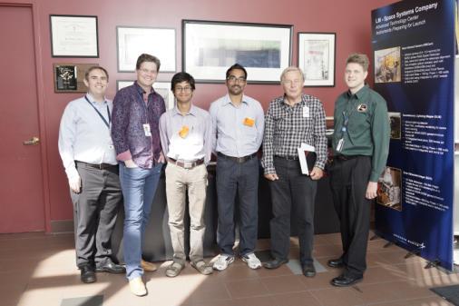
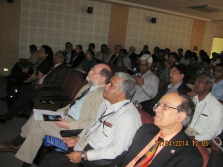
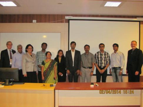
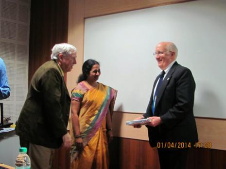
6 2016 Glimpses of SSTDM
7 2016 SSTDM 2014: Executive Summary Discussed the technology status and gaps, and address the need of small satellites and sensors for mapping, monitoring, early warning and mitigation of Natural Disasters: Plenary Session: DM Sensors & Instruments Tech. Remote Sensing Systems for DM Space Systems Natural Disasters Collaborative Projects and Concept Papers ISRO researchers presented the historical overviews of small satellites, remote sensing systems, electro-optical (EO) payloads/ data for DM Suport The international experts described the specific role of remote sensing systems in monitoring natural hazards: floods, and drought and assessing its impact on agriculture, crop production, forest fires, and landslides. India has embarked on Capacity Building for Disaster Management Support. IIRS recognized the need of developing multi-d (6D to7d) [include time, touch (pressure, texture, temperature), sound and smell] visualization in geospatial modeling, for accurate predictions, and early warning. 7
8 2016 SSTDM 2014: Executive Summary Discussion of each type of Natural Disaster identified the critical technology need of high precision early warning systems, and developing new sensors: microwave sensors, SAR systems, wireless sensors, thermal infrared sensors for space-borne assets. Dr. Maneesh Ramesh described first ever installation of wireless sensors for rainfall and landslide monitoring in affected regions. A CubeSat Tutorial Fourteen (14) concept papers related to the use of CubeSat/small sats for Disaster Management were submitted by teams of students from different universities in India, Vietnam and USA. Each team was duly recognized for their contribution, and the cash awards were given to each team. 8
9 2016 SSTDM 2016 Objectives Identify and Develop Small-Satellites, Sensors, and Wireless Communication Technologies for Disaster Management Facilitate networking between Indo-US Experts involved in SSTDM Address the socio-economic causes and technology-development needs of Participating countries Encourage Joint development projects through effective sharing of risks, costs and resources. Tracks: 1. Disaster Management: Challenges and Needs 2. Natural Disasters: Small Satellite and Sensor Technology Status 3. Wireless Communication Status 4. Collaborative Missions for DM 9
10 2016 SSTDM 2016: Planning in Progress Location: Amrita University: Kochi/ Kollam Campus, Kerala Dates (tentative): August (or Aug ) Seeking Guidance from ISRO/UN SPIDER Leadership: Participation from Indo-US and International Experts Advisory Committee: Chairman Kiran Kumar V. Dadhwal, Director NRSC, ISRO Dr. David Miller (NASA HQ, Chief Technologist) Rick Ambrose (President, LMSSC, USA) Discuss areas of collaboration: possible list grouped by themes (for example new sensors, multiple source data integration, early warning models, risk mapping, geospatial processing and data models for DM, ground & sensor network data integration,...) for each of target disasters, and them picking ones which could have largest positive impact. Topics for Student Competition: How to Analyze Satellite Data related to Natural Disaster? Website: By 20 March

11 GLM-R: A Regional Lightning Mapper for Early Warning of Severe Storms United Nations/India Workshop on the Use of Earth Observation Data in Disaster Management and Risk Reduction March 8-11, 2016 Dr. Samantha F. Edgington GLM Chief Scientist Lockheed Martin, ATC Clemens Tillier GLM Instrument Principal Engineer Lockheed Martin, ATC Dr. Hugh Christian Research Professor University of Alabama, Huntsville 2016 Lockheed Martin Corporation. All Rights Reserved.

12 Lightning and Disaster Management Most of the electrical energy generated by a thunderstorm is dissipated by lightning lightning flash rate is quantitatively related to the electrical energy generation The electrical generator is active during the updraft - lightning activity mirrors thunderstorm development Electrical energy is generated during ice production - amount of lightning is quantitatively related to the amount of ice Lightning is detected optically by observing emission lines in the near infrared from ionized Oxygen against the bright cloud background Credit: NOAA 12


13 Why Map Lightning? Lightning Strikes Hazard is highest where high lightning rates and high population coincide Flash Floods Storms with high lightning flash rates cause the most flash floods, lightning mapper data can provide timely and accurate warnings Tornadoes Lightning data provides minute advanced warning Forest Fires Lightning mappers can detect continuing current strikes which cause forest fires Wind Shear and Turbulence Real time data on convection in individual storm cells contributes to efficient air traffic management Cyclone Strength Lightning flash rate data can provide ~24 hours warning of maximum cyclone wind strength Credit: NOAA LIS Lightning Observations Credit: NASA 13

14 Global Distribution of Lightning 14

15 Need for Regional Coverage Flash rate times population density gives a metric of human exposure to lightning related hazardous weather 15

16 Why Detect Lightning from Geostationary Orbit? High detection efficiency Detect a larger percentage of the total lightning activity Coverage Widespread, persistent and uninterrupted coverage over large areas including oceans Improved warning times and decreased false alarm rates Double warning time and halve false alarm rates compared to current Doppler radar based systems Virtual radar Providing areas with limited radar coverage with tracking of thunderstorm development, propagation and evolution, based on total lightning measurements Climate change monitoring Long term monitoring of lightning, which is dependent upon the ground temperature Credit NSSTC 16


17 GLM-R Reference Design 10 degree full angle field of view provides regional coverage Geostationary orbit provides persistent coverage 17
18 GLM-R Reference Design Focal plane runs at frames per second to capture lightning strokes Lens Assembly and Filters Real Time Event Processors Power Converters ~ 20 cm 1 nm wide interference filter captures the Oxygen emission line against bright cloud background Flexible on-board real time event processing enables limited downlink bandwidth ~ 25 cm Ground based algorithms used to detect lightning and produce weather products Low mass/power/size requirements enable use as a hosted payload Focal Plane and Drive Electronics ~ 40 cm 18

19 GLM-R: Regional Lightning Mapper Lightning is a timely and accurate indicator of severe weather Contributes to climate change monitoring using lightning flash frequency Regional lightning mappers will save lives 19
20 2016 Backup 20


 El nino and")
21 Atmosphere Land Ocean 2016 Hazards Hurricanes Landslides Tsunamis Dust storms Thunderstorms Tornadoes Wind Fog Extreme precipitation Lightning Extreme temperatures Floods and Flash floods Volcanoes Earthquakes Snow Avalanches Epidemics Wild fire Chlorophyll bloom (HABs) El nino and la nina Cyclones Snow and ice Climate Droughts Remote Sensing Models and Analysis 21
22 2016 Objectives Identify and Develop Small-Satellites, Sensors, and Wireless Communication Technologies for Disaster Management Uniqueness of the proposed workshop: Ability to network experienced Indo US groups Address the socio-economic causes and technologydevelopment needs of Participating countries Joint development projects are engendered through effective sharing of risks, costs and resources. In SSTDM 2014*: Internationally recognized experts from ISRO, and researchers, technologists, stakeholders, and students from India and US, shared the status and emerging trends in areas of small satellites, sensors, wireless technologies, and disaster management. * At IISC, Bangalore, Dr. Mohan Rao, Co-Chair, India 22
23 2016 SSTDM 2014: Outcome Identified the technology status and gaps, and address the need of small satellites and sensors for mapping, monitoring, early warning and mitigation of Natural disasters. Presentations addressed the specific natural disasters, and the role of existing, and future small satellites in monitoring terrestrial hydrology, hurricanes, floods and drought, dust storms, earthquakes, Tsunami early warning system, subsurface coal fires, and forest fires. Discussions covered each type of disaster, the critical technology need of developing new sensors and the critical need of high precision early warning systems 23
24 2016 SSTDM 2014: Executive Summary Discussed the technology status and gaps, and address the need of small satellites and sensors for mapping, monitoring, early warning and mitigation of Natural disasters: ISRO researchers (ISRO) presented the historical overviews of small satellites, remote sensing systems, electro-optical (EO) payloads design and development, and the use of EO data for disaster management support. The international experts also described the specific role of remote sensing systems in monitoring natural hazards such as floods, and drought and assessing its impact on agriculture, crop production, forest fires, and landslides. Indian sub-continent is one of the world s most disaster-prone area; therefore it has embarked on Capacity Building for Disaster Management Support. Leveraging upon the state of the art 2D and 3D visualization models, IIRS has recognized the need of developing multidimensional (6D to7d) [include time, touch (pressure, texture, temperature), sound and smell] visualization in geospatial modeling, for accurate predictions, and early warning. Later, the presentations focused on specific natural disasters, and the role of existing, and future small satellites in monitoring terrestrial hydrology, hurricanes, floods and drought, dust storms, earthquakes, Tsunami early warning system, subsurface coal 24 fires, and forest fires. Discussion of each type of disaster identified the critical
25 2016 SSTDM 2014: Executive Summary Presentations also focused on specific natural disasters, and the role of existing, and future small satellites in monitoring terrestrial hydrology, hurricanes, floods and drought, dust storms, earthquakes, Tsunami early warning system, subsurface coal fires, and forest fires. Discussion of each type of disaster identified the critical technology need of developing new sensors. Subsequent presentations discussed the need and development of microwave sensors, SAR systems, wireless sensors, thermal infrared sensors for space-borne assets. For example, Dr. Maneesh Ramesh described first ever installation of wireless sensors for rainfall and landslide monitoring in affected regions. Identified the critical need of high precision early warning systems for each type of disaster. For example, an early warning system for floods/drought will help reduce the risk of agricultural products. India is leading an international effort to develop early warning system for Tsunami. A CubeSat Tutorial Fourteen (14) concept papers related to the use of CubeSat/small sats for Disaster Management were submitted by teams of students from different universities in India, Vietnam and USA. Each team was duly recognized for their contribution, and the cash awards were given to each team. 25
Activities and Outlook related to Disaster Reduction in CMA
 Activities and Outlook related to Disaster Reduction in CMA WANG Bangzhong China Meteorological Administration March 15-17 2006 ADENDA Situation about MD and related disasters in CHINA Guidance for MD/RD
Building Institutional Capacity for Multi-Hazard Early Warning in Asia and the Pacific Subtitle
 Building Institutional Capacity for Multi-Hazard Early Warning in Asia and the Pacific Subtitle Title Keran Wang Chief, Space Applications Section ICT and Disaster Risk Reduction Division 22 May 2018 Pillar
Weather Satellite Data Applications for Monitoring and Warning Hazard at BMKG
 The 5th Meeting of the Coordinating Group of the RA II WIGOS Satellite Project 21 October 2017, Vladivostok city, Russky Island, Russia Far Eastern Federal University Weather Satellite Data Applications
Japanese Programs on Space and Water Applications
 Japanese Programs on Space and Water Applications Tamotsu IGARASHI Remote Sensing Technology Center of Japan June 2006 COPUOS 2006 Vienna International Centre Water-related hazards/disasters may occur
Egypt-NOAA Cooperation: Advancing our Environmental Science, Technology, and Education
 Egypt-NOAA Cooperation: Advancing our Environmental Science, Technology, and Education T. G. Onsager NOAA Space Weather Prediction Center and NWS International Activities Office (one-year detail) Terry.Onsager@noaa.gov
WMO Statement on the State of the Global Climate Preliminary conclusions for 2018 and WMO Greenhouse Bulletin
 WMO Statement on the State of the Global Climate Preliminary conclusions for 2018 and WMO Greenhouse Bulletin Dr Elena Manaenkova Deputy Secretary General World Meteorological Organisation Statement on
Dr. Steven Koch Director, NOAA National Severe Storms Laboratory Chair, WRN Workshop Executive Committee. Photo Credit: Associated Press
 Dr. Steven Koch Director, NOAA National Severe Storms Laboratory Chair, WRN Workshop Executive Committee 1 Photo Credit: Associated Press 1" 2" Much%Increased%Vulnerability%to% High6Impact%Weather% %even%before%2011!%
New NASA Ocean Observations and Coastal Applications
 New NASA Ocean Observations and Coastal Applications Duane Armstrong Chief, Applied Science & Technology Project Office August 20, 2014 1 Outline NASA s new Earth Science Ocean Science Missions for 2014
World Meteorological Organization
 World Meteorological Organization Opportunities and Challenges for Development of Weather-based Insurance and Derivatives Markets in Developing Countries By Maryam Golnaraghi, Ph.D. Head of WMO Disaster
APPENDIX 2 OVERVIEW OF THE GLOBAL PRECIPITATION MEASUREMENT (GPM) AND THE TROPICAL RAINFALL MEASURING MISSION (TRMM) 2-1
 AND THE TROPICAL RAINFALL MEASURING MISSION (TRMM) 2-1") APPENDIX 2 OVERVIEW OF THE GLOBAL PRECIPITATION MEASUREMENT (GPM) AND THE TROPICAL RAINFALL MEASURING MISSION (TRMM) 2-1 1. Introduction Precipitation is one of most important environmental parameters.
APPENDIX 2 OVERVIEW OF THE GLOBAL PRECIPITATION MEASUREMENT (GPM) AND THE TROPICAL RAINFALL MEASURING MISSION (TRMM) 2-1 1. Introduction Precipitation is one of most important environmental parameters.
RESAP Progress Report
 RESAP Progress Report December 2016 to October 2017 Presentation to the Twenty-first session of the Intergovernmental Consultative Committee on the Regional Space Applications Programme for Sustainable
10 emergency observation requests were successfully processed during the period
 ISRO s Inputs for the Sentinel Asia DPN and JPT meeting being held during 13-16, 16, November 2012 November 2012 Sentinel Asia Activity Spectrum - A dedicated Sentinel Asia server established at NRSC,
1990 Intergovernmental Panel on Climate Change Impacts Assessment
 1990 Intergovernmental Panel on Climate Change Impacts Assessment Although the variability of weather and associated shifts in the frequency and magnitude of climate events were not available from the
Copernicus Overview and Emergency Management Service
 Copernicus Overview and Emergency Management Service Frédéric BASTIDE European Commission Open informal session of the United Nations Inter-Agency Meeting on Outer Space Activities 12 March 2013, Geneva
Local Weather History
 Local Weather History 52 40- to 2+ 50-minute sessions ACTIVITY OVERVIEW P RO J E C T Students design and conduct a survey to learn about the history of weather disasters in the local area, and then compare
Current and Upcoming NASA Hurricane Measurement Missions National Hurricane Conference
 NASA Science Mission Directorate Earth Science Division Applied Sciences Program Current and Upcoming NASA Hurricane Measurement Missions National Hurricane Conference April 18, 2017 Formulation Implementation
Emergency Management Service (EMS) mapping
 mapping") GMES Emergency Management Service (EMS) mapping Frédéric BASTIDE GMES unit, European Commission UN-SPIDER Expert Meeting: "Crowdsource Mapping for Disaster Risk Management and Emergency Response" 3-5 December,
GMES Emergency Management Service (EMS) mapping Frédéric BASTIDE GMES unit, European Commission UN-SPIDER Expert Meeting: "Crowdsource Mapping for Disaster Risk Management and Emergency Response" 3-5 December,
Unique Vaisala Global Lightning Dataset GLD360 TM
 Unique Vaisala Global Lightning Dataset GLD360 TM / THE ONLY LIGHTNING DETECTION NETWORK CAPABLE OF DELIVERING HIGH-QUALITY DATA ANYWHERE IN THE WORLD GLD360 provides high-quality lightning data anywhere
Weather Information for Surface Transportation (WIST): Update on Weather Impacts and WIST Progress
: Update on Weather Impacts and WIST Progress") Weather Information for Surface Transportation (WIST): Update on Weather Impacts and WIST Progress Samuel P. Williamson Office of the Federal Coordinator for Meteorological Services and Supporting Research
Weather Information for Surface Transportation (WIST): Update on Weather Impacts and WIST Progress Samuel P. Williamson Office of the Federal Coordinator for Meteorological Services and Supporting Research
LECTURE #15: Thunderstorms & Lightning Hazards
 GEOL 0820 Ramsey Natural Disasters Spring, 2018 LECTURE #15: Thunderstorms & Lightning Hazards Date: 1 March 2018 (lecturer: Dr. Shawn Wright) I. Severe Weather Hazards focus for next few weeks o somewhat
Possible Applications of Deep Neural Networks in Climate and Weather. David M. Hall Assistant Research Professor Dept. Computer Science, CU Boulder
 Possible Applications of Deep Neural Networks in Climate and Weather David M. Hall Assistant Research Professor Dept. Computer Science, CU Boulder Quick overview of climate and weather models Weather models
Early Warning System and Role of IMD. Manmohan Singh Meteorological Centre Shimla
 Early Warning System and Role of IMD Manmohan Singh Meteorological Centre Shimla India a land with a unique climatic regime Two monsoon seasons (southwest & northeast monsoons) Two cyclone seasons (pre
Catalysing Innovation in Weather Science - the role of observations and NWP in the World Weather Research Programme
 Catalysing Innovation in Weather Science - the role of observations and NWP in the World Weather Research Programme Estelle de Coning, Paolo Ruti, Julia Keller World Weather Research Division The World
The Science and Policy of Natural Hazards
 Image courtesy of USGS. 12.103 Image courtesy of NOAA. The Science and Policy of Natural Hazards Image courtesy of USGS. Image courtesy of NOAA. Topics Four categories of hazards will be investigated in
Geospatial framework for monitoring SDGs/Sendai targets By Shimonti Paul Sr. Assistant Editor Geospatial Media & Communications
 Geospatial framework for monitoring SDGs/Sendai targets By Shimonti Paul Sr. Assistant Editor Geospatial Media & Communications Outline 1. Introduction to Geospatial Media and Communications 2. Geospatial
ESCI 110: 2 s.h. Introduction to Earth Sciences Programs ESCI 322: 3 s.h. Environmental Hydrology ESCI 241: 4 s.h. Meteorology (G2, L)
") ESCI 110: 2 s.h. Introduction to Earth Sciences Programs General introduction to each of the earth sciences disciplines and to college life. 2 hrs. lec. Offered in fall. Restricted to earth sciences majors.
ESCI 110: 2 s.h. Introduction to Earth Sciences Programs General introduction to each of the earth sciences disciplines and to college life. 2 hrs. lec. Offered in fall. Restricted to earth sciences majors.
5.2 IDENTIFICATION OF HAZARDS OF CONCERN
 5.2 IDENTIFICATION OF HAZARDS OF CONCERN 2016 HMP Update Changes The 2011 HMP hazard identification was presented in Section 3. For the 2016 HMP update, the hazard identification is presented in subsection
CGMS Baseline. Sustained contributions to the Global Observing System. Endorsed by CGMS-46 in Bengaluru, June 2018
 CGMS Baseline Sustained contributions to the Global Observing System Best Practices for Achieving User Readiness for New Meteorological Satellites Endorsed by CGMS-46 in Bengaluru, June 2018 CGMS/DOC/18/1028862,
Congress 2015 Resolution 9 Cataloging Initiative, Global Agenda and Status of the Proposal
 Congress 2015 Resolution 9 Cataloging Initiative, Global Agenda and Status of the Proposal Common Alerting Protocol (CAP) / Impact Based Forecast (IBF) Technical Meeting (WMO, Geneva, Switzerland, 3-4
CEOS Overview and JAXA Plans for Water Cycle Observation
 CEOS Overview and JAXA Plans for Water Cycle Observation Asian Water Cycle Symposium November 2-4, 2005 Tokyo, Japan Chu Ishida Japan Aerospace Exploration Agency (JAXA) Contents 1. CEOS overview 2. CEOS
Add NOAA nowcoast Layers to Maps
 WebEOC Maps Add-on Quick Reference Guide Add NOAA nowcoast Layers to Maps Overview With Maps Add-on, you can configure an unlimited number of map layers. These layers allow you to control the data you
Weather versus Climate: What is the difference? Sources of Weather Information
 Joel O. Paz, Extension Agrometerologist and Gerrit Hoogenboom, Professor & REI Coordinator Department of Biological and Agricultural Engineering Weather versus Climate: What is the difference? The difference
5.2 IDENTIFICATION OF HAZARDS OF CONCERN
 5.2 IDENTIFICATION OF HAZARDS OF CONCERN 2015 HMP Update Changes The 2010 HMP hazard identification was presented in Section 6. For the 2015 HMP update, the hazard identification is presented in subsection
Doug Kluck NOAA Kansas City, MO National Center for Environmental Information (NCEI) National Integrated Drought Information System (NIDIS)
 National Integrated Drought Information System (NIDIS)") National Integrated Drought Information System (NIDIS) for the Missouri River Basin Drought Early Warning Information System (DEWS) & Runoff Trends in the Missouri Basin & Latest Flood Outlook Doug Kluck
National Integrated Drought Information System (NIDIS) for the Missouri River Basin Drought Early Warning Information System (DEWS) & Runoff Trends in the Missouri Basin & Latest Flood Outlook Doug Kluck
WEATHER. rain. thunder. The explosive sound of air as it is heated by lightning.
 WEATHER rain thunder The explosive sound of air as it is heated by lightning. rainbow lightning hurricane They are intense storms with swirling winds up to 150 miles per hour. tornado cold front warm front
WEATHER AND CLIMATE EXTREMES MONITORING BASED ON SATELLITE OBSERVATION : INDONESIA PERSPECTIVE RIRIS ADRIYANTO
 WEATHER AND CLIMATE EXTREMES MONITORING BASED ON SATELLITE OBSERVATION : INDONESIA PERSPECTIVE RIRIS ADRIYANTO INDONESIA AGENCY FOR METEOROLOGY, CLIMATOLOGY AND GEOPHYSICS (BM KG) 1. INTRODUCTION - BMKG
Unique Vaisala Global Lightning Dataset GLD360 TM
 Unique Vaisala Global Lightning Dataset GLD360 TM / THE ONLY LIGHTNING DETECTION NETWORK CAPABLE OF DELIVERING SUCH HIGH-QUALITY DATA ANYWHERE IN THE WORLD GLD360 provides high-quality lightning data anywhere
Global Map: A Tool for Disaster Mitigation for the Asia and Pacific Region
 Global Map: A Tool for Disaster Mitigation for the Asia and Pacific Region D. R. Fraser Taylor Chair, International Steering Committee for Global Mapping (ISCGM) fraser_taylor@carleton.ca www. 18 th United
CGMS Baseline In response to CGMS action/recommendation A45.01 HLPP reference: 1.1.8
 Prepared by WGIII Agenda Item: 7.1 Discussed in WGIII CGMS Baseline In response to CGMS action/recommendation A45.01 HLPP reference: 1.1.8 In CGMS-45, Working Group III agreed to hold a review of the CGMS
United States Multi-Hazard Early Warning System
 United States Multi-Hazard Early Warning System Saving Lives Through Partnership Lynn Maximuk National Weather Service Director, Central Region Kansas City, Missouri America s s Weather Enterprise: Protecting
IDENTIFICATION OF HAZARDS OF CONCERN
 IDENTIFICATION OF HAZARDS OF CONCERN To provide a strong foundation for mitigation strategies considered in Section 6, the Village considered a full range of hazards that could impact the area and then
NOAA s National Weather Service. National Weather Service
 NOAA s National Weather Service Serving the Nation s Environmental Forecasting Needs Lynn Maximuk Regional Director National Weather Service Central Region Headquarters Kansas City, Missouri America s
Contemporary Challenges in Short-Term Climate Forecasting. David DeWitt Director, Climate Prediction Center
 Contemporary Challenges in Short-Term Climate Forecasting David DeWitt Director, Climate Prediction Center 1 Outline Commercial: NOAA Administrator s Award for Decisions Support Services Associated with
NATIONAL FRAMEWORK FOR FLOOD DISASTER MANAGEMENT IN INDONESIA. 11 th GEOSS ASIA PASIFIC SYMPOSIUM Kyoto, October 2018
 NATIONAL FRAMEWORK FOR FLOOD DISASTER MANAGEMENT IN INDONESIA 11 th GEOSS ASIA PASIFIC SYMPOSIUM Kyoto, 24-26 October 2018 1 OUTLINE Disasters in Indonesia The Disaster Management Mechanism Current Status
5.2. IDENTIFICATION OF NATURAL HAZARDS OF CONCERN
 5.2. IDENTIFICATION OF NATURAL HAZARDS OF CONCERN To provide a strong foundation for mitigation strategies considered in Sections 6 and 9, County considered a full range of natural hazards that could impact
Bhutan Country Report for JPTM 2010 (July, 2010) Department of Disaster Management Ministry of Home & Cultural Affairs Royal Government of Bhutan
 Department of Disaster Management Ministry of Home & Cultural Affairs Royal Government of Bhutan") Bhutan Country Report for JPTM 2010 (July, 2010) Department of Disaster Management Ministry of Home & Cultural Affairs Royal Government of Bhutan 1 Contents of Presentation 1. Disaster Hazards and Underlying
Bhutan Country Report for JPTM 2010 (July, 2010) Department of Disaster Management Ministry of Home & Cultural Affairs Royal Government of Bhutan 1 Contents of Presentation 1. Disaster Hazards and Underlying
Workshop on Drought and Extreme Temperatures: Preparedness and Management for Sustainable Agriculture, Forestry and Fishery
 Workshop on Drought and Extreme Temperatures: Preparedness and Management for Sustainable Agriculture, Forestry and Fishery 16-17 Feb.2009, Beijing, China Modeling Apple Tree Bud burst time and frost risk
NOAA s Regional Climate Science & Information: Opportunities and Challenges
 NOAA s Regional Climate Science & Information: Opportunities and Challenges Dr. Wayne Higgins Climate Program Office, Director Office of Oceanic and Atmospheric Research National Oceanic and Atmospheric
WMO Space Programme: anticipated evolution and a Picture of Development of a Vision of WIGOS Space-based Component in 2040
 WMO Space Programme: anticipated evolution and a Picture of 2040 --Development of a Vision of WIGOS Space-based Component in 2040 Wenjian Zhang Director, Observing and Information Systems Department &
NSF Expeditions in Computing. Understanding Climate Change: A Data Driven Approach. Vipin Kumar University of Minnesota
 NSF Expeditions in Computing Understanding Climate Change: A Data Driven Approach Vipin Kumar University of Minnesota kumar@cs.umn.edu www.cs.umn.edu/~kumar Vipin Kumar UCC Aug 15, 2011 Climate Change:
JCOMM-CHy Coastal Inundation Forecasting Demonstration Project (CIFDP)
") WMO World Meteorological Organization Working together in weather, climate and water JCOMM-CHy Coastal Inundation Forecasting Demonstration Project (CIFDP) Coastal Flooding & Vulnerable Populations Coastal
WMO World Meteorological Organization Working together in weather, climate and water JCOMM-CHy Coastal Inundation Forecasting Demonstration Project (CIFDP) Coastal Flooding & Vulnerable Populations Coastal
Synthetic Weather Radar: Offshore Precipitation Capability
 Synthetic Weather Radar: Offshore Precipitation Capability Mark S. Veillette 5 December 2017 Sponsors: Randy Bass, FAA ANG-C6 and Rogan Flowers, FAA AJM-33 DISTRIBUTION STATEMENT A: Approved for public
West Carroll Parish Hazard Mitigation Plan Update Public Meeting. August 25, 2015 Oak Grove, LA
 West Carroll Parish Hazard Mitigation Plan Update Public Meeting August 25, 2015 Oak Grove, LA Agenda Hazard Mitigation Planning Process SDMI Staff Risk Assessment SDMI Staff Update on Previous/Current
National Remote Sensing Center of China. Space Technology for Sustainable Development in China Status, Achievements and Futures.
 National Remote Sensing Center of China Space Technology for Sustainable Development in China Status, Achievements and Futures Jing Li National Remote Sensing Center of China Ministry of Science and Technology,
GEO Geohazards Community of Practice
 GEO Geohazards Community of Practice 1) Co-Chair of GHCP With input from: Stuart Marsh, GHCP Co-Chair Francesco Gaetani, GEO Secretariat and many GHCP contributors 1) Nevada Bureau of Mines and Geology
Overview of Early Warning Systems and the role of National Meteorological and Hydrological Services
 Overview of Early Warning Systems and the role of National Meteorological and Hydrological Services South Africa Second Experts Symposium on Multi-Hazard Early Warning Systems With focus on the Role of
WMO/WWRP/THORPEX World Weather Open Science Conference Sunday 17 Thursday 21 August 2014, Montréal, Canada Scientific Program
 WMO/WWRP/THORPEX World Weather Open Science Conference Sunday 17 Thursday 21 August 2014, Montréal, Canada Scientific Program The overarching theme of the OSC is Seamless Prediction of the Earth System:
UGRC 144 Science and Technology in Our Lives/Geohazards
 UGRC 144 Science and Technology in Our Lives/Geohazards Session 1 Introduction to Hazards and Disasters Dr. Patrick Asamoah Sakyi Department of Earth Science, UG, Legon College of Education School of Continuing
The importance of satellite data for nowcasting in the WWRP strategy
 The importance of satellite data for nowcasting in the WWRP strategy Estelle de Coning and Paolo Ruti World Weather Research Division Steve Goodman Chief Program Scientist, NOAA WMO definition Nowcasting
Disaster Mitigation Competence Centre Project Meeting Coordinator: Simon Lin
 Disaster Mitigation Competence Centre Project Meeting Coordinator: Simon Lin April 26, 2018 Agenda Introduction (Simon Lin) From Previous Meeting on March 17, 2015 (Eric Yen) Progress Report (Eric Yen)
The International Charter Space and Major Disasters is further strengthening its contribution to disaster management worldwide.
 28 September 2012 Issue 3 The International Charter Space and Major Disasters is further strengthening its contribution to disaster management worldwide. Building on a decade of success in making satellite
Untitled.notebook May 12, Thunderstorms. Moisture is needed to form clouds and precipitation the lifting of air, or uplift, must be very strong
 Thunderstorms Moisture is needed to form clouds and precipitation the lifting of air, or uplift, must be very strong cold air and warm air must mix; creating an active circulation system that has both
Space Applications for Disaster Risk Reduction and Sustainable Development
 Space Applications for Disaster Risk Reduction and Sustainable Development Space Applications Section (SAS) ICT and Disaster Risk Reduction Division (IDD) UNESCAP Contents I. RESAP Activities 2016-2017
Preparing for NOAA s Next Generation GOES-R & JPSS
 Preparing for NOAA s Next Generation GOES-R & JPSS Mark Paese Deputy Assistant Administrator NOAA Environmental Satellite & Information Service (NESDIS) WMO Cg-17: Ensuring User Readiness for New Generation
Meteorological Hazards and Current Approach to Observing, Modelling and Predicting Severe Events in Sri Lanka
 Regional Workshop on Impact-based Forecasts in RA II (Asia) 7-9, November, 2017, Seoul, Republic of Korea Meteorological Hazards and Current Approach to Observing, Modelling and Predicting Severe Events
Alignments of Master of Disaster (MoD) Lessons for Grades K-2 with the Next Generation Science Standards (NGSS) X X X X X X X X X X
 Lessons for Grades K-2 with the Next Generation Science Standards (NGSS) X X X X X X X X X X") Alignments of Master of Disaster (MoD) Lessons for Grades K-2 with the Next Generation Science Standards (NGSS) Relevant Next Generation Science Standards Performance Expectations* MoD Lesson Purpose K-PS2-1
Alignments of Master of Disaster (MoD) Lessons for Grades K-2 with the Next Generation Science Standards (NGSS) Relevant Next Generation Science Standards Performance Expectations* MoD Lesson Purpose K-PS2-1
Radio Frequency Earth Science
 Radio Frequency Earth Science Overview for Committee On Radio Frequency (CORF) National Academy of Science National Research Council April 27, 2005 Bill.Watson@NASA.Gov Program Executive for Ground Networks
INDONESIA IMPACT BASED FORECAST PROGRAM
 INDONESIA IMPACT BASED FORECAST PROGRAM Seoul, 19-21 November 2018 The 2nd Regional Workshop on Impact-based Forecasts in Asia Indonesia Agency for Meteorology Climatology and Geophysics (BMKG) A. Fachri
Sri Lanka Enhancing the Role of ICTs for Disaster Risk Management
 Workshop on ICT for Promoting Inclusive and Disaster Resilient Development Ulaanbaatar, Mongolia Sri Lanka Enhancing the Role of ICTs for Disaster Risk Management Kanchana Thudugala Programme Head, eservices
SCIENCE. Natural Disasters ARTHUR P. SCHALICK HIGH SCHOOL CURRICULUM PITTSGROVE TOWNSHIP SCHOOL DISTRICT PITTSGROVE, NJ
 SCIENCE Natural Disasters ARTHUR P. SCHALICK HIGH SCHOOL CURRICULUM PITTSGROVE TOWNSHIP SCHOOL DISTRICT PITTSGROVE, NJ 2013 PITTSGROVE BOARD OF EDUCATION Melissa Conover Cheryl Berwick William H. Rumpp
Complete Weather Intelligence for Public Safety from DTN
 Complete Weather Intelligence for Public Safety from DTN September 2017 White Paper www.dtn.com / 1.800.610.0777 From flooding to tornados to severe winter storms, the threats to public safety from weather-related
Country Report - Singapore
 Country Report - Singapore The 5th Meeting of the Coordinating Group Vladivostok city, Russky Island, Russia Far Eastern Federal University of the RA II WIGOS Satellite Project 21 October 2017 Outline
COPUOS and the UN Development Agenda. Niklas Hedman, UNOOSA
 COPUOS and the UN Development Agenda Niklas Hedman, UNOOSA 2 Committee on the Peaceful Uses of Outer Space Established 1959. In 1961 establishment of two Subcommittees Scientific and Technical Subcommittee
IGOS Geohazards: toward an improved use of Earth Observations for Geohazards mitigation
 IGOS Geohazards: toward an improved use of Earth Observations for Geohazards mitigation Scientific and Technical Subcommittee session Vienna, 15th February 2007 Gonéri Le Cozannet IGOS Geohazards Bureau
Effective Utilization of Synthetic Aperture Radar (SAR) Imagery in Rapid Damage Assessment
 Imagery in Rapid Damage Assessment") Effective Utilization of Synthetic Aperture Radar (SAR) Imagery in Rapid Damage Assessment Case Study Pakistan Floods SUPARCO M. Maisam Raza, Ahmad H. Rabbani SEQUENCE Flood Monitoring using Satellite
Effective Utilization of Synthetic Aperture Radar (SAR) Imagery in Rapid Damage Assessment Case Study Pakistan Floods SUPARCO M. Maisam Raza, Ahmad H. Rabbani SEQUENCE Flood Monitoring using Satellite
THE CYGNSS NANOSATELLITE CONSTELLATION HURRICANE MISSION
 SSTDM2014, International Workshop on Small Satellites andsensor Technology for Disaster Management THE CYGNSS NANOSATELLITE CONSTELLATION HURRICANE MISSION Chris Ruf (1), Scott Gleason (2), Zorana Jelenak
5.2 IDENTIFICATION OF HAZARDS OF CONCERN
 5.2 IDENTIFICATION OF HAZARDS OF CONCERN 2016 HMP Update Changes The 2011 HMP hazard identification was presented in Section 3. For the 2016 HMP update, the hazard identification is presented in subsection
Kentucky Weather Hazards: What is Your Risk?
 Kentucky Weather Hazards: What is Your Risk? Stuart A. Foster State Climatologist for Kentucky 2010 Kentucky Weather Conference Bowling Green, Kentucky January 16, 2010 Perspectives on Kentucky s Climate
Teruyuki Nakajima Director, Earth Observation Research Center (EORC) Japan Aerospace Exploration Agency (JAXA)
 Japan Aerospace Exploration Agency (JAXA)") Tokyo Inter. Conference on the Forest Governance Initiative - Improving Forest Governance using Forest Early Warning Systems and Satellite Technologies - October 24-26, 2017 Teruyuki Nakajima Director,
Tokyo Inter. Conference on the Forest Governance Initiative - Improving Forest Governance using Forest Early Warning Systems and Satellite Technologies - October 24-26, 2017 Teruyuki Nakajima Director,
The Inter-Agency Space Debris Coordination Committee (IADC)
") The Inter-Agency Space Debris Coordination Committee (IADC) An overview of IADC s annual activities Mitsuru Ohnishi, JAXA, Japan IADC Chair www.iadc-online.org 55 th Session of the Scientific and Technical
The Inter-Agency Space Debris Coordination Committee (IADC) An overview of IADC s annual activities Mitsuru Ohnishi, JAXA, Japan IADC Chair www.iadc-online.org 55 th Session of the Scientific and Technical
The WMO Integrated Global Observing System (WIGOS), current status and planned regional activities
, current status and planned regional activities") The WMO Integrated Global Observing System (WIGOS), current status and planned regional activities Dr. Lars Peter Riishojgaard WMO Secretariat, Geneva Outline Introduction to WIGOS WMO The Rolling Review
The WMO Integrated Global Observing System (WIGOS), current status and planned regional activities Dr. Lars Peter Riishojgaard WMO Secretariat, Geneva Outline Introduction to WIGOS WMO The Rolling Review
Caribbean Early Warning System Workshop
 Caribbean Early Warning System Workshop Hamonization in Existing EWS April 14-16, 2016 Presenter: Shawn Boyce Caribbean Institute for Meteorology and Hydrology Husbands, St. James Barbados Background Between
NOAA Surface Weather Program
 NOAA Surface Weather Program Maintenance Decision Support System Stakeholder Meeting #9 Jim O Sullivan NOAA Surface Weather Program Manager NWS Office of Climate, Water, and Weather Services September
Geodesy. orientation. shape. gravity field
 Geodesy noun Science of measuring the shape, orientation and gravity field of the Earth and how it changes over time. shape orientation gravity field Positioning has always been important Downstream applications
Creating a WeatherSMART nation: SAWS drought related research, services and products
 Creating a WeatherSMART nation: SAWS drought related research, services and products Drought Dialogue 23-24 June 2016 Western Cape Government Hannes Rautenbach South African Weather Service SAWS mandate
NOAA Hurricane Forecast Improvement Project
 NOAA Hurricane Forecast Improvement Project Fred Toepfer Hurricane Forecast Improvement Project Manager November 9 th, 2009 Outline NOAA Hurricane Forecast Improvement Project Driving Issue Purpose NOAA
Liana Talaue McManus. Division of Marine Affairs and Policy Rosenstiel School of Marine & Atmospheric Science University of Miami
 Liana Talaue McManus Division of Marine Affairs and Policy Rosenstiel School of Marine & Atmospheric Science University of Miami Outline 1. Coasts as vulnerable & resilient social ecological systems 2.
Second Announcement. 2 nd Workshop CGMS International Cloud Working Group. 29 October - 2 November 2018, Madison, Wisconsin, USA
 Second Announcement 2 nd Workshop CGMS International Cloud Working Group 29 October - 2 November 2018, Madison, Wisconsin, USA Organized by the Space Science and Engineering Center of the University of
COUNTRY REPORT INDONESIA
 COUNTRY REPORT INDONESIA Badan Meteorologi Klimatologi dan Geofisika (BMKG) Agency For Meteorology, Climatology, and Geophysics Republic of Indonesia DKI Jakarta, Indonesia Tel. (021) 4246321 Email: pcs@bmkg.go.id
Progress on GCOS-China CMA IOS Development Plan ( ) PEI, Chong Department of Integrated Observation of CMA 09/25/2017 Hangzhou, China
 PEI, Chong Department of Integrated Observation of CMA 09/25/2017 Hangzhou, China") Progress on GCOS-China CMA IOS Development Plan (2016-2020) PEI, Chong Department of Integrated Observation of CMA 09/25/2017 Hangzhou, China 1. Progress on GCOS-China 1 Organized GCOS-China GCOS-China
Progress on GCOS-China CMA IOS Development Plan (2016-2020) PEI, Chong Department of Integrated Observation of CMA 09/25/2017 Hangzhou, China 1. Progress on GCOS-China 1 Organized GCOS-China GCOS-China
Press Release: First WMO Workshop on Operational Climate Prediction
 Press Release: First WMO Workshop on Operational Climate Prediction a) b) c) d) Photographs during the first WMO Workshop on Operational Climate Prediction: a) Group Photograph, b) Dr M. Rajeevan, Director,
Unit: Weather Study Guide
 Name: Period: Unit: Weather Study Guide Define each vocabulary word on a separate piece of paper or index card. Weather Climate Temperature Wind chill Heat index Sky conditions UV index Visibility Wind
Weather Radar and A3 Introduction
 Weather Radar and A3 Introduction The term RADAR is an acronym formed from the term Radio Detection and Ranging. Nikola Tesla (of electric car fame) suggested in 1900 that moving targets should be observable
WMO. Early Warning System
 World Meteorological Organization Working together in weather, climate and water WMO Tropical Cyclone Early Warning System Koji Kuroiwa Tropical Cyclone Programme World Meteorological Organization For
Earth Systems Curriculum
 Earth Systems Curriculum Course Description This course provides the opportunity to develop knowledge and understanding about the relationships between the structure, processes, and resources on Earth
Emerging Aviation Weather Research at MIT Lincoln Laboratory*
 Emerging Aviation Weather Research at MIT Lincoln Laboratory* Haig 19 November 2015 *This work was sponsored by the Federal Aviation Administration under Air Force Contract No. FA8721-05-C-0002. Opinions,
SINGAPORE SPACE CHALLENGE 2018/19 CHALLENGE STATEMENT
 SINGAPORE SPACE CHALLENGE 2018/19 CHALLENGE STATEMENT DESIGN A EARTH OBSERVATION SATELLITE SYSTEM THAT CAN BE USED TO SUPPORT DISASTER MANAGEMENT IN THE EQUATORIAL REGION TechSAR LANDSAT 2 (1) Background
2 nd Cryonet-Asia Worskshop Salekhard, Russian Federation (2-5 February 2016)
") WMO 2 nd Cryonet-Asia Worskshop Salekhard, Russian Federation (2-5 February 2016) WMO Rolling Review of Requirements (RRR) Etienne Charpentier Chief, WMO Observing Systems Division WMO; Name of Department
WMO 2 nd Cryonet-Asia Worskshop Salekhard, Russian Federation (2-5 February 2016) WMO Rolling Review of Requirements (RRR) Etienne Charpentier Chief, WMO Observing Systems Division WMO; Name of Department
Megha-Tropiques Presentation by Indian Delegation at the 55th Session of UNCOPUOS Vienna 12 June 2012
 Megha-Tropiques Presentation by Indian Delegation at the 55 th Session of UNCOPUOS Vienna 12 June 2012 Megha-Tropiques Mission Indo-French Joint Satellite for studying tropical atmosphere Megha in Sanskrit
World Meteorological Organization
 Appendix VI Presentation on disaster risk reduction brainstorming session (1) World Meteorological Organization WMO DRR Programme Dieter C. Schiessl Director, Weather and Disaster Risk Reduction Services