CONTRIBUTION OF METOP ASCAT DATA FOR LAND SURFACE PARAMETERS MONITORING OVER THE SAHEL
|
|
|
- Clare Walton
- 6 years ago
- Views:
Transcription
(2), Riazanoff S. (1)(3), Mougin E. (4), Jarlan L. (4), Baup F. (4), Hiernaux P. (4), Ndione J.-A. (5),Wade S. (2), Rudant J.")
 AMMA - African Monsoon Multidisplinary Analyses 2 nd EPS/Metop RAO Workshop 20-22 May")
1 CONTRIBUTION OF METOP ASCAT DATA FOR LAND SURFACE PARAMETERS MONITORING OVER THE SAHEL Frison P.-L. (1), Faye G. (1)(2), Riazanoff S. (1)(3), Mougin E. (4), Jarlan L. (4), Baup F. (4), Hiernaux P. (4), Ndione J.-A. (5),Wade S. (2), Rudant J.-P. (1), 1. Université Paris-Est Marne-la-Vallée 2. Université Cheikh Anta Diop de Dakar 3. VisioTerra 4. CESBIO 5. Centre de Suivi Ecologique Sénégal (CSE) AMMA - African Monsoon Multidisplinary Analyses 2 nd EPS/Metop RAO Workshop May 2009 Barcelona, Spain page 1
2 GOALS Surface processes modeling Better understanding of the West African Monsoon and its interactions with global environment Impact of climatic variability on surface processes Role of continental surfaces on climate Radar sensors to assess: Vegetation biomass Net Primary Productivity (NPP) Ë Carbon budget Soil moisture in relation with: evaporative fluxes moisture deeper layer To assess the seasonal and inter-annual variations of these 2 key surface parameters over the Sahel from spaceborne radars sensors: scatterometers. 2 nd EPS/Metop RAO Workshop May 2009 Barcelona, Spain page 2

3 The SAHEL Alternation of a long dry season (October - June) and a short rainy season (June September) Vegetation closely linked to the rainfall regime 2 nd EPS/Metop RAO Workshop May 2009 Barcelona, Spain page 3
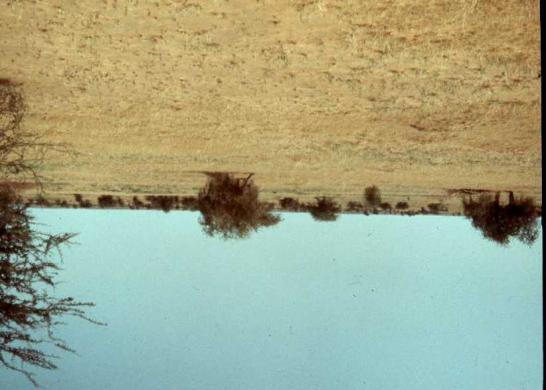
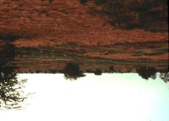
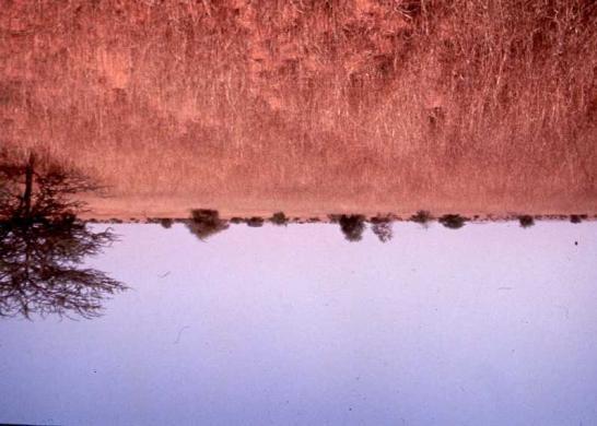
 trees (1-5%) 2 nd EPS/Metop RAO Workshop 20-22 May 2009 Barcelona, Spain")
4 Sahelian Pastoral Area herbaceous steppe (annual grass) : herbaceous layer (0-50%) shrub layer (0-20%) trees (1-5%) 2 nd EPS/Metop RAO Workshop May 2009 Barcelona, Spain page 4
5 Strong interannual variability nd EPS/Metop RAO Workshop May 2009 Barcelona, Spain page 5

6 Radar signal temporal evolution over a Sahelian region (ERS scatterometer Rharous site) Signal stability during the ERS mission Annual cycle linked to the alternation rainy/dry season Inter-annual variability Incidence angle: 45 2 nd EPS/Metop RAO Workshop May 2009 Barcelona, Spain page 6


7 Study area : GOURMA (MALI) Rharous Gossi Hombori Seno Pastoral areas 2 nd EPS/Metop RAO Workshop May 2009 Barcelona, Spain page 7
8 ERS scatterometer Temporal evolution of s 0 (45 ) : 4 sites v Signal inter-annual variability v Signal level during dry season southward southward 2 nd EPS/Metop RAO Workshop May 2009 Barcelona, Spain page 8
9 Calibration with in situ biomass measurements Modeling study Sahelian vegetation Growth model (STEP) Daily surface parameters : Biomass Soil moisture Radiative Transfer model (Karam, 1992) Simulated Backscattering coefficient s 0 (t) Daily meteorological data Soil parameters Soil roughness Vegetation parameters h c 2 nd EPS/Metop RAO Workshop May 2009 Barcelona, Spain page 9
10 Simulation and ERS scatterometer observations Ë Overall good concordance Incidence angle: 45 2 nd EPS/Metop RAO Workshop May 2009 Barcelona, Spain page 10
 s 0 (t) simulations OPTIMISATION Observations : Satellite measurements (s 0 ) 2 nd EPS/Metop RAO Workshop 20-22 May 2009 Barcelona, Spain page 11")
11 SURFACE PARAMETER ESTIMATION METEOSAT Rainfall estimation Sahelian vegetation growth model (STEP) Daily surface parameters : Biomass Soil moisture Radiative Transfer model (Karam, 1992) s 0 (t) simulations OPTIMISATION Observations : Satellite measurements (s 0 ) 2 nd EPS/Metop RAO Workshop May 2009 Barcelona, Spain page 11
 Absolute errors: ~ 200 kg Dry Matter (DM) / ha T Relative error : 17 % (kg Dry Matter / ha) 2 nd EPS/Metop RAO Workshop 20-22 May 2009 Barcelona, Spain")
12 Inversion method : Biomass production map at a regional scale Biomass production map: 2000 rainfall estimation: METEOSAT Biomass + soil moisture: ËERS WSC + METEOSAT Seno Validated over 4 pastoral sites (Gourma and Seno regions) Absolute errors: ~ 200 kg Dry Matter (DM) / ha T Relative error : 17 % (kg Dry Matter / ha) 2 nd EPS/Metop RAO Workshop May 2009 Barcelona, Spain page 12
 SNDVI VEGETATION ERS WSC Overall good agreement between both sensors Detection of low biomass values Wrong values over swampy")
13 Spatialisation to the Sahel Maximum herbaceous mass, year 1999 (0 3.5 t DM/ha) SNDVI VEGETATION ERS WSC Overall good agreement between both sensors Detection of low biomass values Wrong values over swampy areas 2 nd EPS/Metop RAO Workshop May 2009 Barcelona, Spain page 13
14 Spatialisation to the Sahel - Validation sites Agro-Pastoral Area: Fakara (NIGER) ERS WSC Pastoral Areas: Ferlo (SENEGAL) Gourma (MALI) Ë In situ measurement (rainfall, biomass) available 2 nd EPS/Metop RAO Workshop May 2009 Barcelona, Spain page 14
15 TEMPORAL EVOLUTION of ERS SCATTEROMETER RESPONSE ( Sahelian sites) Gourma Rharous (Mali) Ferlo (Senegal) 2 nd EPS/Metop RAO Workshop May 2009 Barcelona, Spain page 15
16 COMPARISON BETWEEN ERS SCATTEROMETER RESPONSE AND SIMULATIONS FERLO (SENEGAL) Good overall concordance Ë Reliability of spatialisation of surface parameters estimation over the Sahel 2 nd EPS/Metop RAO Workshop May 2009 Barcelona, Spain page 16
 x: BYU products (Brigham Young University) 2 nd EPS/Metop RAO Workshop 20-22 May 2009 Barcelona, Spain")
17 QUIKSCAT (Ku band) TEMPORAL SIGNATURES ËAtmospheric perturbation hampering interpretation +: s 0 measured (L2A) *: s 0 atmospheric attenuation corrected (L2A) x: BYU products (Brigham Young University) 2 nd EPS/Metop RAO Workshop May 2009 Barcelona, Spain page 17
18 Long time series provided with METOP - ASCAT measurements FERLO ( SENEGAL) *: ERS scatterometer *: METOP - ASCAT 2 nd EPS/Metop RAO Workshop May 2009 Barcelona, Spain page 18
19 Long time series provided with ASCAT mission FERLO ( SENEGAL) *: ERS scatterometer *: METOP - ASCAT ASCAT acquisition: Higher temporal frequency 2 nd EPS/Metop RAO Workshop May 2009 Barcelona, Spain page 19
20 ASCAT DATA - Comparison between 25 km and 50 km spatial resolution products FERLO ( SENEGAL) Ds 0 < 0.2 db Ë 25 km products for land surfaces monitoring 2 nd EPS/Metop RAO Workshop May 2009 Barcelona, Spain page 20
21 CONCLUSIONS The method is relevant for a spatialisation over the whole Sahel The method requires Meteosat data and ASCAT data for the surfaces C band leads to better results than Ku band ASCAT data warranty the follow on of ERS data ASCAT data dispersion is lower ASCAT data with a better temporal resolution 25 km products are relevant 2 nd EPS/Metop RAO Workshop May 2009 Barcelona, Spain page 21
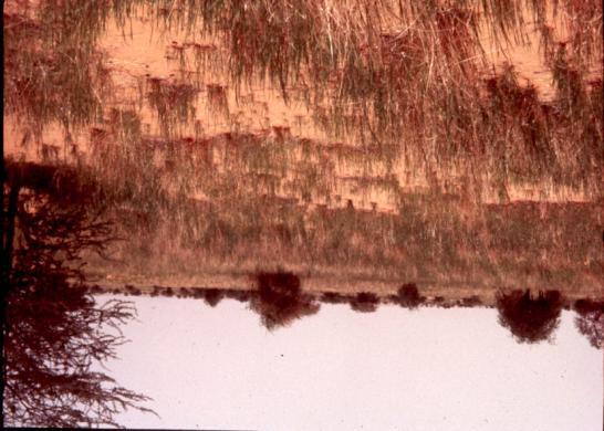
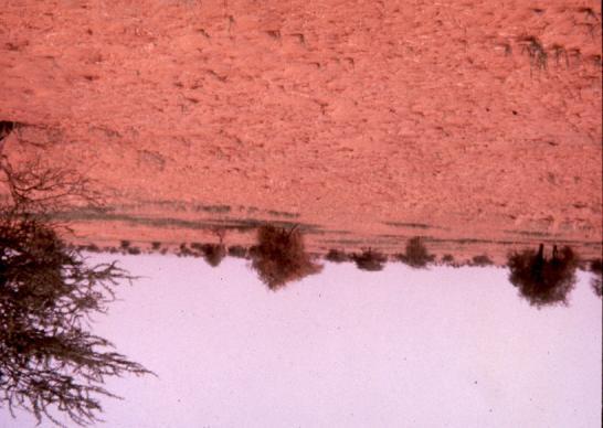
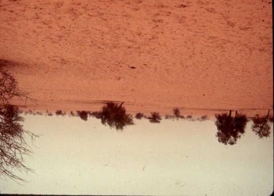
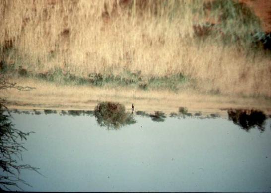
VALERI-2001 CAMPAIGN IN GOURMA (MALI)
") VALERI-2001 CAMPAIGN IN GOURMA (MALI) Participants: Mougin Eric (CESBIO), Fadiala Dembélé (IER), Hiernaux Pierre (ILRI) September 28 October 6, 2001 2 VALERI-2001 CAMPAIGN IN GOURMA (MALI) Due to administrative
VALERI-2001 CAMPAIGN IN GOURMA (MALI) Participants: Mougin Eric (CESBIO), Fadiala Dembélé (IER), Hiernaux Pierre (ILRI) September 28 October 6, 2001 2 VALERI-2001 CAMPAIGN IN GOURMA (MALI) Due to administrative
Analysis of the linkages between rainfall and land surface conditions in the West African monsoon through CMAP, ERS-WSC, and NOAA-AVHRR data
 Author manuscript, published in "Journal of Geophysical Research Atmospheres 110, D24 (2005) NIL_40-NIL_54" DOI : 10.1029/2005JD006394 Analysis of the linkages between rainfall and land surface conditions
The 2006 Rainy Season over the GOURMA meso-site (Mali)
") SOP Meeting, Toulouse, Nov. 2006 Instruments and data sets, Status & Highlights The 2006 Rainy Season over the GOURMA meso-site (Mali) E. Mougin, M. Arjounin, F. Baup, E. Ceschia, L. Diarra, V. Demarez
SOP Meeting, Toulouse, Nov. 2006 Instruments and data sets, Status & Highlights The 2006 Rainy Season over the GOURMA meso-site (Mali) E. Mougin, M. Arjounin, F. Baup, E. Ceschia, L. Diarra, V. Demarez
IMPORTANCE OF SATELLITE DATA (FOR REANALYSIS AND BEYOND) Jörg Schulz EUMETSAT
 Jörg Schulz EUMETSAT") IMPORTANCE OF SATELLITE DATA (FOR REANALYSIS AND BEYOND) Jörg Schulz EUMETSAT Why satellite data for climate monitoring? Global coverage Global consistency, sometimes also temporal consistency High spatial
IMPORTANCE OF SATELLITE DATA (FOR REANALYSIS AND BEYOND) Jörg Schulz EUMETSAT Why satellite data for climate monitoring? Global coverage Global consistency, sometimes also temporal consistency High spatial
Eric Mougin & Josiane Seghieri CESBIO. TT members : 20 european teams 6 malian institutions
 TT3 EOP integrative studies on the Gourma meso-scale site (Mali) Eric Mougin & Josiane Seghieri CESBIO TT members : 20 european teams 6 malian institutions The AMMA meso-scale sites Gourma Niamey Ouémé
Influence of rainfall space-time variability over the Ouémé basin in Benin
 102 Remote Sensing and GIS for Hydrology and Water Resources (IAHS Publ. 368, 2015) (Proceedings RSHS14 and ICGRHWE14, Guangzhou, China, August 2014). Influence of rainfall space-time variability over
SOIL MOISTURE PRODUCTS FROM C-BAND SCATTEROMETERS: FROM ERS-1/2 TO METOP
 1 SOIL MOISTURE PRODUCTS FROM C-BAND SCATTEROMETERS: FROM ERS-1/2 TO METOP Zoltan Bartalis, Klaus Scipal, Wolfgang Wagner I.P.F. - Insitute of Photogrammetry and Remote Sensing, Vienna University of Technology,
ERS scatterometer surface soil moisture analysis of two sites in the south and north of the Sahel region of West Africa
 ERS scatterometer surface soil moisture analysis of two sites in the south and north of the Sahel region of West Africa P. De Rosnay To cite this version: P. De Rosnay. ERS scatterometer surface soil moisture
Assimilation of satellite derived soil moisture for weather forecasting
 Assimilation of satellite derived soil moisture for weather forecasting www.cawcr.gov.au Imtiaz Dharssi and Peter Steinle February 2011 SMOS/SMAP workshop, Monash University Summary In preparation of the
«Action Thématique Incitative sur Programme» CNRS/INSU
 Development and validation of a regional model of desert dust for the study of seasonal and interannual variations over Sahara and Sahel coupling with satellite observations «Action Thématique Incitative
Calibrating SeaWinds and QuikSCAT scatterometers using natural land targets
 Brigham Young University BYU ScholarsArchive All Faculty Publications 2005-04-01 Calibrating SeaWinds and QuikSCAT scatterometers using natural land targets David G. Long david_long@byu.edu Lucas B. Kunz
Multi-scale soil moisture measurements at the Gourma meso-scale site in Mali
 Multi-scale soil moisture measurements at the Gourma meso-scale site in Mali Patricia De Rosnay, Claire Gruhier, F. Timouk, F. Baup, Eric Mougin, Pierre Hiernaux, L. Kergoat, Valérie Le Dantec To cite
Comparison of MSG-SEVIRI and SPOT-VEGETATION data for vegetation monitoring over Africa
 Comparison of MSG-SEVIRI and SPOT-VEGETATION data for vegetation monitoring over Africa Bernard LACAZE CNRS UMR 8586 PRODIG Pôle Image et Campus Spatial, Université Paris Diderot Paris 7 Objectives Comparison
Updates to Land DA at the Met Office
 Updates to Land DA at the Met Office Brett Candy & Keir Bovis Satellite Soil Moisture Workshop, Amsterdam, 10th July 2014 Land DA - The Story So Far - Kalman Filter 18 months in operations - Analyses of
Climate Variability and Malaria over the Sahel Country of Senegal
 Climate Variability and Malaria over the Sahel Country of Senegal Ibrahima DIOUF CPC International Desks NOAA Center for Weather and Climate Prediction 5830 University Research Court, College Park, Maryland
Climate data records from OSI SAF scatterometer winds. Anton Verhoef Jos de Kloe Jeroen Verspeek Jur Vogelzang Ad Stoffelen
 Climate data records from OSI SAF scatterometer winds Anton Verhoef Jos de Kloe Jeroen Verspeek Jur Vogelzang Ad Stoffelen Outline Motivation Planning Preparation and methods Quality Monitoring Output
Analysis of leaf area index in the ECMWF land surface model and impact on latent heat and carbon fluxes: Application to West Africa
 JOURNAL OF GEOPHYSICAL RESEARCH, VOL. 113,, doi:10.1029/2007jd009370, 2008 Analysis of leaf area index in the ECMWF land surface model and impact on latent heat and carbon fluxes: Application to West Africa
Using spaceborne surface soil moisture to constrain satellite precipitation estimates over West Africa
 GEOPHYSICAL RESEARCH LETTERS, VOL. 35, L02813, doi:10.1029/2007gl032243, 2008 Using spaceborne surface soil moisture to constrain satellite precipitation estimates over West Africa Thierry Pellarin, 1
INFLUENCE OF LARGE-SCALE ATMOSPHERIC MOISTURE FLUXES ON THE INTERANNUAL TO MULTIDECADAL RAINFALL VARIABILITY OF THE WEST AFRICAN MONSOON
 3C.4 INFLUENCE OF LARGE-SCALE ATMOSPHERIC MOISTURE FLUXES ON THE INTERANNUAL TO MULTIDECADAL RAINFALL VARIABILITY OF THE WEST AFRICAN MONSOON Andreas H. Fink*, and Sonja Eikenberg University of Cologne,
Re-greening Sahel: 30 years of remote sensing data and field observations (Mali, Niger)
") 1 2 Re-greening Sahel: 30 years of remote sensing data and field observations (Mali, Niger) 3 4 Dardel C.* 1, Kergoat L. 1, Hiernaux P. 1, Mougin E. 1, Grippa M. 1, Tucker C. J. 2 5 6 7 8 9 10 11 12 1
1 2 Re-greening Sahel: 30 years of remote sensing data and field observations (Mali, Niger) 3 4 Dardel C.* 1, Kergoat L. 1, Hiernaux P. 1, Mougin E. 1, Grippa M. 1, Tucker C. J. 2 5 6 7 8 9 10 11 12 1
Introduction to SMAP. ARSET Applied Remote Sensing Training. Jul. 20,
 National Aeronautics and Space Administration ARSET Applied Remote Sensing Training http://arset.gsfc.nasa.gov @NASAARSET Introduction to SMAP Jul. 20, 2016 www.nasa.gov Outline 1. Mission objectives 2.
ASCAT Soil Moisture: An Assessment of the Data Quality and Consistency with the ERS Scatterometer Heritage
 APRIL 2009 N A E I M I E T A L. 555 ASCAT Soil Moisture: An Assessment of the Data Quality and Consistency with the ERS Scatterometer Heritage VAHID NAEIMI, ZOLTAN BARTALIS, AND WOLFGANG WAGNER Institute
West Africa: The 2015 Season
 HIGHLIGHTS The West Africa 2015 growing season developed under an evolving El Nino event that will peak in late 2015. This region tends to have seasonal rainfall deficits in the more marginal areas during
Long term performance monitoring of ASCAT-A
 Long term performance monitoring of ASCAT-A Craig Anderson and Julia Figa-Saldaña EUMETSAT, Eumetsat Allee 1, 64295 Darmstadt, Germany. Abstract The Advanced Scatterometer (ASCAT) on the METOP series of
Report. Northern Africa. RAIDEG-8, 1-2 Nov 2017
 Report Northern Africa RAIDEG-8, 1-2 Nov 2017 Report Northern Africa RAIDEG-8, 1-2 Nov 2017 Important Note: Formal letters have been sent from the PR of Morocco with WMO to PRs of Algeria, Tunisia, Libya
Quantifying Weather and Climate Impacts on Health in Developing Countries (QWeCI)
") Quantifying Weather and Climate Impacts on Health in Developing Countries (QWeCI) Science Talk QWeCIis funded by the European Commission s Seventh Framework Research Programme under the grant agreement
Quantifying Weather and Climate Impacts on Health in Developing Countries (QWeCI) Science Talk QWeCIis funded by the European Commission s Seventh Framework Research Programme under the grant agreement
TELE-EPIDEMIOLOGY URBAN MALARIA MAPPING
 TELE-EPIDEMIOLOGY URBAN MALARIA MAPPING Ministère de la Défense Vanessa Machault Advances in Geospatial Technologies for Health 12-13/09/2011 Objective To develop a robust pre-operational methodology to
Available online at Assimilation of SPOT/VEGETATION NDVI data into a sahelian vegetation dynamics model DRAFT
 Available online at www.sciencedirect.com Remote Sensing of Environment 112 (2008) 1381 1394 www.elsevier.com/locate/rse Assimilation of SPOT/VEGETATION NDVI data into a sahelian vegetation dynamics model
EPIDEMIOLOGY FOR URBAN MALARIA MAPPING
 TELE-EPIDEMIOLOGY EPIDEMIOLOGY FOR URBAN MALARIA MAPPING @IRD/M Dukhan Vanessa Machault Observatoire Midi-Pyrénées, Laboratoire d Aérologie Pleiades days 17/01/2012 The concept of Tele-epidemiology The
West and East Africa The 2014 Rainfall Season
 West and East Africa The 2014 Rainfall Season Highlights SAHEL The pronounced dryness that dominated the earlier stages of the season was alleviated by good rains in August. In September, rainfall was
METEOSAT SECOND GENERATION DATA FOR ASSESSMENT OF SURFACE MOISTURE STATUS
 METEOSAT SECOND GENERATION DATA FOR ASSESSMENT OF SURFACE MOISTURE STATUS Simon Stisen (1), Inge Sandholt (1), Rasmus Fensholt (1) (1) Institute of Geography, University of Copenhagen, Oestervoldgade 10,
A two-season impact study of the Navy s WindSat surface wind retrievals in the NCEP global data assimilation system
 A two-season impact study of the Navy s WindSat surface wind retrievals in the NCEP global data assimilation system Li Bi James Jung John Le Marshall 16 April 2008 Outline WindSat overview and working
Remote Sensing Applications for Land/Atmosphere: Earth Radiation Balance
 Remote Sensing Applications for Land/Atmosphere: Earth Radiation Balance - Introduction - Deriving surface energy balance fluxes from net radiation measurements - Estimation of surface net radiation from
A diffusion model to predict spatial and temporal population dynamics of Rift valley fever vectors in Northern Senegal
 A diffusion model to predict spatial and temporal population dynamics of Rift valley fever vectors in Northern Senegal Soti V., Tran A., Fontenille D, Lancelot R, Chevalier V., Thiongane Y., Degenne P.,
SCAT calibration TU-Wien
 SCAT calibration approach @ TU-Wien Presentation to SCIRoCCO project team ESA Presented by Christoph Reimer Vienna University of Technology Outline Calibration methodology intra-calibration / inter-calibration
How to integrate wetland processes in river basin modeling? A West African case study
 How to integrate wetland processes in river basin modeling? A West African case study stefan.liersch@pik-potsdam.de fred.hattermann@pik-potsdam.de June 2011 Outline Why is an inundation module required?
The estimation of soil moisture from ERS wind scatterometer data over the Tibetan plateau
 Physics and Chemistry of the Earth 28 (2003) 53 61 www.elsevier.com/locate/pce The estimation of soil moisture from ERS wind scatterometer data over the Tibetan plateau Jun Wen a,b, Zhongbo Su a, * a Alterra
The Global Scope of Climate. The Global Scope of Climate. Keys to Climate. Chapter 8
 The Global Scope of Climate Chapter 8 The Global Scope of Climate In its most general sense, climate is the average weather of a region, but except where conditions change very little during the course
Predictability of convective precipitation: Convection permitting ensemble simulations
 Predictability of convective precipitation: Convection permitting ensemble simulations Vera Maurer, Norbert Kalthoff, and Leonhard Gantner Institute for Meteorology and Climate Research () KIT University
WATER VAPOR FLUXES OVER EQUATORIAL CENTRAL AFRICA
 WATER VAPOR FLUXES OVER EQUATORIAL CENTRAL AFRICA INTRODUCTION A good understanding of the causes of climate variability depend, to the large extend, on the precise knowledge of the functioning of the
Capabilities and Limitations of Land Cover and Satellite Data for Biomass Estimation in African Ecosystems Valerio Avitabile
 Capabilities and Limitations of Land Cover and Satellite Data for Biomass Estimation in African Ecosystems Valerio Avitabile Kaniyo Pabidi - Budongo Forest Reserve November 13th, 2008 Outline of the presentation
EUMETSAT SAF NETWORK. Lothar Schüller, EUMETSAT SAF Network Manager
 1 EUMETSAT SAF NETWORK Lothar Schüller, EUMETSAT SAF Network Manager EUMETSAT ground segment overview METEOSAT JASON-2 INITIAL JOINT POLAR SYSTEM METOP NOAA SATELLITES CONTROL AND DATA ACQUISITION FLIGHT
Assimilation of land surface satellite data for Numerical Weather Prediction at ECMWF
 4 th workshop on Remote Sensing and Modelling of Surface properties Saint Martin d Hères, 14-16 March 2016 Assimilation of land surface satellite data for Numerical Weather Prediction at ECMWF P. de Rosnay,
Atmospheric Processes
 Atmospheric Processes Atmospheric prognostic variables Wind Temperature Humidity Cloud Water/Ice Atmospheric processes Mixing Radiation Condensation/ Evaporation Precipitation Surface exchanges Friction
Analysis of Leaf Area Index in the ECMWF land surface scheme and impact on latent heat and carbon fluxes: Application to West Africa
 44 Analysis of Leaf Area Index in the ECMWF land surface scheme and impact on latent heat and carbon fluxes: Application to West Africa L.Jarlan 1,2, G. Balsamo 1, S. Lafont 1-3, A.Beljaars 1, J.C.Calvet
Soil Moisture Estimation Using Surface Backscattering Coefficients Observed by the Tropical Rain Measurement Mission Precipitation Radar
 Soil Moisture Estimation Using Surface Backscattering Coefficients Observed by the Tropical Rain Measurement Mission Precipitation Radar Shinta Seto Communications Research Laboratory, Tokyo, Japan Alan
ASCAT - Metop A developments, Metop B preparations & EPS-SG
 ASCAT - Metop A developments, Metop B preparations & EPS-SG Hans Bonekamp, Craig Anderson, Julia Figa & Julian Wilson Slide: 1 ASCAT Metop A - overview Instrument operating nominally (minor incident in
Downscaling West African climate: uncertainties, sensitivity to the model physics and regional variability
 Downscaling West African climate: uncertainties, sensitivity to the model physics and regional variability Benjamin Pohl, Johanna Ramarohetra, Benjamin Sultan, Arona Diedhiou, Gaëlle de Coëtlogon, Serge
Evaluating Parametrizations using CEOP
 Evaluating Parametrizations using CEOP Paul Earnshaw and Sean Milton Met Office, UK Crown copyright 2005 Page 1 Overview Production and use of CEOP data Results SGP Seasonal & Diurnal cycles Other extratopical
EUMETSAT SAF NETWORK. Lothar Schüller, EUMETSAT SAF Network Manager
 1 EUMETSAT SAF NETWORK Lothar Schüller, EUMETSAT SAF Network Manager EUMETSAT ground segment overview METEOSAT JASON-2 INITIAL JOINT POLAR SYSTEM METOP NOAA SATELLITES CONTROL AND DATA ACQUISITION FLIGHT
Quantifying Weather and Climate Impacts on Health in Developing Countries (QWeCI)
") Quantifying Weather and Climate Impacts on Health in Developing Countries (QWeCI) Science Talk QWeCI is funded by the European Commission s Seventh Framework Research Programme under the grant agreement
Quantifying Weather and Climate Impacts on Health in Developing Countries (QWeCI) Science Talk QWeCI is funded by the European Commission s Seventh Framework Research Programme under the grant agreement
West and East Africa The 2014 Rainfall Season
 West and East Africa The 2014 Rainfall Season HIGHLIGHTS SAHEL The pronounced dryness that dominated the earlier stages of the season until July was alleviated by good August rainfall. In September, rainfall
Climate Variability in South Asia
 Climate Variability in South Asia V. Niranjan, M. Dinesh Kumar, and Nitin Bassi Institute for Resource Analysis and Policy Contents Introduction Rainfall variability in South Asia Temporal variability
Stability in SeaWinds Quality Control
 Ocean and Sea Ice SAF Technical Note Stability in SeaWinds Quality Control Anton Verhoef, Marcos Portabella and Ad Stoffelen Version 1.0 April 2008 DOCUMENTATION CHANGE RECORD Reference: Issue / Revision:
Evaluation strategies of coarse resolution SM products for monitoring deficit/excess conditions in the Pampas Plains, Argentina
 Evaluation strategies of coarse resolution SM products for monitoring deficit/excess conditions in the Pampas Plains, Argentina Francisco Grings, Cintia Bruscantini, Federico Carballo, Ezequiel Smucler,
Our climate system is based on the location of hot and cold air mass regions and the atmospheric circulation created by trade winds and westerlies.
 CLIMATE REGIONS Have you ever wondered why one area of the world is a desert, another a grassland, and another a rainforest? Or have you wondered why are there different types of forests and deserts with
From Space-Based Measurements to Climate Data Records
 CLIMATE@EUMETSAT: From Space-Based Measurements to Climate Data Records Jörg Schulz Rob Roebeling, Marie Doutriaux-Boucher, Viju John, Alessio Lattanzio, Frank Rüthrich, Arndt Meier, Andrey Bogdanov, Julia
The PRECIS Regional Climate Model
 The PRECIS Regional Climate Model General overview (1) The regional climate model (RCM) within PRECIS is a model of the atmosphere and land surface, of limited area and high resolution and locatable over
The SMOS Satellite Mission. Y. Kerr, and the SMOS Team
 The SMOS Satellite Mission Y. Kerr, and the SMOS Team The 4 phases of a project The concept Expression of needs Theoretical solution Practical solution The selling Proposal writing Concept fine tuning
Meeting the Needs for Satellite OVW
 Meeting the Needs for Satellite OVW NEED Multiple scatterometers to extend the coverage of QuikSCAT and provide continuity UNDERWAY EUMETSAT ASCAT on METOP series 1 st is in orbit ISRO Oceansat-2 Timely
URSI-F Microwave Signatures Meeting 2010, Florence, Italy, October 4 8, Thomas Meissner Lucrezia Ricciardulli Frank Wentz
 URSI-F Microwave Signatures Meeting 2010, Florence, Italy, October 4 8, 2010 Wind Measurements from Active and Passive Microwave Sensors High Winds and Winds in Rain Thomas Meissner Lucrezia Ricciardulli
Seasonal and interannual relations between precipitation, soil moisture and vegetation in the North American monsoon region
 Seasonal and interannual relations between precipitation, soil moisture and vegetation in the North American monsoon region Luis A. Mendez-Barroso 1, Enrique R. Vivoni 1, Christopher J. Watts 2 and Julio
Mapping surface soil moisture over the Gourma mesoscale site (Mali) by using ENVISAT ASAR data
 by using ENVISAT ASAR data") Hydrol. Earth Syst. Sci., 15, 63 616, 211 www.hydrol-earth-syst-sci.net/15/63/211/ doi:1.5194/hess-15-63-211 Author(s) 211. CC Attribution 3. License. Hydrology and Earth System Sciences Mapping surface
Hydrol. Earth Syst. Sci., 15, 63 616, 211 www.hydrol-earth-syst-sci.net/15/63/211/ doi:1.5194/hess-15-63-211 Author(s) 211. CC Attribution 3. License. Hydrology and Earth System Sciences Mapping surface
Earth s Major Terrerstrial Biomes. *Wetlands (found all over Earth)
") Biomes Biome: the major types of terrestrial ecosystems determined primarily by climate 2 main factors: Depends on ; proximity to ocean; and air and ocean circulation patterns Similar traits of plants
Biomes Biome: the major types of terrestrial ecosystems determined primarily by climate 2 main factors: Depends on ; proximity to ocean; and air and ocean circulation patterns Similar traits of plants
EUMETSAT LSA-SAF EVAPOTRANSPIRATION PRODUCTS STATUS AND PERSPECTIVES
 EUMETSAT LSA-SAF EVAPOTRANSPIRATION PRODUCTS STATUS AND PERSPECTIVES Arboleda, N. Ghilain, F. Gellens-Meulenberghs Royal Meteorological Institute, Avenue Circulaire, 3, B-1180 Bruxelles, BELGIUM Corresponding
Land Data Assimilation for operational weather forecasting
 Land Data Assimilation for operational weather forecasting Brett Candy Richard Renshaw, JuHyoung Lee & Imtiaz Dharssi * *Centre Australian Weather and Climate Research Contents An overview of the Current
Climate Dynamics (PCC 587): Hydrologic Cycle and Global Warming
: Hydrologic Cycle and Global Warming") Climate Dynamics (PCC 587): Hydrologic Cycle and Global Warming D A R G A N M. W. F R I E R S O N U N I V E R S I T Y O F W A S H I N G T O N, D E P A R T M E N T O F A T M O S P H E R I C S C I E N C
Climate Dynamics (PCC 587): Hydrologic Cycle and Global Warming D A R G A N M. W. F R I E R S O N U N I V E R S I T Y O F W A S H I N G T O N, D E P A R T M E N T O F A T M O S P H E R I C S C I E N C
Julia Figa-Saldaña & Klaus Scipal
 Julia Figa-Saldaña & Klaus Scipal julia.figa@eumetsat.int klaus.scipal@esa.int Meeting, Outline MetOp/EPS status MetOp/EPS Second Generation status 2016 scatterometer conference Other European ocean programme
STUDIES ON MODEL PREDICTABILITY IN VARIOUS CLIMATIC CONDITIONS: AN EFFORT USING CEOP EOP1 DATASET
 STUDIES ON MODEL PREDICTABILITY IN VARIOUS CLIMATIC CONDITIONS: AN EFFORT USING CEOP EOP DATASET KUN YANG, KATSUNORI TAMAGAWA, PETRA KOUDELOVA, TOSHIO KOIKE Department of Civil Engineering, University
ASCAT-B Level 2 Soil Moisture Validation Report
 EUMETSAT EUMETSAT Allee 1, D-64295 Darmstadt, Doc.No. : EUM/OPS/DOC/12/3849 Germany Tel: +49 6151 807-7 Issue : v2 Fax: +49 6151 807 555 Date : 20 December 2012 http://www.eumetsat.int Page 1 of 25 This
The agroclimatic resource change in Mongolia
 The agroclimatic resource change in Mongolia Azzaya D, Gantsetseg B, Munkhzul D Institute of Meteorology and Hydrology,Juulchny gudamj-5, Ulaanbaatar-46, Mongolia, 210646, meteoins@magicnet.mn, azzaya23@yahoo.com
OSI SAF Sea Ice products
 OSI SAF Sea Ice products Lars-Anders Brevik, Gorm Dybkjær, Steinar Eastwood, Øystein Godøy, Mari Anne Killie, Thomas Lavergne, Rasmus Tonboe, Signe Aaboe Norwegian Meteorological Institute Danish Meteorological
Flux Tower Data Quality Analysis in the North American Monsoon Region
 Flux Tower Data Quality Analysis in the North American Monsoon Region 1. Motivation The area of focus in this study is mainly Arizona, due to data richness and availability. Monsoon rains in Arizona usually
Impact of METOP ASCAT Ocean Surface Winds in the NCEP GDAS/GFS and NRL NAVDAS
 Impact of METOP ASCAT Ocean Surface Winds in the NCEP GDAS/GFS and NRL NAVDAS COAMPS @ Li Bi 1,2 James Jung 3,4 Michael Morgan 5 John F. Le Marshall 6 Nancy Baker 2 Dave Santek 3 1 University Corporation
Where does precipitation water come from?
 Chapter II Climate and Meteorology Where does precipitation water come from? Introduction The source of water vapor existing over Mongolia has been considered to consist of evapotranspiration at several
Ju Hyoung, Lee, B. Candy, R. Renshaw Met Office, UK
 the FAO/ ESA/ GWSP Workshop on Earth Observations and the Water-Energy-Food Nexus 25-27 March 2014 in Rome, Italy Ju Hyoung, Lee, B. Candy, R. Renshaw Met Office, UK 1 1. Agriculture needs, current methods,
GEOSC/METEO 597K Kevin Bowley Kaitlin Walsh
 GEOSC/METEO 597K Kevin Bowley Kaitlin Walsh Timeline of Satellites ERS-1 (1991-2000) NSCAT (1996) Envisat (2002) RADARSAT (2007) Seasat (1978) TOPEX/Poseidon (1992-2005) QuikSCAT (1999) Jason-2 (2008)
SMAP and SMOS Integrated Soil Moisture Validation. T. J. Jackson USDA ARS
 SMAP and SMOS Integrated Soil Moisture Validation T. J. Jackson USDA ARS Perspective Linkage of SMOS and SMAP soil moisture calibration and validation will have short and long term benefits for both missions.
Assimilation of ASCAT soil wetness
 EWGLAM, October 2010 Assimilation of ASCAT soil wetness Bruce Macpherson, on behalf of Imtiaz Dharssi, Keir Bovis and Clive Jones Contents This presentation covers the following areas ASCAT soil wetness
Investigations of the Dry Snow Zone of the Greenland Ice Sheet Using QuikSCAT. Kevin R. Moon
 Investigations of the Dry Snow Zone of the Greenland Ice Sheet Using QuikSCAT Kevin R. Moon A thesis submitted to the faculty of Brigham Young University in partial fulfillment of the requirements for
5. General Circulation Models
 5. General Circulation Models I. 3-D Climate Models (General Circulation Models) To include the full three-dimensional aspect of climate, including the calculation of the dynamical transports, requires
Development and analysis of climatological baseline and climate change scenarios for the Economic Community of West African States
 Development and analysis of climatological baseline and climate change scenarios for the Economic Community of West African States Technical report prepared for the United Nations University Institute
Drought Monitoring with Hydrological Modelling
 st Joint EARS/JRC International Drought Workshop, Ljubljana,.-5. September 009 Drought Monitoring with Hydrological Modelling Stefan Niemeyer IES - Institute for Environment and Sustainability Ispra -
The West African Monsoon and its socio-economical impacts
 The West African Monsoon and its socio-economical impacts Aïda Diongue-Niang Direction de la Météorologie Nationale Sénégal First THORPEX Science Symposium Montréal, 6-10 December 2004 The West African
Landscape characterization of Rift Valley Fever risk areas using very high spatial resolution imagery : case study in the Ferlo area, Senegal.
 Landscape characterization of Rift Valley Fever risk areas using very high spatial resolution imagery : case study in the Ferlo area, Senegal. V.Soti 1,2,3, V.Chevalier 1, J.Maura 1, D.Sow 5, A. Begue
Bringing Consistency into High Wind Measurements with Spaceborne Microwave Radiometers and Scatterometers
 International Ocean Vector Wind Science Team Meeting May 2-4, 2017, Scripps Bringing Consistency into High Wind Measurements with Spaceborne Microwave Radiometers and Scatterometers Thomas Meissner, Lucrezia
Evaluation of sub-kilometric numerical simulations of C-band radar backscatter over the french Alps against Sentinel-1 observations
 Evaluation of sub-kilometric numerical simulations of C-band radar backscatter over the french Alps against Sentinel-1 observations Gaëlle Veyssière, Fatima Karbou, Samuel Morin, Matthieu Lafaysse Monterey,
Julia Figa-Saldaña & Klaus Scipal
 Julia Figa-Saldaña & Klaus Scipal julia.figa@eumetsat.int klaus.scipal@esa.int C. Anderson, F. Fois, C. Lin, M. Loiselet, F. Ticconi, J.J.W. Wilson Meeting, Outline Overview and objectives of European
JOURNAL OF GEOPHYSICAL RESEARCH, VOL. 110, D07110, doi: /2004jd005087, 2005
 JOURNAL OF GEOPHYSICAL RESEARCH, VOL. 110,, doi:10.1029/2004jd005087, 2005 Sensitivity of satellite microwave and infrared observations to soil moisture at a global scale: Relationship of satellite observations
SMAP Winds. Hurricane Irma Sep 5, AMS 33rd Conference on Hurricanes and Tropical Meteorology Ponte Vedra, Florida, 4/16 4/20, 2018
 Intensity and Size of Strong Tropical Cyclones in 2017 from NASA's SMAP L-Band Radiometer Thomas Meissner, Lucrezia Ricciardulli, Frank Wentz, Remote Sensing Systems, Santa Rosa, USA Charles Sampson, Naval
SATELLITE OBSERVATIONS OF CLOUD RADIATIVE FORCING FOR THE AFRICAN TROPICAL CONVECTIVE REGION
 SATELLITE OBSERVATIONS OF CLOUD RADIATIVE FORCING FOR THE AFRICAN TROPICAL CONVECTIVE REGION J. M. Futyan, J. E. Russell and J. E. Harries Space and Atmospheric Physics Group, Blackett Laboratory, Imperial
Components of the Climate System. Lecture 2: Earth s Climate System. Pop Quiz. Sub-components Global cycles What comes in What goes out
 Lecture 2: Earth s Climate System Components of the Climate System terrestrial radiation Atmosphere Ocean solar radiation Land Energy, Water, and Biogeochemistry Cycles Sub-components Global cycles What
Diagnosing the characteristics of Sahel Drought in the Ensemble CAM 3.5 using Data Assimilation Yu-Heng Tseng HC/EFDL, NTU
 Diagnosing the characteristics of Sahel Drought in the Ensemble CAM 3.5 using Data Assimilation Sahel Department of Atmospheric Sciences National Taiwan University Collaborators: Junjie Liu, Eugenia Kalnay,
GAP ANALYSIS FOR SATELLITE MISSIONS SUPPORTING THE GOS
 WMO OMM World Meteorological Organization Working together in weather, climate and water GAP ANALYSIS FOR SATELLITE MISSIONS SUPPORTING THE GOS CGMS-39 WMO-WP-31, Agenda item III.5 Dr B. Bizzarri, Consultant
Earth Exploration-Satellite Service (EESS)- Active Spaceborne Remote Sensing and Operations
- Active Spaceborne Remote Sensing and Operations") Earth Exploration-Satellite Service (EESS)- Active Spaceborne Remote Sensing and Operations SRTM Radarsat JASON Seawinds TRMM Cloudsat Bryan Huneycutt (USA) Charles Wende (USA) WMO, Geneva, Switzerland
Earth Exploration-Satellite Service (EESS)- Active Spaceborne Remote Sensing and Operations SRTM Radarsat JASON Seawinds TRMM Cloudsat Bryan Huneycutt (USA) Charles Wende (USA) WMO, Geneva, Switzerland
Lecture 2: Earth s Climate System
 Lecture 2: Earth s Climate System terrestrial radiation solar radiation Atmosphere Ocean Solid Earth Land Energy, Water, and Biogeochemistry Cycles Sub-components Global cycles What comes in What goes
China France. Oceanography S A T. The CFOSAT project. e l l i t e. C. Tison (1), D. Hauser (2), A. Mouche (3) CNES, France (2)
, D. Hauser (2), A. Mouche (3) CNES, France (2)") China France The CFOSAT project C. Tison (1), D. Hauser (2), A. Mouche (3) (1) CNES, France (2) OVSQ, CNRS, LATMOS-IPSL, France (3) IFREMER, LOS, France celine.tison@cnes.fr Oceanography S A T e l l i
China France The CFOSAT project C. Tison (1), D. Hauser (2), A. Mouche (3) (1) CNES, France (2) OVSQ, CNRS, LATMOS-IPSL, France (3) IFREMER, LOS, France celine.tison@cnes.fr Oceanography S A T e l l i
Inter- Annual Land Surface Variation NAGS 9329
 Annual Report on NASA Grant 1 Inter- Annual Land Surface Variation NAGS 9329 PI Stephen D. Prince Co-I Yongkang Xue April 2001 Introduction This first period of operations has concentrated on establishing
Technical Note: Hydrology of the Lake Chilwa wetland, Malawi
 Technical Note: Hydrology of the Lake Chilwa wetland, Malawi Matthew McCartney June 27 Description Lake Chilwa is located in the Southern region of Malawi on the country s eastern boarder with Mozambique
REMOTE SENSING KEY!!
 REMOTE SENSING KEY!! This is a really ugly cover page I m sorry. Name Key. Score / 100 Directions: You have 50 minutes to take this test. You may use a cheatsheet (2 pages), a non-graphing calculator,