EPIDEMIOLOGY FOR URBAN MALARIA MAPPING
|
|
|
- Eugenia Martin
- 6 years ago
- Views:
Transcription


1 TELE-EPIDEMIOLOGY EPIDEMIOLOGY FOR URBAN MALARIA Dukhan Vanessa Machault Observatoire Midi-Pyrénées, Laboratoire d Aérologie Pleiades days 17/01/2012
2 The concept of Tele-epidemiology The study of human or animal diseases transmitted by water, air or vectors - related to climatic, meteorological and environmental factors - using spatial information Ground data -> > main mechanisms Entomology Spatial distribution and dynamic of larval habitats Mosquito densities Mosquito flight range Parasitology, immunology, socio-economics Suitable satellite products Earth observation images Vegetation, soil, humidity indicators Land use and land cover Meteorological data (rainfall, temperature) Elevation Research of relationships - Modeling Spatial-temporal variability of data Hazard map Zone potentially occuped by mosquitoes (ZPOM) Vulnerability map Human or animal population Location, density Risk map 2 / 24
3 Objective To develop a robust operational methodology to draw dynamic high resolution malaria entomological risk maps in urban settings at two levels: - risk maps of the Anopheles breeding sites with larval productivity - risk maps of the Anopheles adult densities Based on the principles of tele-epidemiology: Ground: large data collection Remote sensing: appropriate data and images Modeling: spatial-temporal variability 3 / 24


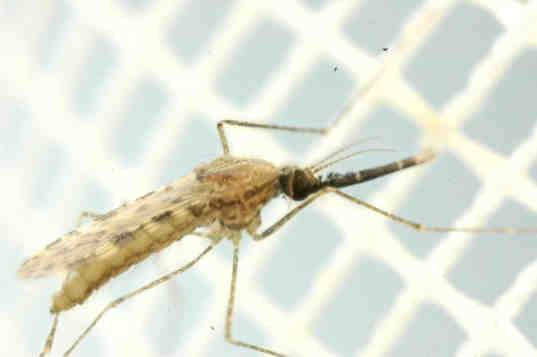
4 Malaria transmission cycle Vector female mosquito Anopheles sp Parasite Plasmodium Stephen Luk - Spatial and temporal distribution - Speed of larval development - Adult survival Climate Environment Human Human Fusay - Speed of development 4 / 24 - Distribution and Vulnerability
 Epidemics")
 -> emerging disease of major")

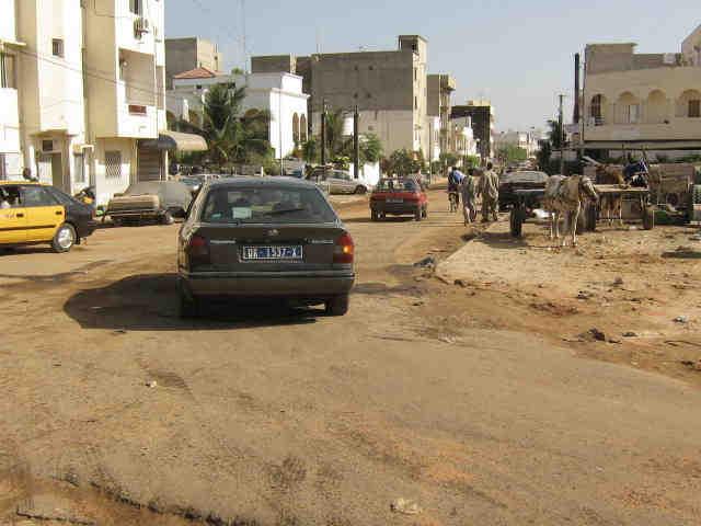
5 Urban malaria Dakar, Senegal 60% of the world population will live in cities (2030) Epidemics of malaria (low parasite transmission, delayed acquired immunity) -> emerging disease of major importance 2.5 millions inhabitants in 2007 Sahelian climate Rainfall: mm (July - October) 5 / 24


6 Ground entomological data collection > km 45 areas (200 m x 200 m) 17 km Adult mosquitoes collection / 15 days ~ Anopheles gambiae s.l. Water bodies + larval habitats / 10 days ~300 larval habitats 6 / 24
 Need for")
7 Spatial and temporal heterogeneity in Dakar 40% 35% 30% 25% 20% 15% 10% Fraction of annual density Fraction of adult de la densité Anopheles annuelle d'anopheles adultes Fraction of annual Fraction de la densité density of Anopheles annuelle de larves larvaed'anopheles 5% 0% From 0 to 250 Anopheles bites/person/night Seasonal peak of Anopheles (rainy season) Need for spatial-temporal risk mapping 7 / 24
8 Dynamic operational mapping methodology Preliminary step Water bodies detection Water is mandatory for larvae Will the water bodies contain larvae? Where? When? Assistance for larval control Step 1 Anopheles larval densities mapping Assistance for mosquito control + information to the population Step 2 Adult Anopheles densities mapping At which scales the emerging mosquitoes will potentially bite humans? Hazard for vulnerable human population Mapping has been done at high spatial resolution (2.5m and 10m) and models were further tested for improvement using Pleiade-like data. 8 / 24

 * Land Surface Temperature (LST) Ground measurements (airport - daily) * Rainfall")
9 Earth Observation + meteorological data SPOT-5 images (2,5 m + 10 m 4 images) 26 september september 2008 * Vegetation, soil and humidity 28 september 2009 indicators 11 may 2009 * Land Use and Land Cover Digital Elevation Model - SRTM (90m 1 image) * Elevation MODIS images (1km weekly) * Land Surface Temperature (LST) Ground measurements (airport - daily) * Rainfall 9 / 24

10 Pleaide-like images (ORFEO-santé) Quickbird Rainy season PAN 2.4m MS World View Dry season m PAN 1.8m MS 10 / 24
11 Preliminary step: water detection Predict the water observed on the ground Logistic regression SPOT-5 200m Re scaled at 10m DEM NDWI rainy season (SPOT-5) NDVI dry season (SPOT-5) Built-up area (SPOT-5 classification) Elevation (DEM) Geographic Information System Detection of humidity Vegetation persisting during the dry season indicates the presence of water Absence of buildings favors larval habitats At low altitude, water table comes up to ground level in Dakar Biological meaning 11 / 24
 Built-up area (SPOT-5 classification) Elevation (DEM) Direct detection of water Type of vegetation, trees, grass Other indices (other bands - blue) Detection of humidity Vegetation")
12 Preliminary step: water detection Predict the water observed on the ground Logistic regression Pleiade-like image 200m Geographic Information System NDWI rainy season (SPOT-5) NDVI dry season (SPOT-5) Built-up area (SPOT-5 classification) Elevation (DEM) Direct detection of water Type of vegetation, trees, grass Other indices (other bands - blue) Detection of humidity Vegetation persisting during the dry season indicates the presence of water Absence of buildings favors larval habitats Improve detection of small water bodies Related or not with presence of water bodies Highlight other land covers 12 / 24


13 Preliminary step: water detection Detection of small water collections Non cemented wells in the market gardens 13 / 24


14 Preliminary step: water detection Land Cover: - High/low vegetation - High/middle/low urban density Land Use: - Residential / industry 14 / 24

15 Preliminary step: map of water bodies Inversion and extrapolation of the model to Dakar Yearly map Spatial resolution 10m 15 / 24
16 Step 1: prediction of the presence of larvae Predict the presence of larvae observed on the ground Logistic Stephen Stephen Luk SPOT-5 MODIS 200m Geographic Information System Mean in and around water bodies Land Surface Temperature (MODIS) Rainfalls (ground) NDWI + Soil BI (SPOT-5) Higher temp. speeds larval development Increases persistence of larval habitats Characterizes temporary water bodies and muddy bottom (favorable for larvae) Biological meaning 16 / 24
 Rainfalls (ground) Geographic Information System Higher temp.")
17 Step 1: prediction of the presence of larvae Predict the presence of larvae observed on the ground Logistic Stephen Stephen Luk Pleiade-like image MODIS 200m Variables associated with the presence of water in 10m grid Land Surface Temperature (MODIS) Rainfalls (ground) Geographic Information System Higher temp. speed larval development Increases persistence of larval habitats NDWI + Soil BI (SPOT-5) Characterizes temporary water bodies and muddy bottom (favorable for larvae) Type of vegetation, trees, grass Other indices (other bands - blue) Shade or surface vegetation Highlight other land covers 17 / 24

18 Step 1: map of presence of Anopheles larvae Inversion and extrapolation of the model to Dakar using the preliminary step Daily map Spatial resolution 10m 18 / 24
19 Step 2: prediction of Anopheles adult densities Predict the number of adults recorded on the ground Negative binomial Dukhan Preliminary step Step 1 Predicted larvae (Step 1) Rainfalls (ground) Mosquitoes survival rate 82% (from literature in Dakar) Built-up areas (SPOT-5 classification) Presence of larvae is related to adults Weights the predicted water surfaces Models the temporal decrease of the mosquito populations Dilution of bites in highly populated areas Biological meaning 19 / 24
 Rainfalls (ground) Mosquitoes survival rate 82% (from literature near Dakar) Built-up Type of areas vegetation,")

20 Step 2: prediction of Anopheles adult densities Predict the number of adults recorded on the ground Negative binomial Dukhan Preliminary step Step 1 Predicted larvae (Step 1) Rainfalls (ground) Mosquitoes survival rate 82% (from literature near Dakar) Built-up Type of areas vegetation, (SPOT-5 trees, classification) grass Build-up areas Higher temp. speed larval development Weights the water surfaces from Step 1 Models the temporal decrease of the mosquito populations Dilution Survival of bites of in adult highly mosquitoes populated areas Refine population densities to model dilution of bites 20 / 24

21 Step 2: map of Anopheles adult densities Inversion and extrapolation of the model to Dakar 20 September 2009 Daily map Spatial resolution 10m 21 / 24


22 Conclusion Remotely sensed environmental and meteorological data can assist temporalspatial fine scale prediction and mapping of Anopheles densities in urban settings at 2 levels: - maps of Anopheles larvae - maps of Anopheles adult mosquitoes The methodology allows predicting future risk (Early Warning System) Guiding, planning and focusing malaria control (national hygiene services) 22 / 24
23 Conclusion Pleiades VHR images can improve mapping at each step of the methodology. Many possibilities for improvement of models will be tested soon, in the scope of EEOS-Malaria (Epidemiology Earth Observation Services Malaria) project, leaded by SIRS and SERTIT. Industrialization of the mapping process -> operational tools 23 / 24

24 Information / 24
TELE-EPIDEMIOLOGY URBAN MALARIA MAPPING
 TELE-EPIDEMIOLOGY URBAN MALARIA MAPPING Ministère de la Défense Vanessa Machault Advances in Geospatial Technologies for Health 12-13/09/2011 Objective To develop a robust pre-operational methodology to
Use of remotely sensed environmental and meteorological data for mapping malaria and dengue entomological risk
 Use of remotely sensed environmental and meteorological data for mapping malaria and dengue entomological risk Vanessa Machault 1 Cécile Vignolles 2 André Yébakima 3 Christophe Rogier 4 Jean-Pierre Lacaux
Risk Mapping of Anopheles gambiae s.l. Densities Using Remotely-Sensed Environmental and Meteorological Data in an Urban Area: Dakar, Senegal
 Risk Mapping of Anopheles gambiae s.l. Densities Using Remotely-Sensed Environmental and Meteorological Data in an Urban Area: Dakar, Senegal Vanessa Machault 1,2,3 *,Cécile Vignolles 3, Frédéric Pagès
Mapping Malaria Risk in Dakar, Senegal. Marion Borderon, Sébastien Oliveau
 Mapping Malaria Risk in Dakar, Senegal Marion Borderon, Sébastien Oliveau When entomology meets social sciences Framework of the research - ANR ACTU PALU - interdisciplinary project Data & method Social
Modelling Bluetongue vectors occurence using GIS and Remote Sensing techniques. Martins H., Nunes T., Boinas F.
 Modelling Bluetongue vectors occurence using GIS and Remote Sensing techniques Martins H., Nunes T., Boinas F. Introduction Objectives Spatial modelling of Culicoides imicola occurence Compare modelling
Predicting Malaria Epidemics in Ethiopia
 Predicting Malaria Epidemics in Ethiopia Eskindir Loha, Hawassa University Torleif Markussen Lunde, UoB 5th Conference on Global Health and Vaccination Research: Environmental Change and Global Health
A diffusion model to predict spatial and temporal population dynamics of Rift valley fever vectors in Northern Senegal
 A diffusion model to predict spatial and temporal population dynamics of Rift valley fever vectors in Northern Senegal Soti V., Tran A., Fontenille D, Lancelot R, Chevalier V., Thiongane Y., Degenne P.,
Climate Variability and Malaria over the Sahel Country of Senegal
 Climate Variability and Malaria over the Sahel Country of Senegal Ibrahima DIOUF CPC International Desks NOAA Center for Weather and Climate Prediction 5830 University Research Court, College Park, Maryland
CLIMATE AND LAND USE DRIVERS OF MALARIA RISK IN THE PERUVIAN AMAZON,
 CLIMATE AND LAND USE DRIVERS OF MALARIA RISK IN THE PERUVIAN AMAZON, 2001-2012 Ben Zaitchik Johns Hopkins University Beth Feingold, Denis Valle, Alex Sandoval, Carlos Alvarez Antonio, Rosa Patricia Zegarra
The Response of Environmental Capacity for Malaria Transmission in West Africa to Climate Change
 AGU Fall Meeting December 9, 2011 The Response of Environmental Capacity for Malaria Transmission in West Africa to Climate Change Teresa K. Yamana & Elfatih A.B. Eltahir MIT Dept. of Civil & Environmental
Geographical Information System (GIS)-based maps for monitoring of entomological risk factors affecting transmission of chikungunya in Sri Lanka
-based maps for monitoring of entomological risk factors affecting transmission of chikungunya in Sri Lanka") Geographical Information System (GIS)-based maps for monitoring of entomological risk factors affecting transmission of chikungunya in Sri Lanka M.D. Hapugoda 1, N.K. Gunewardena 1, P.H.D. Kusumawathie
Geographical Information System (GIS)-based maps for monitoring of entomological risk factors affecting transmission of chikungunya in Sri Lanka M.D. Hapugoda 1, N.K. Gunewardena 1, P.H.D. Kusumawathie
Land Management and Natural Hazards Unit --- DESERT Action 1. Land Management and Natural Hazards Unit Institute for Environment and Sustainability
 Land Management and Natural Hazards Unit --- DESERT Action 1 Monitoring Drought with Meteorological and Remote Sensing Data A case study on the Horn of Africa Paulo Barbosa and Gustavo Naumann Land Management
Landscape characterization of Rift Valley Fever risk areas using very high spatial resolution imagery : case study in the Ferlo area, Senegal.
 Landscape characterization of Rift Valley Fever risk areas using very high spatial resolution imagery : case study in the Ferlo area, Senegal. V.Soti 1,2,3, V.Chevalier 1, J.Maura 1, D.Sow 5, A. Begue
Satellite observed sensitivity of malaria to ENSO and AVHRR based vegetation health for short and long term forecasting in Bangladesh and India By
 Satellite observed sensitivity of malaria to ENSO and AVHRR based vegetation health for short and long term forecasting in Bangladesh and India By Leonid Roytman*, Mohammad Nizamuddin*, Mitch Goldberg**
Understanding the role of land cover / land use nexus in malaria transmission under changing socio-economic climate in Myanmar
 Annual Report for Year 1 June, 2017 January, 2018 NASA Land Cover Land Use Change Program Funded under grant # NNX17AI06G: Understanding the role of land cover / land use nexus in malaria transmission
Impacts of Climate Change on Public Health: Bangladesh Perspective
 Global Journal of Environmental Research 5 (3): 97-15, 211 ISSN 199-925X IDOSI Publications, 211 Impacts of Climate Change on Public Health: Bangladesh Perspective M. Ruhul Amin, S.M. Tareq and S.H. Rahman
Geo-statistical Dengue Risk Model Case Study of Lahore Dengue Outbreaks 2011
 Geo-statistical Dengue Risk Model Case Study of Lahore Dengue Outbreaks 2011 BILAL TARIQ Department of Remote Sensing & Geo-information Science Institute of Space Technology (IST) Karachi Campus, Pakistan
Geospatial data mining in volunteer data: how natural conditions might increase the risk of tick bites and Lyme disease?
 Geospatial data mining in volunteer data: how natural conditions might increase the risk of tick bites and Lyme disease? I. Garcia-Martí 1, R. Zurita-Milla 1, S. Bennema 2, M. G. Harms 2, C. C. van den
Tailored Climate Information Resources for Malaria Control in Africa
 Tailored Climate Information Resources for Malaria Control in Africa Emily Grover-Kopec International Research Institute for Climate and Society NOAA Climate Prediction Applications Science Workshop Tucson,
Towards a risk map of malaria for Sri Lanka
 assessing the options for control of malaria vectors through different water management practices in a natural stream that formed part of such a tank cascade system. The studies established conclusively
Abdolreza Ansari Amoli. Remote Sensing Department Iranian Space Agency
 Risk Assessment and Mapping Using Earth Observation Data In Iran Abdolreza Ansari Amoli Remote Sensing & GIS Expert Remote Sensing Department Iranian Space Agency Different Types of Disasters in Iran Epidemic
Meteorological Information for Locust Monitoring and Control. Robert Stefanski. Agricultural Meteorology Division World Meteorological Organization
 Meteorological Information for Locust Monitoring and Control Robert Stefanski Agricultural Meteorology Division World Meteorological Organization Objectives of Workshop Presentation Meteorological requirements
MISSION DEBRIEFING: Teacher Guide
 Activity 2: It s Raining Again?! Using real data from one particular location, students will interpret a graph that relates rainfall to the number of cases of malaria. Background The relationship between
DROUGHT ASSESSMENT USING SATELLITE DERIVED METEOROLOGICAL PARAMETERS AND NDVI IN POTOHAR REGION
 DROUGHT ASSESSMENT USING SATELLITE DERIVED METEOROLOGICAL PARAMETERS AND NDVI IN POTOHAR REGION Researcher: Saad-ul-Haque Supervisor: Dr. Badar Ghauri Department of RS & GISc Institute of Space Technology
Spatial Analysis of Natural Hazard and Climate Change Risks in Peri-Urban Expansion Areas of Dakar, Senegal
 1 Spatial Analysis of Natural Hazard and Climate Change Risks in Peri-Urban Expansion Areas of Dakar, Senegal URBAN WEEK 2009 BBL Preston Lounge Thursday, March 12, 2009 Christian Hoffmann GeoVille group
Role of GIS in Tracking and Controlling Spread of Disease
 Role of GIS in Tracking and Controlling Spread of Disease For Dr. Baqer Al-Ramadan By Syed Imran Quadri CRP 514: Introduction to GIS Introduction Problem Statement Objectives Methodology of Study Literature
RESEARCH METHODOLOGY
 III. RESEARCH METHODOLOGY 3.1. Time and Research Area The field work was taken place in primary forest around Toro village in Lore Lindu National Park, Indonesia. The study area located in 120 o 2 53 120
VISUALIZATION URBAN SPATIAL GROWTH OF DESERT CITIES FROM SATELLITE IMAGERY: A PRELIMINARY STUDY
 CO-439 VISUALIZATION URBAN SPATIAL GROWTH OF DESERT CITIES FROM SATELLITE IMAGERY: A PRELIMINARY STUDY YANG X. Florida State University, TALLAHASSEE, FLORIDA, UNITED STATES ABSTRACT Desert cities, particularly
ESTIMATION OF LANDFORM CLASSIFICATION BASED ON LAND USE AND ITS CHANGE - Use of Object-based Classification and Altitude Data -
 ESTIMATION OF LANDFORM CLASSIFICATION BASED ON LAND USE AND ITS CHANGE - Use of Object-based Classification and Altitude Data - Shoichi NAKAI 1 and Jaegyu BAE 2 1 Professor, Chiba University, Chiba, Japan.
Towards a fully integrated urban weather environment climate service in Mexico City
 Towards a fully integrated urban weather environment climate service in Mexico City Mexico City Ministry of Environment SEDEMA Tanya Müller (Secretary of Environment), Beatriz Cárdenas (SEDEMA), Luisa
National Oceanic and Atmospheric Administration (NOAA) Camp Spring, MD
 Camp Spring, MD") Early prediction of malaria in forest hills of Bangladesh using AVHRR based satellite data Mohammad Nizamuddin 1, Atiqur Rahman 1, Leonid Roytman 1, Felix Kogan 2, and Al Powell 2 1 Department of Electrical
Early prediction of malaria in forest hills of Bangladesh using AVHRR based satellite data Mohammad Nizamuddin 1, Atiqur Rahman 1, Leonid Roytman 1, Felix Kogan 2, and Al Powell 2 1 Department of Electrical
Vector Hazard Report: Malaria in Ghana Part 1: Climate, Demographics and Disease Risk Maps
 Vector Hazard Report: Malaria in Ghana Part 1: Climate, Demographics and Disease Risk Maps Information gathered from products of The Walter Reed Biosystematics Unit (WRBU) VectorMap Systematic Catalogue
ANALYSIS OF FLOODS AND DROUGHTS IN THE BAGO RIVER BASIN, MYANMAR, UNDER CLIMATE CHANGE
 ANALYSIS OF FLOODS AND DROUGHTS IN THE BAGO RIVER BASIN, MYANMAR, UNDER CLIMATE CHANGE Myo Myat Thu* MEE15631 ABSTRACT 1 Supervisor: Dr. Maskym Gusyev** Dr. Akira Hasegawa** This study investigates floods
Utilizing Remote Sensing Data to Guide the Surveillance and Control of Parasitic Diseases
 Utilizing Remote Sensing Data to Guide the Surveillance and Control of Parasitic Diseases Investigators: Dr. Shizhu Li (Deputy Director of NIPD) Dr. Kun Yang (Deputy Director of JIPD) Speaker: Dr. Shang
SEASONAL CLIMATE OUTLOOK VALID FOR JULY-AUGUST- SEPTEMBER 2013 IN WEST AFRICA, CHAD AND CAMEROON
 SEASONAL CLIMATE OUTLOOK VALID FOR JULY-AUGUST- SEPTEMBER 2013 IN WEST AFRICA, CHAD AND CAMEROON May 29, 2013 ABUJA-Federal Republic of Nigeria 1 EXECUTIVE SUMMARY Given the current Sea Surface and sub-surface
Hydrologic Modelling of the Upper Malaprabha Catchment using ArcView SWAT
 Hydrologic Modelling of the Upper Malaprabha Catchment using ArcView SWAT Technical briefs are short summaries of the models used in the project aimed at nontechnical readers. The aim of the PES India
Teresa K Yamana *, Elfatih AB Eltahir. Abstract
 RESEARCH Open Access Early warnings of the potential for malaria transmission in rural Africa using the hydrology, entomology and malaria transmission simulator (HYDREMATS) Teresa K Yamana *, Elfatih AB
Remote Sensing Geographic Information Systems Global Positioning Systems
 Remote Sensing Geographic Information Systems Global Positioning Systems Assessing Seasonal Vegetation Response to Drought Lei Ji Department of Geography University of Nebraska-Lincoln AVHRR-NDVI: July
Spatio-temporal modeling of weekly malaria incidence in children under 5 for early epidemic detection in Mozambique
 Spatio-temporal modeling of weekly malaria incidence in children under 5 for early epidemic detection in Mozambique Katie Colborn, PhD Department of Biostatistics and Informatics University of Colorado
Interannual variation of MODIS NDVI in Lake Taihu and its relation to climate in submerged macrophyte region
 Yale-NUIST Center on Atmospheric Environment Interannual variation of MODIS NDVI in Lake Taihu and its relation to climate in submerged macrophyte region ZhangZhen 2015.07.10 1 Outline Introduction Data
USGS/EROS Accomplishments and Year 3 Plans. Enhancement of the U.S. Drought Monit Through the Integration of NASA Vegetation Index Imagery
 USGS/EROS Accomplishments and Year 3 Plans Enhancement of the U.S. Drought Monit Through the Integration of NASA Vegetation Index Imagery Jesslyn Brown Team Meeting, Austin, TX, 10/6/09 U.S. Department
Modeling Risk of Japanese
 Modeling Risk of Japanese Encephalitis i in Korea Penny Masuoka, Terry A. Klein, Heung C. Kim, David Claborn, Nicole Achee, Richard Andre, Judith Chamberlin, Kevin Taylor, Susan George, Jennifer Small,
CONTRIBUTION OF METOP ASCAT DATA FOR LAND SURFACE PARAMETERS MONITORING OVER THE SAHEL
 CONTRIBUTION OF METOP ASCAT DATA FOR LAND SURFACE PARAMETERS MONITORING OVER THE SAHEL Frison P.-L. (1), Faye G. (1)(2), Riazanoff S. (1)(3), Mougin E. (4), Jarlan L. (4), Baup F. (4), Hiernaux P. (4),
Peninsular Florida p Modeled Water Table Depth Arboviral Epidemic Risk Assessment. Current Assessment: 06/08/2008 Week 23 Initial Wetting Phase
 Peninsular Florida p Modeled Water Table Depth Arboviral Epidemic Risk Assessment Current Assessment: 06/08/2008 Week 23 Initial Wetting Phase Modeled Water Table Depth: MWTD has remained low across much
Siaga antelope migration revisited: relationship to recent mass deaths
 Siaga antelope migration revisited: relationship to recent mass deaths Navinder J Singh 1 and Matteo Mattiuzzi 2 1.Swedish University of Agricultural Sciences, Umeå 2.BOKU University, Vienna, Austria Theory
Quantifying Weather and Climate Impacts on Health in Developing Countries (QWeCI)
") Quantifying Weather and Climate Impacts on Health in Developing Countries (QWeCI) Science Talk QWeCIis funded by the European Commission s Seventh Framework Research Programme under the grant agreement
Quantifying Weather and Climate Impacts on Health in Developing Countries (QWeCI) Science Talk QWeCIis funded by the European Commission s Seventh Framework Research Programme under the grant agreement
Use of Geospatial data for disaster managements
 Use of Geospatial data for disaster managements Source: http://alertsystemsgroup.com Instructor : Professor Dr. Yuji Murayama Teaching Assistant : Manjula Ranagalage What is GIS? A powerful set of tools
Spati-temporal Changes of NDVI and Their Relations with Precipitation and Temperature in Yangtze River Catchment from 1992 to 2001
 Spati-temporal Changes of NDVI and Their Relations with Precipitation and Temperature in Yangtze River Catchment from 1992 to 2001 ZHANG Li 1, CHEN Xiao-Ling 1, 2 1State Key Laboratory of Information Engineering
Applications of GIS and Remote Sensing for Analysis of Urban Heat Island
 Chuanxin Zhu Professor Peter V. August Professor Yeqiao Wang NRS 509 December 15, 2016 Applications of GIS and Remote Sensing for Analysis of Urban Heat Island Since the last century, the global mean surface
Analyzing spatial and temporal variation of water balance components in La Vi catchment, Binh Dinh province, Vietnam
 Analyzing spatial and temporal variation of water balance components in La Vi catchment, Binh Dinh province, Vietnam Nguyen Duy Liem, Vo Ngoc Quynh Tram, Nguyen Le Tan Dat, Nguyen Kim Loi Nong Lam University-
Using Earth Observation Data for Monitoring River Basins
 Using Earth Observation Data for Monitoring River Basins The NBI Experience By Milly Mbuliro GIS/ Remote Sensing Specialist Nile Basin Initiative Secretariat NBDF, 23 rd -25 th October, Kigali Convention
Vulnerability assessment using remote sensing. Achim Roth, Hannes Taubenböck German Aerospace Center, German Remote Sensing Data Center
 Vulnerability assessment using remote sensing Achim Roth, Hannes Taubenböck German Aerospace Center, German Remote Sensing Data Center Risk Hazard - Vulnerability Izmit Earthquake 1999 Folie 2 Risk Hazard
West and East Africa The 2014 Rainfall Season
 West and East Africa The 2014 Rainfall Season Highlights SAHEL The pronounced dryness that dominated the earlier stages of the season was alleviated by good rains in August. In September, rainfall was
Land cover research, applications and development needs in Slovakia
 Land cover research, applications and development needs in Slovakia Andrej Halabuk Institute of Landscape Ecology Slovak Academy of Sciences (ILE SAS) Štefánikova 3, 814 99 Bratislava, Slovakia Institute
DroughtWatch system operation in Mongolia
 REGIONAL WORKSHOP ON UNDERSTANDING THE OPERATIONAL ASPECTS OF THE DROUGHT OBSERVATION SYSTEM IN MONGOLIA DroughtWatch system operation in Mongolia Dr. Munkhzul Dorjsuren Remote Sensing Specilist, IRIMHE
Environmental Influences on Infection Disease Risk: Studies at Different Spatial Scales
 Environmental Influences on Infection Disease Risk: Studies at Different Spatial Scales Mark L. Wilson Department of Epidemiology Department of Ecology and Evolutionary Biology The University of Michigan
Customizable Drought Climate Service for supporting different end users needs
 1 Customizable Drought Climate Service for supporting different end users needs Ramona MAGNO, T. De Filippis, E. Di Giuseppe, M. Pasqui, E. Rapisardi, L. Rocchi (IBIMET-CNR; LaMMA Consortium) 1 Congresso
Compact guides GISCO. Geographic information system of the Commission
 Compact guides GISCO Geographic information system of the Commission What is GISCO? GISCO, the Geographic Information System of the COmmission, is a permanent service of Eurostat that fulfils the requirements
Utilization of Global Map for Societal Benefit Areas
 Utilization of Global Map for Societal Benefit Areas The Fourth GEOSS AP Symposium Bali Indonesia, 11th March 2010 Shuhei Kojima Geographical Survey Institute Ministry of Land, Infrastructure, Transport
What is insect forecasting, and why do it
 Insect Forecasting Programs: Objectives, and How to Properly Interpret the Data John Gavloski, Extension Entomologist, Manitoba Agriculture, Food and Rural Initiatives Carman, MB R0G 0J0 Email: jgavloski@gov.mb.ca
An Integrated Hydrological and Atmospheric Model to Predict Malaria Epidemics. S. Asefi, J. Li, U. S. Nair, D. K. Ray and R. M.
 An Integrated Hydrological and Atmospheric Model to Predict Malaria Epidemics S. Asefi, J. Li, U. S. Nair, D. K. Ray and R. M. Welch University of Alabama in Huntsville N. Padilla and Estuardo Barrios
Crop and pasture monitoring in Eritrea
 JRC SCIENTIFIC AND POLICY REPORTS Crop and pasture monitoring in Eritrea Kremti rainy season started with substantial delay Ana Pérez-Hoyos, Francois Kayitakire, Hervé Kerdiles, Felix Rembold, Olivier
The Delaware Environmental Monitoring & Analysis Center
 The Delaware Environmental Monitoring & Analysis Center Tina Callahan Delaware Estuary Science & Environmental Summit 2013 January 27-30, 2013 What is DEMAC? Delaware Environmental Monitoring & Analysis
Urban Tree Canopy Assessment Purcellville, Virginia
 GLOBAL ECOSYSTEM CENTER www.systemecology.org Urban Tree Canopy Assessment Purcellville, Virginia Table of Contents 1. Project Background 2. Project Goal 3. Assessment Procedure 4. Economic Benefits 5.
DROUGHT RISK EVALUATION USING REMOTE SENSING AND GIS : A CASE STUDY IN LOP BURI PROVINCE
 DROUGHT RISK EVALUATION USING REMOTE SENSING AND GIS : A CASE STUDY IN LOP BURI PROVINCE K. Prathumchai, Kiyoshi Honda, Kaew Nualchawee Asian Centre for Research on Remote Sensing STAR Program, Asian Institute
PYROGEOGRAPHY OF THE IBERIAN PENINSULA
 PYROGEOGRAPHY OF THE IBERIAN PENINSULA Teresa J. Calado (1), Carlos C. DaCamara (1), Sílvia A. Nunes (1), Sofia L. Ermida (1) and Isabel F. Trigo (1,2) (1) Instituto Dom Luiz, Universidade de Lisboa, Lisboa,
Monitoring daily evapotranspiration in the Alps exploiting Sentinel-2 and meteorological data
 Monitoring daily evapotranspiration in the Alps exploiting Sentinel-2 and meteorological data M. Castelli, S. Asam, A. Jacob, M. Zebisch, and C. Notarnicola Institute for Earth Observation, Eurac Research,
SPATIAL AND TEMPORAL MODELLING OF ECOSYSTEM SERVICES
 SPATIAL AND TEMPORAL MODELLING OF ECOSYSTEM SERVICES Solen Le Clec h, T.Decaëns, S. Dufour, M. Grimaldi, N. Jégou and J. Oszwald ACES Conference 2016 Jacksonville, Florida (USA). December, 5-9th : issues
Drought and its effect on vegetation, comparison of NDVI for drought and non-drought years related to Land use classifications
 Drought and its effect on vegetation, comparison of NDVI for drought and non-drought years related to Land use classifications Jabbari *, S., Khajeddin, S. J. Jafari, R, Soltani, S and Riahi, F s.jabbari_62@yahoo.com
Vegetation and Wildlife Habitat Mapping Study in the Upper and Middle Susitna Basin Study Plan Section 11.5
 (FERC No. 14241) Vegetation and Wildlife Habitat Mapping Study in the Upper and Middle Susitna Basin Study Plan Section 11.5 Initial Study Report Part C: Executive Summary and Section 7 Prepared for Prepared
Utility of National Spatial Data for Conservation Design Projects
 Utility of National Spatial Data for Conservation Design Projects Steve Williams Biodiversity and Spatial Information Center North Carolina State University PIF CDW St. Louis, MO April 11, 2006 Types of
VHR in Cartography, Urban & Land planning. Introduction : Jean-Philippe Cantou, IGN Espace
 VHR in Cartography, Urban & Land planning Introduction : Jean-Philippe Cantou, IGN Espace Pleiades days 17th January 2012 1/11 Framework of the WG3 National spatial data infrastructure (NSDI) geographic
Dr. S.SURIYA. Assistant professor. Department of Civil Engineering. B. S. Abdur Rahman University. Chennai
 Hydrograph simulation for a rural watershed using SCS curve number and Geographic Information System Dr. S.SURIYA Assistant professor Department of Civil Engineering B. S. Abdur Rahman University Chennai
DEM-based Ecological Rainfall-Runoff Modelling in. Mountainous Area of Hong Kong
 DEM-based Ecological Rainfall-Runoff Modelling in Mountainous Area of Hong Kong Qiming Zhou 1,2, Junyi Huang 1* 1 Department of Geography and Centre for Geo-computation Studies, Hong Kong Baptist University,
Cluster Analysis using SaTScan
 Cluster Analysis using SaTScan Summary 1. Statistical methods for spatial epidemiology 2. Cluster Detection What is a cluster? Few issues 3. Spatial and spatio-temporal Scan Statistic Methods Probability
Research Article Comparative Analysis on Applicability of Satellite and Meteorological Data for Prediction of Malaria in Endemic Area in Bangladesh
 Tropical Medicine Volume 2, Article ID 9494, 8 pages doi:.55/2/9494 Research Article Comparative Analysis on Applicability of Satellite and Meteorological Data for Prediction of Malaria in Endemic Area
GIS Application in Landslide Hazard Analysis An Example from the Shihmen Reservoir Catchment Area in Northern Taiwan
 GIS Application in Landslide Hazard Analysis An Example from the Shihmen Reservoir Catchment Area in Northern Taiwan Chyi-Tyi Lee Institute of Applied Geology, National Central University, No.300, Jungda
Quick Response Report #126 Hurricane Floyd Flood Mapping Integrating Landsat 7 TM Satellite Imagery and DEM Data
 Quick Response Report #126 Hurricane Floyd Flood Mapping Integrating Landsat 7 TM Satellite Imagery and DEM Data Jeffrey D. Colby Yong Wang Karen Mulcahy Department of Geography East Carolina University
Introduction to SEIR Models
 Department of Epidemiology and Public Health Health Systems Research and Dynamical Modelling Unit Introduction to SEIR Models Nakul Chitnis Workshop on Mathematical Models of Climate Variability, Environmental
The Importance of Snowmelt Runoff Modeling for Sustainable Development and Disaster Prevention
 The Importance of Snowmelt Runoff Modeling for Sustainable Development and Disaster Prevention Muzafar Malikov Space Research Centre Academy of Sciences Republic of Uzbekistan Water H 2 O Gas - Water Vapor
Drought Estimation Maps by Means of Multidate Landsat Fused Images
 Remote Sensing for Science, Education, Rainer Reuter (Editor) and Natural and Cultural Heritage EARSeL, 2010 Drought Estimation Maps by Means of Multidate Landsat Fused Images Diego RENZA, Estíbaliz MARTINEZ,
Remote sensing technique to monitoring the risk of soil degradation using NDVI
 Remote sensing technique to monitoring the risk of soil degradation using NDVI Ahmed Asaad Zaeen Remote sensing Unit, College of Science, University of Baghdad, Iraq ahmed_a_z@scbaghdad.com Abstract. In
Overview of Remote Sensing in Natural Resources Mapping
 Overview of Remote Sensing in Natural Resources Mapping What is remote sensing? Why remote sensing? Examples of remote sensing in natural resources mapping Class goals What is Remote Sensing A remote sensing
ENV208/ENV508 Applied GIS. Week 1: What is GIS?
 ENV208/ENV508 Applied GIS Week 1: What is GIS? 1 WHAT IS GIS? A GIS integrates hardware, software, and data for capturing, managing, analyzing, and displaying all forms of geographically referenced information.
Creating a WeatherSMART nation: SAWS drought related research, services and products
 Creating a WeatherSMART nation: SAWS drought related research, services and products Drought Dialogue 23-24 June 2016 Western Cape Government Hannes Rautenbach South African Weather Service SAWS mandate
Enhancement of the U.S. Drought Monitor Through the Integration of NASA Vegetation Index Imagery
 Enhancement of the U.S. Drought Monitor Through the Integration of NASA Vegetation Index Imagery Project and Related Activities at USGS/EROS Jim Verdin, Jesslyn Brown, Yingxin Gu, Gail Schmidt, Troy McVay
Report. Developing a course component on disaster management
 Report Developing a course component on disaster management By Chira Prangkio Tawee Chaipimonplin Department of Geography, Faculty of Social Sciences, Chiang Mai University Thailand Presented at Indian
A geographical location model for targeted implementation of lure-and-kill strategies against disease-transmitting mosquitoes in rural areas
 A geographical location model for targeted implementation of lure-and-kill strategies against disease-transmitting mosquitoes in rural areas Robert D. Sumaye 1, Dickson W. Lwetoijera 1,2, Edith P. Madumla
Climate outlook, longer term assessment and regional implications. What s Ahead for Agriculture: How to Keep One of Our Key Industries Sustainable
 Climate outlook, longer term assessment and regional implications What s Ahead for Agriculture: How to Keep One of Our Key Industries Sustainable Bureau of Meteorology presented by Dr Jeff Sabburg Business
1 Introduction. Station Type No. Synoptic/GTS 17 Principal 172 Ordinary 546 Precipitation
 Use of Automatic Weather Stations in Ethiopia Dula Shanko National Meteorological Agency(NMA), Addis Ababa, Ethiopia Phone: +251116639662, Mob +251911208024 Fax +251116625292, Email: Du_shanko@yahoo.com
Dr. Haritini Tsangari Associate Professor of Statistics University of Nicosia, Cyprus
 Dr. Haritini Tsangari Associate Professor of Statistics University of Nicosia, Cyprus H. Tsangari (presenting) 1, Z. Konsoula 1, S. Christou 1, K. E. Georgiou 2, K. Ioannou 3, T. Mesimeris 3, S. Kleanthous
Supplementary material: Methodological annex
 1 Supplementary material: Methodological annex Correcting the spatial representation bias: the grid sample approach Our land-use time series used non-ideal data sources, which differed in spatial and thematic
Earth s Major Terrerstrial Biomes. *Wetlands (found all over Earth)
") Biomes Biome: the major types of terrestrial ecosystems determined primarily by climate 2 main factors: Depends on ; proximity to ocean; and air and ocean circulation patterns Similar traits of plants
Biomes Biome: the major types of terrestrial ecosystems determined primarily by climate 2 main factors: Depends on ; proximity to ocean; and air and ocean circulation patterns Similar traits of plants
Predicting Long-term Exposures for Health Effect Studies
 Predicting Long-term Exposures for Health Effect Studies Lianne Sheppard Adam A. Szpiro, Johan Lindström, Paul D. Sampson and the MESA Air team University of Washington CMAS Special Session, October 13,
WHAT IS BIOLOGICAL DIVERSITY?
 WHAT IS BIOLOGICAL DIVERSITY? Biological diversity or biodiversity is the variety of life - the wealth of life forms found on earth. 9 WHAT IS BIOLOGICAL DIVERSITY? Wilcox s (1984) definition: Biological
Drought Bulletin for the Greater Horn of Africa: Situation in June 2011
 Drought Bulletin for the Greater Horn of Africa: Situation in June 2011 Preliminary Analysis of data from the African Drought Observatory (ADO) SUMMARY The analyses of different meteorological and remote
Spanish national plan for land observation: new collaborative production system in Europe
 ADVANCE UNEDITED VERSION UNITED NATIONS E/CONF.103/5/Add.1 Economic and Social Affairs 9 July 2013 Tenth United Nations Regional Cartographic Conference for the Americas New York, 19-23, August 2013 Item
Mapping Malaria Risk in Dakar, Senegal
 192 Mapping Malaria Risk in Dakar, Senegal Marion BORDERON, Sébastien OLIVEAU, Alphousseyni N'DONKY and Richard LALOU UMR 7300 ESPACE, Aix-en-Provence / France marion.borderon@univ-amu.fr This contribution
Analysis of Rural-Urban Systems and Historic Climate Data in Mexico
 Analysis of Rural-Urban Systems and Historic Climate Data in Mexico Global Conference on Big Data for Official Statistics October 2015, Abu Dhabi, UAE RURAL-URBAN SYSTEMS Rural-Urban Systems: Functional
AGOG 485/585 /APLN 533 Spring Lecture 5: MODIS land cover product (MCD12Q1). Additional sources of MODIS data
. Additional sources of MODIS data") AGOG 485/585 /APLN 533 Spring 2019 Lecture 5: MODIS land cover product (MCD12Q1). Additional sources of MODIS data Outline Current status of land cover products Overview of the MCD12Q1 algorithm Mapping
AGOG 485/585 /APLN 533 Spring 2019 Lecture 5: MODIS land cover product (MCD12Q1). Additional sources of MODIS data Outline Current status of land cover products Overview of the MCD12Q1 algorithm Mapping