The SMOS Satellite Mission. Y. Kerr, and the SMOS Team
|
|
|
- Alexia Shepherd
- 6 years ago
- Views:
Transcription

1 The SMOS Satellite Mission Y. Kerr, and the SMOS Team
2 The 4 phases of a project The concept Expression of needs Theoretical solution Practical solution The selling Proposal writing Concept fine tuning Get the approval and funding (i.e., support, help appreciated) Keep it alive The making (help also appreciated) The use, demonstration of usefulness etc (help will be appreciated) The next generation
3 Background Initiated more than 20 years ago Water and energy budget/ water resources management in Western Africa After testing many approaches Vis NIR Thermal infra red Thermal inertia Scatterometer and radar To no avail
4 The solution? Passive microwaves at Low frequency L Band Collaborations with E Njoku and T Schmugge, D.Le Vine and C. Ruf interferometry And with radioastronomers and antenna specialists 2D Interferometry
5 Walk through
6 Rationale Changing climate Extreme events (floods, droughts, storms ) Increase skills of weather forecasts Water management Adequacy of crops and cultural practices to forcings requires better forecasting and decision making tools need for SSS and SM frequent and global fields

7 Why measuring Soil moisture? Scientific Objectives: Improve our understanding of the land component of the global hydrologic cycle, of the spatial and temporal evolution of the water storage, and of the soil atmosphere interactions so as to improve global water ressources management - globally.

8 Multi-Model Consensus of Regions Where Soil Moisture Impacts Seasonal Precipitation Koster et al. (2004), Science, 305,

9 Why do we want to measure sea surface salinity with the SMOS mission? From J Font et al 2008 Scientific objectives: to increase the knowledge on the ocean component of the global water cycle, large scale circulation, and ocean s Reading Novmber role 9-12/2009 on the climate system


10 Science Objectives for SMOS: Salinity Ocean salinity rationale Thermohaline overturning circulation. How can climate variations induce changes in the global ocean circulation? Air-sea freshwater budget. How are global precipitation, evaporation, and the cycling of water changing? Tropical ocean and climate feedback Lagerloef et al., 2001

11 Ocean Salinity and Climate Salinity links the climatic variations of the global water cycle and ocean circulation Salinity is required to determine seawater density, which in turn governs ocean circulation. Salinity variations are governed by freshwater fluxes due to precipitation, evaporation, runoff and the freezing and melting of ice. Air-Sea Water Flux accounts for 86% of global evaporation 78% of global precipitation Importance Climate prediction El Niño forecasts Global Water budget From J Font et al 2007

12 Salinity and Ocean Circulation The ocean conveyor is sustained by elevated salinity in the Atlantic From J Font et al 2007
 to provide")
 1 st February 87 (K) Need for soil moisture and sea surface salinity fields Only passive L band suitable Real aperture systems currently not adequate (antenna size)")
13 Science Objectives for SMOS: The SMOS Mission TB(40,H) 1 st February 87 (K) SMOS is the second Earth Explorer opportunity mission (1st round) An ESA/CNES/CDTI project Selected in 1999, initiated in 2000 Phase B finished, C/D Started in January 2004 for a launch in 2009 A new technique (2D interferometry) to provide global measurements from space of key variables (SSS and SM) for the first time. T B(40,V) 1 st February 87 (K) Need for soil moisture and sea surface salinity fields Only passive L band suitable Real aperture systems currently not adequate (antenna size) ==>Synthetic antenna T B(40,H) 1 st February 87 (K) TB(40,H) 1 st February 87 (K) Pellarin et al Le Traon et al
14 HOW? How? Passive microwaves L Band Antenna size Two concepts Aquarius/ SMAP SMOS
*s(2) visibility functions")
 Space sampling requirement : every λ/2 value at")
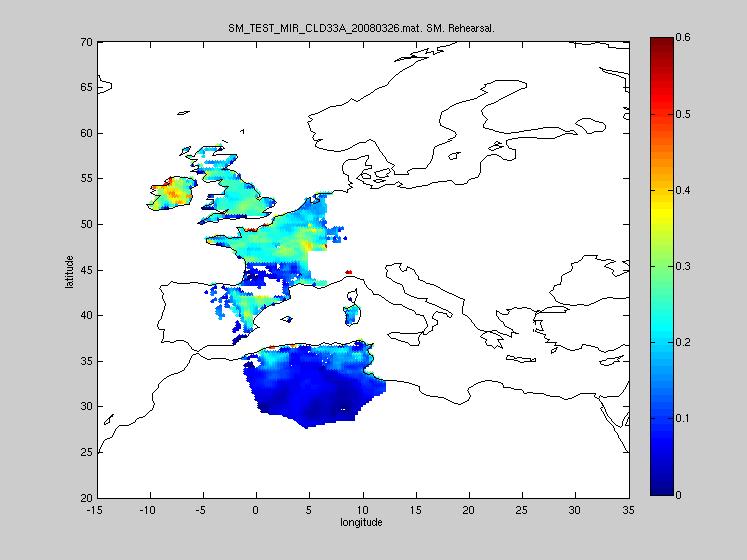
15 Interferometry angular resolution provided by distant antennas correlation products s(1)*s(2) visibility functions V(D/λ) Inverse F.T. on V T B (θ) Space sampling requirement : every λ/2 value at least one time ; hence "thinning" possibilities.
 a full scene is acquired (dual or full pol) Average resolution 43 km, global coverage A given point of the surface is thus seen with several angles")
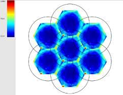
16 Principle of operations SMOS FOV; 755 km, 3x6, 33, 0.875λ, Each integration time, (2.4 s) a full scene is acquired (dual or full pol) Average resolution 43 km, global coverage A given point of the surface is thus seen with several angles Maximum time (equator) between two acquisitions 3 days P. Waldteufel, 2003

17 L1c DATA Making full use of angular measurements High temporal sampling
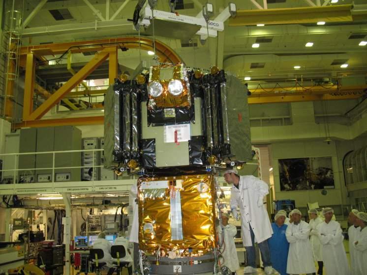
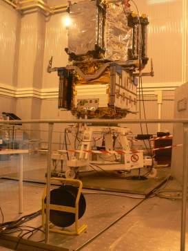
18 The satellite


19

20
21 SPECS System Parameter Specified Value SAT-PDR (actual value) SAT-QR (IVT and RACT) Systematic Error 1.5 K RMS ( 0 ) 2.5 K RMS ( 32 ) Not Available 0.9 K RMS in alias-free FoV Level-1 SM Radiometric Sensitivity (220 K) 3.5 K RMS ( 0 ) 5.8 K RMS ( 32 ) 2.43 K RMS 3.98 K RMS 2.23 K RMS 3.95 K RMS Level-1 OS Radiometric Sensitivity (150 K) 2.5 K RMS ( 0 ) 4.1 K RMS ( 32 ) 1.99 K RMS 3.26 K RMS 1.88 K RMS 3.32 K RMS Stability (1.2 s integration) 4.1 K RMS ( < 32 ) during 10 days inside EMC chamber Not Available 4.03 K RMS Stability (long integration) 0.03 K Not Available < 0.02 K
22 A few dates March 17 GOCE launch November 2 nd SMOS launch November 18 SODAP Start of data flow a few days after (piecewise) calibration tests First image December 6th Around mid December starting full data acquistion (1 week DP-1 week FP etc) Cal val Activities Early May 2010 end of commissioning phase, routine operations


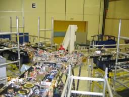
23 Launch Campaign
24 Products
25 ESA products Level 1 1b snapshots --> possible to make pixels 1c angular signature Browse (42.5 deg, SMAP?) Level 2 2 SM, Tau 2 SSS 2 Tb


26 F Cabot et al Or simulated data Products L1C

27 End to End


28 Models and mixed pixels Set of models for each surface type


29 End to End Performances for Soil Moisture level2.
30 Retrieval characteristics Over part of the pixel Pixel content taken into account Antenna gain taken into account «pseudo» dielectric constant Temporal aspects (vegetation contribution) Extensive Algorithm validation Comparison with existing satellite data Needs now actual data
31 Higher levels CNES products L3 SM and OS Spatially aggregated SSS Buoys assimilated SSS Multiorbit invesrion (both) Event detection L4 SM Disaggregation Root zone soil moisture Risks detection Multi sensor approach Coastal areas Facilities to test your own: snow, texture, sea ice..
32
33 Sites strategy Taklamakhan, Dome C, Ocean Danube and VAS Moisture Map Australia Northern Europe Siberia Southern Europe (SW France, Salamanca), USA, Canada Western Africa (Mali Benin) South Africa Orther SM sites from ISMWG initiative?
34 spatialising soil moisture Interpolating atmospheric forcing with actual varying surface characteristics S Juglea et al


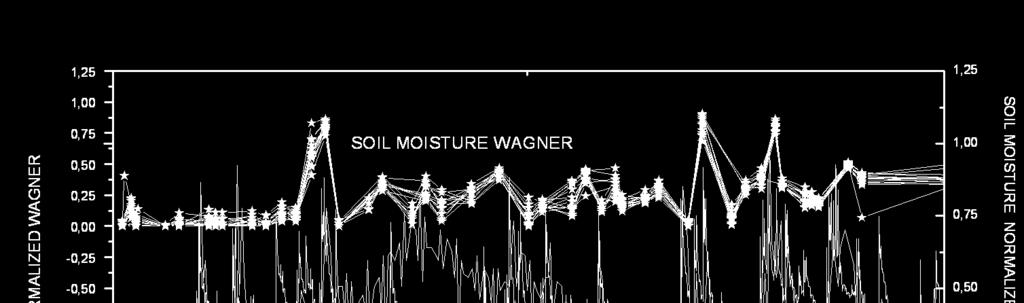
35 S Juglea et al Soil moisture simulated with ISBA and LMEB: Comparison with in situ measurements RMSE = R² =


36 And comparison with satellite data S Juglea et al


37 And comparison with satellite data S. Juglea
38 Next steps SM Algo Keep simulators and prototype up to date. Analyse commissionning rehearsal data : make use of ground campaign in Germany, Spain, Australia and France. Fully validate/ correct during commissioning phase Feed back to level 1 Inter-comparison exercises Start working on statistical approaches. Synergies ==> AMSR-SCAT, etc
39 Issues RFI Variable water bodies Snow ice (partial) Water routing Algo improvements
40 SMOS FO? Next steps same as SMOS almost But for 15 years (3 off) SMOS NEXT Water resources management All specs kept but for spatial resolution (10 times better Or sensitivity (100 times better) Or any combination of the two
41 Conclusion First two phases are over Now we must validate Disseminated And do research with the data NOTE SM and Vegetation opacity Spatial resolution! In other words still loads to do!

42 http// Thank you for your attention Any questions?
SMAP and SMOS Integrated Soil Moisture Validation. T. J. Jackson USDA ARS
 SMAP and SMOS Integrated Soil Moisture Validation T. J. Jackson USDA ARS Perspective Linkage of SMOS and SMAP soil moisture calibration and validation will have short and long term benefits for both missions.
Dual-Frequency Ku- Band Radar Mission Concept for Snow Mass
 Dual-Frequency Ku- Band Radar Mission Concept for Snow Mass Chris Derksen Environment and Climate Change Canada Study Team: Climate Research Division/Meteorological Research Division, ECCC Canadian Space
Assimilation of satellite derived soil moisture for weather forecasting
 Assimilation of satellite derived soil moisture for weather forecasting www.cawcr.gov.au Imtiaz Dharssi and Peter Steinle February 2011 SMOS/SMAP workshop, Monash University Summary In preparation of the
SSS retrieval from space Comparison study using Aquarius and SMOS data
 44 th International Liège Colloquium on Ocean Dynamics 7-11 May 2012 SSS retrieval from space Comparison study using Aquarius and SMOS data Physical Oceanography Department Institute of Marine Sciences
HY-2A Satellite User s Guide
 National Satellite Ocean Application Service 2013-5-16 Document Change Record Revision Date Changed Pages/Paragraphs Edit Description i Contents 1 Introduction to HY-2 Satellite... 1 2 HY-2 satellite data
Satellite Soil Moisture in Research Applications
 Satellite Soil Moisture in Research Applications Richard de Jeu richard.de.jeu@falw.vu.nl Thomas Holmes, Hylke Beck, Guojie Wang, Han Dolman (VUA) Manfred Owe (NASA-GSFC) Albert Van Dijk, Yi Liu (CSIRO)
SAC-D. SMOS 4th Science Workshop April 2003, Porto Presented by Jordi Font, Prepared by Gary Lagerloef
 (Ocean Surface Salinity Measurement) Understanding the ocean s response to the global freshwater cycle SMOS 4th Science Workshop April 2003, Porto Presented by Jordi Font, Prepared by Gary Lagerloef 1
The NASA Soil Moisture Active Passive Mission (SMAP) Status and Early Results
 Status and Early Results") 20154 California Institute of Technology. Government sponsorship acknowledged. National Aeronautics and Space Administration The NASA Soil Moisture Active Passive Mission (SMAP) Status and Early Results
20154 California Institute of Technology. Government sponsorship acknowledged. National Aeronautics and Space Administration The NASA Soil Moisture Active Passive Mission (SMAP) Status and Early Results
Land data assimilation in the NASA GEOS-5 system: Status and challenges
 Blueprints for Next-Generation Data Assimilation Systems Boulder, CO, USA 8-10 March 2016 Land data assimilation in the NASA GEOS-5 system: Status and challenges Rolf Reichle Clara Draper, Ricardo Todling,
REVISION OF THE STATEMENT OF GUIDANCE FOR GLOBAL NUMERICAL WEATHER PREDICTION. (Submitted by Dr. J. Eyre)
") WORLD METEOROLOGICAL ORGANIZATION Distr.: RESTRICTED CBS/OPAG-IOS (ODRRGOS-5)/Doc.5, Add.5 (11.VI.2002) COMMISSION FOR BASIC SYSTEMS OPEN PROGRAMME AREA GROUP ON INTEGRATED OBSERVING SYSTEMS ITEM: 4 EXPERT
WORLD METEOROLOGICAL ORGANIZATION Distr.: RESTRICTED CBS/OPAG-IOS (ODRRGOS-5)/Doc.5, Add.5 (11.VI.2002) COMMISSION FOR BASIC SYSTEMS OPEN PROGRAMME AREA GROUP ON INTEGRATED OBSERVING SYSTEMS ITEM: 4 EXPERT
ECMWF. ECMWF Land Surface Analysis: Current status and developments. P. de Rosnay M. Drusch, K. Scipal, D. Vasiljevic G. Balsamo, J.
 Land Surface Analysis: Current status and developments P. de Rosnay M. Drusch, K. Scipal, D. Vasiljevic G. Balsamo, J. Muñoz Sabater 2 nd Workshop on Remote Sensing and Modeling of Surface Properties,
Soil frost from microwave data. Kimmo Rautiainen, Jouni Pulliainen, Juha Lemmetyinen, Jaakko Ikonen, Mika Aurela
 Soil frost from microwave data Kimmo Rautiainen, Jouni Pulliainen, Juha Lemmetyinen, Jaakko Ikonen, Mika Aurela Why landscape freeze/thaw? Latitudinal variation in mean correlations (r) between annual
Sea Surface Salinity Retrieval within the ESA Soil Moisture and Ocean Salinity (SMOS) Mission
 Mission") Sea Surface Salinity Retrieval within the ESA Soil Moisture and Ocean Salinity (SMOS) Mission Roberto Sabia, Adriano Camps, Mercè Vall-llossera, Ramón Villarino, Jorge Miranda, Alessandra Monerris, Miguel
Sea Surface Salinity Retrieval within the ESA Soil Moisture and Ocean Salinity (SMOS) Mission Roberto Sabia, Adriano Camps, Mercè Vall-llossera, Ramón Villarino, Jorge Miranda, Alessandra Monerris, Miguel
CGMS Baseline. Sustained contributions to the Global Observing System. Endorsed by CGMS-46 in Bengaluru, June 2018
 CGMS Baseline Sustained contributions to the Global Observing System Best Practices for Achieving User Readiness for New Meteorological Satellites Endorsed by CGMS-46 in Bengaluru, June 2018 CGMS/DOC/18/1028862,
IMPORTANCE OF SATELLITE DATA (FOR REANALYSIS AND BEYOND) Jörg Schulz EUMETSAT
 Jörg Schulz EUMETSAT") IMPORTANCE OF SATELLITE DATA (FOR REANALYSIS AND BEYOND) Jörg Schulz EUMETSAT Why satellite data for climate monitoring? Global coverage Global consistency, sometimes also temporal consistency High spatial
IMPORTANCE OF SATELLITE DATA (FOR REANALYSIS AND BEYOND) Jörg Schulz EUMETSAT Why satellite data for climate monitoring? Global coverage Global consistency, sometimes also temporal consistency High spatial
THEME: Seasonal forecast: Climate Service for better management of risks and opportunities
 CENTRE AFRICAIN POUR LES APPLICATIONS DE LA METEOROLOGIE AU DEVELOPPEMENT AFRICAN CENTRE OF METEOROLOGICAL APPLICATIONS FOR DEVELOPMENT Institution Africaine parrainée par la CEA et l OMM African Institution
Assimilation of ASCAT soil wetness
 EWGLAM, October 2010 Assimilation of ASCAT soil wetness Bruce Macpherson, on behalf of Imtiaz Dharssi, Keir Bovis and Clive Jones Contents This presentation covers the following areas ASCAT soil wetness
New Salinity Product in the Tropical Indian Ocean Estimated from OLR
 New Salinity Product in the Tropical Indian Ocean Estimated from OLR Aquarius Bulusu Subrahmanyam and James J. O Brien Center for Ocean-Atmospheric Prediction Studies, Florida State University V.S.N. Murty
Drought Monitoring with Hydrological Modelling
 st Joint EARS/JRC International Drought Workshop, Ljubljana,.-5. September 009 Drought Monitoring with Hydrological Modelling Stefan Niemeyer IES - Institute for Environment and Sustainability Ispra -
Aquarius/SAC-D Soil Moisture Product using V3.0 Observations
 Aquarius/SAC-D Soil Moisture Product using V3. Observations R. Bindlish, T. Jackson, M. Cosh November 214 Overview Soil moisture algorithm Soil moisture product Validation Linkage between Soil Moisture
CLIMATE CHANGE AND REGIONAL HYDROLOGY ACROSS THE NORTHEAST US: Evidence of Changes, Model Projections, and Remote Sensing Approaches
 CLIMATE CHANGE AND REGIONAL HYDROLOGY ACROSS THE NORTHEAST US: Evidence of Changes, Model Projections, and Remote Sensing Approaches Michael A. Rawlins Dept of Geosciences University of Massachusetts OUTLINE
Climate Models and Snow: Projections and Predictions, Decades to Days
 Climate Models and Snow: Projections and Predictions, Decades to Days Outline Three Snow Lectures: 1. Why you should care about snow 2. How we measure snow 3. Snow and climate modeling The observational
Canadian Prairie Snow Cover Variability
 Canadian Prairie Snow Cover Variability Chris Derksen, Ross Brown, Murray MacKay, Anne Walker Climate Research Division Environment Canada Ongoing Activities: Snow Cover Variability and Links to Atmospheric
NOAA In Situ Satellite Blended Analysis of Surface Salinity: Preliminary Results for
 NOAA In Situ Satellite Blended Analysis of Surface Salinity: Preliminary Results for 2010-2012 P.Xie 1), T. Boyer 2), E. Bayler 3), Y. Xue 1), D. Byrne 2), J.Reagan 2), R. Locarnini 2), F. Sun 1), R.Joyce
APPENDIX 2 OVERVIEW OF THE GLOBAL PRECIPITATION MEASUREMENT (GPM) AND THE TROPICAL RAINFALL MEASURING MISSION (TRMM) 2-1
 AND THE TROPICAL RAINFALL MEASURING MISSION (TRMM) 2-1") APPENDIX 2 OVERVIEW OF THE GLOBAL PRECIPITATION MEASUREMENT (GPM) AND THE TROPICAL RAINFALL MEASURING MISSION (TRMM) 2-1 1. Introduction Precipitation is one of most important environmental parameters.
APPENDIX 2 OVERVIEW OF THE GLOBAL PRECIPITATION MEASUREMENT (GPM) AND THE TROPICAL RAINFALL MEASURING MISSION (TRMM) 2-1 1. Introduction Precipitation is one of most important environmental parameters.
Evaluation strategies of coarse resolution SM products for monitoring deficit/excess conditions in the Pampas Plains, Argentina
 Evaluation strategies of coarse resolution SM products for monitoring deficit/excess conditions in the Pampas Plains, Argentina Francisco Grings, Cintia Bruscantini, Federico Carballo, Ezequiel Smucler,
Long term performance monitoring of ASCAT-A
 Long term performance monitoring of ASCAT-A Craig Anderson and Julia Figa-Saldaña EUMETSAT, Eumetsat Allee 1, 64295 Darmstadt, Germany. Abstract The Advanced Scatterometer (ASCAT) on the METOP series of
ECMWF. ECMWF Land Surface modelling and land surface analysis. P. de Rosnay G. Balsamo S. Boussetta, J. Munoz Sabater D.
 Land Surface modelling and land surface analysis P. de Rosnay G. Balsamo S. Boussetta, J. Munoz Sabater D. Vasiljevic M. Drusch, K. Scipal SRNWP 12 June 2009 Slide 1 Surface modelling (G. Balsamo) HTESSEL,
CGMS Baseline In response to CGMS action/recommendation A45.01 HLPP reference: 1.1.8
 Prepared by WGIII Agenda Item: 7.1 Discussed in WGIII CGMS Baseline In response to CGMS action/recommendation A45.01 HLPP reference: 1.1.8 In CGMS-45, Working Group III agreed to hold a review of the CGMS
DLR s TerraSAR-X contributes to international fleet of radar satellites to map the Arctic and Antarctica
 DLR s TerraSAR-X contributes to international fleet of radar satellites to map the Arctic and Antarctica The polar regions play an important role in the Earth system. The snow and ice covered ocean and
GCOM-W1 now on the A-Train
 GCOM-W1 now on the A-Train GCOM-W1 Global Change Observation Mission-Water Taikan Oki, K. Imaoka, and M. Kachi JAXA/EORC (& IIS/The University of Tokyo) Mini-Workshop on A-Train Science, March 8 th, 2013
Read-me-first note for the release of the SMOS level 2 Soil Moisture data products
 Read-me-first note for the release of the SMOS level 2 Soil Moisture data products Processor version Release date by ESA Authors Further information Contact for helpline Comments to ESL Level 2 soil moisture
Assimilation of land surface satellite data for Numerical Weather Prediction at ECMWF
 4 th workshop on Remote Sensing and Modelling of Surface properties Saint Martin d Hères, 14-16 March 2016 Assimilation of land surface satellite data for Numerical Weather Prediction at ECMWF P. de Rosnay,
Observation Operators for sea ice thickness to L-band brightness temperatures
 Observation Operators for sea ice thickness to L-band brightness temperatures F. Richter, M. Drusch, L. Kaleschke, N. Maass, X. Tian-Kunze, G. Heygster, S. Mecklenburg, T. Casal, and many others ESA, ESTEC
EUMeTrain Snow Week 2010 Session 3 (MRG069305) (MRG069305)
 (MRG069305)") EUMeTrain Snow Week 2010 Session 3 (MRG069305) Event Name: Subject Name: Leader: Start Time: End Time: EUMeTrain Snow Week 2010 Session 3 (MRG069305) (MRG069305) Vesa Nietosvaara (Vesa) 2/3/10 2:00 pm
EUMeTrain Snow Week 2010 Session 3 (MRG069305) Event Name: Subject Name: Leader: Start Time: End Time: EUMeTrain Snow Week 2010 Session 3 (MRG069305) (MRG069305) Vesa Nietosvaara (Vesa) 2/3/10 2:00 pm
Radio Frequency Earth Science
 Radio Frequency Earth Science Overview for Committee On Radio Frequency (CORF) National Academy of Science National Research Council April 27, 2005 Bill.Watson@NASA.Gov Program Executive for Ground Networks
OSE/OSSEs at NOAA. Eric Bayler NOAA/NESDIS/STAR
 OSE/OSSEs at NOAA Eric Bayler NOAA/NESDIS/STAR OSE/OSSEs at NOAA NOAA Leadership view: Relatively inexpensive way to: Assess the impact of potential new observations Refine and redirect current observing
Update from the European Centre for Medium-Range Weather Forecasts
 JSC-34 Brasilia, May 2013 Update from the European Centre for Medium-Range Weather Forecasts Adrian Simmons Consultant, ECMWF First main message ECMWF has a continuing focus on a more seamless approach
Applications of Data Assimilation in Earth System Science. Alan O Neill University of Reading, UK
 Applications of Data Assimilation in Earth System Science Alan O Neill University of Reading, UK NCEO Early Career Science Conference 16th 18th April 2012 Introduction to data assimilation Page 2 of 20
Julia Figa-Saldaña & Klaus Scipal
 Julia Figa-Saldaña & Klaus Scipal julia.figa@eumetsat.int klaus.scipal@esa.int Meeting, Outline MetOp/EPS status MetOp/EPS Second Generation status 2016 scatterometer conference Other European ocean programme
Earth Science Flight Mission Overview
 Earth Science Flight Mission Overview Nand Topiwala Science Mission Directorate NASA Headquarters April 25, 2007 Earth Science Missions Afternoon Constellation, or A-Train, Multi-Satellite Observatory
Monitoring Sea Ice with Space-borne Synthetic Aperture Radar
 Monitoring Sea Ice with Space-borne Synthetic Aperture Radar Torbjørn Eltoft UiT- the Arctic University of Norway CIRFA A Centre for Research-based Innovation cirfa.uit.no Sea ice & climate Some basic
Extreme Weather and Climate Change: the big picture Alan K. Betts Atmospheric Research Pittsford, VT NESC, Saratoga, NY
 Extreme Weather and Climate Change: the big picture Alan K. Betts Atmospheric Research Pittsford, VT http://alanbetts.com NESC, Saratoga, NY March 10, 2018 Increases in Extreme Weather Last decade: lack
Remote Sensing Applications for Land/Atmosphere: Earth Radiation Balance
 Remote Sensing Applications for Land/Atmosphere: Earth Radiation Balance - Introduction - Deriving surface energy balance fluxes from net radiation measurements - Estimation of surface net radiation from
SMOSIce L-Band Radiometry for Sea Ice Applications
 Institute of Environmental Physics University of Bremen SMOSIce L-Band Radiometry for Sea Ice Applications Georg Heygster 1), Christian Haas 2), Lars Kaleschke 3), Helge Rebhan 5), Detlef Stammer 3), Rasmus
THEME: Seasonal forecast: Climate Service for better management of risks and opportunities
 CENTRE AFRICAIN POUR LES APPLICATIONS DE LA METEOROLOGIE AU DEVELOPPEMENT AFRICAN CENTRE OF METEOROLOGICAL APPLICATIONS FOR DEVELOPMENT Institution Africaine parrainée par la CEA et l OMM African Institution
Status report on current and future satellite systems by EUMETSAT Presented to CGMS-44, Plenary session, agenda item D.1
 Status report on current and future satellite systems by EUMETSAT Presented to CGMS-44, Plenary session, agenda item D.1 CGMS-44-EUMETSAT-WP-19.ppt, version 1 (# 859110), 8 June 2016 MISSION PLANNING YEAR...
Towards the use of SAR observations from Sentinel-1 to study snowpack properties in Alpine regions
 Towards the use of SAR observations from Sentinel-1 to study snowpack properties in Alpine regions Gaëlle Veyssière, Fatima Karbou, Samuel Morin et Vincent Vionnet CNRM-GAME /Centre d Etude de la Neige
Introduction to SMAP. ARSET Applied Remote Sensing Training. Jul. 20,
 National Aeronautics and Space Administration ARSET Applied Remote Sensing Training http://arset.gsfc.nasa.gov @NASAARSET Introduction to SMAP Jul. 20, 2016 www.nasa.gov Outline 1. Mission objectives 2.
Interferometric Synthetic Aperture Radar (InSAR) and GGOS. Andrea Donnellan NASA/JPL February 21, 2007
 and GGOS. Andrea Donnellan NASA/JPL February 21, 2007") Interferometric Synthetic Aperture Radar (InSAR) and GGOS Andrea Donnellan NASA/JPL February 21, 2007 Sources for Science Objectives Fourth component of EarthScope Involvement: NSF, NASA, USGS, Universities
Interferometric Synthetic Aperture Radar (InSAR) and GGOS Andrea Donnellan NASA/JPL February 21, 2007 Sources for Science Objectives Fourth component of EarthScope Involvement: NSF, NASA, USGS, Universities
Ocean Vector Winds in Storms from the SMAP L-Band Radiometer
 International Workshop on Measuring High Wind Speeds over the Ocean 15 17 November 2016 UK Met Office, Exeter Ocean Vector Winds in Storms from the SMAP L-Band Radiometer Thomas Meissner, Lucrezia Ricciardulli,
SOIL MOISTURE MAPPING THE SOUTHERN U.S. WITH THE TRMM MICROWAVE IMAGER: PATHFINDER STUDY
 SOIL MOISTURE MAPPING THE SOUTHERN U.S. WITH THE TRMM MICROWAVE IMAGER: PATHFINDER STUDY Thomas J. Jackson * USDA Agricultural Research Service, Beltsville, Maryland Rajat Bindlish SSAI, Lanham, Maryland
Chapter outline. Reference 12/13/2016
 Chapter 2. observation CC EST 5103 Climate Change Science Rezaul Karim Environmental Science & Technology Jessore University of science & Technology Chapter outline Temperature in the instrumental record
Observed changes in climate and their effects
 1 1.1 Observations of climate change Since the TAR, progress in understanding how climate is changing in space and time has been gained through improvements and extensions of numerous datasets and data
Challenges to Improving the Skill of Weekly to Seasonal Climate Predictions. David DeWitt with contributions from CPC staff
 Challenges to Improving the Skill of Weekly to Seasonal Climate Predictions David DeWitt with contributions from CPC staff 1 Outline CPC Background Prediction, monitoring, diagnostics, and climate services
Atmospheric Processes
 Atmospheric Processes Atmospheric prognostic variables Wind Temperature Humidity Cloud Water/Ice Atmospheric processes Mixing Radiation Condensation/ Evaporation Precipitation Surface exchanges Friction
Space for the Arctic
 Space for the Arctic Bo Andersen Norwegian Polar Committee & Norwegian Space Centre 1 My Mantra for Space Few, if any of the global challenges can be resolved by space alone But Few, if any can be resolved
Soil Moisture Active Passive (SMAP) Mission: a NASA Opportunity
 Mission: a NASA Opportunity") Soil Moisture Active Passive (SMAP) Mission: a NASA Opportunity Robert Gurney University of Reading WIF Workshop 17 th October 2012 National Aeronautics and Space Administration L-band Active/Passive Soil
Soil Moisture Active Passive (SMAP) Mission: a NASA Opportunity Robert Gurney University of Reading WIF Workshop 17 th October 2012 National Aeronautics and Space Administration L-band Active/Passive Soil
The Field Research Facility, Duck, NC Warming Ocean Observations and Forecast of Effects
 The Field Research Facility, Duck, NC Warming Ocean Observations and Forecast of Effects A potential consequence of a warming ocean is more frequent and more intense wind events (Hurricanes & Typhoons)
Status of Indian Satellite Meteorological Programme
 Status of Indian Satellite Meteorological Programme Pradeep K Thapliyal Space Applications Centre (SAC) Indian Space research Organisation (ISRO) Ahmedabad (INDIA) Email: pkthapliyal@sac.isro.gov.in International
Sea surface salinity from space: new tools for the ocean color community
 Sea surface salinity from space: new tools for the ocean color community Joe Salisbury, Doug Vandemark, Chris Hunt, Janet Campbell, Dominic Wisser, Tim Moore (UNH) Nico Reul, Bertrand Chapron (IFREMR)
Remote Sensing of SWE in Canada
 Remote Sensing of SWE in Canada Anne Walker Climate Research Division, Environment Canada Polar Snowfall Hydrology Mission Workshop, June 26-28, 2007 Satellite Remote Sensing Snow Cover Optical -- Snow
Behind the Climate Prediction Center s Extended and Long Range Outlooks Mike Halpert, Deputy Director Climate Prediction Center / NCEP
 Behind the Climate Prediction Center s Extended and Long Range Outlooks Mike Halpert, Deputy Director Climate Prediction Center / NCEP September 2012 Outline Mission Extended Range Outlooks (6-10/8-14)
Geoscience Australia Report on Cal/Val Activities
 Medhavy Thankappan Geoscience Australia Agency Report I Berlin May 6-8, 2015 Outline 1. Calibration / validation at Geoscience Australia Corner reflector infrastructure for SAR calibration (for information)
Weather Outlook: 2015 Growing Season
 Weather Outlook: 2015 Growing Season Leon F. Osborne Chester Fritz Distinguished Professor Regional Weather Information Center University of North Dakota Grand Forks, North Dakota Why Should We Be Concerned?
Lecture 1. Amplitude of the seasonal cycle in temperature
 Lecture 6 Lecture 1 Ocean circulation Forcing and large-scale features Amplitude of the seasonal cycle in temperature 1 Atmosphere and ocean heat transport Trenberth and Caron (2001) False-colour satellite
ATMOSPHERIC MODELLING. GEOG/ENST 3331 Lecture 9 Ahrens: Chapter 13; A&B: Chapters 12 and 13
 ATMOSPHERIC MODELLING GEOG/ENST 3331 Lecture 9 Ahrens: Chapter 13; A&B: Chapters 12 and 13 Agenda for February 3 Assignment 3: Due on Friday Lecture Outline Numerical modelling Long-range forecasts Oscillations
CMEM: Community Microwave Emission Model
 CMEM: Community Microwave Emission Model SMOS forward operator for Numerical Weather Prediction P. de Rosnay, M. Drusch, J.-P. Wigneron T. Holmes, G. Balsamo, Y. Kerr, J.-C. Calvet SMOS Workshop 29-31
Monthly overview. Rainfall
 Monthly overview 1 to 10 April 2018 Widespread rainfall continued to fall over most parts of the summer rainfall region during this period. Unseasonably good rain fell over the eastern half of the Northern
Experiences of using ECV datasets in ECMWF reanalyses including CCI applications. David Tan and colleagues ECMWF, Reading, UK
 Experiences of using ECV datasets in ECMWF reanalyses including CCI applications David Tan and colleagues ECMWF, Reading, UK Slide 1 Main points Experience shows benefit of integrated & iterative approach
The Canadian Land Data Assimilation System (CaLDAS)
") The Canadian Land Data Assimilation System (CaLDAS) Marco L. Carrera, Stéphane Bélair, Bernard Bilodeau and Sheena Solomon Meteorological Research Division, Environment Canada Dorval, QC, Canada 2 nd Workshop
The Canadian Land Data Assimilation System (CaLDAS) Marco L. Carrera, Stéphane Bélair, Bernard Bilodeau and Sheena Solomon Meteorological Research Division, Environment Canada Dorval, QC, Canada 2 nd Workshop
Extended Kalman Filter soil-moisture analysis in the IFS
 from Newsletter Number 127 Spring 211 METEOROLOGY Extended Kalman Filter soil-moisture analysis in the IFS doi:1.21957/ik7co53s This article appeared in the Meteorology section of ECMWF Newsletter No.
H SAF SATELLITE APPLICATION FACILITY ON SUPPORT TO OPERATIONAL HYDROLOGY AND WATER MANAGEMENT EUMETSAT NETWORK OF SATELLITE APPLICATION FACILITIES
 H SAF SATELLITE APPLICATION FACILITY ON SUPPORT TO OPERATIONAL HYDROLOGY AND WATER MANAGEMENT EUMETSAT NETWORK OF SATELLITE APPLICATION FACILITIES H-SAF: SATELLITE PRODUCTS FOR OPERATIONAL HYDROLOGY H-SAF
Applications of Data Assimilation in Earth System Science. Alan O Neill Data Assimilation Research Centre University of Reading
 Applications of Data Assimilation in Earth System Science Alan O Neill Data Assimilation Research Centre University of Reading DARC Current & Future Satellite Coverage Formation Flying - Afternoon Constellation
earth observation New data products provided by SMOS have been opening the door for novel applications (Image - MetroTiff)
") earth observation New data products provided by SMOS have been opening the door for novel applications (Image - MetroTiff) 38 www.esa.int smos SMOS over land New applications for ESA s water mission Matthias
earth observation New data products provided by SMOS have been opening the door for novel applications (Image - MetroTiff) 38 www.esa.int smos SMOS over land New applications for ESA s water mission Matthias
Land Surface Remote Sensing II
 PROCEEDINGS OFSPIE Land Surface Remote Sensing II Thomas J. Jackson Jing Ming Chen Peng Gong Shunlin Liang Editors 13-16 October 2014 Beijing, China Sponsored by SPIE Cosponsored by State Key Laboratory
EUMETSAT SAF NETWORK. Lothar Schüller, EUMETSAT SAF Network Manager
 1 EUMETSAT SAF NETWORK Lothar Schüller, EUMETSAT SAF Network Manager EUMETSAT ground segment overview METEOSAT JASON-2 INITIAL JOINT POLAR SYSTEM METOP NOAA SATELLITES CONTROL AND DATA ACQUISITION FLIGHT
Remote Sensing of Precipitation
 Lecture Notes Prepared by Prof. J. Francis Spring 2003 Remote Sensing of Precipitation Primary reference: Chapter 9 of KVH I. Motivation -- why do we need to measure precipitation with remote sensing instruments?
Implementation of SMOS data monitoring in the ECMWF Integrated Forecasting System
 Implementation of SMOS data monitoring in the ECMWF Integrated Forecasting System Joaquín Muñoz Sabater, Anne Fouilloux and Patricia de Rosnay ECMWF, Shinfield Park, Reading RG2 9AX, United Kingdom Joaquin.Munoz@ecmwf.int
2015 Fall Conditions Report
 2015 Fall Conditions Report Prepared by: Hydrologic Forecast Centre Date: December 21 st, 2015 Table of Contents Table of Figures... ii EXECUTIVE SUMMARY... 1 BACKGROUND... 2 SUMMER AND FALL PRECIPITATION...
sentinel-3 A BIGGER PICTURE FOR COPERNICUS
 sentinel-3 A BIGGER PICTURE FOR COPERNICUS SATELLITES TO SERVE By providing a set of key information services for a wide range of practical applications, Europe s Copernicus programme has been put in place
Global SWE Mapping by Combining Passive and Active Microwave Data: The GlobSnow Approach and CoReH 2 O
 Global SWE Mapping by Combining Passive and Active Microwave Data: The GlobSnow Approach and CoReH 2 O April 28, 2010 J. Pulliainen, J. Lemmetyinen, A. Kontu, M. Takala, K. Luojus, K. Rautiainen, A.N.
Answer each section in a separate booklet.
 DURATION: 3 HOURS TOTAL MARKS: 150 Internal Examiners: Dr S Pillay & Mr J Lutchmiah External Examiner: Dr J Odindi NOTE: This paper consists of 8 pages and an MCQ answer sheet. Please ensure that you have
Incorporation of SMOS Soil Moisture Data on Gridded Flash Flood Guidance for Arkansas Red River Basin
 Incorporation of SMOS Soil Moisture Data on Gridded Flash Flood Guidance for Arkansas Red River Basin Department of Civil and Environmental Engineering, The City College of New York, NOAA CREST Dugwon
EUMETSAT STATUS AND PLANS
 1 EUM/TSS/VWG/15/826793 07/10/2015 EUMETSAT STATUS AND PLANS François Montagner, Marine Applications Manager, EUMETSAT WMO Polar Space Task Group 5 5-7 October 2015, DLR, Oberpfaffenhofen PSTG Strategic
Name the surface winds that blow between 0 and 30. GEO 101, February 25, 2014 Monsoon Global circulation aloft El Niño Atmospheric water
 GEO 101, February 25, 2014 Monsoon Global circulation aloft El Niño Atmospheric water Name the surface winds that blow between 0 and 30 What is the atmospheric pressure at 0? What is the atmospheric pressure
NOAA/OAR Observing Systems
 NOAA/OAR Observing Systems Dr. Christopher L. Sabine Director NOAA s Pacific Marine Environmental Laboratory Workshop on Hydroclimate Monitoring Systems and Measurement Needs June, 2014 Global Ocean Observing
Weather & Ocean Currents
 Weather & Ocean Currents Earth is heated unevenly Causes: Earth is round Earth is tilted on an axis Earth s orbit is eliptical Effects: Convection = vertical circular currents caused by temperature differences
Aquarius Data Release V2.0 Validation Analysis Gary Lagerloef, Aquarius Principal Investigator H. Kao, ESR And Aquarius Cal/Val Team
 Aquarius Data Release V2.0 Validation Analysis Gary Lagerloef, Aquarius Principal Investigator H. Kao, ESR And Aquarius Cal/Val Team Analysis period: Sep 2011-Dec 2012 SMOS-Aquarius Workshop 15-17 April
A temporal stability analysis of the Australian SMAP mission validation site
 20th International Congress on Modelling and Simulation, Adelaide, Australia, 1 6 December 2013 www.mssanz.org.au/modsim2013 A temporal stability analysis of the Australian SMAP mission validation site
SOIL MOISTURE FROM SATELLITE: A COMPARISON OF METOP, SMOS AND ASAR PRODUCTS
 SOIL MOISTURE FROM SATELLITE: A COMPARISON OF METOP, SMOS AND ASAR PRODUCTS Nazzareno Pierdicca 1, Luca Pulvirenti 1, Fabio Fascetti 1, Raffaele Crapolicchio 2,3, Marco Talone 2, Silvia Puca 4 1 Dept.
Climate Change 2007: The Physical Science Basis
 Climate Change 2007: The Physical Science Basis Working Group I Contribution to the IPCC Fourth Assessment Report Presented by R.K. Pachauri, IPCC Chair and Bubu Jallow, WG 1 Vice Chair Nairobi, 6 February
Drought Impacts in the Southern Great Plains. Mark Shafer University of Oklahoma Norman, OK
 Drought Impacts in the Southern Great Plains Mark Shafer University of Oklahoma Norman, OK Causes of Drought: Large-Scale, Stationary High Pressure Air rotates clockwise around high pressure steers storms
Seasonal Climate Watch November 2017 to March 2018
 Seasonal Climate Watch November 2017 to March 2018 Date issued: Oct 26, 2017 1. Overview The El Niño Southern Oscillation (ENSO) continues to develop towards a La Niña state, and is expected to be in at
Weather Outlook 2016: Cycles and Patterns Influencing Our Growing Season
 Weather Outlook 2016: Cycles and Patterns Influencing Our Growing Season Leon F. Osborne Chester Fritz Distinguished Professor of Atmospheric Sciences University of North Dakota Cycle of El Niño Events
The SMOS Mission: New Tool for Monitoring Key Elements of the Global Water Cycle
 INVITED PAPER The SMOS Mission: New Tool for Monitoring Key Elements of the Global Water Cycle This satellite mission will use new algorithms to try to forecast weather and estimate climate change from
Space-based Weather and Climate Extremes Monitoring (SWCEM) Toshiyuki Kurino WMO Space Programme IPET-SUP-3, 2-4 May 2017
 Toshiyuki Kurino WMO Space Programme IPET-SUP-3, 2-4 May 2017") Space-based Weather and Climate Extremes Monitoring (SWCEM) Toshiyuki Kurino WMO Space Programme IPET-SUP-3, 2-4 May 2017 based on outcome from Workshop on Operational SWCEM 15-17 February 2017, Geneva
Space-based Weather and Climate Extremes Monitoring (SWCEM) Toshiyuki Kurino WMO Space Programme IPET-SUP-3, 2-4 May 2017 based on outcome from Workshop on Operational SWCEM 15-17 February 2017, Geneva
Climate Outlook for March August 2017
 The APEC CLIMATE CENTER Climate Outlook for March August 2017 BUSAN, 24 February 2017 Synthesis of the latest model forecasts for March to August 2017 (MAMJJA) at the APEC Climate Center (APCC), located
Seasonal Climate Watch February to June 2018
 Seasonal Climate Watch February to June 2018 Date issued: Jan 26, 2018 1. Overview The El Niño-Southern Oscillation (ENSO) is expected to remain in a weak La Niña phase through to early autumn (Feb-Mar-Apr).
Tandem-L: A Mission Proposal for Monitoring Dynamic Earth Processes
 Tandem-L: A Mission Proposal for Monitoring Dynamic Earth Processes A. Moreira, G. Krieger, M. Younis, I. Hajnsek, K. Papathanassiou, M. Eineder, P. Dekker, F. De Zan German Aerospace Center (DLR) Dynamic