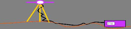
Bahnen und Schwere. Bahnen und Schwere. Adrian Jäggi. Astronomical Institute University of Bern
|
|
|
- Miles Baldwin
- 5 years ago
- Views:
Transcription

1 Bahnen und Schwere Adrian Jäggi Astronomical Institute University of Bern
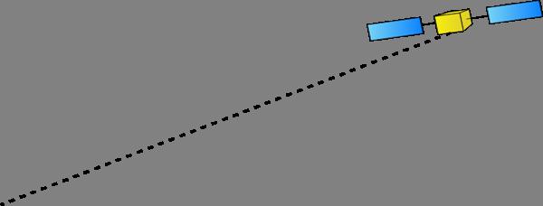
2 GOCE Orbit Characteristics (1) GOCE History : 17 March: Launch into a sun-synchronous (i ~ 97 ), dusk-dawn orbit at an altitude of km 7 May: First drag-free flight 26 May: Second drag-free flight with various activities on gradiometer calibration 13/14 September: Arrival at final orbital altitude of km (254.9 km), start of drag-free flight for first Measurement and Operational Phase (MOP-1)
3 GOCE Orbit Characteristics (2) Ground-track coverage on 2 Nov, 2009 Complete geographical coverage after 979 revolutions (repeat-cycle of 61 days)
4 Bahnen und Schwere
5 Introduction to GPS GPS: Global Positioning System Characteristics: - Satellite system for (real-time) Positioning and Navigation - Global (everywhere on Earth, up to altitudes of 5000km) and at any time - Unlimited number of users - Weather-independent (radio signals are passing through the atmosphere) - 3-dimensional position, velocity and time information
6 GPS Segments The GPS consists of 3 main segments: - Space Segment: the satellites and the constellation of satellites - Control Segment: the ground stations, infrastructure and software for operation and monitoring of the GPS - User Segment: all GPS receivers worldwide and the corresponding processing software We should add an important 4th segment: - Ground Segment: all civilian permanent networks of reference sites and the international/regional/local services delivering products for the users

7 Space Segment - The space segment nominally consists of 24 satellites, presently: 30 active GPS satellites - Constellation design: at least 4 satellites in view from any location on the Earth at any time
8 Control Segment
9 User Segment and Ground Segment User Segment: - All GPS receivers on land, on sea, in the air and in space - Broad user community with applications of the GPS for positioning and navigation, surveying, geodynamics and geophysics, atmosphere, Ground Segment: - Global network of the International GNSS Service (IGS: ~ 400 stations) - Regional and local permanent networks (Europe, Japan, US): densification of the reference frame, positioning services

10 Global Network of the IGS GPS-only receivers Combined GPS-GLONASS receivers IGS stations used for computation of final orbits at CODE (Dach et al., 2009)
, Wabern, Switzerland - German Federal Office for Cartography and Geodesy (BKG), Frankfurt, Germany - Institute of Astronomical and Physical Geodesy")
11 Analysis Centers (ACs) of the IGS CODE (Center for Orbit Determination in Europe): CODE is a joint-venture between: - Astronomical Institute of the University of Bern (AIUB), Bern, Switzerland - Swiss Federal Office of Topography (swisstopo), Wabern, Switzerland - German Federal Office for Cartography and Geodesy (BKG), Frankfurt, Germany - Institute of Astronomical and Physical Geodesy (IAPG) of the Technische Universität München (TUM), Munich, Germany

12 Computation of Final Orbits at CODE 1994, ~ 20cm , better than 10 cm , better than 5 cm , better than 2 cm 2010 The COD solution is computed at AIUB and used for GOCE orbit determination
13 Computation of Final Clocks at CODE The final clock product with 5 min sampling is based on undifferenced GPS data of at maximum 120 stations of the IGS network The IGS 1 Hz network is finally used for clock densification to 5 sec (Bock et al., 2009) The 5 sec clocks are interpolated to 1 sec as needed for GOCE orbit determination
 - P-code (Protected / Precise) -")
14 GPS Signals Signals driven by an atomic clock Two carrier signals (sine waves): - L1: f = MHz, λ = 19 cm - L2: f = MHz, λ = 24 cm Bits encoded on carrier by phase modulation: - C/A-code (Clear Access / Coarse Acquisition) - P-code (Protected / Precise) - Broadcast/Navigation Message
15 Pseudorange / Code Measurements Code Observations are defined as: Speed of light (in vacuum) Receiver clock reading at signal reception (in receiver clock time) GPS satellite clock reading at signal emission (in satellite clock time) - No actual range (distance) because of clock offsets - Measurement noise: ~ 0.5 m for GOCE P-code
16 Code Observation Equation, GPS time of reception and emission Satellite clock offset Receiver clock offset Distance between receiver and satellite Known from ACs or IGS: - satellite positions - satellite clock offsets 4 unknown parameters: - receiver position - receiver clock offset
17 Basic Positioning and Navigation Concept (1) Simplified model for : atmospheric delay missing, exactly 4 satellites, More than 4 satellites: best receiver position and clock offset with least-squares or filter algorithms


18 Basic Positioning and Navigation Concept (2)
19 Carrier Phase Measurements (1) Phase (in cycles) increases linearly with time : where is the frequency The satellite generates with its clock the phase signal (in satellite clock time) we have. At emmision time The same phase signal, e.g., a wave crest, propagates from the satellite to the receiver, but the receiver measures only the fractional part of the phase and does not know the integer number of cycles (phase ambiguity):
20 Carrier Phase Measurements (2) The receiver generates with its clock a reference phase. At time of reception of the satellite phase (in receiver clock time) we have: The actual phase measurement is the difference between receiver reference phase and satellite phase : Multiplication with the wavelength equation in meters: leads to the phase observation Difference to the pseudorange observation: integer ambiguity term
21 Improved Observation Equation Distance between satellite and receiver Satellite clock offset wrt GPS time Receiver clock offset wrt GPS time Tropospheric delay Ionospheric delay Phase ambiguity Relativistic corrections Delays in satellite (cables, electronics) Delays in receiver and antenna Multipath, scattering, bending effects Measurement error Satellite positions and clocks are known from ACs or IGS Not existent for LEOs Cancels out (first order only) when forming the ionospherefree linear combination:
22 Time Systems and Reference Systems Time Systems: - TAI (Temps Atomic International): ensemble of atomic clocks - UT1 (Universal Time 1): time defined by the Earth s rotation - UTC (Universal Time Coordinated): differs from TAI only by leap seconds (adjusted to UT1: UT1 UTC < 0.9 sec) - GPS time: constant difference TAI - GPS = 19 sec - GPS-UTC = 15 sec at present Reference Systems: - ITRF (International Terrestrial Reference Frame): combination of global VLBI, SLR, GPS and DORIS solutions. Best Earth-fixed reference frame, at present still ITRF ICRF (International Celestial Reference Frame): inertial frame, realized by coordinates of extragalactic radio sources (GOCE Standards, 2009)
23 Geometric Distance Geometric distance is given by: Inertial position of LEO antenna phase center at reception time Inertial position of GPS antenna phase center of satellite at emission time Signal traveling time between the two phase center positions Different ways to represent : - Kinematic orbit representation - Dynamic or reduced-dynamic orbit representation
24 Kinematic Orbit Representation (1) Satellite position (in inertial frame) is given by: Transformation matrix from Earth-fixed to inertial frame LEO center of mass position in Earth-fixed frame LEO antenna phase center offset in Earth-fixed frame Kinematic positions are estimated for each measurement epoch: - Measurement epochs need not to be identical with nominal epochs - Positions are independent of models describing the LEO dynamics Velocities cannot be provided
25 Kinematic Orbit Representation (2) A kinematic orbit is an ephemeris at discrete measurement epochs Kinematic positions are fully independent on the force models used for LEO orbit determination (Svehla and Rothacher, 2004)

26 Kinematic Orbit Representation (3) Measurement epochs (in GPS time) Positions (km) (Earth-fixed) Clock correction to nominal epoch (μs), e.g., to epoch 00:00:03 Excerpt of kinematic GOCE positions at begin of 2 Nov, 2009 GO_CONS_SST_PKI_ T235945_ T235944_0001 Times in UTC
27 Measurement Epochs Clock jumps of ~ 20 ms are occuring after ~ 27 h Fractional parts of measurement epochs: The measurement sampling is 1 Hz, but the internal clock is not steered to integer seconds (fractional parts are shown in the figure for the midnight epochs).
28 Dynamic Orbit Representation (1) Satellite position (in inertial frame) is given by: LEO center of mass position LEO antenna phase center offset LEO initial osculating orbital elements LEO dynamical parameters Satellite trajectory is a particular solution of an equation of motion - One set of initial conditions (orbital elements) is estimated per arc Dynamical parameters of the force model on request
29 Dynamic Orbit Representation (2) Equation of motion (in inertial frame) is given by: with initial conditions The acceleration consists of gravitational and non-gravitational perturbations taken into account to model the satellite trajectory. Unknown parameters of force models may appear in the equation of motion together with deterministic (known) accelerations given by analytical models.

30 Osculating Orbital Elements (1) ω Ω


31 Osculating Orbital Elements of GOCE (2) Semi-major axis: Twice-per-revolution variations of about ±10 km around the mean semi-major axis of km, which corresponds to the km mean altitude used by ESA
32 Osculating Orbital Elements of GOCE (3) Numerical eccentricity: Small, short-periodic variations around the mean value of about , i.e., the orbit is close to circular

33 Osculating Orbital Elements of GOCE (4) Inclination: Twice-per-revolution and longer variations around the mean inclination of about 96.6 (sun-synchronous orbit)
34 Osculating Orbital Elements of GOCE (5) Right ascension of ascending node: Twice-per-revolution variations and linear drift of about +1 /day (360 /365days) due to the sun-synchronous orbit
35 Dynamic Orbit Representation (3) Dynamic orbit positions may be computed at any epoch within the arc Dynamic positions are fully dependent on the force models used, e.g., on the gravity field model
36 Reduced-Dynamic Orbit Representation (1) Equation of motion (in inertial frame) is given by: Pseudo-stochastic parameters Pseudo-stochastic parameters are: - additional empirical parameters characterized by a priori known statistical properties, e.g., by expectation values and a priori variances - useful to compensate for deficiencies in dynamic models, e.g., deficiencies in models describing non-gravitational accelerations - often set up as piecewise constant accelerations to ensure that satellite trajectories are continuous and differentiable at any epoch
37 Reduced-Dynamic Orbit Representation (2) Reduced-dynamic orbits are well suited to compute LEO orbits of highest quality (Jäggi et al., 2006; Jäggi, 2007) Reduced-dynamic orbits heavily depend on the force models used, e.g., on the gravity field model (Jäggi et al., 2008)
38 Partial Derivatives Orbit improvement ( : numerically integrated a priori orbit): yields corrections to a priori parameter values by least-squares Previously, for each parameter the corresponding variational equation has to be solved to obtain the partials - Numerical integration for initial osculating elements - Numerical quadrature for dynamic parameters - Linear combinations for pseudo-stochastic parameters, e.g., by: (Jäggi, 2007)

39 Reduced-dynamic Orbit Representation (3) Position epochs (in GPS time) Positions (km) & Velocities (dm/s) (Earth-fixed) Clock corrections are not provided Excerpt of reduced-dynamic GOCE positions at begin of 2 Nov, 2009 GO_CONS_SST_PRD_ T235945_ T235944_0001
40 GOCE Sensor Offsets (1) Phase center offsets : - are needed in the inertial or Earth-fixed frame and have to be transformed from the satellite frame using attitude data from the star-trackers - consist of a frequency-independent instrument offset, e.g., defined by the center of the instrument s mounting plane (CMP) in the satellite frame - consist of frequency-dependent phase center offsets (PCOs), e.g., defined wrt the center of the instrument s mounting plane in the antenna frame (ARF) - consist of frequency-dependent phase center variations (PCVs) varying with the direction of the incoming signal, e.g., defined wrt the PCOs in the antenna frame
41 GOCE Sensor Offsets (2) ~ Flight direction ~ Nadir pointing Offset wrt satellite reference frame (SRF) is constant Offset wrt center of mass (CoM) is slowly varying
42 GOCE Sensor Offsets (3) Table 1: CoM coordinates in SRF system CoM X SRF [m] Y SRF [m] Z SRF [m] Begin of Life (BoL) End of Life (EoL) Table 2: SSTI antenna CMP coordinates in SRF system Table 3: SSTI antenna CMP coordinates wrt to CoM (BoL) CMP coordinates X SRF [m] Y SRF [m] Z SRF [m] Main Redundant CMP coordinates X CoM [m] Y CoM [m] Z CoM [m] Main Redundant Table 4: SSTI antenna phase center offsets in ARF system Phase center offsets X ARF [mm] Y ARF [mm] Z ARF [mm] Main: L Main: L Redundant: L Redundant: L Derived from Bigazzi and Frommknecht (2010)

43 GOCE GPS Antenna L1, L2, Lc phase center offsets L2 PCO L1 PCO Lc PCO Lc phase center variations mm CMP flight direction Measured from ground calibration in anechoic chamber Empirically derived during orbit determination according to Jäggi et al. (2009b)

 IAPG =>")
44 GOCE High-level Processing Facility: Orbit Groups Responsibilities: DEOS => RSO (Rapid Science Orbit) AIUB => PSO (Precise Science Orbit) IAPG => Validation
45 GOCE High-level Processing Facility: Orbit Products Orbit solution Software GPS Observ. GPS products Sampling Data batches Latency reduceddynamic GEODYN triple-diff IGS rapid 10 sec 30 h 1 day RSO kinematic GHOST zero-diff CODE rapid 1 sec 24 h 1 day reduceddynamic BERNESE zero-diff CODE final 10 sec 30 h 7-10 days PSO kinematic BERNESE zero-diff CODE final 1 sec 30 h 7-10 days Accuracy requirement: 2 cm (Visser et al., 2009) (Bock et al., 2007)
46 SST_PSO_2 Product The final Level-2 PSO product consists of: SST_PKI_2: Kinematic positions, 1 sec, SP3c format SST_PRD_2: Reduced-dynamic positions and velocities, 10 sec, SP3c format SST_PRM_2: Rotation from Earth-fixed to inertial frame, 1 sec, quaternions SST_PCV_2: Covariance matrix of kinematic positions, 4 off-diagonal blocks SST_PRP_2: Report, PDF format The data files cover a time span of 24h (GOCE Level 2 Product Data Handbook, 2009)


47 GPS Data Availability GPS data availability is excellent: - 12 channel GPS receiver provides 1Hz data with hardly any gaps; less than 5 satellites are tracked for less than 0.2% of all measurement epochs Missing kinematic positions: about 0.5%
48 Visualization of GOCE PSO Product m It is more instructive to look at differences between orbits in well suited coordinate systems m m
49 Co-Rotating Orbital Frames R, S, C unit vectors are pointing: - into the radial direction - normal to R in the orbital plane - normal to the orbital plane (cross-track) T, N, C unit vectors are pointing: - into the tangential (along-track) direction - normal to T in the orbital plane - normal to the orbital plane (cross-track) Small eccentricities: S~T (velocity direction)
 Differences at epochs of kin.")
50 Orbit Differences KIN-RD (Begin of Mission) Differences at epochs of kin. positions

51 Orbit Differences KIN-RD, Time-Differenced Largest scatter of kin. positions
52 Pseudo-Stochastic Accelerations (Begin of Mission) First drag-free flight on 7 May
53 Improving GOCE Orbit Determination (1) PCV modeling is one of the limiting factors for most precise LEO orbit determination. Unmodeled PCVs are systematic errors, which mm - directly propagate into kinematic orbit determination and severly degrade the position estimates - propagate into reduced-dynamic orbit determination to a smaller, but still large extent
54 Improving GOCE Orbit Determination (2) w/o PCV with PCV

55 Orbit Differences KIN-RD Remark on KIN-RD differences: The differences show the consistency between both orbits and give an impression of the quality of kinematic positions, but they are not an indicator for orbit accuracy

")


56 GOCE Orbit Validation by Satellite Laser Ranging (SLR) Flight direction Distribution of SLR measurements as seen from the GOCE satellite (mission beginning)

57 GOCE Orbit Accuracy from SLR Residuals (1) LEO orbits may be shifted up to several cm s in the cross-track direction by unmodeled PCVs. Thanks to the low orbital altitude of GOCE it could be confirmed for the first time with SLR data that the PCV-induced crosstrack shifts are real (see measurements from the SLR stations in the east and west directions at low elevations).
58 GOCE Orbit Accuracy from SLR Residuals (2) Orbit solution Mean [cm] RMS [cm] RSO PSO reduced-dynamic kinematic reduced-dynamic kinematic
59 Orbit Differences KIN-RD on 2 Nov, 2009 (1)
60 Orbit Differences KIN-RD on 2 Nov, 2009 (2) Larger differences twice-per-revolution
61 Orbit Differences KIN-RD on 2 Nov, 2009 (3) Larger differences over polar regions

62 Bahnen und Schwere
63 GPS-only Gravity Field Recovery Kinematic Orbit Orbit Positions Pseudo-Observations Pseudo-Observations with with Covariance Covariance Information Information Accelerometer Data Data (optional) (optional) Set-Up of of an an Orbit Orbit Determination Problem by by Least-Squares - - computation computation of of the the observation observation equations equations for for each each daily daily arc arc by by numerical numerical integration integration (estimated (estimated parameters: parameters: SH SH coefficients, coefficients, arc-specific arc-specific parameters, parameters, e.g., e.g., initial initial conditions conditions and and pulses) pulses) - - construction construction of of the the normal normal equations equations for for each each daily daily arc arc Manipulation of of Normal Equation Systems - - manipulation manipulation and and subsequent subsequent pre-elimination pre-elimination of of arc-specific arc-specific parameters parameters (e.g., (e.g., constraining constraining or or downsampling downsampling of of pulses) pulses) - - accumulation accumulation of of daily daily normal normal equations equations into into weekly, weekly, monthly, monthly, and and annual annual systems systems - - regularization regularization of of SH SH coefficients coefficients (not (not used) used) - - inversion inversion of of the the resulting resulting normal normal equation equation systems systems (Jäggi et al., 2009a)
64 GOCE GPS-only Solutions (1) Reference field: ITG-GRACE03S Degree Differences: 0.7-years GOCE Order Difference degree amplitudes are often used for comparisons
65 GOCE GPS-only Solutions (2) Reference field: ITG-GRACE03S Differences: 30-sec positions 5-sec positions 1-sec positions 1-sec pos. + cov. Kinematic positions should be used with at least 5-sec sampling for GOCE gravity field recovery
66 Comparison of different GPS-only Solutions Reference field: ITG-GRACE03S Differences: EIGEN-05S 1-year GRACE 0.7-years GOCE 8-years CHAMP Low orbital altitude of GOCE significantly improves the slope of the difference degree amplitudes
67 Impact of the Polar Gap (1) Reference field: ITG-GRACE03S Differences: n max = 110 n max = 120 Differences seem to become significantly larger when increasing the parameter space
68 Impact of the Polar Gap (2) Max. Deg.: n max = 90 n max = 110 n max = 120 Zonal terms are weakly estimated (polar gap) and suffer when increasing the parameter space
69 Selection of the Maximum Degree Reference field: ITG-GRACE03S Differences: n max = 110 n max = 120 A maximum degree larger than 120 should be used when longer data spans will be processed
70 Impact of PCVs on gravity field recovery Reference field: ITG-GRACE2010 Differences: GOCE (w/o PCV) GOCE (with PCV) Unmodelled PCVs significantly contribute to the error-budget of GPS-only gravity field recovery
71 Contribution to Gradiometer Solutions Reference field: ITG-GRACE2010 Differences: GPS-only Gradiometer-only Combination GPS contributes up to about degree 30 to combined GOCE-only gravity field solutions
72 Literature (1) Blewitt, G. (1997): Basics of the GPS Technique: Observation Equations, in Geodetic Applications of GPS, Swedish Land Survey, pp , available at GPSBasics.pdf Bigazzi, A., B. Frommknecht (2010): Note on GOCE instruments positioning, XGCE-GSEG-EOPG-TN , Issue 3.1, European Space Agency, available at Bock, H., A. Jäggi, D. Švehla, G. Beutler, U. Hugentobler, P. Visser (2007): Precise orbit determination fort he GOCE satellite using GPS. Advances in Space Research, 39(10), , doi: /j.asr Bock, H., R. Dach, A. Jäggi, G. Beutler (2009): High-rate GPS clock corrections from CODE: Support of 1 Hz applications. Journal of Geodesy, 83(11), , doi: /s Dach, R., E. Brockmann, S. Schaer, G. Beutler, M. Meindl, L. Prange, H. Bock, A. Jäggi, L. Ostini (2009): GNSS processing at CODE: status report, Journal of Geodesy, 83(3-4), , doi: /s
73 Literature (2) GOCE Standards (2009): GO-TN-HPF-GS-0111, Issue 3.1. European GOCE Gravity Consortium, available at GOCE_Standards_3.1.pdf GOCE Level 2 Product Data Handbook (2009): GO-MA-HPF-GS-0110, Issue 4.1. European GOCE Gravity Consortium, available at pub/esa_doc/goce/product_data_handbook_4.1.pdf Jäggi, A., U. Hugentobler, G. Beutler (2006): Pseudo-stochastic orbit modeling techniques for low-earth satellites. Journal of Geodesy, 80(1), 47-60, doi: /s Jäggi, A. (2007): Pseudo-Stochastic Orbit Modeling of Low Earth Satellites Using the Global Positioning System. Geodätisch-geophysikalische Arbeiten in der Schweiz, 73, Schweizerische Geodätische Kommission, available at Jäggi, A., H. Bock, R. Pail, H. Goiginger (2008): Highly Reduced-Dynamic Orbits and their Use for Global Gravity Field Recovery: A Simulation Study for GOCE, Studia Geophysica et Geodaetica, 52(3), , doi: /s z
74 Literature (3) Jäggi, A., G. Beutler, L. Prange, R. Dach, L. Mervart (2009a): Assessment of GPS-only observables for Gravity Field Recovery from GRACE, in Observing our Changing Earth, edited by M. Sideris, pp , Springer, doi: / _14 Jäggi, A., R. Dach, O. Montenbruck, U. Hugentobler, H. Bock, G. Beutler (2009b): Phase center modeling for LEO GPS receiver antennas and its impact on precise orbit determination. Journal of Geodesy, 83(12), , doi: /s Svehla, D., M. Rothacher (2004): Kinematic Precise Orbit Determination for Gravity Field Determination, in A Window on the Future of Geodesy, edited by F. Sanso, pp , Springer, doi: /b Visser, P., J. van den IJssel, T. van Helleputte, H. Bock, A. Jäggi, G. Beutler, D. Švehla, U. Hugentobler, M. Heinze (2009): Orbit determination for the GOCE satellite, Advances in Space Research, 43(5), , doi: /j.asr
Earth gravity field recovery using GPS, GLONASS, and SLR satellites
 13-01-08 Earth gravity field recovery using GPS, GLONASS, and SLR satellites Krzysztof Sośnica (1), Adrian Jäggi (1), Daniela Thaller (2), Ulrich Meyer (1), Christian Baumann (1), Rolf Dach (1), Gerhard
Earth gravity field recovery using GPS, GLONASS, and SLR satellites
 Earth gravity field recovery using GPS, GLONASS, and SLR satellites Krzysztof Sośnica (1), Adrian Jäggi (1), Daniela Thaller (2), Ulrich Meyer (1), Gerhard Beutler (1), Rolf Dach (1) (1) Astronomical Institute,
Accelerometers for GNSS Orbit Determination
 Accelerometers for GNSS Orbit Determination Urs Hugentobler, Anja Schlicht Technische Universität München 5th International Colloquium on Scientific and Fundamental Aspects of the Galileo Programme October
IGS-related multi-gnss activities at CODE
 IGS-related multi-gnss activities at CODE Lars Prange (1), Rolf Dach (1) Simon Lutz (1), Stefan Schaer (2), Adrian Jäggi (1) (1) Astronomical Institute, University of Bern, Switzerland source: http://boris.unibe.ch/57698/
ESTIMATION OF NUTATION TERMS USING GPS
 ESTIMATION OF NUTATION TERMS USING GPS Markus Rothacher, Gerhard Beutler Astronomical Institute, University of Berne CH-3012 Berne, Switzerland ABSTRACT Satellite space-geodetic measurements have been
Impact of the SRP model on CODE's 5- system orbit and clock solution for the MGEX
 Impact of the SRP model on CODE's 5- system orbit and clock solution for the MGEX L. Prange, E. Orliac, R. Dach, D. Arnold, G. Beutler, S. Schaer, A. Jäggi Astronomical Institute, University of Bern, Switzerland
CODE's multi-gnss orbit and clock solution
 source: https://doi.org/10.7892/boris.68193 downloaded: 13.3.2017 CODE's multi-gnss orbit and clock solution L. Prange, E. Orliac, R. Dach, D. Arnold, G. Beutler, S. Schaer, A. Jäggi Astronomical Institute,
Application of Accelerometer Data in Precise Orbit Determination of GRACE -A and -B
 Chin. J. Astron. Astrophys. Vol. 8 (28), No., 63 61 (http://www.chjaa.org) Chinese Journal of Astronomy and Astrophysics Application of Accelerometer Data in Precise Orbit Determination of GRACE -A and
Test Computations
 158 7. Test Computations.3.2.1 -.1 -.2 Fourier index 2.8.4 -.4 -.8 Fourier index 2.2.1 -.1 -.2 Fourier index 3.8.4 -.4 -.8 Fourier index 3.2.1 -.1 -.2 -.3 Fourier index 4.8.4 -.4 -.8 Fourier index 4.2.1
A new Solar Radiation Pressure Model for the GPS Satellites
 A new Solar Radiation Pressure Model for the GPS Satellites T.A. Springer, G. Beutler, M. Rothacher Astronomical Institute, University of Bern Sidlerstrasse 5, CH-32 Bern, Switzerland Abstract The largest
GPS-ONLY GRAVITY FIELD RECOVERY FROM GOCE
 GPS-ONLY GRAVITY FIELD RECOVERY FROM GOCE A. Jäggi, H. Bock, and U. Meyer Astronomical Institute, University of Bern, 3012 Bern, Switzerland ABSTRACT The Gravity field and steady-state Ocean Circulation
New satellite mission for improving the Terrestrial Reference Frame: means and impacts
 Fourth Swarm science meeting and geodetic missions workshop ESA, 20-24 March 2017, Banff, Alberta, Canada New satellite mission for improving the Terrestrial Reference Frame: means and impacts Richard
Improved GNSS-Based Precise Orbit Determination by using highly accurate clocks
 Improved GNSS-Based Precise Orbit Determination by using highly accurate clocks A. Susnik 1, R. Dach 1, K. Wang 2, M. Meindl 2, M. Rothacher 2, D. Koch 2, T. Romanyuk 3, I. Selmke 3, U. Hugentobler 3,
Impact of Earth Radiation Pressure on LAGEOS Orbits and on the Global Scale
 13-Po-22 Impact of Earth Radiation Pressure on LAGEOS Orbits and on the Global Scale Krzysztof Sośnica (1), Carlos Javier Rodríguez-Solano (2), Daniela Thaller (3), Adrian Jäggi (1), Rolf Dach (1), Gerhard
GNSS: Global Navigation Satellite Systems
 GNSS: Global Navigation Satellite Systems Global: today the American GPS (Global Positioning Service), http://gps.losangeles.af.mil/index.html the Russian GLONASS, http://www.glonass-center.ru/frame_e.html
A new Solar Radiation Pressure Model for the GPS Satellites
 A new Solar Radiation Pressure Model for the GPS Satellites T.A. Springer, G. Beutler, M. Rothacher Astronomical Institute, University of Bern Sidlerstrasse 5, CH-3012 Bern, Switzerland Abstract The largest
Latest improvements in CODE's IGS MGEX solution
 Latest improvements in CODE's IGS MGEX solution L. Prange, R. Dach, G. Beutler, D. Sidorov, A. Villiger, S. Schaer, A. Jäggi Astronomical Institute, University of Bern, Switzerland Federal office of topography
SLR and the Gravity Field
 SLR and the Gravity Field Daniela Thaller With contributions by: Krzysztof Sośnica (University of Wroclaw, Poland) Mathis Bloßfeld (DGFI-TUM, Germany) Gravity Field Determination Dedicated gravity field
Principles of the Global Positioning System Lecture 14
 12.540 Principles of the Global Positioning System Lecture 14 Prof. Thomas Herring http://geoweb.mit.edu/~tah/12.540 Propagation Medium Propagation: Signal propagation from satellite to receiver Light-time
Week 02. Assist. Prof. Dr. Himmet KARAMAN
 Week 02 Assist. Prof. Dr. Himmet KARAMAN Contents Satellite Orbits Ephemerides GPS Review Accuracy & Usage Limitation Reference Systems GPS Services GPS Segments Satellite Positioning 2 Satellite Orbits
Co-location of VLBI with other techniques in space: a simulation study
 Co-location of VLBI with other techniques in space: a simulation study B. Männel, M. Rothacher ETH Zürich, Geodesy and Geodynamics Lab 7 th IGS General Meeting, Madrid 212 1 Reference frame and local ties
Satellite Geodesy and Navigation Present and Future
 Satellite Geodesy and Navigation Present and Future Drazen Svehla Institute of Astronomical and Physical Geodesy Technical University of Munich, Germany Content Clocks for navigation Relativistic geodesy
THE PERTURBATION OF THE ORBITAL ELEMENTS OF GPS AND Y-BIAS. GPS satellite and each arc of one to three days on top of the a priori radiation pressure
 THE PERTURATION OF THE ORITAL ELEMENTS OF GPS SATELLITES THROUGH DIRET RADIATION PRESSURE AND Y-IAS Markus Rothacher, Gerhard eutler, Leos Mervart Astronomical Institute, University of erne H-3 ern, Switzerland
Satellite baseline determination with phase cycle slip fixing over long data gaps
 Satellite baseline determination with phase cycle slip fixing over long data gaps Grzegorz Michalak and Rolf König Overview The cycle slip fixing methode 3 solutions Float ambiguities Ambiguities fixed
PRECISE ORBIT DETERMINATION OF GPS SATELLITES FOR REAL TIME APPLICATIONS
 J. Astron. Space Sci. 18(2), 129 136 (2001) GPS,,,, PRECISE ORBIT DETERMINATION OF GPS SATELLITES FOR REAL TIME APPLICATIONS Hyung-Chul Lim, Pil-Ho Park, Jong-Uk Park, Jung-Ho Cho, Yong-Won Ahn GPS Research
Geodesy Part of the ACES Mission: GALILEO on Board the International Space Station
 Geodesy Part of the ACES Mission: GALILEO on Board the International Space Station 1 Svehla D, 2 Rothacher M, 3 Salomon C, 2 Wickert J, 2 Helm A, 2 Beyerle, G, 4 Ziebart M, 5 Dow J 1 Institute of Astronomical
GGOS Bureau for Standards and Conventions
 GGOS D. Angermann (1), T. Gruber (2), J. Bouman (1), M. Gerstl (1), R. Heinkelmann (1), U. Hugentobler (2), L. Sánchez (1), P. Steigenberger (2) (1) Deutsches Geodätisches Forschungsinstitut (DGFI), München
Research of Satellite and Ground Time Synchronization Based on a New Navigation System
 Research of Satellite and Ground Time Synchronization Based on a New Navigation System Yang Yang, Yufei Yang, Kun Zheng and Yongjun Jia Abstract The new navigation time synchronization method is a breakthrough
NGA GNSS Division Precise Ephemeris Parameters
 NGA GNSS Division Precise Ephemeris Parameters Precise Ephemeris Units. Earth-centered, Earth-fixed Coordinate system Position Velocity GPS time Trajectory interval Standard Trajectory Optional Trajectory
A Mission to Planet Mars Gravity Field Determination
 A Mission to Planet Mars Gravity Field Determination Department for Theoretical Geodesy Graz University of Technology and Space Research Institute Austrian Academy of Sciences Gravity field CHAMP GRACE
Nutation determination by means of GNSS
 Nutation determination by means of GNSS - Comparison with VLBI Nicole Capitaine, Kunliang Yao SYRTE - Observatoire de Paris, CNRS/UPMC, France Introduction Space geodetic techniques cannot be used for
Orbit Representation
 7.1 Fundamentals 223 For this purpose, code-pseudorange and carrier observations are made of all visible satellites at all monitor stations. The data are corrected for ionospheric and tropospheric delays,
Towards a Rigorous Combination of Space Geodetic Techniques
 Towards a Rigorous Combination of Space Geodetic Techniques Markus Rothacher Forschungseinrichtung Satellitengeodäsie, TU Munich, Germany Abstract: The with all its different components and products, ranging
Assessing attitude error of FORMOSAT-3/COSMIC satellites and its impact on orbit determination
 Available online at www.sciencedirect.com Advances in Space Research 49 (2012) 1301 1312 www.elsevier.com/locate/asr Assessing attitude error of FORMOSAT-3/COSMC satellites and its impact on orbit determination
Real-Time Estimation of GPS Satellite Clocks Based on Global NTRIP-Streams. André Hauschild
 Real-Time Estimation of GPS Satellite Clocks Based on Global NTRIP-Streams André Hauschild Agenda Motivation Overview of the real-time clock estimation system Assessment of clock product quality a) SISRE
Very Long Baseline Interferometry for Geodesy and Astrometry
 Very Long Baseline Interferometry for Geodesy and Astrometry Johannes Böhm Harald Schuh and Johannes Böhm, Very Long Baseline Interferometry for Geodesy and Astrometry, in Guochang Xu (editor): Sciences
GOCE-GRAND-2 Project Overview and Status of the GOCE Mission
 GOCE-GRAND-2 Project Overview and Status of the GOCE Mission Reiner Rummel, Thomas Gruber & Jakob Flury Institut für Astronomische und Physikalische Geodäsie Technische Universität München Geotechnologien
ESTIMATING THE RESIDUAL TROPOSPHERIC DELAY FOR AIRBORNE DIFFERENTIAL GPS POSITIONING (A SUMMARY)
") ESTIMATING THE RESIDUAL TROPOSPHERIC DELAY FOR AIRBORNE DIFFERENTIAL GPS POSITIONING (A SUMMARY) J. Paul Collins and Richard B. Langley Geodetic Research Laboratory Department of Geodesy and Geomatics
ESTIMATING THE RESIDUAL TROPOSPHERIC DELAY FOR AIRBORNE DIFFERENTIAL GPS POSITIONING (A SUMMARY) J. Paul Collins and Richard B. Langley Geodetic Research Laboratory Department of Geodesy and Geomatics
INTEGRATED OPERATIONAL PRECISE ORBIT DETERMINATION FOR LEO
 INTEGRATED OPERATIONAL PRECISE ORBIT DETERMINATION FOR LEO J. Fernández Sánchez, F. M. Martínez Fadrique, A. Águeda Maté, D. Escobar Antón GMV S.A., Isaac Newton, 8760 Tres Cantos, Spain, Email: jfernandez@gmv.com,
TOWARDS ROBUST LOCALIZATION OF RTK-GPS TOPOGRAPHIC SURVEYS 23
 TOWARDS ROBUST LOCALIZATION OF RTK-GPS TOPOGRAPHIC SURVEYS Jerry W. Nave, North Carolina A&T University; Tarig A. Ali, American University of Sharjah Abstract Localization is performed to fit the observed
Consistency of antenna products in the MGEX environment
 Consistency of antenna products in the MGEX environment A. Villiger 1, R. Dach 1, L. Prange 1, S. Schaer 12, A. Jäggi 1 1 Astronomical Institute, University of Bern, Bern, Switzerland 2 swisstopo, Wabern,
Model name GO_CONS_GCF_2_DIR_R5 Producer Method Data period Max. degree Input data Processing strategy
 Model name GO_CONS_GCF_2_DIR_R5 Producer - GFZ German Research Centre for Geosciences Potsdam, Section 1.2 Global Geomonitoring and Gravity Field - Groupe de Recherche de Géodésie Spatiale (GRGS)/CNES,
Introduction to geodetic VLBI
 Introduction to geodetic VLBI David Mayer Andreas Hellerschmied Johannes Böhm Harald Schuh and Johannes Böhm, Very Long Baseline Interferometry for Geodesy and Astrometry, in Guochang Xu (editor): Sciences
Lecture 2 Measurement Systems. GEOS 655 Tectonic Geodesy
 Lecture 2 Measurement Systems GEOS 655 Tectonic Geodesy VLBI and SLR VLBI Very Long Baseline Interferometry SLR Satellite Laser Ranging Very Long Baseline Interferometry VLBI Geometric Delay δg S Baseline
Fundamental Station Wettzell - geodetic observatory -
 Fundamental Station Wettzell - geodetic observatory - Wolfgang Schlüter Bundesamt für Kartographie und Geodäsie, Fundamental Station Wettzell Germany Radiometer Workshop, Wettzell, 10.10.06 Evolvement
The GOCE Geoid in Support to Sea Level Analysis
 The GOCE Geoid in Support to Sea Level Analysis The geoid is a very useful quantity for oceanographers Thomas Gruber Astronomical & Physical Geodesy (IAPG) Technische Universität München 1. Characteristics
VELOX-CI: Advanced Application of GPS for Radio Occultation and Satellite Attitude Determination
 VELOX-CI: Advanced Application of GPS for Radio Occultation and Satellite Attitude Determination Yung-Fu Tsai, Guo Xiong Lee and Kay Soon Low Satellite Research Centre (SaRC) School of Electrical and Electronic
Circular Letter SC7: Satellite Gravity Field Missions SSG 2.193: Gravity Field Missions: Calibration and Validation
 Circular Letter SC7: Satellite Gravity Field Missions SSG 2.193: Gravity Field Missions: Calibration and Validation Many groups around the world are working hard to develop software for analyzing satellite
Satellite communications and the environment of space. V 1.1 Swiss Space Summer Camp 2016 Images: NASA 1
 Satellite communications and the environment of space Swiss Space Summer Camp 2016 Images: NASA 1 Can you name these satellites? Sputnik The first man made satellite Launched in 1957 by The USSR Mass 84kg,
We have processed RO data for climate research and for validation of weather data since 1995 as illustrated in Figure 1.
 Real-time Analysis of COSMIC Data Christian Rocken, Doug Hunt, Bill Schreiner University Corporation for Atmospheric Research (UCAR) COSMIC Project Office Boulder, CO Abstract UCAR has analyzed GPS radio
Torsten Mayer-Gürr Institute of Geodesy, NAWI Graz Technische Universität Graz
 GGOS and Reference Systems Introduction 2015-10-12 Torsten Mayer-Gürr Institute of Geodesy, NAWI Graz Technische Universität Graz Torsten Mayer-Gürr 1 Course and exam Lecture Monday 14:00 16:00, A111 (ST01044)
Assessment of the International Terrestrial Reference System 2014 realizations by Precise Orbit Determination of SLR Satellites
 Deutsches Geodätisches Forschungsinstitut (DGFI-TUM) Technische Universität München Assessment of the International Terrestrial Reference System 2014 realizations by Precise Orbit Determination of SLR
GG S. Internal Vision of GGOS. Markus Rothacher. GFZ Potsdam
 Internal Vision of GGOS Markus Rothacher GFZ Potsdam GGOS Retreat DGFI in Munich February 15-16, 2006 Contents Motivation Four Levels of Products of the IAG Services: First Level: Raw Data Collection Second
The ACES Mission. Fundamental Physics Tests with Cold Atom Clocks in Space. L. Cacciapuoti European Space Agency
 The ACES Mission Fundamental Physics Tests with Cold Atom Clocks in Space L. Cacciapuoti European Space Agency La Thuile, 20-27 March 2011 Gravitational Waves and Experimental Gravity 1 ACES Mission Concept
A. Barbu, J. Laurent-Varin, F. Perosanz, F. Mercier and J. Marty. AVENUE project. June, 20
 Efficient QR Sequential Least Square algorithm for high frequency GNSS Precise Point Positioning A. Barbu, J. Laurent-Varin, F. Perosanz, F. Mercier and J. Marty AVENUE project June, 20 A. Barbu, J. Laurent-Varin,
GNSS-specific local effects at the Geodetic Observatory Wettzell
 GNSS-specific local effects at the Geodetic Observatory Wettzell Peter Steigenberger, Urs Hugentobler, Ralf Schmid Technische Universität München (TUM) Uwe Hessels, Thomas Klügel Bundesamt für Kartographie
Possible advantages of equipping GNSS satellites with on-board accelerometers
 Possible advantages of equipping GNSS satellites with on-board accelerometers - a way to get profits - Maciej Kalarus (1) Krzysztof Sośnica (2) Agata Wielgosz (1) Tomasz Liwosz (3) Janusz B. Zielioski
Global Navigation Satellite Systems
 Global Navigation Satellite Systems GPS GLONASS Galileo BeiDou I I (COMPASS)? How Does a GNSS Work? Based on principle of triangulation Also called satellite ranging Signal travels at constant speed (3.0x10
Precise Orbit Determination and prediction of the ISS in the frame of the ACES Mission
 Precise Orbit Determination and prediction of the ISS in the frame of the ACES Mission Wermuth Martin, Montenbruck Oliver German Space Operations Center (GSOC) German Aerospace Center (DLR) Oberpfaffenhofen,
Impact of GPS box-wing models on LEO orbit determination
 Impact of GPS box-wing models on LEO orbit determination Heike Peter (1), Tim Springer (1),(2), Michiel Otten (1),(2) (1) PosiTim UG Sentinel-1 GPS-IIF (2) ESA/ESOC Sentinel-2 Credits:ESA gps.gov IGS Workshop
Impact of solar radiation pressure modeling on GNSS-derived geocenter motion
 EGU 2012, Vienna, Austria Impact of solar radiation pressure modeling on GNSS-derived geocenter motion Carlos Rodriguez-Solano (1) Urs Hugentobler (1) Peter Steigenberger (1) Mathias Fritsche (2) (1) Astronomical,
THE STATUS OF THE GOCE HIGH-LEVEL PROCESSING FACILITY
 Supporting GS Elements Core GS Elements GOCE Mission Management 199 THE STATUS OF THE GOCE HIGH-LEVEL PROCESSING FACILITY Radboud Koop 1, Thomas Gruber 2, Reiner Rummel 2 1 SRON Netherlands Institute for
Orbit Design Marcelo Suárez. 6th Science Meeting; Seattle, WA, USA July 2010
 Orbit Design Marcelo Suárez Orbit Design Requirements The following Science Requirements provided drivers for Orbit Design: Global Coverage: the entire extent (100%) of the ice-free ocean surface to at
GGSP: Realisation of the Galileo Terrestrial Reference Frame
 Galileo Geodetic Service Provider Prototype GGSP: Realisation of the Galileo Terrestrial Reference Frame Wolfgang Söhne, Johannes Ihde Federal Agency for Cartography and Geodesy Gerd Gendt, Markus Rothacher
Figure 1. View of ALSAT-2A spacecraft
 ALSAT-2A TRANSFER AND FIRST YEAR OPERATIONS M. Kameche (1), A.H. Gicquel (2), D. Joalland (3) (1) CTS/ASAL, 1 Avenue de la Palestine, BP 13, Arzew 31200 Oran, Algérie, email:mo_kameche@netcourrier.com
Climate Monitoring with Radio Occultation Data
 Climate Monitoring with Radio Occultation Data Systematic Error Sources C. Rocken, S. Sokolovskiy, B. Schreiner, D. Hunt, B. Ho, B. Kuo, U. Foelsche Radio Occultation Claims Most stable Global Thermometer
Earth-Centered, Earth-Fixed Coordinate System
 Fundamentals of Global Positioning System Receivers: A Software Approach James Bao-Yen Tsui Copyright 2000 John Wiley & Sons, Inc. Print ISBN 0-471-38154-3 Electronic ISBN 0-471-20054-9 CHAPTER FOUR Earth-Centered,
IGS POLAR MOTION MEASUREMENTS
 STATUS & PROSPECTS FOR IGS POLAR MOTION MEASUREMENTS Why does the IGS care about EOPs? observations, predictions, & IGS product table Recent pole & pole rate accuracies & error sources Rapid & Final products
A TRANSATLANTIC GETT TIME TRANSFER EXPERIMENT - LATEST RESULTS
 32nd Annual Precise Time and Time Interval (PTTI) Meeting A TRANSATLANTIC GETT TIME TRANSFER EXPERIMENT - LATEST RESULTS R. Dach, T. Schildknecht, T. Springer Astronomical Institute, University of Berne
CODE s new solar radiation pressure model for GNSS orbit determination
 Noname manuscript No. (will be inserted by the editor) CODE s new solar radiation pressure model for GNSS orbit determination D. Arnold M. Meindl G. Beutler R. Dach S. Schaer S. Lutz L. Prange K. Sośnica
Common Realization of Terrestrial and Celestial Reference Frame
 Common Realization of Terrestrial and Celestial Reference Frame M. Seitz, R. Heinkelmann, P. Steigenberger, T. Artz Abstract The realization of the International Celestial Reference System (ICRS) and the
Strategy for the Realization of the International Height Reference System (IHRS)
") Deutsches Geodätisches Forschungsinstitut (DGFI-TUM) Technische Universität München Strategy for the Realization of the International Height Reference System (IHRS) Laura Sánchez 1, Johannes Ihde 2, Roland
Deutsches Geodätisches Forschungsinstitut (DGFI-TUM) Technische Universität München Strategy for the Realization of the International Height Reference System (IHRS) Laura Sánchez 1, Johannes Ihde 2, Roland
Multi-GNSS Working Group Technical Report 2016
 Multi-GNSS Working Group Technical Report 2016 P. Steigenberger 1, O. Montenbruck 1 1 Deutsches Zentrum für Luft- und Raumfahrt (DLR) German Space Operations Center (GSOC) Münchener Straße 20 82234 Wessling,
IGS-MGEX: QZSS Orbit and Clock Determination
 IGS-MGEX: QZSS Orbit and Clock Determination P. Steigenberger (1), S. Kogure (2) (1) DLR/GSOC, (2) JAXA Quasi-Zenith Satellite System (QZSS) Japanese regional augmentation System for GPS in the Asia and
Table 5-1: POD Processing Overview
 38 of 141 5. ORBITAL ACCURACY This section reports on the orbital accuracy attainable by the Copernicus POD Service with the current system. In order to perform an external validation of the orbital products,
Radio occultation at GFZ Potsdam: Current status and future prospects
 Radio occultation at GFZ Potsdam: Current status and future prospects J. Wickert, T. Schmidt, G. Beyerle, S. Heise, R. Stosius GFZ German Research Centre for Geosciences, Potsdam, Germany The CHAMP, GRACE,
Introduction to Global Navigation Satellite System (GNSS) Module: 2
 Module: 2") Introduction to Global Navigation Satellite System (GNSS) Module: 2 Dinesh Manandhar Center for Spatial Information Science The University of Tokyo Contact Information: dinesh@iis.u-tokyo.ac.jp Slide :
Introduction to Global Navigation Satellite System (GNSS) Module: 2 Dinesh Manandhar Center for Spatial Information Science The University of Tokyo Contact Information: dinesh@iis.u-tokyo.ac.jp Slide :
Very Long Baseline Interferometry for Geodesy and Astrometry
 VieVS User-Workshop 2017 Very Long Baseline Interferometry for Geodesy and Astrometry Johannes Böhm VLBI How does it work? VLBI a flowchart SINEX skd vex2 drudge drudge snp/prc snp/prc NGS Mark4 Mark4
A Unique Reference Frame: Basis of the Global Geodetic Observing System (GGOS) for Geodynamics and Global Change
 for Geodynamics and Global Change") SRTM (InSAR) A Unique Reference Frame: Basis of the Global Geodetic Observing System (GGOS) for Geodynamics and Global Change Hermann Drewes President IAG Commission 1 Reference Frames Deutsches Geodätisches
SRTM (InSAR) A Unique Reference Frame: Basis of the Global Geodetic Observing System (GGOS) for Geodynamics and Global Change Hermann Drewes President IAG Commission 1 Reference Frames Deutsches Geodätisches
Challenges and Perspectives for TRF and CRF Determination
 , IVS 2012 General Meeting Proceedings, p.309 313 http://ivscc.gsfc.nasa.gov/publications/gm2012/boehm.pdf Johannes Böhm 1, Zinovy Malkin 2, Sebastien Lambert 3, Chopo Ma 4 1) Vienna University of Technology
Evaluation of the impact of atmospheric pressure loading modeling on GNSS data analysis
 Evaluation of the impact of atmospheric pressure loading modeling on GNSS data analysis R. Dach a, J. Böhm b, S. Lutz a, and P. Steigenberger c a Astronomical Institute, University of Bern, Bern, Switzerland
An Optical Survey for Space Debris on Highly Eccentric MEO Orbits
 An Optical Survey for Space Debris on Highly Eccentric MEO Orbits T. Schildknecht 1), A. Hinze 1), A. Vananti 1), T. Flohrer ) 1) Astronomical Institute, University of Bern, Sidlerstr. 5, CH-31 Bern, Switzerland
Operational Support by ESOC s GRAS Ground Support Network - Status and Outlook
 ESA UNCLASSIFIED Releasable to the public Operational Support by ESOC s GRAS Ground Support Network - Status and Outlook R. Zandbergen, F.Wollenweber, C.Marquardt, W. Enderle and the ESOC and EUMETSAT
Improvement of the CNES/CLS IDS Analysis Center solution for the contribution to the next ITRF
 IDS Workshop Ponta Delgada, September 2018 Improvement of the CNES/CLS IDS Analysis Center solution for the contribution to the next ITRF Hugues Capdeville, Jean-Michel Lemoine CNES/CLS AC (GRG) Outline
Principles of the Global Positioning System Lecture 18" Mathematical models in GPS" Mathematical models used in GPS"
 12.540 Principles of the Global Positioning System Lecture 18" Prof. Thomas Herring" Room 54-820A; 253-5941" tah@mit.edu" http://geoweb.mit.edu/~tah/12.540 " Mathematical models in GPS" Review assignment
Assessment of the orbits from the 1st IGS reprocessing campaign
 Assessment of the orbits from the 1st IGS reprocessing campaign results from combined reprocessed IGS GPS orbits and EOPs assessment of IG1 orbit repeatability items to consider for next reprocessing Jake
The Status of GNSS Data Processing Systems to Estimate Integrated Water Vapour for Use in Numerical Weather Prediction Models
 Manuscript Click here to download Manuscript: IAG_Furqan.tex Click here to view linked References myjournal manuscript No. (will be inserted by the editor) The Status of GNSS Data Processing Systems to
Orbit and Transmit Characteristics of the CloudSat Cloud Profiling Radar (CPR) JPL Document No. D-29695
 JPL Document No. D-29695") Orbit and Transmit Characteristics of the CloudSat Cloud Profiling Radar (CPR) JPL Document No. D-29695 Jet Propulsion Laboratory California Institute of Technology Pasadena, CA 91109 26 July 2004 Revised
Orbit and Transmit Characteristics of the CloudSat Cloud Profiling Radar (CPR) JPL Document No. D-29695 Jet Propulsion Laboratory California Institute of Technology Pasadena, CA 91109 26 July 2004 Revised
GOCE. Gravity and steady-state Ocean Circulation Explorer
 GOCE Gravity and steady-state Ocean Circulation Explorer Reiner Rummel Astronomical and Physical Geodesy Technische Universität München rummel@bv.tum.de ESA Earth Observation Summerschool ESRIN/Frascati
Accuracy Assessment of SGP4 Orbit Information Conversion into Osculating Elements
 Accuracy Assessment of SGP4 Orbit Information Conversion into Osculating Elements Saika Aida (1), Michael Kirschner (2) (1) DLR German Space Operations Center (GSOC), Oberpfaffenhofen, 82234 Weßling, Germany,
INTERNATIONAL SLR SERVICE
 ARTIFICIAL SATELLITES, Vol. 46, No. 4 2011 DOI: 10.2478/v10018-012-0004-z INTERNATIONAL SLR SERVICE Stanisław Schillak Space Research Centre, Polish Academy of Sciences Astrogeodynamic Observatory, Borowiec
Call for space geodetic solutions corrected for non-tidal atmospheric loading (NT-ATML) at the observation level
 at the observation level") Call for space geodetic solutions corrected for non-tidal atmospheric loading (NT-ATML) at the observation level Xavier Collilieux, Tonie van Dam, Zuheir Altamimi Outline: Context Why correcting for non-tidal
Call for space geodetic solutions corrected for non-tidal atmospheric loading (NT-ATML) at the observation level Xavier Collilieux, Tonie van Dam, Zuheir Altamimi Outline: Context Why correcting for non-tidal
Galileo Extended Slots Characterisation and Relation with the Nominal Constellation
 Galileo Extended Slots Characterisation and Relation with the Nominal Constellation By Andrés AYALA, ) Rubén CASTRO, 2) Nityaporn SIRIKAN, 3) Daniel BLONSKI, 3) and Daniel NAVARRO 3) ) ESTEC, European
Atmospheric delay. X, Y, Z : satellite cartesian coordinates. Z : receiver cartesian coordinates. In the vacuum the signal speed c is constant
 Atmospheric delay In the vacuum the signal speed c is constant c τ = ρ = ( X X ) + ( Y Y ) + ( Z Z ) S S S 2 S 2 S 2 X, Y, Z : receiver cartesian coordinates S S S X, Y, Z : satellite cartesian coordinates
The Global Mapping Function (GMF): A new empirical mapping function based on numerical weather model data
: A new empirical mapping function based on numerical weather model data") The Global Mapping Function (GMF): A new empirical mapping function based on numerical weather model data J. Boehm, A. Niell, P. Tregoning, H. Schuh Troposphere mapping functions are used in the analyses
The Global Mapping Function (GMF): A new empirical mapping function based on numerical weather model data J. Boehm, A. Niell, P. Tregoning, H. Schuh Troposphere mapping functions are used in the analyses
Galileo Precise Orbit Determination at ESOC
 Navigation Support Office Galileo Precise Orbit Determination at ESOC Prof. Dr.-Ing. Werner Enderle Dr.-Ing. Erik Schoenemann Dr. Tim Springer Dr. Florian Dilssner Dr. Francesco Gini Dr. Claudia Flohrer
Delay compensated Optical Time and Frequency Distribution for Space Geodesy
 Delay compensated Optical Time and Frequency Distribution for Space Geodesy U. Schreiber 1, J. Kodet 1, U. Hessels 2, C. Bürkel 2 1 Technische Universität München, GO- Wettzell 2 Bundesamt für Kartographie
Evaluation of the Earth Gravity Model EGM2008 in Algeria
 Evaluation of the Earth Gravity Model EGM2008 in Algeria BENAHMED DAHO S. A. National Centre of Space Techniques, Geodetic Laboratory - BP 13 Arzew - 31200 - Algeria. E-mail: d_benahmed@hotmaii.com /Fax:
GOCE based Gravity Field Models Signal and Error Assessment
 GOCE based Gravity Field Models Signal and Error Assessment Th. Gruber, M. Willberg Institute of Astronomical & Physical Geodesy (IAPG) Technical University Munich GOCE Reprocessing Status Expected Results
Challenges and perspectives for CRF and TRF determination
 Challenges and perspectives for CRF and TRF determination J. Böhm, Z. Malkin, S. Lambert, C. Ma with contributions by H. Spicakova, L. Plank, and H. Schuh Consistency TRF EOP CRF ITRF2008 from VLBI/GNSS/SLR/DORIS