Week 02. Assist. Prof. Dr. Himmet KARAMAN
|
|
|
- Delilah Hensley
- 6 years ago
- Views:
Transcription
1 Week 02 Assist. Prof. Dr. Himmet KARAMAN
2 Contents Satellite Orbits Ephemerides GPS Review Accuracy & Usage Limitation Reference Systems GPS Services GPS Segments Satellite Positioning 2
3 Satellite Orbits The application of operational satellite methods depend substantially on knowing satellite orbits. For single receiver positioning, an orbital error is highly correlated with the position error. In case of baselines, relative orbital errors are approximately equal to relative baseline errors. Orbital information is either transmitted by the satellite as the part of the broadcast message or can be obtained in the form of precise ephemerides from several sources. 3
4 Keplerian Motion Orbits can be described by the 3 laws of Kepler; The orbit of every planet is an ellipse with the sun at a focus. A line joining a planet and the sun sweeps out equal areas during equal intervals of time. The square of the orbital period of a planet is directly proportional to the cube of the semi-major axis of its orbit. Illustration of Kepler's three laws with two planetary orbits. (1) The orbits are ellipses, with focal points ƒ 1 and ƒ 2 for the first planetƒ 1 and ƒ 3 for the second planet. The sun is placed in focal point ƒ 1. (2) The two shaded sectors A 1 and A 2 have the same surface area and the time for planet 1 to cover segment A 1 is equal to the time to cover segment A 2. (3) The total orbit times for planet 1 and planet 2 have a ratio a 1 3/2 : a 2 3/2. 4
5 Perturbed Motion Perturbation is a term used in astronomy in connection with descriptions of the complex motion of a massive body which is subject to appreciable gravitational effects from more than one other massive body. An orbital perturbation is when a force or impulse which is much smaller than the overall force or average impulse of the main gravitating body and which is external to the two orbiting bodies causes an acceleration, which changes the parameters of the orbit over time. 5
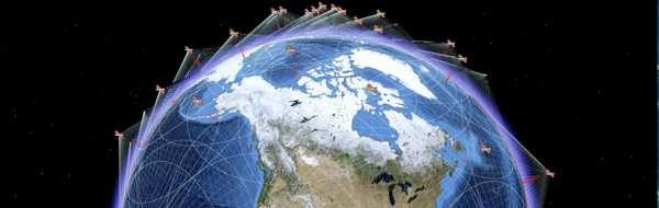
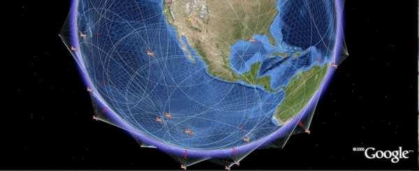
6 Orbit Dissemination Orbit determination for global positioning satellites is based on observations at monitor stations of the respective control segment. Global networks lead to higher accuracy and reliability of the orbits compared to those determined from regional networks. The distribution of the sites is essential to achieve the highest accuracy. 6

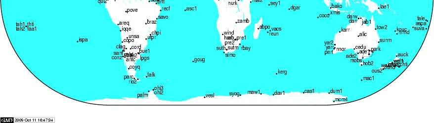
7 IGS Tracking Network 7
8 Ephemerides (astronomical calendar) An ephemeris (plural: ephemerides) (from the Greek word ephemeros = daily) is a table of values that gives the positions of astronomical objects in the sky at a given time or times. Three sets of data are available to determine position and velocity vectors of the satellites in a terrestrial reference frame at any instant: Almanac data Broadcast ephemerides Precise ephemerides The data differ in accuracy and available either in real time or with some delay. Ephemerides Uncertainty Remark Almanac Some kilometers Depending on the age of data Broadcast Ephem. ~ 1 m Or even better 8 Precise Ephem m Depending on the latency
9 Almanac Data Provide the user with adequate data to facilitate receiver satellite acquisition and for planning tasks such as the computation of visibility charts. Regularly updated and broadcasted as a part of the satellite message. Contains parameters for the orbit and satellite clock correction terms for all satellites. 9
10 Sample Almanac Data Parameter ID WEEK t a a e M 0 ω δi Explanation Satellite Identification number Current GPS week Reference epoch in seconds within the current week Square root of semi-major axis Eccentricity Mean anomaly at reference epoch Argument of perigee Inclination offset from 0.3 semicircles (=54 ) l 0 Longitude of the node at weekly epoch t 0 Ώ a 0 a 1 Drift of node s right ascension per second Satellite clock offset in seconds Satellite clock drift coefficient 10
11 Broadcast Ephemerides Based on observations at the monitor stations of the respective control segment. The most recent of these data are used to compute a reference orbit for the satellites. Additional tracking data are entered into a Kalman filter and improved orbits are used for extrapolation. The master station of the control segment is responsible for the computation of the ephemerides and the subsequent upload to satellites. 11
12 Broadcast Ephemerides (2) Contains records with general information, orbital information, and information on the satellite clock. Orbital information is provided in the form of Keplerian parameters together with their temporal variations or position and velocity vectors at equidistant epochs. The information on the satellite clock is in most cases given in the form of coefficients to model the clock offset from system time by polynomials. 12
13 Sample Broadcast Ephemerides Data Parameter ID WEEK t e a e M 0 ω 0 i 0 Explanation Satellite Identification number Current GPS week Ephemerides reference epoch Square root of semi-major axis Eccentricity Mean anomaly at reference epoch Argument of perigee Inclination l 0 Longitude of the node at weekly epoch t 0 13 n i Ώ C uc, C us C rc, C rs C ic, C is t c a 0 a 1 a 2 Mean motion difference Rate of inclination angle Rate of node s right ascension Correction coefficient (argument of perigee) Correction coefficient (geocentric distance) Correction coefficient (inclination) Satellite clock reference epoch Satellite clock offset Satellite clock drift coefficient Satellite clock frequency drift coefficient
14 Precise Ephemerides Most accurate orbital information is provided by the IGS in the form of various data sets for precise ephemerides. Consist of satellite positions and velocities at equidistant epochs. SP1 and ECF1 data formats contains both position and velocity data SP2 and ECF2 data formats contain just position data. Typical spacing of the data is 15 mins. In 1989 satellite clock offset data were added. (SP3 and ECF3) 14
15 Precise Ephemerides Format GPS satellite precise ephemerides (GPS orbits and clock corrections) are computed from the data collected at the GPS reference stations as well as IGS stations around the world. Replacing GPS s broadcast ephemerides with precise ephemerides improves GPS positioning accuracy. Precise ephemerides are packaged as daily (0:00 to 23:45 GPS Time) Precise Orbit and Clock files are at 15-minute interval. Precise Orbit files are in the NGS-SP3 format) and contain X, Y, Z satellite positions. 15


16 16 ISTANBUL TECHNICAL UNIVERSITY - DEPARTMENT OF GEOMATICS ENGINEERING
17 Introduction to GPS 17
18 Historical Review of GPS Global Positioning System, as known GPS or NAVSTAR- GPS (NAVigation System with Timing And Ranging- Global Positioning System), is a radio navigation positioning system developed by the Department of Defence (DoD) to meet the military needs in In 1978, the launch of development satellites began. Civilians were allowed to use GPS in In 1989, first operational satellite was launched. Initial Operational Capability (IOC) was attained in Full Operational Capability (FOC) was achieved in 1994 but declared after
19 Historical Review of GPS (2) In 1996, first UN national policy on GPS was released. In 1998, second civilian signal was provided by GPS. In 1999, GPS modernization program was announced. Two new civil signals were also announced to be provided. In 2000, the degrading in GPS accuracy was stopped by the U.S. government. (SA: selective availability) 19
20 Accuracy & Usage Limitation SA: Selective Availability (removed on May 2, 2000) Error on satellite clocks Error on satellite coordinates AS: Anti Spoofing No availability of real P code 20
21 Reference Systems Coordinate System Time System 21
22 Coordinate System Referring to coordinates, the GPS terrestrial reference system is the World Geodetic System 1984 (WGS-84). This geocentric system was originally realized by the coordinates of about 1500 terrestrial sites which have been derived from Transit observations. The ellipsoid is defined by: Semi-major axis a Normalized second-degree zonal gravitational coefficient Ć 2,0 f =(a b)/a Truncated angular velocity of the earth ω e Earth s gravitational constant µ This frame has been used for GPS since
23 Coordinate System (2) WGS-84 frame has been refined in 1994 (WGS-84 (G730), 1996 (WGS-84 (G873), 2002 (WGS-84 (G1150) With respect to ITRF2005, current WGS-84 frame shows insignificant systematic differences in order of 1 cm. Hence, both frames are virtually identical. 23
24 Time System The system time of GPS is related to the atomic time system and referenced to coordinated universal time (UTC). Nominally the GPS time has a constant offset of 19 seconds with TAI (international atomic time). TAI = GPS time s GPS time is exactly 14 seconds ahead of UTC. Starting at the GPS standard epoch (0hr 6 January, 1980), the system time of GPS is counted in terms of GPS weeks and seconds within the current week. 24
25 Time System (2) For the calculation of the GPS week; WEEK = INT[JD )/7] JD (Julian Date): defines the number mean solar days (each of which is SI second in length) elapsed since the epoch 1.5 (midday) January, 4713 B.C (on the proleptic Julian calendar). The Modified Julian Date (MJD) is obtained by subtracting from the JD. The JD can be computed from the year number Y (a full four digit integer), integer month number M, integer day number D, and the real-valued time in hours H: JD = Int[ y ] + Int[ (m+1) ] + D + H / y = Y - 1 and m = M + 12 if M 2 y = Y and m = M if M > 2 25
26 GPS Services For positioning and timing, GPS provides two levels of services. Standard Positioning Service (SPS) access for civilian users. Precise Positioning Service (PPS) access for authorized users only. GPS Information services provide GPS status information, orbital and other data to civilian users. 26
27 Standard Positioning Service (SPS) Positioning and timing service. Uses the C/A-code. Provided on the L1 signal only. SPS performance refers to the signal in space (SIS). Contributions of ionosphere, troposphere, receiver, multipath, topography or interference are not included. 27
28 Precise Positioning Service Uses the P-code (Y-code respectively) on the L1 and L2 signal. Use of PPS is restricted to US armed forces, federal agencies, and some selected allied armed forces and governments. 28
29 GPS Segments Space Segment Control Segment User Segment 29
30 GPS Space Segment 24 satellites 6 orbiting planes 55 inclination km above Earth 12 hours of orbit 5 hours view in horizon GPS Satellite Types: Block I, Block II, Block IIA, Block IIR, Block IIR-M, Block IIF, Block III 30

31 GPS Control Segment Consist of; Master control station Monitor stations Ground antennas Tracking of satellites for the orbit and clock determination and prediction Time synchronization of the satellites Upload of navigation data message to the satellites Imposing SA on the broadcast signals 31
32 GPS Control Segment (2) Colorado Springs (Main control & monitoring) Hawaii (Monitoring) Ascension Island in South Atlantic Ocean (Monitoring and ground control station) Diego Garcia in Indian Ocean (Monitoring and ground control station) Kwajalein in North Pacific Ocean (Monitoring and ground control station) 32

 33")
33 GPS Control Segment (3) 33

 34")
34 GPS Control Segment (4) 34
35 User Segment Users; Civilians (universities, private and state sectors, etc.) Military Receivers; Trimble Ashtech Rogue Leica Javad etc... 35
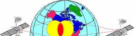
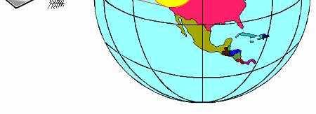
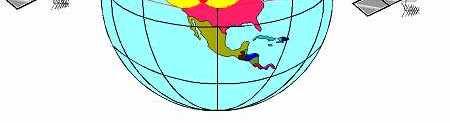
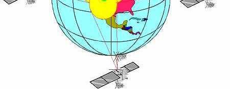
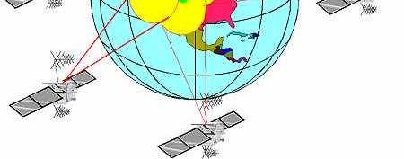
36 Satellite Positioning 1 satellite 2 satellites 3 satellites Latitude Longitude Latitude Longitude Height 36
37 Satellite Positioning 4 satellites Latitude Longitude Height Time or X, Y, Z, t 37
38 Satellite Positioning 38
39 Most Important Features of GPS Cloudy Rainy Suny sea, land space Worldwide Day & night 24 hours 39
40 40 ISTANBUL TECHNICAL UNIVERSITY - DEPARTMENT OF GEOMATICS ENGINEERING
Orbit Representation
 7.1 Fundamentals 223 For this purpose, code-pseudorange and carrier observations are made of all visible satellites at all monitor stations. The data are corrected for ionospheric and tropospheric delays,
GNSS: Global Navigation Satellite Systems
 GNSS: Global Navigation Satellite Systems Global: today the American GPS (Global Positioning Service), http://gps.losangeles.af.mil/index.html the Russian GLONASS, http://www.glonass-center.ru/frame_e.html
NGA GNSS Division Precise Ephemeris Parameters
 NGA GNSS Division Precise Ephemeris Parameters Precise Ephemeris Units. Earth-centered, Earth-fixed Coordinate system Position Velocity GPS time Trajectory interval Standard Trajectory Optional Trajectory
ERTH 455 / GEOP 555 Geodetic Methods. Lecture 04: GPS Overview, Coordinate Systems
 ERTH 455 / GEOP 555 Geodetic Methods Lecture 04: GPS Overview, Coordinate Systems Ronni Grapenthin rg@nmt.edu MSEC 356 x5924 August 30, 2017 1 / 22 2 / 22 GPS Overview 1973: Architecture approved 1978:
Introduction to Global Navigation Satellite System (GNSS) Module: 2
 Module: 2") Introduction to Global Navigation Satellite System (GNSS) Module: 2 Dinesh Manandhar Center for Spatial Information Science The University of Tokyo Contact Information: dinesh@iis.u-tokyo.ac.jp Slide :
Introduction to Global Navigation Satellite System (GNSS) Module: 2 Dinesh Manandhar Center for Spatial Information Science The University of Tokyo Contact Information: dinesh@iis.u-tokyo.ac.jp Slide :
Satellite Communications
 Satellite Communications Lecture (3) Chapter 2.1 1 Gravitational Force Newton s 2nd Law: r r F = m a Newton s Law Of Universal Gravitation (assuming point masses or spheres): Putting these together: r
Chapter 4. Satellite Position Estimation and Satellite Clock Error Analysis
 Chapter 4 Satellite Position Estimation and Satellite Clock Error Analysis 4.1 Introduction In satellite based navigation system, the receiver position accuracy relies on the precise knowledge of the satellite
Celestial Mechanics III. Time and reference frames Orbital elements Calculation of ephemerides Orbit determination
 Celestial Mechanics III Time and reference frames Orbital elements Calculation of ephemerides Orbit determination Orbital position versus time: The choice of units Gravitational constant: SI units ([m],[kg],[s])
Global Navigation Satellite Systems
 Global Navigation Satellite Systems GPS GLONASS Galileo BeiDou I I (COMPASS)? How Does a GNSS Work? Based on principle of triangulation Also called satellite ranging Signal travels at constant speed (3.0x10
MAHALAKSHMI ENGINEERING COLLEGE-TRICHY QUESTION BANK UNIT I PART A
 MAHALAKSHMI ENGINEERING COLLEGE-TRICHY QUESTION BANK SATELLITE COMMUNICATION DEPT./SEM.:ECE/VIII UNIT I PART A 1.What are the different applications of satellite systems? *Largest International System(Intel
Principles of the Global Positioning System Lecture 14
 12.540 Principles of the Global Positioning System Lecture 14 Prof. Thomas Herring http://geoweb.mit.edu/~tah/12.540 Propagation Medium Propagation: Signal propagation from satellite to receiver Light-time
Earth-Centered, Earth-Fixed Coordinate System
 Fundamentals of Global Positioning System Receivers: A Software Approach James Bao-Yen Tsui Copyright 2000 John Wiley & Sons, Inc. Print ISBN 0-471-38154-3 Electronic ISBN 0-471-20054-9 CHAPTER FOUR Earth-Centered,
E. Calais Purdue University - EAS Department Civil 3273
 E. Calais Purdue University - EAS Department Civil 3273 ecalais@purdue.edu Orbits? Satellite orbits: What for? satellite 3 satellite 2 ρr 2 ρ 3 ρ 1 satellite 1 Principle of GPS positioning: Satellite 1
Surveying Prof. Bharat Lohani Department of Civil Engineering Indian Institute of Technology, Kanpur
 Surveying Prof. Bharat Lohani Department of Civil Engineering Indian Institute of Technology, Kanpur Module - 12 Lecture - 1 Global Positioning System (Refer Slide Time: 00:20) Welcome to this video lecture
CALCULATION OF POSITION AND VELOCITY OF GLONASS SATELLITE BASED ON ANALYTICAL THEORY OF MOTION
 ARTIFICIAL SATELLITES, Vol. 50, No. 3 2015 DOI: 10.1515/arsa-2015-0008 CALCULATION OF POSITION AND VELOCITY OF GLONASS SATELLITE BASED ON ANALYTICAL THEORY OF MOTION W. Góral, B. Skorupa AGH University
Workshop on GNSS Data Application to Low Latitude Ionospheric Research May Fundamentals of Satellite Navigation
 2458-6 Workshop on GNSS Data Application to Low Latitude Ionospheric Research 6-17 May 2013 Fundamentals of Satellite Navigation HEGARTY Christopher The MITRE Corporation 202 Burlington Rd. / Rte 62 Bedford
Chapter 2: Orbits and Launching Methods
 9/20/ Chapter 2: Orbits and Launching Methods Prepared by Dr. Mohammed Taha El Astal EELE 6335 Telecom. System Part I: Satellite Communic ations Winter Content Kepler s First, Second, and Third Law Definitions
TOWARDS ROBUST LOCALIZATION OF RTK-GPS TOPOGRAPHIC SURVEYS 23
 TOWARDS ROBUST LOCALIZATION OF RTK-GPS TOPOGRAPHIC SURVEYS Jerry W. Nave, North Carolina A&T University; Tarig A. Ali, American University of Sharjah Abstract Localization is performed to fit the observed
Figure 1. View of ALSAT-2A spacecraft
 ALSAT-2A TRANSFER AND FIRST YEAR OPERATIONS M. Kameche (1), A.H. Gicquel (2), D. Joalland (3) (1) CTS/ASAL, 1 Avenue de la Palestine, BP 13, Arzew 31200 Oran, Algérie, email:mo_kameche@netcourrier.com
Velocity and Acceleration of NavIC Satellites using Broadcast Ephemeris
 Velocity and Acceleration of NavIC Satellites using Broadcast Ephemeris Bidyut B. Gogoi *, Akhilesh Kumar, A. Kartik, Nirmala S. Space Navigation Group Indian Space Research Organisation Satellite Center
The Position of the Sun. Berthold K. P. Horn. necessary to know the position of the sun in the sky. This is particularly
 MASSACHUSETTS INSTITUTE OF TECHNOLOGY ARTIFICIAL INTELLIGENCE LABORATORY Working Paper No. 162 March 1978 The Position of the Sun Berthold K. P. Horn Abstract. The appearance of a surface depends dramatically
Time frames, leap seconds and GPS
 Time frames, leap seconds and GPS Andy Shearer Centre for Astronomy NUI, Galway How important is absolute timing accuracy... I How important is absolute timing accuracy... II important enough for particle
RECOMMENDATION ITU-R S Impact of interference from the Sun into a geostationary-satellite orbit fixed-satellite service link
 Rec. ITU-R S.1525-1 1 RECOMMENDATION ITU-R S.1525-1 Impact of interference from the Sun into a geostationary-satellite orbit fixed-satellite service link (Question ITU-R 236/4) (21-22) The ITU Radiocommunication
EESC 9945 Geodesy with the Global Posi6oning System. Class 2: Satellite orbits
 EESC 9945 Geodesy with the Global Posi6oning System Class 2: Satellite orbits Background The model for the pseudorange was Today, we ll develop how to calculate the vector posi6on of the satellite The
Celestial Mechanics I. Introduction Kepler s Laws
 Celestial Mechanics I Introduction Kepler s Laws Goals of the Course The student will be able to provide a detailed account of fundamental celestial mechanics The student will learn to perform detailed
Fundamentals of Satellite technology
 Fundamentals of Satellite technology Prepared by A.Kaviyarasu Assistant Professor Department of Aerospace Engineering Madras Institute Of Technology Chromepet, Chennai Orbital Plane All of the planets,
Satellite communications and the environment of space. V 1.1 Swiss Space Summer Camp 2016 Images: NASA 1
 Satellite communications and the environment of space Swiss Space Summer Camp 2016 Images: NASA 1 Can you name these satellites? Sputnik The first man made satellite Launched in 1957 by The USSR Mass 84kg,
Principles of Global Positioning Systems Spring 2008
 MIT OpenCourseWare http://ocw.mit.edu 12.540 Principles of Global Positioning Systems Spring 2008 For information about citing these materials or our Terms of Use, visit: http://ocw.mit.edu/terms. 20.3.3.3.3.1
Homework #1 Solution: March 8, 2006
 12.540 Homework #1 Solution: March 8, 2006 Question 1: (a) Convert geodetic position 290 deg Long 42 deg latitude ellipsoidal height 0 m into Cartesian and geocentric coordinates. (b) How far apart on
Figure from Mike Rymer, USGS
 Ge111A Winter 2009 3/5/2009 1 Figure from Mike Rymer, USGS Ge111A Winter 2009 3/5/2009 2 Ge111A Winter 2009 3/5/2009 3 SWIR image made from ASTER data Ge111A Winter 2009 3/5/2009 4 Ge111A Winter 2009 3/5/2009
The GPS System. Brief history of GPS.
 The GPS System. Some time ago, driven partly by commercial interest and partly by curiosity, I decided to do some research into how the GPS system actually works. To understand it at grass roots level
Galileo Extended Slots Characterisation and Relation with the Nominal Constellation
 Galileo Extended Slots Characterisation and Relation with the Nominal Constellation By Andrés AYALA, ) Rubén CASTRO, 2) Nityaporn SIRIKAN, 3) Daniel BLONSKI, 3) and Daniel NAVARRO 3) ) ESTEC, European
Astrodynamics (AERO0024)
") Astrodynamics (AERO0024) 3B. The Orbit in Space and Time Gaëtan Kerschen Space Structures & Systems Lab (S3L) Previous Lecture: The Orbit in Time 3.1 ORBITAL POSITION AS A FUNCTION OF TIME 3.1.1 Kepler
Astrodynamics (AERO0024) 3B. The Orbit in Space and Time Gaëtan Kerschen Space Structures & Systems Lab (S3L) Previous Lecture: The Orbit in Time 3.1 ORBITAL POSITION AS A FUNCTION OF TIME 3.1.1 Kepler
RINEX Extensions to Handle Clock Information ********************************************
 RINEX Extensions to Handle Clock Information ******************************************** Jim Ray, US Naval Observatory Werner Gurtner, University of Berne (Initial version, 27 August 1998) (Error in example
Geometry of Earth Sun System
 12S56 Geometry of Earth Sun System Figure below shows the basic geometry Northern Hemisphere Winter ω equator Earth s Orbit Ecliptic ω ω SUN equator Northern Hemisphere Spring Northern Hemisphere Fall
ESTIMATION OF NUTATION TERMS USING GPS
 ESTIMATION OF NUTATION TERMS USING GPS Markus Rothacher, Gerhard Beutler Astronomical Institute, University of Berne CH-3012 Berne, Switzerland ABSTRACT Satellite space-geodetic measurements have been
AST111, Lecture 1b. Measurements of bodies in the solar system (overview continued) Orbital elements
 Orbital elements") AST111, Lecture 1b Measurements of bodies in the solar system (overview continued) Orbital elements Planetary properties (continued): Measuring Mass The orbital period of a moon about a planet depends
AST111, Lecture 1b Measurements of bodies in the solar system (overview continued) Orbital elements Planetary properties (continued): Measuring Mass The orbital period of a moon about a planet depends
IAU 2006 NFA GLOSSARY
 IAU 2006 NFA GLOSSARY Prepared by the IAU Division I Working Group Nomenclature for Fundamental Astronomy'' (latest revision: 20 November 2007) Those definitions corresponding to the IAU 2000 resolutions
Mobile Systeme Grundlagen und Anwendungen standortbezogener Dienste. Location Based Services in the Context of Web 2.0
 Mobile Systeme Grundlagen und Anwendungen standortbezogener Dienste Location Based Services in the Context of Web 2.0 Department of Informatics - MIN Faculty - University of Hamburg Lecture Summer Term
Topic #13: Universal Gravitation and Satellites (Teacher)
") 1.13.1 The Development of the Theory of Universal Gravitation Before Newton developed the theory of universal gravitation, there were two separate notions of gravity. Terrestrial gravity was thought to
1.13.1 The Development of the Theory of Universal Gravitation Before Newton developed the theory of universal gravitation, there were two separate notions of gravity. Terrestrial gravity was thought to
What is the Right Answer?
 What is the Right Answer??! Purpose To introduce students to the concept that sometimes there is no one right answer to a question or measurement Overview Students learn to be careful when searching for
ACCURACY ASSESSMENT OF GEOSTATIONARY-EARTH-ORBIT WITH SIMPLIFIED PERTURBATIONS MODELS
 ARTIFICIAL SATELLITES, Vol. 51, No. 2 2016 DOI: 10.1515/arsa-2016-0005 ACCURACY ASSESSMENT OF GEOSTATIONARY-EARTH-ORBIT WITH SIMPLIFIED PERTURBATIONS MODELS Lihua Ma, Xiaojun Xu, Feng Pang National Astronomical
EUROPEAN GNSS (GALILEO) INITIAL SERVICES NAVIGATION SOLUTIONS POWERED BY E U R O P E OPEN SERVICE QUARTERLY PERFORMANCE REPORT
 INITIAL SERVICES NAVIGATION SOLUTIONS POWERED BY E U R O P E OPEN SERVICE QUARTERLY PERFORMANCE REPORT") NAVIGATION SOLUTIONS POWERED BY E U R O P E EUROPEAN GNSS (GALILEO) INITIAL SERVICES OPEN SERVICE QUARTERLY PERFORMANCE REPORT OCTOBER - DECEMBER 2017 TABLE OF CONTENTS 1 INTRODUCTION... 1 2 EXECUTIVE
NAVIGATION SOLUTIONS POWERED BY E U R O P E EUROPEAN GNSS (GALILEO) INITIAL SERVICES OPEN SERVICE QUARTERLY PERFORMANCE REPORT OCTOBER - DECEMBER 2017 TABLE OF CONTENTS 1 INTRODUCTION... 1 2 EXECUTIVE
Creating Satellite Orbits
 Exercises using Satellite ToolKit (STK) vivarad@ait.ac.th Creating Satellite Orbits 1. What You Will Do Create a low-earth orbit (LEO) satellite Create a medium-earth orbit (MEO) satellite Create a highly
System of Geodetic Parameters Parametry Zemli 1990 PZ-90.11
 System of Geodetic Parameters Parametry Zemli 1990 PZ-90.11 Authors: PhD Anastasiya N. Zueva, PhD Evgeniy V. Novikov, Dr. Dmitriy I. Pleshakov, PhD Igor V. Gusev Speaker: Igor Gusev 9 th Mee'ng of the
Torsten Mayer-Gürr Institute of Geodesy, NAWI Graz Technische Universität Graz
 GGOS and Reference Systems Introduction 2015-10-12 Torsten Mayer-Gürr Institute of Geodesy, NAWI Graz Technische Universität Graz Torsten Mayer-Gürr 1 Course and exam Lecture Monday 14:00 16:00, A111 (ST01044)
Astrodynamics (AERO0024)
") Astrodynamics (AERO0024) 3. The Orbit in Space Gaëtan Kerschen Space Structures & Systems Lab (S3L) Motivation: Space We need means of describing orbits in three-dimensional space. Example: Earth s oblateness
Astrodynamics (AERO0024) 3. The Orbit in Space Gaëtan Kerschen Space Structures & Systems Lab (S3L) Motivation: Space We need means of describing orbits in three-dimensional space. Example: Earth s oblateness
APPENDIX B SUMMARY OF ORBITAL MECHANICS RELEVANT TO REMOTE SENSING
 APPENDIX B SUMMARY OF ORBITAL MECHANICS RELEVANT TO REMOTE SENSING Orbit selection and sensor characteristics are closely related to the strategy required to achieve the desired results. Different types
These notes may contain copyrighted material! They are for your own use only during this course.
 Licensed for Personal Use Only DO NOT DISTRIBUTE These notes may contain copyrighted material! They are for your own use only during this course. Distributing them in anyway will be considered a breach
ANALYSIS OF THE MEGHA-TROPIQUES TRAJECTORY. DETERMINATION OF RENDEZ-VOUS CONDITIONS WITH THE TERRA SATELLITE.
 ANALYSIS OF THE MEGHA-TROPIQUES TRAJECTORY. DETERMINATION OF RENDEZ-VOUS CONDITIONS WITH THE TERRA SATELLITE. Michel Capderou (1), Florent Deleflie (2), and Olivier Chomette (1) (1) LMD-IPSL Ecole Polytechnique,
Lecture 2 Measurement Systems. GEOS 655 Tectonic Geodesy
 Lecture 2 Measurement Systems GEOS 655 Tectonic Geodesy VLBI and SLR VLBI Very Long Baseline Interferometry SLR Satellite Laser Ranging Very Long Baseline Interferometry VLBI Geometric Delay δg S Baseline
Research Article Time Synchronization and Performance of BeiDou Satellite Clocks in Orbit
 Navigation and Observation Volume 213, Article ID 37145, 5 pages http://dx.doi.org/1.1155/213/37145 Research Article Time Synchronization and Performance of BeiDou Satellite Clocks in Orbit Han Chunhao,
NAVIGATION THEORY QUESTIONS Basics of Navigation
 NAVIGATION THEORY QUESTIONS Basics of Navigation Q610065 look at it The angle between the plane of the ecliptic and the plane of equator is approx? 23.5 degrees In which two months of the year is the difference
Third Body Perturbation
 Third Body Perturbation p. 1/30 Third Body Perturbation Modeling the Space Environment Manuel Ruiz Delgado European Masters in Aeronautics and Space E.T.S.I. Aeronáuticos Universidad Politécnica de Madrid
Coordinates on the Sphere
 Survey Observations Coordinates on the Sphere Any position on the surface of a sphere (such as the Earth or the night sky) can be expressed in terms of the angular coordinates latitude and longitude Latitude
Elements of Geodesy. Shape of the Earth Tides Terrestrial coordinate systems Inertial coordinate systems Earth orientation parameters
 Elements of Geodesy Shape of the Earth Tides Terrestrial coordinate systems Inertial coordinate systems Earth orientation parameters E. Calais Purdue University - EAS Department Civil 3273 ecalais@purdue.edu
Modern Navigation. Thomas Herring
 12.215 Modern Navigation Thomas Herring Review of Monday s Class Spherical Trigonometry Review plane trigonometry Concepts in Spherical Trigonometry Distance measures Azimuths and bearings Basic formulas:
GEOID UNDULATIONS OF SUDAN USING ORTHOMETRIC HEIGHTS COMPARED WITH THE EGM96 ANG EGM2008
 GEOID UNDULATIONS OF SUDAN USING ORTHOMETRIC HEIGHTS COMPARED Dr. Abdelrahim Elgizouli Mohamed Ahmed* WITH THE EGM96 ANG EGM2008 Abstract: Positioning by satellite system determine the normal height above
PHAS 1511: Foundations of Astronomy
 PHAS 1511: Foundations of Astronomy Dr Roger Wesson Research interests: deaths of stars. Planetary nebulae, novae and supernovae. Astronomy: some maths You can see that distances in astronomy are huge.
THE INDIAN REGIONAL NAVIGATION SATELLITE SYSTEM 1E: ANOTHER KEYSTONE FOR MAKE IN INDIA
 09/16 THE INDIAN REGIONAL NAVIGATION SATELLITE SYSTEM 1E: ANOTHER KEYSTONE FOR MAKE IN INDIA 1 Wg Cdr Kiran Krishnan Nair Research Fellow, CAPS It is widely believed that the term Navigation derives from
Mobile and Wireless Networks Course Instructor: Dr. Safdar Ali
 Mobile and Wireless Networks Course Instructor: Dr. Safdar Ali Satellite Communication INTRODUCTION INTRODUCTION Communication satellite are off-course only one means of telecommunication transmission.
Nutation determination by means of GNSS
 Nutation determination by means of GNSS - Comparison with VLBI Nicole Capitaine, Kunliang Yao SYRTE - Observatoire de Paris, CNRS/UPMC, France Introduction Space geodetic techniques cannot be used for
SIMPLIFIED ORBIT DETERMINATION ALGORITHM FOR LOW EARTH ORBIT SATELLITES USING SPACEBORNE GPS NAVIGATION SENSOR
 ARTIFICIAL SATELLITES, Vol. 49, No. 2 2014 DOI: 10.2478/arsa-2014-0007 SIMPLIFIED ORBIT DETERMINATION ALGORITHM FOR LOW EARTH ORBIT SATELLITES USING SPACEBORNE GPS NAVIGATION SENSOR ABSTRACT Sandip Tukaram
Orbit Design Marcelo Suárez. 6th Science Meeting; Seattle, WA, USA July 2010
 Orbit Design Marcelo Suárez Orbit Design Requirements The following Science Requirements provided drivers for Orbit Design: Global Coverage: the entire extent (100%) of the ice-free ocean surface to at
Introduction to geodetic VLBI
 Introduction to geodetic VLBI David Mayer Andreas Hellerschmied Johannes Böhm Harald Schuh and Johannes Böhm, Very Long Baseline Interferometry for Geodesy and Astrometry, in Guochang Xu (editor): Sciences
Observational Astronomy - Lecture 4 Orbits, Motions, Kepler s and Newton s Laws
 Observational Astronomy - Lecture 4 Orbits, Motions, Kepler s and Newton s Laws Craig Lage New York University - Department of Physics craig.lage@nyu.edu February 24, 2014 1 / 21 Tycho Brahe s Equatorial
Orekit in NEOSAT FDS. Alexandre Janer& Pol Sola Romeu(TAS) Maxime Journot(CS) Orekit Day 2017 PROPRIETARY INFORMATION 27/11/2017
 Maxime Journot(CS) Orekit Day 2017 PROPRIETARY INFORMATION 27/11/2017") Orekit in NEOSAT FDS Alexandre Janer& Pol Sola Romeu(TAS) Maxime Journot(CS) Orekit Day 2017 1 Modèle 83230347-DOC-TAS-FR-004 Contents TAS &the NEOSAT program NEOSAT FDS -Generalities Orekit in NEOSAT
Orekit in NEOSAT FDS Alexandre Janer& Pol Sola Romeu(TAS) Maxime Journot(CS) Orekit Day 2017 1 Modèle 83230347-DOC-TAS-FR-004 Contents TAS &the NEOSAT program NEOSAT FDS -Generalities Orekit in NEOSAT
Time and Frequency Activities at the JHU Applied Physics Laboratory
 Time and Frequency Activities at the JHU Applied Physics Laboratory Mihran Miranian, Gregory L. Weaver, Jeffrey F. Garstecki, and Richard A. Dragonette Johns Hopkins University Applied Physics Laboratory,
New satellite mission for improving the Terrestrial Reference Frame: means and impacts
 Fourth Swarm science meeting and geodetic missions workshop ESA, 20-24 March 2017, Banff, Alberta, Canada New satellite mission for improving the Terrestrial Reference Frame: means and impacts Richard
Long-Term Evolution of High Earth Orbits: Effects of Direct Solar Radiation Pressure and Comparison of Trajectory Propagators
 Long-Term Evolution of High Earth Orbits: Effects of Direct Solar Radiation Pressure and Comparison of Trajectory Propagators by L. Anselmo and C. Pardini (Luciano.Anselmo@isti.cnr.it & Carmen.Pardini@isti.cnr.it)
INTRODUCTION TO ORBITAL MECHANICS - MODEL & SIMULATION SOFTWARE (OM-MSS) Earth, Sun, Moon & Satellites Motion in Orbit - Model & Simulation Software
 Earth, Sun, Moon & Satellites Motion in Orbit - Model & Simulation Software") Return to Website INTRODUCTION TO ORBITAL MECHANICS - MODEL & SIMULATION SOFTWARE (OM-MSS) Earth, Sun, Moon & Satellites Motion in Orbit - Model & Simulation Software RC Chakraborty (Retd), Former Director,
Return to Website INTRODUCTION TO ORBITAL MECHANICS - MODEL & SIMULATION SOFTWARE (OM-MSS) Earth, Sun, Moon & Satellites Motion in Orbit - Model & Simulation Software RC Chakraborty (Retd), Former Director,
PHYSICS 1030 Homework #9
 PHYSICS 1030 Homework #9 (Due Dec. 6, 2017) Find the position of the planet Mars at time t D December 6, 2017, 5:00 am EST. You will do this by following the steps shown below. (a) Convert the time t to
orbits Moon, Planets Spacecrafts Calculating the and by Dr. Shiu-Sing TONG
 A Science Enrichment Programme for Secondary 3-4 Students : Teaching and Learning Resources the and Spacecrafts orbits Moon, Planets Calculating the 171 of by Dr. Shiu-Sing TONG 172 Calculating the orbits
COVARIANCE DETERMINATION, PROPAGATION AND INTERPOLATION TECHNIQUES FOR SPACE SURVEILLANCE. European Space Surveillance Conference 7-9 June 2011
 COVARIANCE DETERMINATION, PROPAGATION AND INTERPOLATION TECHNIQUES FOR SPACE SURVEILLANCE European Space Surveillance Conference 7-9 June 2011 Pablo García (1), Diego Escobar (1), Alberto Águeda (1), Francisco
PW-Sat two years on orbit.
 13th of February 2014 is the second anniversary of launch of the first polish student-made satellite PW-Sat. Currently Students' Space Association on Warsaw University of Technology is working on another
Satellite meteorology
 GPHS 422 Satellite meteorology GPHS 422 Satellite meteorology Lecture 1 6 July 2012 Course outline 2012 2 Course outline 2012 - continued 10:00 to 12:00 3 Course outline 2012 - continued 4 Some reading
Orbit Propagatorr and Geomagnetic Field Estimator for NanoSatellite: The ICUBE Mission
 Vol:7, No:7, 23 Orbit Propagatorr and Geomagnetic Field Estimator for NanoSatellite: The ICUBE Mission Lv Meibo, Naqvi Najam Abbas, Hina Arshad, and Li YanJun International Science Index, Physical and
An Assessment of the Accuracy of PPP in Remote Areas in Oman
 An Assessment of the Accuracy of PPP in Remote Areas in Oman Rashid AL ALAWI, Sultanate of Oman and Audrey MARTIN, Ireland Keywords: GNSS, PPP, Oman Survey Infrastructure SUMMARY Traditionally, high accuracy
NPL Time and Frequency Section: NPL S CONTRIBUTION TO TUGGS
 NPL Time & Frequency NPL Time and Frequency Section: NPL S CONTRIBUTION TO TUGGS J A Davis, P W Stacey, R Hlavac, and P B Whibberley. Date: 21st April 2004 THALES UK-BASED GNSS GROUND SEGMENT (TUGGS) Aim
Orbits in Geographic Context. Instantaneous Time Solutions Orbit Fixing in Geographic Frame Classical Orbital Elements
 Orbits in Geographic Context Instantaneous Time Solutions Orbit Fixing in Geographic Frame Classical Orbital Elements Instantaneous Time Solutions Solution of central force motion, described through two
ESTIMATES OF HORIZONTAL DISPLACEMENTS ASSOCIATED WITH THE 1999 TAIWAN EARTHQUAKE
 ESTIMATES OF HORIZONTAL DISPLACEMENTS ASSOCIATED WITH THE 1999 TAIWAN EARTHQUAKE C. C. Chang Department of Surveying and Mapping Engineering Chung Cheng Institute of Technology, Taiwan, ROC ABSTRACT A
Coordinate Systems for Astronomy or: How to get your telescope to observe the right object
 Coordinate Systems for Astronomy or: How to get your telescope to observe the right object Figure 1: Basic definitions for the Earth Definitions - Poles, Equator, Meridians, Parallels The rotation of the
Principles of the Global Positioning System Lecture 18" Mathematical models in GPS" Mathematical models used in GPS"
 12.540 Principles of the Global Positioning System Lecture 18" Prof. Thomas Herring" Room 54-820A; 253-5941" tah@mit.edu" http://geoweb.mit.edu/~tah/12.540 " Mathematical models in GPS" Review assignment
Impact of the SRP model on CODE's 5- system orbit and clock solution for the MGEX
 Impact of the SRP model on CODE's 5- system orbit and clock solution for the MGEX L. Prange, E. Orliac, R. Dach, D. Arnold, G. Beutler, S. Schaer, A. Jäggi Astronomical Institute, University of Bern, Switzerland
EUROPEAN GNSS (GALILEO) INITIAL SERVICES NAVIGATION SOLUTIONS POWERED BY E U R O P E OPEN SERVICE QUARTERLY PERFORMANCE REPORT
 INITIAL SERVICES NAVIGATION SOLUTIONS POWERED BY E U R O P E OPEN SERVICE QUARTERLY PERFORMANCE REPORT") NAVIGATION SOLUTIONS POWERED BY E U R O P E EUROPEAN GNSS (GALILEO) INITIAL SERVICES OPEN SERVICE QUARTERLY PERFORMANCE REPORT APRIL - JUNE 2018 GALILEO INITIAL SERVICES OPEN SERVICE QUARTERLY PERFORMANCE
NAVIGATION SOLUTIONS POWERED BY E U R O P E EUROPEAN GNSS (GALILEO) INITIAL SERVICES OPEN SERVICE QUARTERLY PERFORMANCE REPORT APRIL - JUNE 2018 GALILEO INITIAL SERVICES OPEN SERVICE QUARTERLY PERFORMANCE
Satellite Geodesy and Navigation Present and Future
 Satellite Geodesy and Navigation Present and Future Drazen Svehla Institute of Astronomical and Physical Geodesy Technical University of Munich, Germany Content Clocks for navigation Relativistic geodesy
Experimental Analysis of Low Earth Orbit Satellites due to Atmospheric Perturbations
 Experimental Analysis of Low Earth Orbit Satellites due to Atmospheric Perturbations Aman Saluja #1, Manish Bansal #2, M Raja #3, Mohd Maaz #4 #Aerospace Department, University of Petroleum and Energy
Astrophysics/Astronomy Problems
 Astrophysics/Astronomy Problems Every question counts as a single point, except starred problems (*) which count as 2 points. Double starred problems (**) also count as 2 points, and will be used to decide
EUROPEAN GNSS (GALILEO) INITIAL SERVICES NAVIGATION SOLUTIONS POWERED BY E U R O P E OPEN SERVICE QUARTERLY PERFORMANCE REPORT
 INITIAL SERVICES NAVIGATION SOLUTIONS POWERED BY E U R O P E OPEN SERVICE QUARTERLY PERFORMANCE REPORT") NAVIGATION SOLUTIONS POWERED BY E U R O P E EUROPEAN GNSS (GALILEO) INITIAL SERVICES OPEN SERVICE QUARTERLY PERFORMANCE REPORT JULY - SEPTEMBER 2017 TABLE OF CONTENTS 1 INTRODUCTION... 1 2 EXECUTIVE SUMMARY...
NAVIGATION SOLUTIONS POWERED BY E U R O P E EUROPEAN GNSS (GALILEO) INITIAL SERVICES OPEN SERVICE QUARTERLY PERFORMANCE REPORT JULY - SEPTEMBER 2017 TABLE OF CONTENTS 1 INTRODUCTION... 1 2 EXECUTIVE SUMMARY...
Lecture 2c: Satellite Orbits
 Lecture 2c: Satellite Orbits Outline 1. Newton s Laws of Mo3on 2. Newton s Law of Universal Gravita3on 3. Kepler s Laws 4. Pu>ng Newton and Kepler s Laws together and applying them to the Earth-satellite
Frames for the Future New Datum Definitions for Modernization of the U.S. National Spatial Reference System
 Figure 10. Horizontal position differences (in meters) between NAD 83 and ITRF 08 at time 2022.00 (January 1, 2022). Positional differences are shown for the North American and Pacific tectonic plates.
Relativistic scaling of astronomical quantities and the system of astronomical units _
 Relativistic scaling of astronomical quantities and the system of astronomical units _ Sergei A.Klioner Lohrmann Observatory, Dresden Technical University 1 Lohrmann Observatory, 4 May 2007 2 Content Relativistic
Keplerian Elements Tutorial
 Keplerian Elements Tutorial This tutorial is based on the documentation provided with InstantTrack, written by Franklin Antonio, N6NKF. Satellite Orbital Elements are numbers that tell us the orbit of
COMPARISON OF ANGLES ONLY INITIAL ORBIT DETERMINATION ALGORITHMS FOR SPACE DEBRIS CATALOGUING
 COMPARISON OF ANGLES ONLY INITIAL ORBIT DETERMINATION ALGORITHMS FOR SPACE DEBRIS CATALOGUING Fran Martinez Fadrique, Alberto Águeda Maté, Joan Jorquera Grau, Jaime Fernández Sánchez, Laura Aivar García
EFFECTS OF DIRECT AND INDIRECT SOLAR RADIATION PRESSURE IN ORBITAL PARAMETERS OF GPS SATELITTES
 DOI: 10.2478/auom-2014-0039 An. Şt. Univ. Ovidius Constanţa Vol. 22(2),2014, 141 150 EFFECTS OF DIRECT AND INDIRECT SOLAR RADIATION PRESSURE IN ORBITAL PARAMETERS OF GPS SATELITTES Sergiu Lupu and Eugen
Knowing the Heavens. Goals: Constellations in the Sky
 Goals: Knowing the Heavens To see how the sky changes during a night and from night to night. To measure the positions of stars in celestial coordinates. To understand the cause of the seasons. Constellations
Very Long Baseline Interferometry for Geodesy and Astrometry
 VieVS User-Workshop 2017 Very Long Baseline Interferometry for Geodesy and Astrometry Johannes Böhm VLBI How does it work? VLBI a flowchart SINEX skd vex2 drudge drudge snp/prc snp/prc NGS Mark4 Mark4
Atmospheric delay. X, Y, Z : satellite cartesian coordinates. Z : receiver cartesian coordinates. In the vacuum the signal speed c is constant
 Atmospheric delay In the vacuum the signal speed c is constant c τ = ρ = ( X X ) + ( Y Y ) + ( Z Z ) S S S 2 S 2 S 2 X, Y, Z : receiver cartesian coordinates S S S X, Y, Z : satellite cartesian coordinates
BeiDou and Galileo, Two Global Satellite Navigation Systems in Final Phase of the Construction, Visibility and Geometry
 http://www.transnav.eu the International Journal on Marine Navigation and Safety of Sea Transportation Volume 10 Number 3 September 2016 DOI: 10.12716/1001.10.03.01 BeiDou and Galileo, Two Global Satellite
This Land Surveying course has been developed by Failure & Damage Analysis, Inc.
 This Land Surveying course has been developed by Failure & Damage Analysis, Inc. www.discountpdh.com DEPARTMENT OF THE ARMY U.S. Army Corps of Engineers CECW-EP Washington, DC 20314-1000 ETL 1110-1-183