P-Cable UHR3D Seismic What is it, and when is it better? Presented by: Brian Brookshire, NCS SubSea By Invitation of: SUT Houston's Offshore Site
|
|
|
- Angela Newton
- 5 years ago
- Views:
Transcription

1 P-Cable UHR3D Seismic What is it, and when is it better? Presented by: Brian Brookshire, NCS SubSea By Invitation of: SUT Houston's Offshore Site Investigation and Geotechnics Committee
2 Contents What is it? P-Cable Acquisition Methodology Production Statistics Processing Flows (basic outline) When is it better? (data examples from GoM unless otherwise noted) Faults Shallow Exploration MTCs Seeps 4D Study Lessons learned Moving forward Conclusions
3 What is it?
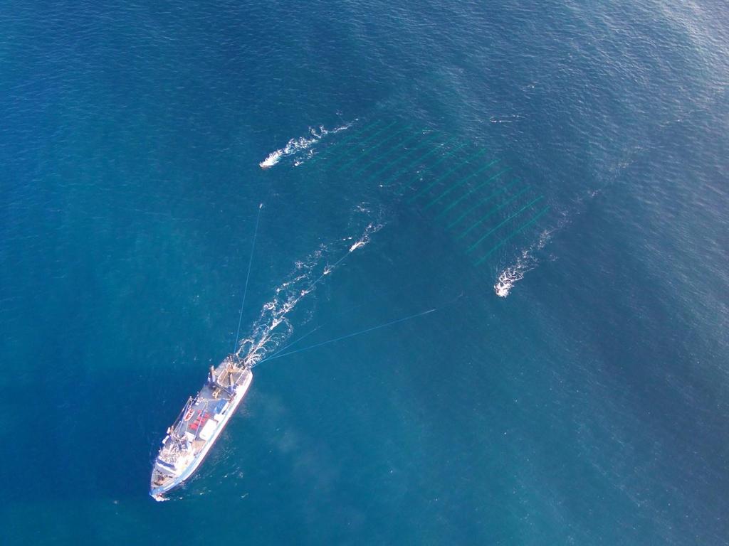
4 P-Cable UHR3D Methodology Receiver Array 18 x 100 m long streamers 6.25 m group interval (16 groups per streamer, 12 phones per group) 12.5 m cross-line streamer spacing Source 210 in 3 GI Gun in Harmonic Mode (G = 105 in 3, I = 105 in 3 ) ~ 6 bar-m peak to peak Survey Parameters ~4 kts survey speed 12.5 m shotpoint spacing m x 6.25 m bins 4 fold 100 m sail line spacing (2cmp lines of overlap) Recording Parameters 0.25 ms sampling interval (8 times conventional rate) 18 db pre-amp gain SAFE-BAND P-Cable Final Configuration v2 - Detailed-Model.pdf Brookshire, Jr. BN, Landers FP and Stein JA. (2015). Applicability of ultra-highresolution 3D seismic data for geohazard identification at mid-slope depths in the Gulf of Mexico: Initial results. Underwater Technology. 32:
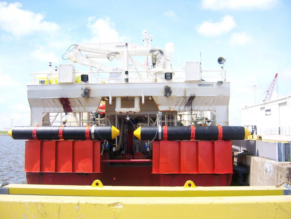
5 1.8m 4.8m

6

7
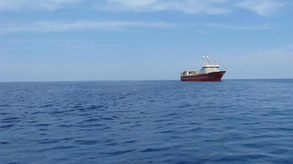
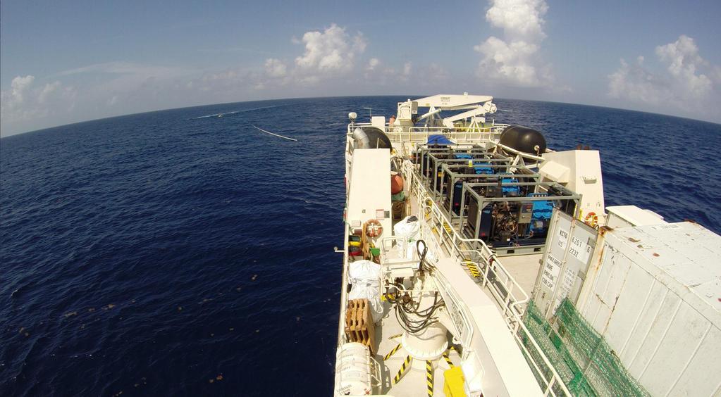
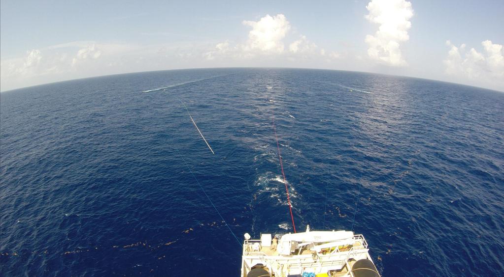
8 Relatively rapid deployment from vessels of opportunity
9
10
11
12 courtesy Fugro/Geometrics
13 Production km^2 Activity Breakdown Less Mob 13.5% Production Stats Repeatability Prime Infill Reshoot Production vs Turn Crew Change Chargeable Standby Technical Downtime Operational Recording time (hrs) Acquisition Total % Line change time (hrs) Average Daily km^2 Production Job Total Best Consecutive Month Other Recent P-Cable Job 12.7% Why is job total production lower than anticipated? -Slow speed over ground in one direction due to issues with Loop Current (as little as 1.5 kts!!). -Growing pains with system. Repeatability Prime Infill Reshoot
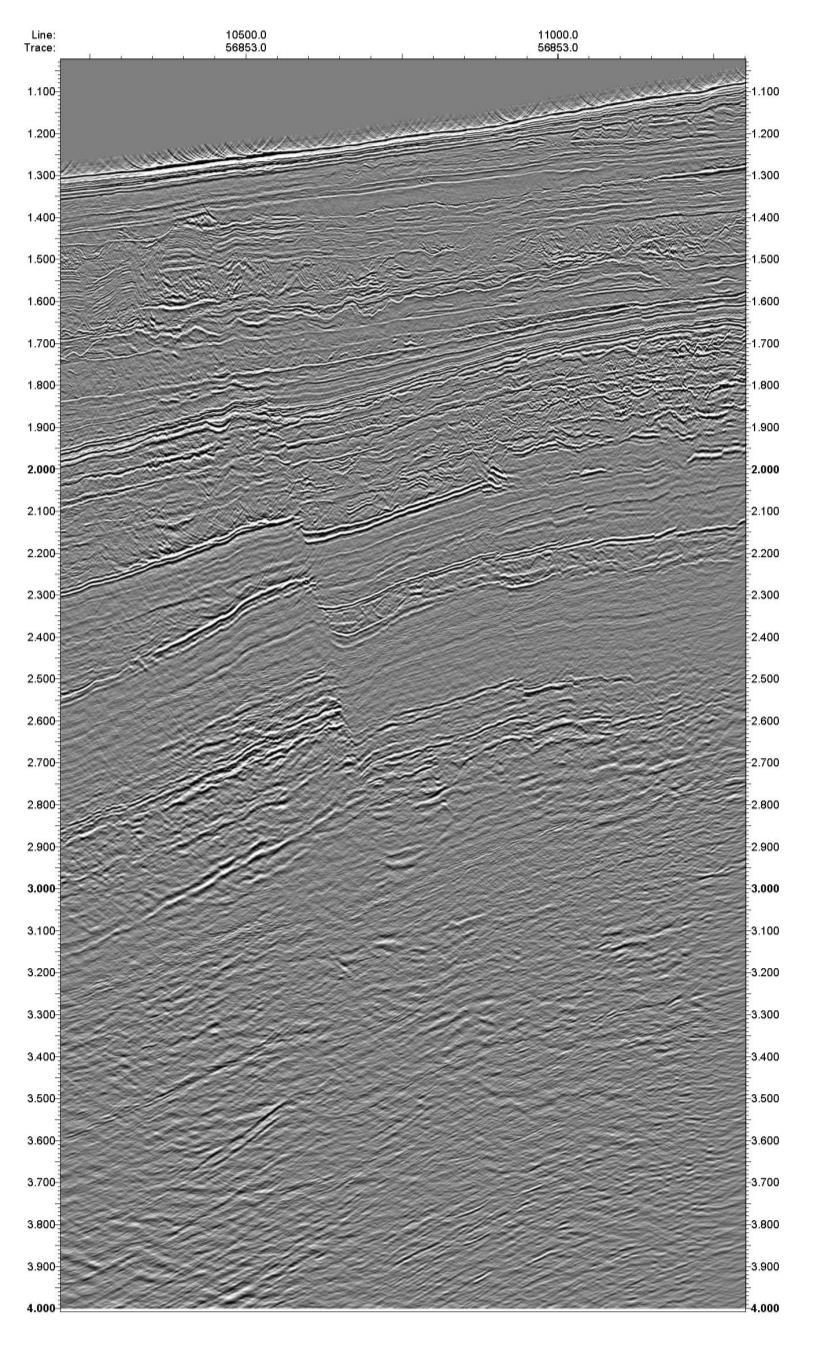
14 Different Iterations of the SAFE-BAND Data Fast Track 3D Volume Current 3D Volume Brand New, Deghosted 2D Examples 20 Hz low cut filter Temporal resample to 0.5 ms Basic wavelet processing Noise elimination Static corrections 3D stack Post-stack time migration Basic post migration processing 20 Hz low cut filter Temporal resample to 0.5 ms Statics corrections 2D SRME on common channel/shots Zero phase operator Noise attenuation Regularization Pre-Stack time migration 3D stack Amplitude balancing 2 to 4 Hz high pass filter Noise attenuation DUGBroad (deghosting) 2D SRME Pre-stack time migration 2D stack Frequency enhancement

15 Survey Area

16 When is it better?

17 Complex Areas (or otherwise) Where Resolution Really Counts ~ 40 km

18 Comparison Reprocessed Short Offset Conventional 3D P-Cable Modified from: Hill A., et al. (2015). Slicing and dicing HR seismic acquisition: Varied approaches to delivery of high-resolution 3D seismic data volumes for drilling hazards. TLE 34:
19 Faults
. Applicability of ultra-highresolution 3D seismic data for geohazard identification at mid-slope depths in the Gulf of Mexico: Initial results.")
20 Small Faults Base of visible gas anomaly ~ 15 m wide inline Displaced blocks ~38 m wide inline, beds as narrow as ~ 1.5 m to 3.0 m (empirically). Brookshire, Jr. BN, Landers FP and Stein JA. (2015). Applicability of ultra-highresolution 3D seismic data for geohazard identification at mid-slope depths in the Gulf of Mexico: Initial results. Underwater Technology. 32:

21 Regional Faults ~ 12.5 km
. Central California Coast Seismic Imaging Project Chapter 3: Offshore Low Energy Seismic Reflection Studies in Estero Bay, San Luis Bay, and Point Sal Areas. PG&E. http://www.pge.")
22 For the freely available 3D volumes visit: Tectonically Active Faults San Luis Obispo Bay Slip Rates ~7km Modified from: Green HG and Graham SA. (2014). Central California Coast Seismic Imaging Project Chapter 3: Offshore Low Energy Seismic Reflection Studies in Estero Bay, San Luis Bay, and Point Sal Areas. PG&E.


23 For the freely available 3D volumes visit: Tectonically Active Faults San Luis Obispo Bay Slip Rates Modified from: Green HG and Graham SA. (2014). Central California Coast Seismic Imaging Project Chapter 3: Offshore Low Energy Seismic Reflection Studies in Estero Bay, San Luis Bay, and Point Sal Areas. PG&E.
24 Shallow Exploration

25 Traps ~3 sec ~7km

26 Barents Sea Shallow Exploration Targets ~0.5 sec

27 Barents Sea Shallow Exploration Targets ~0.5 sec
28 MTCs

29 MTCs sea floor pick (first zero crossing) ~ 40 km Depth range = 700 m to 1000 m Brookshire, Jr. BN (2015). Mass transport complex imaging with P-Cable ultrahigh-resolution 3- dimensional seismic SEG Near Surface Asia Pacific Conference, Extended Abstract.


30 Subsurface Mass Transport Complex (MTC) Imaging Oblique cut similarity attribute volume Top of MTC-I time horizon Corresponding top of MTC-I amp. extraction Oblique cut dip of maximum similarity attribute volume Brookshire, Jr. BN (2015). Mass transport complex imaging with P-Cable ultrahigh-resolution 3- dimensional seismic SEG Near Surface Asia Pacific Conference, Extended Abstract.

31 MTC I zoom profile zero phase, American polarity ~50 mbsf Most Positive Amp. Most Negative Amp. ~ 2 km Brookshire, Jr. BN (2015). Mass transport complex imaging with P-Cable ultrahigh-resolution 3- dimensional seismic SEG Near Surface Asia Pacific Conference, Extended Abstract.
32 MTC I zoom profile zero phase, American polarity ~50 mbsf Most Positive Amp. A B C Most Negative Amp. ~ 2 km Brookshire, Jr. BN (2015). Mass transport complex imaging with P-Cable ultrahigh-resolution 3- dimensional seismic SEG Near Surface Asia Pacific Conference, Extended Abstract.

33 MTC I zoom top (A) amplitudes Most Positive Amp. Most Negative Amp. ~ 2.75 km Brookshire, Jr. BN (2015). Mass transport complex imaging with P-Cable ultrahigh-resolution 3- dimensional seismic SEG Near Surface Asia Pacific Conference, Extended Abstract.

34 MTC I zoom bottom (B) flattened Hz sub-band ~35 m wide Most Positive Amp. Most Negative Amp. ~ 2.75 km Brookshire, Jr. BN (2015). Mass transport complex imaging with P-Cable ultrahigh-resolution 3- dimensional seismic SEG Near Surface Asia Pacific Conference, Extended Abstract.

35 MTC I zoom profile zero phase, American polarity ~50 mbsf Most Positive Amp. A B C Most Negative Amp. ~ 2 km Brookshire, Jr. BN (2015). Mass transport complex imaging with P-Cable ultrahigh-resolution 3- dimensional seismic SEG Near Surface Asia Pacific Conference, Extended Abstract.

36 MTC I zoom bottom ( sec, ~17.5 m below) (C) flattened similarity ~25 m peak to peak Dissimilar Similar ~ 2.75 km Brookshire, Jr. BN (2015). Mass transport complex imaging with P-Cable ultrahigh-resolution 3- dimensional seismic SEG Near Surface Asia Pacific Conference, Extended Abstract.


37 Subsurface Mass Transport Complex (MTC) Related to Seafloor Expression 3D volume with top of MTC superimposed Top of MTC with Seafloor transparency overlain. MTC is ~ 40 ms (30 m) below the seafloor. Brookshire, Jr. BN (2015). Mass transport complex imaging with P-Cable ultrahigh-resolution 3- dimensional seismic SEG Near Surface Asia Pacific Conference, Extended Abstract.
38 Seeps
. Reducing risk in offshore planning and development.")
39 Multiple Surface and Subsurface Expressions Brookshire, Jr. BN, Scott L (2015). Reducing risk in offshore planning and development. GEOExPro. 12 (2):
")


40 Gas Anomaly Amp. (flipped) Amplitudes Subsurface Through Water Column Seafloor Amp. RMS Amp. Water Column sec to sec above seafloor ~ 1.9 km
41 4D Study

42 Repeatability Lines Same racetrack shot twice with approximately 6 hours between successive passes on same line Assess repeatability with minimal environmental variance
43 Largest difference is receiver (real world) Y coordinate Likely due to changes in feather Navigation Repeatability - How successful were we in putting the source and receivers in the same place?
44 NRMS NRMS = 200 * RMS (Base Monitor) / (RMS Base + RMS Monitor) Gives the ratio of the RMS of the difference to the RMS of the inputs (does not preserve sign/polarity) 1000 ms window beginning 50 ms below water bottom. For conventional streamer seismic (lower frequency) <20 % NRMS is considered excellent. Final 4D Processing Steps Presented 4D post stack matching 21 pt (pt = 0.5 ms) least squares filter 150 Hz high cut filter
45 inline (base) inline - 4D matching (monitor)

46 Line Inline - 4D Matching Difference/NRMS NRMS = %
47 inline (base) inline - 4D matching (monitor)

48 inline with 150 Hz high cut (base) inline - 4D matching with 150 Hz high cut (monitor)

49 Line Inline - 4D Matching Difference/NRMS with 150 Hz High Cut NRMS = %
50 Lessons Learned
 speed over ground and speed through water. This led to lower production rates, variable streamer depths, etc.")
51 Lessons Learned Environmental Conditions Watch out for the loop current (and associated mesoscale eddies). Observed current velocities of over 3 kts dramatically impacted vessel (and array) speed over ground and speed through water. This led to lower production rates, variable streamer depths, etc Earth Scan Laboratory, LSU URL:

52 Hmmm trouble may be a brewin. Sargassum (seaweed) mat
53 Oooh, can we go around that?

54 Nope!

55 I don t get paid enough for this s#it.


56 Lessons Learned Better Depth Control / Determination Variable receiver depth, especially problematic during low speed through water scenarios, led to data distortion / acquisition footprint.

57 Frequency Hz Lessons Learned Better Depth Control / Determination Near Channel Cable 1 Frequency Spectra for Entire Line Far Channel FSP LSP FSP LSP

58 Lessons Learned Deghosting is Necessary Cable 1 Near Channel

59 Lessons Learned Deghosting is Necessary Cable 1 Far Channel
60 Moving Forward Can t change the environment (e.g. - currents, seaweed), but better to have a backup area/acquisition strategy during the summer in the GoM. It is essential that we have better streamer depth control, so we will be using single birds at the ends of the streamers. It will also be essential to more precisely derive individual receiver depths using the receiver ghost notch. Empirical results confirm that deghosting is a must. When it is within our sphere of influence, we will require that deghosting be performed on all data sets.
61 Deghosting and Frequency Enhancement

62 Current 3D ms, no deghost

63 2D Test Line ms, deghosted

64 Current 3D ms, no deghost

65 2D Test Line ms, deghosted
66 Conclusions What is it? A small-scale 3D seismic system characterized by high spatial and temporal sampling resolution and precise, accurate positioning. When is it better? It s better when resolution is critical, and understanding the subtle character of the stratigraphic sequences is necessary. Limitations Short Offsets no velocities; good at seeing gas, but not below it. ~ 3 seconds below seafloor is more or less the P-Cable zone.
67 Acknowledgements SAFE-BAND Partners NCS SubSea, Geotrace Technologies and Spec Partners 4D Study Shell, Geotrace Technologies (UK) Deghosted Data DownUnder Geosolutions
Improving Resolution with Spectral Balancing- A Case study
 P-299 Improving Resolution with Spectral Balancing- A Case study M Fatima, Lavendra Kumar, RK Bhattacharjee, PH Rao, DP Sinha Western Offshore Basin, ONGC, Panvel, Mumbai Summary: The resolution limit
Residual Statics using CSP gathers
 Residual Statics using CSP gathers Xinxiang Li and John C. Bancroft ABSTRACT All the conventional methods for residual statics analysis require normal moveout (NMO) correction applied on the seismic data.
Using high-density OBC seismic data to optimize the Andrew satellites development
 Using high-density OBC seismic data to optimize the Andrew satellites development Leendert Padmos, 1* Daniel Davies, 1 Merv Davies 1 and John McGarrity 1 Abstract The processed data from conventional towed-streamer
Th N Seismic Imaging in Gas Obscured Areas - Q Anomaly Detection and Q Migration Applied to Broadband Data
 Th N107 11 Seismic Imaging in Gas Obscured Areas - Q Anomaly Detection and Q Migration Applied to Broadband Data A. Castiello* (ION GXT), Y. Ren (ION GXT), S. Greenwood (ION GXT), T. Martin (ION GXT),
Time vs depth in a North Sea case study of the ugly truth Abstract
 Time vs depth in a North Sea case study of the ugly truth Thomas Massip 1, Lauren Braidwood 1, Juergen Fruehn 1, Owen Isaac 1, Jonathan Denly 1, Robert Richardson 2, Phil Mollicone 3 1 ION Geophysical;
Th D North Sea Case Study for Enhanced Imaging Using a New Multimeasurement Towed Streamer
 Th D201 14 North Sea Case Study for Enhanced Imaging Using a New Multimeasurement Towed Streamer C. Cunnell* (WesternGeco), M. Francis (Schlumberger), C. Abu (Schlumberger), M. Paydayesh (Schlumberger)
A018 Combining Bandwidth Extension Techniques and Pre-stack Q Inversion for Enhanced Imaging of Intra-basalt Plays
 A018 Combining Bandwidth Extension Techniques and Pre-stack Q Inversion for Enhanced Imaging of Intra-basalt Plays A.J. Hardwick* (TGS), J. Whittaker (University of Leeds) & N. Woodburn (TGS) SUMMARY Extensive
Improved stratigraphic interpretation using broadband processing Sergipe Basin, Brazil
 Improved stratigraphic interpretation using broadband processing Sergipe Basin, Brazil Mike Saunders 1, Laurie Geiger 1, Dan Negri 1, Jaime A. Stein 2, T. Altay Sansal 2 and John Springman 2 demonstrate
The coherence cube. MIKE BAHORICH Amoco Corporation Denver, CO. Faults parallel to strike. Conventional amplitude time
 3-D seismic discontinuity for faults and stratigraphic features: The coherence cube MIKE BAHORICH Amoco Corporation Denver, CO STEVE FARMER Amoco Corporation Tulsa, OK Seismic data are usually acquired
Appendix H High Resolution Marine Seismic Reflection Surveys
 Appendix H High Resolution Marine Seismic Reflection Surveys Shoreline Fault Zone Report, Appendix H Seis. Reflection Page H-1 of 8 Introduction Single-channel seismic-reflection data were acquired in
Improved Interpretability via Dual-sensor Towed Streamer 3D Seismic - A Case Study from East China Sea
 Improved Interpretability via Dual-sensor Towed Streamer 3D Seismic - A Case Study from East China Sea S. Rongfu (CNOOC Shanghai), C. Hua (CNOOC Shanghai), W. Yun (CNOOC Shanghai), Z. Yabin (CNOOC Shanghai),
Multicomponent seismic survey at Spring Coulee: a data repeatability study
 Multicomponent repeatability Multicomponent seismic survey at Spring Coulee: a data repeatability study Don Lawton, Peter Gagliardi, Malcolm Bertram, Hanxing Lu, Kevin Hall, Joanna Cooper, Eric Gallant,
Residual Moveout Correction; its impact on PSTM Processed data: A Case Study
 P - 130 Residual Moveout Correction; its impact on PSTM Processed data: A Case Study Anand Prakash*, S.K.Bora, Anil Kumar, Regional Computer Centre,P-32 Transport Deport Road, Kolkata 700088 a_prakash999@hotmail.com
COVER STORY LUKE TWIGGER, CGG, UK, EXAMINES RECENT ADVANCES IN SEISMIC TECHNOLOGY THAT REDUCE SUBSALT RISK.
 COVER STORY LUKE TWIGGER, CGG, UK, EXAMINES RECENT ADVANCES IN SEISMIC TECHNOLOGY THAT REDUCE SUBSALT RISK. O il and gas exploration, especially in areas of complex geology such as salt provinces, is a
E014 4D Case Study at Ringhorne, Ringhorne East, Balder and Forseti - Integrating OBC with Streamer Data
 E014 4D Case Study at Ringhorne, Ringhorne East, Balder and Forseti - Integrating OBC with Streamer Data M.B. Helgerud* (ExxonMobil E&P), U.K. Tiwari (ExxonMobil E&P), S.G. Woods (ExxonMobil E&P), P. Homonko
FloatSeis Technologies for Ultra-Deep Imaging Seismic Surveys
 FloatSeis Technologies for Ultra-Deep Imaging Seismic Surveys 25 th January, 2018 Aleksandr Nikitin a.nikitin@gwl-geo.com Geology Without Limits Overview 2011-2016 GWL Acquired over 43000 km 2D seismic
2012 SEG DOI SEG Las Vegas 2012 Annual Meeting Page 1
 Full-azimuth towed-streamer seismic: An exploration tool for pre-salt hydrocarbon exploration offshore Brazil Alex Cooke*, Franck Le Diagon, Ricardo De Marco, Daniela Amazonas, Timothy Bunting, Nick Moldoveanu,
From PZ summation to wavefield separation, mirror imaging and up-down deconvolution: the evolution of ocean-bottom seismic data processing
 From PZ summation to wavefield separation, mirror imaging and up-down deconvolution: the evolution of ocean-bottom seismic data processing Sergio Grion, CGGVeritas Summary This paper discusses present
Full-waveform inversion application in different geological settings Denes Vigh*, Jerry Kapoor and Hongyan Li, WesternGeco
 Full-waveform inversion application in different geological settings Denes Vigh*, Jerry Kapoor and Hongyan Li, WesternGeco Summary After the synthetic data inversion examples, real 3D data sets have been
P Edward Knight 1, James Raffle 2, Sian Davies 2, Henna Selby 2, Emma Evans 2, Mark Johnson 1. Abstract
 P1-3-10 De-risking Drill Decisions. A case study on the benefit of re-processing conventionally acquired seismic data with the latest broadband processing technology Edward Knight 1, James Raffle 2, Sian
Near-Surface Seismic Reflection Applications
 Near-Surface Seismic Reflection Applications Don Steeples, The University of Kansas, Lawrence, KS USA Abstract Nonintrusive methods of gaining knowledge about the Earth s subsurface comprise several of
Model Building Complexity in the Presence of a Rugose Water Bottom Gippsland Basin Australia
 Model Building Complexity in the Presence of a Rugose Water Bottom Gippsland Basin Australia Paul Bouloudas, Apache Energy, Juergen Fruehn, ION GX Technology Introduction Situated offshore south-eastern
Reflection Seismic Method
 Reflection Seismic Method Data and Image sort orders; Seismic Impedance; -D field acquisition geometries; CMP binning and fold; Resolution, Stacking charts; Normal Moveout and correction for it; Stacking;
Rough sea estimation for phase-shift de-ghosting Sergio Grion*, Rob Telling and Seb Holland, Dolphin Geophysical
 Rough sea estimation for phase-shift de-ghosting Sergio Grion*, Rob Telling and Seb Holland, Dolphin Geophysical Summary This paper discusses rough-sea de-ghosting for variabledepth streamer data. The
Predicting Gas Hydrates Using Prestack Seismic Data in Deepwater Gulf of Mexico (JIP Projects)
") Predicting Gas Hydrates Using Prestack Seismic Data in Deepwater Gulf of Mexico (JIP Projects) Dianna Shelander 1, Jianchun Dai 2, George Bunge 1, Dan McConnell 3, Niranjan Banik 2 1 Schlumberger / DCS
Predicting Gas Hydrates Using Prestack Seismic Data in Deepwater Gulf of Mexico (JIP Projects) Dianna Shelander 1, Jianchun Dai 2, George Bunge 1, Dan McConnell 3, Niranjan Banik 2 1 Schlumberger / DCS
PG&E OFFSHORE CENTRAL COASTAL CALIFORNIA SEISMIC IMAGING PROJECT
 PG&E OFFSHORE CENTRAL COASTAL CALIFORNIA SEISMIC IMAGING PROJECT Public Scoping Meeting California State Lands Commission July 21, 2011 Project Area Project Commitments Assessment of the Hosgri, Shoreline,
Offshore Operations and Project Execution Geophysical Site Surveys
 Offshore Operations and Project Execution Geophysical Site Surveys Chris Almond Senior Geophysicist Fugro Survey Limited 22/04/2015 Presentation Summary: Office-based Personnel Project Awarded Pre Offshore
Complex structural imaging of transition zones in Bohai Bay, China, by OBC technology
 Complex structural imaging of transition zones in Bohai Bay, China, by OBC technology Xiaogui Miao 1, Wei Yan 1, Yongxia Liu 1, Joe Zhou 2, and Kunlun Yang 2 Abstract A series of ocean-bottom cable (OBC)
Summary. Introduction
 Detailed velocity model building in a carbonate karst zone and improving sub-karst images in the Gulf of Mexico Jun Cai*, Hao Xun, Li Li, Yang He, Zhiming Li, Shuqian Dong, Manhong Guo and Bin Wang, TGS
Hague and London Oil Plc
 Hague and London Oil Plc Exploiting Shallow Gas Offshore Netherlands De-Gassing Shallow Hazards or De-Risking Shallow Gas November 2016 The Shallow Gas Play can be Summarized as Schematic evolution of
Hydrocarbon Trap Classification Based on Associated Gas Chimneys
 Chapter 14 Hydrocarbon Trap Classification Based on Associated Gas Chimneys Roar Heggland 1 Abstract Oil seeps, shallow gas, and surface features such as seabed pockmarks and mud volcanoes are historically
EnQuest, 2 ION Geophysical
 De-risking Drill Decisions - A case study on the benefit of re-processing conventionally acquired seismic data with the latest broadband processing technology. Ed Knight 1, James Raffle 2, Sian Davies
Geophysical Applications Seismic Reflection Processing
 Seismic reflection data are routinely acquired for multiple purposes such as exploration, mining, or engineering problems. The seismic data are generally acquired in shot-gathers, i.e. the data is sorted
Elements of 3D Seismology Second Edition
 Elements of 3D Seismology Second Edition Copyright c 1993-2003 All rights reserved Christopher L. Liner Department of Geosciences University of Tulsa August 14, 2003 For David and Samantha And to the memory
Photo credit: Dallas Dunlap, BEG. Growing Experience with HR3D Marine Seismic
 Photo credit: Dallas Dunlap, BEG Growing Experience with HR3D Marine Seismic SUMMARY HR3D is a mature but evolving technology capable of addressing a range of geoscience topics. Learnings from UT: 150
Tu A4 01 Shooting Over the Streamer Spread; a Novel Approach in Seismic Marine Acquisition and Imaging
 Tu A4 01 Shooting Over the Streamer Spread; a Novel Approach in Seismic Marine Acquisition and Imaging V. Vinje* (CGG), J.E. Lie (Lundin Norway), V. Danielsen (Lundin Norway), P.E. Dhelie (Lundin Norway),
3D beam prestack depth migration with examples from around the world
 A Publication of Petroleum Geo-Services Vol. 8 No. 8 August 2008 3D beam prestack depth migration with examples from around the world Introduction In 1999 AGS specialized in 2D seismic depth processing.
Reprocessing strategy for shallower prospects from the available 3D data set Case history of Cambay Basin
 P-378 Reprocessing strategy for shallower prospects from the available 3D data set Case history of Cambay Basin M.Singh*, Vikash Chandra, USD Pandey Summary The occurrence of non commercial hydrocarbons
Indonesia Frontier Basin SUNDA (SU-08) NON-EXCLUSIVE 2-D SURVEY 3084km
 NON-EXCLUSIVE 2-D SURVEY 3084km") Indonesia Frontier Basin SUNDA (SU-08) NON-EXCLUSIVE 2-D SURVEY 3084km SEISMIC ACQUISITION PARAMETERS Acquisition Date: January - March 2008 Vessel: M/V Osprey Explorer Shooting Orientation: Strike-Dip
Indonesia Frontier Basin SUNDA (SU-08) NON-EXCLUSIVE 2-D SURVEY 3084km SEISMIC ACQUISITION PARAMETERS Acquisition Date: January - March 2008 Vessel: M/V Osprey Explorer Shooting Orientation: Strike-Dip
An Improved Dual Sensor Summation Method with Application to Four-Component (4-C) Seafloor Seismic Data from the Niger Delta
 Seafloor Seismic Data from the Niger Delta") Earth Science Research; Vol. 4, No. 2; 2015 ISSN 1927-0542 E-ISSN 1927-0550 Published by Canadian Center of Science and Education An Improved Dual Sensor Summation Method with Application to Four-Component
Earth Science Research; Vol. 4, No. 2; 2015 ISSN 1927-0542 E-ISSN 1927-0550 Published by Canadian Center of Science and Education An Improved Dual Sensor Summation Method with Application to Four-Component
Post Stack 4D Seismic Data Conditioning, Matching and Validation to Map the Changes in Fluid Phase
 Post Stack 4D Seismic Data Conditioning, Matching and Validation to Map the Changes in Fluid Phase Partha P.Mitra, J.V.S.S.N.Murty, B.S.Josyulu, Mohan Menon and Gautam Sen Summary 4D seismic has emerged
Fracture characterization from scattered energy: A case study
 Fracture characterization from scattered energy: A case study Samantha Grandi K., Sung Yuh, Mark E. Willis, and M. Nafi Toksöz Earth Resources Laboratory, MIT. Cambridge, MA. Total Exploration & Production.
Horn River Converted Wave Processing Case Study
 Horn River Converted Wave Processing Case Study Christian D. Ansorger Schlumberger Geosolutions, Calgary Summary Converted wave processing has come a long way in the last 15 years since the advent of the
A 3D seismic survey for mapping shallow targets
 A 3D seismic survey for mapping shallow targets Don C. Lawton, Robert R. Stewart, and Malcolm B. Bertram Department of Geoscience University of Calgary 2500 University Drive N.W. Calgary, Alberta T2N 1N4
Velocity Update Using High Resolution Tomography in Santos Basin, Brazil Lingli Hu and Jianhang Zhou, CGGVeritas
 Lingli Hu and Jianhang Zhou, CGGVeritas Summary The exploration interest in the Santos Basin offshore Brazil has increased with the large deep water pre-salt discoveries, such as Tupi and Jupiter. As the
Estimating vertical and horizontal resistivity of the overburden and the reservoir for the Alvheim Boa field. Folke Engelmark* and Johan Mattsson, PGS
 Estimating vertical and horizontal resistivity of the overburden and the reservoir for the Alvheim Boa field. Folke Engelmark* and Johan Mattsson, PGS Summary Towed streamer EM data was acquired in October
How broadband can unlock the remaining hydrocarbon potential of the North Sea
 How broadband can unlock the remaining hydrocarbon potential of the North Sea Gregor Duval 1 provides some graphic evidence of how broadband seismic data can unmask the hidden potential of the UK Continental
IOGP Hazard Survey Guidelines and Technical Notes. Andy W Hill, BP America, March 2016
 IOGP Hazard Survey Guidelines and Technical Notes Andy W Hill, BP America, March 2016 Summary Background to the IOGP Guidelines for the Conduct of Offshore Drilling Hazard Site Surveys (DHSS) Objective
Colombia s Offshore*
 PS A Seismic-Structural Interpretation, on the Identification of Possible Causes in the Formation of Gas Chimneys in Colombia s Offshore* Tatiana Mayorga 1, Andrés E. Calle 2, Freddy M. Niño 2, Jorge Rubiano
3D Curvature Analysis for Investigating Natural Fractures in the Horn River Basin, Northeast British Columbia
 3D Curvature Analysis for Investigating Natural Fractures in the Horn River Basin, Northeast British Columbia Abdallah Al-Zahrani * University of Calgary aaalzahr@ucalgary.ca and Don C. Lawton University
IODP Science Evaluation Panel: Guidelines and Rationale for Site Characterization Data (Revised: August 2013)
") Site Characterization Data Guidelines IODP Science Evaluation Panel: Guidelines and Rationale for Site Characterization Data (Revised: August 2013) This document outlines the method and rationale for data
Site Characterization Data Guidelines IODP Science Evaluation Panel: Guidelines and Rationale for Site Characterization Data (Revised: August 2013) This document outlines the method and rationale for data
T-z profiles can elucidate the kinematic history of normal faults (i.e. fault nucleation, growth, and/or
 GSA Data Repository 2018026 Phillips et al., 2018, Determining the three-dimensional geometry of a dike swarm and its impact on later rift geometry using seismic reflection data: Geology, https://doi.org/10.1130/g39672.1.
Summary. We present the results of the near-surface characterization for a 3D survey in thrust belt area in Sharjah, United Arab Emirates.
 Near-surface characterization, challenges, and solutions for high-density, high-productivity, Alexander Zarkhidze*, Claudio Strobbia, Abdallah Ibrahim, WesternGeco; Luis Viertel Herrera, Abdulla Al Qadi,
Improved image aids interpretation: A case history
 Ye Zheng, Scott Cheadle (Veritas GeoServices, Calgary, Canada) Glenn M. Rising (Perez Companc Norcen Corod, Venezuela) SUMMARY The Oritupano-Leona 3D of Eastern Venezuela was originally acquired and processed
Detection, Delineation and Characterization of Shallow Anomalies Using Dual Sensor Seismic and Towed Streamer EM data
 Detection, Delineation and Characterization of Shallow Anomalies Using Dual Sensor Seismic and Towed Streamer EM data A.J. McKay* (Petroleum Geo-Services ASA), M. Widmaier (Petroleum Geo- Services ASA),
X040 Buried Sources and Receivers in a Karsted Desert Environment
 X040 Buried Sources and Receivers in a Karsted Desert Environment C. Berron* (CGGVeritas Services S.A.), E. Forgues (CGGVeritas Services S. A.), M. Jervis (Saudi Aramco), A. Bakulin (Saudi Aramco) & R.
Shear wave statics in 3D-3C : An alternate approach
 P-157 C. B. Yadava*, M Singh, Kuldeep Prakash, Kunal Niyogi GEOPIC, Oil & Natural Gas Corporation Ltd, Dehradun Summary 3D-3C data was acquired in Sayan-Tadkeshwar area of Cambay basin to bring out sand
Seismic Inversion on 3D Data of Bassein Field, India
 5th Conference & Exposition on Petroleum Geophysics, Hyderabad-2004, India PP 526-532 Seismic Inversion on 3D Data of Bassein Field, India K.Sridhar, A.A.K.Sundaram, V.B.G.Tilak & Shyam Mohan Institute
Investigating fault shadows in a normally faulted geology
 Investigating fault shadows in a normally faulted geology Sitamai Ajiduah* and Gary Margrave CREWES, University of Calgary, sajiduah@ucalgary.ca Summary Fault shadow poses a potential development risk
Depth Imaging for Unconventional Reservoir Characterization: Canadian Plains Case Study
 Depth Imaging for Unconventional Reservoir Characterization: Canadian Plains Case Study Bill Goodway 1, Greg Purdue 1, Shiang Yong Looi 2, Lijuan (Kathy) Du 2, Mark Rowland 2 1 Apache Canada, 2 Schlumberger
B048 Seabed Properties Derived from Ambient Noise
 B048 Seabed Properties Derived from Ambient Noise E. Muyzert* (Schlumberger Cambridge Research) SUMMARY An extensive study of low-frequency ambient noise wavefields in the seabed has resulted in a new
H005 Pre-salt Depth Imaging of the Deepwater Santos Basin, Brazil
 H005 Pre-salt Depth Imaging of the Deepwater Santos Basin, Brazil Y. Huang* (CGGVeritas), D. Lin (CGGVeritas), B. Bai (CGGVeritas), S. Roby (CGGVeritas) & C. Ricardez (CGGVeritas) SUMMARY Several discoveries,
John Baldwin and Brian Gray Lettis Consultants International, Inc. Alexis Lavine AMEC Josh Goodman and Janet Sowers Fugro Consultants, Inc.
 John Baldwin and Brian Gray Lettis Consultants International, Inc. Alexis Lavine AMEC Josh Goodman and Janet Sowers Fugro Consultants, Inc. December 1, 2011 Pacific Gas & Electric SSHAC Workshop 1 San
Tu N Estimation of Uncertainties in Fault Lateral Positioning on 3D PSDM Seismic Image - Example from the NW Australian Shelf
 Tu N118 06 Estimation of Uncertainties in Fault Lateral Positioning on 3D PSDM Seismic Image - Example from the NW Australian Shelf S. Birdus* (CGG), V. Ganivet (CGG), A. Artemov (CGG), R. Teakle (Chevron)
Experimental comparison of repeatability metrics
 Peter Gagliardi and Don C. Lawton ABSTRACT Time-lapse experiments were performed on the nrms repeatability (NRMS), predictability (PRED) and signal to distortion ratio (SDR) repeatability metrics, and
Optimizing seismic repeatability at Ringhorne, Ringhorne East, Balder and Forseti with QC driven time-lapse processing
 with QC driven time-lapse processing Michael B Helgerud, Upendra Tiwari, Stephen Woods (ExxonMobil Exploration Company) Peter Homonko (ExxonMobil International Limited) Adam Bucki and Bernard Laugier (ExxonMobil
3D Converted Wave Data Processing A case history
 P-290 3D Converted Wave Data Processing A case history N. B. R. Prasad, ONGC Summary In recent years, there has been a growing interest in shear- wave exploration for hydrocarbons as it facilitates to
Detailed structure of buried glacial landforms revealed by high-resolution 3D seismic data in the SW Barents Sea
 Detailed structure of buried glacial landforms revealed by high-resolution 3D seismic data in the SW Barents Sea Benjamin Bellwald 1, Sverre Planke 1,2, Stéphane Polteau 1, Nina Lebedova-Ivanova 1, Amer
We Improved Salt Body Delineation Using a new Structure Extraction Workflow
 We-08-08 Improved Salt Body Delineation Using a new Structure Extraction Workflow A. Laake* (WesternGeco) SUMMARY Current salt imaging workflows require thorough geological understanding in the selection
Application of Interferometric MASW to a 3D-3C Seismic Survey
 Shaun Strong* Velseis Pty Ltd School of Earth Sciences, UQ Brisbane, Australia Steve Hearn Velseis Pty Ltd School of Earth Sciences, UQ Brisbane, Australia SUMMARY Multichannel analysis of seismic surface
Detecting fractures using time-lapse 3C-3D seismic data
 data Zimin Zhang, Don C. Lawton and Robert R. Stewart ABSTRACT This report presents the interpretation of time-lapse 3C-3D seismic data for fracture detection in a Saskatchewan potash mine. Seismic interpretation
Applications of finite-difference modelling to coalscale seismic exploration
 Applications of finite-difference modelling to coalscale seismic exploration Shaun Strong 1,2, Troy Peters 1 1. Velseis Pty Ltd 2 University of Queensland Introduction Geological environments with significant
3D time-lapse seismic monitoring of the pilot CO 2 storage site at Ketzin, Germany
 3D time-lapse seismic monitoring of the pilot CO 2 storage site at Ketzin, Germany Reflections on Seismic Acquisition, Utrecht, Feb 2017 Monika Ivandic, Christopher Juhlin and Fengjiao Zhang Department
Multiattributes and Seismic Interpretation of Offshore Exploratory Block in Bahrain A Case Study
 Multiattributes and Seismic Interpretation of Offshore Exploratory Block in Bahrain A Case Study Suresh Thampi, Aqeel Ahmed, Yahya Al-Ansari, Ali Shehab, Ahmed Fateh, Anindya Ghosh, Ghada Almoulani. The
2012 SEG SEG Las Vegas 2012 Annual Meeting Page 1
 Wei Huang *, Kun Jiao, Denes Vigh, Jerry Kapoor, David Watts, Hongyan Li, David Derharoutian, Xin Cheng WesternGeco Summary Since the 1990s, subsalt imaging in the Gulf of Mexico (GOM) has been a major
2016 EBN Geophysics Symposium: Echoes from Seismic New Broadband Seismic for a Complex Jurassic Play Phil Mollicone, Head of Geophysics
 2016 EBN Geophysics Symposium: Echoes from Seismic New Broadband Seismic for a Complex Jurassic Play Phil Mollicone, Head of Geophysics 18 th February, 2016 Agenda Intro & Acknowledgements Survey objectives,
Marine Geophysical Methods: What Can and Cannot Be Done to Iden8fy Hazards to Dredging & Marine Construc8on
 Marine Geophysical Methods: What Can and Cannot Be Done to Iden8fy Hazards to Dredging & Marine Construc8on Marine Geophysics Sham or Savior? Seen alternatively as the silver bullet or snake oil, marine
Appendix B: Geophysical Data (Thesis Appendix, 2013)
") Utah State University From the SelectedWorks of David J Richey 2013 Appendix B: Geophysical Data (Thesis Appendix, 2013) David J Richey, Utah State University Available at: https://works.bepress.com/david_richey/2/
Utah State University From the SelectedWorks of David J Richey 2013 Appendix B: Geophysical Data (Thesis Appendix, 2013) David J Richey, Utah State University Available at: https://works.bepress.com/david_richey/2/
Satish Singh* (IPG Paris, France, Tim Sears (British Gas, UK), Mark Roberts (IPG Paris, Summary. Introduction P - 92
, Mark Roberts (IPG Paris, Summary. Introduction P - 92") P - 92 Fine-Scale P- and S-Wave Velocities From Elastic Full Waveform Inversion of Multi-Component and Time-Lapse Data: Future of Quantitative Seismic Imaging Satish Singh* (IPG Paris, France, singh@ipgp.jussieu.fr),
P - 92 Fine-Scale P- and S-Wave Velocities From Elastic Full Waveform Inversion of Multi-Component and Time-Lapse Data: Future of Quantitative Seismic Imaging Satish Singh* (IPG Paris, France, singh@ipgp.jussieu.fr),
Instantaneous Spectral Analysis Applied to Reservoir Imaging and Producibility Characterization
 Instantaneous Spectral Analysis Applied to Reservoir Imaging and Producibility Characterization Feng Shen 1* and Gary C. Robinson 1, Tao jiang 2 1 EP Tech, Centennial, CO, 80112, 2 PetroChina Oil Company,
3D land seismic with low environmental impact: a case study from the Murchison Falls National Park, Uganda
 P1-2-12 3D land seismic with low environmental impact: a case study from the Murchison Falls National Park, Uganda Keith Mills 1, Abderrahim Lafram 2, Michael Igoe 3, Sharon Cooper 1, Louise Moorhead 1,
Application of Multi-Attributes and Spectral Decomposition with RGB blending for understanding the strati-structural features: A Case study
 10 th Biennial International Conference & Exposition P 262 Application of Multi-Attributes and Spectral Decomposition with RGB blending for understanding the strati-structural features: A Case study Summary
ZONGE GEOSCIENCES, INC.
 ZONGE GEOSCIENCES, INC. GEOPHYSICAL INVESTIGATION REPORT 2D Seismic Reflection Survey Crump Geyser Geothermal Prospect Warner Valley, Oregon Prepared for: John Casteel District Geologist Nevada Geothermal
Sub Basalt Imaging Using Low Frequency Processing and Angle stack In Saurashtra Region, Western India
 5th Conference & Exposition on Petroleum Geophysics, Hyderabad-2004, India PP 90-94 Sub Basalt Imaging Using Low Frequency Processing and Angle stack In Saurashtra Region, Western India A.K.Sarkar & R.Mohan
Dip-constrained tomography with weighting flow for paleo-canyons: a case study in Para- Maranhao Basin, Brazil Guang Chen and Lingli Hu, CGG
 Dip-constrained tomography with weighting flow for paleo-canyons: a case study in Para- Maranhao Basin, Brazil Guang Chen and Lingli Hu, CGG Summary Para-Maranhao Basin offshore Brazil is well-known for
IPTC PP Challenges in Shallow Water CSEM Surveying: A Case History from Southeast Asia
 IPTC-11511-PP Challenges in Shallow Water CSEM Surveying: A Case History from Southeast Asia Sandeep K. Chandola*, Rashidah Karim, Amy Mawarni, Russikin Ismail, Noreehan Shahud, Ramlee Rahman, Paul Bernabe
Time lapse view of the Blackfoot AVO anomaly
 Time lapse view of the Blackfoot AVO anomaly Han-xing Lu, Gary F. Margrave and Colin C. Potter Time lapse view of the Blackfoot AVO SUMMARY In the Blackfoot field, southeast of Calgary there is an incised
Pluto 1.5 2D ELASTIC MODEL FOR WAVEFIELD INVESTIGATIONS OF SUBSALT OBJECTIVES, DEEP WATER GULF OF MEXICO*
 Pluto 1.5 2D ELASTIC MODEL FOR WAVEFIELD INVESTIGATIONS OF SUBSALT OBJECTIVES, DEEP WATER GULF OF MEXICO* *This paper has been submitted to the EAGE for presentation at the June 2001 EAGE meeting. SUMMARY
Seismic tests at Southern Ute Nation coal fire site
 Seismic tests at Southern Ute Nation coal fire site Sjoerd de Ridder and Seth S. Haines ABSTRACT We conducted a near surface seismic test at the Southern Ute Nation coal fire site near Durango, CO. The
A Petroleum Geologist's Guide to Seismic Reflection
 A Petroleum Geologist's Guide to Seismic Reflection William Ashcroft WILEY-BLACKWELL A John Wiley & Sons, Ltd., Publication Contents Preface Acknowledgements xi xiii Part I Basic topics and 2D interpretation
The seismic response to strong vertical velocity change
 10 th Biennial International Conference & Exposition P-073 The seismic response to strong vertical velocity change Ian F. Jones, ION GX Technology Summary Conventional seismic data processing, whether
SEG/New Orleans 2006 Annual Meeting
 A non-differencing approach to seismic monitoring: Implications for difficult carbonate reservoirs Abdelmoneam E. Raef* and Richard D. Miller, Kansas Geological Survey Summary Application of time-lapse
Downloaded 09/16/16 to Redistribution subject to SEG license or copyright; see Terms of Use at
 Data Using a Facies Based Bayesian Seismic Inversion, Forties Field, UKCS Kester Waters* (Ikon Science Ltd), Ana Somoza (Ikon Science Ltd), Grant Byerley (Apache Corp), Phil Rose (Apache UK) Summary The
Anisotropic 2.5D Inversion of Towed Streamer EM Data from Three North Sea Fields Using Parallel Adaptive Finite Elements
 Anisotropic 2.5D Inversion of Towed Streamer EM Data from Three North Sea Fields Using Parallel Adaptive Finite Elements K. Key (Scripps Institution of Oceanography), Z. Du* (PGS), J. Mattsson (PGS), A.
3. UNDERWAY GEOPHYSICS 1
 Sawyer, D.S., Whitmarsh, R.B., Klaus, A., et al., 1994 Proceedings of the Ocean Drilling Program, Initial Reports, Vol. 149 3. UNDERWAY GEOPHYSICS 1 Shipboard Scientific Party 2 EQUIPMENT AND METHODS Navigation
Tu SRS3 02 Data Reconstruction and Denoising of Different Wavefield Components Using Green s Theorem
 Tu SRS3 02 Data Reconstruction and Denoising of Different Wavefield Components Using Green s Theorem N. Kazemi* (University of Alberta) & A.C. Ramirez (Statoil) SUMMARY Multicomponent technology is likely
Downloaded 09/10/15 to Redistribution subject to SEG license or copyright; see Terms of Use at
 The role of legacy seismic in exploring new offshore hydrocarbon provinces or can you teach old data new tricks (technologies)? Howard Nicholls, Lauren Penn, Anna Marszalek, Paolo Esestime, Karyna Rodriguez,
Velocity model building challenges and solutions for seabed- and paleo-canyons: a case study in Campos Basin, Brazil
 Velocity model building challenges and solutions for seabed- and paleo-canyons: a case study in Campos Basin, Brazil Kai Zhang, Javier Subia, Chevron; Chanjuan Sun, Hao Shen, Nuree Han, CGG Summary The
Research Project Report
 Research Project Report Title: Prediction of pre-critical seismograms from post-critical traces Principal Investigator: Co-principal Investigators: Mrinal Sen Arthur Weglein and Paul Stoffa Final report