Upstream-Downstream Interaction in the context of shared water regime of NE India: Arunachal, Assam
|
|
|
- Eustacia Briggs
- 5 years ago
- Views:
Transcription
1 Upstream-Downstream Interaction in the context of shared water regime of NE India: Arunachal, Assam Partha J Das Water, Climate & Hazard Division Aaranyak-Guwahati Forum for Policy Dialogue on Water Conflicts in India- Pune
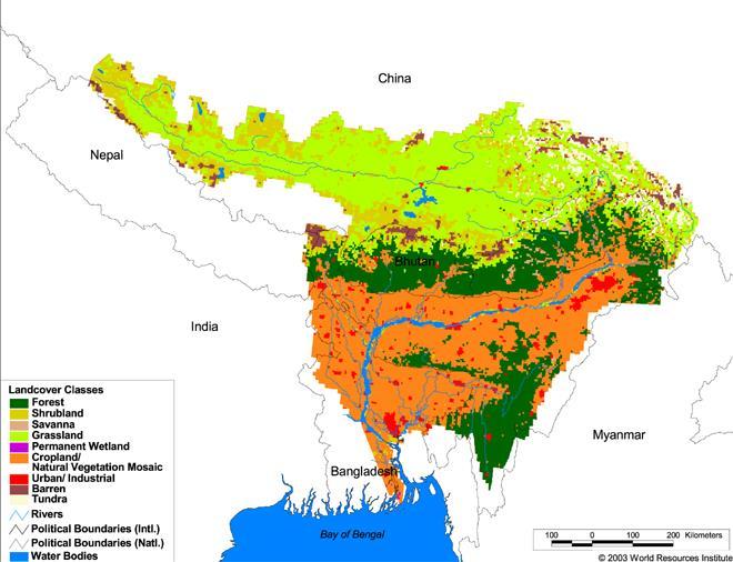

2 Brahmaputra-Meghna Basin(China, Bhutan, India, Bangladesh) Source: ICIMOD


3 Shared river regime Siang, Dibang, Lohit, Subansiri, Jia Dhal, Singora, Ranganadi, Dikrong, Buroi, Borgang, Jia Bharali, Burhidihing, Noa- Dihing

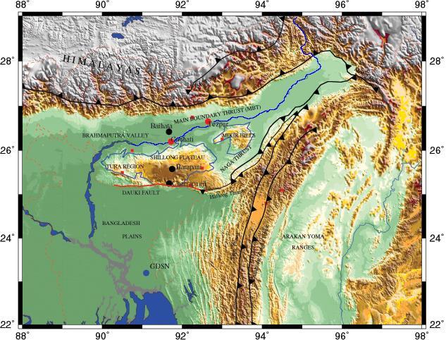
4 RIVER SYSTEM OF THE BRAHMAPUTRA & BARAK RIVER BASIN
5 Upstream-Downstream Interaction: A gravity driven natural mechanism for distribution of matter and energy fluxes depending on topography, morphology, weather-climate and natural ecosystems Activities and interventions on the upstream of a river and its catchment always has an impact on the downstream of the river as well as its catchment
6 Upstream-Downstream Interaction Everybody lives in downstream Upstream-Downstream issues cover intrastate/intra-country and inter-state/international(trans-national) domains In the AP-Assam axis, DOWNSTREAM(DS) is not only Assam but also a large part of AP Collaboration and cooperation between US-DS areas is a must for equitable sharing of benefits of water resources
7 US-DS Interaction in NE India GLOF and LDOF Flash floods generated in Trans-Himalayas affecting AP and Assam(Yiggiong LDOF Floods, 200 June) Flash floods in Garo hills created havoc in Assam in 2004 and 2014 LDOF in Bhutan in Sattischu river created flood havoc in Western Assam in 2004 River avulsion of Dibang pushed Lohit southward and changed the land-water dynamics of the Dibru-Saikhowa landscape in Assam
8 Water level variation at Dibrugarh ( ) YEAR EFFECT OF 1950 EARTHQUAKE ON RIVER REGIME, Source: Goswami and Das, 2002

")

9 Landslide Damming of Brahmaputra (Tsangpo) Tributary in Tibet, June, 2000

10 LDOF: Tibet-Arunachal Border, June 2000

11 Landslide dam induced flooding-2004 A landslide-induced lake on the Tsatichhu river, about 35 kilometres from the Kurichu Hydropower Project, breached at about 4.20 pm on Saturday, July 10, As a result the Kurichu dam released water to the river that flooded Beki-Manas rivers. As a result catastrophic floods gripped Western Assam in 2004 causing unprecedented loss in lives and property

12 Potentially Dangerous Glacial Lakes in Bhutan


13 Flash flood due to heavy rainfall episode, cloud burst, LDOF, GLOF and river dam Flash Flood Havoc at Goalpara, October 7-12, 2004


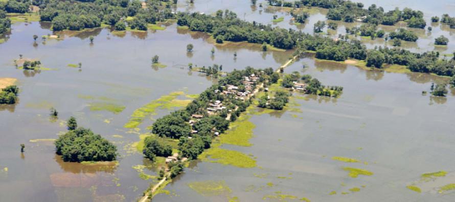
14 Goalpara flash flood- September 22-23, 2014

15 Video Showing flood Devastation of River Gai on 15 th August, 2011

16 The Maguri-Motapung Beel Complex, Tinsukia District, Assam

17
18 Morphological changes in Maguri- Motapung beel Avulsion of Dibang river in early 1980s Southward shift of Lohit river Incursion of the Dibru River into the MMB The beel has become both lotic and lentic in nature The original water body called Maguri beel has almost vanished mainly due to siltation(recorded up to feet) while on the south bank it is expanding mainly due to incursion of the Lohit waters. Bank erosion has become acute in the southern part threatening several villages

19 The Yarlung Zangbo Grand Canyon Chinese intervention on the Brahmaputra: A common concern
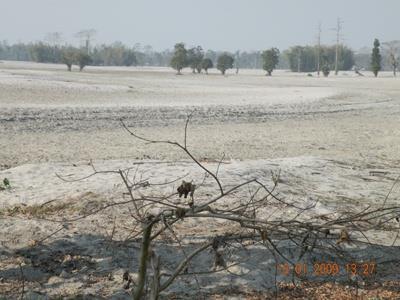
20 Implications of US-DS interaction Sedimentation of river beds and bank and flood/flash floods in Assam is determined to a great extent on processes that generate in upstream hills in AP Agriculturally valuable top soil is getting transported from AP to Assam but getting converted to silt and sand Boulder mining in the foothills cause more soil erosion from stream banks and erratic sedimentation in rivers


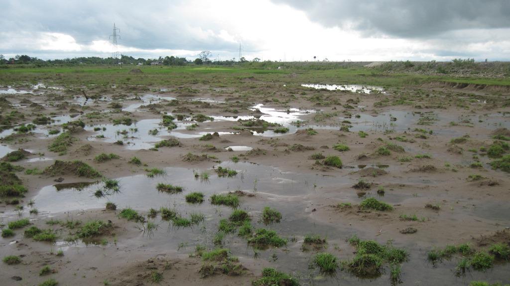
21 Floods have become erratic, more devastating and more frequent in last two decades More flash flood now accompanied with debris in tributaries of the Brhamaputra

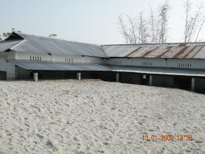
22 Disaster of Sandcasting


23 Structural Adaptation Adaptation Earthen embankment River Drupang, Lakhimpur Geo-bags for bank protection from erosion at Jiadhal(Kumatiya), Dhemaji Geo-tube embankment on the Brahmaputra at Matmora

24 7.76% of the country s total geographical area 24.6%of the country s forest area
25 Dams & DS Impacts Diurnal fluctuation of flow due to peaking power operation of dams Tunneling of rivers Environmental flow Erratic sedimentation patterns on bed and banks: uncertain mode of bank erosion Flash floods due to flow release Displacement due to flood and erosion Internal Migration and outmigration Encroachment, illegal occupation of land Conflict over land

26 Ranganadi HEP at Yazali, AP
27 DSI: RHEP Drastic reduction in lean season flow (December- February) at least by 89% Lowering of GW table, drying of drinking water sources Drying of agricultural land, drought like situations Extinction of fishes, Loss of aquatic biodiversity Loss of livelihood by fishermen community Outmigration of young men and women Internal migration of families/communities Flash floods due to flow release from dam Dolphins no longer seen in the Ranganadi


28 Downstream of Ranganadi going dry at Yazali, AP

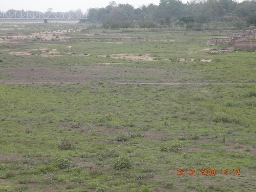


29 Downstream condition of the Ranganadi flood plain

30 Flash flood in Ranganadi downstream areas : Karatipara This bamboo bridge is damaged by floods and constructed several times a year

31 Hawa Camp in Lower Subansiri District, AP: Affected by Ranganadi Floods

32 Collapse of the Ranganadi bridge on NH-52 in the 2009 floods
33
34 Way Forward Integrated River basin management approach Watershed conservation and management Inter-state collaboration and cooperation in river basin management Collaboration between communities of Upstream & Downstream State policy on interstate rivers Integrated Flood and Erosion Management policy for states River Basin Bill of GoI under consideration Early information about river, water, flood(flood forecasting & flood early warning) Maintain E-flows
35 Need of AP-Assam Cooperation We need to develop more understanding about each other Enhance knowledge about upstream-downstream interaction in shared river basins Collaboration and cooperation in research, advocacy and intervention e.g. mitigation of flood, flash flood, erosion Set up a mechanism for Arunachal Assam Dialogue at regular intervals Take forward the dialogue to a full fledged joint action plan for promoting environmental sustainability in the long-run
DISASTER HAZARDS IN BHUTAN By Tshewang Rinzin January Reducing Disaster Risks for a Safe and Happy Bhutan
 DISASTER HAZARDS IN BHUTAN By Tshewang Rinzin 26-27 January 2009 Reducing Disaster Risks for a Safe and Happy Bhutan Disaster Hazards in Bhutan Earthquakes Glacial Lake Outburst Flood (GLOF) Floods in
Bhutan Country Report for JPTM 2010 (July, 2010) Department of Disaster Management Ministry of Home & Cultural Affairs Royal Government of Bhutan
 Department of Disaster Management Ministry of Home & Cultural Affairs Royal Government of Bhutan") Bhutan Country Report for JPTM 2010 (July, 2010) Department of Disaster Management Ministry of Home & Cultural Affairs Royal Government of Bhutan 1 Contents of Presentation 1. Disaster Hazards and Underlying
Bhutan Country Report for JPTM 2010 (July, 2010) Department of Disaster Management Ministry of Home & Cultural Affairs Royal Government of Bhutan 1 Contents of Presentation 1. Disaster Hazards and Underlying
Disaster RISK Management : Bhutanese Scenario
 Disaster RISK Management : Bhutanese Scenario Expert Group Meeting (EGM) on Geo-referenced Information Systems for Disaster Risk Management (Geo-DRM) and sustaining the Community of Practice (COP), Bangkok,
CLIMATE RESILIENT ALTITUDINAL GRADIENTS (CRAGs)
") CLIMATE RESILIENT ALTITUDINAL GRADIENTS (CRAGs) BUILDING CLIMATE CHANGE RESILIENCE IN THE KIVU- RUSIZI WATERSHEDS Great Lake Conference Entebbe 2017 Chris Magero WHAT ARE CRAGs? Climate-Resilient Altitudinal
CLIMATE RESILIENT ALTITUDINAL GRADIENTS (CRAGs) BUILDING CLIMATE CHANGE RESILIENCE IN THE KIVU- RUSIZI WATERSHEDS Great Lake Conference Entebbe 2017 Chris Magero WHAT ARE CRAGs? Climate-Resilient Altitudinal
Role of Hydro-Met Services in Disaster Risk Management
 Role of Hydro-Met Services in Disaster Risk Management Tshewang Rigzin (Mr) National Centre for Hydrology and Meteorology, Bhutan 30 th November 2017 Outline Vision and Mission Functions related to Disaster
A STUDY ON BANK EROSION AND BANK LINE MIGRATION PATTERN OF THE SUBANSIRI RIVER IN ASSAM USING REMOTE SENSING AND GIS TECHNOLOGY
 The International Journal Of Engineering And Science (IJES) Volume 2 Issue 9 Pages 01-06 2013 ISSN(e): 2319 1813 ISSN(p): 2319 1805 A STUDY ON BANK EROSION AND BANK LINE MIGRATION PATTERN OF THE SUBANSIRI
Indexing vulnerability of an embankment reach against breaching: A remote sensing and hydrodynamic based study
 European Water 60: 67-71, 2017. 2017 E.W. Publications Indexing vulnerability of an embankment reach against breaching: A remote sensing and hydrodynamic based study B. Talukdar *, A. Baid and R. Das Civil
RS and GIS based assessment of Bank Erosion in Goalparaa District part of Brahmaputra River, Assam, India
 Short Review Paper International Research Journal of Earth Sciences ISSN 2321 2527 RS and GIS based assessment of Bank Erosion in Goalparaa District part of Brahmaputra River, Assam, India Abstract G.
COUNTRY PRESENTATION ON MR JAYNAL ABEDIN JOINT SECRETARY ( WORKS & DEVELOPMENT ) MINISTRY OF DEFENCE
 MINISTRY OF DEFENCE") COUNTRY PRESENTATION ON By MR JAYNAL ABEDIN JOINT SECRETARY ( WORKS & DEVELOPMENT ) MINISTRY OF DEFENCE Bangladesh Geographical Location of Bangladesh Bangladesh Country at a Glance Physical Features 1,230
COUNTRY PRESENTATION ON By MR JAYNAL ABEDIN JOINT SECRETARY ( WORKS & DEVELOPMENT ) MINISTRY OF DEFENCE Bangladesh Geographical Location of Bangladesh Bangladesh Country at a Glance Physical Features 1,230
Flood Forecasting in Bangladesh
 Flood Forecasting in Bangladesh Types of Flood ing Flood ing can be divided into two categories: Flood ing in the rivers caused by upstream rise of river stage as well as rainfall in the basin. Overland
Temporal changes of Fluvio-Morphological scenario and its impact on Settlement: A GIS based study for Mandia block, Barpeta District, Assam
 Temporal changes of Fluvio-Morphological scenario and its impact on Settlement: A GIS based study for Mandia block, Barpeta District, Assam R.K. Sarmah 1, U. Sarma 2 1,2 Assam Remote Sensing Application
Impact of River Bank Erosion on Land Cover in Lower Subansiri River Flood Plain
 International Journal of Scientific and Research Publications, Volume 6, Issue 5, May 2016 480 Impact of River Bank Erosion on Land Cover in Lower Subansiri River Flood Plain Dr. L.T. Sasang Guite * &
Effect of Soil Properties on River Bank Erosion in Lower Assam Region
 International Journal of Res. In Engg. & Management Vol. 1 No.1. 2016. Pp. 7-15 Copyright by CRDEEP Journals. All Rights Reserved Full Length Research Paper Effect of Soil Properties on River Bank Erosion
Disaster Management in Bhutan
 ROYAL GOVERNMENT OF BHUTAN Disaster Management in Bhutan Tshering Wangchuk ROYAL GOVERNMENT OF BHUTAN EARTH FIRE WATER AIR ROYAL GOVERNMENT OF BHUTAN Presentation Outline Various Hazards in Bhutan Major
Stability Analysis of Flood Protection Embankments and Riverbank Protection Works
 Missouri University of Science and Technology Scholars' Mine International Conferences on Recent Advances in Geotechnical Earthquake Engineering and Soil Dynamics 1 - Fifth International Conference on
Geographical location and climatic condition of the
 Geographical location and climatic condition of the study sites North eastern region of India is comprised of eight states namely; Arunachal Pradesh, Assam, Manipur, Meghalaya, Mizoram, Nagaland, Sikkim
Flood management in Namibia: Hydrological linkage between the Kunene River and the Cuvelai Drainage System: Cuvelai-Etosha Basin
 Flood management in Namibia: Hydrological linkage between the Kunene River and the Cuvelai Drainage System: Cuvelai-Etosha Basin By: Leonard Hango Department of Water Affairs and Forestry Ministry of Agriculture
ICIMOD Responding to Mountain Challenges in the Hindu Kush- Himalayas
 ICIMOD Responding to Mountain Challenges in the Hindu Kush- Himalayas Eklabya Sharma International Centre for Integrated Mountain Development Kathmandu, Nepal Regional Intergovernmental Learning and Knowledge
Sedimentation in the Nile River
 Advanced Training Workshop on Reservoir Sedimentation Sedimentation in the Nile River Prof. Dr. Abdalla Abdelsalam Ahmed 10-16 Oct. 2007, IRTCES, Beijing, China CWR,Sudan 1 Water is essential for mankind
CASE STUDY NATHPA JHAKRI, INDIA
 SEDIMENT MANAGEMENT CASE STUDY NATHPA JHAKRI, INDIA Key project features Name: Nathpa Jhakri Country: India Category: reduce sediment production (watershed management); upstream sediment trapping; bypass
Geo-information and Disaster Risk Reduction in the Hindu Kush-Himalayan region
 Geo-information and Disaster Risk Reduction in the Hindu Kush-Himalayan region Basanta Shrestha, Division Head MENRIS, International Centre for Integrated Mountain Development Kathmandu, Nepal The International
Geographic Information Infrastructure and Policy Framework for Sustainable Mountain Development in the Hindu Kush-Himalayas
 Geo SMART ASIA 2017 22-24 August, Kualalampur Geographic Information Infrastructure and Policy Framework for Sustainable Mountain Development in the Hindu Kush-Himalayas Basanta Shrestha, Director Strategic
CR AAO Bridge. Dead River Flood & Natural Channel Design. Mitch Koetje Water Resources Division UP District
 CR AAO Bridge Dead River Flood & Natural Channel Design Mitch Koetje Water Resources Division UP District Old County Road AAO Bridge Map courtesy of Marquette County Silver Lake Basin McClure Basin
and the Myanmar economy World Water Day, 2018
 and the Myanmar economy World Water Day, 2018 Hannah.baleta@panda.org Three key messages Myanmar is growing economically and developing socially with a large dependency on natural resources such as the
CASE STUDY NATHPA JHAKRI, INDIA
 SEDIMENT MANAGEMENT CASE STUDY NATHPA JHAKRI, INDIA Key project features Name: Nathpa Jhakri Country: India Category: reforestation/revegetation; upstream sediment trapping; bypass channel/tunnel; reservoir
UNIT 11 SOUTH ASIA SG 1 - PHYSICAL GEOGRAPHY & THE ENVIRONMENT
 UNIT 11 SOUTH ASIA SG 1 - PHYSICAL GEOGRAPHY & THE ENVIRONMENT I. PHYSICAL GEOGRAPHY TAKE OUT YOUR PHYSICAL MAP OF SOUTH ASIA A. The Himalayan Mountains form the northern boundary of the region (color
INTERNATIONAL JOURNAL OF GEOMATICS AND GEOSCIENCES Volume 4, No 1, 2013
 INTERNATIONAL JOURNAL OF GEOMATICS AND GEOSCIENCES Volume 4, No 1, 2013 Copyright 2010 All rights reserved Integrated Publishing services Research article ISSN 0976 4380 Flood risk zone mapping of the
FOREST RESEARCH INSTITUTE, DEHRADUN
 PROJECT REPORT DRAINAGE AND REPLENISHMENT STUDY OF MINED AREA OF GANGA SHYAMPUR RIVER HARIDWAR Submitted to UTTARAKHAND FOREST DEVELOPMENT CORPORATION (UFDC) 73, Nehru Road, Deharadun Prepared&Submitted
Natural Disaster Preparedness for Hydropower Projects in High Mountain Environments
 Natural Disaster Preparedness for Hydropower Projects in High Mountain Environments John M. Reynolds Reynolds International Ltd Suite 2, Broncoed House Broncoed Business Park Wrexham Road Mold Flintshire
GEOSPATIAL TECHNOLOGY IN HUMANITARIMAPPING A CASE STUDY OF KOSI RIVER FLOODS: 2008, INDIA
 GEOSPATIAL TECHNOLOGY IN HUMANITARIMAPPING A CASE STUDY OF KOSI RIVER FLOODS: 2008, INDIA APARAJITA GAHTAK ACTED, India B5/18, Safderjung Enclave, New Delhi 110029 Delhi.gis@acted.org Abstract: About the
GIS as a tool in flood management
 GIS for the United Nations and the International Community Conference Panel: GIS and Capacity - How Territorial Planning Benefits from Geospatial Information 3-5 April 2012 Geneva, Switzerland GIS as a
Recent extreme weather events in the Nepal Himalayas
 The Extremes ofthe Extremes: Extraordinary Floods (Proceedings of n symposium held al Reykjavik. Iceland. July 2000). lalispubl.no. 271. 2002. 141 Recent extreme weather events in the Nepal Himalayas SURESH
Term Knowledge Using and applying Grade Criteria Autumn 1 Assessment window October Natural hazards pose major risks to people and property.
 Assessment Schedule Year 9 2015/6 Term Knowledge Using and applying Grade Criteria Autumn 1 Assessment window October 2015 3.1.1.2 Tectonic Natural hazards pose major risks to people and property. Definition
A Roundup of Recent Debris Flow Events in Taiwan
 2015 International Workshop on Typhoon and Flood APEC Experience Sharing on Hazardous Weather Events and Risk Management A Roundup of Recent Debris Flow Events in Taiwan Hsiao-Yuan(Samuel) Yin Ph.D. sammya@mail.swcb.gov.tw
Building the Climate Change Resilience in the Lake Kivu and Rusizi River Catchments: CRAGs II project
 Building the Climate Change Resilience in the Lake Kivu and Rusizi River Catchments: CRAGs II project Project countries: Rwanda and Burundi Project Area: Sebeya and Ruhwa River Systems (Rwanda), Muhira
Paper presented in the Annual Meeting of Association of American Geographers, Las Vegas, USA, March 2009 ABSTRACT
 Paper presented in the Annual Meeting of Association of American Geographers, Las Vegas, USA, March 2009 ABSTRACT CHANGING GEOMORPHOLOGY OF THE KOSI RIVER SYSTEM IN THE INDIAN SUBCONTINENT Nupur Bose,
Analysis of Historical Pattern of Rainfall in the Western Region of Bangladesh
 24 25 April 214, Asian University for Women, Bangladesh Analysis of Historical Pattern of Rainfall in the Western Region of Bangladesh Md. Tanvir Alam 1*, Tanni Sarker 2 1,2 Department of Civil Engineering,
ENGINEERING HYDROLOGY
 ENGINEERING HYDROLOGY Prof. Rajesh Bhagat Asst. Professor Civil Engineering Department Yeshwantrao Chavan College Of Engineering Nagpur B. E. (Civil Engg.) M. Tech. (Enviro. Engg.) GCOE, Amravati VNIT,
The Flood Situation of Assam A Case Study
 Abstract The Flood Situation of Assam A Case Study Mukul Chandra Bora Lecturer (Sélection Grade) in Civil Engineering Dibrugarh Polytechnic, Lahowal: Pin: 786010 Assam, India The problem caused by water
The Effects of Hydraulic Structures on Streams Prone to Bank Erosion in an Intense Flood Event: A Case Study from Eastern Hokkaido
 Symposium Proceedings of the INTERPRAENENT 2018 in the Pacific Rim The Effects of Hydraulic Structures on Streams Prone to Bank Erosion in an Intense Flood Event: A Case Study from Eastern Hokkaido Daisuke
Grant 0299-NEP: Water Resources Project Preparatory Facility
 Document Produced under Grant Project Number: 45206 May 2016 Grant 0299-NEP: Water Resources Project Preparatory Facility Final Report Volume 3 East Rapti (1 of 9) Prepared by Pvt. Ltd. For Ministry of
mountain rivers fixed channel boundaries (bedrock banks and bed) high transport capacity low storage input output
 high transport capacity low storage input output") mountain rivers fixed channel boundaries (bedrock banks and bed) high transport capacity low storage input output strong interaction between streams & hillslopes Sediment Budgets for Mountain Rivers Little
mountain rivers fixed channel boundaries (bedrock banks and bed) high transport capacity low storage input output strong interaction between streams & hillslopes Sediment Budgets for Mountain Rivers Little
Fukien Secondary School Monthly Vocabulary/Expression List for EMI Subjects Secondary Two. Subject: Geography
 Focus: General Specific : Section Two : Unit One 1 Landslide 2 Downslope movement 3 Rock 4 Soil 5 Gravity 6 Natural hazard 7 Rainwater 8 Friction 9 Hilly relief 10 Unstable 11 Season 12 Saturated 13 Construction
Report on Disaster statistics of Nepal
 Report on Disaster statistics of Nepal Submitted by Altaf Rehman Submitted to Dr. Naveed Ahmed University of engineering and technology Peshawar Assignment 1 Section A Registration id 14PWCIV456 Page 1
Geography Class XI Fundamentals of Physical Geography Section A Total Periods : 140 Total Marks : 70. Periods Topic Subject Matter Geographical Skills
 Geography Class XI Fundamentals of Physical Geography Section A Total Periods : 140 Total Marks : 70 Sr. No. 01 Periods Topic Subject Matter Geographical Skills Nature and Scope Definition, nature, i)
Creating a WeatherSMART nation: SAWS drought related research, services and products
 Creating a WeatherSMART nation: SAWS drought related research, services and products Drought Dialogue 23-24 June 2016 Western Cape Government Hannes Rautenbach South African Weather Service SAWS mandate
Use of Geospatial data for disaster managements
 Use of Geospatial data for disaster managements Source: http://alertsystemsgroup.com Instructor : Professor Dr. Yuji Murayama Teaching Assistant : Manjula Ranagalage What is GIS? A powerful set of tools
Description DESCRIPTION
 DESCRIPTION The location of the Upper James Watershed is located in northeastern South Dakota as well as southeastern North Dakota. It includes the following counties located in North Dakota Barnes, Dickey,
APPROACH TO THE SPANISH WATER ORGANISATION IMPROVING FLOOD HAZARD MAPPING, LAWS AND AUTHORITIES COORDINATION
 "Workshop On Land Use Planning And Water Management, With Focus On Flood Risk Management Oslo, Norway. Wednesday 31 January and Thursday 1 February 2007 APPROACH TO THE SPANISH WATER ORGANISATION IMPROVING
International Journal of Modern Trends in Engineering and Research e-issn No.: , Date: April, 2016
 International Journal of Modern Trends in Engineering and Research www.ijmter.com e-issn No.:2349-9745, Date: 28-30 April, 2016 Landslide Hazard Management Maps for Settlements in Yelwandi River Basin,
CHAPTER 12 NATURAL DISASTERS
 CHAPTER 12 NATURAL DISASTERS In this chapter, you learn about the following: Natural calamities cyclones causes, effects and preventive measures Floods causes, affected areas, effects and control Land
Flood Hazard Vulnerability Mapping Using Remote Sensing and GIS: A Case Study of Surat Dhruvesh KM 1*, Praful MU 2 and Aditya MV 1 1
 Flood Hazard Vulnerability Mapping Using Remote Sensing and GIS: A Case Study of Surat Dhruvesh KM 1*, Praful MU 2 and Aditya MV 1 1 CU Shah University, Wadhwan, India 2 ISTAR-CVM, Vallabh Vidyanagar,
RISK ASSESSMENT COMMUNITY PROFILE NATURAL HAZARDS COMMUNITY RISK PROFILES. Page 13 of 524
 RISK ASSESSMENT COMMUNITY PROFILE NATURAL HAZARDS COMMUNITY RISK PROFILES Page 13 of 524 Introduction The Risk Assessment identifies and characterizes Tillamook County s natural hazards and describes how
Flood Inundation Mapping under different climate change scenarios in the upper Indus River Basin, Pakistan
 Flood Inundation Mapping under different climate change scenarios in the upper Indus River Basin, Pakistan Sohaib Baig (doctoral student) 16 November 2017 Disaster Prevention Research Institute 1 Kyoto
Assessing Climate Change Vulnerability of Cultural Resources
 National Park Service U.S. Department of the Interior Klondike Gold Rush National Historical Park Assessing Climate Change Vulnerability of Cultural Resources Cultural Resources Caitlin Rankin, YLCC Climate
Science of Natural Disasters: RIVERS& FLOODS! 27 April 2016
 Science of Natural Disasters: RIVERS& FLOODS! 27 April 2016 Rebecca Clotts Department of Geology, University of St Thomas Flood in St Paul, 2014, Star Tribune 1 2 What is a watershed? 3 4 5 6 7 What is
VULNERABILITY OF WATER SUPPLY TO NATURAL HAZARDS IN JAMAICA
 VULNERABILITY OF WATER SUPPLY TO NATURAL HAZARDS IN JAMAICA RAFI AHMAD rafi.ahmad@uwimona.edu.jm Unit for disaster studies, Department of Geography & Geology, The University of the West Indies, Mona Kingston
Chapter-3 GEOGRAPHICAL LOCATION, CLIMATE AND SOIL CHARACTERISTICS OF THE STUDY SITE
 Chapter-3 GEOGRAPHICAL LOCATION, CLIMATE AND SOIL CHARACTERISTICS OF THE STUDY SITE Chapter-3 GEOGRAPHICAL LOCATION, CLIMATE AND SOIL CHARACTERISTICS OF THE STUDY SITE Assam, the eastern most state of
Morphodynamic changes of Lohit River, NE India: GIS-based study
 Morphodynamic changes of Lohit River, NE India: GIS-based study S. Borgohain 1, *, J. Das 2, A. K. Saraf 1, G. Singh 1 and S. S. Baral 1 1 Department of Earth Sciences, Indian Institute of Technology Roorkee,
Skeletal remains of what was a debris-covered glacier near Mt. Everest
 Annual satellite imaging of the world s glaciers Assessment of glacier extent and change GLIMS Development and population of a digital glacier data inventory HIGH ICE Skeletal remains of what was a debris-covered
Flash flood disaster in Bayangol district, Ulaanbaatar
 Flash flood disaster in Bayangol district, Ulaanbaatar Advanced Training Workshop on Reservoir Sedimentation Management 10-16 October 2007. IRTCES, Beijing China Janchivdorj.L, Institute of Geoecology,MAS
Science EOG Review: Landforms
 Mathematician Science EOG Review: Landforms Vocabulary Definition Term canyon deep, large, V- shaped valley formed by a river over millions of years of erosion; sometimes called gorges (example: Linville
Climate Science to Inform Climate Choices. Julia Slingo, Met Office Chief Scientist
 Climate Science to Inform Climate Choices Julia Slingo, Met Office Chief Scientist Taking the planet into uncharted territory Impacts of climate change will be felt most profoundly through hazardous weather
Decision Support System for Climate Change Adaptation and Management of Water Hazards in River Basins: The Case of Cagayan River Basin, Philippines
 Decision Support System for Climate Change Adaptation and Management of Water Hazards in River Basins: The Case of Cagayan River Basin, Philippines Orlando F. Balderama Visiting Professor 33 rd RECWET
This table connects the content provided by Education Perfect to the NSW Syllabus.
 Education Perfect Geography provides teachers with a wide range of quality, engaging and innovative content to drive positive student learning outcomes. Designed by teachers and written by our in-house
Floods Lecture #21 20
 Floods 20 Lecture #21 What Is a Flood? Def: high discharge event along a river! Due to heavy rain or snow-melt During a flood, a river:! Erodes channel o Deeper & wider! Overflows channel o Deposits sediment
Chapter 2 Planet Earth
 Chapter 2 Planet Earth Section Notes Earth and the Sun s Energy Water on Earth The Land Close-up The Water Cycle World Almanac Major Eruptions in the Ring of Fire Quick Facts Chapter 2 Visual Summary Video
8 Current Issues and Research on Sediment Movement in the River Catchments of Japan
 8 Current Issues and Research on Sediment Movement in the River Catchments of Japan YUTAKA ICHIKAWA INTRODUCTION Prediction of sediment movement is one of the challenging tasks in water-related research.
Module 3, Investigation 1: Briefing 2 The ENSO game: Predicting and managing for El Niño and La Niña
 Part 5. The ENSO game How can prediction help avoid ENSO s tragic human consequences? Scientists from around the world are involved in forecasting, with computer models and sophisticated measurements,
Haiti and Dominican Republic Flash Flood Initial Planning Meeting
 Dr Rochelle Graham Climate Scientist Haiti and Dominican Republic Flash Flood Initial Planning Meeting September 7 th to 9 th, 2016 Hydrologic Research Center http://www.hrcwater.org Haiti and Dominican
The U.S. National Integrated Drought Information System. Roger S. Pulwarty National Oceanic and Atmospheric Administration USA
 The U.S. National Integrated Drought Information System Roger S. Pulwarty National Oceanic and Atmospheric Administration USA Drought: Weather-climate continuum and adaptation deficits 2010 2011 2012 2015
2018 Geography Mock Examination
 2018 Geography Mock Examination Your Geography mock examination will test your understanding of Paper 1 (Living with the physical environment) and Section B (Fieldwork) from Paper 2. Attached are the necessary
Erosion Surface Water. moving, transporting, and depositing sediment.
 + Erosion Surface Water moving, transporting, and depositing sediment. + Surface Water 2 Water from rainfall can hit Earth s surface and do a number of things: Slowly soak into the ground: Infiltration
GG101 Lecture 22: Mass Wasting. Soil, debris, sediment, and broken rock is called regolith.
 GG101 Lecture 22: Mass Wasting Mass Wasting is the movement of rock and soil down a slope due to the force of gravity. Soil, debris, sediment, and broken rock is called regolith. Mass wasting creates broad
Proposal Report On Flood Hazards Mapping Project In Xebangfai River
 Proposal Report On Flood Hazards Mapping Project In Xebangfai River Prepared By Mr. Boualaythong KOUMPHONH Climate Division Department of Meteorology and Hydrology Water Resources and Environment Administration
UGRC 144 Science and Technology in Our Lives/Geohazards
 UGRC 144 Science and Technology in Our Lives/Geohazards Flood and Flood Hazards Dr. Patrick Asamoah Sakyi Department of Earth Science, UG, Legon College of Education School of Continuing and Distance Education
Climate Change and Climate Trends in Our Own Backyard
 Climate Change and Climate Trends in Our Own Backyard Dr. Mark Seeley Department of Soil, Water, and Climate University of Minnesota St Paul, MN 55108 For IATP: Rural Climate Dialogue Grand Rapids, MN
Chapter 10. Running Water aka Rivers. BFRB Pages
 Chapter 10 Running Water aka Rivers BFRB Pages 101-116 Stream Erosion and Transportation Running water is all precipitation (rain, snow, etc) that falls on Earth and is pulled downhill by gravity. Running
Title: Concepts of Flood Risk
 Title: Concepts of Flood Risk Title Prepared by: Dr. Mohammed Abdulkadir and Dr. Micha Werner Outline of presentation Hazards Flood Event Flood losses Classification of floods Flood management Concepts
Floodplain Modeling and Mapping Using The Geographical Information Systems (GIS) and Hec-RAS/Hec-GeoRAS Applications. Case of Edirne, Turkey.
 and Hec-RAS/Hec-GeoRAS Applications. Case of Edirne, Turkey.") Floodplain Modeling and Mapping Using The Geographical Information Systems (GIS) and Hec-RAS/Hec-GeoRAS Applications. Case of Edirne, Turkey. Fuad Hajibayov *1, Basak Demires Ozkul 1, Fatih Terzi 1 1 Istanbul
Floodplain Modeling and Mapping Using The Geographical Information Systems (GIS) and Hec-RAS/Hec-GeoRAS Applications. Case of Edirne, Turkey. Fuad Hajibayov *1, Basak Demires Ozkul 1, Fatih Terzi 1 1 Istanbul
Yield of Water Discharge and Rainfall Seasonality in and around Barnadi River Basin, Assam: India
 EUROPEAN ACADEMIC RESEARCH Vol. III, Issue 1/ April 2015 ISSN 2286-4822 www.euacademic.org Impact Factor: 3.4546 (UIF) DRJI Value: 5.9 (B+) Yield of Water Discharge and Rainfall Seasonality in and DIPAK
Hazard Zonation for Glacial Lake Outburst Flood (GLOF) in Bhutan Himalaya
 in Bhutan Himalaya") Hazard Zonation for Glacial Lake Outburst Flood (GLOF) in Bhutan Himalaya A mode of Adaptation to the impacts of climate change DGM-NCAP Project Karma Department of Geology & Mines Ministry of Economic
Hazard Zonation for Glacial Lake Outburst Flood (GLOF) in Bhutan Himalaya A mode of Adaptation to the impacts of climate change DGM-NCAP Project Karma Department of Geology & Mines Ministry of Economic
United States Multi-Hazard Early Warning System
 United States Multi-Hazard Early Warning System Saving Lives Through Partnership Lynn Maximuk National Weather Service Director, Central Region Kansas City, Missouri America s s Weather Enterprise: Protecting
Landslide Disaster Management in Sri Lanka and Nichola Oya as a Case study. Group 16 Gamini Jayathissa Udeni Nawagamuwa
 Landslide Disaster Management in Sri Lanka and Nichola Oya as a Case study Group 16 Gamini Jayathissa Udeni Nawagamuwa Taiwan Sri lanka >2582 mm, max >5000mm NE= Nov. to Feb 1750 2500 mm >2500 mm Central
GIRLS SECON DARY - MRIEĦEL HALF-YEARLY EXAMINATIONS 2016/2017
 GIRLS SECON DARY - MRIEĦEL HALF-YEARLY EXAMINATIONS 2016/2017 FORM: 4 Time: 1 ½ hrs Name: Class: Section A: Weather and Climate 1. Place the following weather conditions under the appropriate heading.
EFFECTS OF DEBRIS-FLOW CONTROL WORKS ON ENVIRONMENT AND CONSEQUENCES FOR LAND-USE PLANNING CASE STUDY MURBACH, TYROL, AUSTRIA
 EFFECTS OF DEBRIS-FLOW CONTROL WORKS ON ENVIRONMENT AND CONSEQUENCES FOR LAND-USE PLANNING CASE STUDY MURBACH, TYROL, AUSTRIA Joerg Heumader 1* ABSTRACT The torrent Murbach is one of the most dangerous
Debris flow: categories, characteristics, hazard assessment, mitigation measures. Hariklia D. SKILODIMOU, George D. BATHRELLOS
 Debris flow: categories, characteristics, hazard assessment, mitigation measures Hariklia D. SKILODIMOU, George D. BATHRELLOS Natural hazards: physical phenomena, active in geological time capable of producing
Impact of Climate Change on Riverbank Erosion
 International Journal of Sciences: Basic and Applied Research (IJSBAR) ISSN 2307-4531 http://gssrr.org/index.php?journal=journalofbasicandapplied Impact of Climate Change on Riverbank Erosion Most. Nazneen
Historical channel change on the Upper Gila River, Arizona and New Mexico in response to anthropogenic modifications and extreme floods
 Historical channel change on the Upper Gila River, Arizona and New Mexico in response to anthropogenic modifications and extreme floods www.archives.gov www.paztcn.wr.usgs.gov wrh.noaa.gov Upper Gila River
Eagle Creek Post Fire Erosion Hazard Analysis Using the WEPP Model. John Rogers & Lauren McKinney
 Eagle Creek Post Fire Erosion Hazard Analysis Using the WEPP Model John Rogers & Lauren McKinney Columbia River Gorge at Risk: Using LiDAR and GIS-based predictive modeling for regional-scale erosion susceptibility
Domino Effect of River Training in Large Sand-Bed Braiding Rivers
 6 th International Conference on Structural Engineering and Construction Management 2015, Kandy, Sri Lanka, 11 th -13 th December 2015 SECM/15/176 Domino Effect of River Training in Large Sand-Bed Braiding
Managing Floods at Boscastle. Learning Objective: Examine the benefits of managing floods
 Managing Floods at Boscastle Learning Objective: Examine the benefits of managing floods Learning Outcomes: Describe how Boscastle has been affected by flooding Explain strategies to reduce the risk Evaluate
Step 5: Channel Bed and Planform Changes
 Step 5: Channel Bed and Planform Changes When disturbed, streams go through a series of adjustments to regain equilibrium with the flow and sediment supply of their watersheds. These adjustments often
David R. Vallee Hydrologist-in-Charge NOAA/NWS Northeast River Forecast Center
 David R. Vallee Hydrologist-in-Charge NOAA/NWS Northeast River Forecast Center Record flooding along the Shawsheen River during the 2006 Mother s Day Floods Calibrate and implement a variety of hydrologic
EFFECT OF SAND MINING ACTIVITY ON THE SEDIMENT CONTROL SYSTEM (A CASE STUDY OF SOMBE-LEWARA RIVER, DONGGALA, INDONESIA)
") Civil Engineering Forum Volume XXI/1 - January 01 EFFECT OF SAND MINING ACTIVITY ON THE SEDIMENT CONTROL SYSTEM (A CASE STUDY OF SOMBE-LEWARA RIVER, DONGGALA, INDONESIA) Y. A. Bawias Agency of Public Works,
Civil Engineering Forum Volume XXI/1 - January 01 EFFECT OF SAND MINING ACTIVITY ON THE SEDIMENT CONTROL SYSTEM (A CASE STUDY OF SOMBE-LEWARA RIVER, DONGGALA, INDONESIA) Y. A. Bawias Agency of Public Works,
24.0 Mineral Extraction
 Chapter 24 - Mineral Extraction 24.0 Mineral Extraction 24.1 Introduction Apart from gravel, sand, rock, limestone and salt extraction in relatively small quantities mineral extraction is not a strong
TABLE OF CONTENTS LIST OF TABLES. Page
 TABLE OF CONTENTS Page 11.0 EFFECTS OF THE ENVIRONMENT ON THE PROJECT... 11-1 11.1 Weather Conditions... 11-1 11.2 Flooding... 11-2 11.3 Forest Fires... 11-2 11.4 Permafrost and Subsidence Risk... 11-3
Data challenges in Trans-boundary River Basins: Case Study of the Upper Indus Basin
 Data challenges in Trans-boundary River Basins: Case Study of the Upper Indus Basin Asif Khan Lead Author (Water chapter- AR6 IPCC) Post Doctorate (Water-Energy-Food-Climate Change, IIASA, Austria) PhD
JCOMM-CHy Coastal Inundation Forecasting Demonstration Project (CIFDP)
") WMO World Meteorological Organization Working together in weather, climate and water JCOMM-CHy Coastal Inundation Forecasting Demonstration Project (CIFDP) Coastal Flooding & Vulnerable Populations Coastal
WMO World Meteorological Organization Working together in weather, climate and water JCOMM-CHy Coastal Inundation Forecasting Demonstration Project (CIFDP) Coastal Flooding & Vulnerable Populations Coastal
Measures Also Significant Factors of Flood Disaster Reduction
 Non-Structual Measures Also Significant Factors of Flood Disaster Reduction Babiaková Gabriela, Leškov ková Danica Slovak Hydrometeorological Institute, Bratislava Hydrological Forecasts and Warning Department