Addressing water quantity and quality concerns in the Peace-Athabasca Delta, northern Alberta, from perspectives of the past
|
|
|
- Stephen Blair
- 5 years ago
- Views:
Transcription
 and Tom Edwards (Earth U Waterloo) and many others Funding Sources / Partners: NSERC, BC")
1 Addressing water quantity and quality concerns in the Peace-Athabasca Delta, northern Alberta, from perspectives of the past Brent Wolfe, PhD Associate Professor Department of Geography and Environmental Studies Wilfrid Laurier University with contributions from Roland Hall (Biology U Waterloo) and Tom Edwards (Earth U Waterloo) and many others Funding Sources / Partners: NSERC, BC Hydro, PREA, AANDC, PCSP, CFI/OIT, WBNP, Suncor Energy

2 It ain t what you don t know that gets you into trouble. It s what you know for sure that just ain t so. [Mark Twain]
 back in time 1960 Climate Change Columbia Glacier [www.connectingthedrops.ca] 1950 500 1000 1500")
3 WAC Bennett Dam since 1968 Alberta oil sands since 1967 sediment cores year AD Athabasca R mean monthly discharge (Apr-Aug m 3 /s) back in time 1960 Climate Change Columbia Glacier [
4 Peace- Athabasca Delta Peace River Lake Athabasca Lake Clair Athabasca River

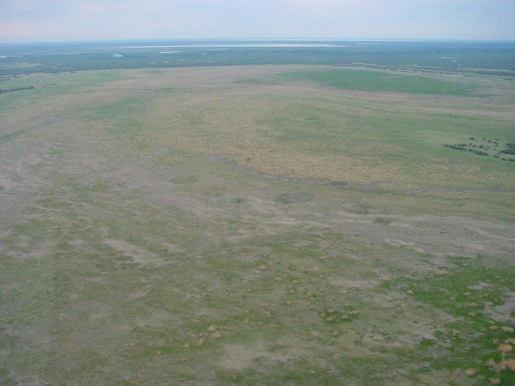
5 Peace Sector a relict delta (infrequently flooded landscape)

6

7

 Mamawi")
8 Athabasca Sector an active delta (frequently flooded landscape) Mamawi Creek Delta

9
10


11

12 Fort Chipewyan, Alberta


13 Peace-Athabasca Delta Non-flood conditions: July 1, 1975 Ice-jam flood: May 22, 1974 Internationally significant (UNESCO World Heritage Site). Many lakes and wetlands rely on periodic recharge from floods.


14 The Peace-Athabasca Delta: Water Level Fluctuations desiccation flooded trees high water marks dead willow fringe

 June 1994 Concern over drying of the delta has developed due to construction of the WAC Bennett Dam on the Peace")
15 Peace-Athabasca Delta Air photo of Mamawi and Jemis Lakes after icejam flood event of 1974 Jemis Lake was generally dry from the mid-1980s to the mid-1990s Mamawi Lake Jemis Lake Mamawi Lake Jemis Lake July 1974 (from Prowse et al. 1996) (from Prowse et al. 1996) June 1994 Concern over drying of the delta has developed due to construction of the WAC Bennett Dam on the Peace River in 1968 and the absence of a major flood for over 20 years from the mid-1970s to the mid-1990s.


16 Gravity Coring Lake Sediments: Archives of Past Hydrology and Ecology


17 Lake Sediments: Archives of Past Hydrology and Ecology Russian Coring


18 Upland Peace Sector - Flood Frequency Record PAD 15 ( Pete s Creek ) PAD 15

")
")
")
")
")
19 PAD 15 Sediment Core Section 1 (0-92 cm) Section 2 ( cm) Section 3 ( cm) Section 4 ( cm) Section 5 ( cm) Section 6 ( cm)
20 year AD low flow high flow PAD 15 sill threshold 1974 flood threshold major floods PAD 15: Flood Frequency Reconstruction Intervals of high flood frequency include ~ and ~ Markedly low flood frequency during the 1700s Decline in flood frequency since about Several multi-decadal intervals between major flood events magnetic susceptibility ( ) [Wolfe et al Hydrological Processes]
21 Upland Peace Sector - Hydroecological Record PAD 5 PAD 5

22 PAD 5: Hydroecological Reconstruction 2000 Wet Dry Closed-Drainage Diatoms Open-Drainage Diatoms year AD low diatom concentration isotope-inf. E/I % relative abundance [Wolfe et al Quaternary Research]
23 Major Findings Flood frequency has been in decline for many decades, beginning as early as the late 1800s. Several multi-decadal intervals without a major flood have occurred during the past 300 years. Hydrological and ecological conditions since 1968 are not outside the range of natural variability observed during the past 300 years. Evidence from lake sediments indicate that the 1700s were the driest period over the past 300 years.

24 Implications Lake sediment reconstructions have yielded no compelling evidence to suggest that ongoing flow regulation of the Peace River has had any discernable lasting effects on the hydroecology of the northern Peace sector of the delta. rather, changes in the hydroecological state of the Peace sector appear to be driven predominantly by ongoing warming, drying and naturally declining Peace River discharge over the past century.

25 A 5200-year Record of Water- Level Variation in Lake Athabasca [Wolfe et al Geophysical Research Letters]
26 A 5200-Year Perspective on Freshwater Availability Water levels appear to correspond with glacier volume variations in the Rockies. Shrinking glaciers since the 1900s correspond with declining river flow. W. Canadian society developed during a period of unusually high river flow. Periods of low water availability can persist for several centuries to millennia at a time a finding that forecasts an urgent need for stringent water policy. [Wolfe et al Geophysical Research Letters]
27 A 5200-Year Perspective on Freshwater Availability 50 years of hydrometric data? is this sufficient to develop effective water policy? [Wolfe et al Geophysical Research Letters]
28 WAC Bennett Dam since 1968 Alberta oil sands since 1967 sediment cores year AD Athabasca R mean monthly discharge (Apr-Aug m 3 /s) back in time 1960 Climate Change Columbia Glacier [

29 Alberta Oil Sands Development vs Athabasca River


30 Natural Loads

31 The Role for Studies of Lake Sediment Cores Determine concentrations of contaminants (before oil sands development) in lake sediments and recent trends. Assess role of river processes and human activities on the accumulation of contaminants in lakes of the Peace-Athabasca Delta. An approach recommended by the Federal Expert Oil Sands Advisory Panel Dowdeswell L et al. (2010) A foundation for the future: Building an environmental monitoring system for the oil sands. A report submitted to the Minister of Environment. 49 p.

32 Lake Sediment Coring Sites (September 2010): Peace-Athabasca Delta PAD 18 PAD 18 Atmospheric flux PAD 31 Fluvial flux PAD 31 PAD 23 Fluvial flux PAD 23
 from the river Mean = 0.")
 Flood deposit Mean = 0.466 mg/kg ± 0.")
 Flood deposit Proportion (0-1) Natural")

33 Concentration (mg / kg sediment) PAD 31: Polycyclic aromatic compounds (PACs) from the river Mean = mg/kg ± (1 SD) Mean = 27.1% ± 7.9 (1 SD) Flood deposit Mean = mg/kg ± (1 SD) Mean = 31.5% ± 2.8 (1 SD) Flood deposit Proportion (0-1) Natural erosion of bitumen deposits along the Athabasca River and distributaries in the oil sands region appears to be the main source of these PACs [Hall et al PLoS ONE]
 Sb (Antimony) As (Arsenic) Hg (Mercury) 1967 1800 1850 1900 1950 2000 Year (CE) % Organic Matter (LOI at 550 C) 100 80 60 40 20 0 100")
34 Extrapolation of CRS Dates PAD 18: Metals from 400 the atmosphere Total and Supported 210 Pb Activity (Bq kg -1 ) c) Adjusted Excess Flux ( g m -2 yr -1 ) Pb (Lead) Sb (Antimony) As (Arsenic) Hg (Mercury) Year (CE) % Organic Matter (LOI at 550 C) Synthetic Crude & Bitumen Production (Million m 3 ) Total Canadian Atmospheric Pb Emissions (tons yr -1 ) Total Canadian Atmospheric Hg Emissions (tons yr -1 ) [Wiklund et al Science of the Total Environment]

35


36

37 Conclusions It ain t what you don t know that gets you into trouble. It s what you know for sure that just ain t so. [Mark Twain] The processes that drive changes in the PAD operate over a broad range of spatial and temporal scales. This feature has made it extremely difficult to identify correctly the causes of observed changes. Long-term paleolimnological data identify that natural processes dominate the delivery of water and bitumen-derived PACs to the delta.
38 Societal Implications Alberta oil sands Climate-drive changes in water supply [Wolfe et al Geophys. Res. Lett.] Impending water scarcity will be a greater threat to downstream ecosystems than issues related to contaminants from the oil sands industry, which have dominated public attention and government actions.

39
Research Progress Report April 2014 University of Waterloo & Wilfrid Laurier University Researchers
 Research Progress Report April 2014 University of Waterloo & Wilfrid Laurier University Researchers Project Title: Sediment Core Sampling to Assess Contaminant Deposition to the Slave River Delta Over
Climate-driven Shifts in Quantity and Seasonality of River Discharge over the past 1000 Years from the Hydrographic Apex of North America
 Wilfrid Laurier University Scholars Commons @ Laurier Geography and Environmental Studies Faculty Publications Geography and Environmental Studies 12-2008 Climate-driven Shifts in Quantity and Seasonality
Changes in Frequency of Extreme Wind Events in the Arctic
 Changes in Frequency of Extreme Wind Events in the Arctic John E. Walsh Department of Atmospheric Sciences University of Illinois 105 S. Gregory Avenue Urbana, IL 61801 phone: (217) 333-7521 fax: (217)
How Do Human Impacts and Geomorphological Responses Vary with Spatial Scale in the Streams and Rivers of the Illinois Basin?
 How Do Human Impacts and Geomorphological Responses Vary with Spatial Scale in the Streams and Rivers of the Illinois Basin? Bruce Rhoads Department of Geography University of Illinois at Urbana-Champaign
An Assessment of Hydro-ecological Changes at Two Closed-drainage Basins in the Peace-Athabasca Delta, Alberta, Canada. By Ramila N.
 An Assessment of Hydro-ecological Changes at Two Closed-drainage Basins in the Peace-Athabasca Delta, Alberta, Canada By Ramila N. Sinnatamby A thesis presented to the University of Waterloo in fulfillment
River ice-jam modelling in MESH. Karl-Erich Lindenschmidt Prabin Rokaya, Luis Morales-Marín, Howard Wheater
 River ice-jam modelling in MESH Karl-Erich Lindenschmidt Prabin Rokaya, Luis Morales-Marín, Howard Wheater Outlook: MESH/RIVICE coupling for Peace River Lindenschmidt et al. (215) Ice jam flood hazard
3/3/2013. The hydro cycle water returns from the sea. All "toilet to tap." Introduction to Environmental Geology, 5e
 Introduction to Environmental Geology, 5e Running Water: summary in haiku form Edward A. Keller Chapter 9 Rivers and Flooding Lecture Presentation prepared by X. Mara Chen, Salisbury University The hydro
National Framework for Glacier Monitoring & Assessment National-scale Reference :
 National Framework for Glacier Monitoring & Assessment National-scale Reference : Western & Northern Cordillera High Arctic (Queen Elizabeth Islands) Low Arctic (Baffin Island) emphasis on long time series
River Response. Sediment Water Wood. Confinement. Bank material. Channel morphology. Valley slope. Riparian vegetation.
 River Response River Response Sediment Water Wood Confinement Valley slope Channel morphology Bank material Flow obstructions Riparian vegetation climate catchment vegetation hydrological regime channel
IP3 Workshop #3, November 2008, Whitehorse, Yukon
 River and Lake Ice: Quantification, Extremes and Historical i Trends; Advances under IPY cryosphere/hydrology & ArcticNet Terry Prowse Katrina Bennett Rheannon Brooks Laurent de Rham Holly Goulding Simon
A 5200 year record of freshwater availability for regions in western North America fed by high elevation runoff
 GEOPHYSICAL RESEARCH LETTERS, VOL. 38,, doi:10.1029/2011gl047599, 2011 A 5200 year record of freshwater availability for regions in western North America fed by high elevation runoff Brent B. Wolfe, 1
Influence of the Major Drainages to the Mississippi River and Implications for System Level Management
 Influence of the Major Drainages to the Mississippi River and Implications for System Level Management Brian M. Vosburg Geologist Louisiana Coastal Protection and Restoration Authority brian.vosburg@la.gov
Environmental Research Letters. Related content. Recent citations LETTER OPEN ACCESS
 Environmental Research Letters LETTER OPEN ACCESS Use of pre-industrial floodplain lake sediments to establish baseline river metal concentrations downstream of Alberta oil sands: a new approach for detecting
Subject Area: Geography
 Long Term Planning Overview Key Stage 3 Subject Area: Geography Academic : 08-9 7 Assessment Your Island Home the physical and human geography of the UK and will investigate weather patterns, population
Current and future climate of the Cook Islands. Pacific-Australia Climate Change Science and Adaptation Planning Program
 Pacific-Australia Climate Change Science and Adaptation Planning Program Penrhyn Pukapuka Nassau Suwarrow Rakahanga Manihiki N o r t h e r n C o o k I s l a nds S o u t h e Palmerston r n C o o k I s l
Projections of 21st century Arctic sea ice loss. Alexandra Jahn University of Colorado Boulder
 Projections of 21st century Arctic sea ice loss Alexandra Jahn University of Colorado Boulder Outline Sea ice projections/ensembles 101 How is Arctic sea ice projected to change in the 21 st century? State
Wetland & Floodplain Functional Assessments and Mapping To Protect and Restore Riverine Systems in Vermont. Mike Kline and Laura Lapierre Vermont DEC
 Wetland & Floodplain Functional Assessments and Mapping To Protect and Restore Riverine Systems in Vermont Mike Kline and Laura Lapierre Vermont DEC NWI+ Hydro-Geomorphic Characterization of Wetlands and
A coupled isotope tracer method to characterize input water to lakes
 Journal of Hydrology (28) 35, 1 13 available at www.sciencedirect.com journal homepage: www.elsevier.com/locate/jhydrol A coupled isotope tracer method to characterize input water to lakes Yi Yi a, *,
Consequences of river regulation works: altered fluvial processes + increasing flood hazard
 Consequences of river regulation works: altered fluvial processes + increasing flood hazard Dr. Tímea Kiss assistant professor Department of Physical Geography and Geoinformatics, University of Szeged,
Surface Temperature Reconstructions for the Last 2,000 Years. Statement of
 Surface Temperature Reconstructions for the Last 2,000 Years Statement of Gerald R. North, Ph.D. Chairman, Committee on Surface Temperature Reconstructions for the Last 2,000 Years National Research Council
Sediment Deposition LET THE RIVER RUN T E A C H E R. Activity Overview. Activity at a Glance. Time Required. Level of Complexity.
 Activity at a Glance Grade: 6 9 Subject: Science Category: Physical Science, Earth Science Topic: Deposition, River Systems Time Required Two 45-minute periods Level of Complexity Medium Materials* TI-73
Climate change: How do we know?
 Climate change: How do we know? This graph, based on the comparison of atmospheric samples contained in ice cores and more recent direct measurements, provides evidence that atmospheric CO2 has increased
Surface Water Short Study Guide
 Name: Class: Date: Surface Water Short Study Guide Multiple Choice Identify the letter of the choice that best completes the statement or answers the question. 1. The three ways in which a stream carries
Flow regime, floodplain inundation and floodplain waterbody connectivity at Congaree National Park
 Flow regime, floodplain inundation and floodplain waterbody connectivity at Congaree National Park John Kupfer Dept. of Geography Univ. of South Carolina Kimberly Meitzen Duke University Nature Conservancy
Rivers T. Perron
 1 Rivers T. Perron 12.001 After our discussions of large-scale topography, how we represent topography in maps, and how topography interacts with geologic structures, you should be frothing at the mouth
Statistical Series 59 Alberta Drilling Activity
 Statistical Series 59 Alberta Drilling Activity Monthly Statistics August 2018 ALBERTA ENERGY REGULATOR Statistical Series 59: Alberta Drilling Activity Monthly Statistics Disclaimer: The information presented
A SURVEY OF HYDROCLIMATE, FLOODING, AND RUNOFF IN THE RED RIVER BASIN PRIOR TO 1870
 A SURVEY OF HYDROCLIMATE, FLOODING, AND RUNOFF IN THE RED RIVER BASIN PRIOR TO 1870 W. F. RANNIE (UNIVERSITY OF WINNIPEG) Prepared for the Geological Survey of Canada September, 1998 TABLE OF CONTENTS
The 21 st Century Colorado River Hot Drought and Implications for the Future
 Coauthor: Jonathan Overpeck The 21 st Century Colorado River Hot Drought and Implications for the Future CRWCD State of the River May 4, 2017 Brad Udall Colorado State University Bradley.udall@colostate.edu
Analysis of Historical Pattern of Rainfall in the Western Region of Bangladesh
 24 25 April 214, Asian University for Women, Bangladesh Analysis of Historical Pattern of Rainfall in the Western Region of Bangladesh Md. Tanvir Alam 1*, Tanni Sarker 2 1,2 Department of Civil Engineering,
Use of benthic invertebrate biological indicators in evaluating sediment deposition impairment on the Middle Truckee River, California
 Use of benthic invertebrate biological indicators in evaluating sediment deposition impairment on the Middle Truckee River, California David B. Herbst Sierra Nevada Aquatic Research Laboratory University
Terrestrial Climate Change Variables
 Terrestrial Climate Change Variables Content Terrestrial Climate Change Variables Surface Air Temperature Land Surface Temperature Sea Level Ice Level Aerosol Particles (acid rain) Terrestrial Climate
Illinois State Water Survey Division
 Illinois State Water Survey Division SURFACE WATER SECTION SWS Miscellaneous Publication 108 SEDIMENT YIELD AND ACCUMULATION IN THE LOWER CACHE RIVER by Misganaw Demissie Champaign, Illinois June 1989
Key Findings & Implications
 A Tree-Ring Based Assessment of Synchronous Extreme Streamflow Episodes in the Upper Colorado & Salt-Verde-Tonto River Basins Key Findings & Implications August 10, 2005 Workshop A Collaborative Project
Module 3. Basic Ecological Principles
 Module 3. Basic Ecological Principles Ecosystem Components Abiotic Biotic Species & Habitat The Biomes of North America Communities Energy & Matter Cycles in Ecosystems Primary Productivity Simple Ecosystem
low turbidity high turbidity
 What is Turbidity? Turbidity refers to how clear the water is. The greater the amount of total suspended solids (TSS) in the water, the murkier it appears and the higher the measured turbidity. Excessive
Global Climate Change and the Implications for Oklahoma. Gary McManus Associate State Climatologist Oklahoma Climatological Survey
 Global Climate Change and the Implications for Oklahoma Gary McManus Associate State Climatologist Oklahoma Climatological Survey OCS LEGISLATIVE MANDATES Conduct and report on studies of climate and weather
Jim Turenne. Soils on Social Media
 Jim Turenne USDA-NRCS 60 Quaker Lane, Suite 46 Warwick, RI. 02886 401-822-8832 Jim.turenne@ri.usda.gov Soils on Social Media www.twitter.com/soilsne www.fb.com/soilsne www.nesoil.com U.S. Department of
Climate Change in Colorado: Recent Trends, Future Projections and Impacts An Update to the Executive Summary of the 2014 Report
 Climate Change in Colorado: Recent Trends, Future Projections and Impacts An Update to the Executive Summary of the 2014 Report Jeff Lukas, Western Water Assessment, University of Colorado Boulder - Lukas@colorado.edu
3.0 TECHNICAL FEASIBILITY
 3.0 TECHNICAL FEASIBILITY 3.1 INTRODUCTION To enable seasonal storage and release of water from Lake Wenatchee, an impoundment structure would need to be constructed on the lake outlet channel. The structure
Streams. Water. Hydrologic Cycle. Geol 104: Streams
 Streams Why study streams? Running water is the most important geologic agent in erosion, transportation and deposition of sediments. Water The unique physical and chemical properties of water make it
Sediment yield estimation from a hydrographic survey: A case study for the Kremasta reservoir, Western Greece
 Sediment yield estimation from a hydrographic survey: A case study for the Kremasta reservoir, Western Greece 5 th International Conference Water Resources Management in the Era of Transition,, Athens,
MONITORING THE EFFECTS OF CLIMATE CHANGE ON SPRINGS, SEEPS AND OTHER WATER NATIONAL PRESERVE
 MONITORING THE EFFECTS OF CLIMATE CHANGE ON SPRINGS, SEEPS AND OTHER WATER RESOURCES IN THE MOJAVE NATIONAL PRESERVE Boris Poff and Debra Hughson Mojave National Preserve, California CLIMATE CHANGE Predictions
Geog Lecture 19
 Geog 1000 - Lecture 19 Fluvial Geomorphology and River Systems http://scholar.ulethbridge.ca/chasmer/classes/ Today s Lecture (Pgs 346 355) 1. What is Fluvial Geomorphology? 2. Hydrology and the Water
27. Running Water I (p ; )
") 27. Running Water I (p. 424-436; 440-444) Hydrosphere How much of the Earth s surface is covered by water? Earth's water is collectively called the and is stored in a number of so-called as follows: 1.
27. Running Water I (p. 424-436; 440-444) Hydrosphere How much of the Earth s surface is covered by water? Earth's water is collectively called the and is stored in a number of so-called as follows: 1.
David R. Vallee Hydrologist-in-Charge NOAA/NWS Northeast River Forecast Center
 David R. Vallee Hydrologist-in-Charge NOAA/NWS Northeast River Forecast Center Record flooding along the Shawsheen River during the 2006 Mother s Day Floods Calibrate and implement a variety of hydrologic
Great Lakes Update. Volume 194: 2015 Annual Summary
 Great Lakes Update Volume 194: 2015 Annual Summary Background The U.S. Army Corps of Engineers (USACE) tracks and forecasts the water levels of each of the Great Lakes. This report summarizes the hydrologic
Steven Noble MDEQ - WRD Enbridge Response Unit
 EPA situation report, October 19, 2012 Steven Noble MDEQ - WRD Enbridge Response Unit Brief history of the spill Monitoring Monitoring the impacts Follow the oil The Current Situation A Look at the Future
GEOL 1121 Earth Processes and Environments
 GEOL 1121 Earth Processes and Environments Wondwosen Seyoum Department of Geology University of Georgia e-mail: seyoum@uga.edu G/G Bldg., Rm. No. 122 Seyoum, 2015 Chapter 6 Streams and Flooding Seyoum,
Grade 8 Science. Unit 1: Water Systems on Earth Chapter 1
 Grade 8 Science Unit 1: Water Systems on Earth Chapter 1 Effects of Water? Churchill River Large Ocean Wave How do you use water? House Hold Use Personal Use Recreational Activities Water Distribution
Bank Erosion and Morphology of the Kaskaskia River
 Bank Erosion and Morphology of the Kaskaskia River US Army Corps Of Engineers St. Louis District Fayette County Soil and Water Conservation District Team Partners : Carlyle Lake Ecosystem Partnership Vicinity
A Report on a Statistical Model to Forecast Seasonal Inflows to Cowichan Lake
 A Report on a Statistical Model to Forecast Seasonal Inflows to Cowichan Lake Prepared by: Allan Chapman, MSc, PGeo Hydrologist, Chapman Geoscience Ltd., and Former Head, BC River Forecast Centre Victoria
The South Eastern Australian Climate Initiative
 The South Eastern Australian Climate Initiative Phase 2 of the South Eastern Australian Climate Initiative (SEACI) is a three-year (2009 2012), $9 million research program investigating the causes and
Overview of fluvial and geotechnical processes for TMDL assessment
 Overview of fluvial and geotechnical processes for TMDL assessment Christian F Lenhart, Assistant Prof, MSU Research Assoc., U of M Biosystems Engineering Fluvial processes in a glaciated landscape Martin
APPLIED FLUVIAL GEOMORPHOLOGY
 APPLIED FLUVIAL GEOMORPHOLOGY Where have we come from, where do we go? Roger TJ Phillips Mariëtte Pushkar and Peter Ashmore Value of Geomorphologists in River Management Start with Historical Geology and
Remaining Capacity in Great Lakes Reservoirs
 US Army Corps of Engineers Detroit District Remaining Capacity in Great Lakes Reservoirs Storage Capacity Behind Great Lakes Dams Field Data and Modeling Motivation for project Project overview Data and
Interactions between water, ice and sediment during spring breakup at the mouth of the Mackenzie River, Northwest Territories
 Interactions between water, ice and sediment during spring breakup at the mouth of the Mackenzie River, Northwest Territories Steven M. Solomon 1, Donald L. Forbes 1, Maxime Belanger 2, Dustin Whalen 1,
Surface Processes Focus on Mass Wasting (Chapter 10)
") Surface Processes Focus on Mass Wasting (Chapter 10) 1. What is the distinction between weathering, mass wasting, and erosion? 2. What is the controlling force in mass wasting? What force provides resistance?
Surface Processes Focus on Mass Wasting (Chapter 10) 1. What is the distinction between weathering, mass wasting, and erosion? 2. What is the controlling force in mass wasting? What force provides resistance?
Permafrost-influenced Geomorphic Processes
 Section 4 Permafrost-influenced Geomorphic Processes Geomorphic processes vary greatly among ecoregions in northern Alaska, extending from the Beaufort Sea coast to the Brooks Range (Figure 4.1). Regional
CR AAO Bridge. Dead River Flood & Natural Channel Design. Mitch Koetje Water Resources Division UP District
 CR AAO Bridge Dead River Flood & Natural Channel Design Mitch Koetje Water Resources Division UP District Old County Road AAO Bridge Map courtesy of Marquette County Silver Lake Basin McClure Basin
Technical Review of Pak Beng Hydropower Project (1) Hydrology & Hydraulics and (2) Sediment Transport & River Morphology
 Hydrology & Hydraulics and (2) Sediment Transport & River Morphology") Technical Review of Pak Beng Hydropower Project (1) Hydrology & Hydraulics and (2) Sediment Transport & River Morphology The 2 nd Regional Stakeholder Forum The Pak Beng Hydropower Project 5 th May 2017
Technical Review of Pak Beng Hydropower Project (1) Hydrology & Hydraulics and (2) Sediment Transport & River Morphology The 2 nd Regional Stakeholder Forum The Pak Beng Hydropower Project 5 th May 2017
Determination of River Water Level Exceedance Frequency Curves
 Swiss Federal Nuclear Safety Inspectorate ENSI Determination of River Water Level Exceedance Frequency Curves G. M. Schoen, R. C. Hausherr, A. Ramezanian PSA 2017 International Topical Meeting on Probabilistic
From micro to macro scale the impact on the sediment discharge after construction of the Three Gorges Dam on Yangtze River (Changjiang)
") From micro to macro scale the impact on the sediment discharge after construction of the Three Gorges Dam on Yangtze River (Changjiang) Aleksandra Dewiszek 9th International SedNet conference Solving societal
From micro to macro scale the impact on the sediment discharge after construction of the Three Gorges Dam on Yangtze River (Changjiang) Aleksandra Dewiszek 9th International SedNet conference Solving societal
Mid-West Heavy rains 18 April 2013
 Abstract: Mid-West Heavy rains 18 April 2013 By Richard H. Grumm and Charles Ross National Weather Service State College, PA The relatively wet conditions during the first 16 days of April 2013 set the
Evolution of the Po Delta, Italy
 Evolution of the Po Delta, Italy Albert Kettner & James Syvitski, Charles Vörösmarty Dynamics and Vulnerability of River Delta Systems workshop September, 2007 Outline 21,000 years ago Effects of the ever
CORRELATION OF CLIMATIC AND SOLAR VARIATIONS OVER THE PAST 500 YEARS AND PREDICTING GLOBAL CLIMATE CHANGES FROM RECURRING CLIMATE CYCLES
 Easterbrook, D.J., 2008, Correlation of climatic and solar variations over the past 500 years and predicting global climate changes from recurring climate cycles: International Geological Congress, Oslo,
Global Climate Change and the Implications for Oklahoma. Gary McManus Associate State Climatologist Oklahoma Climatological Survey
 Global Climate Change and the Implications for Oklahoma Gary McManus Associate State Climatologist Oklahoma Climatological Survey Our previous stance on global warming Why the anxiety? Extreme Viewpoints!
Annex 29. Sediment Transport with the Danube River Flow and Sedimentation Rates along the Danube- Black Sea Navigation Route
 Annex 29 Sediment Transport with the Danube River Flow and Sedimentation Rates along the Danube- Black Sea Navigation Route The transport of sediments with the Danube River flow is the key factor shaping
Lecture 28: Observed Climate Variability and Change
 Lecture 28: Observed Climate Variability and Change 1. Introduction This chapter focuses on 6 questions - Has the climate warmed? Has the climate become wetter? Are the atmosphere/ocean circulations changing?
Susquehanna River Basin A Research Community Hydrologic Observatory. NSF-Funded Infrastructure Proposal in Support of River Basin Hydrologic Sciences
 Susquehanna River Basin A Research Community Hydrologic Observatory NSF-Funded Infrastructure Proposal in Support of River Basin Hydrologic Sciences Fundamental Problem: How Do Humans and Climate Impact
Island Design. UMRS EMP Regional Workshop. Presentation for the
 Island Design Presentation for the UMRS EMP Regional Workshop by Jon Hendrickson Hydraulic Engineer Regional Technical Specialist, Water Quality and Habitat Restoration August 17 19, 2005 Project Delivery
Climate Variability. Eric Salathé. Climate Impacts Group & Department of Atmospheric Sciences University of Washington. Thanks to Nathan Mantua
 Climate Variability Eric Salathé Climate Impacts Group & Department of Atmospheric Sciences University of Washington Thanks to Nathan Mantua Northwest Climate: the mean Factors that influence local/regional
Outline 24: The Holocene Record
 Outline 24: The Holocene Record Climate Change in the Late Cenozoic New York Harbor in an ice-free world (= Eocene sea level) Kenneth Miller, Rutgers University An Ice-Free World: eastern U.S. shoreline
Surficial Geologic Mapping Proposal for STATEMAP FY2019
 Surficial Geologic Mapping Proposal for STATEMAP FY2019 presented by David Grimley Illinois State Geological Survey Prairie Research Institute, University of Illinois IGMAC meeting, September 6 th, 2018
39 Mars Ice: Intermediate and Distant Past. James W. Head Brown University Providence, RI
 39 Mars Ice: Intermediate and Distant Past James W. Head Brown University Providence, RI james_head@brown.edu 37 Follow the Water on Mars: 1. Introduction: Current Environments and the Traditional View
A MULTI-CRITERIA APPROACH SUPPORTING THE INVESTIGATION OF A FLOODPLAIN POTENTIALLY CONTAMINATED BY PESTICIDES
 A MULTI-CRITERIA APPROACH SUPPORTING THE INVESTIGATION OF A FLOODPLAIN POTENTIALLY CONTAMINATED BY PESTICIDES L ZILIANI, B GROPPELLI, S CECCON, F COLOMBO (RAMBOLL ENVIRON) D BOCCHIOLA, M C RULLI, G RAVAZZANI,
SECTION 2 How Is Pacific Northwest Climate Changing?
 SECTION 2 How Is Pacific Northwest Climate Changing? The Pacific Northwest is experiencing a suite of long-term changes that are consistent with those observed globally as a result of human-caused climate
Data challenges in Trans-boundary River Basins: Case Study of the Upper Indus Basin
 Data challenges in Trans-boundary River Basins: Case Study of the Upper Indus Basin Asif Khan Lead Author (Water chapter- AR6 IPCC) Post Doctorate (Water-Energy-Food-Climate Change, IIASA, Austria) PhD
Recent Climate History - The Instrumental Era.
 2002 Recent Climate History - The Instrumental Era. Figure 1. Reconstructed surface temperature record. Strong warming in the first and late part of the century. El Ninos and major volcanic eruptions are
The Danube River. Hydrological Connectivity and Human Influence. By: Pat O Connell, Pat Wilkins, Tiana Royer, and Kevin Gaitsch
 The Danube River Hydrological Connectivity and Human Influence By: Pat O Connell, Pat Wilkins, Tiana Royer, and Kevin Gaitsch Danube River Characteristics Length: 2860 km Drainage Area: 816,000 km 2 Peak
CLIMATE CHANGE AND REGIONAL HYDROLOGY ACROSS THE NORTHEAST US: Evidence of Changes, Model Projections, and Remote Sensing Approaches
 CLIMATE CHANGE AND REGIONAL HYDROLOGY ACROSS THE NORTHEAST US: Evidence of Changes, Model Projections, and Remote Sensing Approaches Michael A. Rawlins Dept of Geosciences University of Massachusetts OUTLINE
Habitat Monitoring Update Hudson River CAG November 16, 2017
 Habitat Monitoring Update Hudson River CAG November 16, 2017 Habitat Reconstruction Overview: Habitats A habitat replacement program is being implemented in an Adaptive Management context to reconstruct
Mississippi River and Tributaries Project Mississippi River Geomorphology and Potamology Program
 Mississippi River and Tributaries Project Mississippi River Geomorphology and Potamology Program Barb Kleiss, Mississippi Valley Division Freddie Pinkard, Vicksburg District June, 2016 Program Objectives
List of Tables. Jacques Whitford 2006 PROJECT ABC50541 October i
 4.6 Surface Water Hydrology and Groundwater...4-72 4.6.1 Boundaries...4-72 4.6.1.1 Spatial Boundaries...4-72 4.6.1.2 Regional Spatial Boundary...4-72 4.6.1.3 Local Spatial Boundary...4-74 4.6.1.4 Temporal
Climate Change and Stormwater. Daniel Brown, Research Associate, GLISA
 Climate Change and Stormwater Daniel Brown, Research Associate, GLISA Global Trends and Regional Trends Global trends are more certain than regional trends. Natural variability plays a larger role at the
Calculating the suspended sediment load of the Dez River
 Erosion and Sediment Transport Monitoring Programmes in River Basins (Proceedings of the Osio Symposium, August 1992). IAHS Publ. no. 210, 1992. 219 Calculating the suspended sediment load of the Dez River
Paleolimnological records of Didymosphenia geminata in North America. Sarah A Spaulding INSTAAR, University of Colorado
 Paleolimnological records of Didymosphenia geminata in North America Sarah A Spaulding INSTAAR, University of Colorado Problem Nuisance blooms of Didymosphenia geminata occur in streams and rivers of the
COMPREHENSIVE ASSESSMENT OF CONTAMINATED FLUVIAL SEDIMENTS EROSION RISK AND ECOLOGICAL HAZARD
 COMPREHENSIVE ASSESSMENT OF CONTAMINATED FLUVIAL SEDIMENTS EROSION RISK AND ECOLOGICAL HAZARD INGO HAAG, ULRICH KERN and BERNHARD WESTRICH Institut für Wasserbau, Universität Stuttgart, 70550 Stuttgart,
Soils, Hydrogeology, and Aquifer Properties. Philip B. Bedient 2006 Rice University
 Soils, Hydrogeology, and Aquifer Properties Philip B. Bedient 2006 Rice University Charbeneau, 2000. Basin Hydrologic Cycle Global Water Supply Distribution 3% of earth s water is fresh - 97% oceans 1%
Nutrient and Sediment Cycling and Retention in Urban Floodplain Wetlands
 Nutrient and Sediment Cycling and Retention in Urban Floodplain Wetlands Greg Noe, Cliff Hupp, Nancy Rybicki, Ed Schenk, and Jackie Batson National Research Program, Reston VA U.S. Department of the Interior
Introduction to Global Warming
 Introduction to Global Warming Cryosphere (including sea level) and its modelling Ralf GREVE Institute of Low Temperature Science Hokkaido University Sapporo, 2010.09.14 http://wwwice.lowtem.hokudai.ac.jp/~greve/
Chapter 3 Sedimentation of clay minerals
 Chapter 3 Sedimentation of clay minerals 3.1 Clay sedimentation on land 3.2 From land to sea 3.3 Clay sedimentation in the sea 1 3.1 Clay sedimentation on land Deserts Glaciers Rivers Lacustrine 2 University
Multi-decadal records of PCBs and PCDD/F in Rhône River sediment cores
 Multi-decadal records of PCBs and PCDD/F in Rhône River sediment cores Brice Mourier, M. Desmet, B. J. Mahler, P. C. Van Metre, S. Sauvé, G. Roux, Y. Perrodin, M. Babut brice.mourier@unilim.fr l SedNet
Developed in Consultation with Florida Educators
 Developed in Consultation with Florida Educators Table of Contents Next Generation Sunshine State Standards Correlation Chart... 7 Benchmarks Chapter 1 The Practice of Science...................... 11
Marl Prairie vegetation response to 20th century land use and its implications for management in the Everglades
 Marl Prairie vegetation response to 20th century land use and its implications for management in the Everglades C. Bernhardt, D. Willard, B. Landacre US Geological Survey Reston, VA USA U.S. Department
Upper Missouri River Basin December 2017 Calendar Year Runoff Forecast December 5, 2017
 Upper Missouri River Basin December 2017 Calendar Year Runoff Forecast December 5, 2017 Calendar Year Runoff Forecast Explanation and Purpose of Forecast U.S. Army Corps of Engineers, Northwestern Division
The Effect of Weather, Erosion, and Deposition in Texas Ecoregions
 The Effect of Weather, Erosion, and Deposition in Texas Ecoregions 7.8B: I can analyze the effects of weathering, erosion, and deposition on the environment in ecoregions of Texas Weathering The breakdown
Glaciers. Valley and Piedmont Glaciers. Glaciers, Gloobal Warming El Niño and the Southern Oscillation. Ice Age Sea Level on North America
 Glaciers, Gloobal Warming El Niño and the Southern Oscillation Glaciers Earth Science: Ch 20, p. 573-581 STM: Ch 25, p. 545-568 Earth Science Chapter 6 p. 154-159, 168-173 Southern Hemisphere Northern
Changes in Marine Extremes. Professor Mikis Tsimplis. The LRET Research Collegium Southampton, 11 July 2 September 2011
 Changes in Marine Extremes by Professor Mikis Tsimplis The LRET Research Collegium Southampton, 11 July 2 September 2011 1 Changes in marine extremes Mikis Tsimplis, School of Law and National Oceanography
The Imperative of Sediment Management Concepts in River Basin Management Plans
 The Imperative of Sediment Management Concepts in River Basin Management Plans Stefan Vollmer, Thomas Hoffmann, Gudrun Hillebrand, Ina Quick, Axel Winterscheid Department M3 Groundwater, Geology, River
Ice Sheets and Sea Level -- Concerns at the Coast (Teachers Guide)
") Ice Sheets and Sea Level -- Concerns at the Coast (Teachers Guide) Roughly 153 million Americans (~53% of the US population) live in coastal counties. World wide some 3 billion people live within 200 km
Ice Sheets and Sea Level -- Concerns at the Coast (Teachers Guide) Roughly 153 million Americans (~53% of the US population) live in coastal counties. World wide some 3 billion people live within 200 km